From Fool River Paddling the Trail to Ben Lilly Paddling Trail Fool River... · Tensas River...
2
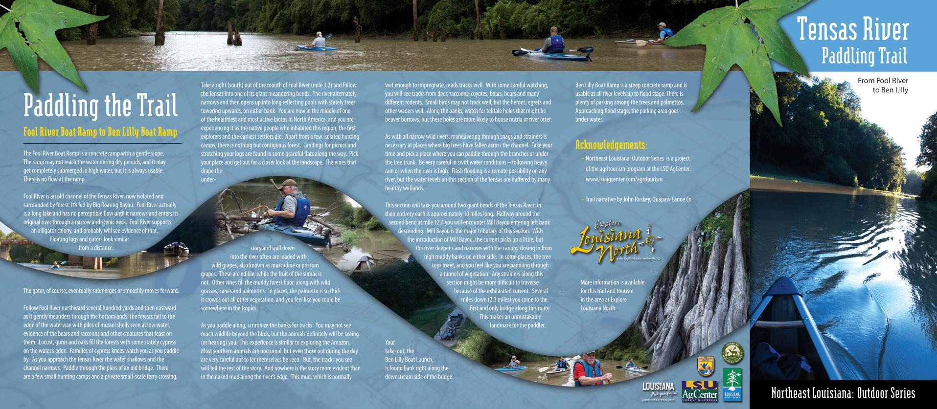
Tensas River Paddling Trail From Fool River to Ben Lilly The Fool River Boat Ramp is a concrete ramp with a gentle slope. The ramp may not reach the water during dry periods, and it may get completely submerged in high water, but it is always usable. There is no flow at the ramp. Fool River is an old channel of the Tensas River, now isolated and surrounded by forest. It’s fed by Big Roaring Bayou. Fool River actually is a long lake and has no perceptible flow until it narrows and enters its original river through a narrow and scenic neck. Fool River supports an alligator colony, and probably will see evidence of that. Floating logs and gators look similar from a distance. The gator, of course, eventually submerges or smoothly moves forward. Follow Fool River northward several hundred yards and then eastward as it gently meanders through the bottomlands. The forests fall to the edge of the waterway with piles of mussel shells seen at low water, evidence of the bears and raccoons and other creatures that feast on them. Locust, gums and oaks fill the forests with some stately cypress on the water’s edge. Families of cypress knees watch you as you paddle by. As you approach the Tensas River the water shallows and the channel narrows. Paddle through the piers of an old bridge. There are a few small hunting camps and a private small-scale ferry crossing. Paddling the Trail Fool River Boat Ramp to Ben Lilly Boat Ramp Take a right (south) out of the mouth of Fool River (mile 3.2) and follow the Tensas into one of its giant meandering bends. The river alternately narrows and then opens up into long reflecting pools with stately trees towering upwards, on either bank. You are now in the middle of one of the healthiest and most active biotas in North America, and you are experiencing it as the native people who inhabited this region, the first explorers and the earliest settlers did. Apart from a few isolated hunting camps, there is nothing but contiguous forest. Landings for picnics and stretching your legs are found in some graceful flats along the way. Pick your place and get out for a closer look at the landscape. The vines that drape the under- story and spill down into the river often are loaded with wild grapes, also known as muscadine or possum grapes. These are edible, while the fruit of the sumac is not. Other vines fill the muddy forest floor, along with wild grasses, canes and palmettos. In places, the palmetto is so thick it crowds out all other vegetation, and you feel like you could be somewhere in the tropics. As you paddle along, scrutinize the banks for tracks. You may not see much wildlife beyond the birds, but the animals definitely will be seeing (or hearing) you! This experience is similar to exploring the Amazon. Most southern animals are nocturnal, but even those out during the day are very careful not to let themselves be seen. But, the tracks you see will tell the rest of the story. And nowhere is the story more evident than in the naked mud along the river’s edge. This mud, which is normally wet enough to impregnate, reads tracks well. With some careful watching, you will see tracks from deer, raccoons, coyotes, boars, bears and many different rodents. Small birds may not track well, but the herons, egrets and other waders will. Along the banks, watch for telltale holes that might be beaver burrows, but these holes are more likely to house nutria or river otter. As with all narrow wild rivers, maneuvering through snags and strainers is necessary at places where big trees have fallen across the channel. Take your time and pick a place where you can paddle through the branches or under the tree trunk. Be very careful in swift water conditions – following heavy rain or when the river is high. Flash flooding is a remote possibility on any river, but the water levels on this section of the Tensas are buffered by many healthy wetlands. This section will take you around two giant bends of the Tensas River; in their entirety each is approximately 10 miles long. Halfway around the second bend at mile 12.4 you will encounter Mill Bayou entering left bank descending. Mill Bayou is the major tributary of this section. With the introduction of Mill Bayou, the current picks up a little, but the river deepens and narrows with the canopy closing in from high muddy banks on either side. In some places, the tree tops meet, and you feel like you are paddling through a tunnel of vegetation. Any strainers along this section might be more difficult to traverse because of the exhilarated current. Several miles down (2.3 miles) you come to the first and only bridge along this route. This makes an unmistakable landmark for the paddler. Your take-out, the Ben Lilly Boat Launch, is found bank right along the downstream side of the bridge. Ben Lilly Boat Ramp is a steep concrete ramp and is usable at all river levels up to flood stage. There is plenty of parking among the trees and palmettos. Approaching flood stage, the parking area goes under water. Acknowledgements: • Northeast Louisiana: Outdoor Series is a project of the agritourism program at the LSU AgCenter. www.lsuagcenter.com/agritourism • Trail narrative by John Ruskey, Quapaw Canoe Co. More information is available for this trail and tourism in the area at Explore Louisiana North. Northeast Louisiana: Outdoor Series
Transcript of From Fool River Paddling the Trail to Ben Lilly Paddling Trail Fool River... · Tensas River...
Tensas River Paddling Trail
From Fool River to Ben Lilly
The Fool River Boat Ramp is a concrete ramp with a gentle slope. The ramp may not reach the water during dry periods, and it may get completely submerged in high water, but it is always usable. There is no flow at the ramp.
Fool River is an old channel of the Tensas River, now isolated and surrounded by forest. It’s fed by Big Roaring Bayou. Fool River actually is a long lake and has no perceptible flow until it narrows and enters its original river through a narrow and scenic neck. Fool River supports
an alligator colony, and probably will see evidence of that. Floating logs and gators look similar
from a distance.
The gator, of course, eventually submerges or smoothly moves forward.
Follow Fool River northward several hundred yards and then eastward as it gently meanders through the bottomlands. The forests fall to the edge of the waterway with piles of mussel shells seen at low water, evidence of the bears and raccoons and other creatures that feast on them. Locust, gums and oaks fill the forests with some stately cypress on the water’s edge. Families of cypress knees watch you as you paddle by. As you approach the Tensas River the water shallows and the channel narrows. Paddle through the piers of an old bridge. There are a few small hunting camps and a private small-scale ferry crossing.
Paddling the TrailFool River Boat Ramp to Ben Lilly Boat Ramp
Take a right (south) out of the mouth of Fool River (mile 3.2) and follow the Tensas into one of its giant meandering bends. The river alternately narrows and then opens up into long reflecting pools with stately trees towering upwards, on either bank. You are now in the middle of one of the healthiest and most active biotas in North America, and you are experiencing it as the native people who inhabited this region, the first explorers and the earliest settlers did. Apart from a few isolated hunting camps, there is nothing but contiguous forest. Landings for picnics and stretching your legs are found in some graceful flats along the way. Pick your place and get out for a closer look at the landscape. The vines that drape the under-
story and spill down into the river often are loaded with
wild grapes, also known as muscadine or possum grapes. These are edible, while the fruit of the sumac is not. Other vines fill the muddy forest floor, along with wild grasses, canes and palmettos. In places, the palmetto is so thick it crowds out all other vegetation, and you feel like you could be somewhere in the tropics.
As you paddle along, scrutinize the banks for tracks. You may not see much wildlife beyond the birds, but the animals definitely will be seeing (or hearing) you! This experience is similar to exploring the Amazon. Most southern animals are nocturnal, but even those out during the day are very careful not to let themselves be seen. But, the tracks you see will tell the rest of the story. And nowhere is the story more evident than in the naked mud along the river’s edge. This mud, which is normally
wet enough to impregnate, reads tracks well. With some careful watching, you will see tracks from deer, raccoons, coyotes, boars, bears and many different rodents. Small birds may not track well, but the herons, egrets and other waders will. Along the banks, watch for telltale holes that might be beaver burrows, but these holes are more likely to house nutria or river otter.
As with all narrow wild rivers, maneuvering through snags and strainers is necessary at places where big trees have fallen across the channel. Take your time and pick a place where you can paddle through the branches or under the tree trunk. Be very careful in swift water conditions – following heavy rain or when the river is high. Flash flooding is a remote possibility on any river, but the water levels on this section of the Tensas are buffered by many healthy wetlands.
This section will take you around two giant bends of the Tensas River; in their entirety each is approximately 10 miles long. Halfway around the
second bend at mile 12.4 you will encounter Mill Bayou entering left bank descending. Mill Bayou is the major tributary of this section. With
the introduction of Mill Bayou, the current picks up a little, but the river deepens and narrows with the canopy closing in from
high muddy banks on either side. In some places, the tree tops meet, and you feel like you are paddling through
a tunnel of vegetation. Any strainers along this section might be more difficult to traverse
because of the exhilarated current. Several miles down (2.3 miles) you come to the
first and only bridge along this route. This makes an unmistakable
landmark for the paddler. Your take-out, the Ben Lilly Boat Launch, is found bank right along the downstream side of the bridge.
Ben Lilly Boat Ramp is a steep concrete ramp and is usable at all river levels up to flood stage. There is plenty of parking among the trees and palmettos. Approaching flood stage, the parking area goes under water.
Acknowledgements: • Northeast Louisiana: Outdoor Series is a project of the agritourism program at the LSU AgCenter. www.lsuagcenter.com/agritourism
• Trail narrative by John Ruskey, Quapaw Canoe Co.
More information is available for this trail and tourism in the area at Explore Louisiana North.
Northeast Louisiana: Outdoor Series
There is no quieter way to get close to nature than from a paddle-powered craft such as a canoe or kayak, and nowhere is this more rewarding than in the depths of the Tensas River National Wildlife Refuge. The possibilities for paddlers on the Tensas River and adjacent bayous, backwaters and tributaries are almost endless. The very best choice, we feel, is the route from Fool River Boat Launch to Ben Lilly Boat Launch.
Getting There:The trail begins at the boat ramp inside the Big Lake Wildlife Management Area. The wildlife management area is located in Franklin, Madison, and Tensas parishes. For a detailed map go to: www.wlf.louisiana.gov. Fool River runs through this area for about 2 miles before crossing into the Tensas National Refuge, running for a little over a mile before it hits the Tensas River.
The Ben Lilly Boat Ramp is located inside the Tensas National Wildlife Refuge. To get there from U.S. 65 at Somerset, go west on La. Highway 575 then turn onto La. Hwy 888. Make a right onto the road that crosses the Tensas River. Ben Lilly Boat Ramp is marked with a sign on the southeast side of the bridge. For more details go to: www.fws.gov/tensasriver/tensas_map.html.
Tensas River Paddling Trail
Access Points:Fool River Boat RampN32.195118 W91.467042
Fool River - Tensas River ConfluenceN32.204742 W91.436147
Mill Bayou ConfluenceN32.203683 W91.321452
Ben Lilly Boat RampN32.180827 W91.356257
Paddling distance from the Fool River Boat Launch to the Ben Lilly Boat Launch is 15.2 miles. This is a great day trip but a challenge for any paddler.
For beginning paddlers or someone with only an hour or two to paddle, park and launch your craft at Fool River Boat Ramp. Paddle as far as you want on Fool River Lake and then turn around and return to your vehicle parked at Fool River Boat Ramp.
Trail Length
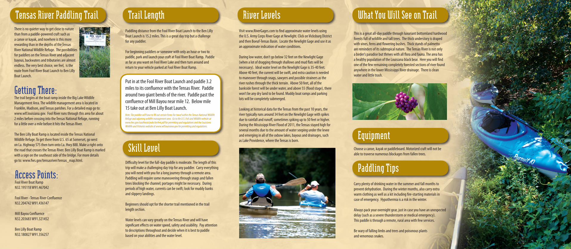
Skill LevelDifficulty level for the full-day paddle is moderate. The length of this trip will make a challenging day trip for any paddler. Carry everything you will need with you for a long journey through a remote area. Paddling will require some maneuvering through snags and fallen trees blocking the channel; portages might be necessary. During periods of high water, currents can be swift; look for muddy banks and slippery landings.
Beginners should opt for the shorter trail mentioned in the trail length section.
Water levels can vary greatly on the Tensas River and will have significant effects on water speed, safety and usability. Pay attention to descriptions throughout and decide when it is best to paddle based on your abilities and the water level.
Visit www.RiverGages.com to find approximate water levels using the U.S. Army Corps River Gage at Newlight. Click on Vicksburg District and then Boeuf-Tensas Basin. Locate the Newlight Gage and use it as an approximate indication of water conditions.
During low water, don’t go below 32 feet on the Newlight Gage (when a lot of dragging through shallows and mud flats will be necessary). Ideal water level on the Newlight Gage is 35-40 feet. Above 40 feet, the current will be swift, and extra caution is needed to maneuver through snags, sawyers and possible strainers as the river rushes through the thick terrain. Above 50 feet, all of the bankside forest will be under water, and above 55 (flood stage), there won’t be any dry land to be found. Muddy boat ramps and parking lots will be completely submerged.
Looking at historical data for the Tensas from the past 10 years, the river typically runs around 34 feet on the Newlight Gage with spikes due to rainfall and runoff, sometimes spiking up to 50 feet or higher. During the Mississippi River Flood of 2011, the Tensas stayed high for several months due to the amount of water seeping under the levee and emerging in all of the oxbow lakes, bayous and drainages, such as Lake Providence, where the Tensas is born.
River Levels
This is a great all-day paddle through luxuriant bottomland hardwood forests full of wildlife and tall trees. The thick understory is draped with vines, ferns and flowering bushes. Thick stands of palmetto are reminders of its subtropical nature. The Tensas River is not only a birder’s paradise but thrives with all flora and fauna. The area has a healthy population of the Louisiana black bear. Here you will find one of the few remaining completely forested sections of river found anywhere in the lower Mississippi River drainage. There is clean water and little trash.
What You Will See on Trail
Put in at the Fool River Boat Launch and paddle 3.2 miles to its confluence with the Tensas River. Paddle around two giant bends of the river. Paddle past the confluence of Mill Bayou near mile 12. Below mile 15 take out at Ben Lilly Boat Launch.Note: The paddler will have to fill out certain forms for travel within the Tensas National Wildlife Refuge and adjoining wildlife management area. Go to the U.S. Fish and Wildlife website at www.fws.gov/southeast/pubs/tnrhnt.pdf for permitting and regulations and the Louisiana Wildlife and Fisheries website at www.wlf.louisiana.gov for permitting and regulations.
EquipmentChoose a canoe, kayak or paddleboard. Motorized craft will not be able to traverse numerous blockages from fallen trees.
Paddling TipsCarry plenty of drinking water in the summer and fall months to prevent dehydration. During the winter months, also carry extra warm clothing as well as a kit including fire-starting materials in case of emergency. Hypothermia is a risk in the winter.
Always pack your overnight gear, just in case you have an unexpected delay (such as a severe thunderstorm or medical emergency). This paddle is through a remote, rural area with few services.
Be wary of falling limbs and trees and poisonous plants and venomous snakes.