Democratic People's Republic of Korea (North Korea): Kim Jong un ...
Upload
dennis-stephensCategory
view
213download
0
Flood Mapping in KoreaFlood Mapping in Korea
2003. 10 2003. 10
Yang-Su KimYang-Su Kim
National Institute for Disaster PreventionNational Institute for Disaster Prevention
Ministry of Government Administration and Home AffairsMinistry of Government Administration and Home Affairs
Republic of KoreaRepublic of Korea
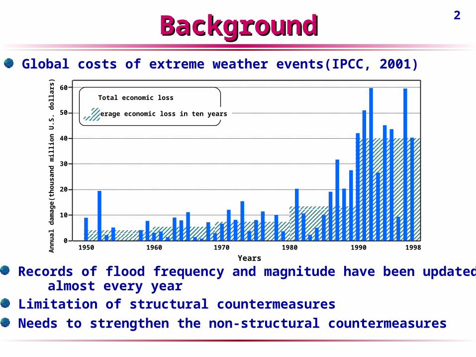
2BackgroundBackground
Records of flood frequency and magnitude have been updated almost every year
Limitation of structural countermeasures
Needs to strengthen the non-structural countermeasures
Global costs of extreme weather events(IPCC, 2001)
Years1950 1960 1970 1980 1990 1998
0
10
20
30
40
50
60
Annu
al d
amag
e(th
ousa
nd m
illio
n U
.S. d
olla
rs) Total economic loss
Average economic loss in ten years

3Flood MappingFlood Mapping
Past Flood Inundated Area Map
Flood-prone Area Map
Flood Hazard Map
Flood InundationArea Map(FIAP)
Flood InundationArea Map(FIAP)
Flood-ProneArea Map(FPAM)
Flood-ProneArea Map(FPAM)
Local dataLocal data
Flood Hazard Map
computer system
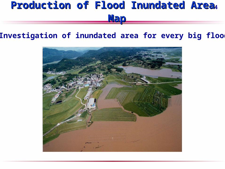
4Production of Flood Inundated Area MapProduction of Flood Inundated Area Map
Investigation of inundated area for every big flood
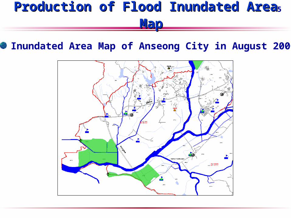
5Production of Flood Inundated Area MapProduction of Flood Inundated Area Map
Inundated Area Map of Anseong City in August 2000
6
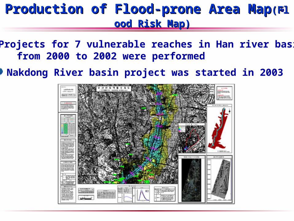
Projects for 7 vulnerable reaches in Han river basin from 2000 to 2002 were performed
Production of Flood-prone Area MapProduction of Flood-prone Area Map(Flood Risk Map)(Flood Risk Map)
Nakdong River basin project was started in 2003
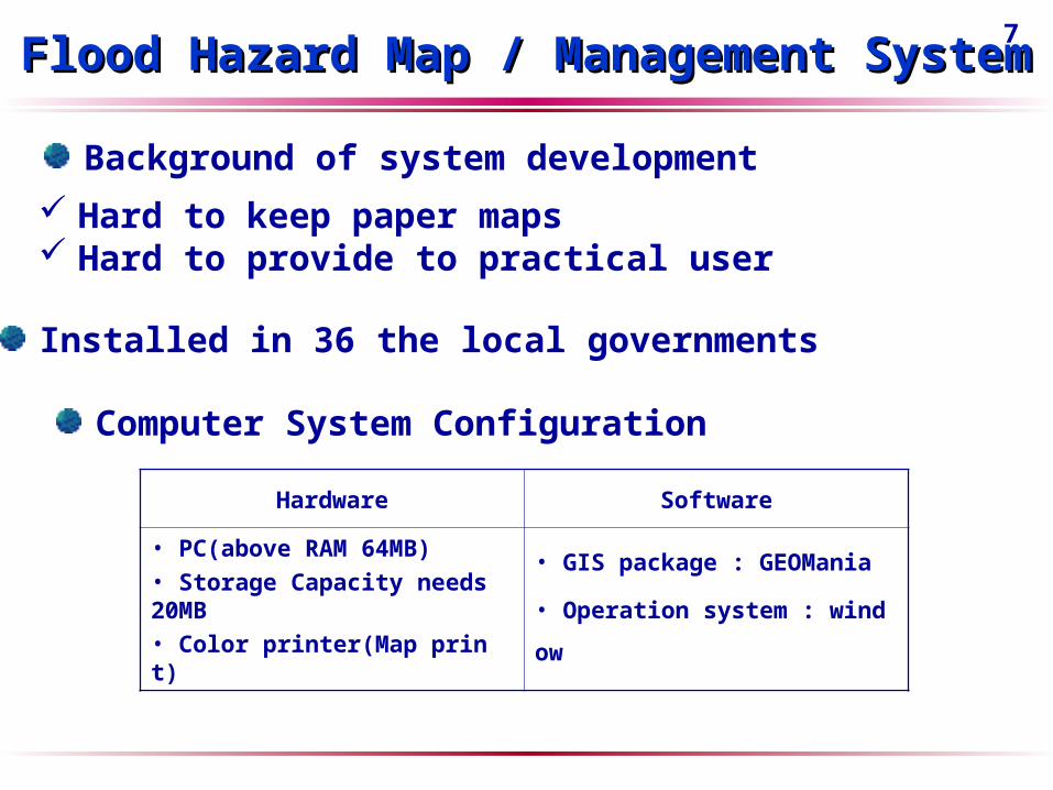
7Flood Hazard Map / Management SystemFlood Hazard Map / Management System
Computer System Configuration
Hardware Software
• PC(above RAM 64MB)• Storage Capacity needs 20MB• Color printer(Map print)
• GIS package : GEOMania
• Operation system : window
Background of system development
Hard to keep paper maps Hard to provide to practical user
Installed in 36 the local governments

8Flood Hazard Map / Management SystemFlood Hazard Map / Management System
System function
Section Contents
GIS Tool GEOMania
Base map(digital)
Topographic map(1:5,000 and 1:2,500)
function
• Input and retrieval of flood information - Climatical and hydrological data - Yearly inundated area• Search of information - search of continuously inundated area - Photograph of damage site - Inundation depth sign board - Public building• Disaster statistics• Flood hazard map design

9Flood Hazard Map / Management SystemFlood Hazard Map / Management System
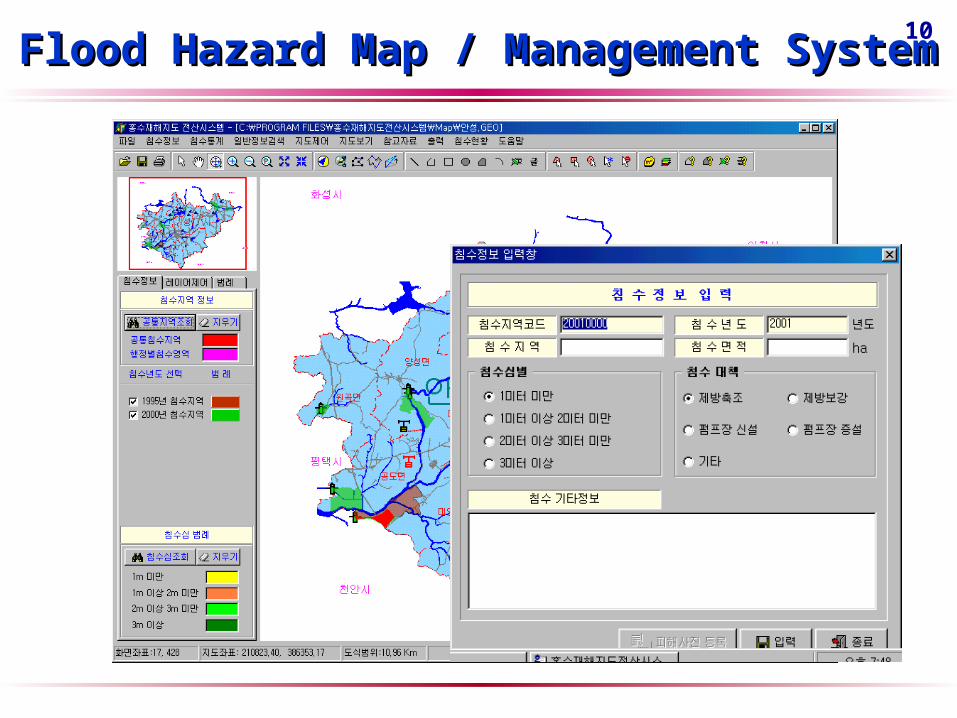
10Flood Hazard Map / Management SystemFlood Hazard Map / Management System

11Flood Hazard Map / Management SystemFlood Hazard Map / Management System

12Flood Hazard Map / Management SystemFlood Hazard Map / Management System

13Flood Hazard Map / Management SystemFlood Hazard Map / Management System
Public building
Gauging station
Pumping station
Inundation depth sign board
Bank breaking point
Vulnerable area for flooding

14Work Division for Flood MappingWork Division for Flood Mapping
FIAM &
FPAM
NDMS DB
NDMS DB• Disaster investigation
- Flood inundation
- Land slide
bank breaking, etc
• Design of FIAM
• Design of FPAM
- Flood simulation
Local Gov
Client
Client
Design of FHM
Distribution andusage of FHM
Input
Total DataManagement
Total DataManagement Production of FHMProduction of FHM
Central Gov.(MOGAHA,
MOCT)
• Support of disaster investigation• Production of FPAM
• Total management of FIAM & FPAM• Improvement of NDMS function
• Institutional support
Research Center(NIDP,
KOWACO)
• Technical support• Assistance of disaster investigation
• Technical support• Education of gov. officer
• Technical support • Education of gov. officer
Local Gov.• Disaster investigation • Design and publication of FIAM• Input in NDMS(DB)
• Management of FIAM• production of FHM• Public information
Design ofFIAM & FPAM
Design ofFIAM & FPAM
Local Gov

15ConclusionConclusion
How to design Flood Hazard Map more efficiently?
How to distribute the Flood Hazard Map?
How to design the FPAM for regions where data are poor?