Flood Disaster Impacts and Responses in Nepal Tarai's ...
42
This case study is part of a broader ProVention Consortium initiative aimed at collecting and analyzing community risk assessment cases. For more information on this project, see www.proventionconsortium.org. CRA Toolkit CASE STUDY PROVENTION CONSORTIUM Community Risk Assessment and Action Planning project Copyright 2002-2005, Maps-Of-The-World.com The maps used do not imply the expression of any opinion on the part of the International Federation of Red Cross and Red Crescent Societies or National Societies or the ProVention Consortium concerning the legal status of a territory or of its authorities Flood Disaster Impacts and Responses in Nepal Tarai’s Marginalised Basins NEPAL – Nawalparasi and Rautahat Districts
-
Upload
truongkien -
Category
Documents
-
view
223 -
download
1
Transcript of Flood Disaster Impacts and Responses in Nepal Tarai's ...

This case study is part of a broader ProVention Consortium initiative aimed at collecting and analyzing community risk assessment cases. For more information on this project, see www.proventionconsortium.org.
CRA Too lk i t CASE STUDY
PROVENTION CONSORTIUM Community Risk Assessment
and Action Planning project
Copyright 2002-2005, Maps-Of-The-World.com
The maps used do not imply the expression of any opinion on the part of the International Federation of Red Cross and Red Crescent Societies or National Societies or the ProVention Consortium concerning the legal status of a territory or of its authorities
Flood Disaster Impacts and Responses in Nepal Tarai’s Marginalised Basins
NEPAL – Nawalparasi and Rautahat Districts

Bibliographical reference: Dixit A. et. al., Flood Disaster Impact and Responses in Nepal Tarai’s Marginalised Basins, in: Working with the Winds of Change. Towards Strategies for Responding to the Risks Associated with Climate Change and other Hazards. M.Moench, Dixit, A, (eds), ProVention Consortium, Institute for Social and Environmental Transition-International and Institute for Social and Environmental Transition-Nepal, second edition, Kathmandu, 2007, chapter 6, pp. 119 -157. Case study can be downloaded from: (http://www.proventionconsortium.org/themes/default/pdfs/winds_of_change.pdf) Click-on reference to the ReliefWeb country file for Nepal: http://www.reliefweb.int/rw/dbc.nsf/doc104?OpenForm&rc=3&cc=npl Note: A Guidance Note has been developed for this case study. It contains an abstract, analyzes the main findings of the study, provides contextual and strategic notes and highlights the main lessons learned from the case. The guidance note has been developed by Ben Wisner and Stephanie Bouris in close collaboration with the author(s) of the case study and the organization(s) involved.
C H A P T E R
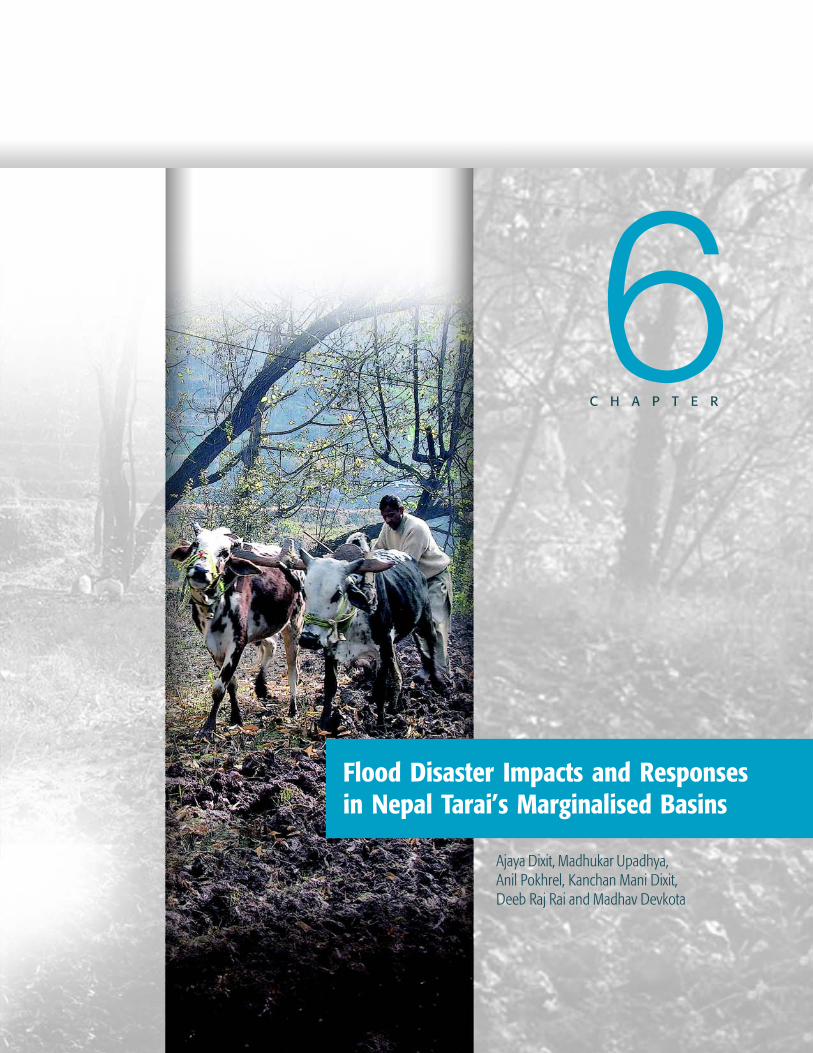
Flood Disaster Impacts and Responsesin Nepal Tarai’s Marginalised Basins
Ajaya Dixit, Madhukar Upadhya,Anil Pokhrel, Kanchan Mani Dixit,Deeb Raj Rai and Madhav Devkota
6
W O R K I N G W I T H T H E W I N D S O F C H A N G E
FLO
OD
DISA
STER
IMPA
CTS
AND
RESP
ON
SES
IN N
EPAL
TAR
AI’S
MAR
GIN
ALIS
ED B
ASIN
S
120
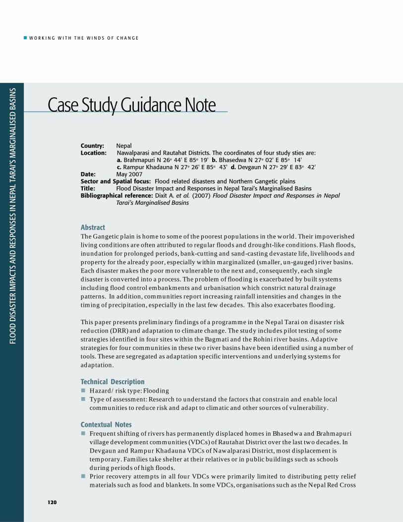
Country: NepalLocation: Nawalparasi and Rautahat Districts. The coordinates of four study sties are:
a. Brahmapuri N 26o 44' E 85o 19' b. Bhasedwa N 27o 02' E 85o 14' c. Rampur Khadauna N 27o 26' E 85o 43' d. Devgaun N 27o 29' E 83o 42'
Date: May 2007Sector and Spatial focus: Flood related disasters and Northern Gangetic plainsTitle: Flood Disaster Impact and Responses in Nepal Tarai’s Marginalised BasinsBibliographical reference: Dixit A. et al. (2007) Flood Disaster Impact and Responses in Nepal
Tarai’s Marginalised Basins
AbstractThe Gangetic plain is home to some of the poorest populations in the world. Their impoverishedliving conditions are often attributed to regular floods and drought-like conditions. Flash floods,inundation for prolonged periods, bank-cutting and sand-casting devastate life, livelihoods andproperty for the already poor, especially within marginalized (smaller, un-gauged) river basins.Each disaster makes the poor more vulnerable to the next and, consequently, each singledisaster is converted into a process. The problem of flooding is exacerbated by built systemsincluding flood control embankments and urbanisation which constrict natural drainagepatterns. In addition, communities report increasing rainfall intensities and changes in thetiming of precipitation, especially in the last few decades. This also exacerbates flooding.
This paper presents preliminary findings of a programme in the Nepal Tarai on disaster riskreduction (DRR) and adaptation to climate change. The study includes pilot testing of somestrategies identified in four sites within the Bagmati and the Rohini river basins. Adaptivestrategies for four communities in these two river basins have been identified using a number oftools. These are segregated as adaptation specific interventions and underlying systems foradaptation.
Technical DescriptionHazard/risk type: FloodingType of assessment: Research to understand the factors that constrain and enable localcommunities to reduce risk and adapt to climatic and other sources of vulnerability.
Contextual NotesFrequent shifting of rivers has permanently displaced homes in Bhasedwa and Brahmapurivillage development communities (VDCs) of Rautahat District over the last two decades. InDevgaun and Rampur Khadauna VDCs of Nawalparasi District, most displacement istemporary. Families take shelter at their relatives or in public buildings such as schoolsduring periods of high floods.Prior recovery attempts in all four VDCs were primarily limited to distributing petty reliefmaterials such as food and blankets. In some VDCs, organisations such as the Nepal Red Cross
FLO
OD
DISA
STER
IMPA
CTS
AND
RESP
ON
SES
IN N
EPAL
TAR
AI’S
MAR
GIN
ALIS
ED B
ASIN
S
120
Case Study Guidance Note

W O R K I N G W I T H T H E W I N D S O F C H A N G E
FLOO
D DISASTER IMPACTS AN
D RESPON
SES IN N
EPAL TARAI’S MARGIN
ALISED BASINS
121
Society, Oxfam GB and local NGOs have initiated group formation, distribution of informationkits, installation of communication equipment, wooden boats and construction of small shelters.Construction of physical infrastructure such as canals, roads, railways and efforts in ‘taming’rivers has had negative consequences. Structures, built along the Indian border, have in manyinstances been related to the cause of flooding. During flood periods people commute longdistances in search of daily labour.The eastern Tarai political unrest has intensified despite a peace accord to end a decade-longinsurgency. Protests (mostly violent) and unexpected and continuous strikes have affectedaccessibility to the communities and delayed visits to communities since January 2007. In thethird week of March 2007, about 30 people were beaten to death in Gaur, the districtheadquarters of Rautahat. Brahmapuri, one of our study sites, is situated 5 kilometers east ofGaur.
Research and Analytical ProcessMethods/tools used: Scoping, Shared Learning Dialogues, Household Surveys, Massmeetings, Capacities and Vulnerability Analysis, Ranking, etc.Role of Climate Information: Climate information is non-existent. People hear weatherinformation on radio and television programmes.
Key Insights Generated for Vulnerability Reduction and Capacity EnhancementIn all four project sites, poor access to information and gender issues emerged as major factorscontributing to vulnerability. Information refers to policies, news, radio, knowledge about reliefactivities, information on floods/rainfall and knowledge of selling price for local produce innearby towns.Women, particularly pregnant women, lactating mothers, women who have recently given birth,elderly women, the disabled and menstruating women are more vulnerable.Spontaneous measures of adaptation (such as building flat-roof houses, two-story houses andhouses on raised plinths) have been widely observed. Livelihood elements that are not likely tobe much affected by inundation or flooding are also increasingly pursued. Examples includean increasing preference for water buffaloes over cows and ducks over goats. In addition,young men migrate in search of alternative livelihoods.Adaptive strategies can be categorised into climate adaptive interventions and underlyingsystems of adaptation. Tables A and B present the findings.
Potential Strategies IdentifiedSee tables at the end of this guidance note.
Strategic Notes and Lessons Learned - Key Points to EmphasiseThe study has provided three main lessons. First, in the last 50 years there has been reliance onthe structural or macro or engineering approach to mitigate flood damage. The concerns ofaffected individuals, families and communities have not been systematically woven into decision-and policy making. Government policies have not contributed to building resilience for copingwith floods. Second, cooperative efforts of the governments of the region have been technologicallyguided in a project-centric mode. Despite repeated references to flooding and the need for itsmitigation in pubic discussions, cooperative efforts have not aimed at building institutions formitigation. Third, institutional dysfunction is widespread as state agencies fail to innovate ineffective responses to flood disasters.
FLOO
D DISASTER IMPACTS AN
D RESPON
SES IN N
EPAL TARAI’S MARGIN
ALISED BASINS
121

W O R K I N G W I T H T H E W I N D S O F C H A N G E
FLO
OD
DISA
STER
IMPA
CTS
AND
RESP
ON
SES
IN N
EPAL
TAR
AI’S
MAR
GIN
ALIS
ED B
ASIN
S
122
VDC
RampurKhadauna
Devgaun
Bhasedwa
Brahmapuri
Diversification
Farming on landaffected by sandcasting (e.g.guava,watermelon).Productivityenhancement.Access to forestresources,diversification ofincome(floriculture,nurseries, etc.)
Farming on landaffected by sanddeposition (e.g.banana, guava,watermelon),
Promotion ofsugarcane farmingin areas likelyaffected by floods.New crops inareas affected bysand deposition(e.g. banana,guava,watermelon).House wiring
New crops in landaffected by sandcasting (e.g.banana, guava,watermelon)
Ecosystem
Communityforestplantation
PlantingAjambari onexisting spurs
Planting treesalong thefloodplainsand plantingAjambarialong spurs
Planting treesalong theBagmati Riverembankment,plantingAjambari onexisting spurs
Disaster RiskReduction
Seed bin storage,improved homes andshelter (e.g. hooks onexisting flat roofs to tietents), boats, raisedroads, first aid kits,raised tubewells;panyalo (RWH),chlorination, hangingseed beds, improvedcooking stove, spursconstruction withbamboo sticks andsand-filled bags, seedbanks
Installation ofdemonstration treadlepumps, provision ofdrinking water wheretubewells arecontaminated witharsenic
Making life jackets withused mineral waterbottles, construction ofa demonstration toiletand sanitationawarenessprogrammes,smokeless stoves,construction ofplatforms in existingtubewells, support forreviving existingtubewells, alternativewater supply for areascontaminated byarsenic
Construction of ademonstration toiletand sanitationawarenessprogrammes,smokeless stoves,construction ofplatforms in existingtubewells, support forreviving existingtubewells
Organisationand Incubation
Self-help groups,saving andcredit,communitygroups, trainlocal youths tobecomevolunteers attimes of disaster
Self-help groups,savings andcredit,communitygroups
Train localyouths tobecomevolunteers attimes of disaster
Train localyouths tobecomevolunteers attimes of disaster
SkillDevelopment
Non-formaleducation,communityhealth andsanitationawarenesstrainings,exchange visits,gendersensitisation,accounting andleadershiptraining,promoting biogasand briquette
Exchange visitsto communitieswhere farmingon land affectedby sanddeposition iscurrently tried
Exchange visitsto communitieswhere farmingon land affectedby sanddeposition iscurrently tried
Street theatresto demonstrateways to protectoneself andproperty duringfloods. Trainingto work asreporters(especially forthose whomanageinformationcentres)
Financial andRisk Spreading
Crop and cattleinsurance, lifeinsurance,savings andcredit groupformation bycooperativestheme
Savings andcredit groupformation bycooperativestheme
Savings andcredit groupformation bycooperativestheme
Savings andcredit groupformation bycooperativestheme
Communication
Early-warningsystem, raingauges,networkingthroughvolunteerorganisations,land line andmobile phones,CDMA,community FM,radioprogrammes, TVand press
Establish raingauges at localschools andmonitor dailyrainfall. Transmitrainfall recordsto FM stations.
Establish raingauges atschools in theupstreamcatchment ofLal-Bakaiya andmonitor dailyrainfall. Transmitrainfall recordsto FM stations,set up CDMAphones
Establish awarning systemlinked with theKarmaiyabarrageregulating office,establish acommunicationcentre
| TABLE A | Adaptation Matrix for Nepal VDCs: Adaptation Specific Interventions
FLO
OD
DISA
STER
IMPA
CTS
AND
RESP
ON
SES
IN N
EPAL
TAR
AI’S
MAR
GIN
ALIS
ED B
ASIN
S
122

W O R K I N G W I T H T H E W I N D S O F C H A N G E
FLOO
D DISASTER IMPACTS AN
D RESPON
SES IN N
EPAL TARAI’S MARGIN
ALISED BASINS
123
VDC
RampurKhadauna
Devgaun
Bhasedwa
Brahmapuri
Education
Training, advocacy,adult education, schoolsupport activities,scholarships for poorchildren
Organisation
Network with organisationssuch as Oxfam, Nepal RedCross Society and Dipechosupported programmes
The village is considered avegetable farming pocket.Organise exchange visits topromote different varieties ofvegetables
Networking among differentgroups formed by Dipecho,CPDR, Lutheran, Oxfam andNepal Red Cross Society
Communication
Discussion platformsfor policy issues,listeners' clubs
Setting up oflisteners' clubs
Set up mechanismsfor communicatingseasonal marketprices at differentbazaars for selectcommodities
Transport
Wooden or plastic boats,temporary boats madeof banana trunks andbamboo or inflatedtubes
Use inflated tubes, raftsmade out of bananatrees/dried bamboo etc.to be used during timesof inundation
Use inflated tubes, raftsmade out of bananatrees/dried bamboo etc.to be used during timesof inundation
Livelihood
Bicycle repairshops
Candlestickmaking, incensestick making,bicycle/motorbikerepairing
Train localentrepreneurs tocast rings for toiletvaults and set upsani-marts
Train localentrepreneurs tocast rings for toiletvaults and set upsani-marts
Disasters can be used as opportunities for creating new avenues to allow vulnerablegroups to reduce their vulnerability.
Keywords: Floods, Marginal Rivers, Disaster Risk Reduction, Climate Adaptation, NepalTarai, Himalaya-Ganga, North Gangetic Plains.
Resource person(s): Ajaya Dixit ([email protected]), Anil Pokhrel([email protected]), Kanchan Mani Dixit, Deeb Raj Rai and Madhav Devkota([email protected]), ISET-Nepal.
| TABLE B | Adaptation Matrix for Nepal Sites: Underlying System for Adaptation
FLOO
D DISASTER IMPACTS AN
D RESPON
SES IN N
EPAL TARAI’S MARGIN
ALISED BASINS
123

W O R K I N G W I T H T H E W I N D S O F C H A N G E
FLO
OD
DISA
STER
IMPA
CTS
AND
RESP
ON
SES
IN N
EPAL
TAR
AI’S
MAR
GIN
ALIS
ED B
ASIN
S
124
Changes inprecipitation will
necessarily change theflow of rivers and
thereby the likelihoodof flooding.
The summary of the fourth IPCC report(2007) states that “With regard tochanges in snow, ice and frozen ground(including permafrost), there is highconfidence that based on growingevidence the following types ofhydrological changes will take place:”
“Increased run-off and earlier springpeak discharge in many glacier- andsnow-fed rivers.” ( p. 3)
Referring to the Himalaya region inparticular the report continues:
“Glacier melt is projected toincrease flooding, rock avalanchesfrom destabilised slopes, and affectwater resources within the next twoto three decades. This will befollowed by decreased river flows asthe glaciers recede. ( p. 10)
Heavy precipitation events, which arevery likely to increase in frequency,will augment flood risk. (p. 7)
In the course of the century, watersupplies stored in glaciers and snowcover are projected to decline,reducing water availability in regionssupplied by melt water from majormountain ranges, where more thanone-sixth of the world populationcurrently lives. (p. 7)
Mountainous areas will face glacierretreat, reduced snow cover andwinter tourism, and extensive specieslosses (in some areas up to 60%under high emission scenarios by2080).” (p. 11)
Current projections by the IPCC indicatethat average precipitation levels in theGanga Basin will increase by about 20%,and climate change projections indicatethat variability and the frequency andintensity of extreme weather events suchas large storms are also likely to increase.Climate change will not only affect theregion’s hydrology, but also altertemperature regimes, wind patterns, andstorm tracks. In addition, land usepatterns and aerosol pollution willdirectly affect local weather patterns.Impacts on the types of crops planted,the type and extent of vegetationcoverage, and urban island heat effectswill be significant. Changes inprecipitation will necessarily alter theflow of rivers and thereby the likelihoodof flooding. Paradoxically, while floodswill be of greater magnitude, so, too willthe incidence of drought conditions.
What exactly the impact such changeswill have on the Ganga Basin is not clear— though have an impact they will. TheGanga Basin is not a homogenous landsystem; instead, it encompasses ahighland and lowland hydro-ecologicalsystem that analysts have defined as theHimalaya-Ganga (see Figure 1 for aschematic diagram of the Himalaya-Ganga and the northern Ganga Basin).The system consists of diverse ecologicalzones and includes hundreds of ethnicgroups that speak different languages.1
The highland and lowland system in theGanga Basin encompasses Nepal, India
1 For a discussion on Himalaya-Ganga see Gyawali and Dixit (1994).
The Larger Context

W O R K I N G W I T H T H E W I N D S O F C H A N G E
FLOO
D DISASTER IMPACTS AN
D RESPON
SES IN N
EPAL TARAI’S MARGIN
ALISED BASINS
125
����������
�����
�����
���
����������
���
�������
���
����
���
��� ���
��������
�� ���
������
���
!�
���
"
�
#$
%
�
����
&'
�
�
�
(
In the Himalaya-Gangaregion the monsoonrains sustainagriculture but are adevastating hazard.
and Bangladesh. The people living inthis region are among the poorest in theworld. Their impoverished livingconditions are often attributed to theregular floods which occur during themonsoon seasons (June-September) andto the drought-like conditions thatprevail after the monsoon rains are over(Bandhyopadhyaya, 1999). This flood-drought regime is the natural outcome ofthe region’s climate and hydrology.Since the climate and hydrology of theregion exhibit micro-level variations,their impacts will differ.
Although the monsoon rains are crucialfor sustaining agriculture in theHimalaya-Ganga region, they are also amajor hazard. After the onset of themonsoon in June, rains saturate the
moisture-deficit landscapes promotingthe growth of vegetation and crops and,consequently ensuring the success ofpeople’s agriculture-based livelihoods.A few weeks after their onset, these samelife giving rains are responsible forwidespread flooding. Cloudbursts,landslides, mass movements, mudflowand flash floods are common in themountains, while in the plains ofsouthern Nepal, northern Uttar Pradesh,Bihar, West Bengal and Bangladeshrivers augmented by monsoon rainsoverflow their banks. Sediment erodedfrom the upper regions of rivers istransported to their lower reaches anddeposited on the flood plains of valleysand the Tarai. Rivers cut their banksand shift laterally, creating seriousproblems as people lose their land and
| FIGURE 1 | The Himalaya-Ganga region and river systems

W O R K I N G W I T H T H E W I N D S O F C H A N G E
FLO
OD
DISA
STER
IMPA
CTS
AND
RESP
ON
SES
IN N
EPAL
TAR
AI’S
MAR
GIN
ALIS
ED B
ASIN
S
126
their crops, the very basis of theirlivelihoods. People and communitieshave developed livelihood systems thatare adapted to such disruptions. Theytake advantage of the fine sedimentbrought by floods which increasesagriculture productivity, and struggle tomove the large sized sediment deposits.People face significant problems whensedimentation blocks watercoursescausing stagnant water or when swollenrivers inundate the land — but whensocial and economic continuity isdisrupted people cope. In recent years,however, these natural processes havechanged due to the impacts of humaninterventions and it has become moredifficult for people to adapt successfully.The building of embankments for floodprotection, for example, obstructstributary rivers and by blocking drainagecan extend flood periods. Furthermore,because embankments are poorlymaintained they frequently breachbringing large tracts of land underinundation and causing sand deposition.In short, interventions often contribute torather than prevent flood disasters.
Tributaries and streams serve as ahydrological link between the upper and
lower regions of Himalaya-Ganga. Theyalso function as drainage channelstransferring large volume of waterreceived during the monsoon in uplandregions, plain catchments and in deltaregions to the ocean. The region’s riversconstitute a densely-packed network ofstreams: In fact, its river drainage densityof 0.3 km/km2 reflects just how close thedrainage channels are (Shankar, 1985).Nepal alone has more than 6,000 riverstotaling about 45,000 km in length. Thetributaries of the Ganga River in Nepalcontribute 71 % of its natural historic dryseason flow and 41 % of its total annualflow. The rivers of the Ganga Basin areboth a boon and a bane to the populationof the region: while they feed regionalgroundwater aquifers, serve manyirrigation systems and maintainecosystems, monsoon flooding in thesevery rivers brings widespreaddevastation.
The rivers of Nepal can be classifiedbroadly on the basis of their dry seasonflow as Himalayan, Mahabahrat andChure. The four major Himalayan rivers(the Kosi, the Gandaki, the Karnali andthe Mahakali) exhibit a sustained dryseason flow derived from snow and
Rivers feed regionalgroundwater aquifers,serve many irrigation
systems, and maintainecosystems but are
also the source offloods.
BAGMATIAdapted from Hagen (1998)
Pokhara
Kali Gandaki
ChautaraSailung
Nyalam
Indrawati
| FIGURE 2 | The hill plain composite showing portion of Bagmati and Rohini basins
ROHINI
Brahmapuri
Bhasedwa
Brahmapuri
Bhasedwa
ThakkholaManang
TansingTansing
ButwalButwal
DevgaunDevgaun
Rampur KhadaundRampur Khadaund
ManangThakkhola
MustangMustang

W O R K I N G W I T H T H E W I N D S O F C H A N G E
FLOO
D DISASTER IMPACTS AN
D RESPON
SES IN N
EPAL TARAI’S MARGIN
ALISED BASINS
127
glacier melt. According to Sharma (1977),snowmelt in Nepal begins in March andcontinues till August, when monsoonrains also add to the flow. The sevenMahabharat rivers originate below thesnowline in the middle hills and drainthe region located between theHimalayan basins. They are spring-fedand augmented by the monsoon rains.The third type of rivers originates in theChure range and run parallel to theHimalaya. Composed of fluvial depositsof the Neogene age (Upreti and Dhital,1995) the Chure range is the active stageof the tectonic movement of the lowerHimalaya (Hagen, 1998) and is made upof debris eroded over the last 40 millionyears. Its elevation varies from 150 to1,800 meters. The hydrology of theseveral Chure rivers is characterised byindividual peaks, a fact suggesting thattheir discharge is highly influenced byrainfall. When there is no rainfall, theserivers exhibit very low flow, almost zeroin the upper reaches. In the lowerreaches, however, groundwater and baseflow and contribute to flow and thesereaches may contain significant
Most smaller rivers arenot on the radarscreen of the nationalgovernments but arethe locus of majorflood events.
discharge even in the dry season. Theflow of these rivers usually peaks in Julyor August, but the exact timing dependson the volume of rainfall. Because slopesare steep, Chure rivers flow with highvelocities until they reach the Tarai,where the high energy generated isdissipated as rivers form meanders oncethey emerge onto the plains. The natureof the riverbeds and the pattern ofchannels of a Chure river varyaccording to its reaches. In the upperreaches, the steep slope bank-cuttingand mass movement processes result ina high sediment load. In the Tarai, thesame rivers will meander and changecourse. The hydrological characteristicof these rivers have not been studied indetail and their flooding results in moredamage and devastation than is thus farunderstood while they collectively causemore devastation than the other twotypes. Despite their hazardous nature,these rivers are not on the radar screenof the national governments of theregion, which instead focus theirattention on the major tributaries of theGanga River i.e. the first and second
© A
Dixi
t
Flash flood is a major hazard in valleys ofthe mountains.Flash flood is a major hazard in valleys ofthe mountains.

W O R K I N G W I T H T H E W I N D S O F C H A N G E
FLO
OD
DISA
STER
IMPA
CTS
AND
RESP
ON
SES
IN N
EPAL
TAR
AI’S
MAR
GIN
ALIS
ED B
ASIN
S
128
type rivers. The Chure rivers are termedmarginalised rivers. This definitionemerged in the Duryog Nivaran meetingin Dhaka in 1995.2
Chure rivers flow first across the NepalTarai and then across the contiguouslandmass of Uttar Pradesh, Bihar, andWest Bengal. Their catchments extendfrom Uttar Pradesh in the northwest tothe Darjeeling hills in the east and theGanga River in the south and have anarea of about 80,000 km2. The area iscrisscrossed by hundreds of a third typeof river. In Nepal, the Chure rivers draina total of around 18,860 km2 consistingof the Chure range and the Tarai. Thecatchments of most individual Churerivers are generally less than 350 km2.These rivers are used extensively forirrigation and thus support agriculture,the local economy and communitylivelihoods. Using pumps and wells thecontiguous groundwater aquifers aredrawn on to meet drinking andirrigation needs. As these rivers flowfrom Nepal to India, they acquire a trans-boundary character.
The Tarai region of Nepal is anextension of the Gangetic plain. Togetherthey are home to millions of people whopractice agriculture-based livelihoods. Inthe last five decades, the region haswitnessed tremendous growth ininfrastructure development. Roads,irrigation canals, railway lines, floodcontrol embankments and urbanisationhave all constrained drainage andthereby further exacerbated the impact offlooding. Both, the Nepal Tarai and theGangetic plain are somewhat isolatedfrom technological and economicglobalisation but nonetheless areaffected indirectly. In particular,
commuting and migrating to seekemployment have reshaped livelihoodsystems while the social and politicalcommunication systems are undergoingrapid changes. Such changes add newlayers to the people’s ability to adapt tothe regular occurrence of flood anddrought.
As mentioned above, the impacts ofhydro-meteorological hazards inducedby climate change need to bedisaggregated according to ecologicalzone. Each region, the plains, the hillsand the mountains must be vieweddifferently in order to assess criticalimpacts. The recession of glaciers in theHimalaya range, for example, will affectthe overall water balance in therespective basins but the exact nature ofits impact needs more investigation.Glacial melt may further exacerbate therisk associated with Glacial LakeOutburst Floods (GLOFs). Otherdifferences include the fact that Nepal’swestern hills and Tarai experience moredays without rainfall than the easternhills and the eastern Tarai. At the sametime landslides, mud flows, debrisflows and bishyari (landslides intorivers) are common in the middlemountains. Floods inundate areas inthe Tarai, where instances of bank-cutting and sediment deposition onproductive land may increase.
This paper explores the nature of flooddisasters in two regions in the NepalTarai. It presents our experiences inassessing flood hazard andvulnerability in selected villagedevelopment committees (VDCs) withthe objective of piloting disaster riskreduction activities and adaptationplans.
2 BDPF, Duryog Nivaran and BUET (1995)
The recession ofglaciers in the
Himalaya range willaffect the overall
water balance in therespective basins but
the exact nature ofits impact needs
more investigation.

W O R K I N G W I T H T H E W I N D S O F C H A N G E
FLOO
D DISASTER IMPACTS AN
D RESPON
SES IN N
EPAL TARAI’S MARGIN
ALISED BASINS
129
The study includes a series of casestudies and investigations of twodistricts of the Nepal Tarai, which aresusceptible to flooding. The study sitesare situated in the lower Bagmati and theRohini river basins. Our earlier adaptivestudy project (Moench and Dixit, 2004)was based on empirical evidencecollected in eight VDCs. It focused on thesituation in the head, middle and tail
reaches of the two basins.3 Altogether1,008 households were surveyed then. Forthe current adaptation/DRR pilot phase,the selection of VDCs was based on thefollowing criteria.
Presence of a partner organisation,4
Incidence of human induced floodhazards andCharacteristics of the rivers.
On the basis of the above criteria, fourVDCs, two in each river basin wereselected, Rampur Khaduana andDevgaun in Rohini Basin, and Bhasedwaand Brahmapuri in Bagmati Basin. Thelatter two villages are located in the doab
(between river areas) of the Bagmati andLal Bakaiya rivers in Rautahat District,while Rampur Khadauna and Devgaunare located in Nawalparasi District ofNepal (Figure 3).
3 See Moench and Dixit (2004). Poudel et al. (2004) has done a study of flood hazard in Rautahat District.4 The boundary partners of the study are the Center for Disaster Mitigation (CDM) and the Support Oriented
Organisation (SOS) and the Community Support Organisation (CSO).
| FIGURE 3 | Rautahat and Nawalparasi (Tarai) districts along Bagmati and Rohini rivers
Study VDCs

W O R K I N G W I T H T H E W I N D S O F C H A N G E
FLO
OD
DISA
STER
IMPA
CTS
AND
RESP
ON
SES
IN N
EPAL
TAR
AI’S
MAR
GIN
ALIS
ED B
ASIN
S
130
The findings about these VDCs areexpected to help in the development ofadaptation plans and in theimplementation of selected key measureswhich will serve as pilot activities indisaster risk reduction.
Monsoon rainfall is the primary cause offlooding in all four VDCs, which as aresult experience inundation, bank-cutting and sand deposition. In RampurKhaduana, drainage congestionexacerbates the adverse effect, while inBrahmapuri, embankments built in thestate of Bihar along the border of Nepaland also along the lower reaches of theBagmati River in Nepal have a similarresult. The VDCs studied are indicatedin Figure 3. The VDCs in the RohiniBasin are located upstream of the studyvillages in Eastern Uttar Pradesh.
Nature of Hazard
All three types of rivers discussed abovehave contributed to flooding in theHimalaya-Ganga since time immemorial.Widespread damage over the lastcentury was caused by numerous floodsincluding those in 1927, 1954, and 1972.More recent flood disasters took place in1987 and 1988 in Bangladesh, in 1993,in the Bagmati River of Nepal and in1998, in parts of Nepal and Eastern UttarPradesh which drain the Rohini River,Bihar, West Bengal and Bangladesh Themonsoon of 2007 has also resulted inwidespread flooding and broughtdevastation on a large scale in Nepal,India and Bangladesh. This flood wascaused by excessive rain but specificdetails, such as, those about the natureand magnitude of the rains have yet to beanalysed. In the following sections, wehighlight the impacts of the 1993 and1998 floods.
1993 Bagmati FloodIn 1993, central Nepal received veryhigh rainfall because of a low monsoonweather system. This affected thecatchments of Agra, Belkhu, Malekhu,and Mahesh kholas, which drain thenorthern Mahabharat face, as well asthe Jurikhet, Mandu, Manahari, Lotharand Rapti kholas, which drain thesouthern face. These sub-basins arelocated in the Gandaki River system.The Kulekhani river in the Mahabharatrange flowed into the Bagmati beforethe Kulekhani Hydroelectric Projectwas completed in 1981. The cloudburstalso affected this project. The stormthen moved eastward and settled overGhantemadi in the catchments ofMarin and Kokajhar kholas of SindhuliDistrict in the Bagmati Basin (MOWR,1993). Both are tributaries of theBagmati River. A station in Tistung inthe Kulekhani catchment recorded 540mm of rainfall in 24-hours on July 19,the maximum 24-hour rainfall everrecorded in the history of Nepal. Theresultant massive swelling of theBagmati and its tributaries causedmajor flood devastation in the mid-hillsand the lower Bagmati Basin. Itseverely damaged the Bagmati barrage,its equipment, its gate control system,sections of the main canal, and thehousing colony for staff.
The flooding in the Agra, Belkhu andMalekhu kholas of the Gandaki Riversystem had a devastating impact ontheir watersheds, while the washing outof the bridges along the PrithviHighway isolated the capitalKathmandu from the Tarai. When theflooding in the Jurikhet khola severedthe penstock pipe of the Kulekhani HEP,the country lost almost half its totalinstalled electricity capacity from theIntegrated Nepal Power System (INPS).
Drainage congestionexacerbates flood
effects.

W O R K I N G W I T H T H E W I N D S O F C H A N G E
FLOO
D DISASTER IMPACTS AN
D RESPON
SES IN N
EPAL TARAI’S MARGIN
ALISED BASINS
131
As a result of the floods, about 1,300people died nation-wide with about 111from Rautahat District. In all, 73,606families were affected and 39,043houses were fully or partially damaged.About 43,330 hectares of fertile land waswashed away by floods or covered bylandslide debris and 367 kilometres ofthe road that connected the capital withthe Tarai and its retaining structureswere damaged. Six major bridges andtwenty-five culverts were damaged orwashed away. In addition,approximately 37 large and smallirrigation systems and thousands offarmer managed schemes weredamaged. Furthermore, 213 wooden andsuspension bridges were washed away.Altogether 452 schools, health posts andgovernment buildings were damaged(DPTC, 1993). The extent of loss isshown in Table 1.
1998 Rohini FloodThe 1998 monsoon rains in the RohiniBasin arrived during the last week ofJune and were fully established by thebeginning of July. The monsoon beganin the lower catchment of the basin andspread over the foothills of the uppercatchment in the north. The months of
July and August 1998 wereexceptionally wet, with both the upperand lower regions receiving highrainfall. In addition, several cloudburstsalso occurred, particularly in the uppercatchment where the number ofcloudbursts and wet days was greaterthan it was in the lower catchments. Infact, the rainfall in the region was threetimes higher than the normal. Accordingto the Meteorological Department, thetotal rainfall in Gorakhpur as of August20 was 1,232 mm, a record in and ofitself. Then, on August 24, a recordrainfall of 460 mm in 24-hours fell.
The impact of the flood was not limitedto Parasi and Eastern Uttar Pradesh; italso caused widespread damage inBihar, West Bengal and Bangladesh.According to the un-starred questions inthe Rajaya Sabha, India lost 1.393 millionha of crops, a total comprised of 1.224million ha in Bihar, and 0.131 millionha in West Bengal. The damage inBangladesh was still more devastating.Almost two-thirds of the country(100,000 km2) was submerged. Theinundation continued for 65 days,marooning 33 million people, of whom18 million needed emergency food and
Upper catchmentsexperience majorcloudburst events.
| TABLE 1 | Loss of Life and Property due to 1993 Floods in the Bagmati Basin
Livestock Infrastrctures Affected Houses damaged Land loss loss FMIS Food grain Total
District loss HHs Popn. Death Completely Partially (area in ha) (Km) Road Bridge Dam building Public loss Worth (NRs)
Bhaktapur
Kathmandu 10 58* 2 8 0 3 159 0 0 0 0 0 0 867,274,750
Lalitpur 0 0 6 57 51 135 0 0 1 0 1 0 0 **
Makwanpur 14,748 101,482 242 1,732 1,879 4,656 665 7.92 16 1 251 118 119,864,381
Kavre 2,958 10,642 20 914 92 1,030 159 0 0 0 0 0 0 86,274,750
Sindhuli 11,051 59,142 52 1,206 1,314 4,061 1,930 26 41 5 6 24 1,186 86,349,764
Rautahat 14,644 89,146 111 2,003 4,541 1,366 3,211 40 13 0 1 37 31,673 899,680,261
Sarlahi 15,560 83,265 687 7,066 8,494 25,966 17,736 266 81 4 117 184 0 1,118,918,500
Note * Generated data** Missing data
Source: Developed from Photo Album, Disaster of July 1993 in Nepal, December DPTC (1993)
W O R K I N G W I T H T H E W I N D S O F C H A N G E
FLO
OD
DISA
STER
IMPA
CTS
AND
RESP
ON
SES
IN N
EPAL
TAR
AI’S
MAR
GIN
ALIS
ED B
ASIN
S
132
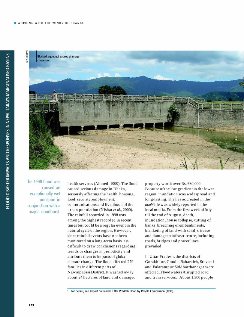
health services (Ahmed, 1999). The floodcaused serious damage in Dhaka,seriously affecting the health, housing,food, security, employment,communications and livelihood of theurban population (Nishat et al., 2000).The rainfall recorded in 1998 wasamong the highest recorded in recenttimes but could be a regular event in thenatural cycle of the region. However,since rainfall events have not beenmonitored on a long-term basis it isdifficult to draw conclusions regardingtrends or changes in periodicity andattribute them to impacts of globalclimate change. The flood affected 279families in different parts ofNawalparasi District. It washed awayabout 24 hectares of land and damaged
property worth over Rs. 680,000.Because of the low gradient in the lowerregion, inundation was widespread andlong-lasting. The havoc created in thedoab5 life was widely reported in thelocal media. From the first week of Julytill the end of August, death,inundation, house collapse, cutting ofbanks, breaching of embankments,blanketing of land with sand, diseaseand damage to infrastructure, includingroads, bridges and power linesprevailed.
In Uttar Pradesh, the districts ofGorakhpur, Gonda, Baharaich, Sravastiand Balarampur Siddharthanagar wereaffected. Floodwaters disrupted roadand train services. About 1,300 people
5 For details, see Report on Eastern Uttar Pradesh Flood by People Commission (1998).
The 1998 flood wascaused an
exceptionally wetmonsoon in
conjunction with amajor cloudburst.
© A
Pok
hrel
Blocked aqueduct causes drainagecongestion.

W O R K I N G W I T H T H E W I N D S O F C H A N G E
FLOO
D DISASTER IMPACTS AN
D RESPON
SES IN N
EPAL TARAI’S MARGIN
ALISED BASINS
133
Climate change willalter flood hazards andprobably increasethem.
and an estimated 2,800 livestock died inthe districts of Gorkhapur, Maharajgunj,Deoria and Kushinagar. Gorakhpurbecame an island after blocked the roadthat linked the city to other cities. Nearly95 % of the affected dwellings were huts.In most of the affected villagesfloodwaters remained for three months.Sand deposition affected 11,253 ha ofland in 148 villages; the depth of thesediment deposited ranged from one toseven feet. Water-borne diseases causedadditional deaths.
The 1998 flood was not an aberration.Nine years later, in 2007, the regionfaced a similar situation as flood waterscaused by the monsoon rains swept theSouth Asian landscape. In parts of theGanga Basin in Nepal, India andBangladesh, flooding inundated large
areas, killed hundreds and displacedmillions. Agricultural and other losseswere high but are still being assessed.Disease has spread throughout much ofthe flood-affected region, affecting bothrural and urban populations. Themonsoon flood of 2007, although abovelong-term averages, is far fromunprecedented. Indeed, floods are aregular feature of life in the basin,important for soil fertility, aquiferrecharge, and a healthy regionalecology. As the misery of so manyinhabitants of the basin clearlydemonstrates, current approaches toflood management are unable tomitigate the impacts on human livesand livelihoods. If climate changeprojections prove accurate and floodevents become more frequent or extreme,this inadequacy will increase.
| TABLE 2 | Loss of Life and Property due to 1993 Floods in the Rohini Basin
Livestock Infrastrctures Affected Houses damaged Land loss loss FMIS Food grain Total
District loss HHs Popn. Death Completely Partially (area in ha) (Km) Road Bridge Dam building Public loss Worth (NRs)
Nawaparasi 279 1,604* *** 2 ** 24.04 0 ** ** ** ** ** ** 680,000
Rupandehi 1,446 8,315* 18 128 ** 0.14 1 ** ** ** ** ** ** 68,190,300
Note * Generated data** Missing data*** Not clear whether there were no deaths or the data is missing. Ethno-history of two study VDCs does not report any deaths.
Source: Developed from Photo Album, Disaster of July 1993 in Nepal, December DPTC (1993)

W O R K I N G W I T H T H E W I N D S O F C H A N G E
FLO
OD
DISA
STER
IMPA
CTS
AND
RESP
ON
SES
IN N
EPAL
TAR
AI’S
MAR
GIN
ALIS
ED B
ASIN
S
134
In order to examine the context of floodhazard and vulnerability, we examinedthe natural and social characteristics ofthe case study sites.
Natural Characteristics
Bagmati BasinThe Bagmati River Basin in centralNepal covers an area of about 3,750 km2.The river’s watershed includes parts ofeight districts: Kathmandu, Lalitpur,Bhaktapur, Makwanpur, Kabhre,Sindhuli, Rautahat, and Sarlahi. TheBagmati River begins north ofKathmandu, at Shivapuri, and drainsout of Nepal into Bihar, where it joinsthe Kosi River near Badla Ghat inKhagaria before joining Ganga River.Nakkhu, Kulekhani, Kokhajor, Marin,
Natural and SocialCharacteristics of theVDCs Studied
Lal Bakaiya and Chandi are its majortributaries. The two study villages arelocated in the doab of the Bagmati andLal Bakaiya rivers.
The Lal Bakaiya River begins in a smalldun (valley) of Makwanpur District andflows to Rautahat District before joiningthe Bagmati in Bihar a few kilometersdownstream of the Nepal-India border.In Makwanpur Districts, it is calledBakaiya, but when it reaches the Taraiand takes on a reddish tinge from thesoil of the Chure range it is known as LalBakaiya. The catchment area of the LalBakaiya River is 168.75 Km2, and itsaverage high flood discharge during themonsoon is 2,365 m3/s at Karmaiya.Though its catchment is five-timessmaller than that of the Bagmati River,Lal Bakaiya causes more damage. Floodsin the river last for just four or five hoursbut river flow is flashy and brings a lot ofsediment load. Bank-cutting and sanddeposition are common in adjoiningVDCs. Lal Bakaiya, as well as theLakhandehi, Ratu, Jhanj, Kalinjor andFuljor rivers drains the Chure range andthe Nepal Tarai before joining theBagmati in Bihar, but the catchmentareas of these rivers are not included inthat of the Bagmati River in Nepal.
Floods lead toinundation bankcutting and sand
deposition.
��������
���
�� �����
������ �
����������
���������������������
���� �����
�����������������������
���������
���
����������������������
��������
������������������
������
���� ������ �!��� ��
��� ����������������
����
"� �� �
"�������#����� ��$�%
&'''
('''
)'''
'
' &' *' +' )(' ),' )-' ()'
��.�����$��%
Note: The red dots in the profile indicate points where tributaries join the Bagmati River.Source: DWIDP (2005)
| FIGURE 4 | Profile of Bagmati river

W O R K I N G W I T H T H E W I N D S O F C H A N G E
FLOO
D DISASTER IMPACTS AN
D RESPON
SES IN N
EPAL TARAI’S MARGIN
ALISED BASINS
135
MAHABHARAT
NEPAL
CHURE RANGE
Bhabar
Chandranigahpur
Bagmati Irrigation Canal
Brahmapuri
Rautahatdistrict
Gaur
Bairgania
Embank
ment
Embankment
Railway line onembankment
Borderpillars
Bagmati river
NORTH BIHAR
INDIA
Bagmati Rive
r Manusmara River
Sarlahi district
Bagmati bridge
To Dhalkebar
Bagmati barrage
BairganiaGarland Embankment
Bhasedwa
Lal Bakaiya River
East West highway
To Nijgadh
Flooding within the lower Bagmati doab,where the river gradient is about four-meters per kilometer, is a consequence ofmorphological disruptions in theBagmati and the Lal Bakaiya. Bothrivers are embanked and extend far intoNepali territory. Bairgaina Block ofBihar is situated between the Bagmatiand Lal Bakaiya rivers and bordersRautahat District of Nepal. The entireblock is surrounded by embankments ina structure known as a ‘garlandembankment’. The northern portion ofthis embankment runs parallel to theNepal-India border, obstructing naturaldrainage. As a result, the river floodsareas within Nepal, including GaurMunicipality and Brahmapuri VDC.
Rohini BasinThe Rohini is a tributary of the WestRapti River, which in turn flows into theGandak River north of Gorakhapur.Though it begins in the Chure, the rivercrosses the Indian border after drainingparts of Rupandehi and Nawalparasidistricts. Most of the area it drains is inthe 1,960 km2 district of Nawalparasi,which has four distinct geographicalzones: the hills, the inner Tarai, theChure and the Tarai. The Parasi plain isa continuation of the north Gangeticland system. In Nepal, the averagenorth-south width of the Tarai plainvaries between five and 40 km. Thecatchment area of Rohini lies betweenthe municipality of Butwal in
Embankmentsconstrain naturaldrainage.
| FIGURE 5 | Schematic view of Bagmati and Lal Bakaiya rivers and dependent area

W O R K I N G W I T H T H E W I N D S O F C H A N G E
FLO
OD
DISA
STER
IMPA
CTS
AND
RESP
ON
SES
IN N
EPAL
TAR
AI’S
MAR
GIN
ALIS
ED B
ASIN
S
136
Rupandehi and the Daunne hills ofNawalparasi District. The eastern partof Butwal located in the watershed ofthe Tinau River also drains into theRohini. Thus, the Rohini and itstributaries drain the area lying betweenthe Narayani (the Gandak) River in theeast and the Tinau River in the west. Itsmain stem begins at Chauranghi in theChure hill and flows into the basin’swestern section. A number of tributaries(nala, kholsa, khahare, khola and streams)flow into the main-stem as it flowssouth. As they flow, the tributarieschange course, split into distributariesand captures neighbouring streams. InNepal, the tributaries of the Rohini arethe Jharahi, Dhanewa, Bhumahi,Bhaluhi and the Somnath. Each begin asan ephemeral stream (khahare) on thesouthern slope of the Chure and laterjoins the Rohini before that river entersUttar Pradesh at Mishrauli ofNautanawa Block.
Of the Rohini’s total length of 122 km,43 km lies in the bhabar and upper Taraiof Nepal; the rest is in India. The Rohini
has a total catchment area of 2,686 km2,794 km2 (30 %) of which is in Nepal.This 30 % contributes more run off thanthat generated within the lowercatchment in India, because thecatchment in Nepal receives morerainfall. Of the total area in Nepal, 505km2 is in Parasi District and 289 km2 inRupandehi. The Rohini River systemand its tributaries drain almost all of theParasi Tarai. The Jharahi and Dhanewarivers join each other after they flow intoIndia and together are called theChandan River. With its tributaries fromNepal and Uttar Pradesh, the Rohinijoins the West Rapti River nearGorakhpur. The drainage area of theriver in the plains of both Nepal andUttar Pradesh is contiguous to that ofthe Tinau (called the Kuda in UttarPradesh) in the west and the Gandak inthe east.
The slopes of the Rohini River and itstributaries change within a fewkilometres of their origin in the Churerange. Because the gradient is low, theyhave a tendency to meander and depositsediment. Even though the slope ishigh, sediment deposition is greater inthe upper reaches because the bulk ofthe sediment is derived from masswasting, and consists of cobbles andpebbles, which readily settle out. Finersediment, in contrast, moves furtherdownstream. The lower reaches of theRohini receive sediment from theupstream sections as well as from theerosion of bed and banks. With thecessation of rainfall, flow velocityreduces and large amounts of sedimentbegin to be deposited in the riverbed andon flood plains, while suspended loadsare transferred still further downstream.In the lower reaches because the streamgradient is less than 0.1, the effects offloods are severe.
Chure rivers areflashy in nature.
Bagmati Basin Characteristic Bagmati River Lal Bakaiya River Rohini Basin
Area (km2) 3,750 806 194
Length (km) 207 116 The longest mainwithin Nepal is43 km.
Maximum Elevation 2,716 2,135 Begins at 850m atChure drops to100 m.
Minimum Elevation 71 72
District Kathmandu, Lalitpur, Makwanpur, Bara, Nawalparasi andBhaktapur, Makwanpur, Rautahat RupandehiKabhre, Sindhuli,Rautahat, and Sarlahi
Tributaries Manahara, Bishnumati, Lohajor, Bakaiya, Jharahi, Bhaluhi,Nakkhu, Marin, Kayan, Bunda, Hile, Majhi, Simat, DhanewaKokhajhor, Chandi, Burani, Sukaura, Jyamire,Manusmara Harda, Dhansar, Bhavar
| TABLE 3 | Summary of Characteristics

W O R K I N G W I T H T H E W I N D S O F C H A N G E
FLOO
D DISASTER IMPACTS AN
D RESPON
SES IN N
EPAL TARAI’S MARGIN
ALISED BASINS
137
District/VDC Household (Nos) Total Population Male Female Area (km2) Population density
Nawalparasi 98,340 562,870 278,257 284,613 1126 500Devgaun 845 5,424 2,819 2,605 9.44 575Rampur Khadauna 659 4,389 2,273 2,116 3.75 1,170
Rautahat 88,162 545,132 282,246 262,886 2162 252Bhasedawa 935 6,254 3,252 3,002 9.75 641Brahmapuri 627 4,332 2,230 2,102 9.19 471
| TABLE 4 | Households, Population and Area of Study VDCs
Source: Field Survey (2006)
Not enough Enough for Enough for Enough for Enough for SurplusVDC 3 months 3 months 6 months 9 months 12 months HHs Total HHs
Devgaun Number 237 138 140 103 135 92 845Per cent 28 17 17 13 16 11
Rampur Khadauna Number 118 156 174 93 74 44 659Per cent 18 24 27 15 12 7
Bhasedhwa Number 404 199 97 136 60 39 935Per cent 44 22 11 15 7 5
Brahmapuri Number 258 152 90 72 37 18 627Per cent 42 25 15 12 6 3
Total HHs 3,066
| TABLE 5 | Household Food Sufficiency by Months
Source: Field Survey (2006)
Social Characteristics
In the following sections, we discuss thesocio-economic conditions of the fourVDCs based on information collected atthe ward level using tools such astransact walking and semi-structuredinterviews. Transects and interviewswere conducted with local NGOs, CBOsand network staff and with volunteersto gather information about floodproblems, as well as about adaptationstrategies and their advantages anddisadvantages.
The 20,399 inhabitants of the four VDCslive in 3,066 households, about the samenumber in each VDC. The two VDCs ofRohini Basin house 9,756, while those ofthe Bagmati Basin house 10,586. Theeconomic status of the people is poor.For the most part, families suffer foodshortages. In Devgaun, for instance, just62 % of the population produces enoughfood for more than six months, while in
Rampur Khadauna, Bhasedwa andBrahmapuri the equivalent figures are69, 77, and 62 % respectively (Table 5).
As shown in Table 6, literacy rates inBrahmapuri, Bhasedwa, RampurKhadauna and Devgaon VDCs are 34,39, 52 and 49 % respectively. Literacy ishigher in the two Rohini Basin VDCsthan in the Bagmati Basin VDCs. In allVDCs female literacy is substantiallylower than male.
Brahmapuri has the largest proportion(41 %) of landless households andRampur Khadauna, the least (19 %).Between 9% and 14 % of landlesshouseholds in the four VDCs rent landfor agriculture purposes, while theremaining landless households earn alivelihood through daily wage labour.In Brahmapuri, only 27 % cultivateprivate lands, in all three other VDCSthe proportion is 40 %. About 40 % oflandowners rent their land to others.

W O R K I N G W I T H T H E W I N D S O F C H A N G E
FLO
OD
DISA
STER
IMPA
CTS
AND
RESP
ON
SES
IN N
EPAL
TAR
AI’S
MAR
GIN
ALIS
ED B
ASIN
S
138
a) Rohini Basin b) Bagmati Basin
����
���������
���
(���
(���
(���
&��
#��
���
���
�
)����('"� ('"(*('"& ('"'*('#& ('#'*('+& ('+'*('&& ('&'*(''& ('''*���&
����
,$-��� .���������
����
���������
���
(���
(���
(���
&��
#��
���
���
�
)����('"� ('"(*('"& ('"'*('#& ('#'*('+& ('+'*('&& ('&'*(''& ('''*���&
����
���$�� �����
Households under different land tenureOwn land Rented to Own Total
VDC cultivated others plus rented Rented Landless households
Devgaun 335 (40) 83 (10) 224 (27) 107 (13) 96 (12) 845
Rampur Khadauna 263 (40) 66 (10) 210 (32) 64 (10) 56 (9) 659
Bhasedhwa 368 (40) 120 (13) 210 (23) 85 (9) 152 (17) 935
Brahmapuri 167 (27) 59 (10) 142 (23) 84 (14) 175 (27) 627
| TABLE 7 | Land Tenure Type
Source: Field Survey (2006)
Female Male Total VDC population % population % population %
Devgaun 2,605 35 2,819 67 5,424 49
Rampur Khadauna 2,116 31 2,273 68 4,389 52
Bhasedhwa 3,002 20 3,252 44 6,254 34
Brahmapuri 2,102 28 2,230 52 4,332 41
| TABLE 6 | Literacy Rate (%) (for Population 6 Years and Above)
Source: Field Survey (2006)
| FIGURE 6 | Status of agricultural land
The amount of land in the BagmatiBasin used for agriculture is decreasing,the amount in Rohini is constant, and inRampur Khadauna it is increasing (SeeFigure 6 (a) and (b)).
We asked villagers to assess the impactof floods. Their responses are listed inTable 8. Villagers identify bank cutting,sand deposition and inundation as themain impacts.

W O R K I N G W I T H T H E W I N D S O F C H A N G E
FLOO
D DISASTER IMPACTS AN
D RESPON
SES IN N
EPAL TARAI’S MARGIN
ALISED BASINS
139
Since the objective of the study was toidentify activities that would enablecommunities to adapt and to helpdisaster risk reduction, it adopted abottom-up approach beginning withaffected communities and backed upwith insights from research and central-level functionaries. Primary informationwas generated through participatoryrural appraisal (PRA) techniques and ahousehold survey. The followingspecific methodologies were used.
1. Reconnaissance visits to theconcerned districts, including theheadwaters of the rivers
2. A social map of the hazards in eachVDC was prepared and transposedon a topographical map (1:25,000) ofthe VDCs.
3. The number of households in theidentified hazard zone was listedand their vulnerability assessed.
4. A time line recording trends wasprepared
5. Individual-, local-, and national-level shared learning dialogues(SLDs) about people’s perceptions offlooding, damage (land, crop, humanlife, animal life) and impact on pre-,during and post-flood situationswere conducted.
Ethno-History and Trend Analysis
Before we discuss the state ofvulnerability the affected and the resultsof the SLDs, it is useful to recount theethno-history of flooding in the region.The analysis of floods in Bhasedwa andBramhapuri VDCs of the Bagmati Basinshows that large-scale devastationoccurs during extreme events such asthe one in 1993, but that in other yearsas well, agricultural land is inundatedand houses are damaged.
Rohini BasinHistorical analysis of floods,populations and natural resources inRampur Khadauna and Devgaun VDCsof Nawalparasi, Rohini Basin showsthat floods are neither sudden norunexpected. Floods in the Piruda Riverin the northeast and the Bhaluhi Riverin the northwest damage cultivated landand crops in Devgaun VDCs. In 1950,2,100 people lived in 400 homes andcultivated 1,000 bigha of land. Thecurrent population is 5,424 living in 841households but they own only 993 bigha
Bank cutting Sand deposition InundationCultivable Other Cultivable Other Cultivable Other Property damage and loss of lives
VDC land use land use land use House Cowshed Human Livestock
Devgaun 29 15.5 11 10 990 63 80 85 150
Rampur Khadauna 45 1,095 44 40
Bhasedhawa 175 8 246 25 10 25 40 2 10
Brahmapuri 58 76 35 14 41 1
| TABLE 8 | Effects of Flood
Source: Field Survey (2006)
Assessing Context of Flooding

W O R K I N G W I T H T H E W I N D S O F C H A N G E
FLO
OD
DISA
STER
IMPA
CTS
AND
RESP
ON
SES
IN N
EPAL
TAR
AI’S
MAR
GIN
ALIS
ED B
ASIN
S
140
/�,�����0,1�����$� �$�2���3�������� ���� ��
.$�$�$��� ��
��4����$��������4��$�
� 1�$��$���0,1�����$� �$�2����1�$��$����� �$� � �!�56��7��8/�� ������!$$���-$�������� ����9� / ���� ���.$�����
�0,1���4�� ���$�,$-$����$���1��� ��$$������ ���������4�����$� � �!����$���$��
���$��*�8(�"9�8("�9� �-:�;�#����� *�"�*� �-:�(3�;�#
.����������<�+"�<� �-:��3�;�#,$-���*�"��<� �-:�"3�;�#
* =��$�* 1��$* (+�>������ � ����* 8+��3�(���9�?�8���3�(#��9* ,$�:�(��@�#�����*"�A�:�@�+
� ������ ������!����"��#�$��"� %�� �&#���$�'��%��� ���&���#�����$�'��%������������$��(�#� ���&���#�����$�'�
� �����$-$��/�,������� �-:��%3�;�#
�����/�,�7$�
�$� � �!�- � �����$B�����!�/�,����.�C,��8���:�;�#93��5C�.�8/$��:�;�#9
1� 2 �� ����2��$��������!�2������$�� �����$� �$������-���$� � �!���$���$�������D
* �.�� ��$����2���$�'������2�$����2���$����,1�* 0�$�� 2!�2� � $��� - ��� ���������6�����$��$�� ���* ��� � ��$���E����$-$!�2� �!�� �� ������$� ��* F����$�$� ��$��2���$�����$������ �������$�� ��3��� � ��$���E���
��$�G��$��2���$������� ��������!��$�$��$�:
/�,�2�������!����$
%��!�3��(*�%�A�����+
��� ��$��������2���0,1�����$� �$3���E��$�� ���2�����$�� ���8/�� ������������ ��9
��$� �$�����$�� ��� �������,1�
�'�A�����"�F$�����+
/�������0� .������ ��.����������.���� .����1#�
��� � ��$ �����E
�$� � �!�0,1��
of cultivated land. Small-scale irrigationbegan in 1951 and pumpsets wereintroduced in 1969. An irrigation canalserves about 500 bigha in Devgaun, butthe supply of water is unreliable.
The Dhanewa River flows from thenortheast south and the Jharahi Riverflows from the southwest to encircle theboundaries of Rampur Khadauna. Thepopulation of the village in 1950 was2,000 and 800 bigha of land werecultivated. The survey in May 2007,showed that the population hadincreased to 4,884 living in 664households and that 1,190 bigha of landwere cultivated. Untill 1968, RampurKhadana had five bigha of forest whichmet the villagers’ needs for firewood andfodder, but it was cleared and convertedinto agriculture land. The Dhanewa andJharahi rivers began to cause flooddamage in 1961. Inundation is currentlymost severe in wards 7, 8 and 9.
There was no motorable road in thevillage untill 1992. The main road linking
| FIGURE 7 | Methodology schematic

W O R K I N G W I T H T H E W I N D S O F C H A N G E
FLOO
D DISASTER IMPACTS AN
D RESPON
SES IN N
EPAL TARAI’S MARGIN
ALISED BASINS
141
In both basinsfloods are a regularphenomenon.
Rampur Khadauna to Parasi is graveledwhile local roads are paved with bricks.Small drains were built in the VDC after1993.
Local people mentioned that untill 1970flooding improved productivity in somesections of Devgaun VDC. The riverwater brought clayey loam suitable forgrowing rabi crops such as arahar(yellow lentils), peas, gram and masuro(red lentils). Merchants from nearbyIndian towns came to the village to buythe harvests. In the last thirty years,productivity has declined substantiallyand crops such as arahar, peas, masuroand gram are not grown anymore.
Bagmati BasinFloods in the Lal Bakaiya River affectBhasedwa while floods in the BagmatiRiver affect Bramhapuri. Each year bothrivers create havoc during monsoon.The Bagmati has moved three kilometerswestward in recent years resulting in aloss of land and depositing sand on asubstantial area. Before 1969, villagersclaim that floods were not a problem. In1966, the Indian Railways diverted theBagmati from its western to easternchannel in order to protect the railwaylines. Wooden piles were dug and spursconstructed along the western channel.These interventions altered the localriver dynamics and exacerbated theimpacts of flooding on Bramhapuri.
About 100 households in Bramhapurihave been displaced in the last twodecades and only 100 of 334 bigha ofagriculture land remain. In Bhasedwa,about 600 households were displaced.About 700 bigha out of a total of 1,250bigha is cultivated in Bhasedwa. In thedecades of 1959-1968, 1969-1978 and1979-1988, respectively 20, 30 and 200bigha of forest was cleared in Bhasedwa.
The figures indicate that the extent ofdeforestation has increased almostseven-fold after the floods in 1970 and1975, which damaged 100 and 10 bighaof cultivated land respectively. Fiftyhouseholds were displaced in 1978 and50 bigha of land were destroyed between1979 and 1988. During the 1993 floods100 households were displaced and 40bigha of cultivated land was damaged.Another 100 households were displacedand crops growing on 100 bigha weredestroyed when the Bagmati canalembankment began breaching after1999. The extent of flood devastation isperceived to be increasing and thecommunities lose cultivated land, crops,livestock and property each year. At thesame time, the degradation of forest andgrazing land is rapid.
© A
Pok
hrel
Step
I
I I
I I I
IV
V
| TABLE 9 | SLD and Vulnerability Assessment Matrix
Activity
Identification of VDCs representing head, tail strata of the river.
Identification of local hazards within each VDC.
Preparation of timeline and Ethno-history of floods.
PRAs at ward level of four VDCs
Vulnerability Assessment in each VDC.
Embankment along Brahmapuri.

W O R K I N G W I T H T H E W I N D S O F C H A N G E
FLO
OD
DISA
STER
IMPA
CTS
AND
RESP
ON
SES
IN N
EPAL
TAR
AI’S
MAR
GIN
ALIS
ED B
ASIN
S
142
��������� ��
H��$����
/����$��� � ��
/$���$�$��
����
0�����$��$
����� �. -$
A�� . -$
��������� ��
�������
E$$����� ��
�������� ��
/2$�$
� � � !
�������� ��
�$������!� �����$�
�������� ��
� ���. -$
�� ��!� �����$��$3�$���$�$��3�� �����$����82���*���!�9
7����
�
F��� !
,$-���
������ �-$����
�� ��!� �����$��$3�$���$�$���3�� �����$����
0�����$��$
/����$��� � ��
/2$�$
�������� ��
��������
�-$����H��$����
����
/$���$�$��
�,1������!=�������!E$$������ ��
. -$������!
)
*
+
,
-
.
/
0
1�$�$��
| TABLE 10 | Ethno-History of Floods in Devgaun
Year
1969
1970
1990
1996
1998
2003
Event
10 kattha of land affected by bank cutting. Floods inundated ward numbers 1, 3 and 4. Flood waters also brought clayey loamincreasing productivity.
Ward numbers 2, 5 and 6 were inundated.
Water from Bhaluwai and Piruda rivers inundated the village. Water released in the Gandak canal exacerbated the problem because crossdrainage structures have insufficient water way. The settlement of ward number 7 and 8 were affected and the crops destroyed.
The river washed two spurs in ward number 1 displacing 5 houses of Yadav Gaon. Those displaced live close to the Hulaki Sadak.
All settlements of ward numbers 1, 2, 7 and 8 and the cropped areas were affected. In ward number 1, four bighas of land wasdestroyed by bank cutting while 10 households were displaced. They bought land in Sarawal VDC. Flood in Pidruda River resulted bankcutting in ward number 8 and washed away a Muslim graveyard (5 bigha of land). Sand deposition affected eight bigha of land Inward number 4.
Floods inundated settlements of ward numbers 1, 7, 8 and all farmlands. Parts of ward number 9 was inundated. All crops destroyed.The productivity of land is decreasing.
| FIGURE 8 | Flood hazard map of Devgaun

W O R K I N G W I T H T H E W I N D S O F C H A N G E
FLOO
D DISASTER IMPACTS AN
D RESPON
SES IN N
EPAL TARAI’S MARGIN
ALISED BASINS
143
/�����
�
�����
���� �����
����
/���
��I�����
���
��� �����
����$���$$�
�$��� ��!� �����$�
,��$��. -$
��������
��� ��
7���� !
7���� !
A� ����
������
�$����$�$�!�22$��$�
������
�������� ��
A�� �. -$
$������$�2�A�� �. -$
J�������$
.��
/���
�$������$�$�!� �����$�
�$��� ��!� �����$�
�$����$�$�!�22$��$�
��������
/$���$�$��
�$����$��������� ��
. -$
�,1������!
����
7��G�$
, �
����$���$$�
�,1��� �� ��
=�������!
�$�$��
�$������$�$�!� �����$�
| TABLE 11 | Ethno-History of Floods in Rampur Khadauna
Year
1961
1979
1982
1990
1991
1996
1998
2000
2003-2005
Event
Early records of inundation in the village date back to this year. All houses of ward number 9 along with agriculture lands were underwater. However, the flood was not devastating. It started receding after 10-12 hours. The flood deposited clayey loam over the fields.This resulted in a harvest boom for crops such as grams, lentils, peas and early paddy. The nature of flooding changed in the lateryears.
Gandak Irrigation Canal was constructed during 1979-80. However, the area received irrigation only after 1984. The main canal runsperpendicular to the ground slope. Cross drainage structures were designed and implemented with insufficient water ways. This causesflooding in the settlements of ward numbers 7, 8 and 9. All crops in the fields were lost. Paddy seed had to be sown repeatedly. Insome areas inundation was minor and paddy harvest was better.
Two persons died in floods. The Dhanewa River gradually became larger and joined the Jharahi resulting a flooding. The settlements ofward 8 and 9 and all crops were submerged for 4 days. The Jharahi River changed course in 1961 after Sugauli Dam was constructedat Haripur VDC. Ward 1 and 2 were affected by bank cutting and inundation.
The widening of Dhanewa River resulted in inundation of houses of ward numbers 7, 8 and 9 and all crops for 4-5 days. Gandak canalreceives no water when required but in the monsoon excess water was released in the canal exacerbating flooding.
Flood caused death of one person. Bank cutting by Dhanewa and Jharahi rivers was severe. No action was taken. Whenever there wasrain in the northern catchment, people realised that flood will come after 1 or 2 days.
Communities of ward numbers 1, 7, 8 and 9 are temporarily displaced. People took shelter at the school and returned to their homesonly after water receded. The confluence of two rivers changed and altered the flooding pattern. The bed level also increased. Sinceriver bed was higher than the fields, the flood water easily found its way into the fields. People from ward number 1 left their homesto live temporarily in ward numbers 3 and 4.
The VDC was submerged. Crops in 1,000 bigha were destroyed.
July floods inundated houses of ward numbers 7, 8 and 9. People along with their belongings and cattle moved to safer places athigher grounds. Some went to live with their relatives. About 1,100 bigha of agriculture land was inundated.
Flooding was recurrent. People used boats to commute when the village was inundated.
| FIGURE 9 | Flood hazard map of Rampur Khadauna

W O R K I N G W I T H T H E W I N D S O F C H A N G E
FLO
OD
DISA
STER
IMPA
CTS
AND
RESP
ON
SES
IN N
EPAL
TAR
AI’S
MAR
GIN
ALIS
ED B
ASIN
S
144
| TABLE 12 | Ethno-History of Floods in Bhasedwa
Year
1937
1965
1970
1975
1978
1985
1993
1995-2003
2004
2005
Event
A September flood destroyed paddy before it was harvested. About 200 bigha of land was destroyed due to inundation and sand-casting. Itdamaged the paddy crop. However, the village was not damaged.
Before paddy could be harvested floods buried more than 1,000 bigha of land under sand. The settlement was unharmed.
Bank cutting washed away the forest of ward number 1. In other wards, sand deposition affected around 100 bigha of land. The land could not bemade arable for long time.
Sand deposition destroyed 200 bigha of land. Parts of forest and local pastures were also lost.
Flood destroyed crops of 50 bigha. It also affected 50 households of Dholbaja tole. The population of ward number 5 was resettled by clearing forestnear Hanumangad of the same ward. No effort was made to prevent bank cutting.
Floods continue to destroy large tracts of land. The problem became recurrent after this year. Farmed land, pasture and orchards were lost. Between1985 and 1991 around 100 bigha of land was lost due to bank cutting. No efforts were made to minimise the losses. In 1991 DDC and DistrictIrrigation Office (DIO) supported construction of spurs made of bamboo piles. Sand bags were also placed. But the problem continued.
An unprecedented flood occurred in the early hours (4:00 am) of 21 July. As it was time to start herding cattle to pastures some people were alreadyawake. They warned the rest of the villagers providing much lead time for people to reach higher grounds. There was no loss of life. The entirevillage was under water. Bank cutting was rapid. 100 households belonging to ward number 6 (Chamar Tole) were displaced and went to live in aneighboring VDC. The poorer people took shelter at their relatives’ homes. Some struggled to salvage their belongings by lighting petro-max at night.Sand deposition destroyed around 100 bigha of land. On August 10 another flood occurred. Its ferocity was lower than that of the July 21 flood butthe flood led to widespread, rapid and devastating bank cutting. Within an hour, 262 feet of bank eroded.
Bank cutting was worse than in 1993. The flood of August 13, 1995 took 50 feet land. Floods of August 16, 17 and 18, 1997 led to bank cutting of 10bigha of cultivated land. This flood washed away road linking the village to the north. The floods of July 21 and 25, 1998 displaced 25 households ofPokhara tole. Families moved at night. After the flood, more than 150 households have migrated and the trend continued until 2003. Everyone livingin the purano basti of Bhasedwa migrated elsewhere.
This flood was devastating compared to 1993 floods. The floods of 1993 had pushed an entire settlement to naya basti. The 2004 floods did notspare this basti - the settlement and surrounding fields were inundated. All dalits of ward number 2 and 3 were displaced. They started living incamps set up at Bhasedwa Primary school. The floods damaged the canal system of Bagmati Irrigation Project (BIP). A 250 meter long embankmentand a spur built by BIP had not been complete as the construction began late. The embankment congested flow which became a serious hazard. Theentire embankment including the spur was washed away. The soil used for building embankment and spur was spread over 100 bigha of land.Farmers still have not succeeded in recovering the land today.
BIP constructed a 400 meter long embankment and a spur. This initiative has saved land behind the embankment. However, land areas bothupstream and downstream of embankment face increased inundation and sediment deposition.
�$�$��1���-$��$�������!.�� $���$���$�$���$����$��������� ���� �����$�����$����$����� ��H�����$��/����,1������!F�$���������� ������$/�������$- �����$���$�$���
1��
�$����$�������� ��
�� �����$����
/��
/��
�$����$�������� ������ ����� ��
�$��$- ����!22$��$���!�������� ��
E���$�
���� !�. -$
�$- ����$���$�$���
�$����-$�$���� -$��$����$����������� ��
H�����$��
�$����$����� ��
�
| FIGURE 10 | Flood hazard map of Bhasedwa

W O R K I N G W I T H T H E W I N D S O F C H A N G E
FLOO
D DISASTER IMPACTS AN
D RESPON
SES IN N
EPAL TARAI’S MARGIN
ALISED BASINS
145
E���$�
/���������� �. -$
/��
/$���$�$��
.�� /$���$�$��
�� �����$����
H�����$��
0�����$��� �����$����
�,1������!
E�������� ��$��������� ������$
�,1������!���$
�������������
����
���� �. -$
�
| TABLE 13 | Ethno-History of Floods in Brahmapuri
Year
1954
1960
1961
1966
1973
1978
1993
1998
2003
Event
A major flood resulted in sediment deposition over the lands. Entire paddy crop was lost. Farm land looked like sand banks and couldnot be farmed for subsequent 7 years. During this period people faced food shortage. The river also brought tree trunks and depositedthem in the fields. Some people collected the timber, sold them and made their living. People built resting places on stilts and lived onit for many days. Cooking was done on machan. Some families stacked one bed over the others to keep them dry. During the 7 yearfood shortage period, the richer households bought food from local and regional markets while the poor households migrated to Indiaand neighbouring village in search of menial jobs. The remitance money they earned helped sustenance.
Local initiatives to construct an irrigation system by damming Bagmati began. This was done to rejuvenate the land affected by sanddeposition. The canal system irrigated 17 % of the land lying east of the village. The efforts to irrigate western areas resulted in theflooding of the village. In anguish people destroyed the dam and the initiative came to an end.
Floods deposited silty-loam over areas affected by sand deposition in 1960 floods. Bagmati River flowed in two channels east and westof Brahmapuri. The westward channel accomodated the major flow while the eastward channel looked like a small irrigation canal.The westward channel of the river continuously impacted the Indian railway line in Bihar.
The Indian Railway diverted flow of Bagmati from the western channel to eastern channel with the objective of protecting the railwaylines. To that end wooden piles were driven and spurs were constructed in the western channel. Indian Railway provided compensationto farmers who owned land adjacent to the eastern channel. The farmers initially did not agree but later realised that river wasgradually moving towards the eastern channel across the border. They agreed to be compensated.
Bank cutting was a major problem after the river began flowing along the eastern channel.
Nun toli of ward number 9 was displaced.
Unprecedented flood occurs in the early morning (at 4:00 am) of July. In the village, the depth of flowing water was 5 feet. Villages asfar as Barhathwa were inundated. The flood also washed an elephant. People could not move from the village in the dark because theentire village was inundated. People stacked beds, climbed roof, trees or to some raised place for safety. One boy was washed away.A woman lost both her sons along with her goats and oxen. Stored food became wet. People could not cook food even after the floodwater receded. The houses were filled with muck for around 3-4 days. Relief agencies arrived only after the flood receded. People hadto travel to Gaur to receive the relief materials because roads were damaged. Both rich and poor were equally affected as the storedgrains had been damaged. Relief distribution was available continuously for three months which helped people to get back to theirlives. All the households in ward number 8 were displaced. About 70 bigha of land was affected by sand deposit.
Between 1998 and 2002, households of ward numbers 2, 6 and 7 continued to be displaced. The high school in Brahmapuri waswashed away by the flood of 2002. The school did not reopen for almost one year.
The lower section of Bagmati was embanked and spurs were constructed with assistance from the Government of India. Thisintervention has minimised bank cutting and flooding. However, Gaur municipality continued to be inundated.
| FIGURE 11 | Flood hazard map of Brahmapuri

W O R K I N G W I T H T H E W I N D S O F C H A N G E
FLO
OD
DISA
STER
IMPA
CTS
AND
RESP
ON
SES
IN N
EPAL
TAR
AI’S
MAR
GIN
ALIS
ED B
ASIN
S
146
One of the major focuses of the studywas assessing the extent ofvulnerability. The theoretical aspects ofvulnerability are discussed in chapter 4and were used to define the parameters
in this assessment. Published literature,reports and documents were reviewed toselect the parameters and severalrounds of discussions were held withexperts and knowledgeable persons. Achecklist consisting of 25 parameterswas prepared and discussed among theteam members and the localcommunities. The components were asfollows: a. physical, b. social, c. gender-related d. economic, e. access tocommunication, f. access to resourcesand g. psychological (Table 15). Theparameters were weighted as shown inTable 14.
The tool thus developed wasadministered to all households in thefour VDCs. Care was taken to ensurethat households in each of the hazardsites identified above (See Figures 8,9,10and 11) were included.
Inadequate drainage capacity results infailure of culverts.
© A
Pok
hrel
Parameters Indicators
I Physical 1 Frequency of flood2 Effects of flood3 Bank cutting/sand casting4 Damage to structures5 Effect of inundation – pollution6 Effect of inundation - on mobility7 House located along the banks8 House located next to embankments9 House located in the direction of flow10 Flood damaged - land types
I I Social 11 Access to education12 Head of household13 Mobility-less or no-mobility
I I I Economic 14 Food sufficiency15 Land holding16 House types17 Source of income18 Food security
IV Access to resources 19 Access to water, sanitation and health institutions20 Access to forests21 Access to service centres
V Communication 22 CommunicationVI Gender Perspective 23 Group formation and funds collection
24 Women participation in SHGsVII Psychological 25 Psychological
| TABLE 15 | Parameters of Vulnerability
Rank Vulnerability type Magnitude For 25 parameters
V Severe 4.1 – 5 101-125
IV High 3.1 – 4 76-100
III Moderate 2.1 – 3 51-75
I I Vulnerable 1.1 – 2 26-50
I Low 1 and below 25 and below
| TABLE 14 | Vulnerability Ranking
Vulnerability Assessment

W O R K I N G W I T H T H E W I N D S O F C H A N G E
FLOO
D DISASTER IMPACTS AN
D RESPON
SES IN N
EPAL TARAI’S MARGIN
ALISED BASINS
147
Notes: 45 Households of all 4 VDCs fall in severely vulnerable class (1.4 per cent), 2051 households of all 4 VDCs fall in highly vulnerable class (67.0 %), 970 households of all4 VDCs fall in rest other classes (31.6 %). (The rest classes include moderately vulnerable, vulnerable and low vulnerable).
Nature of Vulnerability
Ward-wise results are presented inTable 16. These include households inthe severely and highly vulnerablecategories. Overall, 37%, 68%, 83% and90 % of the populations in Devgaun,Rampur Khadauna, Bhasedhawa andBrahmapuri respectively are in thehighly vulnerable category.
In all VDCs, poor access to informationabout policies, relief and climate issuesemerged as the factors contributing mostto vulnerability. There are nomechanisms for providing weather-related information or early warnings atthe local level in any VDC. Nationalradio and TVs do broadcast informationon the daily temperatures and rainfallrecorded at selected stations, but peoplerely on local indicators such as darkclouds to discern if it is likely to rain.The information on vulnerabilitycollected was shared with therepresentatives of the VDCs and used toformulate pilot adaptive measures.Another factor was the genderimbalance.
Devgaun Rampur Khadauna Bhasedhawa Brahmapuri Ward no. SV HV Rest Total SV HV Rest Total SV HV Rest Total SV HV Rest Total
1 0 55 58 113 0 35 29 64 0 26 18 44 0 24 5 292 0 12 79 91 0 44 22 66 0 43 17 60 0 17 29 463 0 27 52 79 0 33 5 38 1 156 39 196 23 66 7 964 0 4 50 54 0 19 47 66 1 115 7 123 0 103 11 1145 0 11 63 74 4 98 9 111 1 103 14 118 11 62 0 736 0 25 59 84 0 57 19 76 0 202 44 246 2 99 5 1067 0 65 63 128 0 60 29 89 0 25 2 27 0 39 6 458 0 68 59 127 0 61 13 74 0 65 1 66 1 84 1 869 1 49 45 95 0 35 40 75 0 32 23 55 0 32 0 32
Total 1 316 528 845 4 442 213 659 3 767 165 935 37 526 64 627
Percentage 0 37 62.5 100 1 67 32 100 0.3 82 17.7 100 6 84 10 100
| TABLE 16 | Aggregate and Ward Wise Vulnerability Assessment
| TABLE 17 | VDC-Wise Vulnerability According to the Dis-aggregated Parameters
Component with VDC wise households in different vulnerability classmagnitude of vulnerability Devgaun Rampur Khadauna Bhasedhawa Brahmapuri
PhysicalSevere - 57 (9) 16 (2) 65 (10)High 100 (12) 376 (57) 637 (68) 336 (54)Moderate to low 745 (88) 226 (34) 282 (30) 226 (36)Total 845 659 935 627SocialSevere 9 (1) 3 (0.5) 4 (0.4) 5 (1)High 180 (21) 101 (15) 158 (17) 104 (17)Moderate to low 656 (78) 555 (84.5) 773(83) 518 (82)Total 845 659 935 627EconomicSevere 207 (25) 220 (33) 447 (48) 482 (77)High 291 (34) 233 (36) 341 (36) 87 (14)Moderate to low 347 (41) 206 (31) 147 (16) 58 (9)Total 845 659 935 627Access to resourcesSevere 198 (23) 205 (31) 122 (13) 176 (28)High 517 (61) 296 (45) 763 (82) 412 (66)Moderate to low 130 (16) 158 (24) 50 (5) 39 (6)Total 845 659 935 627Access to communicationSevere 474 (56) 423 (64) 599 (64) 375 (60)High 6 (1) 1 (0) - -Moderate to low 365 (43) 235 (36) 336 (36) 252(40)Total 845 659 935 627Gender perspectiveSevere 524 (62) 186 (28) 516 (55) 489 (78)High 19 (2) 87 (13) 46 (5) 19 (3)Moderate to low 302 (36) 386 (59) 373 (40) 119 (19)Total 845 659 935 627PsychologicalSevere - - - 2 (0.3)High 2 (0.3) 1 (0) - 1 (0.2)Moderate to low 843 (99.7) 658 (100) 935 (100) 624 (99.5)Total 845 659 935 627

W O R K I N G W I T H T H E W I N D S O F C H A N G E
FLO
OD
DISA
STER
IMPA
CTS
AND
RESP
ON
SES
IN N
EPAL
TAR
AI’S
MAR
GIN
ALIS
ED B
ASIN
S
148
SLD is a usefuliterative tool of
engagement.
A total of seven SLDs with flood-affected persons and key informants (KI)were carried out at each VDC. An attemptwas made to include equal numbers ofmen and women in each SLD, but thiswas not always possible. To ensure thatwomen were represented in SLDs, localpartners were asked to visit villages andrequest women representatives to activelyparticipate. The community suggested thetiming and duration of the meetings. Allproceedings were recorded so that the mixof Bhojpuri/Maithili and Nepalilanguages used in the discussion could betranscribed in Kathmandu andsummaries prepared in English.Partnership with locally-based NGOswas helpful in conducting the SLDs.
A separate national-level SLD was alsoheld. The discussions were recorded andsummaries produced. Later SLDs in theVDCs were not recorded because thesecurity situation in the Nepal Taraideteriorated. The facilitators took notesduring the discussions which werecompiled to produce synopses. Thefindings from SLDs, hazard maps,vulnerability mapping and PRAs carriedout at the ward level contributed to theconceptualisation of village-leveladaptation action plans for all four VDCs.Past experiences from local organisationsand other I/NGOs such as Oxfam GB, theNepal Red Cross Society, and the LutheranWorld Service were also referred to.
The major challenge during the SLDs wasto estimate the extent of property lost dueto floods in the past as people tended toexaggerate because they believed supportagencies would not assist better offpeople. Organisations such as theAgricultural Department and the PovertyAlleviation Fund have conductedmeetings and surveys in the past andsome organisations even helped formgroups, but people complained that therewere no tangible benefits to the villageand that work was limited mostly tocollecting names and other information.People suspect that money is allocated byagencies but lost before it reaches thevillage level. The community repeatedlyasked us what programmes would followthe SLDs and surveys.
Interacting with women was difficult evenwhen women facilitated the discussions.This was especially so when theyattempted to find out the difficulties facedby pregnant and menstruating womenand new and lactating mothers duringtimes of floods. Villagers were unwillingto reveal their experiences even to femalecommunity workers. The lack of toiletsand the inability to commute werementioned as major problems.
Bank-cutting is a major hazard as it doesnot spare even well-off landowners. Somelandowners have lost all their assets inpast floods. They lamented that theirlineage would die out because no onewould want to marry into their families.
Difficulties were encountered whilecarrying out SLDs. People wanted to knowthe political affiliation of the facilitators.They would ask, ‘Which political party doyou work for?’ and complain that it is veryhard to touch base with their politicalleaders. People also enquired about thebenefits they would get from the study.
Shared Learning Dialogue(SLD)

W O R K I N G W I T H T H E W I N D S O F C H A N G E
FLOO
D DISASTER IMPACTS AN
D RESPON
SES IN N
EPAL TARAI’S MARGIN
ALISED BASINS
149
BOX 1 National SLD
A one-day national SLD on Flood Disaster Risk Reduction was organised in Kathmandu on 6November, 2006 after several rounds of local-level SLDs were held. The objective was to discussapproaches that organisations in Nepal take in order to reduce flood disaster risk and to shareperceptions from field. The meeting aimed to initiate discussions on the link between disasterrisk mitigation and long-term development while sharing by sharing experiences.Representatives from organisations involved in water management and disaster prevention,NGOs, INGOs and the media participated in the SLD. The discussion focused on perceptions ofhazard and organisational activities as well as on adaptation approaches to risk mitigation. Bothclimate-related and non-climate-induced disasters were discussed. Some of the key issuesidentified during the national SLD were as follows:• Embankments have both positive and negative roles.• Opportunities must be communicated to the local level, and awareness about disaster risk
mitigation increased.• The problems faced by rural residents do not get priority in the media.• The National Disaster Mitigation Act of 1982 needs to be revised to incorporate
preparedness, resettlement and rehabilitation aspects of disaster victims.• Though awareness has increased people do not incorporate preventive measures such as
retrofitting elements while building homes.• Highway construction is a major cause of increased landslides.• Communities need to be made aware of the adverse impact of roads and embankments.• Financial measures such as insurance and micro credit are useful tool in disaster risk
reduction.• Disaster mitigation needs to be integrated into regular development programme such as
water supply, sanitation and irrigation.• Spillage of faeces from pit latrines is a hazard during flood.• The lack comprehensive policy about issues of compensation, insurance and livelihood
debilitates disaster risk reductions efforts.• Communities seek compensation for properties lost due to flooding and submergence but
laws are not very clear on this count.• The red mark the Department of Water Induced Disaster Prevention (DWIDP) uses to
delineate the extent of vulnerability on their maps drives land prices down. Manycommunities do not favour such a practice.
© A Pokhrel
149Local level share learning dialouge.Local level share learning dialouge.
W O R K I N G W I T H T H E W I N D S O F C H A N G E
FLO
OD
DISA
STER
IMPA
CTS
AND
RESP
ON
SES
IN N
EPAL
TAR
AI’S
MAR
GIN
ALIS
ED B
ASIN
S
150
BOX 2 Local SLDs
The participants of local SLDs involved representatives of thefour VDCs, Bramhapuri, Bhasedwa, Rampur Khadauna andDevgaon VDCs. During the SLDs participants discussed onflooding, the physical social characteristics of the regionincluding changes in flow condition and impact of structures.
The Bagmati and the Lal Bakaiya River systemsBoth rivers are sources of hazard in the monsoon. Therainfall in its hilly catchment is high and some pockets getcloudbursts. The result is immediate flooding. The 1993 floodwas one such event. The lower region of Rautahat District isaffected by embankments and other structures that constraintdrainage causing prolonged inundation.
Though smaller than the Bagmati, the Lal Bakaiya is a flashyand turbulent river. Its head catchment is situated betweenthe Chure and the Mahabharat ranges and the area receiveshigh rainfall. The overland flow is collected and dischargedthrough the narrow Chure gorge that travels with highvelocity carrying sediment and debris load. This river causesbank cutting and much sand deposition.
The Rohini River systemThe flooding of mainly the Jharahi and Dhanewa rivers affectRampur Khadauna and Devgaon. Embankments and canalscause drainage congestion exacerbating the effects. Therising level of the river beds is another threat.
The following issues were identified• Climate is changing due to the excessive use of natural
resources, environmental degradation and humanactivities.
• There is no early warning system. People use theirsenses to feel the direction and movement of the air topredict possible rainfall and consequential flooding. Atimely forecast could minimise the impact of flooding andhelp locals take preparedness activities.
• Flooding usually occurs at night when every one isasleep.
• Floods come even if it does not rain locally.
• Inundation lasts from a few hours to a few weeksdepending upon the volume of rainfall.
• During floods, the members of the communities helpeach other without any discrimination based on religion,caste or political ideology.
• In all villages flooding affects women more than men.
• Embankments and check dams can minimise floodeffects.
• In Bramhapuri the community use a local school buildingas a shelter during floods. In Rampur Khadauna, OxfamGB has provided two boats to be used for rescue purpose.
• Bamboo and other trees on the river banks helpminimise bank-cutting.
• Local communities have organised to form saving and
credit groups in Bramhapuri, Rampur Khadauna andDevgaun.
• All of the villages have road system and access tocommunication such as CDMA. They listen to FM radioservices.
• The government has made little effort to mitigate floodimpacts in the villages. The communities seek supportfrom government departments but do not know whomthey should approach.
• None of the VDCs have government office, health post,sub-heath post, veterinary or agriculture service center.Villages have primary schools.
• Floods bring alluvial soil that improves agriculture andtimber, which can be used as fuel.
• Flooding also destroys paddy, wheat and potatoes.
• Masur, parwal, watermelon, aalas and aluwa are plantedon land covered with mix of sand and clay.
• The Nepal Gandak Canal passes through RampurKhadauna and Devgaun but the supply of water forirrigation is unreliable.
• Groundwater table in Devgaun is between 60 and 70meters deep and is difficult to tap for irrigation.
• Ram Gram, Butwal and Narayanghat in Nepal and thetowns across the border in Uttar Pradesh are potentialmarkets for the agriculture produce of Rampur Khadaunaand Devgaun. Chandranigahapur and Gaur in Nepal andBaraganiya in Bihar are potential markets for farmers ofBrahmapuri and Bhasedwa.
• Embankments built along the banks of the Bagmati,Lalbakaiya, Jharahi, Dhanewa and Bhalui riversoccasionally breach. Bank-cutting is common.
• The poor and so-called low-caste families are mostseriously affected by floods.
• Agricultural production is decreasing and poverty increasing.The poor get displaced each year and become landless.
• In the aftermath of floods epidemics are common. Thereis no organised response to alleviate the spread ofdiseases. Mechanism to provide medical support is verypoor.
• Groundwater contamination due to arsenic is high in bothRauthaut and Nawalparasi districts. People need to beprovided with support to mitigate biological and arseniccontamination of water.
• Flat roofs on the houses would help save householdassets.
• Young males migrate to cities in India, Kathmandu andabroad seeking employment. They send remittanceshome.
• The government of Nepal does not subsidise fertilisers forfarmers, who rely on Indian markets for their purchase.This causes huge difference of the produce.

W O R K I N G W I T H T H E W I N D S O F C H A N G E
FLOO
D DISASTER IMPACTS AN
D RESPON
SES IN N
EPAL TARAI’S MARGIN
ALISED BASINS
151
In the course of the SLDs the followingmeasures to support adaptation were identified:
Establishment of a simple early warningsystem to communicate and forecast theweather and flood dated information.Providing information about rainfall isimportant because it triggers all floods.Enhancing understanding concerning theinfluence of human interventions onflooding.Improving the existing canal to enhancethe reliability of irrigation.Making arrangement for boats to evacuatevillagers.Providing support to improve homes andevacuation shelters.Introducing appropriate measures tomake use of groundwater in income-generating activities.Retaining and stabilising rivers banks.Insuring livestock and grains.Training and building the capacity of localcommunities.Providing of sanitation and drinking waterfacilities during floods.Supporting self-help-groups (SHG)Providing skill training for pursuingalternative livelihoods.Establishing fodder banks for livestock.Providing access to improved seeds foragriculture.Improving access to fertilisers and otherinputs.Preparing VDC-level plan for adaptation.Improving drainage.Using flood-damaged river banks and floodplains for economic benefit.Mitigation of arsenic and bacteriologicalcontamination in drinking water.Conducting community forestry activities.Establishing information centres.
Using visual and audio recording tocapture nuances of the dialogues wasuseful though it required the study team toput in additional time, resources andcommitment. Others researchers andfacilitators need to be made aware of thevalue of recording, but caution is necessarywhile recording in conflict environments.Indeed, in all cases, the prior approval ofthe community has to be sought.
Since the CVA method used is static, it isdifficult to capture dynamic vulnerability.Furthermore, major questions existregarding how CVA can be incorporatedinto operational disaster risk reductionprogrammes. One way could be toprovide a picture of the changing contextof vulnerability by conducting CVAs atdifferent times before and followingfloods. The study team intends to use thisapproach after the monsoon season of2007. We hope it will help capturedifferences and thereby provide a basisfor assessing the relevance and feasibilityof the method.
Continuing dialogue with a communitythrough SLDs is clearly a usefulapproach. It provides a realisticunderstanding of the concerns of thecommunity and helps design supportmeasures which build local capacity foradaptation. In other words, it can helpthose affected by flood disaster to identifyeffective responses, save assets, avoiddiseases, and rebuild livelihoods. Manydevelopment programmes have aimed toachieve such outcomes but are hamstrungbecause they focus on the conventionaltop-down methods. Locating a bottom-upprogramme like ours within the largerframework, in contrast, can help begin theprocess of engaging with the root causesof vulnerability while devising practicalmeasures to respond to the immediateneeds of achieving improved securityfrom flooding.
AdaptationStrategies Identified

W O R K I N G W I T H T H E W I N D S O F C H A N G E
FLO
OD
DISA
STER
IMPA
CTS
AND
RESP
ON
SES
IN N
EPAL
TAR
AI’S
MAR
GIN
ALIS
ED B
ASIN
S
152
This study has provided a broadoverview of the impact of flood disasterson four VDCs situated in the Nepal Taraialong two trans-boundary rivers. TheVDCs are located in the south of Nepalcontiguous to the plains of Uttar Pradeshand Bihar and are typical of manycommunities living in the Nepal Tarai.
The study has shown that sustainedmonsoon rains and cloudbursts in rivercatchments are the main trigger offlooding in Nepal. In many cases,infrastructure constructed to improveliving conditions and provide securityagainst floods has, however, actuallyadded to the misery of VDC residents byslowing drainage and increasing theextent of inundation. The impact offlooding is an outcome of both social andeconomic factors as well as political andhistorical processes. Gender inequityfurther accentuates vulnerability.Although we did examine this aspect indetail, the ongoing turmoil and violencein the Nepal Tarai is an additionaldebilitating factor. Very little real-timeinformation is available about any givenflood situation as the mobility of thepeople is limited due to inundated roads,frequent road blocks due to bandh(political action of closing roads) andpoor security. The remoteness of the areaadds to the problem. It is likely thatstories of human misery will abound inthe study villages and elsewhere after the2007 monsoon rains receded and theaffected regions are more accessible.
Conclusions We can argue that flood disaster riskreduction needs to undergo a paradigmshift if it is to find salience in thechanging social and physical context. Formitigating flood damage, structural orengineering approaches, despite theirlimitations, continue to get preferenceover softer methods. The concerns ofaffected individuals, families andcommunities have not beensystematically woven into this approachto policy making. Governmental policieshave not helped build resilience to floodsor the ability to cope with their effects.Institutional dysfunction is widespread:state agencies fail to innovate and maketheir responses to flood disasterseffective. Poor drainage and waterloggingare widespread and their impact oncommunities is serious.
The primary reason for flooding is highrainfall during the monsoon combinedwith interventions that block drainage.While the rainfall sustains region’sagriculture, when the land becomestotally saturated, excess overlandflooding that river channels cannotaccommodate spills onto the landadjoining river banks causing prolongedinundation, loss of crops and land, andother damage. A logical response tomitigating flood disasters is to ensurethat there is unhindered drainage offloodwater into rivers and to reducevulnerability. Hydro-meteorology,disasters as opportunities and adaptiveresponses are issues worth highlighting.
Hydro-meteorology
Achieving effective disaster riskreduction requires developing a betterunderstanding of the study region’shydro-meteorological character. Thecollection, collation and dissemination ofdata on rainfall, river flow, sediment-load
A more logicalresponse to mitigating
flood disasters is toensure unhindered
drainage.

W O R K I N G W I T H T H E W I N D S O F C H A N G E
FLOO
D DISASTER IMPACTS AN
D RESPON
SES IN N
EPAL TARAI’S MARGIN
ALISED BASINS
153
and geomorphology are essential. Tocapture the variability exhibited bymicro-climates, we need more stations tomonitor rainfall and other climaticparameters in the Tarai andmountainous regions. The data fromsuch stations can help improve ourunderstanding of the climaticconditions of the region. They will alsobe useful for forecasting and thusenabling preparedness for minimisingflooding provided that the data theycollect can be disseminated, interpretedand analysed in time. Particularly infields such as disaster mitigation whereresponses depend on a combination ofbasic scientific and wide social factors,it is critical that society has the capacityto analyse data and identify their needsand alternatives.
Disasters as Opportunities
Though they are part and parcel of theregion, flood hazards have disruptiveeffects on societies and communities.One flood disaster makes the poor morevulnerable to the next and, inconsequence, converts a single disasterinto a series of disasters. Flood hazardsbecome social disasters as victims arecreated by economic and socialdifferences. Yet, disaster can be used asan avenue to create new mechanisms toenable vulnerable groups and thoserepeatedly affected by hazards to reducetheir vulnerability. To that end,strategies should be formulated in sucha way that they strive to change thepattern of relationships andinstitutional arrangements thatexacerbate vulnerability to floods or anyother natural hazard.
A disaster can also be used as anopportunity by planners and scientiststo understand the processes within a
particular geographical area, whereinteraction among natural, economic,social, and developmental activitiesresult in a particular level of impactduring flood events. Such anunderstanding would help thoseconcerned identify new avenues foraction. Though such window ofopportunity may not always catalysechange or provide incentive for puttingin place a more proactive approach todisaster risk, they do lay bare the innerweakness of a society, which can beused as a forensic opportunity toexamine the existing interrelationship.Their usefulness to policy process maynot be direct but cannot beunderestimated.
One area to focus on is onunderstanding how livelihoods areaffected, readjusted or rebuilt in a post-disaster situation. Changes in patternsand strategies adopted for making alivelihood need to be examined. Thelinks between livelihood strategies andthe environment are exposed in theaftermath of a disaster. Mitigationstrategies must suit social andecological environments and help buildlivelihoods. The majority of the affectedpeople in the four VDCs studied are
Stream unable to flow through existing culvert is flowing along Nepal’seast-west highway in Bardiya.
The links betweenlivelihood strategiesand the environmentare exposed in theaftermath of a disaster.
© A
Dixi
t

W O R K I N G W I T H T H E W I N D S O F C H A N G E
FLO
OD
DISA
STER
IMPA
CTS
AND
RESP
ON
SES
IN N
EPAL
TAR
AI’S
MAR
GIN
ALIS
ED B
ASIN
S
154
disadvantaged by their location andtheir actual hardships often go unheardwhen mitigation strategies are planned.By ensuring that space is created fortheir voices to be heard, their relativeisolation can be ended. The hardships ofthose hit by a disaster and the supportthey see as necessary should be theprime concern when mitigationstrategies are formulated.
Another aspect of disaster risk reductioninvolves analysing the driving forcesthat have framed national policyregarding disaster mitigation and howthat policy has changed over time.Questions regarding how policytranslates into procedures in the fieldand how it matches (or does not match)the requirements of the affected peoplerequire much deeper analysis. Theanswers to these questions can be usefulin the execution of institutionalinnovations.
Adaptive Approach
Practical methods for minimising thenegative social impacts of floods canoften be found by building on theactions that families already take and bydesigning interventions which canaccommodate changing situations. Suchinterventions need to address thechallenges that a flood hazard poses aswell as its impacts. In the case of floods,for example, local people often seeksafety from rising floodwater by movingto higher ground, planting flood-resistant or early ripening variety crops,and stockpiling some food andemergency supplies including basicmedicines, though such examples arevery few. Poor access to basic drinkingwater, sanitation, basic health servicesand food stuff, however, continue be amajor problem for the millionsmarooned. It is clear that these servicesmust be made available, but the howquestion remains unanswered. We need
How policy translatesinto procedures in the
field is important.

W O R K I N G W I T H T H E W I N D S O F C H A N G E
FLOO
D DISASTER IMPACTS AN
D RESPON
SES IN N
EPAL TARAI’S MARGIN
ALISED BASINS
155
to continue institutional innovations tohelp improve access to safe drinkingwater during floods.
Strategies that assist people indeveloping alternative and lessvulnerable livelihoods and reducingtheir susceptibility to flood hazards maybe a more effective response thanfocusing exclusively on structuralmeasures to control floods. Anappropriate strategy might be, as peoplehave traditionally done, to build houseson stilts or on high points (‘islands’) forrespite during flooding. Such anapproach would allow flood water todrain quickly and thus remain standingfor a shorter period; it also would notinterfere with the beneficial deposition offertile silt on agricultural land.Community forestry activities can helppromoting biological shield as bufferzones along the flood plains.
A control-focused approach based onembankment building, in contrast,separates rivers from their flood plainsand nullifies the benefit of floodspreading. Overall, approaches thatattempt to reduce the vulnerability ofpeople to flood hazards by enhancingcapacity and by building on existingmitigation actions may be more effective.An added local benefit is that people canimplement these measures in theirlocalities without major institutionalrestructuring. Some strategies are alreadybeing employed while others wereidentified in course of the study.
In the long term, building transport andinformational infrastructures that do notimpede drainage may prove to beeffective in mitigating flood disasters. Itis worth repeating that roads must bedesigned so they do not hinderdrainage. Managing drainage is a
Roads and transportation help mobility but poorly designed bridgescan constrain drainage and exacerbate flooding.
Improving preventivehealth care facilitiesand educationalinstitutions anddiversifying livelihoodscan build adaptivecapacity.
© A
. Pok
hrel
challenge for the community of civilengineers in South Asia; nationalengineering codes will need revisionand new insights incorporated in watereducation stream. We need to focus onthe formulation and implementation ofappropriate laws and on compliancewith municipal codes. This is an arenafor continued thinking andinvestigation. Improving preventivehealth care facilities and diversifyinglivelihoods are other challenges. Theseare elements of governance which needto evolve in any given geographical,social and political context.
In the End
Flood hazards are widespread and havedifferent negative impacts on differentcommunities and households. Duringthe monsoon in South Asia large-scaleinundation causes hardship to peoplein the plains, while landslides, mud anddebris flow affect people the hills.Governments of South Asian nationsneed to focus on approaches that arerooted in the nature of the problems,whether rural or urban areas. People in

W O R K I N G W I T H T H E W I N D S O F C H A N G E
FLO
OD
DISA
STER
IMPA
CTS
AND
RESP
ON
SES
IN N
EPAL
TAR
AI’S
MAR
GIN
ALIS
ED B
ASIN
S
156
rural areas face disadvantagesstemming from the lack of educationaland basic heath services, job insecurity,poorly diversified livelihoods,underemployment and unemployment.In addition, prevailing policies oftendiscriminate against women and denyeconomically and sociallydisadvantaged communities access andentitlement to assets. The market tendsto take advantage of people rather thanthe other way around; marginalisedfarmers often cannot negotiate goodbargains. An effective response to flooddisaster mitigation calls for the creationof pro-poor policy regimes and theallocation of resources to vulnerablegroups. The devolution of politicalpower can make measures forminimising the impacts of floodingmore effective.
The government must facilitate thecreation of a level playing field throughunbiased regulation, monitoring andfacilitation. In its turn, the market mustinnovate in order to create asset-building opportunities. Uncontested,both the government and market showtendencies towards centralisation andrapaciousness. Egalitarian socialauditors, using critical rationality, mustprovide a balance. When all three socialsolidarities are balanced, the terrain willbe in a creative tension, thereby makingan effective response to flood disastermitigation possible.
In the plains of the Himalaya-Gangahuman settlement has evolved adaptingto flood and low flow conditions inrivers. The notion of totally controllingflooding is neither possible nordesirable. Flood damage mitigationapproaches need to begin by ensuringdrainage and minimising flood risks atlocal levels. This reorientation needs tobe supported by a framework of
governance which focuses onempowering communities to build theirassets and resilience. Such initiativesneed to be part of a societal process inwhich there is space for a regulatoryhierarchic state, an innovativeindividualistic market and cautionarysocial auditors to remain in a creativebalance.
The implementation of this studycoincided with one of the most difficultand tumultuous period in Nepal history,as the country moves towards social andpolitical restructuring. As expected,regional groups and other interests arebeing expressed but have yet to beresolved through political negotiations.Also Nepal’s Tarai region is in a state ofturmoil. One manifestation of theconfusion has been violence. In fact,Rautahat District saw one of worstexamples of carnage in Nepal’s history asthirty persons were killed in a singleevent of political violence. Despite thesense of insecurity, the presence oflocally-based groups enabled the study togo ahead.
Needless to say the capacity to respond tothe impacts of change, including thoseinduced by climate change, is essential.Referring to the Himalayan region, thefourth IPCC (2007) report has suggestedthat “heavy precipitation events, whichare very likely to increase in frequency,will augment flood risk.” Thecommunities in the lower Bagmati andRohini regions face such a risk. Thisstudy has enabled us to better understandthe nature of vulnerability of thecommunities to such a risk and how theirability to adapt could be enhanced andthe risks minimised as Nepal and Nepalisocieties continue to undergotransformative change. The exact way inwhich this understanding will contributeto policy-making is an issue for the future.
The government mustfacilitate the creation ofa level playing field for
unbiased regulation,monitoring and
facilitation.

W O R K I N G W I T H T H E W I N D S O F C H A N G E
FLOO
D DISASTER IMPACTS AN
D RESPON
SES IN N
EPAL TARAI’S MARGIN
ALISED BASINS
157
Bibliography
Ahmed I. (1999) Living with Floods: An Exercise in Alternative, The University Press Limited, Dhaka.
Bandhyopadhya, J. (1999) Need for a realistic view, Seminar pp. 52-61.
BDPF, Duryog Nivaran and BUET (1995) May 4-6 Regional Cooperation in Flood Warning; Report of the Workshop organized by BangladeshDisaster Preparedness Forum (BDPF), Duryog Nivaran and Department of Water Resources Engineering of the Bangladesh University ofEngineering and Technology (BUET); Dhaka.
DPTC (1993) Annual Disaster Review, Water Induced Disaster Prevention Technical Centre, Lalitpur, Nepal.
DWIDP (2005) Final Report on preparation of Water-Induced Hazard Maps of The Bagmati River Basin, December, Kathmandu.
Gyawali, D. and Dixit, A. (1994) The Himalaya Ganga: Contending with Inter-linkages in a Complex System: Water Nepal, 4(1): 1-6.
Hagen, T. (1998) Nepal the Kingdom in the Himalaya, Himal Books, Lalitpur Nepal.
Intergovernmental Panel on Climate Change, Working Group 2 (2007), Climate Change 2007: Climate Change Impacts, Adaptation andVulnerability, Summary for Policy Makers.
MoWR (1993) Report on Floods in Bagmati River Basin July 19-21, 1993, Ministry of Water Resources, Government of Nepal, Kathmandu.
Moench, M. and Dixit, A. (eds.) (2004) Adaptive Capacity and Livelihood Resilience, Adaptive Strategies for Responding to Floods andDroughts in South Asia, June, The Institute for Social and Environmental Transition, International, Boulder, Colorado, USA and theInstitute for Social and Environmental Transition, Nepal.
Nishat, A., Reazauddin M., Amin, R., and Khan, A. R. (eds.) (2000) The 1998 floods Impact on Environment, Department of Environment andIUCN Bangladesh, Dhaka x+269 pages
People’s Commission (1998) The Troubled Waters: A Report on the 1998 floods in Eastern Uttar Pradesh Independent People’s Commission onFloods in UP.
Poudel S. N., Pandit, R. K., and Roshan S. (2002) Community approach to flood management in Nepal, A Pilot Case Study, Jal Shrot VikasSanstha, Kathmandu.
Sharma C.K. (1977) River System of Nepal, published by Mrs. Sangeeta Sharma 23/281 Bishalnagar, Kathmandu Nepal.
Shanker, K. (1985) Water Resources, In T.C. Majupuria (ed), Nepal: Nature’s Paradise pp 25-31. White Lotus Co., Bangkok.
Upreti, B. N. and Dhital, M. R. (1995) July Landslide Studies and Management in Nepal Himalaya; paper submitted to the InternationalCenter for Integrated Mountain Development (ICIMOD), Kathmandu.

W O R K I N G W I T H T H E W I N D S O F C H A N G E
FLO
OD
DISA
STER
IMPA
CTS
AND
RESP
ON
SES
IN N
EPAL
TAR
AI’S
MAR
GIN
ALIS
ED B
ASIN
S
158