Fish Habitat Assessment Procedures - Friends of … · Fish Habitat Assessment Procedures by ......
102
Fish Habitat Assessment Procedures by N.T. Johnston and P.A. Slaney Watershed Restoration Technical Circular No. 8 revised April 1996 Funded by: Watershed Restoration Program Ministry of Environment, Lands and Parks and Ministry of Forests The formatting and images in this document may vary slightly from the printed version.
Transcript of Fish Habitat Assessment Procedures - Friends of … · Fish Habitat Assessment Procedures by ......

Fish Habitat Assessment Procedures
by
N.T. Johnston and P.A. Slaney
Watershed Restoration Technical Circular No. 8revised April 1996
Funded by:
Watershed Restoration ProgramMinistry of Environment, Lands and Parks
and Ministry of Forests
The formatting and images in this document may vary slightly from the printed version.

Fish Habitat Assessment Procedures
by
N.T. Johnston1 and P.A. Slaney2
1 Ministry of Environment, Lands and Parks, Fisheries Branch, Fisheries Research andDevelopment Section, 2204 Main Mall, University of British Columbia, Vancouver, BC V6T1Z4
2 Ministry of Environment, Lands and Parks, Watershed Restoration Program, 2204 Main Mall,University of British Columbia, Vancouver, BC V6T 1Z4
Watershed Restoration Technical Circular No. 8revised April 1996

Tech Circ. #8, FHAP Errata (3 January 1997)
1. Please note the following in the text:
- pg. 26, Fig. 2, definition for "D" is incorrect. It should read, "D" is the size (the b-axisdiameter, also called the intermediate axis diameter) of the largest sediment particle (stone)on the channel bed moved by flowing water.
- pg 56-57, Table 5, in the row: “LWD pieces per bankful channel width”, the second columnshould read “< 20 m wide” rather than “all”.
2. The following edits / corrections are required in the forms:
- pg. 89, Form 1 is missing chum salmon in its headings. If working on a chum salmon streamsimply scratch out another (not present) species and pencil in “chum”.
- Forms 4 and 6 are missing column two which should be labelled "Section Number" for thosewishing to break their reach into more than one section. To be consistent, Forms 2 and 5,2nd column should read "Section number", rather than "Section Code" and "Section". Finally,Form 3, 1st and 2nd column should read "Reach number" and "Section number", respectively,and not just "Reach" and "Section".
Form 6 is based on Table 5. In Form 6, change the heading "% Wood Cover" to "% WoodCover in Pools"; and change the heading “Dominant Substrates” to “Substrate,” as perTable 5.

Fish Habitat Assessment
Table of Contents April 1996 i
ContentsIntroduction .......................................................................................... 1
The Watershed Restoration Program............................................ 1
About This Circular .............................................................................. 2
What is the Purpose of This Circular? ........................................... 2
Why Should You Use This Circular ............................................... 2
Background .......................................................................................... 3
Impacts of Forest Harvest on Aquatic Resources....................... 3
Overview of the Fish Habitat Assessment Procedure................. 5
Assumptions and Limitations...................................................... 6
Project Scope............................................................................. 7
Related Assessment Procedures ............................................... 8
Who Should Do the Assessments? ............................................ 8
Other Sources of Information ..................................................... 9
Fish Habitat Assessment Procedure................................................... 10
Overview Fish Habitat Assessment ............................................. 11
Aims of the Overview Assessment...................................... 11
Steps in the Overview Assessment ..................................... 14
Identifying the Watershed ................................................... 14
Existing Information Sources .............................................. 15
Target Fish Species ............................................................ 16
Fish Distribution .................................................................. 17
Habitat Condition................................................................. 20
Preliminary Habitat Evaluation ............................................ 30
Output from the Overview Assessment............................... 32
Level 1 Field Assessment........................................................... 33
Aims of the Level 1 Assessment ......................................... 33

Fish Habitat Assessment
Table of Contents April 1996 ii
Scope of the Level 1 Assessment ....................................... 33
Survey Design..................................................................... 34
Estimation or Measurement? .............................................. 35
Pre-survey Planning............................................................ 36
Habitat Unit Type ................................................................ 37
Survey Methods .................................................................. 41
Data Summary.................................................................... 53
Habitat Evaluation ............................................................... 54
Initial Planning for Fish Habitat Restoration Projects........... 59
Reporting ............................................................................ 60
Level 2 Field Assessment ........................................................... 61
Aims of the Level 2 Assessment ......................................... 61
Scope of the Level 2 Assessment ....................................... 61
Assessment Methods.......................................................... 61
Restoration Prescriptions .................................................... 62
Acknowledgements ........................................................................... 64
References ......................................................................................... 65
Appendix A. WRP Technical Circulars ............................................... 68
Appendix B. Definitions ...................................................................... 70
Appendix C. Sources of Overview Information ................................... 72
Appendix D. Standard MoELP/DFO Fish Species Codes................... 73
Appendix E. Questions to Aid Habitat Evaluation ............................... 78
Appendix F. Forms............................................................................. 88
Overview Fish Distribution Summary Form ................................. 89
Overview Habitat Condition Summary Form................................ 90
Overview Habitat Evaluation Form .............................................. 91
Level 1 Habitat Survey Data Form............................................... 92
Level 1 Fish Distribution Data Form ............................................ 96
Level 1 Habitat Diagnosis Summary Form .................................. 97

Fish Habitat Assessment
Introduction April 1996 1
Introduction
The Watershed Restoration Program
There is an urgent need to renew the forest resources upon which anenvironmentally-sustainable British Columbia economy depends. Pastland management practices have lessened the productive capacity of bothforest lands and, especially, fish-producing waters. The WatershedRestoration Program (WRP) is a provincial initiative under Forest RenewalBC to restore the productive capacity of fisheries, forest and aquaticresources that have been adversely impacted by past forest-harvestpractices. The Watershed Restoration Program hastens the recovery ofdegraded environmental resources in logged watersheds by identifying theneed for, designing, and implementing projects to re-establish conditionsmore similar to those found in unimpacted watersheds.
The major goals of the Watershed Restoration Program to 1999 are:
• to restore, maintain and protect fisheries, aquatic and forestresources that have been adversely impacted by forest harvestingpractices,• to provide community-based training, employment, and stewardshipopportunities, and• to provide a mechanism to bridge historical forest harvestingpractices and the new standards established by the Forest PracticesCode.
An important goal of the WRP is to encourage working partnershipsamong local stakeholder groups to ensure that the whole range of logging-related resource impacts are identified and rehabilitated in a systematic,coordinated manner at the watershed level. Restoration activities fundedunder the Watershed Restoration Program should adopt a process-oriented approach that:
• reduces the generation and delivery of sediments from hillslopes tostream channels,• re-establishes natural drainage patterns and water quality,• replaces lost channel-structuring elements within streams toincrease the amount and quality of fish habitat, and• restores habitat within selected terrestial, riparian and streamecosystems towards pre-logging conditions.
The intent of your restoration work should be to return the processes thatcause the adverse impacts to their natural levels rather than simplytreating the symptoms of the impacts. By altering the rates of processes

Fish Habitat Assessment
About This Circular April 1996 2
that control the physical and biological structure of watersheds, we hope tore-establish more productive, normally-functioning ecosystems in thefuture.
About This Circular
What Is the Purpose of This Circular?
This circular is one of a series of Technical Circulars (see Appendix A)designed to assist in planning watershed restoration projects. The purposeof this circular is to assist local groups (forest licensees, First Nations,community groups, stewardship organizations) to develop and implementintegrated, effective, cost-efficient projects at the watershed scale torehabilitate or restore fishery resources that have been adversely-impacted by past forestry practices. The circular provides a standardframework for identifying the needs and opportunities for fish habitatrestoration through systematic resource assessments, and for prescribingand implementing effective activities to improve fishery and aquaticresources.
Why Should You Use This Circular?
Watershed restoration deals with the results of complex, interconnectedprocesses that often cannot be partitioned into independent sub-components when devising effective corrective actions. Proponents ofprojects that are submitted for funding under the WRP should use theseries of Technical Circulars to ensure that their proposals consider allimportant aspects of watershed restoration, that they have planned theirproposed activities in an efficient manner, that their procedures andmethods are technically sound, and that any data that may be collected bytheir projects will be compatible with Provincial data standards.
This manual should be used with the following related manuals:
• Guidelines for planning watershed restoration projects,• Coastal (or Interior) watershed assessment procedure (CWAP orIWAP),• Channel assessment procedure,• Riparian assessment procedure, and• Fish habitat rehabilitation procedures.
Note that the riparian assessment, stream channel assessment and fish

Fish Habitat Assessment
Background April 1996 3
habitat assessment procedures form an integrated set whose datacollection should be combined wherever possible.
Background
Impacts of Forest Harvest on Aquatic Resources
In order to assess the need for fish habitat restoration, you must have abasic understanding of the impacts of poor forest harvest practices onbiophysical resources. Numerous studies document the impacts of forestharvest activities on fishery and other aquatic resources. Instructive recentsummaries include:
• Hartman, G.F. and J.C. Scrivener. 1990. Impacts of forestrypractices on a coastal stream ecosystem, Carnation Creek, BritishColumbia. Canadian Bulletin of Fisheries and Aquatic Sciences 223,Ottawa, Ontario.
• Koski, K.V. 1992. Restoring stream habitats affected by loggingactivities. pp. 343-403 In G.W. Thayer [ed.] Restoring the nation’smarine environment. Maryland Sea Grant College, University ofMaryland, College Park.
• Meehan, W.R. 1991. [ed.] Influences of forest and rangelandmanagement on salmonid fishes and their habitats. AmericanFisheries Society Special Publication 19, Bethesda, Maryland.
• Slaney, P.A. 1995. The Watershed Restoration Program of BritishColumbia: an opportunity and a challenge. pp. 117-133 In W.T.Dushenko, H.E. Poll and K. Johnston [eds.] Environmental ImpactAssessment and Remediation: Towards 2000. Canadian Society ofEnvironmental Biologists, Toronto.
The adverse impacts of forest harvest practices on fishery and aquaticresources arise primarily through:
• increases in the rate of sediment generation and delivery tothe stream network, which reduces the productivity of the aquaticecosystem through deleterious changes to the physical structure ofthe stream channel as well as through direct physiological effects onthe biota. Fine sediment, which often originates from road runningsurfaces or cut-and-fill slopes, is particularly damaging. In coastalB.C., mass wasting in logged areas or from poorly-sited or poorly-maintained road networks is also a common sediment source. In

Fish Habitat Assessment
Background April 1996 4
interior B.C., surface erosion after the exposure of fine-texturedmineral soils is an important sediment source. The interception andconcentration of natural drainage by road networks often exacerbatesthe erosion and delivery of fine sediments to the stream channel. Thegeomorphic impacts of increased sediment delivery to the streamchannel depend on the ability of the channel to transport and storethe material. Where sediment sources are directly connected to thestream channel, large changes to stream channel structure mayoccur. In extreme cases, aggradation and channel widening cancause channel de-watering at low flows.
• altered patterns of discharge, from changes to the hydrologicregime (such as altered patterns of: rainfall interception and storage,snowmelt, and evapo-transpiration) and flow concentration by roadnetworks, which alter the timing and amounts of water delivered tothe stream channel (e.g., increasing peak flood flows).
• removal of the natural riparian vegetation and its replacementby vegetation with very different stand characteristics, both ofwhich may impair the functional role of the riparian zone inestablishing physical and biological conditions within the streamecosystem. Ecological functions of the riparian vegetation mayinclude:
• regulation of stream temperature by controlling the direct inputof solar insolation,• regulation of instream algal production by controlling theamount and quality of photosynthetically active radiationreaching the stream,• regulation of instream biological production by determining theinputs of allochthonous organic carbon (leaves, detritus,terrestial insects, large woody debris, dissolved organic carbon)to the channel,• regulation of the physical structure of the stream channel bydetermining the input and characteristics of large woody debris(LWD) that partly controls sediment storage and transport andlocal flow characteristics (and thus fish habitat),• the maintenance of bank stability, and• buffering the stream from contaminants, pollutants and finesediments by intercepting surface flow and altering subsurfaceflow.
The characteristics of the riparian vegetation thus can strongly influencethe diversity and productivity of the aquatic biota. Changes from the typicalseral stages for the site often alter the ecological functioning of the riparianzone in ways that produce undesirable changes to the composition andabundance of the pre-logging fauna, (e.g., by decreasing the abundance

Fish Habitat Assessment
FHAP Overview April 1996 5
of economically-valuable salmonid fishes). Changes to riparian functionsuch as decreased LWD generation may take 40-50 years post-harvest tobe fully expressed (Scrivener and Brown 1993) and 75-150 yearssubsequently to recover (Koski 1992). You should consult the referencesand experienced professionals for further information on the adverseimpacts of forest harvest on aquatic resources.
Overview of the Fish Habitat Assessment Procedure
The WRP fish habitat assessment procedure attempts to identifyopportunities and appropriate techniques to increase depressed stocks ofsalmonids in streams. The assessment provides a standard methodologyfor reviewing existing information, conducting field surveys at thereconnaissance level, and interpreting the results consistently. Theprocedure is based on that of the Washington State Forest PracticesBoard (Anonymous 1993).
The assessment procedure consists of four steps:
1. identification of fish species at risk in the watershed,2. a quantitative description of fish habitat conditions,3. evaluation of fish habitat conditions, and4. identification of opportunities for effective fish habitat rehabilitation.
We implement the description and evaluation of fish habitat conditions inthree distinct steps: (1) an overview summary of existing informationand/or air photo interpretation, (2) a reconnaissance (level 1) fieldsurvey, and (3) more-detailed, site-specific (level 2) field surveys wherethese are needed to plan restoration work.
We identify physical limitations to salmonid production by quantifying andcharacterizing the physical habitats used by the different stream-residentlife stages. We then compare these amounts and characteristics againststandards for similar, undisturbed streams to identify degraded habitats orhabitats that have limited availability and which may be corrected by fishhabitat restoration projects. We give special attention to degradedhabitats, to habitats that are (or were) heavily used, and to habitats thatare limited in availability. We consider the habitats used during several lifephases:
• migrating adults and juveniles,• adults holding instream for long periods prior to spawning,• spawning adults,• incubating eggs,• summer rearing by juveniles and resident adults, and• overwinter shelter and rearing.

Fish Habitat Assessment
Assumptions April 1996 6
The fish habitat assessment procedure thus considers sequentially: whatspecies are present, their abundance, habitat conditions, limitations toproduction, and opportunities for habitat rehabilitation.
Assumptions and Limitations
The procedure reported here for assessing fish habitats is limited in scopeand application. The fundamental assumptions of the method are: (1) thatfish distribution and abundance are limited by the quantity and quality ofphysical habitats present within the watershed, and (2) that the limitinghabitat(s) can be identified correctly by comparison to similar undisturbedwatersheds. Anonymous (1993) lists other assumptions.
The ability of habitat capability models to predict observed abundances ofjuvenile salmonids from physical habitat conditions (see Fausch et al.1988) suggest that such factors often may be the principal limitations tofish production. While the assumption that physical habitat limits fishproduction may be plausible in watersheds that show gross morphologicalchanges to the stream channel or the riparian zone subsequent to timberharvest, you should also consider other factors, such as predation(including human harvest), food availability, disease and other bioticinteractions as potential limitations to fish production before concludingthat habitat conditions impose the principal limitation. You should alsoconsider the role of natural disturbance (such as fire, glacial conditions,natural landslides or debris flows) in determining physical habitatconditions.
Unfortunately, there are no simple methods for objectively determining thefactors that limit the production of stream-dwelling salmonids. Reeves etal. (1989) propose a formal procedure to identify physical habits that limitcoho production in coastal streams, but, in general, the correctidentification of limiting factors for stream-dwelling salmonids dependsstrongly on the skills and experience of the person doing the assessment.A quantitative comparison of observed physical conditions to conditions inundisturbed watersheds, which are assumed to represent the averageconditions to which salmonid communities have adapted over evolutionarytime, appears to be the best general method available at the moment.
The adequacy of this comparative approach depends partly upon theinformation about habitat conditions in undisturbed watersheds, which issparse for most ecoregions, and partly on the degree to which the averagehabitat conditions in undisturbed watersheds match the habitatrequirements of the target species or assemblage of species. Becausedifferent salmonids differ in their use of physical habitats, “average”conditions in undisturbed watersheds may not adequately diagnoselimitations for a given target species.

Fish Habitat Assessment
Project Scope April 1996 7
The present assessment procedure emphasizes the physical habitatrequirements of salmonids, in part because they often dominate streamfish communities in British Columbia, in part because they are highlyvulnerable to the adverse impacts of poor forest harvesting practices, andin part because of their high economic and cultural values. The emphasison salmonids ignores issues such as the maintenance of biodiversity ormultispecies management, and may not adequately protect or restoreother taxa in areas where salmonids were not historically the dominantcomponent of the fish assemblage. If non-salmonids are the targetspecies for fish habitat restoration, then the diagnostics used to assesshabitat condition must be modified to reflect the habitat requirements ofthe target species.
Project Scope
Whole watersheds are the units for which restoration plans should bedeveloped.
The assessment procedures in WRP Technical Circulars No. 2-9emphasize the potential impacts of forest harvest on aquatic resources.To assess the cumulative effects of forest harvest, you will usually firstcomplete the appropriate watershed assessment procedure (CWAP orIWAP) or a similar review. You would then examine the state of roads,hillslopes, gullies, riparian areas, stream channels or fish habitat, asappropriate, to identify specific problems that may be treated throughrestoration projects.
The appropriate spatial scale for applying the assessment and restorationprocedures from Technical Circulars No. 2-9 is, approximately, third tofourth order basins on 1:50,000 National Topographic series (NTS) maps.Watersheds of this size are logistically tractable for integrated restorationprojects. Because lower order watersheds are nested hierarchically withinhigher order watersheds, large watersheds can usually be subdivided intosub-basins of a size that is appropriate for our assessment procedures.(refer to the CWAP or IWAP guidebooks for details on identifying sub-basins; the “point of interest” is the junction of the third-order channel witha higher order channel). In coastal areas with high precipitation, usesmaller (i.e., third order) watersheds, while in drier interior locations, youcan normally use larger watersheds. To apply the fish habitat assessmentprocedure, you will normally subdivide the portions of the watershed usedby fish into homogeneous reaches (see Appendix B for definitions) whosefish habitat conditions are separately surveyed.

Fish Habitat Assessment
Who Does FHAP? April 1996 8
Related Assessment Procedures
The amount, distribution, and quality of fish habitat are influenced by thegeophysical processes that control channel morphology and by the bio-physical processes within the riparian zone that regulate the inputs of heat,organic carbon, and nutrients to the channel. The riparian and streamchannel assessments (Technical Circulars No. 6 and 7) provideinformation that is useful to the evaluation of fish habitats. All threeassessments should be closely coordinated, to ensure consistency incommon methods (e.g., the definition of stream reach boundaries), toensure the exchange of information and to avoid duplication in fieldsurveys, especially for remote sites. Where possible, air photo analysesand field surveys should simultaneously gather data for all assessmentsthat are indicated as necessary by the results of the watershedassessment procedure.
Who Should Do the Assessments?
The overview fish habitat assessment and the Level 1 field assessmentare designed to be done by experienced fisheries technicians with aworking understanding of fish habitat restoration options and methods.Level 2 procedures generally can be completed by experienced fisheriestechnicians working, if necessary, under the supervision of a professionalbiologist. Some Level 2 geotechnical assessments and structuralprescriptions must be done by an experienced licensed professional withthe appropriate background (e.g., registered professional engineers orgeoscientists). The assessment procedures are not a substitute fortraining and experience: consult specialists for particularly complexsituations.
The fish habitat assessment procedure provides a standard methodologyfor reviewing existing information, conducting field surveys, andinterpreting the results consistently to identify opportunities for effectivefish habitat rehabilitation projects. To use the methodology effectively, youmust have a good knowledge of the life histories and habitat requirementsof salmonids. You should also be familiar with the standard field methodsoutlined in the BC Ministry of Environment, Lands and Parks “Lake andstream inventory standards and procedures” manual (Anonymous 1995), which is available from:
Inventory and Data Systems SectionBC Fisheries Branch1106 Cook Street, 3rd floorVictoria, British Columbia, V8V 1X4.

Fish Habitat Assessment
Information Sources April 1996 9
Other Sources of Information
Useful sources of information on the life stages and habitat requirementsof salmonids include:
Anonymous. 1980. Stream enhancement guide. British ColumbiaMinistry of Environment and Canada Department of Fisheries andOceans, Vancouver.
Bjornn, T.C. and D.W. Reiser. 1991. Habitat requirements ofsalmonids in streams. pp. 83-138. In W.R. Meehan [ed.] Influencesof forest and rangeland management on salmonid fishes and theirhabitats. American Fisheries Society Special Publication 19,Bethesda, Maryland.
Groot, C. and L. Margolis. 1991. Pacific salmon life histories. UBCPress, Vancouver.
Other approaches to fish habitat assessment that you might wish to reviewinclude:
Anonymous. 1993. Fish habitat. pp. F1-F36. In Standardmethodology for conducting watershed analysis. Version 2.0.Washington Forest Practices Board, Washington State Departmentof Natural Resources, Olympia.
A particularly clear description of the two-stage sampling procedure that isrecommended below for quantitative fish habitat assessment is:
Dolloff, C.A., D.G. Hankin and G.H. Reeves. 1993. Basinwideestimation of habitat and fish populations in streams. United StatesDepartment of Agriculture, Forest Service, General Technical ReportSE-83, Asheville, North Carolina.
Approved survey methods are discussed in:
Anonymous. 1995. Lake and stream inventory standards andprocedures. British Columbia Ministry of Environment, Lands andParks, Fisheries Branch, Victoria.
Useful guides to fish habitat restoration or rehabilitation include:
Anonymous. 1980. Stream enhancement guide. British ColumbiaMinistry of Environment and Canada Department of Fisheries andOceans, Vancouver.
Adams, M.A. and I.W. Whyte. 1990. Fish habitat enhancement: amanual for freshwater, estuarine, and marine habitats. Canada

Fish Habitat Assessment
FHAP April 1996 10
Department of Fisheries and Oceans, Vancouver.
Slaney, P.A. [ed.] 1996. Fish habitat rehabilitation procedures.British Columbia Ministry of Environment, Lands and Parks andBritish Columbia Ministry of Forests, Watershed RestorationProgram, Technical Circular No. 9 (available May 1996).
Fish Habitat Assessment Procedure
If the watershed assessment (CWAP or IWAP) or a similar review of thecumulative impacts of forest harvest in the watershed suggests potentialimpacts on fish or fish habitat, then you will undertake a fish habitatassessment (FHAP) to further identify the nature, locations, andmagnitude of impacts on fish, and the opportunities for effectiverehabilitation.
The FHAP (Figure 1) begins by identifying the species and stocks at riskto the effects of poor logging practices in the watershed. The species atrisk are usually the economically important salmonids whose abundancehas declined following timber harvest or which are known to be sensitiveto the effects of logging. These are the potential target species for habitatrestoration efforts. The early identification of target species can increasethe efficiency of the FHAP by focusing analyses on the particular habitatsused by these species in the watershed and by providing more precisecriteria for evaluating the status of their habitats.
Office analyses and field surveys provide quantitative descriptions of fishhabitats which are evaluated by comparing them to pre-logging conditionsin the watershed or to standards derived from similar undisturbedwatersheds. The comparison of observed habitat conditions withdiagnostic values suggests the factors that limit fish production in thewatershed. You will base your plans to restore the target fish species onthe limiting factors that the FHAP identifies.
These surveys and analyses attempt to answer the following questions:
1. what fish species are present in the watershed, where arethey, and in what numbers by life stage?
2. what is the amount, type, actual and potential use of habitatwithin the watershed by species and life stage?
3. what degraded habitats do you find, where and in whatquantity by species and life stage?

Fish Habitat Assessment
Overview Assessment April 1996 11
4. what, where and in what quantity are the habitats that limitsalmonid production?
5. what are the most likely options for the effective rehabilitationof logging-impaired fish habitat?
In practice, you will usually implement the FHAP as an iterative process.The first stage of FHAP is an overview assessment to identify areas ofpotential concern and to indicate the general nature of impacts. Thesecond stage is a more-detailed quantitative field assessment ofparticular areas of concern, leading to precise statements of restorationplans to improve logging-impaired habitats.
Overview Fish Habitat Assessment
Aims of the Overview Fish Habitat Assessment
The objectives of the overview assessment are:
• to determine what fish species (and life stages) are at risk to theimpacts of poor forestry practices in the watershed,• to identify areas of concern that need to be examined inquantitative field surveys of fish habitat,• to identify preliminary restoration strategies (no action, restoration,rehabilitation, mitigation),• where appropriate, to identify preliminary project objectives, scopeand priorities.
The overview assessment uses existing or easily obtained information toprovide a preliminary indication of the factors that limit fish production inthe watershed. You iteratively test and modify these initial hypotheses bycollecting further information in field surveys and by doing further analysesand interpretations. The results of the overview assessment will directsubsequent field surveys to those areas of the watershed where there isevidence of habitat impairment that may limit fish production, i.e., areas ofspecial concern. The focus of the field survey will vary depending on thetarget fish species and life stage and on the perceived nature of habitatimpairment.
The purpose of the overview assessment is to focus field assessmentsand preliminary restoration plans on areas where substantial benefits tothe fishery resource are likely. If the target species and the areas ofspecial concern are already known, you may be able to proceed directly tofield surveys after summarizing the existing data.
Areas of special concern may include:

Fish Habitat Assessment
FHAP Overview April 1996 12
Figure 1 - Flowchart of the fish habitat assessment process (see notes below).
Step 1 - Identify target species
YES Are the species, distribution and abundance of fishes NO in the watershed known?
Request fishery inventory
YES Do economically or culturally important salmonids NO occur in the watershed? (see note below)
Stop
YES/DON’T KNOW Have their abundances declined OR are there NO known areas of habitat degradation? (see note)
Target Species (depressed or at risk) Stop
Step 2 - Describe fish habitat
YES Are areas of suspected habitat degradation and “critical” NO habitats identified for the target species?
Do Overview Survey
YES Are there sufficient quantitative data to evaluate habitat NO conditions and use? (see note below)
Do Level 1 or 2 (field) Survey
Step 3 - Evaluate fish habitat conditions
YES/DON’T KNOW Have fish habitat conditions changed from pre-logging NO conditions?
Stop (non-habitat limitations to fish production)

Fish Habitat Assessment
FHAP Overview April 1996 13
YES Do diagnostics of habitat condition indicate reaches with NO “poor” conditions?
Stop (consider non-habitat limitations to fish production)
YES Do the impaired habitat conditions limit fish production? NO
Stop (non-habitat limitations to fish production)
Step 4 - Recommend fish habitat restoration methods
YES Are there sufficient quantitative data to plan habitat NO restoration projects?
Do Level 2 (field) Survey
Consult Fish Habitat Rehabilitation Procedures (Technical Circular No. 9)
Notes:1. The FHAP follows a watershed assessment (CWAP or IWAP) or asimilar review and assessment of the cumulative impacts of forestharvest in the watershed which has suggested land-use impacts on fishor fish habitat. Thus, adverse impacts on fish or their habitat areindicated or suspected before commencing a FHAP.
2. Rare, threatened, or regionally-significant non-salmonids may also beconsidered as potential target species. Consult regional Fisheries staff.
3. When you examine trends in abundance in Step 1 to identifypotentially depressed stocks, look at the abundance of the life stagethat uses the habitat that is being considered (e.g., stream-rearingjuveniles).
4. Level 2 field surveys are normally restricted to those sites which thelevel 1 assessment has identified as potentially impaired habitat. Youwould do a level 2 survey to provide any additional site-specific habitatinformation that is needed to diagnose the nature of the impairment, aswell as to provide the detailed information needed to plan theappropriate habitat rehabilitation project for the site.

Fish Habitat Assessment
Overview Assessment April 1996 14
• areas of degraded fish habitat,• other (similar) areas with similar sensitivity to impacts,• “critical” habitats that are of particular importance to the targetspecies (limiting habitats or heavily used areas).
Note that the results of the watershed assessment procedure (CWAP orIWAP) and the stream channel assessment procedure (Technical CircularNo. 7) may help identify areas of special concern in advance of theoverview FHAP.
Steps in the Overview Assessment
The steps in the overview fish habitat assessment are:
1. delineate and identify the watershed of interest
2. assemble existing information:(i) topographical maps(ii) aerial photographs(iii) fish distribution, abundance and habitat use information
3. establish stream reaches
4. from the existing information,(i) identify target fish species(ii) summarize trends in fish abundance for the target species(iii) map salmonid distributions by life stage(iv) identify critical or heavily-used reaches
5. from existing information and/or aerial photographs,(i) determine habitat conditions at an overview level(ii) evaluate habitat conditions or sensitivity
6. identify areas of special concern
7. suggest preliminary fish habitat rehabilitation strategies,(i) restorative measures(ii) mitigative measures, if needed.
Identifying the Watershed
Identify the watershed by its gazetteered name and hierarchical watershedcode (Anonymous 1988). Refer to the Gazetteer of Canada (Anonymous1985) for official names. Obtain the watershed code from the MoELPWatershed Dictionary (consult regional WRP staff). Note that sub-basinsmay have their own codes. If standard watershed codes have not beenassigned to the stream, then follow the guidelines in the Forest Practices

Fish Habitat Assessment
Overview Assessment April 1996 15
Code (FPC) fish-stream classification procedure to assign an interimlocational point to the stream mouth.
Determine watershed boundaries, drainage area, stream network patternand major geological features from 1:50,000 National Topographic Series(NTS) maps and aerial photographs if these are not available from theMoELP Watershed Atlas. Plot a long profile of the mainstem and majortributaries from 1:50,000 NTS maps to identify major reach breaks andaverage gradients (see Newbury and Gaboury 1993, p. 10, for methods).
Report the following watershed location and tenure information:
• gazetteered name of the watershed, plus any local names• NTS 1:50,000 or British Columbia Geographic Series (BCGS)1:20,000 map sheets for the watershed (specify map source)• hierarchical watershed code• universal transverse mercator (UTM) coordinates of the streammouth (use the North American Datum 1983 geo-reference standard)• stream order at 1:50,000 NTS map scale• named sub-basins (tributaries) and their watershed codes• MoF region and district• nearest community, distance (km) and type of access• licensee(s) and other significant stakeholders• forest tenure (TFL, etc.)• percent private lands.
Existing Information Sources
An early step in a FHAP is to assemble the information that is currentlyavailable on the distribution, abundance, habitat requirements, habitat useand habitat conditions for salmonids in the watershed of interest.Information on “critical” habitats and descriptions of known habitatproblems are particularly useful.
The overview FHAP examines the following information on forest andaquatic resources:
• FPC fish stream classifications or distribution of salmon andsportfish• occurrence of rare, threatened, endangered or regionally significantfish• historic trends in abundance and distribution of salmon or sportfish• historic trends in fish habitat quantity and quality• historic trends in water quality and quantity• amount, locations and trends in the recreational use of aquaticresources

Fish Habitat Assessment
Overview Assessment April 1996 16
• special public concerns• non-WRP fishery resource rehabilitation work.
The principal sources for existing information on fish and fish habitat are:
• stream inventory summary system (SISS) database• fisheries information summary system (FISS) database• salmon escapement database system (SEDS)• MoELP aquatic biophysical maps• MoELP Resource and Analysis Branch (RAB) surveys and maps• MoELP/MoF/DFO special reports and studies (e.g., the annualsteelhead harvest analysis)• licensee’s file information.
The SISS catalogues contain information on fish species distributions,harvest and escapement, life history timing, fish production potential,obstructions to fish migration, and lake, water, and water quality issues.The FISS database, which is gradually replacing SISS, contains similarinformation in a fully georeferenced format that can be overlain on a1:50,000 stream network map. RAB files contain standard stream surveyinformation, usually in the form of (unsummarized) reach cards thattabulate habitat characteristics and fish abundance. SSIS, FISS, aquaticbiophysical maps and some RAB files are available for viewing at regionaloffices of the BC Ministry of Environment, Lands and Parks or from theInventory Section of the BC Fisheries Branch (3rd floor, 1106 Cook Street,Victoria, B.C., V8V 1X4). You can purchase FISS maps from ArchetypePrint, #335 - 375 Water Street, Vancouver, B.C., V6B 5C6, phone 602-0282. SEDS contains historic salmon escapement estimates for majorstreams. It is available through DFO divisional offices. Your regional WRPFisheries Specialist can assist you to obtain information from the abovesources.
The database information may be incomplete or out of date. Therefore it isimportant to interview MoELP and DFO regional fisheries staff to fill ingaps in the information. Special studies such as the MoELP steelheadharvest analysis, annual regional snorkel surveys of juvenile or adultabundance, and visual surveys of spawner numbers may not appear in thedatabases and must be specifically sought out. Forest tenure holdersfrequently have fish survey data, as may the various Aboriginal fisheriescouncils whose jurisdictions include the watershed.
Target Fish Species
The target species for fish habitat assessment and restoration areeconomically or culturally important salmonids whose abundance hasdeclined following past timber harvest or which are known to be sensitiveto the effects of logging. These are: anadromous Pacific salmon (cohosalmon, chinook salmon, pink salmon, chum salmon, sockeye salmon),

Fish Habitat Assessment
Overview Assessment April 1996 17
non-anadromous salmon (kokanee), resident or anadromous trout(rainbow trout and steelhead, cutthroat trout, brown trout) and char (bulltrout, Dolly Varden, brook trout, and lake trout). In some areas targetspecies may also include Arctic grayling, mountain whitefish, and lakewhitefish. Exceptionally, the target species may be rare, threatened,endangered, or regionally significant non-salmonids; consult your regionalBC Fisheries Branch office or the B.C. Conservation Data Centre for acurrent listing of such species.
Briefly summarize historic trends in stock abundance (stable, increasing,decreasing) for the dominant species. Catch data and escapementestimates are the most common sources of information on stockabundance. The historic trends in fish abundance may be linked to habitatchanges (see below), but they may also indicate stocks that areparticularly sensitive to habitat degradation because of low abundance(Anonymous 1993), e.g., stocks of bull trout or summer steelhead.
Where reliable information on stock status exists, you can initially assignpriorities to target species either by their relative abundances or by theirpost-logging declines in abundance. In the absence of reliable abundancedata, use anecdotal information from knowledgeable observers todetermine dominant species. You will adjust the initial prioritization oftarget species when more information on the nature and location oflogging impacts becomes available. Confirm your initial prioritization withregional Fisheries staff.
Because salmonids differ in their life histories and habitat use, knowing thetarget salmonid species can greatly increase the efficiency of the FHAP bysuggesting likely areas of concern whose conditions need to be evaluated.Consult the references listed above for detailed information on the habitatrequirements of salmonids that can be used to suggest possible areas ofspecial concern in the watershed.
If you have no information about salmonid distributions in the watershedbut know that fishery values are (or were) significant, request the FRBC-funded fisheries inventory program to establish the species compositionand their current distributions by completing the BC Fisheries Branchstandard fish inventory in those portions of the stream network where theaverage reach gradient is less than 20 percent.
Fish Distribution
You will use existing fish distribution (and abundance) information to moreclearly identify the portions of the stream network where you must assessfish habitat conditions. These may include potentially sensitive areas,such as:
• areas that are (or were) heavily used by fish,

Fish Habitat Assessment
Overview Assessment April 1996 18
• areas that are (potentially) impacted, such as:(i) areas with marked post-logging changes in fish distribution orabundance, or(ii) areas of the watershed where fish are abnormally absent,
• fish-bearing areas with high connectivity to logging-impairedupslope areas.
You should later confirm the (abnormal) reported absence of fish fromportions of the watershed (e.g., above reported barriers).
Organize fish distribution data by stream reach. A stream reach is ahomogeneous section of stream channel, characterized by uniformdischarge, gradient, channel morphology, channel confinement, andstreambed and bank materials. There is normally a repetitive pattern ofstructural features (e.g., pool-riffle sequences) within the reach. Reachboundaries occur at significant changes in:
• gradient (e.g., greater than 2% change, such as at a waterfall),• confinement (e.g., from a single channel to a braided channel, orfrom a broad floodplain to a canyon), or• discharge (e.g., at the confluence of a major tributary, such as oneencompassing more than 10% of the watershed area upstream ofthe confluence).
The channel assessment procedure is the primary source for streamreaches. The FHAP, the channel assessment procedure and the FPC fish-stream identification procedure all organize information by streamreaches, so it is important to define and number reaches consistently. Userecent 1:15,000 or larger scale aerial photographs to define reaches.Appendix C gives sources for maps and aerial photographs. Third orderstreams (at 1:50,000 scale) typically will have reach lengths on the orderof 500 m. Transfer the reach boundaries to 1:20,000 terrain resourcesinformation management (TRIM) maps and record their UTM coordinates.Number the reaches sequentially along the mainstem, starting at thestream mouth.
You may wish to subdivide reaches into smaller, more-homogeneoussections based on the attributes of the adjacent riparian forest ( such asthe presence of absence of a riparian buffer strip, or changes in standcharacteristics).
If an aquatic biophysical map is available for the watershed, use it toestablish the distributions of the target fish species. If an aquaticbiophysical map is not available, use the FISS database to map thedistributions of target species by life stage and to locate known areas ofconcern. Check that recent survey information is included. Also use theresults of the WAP, road and gully assessments to identify and plotupslope sources of sediment or debris that may impact fish habitat.

Fish Habitat Assessment
Overview Assessment April 1996 19
Otherwise, summarize existing distribution information, by stream reach,on the overview fish distribution form (adapted from LGL Ltd. 1995) forthe watershed. Appendix F contains copies of all forms used in the FHAPprocedure. Record the following information for each species, life stageand reach:
Reach NumberFrom the channel assessment procedure.
Section NumberWithin the reach (if necessary).
Data SourceNote the source of the information, as:
SISS (stream inventory summary system)FISS (fisheries information summary system)ABM (aquatic biophysical maps)SEDS (spawning escapement data system)MELP (BC Fisheries Branch reports or studies)DFO (Canada Department of Fisheries and Oceans reports orspecial studies)FOR (forest licensee)TG (tribal group or aboriginal fisheries council records)LKNOW (local knowledge).
Survey MethodsCode the methods used to obtain the original juvenile and adult fishdistribution information as:
AC = aerial countAG = anglingAR = angler reportBL = blastingCR = creel censusDC = dead captureDN = dip nettingEL = electrofishingFT = fish traps or fenceGN = gillnettingMT = minnow trapsPO = poisonSN = seinesSA = stomach analysisSL = set lineSW = swimming (snorkel count)UN = unknownVO = visual observation (i.e., shore count)

Fish Habitat Assessment
Overview Assessment April 1996 20
Fish PresenceFor each salmonid species and life stage (juvenile, adult, spawner),record the presence of the species in the reach and section as:
N = not presentK = presence knownS = suspected presenceH = historically presentU = unknown
Where fish are known to use off-channel habitats such as ephemeraltributaries, side channels, cut-off channels, and other seasonally floodedareas within the floodplain, record their presence as occurring in theadjacent stream reach.
Plot fish distributions by species and life stage on 1:20,000 topographicmaps using the TRIM maps as the base map, and summarize the fishdistribution information in a georeferenced database, if possible, usingArc/Info formats. Indicate known spawning and rearing areas on the maps.Here and below, if you cannot utilize a geographic information system(GIS) to summarize distribution data, then plot the information on 1:20,000mylar map overlays and summarize the information in brief tables indexedto map locations. Consult the regional WRP Fisheries Specialist orregional GIS technician for details on GIS formatting.
Habitat Condition
The overview habitat condition assessment attempts:
(1) to further identify areas of special concern, such as:
• reaches that contain the only habitat available for a species orlife stage,• reaches with known or suspected habitat degradation,• reaches that are at risk to logging impacts, particularly alteredinputs of sediment and large woody debris, or• reaches with potential barriers to normal movements amonghabitats.
(2) to identify preliminary restoration strategies and methods.
Where possible, use (existing) recent stream survey data to assesshabitat conditions. If recent field survey data are not available, air photointerpretation is an efficient source for overview information on fish habitatcondition in medium-sized channels. Photos must be 1:15,000 scale orlarger (1:5,000 is highly desirable) and should be recent (taken within thelast two years). You can obtain aerial photos from Maps BC (see AppendixB). The licensee may have additional air photos. In some cases, there

Fish Habitat Assessment
Overview Assessment April 1996 21
may be pre-logging air photos from which you can identify post-loggingchanges in habitat conditions. Air photos taken under bright overcastconditions at times when deciduous trees are not in leaf (early spring orlate fall) and flows are low to moderate are best for examining channel andriparian conditions. Note that only certain features such as channelpattern, channel width, large woody debris, and riparian vegetation typemay be accurately discerned from aerial photographs.
If suitable recent air photos are not available, options for obtainingequivalent overview information on the stream network include:
• conventional aerial photography (1:5,000 scale),• aerial videotaping, or• more extensive level 1 field surveys.
Which option, if any, is best suited to your needs depends on their relativecosts in the watershed of interest and on the information about habitatconditions that is available to you. When considering alternative methodsof obtaining overview-level information on current habitat conditions, recallthat the intent of the overview assessment is to focus subsequentfield assessments and preliminary restoration plans on areas wheresubstantial benefits to the fishery resource are likely. Consult WRPstaff about the need for new aerial photography or aerial videos of thestream.
Maps BC can arrange tenders for aerial photography at the requiredstandard, while commercial companies will take Global Positioning System(GPS)-coordinated aerial videos with a running commentary on habitatconditions by an experienced biologist. Note that standard oblique aerialvideos do not normally permit accurate quantitative measurements ofstream channel features. Note also that all aerial methods may be largelyineffective for small streams with treed riparian areas.
Aerial image acquisition costs can be quite variable, depending on theoperating costs of the aerial platform (balloon, helicopter, fixed-wingaircraft), the remoteness of the site, and the number of photos (whichdepends upon the scale and desired amount of overlap among photos).Conventional black-and-white air photos at 1:5,000 scale will cost about$70-$100 per km of channel for accessible sites. However, 35 mm colourphotos at 1:5,000 scale can cost as little as $20-$50 per km (R.C.Bocking, pers. comm.).
Accurate air photo interpretation is a skill that requires both training andpractice. Consult standard texts (e.g., Lillesand and Kiefer 1994) fortechniques. Note that at the most commonly-available scale (1:15,000),you are able to determine accurately only large-scale features; 1 mm onthe photo represents 15 m on the ground. Use a stereoscopic magnifier(about 2-4 X) to improve resolution, but recognize that your ultimate

Fish Habitat Assessment
Overview Assessment April 1996 22
resolution will likely be ± 5 m. Develop a set of photos that can be usedfor training and for interpretation checks. Evaluate the accuracy of the airphoto interpretations by comparing the results on a test basis againstaccurate field surveys of the same areas.
Use 1:20,000 TRIM maps as base maps for the air photo analysis ofhabitat conditions. Some overview information is most-easily obtainedfrom the digital TRIM maps, using standard GIS utilities. Recordinformation from the air photos on the overview habitat condition form(Appendix F). This form (modified from LGL Ltd. 1995) facilitates thetransfer of georeferenced habitat information to GIS format. Record thegazetteered stream name, watershed code, NTS (1:50,000) map sheets,and UTM coordinates of the stream mouth.
Obtain the appropriate series of stereo air photo pairs from Maps BC. Thephotos must cover the portion of the stream network known to be used bysalmonids or all reaches with gradients of 20% or less if fish distributionsare not known. Ensure that the photos cover both the stream channel andthe adjacent floodplain. Use the TRIM or NTS topographic maps to ensurethat the location and coverage of the air photos are correct. Record theMaps BC flight reference numbers for the air photo series. Number thephotographs sequentially beginning at the stream mouth.
Organize the air photo information by stream reach, using the reachbreaks and reach numbers from above. Mark reach breaks on the airphotos and the digital base map. Begin at the stream mouth and workupstream. Where necessary, divide the reach into more homogeneoussections based on adjacent forest cover (e.g., cut blocks versus forested)or off-channel habitats. Mark section boundaries on the air photos and thedigitized base map, and label them alphabetically within the reach,progressing upstream.
Determine photo scale as the ratio of the known (measured) distancebetween two identifiable points on the ground to the same distance on thephoto. Alternatively, calculate the nominal scale of the photo as:
scale = camera focal length / flying height above terrain
where both are in the same units. The flying height is the distancebetween the aircraft and the object being photographed, so you may needto correct the aircraft elevation information from the Maps BC flight logs bysubtracting the average elevation of the land directly below the plane.
For each reach (or section within a reach, if applicable) determine andrecord the following information:
Reach NumberFrom the channel assessment procedure or air photo analysis.

Fish Habitat Assessment
Overview Assessment April 1996 23
Section Code (if applicable)
Reach (or Section) Length in metres (m)If the reach and section boundaries have been digitized, use GISutilities to calculate lengths. Otherwise, use a map wheel, followingthe stream channel. Average measurements taken in both upstreamand downstream directions, and multiply by the photo scale. Notethat the reach length (and other linear measurements) will varysomewhat depending on the data source (air photo, TRIM map, NTSmap) and method of measurement.
Elevation and Channel Gradient (%)Determine the elevations of the reach and section boundaries. Usethe GIS utilities if the section boundaries have been digitized, anduse the base map otherwise. Calculate the gradient of each sectionas the change in elevation over the section divided by the sectionlength, times 100 percent. Where a section boundary does notcorrespond to an elevation contour line, use the lower adjacentcontour at the upstream end and the higher adjacent contour at thedownstream end; this will bias the gradient estimate downward.Record the gradient to the nearest 0.1%.
Mean Bankfull Channel Width (Wb) in mThe bankfull channel width is the distance between banks defined bythe topographic break from a vertical bank to a flat floodplain and/orby a change from no rooted vegetation to rooted perennialvegetation; consult the stream channel assessment procedure formore precise indicators. Measure Wb directly from the air photo,using a stereo magnifier, and adjust for photo scale andmagnification. Take measurements perpendicular to the channel axisat about 100 m intervals along the section and record the averagewidth to the nearest m.
Channel Type and Disturbance IndicatorsChannel “type” is a generalized descriptor of the overall morphologyof the stream channel. It is used to indicate channel disturbance andto establish the relative value of the channel as salmonid habitat. Weuse channel type in the FHAP to identify reaches that should befurther examined in field surveys, either because they are high-valuehabitats or because they show obvious disturbance. Post-loggingchanges to channel features which lower (formerly-high) habitatvalues are the best indicators of areas of concern, but you may alsouse indications of disturbance in high- and moderate-value reachesto identify potential areas of concern. You will need to examine atime series of aerial photographs or field surveys to detect changesin channel type. The companion stream channel assessmentprocedure (WRP Technical Circular No. 7) provides a rigorousevaluation of the nature and extent of channel disturbance that result

Fish Habitat Assessment
Overview Assessment April 1996 24
from past logging activities; it should be used in conjunction with theFHAP to better identify areas of concern.
The stream channel assessment procedure describes the channeltypology. Refer to Figure 2 for schematic examples of the channeltypes. The channel typology recognizes three basic channel types(step-pool; cascade-pool; riffle-pool, abbreviated as SP, CP and RP,respectively) which are modified by substrate and debris qualifiers:bedrock (r), boulder (b), cobble (c), gravel (g) and wood (w).
Gradient, channel pattern, bar type, LWD characteristics and channelstability then determine the relative value of these channel types assalmonid habitat. Table 1 assigns approximate values to differentchannel types, but note that these values may vary depending onactual conditions and on the preferences of the target species.
Record the channel type for the reach using the channel codes listedin Table 1. Code the type as U (unknown) if the channel type cannotbe discerned from the aerial photographs.
Table 1. Channel type codes and preliminary relative values of differentchannel types as salmonid habitat under stable, aggrading and degradingchannel conditions (see note below).
Salmonid Habitat ValueChannel Type Channel
CodeAggradingChannel
StableChannel
DegradingChannel
Block-Step-Pool SPr very low low very lowBoulder-Step-Pool SPb very low low-moderate very lowDebris-Boulder-Step-Pool SPbw very low low-moderate very lowBoulder-Cascade-Pool CPb very low moderate very lowDebris-Cobble-Cascade-Pool CPcw low moderate-high low-moderateRiffle-Pool RPcw low-moderate very high moderateRiffle-Bar-Pool RPgw low-moderate very high moderatePond or small lake L moderate-high moderate-high moderate-highUnknown U unknown unknown unknown
Note: Consult the MoELP regional Fisheries Specialist before applying habitat values.
Use the presence of indicator features (Table 2) to diagnose recentchannel disturbances that may lower salmonid habitat values.Record the most evident disturbances, using the codes listed inTable 2. Consult Technical Circular No. 7 for photographed examplesand detailed descriptions of the disturbance indicators.

Fish Habitat Assessment
Overview Assessment April 1996 25
Table 2. Indicators of recent channel disturbance (from Hogan and Bird 1995).
Indicator Feature CodeBed Characteristics: 1. Extensive areas of scour SC
2. Extensive areas of (unvegetated) bar DW3. Large, extensive sediment wedges WG4. Elevated mid-channel bars MB5. Extensive riffle zones LR6. Limited pool frequency and extent FP
Channel pattern: 1. Multiple channels (braiding) MCBanks: 1. Eroding banks EB
2. Isolated sidechannels or backchannels BCLWD: 1. Most LWD parallel to banks PD
2. Recently formed LWD jams JM
Potential BarriersNote the location and nature of partial or complete blockages tomovement by juvenile or adult salmonids and mark them on thebase map for field verification. Also check the SSIS files for thelocations of known blockages. Distinguish the following types ofpotential barriers:
a. culverts (CV) and disused bridges (BR) - road crossings thatconstrict the channel can be barriers to fish movement,especially on abandoned roads spanning smaller channels.Consult the results of the road condition assessment to judgethe status of culverts and abandoned bridges, or examine themdirectly.b. landslides or bank sloughing (LS) - unvegetated activelyeroding banks or slopes that produce large fans of sediment orabrupt changes in stream course.c. log jams (X) - substantial accumulations of logs thatcompletely cover the stream channel.d. beaver dams (BD) - identified as pools behind a channel-spanning structure of mud and interleaved trees and rocks,usually in low to moderate gradient areas.e. falls (F) - vertical drops greater than about 2 m.f. cascades or chutes (C) - appear as white water in steepchannels.g. gradient barriers (G) - gradients greater than about 20% areoften barriers to fish movement.h. no barriers (N)i. unknown (U).

Fish Habitat Assessment
Overview Assessment April 1996 26
Figure 2. Schematic illustrations of channel types (from Hogan and Bird 1995)
Abbreviations:D is the size of the largest sediment particle on the channel bed,d is the bankfull channel depth,Wb is the bankfull channel width, ands is the average slope of the channel.

Fish Habitat Assessment
Overview Assessment April 1996 27
Figure 2. (continued) Channel types

Fish Habitat Assessment
Overview Assessment April 1996 28
Percent PoolsEstimate to the nearest quartile the proportion of the section areathat consists of pools. Note that pool areas vary with flow. Percentpool data are most useful when they refer to low flow conditions.Code the percentage pool as:
0 = no pools in the section1 = 1-25% pool by area2 = 26-50% pool by area3 = 51-75% pool by area4 = 76-100% pool by area9 = unable to estimate pool area (e.g., because of canopyclosure).
Large Woody Debris (LWD) Amount and DistributionLogs within the bankfull channel width that can be seen individuallyon the air photos are LWD. Score the amount of LWD in the sectionas:
N = no LWDF = few LWD pieces (fewer than 1 piece per Wb of streamlength)A = abundant LWDU = unknown.
Categorize the distribution of LWD as:
C = clumped distribution of LWD piecesE = LWD is evenly-distributed along the channel
Riparian Vegetation TypeDetermine the composition of the dominant vegetation typeimmediately adjacent the stream channel (i.e., in the FPC riparianmanagement area, RMA).
If a riparian assessment is being done, obtain vegetation type andstand structure data from the riparian assessment. Otherwise, useboth air photos and forest cover maps (obtainable from the licenseeor MoF district offices) to identify the dominant vegetation type. The1:5,000 forest cover maps provide considerable information onvegetation type and structure beyond that extractable from the airphotos. If forest cover maps are available in digital format, mergethem with the TRIM base maps to delineate vegetation types withinthe RMA. Record the dominant riparian vegetation type as:
N = unvegetated. Much bare mineral soil is visible,G = non-forested grassland or bog (<10% tree cover)S = shrub/herb. Herbaceous or shrubby vegetation dominate.C = conifer-dominated riparian forest

Fish Habitat Assessment
Overview Assessment April 1996 29
D = deciduous-dominated riparian forestM = mixed conifer-deciduous riparian forest (>25% conifer anddeciduous)
Riparian Structural StageRecord the structural stage of the dominant vegetation in the RMAas:
INIT - the non-vegetated or initial stage following disturbance,with less than 5% cover.SHR - shrub/herb stage. Less than 10% tree cover.PS - pole-sapling stage, with trees overtopping the shrub layer,usually less than 15-20 years old.YF - young forest. Self-thinning is evident and the forest canopyis differentiating into distinct layers. Stand age is 30-80 years.MF - mature forest with well-developed understory. Conifer-dominated mature forests (MFc) have greater than 50%conifers in the sub-canopy layers while mixed forests (MFm)have greater than 25% component of both coniferous anddeciduous trees in all canopy layers.
Canopy Closure (shading)Categorize the proportion of the surface area of the stream coveredby the riparian canopy as (Anonymous 1993):
1 = stream surface and banks visible (0-20% shade)2 = stream surface and banks visible at times (20-40%)3 = stream surface visible but banks are not visible (40-70%)4 = stream surface slightly visible or visible in patches (70-90%)5 = stream surface not visible (>90% shade)
Off-channel Fish HabitatDetermine the extent of and access to off-channel fish habitatadjacent to the stream section. Include low-energy waters such aspools, sidechannels, oxbows, and other backwaters that areaccessible at high discharge, although they may be dry at low flow.Also note backwaters that are isolated from the main stream channelby roads, berms, debris or changes in channel position. Record off-channel fish habitat as:
U = unknown.P = poor. No off-channel habitat or no access for fish.F = fair. Little off-channel habitat or poor access for fish.M = moderate. Some off-channel habitat with good access forfish.G = good. Abundant off-channel habitat with good access forfish.

Fish Habitat Assessment
Overview Assessment April 1996 30
Preliminary Habitat Evaluation
The preliminary assessment of habitat conditions will be based largelyon qualitative comparisons and indicators of habitat disturbance ratherthan on quantitative measures. You will use the preliminary assessment toidentify areas of special concern that must be examined in field surveys.
The values of the habitat variables that were tabulated above providequalitative information about present habitat conditions (see Table 5, p.57). Poor conditions or post-logging changes towards poorer conditionsmay indicate opportunities for fish habitat restoration. Try to interpret thehabitat variables as an interconnected set to provide a clearer picture ofthe causes of harmful changes in habitat conditions. Use the upslopeimpact potential (see below) to relate observed channel conditions topossible causes as well as to suggest areas of the stream that may be atrisk to future impacts.
Channel type, which integrates several habitat variables, provides a broadrelative measure of the value of the reach as salmonid habitat (see Table1). The indicators of recent disturbance to the channel that are listed inTable 2 reduce the value of the channel type as salmonid habitat andsuggest the possible causes of habitat impairment.
Other habitat variables also aid in diagnosing habitat quality or indicatecauses of habitat degradation. Barriers potentially reduce habitat quality byrestricting access to upstream spawning, rearing and overwintering areas.Pools are often excellent rearing and holding habitat. Low pool frequencyor extent in otherwise high-value channel types (RPcw and RPgw) greatlyreduce habitat values. LWD is important as a cover element and forproducing the microhabitat conditions preferred by salmonids as rearingand overwintering habitats. Low amounts of LWD or LWD whosedistribution is clumped or parallel to the banks reduce habitat values.
Riparian stand structure and canopy closure greatly influence streamtemperature, organic carbon inputs and LWD recruitment to the channeland may influence bank stability. Extensive areas of riparian forest thathave been clearcut and are regenerating with shrubs or with young standsof deciduous trees that lack large conifers as structural elements suggestelevated stream temperature, reduced bank stability, and reduced inputsof LWD, all of which generally reduce habitat quality. Young stands ofdeciduous trees may, however, increase food availability for stream-rearing salmonids by increasing the light reaching the stream to increaseinstream algal production, and by adding larger quantities of higher-qualityleaf litter to stimulate invertebrate production in the stream. The net effectof riparian logging is generally strongly negative, but could be positive instreams where food is the principal limitation to fish production.
Off-channel habitat, especially stable, low-velocity backwaters in RPgw

Fish Habitat Assessment
Overview Assessment April 1996 31
and RPcw channels, are very important overwintering sites and refugeareas during high-flow periods. Loss of access, reductions in extent,decreases in structural complexity, decreases in water quality and reducedcover in off-channel habitats all degrade the quality of salmonid habitat inthe reach.
Abnormal turbidity from identifiable, logging-related sources such as masswasting into the channel, erosion from roads or unvegetated slopes, andbank instability in logged riparian areas may impair salmonid habitatquality. In naturally-turbid glacier-fed streams, however, water quality inoff-channel areas and in non-glacial tributaries may be a more importantdeterminant of habitat quality than the effects of turbidity in mainstemreaches.
Use the above indicators and the questions in Appendix E to identify majorimpacts on salmonid habitat within reaches. Assess the relative severity ofimpacts from the direction and magnitude of the deviations from expectedconditions or from the occurrence of multiple impact indicators, especiallyin channel types (RPgw, RPcw) with high value as salmonid habitat. Notethe nature of the major impacts that occur in the reach or section on thepreliminary habitat evaluation form (Appendix F). You will use yoursubjective assessments of habitat value and severity of impacts todelineate areas that must be examined in quantitative field surveys.
Also assess the potential for further impacts from adjacent upslope areas.Use the results of the WAP, road, and gully assessments or aerialphotographs to identify adjacent upslope areas with high connectivity tothe stream channel where mass wasting, extensive erosion, flowconcentration or debris-charged gullies may impact the channel. Recordthe upslope impact potential, by reach, as:
L = low. No obvious upslope impact sources.M = moderate. Few upslope impact sources or low connectivity to thestream channel.H = high. Many or severe impact sources and high connectivity.U = unknown upslope impact sources.
Use the georeferenced information on fish distribution, fish use, andhabitat quality to delineate and prioritize areas to be examined inlevel 1 field surveys. Summarize this habitat information as ageoreferenced database or as a summary table indexed to location. UsingGIS or map overlays, superimpose the distributions of fish and impactedhabitats to identify reaches with major habitat impacts or high upslopeimpact potential that are also heavily used by the target fish species asspawning, rearing or overwintering sites. These reaches are the areas ofspecial concern that are the highest priority to be examined in fieldsurveys. Reaches that are little used by the target species and whichappear little impacted are low priorities for field surveys. Reaches where

Fish Habitat Assessment
Overview Assessment April 1996 32
fish use has changed, reaches that are heavily used by fish but whichshow only moderate impacts to physical habitat, and reaches that aremoderately used by fish but which show severe habitat impacts areintermediate priorities.
Delineate areas to be further examined in field surveys on the 1:20,000base map, identifying reaches by their priority class (high, moderate, low).Attach a brief text summary to each reach, identifying fisheries values andprobable habitat impacts within the reach. If possible, suggest restorationopportunities, based on the preliminary observations of nature, cause, andseverity of impacts in the reach; record this on the “preliminary habitatassessment” form.
Use the extent and severity of adverse impacts to fish habitat and the riskof further impacts to suggest a likely restoration strategy (see AppendixB for definitions), as either:
• restoration,• rehabilitation,• mitigation, or• no action.
In proposing an initial restoration strategy, consider the:
• technical feasibility,• benefits and costs,• risk, and• management implications
of the strategy. The nature of the likely restoration strategy will influencethe need for, the extent, and the focus of any level 1 or level 2 field survey.
Output from the Overview Assessment
The output from the overview fish habitat assessment will be:
1. a list of salmonid species that are likely targets for restorationactivities2. distribution maps for the target salmonids, showing the locations ofcritical habitats3. an initial list of habitat concerns by stream reach4. a prioritized list of reaches to be further examined in level 1 fieldsurveys5. a list of possible restoration opportunities, by reach, and6. an initial restoration strategy, to guide further field surveys andproject planning.

Fish Habitat Assessment
Level 1 Assessment April 1996 33
Level 1 Field Assessment
Aims of the Level 1 Assessment
The objectives of the level 1 assessment are:
• to confirm or revise our identification of the nature, location, extentand severity of forest harvest impacts on fish habitat• to provide sufficient information to identify and prioritize restorationoptions, and to identify initial project objectives and scope• to identify the need for any level 2 assessments• to prepare initial budgets and schedules for restoration projects.
The level 1 assessment tests the initial conjectures that the overviewassessment has provided about the factors that limit fish production in thewatershed by collecting further quantitative information in field surveys andapplying more precise diagnostics to identify habitat impairment. It alsoprovides the quantitative information needed initially to define and planrestoration projects.
Scope of the Level 1 Assessment
The level 1 fish habitat assessment is a purposive field survey of currenthabitat conditions in selected reaches. If you have completed an overviewassessment, a level 1 assessment would examine high priority reachesidentified by the overview assessment and would focus on the impactsthat were identified as significant in those reaches. If you have not donean overview assessment, you should assemble and review any existingfish distribution and habitat information, similarly to the overviewprocedure, to define a set of reaches whose habitat condition mayinfluence fish production and which should be examined. If there is noinformation available on the fish distribution or habitat conditions in thestream, then combine elements of a level 1 habitat survey with a FPC fish-stream identification survey to determine fish species composition,distributions and habitat conditions.
By using existing and overview information, you can usually restrict thelevel 1 field survey to a relatively small portion of the watershed wherehabitat information will be useful in defining opportunities for effectiverestoration projects.
The level 1 assessment uses several features to characterize habitatconditions for the target species. The habitat features of particularimportance are:
1. adult holding pools

Fish Habitat Assessment
Level 1 Assessment April 1996 34
2. spawning gravel quantity and quality3. (rearing) pool area and frequency4. cover in pools and riffles5. LWD frequency and distribution6. substrate characteristics of the stream bed7. off-channel habitat8. nutrient concentrations during the summer growing season
The field survey collects quantitative information on the above features.Methods to obtain these data are described below. You will also collectqualitative information on other habitat features.
To evaluate habitat conditions, the level 1 assessment compares thevalues of the above habitat features within the reach to expected values. Ifwatershed or regional criteria for habitat conditions do not exist,then use the diagnostic criteria of Table 5 to evaluate conditions inthe reach. The evaluation considers conditions in each reach separately,to characterize the quality of the feature within the reach as poor, fair orgood.
Survey Design
The level 1 field survey is purposive, in that you normally only survey aspecific (non-random) set of stream reaches that have been identified bythe overview assessment. Within each reach, you obtain quantitativemeasurements of habitat characteristics by either:
• complete sampling,• stratified random subsampling, or• stratified systematic subsampling (from a random start point)
using naturally-occurring habitat units (e.g., pools, riffles, glides) as strata.We recommend against the use of an arbitrarily-chosen “representativesection” to characterize habitat features within the reach. “Representative”sections are likely to produce biased estimates of reach characteristicsand will inflate variance estimates.
Complete sampling within a reach is feasible for some habitat features, butmay use resources inefficiently if accurate measurements are costly ortime-consuming to obtain (e.g., fish densities).
Complete sampling may be impractical, necessitating some sort ofsubsampling. Because stream reaches are composed of repetitivesequences of naturally-distinguishable habitat units such as pools andriffles, stratified random subsampling is often the best method to estimatereach characteristics where you cannot sample all units. Use pools, glides,riffles and cascades as your strata. If the number and location of thesampling units within the various strata are known (e.g., mapped from air

Fish Habitat Assessment
Level 1 Assessment April 1996 35
photos), then the desired number of habitat units can be randomly chosenfrom each stratum. Use a random number generator to select the habitatunits that are to be sampled in each stratum.
If the distribution of habitat units is not known in advance, use systematicrandom sampling with a separate, random start point for each stratum. It isimportant that the various strata be sampled independently; each musthave a separate random start point. If the planned subsampling fractionfor the i-th stratum is 1/K (K is an integer), you would chose anindependent start point S between 1 and K. You would start samplingwhen you encounter the S-th habitat unit in the stratum and sample everyK-th unit thereafter. In general you will not know the distribution of habitatunits so you will normally use systematic random sampling. If you cansample all habitat units encountered, you need no subsampling, of course.
Estimation or Measurement?
Using an easier (cheaper, faster) but less-accurate method calibrated toan accurate method can greatly increase the efficiency of the survey if thevariance among samples is greater than the variance within samples. Forexample, the linear dimensions of many habitat features can be visuallyestimated or estimated with a rangefinder with acceptable precision. Bycalibrating the estimation method to an accurate method (e.g., asurveyor’s tape), you can adjust the visual estimates with the calibrationratio. The increase in the number of measurements taken (e.g., completesampling) may offset the imprecision in the estimation procedure to give amore precise estimate of the habitat feature for a given survey cost.
To calibrate visual or other rapid estimation methods, take both visual andaccurate measurements of the habitat feature (say, bankfull channel widthWb) on a systematic subsample of measurements, say 1 in k (k is aninteger), beginning from a random, independent start point between 1 andk. You should take at least 10 pairs of measurements spanning a widerange in values. Plot the relationship between the accurate and visualmeasurements for each calibration to inspect the data for outliers and toensure that the data pass through the origin. Calculate the calibrationratio for the measurement as:
where mi is the i-th accurate measurement and xi is the correspondingvisual estimate, i = 1,....,M (10 in this case). Calculate separate calibrationratios for each stratum.
Use the stratum calibration ratio to adjust the rapid (e.g., visual) estimatesfrom habitat units where only the rapid estimates were made:

Fish Habitat Assessment
Level 1 Assessment April 1996 36
where is the adjusted i-th estimate, is the calibration ratio for thevariable, and xi is the corresponding rapid estimate.
Hankin and Reeves (1988) and Dolloff et al. (1993) discuss how tocombine stratified systematic subsampling with rapid, visual estimationto obtain basinwide estimates of habitat proportions and fish numbers.
Pre-survey Planning
Your pre-survey planning should identify:
• survey locations and scope• the survey design• survey methods• access and transportation constraints• required permits and operational regulations• training and safety issues• the roles and responsibilities of the field crew.
An overview assessment defines the scope of the level 1 field assessmentby identifying stream reaches that need to be examined and by suggestingthe nature of habitat impairment within these reaches. Mark the reaches tobe surveyed on waterproof 1:20,000-scale (or larger) maps that are carriedby the survey crew, reference the reach boundaries to known landmarks,and list their approximate UTM coordinates.
Your choice of a survey design and measurement methods depends uponthe desired accuracy of the results and upon logistic and budgetaryconstraints. The absence of detailed information on the distribution ofhabitat units will often force you to use stratified systematic subsamplingas your survey design. Where the overview assessment identifies severeimpacts whose nature and extent are unlikely to be mistaken, we suggesta lower sampling fraction and the use of calibrated rapid-estimationmethods. Use larger subsampling fractions where more subtle effectsmust be considered.
Prior to the survey, you should select the classification system that you willuse to identify habitat units, determine the habitat characteristics that youwill measure, and stratify the survey area into survey units (Dolloff et al.1993). You should also decide the measurement methods that you will useto characterize habitat units, and review their use with the field crew. Werecommend habitat classification systems and measurement methodsbelow, but other methods may be more appropriate in your particularcircumstances. If you intend to use non-standard methods, you shouldobtain the prior approval of the Regional WRP Fisheries Specialist.

Fish Habitat Assessment
Level 1 Assessment April 1996 37
Because habitat characteristics may vary with discharge, do the surveyunder summer base flow conditions. Examine seasonal discharge patternsfor the stream or for nearby streams from Water Survey of Canada or BCWater Management Branch discharge records to identify likely base flowconditions. Avoid doing surveys during changes in flow conditions (e.g.,after a rainstorm or during snowmelt). Be aware of regional timingwindows for instream fisheries work that might affect your survey.
Access to the stream channel may be very limited in remote areas.Logging roads that appear on maps may be unusable. Obtain up-to-dateinformation on stream access and, where possible, verify it before thesurvey.
Surveys that include fish capture or collection require a fish collectionpermit from the regional Fisheries section of the BC Ministry ofEnvironment, Lands and Parks (freshwater fishes) and/or from theCanada Department of Fisheries and Oceans (salmon). You can obtainthese permits from regional MoELP and DFO offices. There is a small feefor the permit. The field crew must carry the permit and all crew membersalso require a valid freshwater angling license. Allow up to a month toobtain a fish collection permit. Consult with First Nations fisheries councilsregarding any permits needed to work on reserve lands. Inform regionalConservation Officers when and where you will be sampling.
Your survey work must comply with BC Workers Compensation Boardregulations. Anonymous (1995, p.98) lists sections of the WCB “IndustrialHealth and Safety Regulations” that may apply to stream surveys. Identifypotential hazards to worker safety through a formal job safety analysis andtake steps to minimize risk. Ensure that crew members have appropriatewilderness survival training, first aid training and first aid supplies. Ensurethat the survey crew files a field itinerary and that check-in procedures areestablished and followed. Have contingency plans for removing the surveycrew under adverse or emergency conditions.
Ensure that the survey crew is adequately trained and supervised; fieldwork in remote areas costs too much to tolerate erroneous or inaccuratedata. Review the work with the crew to ensure that everyone understandswhy and how activities are carried out. Clearly identify the crew chief, hisauthority and his responsibilities. The crew chief must ensure that the fieldwork meets the required technical standards. The crew chief should alsobe responsible for maintaining the field data records.
Habitat Unit Type
The level 1 fish habitat assessment divides each stream reach into strataconsisting of distinct, naturally-occurring habitat units. The field crewsurveys an independent, random sample of habitat units from eachstratum to characterize the average conditions within the reach. We

Fish Habitat Assessment
Level 1 Assessment April 1996 38
recommend that the level 1 field assessment use a five element habitatunit classification to ensure the consistent identification of geomorphichabitat units.
The hierarchical habitat unit classification system (Hawkins et al. 1993)recommended in the draft MoELP “stream inventory” manual (Anonymous1995) divides channel geomorphic units into three levels (Table 3).The coarsest division is between fast-flowing and slow-flowing water. Thenext level divides fast water into turbulent and non-turbulent categories,and roughly corresponds to “riffles” and “glides”, broadly defined. Slowwater similarly divides into scour pool and dammed pool components. We
Table 3. Classification of geomorphic habitat units (Hawkins et al. 1995).
Level 1 Level 2 Level 3
Fall Cascade
Turbulent Rapid (“riffles”) Riffle
ChuteFast Water
SheetNon-turbulent (“glides”) Run
Eddy Trench Mid-channel
Scour Pool Convergence Lateral Plunge
Slow Water (“pools”)
Debris Beaver
Dammed Pool Landslide Backwater Abandoned channel

Fish Habitat Assessment
Level 1 Assessment April 1996 39
do not normally use the tertiary units in our level 1 field surveys, but weinclude them in Table 3 to provide concrete examples of the habitat unitsthat we do use.
The habitat units distinguished in a level 1 assessment are:
1. pools (both scour pools and dammed pools)2. non-turbulent fast-flowing water (glides, broadly defined),3. turbulent fast-flowing water (riffles, broadly defined),4. cascades (higher-gradient “riffles”), and5. other (see below).
We employ the familiar names “riffle” and “glide” for fast-flowing watersbecause most fishery biologists use these names and because true riffle-pool sequences are common in the lower-gradient alluvial areas wheresurveys will be most common. In steeper gradient reaches, you shouldfurther distinguish cascades (steep, coarse-substrate “riffles”).
It is important that you define and name habitat unit types consistently(see below). Train your field crews to a common standard. Consult yourRegional WRP Fisheries Specialist for information about WRP trainingworkshops.
Differences in water velocity, morphology, local topography andsubstrate size distinguish habitat unit types. Use the following definitionsto delineate habitat units:
Pools are areas of (relatively) slower, deeper water with a concavebottom profile, finer sediments, and a water surface gradient near0%. Scour adjacent to obstructions or the impoundment of waterbehind obstructions create the pool. Pool-like habitat units must haveboth the following minimum dimensions (adapted from Schuett-Hames et al. 1994) to be separately identified as pools in our habitatsurvey:
Bankfull Channel Width (m) Minimum Area (m2) Minimum Residual Depth (m) 0 - 2.5 1.0 0.202.5 - 5 2.0 0.40 5 - 10 4.0 0.50 10 - 15 6.0 0.60 15 - 20 8.0 0.70 > 20 10.0 0.80
The residual depth is the difference between the maximum pooldepth and the depth at the pool outlet, and approximates the pooldepth at zero flow (see Figure 3).
Glides here include all areas of fast-flowing, non-turbulent water.Glides (and riffles) have relatively flat bottoms in cross-section (cf.

Fish Habitat Assessment
Level 1 Assessment April 1996 40
the concave bottom of pools). Pool tailouts, the elongated transitionalzone of moderately-shallow, flat-bottomed water with smooth,laminar flow that occur between pools and riffles in low-gradientchannels, are a common form of glide (Figure 3). Water velocity,bottom profile and minimum residual depth criteria help distinguishthe tailout glide area from the pool.
Riffles are areas of turbulent, fast-flowing water. In alluvial reaches,they are commonly shallow, moderate-gradient areas with gravel orcobble substrates, bed material projecting above the water surface,and with obvious surface turbulence.
Cascades are steep, stepped “riffles” of bedrock or emergent cobbleor boulders in channels with gradients greater than about 4% (Hoganand Bird 1995).
Other. “Other” includes wetland complexes that lack an identifiable

Fish Habitat Assessment
Level 1 Assessment April 1996 41
primary channel, sloughs, lakes, areas of sub-surface flow, or areaswhere the channel cannot be observed (e.g., under large log jams).
Macrohabitat units have linear dimensions of the same order as or largerthan the wetted width and usually span the wetted channel. However,some habitat units, such as lateral scour pools, may be embedded withinlarger units. All habitat units must meet minimum size criteria (Table 4) tobe distinguished as separate units. Otherwise, combine small units withthe adjacent habitat unit that does meet the size criterion.
Table 4. Minimum size criteria for habitat units (adapted fromSchuett-Hames et al. 1994).
Bankfull Channel Width (m) Minimum Area (m2) 0 - 2.5 1.0
2.5 - 5 2.0 5 - 10 4.0 10 - 15 6.0 15 - 20 8.0 > 20 10.0
Survey Methods
All assessments that are funded by the WRP must use methods that havebeen approved by the intergovernmental Resource Inventory Committee(RIC). The methods described here are a subset of the approved methodswhich are discussed in more detail in the MoELP “Lake and streaminventory standards and procedures” manual (Anonymous 1995). Youmay, however, substitute other appropriate RIC-approved methods forthose recommended here.
If a channel assessment procedure is being done, combine the fieldsurvey portions of the fish habitat assessment procedure and the channelassessment procedure whenever possible.
EquipmentLevel 1 fish habitat surveys require the following equipment:
1. fibreglass surveyor’s tape (50 m length)2. surveyor’s rod or metre stick (0.01m divisions)3. clinometer or Abney level4. hip chain (metre divisions)5. 1:20,000 (or larger) map6. handheld Geographic Positioning System (GPS) unit7. thermometer (or recording thermograph)

Fish Habitat Assessment
Level 1 Assessment April 1996 42
8. clip board 9. level 1 habitat survey forms (see Appendix F)10. waterproof field note book11. pencils12. camera and film13. first aid equipment14. optical or electronic rangefinder (optional)15. flow meter (optional).
Calibrate all linear measurement equipment against a designated 50 mstandard fibreglass surveyor’s tape prior to the start of a survey. Schuett-Hames et al. (1994) provide detailed instructions. Pocket thermometers orthermistors should be calibrated against a calibration thermometer that istraceable to a NBS standard. You should re-calibrate optical or electronicrangefinders several times a day during surveys.
General InformationFill in the general information required on the level 1 habitat survey form(Appendix F). You will have the gazetteered name and watershed codefrom your Overview Assessment. Note weather conditions and otherfactors that might affect the survey.
Discharge (m3·s-1)Because habitat unit characteristics vary with discharge, survey results areonly comparable if they are done under the same flow conditions. Usesummer base flow as the standard condition of discharge. Establish areference site in the lowermost reach that you survey, and measuredischarge at the site. The reference site should be in a glide area withsmooth, non-turbulent surface flow, be free of obstructions and havestable banks. Use a portable GPS unit to obtain the UTM coordinates ofthe site, and/or describe its location with respect to a known, re-locatablegeographic landmark. If you have access to a flow meter, determinedischarge by the “velocity metering” method described in the MoELP“Lake and stream inventory standards and procedures” manual(Anonymous 1995). Otherwise, use the “floating chip” method(Anonymous 1995, p. 158), as follows.
Measure the wetted width (Ww) of the channel at the reference site bystretching your calibrated surveyor’s tape across the stream perpendicularto the direction of flow. Measure water depth (± 0.01 m) at 5-10 equally-spaced locations across the transect and calculate the mean depth, D.Determine the average water velocity by timing a floating object over ameasured distance that is centred on the depth transect location. Establisha release point and a “start timing” point upstream of the depth transectand a “stop timing” site below it. Measure the distance between the startand stop timing transects, and time the object over this distance. A floatingorange is an excellent marker because it is semi-buoyant. Determine
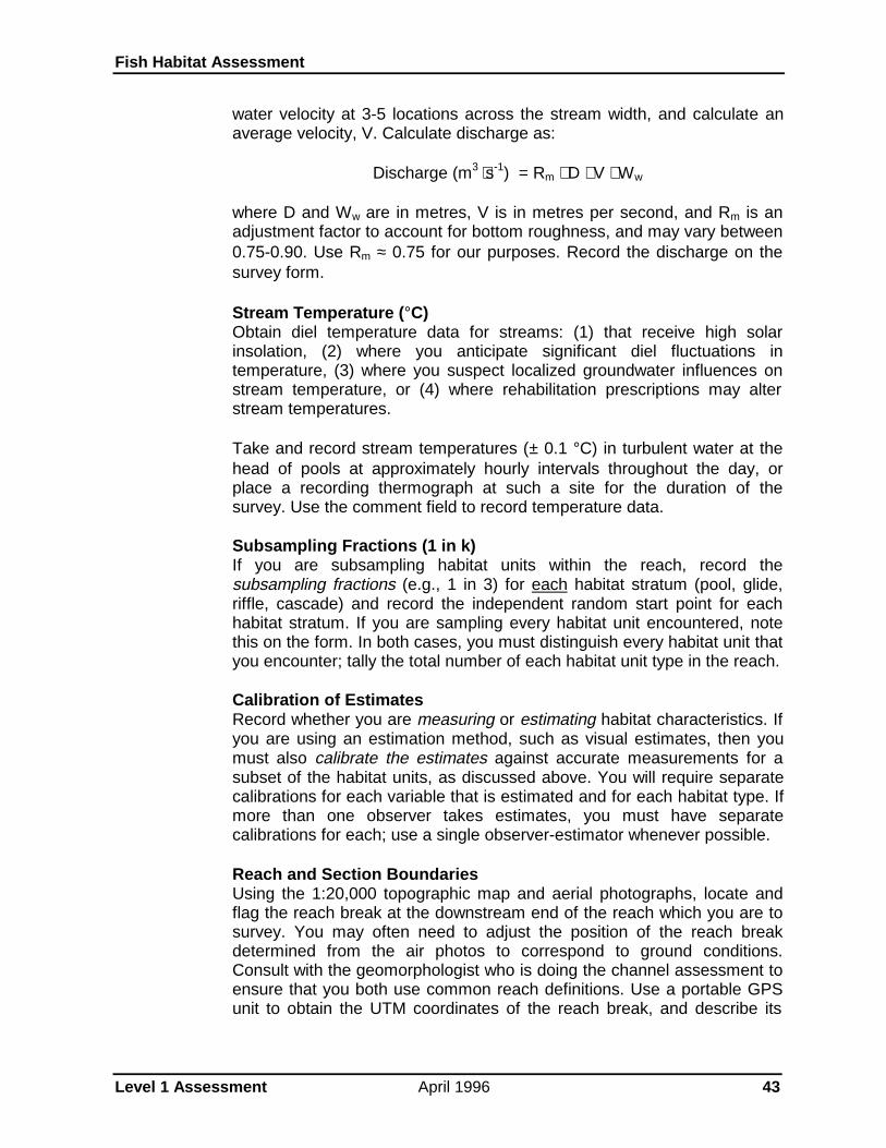
Fish Habitat Assessment
Level 1 Assessment April 1996 43
water velocity at 3-5 locations across the stream width, and calculate anaverage velocity, V. Calculate discharge as:
Discharge (m3 ⋅s-1) = Rm ⋅ D ⋅ V ⋅ Ww
where D and Ww are in metres, V is in metres per second, and Rm is anadjustment factor to account for bottom roughness, and may vary between0.75-0.90. Use Rm ≈ 0.75 for our purposes. Record the discharge on thesurvey form.
Stream Temperature (°C)Obtain diel temperature data for streams: (1) that receive high solarinsolation, (2) where you anticipate significant diel fluctuations intemperature, (3) where you suspect localized groundwater influences onstream temperature, or (4) where rehabilitation prescriptions may alterstream temperatures.
Take and record stream temperatures (± 0.1 °C) in turbulent water at thehead of pools at approximately hourly intervals throughout the day, orplace a recording thermograph at such a site for the duration of thesurvey. Use the comment field to record temperature data.
Subsampling Fractions (1 in k)If you are subsampling habitat units within the reach, record thesubsampling fractions (e.g., 1 in 3) for each habitat stratum (pool, glide,riffle, cascade) and record the independent random start point for eachhabitat stratum. If you are sampling every habitat unit encountered, notethis on the form. In both cases, you must distinguish every habitat unit thatyou encounter; tally the total number of each habitat unit type in the reach.
Calibration of EstimatesRecord whether you are measuring or estimating habitat characteristics. Ifyou are using an estimation method, such as visual estimates, then youmust also calibrate the estimates against accurate measurements for asubset of the habitat units, as discussed above. You will require separatecalibrations for each variable that is estimated and for each habitat type. Ifmore than one observer takes estimates, you must have separatecalibrations for each; use a single observer-estimator whenever possible.
Reach and Section BoundariesUsing the 1:20,000 topographic map and aerial photographs, locate andflag the reach break at the downstream end of the reach which you are tosurvey. You may often need to adjust the position of the reach breakdetermined from the air photos to correspond to ground conditions.Consult with the geomorphologist who is doing the channel assessment toensure that you both use common reach definitions. Use a portable GPSunit to obtain the UTM coordinates of the reach break, and describe its

Fish Habitat Assessment
Level 1 Assessment April 1996 44
location with respect to a known, re-locatable geographic landmark. Markthe adjusted reach boundary on your 1:20,000 field map.
Reach and Section NumbersRecord the reach and section numbers from your field map.
Habitat Unit TypeRecord the habitat unit type for sampled units as:
P = poolG = glideR = riffleC = cascade, orO = other. Record the nature of the “other” habitat unit in thecomment field.
It is essential that you also tally the total number of each habitat unit typein the reach to allow you to expand the substratum estimates.
Habitat Unit CategoryYou should distinguish habitat units in secondary channels or small habitatunits that do not span the main channel from major habitat units in themain channel (Figure 4). Do not neglect secondary channels; they areoften important habitats for juvenile fish. Categorize habitat units as(modified from Schuett-Hames et al. 1994):
1 = primary habitat units. Primary units are habitat units in the mainstream channel which occupy more than 50% of the wetted width.
2 = secondary habitat units. Secondary units occur in minor channelsthat are isolated from the main channel by a vegetated island withperennial plants greater than 1 metre in height. In braided reaches,where many secondary channels occur, record only the habitat unitsin the dominant channels and note that the channel is braided.
3 = tertiary habitat units. Tertiary units are significant, identifiablehabitat units within the main stream channel that meet the minimumsize criteria (Table 4) but which occupy less than 50% of the wettedwidth (e.g., they are embedded within a larger habitat unit, or areseparated from the primary unit by an obstruction or a gravel bar thatlacks perennial vegetation). In a level 1 survey you would normallydistinguish only those tertiary units that are significant as fish habitat(e.g., deep lateral scour pools); otherwise combine them with thelarger adjacent unit that meets the minimum size criterion.
Distance (m)Determine the location of the downstream boundary of the habitat unitfrom the known survey start point (e.g., the stream mouth or the down-

Fish Habitat Assessment
Level 1 Assessment April 1996 45
stream reach boundary). Measure the distance in metres along thethalweg (the deepest portion of the stream channel), using a calibrated hipchain or surveyor’s tape. If you use a hip chain, check that the threadremains out of the stream, and re-establish the start point frequently (bytying off the thread). Be sure also to record the total length of the reach.
Length (m)Measure the length along the thalweg of the habitat unit in metres, using acalibrated surveyor’s tape. If the thalweg is not accessible (e.g., becauseof water depth), take the length measurement at mid-point on the unit’sboundary. For sinuous units, take the length as the sum of straight-linelengths along the thalweg.
Your identification of habitat unit boundaries will affect the measuredlength; be consistent in applying the definitions given above. If theboundary between adjacent habitat types is indistinct, mark the first pointin each habitat unit type where you are certain of the type, and establishthe boundary half-way between the two points.
Gradient (%)Use a clinometer or Abney level to measure the gradient (± 0.5%) of thewater surface over the habitat unit. Mark the surveyor’s rod at the eye levelof the measurer. The rod man holds the surveyor’s rod vertical at the far

Fish Habitat Assessment
Level 1 Assessment April 1996 46
boundary of the habitat unit while the measurer sights the clinometer onthis mark to make the gradient measurement.
Mean Water Depth (m)Determine the mean depth (± 0.05 m) of the habitat unit by averaging 3depths taken ¼, ½, and ¾ of the distance across a transect perpendicularto the flow at a “representative” site within the habitat unit. Choose this siteto portray average conditions within the habitat unit. Although using a“representative” site for depth and width measurements reduces theaccuracy of the data, it will identify major habitat problems while greatlyspeeding the survey. If greater accuracy is required, increase the numberof sample points along the transect and/or the number of transects withinthe habitat unit.
Mean Wetted Width, Ww (m)Measure the wetted width (± 0.1 m) of the habitat unit as the horizontaldistance perpendicular to the channel axis from water’s edge on one sideto water’s edge on the opposite side at the “representative” site usedabove to determine mean depth. The wetted edge is the point at whichsediment particles are no longer surrounded by water. Do not include drygravel bars in the wetted width. For irregularly-shaped habitat units,determine an average wetted width from 3-5 measurements at equalintervals along the habitat unit. If a tertiary habitat unit is embedded in theprimary unit, subtract the width of the embedded unit from the total widthto obtain a wetted width for the primary unit.
Mean Bankfull Channel Width, Wb (m)The FPC “Riparian Management Area Guidebook” defines standards fordetermining the bankfull channel width of streams. Because Wb is used toadjust for differences in stream size when applying diagnostics, take careto measure it consistently and correctly.
Measure the bankfull channel width (± 0.1 m) at a “representative” site asthe horizontal distance perpendicular to the channel axis between the topsof the streambanks on opposite sides of the stream (Figure 5). Identify thetop of bank as:
• the elevation of the topographic break from a vertical bank to thefloodplain• the location of changes in vegetation and sediment texture, suchas:
• the presence of undisturbed perennial terrestial vegetation atthe bank top, or• a change from recently deposited or scoured sediments(clean sands, gravels and cobbles) to undisturbed sediments,frequently with an organic layer (e.g., leaf mould, fine organiclitter)

Fish Habitat Assessment
Level 1 Assessment April 1996 47
In measuring the bankfull channel width,
• do not include vegetated islands (i.e., islands with perennialterrestial vegetation more than 1 metre in height). If multiplechannels are separated by vegetated islands, sum the separatebankfull channel width measurements.

Fish Habitat Assessment
Level 1 Assessment April 1996 48
• include unvegetated gravel bars in the bankfull channel widthmeasurement.
Mean Bankfull Depth, Db (m)Measure the vertical distance (± 0.05 m) from a horizontal line at theheight of the bankfull width to the water surface at the “representative” siteat which you measured the bankfull width. For small channels, this can bedone by running the surveyors’ tape across the channel at the height ofthe bankfull width and measuring the vertical distance from the tape to thewater surface, using the surveyor’s rod. The mean bankfull depth is thesum of this distance and the mean water depth. For larger channels,measure the vertical distance from the bank top to the water surfacenearest the bank, and add this distance to the mean water depth.
Maximum Pool Depth (m)For pools, measure (or estimate, if necessary) the maximum water depth(± 0.05 m).
Riffle Crest (Pool Outlet) Depth (m)For pools, measure the water depth (± 0.05 m) at the pool outlet (seeFigure 2).
Residual Depth (m)Calculate the residual depth (± 0.05 m) of the pool as the differencebetween the maximum pool depth and the riffle crest depth (or pool outletdepth). Note that pools must meet both minimum surface area andminimum residual depth criteria to be counted.
Pool TypeRecord the pool type as:
S = scour pool, formed by scouring around or adjacent to anobstruction such as a log, boulder, or root wad or by flowconvergence where two channels joinD = dammed pool, formed by impoundment behind a channel-spanning obstruction such as a beaver dam, log, or log jamU = unknown (unable to classify).
Dominant and Sub-Dominant Bed MaterialsEstimate and record the size-class of the substrate material that coversthe largest proportion (dominant) and the second-largest proportion (sub-dominant) of the habitat unit. Categorize substrates as:
S = sands, silts, clays or fine organic material (< 2 mm diameter)G = gravels (2 - 64 mm)C = cobbles (64 - 256 mm)B = boulders (256 - 4000 mm)R = bedrock (> 4000 mm).

Fish Habitat Assessment
Level 1 Assessment April 1996 49
Make the estimate by walking several transects through the habitat unit,where this can be safely done, noting or measuring the length covered bythe different particle size-classes. An alternative method is to makesubjective estimates of the percentage of the habitat unit covered by eachsubstrate particle size-class. Note, however, that such “quantitative” dataare rarely accurate.
Spawning Gravel Amount and TypeSpawning gravels are gravels that are located in areas where water depthsgreater than 15 cm and water velocities between about 0.3 and 1.0 m·s-1
are expected during the spawning season. For anadromous salmon,spawning gravel patches should be 1-2 m2 in area with a particle sizebetween about 10-150 mm. For (small) resident trout and char, spawninggravel patches should be greater than 0.1 m2 in area with a particle sizebetween 10-75 mm. Pay particular attention to pool tailouts and rifflecrests as potential spawning sites. Record the presence of suitablespawning gravels for the target fish species as:
N = no suitable gravel patches in the habitat unitL = little suitable spawning gravels (e.g., isolated pockets)H = extensive areas of spawning gravels.
Record the type of spawning gravel as:
R = suitable for resident trout and charA = suitable for anadromous salmonAR = suitable for both resident trout and anadromous salmon.
Large Woody Debris TallyLarge woody debris (LWD) is a piece of dead wood, having a diameter 10cm or larger over a minimum 2 m length, that intrudes into the bankfullchannel. Only a portion of the LWD pieces lying within the bankfullchannel (typically less than 40%, Montgomery et al. 1995) are functionalLWD that influence channel geomorphology by causing scour orimpoundment.
The level 1 assessment tallies all LWD within the bankfull channel,because this is how the diagnostic values in Table 5 were derived. Countboth LWD that lies (partially) within the low flow and LWD that is partiallysubmerged only at bankfull flow, but do not count LWD on vegetated bartops above the bankfull channel. Tally debris jams that contain 10 or moreLWD pieces as a log jam rather than counting the individual pieces.
We also tally functional LWD by three size classes (10-20 cm diameter,20-50 cm diameter and > 50 cm diameter) to identify the size of stableLWD in the stream reach. Count as functional LWD only those LWDpieces that are the primary cause of the formation or geometry of a pool.

Fish Habitat Assessment
Level 1 Assessment April 1996 50
Cover (% by type)Cover is a structural element in the wetted channel or within 1 metre of thewater surface that serves to visually isolate fish and/or to provide suitablemicrohabitats where fish can hide, rest or feed. Hamilton and Bergersen(1984) discuss the varied meanings associated with “cover”.
Estimate the percentage of the total surface area of the habitat unit that iscovered by the following cover types:
SWD = small woody debris (i.e., smaller than the criteria givenabove)LWD = large woody debris, as defined aboveB = bouldersC = undercut banksDP = deep pool (i.e., the portion of a pool with a depth > 1 m)OV = overhanging vegetation within 1 metre of the water surfaceIV = instream vegetation.
Record the percentage of the total surface area of the habitat unit for (upto) the three dominant cover types. Record the amount of cover as:
N = no cover in the habitat unit,TR = cover element is present but likely comprises less than 2% ofthe habitat unit area, ornumeric value = the estimated percentage of the total area by covertype.
Off-channel HabitatRecord the presence of off-channel habitat that may be used by fish asrefuges or rearing areas at high flows. Pay particular attention to relictchannels in the adjacent floodplain which have been isolated by lateralmovement of the stream and which could be re-connected to the streamas a restoration project. Note any ground water flows within isolatedsidechannels.
Categorize off-channel habitat as:
SC = sidechannelsSL = sloughs (blind-ended channels)PD = off-channel pondsWL = seasonally-flooded wetlands
Measure or estimate the length and area of the off-channel habitat unit,and note fish access to the off-channel area as:
N = no access to fishP = accessible only at high flowsG = accessible at most flows.

Fish Habitat Assessment
Level 1 Assessment April 1996 51
Disturbance IndicatorsRecord the presence of any of the disturbance indicators listed in Table 2.If a channel assessment is being done, then categorize disturbances withthe assistance of the geomorphologist wherever possible. If you noteeroding banks, comment on the cause, extent, and the likelihood ofsuccessful stabilization.
BarriersRecord natural or man-made barriers to fish movement as:
N = no barriersX = log jams that prevent fish passageCV = culverts (blocked, perched, velocity barrier)BR = dis-used bridges (obstruction, velocity barrier)LS = landslide or bank sloughing that obstructs the channelBD = beaver damF = falls with a vertical drop > 2 mC = chute or cascade impassable to fish (velocity barrier).
Note that most log jams are readily passable by fish unless a vertical dropis created by bedload and debris storage.
Riparian Vegetation TypeRecord the dominant vegetation type in the riparian area within 20 m ofthe stream channel as:
N = largely unvegetated, with much bare mineral soil visibleG = grasslands or bogSH = shrub/herb, dominated by herbaceous or shrubby vegetationD = deciduous forestC = coniferous forestM = mixed deciduous-coniferous forest.
If a riparian assessment is being done, coordinate your collection ofvegetation type and stand structure data with the riparian surveys.
Riparian Structural StageRecord the structural stage of the dominant vegetation in the adjacentriparian area as:
INIT = the non-vegetated or initial colonization stage followingdisturbance, with less than 5% coverSHR = shrub/herb stage with less than 10% tree coverPS = pole-sapling stage, with trees overtopping the shrub layer,usually less than 15-20 years oldYF = young forest. Self-thinning is evident and the forest canopy isdifferentiating into distinct layers. Stand age is typically 30-80 years.MF = mature forest with well-developed understory.

Fish Habitat Assessment
Level 1 Assessment April 1996 52
Overstream Canopy ClosureCategorize the extent of canopy closure over the stream (i.e., theproportion of the surface area of the stream that is covered by theprojecting riparian canopy) as:
0 = none1 = 1-20% covered2 = 21-40% covered3 = 41-70% covered4 = 71-90% covered5 = > 90% covered.
Fish Distribution and Relative AbundanceConduct a low-intensity survey of fish distribution and relative abundancewithin habitat types to help identify heavily-used habitats that may limit fishproduction. For a level 1 assessment, we are primarily interested inconfirming fish use rather than in obtaining accurate estimates of fishabundance. Therefore we recommend low-intensity, qualitative surveys,although you may use any of the sampling methods discussed in theMoELP “Lake and stream inventory standards and procedures” manual(Anonymous 1995) or the FPC “Fish-stream Identification Guidebook”.
We suggest that you use baited minnow traps (Gee traps) because of theirsimplicity of use and effectiveness in a wide range of habitat types. Theyare, however, ineffective for large fish (>20 cm fork length). Swales (1987)discusses their use in different habitat types. Minnow traps are especiallyuseful in spatially-complex habitats (debris jams, offchannel ponds) whereother survey methods are largely ineffective.
Standardized electrofishing is an alternative method, but is more complex,much more time-consuming and more dangerous. Snorkelling is aneffective survey method in moderate-to-large streams (Slaney and Martin1987). Refer to Anonymous (1995) for descriptions of other acceptablemethods (e.g., shore-based visual estimates, seines, standardizedangling, etc.).
Stratify the fish sampling by habitat type. Subsampling habitats may benecessary to keep survey costs reasonable. At the time that the physicalhabitat sampling is done, clearly mark the habitat units that are to besampled for fish. Set baited minnow traps at a standard density (say 2traps per 10 m stream length) for a standard time interval (at least 6h, andideally 24h). Anchor the traps to shore with a stout line and mark theirlocations with labelled flagging tape. On retrieval, identify and enumeratethe fish. Use McPhail and Carveth (1993) as the standard guide to fishidentification, and ensure that the crew can accurately identify the speciesthat are likely to be present. Enumerate fry, parr and smolts separately byspecies. Record the information on the “Level 1 fish distribution summaryform” (Appendix F).

Fish Habitat Assessment
Level 1 Assessment April 1996 53
Use large differences in catch per unit effort to identify habitat types thatare heavily-used by the target species and life stage, and to delimit fishdistributions within the sampled reaches.
PhotographsTake 35 mm photographs of significant habitat features such as LWDcharacteristics, eroding banks, sediment texture, extensive riffle areas,cover, etc. within the survey reach. Label the picture with its exact location,direction of view (upstream or downstream; left bank or right bank), dateand time, and the significant feature that is being noted. Provide ameasure of scale in the photograph (e.g., include the surveyor’s rod in thepicture). Habitat features that are difficult to quantify may be more easilyinterpreted from a photograph.
Inorganic NutrientsIn areas where nutrient concentrations may limit stream productivity,determine nitrate-nitrogen (NO3-N) and soluble reactive phosphorus (SRP)concentrations for the stream at the start of the summer growing season(post-freshet) by collecting a water sample from a riffle area in an alluvialreach near the stream mouth. Follow standard methods of collection(MoELP “Lake and stream inventory standards and procedures” manual,Anonymous 1995) and analysis (APHA 1980).
Data Summary
You must summarize your survey data by reach to provide the reach totalsand reach averages for the quantitative variables whose values are usedto diagnose habitat impairment (e.g., Table 5). The computations neededto summarize your survey data depend upon the survey design and themeasurement methods used to obtain the data. Consult standard texts onsurvey sampling (e.g., Scheaffer et al. 1979) for detailed information oncomputations.
In all cases your data will be stratified by habitat unit type (pools, glides,riffles, cascades, other). If you used an accurate measurement method toobtain the data and the strata were sampled independently, then youbegin by calculating the mean and variance of the variable for eachstratum. You then obtain reach averages and reach totals for the variableas the weighted average of the stratum means or totals:
Y = 1N
N Yreach mean i i
i = 1
5
⋅∑and
Y = N Yreach total i i
i = 1
5
⋅∑
where:

Fish Habitat Assessment
Level 1 Assessment April 1996 54
Yi is the mean value for the i-th stratum (e.g., pools), i = 1,...,5 N is the total number habitat units in the reach, and Ni is the total number of habitat units in the i-th stratum.
If the variable is estimated with error (e.g., rapid visual estimationcalibrated to accurate measurements) rather than being measured withessentially no error and you have used “a two-stage sampling design withequal probability of selection of unequal sized primary sampling units”(Hankin and Reeves 1988, p. 836), then you can determine stratum totalsusing adjusted estimates, as discussed above:
where is the adjusted i-th estimate, xi is the corresponding rapidestimate, and is the calibration ratio for the variable. The stratum total isthen:
where ni is the number of habitat units in which rapid estimates were madeand Ni is the total number of habitat units in the stratum (n ≈ Ni / k for a 1in k subsample). If accurate measurements and visual estimates weretaken on M units in the stratum to develop the calibration ratio, then usethe accurate measurements rather than the adjusted visual estimates forthose M units of the n when estimating the stratum total. Because thesestrata totals are independent (strata were independently sampled), youobtain the reach total by adding the strata totals. See Dolloff et al. (1993)for a clear example of the use of two-stage sampling to determine fishabundance and habitat type areas.
Some of the diagnostics in Table 5 are counts per bankfull channel width.To calculate these, first determine the number of bankfull channel widthsin the reach by dividing the total reach length by the mean bankfullchannel width. Then obtain, say, the number of large LWD pieces perbankfull channel width, by dividing the total number of large LWD pieces inthe reach by the number of mean bankfull channel widths in the reach,
LWD per Wb = LWD tally / (reach length / Wb).
Summarize this habitat information as a georeferenced database or as asummary table indexed to locations.
Habitat Evaluation
Identify potential physical habitat limitations to salmonid production by

Fish Habitat Assessment
Level 1 Assessment April 1996 55
comparing the amounts and characteristics of physical habitats againststandards for similar, undisturbed streams to detect habitats that aredegraded or at risk, and which may be improved by fish habitat restorationprojects. Pay special attention to habitats that are (or were) heavily usedby salmonids, and to habitats whose availability is limited.
There are several ways to identify degraded areas from the overviewand level 1 habitat assessment data:
1. compare pre- and post-logging habitat conditions within specificreaches, to identify deleterious changes.
2. compare present habitat conditions within reaches against“standards” for similar, undisturbed reaches to detect differences thatsuggest habitat impairment. The standards can be:
(i) average habitat conditions in similar, undisturbed reacheswithin the watershed of interest,(ii) average habitat conditions within similar reaches in similar,undisturbed watersheds in the ecoregion, or(iii) expected habitat conditions from published summaries ofhabitat use by the target species.
3. observe indicators of habitat damage within the reach.
A direct demonstration of (harmful) habitat changes by comparing pre-and post-logging conditions within the same stream reach is the mostconvincing indication of habitat impairment. You will need pre-logginghabitat data, either from field surveys or from the analysis of aerialphotographs, to establish that changes have occurred. To interpret theobserved changes as deleterious, consider the known habitat needs andpreferences of the target species. You should also consider the likely roleof natural disturbance in causing the observed changes.
In many cases pre-logging data are unavailable, and you will infer damageby comparing present habitat conditions against expected conditions. Ifsimilar, undisturbed channel types can be found within the watershed,determine the average conditions in the undisturbed reaches and usedeviations from these average conditions to indicate habitat change inlogged reaches. If you cannot obtain data for similar unperturbed reachesin the watershed, use average habitat conditions for the same channeltypes in similar watersheds in the ecoregion where these data exist or canbe easily obtained from other inventory or pre-harvest planning programs.Consult WRP staff regarding the availability and use of regional standards.Lastly, use “generic” descriptors of habitat quality (Table 5) to identifydamaged or poor habitat conditions if more precise measures are notavailable.

Fish Habitat Assessment
Level 1 Assessment April 1996 56
Table 5. Diagnostics of salmonid habitat condition at the reach level (from Anonymous 1993); see notes below.
Habitat Gradient or Quality
Parameter Wb Class Use Poor Fair Good
Percent pool(by area)
<2 %, < 15 mwide
Summer/winterrearing habitat
< 40 % 40 - 55% > 55 %
Percent pool(by area)
2-5 % , < 15 mwide
Summer/winterrearing habitat
< 30 % 30 - 40 % > 40 %
Percent pool(by area)
>5 % , < 15 mwide
Summer/winterrearing habitat
< 20 % 20 - 30 % > 30 %
Pool frequency(mean pool
spacing)
<2 %, < 15 mwide
Summer/winterrearing habitat
> 4 channelwidths per
pool
2 - 4 channelwidths per
pool
< 2 channelwidths per
pool
Pool frequency(mean pool
spacing)
2-5 % , < 15 mwide
Summer/winterrearing habitat
> 4 channelwidths per
pool
2 - 4 channelwidths per
pool
< 2 channelwidths per
pool
Pool frequency(mean pool
spacing)
>5 % , < 15 mwide
Summer/winterrearing habitat
> 4 channelwidths per
pool
2 - 4 channelwidths per
pool
< 2 channelwidths per
pool
LWD piecesper bankfull
channel width
all Summer/winterrearing habitat
< 1 1 - 2 > 2
% wood coverin pools
< 5 %, < 15 mwide
Summer/winterrearing habitat
most pools inlow category
0 - 5 %
most pools inmoderatecategory
6 - 20 %
most pools inhigh category
> 20 %
Boulder coverin gravel-
cobble riffles
all Summer/winterrearing habitat
< 10 % 10 - 30 % > 30 %
Overheadcover
all Summer/winterrearing habitat
< 10 % 10 - 20 % > 20 %
Substrate all Winter rearinghabitat
intersticesfilled: sand orsmall gravel subdominantin cobble or
boulderdominant
intersticesreduced: sandsubdominantin some unitswith cobble or
boulderdominant
intersticesclear: sand orsmall gravel
rarelysubdominantin any habitat
unit

Fish Habitat Assessment
Level 1 Assessment April 1996 57
Table 5. (continued). Diagnostics of salmonid habitat condition (from Anonymous 1993).
Habitat Gradient or Quality
Parameter Wb Class Use Poor Fair Good
Off-channelhabitat
< 3 % , allwidths
Winter rearinghabitat
few or nobackwaters,
no off-channelponds
somebackwaters
backwaterswith cover andpond, oxbowsand other low
energy off-channel areas
Holding pools all Adult migration few pools/km > 1 m deepwith goodcover, cool
adequatepools/km, > 1m deep withgood cover,
cool
Access tospawning
areas
all Adult migration accessblocked by lowwater, culvert,
falls,temperature
no blockages
Gravelquantity
all Spawning andincubation
absent or little Frequentspawning
areas
Gravelquality
all Spawning andincubation
sand isdominant
substrate atsome sites
sand issubdominantsubstrate atsome sites
sand is neverdominant orsubdominant
substrate
Redd scour all Spawning andincubation
evidence ofextensive redd
scour
some scour orpotential for
scour
stable with lowpotential for
scour
Inorganicnutrients
all Summerrearing habitat
spawnernumbers
depressed and
NO3-N < 20µg·L-1 and / orSRP < 1 µg·L-1
spawnernumbersnormal;
NO3-N from20-40 µg·L-1
and SRP from1-2 µg·L-1
NO3-N > 60µg·L-1 and
SRP >3 µg·L-1
Notes:1. Use this table when regional standards are not available.2. We currently lack standards for channels with Wb > 15 m. Be cautious in the application of the above diagnostics to such channels.

Fish Habitat Assessment
Level 1 Assessment April 1996 58
If you use differences between observed and expected conditions to inferhabitat change in a disturbed reach, ensure that you are, in fact,comparing similar channel types. The undisturbed reaches used toestablish expected conditions must match the disturbed reach with respectto channel type, gradient, confinement, discharge, and natural vegetationin order to attribute observed differences to the disturbance.
The principal aim of your habitat evaluation is to identify habitat conditionsin the surveyed reaches that may limit salmonid fish production and tosuggest restoration projects to rectify these limitations. Use the new fielddata to review the results from your preliminary (i.e., overview) habitatevaluation. Apply additional diagnoses (e.g., Table 5) to better indicatehabitat impairment where the new field data permit this to be done. Applythe methods discussed above for the preliminary habitat evaluation to thenew survey data.
Sequentially consider whether the habitat requirements of the various lifestages of the target fishes are met by current conditions within thewatershed. Use the major questions from Appendix E to help identifypotential limitations. Where limitations are evident, note the locations,extent and severity of the habitat conditions that indicate the limitations.Be as specific as possible about the impacts and probable causes ofhabitat impairment.
Pay special attention to associations between fish abundance andparticular habitat conditions which might suggest the functional processesthrough which the limitation occurs. Use your knowledge of the life historyand habitat requirements of the target species to guide your interpretationof habitat conditions. Continually ask yourself whether the observedconditions are likely to be a significant limitation to fish production in thewatershed. Comparisons between your data and conditions in analogousreaches in similar, unimpacted watersheds are especially informative inassessing the severity of observed impacts.
Try to identify the underlying physical or biological process that causes theobserved limitation. Will you be able to restore the process to its pre-logging condition? Be aware that some logging-induced changes to thephysical processes that influence ambient factors in the stream maycontinue to degrade habitat conditions for long periods into the future.Consider what in-stream restoration work will reduce the impacts of theprocess on fish until the process has been returned to normal.
Using both the overview and level 1 field data, summarize indicators offish habitat impairment for each reach. Use the georeferencedinformation on fish distribution, fish use, and habitat quality to identify thereaches with major habitat impacts that are also heavily used by the targetfish species as spawning, rearing or overwintering sites. Attach a brief textsummary to each reach, identifying fisheries values and probable habitatimpacts within the reach.

Fish Habitat Assessment
Level 1 Assessment April 1996 59
Review this habitat condition data to identify opportunities for effectiverehabilitation projects; consult WRP Technical Circular No. 9 for detailedinformation on rehabilitation methods. You should also examine the resultsof the channel assessment procedure for indications of alteredgeomorphic processes that might influence fish habitat conditions and/oryour choice of restoration methods. Also review the upslope impactindicators from the overview assessment of the reach.
Initial Planning for Fish Habitat Restoration Projects
It is essential that you state clearly the objectives and scope of proposedfish habitat restoration projects and that these objectives address theprobable limitations to fish production that the field assessments havesuggested. Develop your fish habitat restoration projects as an integratedset that treats the major habitat limitations to fish production that arisefrom the assessment.
A statement of project objectives should identify:
• the concerns that initiated the project• the specific goals of the project, and• its relationship to the overall goals of the restoration plan for theentire watershed.
Project scope includes:
• the topics and activities to be considered (or excluded) in the project• the spatial bounds of the project• the time frame for the project, and• its links to other program components.
For example, you may observe a lack of functional LWD and associatedscour pools with complex cover in low gradient reaches that are used bycoho juveniles as summer rearing habitat. The low abundance of coho in awatershed with adequate adult escapements and spawning areas and withlarge amounts of off-channel winter rearing habitat suggests that summerhabitat is a potential limitation to coho production in the watershed. Thephysical process that generates the preferred summer habitat of juvenilecoho is scour around stable LWD to produce pool habitat with bothoverhead and instream cover. Technical Circular No. 9 identifies LWDplacements as an effective restoration method in channels whereincreased sediment storage is not occurring. The channel assessmentprocedure did not reveal channel aggradation or other disturbanceindicators associated with increased sediment inputs. Comparison ofobserved LWD abundance (0.2 pieces per bankfull channel width) withthose in similar channels in nearby, unlogged watersheds (2.2 pieces perchannel width) suggests that about an additional 100 pieces would beneeded in the 750 m reach whose bankfull width is 15 m. Natural LWD

Fish Habitat Assessment
Level 1 Assessment April 1996 60
occurs primarily as evenly-spaced single pieces greater than 30 cmdiameter in similar unlogged reaches. Thus, a possible restorationobjective might “to increase the abundance of small pools with complexcover to produce summer rearing habitat for coho fry by constructing 100log placements with logs > 30 cm in diameter and with the placementsdistributed evenly over the 750 m reach”.
Where several rehabilitation projects are possible, employ the criteriadiscussed in the preliminary habitat assessment to prioritize them. Referto WRP Technical Circular No. 1 (Guidelines for Planning WatershedRestoration Projects) for additional information on establishing priorities.
Reporting
The level 1 fish habitat assessment report should provide the outlines of anintegrated fish habitat restoration plan for the watershed. It should verifythe nature, locations and severity of impacts to fishery resources;recommend restoration strategies; identify project objectives and projectscope; and give initial priorities for restoration work. The focus of the reportis not only to identify the type and locations of impacts but also to provide anaccurate evaluation of the opportunities for habitat restoration activities.
The text of the report should describe the methods used in the fieldassessments, the areas examined, and the results of the assessments. Mapoverlays are particularly useful in identifying areas of the watershed whereimpacts are evident. The level 1 report should suggest restoration strategiesand should provide a classification of impacts as low, medium or highpriorities for restoration (using the criteria of WRP Technical Circular No. 1).Tabulate significant problems, identify project objectives and preferredrestoration strategies, and provide work sequence priorities by area (e.g., bysub-basin). Try to provide preliminary estimates of time and costs, based onthe restoration strategies and priorities that you have identified. Makespecific recommendations for necessary level 2 assessments. Provide thedata (field notes, data forms, maps) and analyses to support yourinterpretations as appendices to the report.
The level 1 assessment report develops initial statements of project scopeand objectives for the components of the integrated watershed-levelrestoration plan. The major elements of the plan and likely approaches torestoration derive from the level 1 assessment results. In some cases, level2 assessment results will be needed to flesh out the initial plan into specificprescriptions and implementation schedules, but the level 1 assessmentsdefine the problem. In some cases, a level 1 assessment may providesufficient information to proceed with restoration prescriptions.

Fish Habitat Assessment
Level 2 Assessment April 1996 61
Level 2 Field Assessment
Aims of the Level 2 Assessment
You will conduct level 2 field assessments where you require additional site-specific information to diagnose the nature of the habitat impairment, toidentify or plan effective restoration or mitigation prescriptions, or to confirmor revise the initial statements of project scope, objectives and priorities.
The objectives of level 2 assessments are:
• to identify appropriate restoration options and priorities, and• to provide detailed site information needed to prepare rehabilitationprescriptions.
Scope of the Level 2 Assessment
Level 2 field assessments are (usually) limited in scope to specific sites thatthe level 1 assessment has identified as potentially impaired and where yourequire additional information to identify or to plan appropriate rehabilitationactivities. A level 2 assessment consists normally of detailed measurementsor inspections at particular sites to provide the specific information neededto develop appropriate habitat rehabilitation plans. Any surveys that arerequired as part of level 2 assessments should provide precise, quantitativedata to address specific uncertainties in the design of the fish habitatrehabilitation program. For example, you may need an accurate estimate ofthe size of a remnant fish population to assess the likely benefits of a costlyhabitat rehabilitation program; a basin-wide survey of fish abundance mightthen be appropriate. Or, for example, you may need to survey a detailedchannel profile to design a groundwater-channel rearing project. Use theresults of the level 2 assessment to clarify the objectives and scope ofrestoration activities at specific locations, and to provide necessary detailedsite information.
Assessment Methods
You will usually design a level 2 assessment to provide the specificinformation needed to select, plan and implement a habitat rehabilitationproject that a level 1 assessment has suggested. The exact nature of theassessment depends upon your information needs. Consult WRP TechnicalCircular No. 9, which specifies the information requirements of commonrehabilitation techniques. Manuals such as Newbury and Gaboury (1993)also describe in detail the information needed to plan certain types ofrestoration projects.
In general, you will require more precise, site-specific information on stream

Fish Habitat Assessment
Level 2 Assessment April 1996 62
channel morphology and fish use than that provided by the level 1assessment. Detailed plans of rehabilitation sites or analogous undisturbedreference sites will be a common requirement; refer to Newbury andGaboury (1993) for sketch plan and plane table survey methods. Use thequantitative methods specified in the MoELP “Lake and stream inventorystandards and procedures” manual to acquire any additional information.We recommend Hankin and Reeves’ (1988) two-stage sampling design forquantitative estimates of fish abundance, where these are needed forrestoration planning (note that other management needs for detailed fishabundance or habitat condition information should be addressed through theFRBC fisheries inventory program). Dolloff et al. (1993) give a cleardescription and a worked example of the method. Note that you cansubstitute other rapid quantitative estimation methods for the visualestimates used by Hankin and Reeves. Have your regional WRP FisheriesSpecialist review and approve the methods that you propose to use in alevel 2 assessment before embarking on the work.
To increase the utility of level 2 field assessments, you should review initialstatements of project objectives and scope from the level 1 assessment todirect the level 2 field assessments to high priority sites. Ensure thatthose doing the assessments have the training, experience and a sufficientunderstanding of the project scope and objectives to accurately documentand correctly interpret present conditions and to recommend suitableprescriptions for restoration.
Restoration Prescriptions
The prescriptive phase of project planning involves identifying andevaluating habitat problems, and determining a “best” course of action toaddress them. Use the results of the level 2 assessments to clarify theobjectives and scope of restoration activities at specific locations. Therecommended prescriptions must be consistent with the higher levelobjectives of the integrated watershed restoration plan and with regionalmanagement plans for the area. Make sure that your prescriptions conformto current standards for the activities (e.g., with Forest Practices Coderegulations).
The set of proven, effective methods for fish habitat rehabilitation is limited.Typical prescriptions will entail one or more of:
• restoring fish access and spawning sites• streambank rehabilitation• off-channel habitat rehabilitation• restoration of LWD• accelerating the recovery of log jam habitat• boulder clusters to restore rearing habitat• deflectors and weirs to rehabilitate mainstem rearing habitat

Fish Habitat Assessment
Level 2 Assessment April 1996 63
• re-constructing channelized habitat• inorganic nutrient additions to restore productivity, or• minimum flow augmentation.
You should discuss novel restoration methods with district WRP staff andwith appropriate regional WRP technical experts before prescribing them.
Establishing suitable restoration prescriptions involves both formal analysesand professional judgement, and is often best done on-site. Try to writeclear and detailed prescriptions that can be used as technical specificationsfor the on-site work. Clear, detailed prescriptions also facilitate accuratebudget estimates. Photographs, sketches and drawings are useful aids toformulating clear prescriptions. Try to avoid costly engineering drawingsunless they are essential.
Describe the purpose of any proposed restoration and the specific concernsto be dealt with at each site. Using Technical Circular No. 9, identifyeffective restoration prescriptions to attain the desired site objectives. Whereseveral corrective actions are possible, provide a rationale for therecommended prescription. Predict the likely resource benefits of the work,using published biostandards (Adams and Whyte 1990; also see WRPTechnical Circular No. 9) and identify any constraints that may influence theeffectiveness of the work.
Refer to Technical Circular No. 9 (Fish Habitat Rehabilitation Procedures)for appropriate formats to prepare and present restoration prescriptions.Summarize the necessary restoration work on a site-by-site basis in aconcise overview table that indicates:
• the exact location of the site• the boundaries of the work site• the nature of the problem• the precise objectives of the work• the recommended prescription(s)• the work sequence priority of the site works• special concerns (safety, environmental protection, timing)• labour and materials requirements• estimated costs• the expected benefits of the work
It is important to locate work sites accurately. If possible, use GlobalPositioning Systems to obtain UTM coordinates for the site. Record thedistance to the site from some well defined location (e.g., along a road) andaccurately indicate the site on large scale maps (e.g., 1:5,000 or 1:20,000 asappropriate). You may want to lay out the work site with flagging tape,painted marks, or boundary stakes at the same time that you develop theprescription. Having an accurate location will be important for post-

Fish Habitat Assessment
Acknowledgements April 1996 64
implementation monitoring when the problem that initiated the restorationwork may no longer be visible to mark the site.
AcknowledgementsWe thank Bob Bocking, Tony Cheong, Marc Gaboury, Doug Johnston,Wendell Koning, Ross Neuman, Gerry Oliver, Daiva Zaldokas and theparticipants in the FHAP training workshops for suggesting changes to theassessment procedure. We are grateful to the authors of the “FishHabitat” module of the Washington State watershed assessmentprocedure for providing the basic form of the analysis. The overviewassessment procedure was adapted from that developed by LGL Ltd.Comments by Blair Holtby, Gerry Oliver and Craig Wightman improved theoriginal interim procedure.

Fish Habitat Assessment
References April 1996 65
ReferencesAdams, M.A. and I.W. Whyte. 1990. Fish habitat enhancement: a manualfor freshwater, estuarine, and marine habitats. Canada Department ofFisheries and Oceans, Vancouver.
American Public Health Association. 1980. Standard methods for theexamination of water and wastewater. 15th edition. American PublicHealth Association, Washington.
Anonymous. 1980. Stream enhancement guide. British Columbia Ministryof Environment and Canada Department of Fisheries and Oceans,Vancouver.
Anonymous. 1985. Gazetteer of Canada. Canadian PermanentCommittee on Geographical Names. Canada Department of Energy,Mines and Resources, Ottawa.
Anonymous. 1988. A guide to the hierarchical watershed coding systemfor British Columbia. BC Ministry of Environment, Water ManagementBranch, Victoria.
Anonymous. 1993. Fish habitat. pp. F1-F36. In Standard methodology forconducting watershed analysis. Version 2.0. Washington Forest PracticesBoard, Washington State Department of Natural Resources, Olympia
Anonymous. 1995. Lake and stream inventory standards and procedures,BC Ministry of Environment, Lands and Parks, Fisheries Branch, Victoria.
Bjornn, T.C. and D.W. Reiser. 1991. Habitat requirements of salmonids instreams. pp. 83-138. In W.R. Meehan [ed.] Influences of forest andrangeland management on salmonid fishes and their habitats. AmericanFisheries Society Special Publication 19, Bethesda, Maryland.
Dolloff, C.A., D.G. Hankin and G.H. Reeves. 1993. Basinwide estimationof habitat and fish populations in streams. United States Department ofAgriculture, Forest Service, General Technical Report SE-83, Asheville,North Carolina.
Fausch, K.D., C.L. Hawkes, and M.G. Parsons. 1988. Models that predictstanding crop of stream fish from habitat variables: 1950-1985. UnitedStates Department of Agriculture, Forest Service, Pacific NorthwestResearch Station, General Technical Report PNW-GTR-213, Portland,Oregon.
Groot, C. and L. Margolis. 1991. Pacific salmon life histories. UBC Press,Vancouver.
Fish Habitat Assessment
References April 1996 66
Hamilton, K. and E.P. Bergersen. 1984. Methods to estimate aquatichabitat variables. Colorado Cooperative Fishery Research Unit, ColoradoState University, Fort Collins, Colorado.
Hankin, D.G. and G.H. Reeves. 1988. Estimating total fish abundance andhabitat area in small streams based visual estimation methods. CanadianJournal of Fisheries and Aquatic Sciences 45: 834-844.
Hartman, G.F. and J.C. Scrivener. 1990. Impacts of forestry practices on acoastal stream ecosystem, Carnation Creek, British Columbia. CanadianBulletin of Fisheries and Aquatic Sciences 223, Ottawa, Ontario.
Hawkins, C.P., J.L. Kershner, P.A. Bisson, M.D. Bryant, L.M. Decker, S.V.Gregory, D.A. McCullough, C.K. Overton, G.H. Reeves, R.J. Steedman,and M.K. Young. 1993. A hierarchical approach to classifying streamhabitat features. Fisheries 18: 3-12.
Hogan, D.L. and S.A. Bird. 1995. Channel assessment procedure. BritishColumbia Ministry of Environment, Lands and Parks and British ColumbiaMinistry of Forests, Watershed Restoration Program, Technical CircularNo. 7, Victoria.
Koski, K.V. 1992. Restoring stream habitats affected by logging activities.pp. 343-403 In G.W. Thayer [ed.] Restoring the nation’s marineenvironment. Maryland Sea Grant College, University of Maryland, CollegePark.
Lillesand, T.M. and R.W. Kiefer. 1994. Remote sensing and imageinterpretation. third edition. John Wiley and Sons, New York.
LGL Limited. 1995. Deena Creek watershed rehabilitation. Council of theHaida Nation, Skidegate, Haida Gwaii.
McPhail, J.D. and Carveth, R. 1993. Field key to the freshwater fishes ofBritish Columbia. Department of Zoology, University of British Columbia,Vancouver.
Meehan, W.R. 1991. [ed.] Influences of forest and rangeland managementon salmonid fishes and their habitats. American Fisheries Society SpecialPublication 19, Bethesda, Maryland.
Montgomery, D.R., J.M. Buffington, R.D. Smith, K.M. Schmidt, and G.Pess. 1995. Pool spacing in forested streams. Water Resources Research31: 1097-1105.
Newbury, R.W. and M.N. Gaboury. 1993. Stream analysis and fish habitatdesign. Manitoba Department of Natural Resources, Winnipeg.

Fish Habitat Assessment
References April 1996 67
Reeves, G.H., F.H. Everest, and T.E. Nickelson. 1989. Identification ofphysical habitats limiting the production of coho salmon in western Oregonand Washington. United States Department of Agriculture, Forest Service,Pacific Northwest Research Station, General Technical Report PNW-GTR-245, Portland, Oregon.
Scheaffer, R.L., W. Mendenhall and L. Ott. 1979. Elementary surveysampling. Duxbury Press, Boston, Massachusetts.
Schuett-Hames, D., A. Pleuss, L. Bullchild, and S. Hall. 1994. Ambientmonitoring program manual, Timber-Fish-Wildlife, Northwest IndianFisheries Commission, Olympia, Washington.
Scrivener, J.C. and T.G. Brown. 1993. Impacts and complexity of forestpractices on streams and their salmonid fishes in British Columbia. In G.Shooner and S. Asselin [eds.] Le développement du Saumon atlantique auQuébec: connaître les règles du jeu pour réussir. Colloque international dela Fédération québecoise pour le saumon atlantique, Québec, décembre1992. Collection Salmo salar no 1: 201 pp.
Slaney, P.A. and A.D. Martin. 1987. Accuracy of underwater census oftrout populations in a large stream in British Columbia. North AmericanJournal of Fisheries Management 7: 117-122.
Slaney, P.A. 1995. The Watershed Restoration Program of BritishColumbia: an opportunity and a challenge. pp. 117-133 In W.T. Dushenko,H.E. Poll and K. Johnston [eds.] Environmental Impact Assessment andRemediation: Towards 2000. Canadian Society of EnvironmentalBiologists, Toronto.
Slaney, P.A. [ed.] 1996. Fish habitat rehabilitation procedures. BritishColumbia Ministry of Environment, Lands and Parks and British ColumbiaMinistry of Forests, Watershed Restoration Program, Technical CircularNo. 9 (available April 1996).
Swales, S. 1987. The use of small wire-mesh traps in sampling juvenilesalmonids. Aquaculture and Fisheries Management 18: 187-195.

Fish Habitat Assessment
Appendix A April 1996 68
Appendix A. WRP Technical Circulars.
This series of circulars provides a standard set of techniques to assessopportunities for restoration activities and to plan appropriate restorationprescriptions. The first two circulars provide: (1) an overview of theplanning process, and (2) an assessment process for determining thecumulative effects of forest harvest on forest resources in the watershed.The remaining circulars describe procedures for assessing specificwatershed components in more detail, and specify activities and standardsto assist the rehabilitation of watersheds.
The titles in the series are:
1. Guidelines for Planning Watershed Restoration Projects2. Watershed Assessment Procedure (Interim Methods) out of print3. Forest Road Rehabilitation Handbook (Interim Methods)4. Forest Site Rehabilitation for Coastal British Columbia (InterimMethods) out of print5. Gully Assessment Procedure for British Columbia Forests (InterimMethods) out of print6. Riparian Assessment Procedures (Interim Methods)7. Channel Assessment Procedure (Interim Methods)8. Fish Habitat Assessment Procedure9. Fish Habitat Rehabilitation Procedures available May 1996
Many WRP (interim) assessment procedures overlap with procedures thatwill be required as part of the new Forest Practices Code (FPC). When theForest Practice Code guidebooks are published, beginning in 1995, theywill supersede WRP circulars. In particular, WRP Technical Circular No. 2- Watershed Assessment Procedure (Interim Methods) has been replacedby two FPC guidebooks:
Coastal Watershed Assessment Procedure GuidebookInterior Watershed Assessment Procedure Guidebook
and WRP Technical Circular No. 5 - Gully Assessment Procedure (InterimMethods) has been replaced by the FPC guidebook:
Gully Assessment Procedure Guidebook.
In planning restoration activities, it is important to recognize the linkagesamong the various physical and biological subcomponents of watershedsand to integrate activities to ensure their successful implementation.Although the circulars treat particular aspects of watershed restorationseparately, you should use them together to develop an integratedprogram that considers activities for the entire watershed.

Fish Habitat Assessment
Appendix A April 1996 69
Copies of the WRP Technical Circulars are available from the WRPcoordinators in your regional MoELP and MoF offices, or from:
Forest Renewal Coordination OfficeMinistry of Environment, Lands and ParksSuite 300, 1005 Broad StreetVictoria, B.C., V8W 2A1.

Fish Habitat Assessment
Appendix B April 1996 70
Appendix B. Definitions
There are several frequently-used terms in this manual whose meaningneeds definition:
condition assessment - an objective procedure to characterize thepresent state of a natural resource in a watershed and to diagnoseresource impairment that can be remedied by restoration activities.
fisheries sensitive zones - side and back channels, ponds,swamps, seasonally flooded depressions, lake littoral zones andestuaries that are seasonally occupied by over-wintering anadromousfishes (refer to the Forest Practices Code)
floodplain - the low-lying, topographically flat area adjacent to astream channel which is regularly flooded by stream water on aperiodic basis and which shows evidence of the action of flowingwater, such as active or inactive flood channels, recent fluvial soils,rafted debris, or tree scarring.
forest resources - the new Forest Practices Code of BritishColumbia Act defines forest resources as “resources and valuesassociated with forests and range including, without limitation, timber,water, wildlife, fisheries, recreation, botanical forest products, forage,and biological diversity”.
gully - a long, linear depression incised into steep hillslopes, wherethe overall gradient is at least 25%, with a channel confined in a V-notch ravine with banks higher than 3 m, sideslopes steeper than 40percent and an overall length greater than 100 metres.
mass wasting - landslide processes, including debris falls, debrisslides, debris avalanches, debris flows, debris torrents, rockfalls,rockslides, slumps and earthflows, and the small scale slumping,collapse and ravelling of road cuts and fills.
mitigation - activities undertaken to compensate for the impairmentof natural resources where restoration or rehabilitation is not feasible.Mitigation may not replace like-with-like and need not occur in thedamaged watershed.
rehabilitation - returning to a state of health and useful activity. Inthis manual, rehabilitation means producing conditions morefavourable to particular groups of organisms, especially theeconomically-valuable or aesthetically-desired components of thenative flora and fauna, without necessarily returning the system to itsundisturbed condition.

Fish Habitat Assessment
Appendix B April 1996 71
restoration - bringing back to a former or original condition (e.g., thepre-logging state). In this manual the term “restoration” is meant toinclude rehabilitation.
riparian area - the land adjacent to the normal high water line in astream or lake whose soils and vegetation are influenced by thepresence of the ponded or channelized water. Riparian managementareas are administratively-defined strips of land adjacent to certainstream channels; consult the Forest Practices Code and regulationsfor their definition.
stakeholders - local groups that have a legitimate interest in themanagement of a watershed and its forest resources, especiallythose groups with a legally-recognized interest.
stream - a watercourse formed when water flows betweencontinuous, definable banks. The flow in the channel may beperennial or intermittent.
stream order - stream order is a scale-dependent property ofdrainage networks that describes the position and approximate sizeof a stream segment in the network. First order streams areheadwater streams that have no tributaries. A second order stream isformed where two first order streams join, a third order stream isformed where two second order streams join, etc. Note that theconfluence of a second order stream with a first order streamremains a second order stream.
stream reach - a homogeneous segment of a drainage network,characterized by uniform channel pattern, gradient, substrate, andchannel confinement.
watershed - an area of land (the catchment or drainage basin),bounded peripherally by a topographic height of land, that deliverswater along a stream channel to a common outlet. Watersheds arethe natural landscape units from which hierarchical drainagenetworks are formed.

Fish Habitat Assessment
Appendix C April 1996 72
Appendix C. Sources of Overview Information
You can obtain NTS (1:50,000) and BCGS (1:20,000) topographic mapsand digital format TRIM maps (1:20,000) from:
Maps BCMap and Airphoto Sales3rd floor, 1802 Douglas StreetVictoria, B.C., V8V 1X4
Note that TRIM digital maps are georeferenced to North American Datum1983 UTM standards (NAD83) whereas many NTS maps are referencedto NAD27.
You can obtain an index of soil maps from Maps BC, at the aboveaddress.
You may be able to obtain terrain stability maps, forest cover maps, andaccess management plan maps from the district MoF office or from theforest tenure holder (licensee).
Maps BC may have historic and current aerial photographs of thewatershed. Some forest tenure holders may have additional aerialphotographs. Note that flight lines are usually not arranged by watershed;consult Maps BC about how to identify the photo series that you need tocover the watershed.
You can access information on fish distribution, species composition, andfish habitat characteristics from the Stream Information Summary System(SISS) through your regional BC Fisheries Branch office or through:
Inventory and Data Systems SectionBC Fisheries BranchMinistry of Environment, Lands and Parks1106 Cook Street, 3rd floorVictoria, B.C., V8V 1X4.
Available FISS maps can be purchased from:
Archetype Print#335 - 375 Water StreetVancouver, B.C., V6B 5C6phone (604) 602-0282.

Fish Habitat Assessment
Appendix D April 1996 73
Appendix D. Standard Fish Species Codes
CODE COMMON NAMES LATIN NAMES
Fish (General)
AF All Species
SP Species Present, not identified
NF No Fish
Salmonids (Salmon, Trout, Char)
SA Salmon (General) Oncorhynchus spp., Salmo salar
AO All Salmon Oncorhynchus spp., Salmo salar
AS Atlantic Salmon Salmo salar
GB Brown Trout, German Brown Trout Salmo trutta
AGB Anadromous Brown Trout, Anadromous GermanBrown Trout
Salmo trutta
CM Chum Salmon, Dog Salmon Oncorhynchus keta
CH Chinook Salmon, Spring Salmon, King Salmon,Tyee
O. tshawytscha
PK Pink Salmon, Humpback Salmon O. gorbuscha
CO Coho Salmon O. kisutch
SK Sockeye Salmon O. nerka
KO Kokanee O. nerka
CT Cutthroat Trout (General) O. clarki (formerly Salmo clarki)
ACT Anadromous Cutthroat Trout O. clarki (formerly Salmo clarki)
CCT Coastal Cutthroat Trout O. clarki clarki (formerly Salmo clarki clarki)
WCT Westslope Cutthroat Trout (preferred)Yellowstone Cutthroat Trout
O. clarki lewisi (formerly Salmo clarki lewisi)
RB Rainbow Trout, Kamloops Trout O. mykiss (formerly Salmo gairdneri)
ST Steelhead O. mykiss (formerly Salmo gairdneri)
AC Arctic Char Salvelinus alpinus
BT Bull Trout S. confluentus
DV Dolly Varden, Dolly Varden Char S. malma
ADV Anadromous Dolly Varden, Anadromous DollyVarden Char
S. malma
EB Brook Trout, Eastern Brook Trout S. fontinalis
AEB Anadromous Eastern Brook Trout S. fontinalis
SPK Splake Salvelinus fontinalis x namaycush

Fish Habitat Assessment
Appendix D April 1996 74
CODE COMMON NAMES LATIN NAMES
LT Lake Trout, Lake Char S. namaycush
Sturgeon
SG Sturgeons (General) Acipenser spp.
GSG Green Sturgeon A. medirostris
WSG White Sturgeon A. transmontanus
Cod
BB Burbot, Freshwater Ling Cod, Ling, Loche,Lawyer
Lota lota
Whitefish
WG Whitefish (General) Prosopium spp., Coregonus spp., Stenodus sp.
PW Pygmy Whitefish, Coulter’s Whitefish Prosopium coulteri
GPW Giant Pygmy Whitefish P. sp., poss. subspecies of Prosopium coulteri
MW Mountain Whitefish, Rocky Mountain Whitefish P. williamsoni
RW Round Whitefish P. cylindraceum
LW Lake Whitefish, Common Whitefish, HumpbackWhitefish
Coregonus clupeaformis
HW Humpbacked Whitefish C. pidschian
BW Broad Whitefish, Round-nosed Whitefish, Sheep-nose Whitefish
C. nasus
SQ Squanga C. sp.
CS Least Cisco C. sardinella
CA Arctic Cisco C. autumnalis
CL Lake Cisco C. artedii
IN Inconnu, Sheefish, "Conny" Stenodus leucichthys
Lampreys
L Lampreys (General) Lampetra spp.
AL Arctic Lamprey L. ?
PL Pacific Lamprey, Sea Lamprey L. tridentata
BL Western Brook Lamprey L. richardsoni
RL River Lamprey, Western Lamprey L. ayresi
MCL Morrison Creek Lamprey L. richardsoni marifaga
LL Lake Lamprey, Cowichan Lamprey L. macrostoma
Grayling
GR Arctic Grayling Thymallus arcticus
Goldeyes
GE Goldeye Hiodon alosoides

Fish Habitat Assessment
Appendix D April 1996 75
CODE COMMON NAMES LATIN NAMES
Herrings
SH American Shad Alosa sapidissima
Minnows
C Minnows (General) many, all cyprinids
CP Carp Cyprinus carpio
GC Goldfish Carassius auratus
TC Tench Tinca tinca
RSC Redside Shiner Richardsonius balteatus
STC Spottail Shiner Notropis hudsonius
ESC Emerald Shiner N. atherinoides
CBC Chub, General
FHC Flathead Chub Platygobio gracilis
LKC Lake Chub Couesius plumbeus
PCC Peamouth Chub, Peamouth Mylocheilus caurinus
NSC Northern Squawfish Ptychocheilus oregonensis
CMC Chiselmouth Acrocheilus alutaceus
BMC Brassy Minnow Hybognathus hankinsoni
DC Dace, General Rhinichthys spp., Phoxinus spp.
LNC Longnose Dace Rhinichthys cataractae
NDC Nooksack Dace Rhinichthys sp.
SDC Speckled Dace R. osculus
LDC Leopard Dace R. falcatus
UDC Umatilla Dace R. umatilla
FDC Finescale Dace Phoxinus neogaeus (formerly Pfrille neogaea andChrosomus neogaeus)
RDC Northern Redbelly Dace P. eos (formerly Chrosomus eos)
PDC Pearl Dace, Northern Pearl Dace Margariscus margarita (formerly Semotilus margarita)
FM Fathead Minnow Pimephales promelas
Suckers
SU Suckers, General Catostomus sp.
CSU Largescale Sucker, Coarsescale Sucker Catostomus macrocheilus
WSU White Sucker C. commersoni
BSU Bridgelip Sucker, Columbia Small-scaled Sucker C. columbianus
LSU Longnose Sucker, Fine-scaled Sucker, NorthernSucker
C. catostomus

Fish Habitat Assessment
Appendix D April 1996 76
CODE COMMON NAMES LATIN NAMES
SSU Salish Sucker C. sp.
MSU Mountain Sucker, Northern/Plains MountainSucker
C. platyrhynchus (formerly Pantosteus jordani)
Catfish
BH Catfish, General (pref.), Bullheads
BNH Brown Bullhead, Brown Catfish Ameiurus nebulosus (formerly Ictalurus nebulosus)
BKH Black Bullhead, Black Catfish A. melas (formerly Ictalurus melas)
Pike
NP Northern Pike, Jackfish, Jack Esox lucius
Smelts
SM Smelts, General
RSM Rainbow Smelt Osmerus dentex
EU Eulachon, Candlefish Thaleichthys pacificus
LSM Longfin Smelt Spirinchus thaleichthys
PLS Pygmy Longfin Smelt Spirinchus spp.
SSM Surf Smelt Hypomesus pretiosus
Sticklebacks
SB Sticklebacks, General
TSB Threespine Stickleback Gasterosteus aculeatus
CSB Charlotte Unarmoured Stickleback, UnarmouredStickleback
G. sp.
LSB Lake Sticklebacks (Enos, Paxton, Priest, Balkwill,Emily, Hadley)
G. sp.
GSB Giant Stickleback, Giant Black G. sp.
BSB Brook Stickleback Culaea inconstans
NSB Ninespine Stickleback Pungitius pungitius
Sculpins
CC Sculpins, General (pref.), Bullheads- (do not use) Primarily Cottus spp.
CCA Sharpnose Sculpin Clinocottus acuticeps
COM Tidepool Sculpin Oligocottus maculosus
CLA Pacific Staghorn Sculpin, Staghorn Sculpin Leptocottus armatus
CMT Deepwater Sculpin Myoxocephalus thompsoni (quadricornis ?)
CAS Prickly Sculpin Cottus asper
CAL Coastrange Sculpin, Aleutian Sculpin C. aleuticus
CRI Spoonhead Sculpin, Spoonhead Muddler C. ricei

Fish Habitat Assessment
Appendix D April 1996 77
CODE COMMON NAMES LATIN NAMES
CRH Torrent Sculpin C. rhotheus
CCG Slimy Sculpin C. cognatus
CCN Shorthead Sculpin C. confusus
CBA Mottled Sculpin C. bairdi
CCL Cultus Lake Sculpin C. sp.
Sunfish/Bass
BS Bass/Sunfish, General Micropterus spp., Lepomis sp., Pomoxis sp.
PMB Pumpkinseed, Sunfish, Pumpkinseed Sunfish Lepomis gibbosus
BCB Black Crappie, Calico Bass Pomoxis nigromaculatus
SMB Smallmouth Bass, Smallmouth Black Bass Micropterus dolomieui
LMB Largemouth Bass, Largemouth Black Bass M. salmoides
Perches
P Perch, General Perca sp., Stizostedion sp.
YP Yellow Perch, americanYellow Perch, many others
Perca flavescens
WP Walleye, Pike-perch, Pickerel, Dore, many others Stizostedion vitreum
Flounders
SFL Starry Flounder Platichthys stellatus
Troutperch
TP Troutperch Percopis omiscomaycus
Mosquitofish
GAM Mosquitofish, Gambusia Gambusia sp.

Fish Habitat Assessment
Forms April 1996 78
Appendix E. Questions for Habitat Evaluation
Use the following questions (modified from Anonymous 1993) to helpevaluate salmonid habitat information at the stream reach scale and toidentify data needs. The questions are organized into groupscorresponding to salmonid life stages in streams. Use the major questionsin bold italics as a check-list to identify potentially degraded orlimiting habitats. Use the series of yes/no questions to help you answerthe major (bold italicized) questions. If you lack the information to answera series of yes/no questions, try to answer the major question from theavailable information, note possible needs for further information, andproceed to the next question. Pay particular attention to evaluatingsummer and winter rearing habitats.
Adult upstream migration
1. Are there obstructions to upstream migration?
1. Are there reaches within the watershed with an average stream gradientless than 10 % where there are no anadromous salmonids?.......... yes Obstructions may be present; go to 2.......... no There are no significant barriers to upstream
migration........... don’t know Determine the limits to fish distribution in the
basin (FPC fish stream classification).
2. Are present upstream limits of salmonid distribution less than thehistorical limits?.......... yes Obstructions may be present; go to 3.......... no Any blockage is likely to be part of the natural
landscape. Locate and categorize the blockageas high gradient (chutes, waterfalls), dams (logjam, landslides, beaver dam), low surface flow(aggraded channel, low discharge).
.......... don’t know Go to 3
3. Are there sites with large vertical drops during the upstream migrationperiod (greater than about 2-2.5 m for salmon or steelhead and 0.8 m forresident trout)?.......... yes Potentially impassable obstruction; go to 4.......... no Go to 4.......... don’t know An overview or level 1 habitat survey is requiredto locate potential obstructions to spawner migration.
4. Are there sites with high water velocities over the upstream migrationperiod (velocities greater than about 2.5 m·s
-1 for salmon or 1.2 m·s
-1 for

Fish Habitat Assessment
Forms April 1996 79
resident trout)?.......... yes Potentially impassable obstruction; go to 5.......... no Go to 5
5. Do large areas have maximum water depths less than 0.1 m during theupstream migration period?.......... yes Potentially impassable obstruction; go to 6.......... no Go to 6
6. Does the site have maximum water temperatures above 20°C forlengthy periods during the upstream migration period?.......... yes Potentially impassable obstruction; go to 7.......... no Go to 7
7. Can you identify the cause of the obstruction?.......... yes Categorize the obstruction; go to 8.......... no An overview or level 1 habitat survey is
required; go to 8
8. Does the vertical drop originate from one of these sources:a. debris jam?b. landslide?c. failed or poorly maintained culvert?d. poorly designed culvert or other road crossing?e. man-made dam or irrigation diversion?f. beaver dam?
.......... yes Consider rehabilitation prescriptions; go to 9
.......... no Natural obstruction; go to 9
9. Does the high water-velocity barrier originate from one of thesesources:
a. poorly designed culvert?b. failed or poorly maintained culvert?c. debris jam?d. channel constriction from man-made structure?e. channel constriction from landslide?
.......... yes Consider rehabilitation prescriptions; go to 10
.......... no Natural obstruction; go to 10
10. Does the shallow water depth originate from one of these sources:a. poorly designed culvert?b. failed or poorly maintained culvert?c. channel widening from bank erosion?d. channel aggradation?e. channel diversion?
.......... yes Consider rehabilitation prescriptions; go to 11
.......... no Natural obstruction; go to 11
11. Does the high water temperature originate from one of these sources:

Fish Habitat Assessment
Forms April 1996 80
a. extensively logged riparian zone?b. heat discharge from industrial facility?
.......... yes Consider rehabilitation prescriptions.
.......... no Natural obstruction.
2. Is there reduced or inadequate quantity / quality of adult holdinghabitat?
1. Are there important summer steelhead, summer chinook, summer cohoor other stocks in the watershed that use holding pools for lengthyperiods?.......... yes Go to 2.......... no/don’t know Go to 4
2. Can you identify the locations of adult holding pools in the watershed?.......... yes Go to 3.......... no A level 1 fish habitat survey is required to locate
pools with depths greater than 1 m at low flowand with adequate overhead cover; go to 3
3. Has pool infilling, increased water temperature during the period of adultuse, or reduced cover from large woody debris, large boulders, turbulence,depths greater than 1 m, and cutbanks reduced the number or quality ofknown adult holding pools?.......... yes Consider rehabilitation prescriptions; go to 4.......... no/don’t know Go to 4
4. Are there fewer than 1 pool·km-1
with more than 20 % surface cover andwith residual depths greater than 1 m during the period of adult migration?.......... yes Consider prescriptions for rehabilitation if the
average bankfull channel width is greater than10 m.
.......... no Adequate adult holding areas.
.......... don’t know Do a level 1 fish habitat survey.
Spawning and incubation conditions
1. Are suitable spawning gravels available in the watershed?
Suitable spawning sites for salmonids are areas such as pool tail-outswhere the dominant substrate sizes are approximately 1 to 10 cmdiameter, fines (particle size less than about 2 mm, e.g., silts, sands)comprise less than 30 % of the substrate, minimum water depths exceed15 to 30 cm, and water velocities are between about 10 and 100 cm·s
-1.
Generally, individual patches of gravel must be 1-2 m2 to be considered
likely spawning habitats. Bjornn and Reiser (1991) list substrate size,minimum patch size, water depth, and water velocity criteria for spawning

Fish Habitat Assessment
Forms April 1996 81
areas by salmonid species.
1. Are the historical locations of spawning sites known?.......... yes Go to 3.......... no Go to 2
2. Are there areas of potential spawning gravels, as defined above?.......... yes Go to 3.......... no Consider rehabilitation prescriptions........... don’t know A level 1 fish habitat survey is required.
3. Is more than 30 % of the surface area of historical spawning gravelscovered or replaced by sands or other fine sediments?.......... yes Possible degradation of spawning habitat.
Determine source of fines; go to 5.......... no Go to 4.......... don’t know A level 1 fish habitat survey is required; go to 4
4. Have historical spawning gravels been scoured leaving a substrate ofcobble, boulder or bedrock?.......... yes Develop rehabilitation prescription; go to 5.......... no Go to 5.......... don’t know A level 1 fish habitat survey is required; go to 5
5. Is the estimated area of potential spawning gravel in the basin less than25 % of that needed? Estimate the area of spawning gravel that isneeded by multiplying one-half the escapement target or average historicalescapement for the basin by the area per redd for the species of interest:chinook salmon 10 m
2; chum salmon 2 m
2; coho salmon 3 m
2; pink salmon
0.5-1 m2; sockeye salmon 2 m
2; steelhead trout 4-5 m
2; resident trout and
char 0.2 m2 (Bjorrn and Reiser 1991).
.......... yes Consider rehabilitation prescriptions; go to 6
.......... no Adequate quantity of spawning gravels; go to 6
.......... don’t know Go to 6
6. Is sand the dominant substrate at some potential spawning sites?.......... yes Possible poor spawning habitat; determine
source of fines........... no Adequate spawning gravel quality........... don’t know A level 1 fish habitat survey is required.
2. Has the stability of spawning areas decreased?
1. Is there evidence of frequent redd scour to the egg pocket depth (15-30cm)?.......... yes Possible degradation of spawning habitat; go to
2.......... no/don’t know Go to 2

Fish Habitat Assessment
Forms April 1996 82
2. Is there evidence of frequent redd dewatering or freezing?.......... yes Possible degradation of spawning habitat........... no Spawning gravels are stable........... don’t know Unable to assess the stability of spawning
gravels.
Summer rearing
1. Has pool area, pool depth or pool abundance decreased?
Evaluate changes in pool abundance and total pool area. If you are usinga time series of aerial photographs, ensure that they were taken at similardischarge stages.
1. Is the mean bankfull width in the reach less than 15 m?.......... yes "Small" stream. Go to 2.......... no "Large" stream. Go to 8.......... don’t know An overview or level 1 fish habitat survey is
required.
2. Is the average stream gradient less than 2 % in this reach?.......... yes Go to 3.......... no Go to 4.......... don’t know Calculate reach gradient from topographic map
contours.
3. Do pools comprise less than 40 % of the total reach area?.......... yes Summer rearing habitat may be degraded or
limiting for pool-dependent species such ascoho. Consider rehabilitation prescriptions. Goto 8
.......... no Adequate pools. Go to 8
.......... don’t know An overview or level 1 fish habitat survey isrequired.
4. Is the average stream gradient between 2 % and 5 % in this reach?.......... yes Go to 5......... no Go to 6
5. Do pools comprise less than 30 % of the total reach area?.......... yes Summer rearing habitat may be degraded or
limiting for pool-dependent species such ascoho. Consider rehabilitation prescriptions.
.......... no Adequate pools. Go to 8
.......... don’t know An overview or level 1 fish habitat survey isrequired.
6. Is the average stream gradient greater than 5 % in this reach?.......... yes Go to 7

Fish Habitat Assessment
Forms April 1996 83
.......... no Go to 8
7. Do pools comprise less than 20 % of the total reach area?.......... yes Summer rearing habitat may be degraded or
limiting for pool-dependent species such ascoho. Consider rehabilitation prescriptions. Goto 8
.......... no Adequate pools. Go to 8
.......... don’t know An overview or level 1 fish habitat survey isrequired.
8. Is the mean spacing between pools greater than 4 bankfull widths?.......... yes Summer rearing habitat may be degraded or
limiting for pool-dependent species such ascoho. Consider rehabilitation prescriptions. Goto 9
.......... no Adequate pools. Go to 9
.......... don’t know An overview or level 1 fish habitat survey isrequired.
9. Are there fewer than 1 pool·km-1
with residual depths greater than 1 mduring the summer low flows?.......... yes Summer rearing habitat may be degraded or
limiting for pool-dependent species such ascoho. Consider rehabilitation prescriptions.
.......... no Adequate pools.
.......... don’t know An overview or level 1 fish habitat survey isrequired.
2. Has in-channel cover or habitat complexity decreased in summerrearing habitat? Consider both pools and riffles for the relevant species.
1. Is there fewer than one large woody debris (LWD) piece per bankfullchannel width in CPcw, RPcw or RPgw channels?.......... yes Summer rearing habitat may be degraded or
limiting. Consider rehabilitation prescriptions.Go to 2
.......... no Adequate LWD. Go to 2
.......... don’t know An overview or level 1 fish habitat survey isrequired.
2. Is overhead cover less than 10 % of the wetted channel area? Overhead cover includes LWD, large boulders, cutbanks, or overhangingvegetation within 1 m of the water surface........... yes Summer rearing habitat may be degraded or
limiting. Consider rehabilitation prescriptions.Go to 3
.......... no Adequate overhead cover. Go to 3

Fish Habitat Assessment
Forms April 1996 84
.......... don’t know An overview or level 1 fish habitat survey isrequired.
3. Is boulder cover in cobble-boulder riffles less than 10 % of the wettedriffle area?.......... yes Summer rearing habitat may be degraded or
limiting for species that use riffles (e.g.,steelhead parr). Consider rehabilitationprescriptions. Go to 4
.......... no Adequate boulder cover. Go to 4
.......... don’t know An overview or level 1 fish habitat survey isrequired.
4. Is average wood cover (SWD and LWD) in pools less than 5 % of thepool area?.......... yes Summer rearing habitat may be degraded or
limiting for pool-rearing species. Considerrehabilitation methods.
.......... no Adequate cover.
.......... don’t know An overview or level 1 fish habitat survey isrequired.
3. Do unsuitably high water temperatures or low dissolved oxygenconditions occur during summer low flows?
1. Do maximum water temperatures exceed 20°C for lengthy periodsduring the summer low flow period?.......... yes Summer rearing habitat may be degraded or
limiting. Consider rehabilitation prescriptions.Go to 2
.......... no Adequate summer temperatures. Go to 2
.......... don’t know Go to 2
2. Do dissolved oxygen levels less than 5 mg·L-1
occur during the summerlow flow period?.......... yes Summer rearing habitat may be degraded or
limiting. Consider rehabilitation prescriptions........... no Adequate oxygen concentrations.
4. Does channel dewatering (e.g., subsurface flow or a series of isolatedpools), or marked reduction in surface flow from upstream to downstreamalong a reach, occur during summer low flow?
.......... yes Summer rearing habitat may be degraded orlimiting. Determine the source of aggradingchannel sediments.
.......... no Summer flows normal

Fish Habitat Assessment
Forms April 1996 85
5. Do prolonged periods of high turbidity occur?
......... yes Summer rearing habitat may be degraded. Determine source of turbidity.
.......... no Go to next question
6. Has food abundance has decreased?
1. Are riparian areas logged to the stream bank and not reforested?.......... yes Inputs of riparian SOD (terrestial insects and
detritus) may be reduced. Consider riparianrehabilitation.
.......... no Normal terrestial inputs of insects and detritus.
2. Are mayfly and stonefly nymphs and caddisfly larvae scarce in suitablehabitats?.......... yes Low or reduced food availability. Consider
rehabilitation prescriptions such as streamfertilization if the physical habitat is unimpacted.
.......... no Normal food availability.
Winter rearing
1. Has overwinter cover been diminished? Consider:
• have large, deep pools with abundant LWD or boulder coverdecreased in size or abundance?
• has the availability or quality of off-channel habitat beenreduced? Note especially the connections between off-channel habitats and the main channels.
• has infilling reduced the amount of winter hiding habitat incoarse substrate (rubble and boulders) in riffles and pools?
• have peak flows increased in frequency or magnitude?
1. Are there fewer than 1 pool·km-1
with depths greater than 1 m during thewinter?.......... yes Consider prescriptions for rehabilitation if
average bankfull channel width is greater than10 m. Go to 2
.......... no Adequate deep pools. Go to 2
.......... don’t know An overview or level 1 fish habitat survey isrequired.

Fish Habitat Assessment
Forms April 1996 86
2. Do cover elements such as LWD comprise less than 10 % of the area ofdeep pools?.......... yes Possible degradation of overwintering habitat.
Consider rehabilitation prescriptions. Go to 3.......... no adequate cover in deep pools. Go to 3.......... don’t know An overview or level 1 fish habitat survey is
required.
3. Do cover elements such as boulders comprise less than 10 % of thearea of cobble riffles?.......... yes Possible degradation of overwintering habitat.
Consider rehabilitation prescriptions. Go to 4.......... no Adequate boulder cover. Go to 4.......... don’t know An overview or level 1 fish habitat survey is
required.
4. Have backwaters or off-channel ponds been isolated from the mainchannel?.......... yes Possible loss of overwintering habitat. Consider
rehabilitation prescriptions. Go to 5.......... no Adequate access to offchannel habitat. Go to 5.......... don’t know An overview or level 1 fish habitat survey is
required.
5. Are backwaters or off-channel ponds with cover connected to the mainstream channel during winter flows?.......... yes Adequate access. Go to 6.......... no Possible loss of overwintering habitat. Consider
rehabilitation prescriptions. Go to 6.......... don’t know An overview or level 1 fish habitat survey is
required.
6. Are sand or very small gravel the subdominant substrates in cobble- orboulder-dominant substrates?.......... yes Possible infilling of overwintering habitat
Determine source of fines. Go to 7.......... no Adequate interstitial refuges. Go to 7.......... don’t know An overview or level 1 fish habitat survey is
required.
7. Have peak winter flows increased?.......... yes Possible degradation of overwintering habitat........... no Overwintering habitat not impacted by
increased flows.

Fish Habitat Assessment
Forms April 1996 87
Juvenile migration
1. Are there obstructions to migration among habitats? Consider thefollowing potential obstructions:
• reduced connections with tributaries and off-channel orseasonal habitats?
• impassable reaches from low or subsurface flow? At whattime of year are these conditions present?
• impassable culverts?
• impassable debris jams? natural dams? falls or chutes?
• artificial obstructions such as dams or irrigationdiversions?
• areas where migration is impeded by water quality factorssuch as high temperatures?

Fish Habitat Assessment
Forms April 1996 88
Appendix F. Forms for the FHAP
The forms that are required for the FHAP follow:
Form 1. Overview assessment - Fish distribution summary form
Form 2. Overview assessment - Habitat condition summary form
Form 3. Overview assessment - Preliminary habitat assessment form
Form 4. Level 1 field assessment - Habitat survey data form
Form 5. Level 1 field assessment - Fish distribution data form
Form 6. Level 1 assessment - Habitat diagnosis summary form

Fish Habitat Assessment Form 1
Overview Habitat Summary Form April 1996 89
Overview Assessment - Fish Distribution Summary Form
Watershed Name: NTS maps:
Watershed Code: Forest District:
Reach Section Data Survey Method SK CH CO PK ST RB CT DV BTNo. No. Source juv ad juv ad sp juv ad sp juv ad sp juv ad sp juv ad sp juv ad sp juv ad sp juv ad sp juv ad

Fish Habitat Assessment Form 2
Overview Habitat Summary Form April 1996 90
Overview Assessment - Habitat Condition Summary Form
Watershed Name: Sub-basin:
Watershed Code: NTS maps:
Air Photo Series: Photo Numbers: Photo scale:
Reach Section Length Elevation (m) Gradient Wb Channel Disturbance Barriers Pools LWD Riparian Stand Canopy OffchannelNumber Code (m) Upper Lower (%) (m) Type Types Code Codes Type Structure Closure Habitats

Fish Habitat Assessment Form 3
Overview Habitat Summary Form April 1996 91
Overview Assessment - Preliminary Habitat Assessment Form
Watershed Name: UTM Coordinates:
Watershed Code: NTS maps:
Reach Section Habitat Upslope Major Impacts Priority RestorationValue Impact
PotentialOpportunities

Fish Habitat Assessment Form 4
Level 1 Habitat Summary Form April 1996 92
Level 1 - Habitat Survey Data Form
Forest District: Watershed: Sub-Basin: NTS map sheet: Weather: Discharge (m3·s-1): Survey Date: / / Survey Crew: Subsampling Fractions: / / / /
( d / m / y ) ( R / P / G / C / O )
Mean Depth Mean Width Pools Only Bed Material TypeReach Distance Habitat Unit Length Gradient Bankfull Water Bankfull Wetted Max. Crest Residual Pool Dom. Sub- Spawning
Number (m) Type Cat (m) (%) (m) (m) (m) (m) Depth (m) (m) (m) Type Dom. Gravel?
12345678910
TotalLWD
Functional LWDTally
Cover Offchannel Habitat DisturbanceIndicators
Riparian Vegetation Barriers Comments
Tally 10 - 20 - > 50 Cover % Cover % Type Access Length Type Structure Canopy20 cm 50 cm cm Type Type (m) Closure
12345678910

Fish Habitat Assessment Form 4
Level 1 Habitat Summary Form April 1996 93
Mean Depth Mean Width Pools Only Bed Material TypeReach Distance Habitat Unit Length Gradient Bankfull Water Bankfull Wetted Max. Crest Residual Pool Dom. Sub- Spawning
Number (m) Type Cat (m) (%) (m) (m) (m) (m) Depth (m) (m) (m) Type Dom. Gravel?
1112131415161718192021222324
TotalLWD
Functional LWDTally
Cover Offchannel Habitat DisturbanceIndicators
Riparian Vegetation Barriers Comments
Tally 10 - 20 - > 50 Cover % Cover % Type Access Length Type Structure Canopy20 cm 50 cm cm Type Type (m) Closure
1112131415161718192021222324

Fish Habitat Assessment Form 4
Forms April 1996 94
Level 1 habitat survey data form (adapted from Anonymous 1993).
DISCHARGE: Estimate DISCHARGE (m3·s-1) at the origin of the survey as:0.75 x VELOCITY x MEAN DEPTH x WETTED WIDTH
where VELOCITY is the average velocity (m·s-1) of a floating object over a measured length centred on the surveypoint, MEAN DEPTH (m) is the average of 5-10 measurements at equal intervals along a transect perpendicular tothe direction of flow, and WETTED WIDTH (m) is the measured distance along the transect across the flow.
SUBSAMPLING FRACTIONS: If habitat units are subsampled, record the independent subsampling fractions forRiffles, Pools, Glides, Cascades or Other units (e.g., 1 in 5 / 1 in 2 / 1 in 5 / 1 in 5 / 1 in 3).
DISTANCE: Measure the DISTANCE in metres from the survey origin (normally the stream mouth) to thedownstream boundary of the habitat unit, using a hip chain. Measure the LENGTH (m) of the habitat unit similarly.
HABITAT UNITS: Distinguish among POOLS (P), GLIDES (G), RIFFLES (R), CASCADES (C) and OTHER (O) habitat unittypes and PRIMARY (1), SECONDARY (2), or TERTIARY (3) categories. Primary habitat units occupy more than 50% ofthe wetted width of the main channel. Secondary units are occupy secondary channels. Tertiary units areembedded within primary units but meet the minimum size criteria. Pools must equal or exceed the followingminimum areas and minimum residual depths to be separately counted as pools:
Bankfull Channel Width (m) Minimum Area (m2) Minimum Residual Depth (m) 0 - 2.5 1.0 0.202.5 - 5 2.0 0.40 5 - 10 4.0 0.50 10 - 15 6.0 0.60 15 - 20 8.0 0.70 > 20 10.0 0.80
DEPTH and WIDTH MEASUREMENTS:MEAN BANKFULL CHANNEL WIDTH is the average width (±0.1m) across transects perpendicular to the channel axisbetween banks defined by the presence of permanent rooted vegetation (usually trees or shrubs). For habitat unitswith a relatively uniform width, measure the mean bankfull channel width at a “representative” point. For irregularlyshaped habitat units, take 1-5 measured widths at equal intervals to determine a mean value. MEAN WETTED WIDTHis the average width (m) of the water surface across transects perpendicular to the channel axis. MEAN DEPTH isaverage depth (±0.05 m) at 3 (or more) equally-spaced points along a transect perpendicular to the channel axis.MEAN BANKFULL DEPTH is the depth from the height of the bankfull channel to the channel bottom.
POOL MEASUREMENTS:MAXIMUM DEPTH in m (± 0.05 m) at the deepest point. RIFFLE CREST DEPTH in m is the water depth measured at theriffle crest (i.e., at the pool overflow or pool control element) of the pool. RESIDUAL DEPTH in m is the differencebetween the maximum pool depth and the riffle crest depth. It is (approximately) the depth of water that would beretained in the pool at zero flow. POOL TYPE is the structural feature that causes the pool to form, either a SCOURpool, or a DAMMED pool or UNKNOWN.
BED MATERIAL: The DOMINANT AND SUBDOMINANT SUBSTRATES are the bed material types that cover the largestand second largest percentage of the area of the habitat unit. Categorize substrates as:
S - sands, silts, clays, or fine organic material (<2 mm diameter)G - gravels (2 - 64 mm)C - cobbles (64 - 256 mm)B - boulder (> 256 mm)R - bedrock (> 4000 mm)
SPAWNING GRAVELS are gravels located in areas where water depths greater than 15 cm and water velocities in therange 0.3 - 1.0 m·s-1 are expected during the spawning season. Categorize SPAWNING GRAVEL TYPE as:
A - an area of gravel suitable for anadromous salmon (10-150 mm, at least 1.5 m2).R - an area of gravel suitable for resident trout and charr (10-75 mm, at least 0.1 m2)AR - both salmon and resident trout spawning habitat is present.
Categorize the AMOUNT OF SPAWNING GRAVEL as: N = none; L = isolated pockets only; or H = extensive amounts.

Fish Habitat Assessment Form 4
Forms April 1996 95
LARGE WOODY DEBRIS: is defined as wood within the bankfull channel with a diameter equal to or greater than10 cm over a length greater than 2 m. FUNCTIONAL LWD are those pieces that influence channel geomorphology (bycausing scour or impoundment). Count all LWD pieces for the TOTAL LWD TALLY and separately tally FUNCTIONALLWD pieces by diameter class.
COVER: % cover is the percent of the wetted surface area that is covered by WOODY DEBRIS (LWD or SWD),BOULDERS (B), CUTBANKS (C), DEEP POOLS (DP), OVERHANGING VEGETATION within 1 m of the water surface (OV) orINSTREAM VEGETATION (IV). Record the percentage cover as TR if it is less than 2% of the habitat unit area.
OFFCHANNEL HABITAT: Note the presence of offchannel habitats such as: SIDECHANNELS (SC), SLOUGHS (SL),PONDS (PD), and seasonally flooded WETLANDS (WL) that could be used as refuge areas during high flows. Notethe access to the offchannel habitat as: NO ACCESS to fish (N), ACCESSIBLE AT HIGH FLOWS only (P), or ACCESSIBLEAT MOST FLOWS (G). Determine the LENGTH (m) of the offchannel habitat.
DISTURBANCE INDICATORS: Record the presence of the following disturbance indicators:Indicator Feature Code
Bed Characteristics: 1. Extensive areas of scour SC2. Extensive areas of (unvegetated) bar DW3. Large, extensive sediment wedges WG4. Elevated mid-channel bars MB5. Extensive riffle zones LR6. Limited pool frequency and extent FP
Channel pattern: 1. Multiple channels (braiding) MCBanks: 1. Eroding banks EB
2. Isolated sidechannels or backchannels BCLWD: 1. Most LWD parallel to banks PD
2. Recently formed LWD jams JM
RIPARIAN VEGETATION: Record the dominant riparian VEGETATION TYPE as:N - UNVEGETATED. Much bare mineral soil is visible.S - SHRUB/HERB. Herbaceous or shrubby vegetation dominate.C - CONIFEROUS forestD - DECIDUOUS forestM - MIXED CONIFER-DECIDUOUS forest
Record the STRUCTURAL STAGE of the dominant vegetation in the RMA as:INIT - the non-vegetated or initial stage following disturbance, with less than 5% cover.SHR - shrub/herb stage. Less than 10% tree cover.PS - pole-sapling stage, with trees overtopping the shrub layer, usually less than 15-20 years old.YF - young forest. Self-thinning is evident and the forest canopy is differentiating into distinct layers. Standage is 30-80 years.MF - mature forest with well-developed understory.
Categorize the CANOPY CLOSURE (i.e., proportion of the surface area of the stream covered by the projecting ripariancanopy) as:
1 - 0-20% covered2 - 20-40% covered3 - 40-70% covered4 - 70-90% covered5 - >90% covered
BARRIERS: Record natural and man-made barriers to fish movement as:no barriers (N) culverts (CV) and disused bridges (BR) landslides or bank sloughing (LS)log jams (X) beaver dams (BD) cascades or chutes (C)
falls (F) - vertical drops greater than 2 m.

Fish Habitat Assessment Form 5
Forms April 1996 96
Level 1 - Fish Distribution Data Form
Watershed Name: UTM Code:
Watershed Code: Forest District:
Survey Crew: Date:
Reach Section Habitat Survey Method SK SK SK CH CH CH CM CM CM CO CO CO PK PK PK ST ST ST RB RB RB CT CT CT DV DV DV BT BT BTNumber Type Adults Juveniles juv ad sp juv ad sp juv ad sp juv ad sp juv ad sp juv ad sp juv ad sp juv ad sp juv ad sp juv ad sp

Fish Habitat Assessment Form 6
Forms April 1996 97
Level 1 - Habitat Diagnosis Summary Form (from Anonymous 1993)
Calculate mean values of habitat conditions over each reach and use the values from Table 5 to rate habitat conditions within reaches as poor, fairor good.
Watershed Name: UTM Code:
Watershed Code: Forest District:
ReachNumber
% Pools PoolFrequency
LWD Piecesper Channel
Width
% WoodCover
DominantSubstrates
Off-ChannelHabitat
GravelQuantity
HoldingPools
Value Rating Value Rating Value Rating Value Rating Value Rating Value Rating Value Rating Value Rating