Final Year Project LYU0301 Location-Based Services Using GSM Cell Information over Symbian OS Mok...
37
Final Year Project LYU0301 Location-Based Services Using GSM Cell Information over Symbian OS Mok Ming Fai CEG mfmok1@cse Lee Kwok Chau CEG leekc1@cse
-
date post
21-Dec-2015 -
Category
Documents
-
view
219 -
download
1
Transcript of Final Year Project LYU0301 Location-Based Services Using GSM Cell Information over Symbian OS Mok...

Final Year ProjectLYU0301
Location-Based Services Using GSM Cell Information over
Symbian OS
Mok Ming Fai CEG mfmok1@cseLee Kwok Chau CEG leekc1@cse

Agenda
Symbian OS Location-based services (LBS) Current GSM Positioning Methods Using GSM cell information in 2D space and
1D path MTR Travaller Future Work
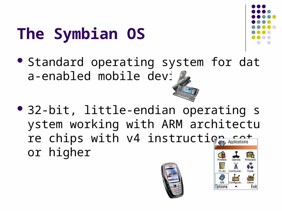
The Symbian OS
Standard operating system for data-enabled mobile devices
32-bit, little-endian operating system working with ARM architecture chips with v4 instruction set or higher

Location-Based Services (LBS)
Services are provided based on user’s location under different wireless networks
LBS is applicable in various fields Different issues have to be considered Each of them requires different accuracy and
latency

GSM Positioning Methods
Region-based Cell Information (CI)
Point-based Time of Arrival (TOA) Angle of Arrival (AOA) Enhanced Observed Time Difference (E-OTD) Assisted GPS (A-GPS)

Point-based GSM Positioning Methods TOA (200m - 10km)
E-OTD (50m - 100m)
AOA (>>150m)
A-GPS (10m - 50m)
Motivation
Advanced positioning methods require: extra cost to existing network / synchronization between ba
se stations special hardware to end users telco-dependent
Not all LBSs need very accurate location information GSM cell information (e.g. cell ID) is available in ordi
nary GSM handset Symbian phone offers programming capability for ge
neral developers Location estimation by GSM cell ID is adopted in our
project

Overview of GSM Cell ID Location Estimation Each base station has unique location ID and cell ID Main idea: each base station can somehow provide
certain ‘information’ about a particular location Advantages:
simple implementation, only current registered cell is required
applicable on ordinary GSM phone without any support from telco
Location: [50]Cell ID: [1]
Location: [50]Cell ID: [2]
Location: [50]Cell ID: [3]
Location: [50]Cell ID: [4]

GSM Cell Change Event
Received signal strength from current registered cell is weaker than another, so cell change occurs
Consequences: More information provided More reliable in detecting boundary

Location-based Services in 2D Space
Initiatives To locate the approximate location of a mobile ph
one using a program that run on Symbian OS
Principle Determining GSM cells coverage and their distrib
ution Plot a cell ID-to-location map Locate current position of
a mobile device
Data Collection Method
Collected location ID and cell ID pairs for two telcos in the CU campus.
Data Collection method: Static Method for SmarTone Cell Change Method for Peoples
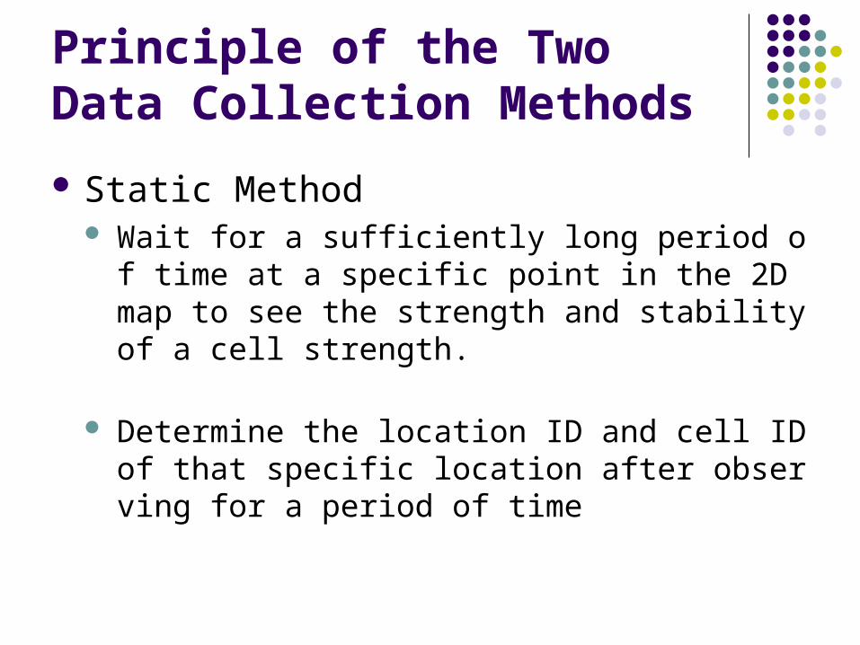
Principle of the Two Data Collection Methods
Static Method Wait for a sufficiently long period of time at a spec
ific point in the 2D map to see the strength and stability of a cell strength.
Determine the location ID and cell ID of that specific location after observing for a period of time

Principle of the Two Data Collection Methods
Cell Change Method Walk around the campus and find the “boundaries
” of different cells When cell change occurs we note down the chan
ge and try to find out the boundaries of the cells: location where cell change event is detected
Cell boundaries
Cell A
Cell B
Cell C
A->B
B->C
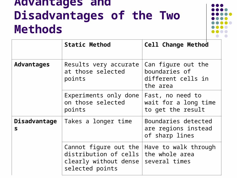
Advantages and Disadvantages of the Two Methods
Static Method Cell Change Method
Advantages Results very accurate at those selected points
Can figure out the boundaries of different cells in the area
Experiments only done on those selected points
Fast, no need to wait for a long time to get the result
Disadvantages Takes a longer time Boundaries detected are regions instead of sharp lines
Cannot figure out the distribution of cells clearly without dense selected points
Have to walk through the whole area several times

Experimental Results
For Peoples

Experimental Results

Experimental Results
For SmarTone

Experimental Results

Conclusion of the Experiment
Potential difficulties in 2D Space
ID-to-location map drawn not accurate enough Cannot locate the location of a mobile device to
an acceptable accuracy owing to the large size of cells
Hierarchy of cells make it even harder to locate our current position
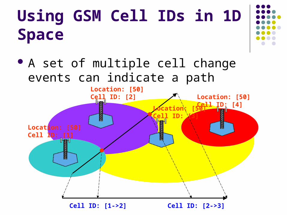
Using GSM Cell IDs in 1D Space
Location: [50]Cell ID: [1]
Location: [50]Cell ID: [2]
Location: [50]Cell ID: [3]
Location: [50]Cell ID: [4]
Cell ID: [1->2] Cell ID: [2->3]
A set of multiple cell change events can indicate a path

Problem of Using GSM Cell IDs in 1D Space
The mapping of cell change event set and path is one-to-many
Apply this method on fixed path

MTR Traveller for Stations in Subway
Apply on traffic route MTR Traveller – detect station arrival Initial observation:
Between two stations in subway, there is exactly one cell change
This event can tell user that he / she is going from one station to another station
Station 2Station 1Cell ID changes here

MTR Traveller for Stations in Open Area
KCR stations in open area Many cells are involved in between two stations A station platform may also be covered by multiple cells
Group the cells into ‘station cells’ (pure cell ID) and ‘transition pairs’ (cell changes)
Station Cells:
[S1, O], [S1, B]
Transition Pairs:
[S1, S2, O, B], [S1, S2, B, P], [S1, S2, P, G]
Station 2Station 1

Operation of MTR Traveller
Transition pair => on the way between S1 and S2 Station cell => in the station platform
Station Cells:
[S1, O], [S1, B]
Transition Pairs:
[S1, S2, O, B], [S1, S2, B, P], [S1, S2, P, G]
Station 2Station 1
Cell ID: O
[S1, O] => in Station 1
Cell ID: OB[S1, B] => in
Station 1
Cell ID: BP[S1, S2, B, P] => on the
way of S1S2
Cell ID: PG[S1, S2, P, G] => on the
way of S1S2

MTR Cell ID Data
Peoples

MTR Cell ID Data
SmarTone

MTR Cell ID Data
Sunday
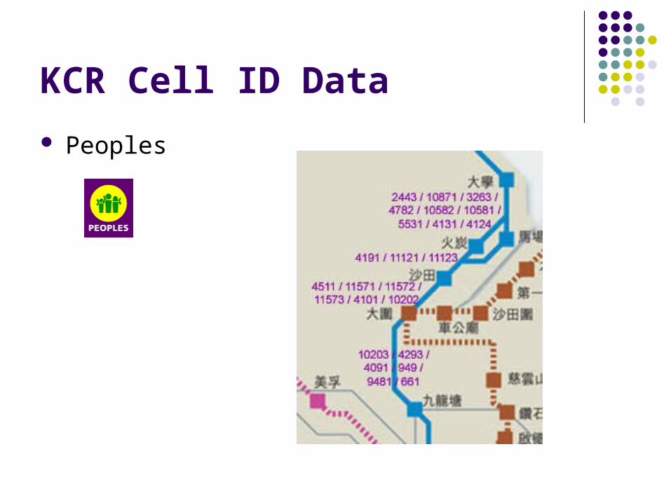
KCR Cell ID Data
Peoples

KCR Cell ID Data
SmarTone

Estimating the Accuracy of Proposed Method
Record the time difference at which the cell change occurs and at the moment that the train actually arrives the destination station
Convert the error range in time to distance by assuming constant velocity in that range
Result: 30m - 300m, comparable to E-OTD

Demonstration
Videos in actual stations

Evolution of Our Positioning Methods
Pure GSM Cell
Information Location
Estimation(Region Based)
GSM Cell Change Method
(Boundary / Line Based)
GSM Cell Change Method in
1D Path(Point Based)Detect registered
cell change occurred at cell boundary
Concentrate on specific cell changes (intersections between the path and the boundary)

Automatic Cell Data Collection
Collection of cell data was done manually in the past
Automatic cell data collection tool is required for regular update
Cell Snap
Contribution of Work
Enhancing pure cell ID location estimation by considering cell change events
MTR Traveller provides different application opportunities, such as: Notification Information providing
Cell Snap allows automatic cell data collection
Future Work
Improvement on MTR Traveller Personalization Informative User interface Distributed intelligence (SMS / GPRS)
Generic middleware / library for developers Other applications
Bus / tram route Detection of car speed detectors

Conclusion
GSM cell provides location-related information, but not accurate and reliable enough
Those information can be obtained through Symbian phone
The method was enhanced by using cell change events
Difficulties were encountered in 2D space The proposed method was also applied to 1D path:
MTR Traveller Automatic cell data collection by Cell Snap

Q&A Section
Thank you very much!