Final Circ Element 4-01-09
29
1 CIRCULATION ELEMENT El Centro General Plan INTRODUCTION The City of El Centro is served by a diverse circulation system consisting of roadways, public transit, rail and air service, and pedestrian and bicycle trails. While the Interstate 8 freeway serves as the City’s primary thoroughfare, Highway 86 and County Highway S80 bisect El Centro at Imperial and Adams Avenues; with County Highway S80 turning into Evan Hewes Highway near the City’s eastern boundary. Imperial County Transit provides public bus service along Highway 86 (4 th Avenue), State Street (south of Main St.), Highway 86 (Imperial Avenue) and a loop to the El Centro Regional Medical Center. Greyhound Bus provides additional intracity service with other fixed routes and charter. In addition to vehicular roadways, the San Diego & Arizona railroads approach El Centro from the east and west and merge into the Union Pacific Railroad, which extends north and south through the center of the City. Douthitt Strip Airport, a private airstrip, is located in the eastern portion of the City near Evan Hewes Highway. The City’s network of bicycle paths offers an alternative to more conventional modes of transportation. Whereas the City’s planned land use development pattern is identified in the Land Use Element, the Circulation Element guides the continued development and improvement of both the existing and planned transportation system. Demand for local and regional circulation improvements and construction will increase as additional land is developed in the future. The Circulation Element establishes acceptable roadway service levels and identifies improvements required to maintain the service levels. The use of other modes of transportation such as transit, walking, bicycling and ridesharing are promoted to reduce the demand for transportation system improvements and to improve air quality. Purpose of the Circulation Element The purpose of the Circulation Element is to provide a safe, efficient and adequate circulation system for the City. State planning law requires: “…a circulation element consisting of the general location for proposed major thoroughfares, transportation routes, terminals and other local public utilities and facilities, all correlated with the land use element plan.” To meet this purpose, the Circulation Element addresses the circulation improvements needed to provide adequate capacity for future land uses. Additionally, a hierarchy of transportation routes with typical development standards described for each roadway is established in the element.
Transcript of Final Circ Element 4-01-09

1
CIRCULATION ELEMENT El Centro General Plan
INTRODUCTION
The City of El Centro is served by a diverse circulation system consisting of roadways, public transit, rail and air service, and pedestrian and bicycle trails. While the Interstate 8 freeway serves as the City’s primary thoroughfare, Highway 86 and County Highway S80 bisect El Centro at Imperial and Adams Avenues; with County Highway S80 turning into Evan Hewes Highway near the City’s eastern boundary. Imperial County Transit provides public bus service along Highway 86 (4
th
Avenue), State Street (south of Main St.), Highway 86 (Imperial Avenue) and a loop to the El Centro Regional Medical Center. Greyhound Bus provides additional intracity service with other fixed routes and charter. In addition to vehicular roadways, the San Diego & Arizona railroads approach El Centro from the east and west and merge into the Union Pacific Railroad, which extends north and south through the center of the City. Douthitt Strip Airport, a private airstrip, is located in the eastern portion of the City near Evan Hewes Highway. The City’s network of bicycle paths offers an alternative to more conventional modes of transportation.
Whereas the City’s planned land use development pattern is identified in the Land Use Element, the Circulation Element guides the continued development and improvement of both the existing and planned transportation system. Demand for local and regional circulation improvements and construction will increase as additional land is developed in the future. The Circulation Element establishes acceptable roadway service levels and identifies improvements required to maintain the service levels. The use of other modes of transportation such as transit, walking, bicycling and ridesharing are promoted to reduce the demand for transportation system improvements and to improve air quality.
Purpose of the Circulation Element
The purpose of the Circulation Element is to provide a safe, efficient and adequate circulation system for the City. State planning law requires:
“…a circulation element consisting of the general location for proposed major thoroughfares, transportation routes, terminals and other local public utilities and facilities, all correlated with the land use element plan.”
To meet this purpose, the Circulation Element addresses the circulation improvements needed to provide adequate capacity for future land uses. Additionally, a hierarchy of transportation routes with typical development standards described for each roadway is established in the element.

2
The State’s 1998 General Plan Guidelines recommend that the circulation policies and plans should:
Coordinate the transportation and circulation system with planned land uses; Promote the safe and efficient transport of goods and the safe and effective
movement of all segments of the population; Make efficient use of existing transportation facilities; and Protect environmental quality and promote the wise and equitable use of
economic and natural resources.
According to the Guidelines, the Circulation Element should address all facets of circulation including streets and highways, transportation corridors, public transit, railroads, bicycle and pedestrian facilities, and commercial and general airports. The City of El Centro Circulation Element fulfills state requirements by including a plan to provide effective circulation facilities to support desired community development.
Scope and Content of the Circulation Element
Included in this element are goals and policies to improve overall circulation in the City of El Centro. A hierarchical roadway network is established for vehicle transportation, with designated roadway types and design standards. The roadway type is linked to anticipated traffic levels, and acceptable levels of service are established to determine when capacity improvements are necessary. Alternative transportation modes are also emphasized in this element to reduce dependency on the automobile and thereby improve environmental quality.
The Circulation Element has three sections: 1) Introduction; 2) Issues, Goals and Policies; and 3) the Circulation Plan. In the Issues, Goals and Policies section, major issues pertaining to the transportation system are identified, and related goals and policies are established.
The goals are statements of the City’s desires and consist of broad statements of purpose and direction. The policies serve as guidelines for planning circulation improvements to accommodate anticipated population growth, maintaining acceptable service levels while development occurs, promoting alternative transportation modes, and coordinating with local and regional jurisdictions to phase regional transportation facilities. The Circulation Plan explains how the goals will be achieved and the policies implemented. Specific action programs for the Circulation Element are contained in the Circulation Plan.
The Circulation Element was created in a public forum with input from numerous interest groups, citizens, jurisdictions, and agencies. Extensive efforts were made to involve the public, including:
Public workshops to receive initial comments and discuss circulation and transportation issues;
Coordination with the Southern California Association of Governments (SCAG);
Coordination with the Imperial Valley Association of Governments;
3
Coordination with Imperial County; Coordination with CALTRANS and other related agencies.
Related Plans and Programs
There are several existing plans and programs prepared by various agencies that are directly applicable to the aims and objectives of the Circulation Element. Plans and programs related to the Circulation Element include the following:
Southern California Association of Governments Plans and Programs (SCAG)
The Southern California Association of Governments (SCAG) is responsible for the regional planning in Southern California. SCAG has prepared long range growth and development plans for the Southern California region since the early 1970s as part of the ongoing Development Guide Program. This program provides a framework for coordinating local and regional decisions regarding future development and growth. An important component of this process is the preparation of growth forecast policies at intervals ranging from three to five years. The adopted growth forecast policies become the basis for SCAG’s functional plans (transportation, housing, air and water) for the region. The population totals and growth distribution are used in planning the future capacity of highways and transit systems.
The Growth Management Plan recommends ways to redirect the region’s growth in order to minimize congestion and better protect the environment. While SCAG has no authority to mandate implementation of its Growth Management Plan, some of the Plan’s principal goals (such as improved jobs/housing balance) are being implemented through county and city general plans.
Circulation Element of the Imperial County General Plan
The Circulation Element of the Imperial County General Plan contains the most recent information about the transportation needs of the County and the various modes available to meet the identified needs. A Circulation and Scenic Highways Plan is contained in the County Circulation Element to ensure adequate capacity on County roads and regional routes serving unincorporated areas of the County. To ensure that improvements to the County circulation system correspond with new development, the Circulation Element addresses the phasing of roadway improvements and financing alternatives.
City of El Centro Bicycle Plan
In 2000, the City of El Centro adopted a Bicycle Master Plan for use as a guideline for designing future bicycle facilities. Elements of the Bicycle Master Plan are included in the Pedestrian and Bicycle Network section of this document.

4
Other plans related to the Circulation Element include the following:
• Imperial County Airport Land Use Compatibility Plan • Imperial County Transit Vision Report
• City of Imperial General Plan
• Arterial Needs and Circulation Analysis for Imperial Valley Association of
Governments Communication and coordination between the City of El Centro and other agencies should continue in order to encourage an integrated approach to circulation strategies for the region.
Relationship to Other El Centro General Plan Elements In accordance with State planning law, the Circulation Element, although independent, must be consistent with the other General Plan elements. All elements of the General Plan are interrelated to a degree, and certain goals and policies of each element may also address issues that are the major subjects of other elements. The Circulation Element relates most closely to the Land Use, Noise, and Safety Elements.
Planned development identified in the Land Use Element is the basis for determining future road improvements; therefore the Land Use Element is directly linked to the Circulation Element. For example, the circulation policies and plans identify the improvements to the roadway system that will be required in order to serve traffic generated by the uses permitted in the Land Use Element. In addition, the Circulation Element promotes alternative transportation modes to minimize the regional impacts of planned local development.
The Noise Element contains policies and plans aimed to ease the adverse effects of noise on the community that are directly attributable to the future transportation plans contained in the Circulation Element. Noise exposure will be a key consideration when locating and designing new development along arterials and other transportation related noise sources. In addition, policies and plans contained in the Safety Element addressing transportation related hazards are complementary to policies and plans contained in the Circulation Element.

5
ISSUES, GOALS, AND POLICIES The City of El Centro has a circulation system that includes vehicular, public transit, rail, air, bicycle and pedestrian components. An inter-dependent circulation system is created as the local system is tied to a larger regional circulation system. A safe and convenient circulation system is needed to support a variety of land uses in the community.
Four major issues are addressed by the goals, policies, and plans of the Circulation Element. These major issues include: 1) providing a suitable system of City roadways that meets the needs of the community; 2) providing a public transportation network that gives El Centro residents access to various locations within the City and throughout the region; 3) ensuring adequate bicycle and pedestrian access throughout the community; and 4) supporting regional serving airports and railways.
Primary Circulation System
A well-designed local roadway system provides safe and convenient access to activities in the community. As well as providing access to all sections of the community, the roadway system should reflect the ideals of the community.
Circulation Goal 1: Provide a system of roadways that meets the needs of the community.
Policy 1.1: Provide and maintain a circulation system that is in balance with the land uses in El Centro by implementing the Circulation Master Plan.
Policy 1.2: Improve El Centro circulation system roadways in concert with land development to ensure sufficient levels of service.
Policy 1.3: Strive to maintain traffic conditions at intersections and roadways at level of service C or better, with the exception of the largely commercial corridors located along Imperial Avenue, Fourth Street, Dogwood Avenue and Ross Avenue (as specified in Figure C-8), where level of service D during peak hours is acceptable only after all respective circulation element improvements are implemented to the satisfaction of the City engineer. Exceptions to these standards will be allowed only where the City Council determines that the improvements needed to maintain the City’s level of service standard at specific locations are infeasible.
Policy 1.4: Review new development proposals to ensure that the proposed development provides adequate parking and would not increase traffic on roadways and intersections to a level of service (LOS) worse than “C” unless the project will provide overriding socio/economic benefits to the City.
Policy 1.5: Provide Thresholds-of-Significance criteria to determine whether a project might have a significant effect on the environment.

6
Policy 1.6: Provide policies and procedures for System Planning as it relates to interregional transportation and Access Management to manage and regulate the design and implementation of driveways, medians, median openings, traffic signals, and freeway interchanges.
Policy 1.7: Work with adjacent jurisdictions and transportation agencies to identify necessary improvements to the regional roadway system to ensure adequate regional access to and from El Centro.
Policy 1.8: Coordinate improvements to the local circulation system with other major transportation improvement programs.
Policy 1.9: Enforce minimum design standards for streets as established in the General Plan and City ordinances.
Policy 1.10: Encourage site planning and subdivision design that best utilizes available traffic capacity on abutting streets through design techniques such as lot orientation, limitations on intersecting streets, and driveway locations and spacing.
Policy 1.11: Beautify the City’s major thoroughfares and entrances to the business loop through a streetscape improvement program that includes activities such as tree planting and landscaping.
Policy 1.12: Strive to preserve existing on-street parking in commercial areas wherever possible. However, right-of-way constraints may make it necessary to eliminate on-street parking to accommodate needed roadway improvements.
Public Transportation
Public transportation is an important factor in the provision of alternative means of transportation. It offers an alternative to the use of automobiles and helps reduce air pollution and road congestion.
Circulation Goal 2: Promote a public transportation network that allows for convenient access to major destinations, both within El Centro, as well as within the region.
Policy 2.1: Coordinate with the Imperial Valley Association of Governments (IVAG) to ensure that adequate bus service, including a fixed-route public transit system, is available for all segments of the community.
Policy 2.2: Encourage the increased use and expansion of public transportation opportunities.
Policy 2.3: Provide for the location of necessary transit infrastructure, such as bus stops, in major activity centers.
Policy 2.4: Support ridesharing services and other similar alternative modes of transportation.

7
Pedestrian and Bicycle Network
Non-vehicular modes of transportation offer an alternative option to the traditional use of automobiles. These modes of transportation, such as bicycling and walking, help to reduce roadway congestion and air pollution and provide recreational opportunities for the City’s residents.
Circulation Goal 3: Provide for adequate bicycle and pedestrian access throughout the community.
Policy 3.1: Provide and maintain a system of pedestrian and bicycle access-ways that links residential areas with parks, scenic areas, schools, libraries, civic center, major employment and retail centers, and other areas of congregation within El Centro and the surrounding area.
Policy 3.2: Continue to improve the accessibility of public facilities and commercial centers to improve access and mobility of the elderly and the disabled.
Policy 3.3: Encourage the incorporation of bicycle facilities, such as bike lockers and showers at workplaces, bicycle racks on buses, and bike lockers and/or racks in retail areas to facilitate bicycle travel.
Policy 3.4: Maintain the pedestrian and bicycle system, including improving the road surface and sidewalk, to reduce safety hazards associated with drainage grates, manholes, potholes, and uneven surfaces.
Policy 3.5: Strive to include a separation between curbs and sidewalks, such as a landscaped planting strip, as well as implementing traffic calming measures in order to reduce safety hazards to pedestrians, create “walkable” streets, and provide an aesthetically pleasing environment.
Airports and Railways
Airports and railways provide essential functions for cities and regions. Efficient movement of people and goods in and out of El Centro is fundamental to the economic vitality of the City and Imperial County.
Circulation Goal 4: Continue to utilize regional airports and railways to facilitate economic development, as well as the movement of people, and establish El Centro as a regional hub of commerce and travel.
Policy 4.1: Coordinate with the County of Imperial and plan for the expansion of the Imperial County Airport to encourage inter-regional travel and commerce.
Policy 4.2: Review development proposals within areas affected by the operation of local airports and railways to ensure land use compatibility, protect the public safety, and allow for continued aviation and rail operations.

8
Policy 4.3: Continue to pursue a joint use agreement with the U.S. Navy to allow commercial jet service at the Naval Air Facility.
Policy 4.4: Encourage passenger rail service between El Centro, Calexico and San Diego.
Related Goals and Policies
The goals and policies described in the Circulation Element are related to and support subjects included within other General Plan elements. In turn, many goals and policies from other elements directly or indirectly support the goals and policies of the Circulation Element. These supporting goals and policies are identified in Table C-1.
Table C-1 Related Goals and Policies by Element
Circulation Issue Area General Plan Elements Primary
Circulation System
Public Transportation
Pedestrian and Bicycle Network
Airports and Railways
Land Use 1.1, 1.4, 1.11, 1.12, 1.13, 3.3
1.1, 1.11, 1.13, 2.2, 2.3, 3.3
1.1, 1.13 1.2, 2.1, 2.4
Economic Development 1.1, 1.3 1.1, 1.3 1.1, 1.3, 2.1 Housing Circulation Public Facilities Conservation/Open Space
5.1, 5.2, 5.3 5.1, 5.2, 5.3 3.3, 5.3
Safety 1.3, 5.1, 5.2, 5.6
1.3 5.2, 5.3 1.3, 5.1, 5.4, 5.5, 5.6
Noise 1.1, 2.1, 2.2, 2.3
1.1 1.1, 2.1, 2.3, 2.6, 2.7, 2.8
9
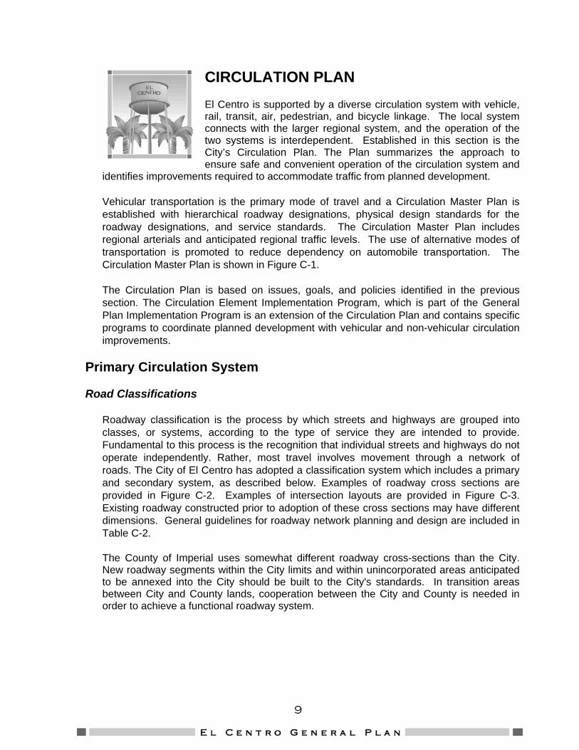
CIRCULATION PLAN El Centro is supported by a diverse circulation system with vehicle, rail, transit, air, pedestrian, and bicycle linkage. The local system connects with the larger regional system, and the operation of the two systems is interdependent. Established in this section is the City’s Circulation Plan. The Plan summarizes the approach to ensure safe and convenient operation of the circulation system and
identifies improvements required to accommodate traffic from planned development.
Vehicular transportation is the primary mode of travel and a Circulation Master Plan is established with hierarchical roadway designations, physical design standards for the roadway designations, and service standards. The Circulation Master Plan includes regional arterials and anticipated regional traffic levels. The use of alternative modes of transportation is promoted to reduce dependency on automobile transportation. The Circulation Master Plan is shown in Figure C-1.
The Circulation Plan is based on issues, goals, and policies identified in the previous section. The Circulation Element Implementation Program, which is part of the General Plan Implementation Program is an extension of the Circulation Plan and contains specific programs to coordinate planned development with vehicular and non-vehicular circulation improvements.
Primary Circulation System
Road Classifications
Roadway classification is the process by which streets and highways are grouped into classes, or systems, according to the type of service they are intended to provide. Fundamental to this process is the recognition that individual streets and highways do not operate independently. Rather, most travel involves movement through a network of roads. The City of El Centro has adopted a classification system which includes a primary and secondary system, as described below. Examples of roadway cross sections are provided in Figure C-2. Examples of intersection layouts are provided in Figure C-3. Existing roadway constructed prior to adoption of these cross sections may have different dimensions. General guidelines for roadway network planning and design are included in Table C-2.
The County of Imperial uses somewhat different roadway cross-sections than the City. New roadway segments within the City limits and within unincorporated areas anticipated to be annexed into the City should be built to the City's standards. In transition areas between City and County lands, cooperation between the City and County is needed in order to achieve a functional roadway system.

10
Primary Circulation System
Freeways are controlled access routes that provide for major intra and interregional travel. They are corridors that accommodate trips at highest speeds with access only from selected links to the network, consistent with the population and network densities of the areas they traverse.
Arterial Streets are intended to provide for the movement of through-traffic between major traffic generators such as the Civic Center, the Central Business District and other commercial centers, and distribute traffic from freeways to less important arterials serving residential areas directly. Insofar as possible, direct vehicle access to abutting properties should, on these arterials, be at limited intervals. The City of El Centro currently has two designations of arterials: four-lane and two-lane.
Collector Streets collect and distribute traffic to and from major highways and local streets. Collector streets also serve secondary traffic generators such as shopping and business centers, schools, parks and high density or large-scale residential areas.
Secondary Circulation System
The secondary circulation system includes local streets for both residential and business use, as well as alternative modes of transportation which do not rely on private automobiles.
Local Streets provide for direct access to property by local traffic. They are usually constructed by landowners as abutting land is developed.
*Note: Levels of service are not applied to residential streets since their primary purpose is to serve abutting lots, not carry through traffic. Levels of Service normally apply to roads carrying through traffic between major trip generators and attractors.
Alleys make up a significant portion of existing local streets. The City contains approximately twenty-two miles of alleys. At one time alleys were required with all residential, commercial, and industrial development including single-family home construction. Although alleys are no longer required in new low-density residential projects, the City will focus on maintaining the existing alley network.
Circulation Element Implementation Program
Phasing and construction of needed improvements identified in the Circulation Master Plan will be achieved through a variety of methods. These methods include the adoption and implementation of a capital improvement program, and coordination with the Southern California Association of Governments (SCAG), Caltrans, Imperial County Local Transportation Authority, the County of Imperial, and other regional transportation agencies. In addition, the City will develop a financing plan to facilitate the development of necessary transportation system improvements that identifies available funding sources and requires proposed development projects to construct and/or fund necessary traffic improvements, such as traffic signals and roadway improvements, resulting from the proposed project. These improvements should include alternative means of transportation in addition to improvements associated with automobile usage.

11
Figure C-1 (1 of 2)
City of El Centro General Plan Buildout Circulation Element Future Road Network

12
[Type a quote from the document or the summary of an interesting point. You can position the text box anywhere in the document. Use the Text Box Tools tab to change the formatting of the pull quote text box.]
Figure C-1 (2 of 2) City of El Centro General Plan Buildout
Circulation Element Future Road Network Legend
2-Lane Collector
4-Lane Collector
4-Lane Arterial
6-Lane Arterial
Freeway / Expressway
City of El Centro Sphere of Influence
Railroad Tracks
Future Interchange
Future Bridge
Future Bridge Widening
Study Intersection
2-Lane Arterial
IN GENERAL, PRIMARY ARTERIALS SHOULD BE CONSTRUCTED AT A ½-MILE GRID SPACING IN FUTURE GROWTH AREAS. SPECIFIC PLANS MAY ALLOW FOR AN ALTERATION OF THIS GUIDELINE PER APPROVAL FROM THE CITY. ROADWAYS THAT ARE NOT INCLUDED IN THE CITY’S TRAFFIC IMPACT FEE SHOULD BE PAID FOR BY THE DEVELOPMENT THEY SERVE.

13
Figure C-2 Typical Street
Cross-Sections
Notes: 1. STREETS THROUGH AREAS WITH RIGHT-OF-WAY CONSTRAINTS MAY USE
NARROWER SHOULDERS, TRAVEL LANES AND/OR PARKING STRIPS, SUBJECT TO THE APPROVAL OF THE CITY OF EL CENTRO AND OTHER AGENCIES WITH ROADWAY JURISDICTION.
2. BIKE LANES SHALL BE INCLUDED WHERE INDICATED ON THE MOST RECENT “CITY OF EL CENTRO BICYCLE MASTER PLAN” AND “CITYWIDE BIKEWAY SYSTEM DESIGN REPORT” (REFER TO FIGURE C-6). BIKE LANES MAY BE IN ADDITION TO OR MAY DISPLACE ON-STREET PARKING, SUBJECT TO THE APPROCAL OF THE CITY OF EL CENTRO AND OTHER AGENCIES WITH ROADWAY JURISDICTION.

14
Figure C-3 (1 of 3) Typical Intersection
Layouts

15
Figure C-3 (2 of 3) Typical Intersection
Layouts

16
Figure C-3 (3 of 3) Typical Intersection
Layouts

17
TABLE C-2Functional Roadway Classifications Planning and Design Guidelines
Classification FunctionTypical Percent of
Surface Street System Mileage
Continuity Spacing (miles)
Typical Portion of Surface Street
System Vehicle-Miles Carried
DirectLand Access
Minimum Roadway Inter-section Spacing
Speed Limit(mph) Parking Comments
Freeway andExpressway Traffic movement NA Continuous 4 NA None 1 mile 45-55 Prohibited
Supplements capacity of arterialstreet system and provides highspeed mobility.
PrimaryArterial
Intercommunityand intrametroareaPrimary-trafficmovementSecondary-landaccess
5-10% Continuous 1-2 40-65% Limited-majorgeneratorsonly
1/2 mile 35-45 infully
developedareas
Prohibited
SecondaryArterial
Primary-intercommunity,intrametro area,traffic movementSecondary-landaccess
10-20 Continuous 1/2-1 25-40 Restricted-somemovementsmay beprohibited;number andspacing ofdrivewayscontrolled
1/8 mile 30-35 Generallyprohibited
Collector Primary-collect/distribute trafficbetween localstreets and arterialsystemSecondary-landaccessTertiary-inter-neighborhoodtraffic movement
5-10 Notnecessarilycontinuous:should notextendacrossarterials
1/2 or less 5-10 Safetycontrols;limitedregulation
300 feet 25-30 Limited Through traffic should bediscouraged.
Local Land access 60-80 None As needed 10-30 Safetycontrols only 300 feet 25 Permitted Through traffic should be
discouraged.NA = Not applicable.Source: Planning Urban Arterial and Freeway SystemsPublished by: Institute of Transportation Engineers, Washington, D.C.
Backbone of street system.

18
Performance Criteria
The goal of the Circulation Element will be to provide a roadway system with adequate capacity and acceptable levels of service (LOS) to accommodate projected travel demands associated with the buildout of the Land Use Element. This can be accomplished by establishing minimum service levels for the designated street and conventional state highway system. Strategies that result in improvements to the transportation system, coupled with local job creation, will allow County residents to have access to a wide range of job opportunities within reasonable commute times.
The performance criteria used for evaluating volumes and capacities on the City Street System are based on Average Daily Traffic (ADT) data and the classification system described previously. El Centro’s current system of LOS evaluation criteria is described in Table C-3. Level of service C is considered acceptable, with the exception of the largely commercial corridors located along Imperial Avenue, Fourth Street, Dogwood Avenue and Ross Avenue (as specified in Figure C-8), where level of service D is acceptable. Exceptions to these standards will be allowed only where the City Council determines that the improvements needed to maintain the City’s level of service standard at specific locations are infeasible.
The City will utilize the LOS criteria outlined in Table C-3 to determine the significance of potential impacts as a result of development proposals. Those projects resulting in significant impacts to the transportation system will be required to mitigate such impacts through physical improvements and/or impact fees.
Relationship to Land Use
Future traffic volumes and highway capacity are directly related to future land use. Different types of land uses have differing effects on the street system in terms of the number of trips that are generated. Table C-4 indicates the expected trip generation of selected land uses that are identified in the Land Use Element.

19
ROADWAY TYPE CODE LOS A LOS B LOS C LOS D LOS E
10-Lane Freeway 10F 64,000 99,000 139,000 160,000 182,000
8-Lane Freeway 8F 51,000 79,000 112,000 136,000 146,000
6-Lane Freeway 6F 39,000 59,000 85,000 102,000 110,000
8-Lane Expressway 8E 35,000 54,000 75,000 90,000 98,000
6-Lane Expressway 6E 28,000 42,000 56,000 67,000 74,000
4-Lane Freeway 4F 26,000 40,000 57,000 69,000 74,000
8-Lane Divided Arterial (w/ left-turn lane) 9 40,000 47,000 54,000 61,000 68,000
6-Lane Divided Arterial (w/ left-turn lane) 7 32,000 38,000 43,000 49,000 54,000
4-Lane Expressway 4E 18,000 27,000 36,000 45,000 50,000
4-Lane Divided Arterial (w/ left-turn lane) 5 22,000 25,000 29,000 32,500 36,000
4-Lane Undivided Arterial (no left-turn lane) 4 16,000 19,000 22,000 24,000 27,000
2-Lane Rural Highway 2R 4,000 8,000 12,000 17,000 25,000
2-Lane Arterial (w/ left-turn lane) 3 11,000 12,500 14,500 16,000 18,000
2-Lane Collector 2 6,000 7,500 9,000 10,500 12,000
2-Lane Local 1 1,200 1,400 1,600 1,800 2,000
1-Lane Freeway Diamond Ramp 1D 11,000 12,800 14,700 16,500 18,300
2-Lane Freeway Diamond Ramp 2D 22,000 25,600 29,400 33,000 36,600
1-Lane Freeway Loop Ramp 1L 9,000 10,500 12,000 13,500 15,000
2-Lane Freeway Loop Ramp 2L 16,000 18,700 21,300 24,000 26,700
Table C-3 Level of Service Threshold Volumes for Various Roadway Types (ADT)
Notes: 1. The above threshold volumes for preliminary planning purposes only. If available, the results of detailed level of service analyses will typically have priority over
the levels of service derived from this table. In that case this table can be used by the analyst for providing additional considerations for recommending the appropriate general roadway type for the specific condition being analyzed.
2. All above facilities assume a 60%/40% peak hour directional split. All above facilities assume peak hour representing approximately 10% of the Average Daily Traffic (ADT), except for mainline freeway facilities, which assume peak hour representing 9% of the Average Daily Traffic (ADT).
3. Based on Highway Capacity Manual, Transportation Research Board, 2000. 4. Freeway thresholds are consistent with conditions utilizing a .95 peak hour factor, with 2% trucks and slightly over a one-mile average interchange spacing. 5. Expressways are consistent with the average of a multi-lane highway (with no signals) and Class 1 arterial (with an average signal spacing of 0.8 signals per mile
and a .45 G/C ratio). 6. Arterial thresholds are consistent with the average of Class 1 and Class 2 arterials with an assumed signal density of two signals per mile. This assumes a divided
arterial with left-turn lanes. Thresholds for four-lane undivided arterials assume approximately two-thirds the capacity of a four-lane divided arterial due to the impedance in traffic flow resulting from left-turning vehicles waiting in the inside through lane, thus significantly reducing the capacity of the roadway.
7. Rural highways are generally consistent with the 2000 Highway Capacity Manual rural highway, assuming 8% trucks, 4% RV’s, 20% no-passing, and level terrain. The greatest difference is that it assumes a maximum capacity (upper end of LOS E) of 25,000 rather than the 28,000 calculated using the new Highway Capacity Manual.
8. Two-lane collectors assume approximately three-fourths of the capacity of a two-lane arterial with left-turn lanes. This is based on the assumption that left-turn channelization is not provided on a two-lane collector.
9. Local street level of service thresholds are based upon “Neighborhood Traffic Related Quality-of-Life Considerations” which assumes a standard suburban neighborhood, 40-foot roadway width, and 25 mile per hour speed limit with normal speed violation rates.
10. Capacities for Diamond Ramps and Loop Ramps may be slightly higher or lower than the planning level capacities indicated above. The 2000 Highway Capacity Manual (2000 HCM) states that the capacity of a one-lane diamond to be 2,200 vehicles per hour (vph), and 1,800 vph for a small radius loop ramp. Two-lane freeway ramp capacities are estimated in the 2000 HCM to be 4,400vph for a two-lane diamond, and 3,200vph 20 for a two-lane small radius loop. Varying intermediate capacities are provided for incremental conditions between these extremes. Capacities given for each service level assume the same level of service for the adjoining merging roadway as well as level of service being determined by volume-to-capacity and not attainable speed. Level of service will be controlled by freeway level of service if worse than ramp. Mitigations of level of service deficiencies may include the addition of a lane on the freeway ramp, the addition of an auxiliary lane on the freeway mainline, the addition of approach lanes at the ramp junction with the local intersecting street, and/or geometric modifications to improve the efficiency of the ramp itself or its termini. The appropriate mitigation should be determined on a case-by-case basis, considering freeway main line volumes and weaving, the extent that the freeway ramp volume exceeds the above planning thresholds, and the level of service of the ramp intersection with the local street.
11. All volumes are approximate and assume ideal roadway characteristics.

20
Table C-4 Land Use and Trip Generation Summary
Daily Trip Generation Land Use Daily Trips Per
Acre Daily Trips per Dwelling Unit
Daily Trips per 1,000 Square Feet Building
Residential Rural 12 12 N/A Low Density 45 10 N/A Medium Density 68 8 N/A High-Medium Density 96 6 N/A Commercial Neighborhood Commercial 1,200 N/A 120 Office Commercial 300 N/A 20 Heavy Commercial 200 N/A 16 Tourist Commercial 300 N/A N/A Downtown Commercial 400 N/A 40 Industrial General Industrial 50 N/A 4 Light Manufacturing 50 N/A 4 General Manufacturing 60 N/A 5 Planned Industrial 90 N/A 8 Community Facilities Civic 450 N/A 30 Public 150 N/A 10
Note: The above trip generation rates are approximate and for informational purposes only. Trip generation rates used for environmental purposes should be based on rates established in publications by the Institute of Transportation Engineers (ITE) or San Diego Association of Governments (SANDAG) and approved by the El Centro Public Works Department.
General Plan Circulation System
The circulation goals and policies emphasize the need for a circulation system capable of serving both existing and future traffic. The location, design and constituent modes of the circulation system have major impacts on air quality, noise, community appearance and other environmental resources. The El Centro Circulation Master Plan depicted in Figure C-1 delineates the planned circulation system including primary roadway segments with the freeways, arterial streets and collector street designations. The plan accommodates anticipated traffic levels and the hierarchical roadway classification system is implemented to avoid community impacts.

21
El Dorado Colonia Circulation System
The Land Use Element identifies the El Dorado Colonia as an area that would benefit from redevelopment and new development activities. For a new development, a street system must be in place to serve this new development. Figure C-4 provides a conceptual illustration of an appropriate street system for this area. The proposed street system assumes residential development and conforms to the grid street pattern that is prevalent in other parts of the Planning Area. Other circulation patterns may serve this area effectively.
Future Railroad Crossings
The California Public Utilities Commission (P.U.C.) is requesting that all existing railroad at-grade crossings be modified to grade separations if the existing roadway is proposed to remain over the tracks. It must be emphasized that the P.U.C. request is not a requirement. A grade separation involves reconstructing the roadway to pass over the railroad tracks on a bridge or to construct a bridge under the existing railroad tracks to allow the existing roadway to pass underneath the railroad tracks. At-grade widening is routinely implemented and is a reasonable option in most cases.
Roadways in and near the City of El Centro that will include grade separations include Bradshaw Drive and Villa Avenue. McCabe Road intersects Dogwood Avenue in the immediate proximity of the existing railroad tracks. The McCabe Road overcrossing will probably require Dogwood Avenue to also be reconstructed as an overcrossing. This will result in the entire McCabe Road / Dogwood Avenue intersection being constructed on an elevated roadway. The alternative is to realign and/or offset the McCabe and Dogwood Intersection so as to create a single road grade separation (for only a single leg of the intersection), and not the entire intersection.. There are other existing minor at-grade crossings near the downtown area. These roadways are not planned to be widened in the future and will remain as at-grade crossings. City staff should seek the assistance of a consultant to assist with the design and approval process through the P.U.C. to allow for widening of the existing at-grade railroad crossings within the roadway’s right-of-way at La Brucherie Avenue, Imperial Avenue, Eighth Street, Ross Avenue, and Danenberg Drive per P.U.C. General Order 88.

22
Figure C-4 Proposed Street System
El Dorado Colonia

23
Regional Transportation
El Centro and the Imperial County region have experienced great success during the last century providing agricultural products to the rest of the nation and parts of the world. This would not have been possible without an efficient regional transportation system. The system must link localities with outside commerce centers and regional transportation hubs. In addition, the regional circulation system must meet the needs of local residents.
Interstate 8 bisects El Centro and provides the major access route to other regional highways and freeways throughout California. The Union Pacific Railroad extends north-south through the City and is intersected with the San Diego and Arizona railroad tying into the City’s industrial areas to the east. Air transportation is available at the Imperial County and Brawley airports, located north of the City.
Since many local roadways, such as Interstate 8, are used by regional traffic traveling through the City, the community is interested in reducing the negative impacts to local residents from vehicles traveling on I-8. To avoid adverse impacts from regional traffic, the City will continue to coordinate transportation improvements and address circulation issues with the County of Imperial, other cities in the County, Caltrans, and the Southern California Association of Governments (SCAG). The Imperial Valley Association of Governments is in the process of developing of a regional traffic impact fee which will assist in funding capital improvements to mitigate regional traffic growth, including the growth from the City of El Centro. The City of El Centro should cooperate with the other agencies in Imperial County to expedite the development and implementation of a regional traffic impact fee in order to provide funding for El Centro’s fair share of traffic impacts on these regional facilities.
Goods Movement
The efficient movement of goods in and through Imperial County is vital to the local economy. The ability of the City of El Centro, as well as the entire region, to compete domestically and internationally on an economic basis requires an efficient and cost-effective method for distributing and receiving products. This can be accomplished through planning, design, construction, and maintenance of the regional and local street and highway system.
Truck Traffic
Although the City of El Centro does not currently designate truck routes, generally the majority of truck travel occurs on Interstate 8, State Route 86 and Dogwood Avenue. In addition, local truck traffic on arterial roads is significant, especially in the eastern and southeastern portions of the City where the major industrial development is located. In addition, heavy industrial uses are located along the Union Pacific Railroad.

24
Public Transportation
Promotion of alternative modes of transportation such as public transit and bicycling is a key component of the Circulation Plan. Use of alternative modes of transportation will produce a number of benefits for the community including reduced traffic, less need for costly roadway improvement projects and improved air quality.
Public Transit
Services in Imperial Valley and the City of El Centro include: Greyhound Bus providing intracity service with fixed routes and charter; EOC/Salton Senior Transportation; Valley Transit System; Imperial County Transit; Imperial Valley Transit Authority; City of El Centro Blue Line Shuttle Bus System (see Figure C-5).
Community Systems
There are various specialized services, primarily only for those people that are enrolled in these programs, such as: IV Transit; Association for Retarded Citizens; Work Training Center; MediVan; IV Blind Center; EOC Senior Nutrition; Clinica de Salud; and Calexico Senior Transportation. Other public access to transportation include: Dial-a-Ride, Desert Cab Company, City Cab Company and Yellow Cab.
Paratransit Service
The City supports reliable, efficient and effective countywide paratransit service by encouraging development of service systems that satisfy the transit needs of the elderly and physically handicapped. Paratransit services are transportation services such as car pooling, van pooling, taxi service, and dial-a-ride programs.
Fixed Route Transit Service
The Imperial County Transit provides bus service along Fourth Street (SR 86), State Street, Imperial Avenue (SR 86) and a loop to the El Centro Regional Medical Center on Ross Avenue and Aurora Drive (see Figure C-6).
In an effort to improve transit service and increase ridership, the City will require that transit facilities be constructed along with major new development and rehabilitation projects. Additionally, the City will work with Imperial Valley Transit to expand transit routes and special transit services to meet the community’s expanding needs.
Pedestrian and Bicycle Network
Continuing the promotion of alternative modes of transportation, the Circulation Plan promotes and encourages the development and use of a network of pedestrian and bicycle routes. The City’s pedestrian network is mainly associated with sidewalks on existing roads as shown in Figure C-2. The City will identify areas within the existing community that would benefit from improved pedestrian facilities, and future development and redevelopment will be required to incorporate pedestrian connections with major

25
destinations. In addition, the City will strive to include a separation between curbs and sidewalks, such as a landscaped planting strip, in order to reduce safety hazards to pedestrians, create “walkable” streets, and provide an aesthetically pleasing environment.
Bicycling is a highly feasible alternative to vehicle transportation within the City of El Centro. With the exception of the hottest summer months, the climate within the city and the relative short distances between activity centers and residences make bicycling increasingly attractive.
The City of El Centro has adopted the Caltrans classifications of bicycle facilities (Class I, Class II, and Class III). Class I bikeways are “bike paths”, separated completely from the roadway and designated for the exclusive use of bicyclists and pedestrians. Class II bikeways are “bike lanes” within the roadway designated for the use of bicyclists. Class III bikeways are “bike routes” which provide signs and a travel lane shared by bicyclists and vehicles. The current system of bicycle facilities is depicted in Figure C-6 and is described in detail in the “City of El Centro Bicycle Master Plan”. In addition to the Bicycle Master Plan, the City recently completed a “Citywide Bikeway System Design Report”. The City will continue to implement and update the plans as appropriate.
Airports and Railways Airports
Commercial air service to Imperial Valley is provided through the Imperial County Airport. The airport provides for scheduled airline service and private air travel. The airport, located just north of the City of El Centro, is accessible by State Route 86 and, in large part, is surrounded by residential and industrial development. Additionally, Douthitt Strip, a private airstrip located in the eastern portion of El Centro, is accessible by State Route 80 (see Figure C-7).
To ensure public safety, the City will continue to coordinate with the County of Imperial Airport Land Use Commission and review proposed development projects within the area impacted by airport operations.
Railroads
Two rail lines serve El Centro. The Union Pacific Railroad main line enters the eastern border near Winterhaven and then bears northwest and leaves Imperial County just east of the Salton Sea. This is the railroad that serves Los Angeles and points northward in California. There is a major branch line from this main line at Niland that provides rail service to Calipatria, Brawley, Imperial, El Centro, Calexico, and Mexico. This line is used extensively for agricultural shipments. Minor spurs provide service to Westmoreland and the area north of Holtville. A San Diego and Arizona route links El Centro to San Diego, but is not currently in operation beyond Plaster City because of flooding damage, but feasibility studies have been undertaken to bring it back into operation (see Figure C-7).
The City will coordinate with rail service providers and developers to ensure new development and nearby railways incorporate appropriate safety and noise reduction features into project design.

26
Figure C-5 City of El Centro
Blue Line Shuttle Route

27
Figure C-6 Transit and
Bicycle Routes

28
Figure C-7 Airports and Railways

29
Figure C-8 Level of Service “D” Corridors
Note: The Level of service “D” corridors apply only during peak hours and after all respective circulation element improvements are implemented to the satisfaction of the City engineer.


![Muzicoterapia CA Element Terapeutic[1].Final(1)](https://static.fdocuments.net/doc/165x107/577cdfa21a28ab9e78b1a630/muzicoterapia-ca-element-terapeutic1final1.jpg)