Filey FAS FAS FTC Planning 15.2.1… · during storm events as they catch the overland flows and...
26
Filey FAS Presentation to Planners Stewart Rowe 15.2.2016
-
Upload
truongtuyen -
Category
Documents
-
view
219 -
download
3
Transcript of Filey FAS FAS FTC Planning 15.2.1… · during storm events as they catch the overland flows and...

Filey FAS
Presentation to Planners
Stewart Rowe
15.2.2016
23 September 2015
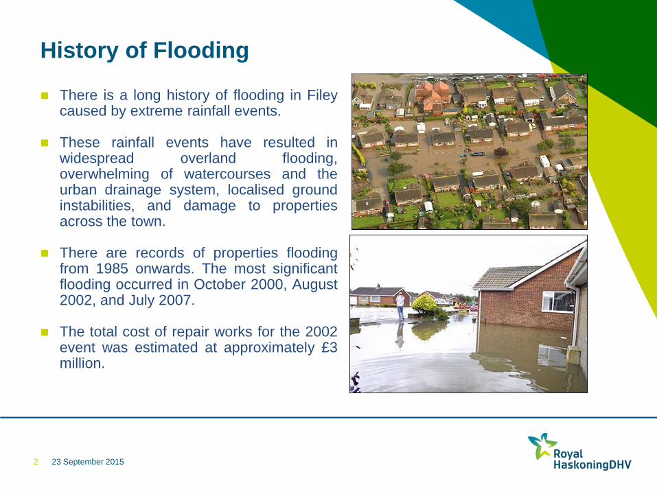
History of Flooding
There is a long history of flooding in Filey
caused by extreme rainfall events.
These rainfall events have resulted in widespread overland flooding, overwhelming of watercourses and the urban drainage system, localised ground instabilities, and damage to properties across the town.
There are records of properties flooding from 1985 onwards. The most significant flooding occurred in October 2000, August 2002, and July 2007.
The total cost of repair works for the 2002 event was estimated at approximately £3 million.
2
23 September 2015
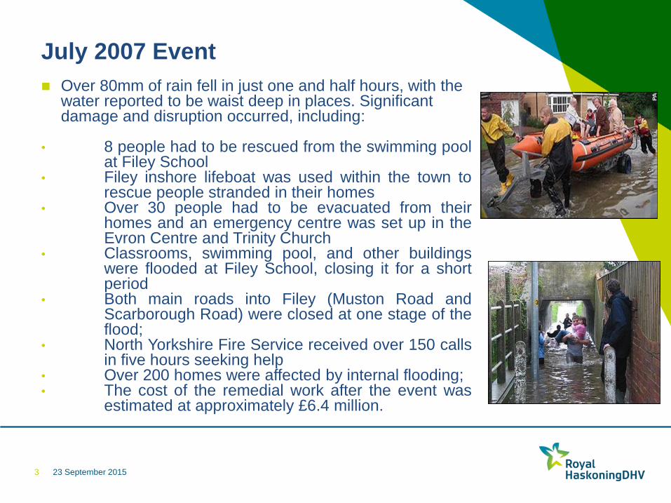
July 2007 Event
Over 80mm of rain fell in just one and half hours, with the
water reported to be waist deep in places. Significant damage and disruption occurred, including:
• 8 people had to be rescued from the swimming pool at Filey School
• Filey inshore lifeboat was used within the town to rescue people stranded in their homes
• Over 30 people had to be evacuated from their homes and an emergency centre was set up in the Evron Centre and Trinity Church
• Classrooms, swimming pool, and other buildings were flooded at Filey School, closing it for a short period
• Both main roads into Filey (Muston Road and Scarborough Road) were closed at one stage of the flood;
• North Yorkshire Fire Service received over 150 calls in five hours seeking help
• Over 200 homes were affected by internal flooding; • The cost of the remedial work after the event was
estimated at approximately £6.4 million.
3
23 September 2015
Background to Scheme
Since the major flood events of 2002 and 2007 various investigations and studies
looking into the causes of the flooding and the potential solutions have been carried
out.
These have confirmed that the flooding in Filey is caused by the complex interaction of
overland flows from the catchment surrounding the town, the surface water runoff
within the town, and the urban drainage system.
The solution to the flooding has therefore needed a multi-agency approach. The
Project Steering Group was set up to help the partnership working and includes
representatives from:
Scarborough Borough Council
Filey Town Council
North Yorkshire County Council
Environment Agency
Yorkshire Water
Filey Flood Working Group
4
23 September 2015
What have we been doing ?
A staged approach has been adopted to progressively refine
the scheme and get a better understanding of the risks,
eliminate them where possible, and provide an affordable
solution to the flooding problems in Filey.
Existing data and previous reports have been reviewed to
identify gaps in knowledge and help focus the activities at
each stage of the project.
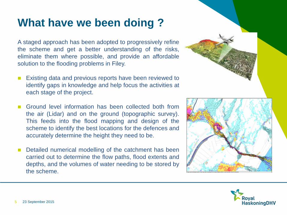
Ground level information has been collected both from
the air (Lidar) and on the ground (topographic survey).
This feeds into the flood mapping and design of the
scheme to identify the best locations for the defences and
accurately determine the height they need to be.
Detailed numerical modelling of the catchment has been
carried out to determine the flow paths, flood extents and
depths, and the volumes of water needing to be stored by
the scheme.
5
23 September 2015
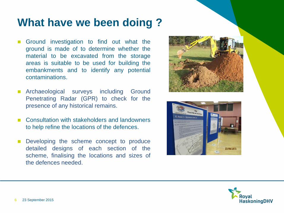
What have we been doing ?
Ground investigation to find out what the
ground is made of to determine whether the
material to be excavated from the storage
areas is suitable to be used for building the
embankments and to identify any potential
contaminations.
Archaeological surveys including Ground
Penetrating Radar (GPR) to check for the
presence of any historical remains.
Consultation with stakeholders and landowners
to help refine the locations of the defences.
Developing the scheme concept to produce
detailed designs of each section of the
scheme, finalising the locations and sizes of
the defences needed.
6
23 September 2015
What have we been doing ?
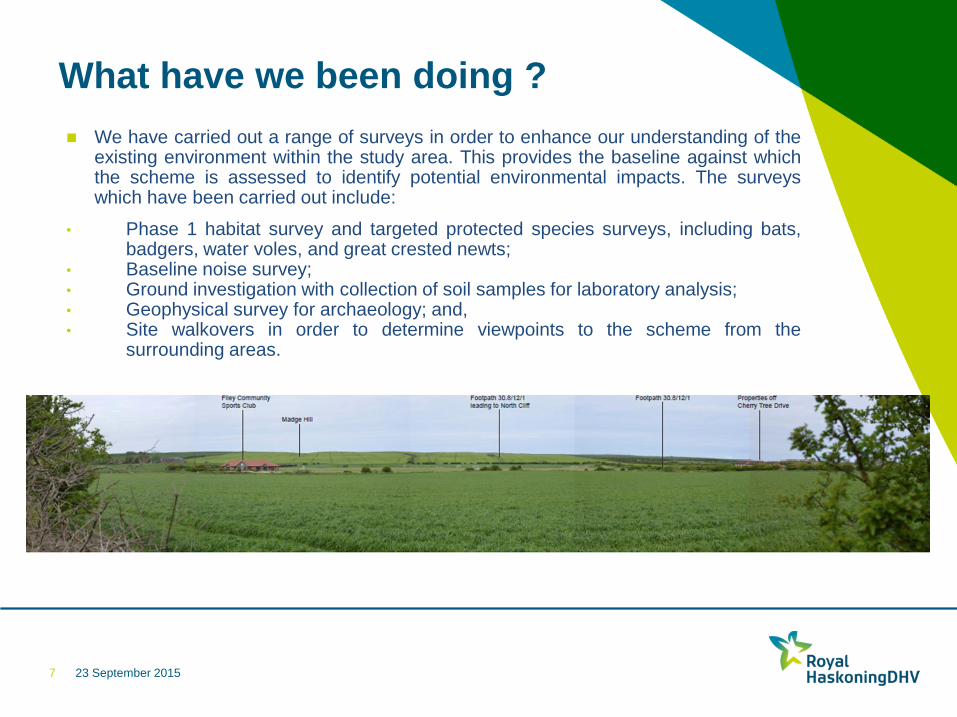
We have carried out a range of surveys in order to enhance our understanding of the existing environment within the study area. This provides the baseline against which the scheme is assessed to identify potential environmental impacts. The surveys which have been carried out include:
• Phase 1 habitat survey and targeted protected species surveys, including bats, badgers, water voles, and great crested newts;
• Baseline noise survey; • Ground investigation with collection of soil samples for laboratory analysis; • Geophysical survey for archaeology; and, • Site walkovers in order to determine viewpoints to the scheme from the
surrounding areas.
7
23 September 2015
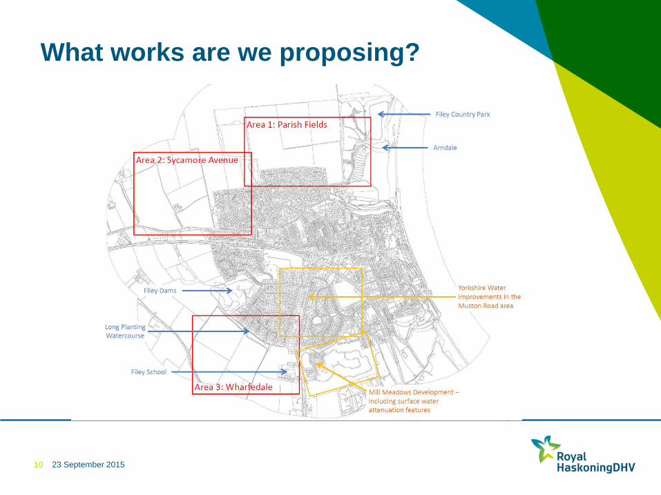
What works are we proposing?
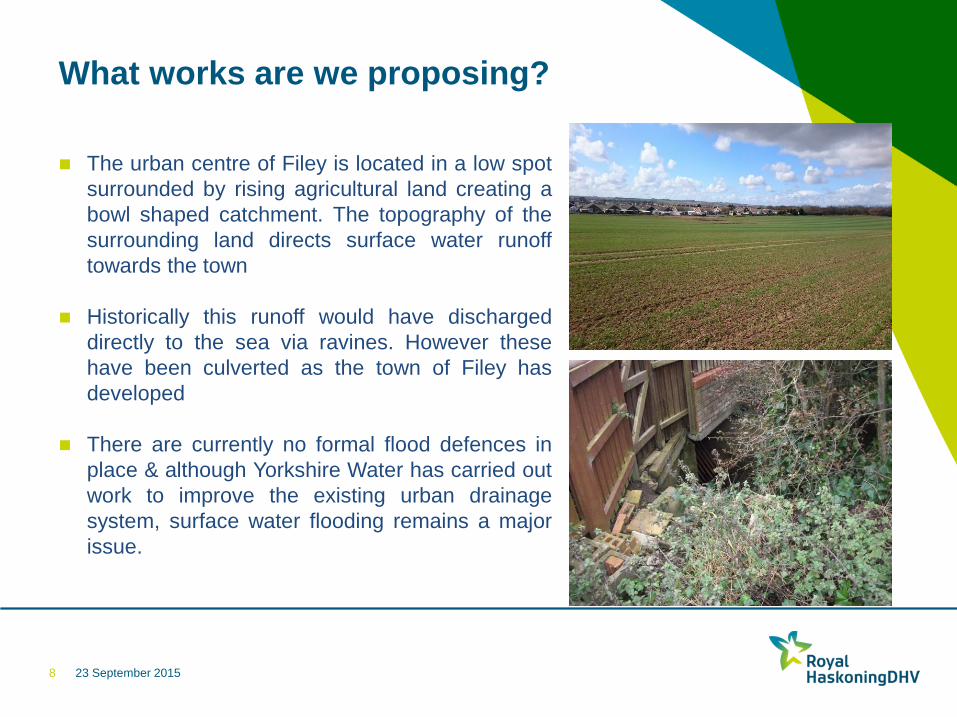
The urban centre of Filey is located in a low spot
surrounded by rising agricultural land creating a
bowl shaped catchment. The topography of the
surrounding land directs surface water runoff
towards the town
Historically this runoff would have discharged
directly to the sea via ravines. However these
have been culverted as the town of Filey has
developed
There are currently no formal flood defences in
place & although Yorkshire Water has carried out
work to improve the existing urban drainage
system, surface water flooding remains a major
issue.
8
23 September 2015
What works are we proposing?
The proposed scheme comprises:
A series of earth embankments to encircle larges areas
of the town
Storage areas at specific locations to temporarily store
floodwater before it is released at a controlled rate into
the existing urban drainage system and ravines once
the storm has passed.
Land raising
Drainage channels and culverts to redirect floodwater
flows ditches.
9
23 September 2015
What works are we proposing?
10
23 September 2015
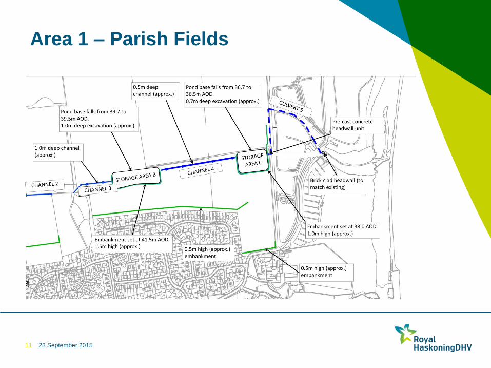
Area 1 – Parish Fields
11
23 September 2015
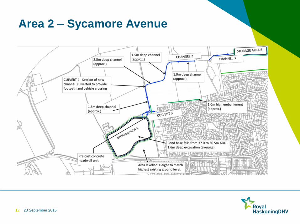
Area 2 – Sycamore Avenue
12
23 September 2015
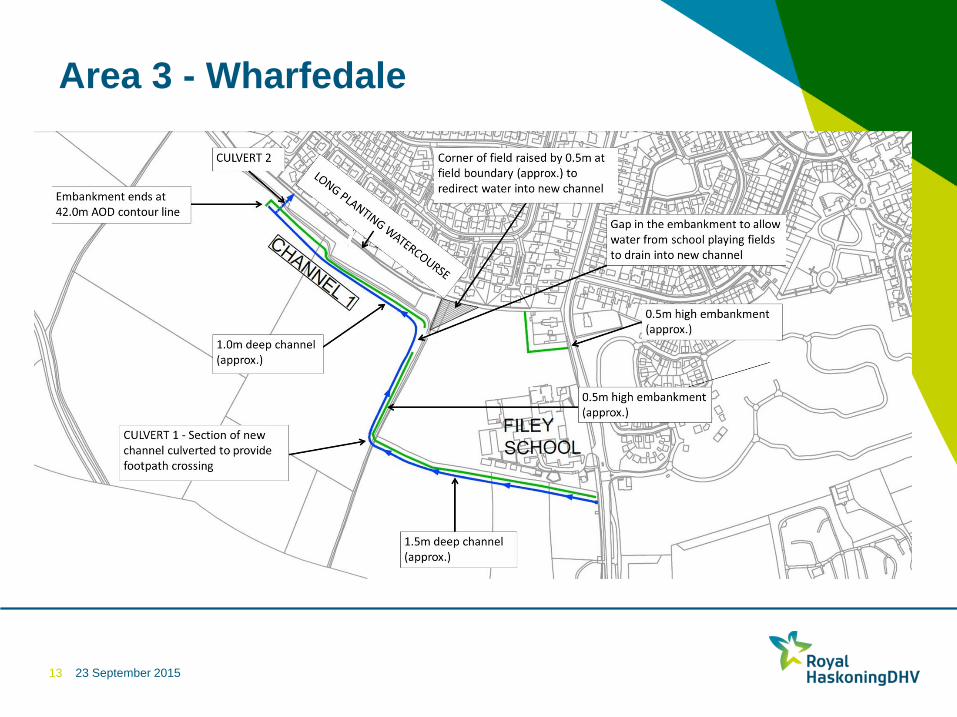
Area 3 - Wharfedale
13
Corner of field raised by 0.5m at field boundary (approx.) to redirect water into new channel
0.5m high embankment (approx.)
1.5m deep channel (approx.)
Embankment ends at 42.0m AOD contour line
0.5m high embankment (approx.)
1.0m deep channel (approx.)
Gap in the embankment to allow water from school playing fields to drain into new channel
CULVERT 2
CULVERT 1 - Section of new channel culverted to provide footpath crossing
23 September 2015
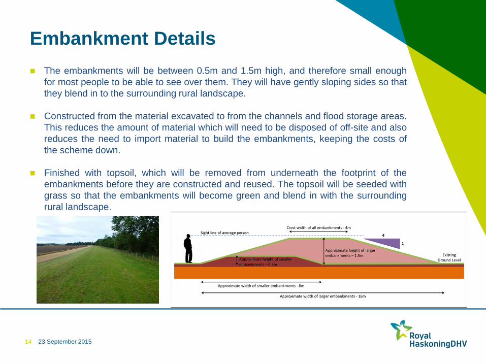
Embankment Details
The embankments will be between 0.5m and 1.5m high, and therefore small enough
for most people to be able to see over them. They will have gently sloping sides so that
they blend in to the surrounding rural landscape.
Constructed from the material excavated to from the channels and flood storage areas.
This reduces the amount of material which will need to be disposed of off-site and also
reduces the need to import material to build the embankments, keeping the costs of
the scheme down.
Finished with topsoil, which will be removed from underneath the footprint of the
embankments before they are constructed and reused. The topsoil will be seeded with
grass so that the embankments will become green and blend in with the surrounding
rural landscape.
14
23 September 2015
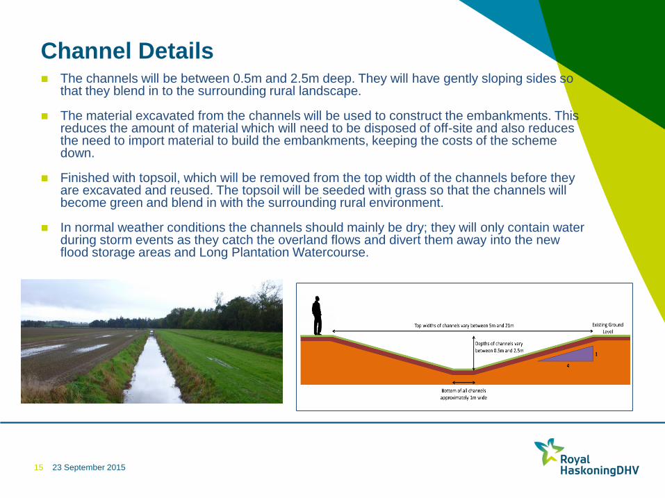
Channel Details
The channels will be between 0.5m and 2.5m deep. They will have gently sloping sides so that they blend in to the surrounding rural landscape.
The material excavated from the channels will be used to construct the embankments. This reduces the amount of material which will need to be disposed of off-site and also reduces the need to import material to build the embankments, keeping the costs of the scheme down.
Finished with topsoil, which will be removed from the top width of the channels before they are excavated and reused. The topsoil will be seeded with grass so that the channels will become green and blend in with the surrounding rural environment.
In normal weather conditions the channels should mainly be dry; they will only contain water during storm events as they catch the overland flows and divert them away into the new flood storage areas and Long Plantation Watercourse.
15
23 September 2015
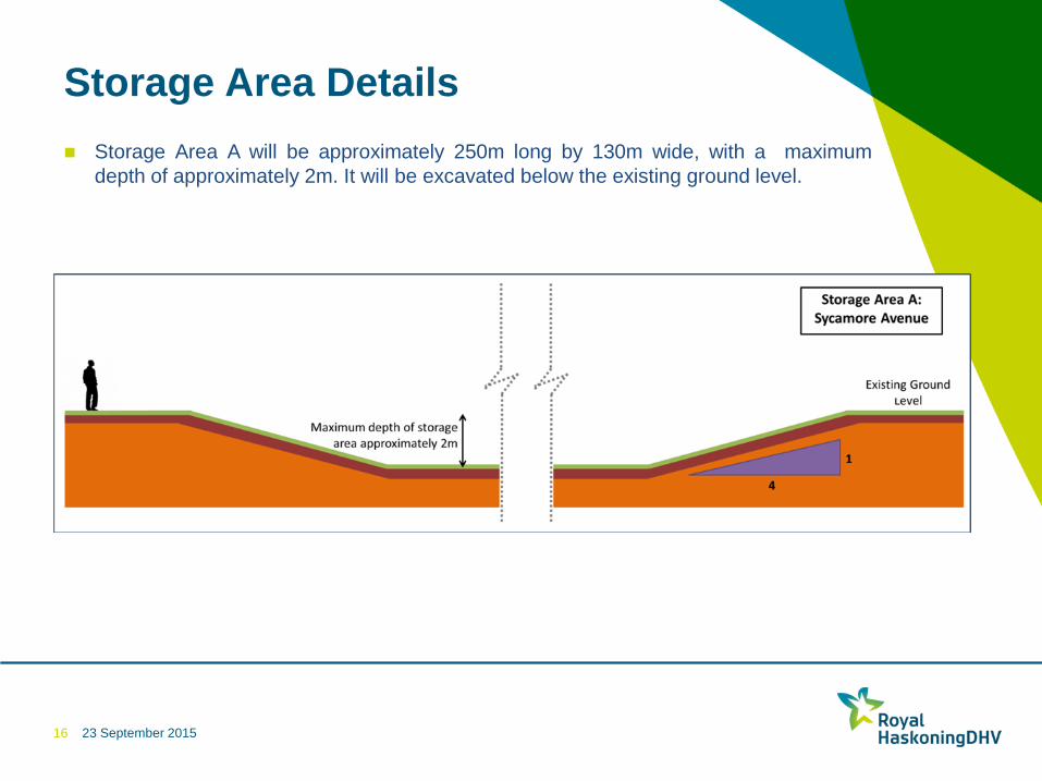
Storage Area Details
Storage Area A will be approximately 250m long by 130m wide, with a maximum
depth of approximately 2m. It will be excavated below the existing ground level.
16
23 September 2015
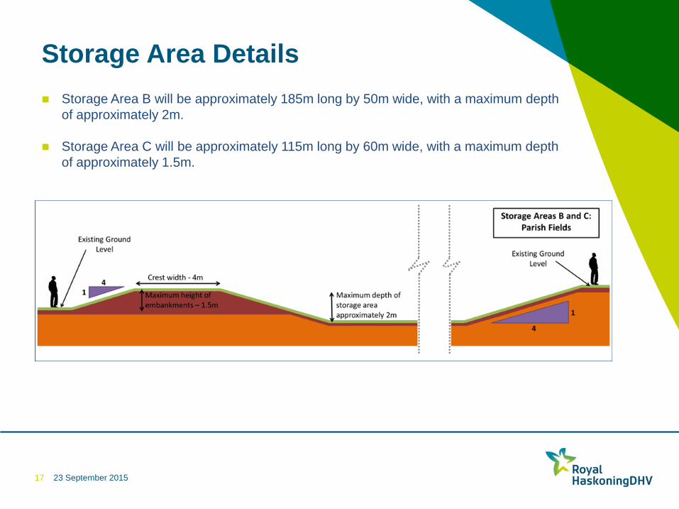
Storage Area Details
17
Storage Area B will be approximately 185m long by 50m wide, with a maximum depth
of approximately 2m.
Storage Area C will be approximately 115m long by 60m wide, with a maximum depth
of approximately 1.5m.
23 September 2015
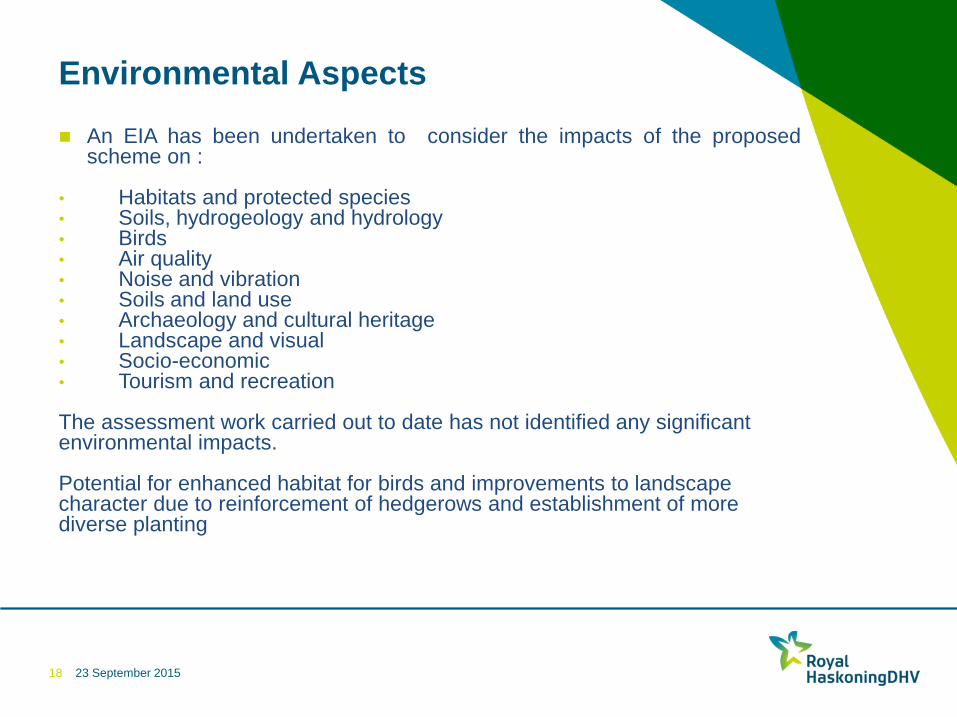
Environmental Aspects
An EIA has been undertaken to consider the impacts of the proposed
scheme on :
• Habitats and protected species • Soils, hydrogeology and hydrology • Birds • Air quality • Noise and vibration • Soils and land use • Archaeology and cultural heritage • Landscape and visual • Socio-economic • Tourism and recreation The assessment work carried out to date has not identified any significant environmental impacts. Potential for enhanced habitat for birds and improvements to landscape character due to reinforcement of hedgerows and establishment of more diverse planting
18
23 September 2015
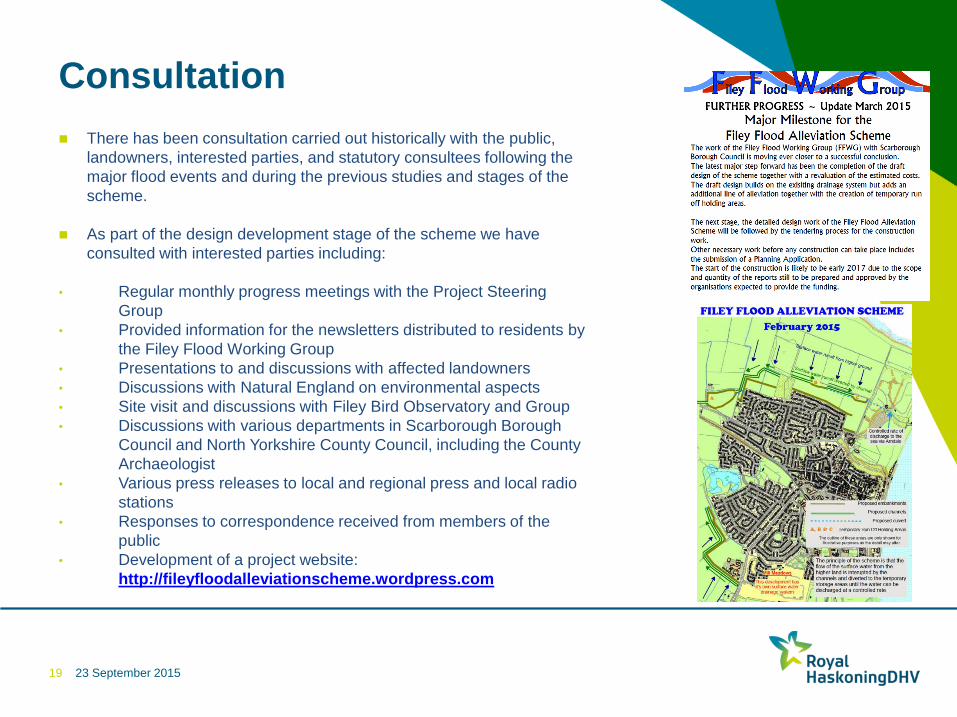
Consultation
19
There has been consultation carried out historically with the public,
landowners, interested parties, and statutory consultees following the
major flood events and during the previous studies and stages of the
scheme.
As part of the design development stage of the scheme we have
consulted with interested parties including:
• Regular monthly progress meetings with the Project Steering
Group
• Provided information for the newsletters distributed to residents by
the Filey Flood Working Group
• Presentations to and discussions with affected landowners
• Discussions with Natural England on environmental aspects
• Site visit and discussions with Filey Bird Observatory and Group
• Discussions with various departments in Scarborough Borough
Council and North Yorkshire County Council, including the County
Archaeologist
• Various press releases to local and regional press and local radio
stations
• Responses to correspondence received from members of the
public
• Development of a project website:
http://fileyfloodalleviationscheme.wordpress.com
23 September 2015
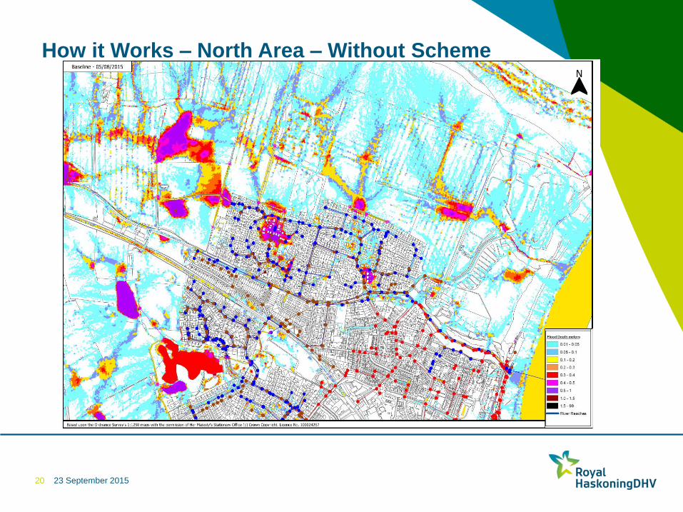
How it Works – North Area – Without Scheme
20
23 September 2015
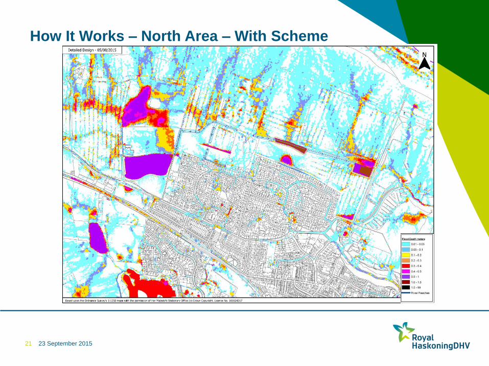
How It Works – North Area – With Scheme
21
23 September 2015
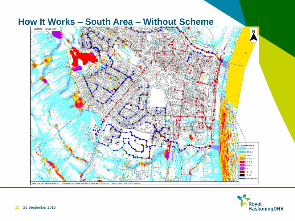
How It Works – South Area – Without Scheme
22
23 September 2015
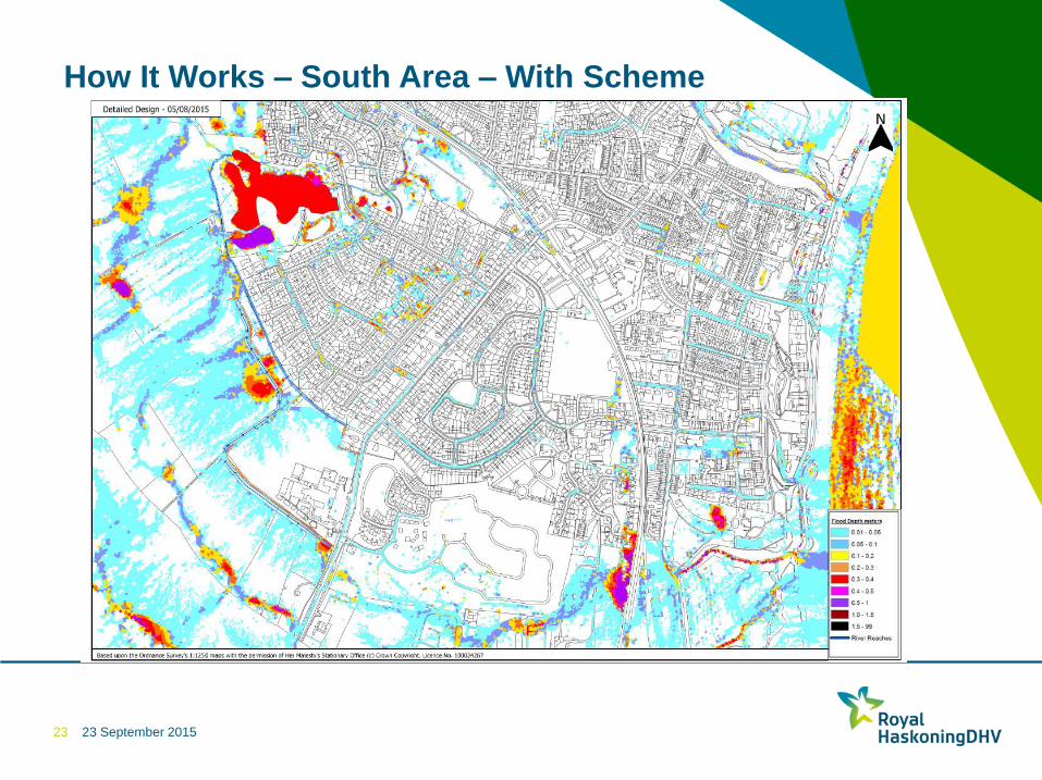
How It Works – South Area – With Scheme
23
23 September 2015
Scheme Benefits
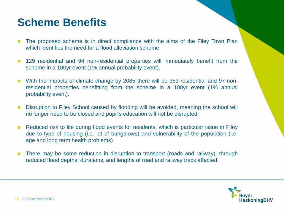
The proposed scheme is in direct compliance with the aims of the Filey Town Plan
which identifies the need for a flood alleviation scheme.
129 residential and 94 non-residential properties will immediately benefit from the
scheme in a 100yr event (1% annual probability event).
With the impacts of climate change by 2085 there will be 353 residential and 97 non-
residential properties benefitting from the scheme in a 100yr event (1% annual
probability event).
Disruption to Filey School caused by flooding will be avoided, meaning the school will
no longer need to be closed and pupil’s education will not be disrupted.
Reduced risk to life during flood events for residents, which is particular issue in Filey
due to type of housing (i.e. lot of bungalows) and vulnerability of the population (i.e.
age and long term health problems)
There may be some reduction in disruption to transport (roads and railway), through
reduced flood depths, durations, and lengths of road and railway track affected.
24
23 September 2015
Scheme Benefits
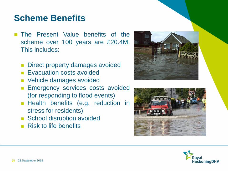
The Present Value benefits of the
scheme over 100 years are £20.4M.
This includes:
Direct property damages avoided
Evacuation costs avoided
Vehicle damages avoided
Emergency services costs avoided
(for responding to flood events)
Health benefits (e.g. reduction in
stress for residents)
School disruption avoided
Risk to life benefits
25

23 September 2015
ANY QUESTIONS ?
26