Figure 15. Overview of UPS3. -...
10
UPPER PATUXENT RIVER WATERSHED RESTORATION ACTION STRATEGY 51 Figure 15. Overview of UPS3.
Transcript of Figure 15. Overview of UPS3. -...

UPPER PATUXENT RIVER WATERSHED RESTORATION ACTION STRATEGY
51
Figure 15. Overview of UPS3.
UPPER PATUXENT RIVER WATERSHED RESTORATION ACTION STRATEGY
52
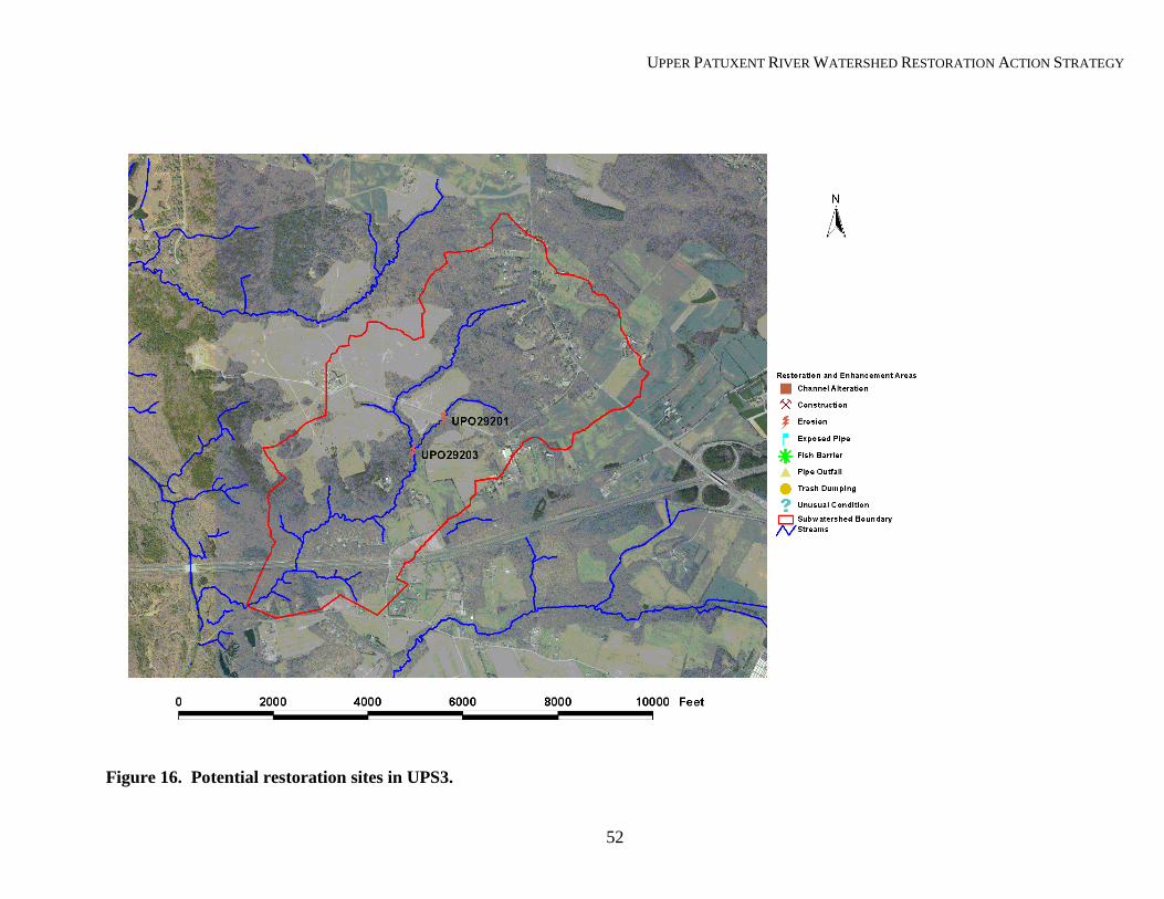
Figure 16. Potential restoration sites in UPS3.

UPPER PATUXENT RIVER WATERSHED RESTORATION ACTION STRATEGY
53
UPS4—Unnamed Tributary to the Patuxent River. This subwatershed is located in the southern portion of the Upper Patuxent River watershed area between US Route 50 and Central Avenue (MD 214). It has a drainage area of approximately 2 square miles. As illustrated in Figure 17, US Route 50 runs along the northern edge of the watershed. Other major roads crossing the subwatershed include MD 424, Patuxent River Road, and Governor Bridge Road. Four water chemistry and four biological monitoring stations were established in the subwatershed for this study. In addition, one fish sampling station was established. Land Use. Land use within this subwatershed is summarized in the table below: Table 24. Land Use Summary for UPS4
As illustrated in Figure 17, this subwatershed has over 50% of its area dedicated to agricultural land uses while approximately 16% is used for residential land. Most of the nearly 19% of vacant land is currently forested and is zoned residential agriculture. The current level of watershed impervious surface is approximately 2% and is
anticipated to reach 5% at full build-out conditions. Natural Resources. As described in the National Wetlands Inventory, approximately 17 acres of this watershed have been mapped as wetlands. Most of these sites are created open water systems and are likely farm ponds created to control erosion from the surrounding crop fields. A total of about 5.6 miles of stream channel drain this subwatershed. Watershed Conditions. The BCS results for UPS4 are summarized below: Table 25. BCS Summary for UPS4
Metric Group Metric Group Score Condition Rating Water Quality Conditions 8 Fair Living Resource Conditions 51 Poor Habitat Conditions 96 Poor Landscape Conditions 68 Fair Hydrologic Conditions 8 Fair Overall BCS 231 Poor The overall BCS is rated poor and this subwatershed shows signs of degradation. As described in Pavlik and Stribling (2003), biological conditions were judged to be very poor based on aquatic invertebrate populations. However, with the exception of the most upstream sample station, habitat conditions were found to be partially supporting. Fish sampling found only 4 species, most of which are considered pollution tolerant. The dearth of fish species could be related to the fish blockages described in Table 26. In general, habitat conditions should support a more robust community of fish and invertebrates.
Land Use Acres % of Area Agriculture 686.0 54.2 Water 4.2 0.3 Open Space 36.0 2.8 Single Family Residential 199.9 15.8 Retail 2.8 0.2 Utility/Roadway Right-of-Way 100.3 7.9 Vacant Land 236.5 18.7
Total Area 1265.8 100.0

UPPER PATUXENT RIVER WATERSHED RESTORATION ACTION STRATEGY
54
As described in DNR (2002b), headwater concentration values of orthophosphate were about twice as high (0.011 versus 0.006 mg/L) as in stations located in the lower portion of the watershed. This could be related to the high levels of cropland surrounding the stream in the upper portions of the subwatershed. In addition, these reaches drain some of the most intensely developed portions of the subwatershed. This development may have an additional effect on water quality, impacting parameters such as heavy metals and other toxic substances, measurement of which was beyond the scope of this assessment. Finally, the large amount of agricultural land likely generates runoff contaminated with herbicides and pesticides, which might explain the depressed biological community. However, these parameters were not measured in this assessment. Watershed Improvement Activities. Based on conditions and land use characteristics in this subwatershed, the following general recommendations are made:
• Investigate downstream of the assessment area to determine if natural or manmade fish passage impediments exist and correct as necessary;
• Work with the Soil Conservation District and the Anne Arundel County Department of Public Works to determine the distribution of best management practices in the subwatershed;
• Improve buffer and stream channel conditions in the eastern headwater reaches; and • Consider performing additional water quality assessments to determine if currently
unmeasured pollutants are impacting biological communities. Figure 18 and Table 26 denote specific restoration or enhancement projects for this subwatershed. For projects UPO32103 and UPO32104, UPQ31103 and UPR31101, and UPP31102 and UPP31105, there are likely linkages between erosion and other channel disturbances. Consequently, these projects should be combined for future diagnostic work necessary to support restoration designs for these problem reaches.

UPPER PATUXENT RIVER WATERSHED RESTORATION ACTION STRATEGY
55
Table 26. Description and Ranking of Restoration Projects in UPS4
SCA Site Number
Project Type Project Description Subwatershed
Priority Ranking Notes
UPQ31103 FB Perched road crossing 1
UPR31101 CA/UC In-stream pond removal/retrofit, riparian area restoration 1
The blockage is downstream of 2200’ of highly altered reach. Appears to be headwaters converted to agricultural drainage. These projects should be done in tandem. Further investigation needed to determine project feasibility
UPO31104 PO 18-inch pipe from agricultural area. 3 Rotten egg smell observed in discharge. Water quality investigation should be performed.
UPO32103 FB Severely perched culvert road crossing 3
UPO32104 ES 10 feet high, 300 feet long eroding bank 3
Crossing under Patuxent River Road. Erosion downstream of culvert. Projects should be done concurrently. Additional diagnostic study needed for design.
UPO32101 TD Extensive dump comprised of residential and industrial trash 6 Professional clean-up suggested due
to nature, extent of trash. UPP31102 ES 4 feet high, 2200 feet long eroding bank 7
UPP31105 ES 4 feet high, 2500 feet long eroding bank 7
These projects are in close proximity to each other and downstream of UPR31101. Additional study necessary to determine cause of instability.

UPPER PATUXENT RIVER WATERSHED RESTORATION ACTION STRATEGY
56
Figure 17. Overview of UPS4.

UPPER PATUXENT RIVER WATERSHED RESTORATION ACTION STRATEGY
57
Figure 18. Potential restoration sites in UPS4.

UPPER PATUXENT RIVER WATERSHED RESTORATION ACTION STRATEGY
58
UPS6—Unnamed Tributary to the Patuxent River. This subwatershed is located in the southern portion of the Upper Patuxent River watershed area, just north of Kings Branch and northwest of Davidsonville. It has a drainage area of just under one square mile. Three water chemistry, three biological monitoring stations, and one fish sampling station were established in the subwatershed for this assessment. Land Use. Land use in UPS6 is summarized in the table below: Table 27. Land Use Summary for UPS6
As illustrated in Figure 19, this subwatershed has almost 56% of its area dedicated to agricultural land uses, the highest amount of any watershed assessed in Anne Arundel County during the
WRAS. Single family residential along with open space and vacant land uses, which have been combined into a forest category, comprise the remaining land uses in UPS6. The current level of watershed impervious surface is estimated at 2% and predicted to reach 5% at full build-out conditions. Natural Resources. A total of 2.5 miles of stream channel drain this subwatershed. No NWI wetlands are mapped in this subwatershed, and only 20 acres are mapped as having hydric soils, mostly on agricultural lands. As mentioned above, approximately 26% of the subwatershed is in forest cover, mostly concentrated in one large block in the northwestern corner of the subwatershed, with the balance distributed primarily within the riparian area. Watershed Conditions. The BCS results for UPS6 are summarized below: Table 28. BCS Summary for UPS6
Metric Group Metric Group Score Condition Rating Water Quality Conditions 14 Poor Living Resource Conditions 51 Poor Habitat Conditions 99 Poor Landscape Conditions 67 Fair Hydrologic Conditions 6 Good Overall BCS 237 Poor UPS6 had the second worst BCS of all the subwatersheds, in Anne Arundel County, examined in this assessment. While this subwatershed shows signs of degradation, and the overall condition score is poor, this evaluation is based on incomplete SCA work. Portions of the stream, located on private property, were not assessed because landowners did not grant access to DNR crews. It is not known how including these reaches might have impacted the overall BCS score. As described in Pavlik and Stribling (2003), biological conditions were judged to be poor based on aquatic invertebrate populations. Habitat conditions were judged to be partially supporting.
Land Use Acres % of Area Agriculture 333.1 55.4 Forest (Open Space and Vacant Land) 155.6 26.0 Single Family Residential 112.0 18.6
Total Area 600.6 100.0

UPPER PATUXENT RIVER WATERSHED RESTORATION ACTION STRATEGY
59
During fish sampling, only one species (blacknose dace, Rhinichthys atratulus), was observed at the sample station (DNR, 2002b). In both Pavlik and Stribling (2003) and DNR (2002b), a significant fish blockage was observed downstream of the starting point for the SCA assessment. This could explain the lack of fish species in this stream. However, habitat conditions match the observed biological community, excluding fish populations. Erosion is a moderate problem in this subwatershed. The SCA data described moderate or greater erosion in approximately 16% of assessed reaches. While the precise causes of the observed problems are unknown, they are likely related to increased runoff from developed areas, alterations caused by roads crossing the stream, and/or remnants of historical agricultural practices. As described in DNR (2002b), orthophosphate concentrations coming from the northern headwater station were about twice as high (0.011 versus ~0.005 mg/L) as in stations located in the lowest portion of the watershed and draining the southeastern headwaters. The reason for elevated levels in this forested area versus elsewhere in the subwatershed is not known, but it is possible that moderate rains a few days before sampling might have mobilized sediment that was still in the water column when samples were taken. However, less sediment is usually expected from forested areas compared to other areas. It is possible that other erosion sites located within the forest, not judged severe by SCA crews, could be generating sufficient sediment to elevate orthophosphate levels. It is also possible that septic system effluent could be adversely impacting stream water quality, although phosphorous loading from septic systems is thought to be limited (Novotny and Olem, 1994). Additional investigation is required to determine if this is the case. Watershed Improvement Activities. Based on conditions and land use characteristics in this subwatershed, the following general recommendations are made:
• Investigate downstream of assessment area to determine if natural or manmade fish passage impediments exist and correct as necessary;
• Work with the Soil Conservation District and the Anne Arundel County Department of Public Works to determine the distribution of best management practices in the subwatershed;
• Determine feasibility of wetland restoration on agricultural hydric soil areas; • Improve buffer and stream channel conditions in the eastern headwater reaches; and • Consider performing additional water quality assessments to determine the sources of
sediment/elevated orthophosphate levels from the northern headwater area. Specific restoration or enhancement projects recommended for this subwatershed are listed in Table 29 and shown in Figure 20.

UPPER PATUXENT RIVER WATERSHED RESTORATION ACTION STRATEGY
60
Table 29. Description and Ranking of Priority Projects in UPS6.
SCA Site Number
Project Type Project Description
Subwatershed Priority Ranking
Notes
-- FB High blockage
downstream of Patuxent River Road
1 Not assessed during
SCA. Requires additional investigation.
UPP34102 ES Eroding bank 5 feet high, 2000 feet long 1
Pasture adjacent to stream. Limit animal
access, investigate possible solutions to
stream instability.
UPP35101 FB Double corrugated metal pipes too shallow for fish
passage 2
Actual extent of problem requires
additional investigation. Photos make this site
appear not as severe as other passage projects.
UPP35102 ES Eroding bank 5 feet high, 1800 feet long 3
Might be related to residential development
along stream.
UPP34108 ES Eroding bank 8 feet high, 1600 feet long 4 Downstream of crossing
at Double Gate Road
UPP35103 UC Orange flocculent
covering entire stream bottom
4 Unknown cause. Could be natural.