Field Assignment Geology 103
23
Thunder Mountain Kirkwood, CA Mary Simpson Geology 103 Professor Lawler
-
Upload
mary-simpson -
Category
Education
-
view
77 -
download
1
Transcript of Field Assignment Geology 103
Thunder Mountain
Kirkwood, CA
Mary SimpsonGeology 103
Professor Lawler
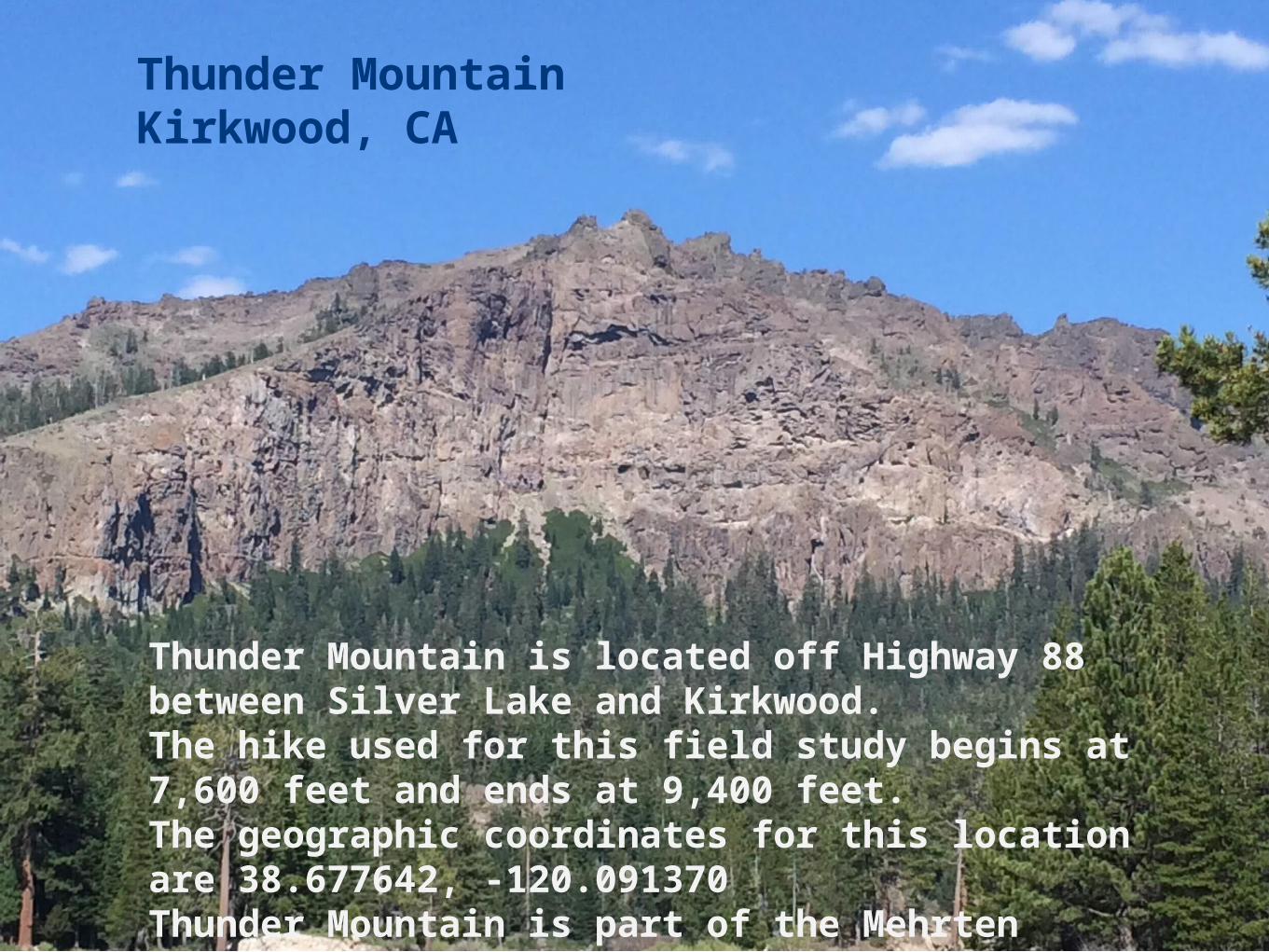
Thunder MountainKirkwood, CA
Thunder Mountain is located off Highway 88 between Silver Lake and Kirkwood. The hike used for this field study begins at 7,600 feet and ends at 9,400 feet. The geographic coordinates for this location are 38.677642, -120.091370Thunder Mountain is part of the Mehrten Formation
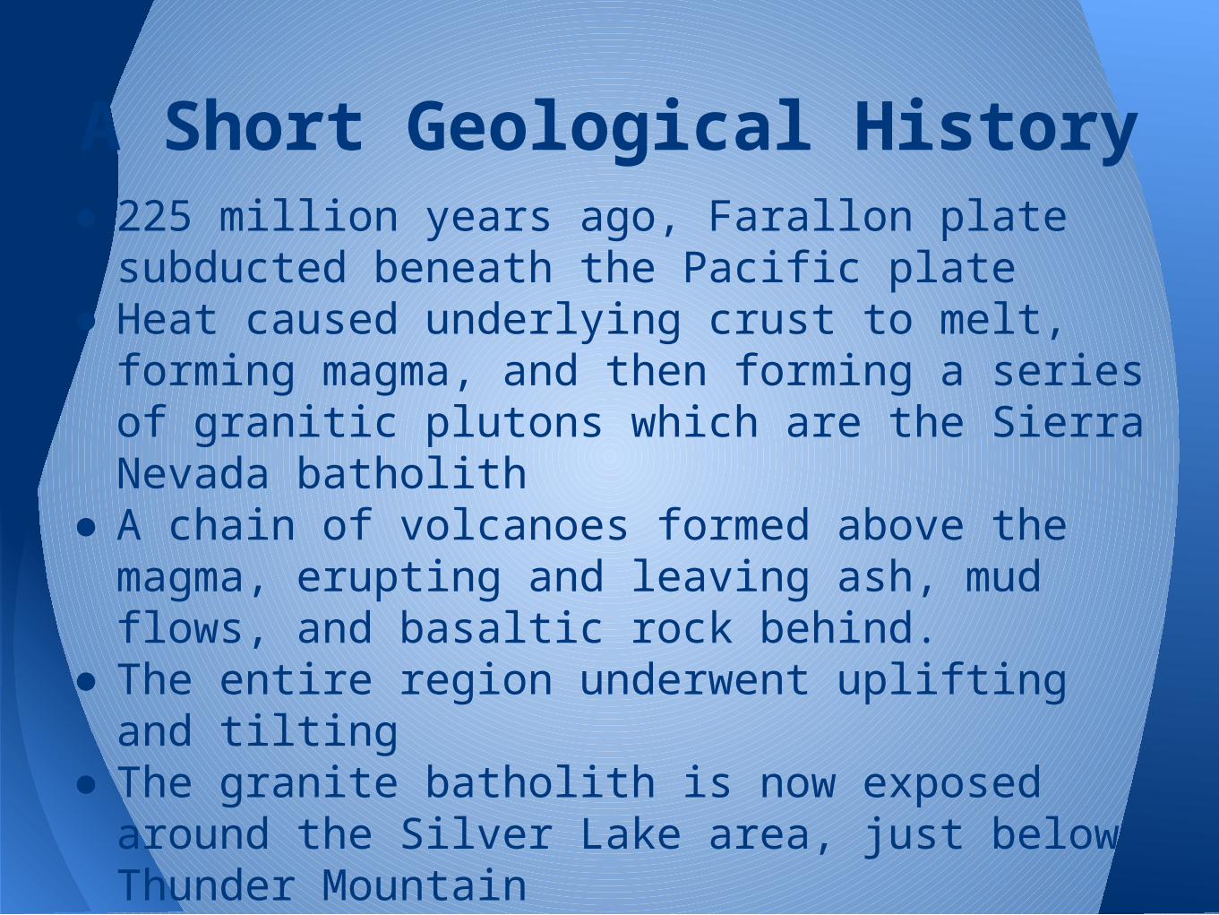
● 225 million years ago, Farallon plate subducted beneath the Pacific plate
● Heat caused underlying crust to melt, forming magma, and then forming a series of granitic plutons which are the Sierra Nevada batholith
● A chain of volcanoes formed above the magma, erupting and leaving ash, mud flows, and basaltic rock behind.
● The entire region underwent uplifting and tilting
● The granite batholith is now exposed around the Silver Lake area, just below Thunder Mountain
● Thunder Mountain is primarily made up of mud and ash flow remnants (TUSD.org, n.d.)
A Short Geological History

Part 1
Evidence of Change Over
Time
31
2
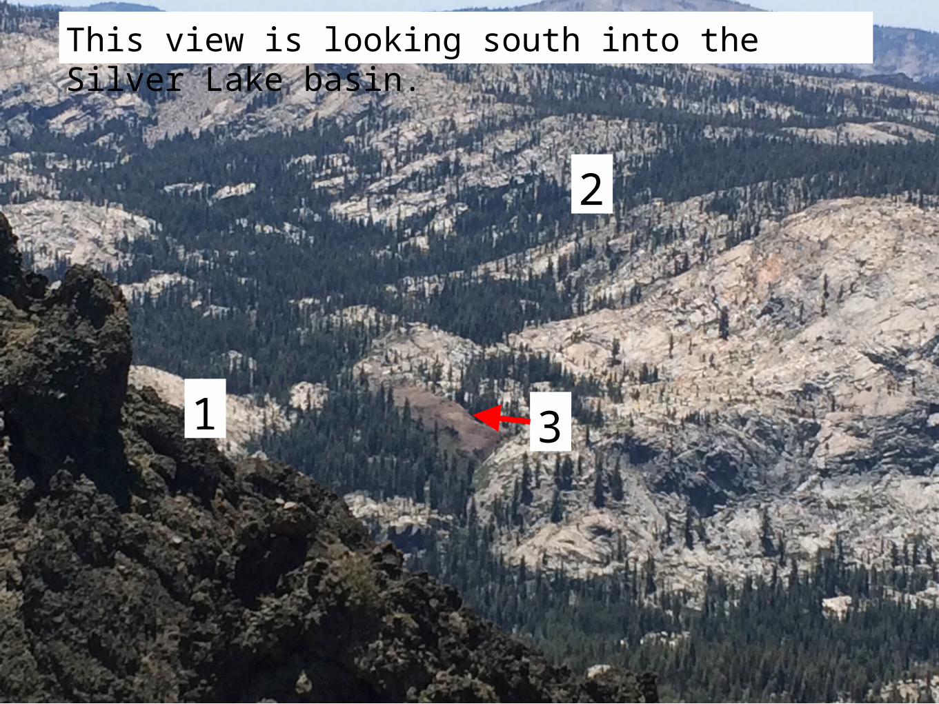
This view is looking south into the Silver Lake basin.
The Mountain• A granitic batholith sits beneath the mountain, formed during the Triassic Period
• Uplift, tilting, and volcanic action followed, building the mountain to its current height of 9,400 feet
• Deposits of volcanic tuff and ash flow are most likely from the late Miocene (Busby, et. al. 2008)(1)
• The U-shaped valley is indicative of glaciation and erosion which took place during the Pleistocene(2)
• The massive pile of dirt is also indicative of on-going erosive forces of snow, wind, and rain as it breaks down the mountain and flows into the valley(3)
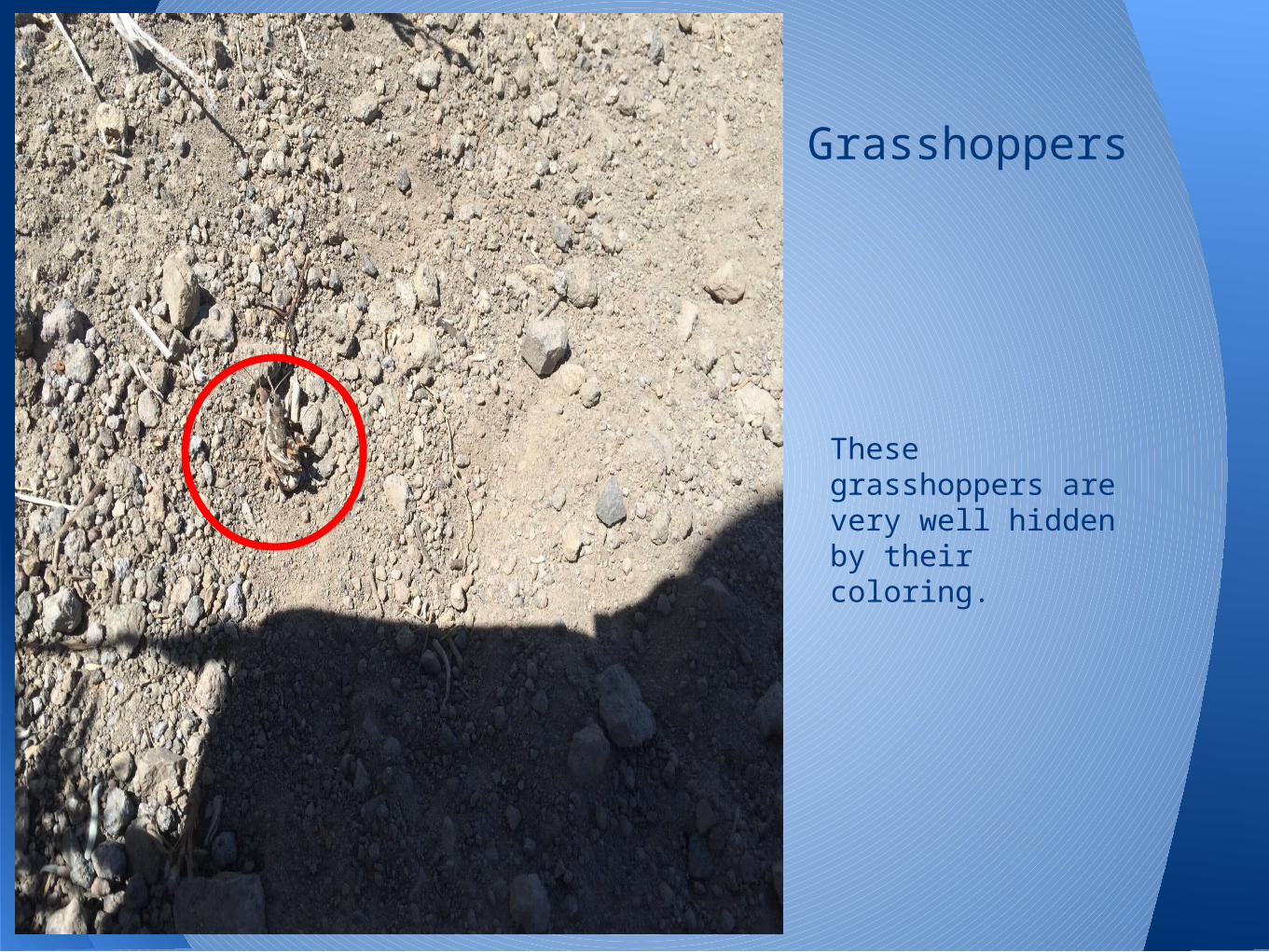
These grasshoppers are very well hidden by their coloring.
Grasshoppers
Grasshopper• Order Orthopera, Suborder Caeliferam Genus
Xanthippus• They are widely diverse• Stridulation causes a clicking or singing noise,
used for mating and warning• They eat plant and animal material• Their camouflage is an adaptation to hide
from predators - there are many varieties with differing camouflage for different habitats
• It is thought that they remain in egg formation during the harsh winters and appear in June after the snow melts - this makes them well-adapted to the harsh conditions in the high Sierra
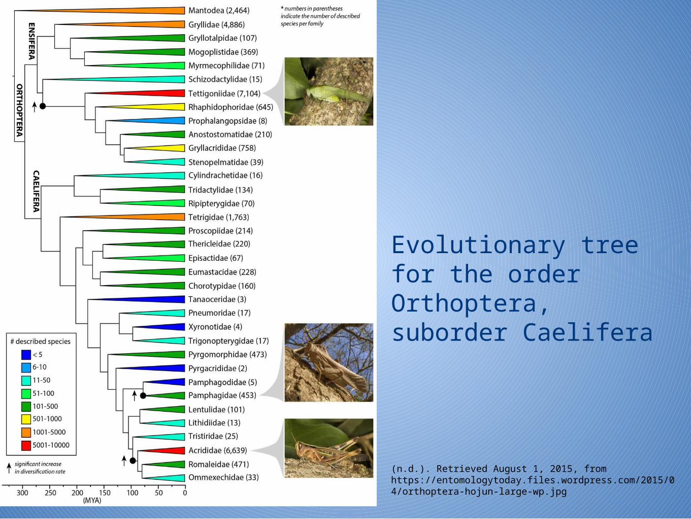
Evolutionary tree for the order Orthoptera, suborder Caelifera
(n.d.). Retrieved August 1, 2015, from https://entomologytoday.files.wordpress.com/2015/04/orthoptera-hojun-large-wp.jpg
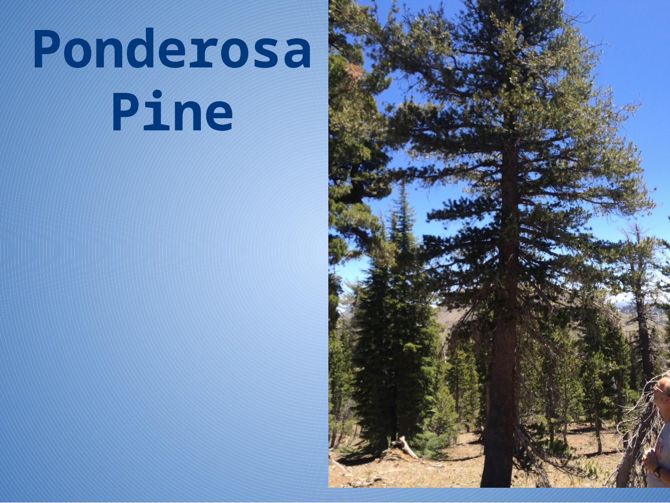
Ponderosa Pine
• Species: Pinus Ponderosa• Thick bark protects against fire•Fires destroy undergrowth allowing the pines to flourish and survive
•Commonly used species for tree-ring dating•Large trees can live more than 500 years•Exact origin is unknown•Oldest fossil is 600,000 years old, found in West Central Nevada (Bettancourt, 1990)
•Thrives in basaltic soil•Evidence of genetic diversity indicates this survived the glaciation of the Pleistocene Epoch (Meisenbach, 2003)

Part 2
Rocks!
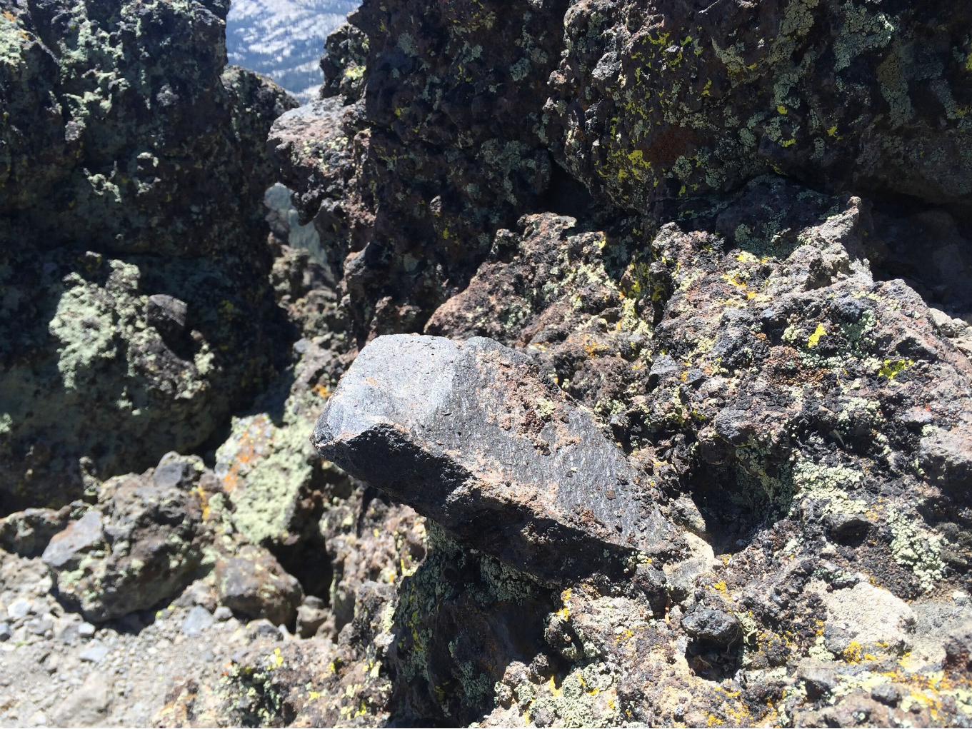
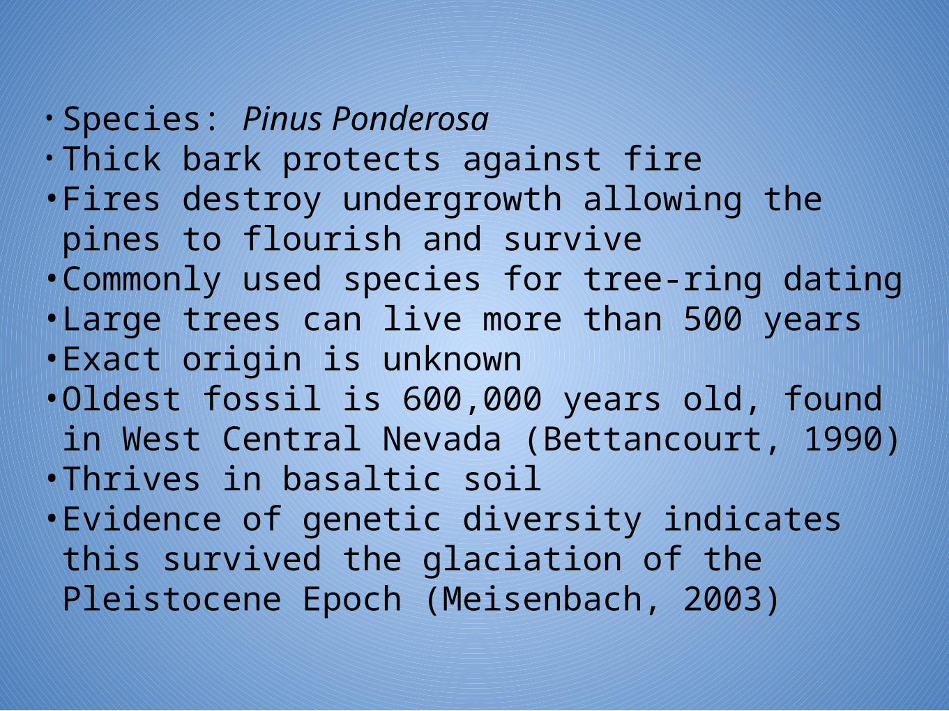
BrecciaThis is an example of breccia. At first I thought this was conglomerate, but the clasts are angular in nature, indicating they were carried a short distance with minimal erosion. Conglomerate has rounded clasts.
Breccia is plentiful in the Thunder Mountain area. During the Nevadan Orogeny, mud and ash flowed down the mountain collecting country rock as it did, then hardening into the breccia we see today.
This occurred during the late Jurassic period.This is a clastic sedimentary rock.
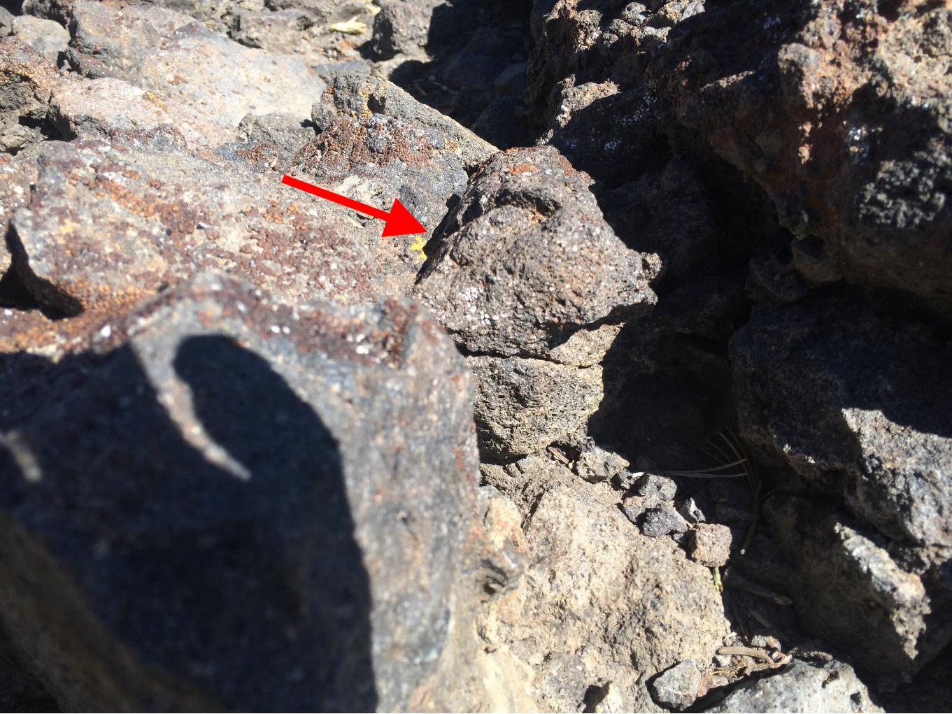
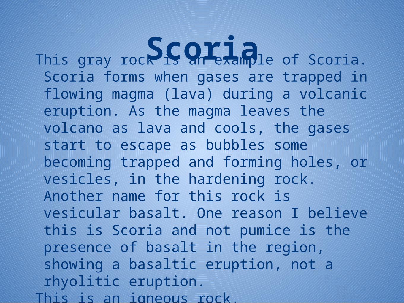
ScoriaThis gray rock is an example of Scoria. Scoria forms when gases are trapped in flowing magma (lava) during a volcanic eruption. As the magma leaves the volcano as lava and cools, the gases start to escape as bubbles some becoming trapped and forming holes, or vesicles, in the hardening rock. Another name for this rock is vesicular basalt. One reason I believe this is Scoria and not pumice is the presence of basalt in the region, showing a basaltic eruption, not a rhyolitic eruption.
This is an igneous rock.
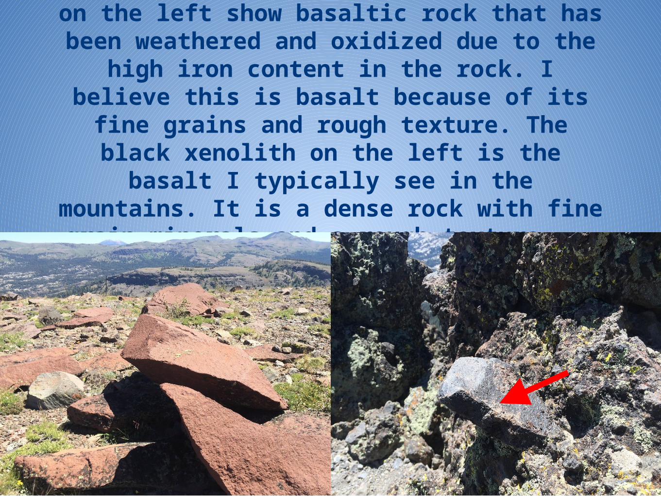
Two examples of basalt. The red rocks on the left show basaltic rock that has been weathered and oxidized due to the high iron content in the rock. I believe this is
basalt because of its fine grains and rough texture. The black xenolith on the
left is the basalt I typically see in the mountains. It is a dense rock with fine grain minerals and a rough texture.
Basalt• Basalt is a fine grained, dark igneous rock formed
from quickly cooling lava flows. • It contains primarily plagioclase and pyroxene
minerals. • The red rock had me puzzled. In researching, I
found andesite to also be a possibility for this rock, which is still a basaltic rock, but a rock somewhat between basalt and granite. (William Rowe, Paul Carpenter)(King,2015)
• This is an igneous rock.

Part 3
Relative Dating
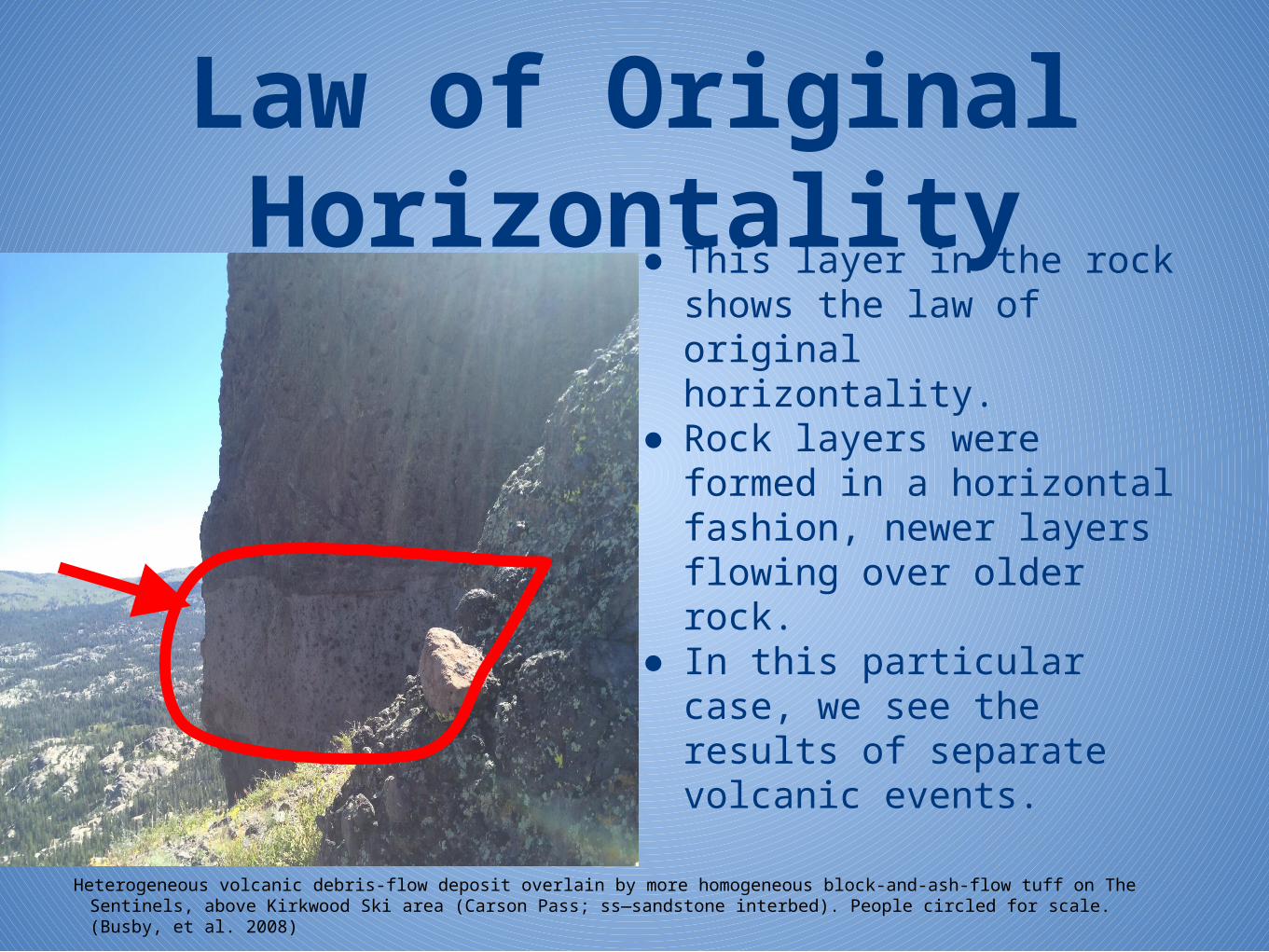
Law of Original Horizontality
● This layer in the rock shows the law of original horizontality.
● Rock layers were formed in a horizontal fashion, newer layers flowing over older rock.
● In this particular case, we see the results of separate volcanic events.
Heterogeneous volcanic debris-flow deposit overlain by more homogeneous block-and-ash-flow tuff on The Sentinels, above Kirkwood Ski area (Carson Pass; ss—sandstone interbed). People circled for scale. (Busby, et al. 2008)

Principle of Inclusions
I also found this example of an inclusion.
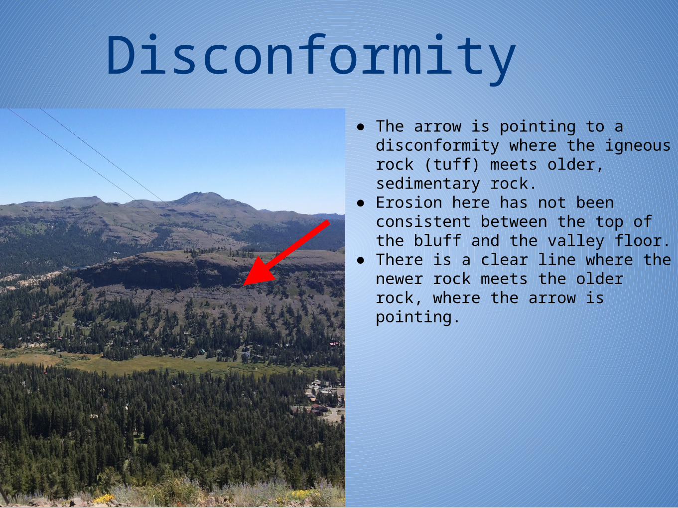
Disconformity● The arrow is pointing to a disconformity
where the igneous rock (tuff) meets older, sedimentary rock.
● Erosion here has not been consistent between the top of the bluff and the valley floor.
● There is a clear line where the newer rock meets the older rock, where the arrow is pointing.
(Unconformities, n.d.)

References• Basalt. (n.d.). Retrieved July 31, 2015, from http://geology.com/rocks/basalt.shtml • Betancourt, J.L. 1987. Paleoecology of pinyon-juniper woodlands: U.S. Department of Agriculture, Forest
Service, Intermountain Research Station.• Busby, C., Hagan, J., Piturka, K., Pluhar, C., Gans, P., Wagner, D., . . . Skilling, I. (2008). Retrieved July 31,
2015. • Carpenter, Paul. via Gmail• Evans, A. (2007). National Wildlife Federation field guide to insects and spiders & related species of North America. New
York: Sterling Pub. • Imai, T., Skilling, I., & Busby, C. (n.d.). Peperite-Fed Andesitic Debris Flows in the Miocene Mehrten
Formation, Kirkwood,. Retrieved July 31, 2015.• Kershner, B. (2008). National Wildlife Federation field guide to trees of North America. New York: Sterling Pub. • King, H. (n.d.). Andesite. Retrieved July 31, 2015. • Klots, A., & Klots, E. (1971). Insects of North America. New York: Doubleday. • Little, E. (1979). The Audobon Society field guide to North American trees, western region. New York: Knopf. • Marshall, S. (2008). 500 insects: A visual reference. Richmond Hill, Ont.: Firefly Books. • Milne, L., & Milne, M. (1995). National Audubon Society field guide to North American insects and spiders (A Chanticleer
Press ed.). New York: Knopf. • (n.d.). Retrieved August 1, 2015, from http://www.tusd.org/Portals/5/Teachers/.../Chapter 6 Section 4.do • (n.d.). Retrieved August 1, 2015, from https://entomologytoday.files.wordpress.com/2015/04/orthoptera-hojun-large-wp.jpg • Petrides, G., & Petrides, O. (1992). Western trees: Western United States and Canada. Boston: Houghton Mifflin. • Rowe, William. via Gmail• Scoria. (n.d.). Retrieved July 31, 2015, from http://geology.com/rocks/scoria.shtml • Unconformities. (n.d.). Retrieved August 1, 2015, from
http://www.indiana.edu/~geol105b/images/gaia_chapter_6/unconformities.htm • United States. National Park Service. (2015, July 31). Ponderosa Pine. Retrieved July 31, 2015.