
FEDERAL EMERGENCY MANAGEMENT AGENCY Risk MAP … Best Practice - Indiana.pdf · FEDERAL EMERGENCY...
2
COOPERATING TECHNICAL PARTNERS FEDERAL EMERGENCY MANAGEMENT AGENCY Risk MAP OUTCOME So far, the State has collected data on non-levee embankments for 82 of Indiana’s 92 counties. The data collected as part of this effort is used in Risk MAP projects during Discovery and Resilience meetings. Because the data is GIS-based, it will be made available online and shared with partners such as FEMA, the U.S. Army Corps of Engineers, and the Indiana Department of Homeland Security. Additional future work includes employing the data to identify at-risk structures and infrastructure and conducting education and outreach. BENEFIT Considering the vulnerabilities associated with non-levee embankments provides a more holistic view of flood problems and allows for more comprehensive identification of mitiga- tion strategies in State and local hazard mitigation plans. The next step in the project is to identify the at-risk structures behind non-levee embankments. Once that is complete, the CTP staff can work with communities to educate property owners about the residual risk that exists behind the embankments. Innovative Approach to Identifying & Mapping Non-Levee Embankments CHALLENGE In Indiana, only a small number of levees are shown on Flood Insurance Rate Maps, and in many instances, the State was unaware of where non-levee embankments existed. Yet communities were developing in these areas with a false sense of security that the non-levee embankments — which are not constructed to engineering standards, inspected, or maintained — provided flood protection. SOLUTION Indiana needed a solution to account for the levees and non-levee embankments and to determine their potential effects on storage capacity and increased downstream flooding. Using a grant from the Indiana Office of Community and Rural Affairs, the Indiana Silver Jackets put together a project research team to focus on this initiative. This project was made possible by an existing Statewide LiDAR (digital mapping of ground elevations) dataset, combined with access to a high-speed supercomputer at Indiana University to analyze the high levels of data that are needed to implement the study methodology. continued Cataloging non-levee embankments involved site visits, often requiring access to private land.
Transcript of FEDERAL EMERGENCY MANAGEMENT AGENCY Risk MAP … Best Practice - Indiana.pdf · FEDERAL EMERGENCY...
COOPERATING TECHNICAL PARTNERS FEDERAL EMERGENCY MANAGEMENT AGENCY
Risk MAP
OUTCOMESo far, the State has collected data on non-levee embankments for 82 of Indiana’s 92 counties. The data collected as part of this effort is used in Risk MAP projects during Discovery and Resilience meetings. Because the data is GIS-based, it will be made available online and shared with partners such as FEMA, the U.S. Army Corps of Engineers, and the Indiana Department of Homeland Security. Additional future work includes employing the data to identify at-risk structures and infrastructure and conducting education and outreach.
BENEFITConsidering the vulnerabilities associated with non-levee embankments provides a more holistic view of flood problems and allows for more comprehensive identification of mitiga-tion strategies in State and local hazard mitigation plans. The next step in the project is to identify the at-risk structures behind non-levee embankments. Once that is complete, the CTP staff can work with communities to educate property owners about the residual risk that exists behind the embankments.
Innovative Approach to Identifying & Mapping Non-Levee Embankments
CHALLENGEIn Indiana, only a small number of levees are shown on Flood Insurance Rate Maps, and in many instances, the State was
unaware of where non-levee embankments existed. Yet communities were developing in these areas with a false sense of
security that the non-levee embankments—which are not constructed to engineering standards, inspected, or maintained—
provided flood protection.
SOLUTIONIndiana needed a solution to account for the levees and non-levee embankments and to determine their potential effects on storage capacity and increased downstream flooding. Using a grant from the Indiana Office of Community and Rural Affairs, the Indiana Silver Jackets put together a project research team to focus on this initiative.
This project was made possible by an existing Statewide LiDAR (digital mapping of ground elevations) dataset, combined with access to a high-speed supercomputer at Indiana University to analyze the high levels of data that are needed to implement the study methodology.
continued
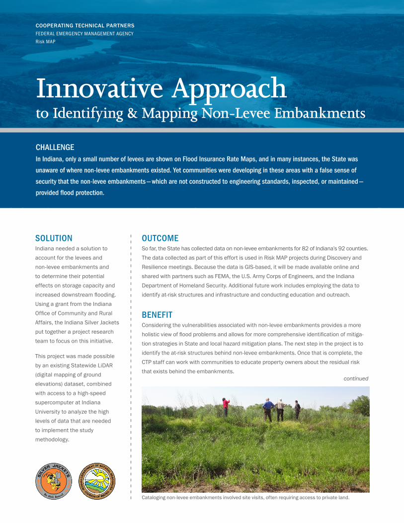
Cataloging non-levee embankments involved site visits, often requiring access to private land.

LESSONS LEARNEDThe team developed three methods—manual digitization, slope derived (semi-automated), and maximum curvature (semi-automated)—and a combination method. Using a highly technical and detailed automated methodology speeds up the mapping process by allowing users to pinpoint where to focus manual attention and compare raw data to see areas of change and to highlight these areas—a lesson learned from collecting LiDAR data.
Additional planned work will include researching the correlation between non-levee embankments and fluvial erosion and the effect that removing non-levee embankments would have on both flood hazard mapping and fluvial erosion models. As Indiana works to fund a new statewide LiDAR initiative, the potential of comparing these two large statewide LiDAR datasets using the Indiana University supercomputer is being explored to help monitor the removal of or building of new, unmapped non-levee embankments.
INNOVATIVE APPROACH TO IDENTIFYING & MAPPING NON-LEVEE EMBANKMENTS | 2
RISK MAP PHASES
• Data Development
and Sharing
• Risk MAP Goals Advanced
• Deployment
• New, Validated, or
Updated Engineering
• Awareness
• Action
RESOURCES• Indiana Floodplain Mapping: www.in.gov/dnr/water/5647.htm
• USACE Levee Safety Program: www.usace.army.mil/Missions/CivilWorks/LeveeSafetyProgram.aspx
• FEMA’s Levee Analysis and Mapping Approach: www.fema.gov/final-levee-analysis-and-mapping-approach
• National Committee on Levee Safety: www.leveesafety.org
• Procedure Memorandum No. 51 “Guidance for Mapping of Non-Levee Embankments Previously Identified as Accredited” www.fema.gov/media-library/assets/documents/34953
Capturing data in the GIS system included the type of non-levee embankment.
COOPERATING TECHNICAL PARTNERS FEDERAL EMERGENCY MANAGEMENT AGENCY Risk MAP


