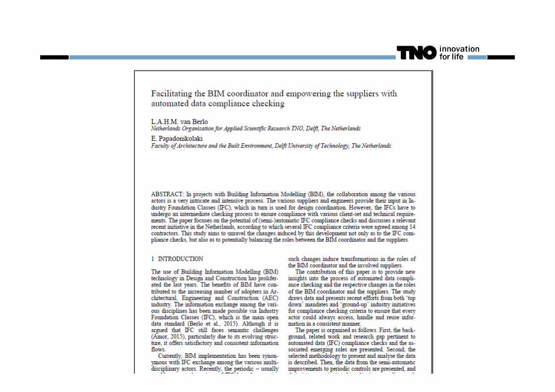
FACILITATING THE BIM COORDINATOR WITH AUTOMATED DATA COMPLIANCE CHECKING
31
FACILITATING THE BIM COORDINATOR WITH AUTOMATED DATA COMPLIANCE CHECKING ILS check in BIMserver.org | Léon van Berlo
-
Upload
leon-berlo -
Category
Technology
-
view
511 -
download
0
Transcript of FACILITATING THE BIM COORDINATOR WITH AUTOMATED DATA COMPLIANCE CHECKING

FACILITATING THE BIM COORDINATOR WITH AUTOMATED DATA COMPLIANCE CHECKING ILS check in BIMserver.org | Léon van Berlo
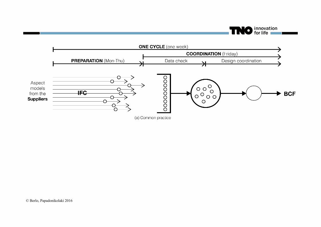
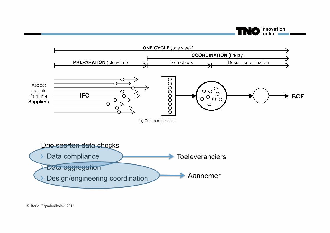
© Berlo, Papadonikolaki 2016
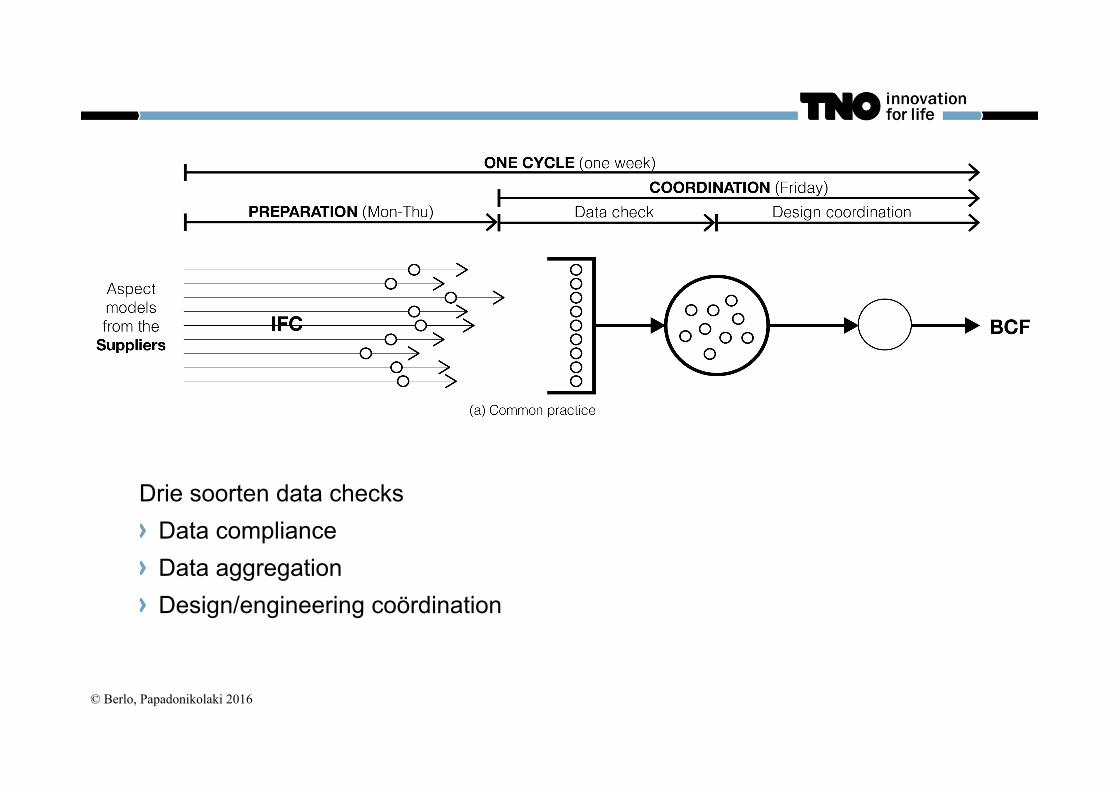
© Berlo, Papadonikolaki 2016
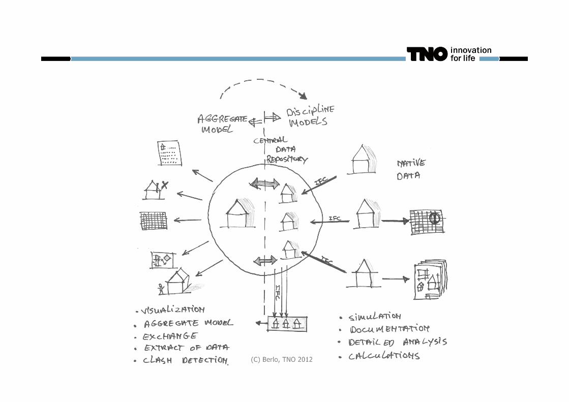
Drie soorten data checks Data compliance Data aggregation Design/engineering coördination
© Berlo, Papadonikolaki 2016
Drie soorten data checks Data compliance Data aggregation Design/engineering coordination
Toeleveranciers
Aannemer
© Berlo, Papadonikolaki 2016
© Berlo, Papadonikolaki 2016
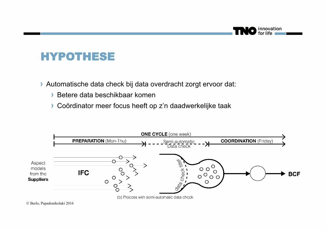
HYPOTHESE
Automatische data check bij data overdracht zorgt ervoor dat: Betere data beschikbaar komen Coördinator meer focus heeft op z’n daadwerkelijke taak
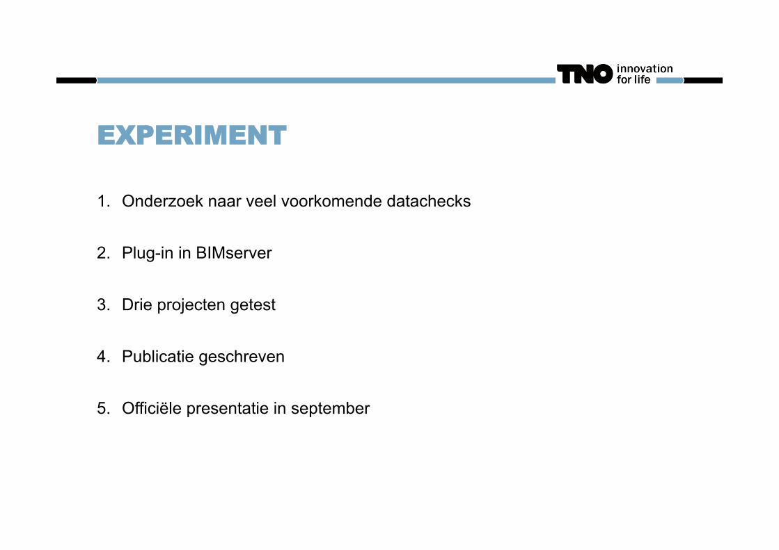
EXPERIMENT
1. Onderzoek naar veel voorkomende datachecks
2. Plug-in in BIMserver
3. Drie projecten getest
4. Publicatie geschreven
5. Officiële presentatie in september
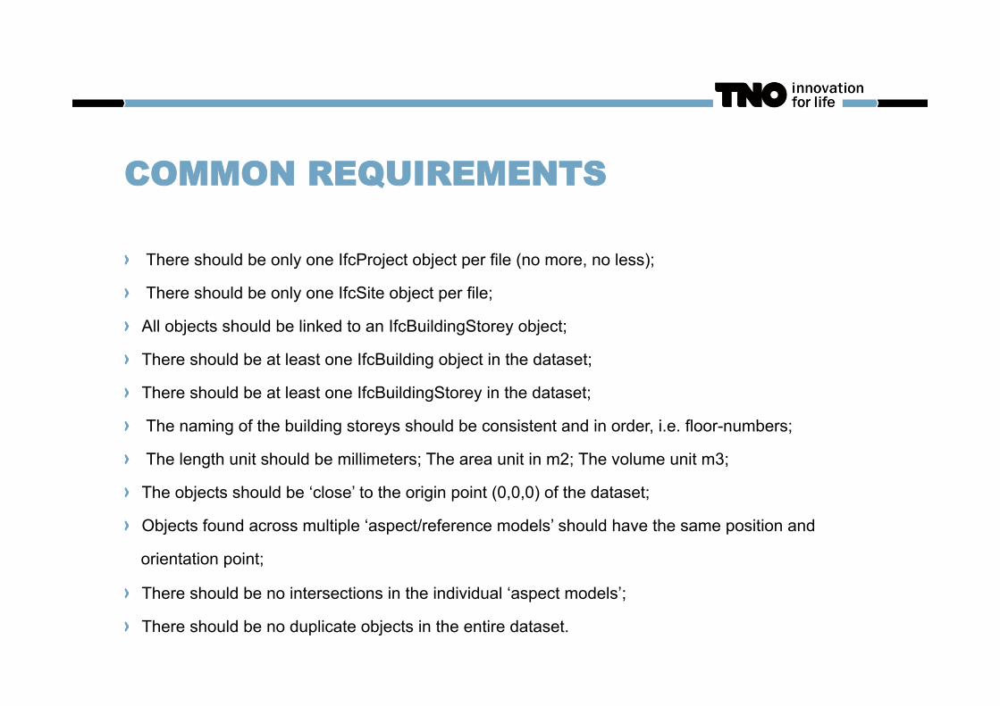
COMMON REQUIREMENTS
There should be only one IfcProject object per file (no more, no less);
There should be only one IfcSite object per file;
All objects should be linked to an IfcBuildingStorey object;
There should be at least one IfcBuilding object in the dataset;
There should be at least one IfcBuildingStorey in the dataset;
The naming of the building storeys should be consistent and in order, i.e. floor-numbers;
The length unit should be millimeters; The area unit in m2; The volume unit m3;
The objects should be ‘close’ to the origin point (0,0,0) of the dataset;
Objects found across multiple ‘aspect/reference models’ should have the same position and
orientation point;
There should be no intersections in the individual ‘aspect models’;
There should be no duplicate objects in the entire dataset.
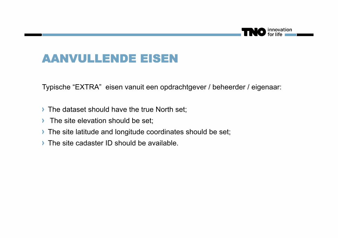
AANVULLENDE EISEN
Typische “EXTRA” eisen vanuit een opdrachtgever / beheerder / eigenaar: The dataset should have the true North set; The site elevation should be set; The site latitude and longitude coordinates should be set; The site cadaster ID should be available.
EN NATUURLIJK DE ILS
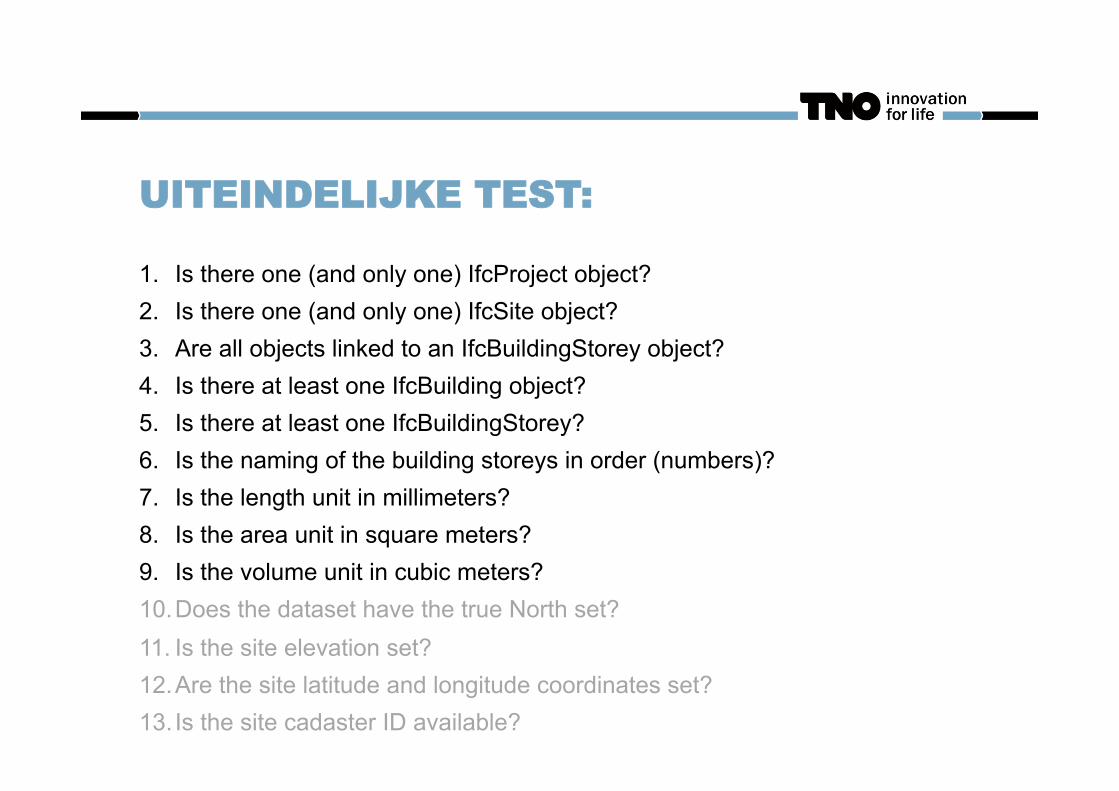
UITEINDELIJKE TEST:
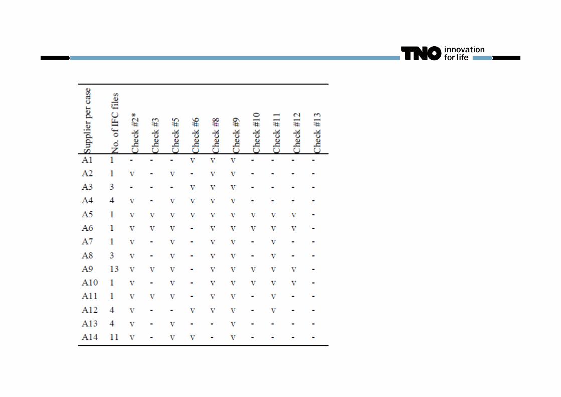
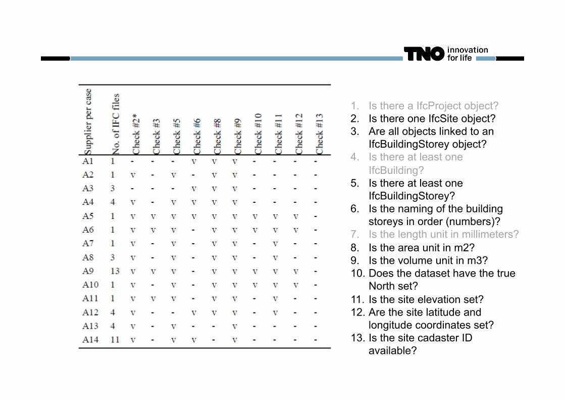
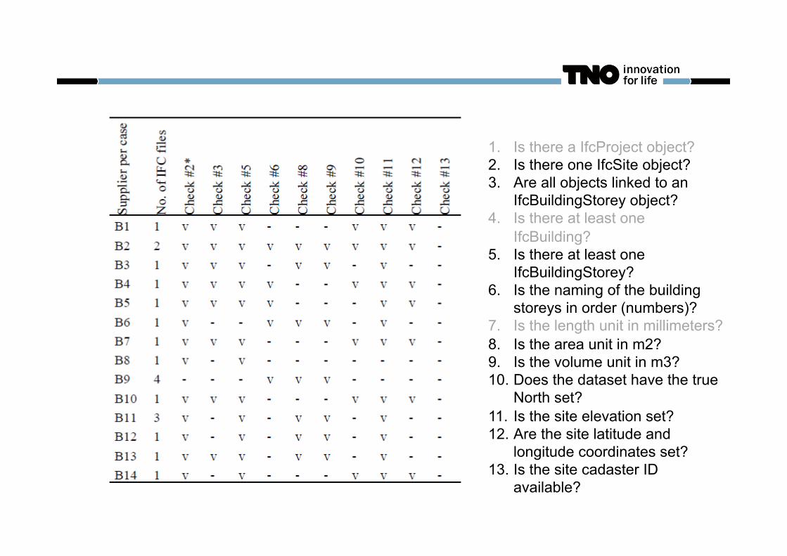
1. Is there one (and only one) IfcProject object? 2. Is there one (and only one) IfcSite object? 3. Are all objects linked to an IfcBuildingStorey object? 4. Is there at least one IfcBuilding object? 5. Is there at least one IfcBuildingStorey? 6. Is the naming of the building storeys in order (numbers)? 7. Is the length unit in millimeters? 8. Is the area unit in square meters? 9. Is the volume unit in cubic meters? 10. Does the dataset have the true North set? 11. Is the site elevation set? 12. Are the site latitude and longitude coordinates set? 13. Is the site cadaster ID available?
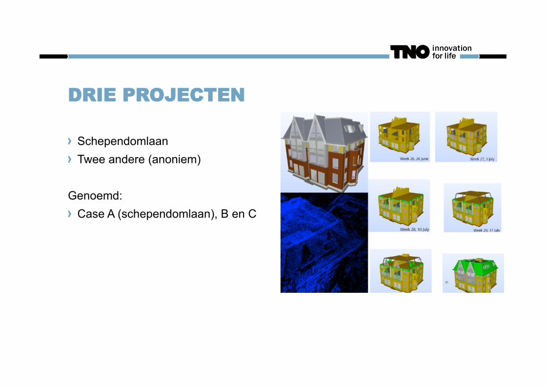
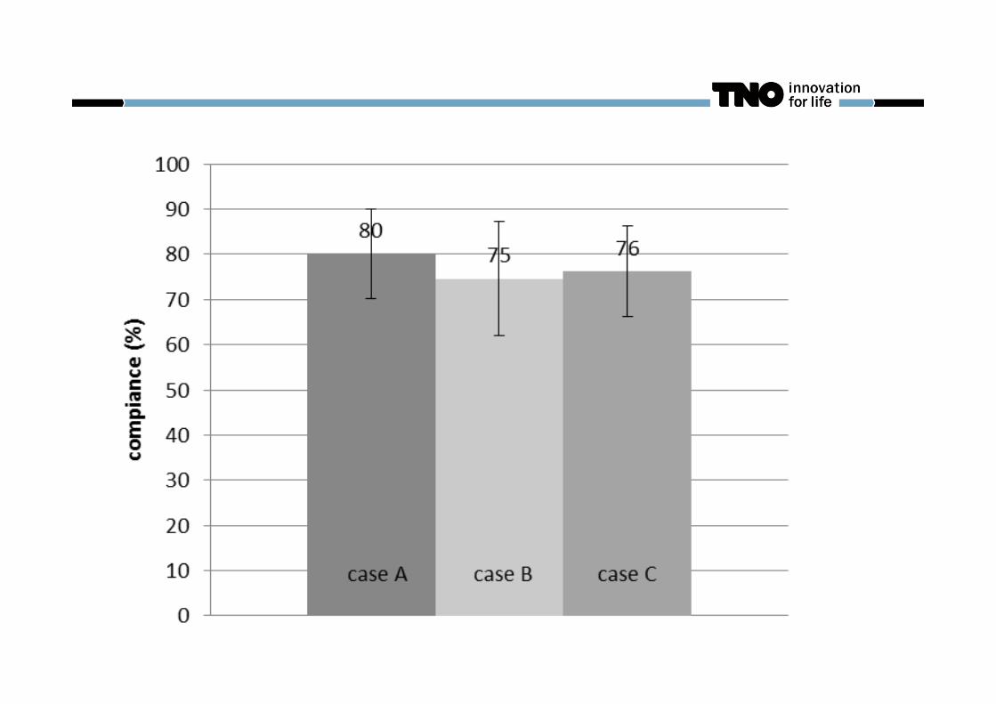
DRIE PROJECTEN
Schependomlaan Twee andere (anoniem)
Genoemd: Case A (schependomlaan), B en C
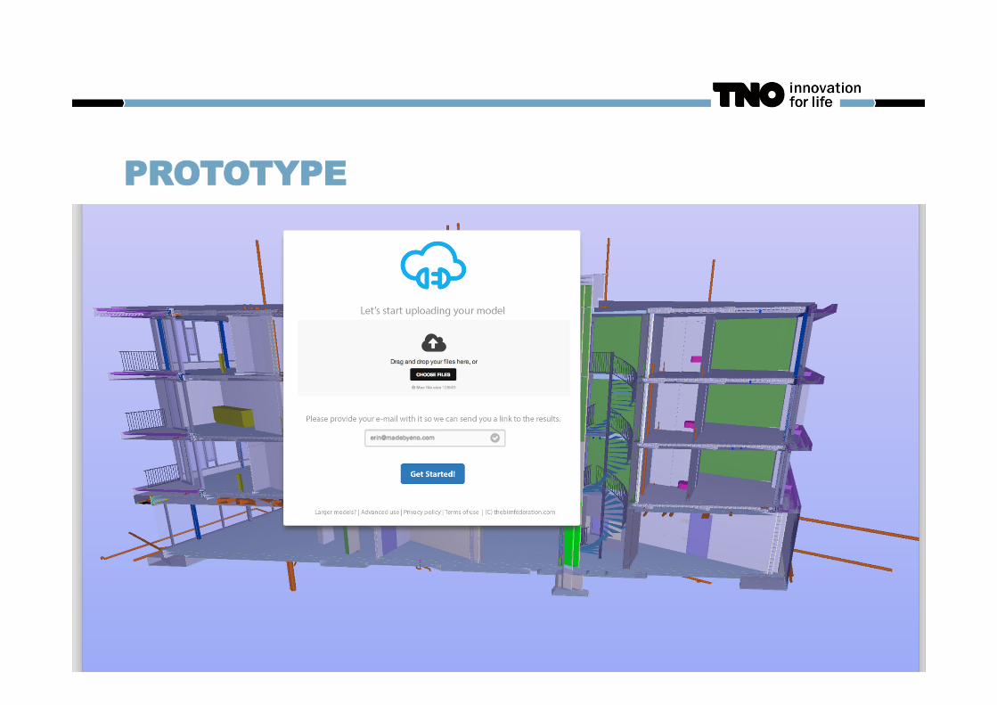
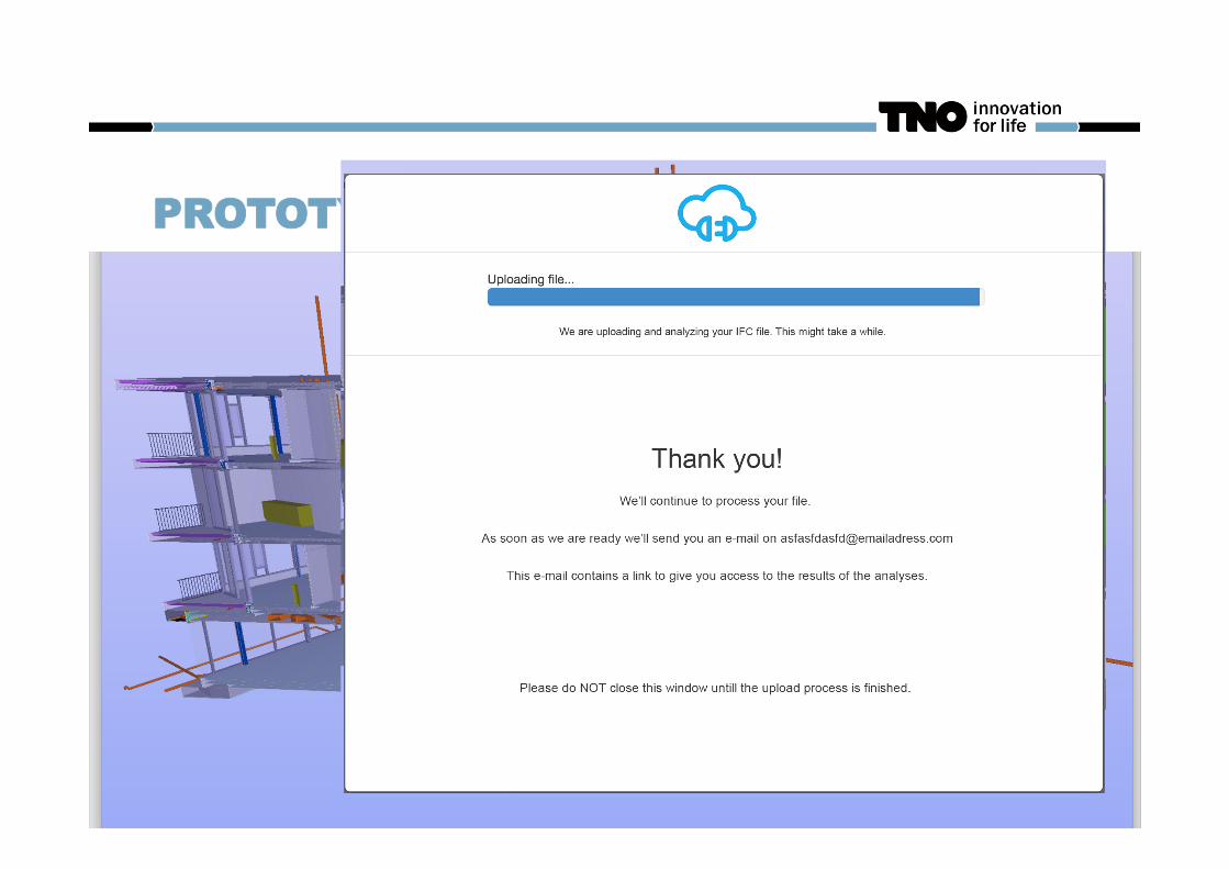
PROTOTYPE
PROTOTYPE
CRUCIALE PUNT
Voorheen: Per e-mail/dropbox/sharepoint/whatever data opsturen
Nu: Uploaden naar website en niet geaccepteerd worden als data interne fouten bevat.
CRUCIALE PUNT
Voorheen: Per e-mail/dropbox/sharepoint/whatever data opsturen
Nu: Uploaden naar website en niet geaccepteerd worden als data interne fouten bevat. Gedachtegang is dat het ‘over de schutting gooien’ gedrag wordt belemmerd en de verantwoordelijkheid van goede datasets bij de bron komt/blijft. (zodat de coördinator niet met het de gebakken peren zit)
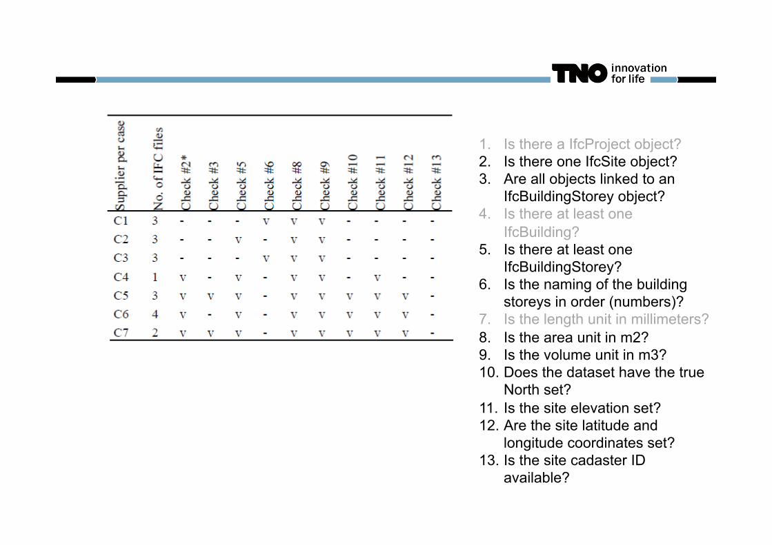
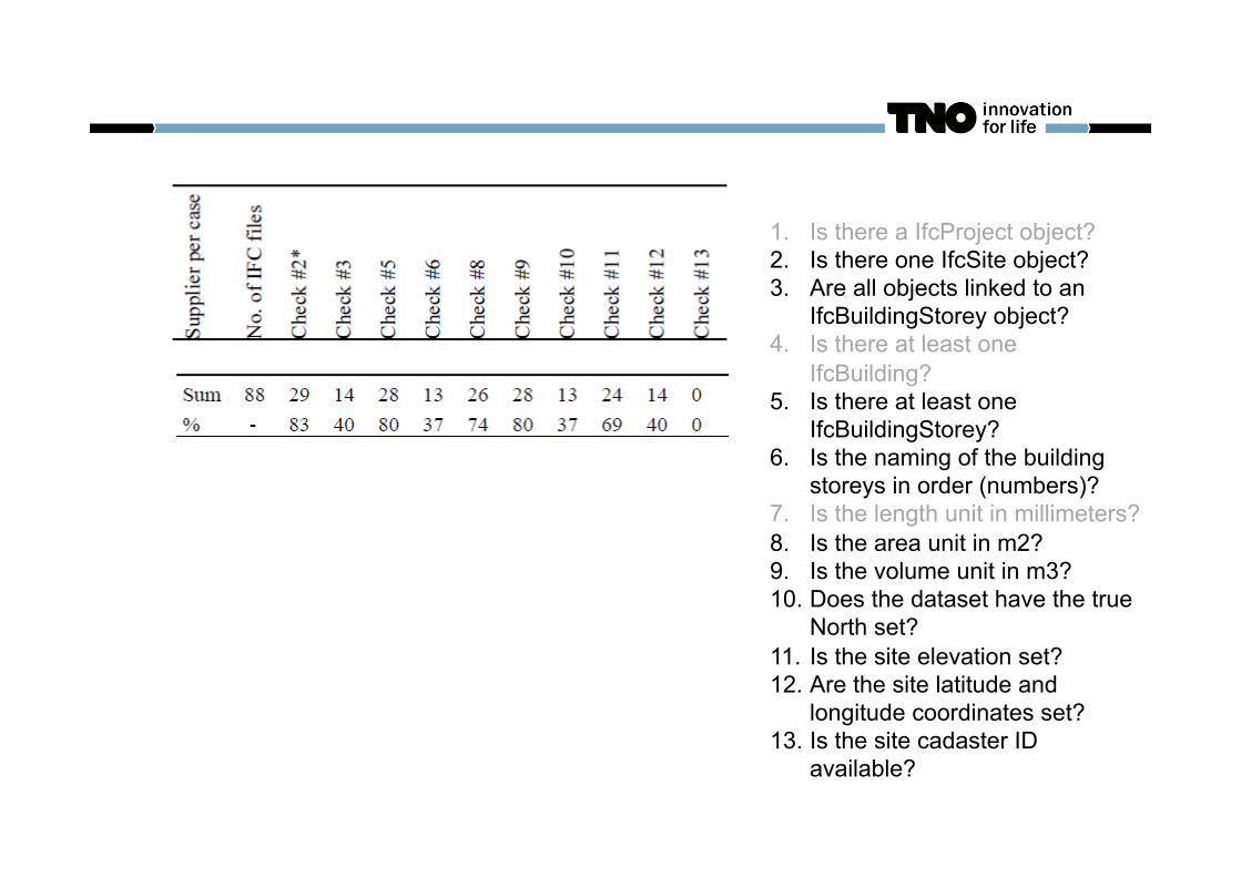
1. Is there a IfcProject object? 2. Is there one IfcSite object? 3. Are all objects linked to an
IfcBuildingStorey object? 4. Is there at least one
IfcBuilding? 5. Is there at least one
IfcBuildingStorey? 6. Is the naming of the building
storeys in order (numbers)? 7. Is the length unit in millimeters? 8. Is the area unit in m2? 9. Is the volume unit in m3? 10. Does the dataset have the true
North set? 11. Is the site elevation set? 12. Are the site latitude and
longitude coordinates set? 13. Is the site cadaster ID
available?
CONCLUSIE & DISCUSSIE
Best goede data
Niet alles eenduidig te toetsen (benaming van verdiepingen)
Nog steeds geen inzicht in potentie “Whereas this study has shown the potential of online automated compliance checking, there is
no clear evidence that the quality of models will improve in the process. Further research would
be required across multiple projects to validate this hypothesis.“
Misschien komt er wel geen data meer van een toeleverancier omdat de drempel te hoog is; dan levert dat juist extra problemen op.
OPEN UITNODIGING
Zouden graag verder willen onderzoeken in een ‘live’ project Kijken naar gedrag van toeleveranciers Wellicht ook eenvoudige automatische coordinatie tussen toeleveranciers Misschien zelfs online BCF dashboard koppelen voor issue management
Interesse? [email protected] of 06-42367465
DE TNO ‘STAP TE VER’
Data automatisch corrigeren Meters naar milimeters Lat/lon overnemen van hoofdmodel Nulpunt corrigeren Etc…
Beter vastleggen van eisen met methode die voor computer eenduidig is (query taal; ruleset; Model View Definitions, concept bibliotheken, enz…)
FAQ
Ja, de broncode van de plug-in is gratis te downloaden: github.com/opensourcebim (en komt standaard in de 2.0 versie van BIMserver)
Nee, formeel mag ik de paper niet e-mailen Nee, deze 3 cases zeggen niks over de hele sector en zijn niet te generaliseren
Ja, ik denk dat er ook potentie zit om dit concept toe te passen op andere plaatsen in het proces (dus niet alleen tussen aannemers en toeleveranciers)
BEDANKT VOOR UW AANDACHT