f i D ft far*''rffj
17
42E05SW0003 2.10458 BARBARA LAKE Proton Magnetometer and YLF Electromagnetic Surveys Newkirk-Dunvegan Project NTS ^2-E-5 Phantom Exploration Services Ltd 010 THUNDER BAY MININC D IV;';i'^i f i D ft (ft [CfiMfr r fn IL ^ [r; li W i.; far*''rffj Sept., 198? R. D. Middaugh M/iV/NG LANDS SECTION
Transcript of f i D ft far*''rffj

42E05SW0003 2.10458 BARBARA LAKE
Proton Magnetometer
and
YLF Electromagnetic
Surveys
Newkirk-Dunvegan Project
NTS ^2-E-5
Phantom Exploration Services Ltd
010
THUNDER BAYMININC D IV;';i'^i
f i D ft (ft [CfiMfr r fn IL ^ [r; li W i.;far*''rffj
Sept., 198? R. D. Middaugh
M/iV/NG LANDS SECTION
INTRODUCTION
Armeno Resources Inc. of Vancouver, B.C. contracted
Phantom Exploration Services Ltd. of Thunder Bay, Ontario
to conduct magnetic and electromagnetic (VLF) surveys
on their Newkirk-Dunvegan Project during the summer of 198?,
LOCATION, ACCESS AND GRIPPING
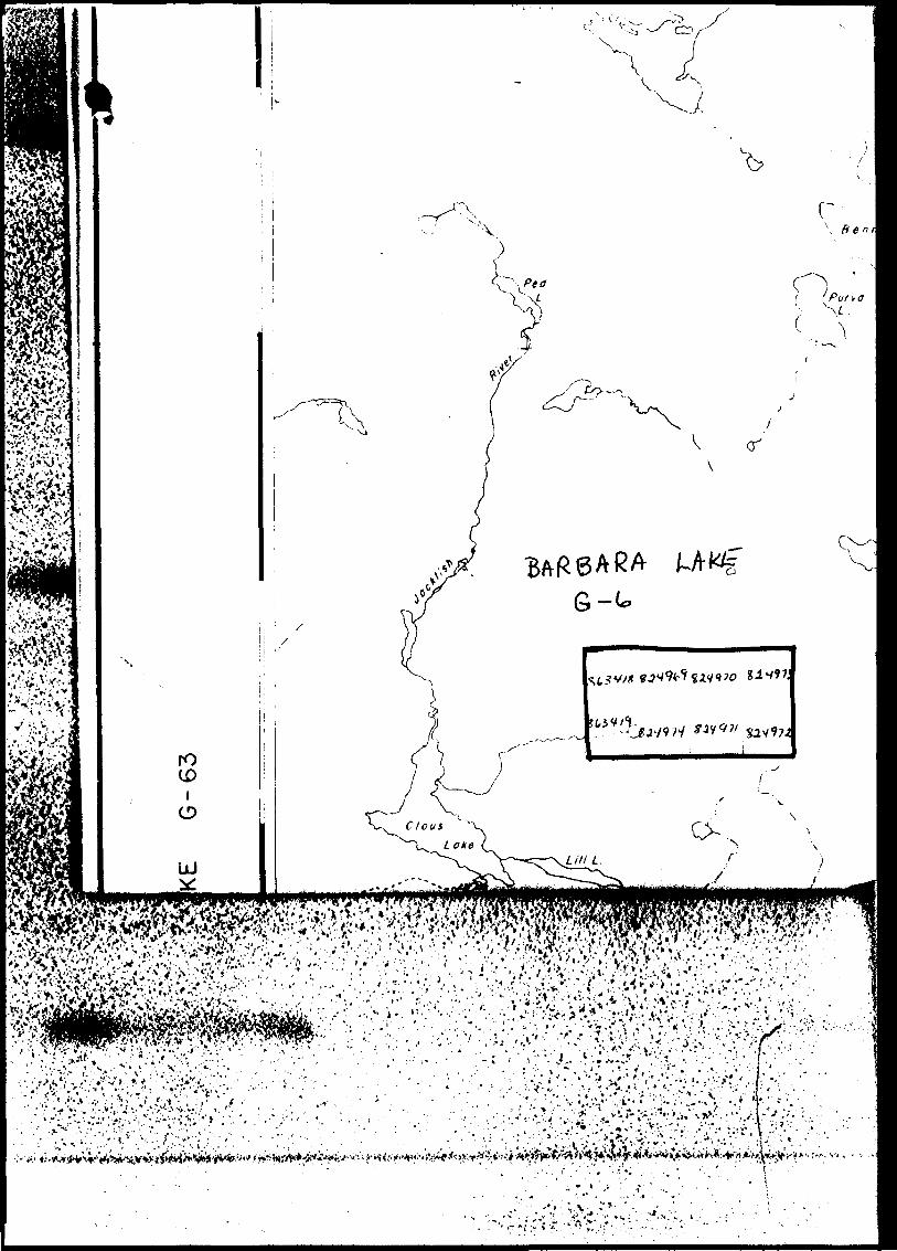
The survey area is located approximately 15 km
east southeast of Orient Bay, Ontario. The area is
protected by 8 unpatented mining claims numbered TB
82^969-97^ inclusive and TB 863^18-^-19 inclusive,
which are located in the Thunder Bay mining division.
The property is reached by travelling northeast
on the Gore Creek Road from highway #11 for ^ kilometers.
From this point an old haul road leads easterly for
about 9 kilometers. From this point a good walking
trail leads north for about 2 kilometers to the grid.
The grid was established by Phantom Exploration
personnell. Approximately 11.? kilometers of line was
cut, chained and picketted at 25 meter intervals. The
base line was orientated east west while north south
wing lines were cut at 120 meter intervals along it.

-2-
PERSONNELL
The day to day work and the overall supervision
of the geophysical program was carried out by R. D.
Middaugh of Phantom Exploration Services Ltd.
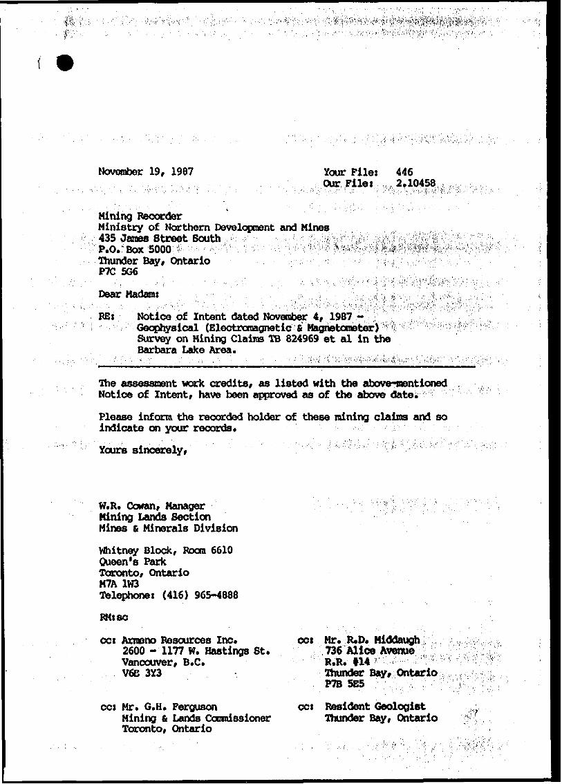
INSTRUMENTATION
Magnetic
A proton precession magnetometer (model omni IV)
manufactured by EDA Instruments of Toronto, Ontario
was used for this survey. The total field was read
with a resolution of one gamma and all the field
values were corrected for diurnal variations using
another omni IV magnetometer in the base station
mode. Readings were recorded at 25 meter intervals
on the grid lines.
Electromagnetic
A VLF EM-16 unit manufactured by Geonics
Limited of Mississauga, Ontario was used for this
survey. Both in and out of phase components were
recorded at 25 meter intervals on the grid lines.
The transmitter station used was Cutler, Maine
with a frequency of 24.0 KHz.

-3-
DISCUSSION OF RESULTS
Magnetic
The grid area is presented in plan form
at a scale of l j 2500. The corrected magnetic
data is plotted on this map and contoured at
50 gamma intervals.
Although no regional gradient is evident,
the relatively flat magnetic data does indicate
that the underlying rocks exhibit a weak east
west regional magnetic trend. The most prominent
feature is located in the north east corner of
the property and represents a small portion of
what is left of an extensive diabase sill that
once covered the whole area. The other moderate
features probably reflect compositional variations
in the underlying metasediments.
Electromagnetic
The survey area is presented in plan form at
a scale of 1:2500 with a vertical scale set at l
cm ^ lOfo for the EM profiles.
The few conductive trends located within the
survey area are characterized by short or discon
tinuous strike lengths and poor conductivity and
seem to be coincident with topographic low swampy
areas.

CONCLUSIONS AND RECOMMENDATIONS
The survey area is underlain for the most part
by metasediments that exhibit a weak east west regional
magnetic trend. The exception is a small area of dibase
located in the north east part of the property.
The conductive trends located seem to be caused
by low swampy topographic features.
The original concept of attempting to locate and
delineate lithium bearing pegmatites using these geo
physical methods does not seem to work in this geological
setting. Grass roots prospecting and mapping are the best
and seemingly only ways to locate these pegmatites.
Since the pegmatites have been located by earlier
work, future programs should concentrate on evaluating
the potential of these deposits through drilling and
sampling, given that a suitable market for the lithium
products has be procured.
Submitted by
Phantom Exploration Services Ltd.
R. D. Middaugh
Geologist

APPENDIX
Map 1. Location Map
Map 2. VLF Survey Profiles
Map 3- Magnetometer Survey

MmiMryo- Report of WorkNatural l f, . . r . . . Resources IGeophys.cal. Geoloy.cal.
Gcoch^icald-iciExnofv-;-
v/-
42Eessweee3 a.10458 BARBARA LAKE 300
!f 6~'
Survey-//77
.Narr*e anc; Adrl'css of Author (of Geo Technical reno'* 1
F /far
To'ai M.ies ci
//.7
Credits Requested per Each Claim In Columns at rig 1 '.; '.'^,- --. C airns Traversed jList in numerical sequence)Spec'a' P 'Ovsions
For firsl survey
Enter 40 d^ys. (This includes hoe cutting/
For each additional survey: using the same grid:
Enter 20 days Ifor each*
Geophysical
- Magnetomete
Raciiometrir
Othe'
Geological
, Geochem.cal
Man Days
Compieie ft'v^rse side,, i .
and ente' total(s) here- Electromagnetic
- Magnetometer
Other
Geological
Geochernicai
Airborne Creditf
Note- Spocial ti'C'.if'ons E"""o'"aq'-t -
c'^rMs tlo not npply to A. -1)0---' b-^'v"yi. Vagne:o'"fH-
Radiometric
Expenditures (excludes power stripping)Type of Work Performed
Performed on
Calculation of Expenditure Days Credits
Total Expenditures
InstructionsTotal Days Credits may be apportioned at the claim holder's choice. Enter number of days credits per claim selected in columns at right.
Total number of mining claims covered by this report of work.
Certiycation VerHying Report of Workl hereby certify that l have a personal and intimate knowledge ol tho f.icu set fort "i in the Report of Work annexed hereto, having performed the work or witnessed same during and/or after its completion and the iinnoxf-ci ITXV* ^ T rue
Name.*j**-Pw*taJAddress of Person Certifying
"t^' (S -
1362 ( RI PI
November 19, 1987 Your Filet Our Filer
Mining RecorderMinistry of Northern Development and Mines435 Janes Street SouthP.O. Box 5000 .v ; V*\ Y^--- ''.-'r'Thunder Bay, OntarioPTC 506
Dear Madam:
RES
4462.10458
Notice of Intent dated November 4, 1987 - Geophysical (Electromagnetic fi Magnetometer) Survey on Mining Claims TB 824969 et al in the Barbara Lake Area.
The assessment work credits, as listed with the above-mentioned Notice of Intent, have been approved as of the above date.
Please inform the recorded holder of these mining claims and so indicate on your records.Yours sincerely, ' ' '' ' "' - ''"'' : V :; '" : ' " : '* : "'^ '' ; "'""' v ' : ' ;
W.R. Cowan, Manager Mining Lands Section Mines fi Minerals Division
Whitney Block, Boom 6610Queen's ParkToronto, OntarioM7A 1W3^telephones (416) 965-4888
FMt se
ccs Armono Besources Inc.2600 -1177 W. Hastings St. Vancouver, B.C. V6E 3Y3
ccs Mr. G.H. FergusonMining fi Lands Commissioner Toronto, Ontario
ccs Mr. R.D. Middaugh 736 Alice Avenue' .' ' ' R.R. 114
Thunder Bay, Ontario. P7B 5E5 :': : ,,:, ;-; .; "ccs Resident Geologist
Thunder Bay, Ontario

Ministry ofNorthern Developmentand Mines
Ontario
Technical Assessment Work Credits
Date
November 4, 1987
File
2.10458Mining Recorder's Report of Work No.
446
Recorded Holder
Armeno Resources Inc.Township or Area
Barbara Lake
Type of survey and number of Assessment days credit per claim
Geophysical 40
RprtrnmaQnAtir Hays
20Magnetometer... ,, . Hays
InH^e^ polc'i'at'on . fky*
flthpr riays
Section 77 (19) See "Mining Claims Assessed" column
Geological Hays
fipnrhemiral Hays
Man days fi Airborne l j
Special provision (x] Ground 0
l | Credits have been reduced because of partial coverage of claims.
[~l Credits have been reduced because of corrections to work dates and figures of applicant.
Mining Claims Assessed
TB 824969 - 974 863418
Special credits under section 77 (16) for the following mining claims
30 Days Electromagnetic and 15 Days Magnetometer
TB 863419
No credits have been allowed for the following mining claims
Q not sufficiently covered by the survey Q insufficient technical data filed
The Mining Recorder may reduce the above credits if necessary in order that the total number of approved assessment days recorded on each claim does not exceed the maximum allowed as follows: Geophysical - 80; Geologocal - 40; Geochemical - 40; Section 77(19) - 60.
res/)?)

Ontario
Ministry of Natural Resources
GEOPHYSICAL - GEOLOGICAL - GEOCHEMICAL TECHNICAL DATA STATEMENT
File.
TO BE ATTACHED AS AN APPENDIX TO TECHNICAL REPORTFACTS SHOWN HERE NEED NOT BE REPEATED IN REPORT
TECHNICAL REPORT MUST CONTAIN INTERPRETATION, CONCLUSIONS ETC.
Type of Survey(s).
Township or Area.
Claim Holder(s)
'BftgQflg/4
Survey Company
Author of Report
Address of Author Trtuug^
Covering Dates of Survey-
Total Miles of Line Cut_
(linecuttinq to office)
H. IfT
SPECIAL PROVISIONS CREDITS REQUESTED
ENTER 40 days (includes line cutting) for first survey.
ENTER 20 days for each additional survey using same grid.
^ , . , Geophysical
Electromagnetic
DAYS per claim
Radiometric
-Other
Geological.
Geochemical.
AIRBORNE CREDITS (Special provision credits do not apply to airborne surveys)
Magnetometer .Electromagnetic Radiometric
AQthoV of Report or Ageit
Res. Geol.. .Qualifications.
Previous Surveys File No. Type Date Claim Holder
Rf C l:
MINING CLAIMS TRAVERSED List numerically
(prefix) (number)
"Z.
l
AM
VED•t-
MININGTOTAL CLAIMS.
837 ( 5/79)
IND
UC
ED P
OLA
RIZ
ATI
ON
RES
ISTI
VIT
Y
-2 13 rt O *-^
rt rt"
o 3 o. rt
Electrode "B 3
Q- ^
:t*1
*X3
i—
ora
^|g
srt ta
ngrt S O rt
00 rt
S 0 3
O
O. D H rt O
O
w r* •1 i B
Drt
rt
J2
.QC
Crt
rt3
3n
rt O
o
GR
AV
ITY
Elevatio 3
B3 1 •-I p o
rt O) r* o' 3 i rt a) 3 O. o" s f-*
- o' 3
O
y
3*
i s.
iS
f* S
S.
8 3
O
3
2 S
3 S
o. rt
E -
ELEC
TRO
MA
GN
ETIC
MA
GN
ETIC
1Parameter
s measur rt o. ^ C ^- k H C*
~5~"*
1 ^1 ^ 1
ffi I
JO s ^ •o •i a* tj •^ S
Method:
Fr
en ii en rv P rt
r ~
t- ^
s-
en^
i. r*"
r*
rt
"^
J* S
n o o r* cr k1 x H 3 rt D *v ft) S. rt" 5' rt
Coil
configuration
Coil
separation ——
Arnirary H ^
^ ^s^
^J\
-o o
1 Instrument -w 0 5 A tP ^ •~ ^ C
Accuracy — Scale
i
Diurnal
correction
Base
Station
check
Base
Station
locati 8 *
g 1
1 1
r 1
rf-
*^
O-
r*
i S
rt *— *. o c M
N--^
,'T
y rt. Hr •^ o s ^ S t) rj
/•f 1 \
x ^
Instrument /fi c^ ^ ~0 \J c* N
^^
'
^ ^ •k ?i 4 J ^ 5^ 5 b * cf —
Contour
interval "2 i~* ^r |V
L J C ^O 1 t ^ r— T7 rj, ** j; 0 Q
^
Number
of
Stations
-Station
interva
l P } T/ W A
C r" ^r i XT g cs fi ~1 0? rf w
O"
T3
rt
ja
^
2.
Oy
^
*(ra
5d S o- CT
Q en
i3 0 s m -f /n 'i) l/}
V
M^ r- " A u* — 5o 9* i
^GROUND
SURVEY C/3 1 SJ 3 o S r* 3 3
0
rt
W
g
^
1
3
•o S
l
?•?
H
o.
W-
Qp
KS1
2
rt "
J
0o
*^n
j^0 en C i < ^

SELF POTENTIAL
Instrument_________________________________________ Range. Survey Method ———————————————————————————————————————————
Corrections made.
RADIOMETRIC
Instrument.
Values measuredEnergy windows (levels) ________,——————————.^———.-————————Height of instrument——————.-——-——-—^—-...^—...-—.—Background Count.Size of detector.^——.^——-————-—————-..-^———™———.—-..——.—.—...—.Overburden —————.-——..^-—----^—————-——-——————.^-—————.^—-.—-
(type, depth — include outcrop map)
OTHERS (SEISMIC, DRILL WELL LOGGING ETC.) Type of survey—.^—.———————^^————.——Instrument ——————-——^^————^—-—^————.
Accuracy^—-———-—^--—————^——.^———.Parameters measured.
Additional information (for understanding results).
AIRBORNE SURVEYS
Type of survey(s)———— Instrument(s) ——————
(specify for each type of lurvey) Accuracy———-^———-————-——
(specify for each type of survey) Aircraft used^———————-——-—————--^—.———.—.....——-
Sensor altitude.Navigation and flight path recovery method.
Aircraft altitude_______________________________Line Sparing Miles flown over total area——————..—..——.———.^————.-—— Over claims only-
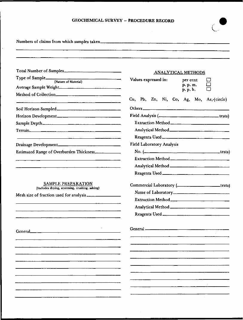
GEOCHEMICAL SURVEY - PROCEDURE RECORD
Numbers of claims from which samples taken.
C.
Total Number of Samples. Type of Sample.
(Nature of Material)
Average Sample Weight——————. Method of Collection————————
Soil Horizon Sampled. Horizon Development- Sample Depth————Terrain————————
Drainage Development———————————— Estimated Range of Overburden Thickness.
ANALYTICAL METHODSValues expressed in: per cent
p. p. m. p. p. b.
n nD
Cu, Pb, Zn, Ni, Co, Ag, Mo, As.-(circle)
Others —————————————^—-—^—..^—Field Analysis (.
Extraction Method. Analytical Method- Reagents Used——
Field Laboratory AnalysisNo. -^—————.^
SAMPLE PREPARATION(Includes drying, screening, crushing, ashing)
Mesh size of fraction used for analysis—-——
Extraction Method. Analytical Method - Reagents Used __
Commercial Laboratory (- Name of Laboratory— Extraction Method—— Analytical Method ——Reagents Used ————
.tests)
.tests)
.tests)
General. General.
#m
mt-V--'-^v.'
,", ^ro O)
UJ
j-
L/'
•••^•ftm'4;^
##f
y^TT'.y^.i* ;i Tr^vJifn v'^4^?:wv..-v--.y.'.'-'.•'.^l .v.-.
V.-
'C^,:;.^.v;i-i'.'.- " - -; 1 - " -", ..:
'.•-'•V-^'
SM.^4^- .: -,v
v-.y- .;:: *.
*™,t '.,' - - ' *
-•' l '•' ~ * .
:-'.:, '^^- Ifr* *; r p v-. *'a.*-''/.'. ,*.^* *-j'*.~, ••-. ".'•V, , .. * . . v, ' * ' .1 ...' .H&•*'*mWW* /••^•r -;- j,
v^^VA-c'.?;^imi-.*^,v*^^:;:.".y;^.-;Yt,^.vfv.7;.
^iPPPM:?^i^^^^i^^^^^ s^^^^^l^^**;*^#iti^iiti^

jjKJOfan. tn vg Ft^nwujgmiiaejajjta
LAKE JEAN G-6463?QO B7?45'
45 0 22' 30 49 0 22 30
42ES5SWMe3 2.10458 BARBARA LAKE 200 COSGRAVE LAKE G- i--
LO
O
LU
LU
LGENLD
PATENTED LANDCROWN LAND SALELEASESLOCATED LANDLICENSE OF OCCUPATIONMINING RIGHTS ONLYSURFACE RIGHTS ONLYROADSIMPROVED ROADSKING'S HIGHWAYSRAILWAYSPOWER UNESMARSH OR MLJSKEGM-'NES
CANCELLED PATENTED S. R. O.
h
NOTES
THUNDER BAYMINING DIVISION
AMPM
i
AREA
.^ ?wa^
f/:.'.'.B. AOfti:M;5THATfVE DISTRICT
- -
i "S s r1, i •r***. 51" p^ p", jan U S'-, L* t. H B A
LAND TITLES/ REGiSTBV DIVISION
T'": .^, V-j 4-7 i w is/ &S.- n w
Land
O^t^ri.^ ••^.-'. . i-.^. i .^,
c
4335
B.L. 0 + 00
1+00 S
2 + 00 S
3 + 00 S
4 + 00 S
5 + 00 S
6+00 S
7 + 00 S
8+00 S
OCVJ
Ut
B L. 0 + 00
l 4- 00 S
2 + O OS
3+OOS
4+00 S
5+00 S
6+OOS
7 + OOS
8+OC S
49 0 20
MAGNETOMETER SURVEYINSTRUMENT OMNI IV MAG ACCURACY OIK REFERENCE FIELD 6)000 DATUM : 58OOO l CONTOUR INTERVAL : MAGNETIC LOW -
BASE STATION RECORDER INFORMATION
INSTRUMENT OMNI IV RECORDING INTERVAL 10 SEC
VLF SURVEYINSTRUMENT. GEONICS EM - 16 TRANSMITTING STATION : CUTLER, MAINE OPERATOR FACING NORTH DIP ANGLE : f N + , S - ) - ^^ - - QUADRATURE *-~- x ---*---* PROFILE SCALE- IcmjIOVo ^^^
POSITIVE READINGS EAST OF LINE
TOPOGRAPHY
CLAIM POST
STREAM
SWAMP
3,
ARMENO RESOURCES INC.
NEWKIRK - DUNVEGANGEORGIA LAKE AREA
DISTRICT OF THUNDER BAY
VLF PROFILE MAPDate: SEPT. t i987[ Scale: li 2500 j NT. S. i 42-E-5
PHANTOM EXPLORATION SERVICES LTD.— -. ..--...III 111(11
42E05S*ee03 2.16458 BARBARA LAKE
210

B L. 0 + 00
i+o
2-t-OO S
3 -t-CC S
4-*-00 S
e +OD s
O C\J
-J
O
-I
LU
OCVJ
LU
O^roo
LJ
O CD fO
LU
O 00
LU
O O CO
LU
OC\J
LU
O ^t 00
LU
O CD O*-l
LJO 00 O
-l
LU
O O Os)
LU
O eg
8-*-
/ B.L. 0-1-00
00 S
2 + QOS
4-OOS
5-1-00 S
6+OOS
7 + OOS
8 4-0 C S
42E05SWe0fl3 2.16456 BARBARA LAKE 220 "
49 0 2O
CLAUS
Scale i: 31680
MAGNETOMETER SURVEYINSTRUMENT: OMNI iv MAG.ACCURACY : 0-1 X REFERENCE FIELD: 61000 DATUM : 58000 * CONTOUR INTERVAL : 50 f MAGNETIC LOW :
BASE STATION RECORDER INFORMATIONINSTRUMENT : OMNI IV RECORDING INTERVAL : 10 SEC.
VLF SURVEYINSTRUMENT; GEONICS EM-IB TRANSMITTING STATION : CUTLER, MAINE OPERATOR FACING - NORTH DIP ANGLE : ( N 4- , S ~ ) - —— - 'QUADRATURE : V---X---X---K
PROFILE SCALE : ____ ————
POSITIVE READINGS : EAST OF LINE
TOPOGRAPHY
CLAIM POST
STREAM
SWAMP
ARMENO RESOURCES INC.
NEWKIRK - DUNVEGANGEORGIA LAKE AREA
DISTRICT OF THUNDER BAY
MAGNETOMETER SURVEYDate: SEPT.,1987 Scale: C 2500 NT. S. : 42-E-5
PHANTOM EXPLORATION SERVICES LTD.