Excising airports to better compare urban parkland - TPL
6
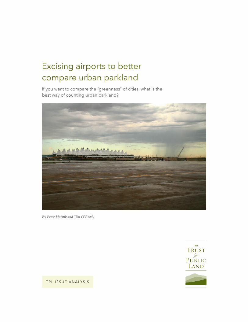
Excising airports to better compare urban parkland By Peter Harnik and Tim O’Grady TPL ISSUE ANALYSIS If you want to compare the “greenness” of cities, what is the best way of counting urban parkland?
Transcript of Excising airports to better compare urban parkland - TPL
Excising airports to better compare urban parkland
By Peter Harnik and Tim O’Grady
T P L I S S U E A N A LY S I S
If you want to compare the “greenness” of cities, what is the best way of counting urban parkland?

excising airports to better compare urban parkland · 2
Traditionally, the most common measurement is by using “acres per 1,000 persons.” The implication of this is how well parkland serves the population, how “crowded” each park would be if everyone went out and used all of them simultaneously. Another meth-od is to consider what percent of a city’s land area is devoted to parks. Here the implication is how well parkland serves as an environmental mechanism for the city, what percent of a storm’s precipitation would be captured via permeable earth and what percent of sunlight would be kept from adding to the heat island. A third method, which brings the other two together, measures what percent of the population is within a half-mile of a park, any park. This time the metric is the ease of getting to a park, preferably without using a car.
If every city were of equal population density, we wouldn’t need three complementary ways of thinking. Since they aren’t, each method brings its own wisdom and insights—and, of course, its own quirky impacts and implications.
Measured on a percent-of-land-area basis, New York City shows up as one of the “greenest” cities in the U.S., at 19.7 percent. But with its extreme popu-
lation density, all that parkland (38,201 acres) pro-vides only 4.7 acres per 1,000 persons. In contrast, Indianapolis appears to be generous to its citizens, providing 13.4 acres of parks for every 1,000 residents, but actually only 5 percent of the city is covered by its 11,203 acres of parks. Because of this, far fewer Indi-anapolitans (31.7 percent) than New Yorkers (96.4 percent) can get to a park within a 10-minute, half-mile walk.
The Trust for Public Land’s Center for City Park Excellence (CCPE) has been calculating and tracking acreage (and many other park attributes) in the largest U.S. cities for more than a decade, starting in 2000. Since this had never been done before and since city park departments are rarely funded adequately for broad data collection, it took several years of trial and error to establish accurate figures. Over time, the data-base has become more and more reliable.
In 2010, CCPE began getting complaints from park advocates in Denver who felt that the statistics weren’t accurately portraying parkland in their city. Measured on an acres-per-one-thousand-people basis, Denver ranked a respectable 9.8. But as a percent of city size, the Mile High City measured an unimpressive 6%.
Denver: composition of city parks
denver pre 1988
denver post 1988
denver parks
Denver Airport is so large that it notably drags down
the city’s national rating in parkland ratios.

excising airports to better compare urban parkland · 3
city number of airports acreage
Denver 1 22,721
Houston 3 12,200
Orlando 2 11,008
Jacksonville 4 9,759
Oklahoma City 4 9,197
Chicago 2 6,628
Colorado Springs 1 6,418
Irving, Texas 1 5,801
Kansas City 3 5,176
New York 2 5,151
Indianapolis 2 4,869
Columbus 4 4,868
Anchorage Borough 3 4,787
Los Angeles 5 4,485
Memphis 2 4,260
Note: Military bases with airports are excluded if there are full-time residents on the premisesSource: Center for City Park Excellence
Moreover, the city itself was characterized by TPL as a “medium-low-population-density” city, comparable to San Diego and St. Petersburg, Fla., which didn’t conform to the way Denverites perceived where they lived. The problem turned out to be the new Denver International Airport, built on land annexed from neighboring Adams County in 1989.
By adding 53 square miles of land (22,721 acres for the airport, plus a large buffer), the city instantly mushroomed in area by more than 50 percent with-out adding any new residents. Statistically, the airport acquisition reduced Denver’s city-wide density from 8.43 persons per acre (equivalent to Pittsburgh’s den-sity) to 6.43 (more like Garland, Tex.), even though individual Denverites didn’t feel any more room in their daily lives. The statistical addition of the gigan-tic airport—the nation’s largest—also makes it seem as if Denver’s 5,900-acre park system has become less effective: the city is now officially only 6 percent parkland, compared to nearly 8 percent before DIA was added.
Denver International Airport, from the air (below), and from the ground (p.1).
table 1: Major cities containing the most airport acreage

excising airports to better compare urban parkland · 4
Naturally, CCPE couldn’t give Denver special treatment, but we agreed that it didn’t make sense for our analysis to penalize cities for airport acreage that would never need any internal parkland. We also decided that the same logic holds for urban railyards, large properties dedicated to freight transport, train storage and maintenance. Thus, using published information as well as conducting original geograph-ic information system (GIS) analyses, we found the acreage devoted to air and rail facilities in each of the 100 most populous U.S. cities. Airports were iden-tified using the “USA Airport Hub Size” GIS layer from the mapping software company Esri. Railyards were identified from satellite imagery of multiple tracks converging into contiguous sites of train activ-ity; these were then turned into measurable polygons. The areal extents of both airports and railyards were clipped to capture only the acreage within the studied cities’ boundaries.
It turns out that Denver does lead the nation with 23,123 acres dedicated to airports and railyards. The Mile-High City is followed by Houston (with three
city railyard acreage
Chicago 2,262
Memphis 1,277
Houston 1,266
Kansas City 1,147
Jacksonville 1,025
Fort Worth 962
Philadelphia 957
Columbus 811
Louisville/Jefferson 792
Atlanta 762
Lincoln 735
Portland 716
Cleveland 673
Detroit 645
New York 595
Source: Center for City Park Excellence
table 2.Major cities containing most railyard acreage
Amtrak and Metra Railyards, Chicago

excising airports to better compare urban parkland · 5
airports and lots of trackage), Orlando and Jackson-ville. By proportion of city size, Denver is again on top, followed by Orlando, Fla., Irving, Tex. (home to Dallas-Ft.Worth Airport) and Newark, N.J. It is the same four—Denver, Orlando, Irving and Newark— whose parkland-as-percent-of-land gains the most by excising air and rail facilities from their areas.
Note that no city suffers a reduction in its percent parkland using this methodology. For the 22 cities that have no airport within their boundaries and have only miniscule railyard acreage, the parkland percentage re-mains unchanged. (Anchorage has several airports, but the gargantuan city itself spreads so far that removing the facilities doesn’t even register in the analysis.)
Should other industrial areas within cities be excised from urban parkland analysis? Obviously, from Los Angeles to Chicago to Atlanta there are thousands of acres of factories, warehouses, scrapyards and other industrial neighborhoods. Nevertheless, we conclude they should not be removed. For one thing, while airports and active rail yards have restricted access and have neither parks nor residents within them, this is often not the case for other industrial districts. Many factory neighborhoods are interspersed with residents. Moreover, many workers can actually make use of parkland for sports leagues and recreation before and after work hours. In fact, industrial neighborhoods can be excellent places to locate fields for nighttime recre-ation since the lights, noise and parking will not affect sleeping residents.
Removing railyard and airport acreage from cities’ total land area gives park planners a more accurate measure of the proportion of a city that is parkland. CCPE has therefore modified many of its analyses to include an “adjusted city acreage” field that represents cities’ land minus airports and railyards. We hope this dataset will spark innovations in the ways urban green space distribution is conceptualized in the future.
table 3.Parkland as percent of city size after removing airports and railyards, selected cities
city%
parkland
% parkland
after removing airports
and railyards
% increase
Denver 6.03 7.89 131%
Orlando 4.54 5.45 120%
Irving, Texas 4.36 5.04 116%
Newark 5.47 6.03 110%
Oakland 16.98 18.27 108%
Honolulu (urban)
31.01 33.05 107%
Chicago 8.57 9.13 106%
Lincoln 11.05 11.75 106%
Cleveland 6.17 6.54 106%
Boston 15.91 16.85 106%
Colorado Springs
8.96 9.45 105%
Boise 5.46 5.74 105%
Arlington, Va. 12.28 12.86 105%
Reno 4.54 4.75 105%
Portland 16.63 17.40 105%
Source: Center for City Park Excellence
Chicago Railyards

excising airports to better compare urban parkland · 6
A Different SolutionNot all airports need to be excised from studies of ur-ban park acreage. Some have been recognized for their large size and relatively flat terrain and have actually been turned into parks.
Just off the shoreline of downtown Chicago, North-erly Island is an artificial peninsula that was selected as the site for Chicago’s “Century of Progress” World’s Fair in 1933. In 1947, however, its recreational value was nullified as it was transformed into Meigs Field, a small airport. Fifty years later, when the airport’s lease expired, the Chicago Parks District reverted the
peninsula back to parkland. Today Northerly Island boasts 91 acres of prairie grasses, meandering paths, play areas, a wildlife sanctuary and a concert pavilion.
Similarly, in downtown Santa Fe, N.M., in 1995, The Trust for Public Land purchased a defunct 50-acre railyard and brokered a deal whereby 37 acres was de-veloped for housing, retail and commercial uses, while the remaining 13 acres was sculpted into an innovative park and plaza with a playground, gazebo, climbing wall, labyrinth, and bike and pedestrian trails, plus a rail line connection to Albuquerque.
Peter Harnik is director of The Trust for Public Land’s Center for City Park Excellence and author of Urban Green: Innovative Parks for Resurgent Cities. Tim O’Grady was a 2013 research intern for the Center.
The Trust for Public Land creates parks and protects
land for people, ensuring healthy, livable communities
for generations to come.
PHOTOS: COVER, DOC SEARLS; 3, FLICKR USER BACHIR; 4, JOHN W. IWANSKI;
5, FLICKR USER JORDAN FISCHER; 6, ANDREW NEIGHBOUR .
PRINTED ON 100% RECYCLED PAPER. ©2014 THE TRUST FOR PUBLIC LAND.
Santa Fe Railyard Park and Plaza, New Mexico