Example COAL MINING RISK ASSESSMENT CMRa
15
COAL MINING RISK ASSESSMENT FOR A GOOD CLIENT Earth Environmental & Geotechnical Ltd Houldsworth Mill Business & Arts Centre Houldsworth Street Stockport SK5 6DA www.earthenvironmental.co.uk Tel 0161 9756088 A3381/20 January 2020
Transcript of Example COAL MINING RISK ASSESSMENT CMRa
COAL MINING RISK ASSESSMENT
FOR
A GOOD CLIENT Earth Environmental & Geotechnical Ltd Houldsworth Mill Business & Arts Centre Houldsworth Street Stockport SK5 6DA www.earthenvironmental.co.uk Tel 0161 9756088 A3381/20 January 2020

Earth Environmental & Geotechnical i xxxxxxxxxxx Report No. A3381/20 January 2020
Report Title: XXXXXXX Coal Mining Risk Assessment
Report Reference: A3381/20
Client: XXXXXXX
Issue Date: 14th January 2020
Drafted By: XXXXXXX
Reviewed By: A Czarnecki BSc (Hons) FGS CGeol
Authorised By: A Czarnecki BSc (Hons) FGS CGeol
This document has been prepared for the titled project (or named part thereof) and should not be relied upon or used for any other project without an independent check being carried out as to its suitability and prior written authorisation being obtained from Earth Environmental & Geotechnical. Earth Environmental & Geotechnical accepts no responsibility or liability for the consequences of the use of this document, wholly or in part, for any other purpose than that for which it was commissioned. Any persons so using or relying upon this document for such other purpose do so at their own risk. This report was prepared for the sole use of the Client and shall not be relied upon or transferred to any other party without the express written authorisation of Earth Environmental & Geotechnical. It may contain material subject to copyright or obtained subject to license; unauthorised copying of this report will be in breach of copyright/license. The findings and opinions provided in this document are given in good faith and are subject to the limitations imposed by employing site assessment methods and techniques, appropriate to the time of investigation and within the limitations and constraints defined within this document. The findings and opinions are relevant to the dates when the assessment was undertaken but should not necessarily be relied upon to represent conditions at a substantially later date. The findings and opinions conveyed in this report are based on information obtained from a variety of sources as detailed and which Earth Environmental & Geotechnical assumes to be reliable but have not been independently confirmed. Therefore, Earth Environmental & Geotechnical cannot and does not guarantee the authenticity or reliability of third-party information it has relied upon. Where opinions expressed in this report are based on current available guidelines and legislation, no liability can be accepted by Earth Environmental & Geotechnical for the effects of any future changes to such guidelines and legislation. The limitations of liability of Earth Environmental & Geotechnical for the contents of this document have been agreed with the Client, as set out in the terms and conditions of offer and related contract documentation.
Earth Environmental & Geotechnical ii xxxxxxxxxxx Report No. A3381/20 January 2020
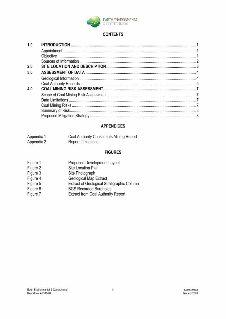
CONTENTS 1.0 INTRODUCTION ........................................................................................................................ 1
Appointment ................................................................................................................................ 1 Objective ..................................................................................................................................... 1 Sources of Information ................................................................................................................ 2
2.0 SITE LOCATION AND DESCRIPTION ...................................................................................... 3 3.0 ASSESSMENT OF DATA .......................................................................................................... 4
Geological Information ................................................................................................................ 4 Coal Authority Records ............................................................................................................... 5
4.0 COAL MINING RISK ASSESSMENT ......................................................................................... 7 Scope of Coal Mining Risk Assessment ..................................................................................... 7 Data Limitations .......................................................................................................................... 7 Coal Mining Risks ....................................................................................................................... 7 Summary of Risk ......................................................................................................................... 8 Proposed Mitigation Strategy ...................................................................................................... 8
APPENDICES
Appendix 1 Coal Authority Consultants Mining Report Appendix 2 Report Limitations
FIGURES
Figure 1 Proposed Development Layout Figure 2 Site Location Plan Figure 3 Site Photograph Figure 4 Geological Map Extract Figure 5 Extract of Geological Stratigraphic Column Figure 6 BGS Recorded Boreholes Figure 7 Extract from Coal Authority Report

Earth Environmental & Geotechnical 1 xxxxxxxxxxxx Report No. A3381/20 January 2020
1.0 INTRODUCTION Appointment
1.1 Earth Environmental & Geotechnical Ltd have been commissioned by the Client), to undertake a Coal Mining Risk Assessment at xxxxxxxxxxxx.
1.2 The Client intends to develop the site by providing two classroom extensions and reconfiguration of a number of areas with the existing school, as shown below in Figure 1.
1.3 This Coal Mining Risk Assessment is required to assist with a potential future planning application.
Figure 1 Development Layout Plan
Objective
1.4 The purpose of the Coal Mining Risk Assessment is to collate available geological, mining and historical data in order to assess the potential for the site to be affected by underground mining. This report has been drafted in accordance with the Coal Authority (CA) Coal Mining Risk Assessment Template, January 2011.
Extension Area in Red

Earth Environmental & Geotechnical 2 xxxxxxxxxxxx Report No. A3381/20 January 2020
Sources of Information
1.5 The Coal Mining Risk Assessment compiles a review of the following information sources:
• Online British Geological Survey maps and data. • British Geological Survey of England, Sheet 85 Manchester 1: 50,000 scale, 2010 edition. • Coal Authority Interactive Map Viewer. • Coal Authority Mining Report dated 14th January 2020. • British Geological Survey online borehole records. • Google Earth imagery. • Online Historical Ordnance Survey maps. • Site Investigations in Areas of Mining Subsidence, FG Bell, 1975. • The threat of abandoned mines on the stability of urban areas, Barry Clarke, IAEG2006
Paper Number 379, The Geological Society of London, 2006. • The collapse of shallow coal mine workings, Durham theses, Durham University, Garrard,
1981. • Construction over abandoned mineworking’s, CIRIA Special Publication 32, 2002. • Abandoned Mineworking’s Manual, CIRIA 2019. • Local Council Planning Portal.

Earth Environmental & Geotechnical 3 xxxxxxxxxxxx Report No. A3381/20 January 2020
2.0 SITE LOCATION AND DESCRIPTION
Figure 2 Site Location Plan
Figure 3 Site Photograph
N

Earth Environmental & Geotechnical 4 xxxxxxxxxxxx Report No. A3381/20 January 2020
3.0 ASSESSMENT OF DATA Geological Information
3.1 The geology of the site has been determined from geological maps for the area and examination of Coal Authority (CA) records.
BGS Published Data Assessment
3.2 An extract from the most recently published geological map showing the approximate site location and key local geological features is presented below in Figure 4 with an extract of the relevant geological stratigraphic column presented subsequently as Figure 5.
Figure 4 Geological Map
Figure 5 Extract of Geological Stratigraphic Column
3.3 The BGS states that the site is underlain by superficial deposits consisting of Devensian Sand & Gravel.
3.4 The solid geology beneath the site is recorded to be Pennine Lower Coal Measures Formation.
3.5 The geological map shows strata dipping to the south west, with the proven Arley coal seam outcropping offsite 150m to the south west.
Site Arley coal
seam

Earth Environmental & Geotechnical 5 xxxxxxxxxxxx Report No. A3381/20 January 2020
3.6 Geological memoirs suggest that the Arley coal seam (0.91m to 1.2m thick) was worked for its excellent quality for coking, house and steam coal.
3.7 Several BGS recorded boreholes are present in the surrounding area with the nearest locations shown in Figure 6 below.
Figure 6 BGS Recorded Borehole Locations
3.8 The nearest (575m) borehole (SD80NE2) to the sites eastern boundary shows a depth to rockhead of 79m.
3.9 Borehole SD80NE3 (400m west) encountered rockhead at a depth of 80.69m.
Coal Authority Records
3.10 A Coal Authority Mining Report has been acquired for the site and reveals that there are no proven records of past underground mine workings beneath the site.
3.11 The report states that probable unrecorded shallow workings are also not present.
3.12 There are no records of any spine roadways at shallow depth beneath the site.
3.13 There are no recorded coal mine entries known to the Coal Authority within, or within 100m of the boundary of the property.
3.14 The report suggests that the Arley coal seam outcrops on the site, which does not accord with geological mapping. Geological mapping shows the Arley coal seam outcropping 150m to the west of the site.
3.15 There are no faults, fissure or break lines recorded within the site boundary.
3.16 There are no opencast mines recorded within 500m of the site boundary.
SD80NE3
SD80NE2

Earth Environmental & Geotechnical 6 xxxxxxxxxxxx Report No. A3381/20 January 2020
3.17 There are no CA managed tips within 500m of the site boundary.
Figure 7 Extract from Coal Authority Report
3.18 There are no remediated sites or coal mining subsidence claims within 50m of the site boundary.
3.19 The Coal Authority Interactive Viewer shows a Development High Risk Area on the site associated with the outcropping coal seam. It does not show an area of shallow probable workings associated with the outcropping coal seam.
3.20 The CA has no records with regards to mine gas or mine water treatment schemes within 500m of the site boundary.
3.21 The CA have no records with respect to the following:
• Future underground mining;
• Coal mining licenses within 200m of the site boundary;
• Section 46 notices regarding land risk from mining subsidence;
• Withdrawal of support notices;
• Payments to owners of former copyhold land.
Site History
3.22 The available historical plans dating back to 1848 do not show any mining features on the site or in the local area. A school was shown on the site in 1848.
Arley coal seam
outcrop

Earth Environmental & Geotechnical 7 xxxxxxxxxxxx Report No. A3381/20 January 2020
4.0 COAL MINING RISK ASSESSMENT
Scope of Coal Mining Risk Assessment
4.1 Objectives of the coal mining risk assessment are to provide a desk-based assessment of available geological and mining information relating to the site (and wider area) and to use this information so as to identify risks present to the development from the legacy of mining.
4.2 As part of the risk assessment, potential mitigation measures (if required) should be considered, including any necessary remedial works.
4.3 The outcome of the risk assessment should demonstrate to the Local Authority that the proposed development is or can be made safe (and stable) to meet the requirements of the National Planning Policy Framework (NPPF).
Data Limitations
4.4 It should be appreciated that it did not become a legal requirement to deposit coal mining abandonment plans until the 1870’s and that this requirement was not rigorously enforced for some time after. Many shallow coal seams were worked prior to the introduction of first edition Ordnance Survey Maps and information on these workings is often not available. Therefore, if coal seams were accessible then there is the potential that they could have been worked by formal or informal means.
4.5 It is also possible that if unrecorded workings are present then unrecorded mine entries may be present.
Coal Mining Risks
4.6 The risks associated with coal mining are as follows:
• Collapse of relict workings beneath buildings causing damage to the building fabric and infrastructure.
• Migration of mine gases from old mine workings and mine entries resulting in accumulation of flammable and asphyxiating gases in confined areas.
• Consolidation of relict workings and overlying strata causing structural defects in building fabric and infrastructure.
• Failure of mine entries causing loss of ground beneath building and external areas.
• Spontaneous combustion of old mine workings.

Earth Environmental & Geotechnical 8 xxxxxxxxxxxx Report No. A3381/20 January 2020
Summary of Risk
4.7 The Coal Authority report confirms the absence of proven or unrecorded mine workings.
4.8 The local geology consists of deep superficial deposits up to 80m thick, underlain by the Pennine Lower Coal Measures Formation.
4.9 There is an ambiguity between geological mapping and Coal Authority mining records for the site. The Coal Authority have placed the Arley coal seam outcrop on the site. Earth Environmental & Geotechnical have contacted the Coal Authority about their records and they state:
“In this instance the outcrop data is based on County Geological Sheet 88SE and records inherited from NCB/British Coal placing the outcrop in its current position. And as you state, this differs from BGS 1:50k mapping but we assume that the NCB position was derived by either a surveyor or geologist specialising in coal mining geology in this area”.
4.10 We do not accept this interpretation of the local geology as the area was re-surveyed in 2003-2005. Geological map 88SE is dated from 1929 and therefore of some antiquity.
Proposed Mitigation Strategy
4.11 Irrespective of the ambiguity in the interpretation of the local geology, the fact is that there is very deep drift material overlying rockhead, up to 80.69m thick.
4.12 Any coal seam outcrop is therefore considerably beyond the depth range of the surface and no remedial measures are required for the proposed development.
Earth Environmental & Geotechnical 9 xxxxxxxxxxxx Report No. A3381/20 January 2020
APPENDIX 1
COAL AUTHORITY MINING REPORT

Earth Environmental & Geotechnical 10 xxxxxxxxxxxx Report No. A3381/20 January 2020
APPENDIX 2
REPORT LIMITATIONS

Earth Environmental & Geotechnical 11 xxxxxxxxxxxx Report No. A3381/20 January 2020
REPORT LIMITATIONS
This contract was completed by Earth Environmental & Geotechnical Ltd on the basis of a defined programme and scope of works and terms and conditions agreed with the client. This report was compiled with all reasonable skill, and care, bearing in mind the project objectives, the agreed scope of works, the prevailing site conditions, the budget and staff resources allocated to the project.
Other than that, expressly contained in the above paragraph, Earth Environmental & Geotechnical Ltd provides no other representation or warranty whether express or implied, is made in relation to the services. Unless otherwise agreed this report has been prepared exclusively for the use and reliance of the client in accordance with generally accepted consulting practices and for the intended purposes as stated in the agreement under which this work was completed. This report may not be relied upon, or transferred to, by any other party without the written agreement of a Director of Earth Environmental & Geotechnical Ltd.
If a third party relies on this report, it does so wholly at its own and sole risk and Earth Environmental & Geotechnical Ltd disclaims any liability to such parties.
It is Earth Environmental & Geotechnical Ltd understanding that this report is to be used for the purpose described in the introduction to the report. That purpose was an important factor in determining the scope and level of the services. Should the purpose for which the report is used, or the proposed use of the site change, this report will no longer be valid and any further use of, or reliance upon the report in those circumstances by the client without Earth Environmental & Geotechnical Ltd review and advice shall be at the client's sole and own risk.
The report was written in 2020 and should be read in light of any subsequent changes in legislation, statutory requirements and industry best practices. Ground conditions can also change over time and further investigations or assessment should be made if there is any significant delay in acting on the findings of this report. The passage of time may result in changes in site conditions, regulatory or other legal provisions, technology or economic conditions which could render the report inaccurate or unreliable. The information and conclusions contained in this report should not be relied upon in the future without the written advice of Earth Environmental & Geotechnical Ltd. In the absence of such written advice of Earth Environmental & Geotechnical Ltd, reliance on the report in the future shall be at the client's own and sole risk. Should Earth Environmental & Geotechnical Ltd be requested to review the report in the future, Earth Environmental & Geotechnical Ltd shall be entitled to additional payment at the then existing rate or such other terms as may be agreed between Earth Environmental & Geotechnical Ltd and the client.
The observations and conclusions described in this report are based solely upon the services that were provided pursuant to the agreement between the client and Earth Environmental & Geotechnical Ltd. Earth Environmental & Geotechnical Ltd has not performed any observations, investigations, studies or testing not specifically set out or mentioned within this report.
Earth Environmental & Geotechnical 12 xxxxxxxxxxxx Report No. A3381/20 January 2020
Earth Environmental & Geotechnical Ltd is not liable for the existence of any condition, the discovery of which would require performance of services not otherwise contained in the services. For the avoidance of doubt, unless otherwise expressly referred to in the introduction to this report, Earth Environmental & Geotechnical Ltd did not seek to evaluate the presence on or off the site of electromagnetic fields, lead paint, radon gas or other radioactive materials.
The services are based upon Earth Environmental & Geotechnical Ltd observations of existing physical conditions at the site gained from a walkover survey of the site together with Earth Environmental & Geotechnical Ltd interpretation of information including documentation, obtained from third parties and from the client on the history and usage of the site. The findings and recommendations contained in this report are based in part upon information provided by third parties, and whilst Earth Environmental & Geotechnical Ltd have no reason to doubt the accuracy and that it has been provided in full from those it was requested from, the items relied on have not been verified.
No responsibility can be accepted for errors within third party items presented in this report. Further Earth Environmental & Geotechnical Ltd was not authorised and did not attempt to independently verify the accuracy or completeness of information, documentation or materials received from the client or third parties, including laboratories and information services, during the performance of the services. Earth Environmental & Geotechnical Ltd is not liable for any inaccurate information, misrepresentation of data or conclusions, the discovery of which inaccuracies required the doing of any act including the gathering of any information which was not reasonably available to Earth Environmental & Geotechnical Ltd and including the doing of any independent investigation of the information provided to Earth Environmental & Geotechnical Ltd save as otherwise provided in the terms of the contract between the client and Earth Environmental & Geotechnical Ltd.
Where field investigations have been carried out these have been restricted to a level of detail required to achieve the stated objectives of the work. Ground conditions can also be variable and as investigation excavations only allow examination of the ground at discrete locations. The potential exists for ground conditions to be encountered which are different to those considered in this report. The extent of the limited area depends on the soil and groundwater conditions, together with the position of any current structures and underground facilities and natural and other activities on site. In addition, chemical analysis was carried out for a limited number of parameters [as stipulated in the contract between the client and Earth Environmental & Geotechnical Ltd] based on an understanding of the available operational and historical information, and it should not be inferred that other chemical species are not present.
The groundwater conditions entered on the exploratory hole records are those observed at the time of investigation. The normal speed of investigation usually does not permit the recording of an equilibrium water level for any one water strike. Moreover, groundwater levels are subject to seasonal variation or changes in local drainage conditions and higher groundwater levels may occur at other times of the year than were recorded during this investigation.
Any site drawing(s) provided in this report is (are) not meant to be an accurate base plan but is (are) used to present the general relative locations of features on, and surrounding, the site.