
ESKOM’S NORTHERN KWAZULU - mdte.co.za · STRENGTHENING PROJECT: IPHIVA SUBSTATION ... • 132 kV...
14
1
Transcript of ESKOM’S NORTHERN KWAZULU - mdte.co.za · STRENGTHENING PROJECT: IPHIVA SUBSTATION ... • 132 kV...
1

1
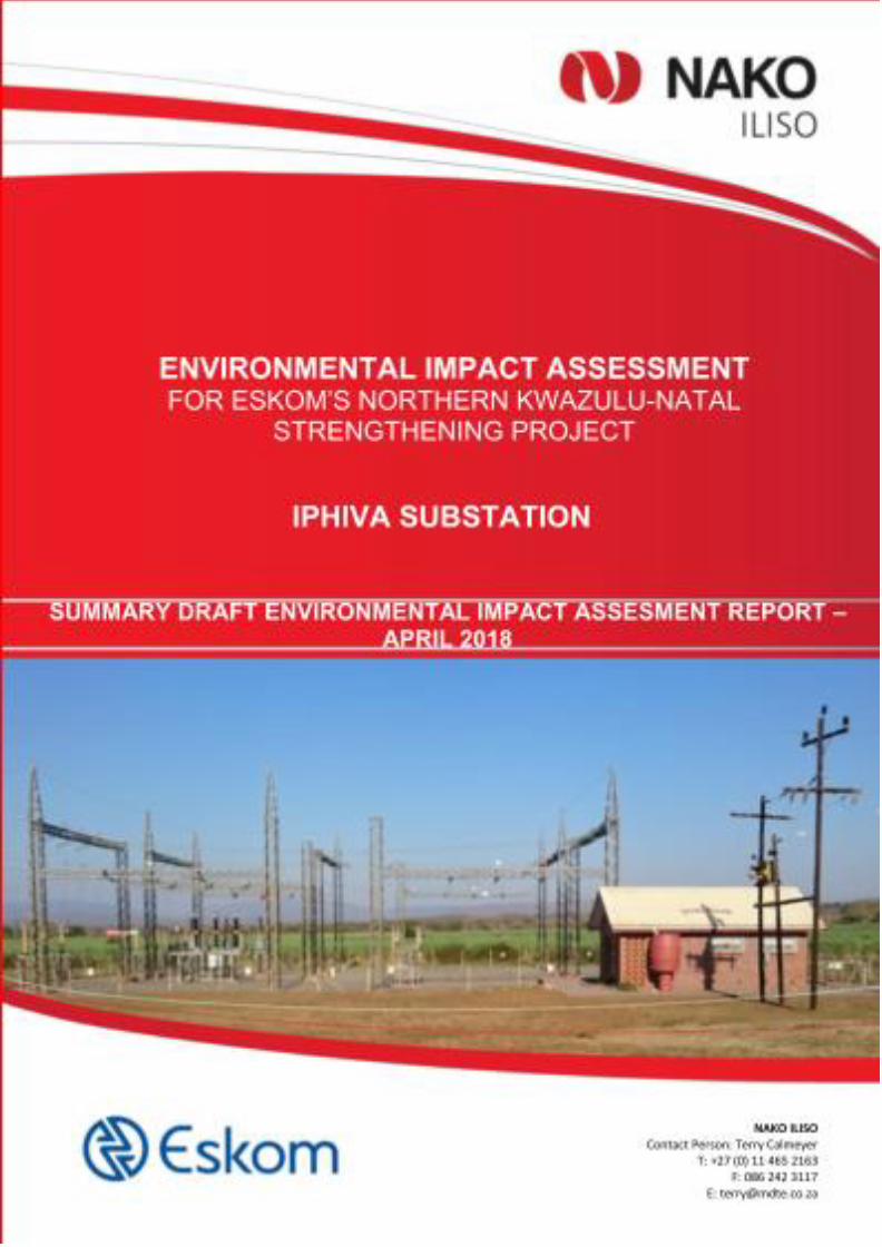
ESKOM’S NORTHERN KWAZULU-NATAL
STRENGTHENING PROJECT: IPHIVA SUBSTATION
ENVIRONMENTAL IMPACT ASSESSMENT
SUMMARY OF THE DRAFT ENVIRONMENTAL IMPACT
ASSESSMENT REPORT
Background
ESKOM Holdings SOC Ltd (Eskom) has commissioned a project to strengthen the supply of
electricity in northern KwaZulu-Natal (KZN). NAKO ILISO has been appointed to undertake
an Environmental Impact Assessment (EIA) to support applications for Environmental
Authorisation.
The project has been divided into the following four components, each of which has an
application:
• Iphiva Substation;
• Normandie-Iphiva 400 kV Transmission Powerline;
• Iphiva-Duma 400 kV Transmission Powerline; and
• 132 kV Distribution Powerlines.
This report documents the process and findings of the assessment of the Iphiva Substation.
This report will be subject to a public comment period after which it will be finalised and
submitted to the competent authority for review.
Need for the project
The northern KZN network is currently fed at 132 kV by the Normandie and Impala Main
Transmission Substations. The major load centres are Pongola and the Makhatini Flats. The
Normandie Substation is situated approximately 80 km north-west of Pongola and the Impala
Substation is situated approximately 180 km south of Makhatini Flats. High voltage drops are
experienced in the 132 kV network and the voltages are approaching unacceptable low
voltage levels as the demand increases. Contingencies on the main 132 kV supplies also lead
to thermal overloading of the remaining network.
2
Project Description
In order to strengthen and alleviate current and future network constraints in northern KZN, it
is proposed that the Iphiva 400/132 kV Substation be introduced in the area, which will de-
load the main sub-transmission network and improve the voltage regulation in the area. The
Iphiva Substation will be integrated with the existing electricity network by 400 kV
Transmission powerlines to the Normandie and Duma Substations, and approximately 165
km of 132 kV Distribution powerlines.
A total footprint of 400 x 400 m (i.e. 16 ha) will be required for the development, within a site-
specific study area of 1 x 1 km. The 16 ha development footprint area includes provisions for
an 80 m high microwave radio communication mast, oil and fuel storage facilities, and an oil
bund to contain any accidental transformer oil spills. The proposed substation will comprise
standard electrical equipment, including transformers, reactors, busbars, and isolators.
Listed Activities
The proposed project triggers several activities listed in the National Environmental
Management Act (No 107 of 1998) (NEMA), as amended, as requiring environmental
authorisation before they can commence. The purpose of this study is to undertake an EIA
process, with associated Public Participation Process (PPP) and specialist studies, to enable
the competent authority to decide whether the project should go ahead or not, and if so, then
on what conditions.
Receiving Environment
The project is located in the KZN Province. The area has warm to hot summers, high
evaporation, dry warm winters and a mean annual rainfall between 495 and 1 560 mm.
Average rainfall is higher in the west and decreases gradually to the east. The dominant
landscape features are valley slopes to undulating hills and flat plains with a network of rivers
and smaller streams. The northern and central parts of the study area are more mountainous
and have extreme topographical features.
The region is well known for its large wetlands, river systems, grassland hills, bushveld and
diverse micro-habitats. The study area falls within the Maputaland-Pondoland-Albany hotspot,
which is rich in floral diversity and is part of the Maputaland Centre of Plant Endemism. 58 of
Southern Africa's endemic and near endemic avifaunal species are found within the project
area.
3
Mkuze and Pongola are the large towns in the area. The rest of the area consist of settlements
in areas under traditional leadership, commercial farms and game reserves. The land under
traditional management belongs to the Ingonyama Trust. Settlement patterns are scattered.
Dwellings consist mostly of brick structures or traditional structures. Most people have isiZulu
as their home language.
In terms of commercial farming, sugar cane and forestry are concerns when it comes to the
presence of powerlines. Sugar cane needs to be burnt, and as such cannot always be planted
below powerlines. Although there are other methods to harvest sugar cane under powerlines,
these are more expensive and labour intensive. Fire is a risk for forestry, and a spark or a
snapped power line could cause extensive damage.
Alternatives
Eskom and the EAP, in consultation with specialists and I&APs identified thirteen (13)
technically feasible approximately 1 km2 sites on which Eskom could construct the substation.
A technical screening and comparative assessment were undertaken in the Scoping Phase of
the project, and the two sites that are the best practical environmental option, referred to as
Iphiva 3 and Iphiva 6, were recommended for further assessment.
Public Participation in the Scoping Phase
Public participation is an important aspect of any EIA, with the objective to assist stakeholders
to table issues of concern, suggestions for enhanced benefits and to comment on the findings
of the EIA. The Public Participation Process (PPP) is designed to provide sufficient and
accessible information to Interested and Affected Parties (I&APs) in an objective manner.
An I&AP database has been established to record the details of stakeholders that wish to
register for the project. Key stakeholders have been identified and notified of the project and
their opportunities to participate. A Background Information Document was compiled and
distributed to all registered I&APs and at meetings. Newspaper advertisements were placed
in four newspapers in English and isiZulu. Onsite notices were erected at 23 locations in the
study area. Meetings were held with Key Stakeholder and Authorities at four venues in the
study area, in order to present the proposed project to them, and give them an opportunity to
raise any concerns that they might have. Similar meetings, in isiZulu, took place with each of
the 31 Traditional Councils in the study area. Focus Group Meetings with Ezemvelo KZN
Wildlife, organisations concerned about impacts on birds, Farmers Organisations and the
landowners of the substation site alternatives also took place.
4
The draft Scoping Report was available for public comment. All comments made at meetings
or submitted by other means were captured in a Comments and Responses Report, and
incorporated into a Final Scoping Report that was submitted to the competent authority for
review. The competent authority has accepted the Final Scoping Report and this EIA phase
of the project has been undertaken according to the Plan of Study in the Scoping Report.
This draft EIA Report is now available for a 30-day public comment period. All comments
received will be considered and the EIA Report will be finalised for submission to the
competent authority.
Key Issues
The following key issues have been identified:
• Impacts on areas protected by National and Provincial legislation resulting in loss of plants
and animals of conservation value and a loss in the income from and value of the facilities,
primarily due to visual impacts;
• Impacts on the rich and diverse fauna and flora (specifically large birds);
• Impacts on landuse, particularly for sugar cane farmers and forestry;
• Impacts on Heritage Resources;
• Social impacts;
• Economic,
• Impacts on the biophysical environment resulting from access roads;
• Construction Impacts; and
• Cumulative impacts.
Specialist Studies
This EIA Report uses input from specialists to assess the key impacts, determine their
significance, and recommend appropriate measures to mitigate negative impacts and
enhance benefits. The specialist studies that have been undertaken are summarised below.
Mitigation measures recommended have been included in the Draft Environmental
Management Programme (EMPr).
A preliminary geotechnical investigation was undertaken to confirm that the sites being
assessed are suitable for the construction of a substation.
An assessment of the local flora and fauna communities associated with the proposed
powerlines was undertaken. This study predicted that:

5
• The direct loss of floral species/vegetation types and biodiversity will have a moderate
significance after mitigations;
• The loss of species of special concern (protected species) would have a negligible impact
after mitigation; and
• The impact of alien vegetation establishment will be negligible after mitigation.
The fauna and flora specialist recommended that the project is authorised. Iphiva 3 has a
suitable and relatively undisturbed vegetation cover and is not disturbed by anthropogenic
activities such as agricultural field, rural housing, bush clearing or informal roads. The site is
available for livestock to graze. Iphiva 6 is disturbed by rural housing, bush clearing or informal
roads, with little natural habitat remaining. There is scattered natural vegetation such as Aloe
marlothii (Mountain Aloe) and various Acacia species. Based on the amount of natural habitat
that is relatively undisturbed that will be disturbed by the placement of the substation the fauna
and flora specialist recommended Iphiva 6 as the preferred alternative.
With the clearing of vegetation for the construction of the substation, avi-fauna habitat will be
removed. Indigenous vegetation will be replaced by fast growing alien and weed vegetation,
degrading the general habitat quality. The construction of infrastructure especially at height,
which includes distribution lines emanating from the substation will pose a risk to avifaunal
species in the form of collision and electrocution risk.
The consideration of alternative substation sites from an avifaunal perspective, was primarily
determined by the ecological sensitivity present based on:
• Presence or absence of Red Data or protected bird species;
• Presence or absence of exceptional Avifaunal species diversity;
• Extent of intact habitat in good ecological condition in the absence of disturbance; and
• Presence or absence of important ecosystems protected areas, such as Important Bird
Areas, Protected Areas, areas demarcated for future protected area status (NPAES) and
wetlands.
The habitat present at Iphiva 6 is impacted by the presence of the local community, with Iphiva
3 being undisturbed and more natural. No Species of Special Concern were encountered on
either of the substation sites during the field work. A Brown Snake Eagle was recorded close
to Iphiva 3. The significance of the direct loss of habitat types and biodiversity during
construction after mitigation is therefore moderate for Iphiva 3 and minor for Iphiva 6. Loss of
species of special concern during construction after mitigation is minor for Iphiva 3 and

6
negligible for Iphiva 6. The avi-fauna specialist recommended Iphiva 6 as the preferred site
for the substation.
The aim of the wetland assessment process was to provide specialist opinion on the viability
of the proposed strengthening project in terms of wetland ecology. Wetland areas were
identified and preliminary wetland boundaries were delineated at the desktop level using
detailed aerial imagery (Southern Mapping, 2015) along with 1m contours for the two Iphiva
Substation sites under consideration.
Baseline and background information was researched and used to understand the area on a
desktop level prior to fieldwork; this included but was not limited to:
• The Ramsar Convention;
• National Freshwater Ecosystem Priority Areas (NFEPA) (Nel et al., 2011);
• Water Management Areas (WMA) and Quaternary Catchments; and
• The KwaZulu-Natal 2012 Critical Biodiversity Areas Map.
The ecologist recommended that the project be authorised. Existing anthropogenic
disturbance is by far considered the largest driver of transformation of wetland habitats and
Iphiva 6 is therefore the preferred site for development.
The investigation of agricultural potential involved the collation of climate, geology,
topography information and determining the broad soil groups of the area as background for
further interpretation. Properties of the soil groups, soil depth, clay content, soil restrictions as
well as land capability classes were considered. The soil investigation was based on a field
investigation and additional available information from the Land Type Survey of the Institute
of Soil Climate and Water, as well as other relevant information.
The soils in the project area were then classed in four land capability/potential classes,
namely:
• Soils of intermediate suitability for arable agriculture;
• Soils not suitable for arable agriculture, but suitable for forestry or grazing;
• Soils of poor suitability for arable agriculture; and
• No dominant class.
Properties like clay content and susceptibility to erosion is highly dependent on the parent
material. The mudstone underlying this area can give rise to soils severely susceptible to

7
erosion when exposed. Exposed surfaces should therefore be limited or prevented. It should
be covered with any vegetation even for short periods.
Arable crop production is not restricted by the climate of the area but may become risky in the
areas with lower and irregular rainfall patterns.
At the Iphiva 3 and 6 Substations the soils are not suitable for arable agriculture, but rather
suitable for grazing from an agricultural viewpoint. When not covered with vegetation the soils
have a high risk for erosion. The specialist has no objections to the project from the agricultural
and soil potential standpoint and recommends that Iphiva 6 is implemented.
The Heritage Impact Assessment complies in part with the KwaZulu-Natal Heritage Act, (No
4 of 2008) (KZNHA) and National Heritage Resources Act, (No 25 of 1999) (NHRA). The
greater cultural landscape is expected to contain heritage resources spanning from
palaeontological through to contemporary living heritage resources. Various resource types
are anticipated to occur. These include but are not limited to archaeological resources from
various time periods; and burial grounds and graves.
Earth moving activities, such as vegetation and surface clearing, or excavation for the relevant
infrastructures, construction and/or upgrading of access roads and stringing of conductors
have the greatest likelihood of direct impacts on heritage resources.
The visual specialist study is based on the Oberholzer (2005) guideline that draws on best
practice in EIA and provides guidance applicable to visual specialist assessments. Projects-
specific receptor (viewer) sensitivity is based on accepted international practice, previous
experience of the visual specialists, social specialist and the economic specialist.
Guest houses, game lodges and nature-based tourism in protected areas dependent upon a
pristine visual resource for tourism value are considered to have a High viewer sensitivity.
rural (commercial farming) homesteads a Moderate viewer sensitivity, and National / provincial
road users where other infrastructure is present and transformation has already taken place,
Formal settlements (such as Pongola / Mkuze / Ulundi) and informal settlements / villages
(likely considers transmission lines as a sign of progress) a Low viewer sensitivity.
The greatest factor that influenced visual impact for this project was the presence of
conservation areas, due to their dependence upon the landscape as visual resource as
8
income generator for tourism-related activities. The avoidance and minimisation of the visual
impact was mostly focused around reducing impact on these areas.
Impacts were identified for each of the viewer groups against each of the infrastructure
components. Visibility and visual exposure were combined in the GIS viewsheds generated.
These aspects and visual intrusion were combined to calculate the intensity / magnitude of
each impact. The visual intensity was then combined with pre-defined impact assessment
aspects such as the nature, duration, extent to determine the significance of each impact
before and after mitigation.
Site 6 is preferred, based on numerous visibility analyses, taking into account scenic points,
existing/known lookout points and game drive routes in Manyoni Private Game Reserve, which
is the closest game reserve to the two sites.
Demographic, economic, geographic, institutional, legal, emancipatory, empowerment, and
socio-cultural processes were investigated in the Social Impact Assessment: The social
specialist identified the following key stakeholder groups potentially impacted by the project:
• Communities under traditional authority;
• Commercial farming;
• Tourism establishments; and
• Surrounding urban areas.
The proposed project activities set into motion certain social change processes, and these
change processes can lead to the experience of social impacts. Social impacts are context
specific and may be experienced differently by different groups in the area. The social
environment is very dynamic and is constantly changing.
The following change processes and impacts have been identified for the proposed project:

9
The social specialist concluded that the project will make an important contribution to the
supply of electricity in northern KZN and will be of service to many previously disadvantaged
communities. She therefore recommends that the project as a whole should proceed, but in
the process attempt to minimise negative social impacts to the immediate environment,
keeping in mind the current economic climate and broader societal picture in terms of
expenditure. Iphiva 6 is recommended.
One of the key issues that landowners affected by the proposed project have raised is the
impact on the eco-tourism activities and knock-on effects including decline in property values,
loss of jobs, and reduced budgets for conservation of animals. The socio-economic specialist
study only allowed for this to be assessed on a qualitative level. Interaction with the
landowners has highlighted that the project could be opposed should this aspect not be
adequately addressed. The inclusion of a more detailed economic assessment was therefore
commissioned.
Tourism is not an economic sector in its own right but is a complex and composite sector
comprising mainly of accommodation, transportation, food and beverages, cultural and
recreational activities. The activities undertaken by the tourist relate with the travel,
destination, and entertainment activities and expenditure that tourists make. The tourism

10
sector contributes approximately 6 % to the value of economic activity for all goods and
services produced within the area. This is slightly higher than the national average. The total
number of people employed in tourism amounts to approximately 4.6 % of all employment
within the regional economy. The tourism value of the region is estimated at R 1.9 billion for
the geographical area for 2016, and employment amounts to approximately 9 831 for the
corresponding year.
The development of the substation will be a significant investment for and have a positive
impact on the economy. This is related to the construction and maintenance of the
infrastructure as well as positive spin-off impact due to increased electricity supply.
Investment costs for the new substation is estimated to be in the order of R 1.25 billion.
The economic specialist found that the agglomeration of eco- and nature-based tourism is
high within this region and a large share of these establishments cater for the international
tourism market and even state their tariffs in Euro and Dollar instead of South African Rand.
The intensity of the economic impact for tourism activity will be different for each
property/activity and depends on inter alia the:
• Land use type – property with tourism activity, such as game farming, lodges, protected
areas and nature reserves should, as far possible, be eliminated from the preferred
alignment.
• Powerline route – The route should be on the boundary of farms and not transcend
properties diagonally or through the middle.
• Size of the property – A powerline that transcend properties diagonally or through the
middle, for property smaller than 200 ha – tips an argument for expropriation
• Existing infrastructure – Do not place powerlines over or in close proximity to tourism
infrastructure.
• Visibility of the new structure - Place the powerlines / pylons and the substation in areas
where it is not visible from tourism areas/hides/etc.
• Market related compensation for the affected property should be provided where the
powerline is developed.
• Landowners should be consulted about their preferred configuration if their property is
affected.
The impact on tourism activity is in most cases higher than other land uses and varies between
-5% and -30% of the existing property value and production level. The tourism value for game
reserves/lodges/private game reserves within the regional economy is estimated to be

11
approximately R6 303 per hectare for final sales. The alternatives where the negative
economic impact is lowest is preferred.
Impacts (Table below) are measured in terms of:
• Production: refers to the value of output generated in the economy as a result of the
existing tourism activity.
• Employment: reflects the number of jobs created by the tourism activity.
• Household Income: refers to the income by households as a result of their involvement in
the activity and downstream beneficiation production.
Summary of economy wide economic impact
Project Component Total hectare
within reserve/ lodge/ game farm
Economy-Wide
Economic Value
Employment
Household
Income
Iphiva 3 106 ha R 1.2 million 5 jobs R 0.6 million
Iphiva 6 0 ha 0 0 0
The economic specialist found that the construction and operation of the Iphiva 3 Substation
will have a high negative significant impact after mitigation on Property value of the site while
it will be low for Iphiva 6. The significance of the impact on adjacent properties is Medium-
High for both sites. The reduction in the economic value of the regional economy as a result
of a reduction in tourism activities and future expansion/investment in tourism activity may also
be impacted due to the loss in productive land and is expected to be High for Iphiva 3 and Low
for Iphiva 6.
The economic specialist recommended that Iphiva 6 be implemented, and in order to achieve
the lowest possible negative economic impact a suitable location for the substation on Iphiva
6 should be found where the visual impact is as low as possible for the surrounding areas.
Conclusion and Recommendation
The EAP recommends that the construction and operation of the Iphiva Substation be
authorised. Iphiva 6 is the best practical environmental option available.
The substation should be placed in the northern section of Site 6 (with the lowest visibility).
The southern slopes of the hill on Site 6 should be avoided. This will reduce the visual and
associated economic impacts on tourism. High structures, such as the radio tower pose a risk
of collision for birds, and suitable measures must be applied to make the mast visible to birds.
12
A site investigation of the proposed substation site layout should be conducted by a suitable
qualified avifauna and fauna and flora specialists in order to determine the presence of any
threatened, protected, endemic bird, animal or plant species of special concern within or in
close proximity to the area to be impacted by construction areas.
Areas with a high ecological sensitivity, wetlands and watercourses should be designated as
“No-Go” areas and be off limits to all unauthorised vehicles and personnel.
The footprint area must be limited to what is essential in order to minimise impacts as a result
of vegetation clearing and compaction of soils. Protected trees on the footprint of the
substation site will require permits before these trees are damaged or removed. Physical
damage to natural vegetation on the periphery of the footprint, in all riparian areas and areas
with steep slopes must be avoided. No hunting is permitted by Eskom employees or
contractors. No incision and canalisation of the wetland features should take place. No
material may be dumped or stockpiled in any “No-Go areas. All vehicles must remain on
demarcated roads and within the project area footprint. All land disturbed by Eskom should be
vegetated and left in the condition it was before the construction and no disturbed areas should
be left uncovered during construction to prevent erosion.
Exemption from further palaeontological assessment is recommended. A Fossil Chance Find
Procedure must be included in the EMPr.
The social mitigation and management measures include appointing a Community Liaison
Officer, compiling and implementing policies for employment, conduct of employees and
contractors, road use, access control specifically for protected and game reserve areas, a
relocation and compensation in accordance with international best practice, strategies for
community relations, communication, Corporate Social Investment, safety and security, HIV
and life skills, and a grievance mechanism. A relocation specialist should be appointed should
relocation be required. Construction camps should be established in accordance with
international best practice, and Eskom must join local fire protection agencies and have and
implement a fire fighting strategy.

1


