ENGINEERING GEOLOGY AND GEOHAZARDS REPORT Harris …Engineering Geology and Geohazards Report BCI...
20
ENGINEERING GEOLOGY AND GEOHAZARDS REPORT Harris Quarry Willits, California Prepared by: Blackburn Consulting, Inc. December 2004 Prepared for: Rau & Associates
Transcript of ENGINEERING GEOLOGY AND GEOHAZARDS REPORT Harris …Engineering Geology and Geohazards Report BCI...
ENGINEERING GEOLOGY AND
GEOHAZARDS REPORT Harris Quarry
Willits, California
Prepared by:
Blackburn Consulting, Inc.
December 2004
Prepared for:
Rau & Associates
ENGINEERING GEOLOGY AND GEOHAZARDS REPORT
HHaarrrriiss QQuuaarrrryy
TABLE OF CONTENTS
INTRODUCTION .............................................................................................................. 1
Purpose....................................................................................................................... 1 Scope of Services....................................................................................................... 1
SITE AND PROJECT DESCRIPTION.............................................................................. 1 GEOLOGY ......................................................................................................................... 2
Regional Geology ...................................................................................................... 2 Site Specific ............................................................................................................... 2 Faulting ...................................................................................................................... 3
SURFACE WATER AND GROUNDWATER ................................................................. 4 GEOLOGIC HAZARDS .................................................................................................... 4
Faulting ...................................................................................................................... 4 Ground Shaking ......................................................................................................... 4 Liquefaction ............................................................................................................... 5 Landslides and Slope Stability................................................................................... 5 Seismically Induced Settlement................................................................................. 5 Naturally Occurring Asbestos.................................................................................... 5
RECOMMENDATIONS.................................................................................................... 5 Cut Slopes .................................................................................................................. 5 Erosion Control.......................................................................................................... 6
LIMITATIONS................................................................................................................... 6 REFERENCES ................................................................................................................... 7
Figure 1 Vicinity Map Figure 2 Regional Geologic Map Figure 3 Site Geologic Map Figure 4 Regional Fault Map Figure 5 Alquist-Priolo Earthquake Fault Zone Figure 6 Typical Section Figure 7 Asbestos Content Analysis APPENDIX Site Photos
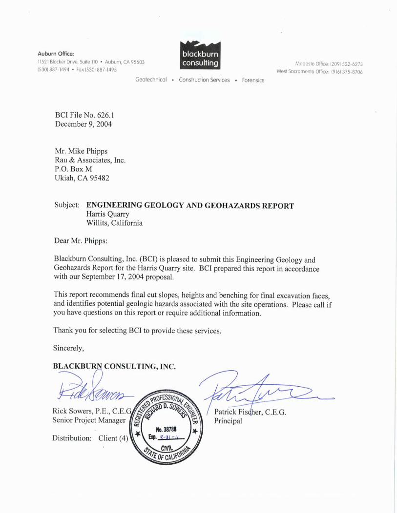
Engineering Geology and Geohazards Report BCI File 626.1 Harris Quarry, Willits, California December 9, 2004
1
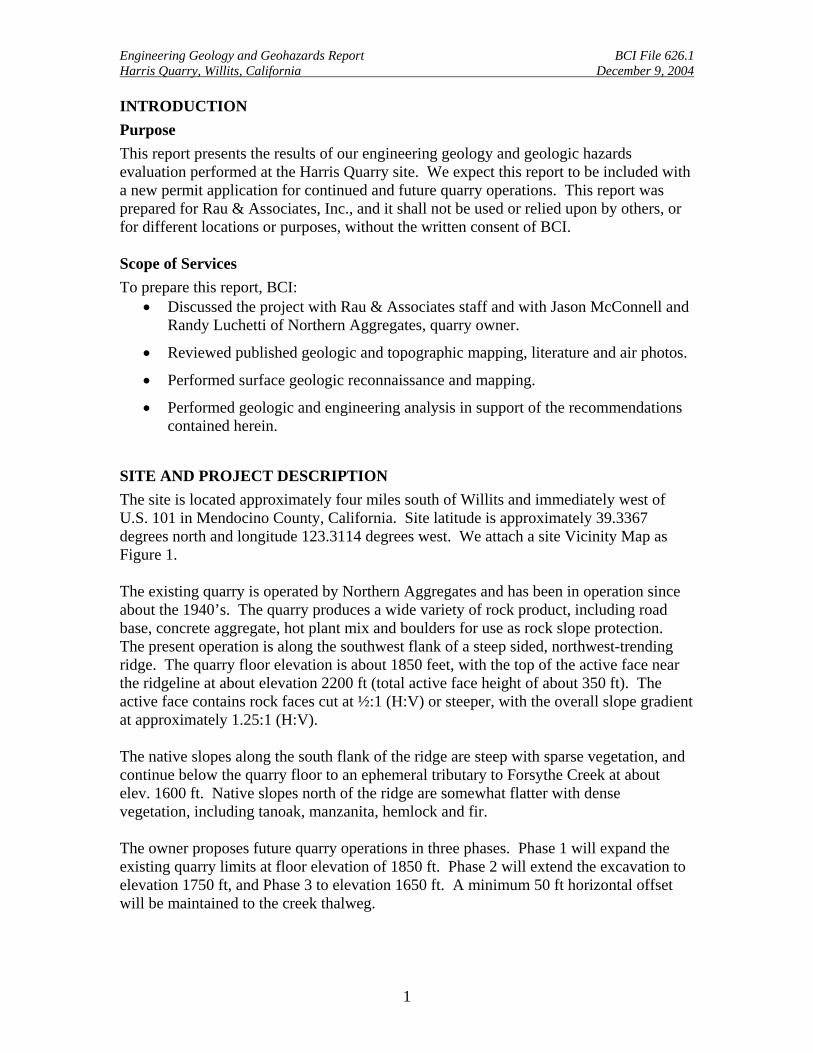
INTRODUCTION Purpose This report presents the results of our engineering geology and geologic hazards evaluation performed at the Harris Quarry site. We expect this report to be included with a new permit application for continued and future quarry operations. This report was prepared for Rau & Associates, Inc., and it shall not be used or relied upon by others, or for different locations or purposes, without the written consent of BCI. Scope of Services To prepare this report, BCI:
• Discussed the project with Rau & Associates staff and with Jason McConnell and Randy Luchetti of Northern Aggregates, quarry owner.
• Reviewed published geologic and topographic mapping, literature and air photos.
• Performed surface geologic reconnaissance and mapping.
• Performed geologic and engineering analysis in support of the recommendations contained herein.
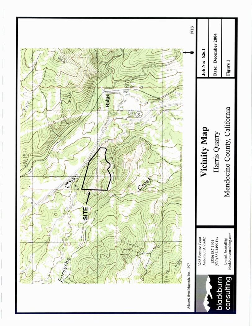
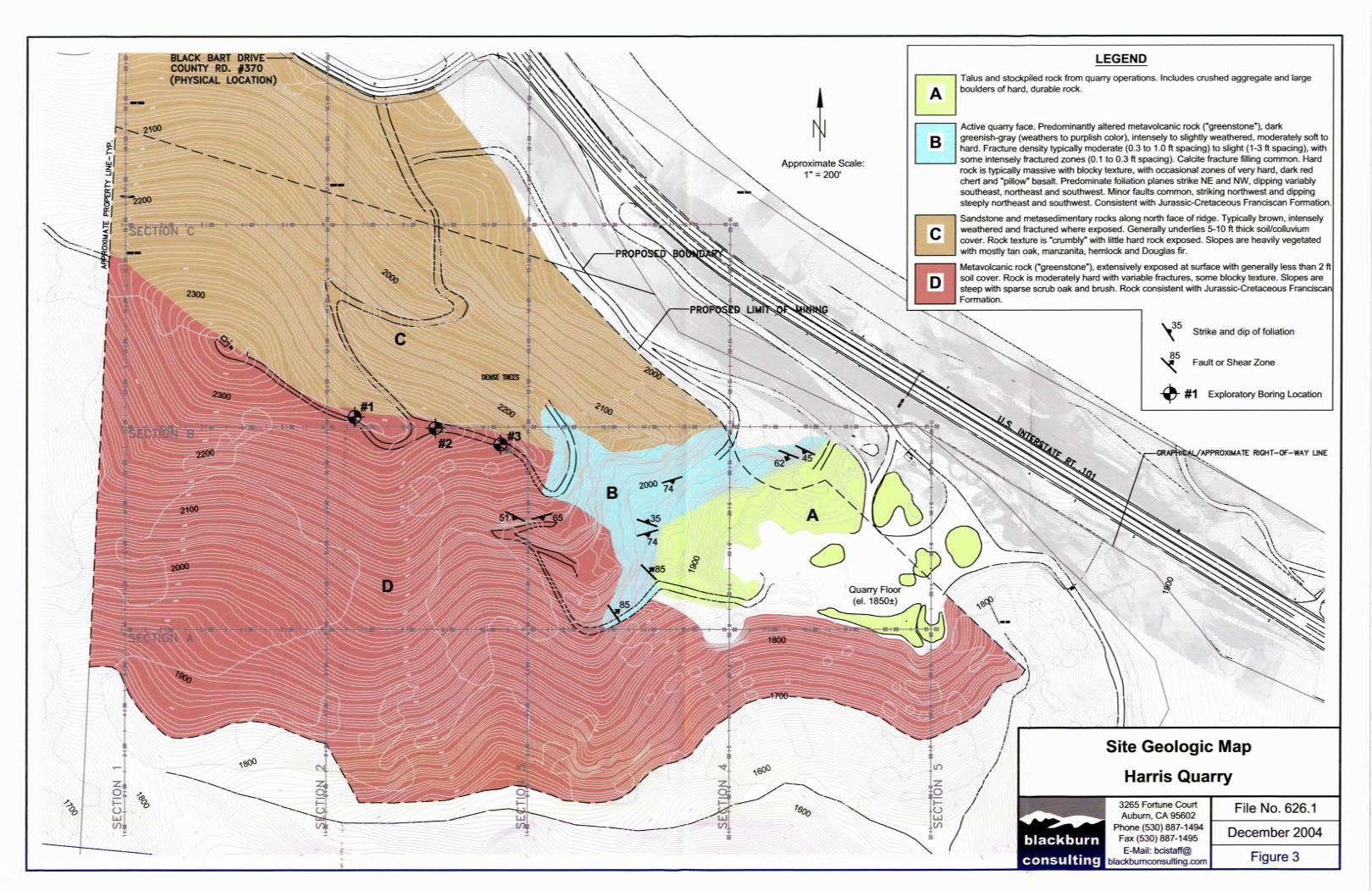
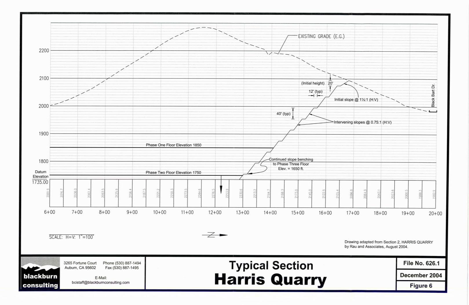
SITE AND PROJECT DESCRIPTION The site is located approximately four miles south of Willits and immediately west of U.S. 101 in Mendocino County, California. Site latitude is approximately 39.3367 degrees north and longitude 123.3114 degrees west. We attach a site Vicinity Map as Figure 1. The existing quarry is operated by Northern Aggregates and has been in operation since about the 1940’s. The quarry produces a wide variety of rock product, including road base, concrete aggregate, hot plant mix and boulders for use as rock slope protection. The present operation is along the southwest flank of a steep sided, northwest-trending ridge. The quarry floor elevation is about 1850 feet, with the top of the active face near the ridgeline at about elevation 2200 ft (total active face height of about 350 ft). The active face contains rock faces cut at ½:1 (H:V) or steeper, with the overall slope gradient at approximately 1.25:1 (H:V). The native slopes along the south flank of the ridge are steep with sparse vegetation, and continue below the quarry floor to an ephemeral tributary to Forsythe Creek at about elev. 1600 ft. Native slopes north of the ridge are somewhat flatter with dense vegetation, including tanoak, manzanita, hemlock and fir. The owner proposes future quarry operations in three phases. Phase 1 will expand the existing quarry limits at floor elevation of 1850 ft. Phase 2 will extend the excavation to elevation 1750 ft, and Phase 3 to elevation 1650 ft. A minimum 50 ft horizontal offset will be maintained to the creek thalweg.
Engineering Geology and Geohazards Report BCI File 626.1 Harris Quarry, Willits, California December 9, 2004
2
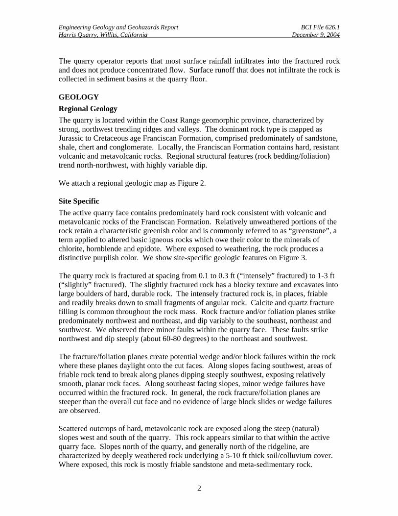
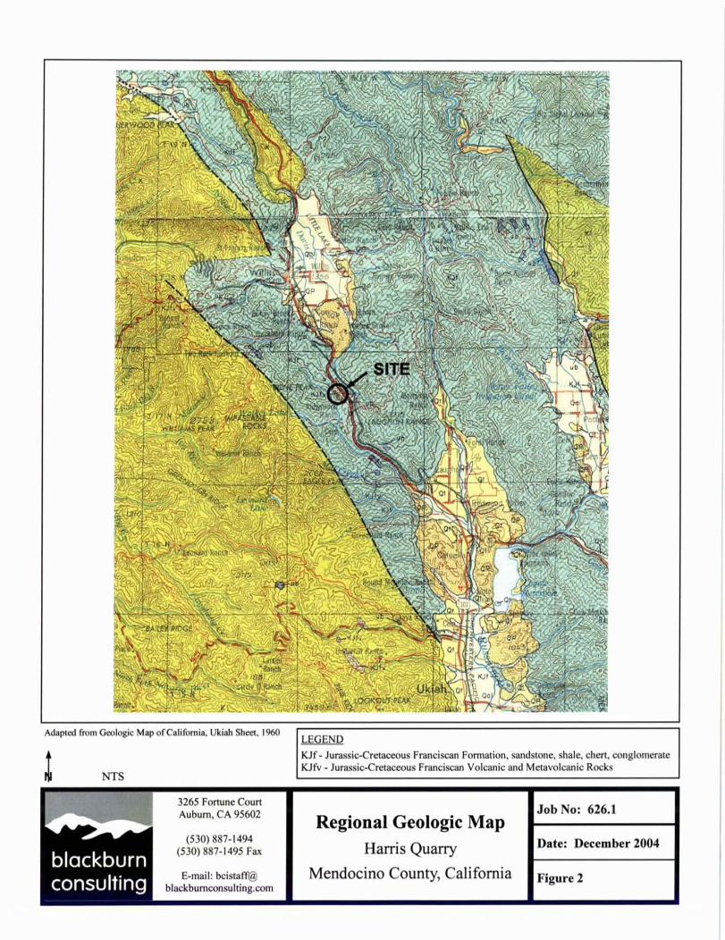
The quarry operator reports that most surface rainfall infiltrates into the fractured rock and does not produce concentrated flow. Surface runoff that does not infiltrate the rock is collected in sediment basins at the quarry floor. GEOLOGY Regional Geology The quarry is located within the Coast Range geomorphic province, characterized by strong, northwest trending ridges and valleys. The dominant rock type is mapped as Jurassic to Cretaceous age Franciscan Formation, comprised predominately of sandstone, shale, chert and conglomerate. Locally, the Franciscan Formation contains hard, resistant volcanic and metavolcanic rocks. Regional structural features (rock bedding/foliation) trend north-northwest, with highly variable dip. We attach a regional geologic map as Figure 2.
Site Specific The active quarry face contains predominately hard rock consistent with volcanic and metavolcanic rocks of the Franciscan Formation. Relatively unweathered portions of the rock retain a characteristic greenish color and is commonly referred to as “greenstone”, a term applied to altered basic igneous rocks which owe their color to the minerals of chlorite, hornblende and epidote. Where exposed to weathering, the rock produces a distinctive purplish color. We show site-specific geologic features on Figure 3. The quarry rock is fractured at spacing from 0.1 to 0.3 ft (“intensely” fractured) to 1-3 ft (“slightly” fractured). The slightly fractured rock has a blocky texture and excavates into large boulders of hard, durable rock. The intensely fractured rock is, in places, friable and readily breaks down to small fragments of angular rock. Calcite and quartz fracture filling is common throughout the rock mass. Rock fracture and/or foliation planes strike predominately northwest and northeast, and dip variably to the southeast, northeast and southwest. We observed three minor faults within the quarry face. These faults strike northwest and dip steeply (about 60-80 degrees) to the northeast and southwest. The fracture/foliation planes create potential wedge and/or block failures within the rock where these planes daylight onto the cut faces. Along slopes facing southwest, areas of friable rock tend to break along planes dipping steeply southwest, exposing relatively smooth, planar rock faces. Along southeast facing slopes, minor wedge failures have occurred within the fractured rock. In general, the rock fracture/foliation planes are steeper than the overall cut face and no evidence of large block slides or wedge failures are observed. Scattered outcrops of hard, metavolcanic rock are exposed along the steep (natural) slopes west and south of the quarry. This rock appears similar to that within the active quarry face. Slopes north of the quarry, and generally north of the ridgeline, are characterized by deeply weathered rock underlying a 5-10 ft thick soil/colluvium cover. Where exposed, this rock is mostly friable sandstone and meta-sedimentary rock.
Engineering Geology and Geohazards Report BCI File 626.1 Harris Quarry, Willits, California December 9, 2004
3
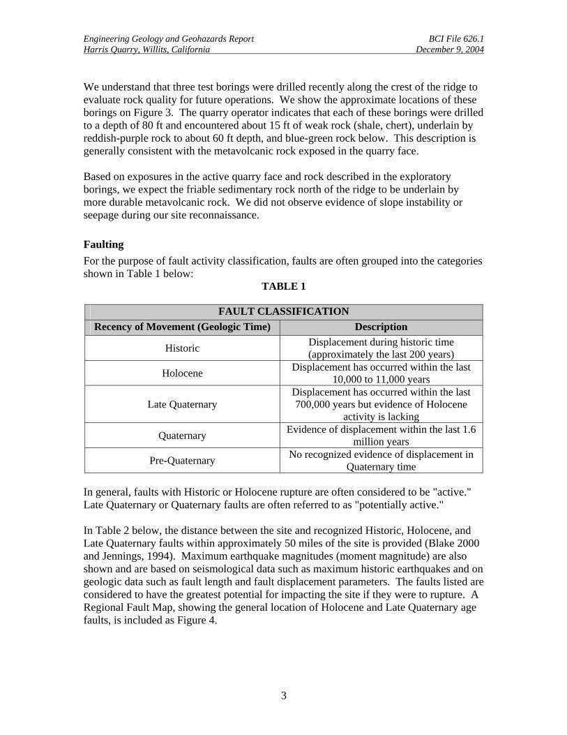
We understand that three test borings were drilled recently along the crest of the ridge to evaluate rock quality for future operations. We show the approximate locations of these borings on Figure 3. The quarry operator indicates that each of these borings were drilled to a depth of 80 ft and encountered about 15 ft of weak rock (shale, chert), underlain by reddish-purple rock to about 60 ft depth, and blue-green rock below. This description is generally consistent with the metavolcanic rock exposed in the quarry face. Based on exposures in the active quarry face and rock described in the exploratory borings, we expect the friable sedimentary rock north of the ridge to be underlain by more durable metavolcanic rock. We did not observe evidence of slope instability or seepage during our site reconnaissance. Faulting For the purpose of fault activity classification, faults are often grouped into the categories shown in Table 1 below:
TABLE 1
FAULT CLASSIFICATION Recency of Movement (Geologic Time) Description
Historic Displacement during historic time (approximately the last 200 years)
Holocene Displacement has occurred within the last 10,000 to 11,000 years
Late Quaternary Displacement has occurred within the last 700,000 years but evidence of Holocene
activity is lacking
Quaternary Evidence of displacement within the last 1.6 million years
Pre-Quaternary No recognized evidence of displacement in Quaternary time
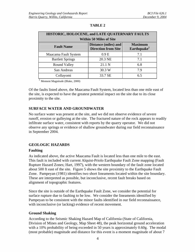
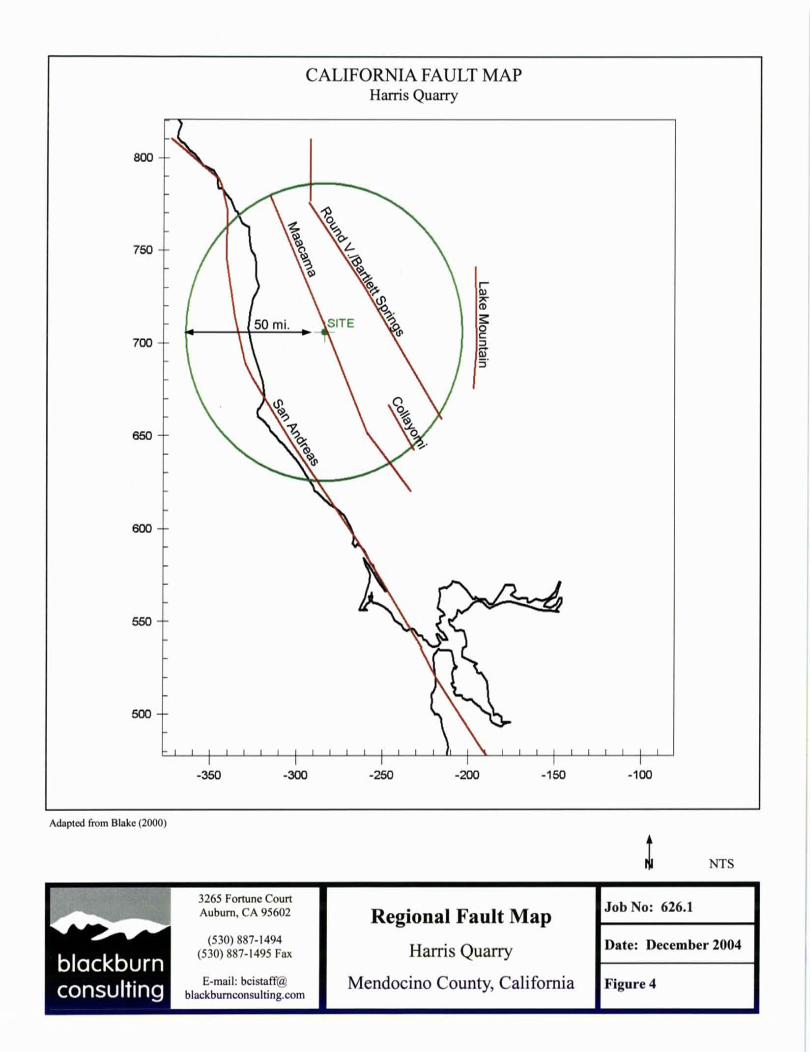
In general, faults with Historic or Holocene rupture are often considered to be "active." Late Quaternary or Quaternary faults are often referred to as "potentially active." In Table 2 below, the distance between the site and recognized Historic, Holocene, and Late Quaternary faults within approximately 50 miles of the site is provided (Blake 2000 and Jennings, 1994). Maximum earthquake magnitudes (moment magnitude) are also shown and are based on seismological data such as maximum historic earthquakes and on geologic data such as fault length and fault displacement parameters. The faults listed are considered to have the greatest potential for impacting the site if they were to rupture. A Regional Fault Map, showing the general location of Holocene and Late Quaternary age faults, is included as Figure 4.
Engineering Geology and Geohazards Report BCI File 626.1 Harris Quarry, Willits, California December 9, 2004
4
TABLE 2
HISTORIC, HOLOCENE, and LATE QUATERNARY FAULTS Within 50 Miles of Site
Fault Name Distance (miles) and Direction from Site
Maximum Earthquake1
Maacama Fault System 0.9 E 7.1 Bartlett Springs 20.3 NE 7.1 Round Valley 21.1 N 6.8 San Andreas 30.3 W 7.9 Collayomi 33.7 SE 6.5
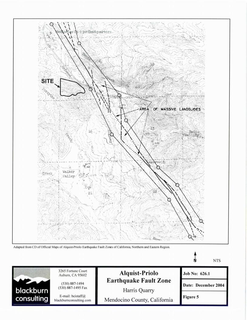
1 Moment Magnitude (Blake, 2000) Of the faults listed above, the Maacama Fault System, located less than one mile east of the site, is expected to have the greatest potential impact on the site due to its close proximity to the site. SURFACE WATER AND GROUNDWATER No surface water was present at the site, and we did not observe evidence of severe runoff, erosion or gulleying at the site. The fractured nature of the rock appears to readily infiltrate surface water, consistent with reports by the quarry operator. We did not observe any springs or evidence of shallow groundwater during our field reconnaissance in September 2004. GEOLOGIC HAZARDS Faulting As indicated above, the active Maacama Fault is located less than one mile to the east. This fault is included with current Alquist-Priolo Earthquake Fault Zone mapping (Fault Rupture Hazard Zones; Hart, 1997), with the western boundary of the fault zone located about 500 ft east of the site. Figure 5 shows the site proximity to the Earthquake Fault Zone. Pampeyan (1981) identifies two short lineaments located within the site boundary. These are interpreted as possible, but inconclusive, recent fault breaks based on alignment of topographic features. Since the site is outside of the Earthquake Fault Zone, we consider the potential for surface rupture due to faulting to be low. We consider the lineaments identified by Pampeyan to be consistent with the minor faults identified in our field reconnaissance, with inconclusive (or lacking) evidence of recent movement.
Ground Shaking According to the Seismic Shaking Hazard Map of California (State of California, Division of Mines and Geology, Map Sheet 48), the peak horizontal ground acceleration with a 10% probability of being exceeded in 50 years is approximately 0.60g. The modal (most probable) magnitude and distance for this event is a moment magnitude of about 7
Engineering Geology and Geohazards Report BCI File 626.1 Harris Quarry, Willits, California December 9, 2004
5
at a distance of approximately 5 km (3 miles). This level of ground shaking can result in rockfalls and seismically induced landslides within weak materials.
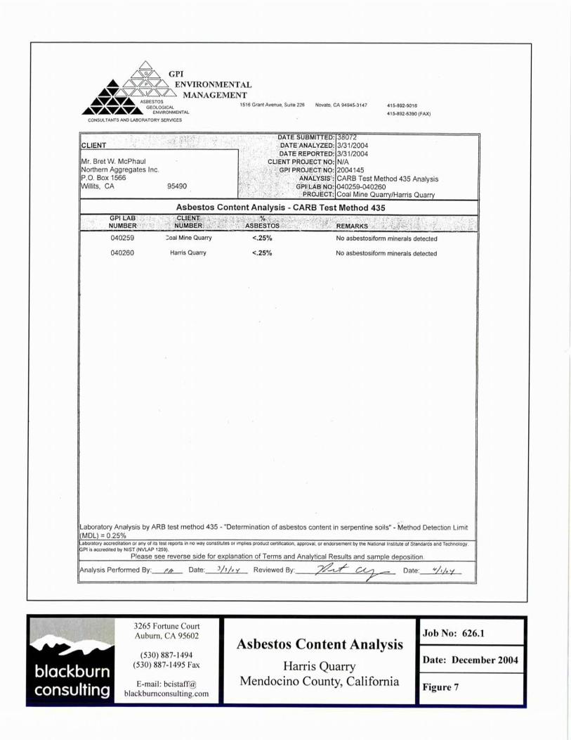
Liquefaction Liquefaction can occur when loose to medium dense, granular, saturated soils (generally within 50 feet of the surface) are subjected to ground shaking. The site is underlain by firm metavolcanic rock that is not susceptible to liquefaction. Additionally, regional groundwater levels are expected to be greater than 50 feet in depth. For these reasons, we consider the potential for damaging liquefaction to occur to be very low. Landslides and Slope Stability No landslides are shown on the published geologic mapping and we did not identify any landslides during our site reconnaissance or review of aerial photos. Landslides are common within areas of weaker Franciscan rock near the site and large landslides are mapped within the fault zone to the east; however, the overall hard, durable rock exposed along natural slopes of the site and within the quarry face generally preclude large failure forms such as translational or rotational rock slides, earthflows and debris slides. Minor wedge failures and/or rockfalls can, however, be expected within areas of intensely fractured rock, especially under the influence of strong seismic ground shaking. Seismically Induced Settlement During a seismic event, ground shaking can cause densification of soil that can result in settlement of the ground surface. The surficial soil/colluvium along the north side of the ridge (uppermost 5-10 ft) is considered susceptible to densification under anticipated ground motions, but is not considered a serious hazard in the absence of overlying structures. Naturally Occurring Asbestos The quarry owner completed laboratory testing in March 2004 for naturally occurring asbestos minerals (CARB test method 435, “Determination of asbestos content in serpentine soils”). Results of these tests indicate no asbestosforms minerals detected, with asbestos content less than the method detection limit of 0.25%. We attach a copy of the laboratory test report as Figure 7. RECOMMENDATIONS Cut Slopes We expect the final quarry cuts to expose predominately fractured metavolcanic rock similar to that exposed in the existing quarry face. Along slopes north of the ridge, we expect the uppermost 20 ft to be comprised of colluvium and intensely weathered sandstone. On these bases, and considering the likelihood of the site to experience strong ground shaking within a 50-year return period, we recommend the following criteria for final excavation slopes:
• Cut final excavation slopes no steeper than 0.75:1 (H:V), equal to a maximum slope angle of 53°.
Engineering Geology and Geohazards Report BCI File 626.1 Harris Quarry, Willits, California December 9, 2004
6
• Provide on-slope benches at 40 ft vertical intervals, with minimum 12 ft bench width.
• Along final cuts north of the ridge, cut the upper 20 ft of vertical height at 1.5:1 (H:V) to account for the weaker colluvium and rock in this area.
Interim cut slopes, including internal faces during individual phases of operations prior to final excavation, should be evaluated in accordance with current Mine Safety and Health Administration (MSHA) requirements as quarry operations progress. In addition, per recommendations by the Office of Mine Reclamation (OMR), slope stability analyses should be performed when the quarry face progresses to within 150 ft of the final face cut. This will provide an opportunity to modify the final cut configuration, if necessary, based on specific rock exposures at that time. Erosion Control We expect the majority of surface runoff to readily infiltrate the fractured rock exposed along the final cut faces and the intervening benches. Locally, areas of hard rock may limit infiltration, but we do not expect high volumes of concentrated runoff. We recommend the intervening benches be out-sloped 2% to avoid concentrated flow and consequent erosion of the benches. Disturbed slopes adjacent to the excavation should be protected from erosion by planting native vegetation, or other appropriate means. LIMITATIONS BCI prepared this report in accordance with generally accepted geologic and geotechnical engineering principles and practices currently used in this area. We do not warranty our services. This report is for the purposes of project planning and permitting only. This report should be reviewed and modified if conditions change or if further data is made available.
Engineering Geology and Geohazards Report BCI File 626.1 Harris Quarry, Willits, California December 9, 2004
7
REFERENCES Blake, T.F., 2000, EQFAULT, A Computer Program for the Deterministic Prediction
of Peak Horizontal Acceleration from 3-D Fault Sources.
Blake, T.F., 2000, FRISKSP, A Computer Program for the Probabilistic Estimation of Peak Acceleration and Uniform Hazard Spectra.
Hart, E.W., 1997, Fault-Rupture Hazard Zones in California: California Department
of Conservation, Division of Mines and Geology, Special Publication 42.
Jennings, Charles W., 1994, Fault Activity Map of California and Adjacent Areas with Location and Ages of Recent Volcanic Eruption.
Jennings, Charles W., and Strand, Rudolph G., 1960, Geologic Map of California,
Ukiah Sheet.
Pampeyan, E.H., Harsh, P.W., and Coakley, J.M., 1981, Preliminary Map Showing Recently Active Breaks Along the Maacama Fault Zone Between Laytonville and Hopland, Mendocino County, California; USGS MF-1217.
Petersen, M.D., et al, 1996, Probabilistic Seismic Hazard Assessment for the State of
California; California Division of Mines and Geology, OFR 96-08.
Petersen, M., et al, 1999, Seismic Shaking Hazard Maps Of California; California Division of Mines and Geology, OFR 92-1
Air Photos, 9x9 Contact Prints, 6/11/04, #1-1, 1-2, 1-3, 1-4, 1-5 (1:4800).
Engineering Geology and Geohazards Report BCI File 626.1 Harris Quarry, Willits, California December 9, 2004
APPENDIX - SITE PHOTOS
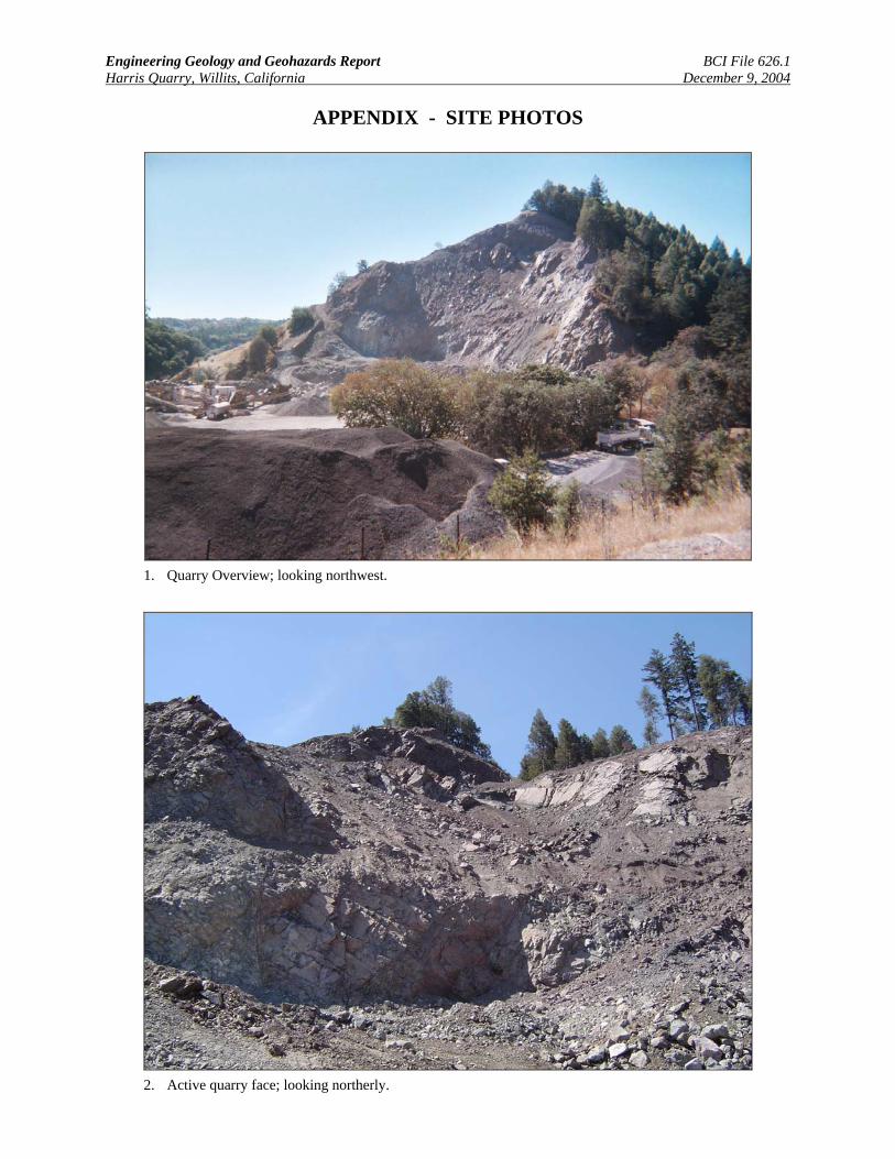
1. Quarry Overview; looking northwest.
2. Active quarry face; looking northerly.
Engineering Geology and Geohazards Report BCI File 626.1 Harris Quarry, Willits, California December 9, 2004
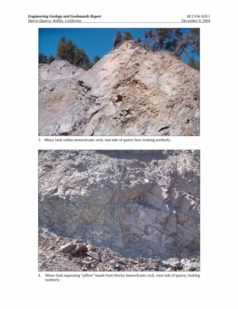
3. Minor fault within metavolcanic rock, east side of quarry face; looking northerly.
4. Minor fault separating “pillow” basalt from blocky metavolcanic rock, west side of quarry; looking
northerly.
Engineering Geology and Geohazards Report BCI File 626.1 Harris Quarry, Willits, California December 9, 2004
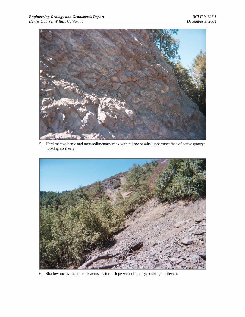
5. Hard metavolcanic and metasedimentary rock with pillow basalts, uppermost face of active quarry;
looking northerly.
6. Shallow metavolcanic rock across natural slope west of quarry; looking northwest.