EIR Scoping Document - · PDF fileThe project includes a Minor Conditional Use Permit for a...
23
For More Information Contact Alex Tuttle, Development Review Division, (805) 884-6844 Owner/Applicant Timothy Doheny c/o Paul Van Leer Route 1, Box 234-A Goleta, CA 93117 Agent Alicia Harrison Brownstein Hyatt Farber Schreck, LLP 21 E. Carrillo St. Santa Barbara, CA 93101 Surveyor Mark Lloyd L&P Consultants 3 West Carrillo St, Suite 205 Santa Barbara, CA 93101 EIR Scoping Document Las Varas Ranch Project 05TPM-00000-00002, 05LLA-00000-00005, 05LLA-00000-00006, 07CUP-00000-00057, 07RZN-00000-00007, 07RZN-00000-00006 June 5, 2008
Transcript of EIR Scoping Document - · PDF fileThe project includes a Minor Conditional Use Permit for a...

For More Information Contact Alex Tuttle, Development Review Division, (805) 884-6844
Owner/Applicant Timothy Doheny c/o Paul Van Leer Route 1, Box 234-A Goleta, CA 93117
Agent Alicia Harrison Brownstein Hyatt Farber Schreck, LLP 21 E. Carrillo St. Santa Barbara, CA 93101
Surveyor Mark Lloyd L&P Consultants 3 West Carrillo St, Suite 205 Santa Barbara, CA 93101
EIR Scoping Document
Las Varas Ranch Project
05TPM-00000-00002, 05LLA-00000-00005, 05LLA-00000-00006, 07CUP-00000-00057, 07RZN-00000-00007, 07RZN-00000-00006
June 5, 2008
Las Varas Ranch Project EIR Scoping Document Page 2
1.0 REQUEST/PROJECT DESCRIPTION The project comprises the following components:
05LLA-00000-00005
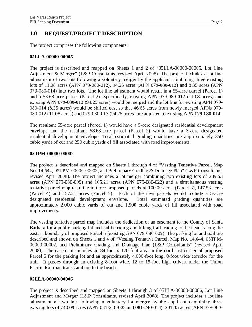
The project is described and mapped on Sheets 1 and 2 of “05LLA-00000-00005, Lot Line Adjustment & Merger” (L&P Consultants, revised April 2008). The project includes a lot line adjustment of two lots following a voluntary merger by the applicant combining three existing lots of 11.08 acres (APN 079-080-012), 94.25 acres (APN 079-080-013) and 8.35 acres (APN 079-080-014) into two lots. The lot line adjustment would result in a 55-acre parcel (Parcel 1) and a 58.68-acre parcel (Parcel 2). Specifically, existing APN 079-080-012 (11.08 acres) and existing APN 079-080-013 (94.25 acres) would be merged and the lot line for existing APN 079-080-014 (8.35 acres) would be shifted east so that 46.65 acres from newly merged APNs 079-080-012 (11.08 acres) and 079-080-013 (94.25 acres) are adjusted to existing APN 079-080-014. The resultant 55-acre parcel (Parcel 1) would have a 5-acre designated residential development envelope and the resultant 58.68-acre parcel (Parcel 2) would have a 3-acre designated residential development envelope. Total estimated grading quantities are approximately 350 cubic yards of cut and 250 cubic yards of fill associated with road improvements. 05TPM-00000-00002 The project is described and mapped on Sheets 1 through 4 of “Vesting Tentative Parcel, Map No. 14,644, 05TPM-00000-00002, and Preliminary Grading & Drainage Plan” (L&P Consultants, revised April 2008). The project includes a lot merger combining two existing lots of 239.53 acres (APN 079-080-009) and 165.21 acres (APN 079-080-022) and a simultaneous vesting tentative parcel map resulting in three proposed parcels of 100.00 acres (Parcel 3), 147.53 acres (Parcel 4) and 157.21 acres (Parcel 5). Each of the new parcels would include a 5-acre designated residential development envelope. Total estimated grading quantities are approximately 2,000 cubic yards of cut and 1,500 cubic yards of fill associated with road improvements. The vesting tentative parcel map includes the dedication of an easement to the County of Santa Barbara for a public parking lot and public riding and hiking trail leading to the beach along the eastern boundary of proposed Parcel 5 (existing APN 079-080-009). The parking lot and trail are described and shown on Sheets 1 and 4 of “Vesting Tentative Parcel, Map No. 14,644, 05TPM-00000-00002, and Preliminary Grading and Drainage Plan (L&P Consultants” (revised April 2008)). The easement includes an 84-foot x 170-foot area in the northeast corner of proposed Parcel 5 for the parking lot and an approximately 4,000-foot long, 8-foot wide corridor for the trail. It passes through an existing 8-foot wide, 12 to 15-foot high culvert under the Union Pacific Railroad tracks and out to the beach. 05LLA-00000-00006
The project is described and mapped on Sheets 1 through 3 of 05LLA-00000-00006, Lot Line Adjustment and Merger (L&P Consultants, revised April 2008). The project includes a lot line adjustment of two lots following a voluntary lot merger by the applicant combining three existing lots of 740.09 acres (APN 081-240-003 and 081-240-014), 281.35 acres (APN 079-080-

Las Varas Ranch Project EIR Scoping Document Page 3
002) and 261.83 acres (APN 079-080-001) into two lots. The lot line adjustment would result in two parcels of 168.27 acres (Parcel 7) and 1,115 acres (Parcel 6). Specifically, existing APNs 081-240-003 and 081-240-014 (740.09 acres) and existing APN 079-080-002 (281.35 acres) would be merged and the existing lot line for existing APN 079-080-002 (281.35 acres) would be shifted west so that 93.56 acres from existing APN 079-080-001 (261.83 acres) would be adjusted to newly merged APNs 081-240-003, 081-240-014 and 079-080-002. The resultant 168.27-acre parcel (Parcel 7) would include a 5-acre development envelope. The resultant 1,115-acre parcel (Parcel 6) would not include a development envelope given its size, though residential development would be limited to the lower half of the parcel and east of Las Varas Creek. The project also includes the dedication of a lateral 25-foot wide easement to the County of Santa Barbara for a public riding and hiking trail along the southern property line of proposed Parcels 6 and 7 adjacent to Highway 101 (existing APNs 079-080-001 and 079-080-002). This easement is described and shown on Sheets 1, 2 and 3 for 05LLA-00000-00006, Lot Line Adjustment and Merger. Construction of the trail would be contingent upon the County constructing a bridge over the existing underpass used by cattle to cross under Highway 101. Total estimated grading quantities are approximately 5,500 cubic yards of cut and 5,000 cubic yards of fill associated with roadway development and improvements.
07CUP-00000-00057 The project includes a Minor Conditional Use Permit for a State Small Water System for existing and future residences on the seven proposed parcels that would result from the proposed project. The water system would be designed to support up to two residential water connections for each parcel for a total of 14 water connections. It would be designed to meet domestic and landscape irrigation water demands. Water would be supplied by surface water from existing water diversion and storage facilities within the Ranch and groundwater from a recently drilled well. The water system would include a water well, two booster pumps, treatment facility, and two above-ground water tanks to serve two different pressure zones. The treatment facility would include a building of approximately 960 square feet (24 feet x 40 feet) for treatment equipment and supplies. It would require electrical power and a year-round and all weather access road. The water tanks would have storage capacities of 30,000 and 60,000 gallons. The water lines would range between 2-inch and 4-inch diameter. This project description is based on the information and site plan included in “Water Supply Report for Edwards and Las Varas Ranches” (Penfield & Smith, August 2005). 07RZN-00000-00006 The applicant has requested to rezone two parcels and a portion of a third parcel that are currently zoned Unlimited Agriculture (“U”) under Ordinance Number 661 (now defunct) to Agriculture II with a 100-acre minimum lot area (AG-II-100) under the Land Use and Development Code. The subject parcels consist of a 740.09 acre parcel (APN 081-240-003 and APN 081-240-014), a 281.35 acre parcel (APN 079-080-002) and a 261.83 acre parcel (APN 079-080-001). APN 081-240-003, APN 081-240-014, APN 079-080-002 and the northeast portion of APN 079-080-001 are located in the Inland Area and zoned “U” under Ordinance Number 661. (The remaining portion of APN 079-080-001 is located in the Coastal Zone and
Las Varas Ranch Project EIR Scoping Document Page 4
zoned AG-II-100.) The subject parcels are designated Agriculture II, 100-acre minimum lot area (A-II-100) under the Comprehensive Plan. The proposed rezone would update the zoning of the subject parcels consistent with current governing ordinances and the designation in the Comprehensive Plan.
07RZN-00000-00007
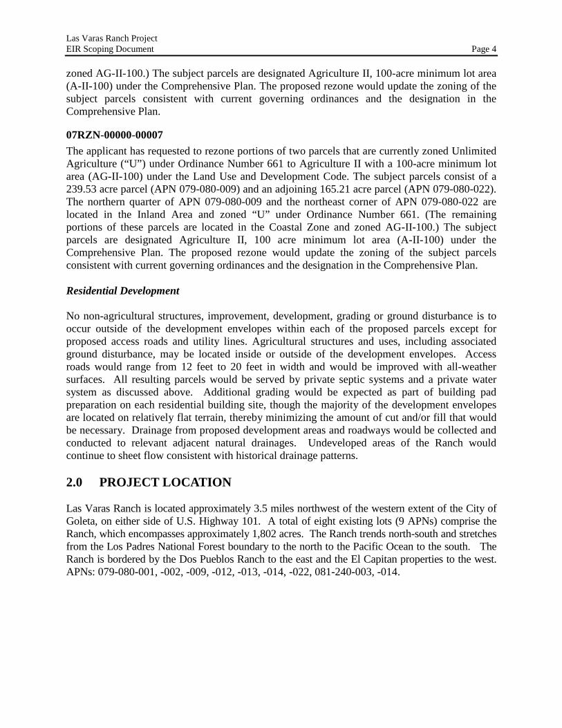
The applicant has requested to rezone portions of two parcels that are currently zoned Unlimited Agriculture (“U”) under Ordinance Number 661 to Agriculture II with a 100-acre minimum lot area (AG-II-100) under the Land Use and Development Code. The subject parcels consist of a 239.53 acre parcel (APN 079-080-009) and an adjoining 165.21 acre parcel (APN 079-080-022). The northern quarter of APN 079-080-009 and the northeast corner of APN 079-080-022 are located in the Inland Area and zoned “U” under Ordinance Number 661. (The remaining portions of these parcels are located in the Coastal Zone and zoned AG-II-100.) The subject parcels are designated Agriculture II, 100 acre minimum lot area (A-II-100) under the Comprehensive Plan. The proposed rezone would update the zoning of the subject parcels consistent with current governing ordinances and the designation in the Comprehensive Plan. Residential Development No non-agricultural structures, improvement, development, grading or ground disturbance is to occur outside of the development envelopes within each of the proposed parcels except for proposed access roads and utility lines. Agricultural structures and uses, including associated ground disturbance, may be located inside or outside of the development envelopes. Access roads would range from 12 feet to 20 feet in width and would be improved with all-weather surfaces. All resulting parcels would be served by private septic systems and a private water system as discussed above. Additional grading would be expected as part of building pad preparation on each residential building site, though the majority of the development envelopes are located on relatively flat terrain, thereby minimizing the amount of cut and/or fill that would be necessary. Drainage from proposed development areas and roadways would be collected and conducted to relevant adjacent natural drainages. Undeveloped areas of the Ranch would continue to sheet flow consistent with historical drainage patterns. 2.0 PROJECT LOCATION Las Varas Ranch is located approximately 3.5 miles northwest of the western extent of the City of Goleta, on either side of U.S. Highway 101. A total of eight existing lots (9 APNs) comprise the Ranch, which encompasses approximately 1,802 acres. The Ranch trends north-south and stretches from the Los Padres National Forest boundary to the north to the Pacific Ocean to the south. The Ranch is bordered by the Dos Pueblos Ranch to the east and the El Capitan properties to the west. APNs: 079-080-001, -002, -009, -012, -013, -014, -022, 081-240-003, -014.
Las Varas Ranch Project EIR Scoping Document Page 5
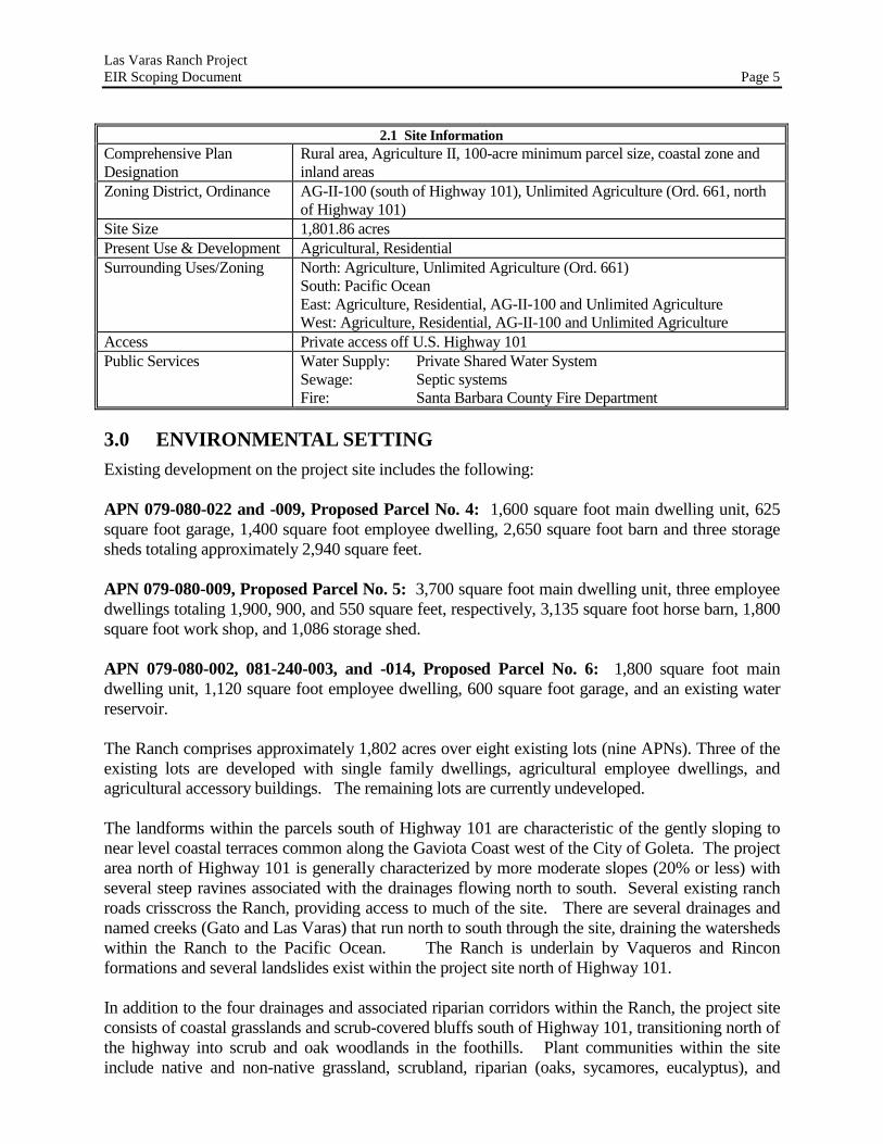
2.1 Site Information Comprehensive Plan Designation
Rural area, Agriculture II, 100-acre minimum parcel size, coastal zone and inland areas
Zoning District, Ordinance AG-II-100 (south of Highway 101), Unlimited Agriculture (Ord. 661, north of Highway 101)
Site Size 1,801.86 acres Present Use & Development Agricultural, Residential Surrounding Uses/Zoning North: Agriculture, Unlimited Agriculture (Ord. 661)
South: Pacific Ocean East: Agriculture, Residential, AG-II-100 and Unlimited Agriculture West: Agriculture, Residential, AG-II-100 and Unlimited Agriculture
Access Private access off U.S. Highway 101 Public Services Water Supply: Private Shared Water System
Sewage: Septic systems Fire: Santa Barbara County Fire Department
3.0 ENVIRONMENTAL SETTING Existing development on the project site includes the following: APN 079-080-022 and -009, Proposed Parcel No. 4: 1,600 square foot main dwelling unit, 625 square foot garage, 1,400 square foot employee dwelling, 2,650 square foot barn and three storage sheds totaling approximately 2,940 square feet. APN 079-080-009, Proposed Parcel No. 5: 3,700 square foot main dwelling unit, three employee dwellings totaling 1,900, 900, and 550 square feet, respectively, 3,135 square foot horse barn, 1,800 square foot work shop, and 1,086 storage shed. APN 079-080-002, 081-240-003, and -014, Proposed Parcel No. 6: 1,800 square foot main dwelling unit, 1,120 square foot employee dwelling, 600 square foot garage, and an existing water reservoir. The Ranch comprises approximately 1,802 acres over eight existing lots (nine APNs). Three of the existing lots are developed with single family dwellings, agricultural employee dwellings, and agricultural accessory buildings. The remaining lots are currently undeveloped. The landforms within the parcels south of Highway 101 are characteristic of the gently sloping to near level coastal terraces common along the Gaviota Coast west of the City of Goleta. The project area north of Highway 101 is generally characterized by more moderate slopes (20% or less) with several steep ravines associated with the drainages flowing north to south. Several existing ranch roads crisscross the Ranch, providing access to much of the site. There are several drainages and named creeks (Gato and Las Varas) that run north to south through the site, draining the watersheds within the Ranch to the Pacific Ocean. The Ranch is underlain by Vaqueros and Rincon formations and several landslides exist within the project site north of Highway 101. In addition to the four drainages and associated riparian corridors within the Ranch, the project site consists of coastal grasslands and scrub-covered bluffs south of Highway 101, transitioning north of the highway into scrub and oak woodlands in the foothills. Plant communities within the site include native and non-native grassland, scrubland, riparian (oaks, sycamores, eucalyptus), and

Las Varas Ranch Project EIR Scoping Document Page 6
individual oaks. Agricultural orchards (lemons and avocados) are intermixed within these vegetation communities throughout the lower half of the site (north and south of Highway 101). Fauna present on the site include common wildlife species found in the foothills and riparian corridors of the coastal range, as well as larger carnivores such as coyotes, mountain lions, and bobcats. Several sensitive species, including California red-legged frog, Coast Range newt, and White-tailed kite, among others, have been documented within the site. Numerous other reptiles and amphibians, bird species, including several raptors, and mammals are known or expected to occur within the Ranch. Ranching on the site consists of approximately 75 cattle that graze throughout the Ranch. The Ranch has a long history of human activity and several documented archaeological sites and historic resources are found on the property.
4.0 POTENTIALLY SIGNIFICANT EFFECTS
AESTHETICS/VISUAL RESOURCES
Impact Discussion:
Environmental assessment of a proposed project’s impacts to the aesthetics/visual resources of a site begins with identification of the existing visual resources on and off the site, including the site’s physical attributes, its relative visibility, and its relative uniqueness. Assessment must also address the role a site plays in any larger visual context. The Visual Impact Guidelines of the County of Santa Barbara Environmental Thresholds and Guidelines Manual identify five specific landscapes of particular value, including mountainous areas, public parks, urban fringes, scenic travel corridors, and coastal areas. The project site encompasses three of these landscapes: scenic travel corridors, mountainous areas, and coastal areas. In addition, the County’s Comprehensive Plan identifies views of mountains, coastal bluffs, and scenic areas as significant visual resources. The proposed project would establish residential development envelopes ranging in size from three to five acres for six of the seven proposed parcels. The seventh site is limited to the lower half of the lot, though a specific development envelope has not been identified. Efforts have been made to site the development envelopes such that they cannot be viewed by the public, though at least some of these sites are visible from U.S. Highway 101 to varying degrees, which is designated locally as a Scenic Highway in this location. Mountain and ocean views could potentially be degraded by development of future residences within these envelopes or on proposed Parcel 6 depending on the exact topography, building location and size, lighting, and vegetation screening. Development envelopes of the sizes proposed could accommodate very large estate-style homes and associated accessory structures (e.g. pools, guest houses, tennis courts, etc.) that differ from the size and style of homes historically developed along the Gaviota Coast. Development of seven estate homes within the Ranch could alter the visual character of the area which is characterized predominantly by open lands and agricultural development, or create structures which are visually incompatible with surrounding low-intensity development. Lighting associated with the project could create glare off-site, light spillage and/or night sky light pollution, thereby resulting in potentially significant impacts to the nighttime character of the surrounding rural area, which currently experiences low amounts of nighttime lighting. Future residential development associated with the proposed project would likely contribute incrementally to cumulative impacts to aesthetics/visual resources associated with increasing residential development along the Gaviota Coast.

Las Varas Ranch Project EIR Scoping Document Page 7
Potential Mitigation:
Mitigation could include design requirements (including building height), vegetative screening, building footprint locations, development envelope relocations, minimization of lighting, or other similar measures in order to preserve the visual character of the area and not contribute to the degradation of mountain or ocean views. Additional mitigation would likely include standard conditions related to hooded and shielded exterior lights, directing light downward and preventing spillover onto adjacent properties. For proposed Parcel 6, mitigation could include the identification of a specific development envelope to reduce potential visual impacts associated with future residential development.
Scope of EIR:
• Identify the existing visual resources of the Ranch and its surroundings, including the site’s physical attributes, its relative visibility from area roads, trails, and residences, and assess potential impacts to these resources from development of the proposed project including future residences and accessory structures.
• Identify the existing character of public views across, into, and out of the site and assess potential impacts to these views from residential development on the proposed lots. Assess impacts to private views from development of the project.
• Identify the night time setting and character of the Ranch and surrounding area and assess the potential impacts to this nighttime character from proposed development.
• Identify any impacts to the existing character of the Ranch and the integrity of the Ranch’s visual character from proposed development.
• Analyze cumulative impact levels and the contribution of the proposed project to these cumulative impacts.
• The EIR shall include visual simulations or other tools as necessary to inform the impact discussion.
• Identify mitigation measures as necessary and residual impacts.
AGRICULTURAL RESOURCES
Impact Discussion:
The Ranch comprises approximately 1,800 acres that have historically been used for various forms of agriculture, including grazing and irrigated orchards and other crops. The Ranch has a mix of prime and non-prime lands, some of which are designated as Unique Farmland or Farmland of Statewide Importance. It is the intent of the project applicant to maintain long-term agricultural production where feasible throughout the Ranch outside of the proposed development envelopes. In total, the proposed development envelopes would remove approximately 33 acres from potential agricultural production (assuming a 5-acre development envelope for proposed Parcel 6), which represents a small fraction of the entire Ranch and the acreage potentially available for continued agriculture. All but two of the proposed parcels would exceed 100 acres in size and have suitable areas for continued cultivation or grazing. The remaining two sub-100 acre parcels located south of the railroad along the coastal bluff are not currently suitable for intensive agriculture but could continue to be used for periodic grazing. However, the proposed project could fragment the ownership of the Ranch into separately owned lots or break up the contiguity of production areas or grazing areas which could in turn reduce

Las Varas Ranch Project EIR Scoping Document Page 8
the feasibility and likelihood that the property would continue to be used for agricultural purposes in the long-term. Despite the acreage that would remain available for continued agricultural production and grazing, impacts to agriculture from the potential ownership fragmentation and the increased level of residential development and human activity within the Ranch could be potentially significant. Continued residential development and fragmentation and break up of contiguous agricultural areas could result in cumulative impacts to the long-term viability of agricultural within the Gaviota Planning area. Potential Mitigation: If found to be significant, potential mitigation could include entering into agricultural easements or other similar mechanisms to help maintain long-term agricultural viability, or the relocation of development envelopes to minimize the fragmentation of productive agricultural land, or requiring any buffers between agricultural areas and residential areas to be included within the development envelopes in order to avoid removing additional land from agriculture. Scope of EIR: • Evaluate the agricultural viability of the existing Ranch and current parcel configuration. • Analyze impacts to long-term agricultural production, including cattle grazing, resulting from
the proposed project. • Analyze cumulative impacts to agriculture in the area and the contribution of the proposed
project to these cumulative impacts. • Identify mitigation measures if necessary to reduce impacts. • Identify residual impacts after implementation of mitigation measures. Sources of Information: • Stephanie Stark, Agricultural Planner, 681-5600
AIR QUALITY
Impact Discussion:
Development of the project would potentially result in construction-related air quality impacts, including dust generation from grading for the access roads and building pads, and air pollution emissions from construction equipment and construction vehicles. Long-term air quality impacts are not expected from the use of the ranch for continued agriculture and residential purposes. Potential Mitigation:
Standard dust and ozone precursor control measures would help to mitigate these impacts. Scope of EIR: • Assess air quality impacts associated with grading and construction activities from development
of the proposed project, including greenhouse gases. • Identify mitigation measures as necessary, including standard emission control conditions
applied by the Santa Barbara County Air Pollution Control District. • Assess cumulative air quality impacts as well as the project’s contribution to those impacts.

Las Varas Ranch Project EIR Scoping Document Page 9
• Assess residual impacts of the project. Sources of Information: • APCD staff – Vijaya Jammalamadaka, 961-8893 • Santa Barbara County Clean Air Plan (2004) BIOLOGICAL RESOURCES Existing Plant and Animal Communities/Conditions: The project site is characterized by small-scale residential and agricultural development, active lemon and avocado orchards, pasture and other open lands, and four drainage features. In addition to the four drainages and associated intact riparian corridors, the project site consists of coastal grasslands and scrub-covered bluffs south of Highway 101, transitioning north of Highway 101 into scrub and oak woodlands in the foothills. Plant communities within the site include native and non-native grassland, scrubland, riparian (oaks, sycamores, eucalyptus), and individual oaks. In addition, at least two seasonal wetland features are located south of Highway 101 within proposed Parcel 4. Multiple eucalyptus groves within the drainages provide important overwintering habitat for Monarch butterflies. The different habitats on the Ranch support a wide range of wildlife, including numerous common and several sensitive species (including the California red-legged frog which is a Federally Threatened species and the white-tailed kite which is a State Fully Protected Species). The extensive grasslands, oak woodlands, riparian woodlands, and scrub habitats provide high-quality foraging and possibly nesting habitat for raptors. There are no known haul-out areas for seals along the beach within the property’s boundaries. Impact Discussion: Project development would result in both direct and indirect impacts to biological resources. Development of the access road to serve the residential development envelopes would require temporary disturbance of Gato Creek and riparian vegetation associated with a bridge across the creek. Several sensitive species, including the California red-legged frog and Coast range newt, were found in the area of the proposed bridge where an Arizona crossing currently exists. Construction of the bridge and a temporary change in the creek flow and downstream scour pool upon removal of the Arizona crossing could result in direct impacts to these species. In addition, several of the development envelopes, including potential residential development of proposed Parcel 6, are located adjacent to the on-site drainages which could result in degradation of the riparian corridors and upland habitats which support several wildlife species. Increased development and human activity (and pet activity) could disrupt the foraging patterns and nesting or roosting habitat for white-tailed kite and other raptor species. Dogs, and especially cats, are significant sources of harassment and/or predation of wildlife, particularly the same prey species on which raptors depend for food. Residential development on proposed Parcel 6 would be limited to the east side of Las Varas Creek and the lower half of the parcel. However, there are several sensitive resources within this designated area that could be impacted by future residential development, including riparian and oak woodland and scrubland habitat. Impacts to these resources are potentially significant depending on the ultimate envelope location and access road requirements.

Las Varas Ranch Project EIR Scoping Document Page 10
Noise and lighting associated with buildout of the project could disturb wildlife and hinder their normal activities. Development of the proposed project could result in water quality impacts to the area drainages due to storm water runoff and increased pollutants from typical residential development and activities (e.g. oil, grease, etc.), soil erosion and sedimentation, and construction activities and waste. This could result in a degradation of the aquatic habitat and direct impact to species dependent on healthy aquatic systems. The use of non-native plant material in landscaping and restoration could invade native habitats and affect the long-term integrity and persistence of native plant communities in the project area. Lastly, increased use of the beach area by the public with the creation of the new public beach access, as well as by new residents within the Ranch could potentially impact sensitive beach species such as the glubose dune beetle and other beach-dwelling invertebrates. Potential Mitigation: Mitigation to address these impacts would likely be in the form of potential movement of development envelopes to ensure sufficient setbacks from sensitive biological resources, proper design of the bridge over Gato Creek and the implementation of Best Management Practices to minimize disturbance to riparian vegetation and aquatic habitat during construction, and the use of biological monitors prior to and during construction in or near biologically sensitive areas. Implementation of a Creek Protection and Restoration plan in the vicinity of the Gato Creek bridge crossing and other disturbed riparian areas would help to minimize short-term impacts to riparian vegetation and aquatic habitat. Additionally, implementation of lighting guidelines and lighting fixture requirements would help to reduce indirect impacts to wildlife resulting from night lighting. Review of landscaping plans for future development to ensure the use of only local, native plant species or other non-invasive plant material would help to protect the native plant communities within the project area. Water quality impacts (to be discussed under the Water Resources section) would likely be addressed by incorporating Best Management Practices into the project design, minimizing grading, incorporating standard construction management measures, and other such measures to reduce erosion and transport of pollutants into adjacent water bodies. Scope of EIR: • Assess current baseline conditions throughout the site (including the beach and coastal bluff
top), with particular emphasis on identifying endangered, threatened, rare, and locally sensitive species, habitats, and plant communities within and in close proximity to the proposed development envelopes and access roads (and throughout the lower half of proposed Parcel 6); accurately map riparian corridors, native grasslands, individual oak trees and specimens of non-native species.
• Assess impacts to existing biological resources from proposed development, including loss of habitat, sedimentation from grading and site preparation efforts and Fire Department vegetation clearance requirements, and increased human activity.
• Identify and map on-site wetlands and vernal pools (if any) and identify impacts to wetlands, if any.
• Consider impacts to listed species and other regulated resources, if any, and discuss role of other regulatory agencies (e.g. USFWS, CDFG, USACOE, etc.).
• Analyze impacts to wildlife corridor/movement areas, including access to habitat in adjacent areas. This should include an analysis of indirect impacts from increased human activity and night lighting (interior and exterior).

Las Varas Ranch Project EIR Scoping Document Page 11
• Assess cumulative impacts to biological resources and the project’s contribution to those impacts.
• Identify feasible mitigation measures, if any, and identify residual impacts. CULTURAL RESOURCES Impact Discussion: An Extended Phase I archaeological investigation was conducted at the Ranch by SAIC in 2005, covering a portion of the site south of Highway 101. The study confirmed that portions of the project are proposed within the vicinity of recorded archaeological sites. Other known archaeological resources have been documented within the Ranch though were not the subject of past reports for the project. Depending on the location of the building footprints, road improvements, water line trenching, and other ground disturbing activities, impacts to known archaeological resources could be potentially significant. In addition, grading and site preparation could result in potentially significant impacts to unknown archaeological resources given the general cultural sensitivity of the site. In addition to the direct disturbance to the archaeological remains that could occur on the Ranch, construction in close proximity to known archaeological sites could increase the potential for illicit artifact collection, as well as increase the number of permanent residents within the area, both of which have the potential to create significant indirect impacts on the resources. Potential Mitigation: Mitigation would likely take the form of a combination of avoidance by adjusting development envelopes or access road alignments, Phase 2 or 3 archaeological investigations if avoidance is infeasible, and monitoring during construction by a County-qualified archaeologist and/or Chumash representative. Scope of EIR: • Confirm the analysis provided in the previous archaeological investigations conducted on the
site. • Determine need for additional analysis based on project scope and understanding of other
known resources within the Ranch. Determine additional impacts, if any. • Assess cumulative impacts to cultural resources and discuss the project’s contributions to those
impacts. • Review proposed mitigations and revise as necessary. Identify additional measures as necessary
to mitigate impacts. Assess residual impact levels. Sources of Information: • Preliminary Assessment of Cultural Resources at Gato Canyon, Las Varas/Edwards Ranches,
prepared by Singer and Associates, 1996. • Phase 1 Archaeological Resources Report, Las Varas Ranch, prepared by David Stone, 2003. • Extended Phase 1 Archaeological Investigation, Las Varas/Edwards Ranch, prepared by SAIC,
2005. • Supplemental Archaeological Phase 1 Archaeological Report, prepared by David Stone, 2006.
Las Varas Ranch Project EIR Scoping Document Page 12
FIRE PROTECTION Impact Discussion: The Ranch is located in a designated High Fire Hazard Area, as is the entire Gaviota Coast. Existing sources of ignition include vehicles traveling along U.S. Highway 101, power lines, and agricultural activities (e.g. tractors emitting sparks, sparks generated by welding irrigation lines and other maintenance activities, as in the case of the Zaca fire, etc.). The project would not significantly increase existing fire hazards in or around the project site as the level of residential development would be low and agricultural activity would remain. Increased human activity associated with the proposed public access trails through the Ranch could potentially increase the chances of a fire starting by careless acts, such as discarded cigarettes. Vegetation management and fire clearance per County Fire Department standards around future residential development within the identified development envelopes as well as along access roads and public trails would minimize the threat of fires affecting new development and similarly the potential for a fire started by a resident or member of the public spreading through the Ranch. It is critical that the project provide adequate access, fire hydrants and water pressure and flows to ensure an adequate level of fire protection. In this sense, the proposed project could result in potentially significant impacts to fire protection if these elements are not adequately provided in the project description. The project has already been conditioned by the County Fire Department to ensure these standard fire protection features are in place prior to any future residential development. However, the proposed water supply system to serve new residential development has not included the installation of fire hydrants per County requirements nor has it demonstrated that minimum water flow and pressure could be achieved as currently designed. Without demonstrating that the water supply system would be sufficient to meet County Fire Department requirements, impacts are considered potentially significant. Fire service at the site would be provided by the County Fire Department. The nearest fire station is Station 11 located on Storke Road near Hollister Avenue, approximately seven miles to the east of the Ranch. This distance, combined with the time potentially required to access individual residences within the Ranch, would be beyond safe fire response time of five minutes, thus resulting in a potential fire hazard to future residents of the project site. Impacts are potentially significant. Potential Mitigation: Mitigation would include installation of the improvements required by County Fire for adequate access and fire protection. Other possible mitigation could include additional water storage within the Ranch to provide fire protection in the absence of timely response by firefighters as well as funding a fair share of a new fire station to be constructed in western Goleta that would serve the site in the future.
Scope of EIR: • Assess impacts of development of the proposed project on fire protection and fire hazards,
including the ability of the private water system to meet County Fire Department standards and the fire response times within the Ranch.
• Identify mitigations as necessary to mitigate project impacts. Identify residual impact levels.

Las Varas Ranch Project EIR Scoping Document Page 13
• Assess the cumulative impacts on fire protection and assess the project’s contributions to those impacts.
GEOLOGIC PROCESSES Impact Discussion: The Dos Pueblos Fault runs east to west through the Ranch, north of Highway 101. It is not considered “active” by the State and no development envelope is located on the fault line. Fault rupture is not considered likely and adherence to Building Code requirements would address potential damage due to seismic groundshaking. A preliminary geologic investigation of proposed Parcel 7 (05LLA-00000-00006) conducted by Earth Systems in 2005 identified several pre-existing slope failures (in the form of landslides) on the property, most of which are in areas underlain by the Rincon formation. The landslides present a hazard to the proposed access road through Parcel 7 requiring further discussion in the EIR. Proposed Parcel 6 consists of a mixture of moderate to steep slopes with more gently sloping terrain within the hill tops and valley bottoms. Since the exact location of future development of this parcel is unknown and could potentially involve grading for residential development or access roads on moderate or steep slopes, geologic impacts are considered potentially significant. The coastal plain on the south side of Highway 101 is near level (slopes less than 3%) running to an abrupt coastal bluff 50 to 75 feet above the shoreline. Several incised drainages traverse the property in a north-south direction. Most of the proposed development envelopes would be accessed by existing ranch roads. However, grading would be associated with widening or otherwise improving the ranch roads to meet County Fire Department requirements, as well construction of the bridge crossing over Gato Creek. In addition, minor grading would be expected as part of future residential development within the development envelopes. Grading and resulting exposed soils has the potential to result in an increase in wind and water erosion and sedimentation of area creeks. Potentially significant impacts on soil erosion would result if soils were exposed for an extended period of time or if grading were to occur during the rainy season or in cases where significant vegetation removal occurred. Proposed grading would not likely result in an appreciable visual change to existing site topography since proposed grading would retain the overall site profile. Setbacks from the drainages and erosion and sediment control would help to reduce impacts associated with grading activities, though absent these project details, impacts are considered potentially significant. Potential Mitigation:
1. Structures shall be designed to earthquake standards of the International Building Code. Plan Requirements and Timing: Prior to plan check, the applicant shall submit building plans indicating standards to the satisfaction of Building & Safety Division. Monitoring: Building inspectors shall site inspect prior to occupancy clearance.
2. Geological recommendations included in the Earth Systems report dated September 2005 for Parcel 7 shall be refined as necessary and incorporated into the project design and construction. Plan Requirements and Timing: Updated geological report shall be submitted to P&D for review prior to approval of land use permits for grading. Monitoring: Building inspectors shall site inspect.

Las Varas Ranch Project EIR Scoping Document Page 14
3. Excavation and grading shall be limited to the dry season of the year (April 15 – November
1) unless a Building & Safety-approved Grading and Erosion Control Plan is in place and all measures therein are in effect. Plan Requirements: The Grading and Erosion Control Plan shall be designed to minimize erosion and shall include the following:
a. Detailed plans and report prepared by a licensed geologist or engineer for any permanent erosion control structures.
b. Methods such as retention basins, drainage diversion structures and spot grading shall be used as appropriate to reduce siltation into adjacent drainages or roadways during the grading and construction activities.
c. Provisions to reseed exposed graded surfaces with ground cover to minimize erosion. Graded areas that are to be built upon shall be revegetated within four weeks of completion of grading activities with deep-rooted, drought-tolerant species wherever possible and in accordance with the project design guidelines to minimize the potential for oversaturation and erosion. Surfaces graded for placement of structures shall be seeded with ground cover if construction does not commence within four weeks of grading completion. This requirement shall be noted on all grading and building plans.
d. All cut and fill slopes on the property shall be no steeper than 2:1 (horizontal to vertical) without the use of engineered retaining walls.
e. All fill material shall be recompacted to engineered standards as specified within the Uniform Building Code or by a qualified soils engineer and as approved by P&D.
f. Recommendations regarding the placement of fill material, recompaction, and grading methods contained in required soils reports for any given phase of construction shall be implemented.
Timing: The Grading and Erosion Control Plan for each project shall be submitted for review and approved by P&D and Flood Control prior to approval of any Land Use Permits for grading. The applicant shall notify Permit Compliance prior to commencement of demolition and/or grading. Applicable components of the grading plan shall be implemented during demolition and grading activities and prior to occupancy clearance. Monitoring: Grading inspectors shall monitor technical aspects of the grading activities. Permit Compliance shall site inspect during grading to monitor dust generation and four weeks after grading completion to verify seeding and/or that construction has commenced in areas graded for structures.
Scope of EIR: • Confirm analysis provided in past geologic reports for the project site.
• Assess the geologic impacts associated with grading and site preparation for the proposed project.
• Assess the adequacy of recommended mitigation measures in past geologic reports and revise, add to, or amplify as necessary.
• Assess cumulative geologic impacts in the area and evaluate the project’s contribution to those cumulative impacts.
• Identify residual impact levels of the project after mitigation.

Las Varas Ranch Project EIR Scoping Document Page 15
Sources of Information:
• Engineering Geology and Geotechnical Engineering Report for Las Varas Ranch Parcel 7, Earth Systems, September 2005.
HAZARDOUS MATERIALS/RISK OF UPSET Impact Discussion: Portions of the Ranch have been used for various types of agriculture since the 19th century. It is likely that various agricultural chemicals have been used, stored, and possibly disposed of during this time. In addition, much of the property will remain in agriculture with continued use and storage of agricultural chemicals. While residential development within the development envelopes would not result in substantial increases in the use or storage of these or any other potentially hazardous materials, exposure of residents to these hazards is possible depending on how they are stored and handled. There is a certain inherent risk associated with living next to or among active agriculture. The County’s Right to Farm Ordinance ensures that routine agricultural activities are allowed to continue without hindrance by adjacent residents. In addition, the use and storage of agricultural chemicals is closely monitored and permitted by the County Agricultural Commissioner’s Office to ensure proper procedures are followed and the potential for unsafe exposure or contamination is minimized. Servicing of farm equipment and vehicles in the past likely required the use of hazardous materials such as solvents which may have contaminated the soil. In addition, there are several abandoned and plugged oil wells within the Ranch. Soil contamination from past improper disposal or storage of agricultural chemicals, abandoned oil wells, or other hazardous materials is possible and unknown at this time without a Phase I Environmental Site Assessment. Potential Mitigation:
1. Agricultural operations on the Ranch shall obtain all the necessary and applicable permits for use and storage of chemicals and other hazardous materials on the property and comply with all of the requirements of said permits. Implementation of this requirement would ensure that no hazardous materials/risk of upset impacts would result from this project.
2. A Phase I Environmental Site Assessment shall be conducted in and around the proposed residential development envelopes to identify any soil contamination. Remediation, as deemed necessary, would be conducted prior to any future residential development.
Scope of EIR
• Identify the nature and extent of hazardous materials currently used or previously used and stored on the project site through a Phase I Environmental Site Assessment and research with the County Agricultural Commissioner’s Office.
• Evaluate the potential for exposure to future residents and trail users from the continued use of agricultural chemicals or any identified areas of soil or groundwater contamination.
• Assess cumulative impacts and the project’s contribution to those impacts. • Identify mitigation measures where appropriate and residual impacts.

Las Varas Ranch Project EIR Scoping Document Page 16
HISTORIC RESOURCES Impact Discussion: The Ranch has been a principal figure in the agricultural history of Goleta and the Gaviota Coast and is associated with families and individuals prominent in Santa Barbara history. Many structures remain on the property from the early 1900s that are historically significant. A Phase 1-2 Cultural Resources Study prepared by Ronald Nye and Alexandra Cole in 2006 identified two separate groupings of buildings covering proposed Parcels 4 and 5 which constitute significant rural landscapes, defined as “a geographically definable area possessing a significant concentration, linkage, or continuity of landscape components which are united by human use and past events or aesthetically by plan or physical development.” In addition, the existing main residence on proposed Parcel 4 qualifies as individually eligible as a County Place of Historic Merit for its architectural style, association with the Edwards family, and its ability to convey an important sense of time and place. The proposed residential development envelope on proposed Parcel 5 is located away from the existing historic structures on that parcel and thus impacts from development of that site are not anticipated as long as the structures remain in place and any restoration or rehabilitation of the structures retains their historical significance. The proposed residential development envelope on proposed Parcel 4 encompasses the historic structures on that portion of the property and thus future residential development within that envelope could significantly impact the historic resources. Potential Mitigation: The 2006 Phase 1-2 Cultural Resources Study prepared for this project included the following mitigation measures:
• Retaining in situ all of the significant historic buildings as part of the project. • The siting of any future residence within the proposed Parcel 4 shall not compromise the
integrity of the rural setting and is compatible in style and scale to the existing buildings (this may require further evaluation by a County-approved architectural historian at the time residential development is proposed).
• Any rehabilitation of historic structures shall not compromise the integrity of the rural setting and shall be compatible in style and scale to the existing buildings.
• Prior to the project’s implementation, the applicant shall provide for photodocumentation of the four significant buildings in the area of the residential development envelope on proposed Parcel 4 by a County-approved historian. Such photodocumentation includes large-format black and white archival photographs of the elevations of each building and their relationship to each other within their setting. A color Xerox copy of these photographs, with a copy of this report, shall be provided to Planning and Development and the original photographs and negatives shall be compiled in a binder, with a site map with arrows indicating the direction of each photograph, and provided to the Goleta Valley Historical Society. A letter from the society to Planning and Development accepting receipt of this documentation shall indicate that this mitigation measure has been fulfilled.
Other mitigation measures may include compliance with the Secretary of the Interior’s Standards for the Treatment of Historic Properties for any restoration/rehabilitation of any of the historic structures or for siting new development adjacent to historic structures, or other measures as may be identified during the EIR analysis.
Las Varas Ranch Project EIR Scoping Document Page 17
Scope of EIR: • Confirm analyses provided in the cultural resources study and ensure it covers the full extent of
the resources on the Ranch, and verify its continued applicability given any revisions to the proposed project.
• Identify additional studies, if necessary, to adequately assess impacts of the project to historically significant structures or rural settings.
• Assess adequacy of mitigation measures provided in the cultural resources study and identify additional mitigation measures, if any, necessary to reduce impacts.
• Assess residual impacts of the project. • Assess cumulative impacts to historic resources as well as the project’s contribution to the
cumulative impacts. Sources of Information: A Phase 1-2 Cultural Resources Study, Historic Resources, was prepared for this project by Ronald Nye and Alexandra Cole, dated May 22, 2006. LAND USE Impact Discussion: The Ranch and surrounding areas are characterized by open space, agricultural land with agricultural accessory structures, and low-intensity residential development. The 1,800-acre project site has a land use designation of A-II (Agriculture, 100-acre minimum parcel size). With the exception of two parcels currently substandard in parcel size and which would remain substandard after the proposed lot line adjustment (05LLA-00000-00005), the proposed project would result in parcels that meet minimum parcel size requirements and are consistent with existing land use designations. The project proposes residential (non-agricultural) development envelopes on six of the seven proposed parcels ranging in size from three to five acres. Residential development on proposed Parcel 6 is only constrained to the extent that it would be limited to the lower half of the parcel and east of Las Varas Creek. Residential development of this parcel would likely be in the five-acre or more range as well. These envelopes could accommodate very large estate-style residences and residential accessory structures and improvements that are potentially out of character with the surrounding rural agricultural area and existing development, continuing the current trend of project applications seeking to expand estate-style residential development along the Gaviota Coast; no limits are placed on the size of future residential development. The project proposes to provide sewer and water service to residential envelopes through a private system that would be sized according to the demonstrated demand. Therefore, there would be no extension of municipal water or sewer lines that could serve additional development in the future. The shared water system could potentially be expanded in the future to accommodate additional development if the largest proposed parcel (proposed Parcel 6) were further subdivided in the future. The remaining project parcels could not be further subdivided given the current zoning and minimum 100-acre parcel size. Proposed Parcel 6 is severely constrained with steep slopes and extensive riparian and oak woodland vegetation further up the canyon, thus limiting the opportunities for additional development and residential subdivisions. For these reasons, it is unlikely that the project would be growth inducing.
Las Varas Ranch Project EIR Scoping Document Page 18
Development of the project would contribute incrementally to cumulative impacts to land use associated with additional residential development along the rural Gaviota Coast and the partial conversion from agriculture and open space to residential uses. Potential Mitigation: Mitigation to reduce land use impacts relative to the potential incompatibility of uses and structures would primarily come from mitigations to address aesthetics/visual resources to ensure development is compatible with surrounding uses and the rural agricultural character of the area. Scope of EIR: • Assess the character of surrounding land use and development and analyze the compatibility of
the proposed project development with that character. • Confirm the analysis of growth inducement associated with the proposed shared water system. • Identify mitigation measures, if any, to reduce land use impacts and resulting residual
environmental effects. • Assess cumulative impact levels and the contribution of the proposed project to these
cumulative impacts. NOISE Impact Discussion: Significant sources of noise are generally associated with transportation facilities such as major roadways, airports, railroads, etc., as well as certain commercial and industrial uses. Some of the residential development envelopes are located in close proximity to the Union Pacific Railroad, which could result in the temporary exposure of the residents to noise levels above 65dB. However, averaged throughout the day, noise levels would be below County thresholds since the trains only operate periodically and for short periods at a time. Noise generated by vehicles traveling along Highway 101 is below the 65 dB County threshold for a significant noise impact. Standard construction methods and building materials required by the Building Code would ensure interior noise levels of less than 45 dB CNEL, consistent with the County’s adopted thresholds. As such, impacts to noise-sensitive receptors on-site from these noise impacts would be less than significant. Residential uses are considered sensitive noise receptors. Development of the individual lots could expose residents of adjacent lots located within 1,600 feet, to short-term construction generated noise levels exceeding the County threshold of 65 dB CNEL. This is considered a potentially significant impact but can be mitigated by standard conditions of approval placed on future development projects. The project would not generate new long-term source of noise, with the exception of continued agricultural activities throughout the ranch. Residential activity on the ranch is not expected to generate long-term noise above ambient levels. The project would contribute incrementally to cumulative noise impacts in combination with other planned and pending projects in the vicinity, though its contribution is not expected to be significant.

Las Varas Ranch Project EIR Scoping Document Page 19
Implementation of the following mitigation measures would effectively reduce short-term construction-related noise impacts associated with development of the project. No further analysis in the EIR is required to address this issue. Mitigation Measures: 1. Construction activity for site preparation and future development shall be limited to the hours
between 7:00 a.m. and 4:00 p.m., Monday through Friday. No construction shall occur on State holidays (e.g. Thanksgiving, Labor Day). Construction equipment maintenance shall be limited to the same hours. Non-noise generating construction activities such as interior painting are not subject to these restrictions. Plan Requirements: Signs stating these restrictions shall be provided by the applicant and posted on site. Timing: Signs shall be in place prior to beginning of and throughout grading and construction activities for each element of buildout. Violations may result in suspension of permits. Monitoring: Building Inspectors and Permit Compliance shall spot check and respond to complaints.
2. Stationary construction equipment that generates noise which exceeds 65 dBA at the parcel boundaries shall be shielded to P&D’s satisfaction and shall be located as far as possible from occupied residences. Plan Requirements and Timing: The equipment area with appropriate acoustic shielding shall be designated on building and grading plans. Equipment and shielding shall remain in the designated location throughout construction activities for each element of buildout. Monitoring: Permit Compliance shall perform site inspections to ensure compliance.
3. Immediately prior to approval of Land Use Permits for any proposed development under the project, the applicant shall mail written notice of the project’s approval to all property owners and occupants of parcels within 1,600 feet of the site of the noise generating construction. Mailed notice shall include the conditions of approval as well as the proposed construction schedule. Plan Requirements and Timing: Proof of mailing the notices shall be provided to P&D prior to issuance of Land Use Permits. Monitoring: Staff shall confirm receipt of the proof of mailing.
PUBLIC FACILITIES Impact Discussion: The proposed project would not cause a substantial increase in the residential population in this area. Hence, the project is not expected to result in a need for new or altered police protection and/or health care services, nor would buildout of the project generate students in excess of school capacity. Impacts to these public facilities would be less than significant. In Santa Barbara County, solid waste is transferred to the Tajiguas Landfill on the Gaviota Coast. Solid waste disposal is a significant issue for the County as the Tajiguas Landfill is nearing capacity. The California Integrated Waste Management Act of 1989 (State Assembly Bill 939) required all cities and counties to develop a Source Reduction and Recycling Element (SRRE) for diverting 50% of their solid waste from landfills by the year 2000. City and county governments throughout the state of California responded by adopting waste diversion programs to meet the
Las Varas Ranch Project EIR Scoping Document Page 20
requirements of AB 939. To comply with the goals set by AB 939, the County of Santa Barbara requires a reduction in solid waste generation for all new development projects in the County. County waste characterization studies estimate that implementation of a source reduction and recycling program could reduce the total volume of waste generated by new development projects by approximately 50%.1 The project entails the creation of seven new lots with the potential for future residential development. Pursuant to the County Thresholds and Guidelines Manual, solid waste generation from those seven units would equal: 3.01 people/unit x 7 units x 0.95 tons/year = 20.02 tons of solid waste/year Required source reduction, recycling and composting would reduce the waste stream by approximately 50% resulting in a total generation of approximately 10 tons of solid waste per year. This is well below the County’s 196 tons per year threshold. New pending thresholds for construction and demolition waste would not likely be triggered by the proposed project given the level of proposed development and the minimal demolition that would be anticipated. Nonetheless, standard conditions requiring the recycling of demolition waste would be imposed at the time of future development. Therefore, impacts to solid waste would be less than significant. Additionally, the project’s contribution to cumulative solid waste impacts would also be less than significant. These impacts will not be further evaluated in the EIR. Water and sewer service for the residential developments would be provided by on-site private systems. Thus, the project would have no impact on the public sewer system or water supply system. Impacts are less than significant and will not be further evaluated in the EIR. Recommended Mitigation: 1. Demolition and/or excess construction materials shall be separated onsite for reuse/recycling
or proper disposal (e.g., concrete asphalt). During grading and construction, separate bins for recycling of construction materials and brush shall be provided onsite. Plan Requirements: This requirement shall be printed on the grading and construction plan. Permittee shall provide P&D with receipts for recycled materials or for separate bins. Timing: Materials shall be recycled as necessary throughout construction. All materials shall be recycled prior to occupancy clearance. Monitoring: P&D shall review receipts prior to occupancy clearance.
RECREATION Impact Discussion: The proposed project includes easements for two public trails, an 8-foot wide easement for hiking and riding dedicated to the County for vertical beach access through proposed Parcel 5, and a 25- foot wide lateral easement for public riding and hiking dedicated to the County adjacent to Highway 101 along the southern property lines of proposed Parcels 6 and 7. As such, the project would result in beneficial impacts to recreation by providing public access to previously inaccessible areas. No
1 Santa Barbara County Environmental Thresholds and Guidelines Manual (1995).

Las Varas Ranch Project EIR Scoping Document Page 21
further impacts to public recreation are anticipated as part of the proposed project. No further discussion in the EIR is warranted. Potential Mitigation: The proposed project would result in beneficial recreational impacts. No mitigation is necessary. TRANSPORTATION/CIRCULATION Impact Discussion: The proposed project would not significantly increase traffic generation to or from the Ranch associated with future residential development of the site or public use of the recreational trails. Three of the existing lots already have principal residences on them, such that the project would result in a net increase of four primary residences. A total of four residences would be expected to generate up to 40 average daily trips and four AM and PM peak hour trips using rip generation rates published in the Institute of Transportation Engineers’ Trip Generation, 7th Edition, 2003. An increase of visitors to the public trail access points would be expected to generate a small increase in traffic trips to the area. These levels would not affect the level of service on Highway 101 and there are no intersections in the project vicinity that would be impacted in terms of maintaining appropriate levels of service. The project site is accessed directly off Highway 101 where vehicles are traveling at very high speeds. Access into the site is provided by a combination of turning lanes and extended shoulders depending on the direction of travel and destination on either side of the highway. Though sight distance is very good along this portion of the highway and typically traffic levels are low, short acceleration lanes exiting the site and deceleration lanes entering the site could result in a potential public safety hazard even with only a minor increased use of the site. Impacts on public safety from existing access points at the Ranch are potentially significant. Potential Mitigation: Potential mitigation would likely include a measure to ensure that ingress and egress into the Ranch is designed to meet minimum Caltrans requirements for sight distance and the possible addition of longer acceleration and deceleration lanes to provide for safe entry into and exit out of the site. Scope of EIR: • Prepare a traffic study analyzing the ingress/egress of the project site. • Assess impacts of the project on area roads and intersections, and traffic hazards. • Assess cumulative impacts to transportation/circulation and identify the project’s contribution to
those impacts. • Identify mitigation measures to reduce impacts to less than significant levels. • Assess residual impacts of the project after mitigation. WATER RESOURCES/FLOODING Impact Discussion: There are four drainages that run through the project site, draining portions of the Las Varas and Gato watersheds. Drainage patterns would not likely change as a result of buildout of the
Las Varas Ranch Project EIR Scoping Document Page 22
proposed project. The project would result in an increase of impervious surfaces associated with paving the access roads and residential development within the development envelopes. However, the amount of additional impervious surfaces relative to the Ranch as a whole would be minor and would not likely result in increased surface runoff on a broad scale, though there would be more localized effects immediately surrounding new impervious areas. Grading activities and vegetation removal during construction could result in short-term water quality impacts associated with increased erosion and the potential transport of pollutants into affected creeks. Construction of the proposed bridge across Gato Creek could result in direct water quality impacts associated with grading activities and temporary vegetation removal in the riparian corridor. Oil leaks, grease, brake fluid and other similar pollutants could result in water quality impacts associated with the proposed public parking lot adjacent to Las Varas Creek. Construction projects of one or more acres are subject to National Pollution Discharge Elimination System Phase II (non-point source) permit regulations, which require development of a Storm Water Quality Management Plan (SWQMP) to minimize water quality degradation through storm water monitoring, establishment of Best Management Practices (BMP), implementation of erosion control measures and implementation of spill prevention and containment measures during operation of the project. In addition, erosion and sediment control measures are required during construction to minimize erosion and associated impacts to water quality. Development of comprehensive plans for both construction and operation of the project would reduce potential effects to surface water quality from pollutant inputs associated with construction and operations to less than significant levels. The continued use and storage of agricultural chemicals on the Ranch associated with the ongoing and future agricultural operations has the potential to result in water quality impacts if not properly managed. The storage and application of these chemicals is closely monitored and permitted by the County Agricultural Commissioner’s Office to ensure proper procedures are followed, thereby minimizing the potential for runoff of these chemicals into area drainages. However, since the project would not likely change the current level of agricultural use on the site and County requirements would continue to be applied and complied with, impacts of agricultural use are less than significant and will not be further analyzed. Potential Mitigation: Mitigation would likely include a combination of structural and non-structural Best Management Practices during construction and operation of the project to minimize water quality impacts, such as erosion and sedimentation control, vegetated swales and other drainage features to treat runoff before it enters nearby creeks, minimization of impervious surfaces, etc. Scope of EIR: • Assess impacts to water resources and flooding associated with buildout of the proposed
project, including water quality, flood hazards, and long-term hydrological changes. Include an analysis of short-term impacts due to construction activities.
• Identify mitigation measures necessary to reduce impacts to less than significant levels. • Evaluate cumulative impacts to water resources and flooding and identify the project’s
contribution to those impacts. • Assess residual impacts of the project after mitigation.
Las Varas Ranch Project EIR Scoping Document Page 23
5.0 PROJECT ALTERNATIVES Pursuant to Section 15126.6 of the CEQA Guidelines, the EIR shall consider and analyze a reasonable range of alternatives to the proposed project. The alternatives selected should be capable of avoiding or lessening any significant environmental effects of the proposed project. The EIR shall include a discussion and analysis of the following four alternatives: • No Project Alternative • Reduced Envelope Alternative • Redesigned Project Alternative • Off-site Project Alternative (TDM Program) The specific features of these alternatives will be worked out early on in the EIR analysis.
6.0 ATTACHMENTS Attachment A: Site Plans G:\GROUP\PERMITTING\CASE FILES\TPM\05 CASES\05TPM-00000-00002 LAS VARAS (14,664)\CEQA\LAS VARAS SCOPING DOC.DOC