Earth Observations to Assess Impact of Hurricane Katrina ... · Earth Observations to Assess Impact...
24
Stennis Space Center Earth Observations to Assess Impact of Hurricane Katrina on John C. Stennis Space Center Predicting Conditions of Hurricane Evacuation and Return Routes 2012 SSC Resilience & Adaptation to Climate Risks Workshop NASA SSC 16 October 2012
Transcript of Earth Observations to Assess Impact of Hurricane Katrina ... · Earth Observations to Assess Impact...
Stennis Space Center
Earth Observations to Assess Impact of Hurricane Katrina on John C. Stennis Space Center
Predicting Conditions of Hurricane Evacuation and Return Routes
2012 SSC Resilience & Adaptation to Climate Risks Workshop
NASA SSC 16 October 2012
Stennis Space Center
• Project Background
• Scope of Project
• Demonstration • Closing Remarks
O v e r v i e w
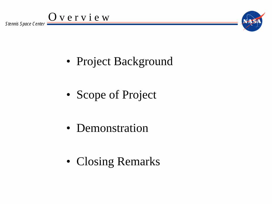
Stennis Space Center B A C K G R O U N D

Stennis Space Center I N C E P T I O N
Resource Posture • Power & communication lines down • Computer networks inoperative • Staff displaced
Key Parameters • Infrastructure • Topography – lay of the land • Geography – relative location • Climatology
• Wind • Water
Decision Support (DS) • Site, Image-Based Maps
• General site analysis • Graphical assistance
• Infrastructure overlays • Proximity to utilities • Network analysis
• Site suitability • Temporary Housing • Resource staging • Heliport
Lessons Learned • Some DS capability needed • Tailor products to Managers
Stennis Space Center E M A P S
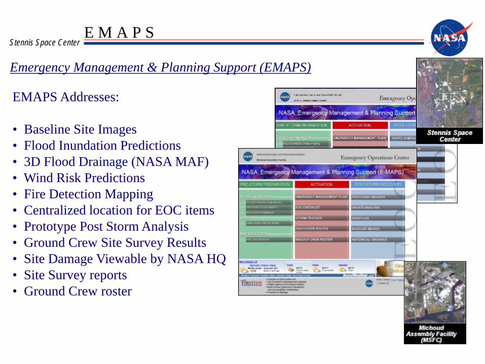
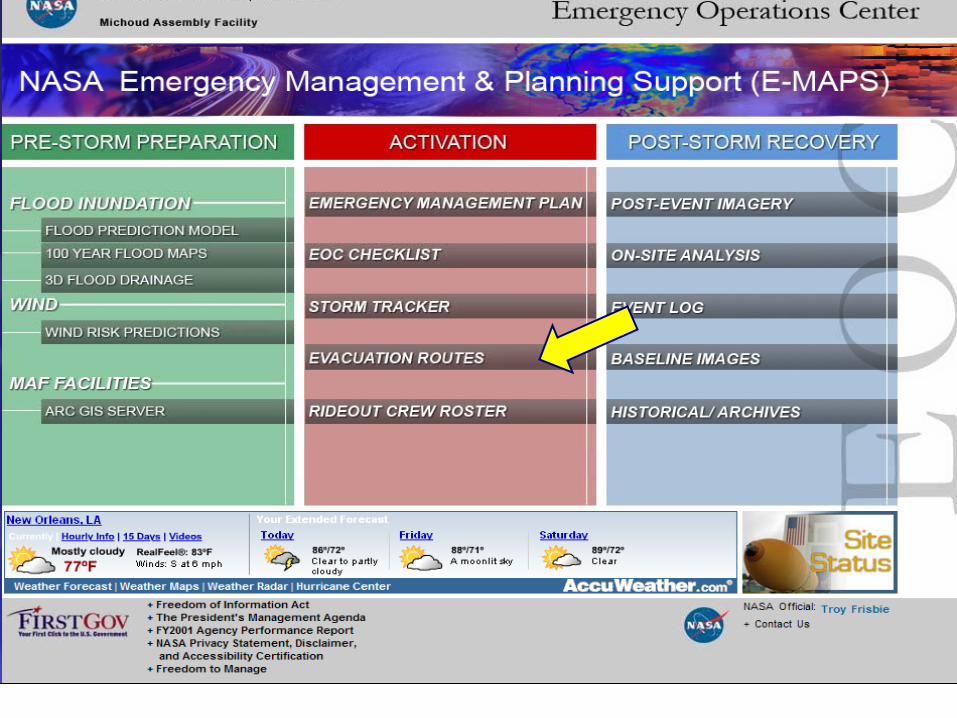
Emergency Management & Planning Support (EMAPS)
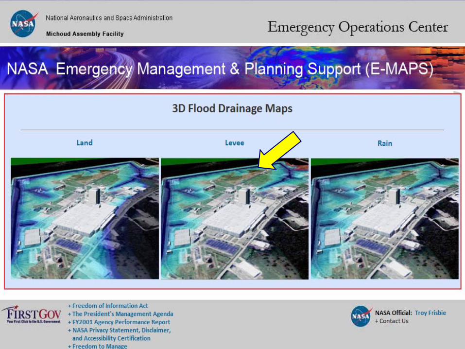
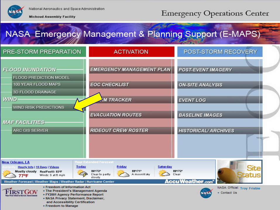
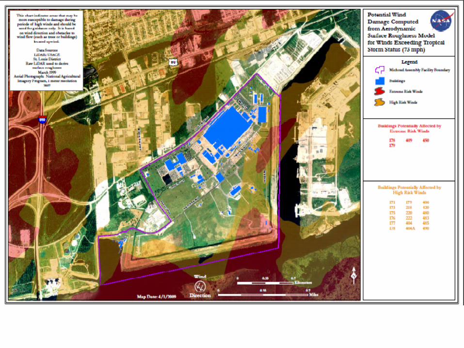
EMAPS Addresses: • Baseline Site Images • Flood Inundation Predictions • 3D Flood Drainage (NASA MAF) • Wind Risk Predictions • Fire Detection Mapping • Centralized location for EOC items • Prototype Post Storm Analysis • Ground Crew Site Survey Results • Site Damage Viewable by NASA HQ • Site Survey reports • Ground Crew roster

Stennis Space Center

Stennis Space Center
Stennis Space Center

Stennis Space Center
Stennis Space Center

Stennis Space Center
Stennis Space Center

Stennis Space Center
Stennis Space Center
Stennis Space Center
Stennis Space Center R O S E S F O L L O W – O N
Stennis Space Center R O S E S F O L L O W – O N
• NASA MAF showed a huge interest in a follow-on to EMAPS,
• Research Opportunities in Space and Earth Sciences (ROSES) 2008
submission, Evaluation of Hurricane Evacuation Routes’ Resiliency to Storm Damage,
• ROSES follow-on project awarded; proof of concept completed 2011,
• Project Team: • Troy Frisbie, NASA, Principle Investigator • Richard Brown, SSAI (now CSC), Co-Investigator • Don Holland, SSAI, Co-Investigator • Kelly Boyd, AGT (now A2R), GIS & Modeling • Wei Wu, University of Southern Mississippi (USM), Modeling
Stennis Space Center
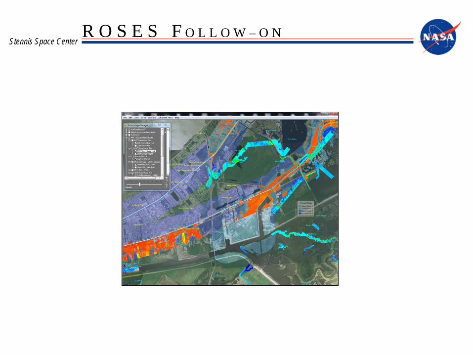
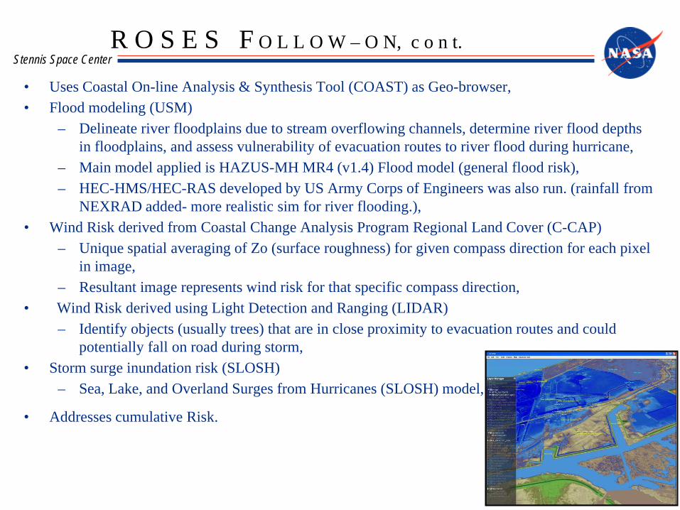
• Uses Coastal On-line Analysis & Synthesis Tool (COAST) as Geo-browser, • Flood modeling (USM)
– Delineate river floodplains due to stream overflowing channels, determine river flood depths in floodplains, and assess vulnerability of evacuation routes to river flood during hurricane,
– Main model applied is HAZUS-MH MR4 (v1.4) Flood model (general flood risk), – HEC-HMS/HEC-RAS developed by US Army Corps of Engineers was also run. (rainfall from
NEXRAD added- more realistic sim for river flooding.), • Wind Risk derived from Coastal Change Analysis Program Regional Land Cover (C-CAP)
– Unique spatial averaging of Zo (surface roughness) for given compass direction for each pixel in image,
– Resultant image represents wind risk for that specific compass direction, • Wind Risk derived using Light Detection and Ranging (LIDAR)
– Identify objects (usually trees) that are in close proximity to evacuation routes and could potentially fall on road during storm,
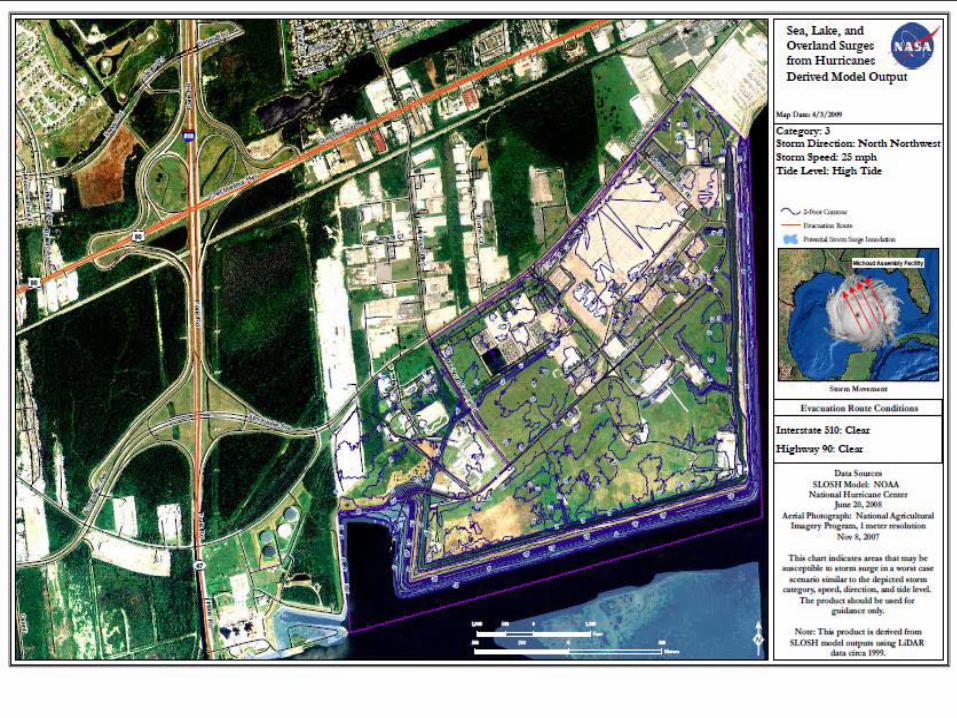
• Storm surge inundation risk (SLOSH) – Sea, Lake, and Overland Surges from Hurricanes (SLOSH) model,
• Addresses cumulative Risk.
R O S E S F O L L O W – O N, c o n t.

Stennis Space Center
Primary & secondary evacuation routes identified

Stennis Space Center
• Focus area on NASA MAF • Wind & Surge Modeling Applied

Stennis Space Center Evacuation routes analyzed under Cat 5 conditions
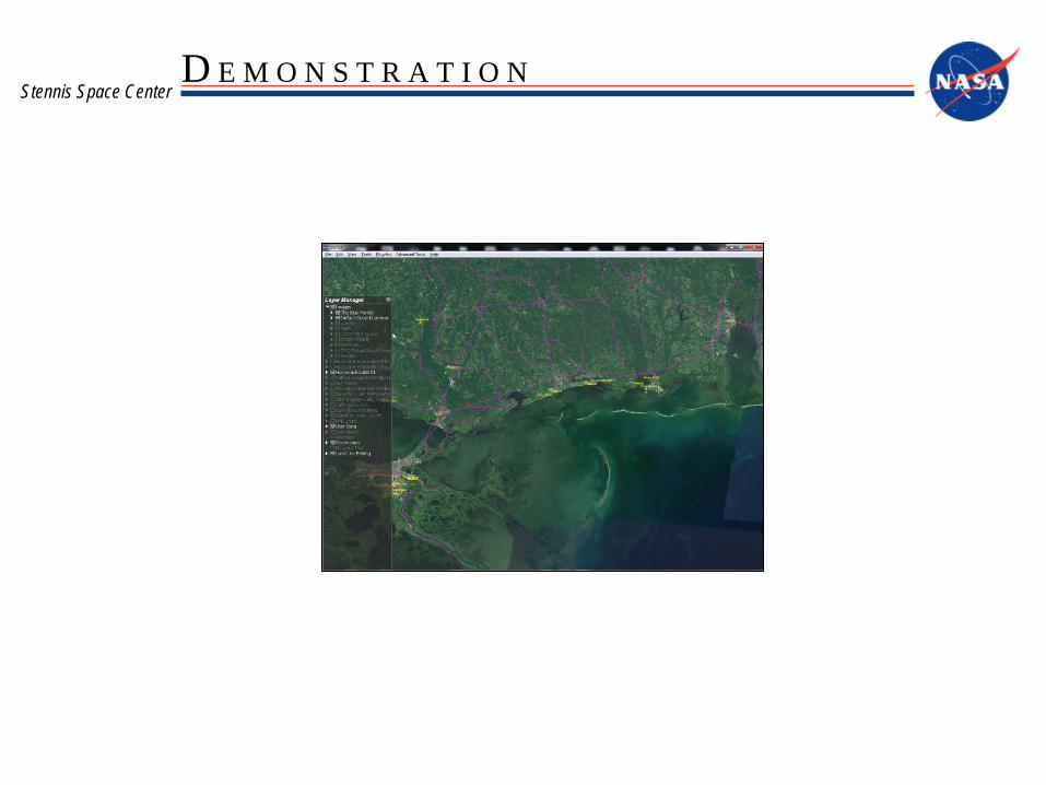
Stennis Space Center D E M O N S T R A T I O N
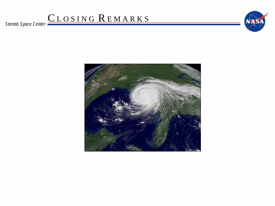
Stennis Space Center C L O S I N G R E M A R K S

Questions?
Troy E. Frisbie Project Manager Mail Code RA10 NASA, Stennis Space Center Ph: 228-688-1898 e-mail: [email protected]