Earth Observation LULC Products in support of Ecosystem ......assessment of ecosystems and their...
40
EO LULC Products in support of Ecosystem Monitoring in the EU 19.04.16 | LCLUC Spring Science Team meeting, MD [email protected] Earth Observation LULC Products in support of Ecosystem Monitoring in the EU ioannis Manakos, Dr. Centre for Research and Technology Hellas Information Technologies Institute Visual Analytics, Virtual & Augmented Reality Lab Researcher in Remote Sensing European Association of Remote Sensing Laboratories Special Interest Group in Land Use & Land Cover Chairman
Transcript of Earth Observation LULC Products in support of Ecosystem ......assessment of ecosystems and their...

EO LULC Products in support of Ecosystem Monitoring in the EU 19.04.16 | LCLUC Spring Science Team meeting, MD [email protected]
Earth Observation LULC Products in support of
Ecosystem Monitoring in the EU
ioannis Manakos, Dr.
Centre for Research and Technology Hellas Information Technologies Institute Visual Analytics, Virtual & Augmented Reality LabResearcher in Remote Sensing
European Association of Remote Sensing Laboratories Special Interest Group in Land Use & Land CoverChairman
EO LULC Products in support of Ecosystem Monitoring in the EU 19.04.16 | LCLUC Spring Science Team meeting, MD [email protected]
Earth Observation LULC Products in support of
Ecosystem Monitoring in the EU
Framework conditions

EO LULC Products in support of Ecosystem Monitoring in the EU 19.04.16 | LCLUC Spring Science Team meeting, MD [email protected]
Earth Observation LULC Products in support of
Ecosystem Monitoring in the EU
Biogeographical regions:
The EU has nine biogeographic regions, each with is own characteristic blend of vegetation, climate topography and geology.
Working at this level makes it easier to check species and habitat conservation trends under similar natural conditions, irrespective political and administrative boundaries
Credit: © European Communities, 2009

EO LULC Products in support of Ecosystem Monitoring in the EU 19.04.16 | LCLUC Spring Science Team meeting, MD [email protected]
Natura 2000 sites in the EU
Credit: European Environmental Agency (EEA)
Blue lines: Habitats Directive Sites (pSCI, SCI or SAC)Red lines: Birds Directive Sites (SPA)Scale under 1:10.000.000
• Member States identify sites that are important for the conservation of species and habitats listed in the Habitats Directive occurring naturally in their territory based on purely ecological grounds.
• European Commission examinesthe information provided across the whole biogeographical region and, in cooperation with all relevant actors, selects sites of Communityimportance.
• Member States formally protect these areas and introduce measures to maintain or restore them to a good conservation state.
Credit: © European Communities, 2009
EO LULC Products in support of Ecosystem Monitoring in the EU 19.04.16 | LCLUC Spring Science Team meeting, MD [email protected]
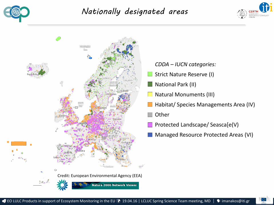
Credit: European Environmental Agency (EEA)
Nationally designated areas
CDDA – IUCN categories:
Strict Nature Reserve (I)
National Park (II)
Natural Monuments (III)
Habitat/ Species Managements Area (IV)
Other
Protected Landscape/ Seasca[e(V)
Managed Resource Protected Areas (VI)
EO LULC Products in support of Ecosystem Monitoring in the EU 19.04.16 | LCLUC Spring Science Team meeting, MD [email protected]
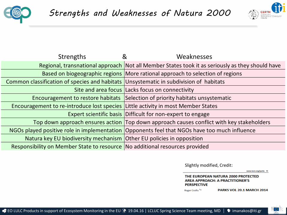
Strengths and Weaknesses of Natura 2000
Slightly modified, Credit:
Strengths & WeaknessesRegional, transnational approach Not all Member States took it as seriously as they should have
Based on biogeographic regions More rational approach to selection of regions
Common classification of species and habitats Unsystematic in subdivision of habitats
Site and area focus Lacks focus on connectivity
Encouragement to restore habitats Selection of priority habitats unsystematic
Encouragement to re-introduce lost species Little activity in most Member States
Expert scientific basis Difficult for non-expert to engage
Top down approach ensures action Top down approach causes conflict with key stakeholders
NGOs played positive role in implementation Opponents feel that NGOs have too much influence
Natura key EU biodiversity mechanism Other EU policies in opposition
Responsibility on Member State to resource No additional resources provided
EO LULC Products in support of Ecosystem Monitoring in the EU 19.04.16 | LCLUC Spring Science Team meeting, MD [email protected]
Protected Areas condition
Protected Areas
- are subject to changing environmental conditions and anthropogenic
pressures;
- their management strategies, size, boundaries and protection status will
presumably require significant updating in the near future;
- new geographical areas may need to become protected (at a level to be
defined) (, for example to host plant and/or animal populations that moved their
distribution range in response to climate change and human pressures);
- At the same time, existing PAs may require a significant revision of the
management and protection policies (, to account for emergent challenges and to
find optimal compromises between conservation requirements and
social/economical needs).
ECOPOTENTIAL will address these aspects of future PAs.
EO LULC Products in support of Ecosystem Monitoring in the EU 19.04.16 | LCLUC Spring Science Team meeting, MD [email protected]
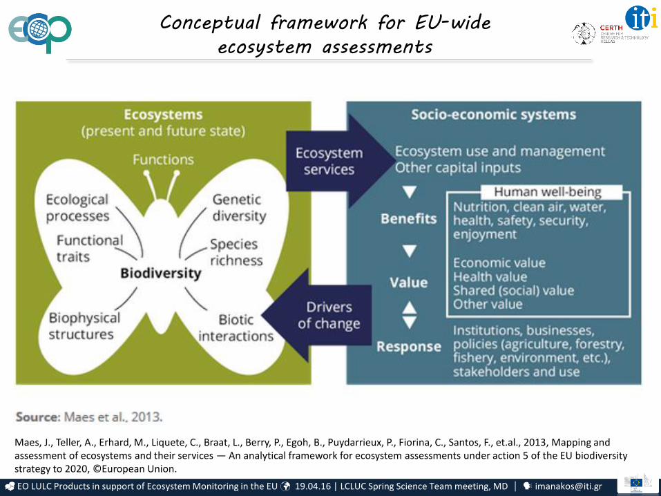
Conceptual framework for EU-wide
ecosystem assessments
Maes, J., Teller, A., Erhard, M., Liquete, C., Braat, L., Berry, P., Egoh, B., Puydarrieux, P., Fiorina, C., Santos, F., et.al., 2013, Mapping and assessment of ecosystems and their services — An analytical framework for ecosystem assessments under action 5 of the EU biodiversity strategy to 2020, ©European Union.
EO LULC Products in support of Ecosystem Monitoring in the EU 19.04.16 | LCLUC Spring Science Team meeting, MD [email protected]
Earth Observation LULC Products in support of
Ecosystem Monitoring in the EU
Services & Pressures (examples for mountain, arid/ semi-arid and coastal ecosystems)

EO LULC Products in support of Ecosystem Monitoring in the EU 19.04.16 | LCLUC Spring Science Team meeting, MD [email protected]
Services @ mountain ecosystems
Mountain ecosystems are rich in endemic and endangered species and directly linked to downstream regions
Benefits are identified for watersheds, slope stability, discharge regulation, food and energy production, recreational services and options for tourism.
The spatial heterogeneity of mountains exhibits methodological challenges for EO (cloudiness, shade, etc.) making these areas excellent training grounds for the development of robust approaches.
In Europe, mountainous PAs of international value exist in all climatic zones and latitudes.
EO LULC Products in support of Ecosystem Monitoring in the EU 19.04.16 | LCLUC Spring Science Team meeting, MD [email protected]
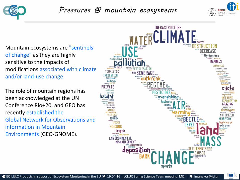
Pressures @ mountain ecosystems
Mountain ecosystems are "sentinels of change" as they are highly sensitive to the impacts of modifications associated with climate and/or land-use change.
The role of mountain regions has been acknowledged at the UN Conference Rio+20, and GEO has recently established theGlobal Network for Observations and information in Mountain Environments (GEO-GNOME).
EO LULC Products in support of Ecosystem Monitoring in the EU 19.04.16 | LCLUC Spring Science Team meeting, MD [email protected]
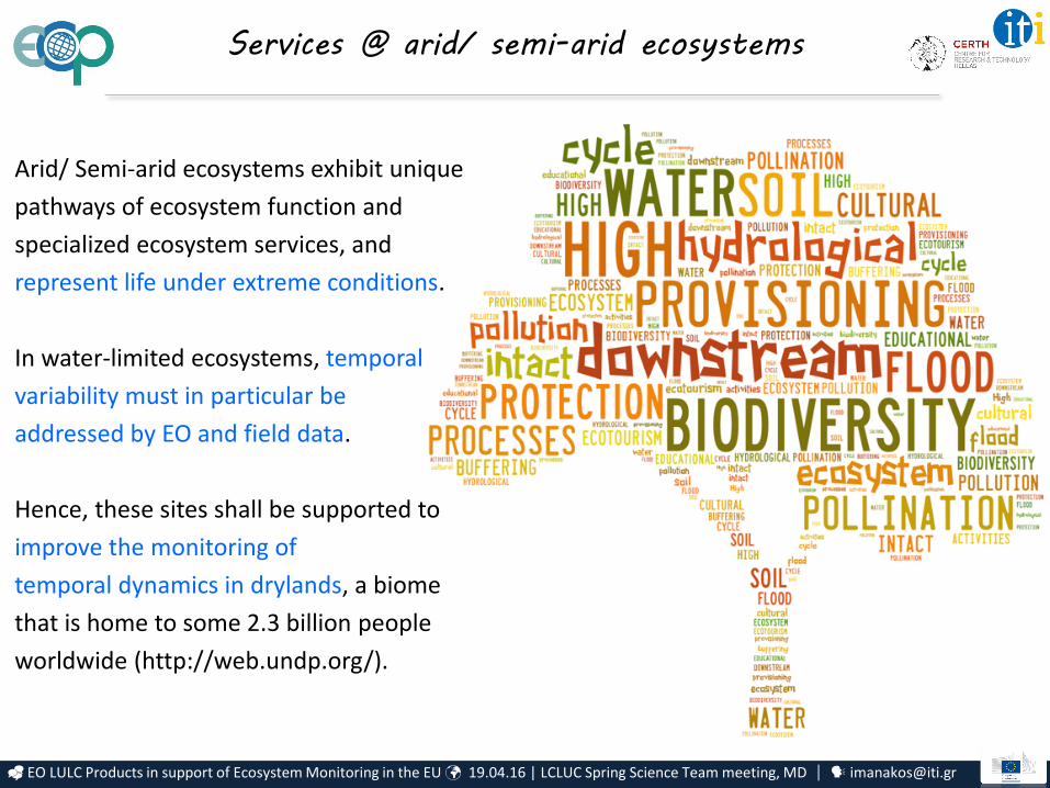
Arid/ Semi-arid ecosystems exhibit unique
pathways of ecosystem function and
specialized ecosystem services, and
represent life under extreme conditions.
In water-limited ecosystems, temporal
variability must in particular be
addressed by EO and field data.
Hence, these sites shall be supported to
improve the monitoring of
temporal dynamics in drylands, a biome
that is home to some 2.3 billion people
worldwide (http://web.undp.org/).
Services @ arid/ semi-arid ecosystems

EO LULC Products in support of Ecosystem Monitoring in the EU 19.04.16 | LCLUC Spring Science Team meeting, MD [email protected]
Such water-limited ecosystems can be
vulnerable to the current impacts
associated with global change.
Large areas in southern Europe are
exposed to the risk of facing significantly
drier conditions, and collapse of previous
ecosystem functioning can occur as a
consequence of increased climatic
variability.
Here especially, uncertainties are high
about future ecosystem behavior.
Pressures @ arid/ semi-arid ecosystems
EO LULC Products in support of Ecosystem Monitoring in the EU 19.04.16 | LCLUC Spring Science Team meeting, MD [email protected]
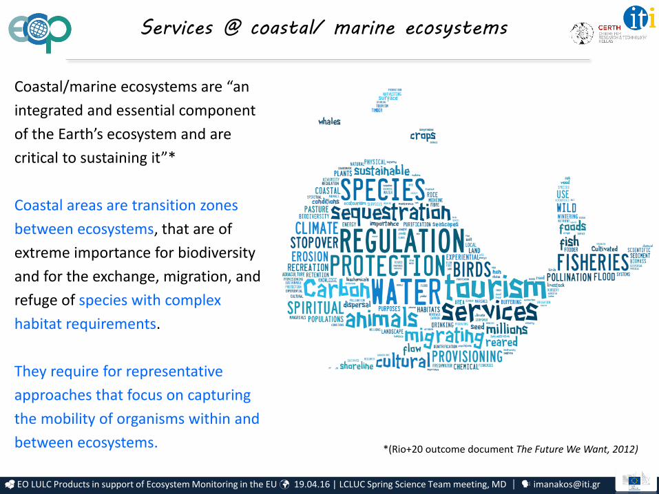
Coastal/marine ecosystems are “an
integrated and essential component
of the Earth’s ecosystem and are
critical to sustaining it”*
Coastal areas are transition zones
between ecosystems, that are of
extreme importance for biodiversity
and for the exchange, migration, and
refuge of species with complex
habitat requirements.
They require for representative
approaches that focus on capturing
the mobility of organisms within and
between ecosystems.
Services @ coastal/ marine ecosystems
*(Rio+20 outcome document The Future We Want, 2012)
EO LULC Products in support of Ecosystem Monitoring in the EU 19.04.16 | LCLUC Spring Science Team meeting, MD [email protected]
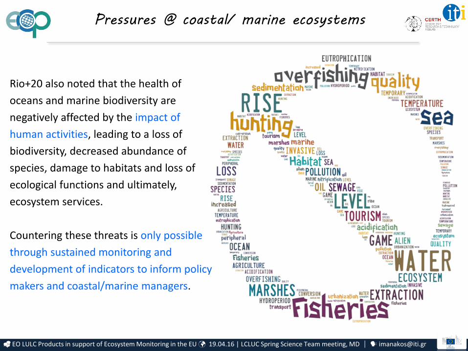
Rio+20 also noted that the health of
oceans and marine biodiversity are
negatively affected by the impact of
human activities, leading to a loss of
biodiversity, decreased abundance of
species, damage to habitats and loss of
ecological functions and ultimately,
ecosystem services.
Countering these threats is only possible
through sustained monitoring and
development of indicators to inform policy
makers and coastal/marine managers.
Pressures @ coastal/ marine ecosystems

EO LULC Products in support of Ecosystem Monitoring in the EU 19.04.16 | LCLUC Spring Science Team meeting, MD [email protected]
Global trends influencing EU ecosystems
CREDIT:
1. Population trends2. Urbanization3. Diseases4. Global competition for resources5. Climate change6. Governance frameworks

EO LULC Products in support of Ecosystem Monitoring in the EU 19.04.16 | LCLUC Spring Science Team meeting, MD [email protected]
Earth Observation LULC Products in support of
Ecosystem Monitoring in the EU
EO LC products for ecosystem monitoring

EO LULC Products in support of Ecosystem Monitoring in the EU 19.04.16 | LCLUC Spring Science Team meeting, MD [email protected]
Strategic Goals CBD headline indicators
Aic
hi T
arge
ts
A 4. Sustainability(4) Pressure practices, (5) Pressures various
B
5. Habitat loss(1) Extent, (4) Pressures practices, (5) Pressures Various
7. Agriculture, forest and aquaculture (4) Pressures practices
8. Pollution (5) Pressures various
9. Alien species (2) Species, (5) Pressures various
C
11. Protected areas (11) Protected areas
12. Threatened species (2) Species
13. Genetic diversity
D14. Ecosystem services (6) Services, (11) Protected areas
15. Climate change resilience (6) Services, (11) Protected areas
E
17. National BD Strategies & Action Plans
18. Indigenous knowledge
19. Knowledge Sharing
International acknowledgement of the role of LC
products for ecosystem monitoring
Land Cover products contribute to 13 out of 20 targets, as acknowledged by
Aichi Targets: following the Strategic Plan for Biodiversity by the United Nations (UN), Convention on Biological Diversity (CBD)

EO LULC Products in support of Ecosystem Monitoring in the EU 19.04.16 | LCLUC Spring Science Team meeting, MD [email protected]
Z. Petrou, I. Manakos, T. Stathaki, "Remote sensing for biodiversity monitoring: A review of methods for biodiversity indicator extraction and assessment of progress towards international targets", 2015, Biodiversity and Conservation, 24(10), 2333-2363.
Numerous studies exist for RS products
performance in service of CBD indicators estimation
EO LULC Products in support of Ecosystem Monitoring in the EU 19.04.16 | LCLUC Spring Science Team meeting, MD [email protected]
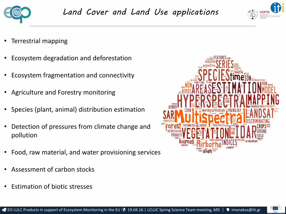
• Terrestrial mapping
• Ecosystem degradation and deforestation
• Ecosystem fragmentation and connectivity
• Agriculture and Forestry monitoring
• Species (plant, animal) distribution estimation
• Detection of pressures from climate change and pollution
• Food, raw material, and water provisioning services
• Assessment of carbon stocks
• Estimation of biotic stresses
Land Cover and Land Use applications

EO LULC Products in support of Ecosystem Monitoring in the EU 19.04.16 | LCLUC Spring Science Team meeting, MD [email protected]
Nomenclature for common understanding
European Nature Information System (EUNIS)EUNIS is a comprehensive pan-European system to facilitate the harmonized description and collection of data across Europe through the use of criteria for habitat identification. It is hierarchical and covers all types of habitat types from natural to artificial, from terrestrial to freshwater and marine.
Mapping and Assessment of Ecosystems and their Services (MAES)MAES aims to demonstrate the effectiveness of mapping and assessment of ecosystems and their services in planning and land management. Ecosystems are mapped by interpreting available land cover (LC) data on the basis of the European habitat classification (EUNIS).
Links to General Habitat Categories and Annex I ones are established within EU projects
Links to LCCS of FAO, as well:
V. Kosmidou, Z. Petrou, R.G.H. Bunce, C.A. Mucher, R.H.G. Jongman, M.M. Bogers, R.M. Lucas, V. Tomaselli, P. Blonda, E. Padoa-Schioppa, I. Manakos, M. Petrou, "Harmonization of the Land Cover Classification System (LCCS) with the General Habitat Categories (GHC) classification system", 2014, Ecol. Indic. 36, 290–300.M. Adamo, C. Tarantino, V. Tomaselli, V. Kosmidou, Z. Petrou, I. Manakos, R.M. Lucas, C.A. Mucher, G. Veronico, C. Marangi, V. De Pasquale, P. Blonda, "Expert knowledge for translating land cover/use maps to General Habitat Categories (GHC)", 2014, Landscape Ecol., 29(6), 1045-1067.
EO LULC Products in support of Ecosystem Monitoring in the EU 19.04.16 | LCLUC Spring Science Team meeting, MD [email protected]
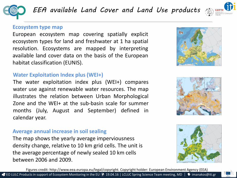
Ecosystem type mapEuropean ecosystem map covering spatially explicitecosystem types for land and freshwater at 1 ha spatialresolution. Ecosystems are mapped by interpretingavailable land cover data on the basis of the Europeanhabitat classification (EUNIS).
Water Exploitation Index plus (WEI+)The water exploitation index plus (WEI+) compareswater use against renewable water resources. The mapillustrates the relation between Urban MorphologicalZone and the WEI+ at the sub-basin scale for summermonths (July, August and September) defined incalendar year.
Average annual increase in soil sealing The map shows the yearly average imperviousness density change, relative to 10 km grid cells. The unit is the average percentage of newly sealed 10 km cells between 2006 and 2009.
EEA available Land Cover and Land Use products
Figures credit: http://www.eea.europa.eu/legal/copyright. Copyright holder: European Environment Agency (EEA)
EO LULC Products in support of Ecosystem Monitoring in the EU 19.04.16 | LCLUC Spring Science Team meeting, MD [email protected]
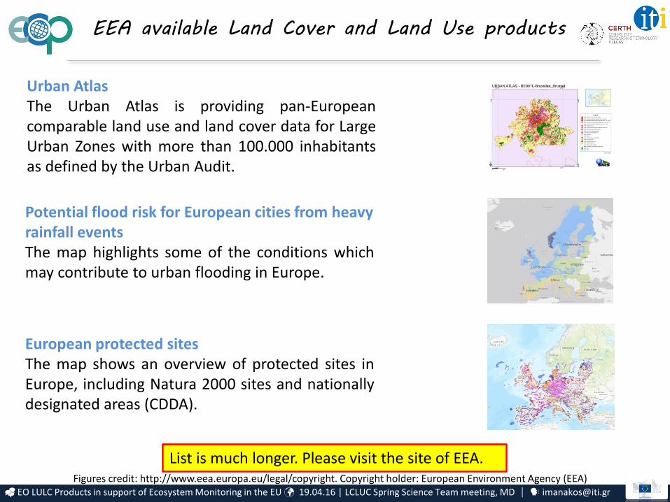
Potential flood risk for European cities from heavy rainfall eventsThe map highlights some of the conditions whichmay contribute to urban flooding in Europe.
European protected sitesThe map shows an overview of protected sites inEurope, including Natura 2000 sites and nationallydesignated areas (CDDA).
Urban AtlasThe Urban Atlas is providing pan-Europeancomparable land use and land cover data for LargeUrban Zones with more than 100.000 inhabitantsas defined by the Urban Audit.
Figures credit: http://www.eea.europa.eu/legal/copyright. Copyright holder: European Environment Agency (EEA)
EEA available Land Cover and Land Use products
List is much longer. Please visit the site of EEA.
EO LULC Products in support of Ecosystem Monitoring in the EU 19.04.16 | LCLUC Spring Science Team meeting, MD [email protected]
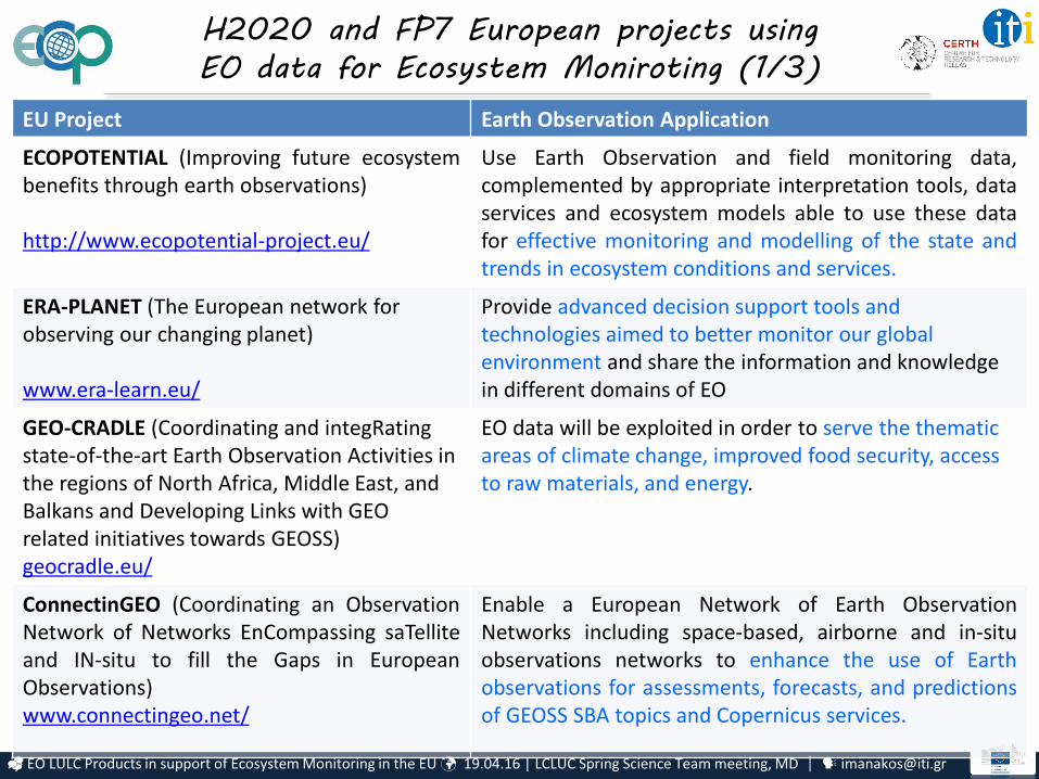
H2020 and FP7 European projects using
EO data for Ecosystem Moniroting (1/3)
EU Project Earth Observation Application
ECOPOTENTIAL (Improving future ecosystembenefits through earth observations)
http://www.ecopotential-project.eu/
Use Earth Observation and field monitoring data,complemented by appropriate interpretation tools, dataservices and ecosystem models able to use these datafor effective monitoring and modelling of the state andtrends in ecosystem conditions and services.
ERA-PLANET (The European network for observing our changing planet)
www.era-learn.eu/
Provide advanced decision support tools and technologies aimed to better monitor our global environment and share the information and knowledge in different domains of EO
GEO-CRADLE (Coordinating and integRatingstate-of-the-art Earth Observation Activities in the regions of North Africa, Middle East, and Balkans and Developing Links with GEO related initiatives towards GEOSS)geocradle.eu/
EO data will be exploited in order to serve the thematic areas of climate change, improved food security, access to raw materials, and energy.
ConnectinGEO (Coordinating an ObservationNetwork of Networks EnCompassing saTelliteand IN-situ to fill the Gaps in EuropeanObservations)www.connectingeo.net/
Enable a European Network of Earth ObservationNetworks including space-based, airborne and in-situobservations networks to enhance the use of Earthobservations for assessments, forecasts, and predictionsof GEOSS SBA topics and Copernicus services.
EO LULC Products in support of Ecosystem Monitoring in the EU 19.04.16 | LCLUC Spring Science Team meeting, MD [email protected]
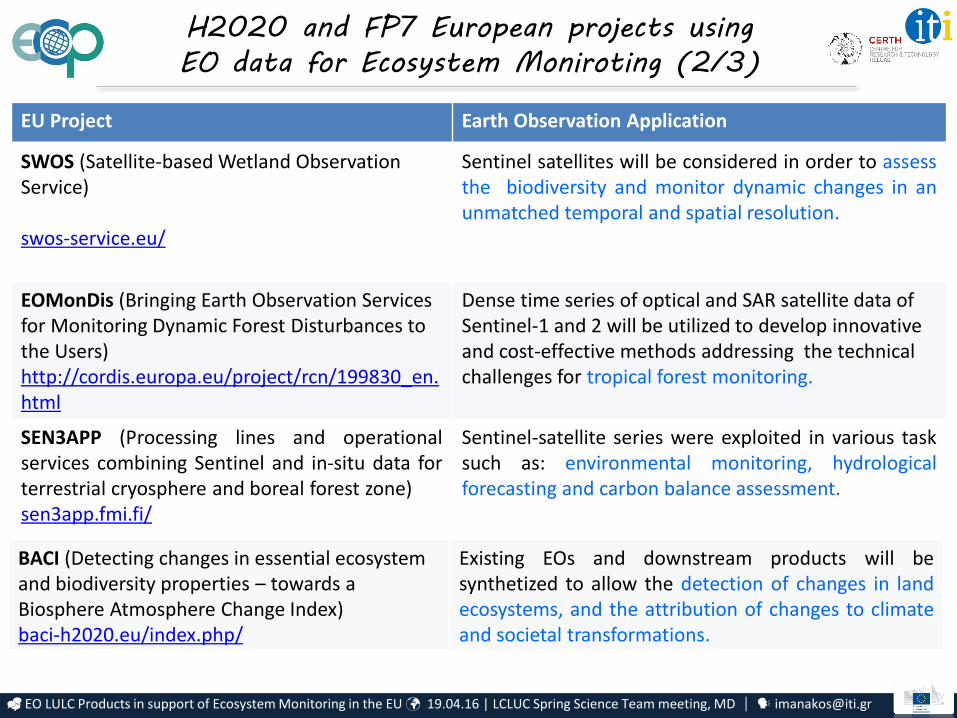
EU Project Earth Observation Application
SWOS (Satellite-based Wetland Observation Service)
swos-service.eu/
Sentinel satellites will be considered in order to assessthe biodiversity and monitor dynamic changes in anunmatched temporal and spatial resolution.
EOMonDis (Bringing Earth Observation Services for Monitoring Dynamic Forest Disturbances to the Users)http://cordis.europa.eu/project/rcn/199830_en.html
Dense time series of optical and SAR satellite data of Sentinel-1 and 2 will be utilized to develop innovative and cost-effective methods addressing the technical challenges for tropical forest monitoring.
SEN3APP (Processing lines and operationalservices combining Sentinel and in-situ data forterrestrial cryosphere and boreal forest zone)sen3app.fmi.fi/
Sentinel-satellite series were exploited in various tasksuch as: environmental monitoring, hydrologicalforecasting and carbon balance assessment.
BACI (Detecting changes in essential ecosystem and biodiversity properties – towards a Biosphere Atmosphere Change Index)baci-h2020.eu/index.php/
Existing EOs and downstream products will besynthetized to allow the detection of changes in landecosystems, and the attribution of changes to climateand societal transformations.
H2020 and FP7 European projects using
EO data for Ecosystem Moniroting (2/3)
EO LULC Products in support of Ecosystem Monitoring in the EU 19.04.16 | LCLUC Spring Science Team meeting, MD [email protected]
EU Project Earth Observation Application
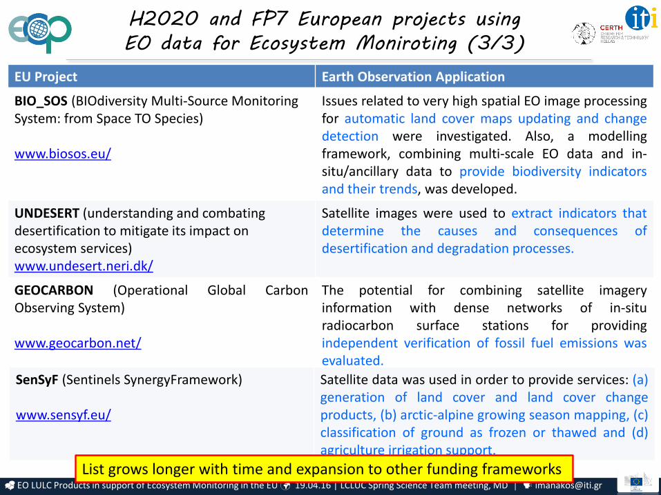
BIO_SOS (BIOdiversity Multi-Source Monitoring System: from Space TO Species)
www.biosos.eu/
Issues related to very high spatial EO image processingfor automatic land cover maps updating and changedetection were investigated. Also, a modellingframework, combining multi-scale EO data and in-situ/ancillary data to provide biodiversity indicatorsand their trends, was developed.
UNDESERT (understanding and combating desertification to mitigate its impact on ecosystem services)www.undesert.neri.dk/
Satellite images were used to extract indicators thatdetermine the causes and consequences ofdesertification and degradation processes.
GEOCARBON (Operational Global CarbonObserving System)
www.geocarbon.net/
The potential for combining satellite imageryinformation with dense networks of in-situradiocarbon surface stations for providingindependent verification of fossil fuel emissions wasevaluated.
SenSyF (Sentinels SynergyFramework)
www.sensyf.eu/
Satellite data was used in order to provide services: (a)generation of land cover and land cover changeproducts, (b) arctic-alpine growing season mapping, (c)classification of ground as frozen or thawed and (d)agriculture irrigation support.
H2020 and FP7 European projects using
EO data for Ecosystem Moniroting (3/3)
List grows longer with time and expansion to other funding frameworks
EO LULC Products in support of Ecosystem Monitoring in the EU 19.04.16 | LCLUC Spring Science Team meeting, MD [email protected]
Earth Observation LULC Products in support of
Ecosystem Monitoring in the EU
Challenges faced in the EU
EO LULC Products in support of Ecosystem Monitoring in the EU 19.04.16 | LCLUC Spring Science Team meeting, MD [email protected]
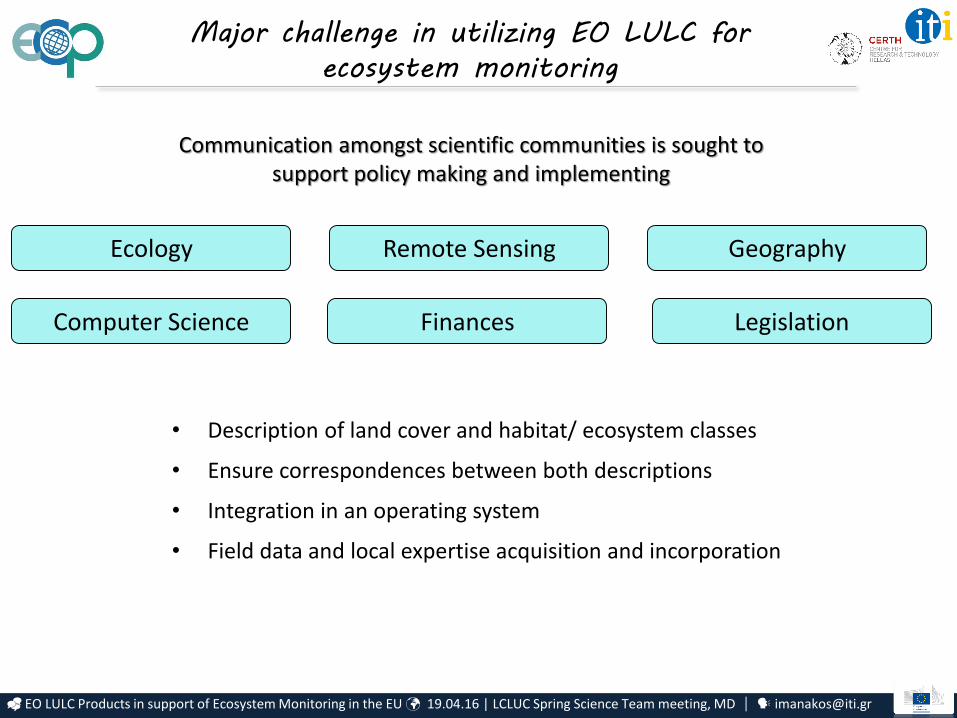
Major challenge in utilizing EO LULC for
ecosystem monitoring
Communication amongst scientific communities is sought to support policy making and implementing
Remote SensingEcology
Computer Science
Geography
• Description of land cover and habitat/ ecosystem classes
• Ensure correspondences between both descriptions
• Integration in an operating system
• Field data and local expertise acquisition and incorporation
Finances Legislation
EO LULC Products in support of Ecosystem Monitoring in the EU 19.04.16 | LCLUC Spring Science Team meeting, MD [email protected]
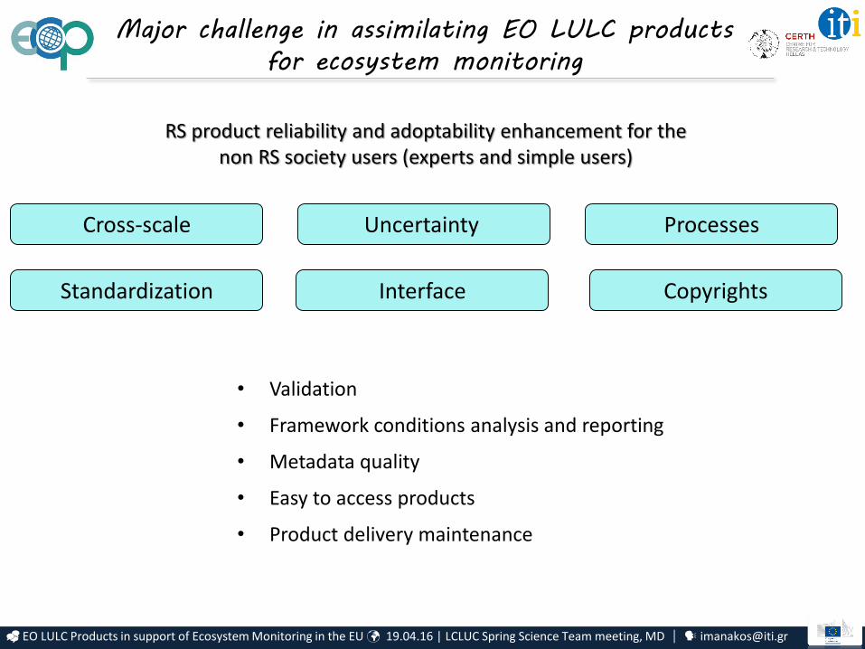
Major challenge in assimilating EO LULC products
for ecosystem monitoring
RS product reliability and adoptability enhancement for the non RS society users (experts and simple users)
Uncertainty Cross-scale
Standardization
Processes
• Validation
• Framework conditions analysis and reporting
• Metadata quality
• Easy to access products
• Product delivery maintenance
Interface Copyrights
EO LULC Products in support of Ecosystem Monitoring in the EU 19.04.16 | LCLUC Spring Science Team meeting, MD [email protected]
Earth Observation LULC Products in support of
Ecosystem Monitoring in the EU
Towards integrated service platforms(examples from on going research activities)
EO LULC Products in support of Ecosystem Monitoring in the EU 19.04.16 | LCLUC Spring Science Team meeting, MD [email protected]
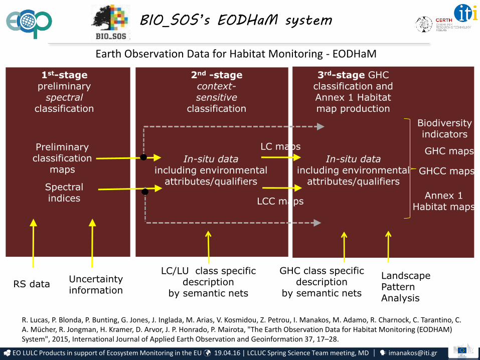
Annex 1 Habitat maps
2nd -stage context-sensitive
classification
MS image pre-
processing
1st-stagepreliminary
spectral classification
Preliminary classification
maps
Spectral indices
LC maps
LCC maps
GHC maps
GHCC maps
Biodiversity indicators
LC/LU class specific description
by semantic nets
In-situ data including environmental
attributes/qualifiers
GHC class specific description
by semantic nets
Landscape Pattern Analysis
Earth Observation Data for Habitat Monitoring - EODHaM
3rd-stage GHC classification and Annex 1 Habitat map production
In-situ data including environmental
attributes/qualifiers
Uncertainty information
BIO_SOS’s EODHaM system
R. Lucas, P. Blonda, P. Bunting, G. Jones, J. Inglada, M. Arias, V. Kosmidou, Z. Petrou, I. Manakos, M. Adamo, R. Charnock, C. Tarantino, C. A. Mücher, R. Jongman, H. Kramer, D. Arvor, J. P. Honrado, P. Mairota, "The Earth Observation Data for Habitat Monitoring (EODHAM) System", 2015, International Journal of Applied Earth Observation and Geoinformation 37, 17–28.
RS data
EO LULC Products in support of Ecosystem Monitoring in the EU 19.04.16 | LCLUC Spring Science Team meeting, MD [email protected]
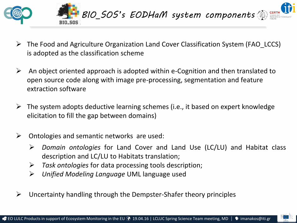
BIO_SOS’s EODHaM system components
The Food and Agriculture Organization Land Cover Classification System (FAO_LCCS) is adopted as the classification scheme
An object oriented approach is adopted within e-Cognition and then translated to open source code along with image pre-processing, segmentation and feature extraction software
The system adopts deductive learning schemes (i.e., it based on expert knowledge elicitation to fill the gap between domains)
Ontologies and semantic networks are used:
Domain ontologies for Land Cover and Land Use (LC/LU) and Habitat classdescription and LC/LU to Habitats translation;
Task ontologies for data processing tools description; Unified Modeling Language UML language used
Uncertainty handling through the Dempster-Shafer theory principles

EO LULC Products in support of Ecosystem Monitoring in the EU 19.04.16 | LCLUC Spring Science Team meeting, MD [email protected]
Previous EODHaM system• Segmentation and attribution• Rule-based classification using indices and image bands • Translation to GHCs and Annex 1
Updated EODHaM system*① Refinement of existing rule-based approaches② Integration of existing land cover/habitat maps③ Incorporation of external classifications (e.g., random forests, K means)④ Introduction of sub-pixel proportions⑤ Change detection (LCCS L3/L4 and indices)⑥ Categorisation of processes of change (e.g., deforestation, agricultural
expansion, woody shrub decline)⑦ Inclusion of a scoring system that relates change events to impacts on
ecosystem services.⑧ Application of an accuracy assessment procedure (TBD).
*Credit: Richard Lucas and Anthea Mitchell University of New South Wales, Sydney, Australia
ECOPOTENTIAL’s EODESM system
Earth Observation Data for Ecosystem Monitoring
EO LULC Products in support of Ecosystem Monitoring in the EU 19.04.16 | LCLUC Spring Science Team meeting, MD [email protected]
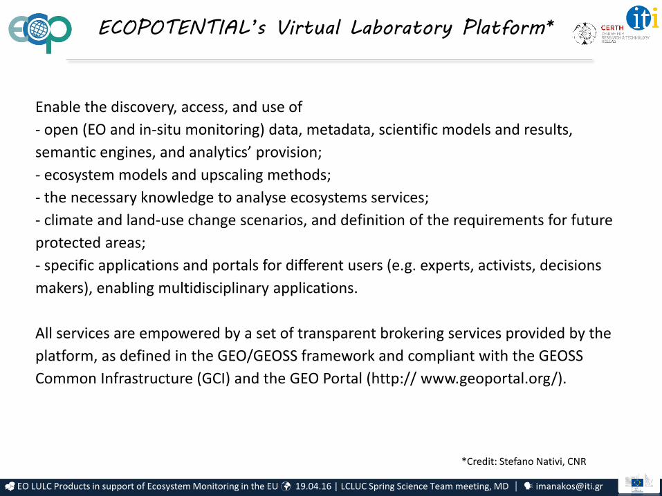
ECOPOTENTIAL’s Virtual Laboratory Platform*
Enable the discovery, access, and use of
- open (EO and in-situ monitoring) data, metadata, scientific models and results,
semantic engines, and analytics’ provision;
- ecosystem models and upscaling methods;
- the necessary knowledge to analyse ecosystems services;
- climate and land-use change scenarios, and definition of the requirements for future
protected areas;
- specific applications and portals for different users (e.g. experts, activists, decisions
makers), enabling multidisciplinary applications.
All services are empowered by a set of transparent brokering services provided by the
platform, as defined in the GEO/GEOSS framework and compliant with the GEOSS
Common Infrastructure (GCI) and the GEO Portal (http:// www.geoportal.org/).
*Credit: Stefano Nativi, CNR

EO LULC Products in support of Ecosystem Monitoring in the EU 19.04.16 | LCLUC Spring Science Team meeting, MD [email protected]
Earth Observation LULC Products in support of
Ecosystem Monitoring in the EU
Towards integrated networking platforms
EO LULC Products in support of Ecosystem Monitoring in the EU 19.04.16 | LCLUC Spring Science Team meeting, MD [email protected]
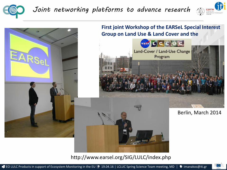
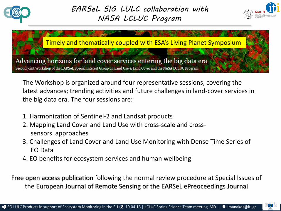
First joint Workshop of the EARSeL Special Interest Group on Land Use & Land Cover and the
NASA LCLUC Program
http://www.earsel.org/SIG/LULC/index.php
Berlin, March 2014
Joint networking platforms to advance research
EO LULC Products in support of Ecosystem Monitoring in the EU 19.04.16 | LCLUC Spring Science Team meeting, MD [email protected]
The Workshop is organized around four representative sessions, covering the latest advances; trending activities and future challenges in land-cover services in the big data era. The four sessions are:
1. Harmonization of Sentinel-2 and Landsat products2. Mapping Land Cover and Land Use with cross-scale and cross-
sensors approaches3. Challenges of Land Cover and Land Use Monitoring with Dense Time Series of
EO Data4. EO benefits for ecosystem services and human wellbeing
Free open access publication following the normal review procedure at Special Issues ofthe European Journal of Remote Sensing or the EARSeL ePreoceedings Journal
EARSeL SIG LULC collaboration with
NASA LCLUC Program
Timely and thematically coupled with ESA’s Living Planet Symposium
EO LULC Products in support of Ecosystem Monitoring in the EU 19.04.16 | LCLUC Spring Science Team meeting, MD [email protected]
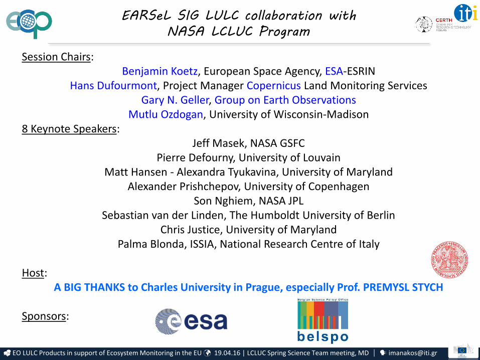
Session Chairs: Benjamin Koetz, European Space Agency, ESA-ESRIN
Hans Dufourmont, Project Manager Copernicus Land Monitoring ServicesGary N. Geller, Group on Earth Observations
Mutlu Ozdogan, University of Wisconsin-Madison8 Keynote Speakers:
Jeff Masek, NASA GSFCPierre Defourny, University of Louvain
Matt Hansen - Alexandra Tyukavina, University of MarylandAlexander Prishchepov, University of Copenhagen
Son Nghiem, NASA JPLSebastian van der Linden, The Humboldt University of Berlin
Chris Justice, University of MarylandPalma Blonda, ISSIA, National Research Centre of Italy
Host: A BIG THANKS to Charles University in Prague, especially Prof. PREMYSL STYCH
Sponsors:
EARSeL SIG LULC collaboration with
NASA LCLUC Program
EO LULC Products in support of Ecosystem Monitoring in the EU 19.04.16 | LCLUC Spring Science Team meeting, MD [email protected]
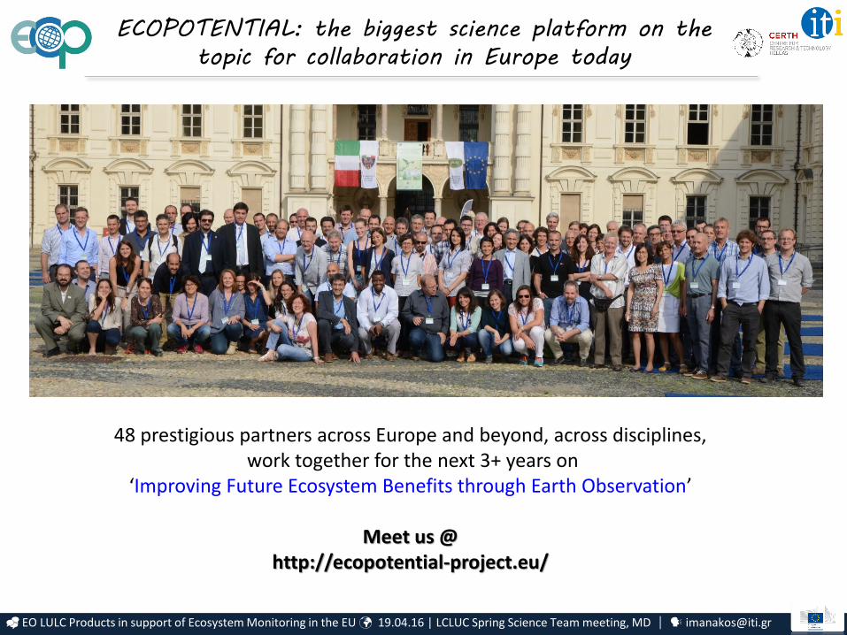
ECOPOTENTIAL: the biggest science platform on the
topic for collaboration in Europe today
48 prestigious partners across Europe and beyond, across disciplines,work together for the next 3+ years on
‘Improving Future Ecosystem Benefits through Earth Observation’
Meet us @ http://ecopotential-project.eu/
EO LULC Products in support of Ecosystem Monitoring in the EU 19.04.16 | LCLUC Spring Science Team meeting, MD [email protected]
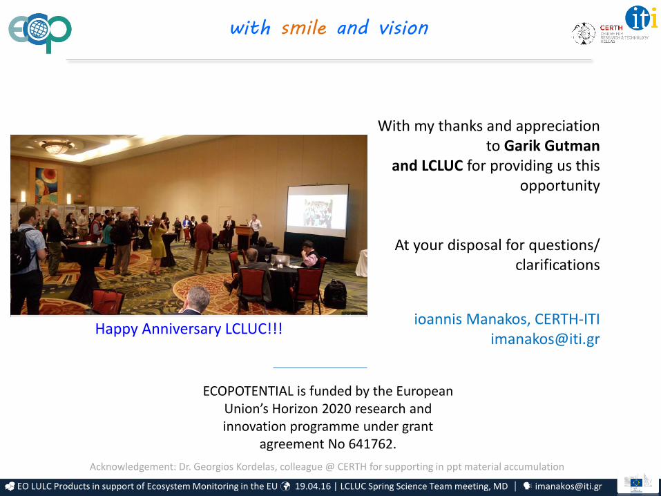
with smile and vision
ioannis Manakos, [email protected]
With my thanks and appreciation to Garik Gutman
and LCLUC for providing us this opportunity
At your disposal for questions/ clarifications
ECOPOTENTIAL is funded by the European Union’s Horizon 2020 research and innovation programme under grant
agreement No 641762.
Acknowledgement: Dr. Georgios Kordelas, colleague @ CERTH for supporting in ppt material accumulation
Happy Anniversary LCLUC!!!