E4014 Construction Surveying Hydrographic Surveys.
62
E4014 Construction Surveying Hydrographic Surveys
-
Upload
jemimah-newton -
Category
Documents
-
view
237 -
download
2
Transcript of E4014 Construction Surveying Hydrographic Surveys.

E4014 Construction Surveying
Hydrographic Surveys
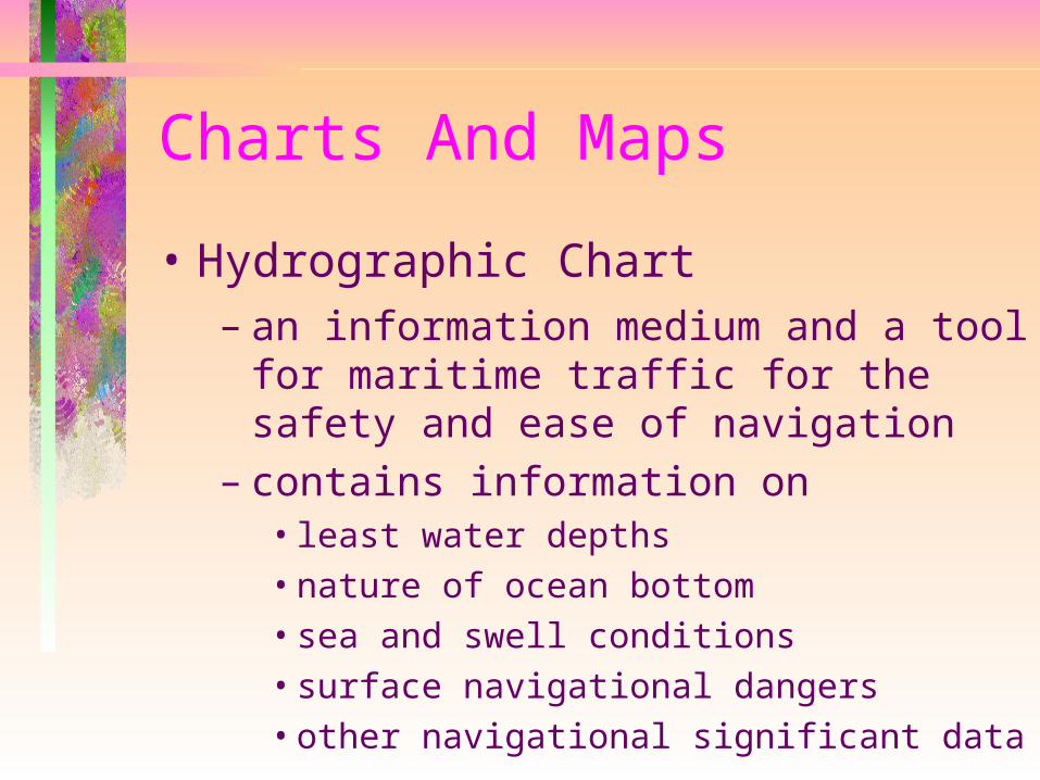
Charts And Maps
• Hydrographic Chart– an information medium and a tool for
maritime traffic for the safety and ease of navigation
– contains information on• least water depths• nature of ocean bottom• sea and swell conditions• surface navigational dangers• other navigational significant data
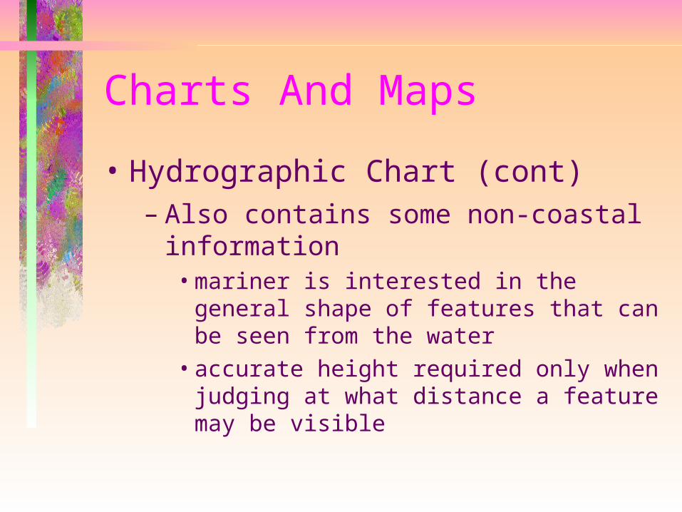
Charts And Maps
• Hydrographic Chart (cont)– Also contains some non-coastal
information• mariner is interested in the general shape
of features that can be seen from the water
• accurate height required only when judging at what distance a feature may be visible
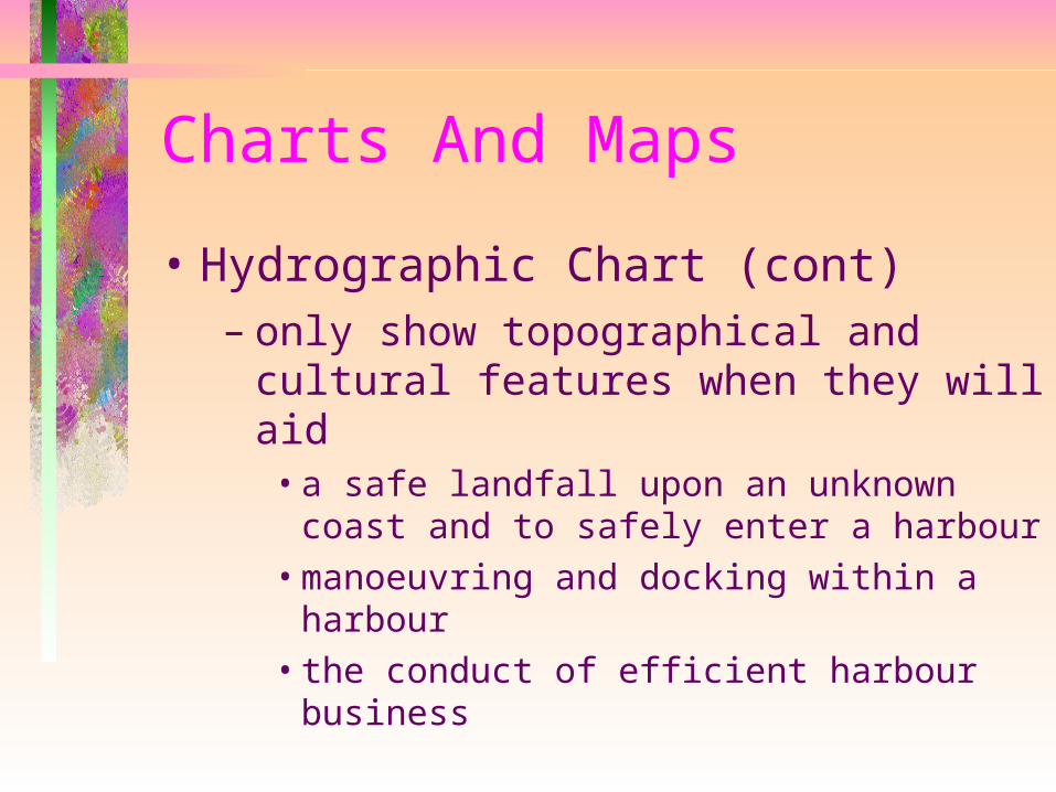
Charts And Maps
• Hydrographic Chart (cont)– only show topographical and cultural
features when they will aid• a safe landfall upon an unknown coast
and to safely enter a harbour• manoeuvring and docking within a
harbour• the conduct of efficient harbour business
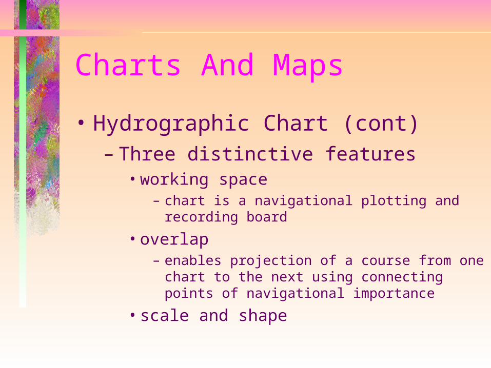
Charts And Maps
• Hydrographic Chart (cont)– Three distinctive features
• working space– chart is a navigational plotting and recording
board
• overlap– enables projection of a course from one chart
to the next using connecting points of navigational importance
• scale and shape
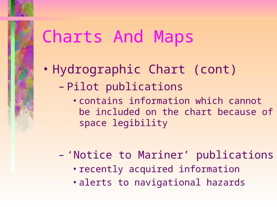
Charts And Maps
• Hydrographic Chart (cont)– Pilot publications
• contains information which cannot be included on the chart because of space legibility
– ‘Notice to Mariner’ publications• recently acquired information• alerts to navigational hazards
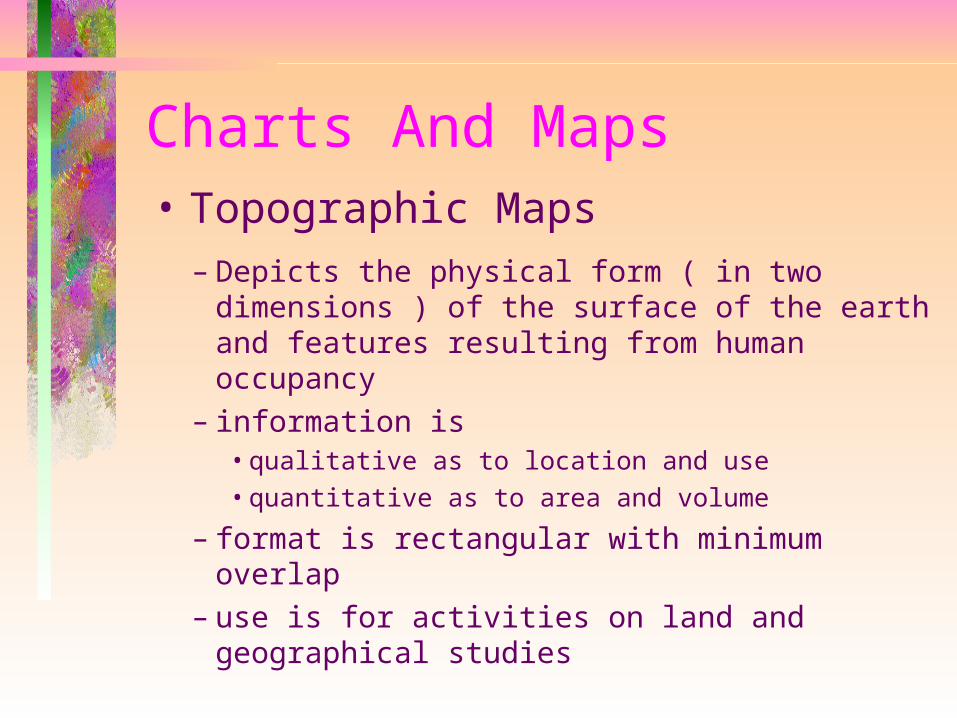
Charts And Maps• Topographic Maps
– Depicts the physical form ( in two dimensions ) of the surface of the earth and features resulting from human occupancy
– information is • qualitative as to location and use• quantitative as to area and volume
– format is rectangular with minimum overlap– use is for activities on land and geographical
studies
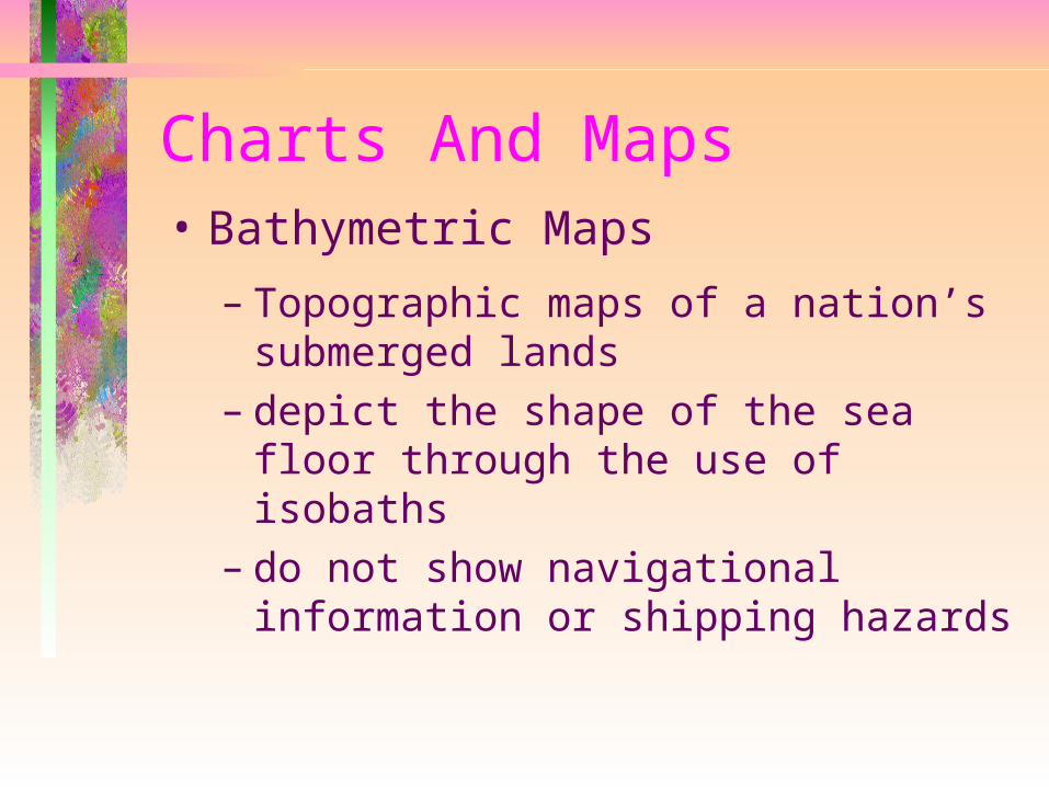
Charts And Maps• Bathymetric Maps
– Topographic maps of a nation’s submerged lands
– depict the shape of the sea floor through the use of isobaths
– do not show navigational information or shipping hazards
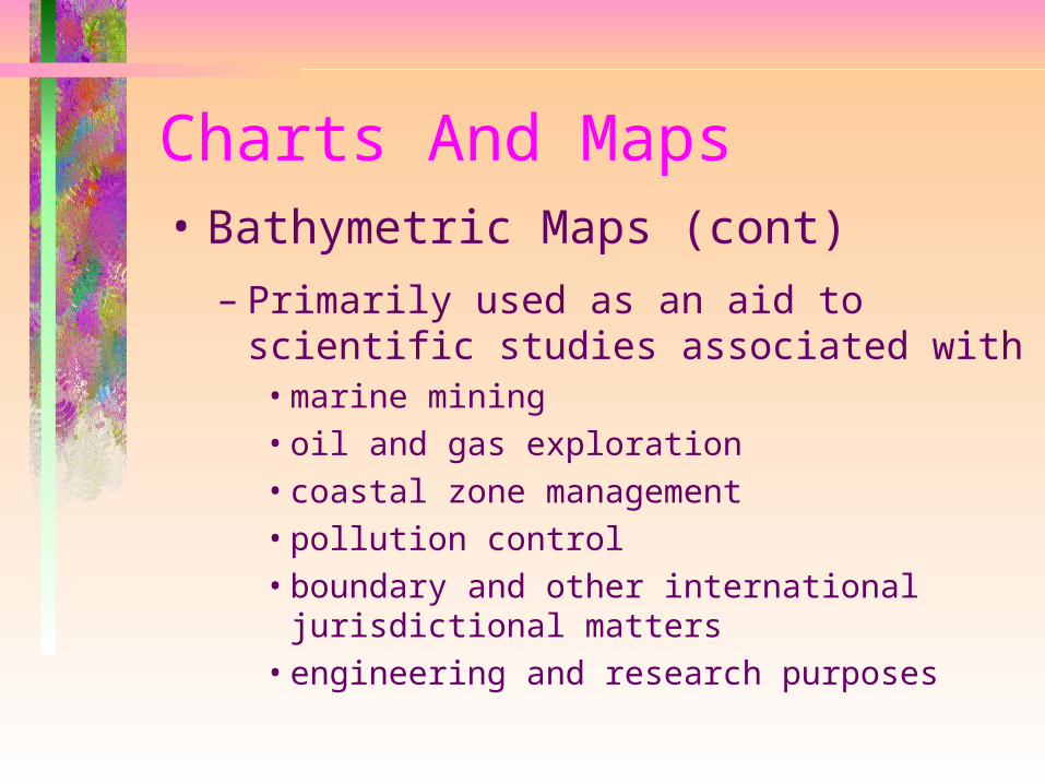
Charts And Maps• Bathymetric Maps (cont)
– Primarily used as an aid to scientific studies associated with• marine mining• oil and gas exploration• coastal zone management• pollution control • boundary and other international
jurisdictional matters• engineering and research purposes

Soundings• Sounding
– Measurement of the vertical depth from the level surface of the water to the bed of the lake, river or sea
– a series of soundings whether taken at random points or on a grid can be used to prepare a plan showing the topographic features of the land covered by the water
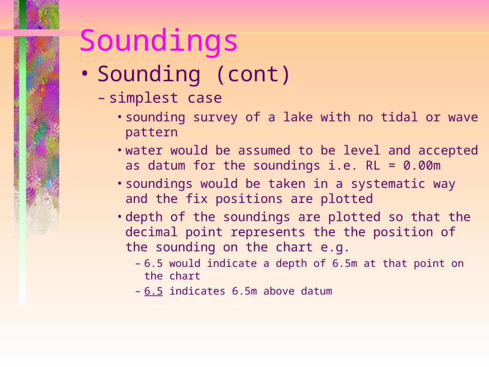
Soundings• Sounding (cont)
– simplest case• sounding survey of a lake with no tidal or wave
pattern• water would be assumed to be level and accepted
as datum for the soundings i.e. RL = 0.00m• soundings would be taken in a systematic way and
the fix positions are plotted• depth of the soundings are plotted so that the
decimal point represents the the position of the sounding on the chart e.g.
– 6.5 would indicate a depth of 6.5m at that point on the chart
– 6.5 indicates 6.5m above datum
Soundings - Sounding Datums
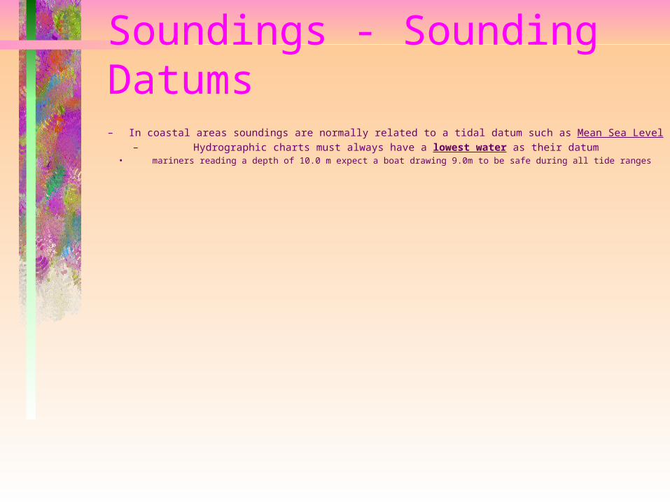
– In coastal areas soundings are normally related to a tidal datum such as Mean Sea Level– Hydrographic charts must always have a lowest water as their datum
• mariners reading a depth of 10.0 m expect a boat drawing 9.0m to be safe during all tide ranges
Soundings• Sounding Datums (cont)
– Each sounding made on tidal water must be corrected for the height of the tide at the time the sounding was taken• a tide board is attached to a suitable
structure and set vertically in the water in the vicinity of the survey area
– preferable to be visible from the boat
• tide board readings and the time are observed and recorded at constant intervals e.g.15min
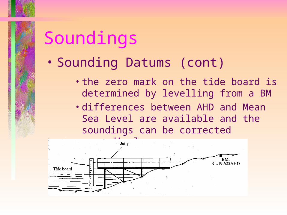
Soundings• Sounding Datums (cont)
• the zero mark on the tide board is determined by levelling from a BM
• differences between AHD and Mean Sea Level are available and the soundings can be corrected accordingly
Soundings - Sounding Datums
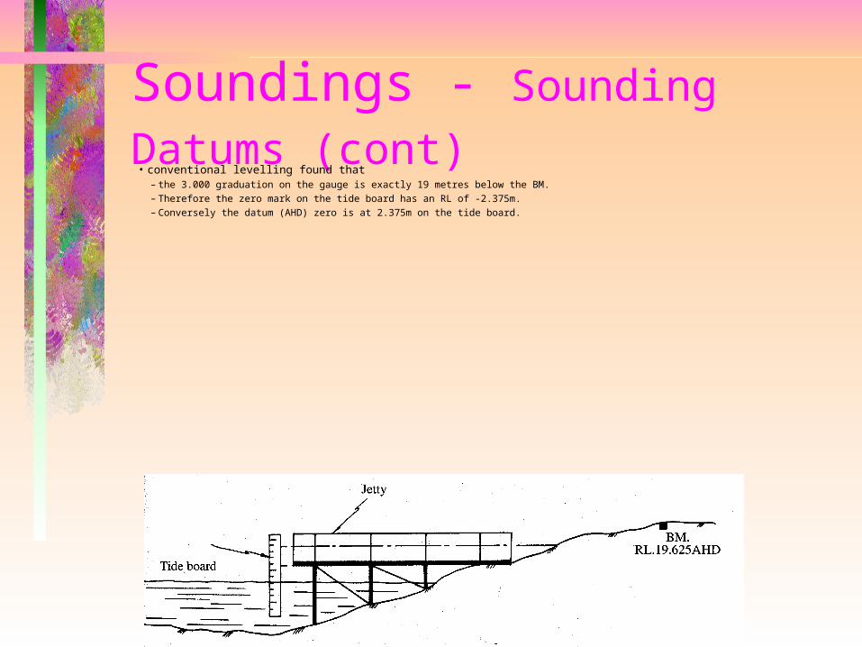
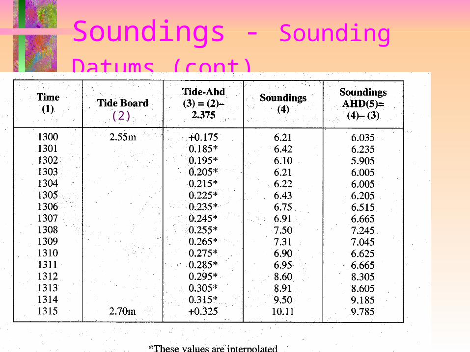
(cont) • conventional levelling found that
– the 3.000 graduation on the gauge is exactly 19 metres below the BM.– Therefore the zero mark on the tide board has an RL of -2.375m. – Conversely the datum (AHD) zero is at 2.375m on the tide board.
Soundings - Sounding Datums
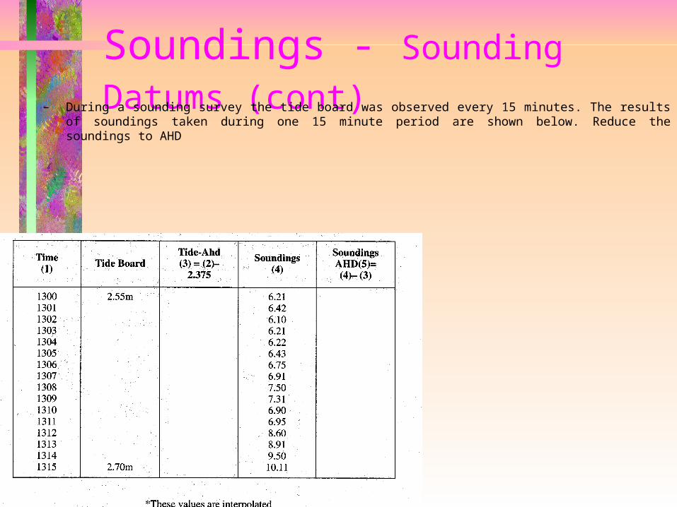
(cont) – During a sounding survey the tide board was observed every 15 minutes. The results of soundings taken during one 15 minute period are shown below. Reduce the soundings to AHD

Soundings - Sounding Datums
(cont)
(2)
Interpolatewith respect
to time
Soundings - Sounding Datums
(cont)
(2)

Tides• Caused by the combined gravitational effects of the sun and moon, with the moon having the major effect
– influenced by• terrestrial gravity• earth’s rotation• land masses• weather systems
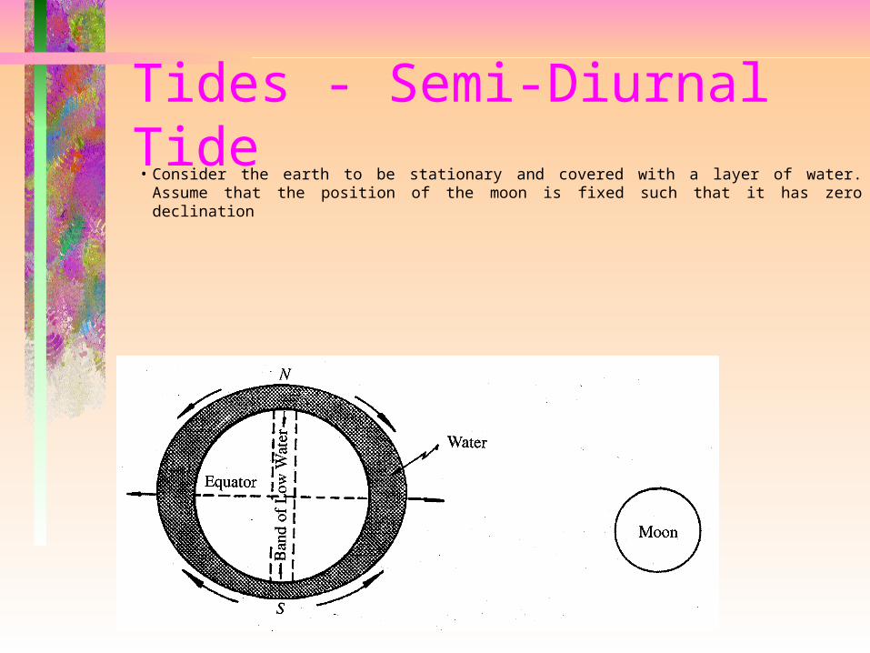
Tides - Semi-Diurnal Tide• Consider the earth to be stationary and covered with a layer of water.
Assume that the position of the moon is fixed such that it has zero declination
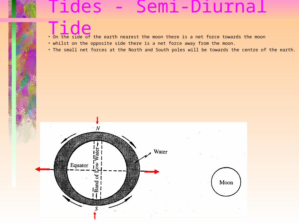
Tides - Semi-Diurnal Tide• On the side of the earth nearest the moon there is a net force towards the moon• whilst on the opposite side there is a net force away from the moon. • The small net forces at the North and South poles will be towards the centre of the earth.
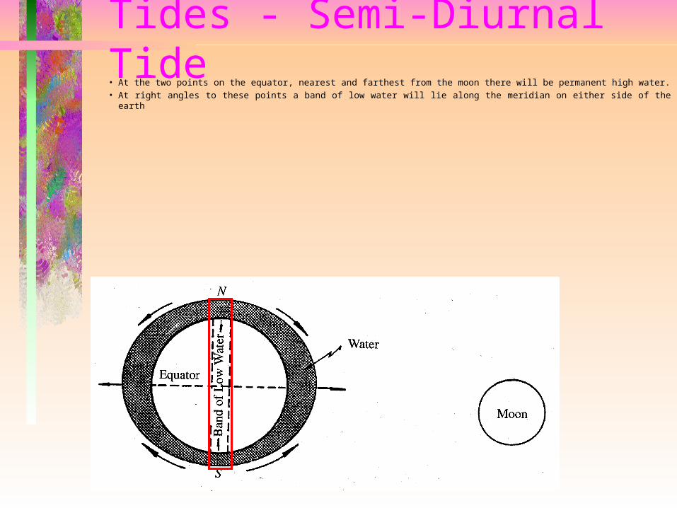
Tides - Semi-Diurnal Tide• At the two points on the equator, nearest and farthest from the moon there will be permanent high
water.• At right angles to these points a band of low water will lie along the meridian on either side of the earth

Tides - Semi-Diurnal Tide• When the moon moves into perigee (closest point to the earth during the moon’s elliptical orbit) the high waters will be higher
and the low waters will be lower. • The opposite effect occurs when the moon moves out to apogee (most distant point) • These minimum and maximum tides are known as perigean and apogean respectively
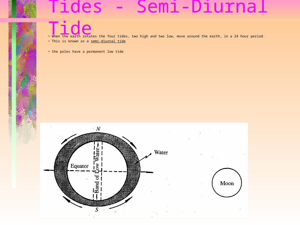
Tides - Semi-Diurnal Tide• When the earth rotates the four tides, two high and two low, move around the earth, in a 24 hour period. • This is known as a semi-diurnal tide
• the poles have a permanent low tide
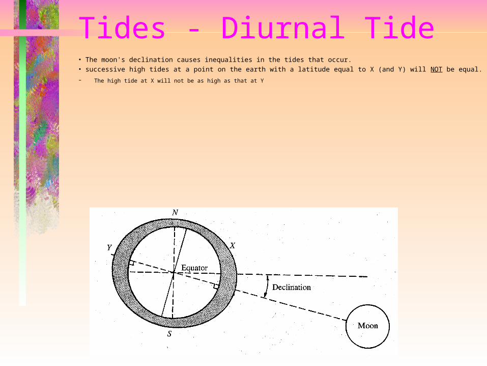
Tides - Diurnal Tide• The moon's declination causes inequalities in the tides that occur. • successive high tides at a point on the earth with a latitude equal to X (and Y) will NOT be equal.
– The high tide at X will not be as high as that at Y

Tides - Diurnal Tide• At all points on the earth where the latitude on earth is greater than the moon’s co-declination, there is only one high tide and one low tide
per day. • This is known as the diurnal tide• The form of tide varies between the extremes of diurnal and semi-diurnal, with those exhibiting both characteristics being known as 'mixed'
Moon’s co-declination
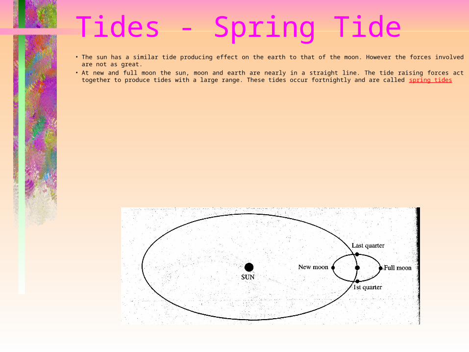
Tides - Spring Tide• The sun has a similar tide producing effect on the earth to that of the moon. However the forces involved are not as
great. • At new and full moon the sun, moon and earth are nearly in a straight line. The tide raising forces act together to
produce tides with a large range. These tides occur fortnightly and are called spring tides
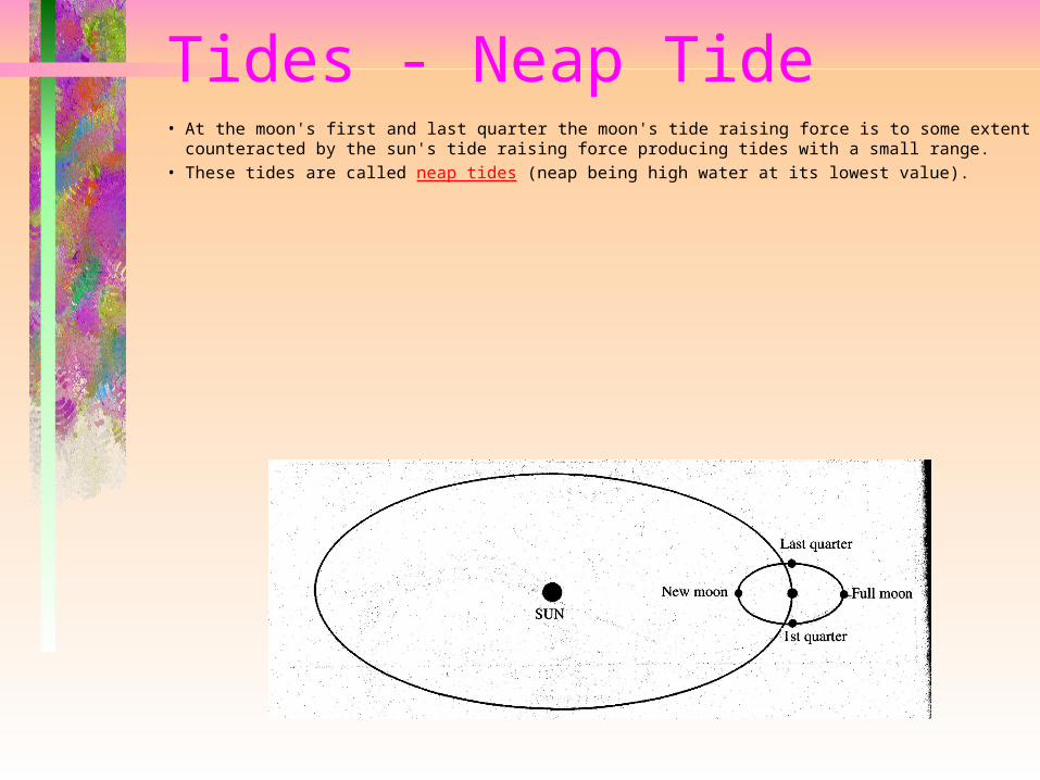
Tides - Neap Tide• At the moon's first and last quarter the moon's tide raising force is to some extent
counteracted by the sun's tide raising force producing tides with a small range. • These tides are called neap tides (neap being high water at its lowest value).
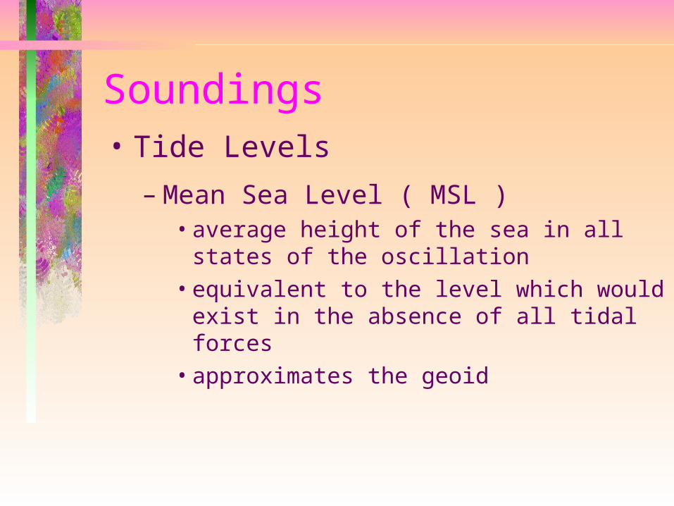
Soundings• Tide Levels
– Mean Sea Level ( MSL )• average height of the sea in all states of
the oscillation• equivalent to the level which would exist
in the absence of all tidal forces• approximates the geoid
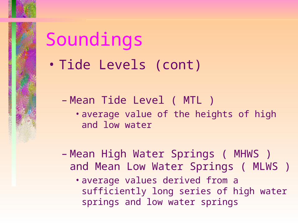
Soundings• Tide Levels (cont)
– Mean Tide Level ( MTL )• average value of the heights of high and low
water
– Mean High Water Springs ( MHWS ) and Mean Low Water Springs ( MLWS )• average values derived from a sufficiently
long series of high water springs and low water springs
Soundings• Tide Levels (cont)
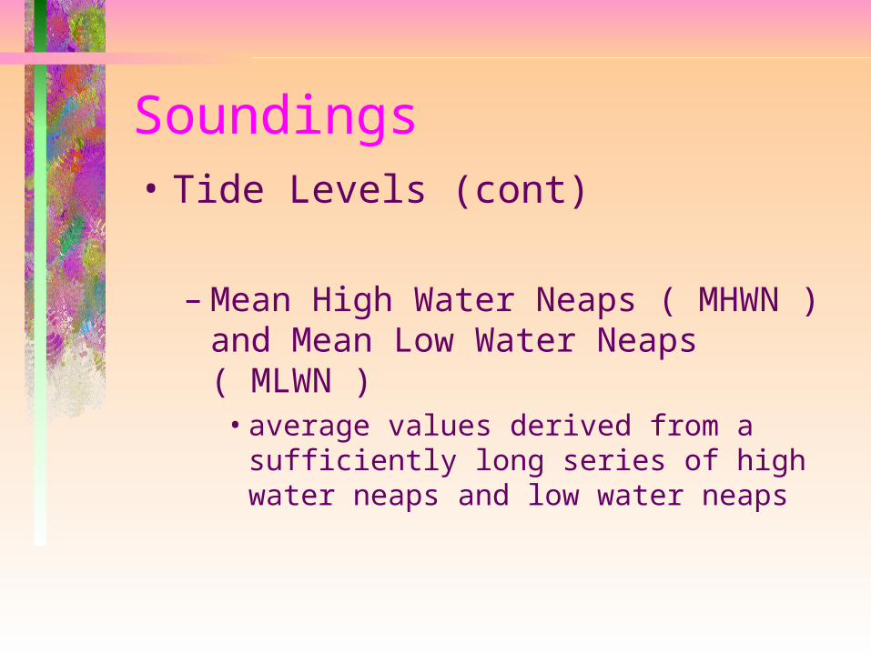
– Mean High Water Neaps ( MHWN ) and Mean Low Water Neaps ( MLWN )• average values derived from a sufficiently
long series of high water neaps and low water neaps
Soundings• Tide Levels (cont)
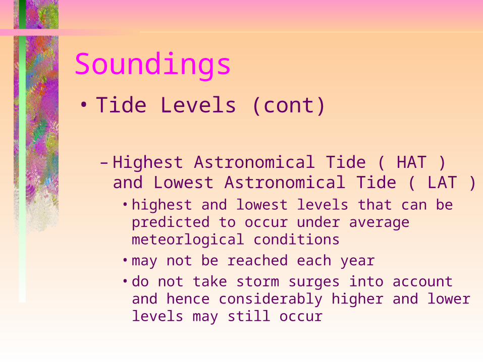
– Highest Astronomical Tide ( HAT ) and Lowest Astronomical Tide ( LAT )• highest and lowest levels that can be
predicted to occur under average meteorlogical conditions
• may not be reached each year• do not take storm surges into account
and hence considerably higher and lower levels may still occur
Soundings• Tide Levels (cont)
– Indian Spring Low Water ( ISLW )• level suggested by Sir Charles Darwin for
Indian waters• mathematically derived from tide data
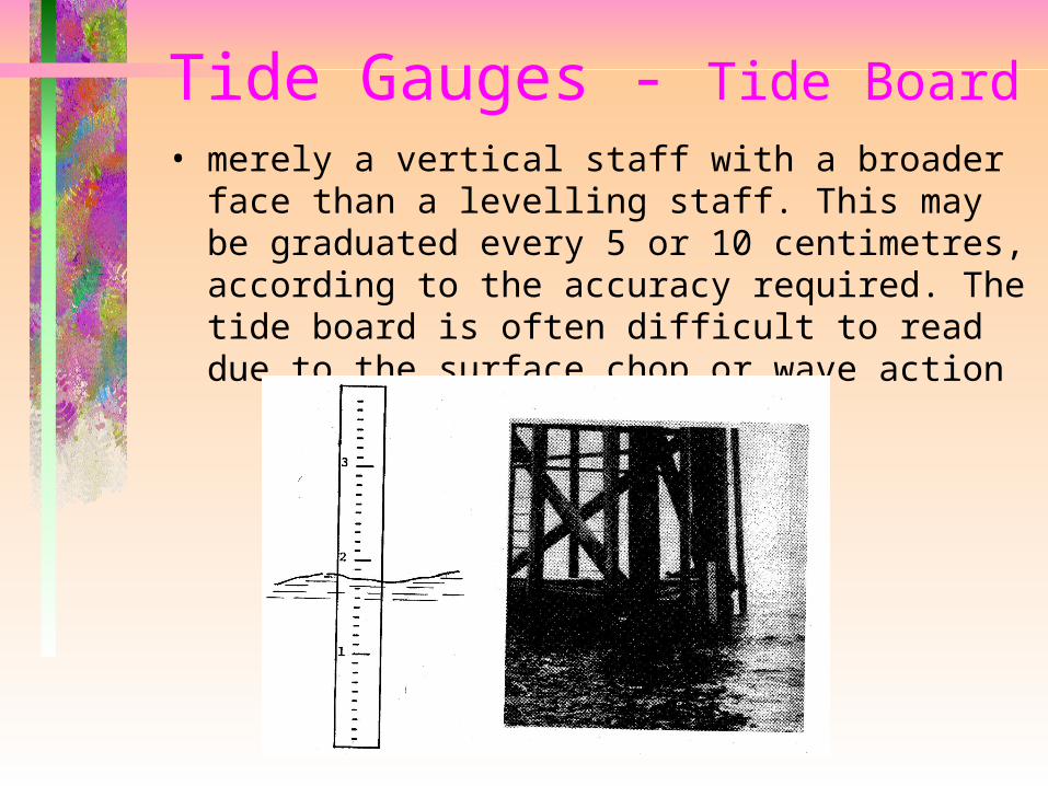
Tide Gauges - Tide Board• merely a vertical staff with a broader face than
a levelling staff. This may be graduated every 5 or 10 centimetres, according to the accuracy required. The tide board is often difficult to read due to the surface chop or wave action
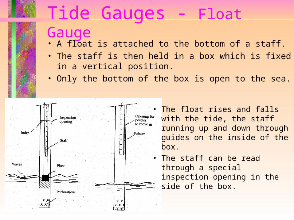
Tide Gauges - Float Gauge• A float is attached to the bottom of a staff.• The staff is then held in a box which is fixed in
a vertical position. • Only the bottom of the box is open to the sea.
• The float rises and falls with the tide, the staff running up and down through guides on the inside of the box.
• The staff can be read through a special inspection opening in the side of the box.

Tide Gauges - Automatic Tide Gauge• normally established permanently at an official
tide station. • The tidal fluctuations are recorded on a chart
attached to a drum which revolves with time
• The gauge may need to be visited only once every seven days to change the paper chart and reset the drive mechanism, i.e. wind the clock
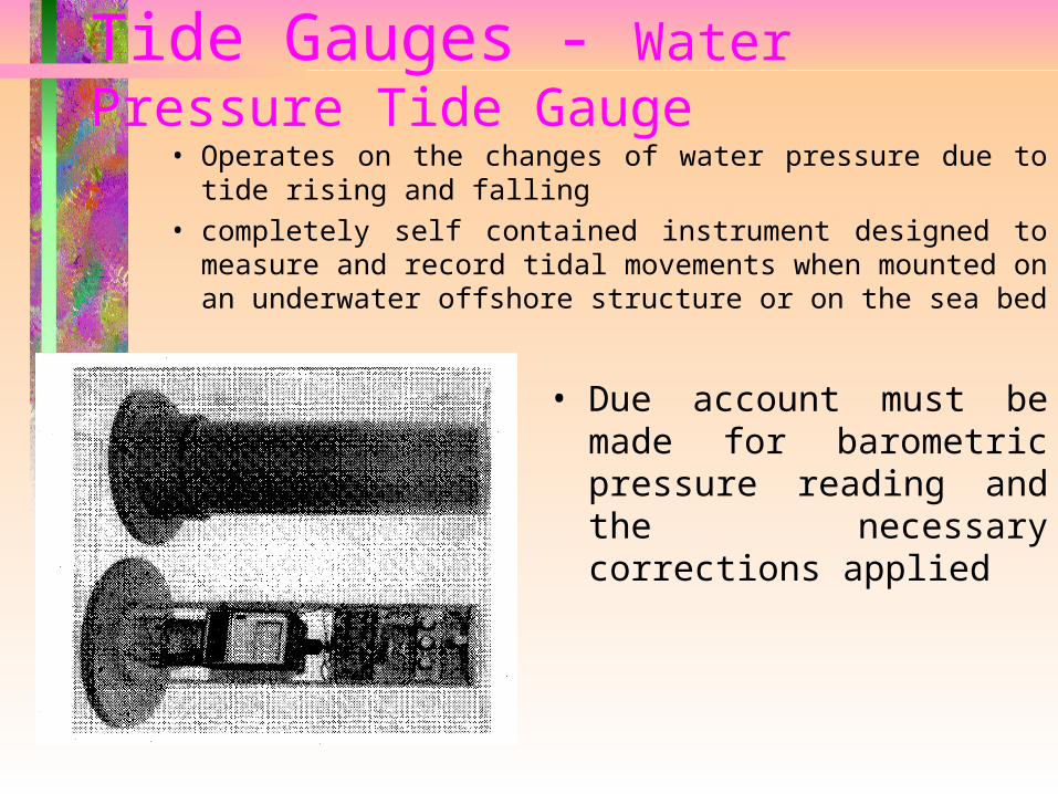
Tide Gauges - Water Pressure Tide Gauge
• Operates on the changes of water pressure due to tide rising and falling
• completely self contained instrument designed to measure and record tidal movements when mounted on an underwater offshore structure or on the sea bed
• Due account must be made for barometric pressure reading and the necessary corrections applied
Establishing Tide Levels
• If tide observations are made over a period of time, statistical values for various types of tide can be arrived at, such as mean sea level (MSL), MHWS, MLWN, etc.
• The degree of variation that can occur at a point for observations taken over different time periods will of course depend upon the
range of the tide at that point.
Establishing Tide Levels
• As a guide, the following figures are appropriate:
– Figures based on one full day's observation may vary considerably from observations made on another day as meteorological conditions play a big part.
– Figures based on one full lunar month's observations (291/2 days) may vary by up to 25cm from values taken from another month's observations on the East coast of Queensland. This figure is the semi-annual and annual variation of MSL.
– Figures based on one full year's observations may vary from values taken from another year's observations.
Establishing Tide Levels
• Thus it can be seen that to obtain the figure for tidal variation at a point observations should be taken over at least one lunar month.
• More accurate results are obtained when observations are taken over a full year.
• The most accurate results cannot be obtained until continuous observations have been made
over at least 19 years.
Establishing Tide Levels
• Ships are concerned with the least amount of water that may be below them.
• the datum for depths at sea, and navigation charts is normally a low water datum.
• Two datums which have been used in the past for navigation charts are – LWST and ISLW,
– both of which are to be progressively replaced by
LAT.
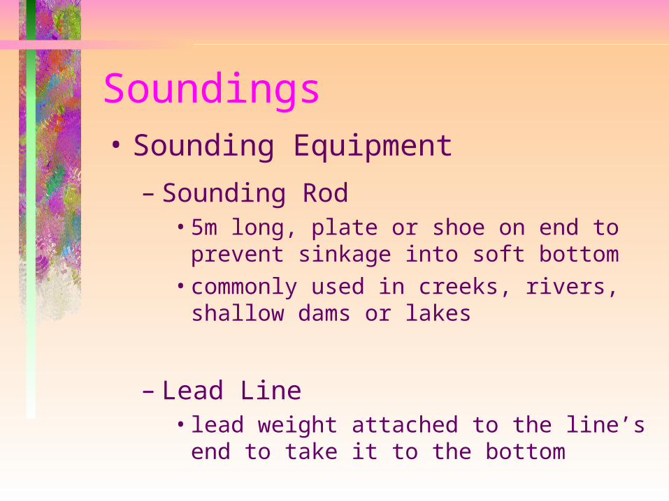
Soundings• Sounding Equipment
– Sounding Rod• 5m long, plate or shoe on end to prevent
sinkage into soft bottom• commonly used in creeks, rivers, shallow
dams or lakes
– Lead Line• lead weight attached to the line’s end to
take it to the bottom

Soundings• Sounding Equipment (cont)
– Sonar Equipment• Sound Navigation Ranging• measure the range of an object by timing
the two way journey of pulse of sound energy and converting the result to units of distance
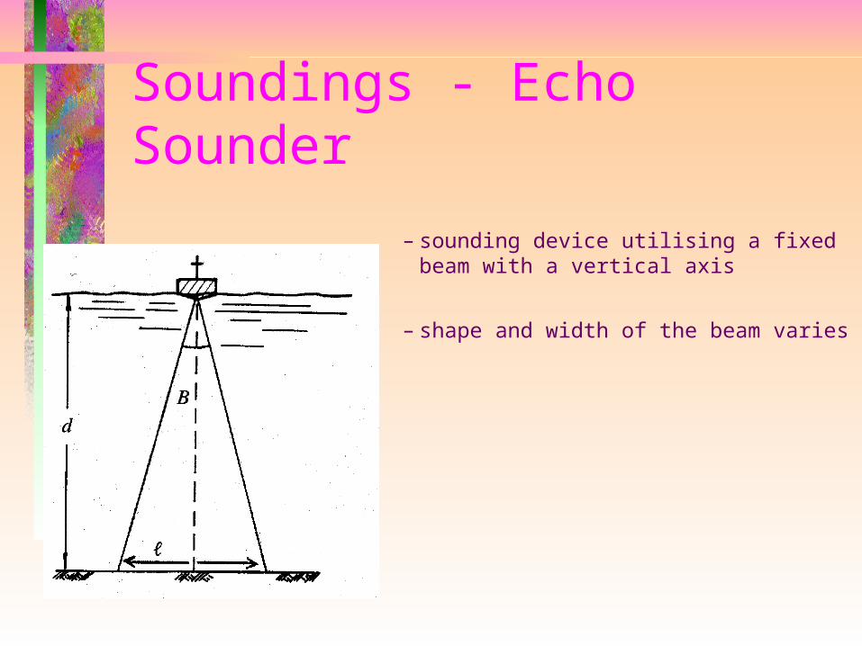
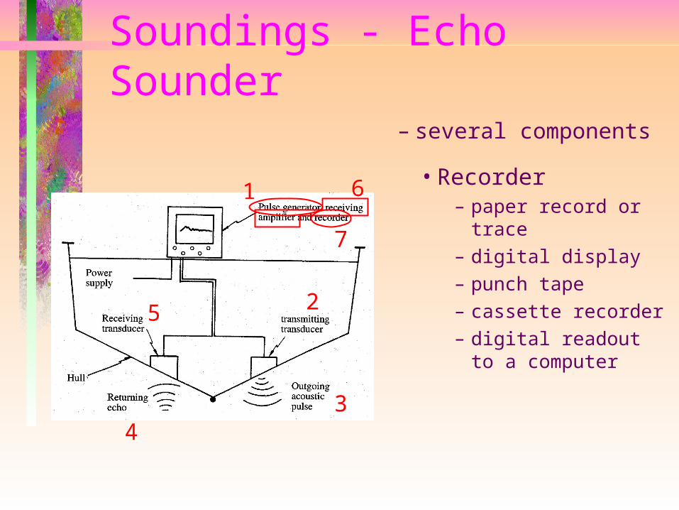
Soundings - Echo Sounder
– sounding device utilising a fixed beam with a vertical axis
– shape and width of the beam varies
Soundings - Echo Sounder
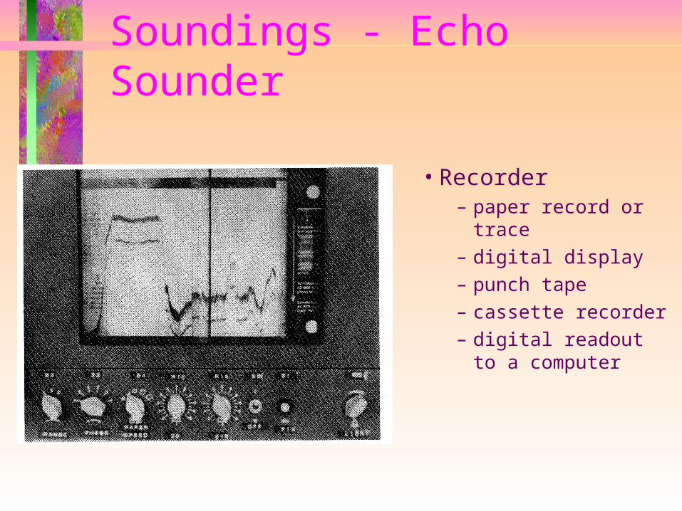
• Recorder– paper record or
trace– digital display– punch tape– cassette recorder– digital readout to a
computer
– several components
1
2
34
5
6
7
Soundings - Echo Sounder
• Recorder– paper record or
trace– digital display– punch tape– cassette recorder– digital readout to a
computer
Soundings - Echo Sounder
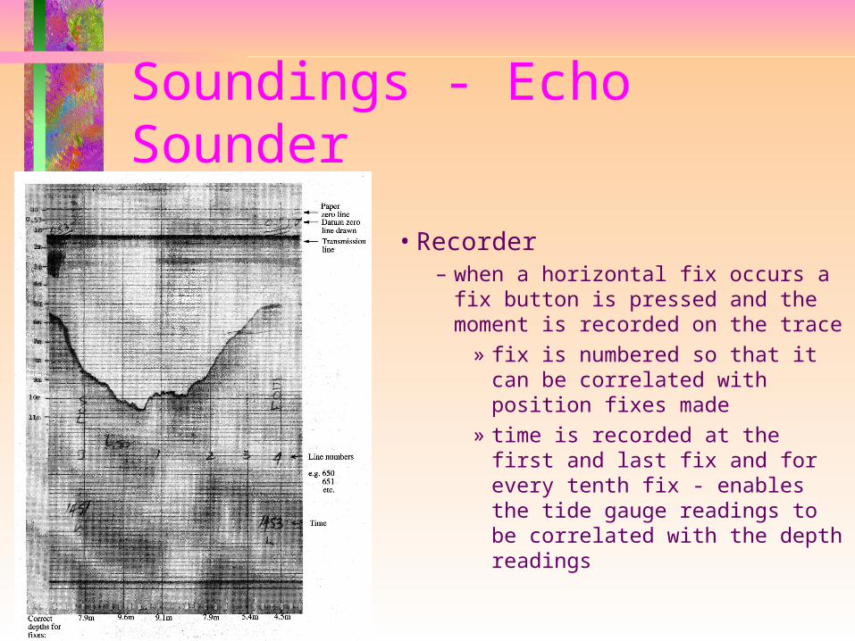
• Recorder– when a horizontal fix occurs a fix
button is pressed and the moment is recorded on the trace
» fix is numbered so that it can be correlated with position fixes made
» time is recorded at the first and last fix and for every tenth fix - enables the tide gauge readings to be correlated with the depth readings
Soundings - Echo Sounder
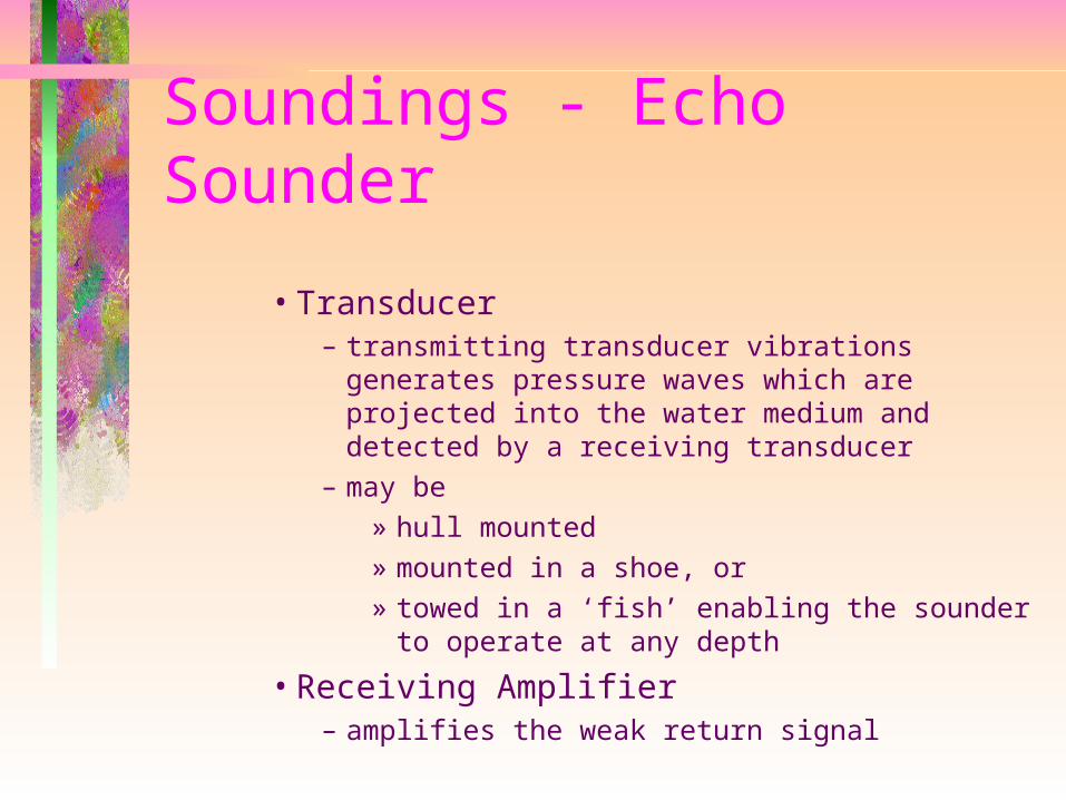
• Transducer– transmitting transducer vibrations generates
pressure waves which are projected into the water medium and detected by a receiving transducer
– may be » hull mounted » mounted in a shoe, or» towed in a ‘fish’ enabling the sounder to
operate at any depth
• Receiving Amplifier– amplifies the weak return signal
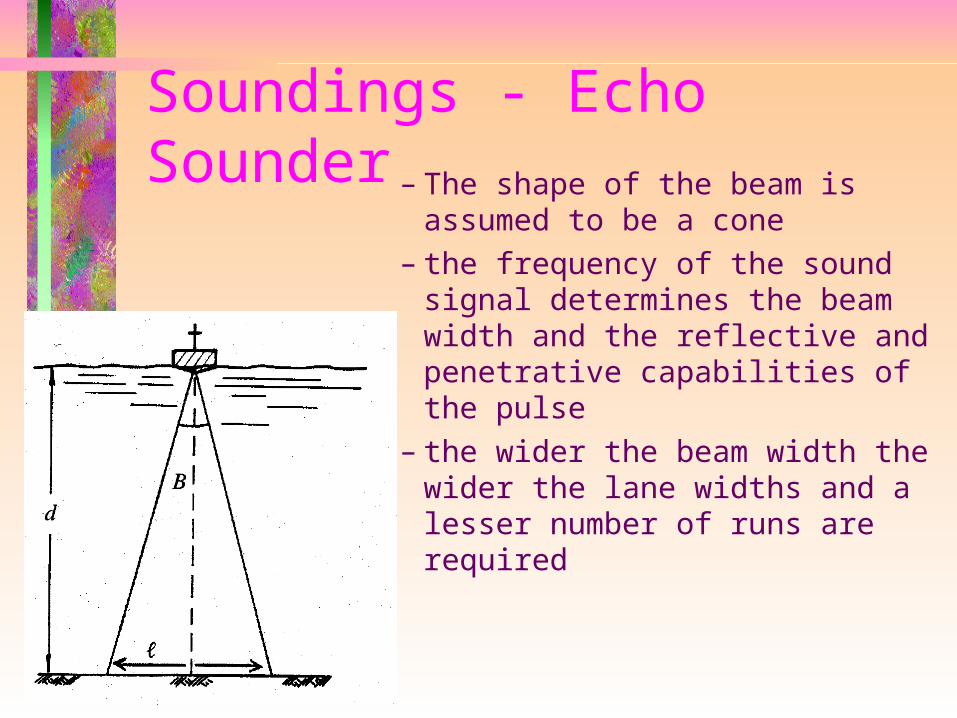
Soundings - Echo Sounder– The shape of the beam is
assumed to be a cone– the frequency of the sound
signal determines the beam width and the reflective and penetrative capabilities of the pulse
– the wider the beam width the wider the lane widths and a lesser number of runs are required
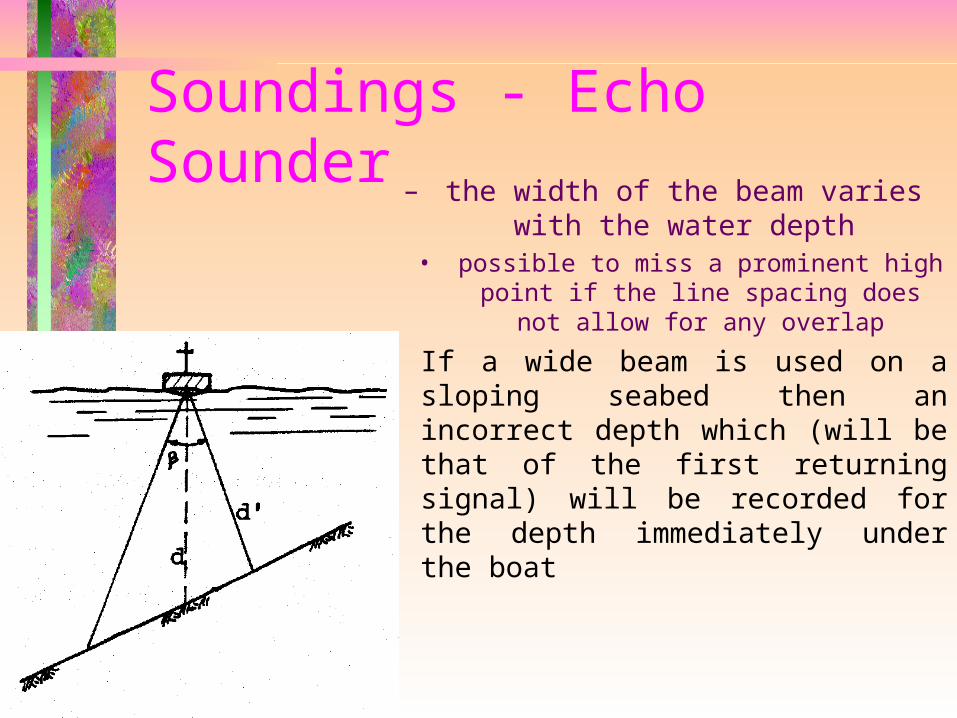
Soundings - Echo Sounder– the width of the beam varies
with the water depth• possible to miss a prominent high
point if the line spacing does not allow for any overlap
– If a wide beam is used on a sloping seabed then an incorrect depth which (will be that of the first returning signal) will be recorded for the depth immediately under the boat
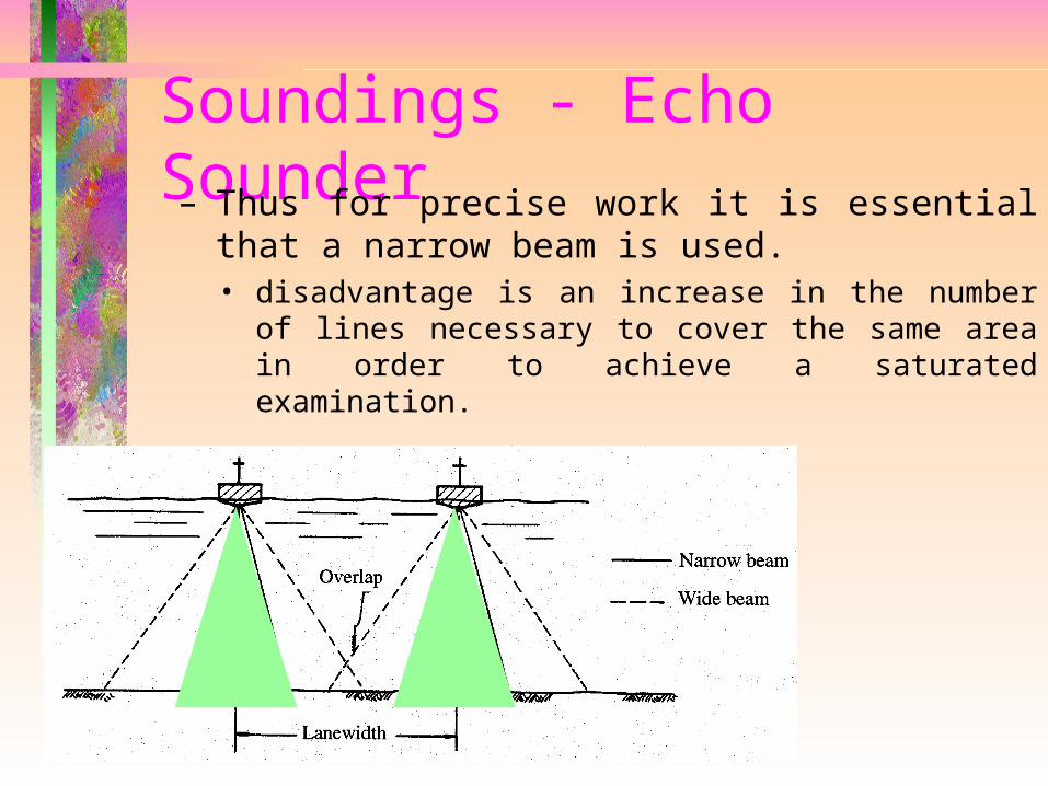
Soundings - Echo Sounder– Thus for precise work it is essential that a
narrow beam is used.• disadvantage is an increase in the number of
lines necessary to cover the same area in order to achieve a saturated examination.
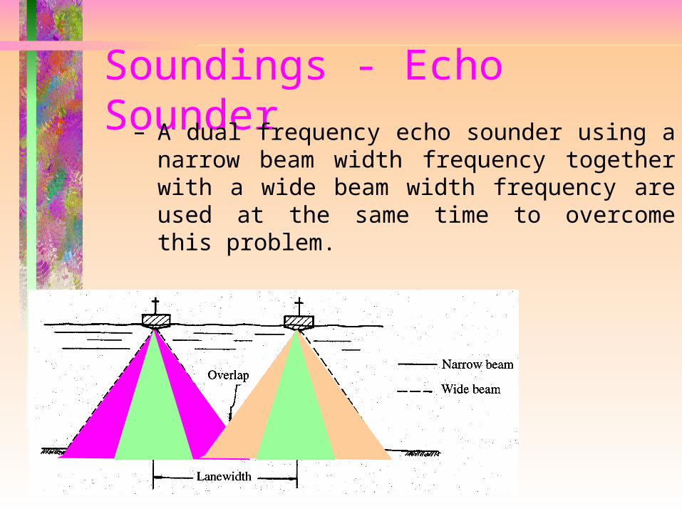
Soundings - Echo Sounder– A dual frequency echo sounder using a
narrow beam width frequency together with a wide beam width frequency are used at the same time to overcome this problem.
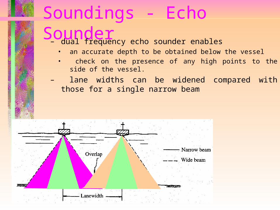
Soundings - Echo Sounder– dual frequency echo sounder enables
• an accurate depth to be obtained below the vessel • check on the presence of any high points to the side of
the vessel.
– lane widths can be widened compared with those for a single narrow beam
Soundings - Echo Sounder
– Calibration• velocity of the pulse varies with the
temperature and salinity of the water• time taken for the outward and return
pulse will vary and the depth indicated will vary
Soundings - Echo Sounder
– Calibration• three methods of calibration
– Calculation» use the temperature and salinity of the
water to calculate the velocity of sound within the water
– Direct Calibration» when the bottom is smooth and level, the
recorder may be calibrated by by comparison with direct sounding by lead line
Soundings - Echo Sounder
– Calibration• third method of calibration
– Bar Check» a metal bar is lowered under the
transducers to known depths below the water
» the echo sounder is adjusted until the correct depth is measured
» checks are made at other depths
Soundings - Echo Sounder
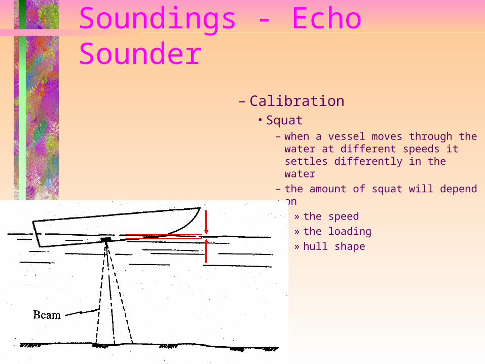
– Calibration• Squat
– when a vessel moves through the water at different speeds it settles differently in the water
– the amount of squat will depend on
» the speed» the loading» hull shape
Soundings - Reduction of Echo Sounder Traces
– Calibration• Squat
– determined by» sailing over an area of known depth at
different speeds - the different depth readings record the differences due to squat
» a staff is set up at the bow and the stern of the vessel - the vessel is sailed past at different speeds and a level used to read the staves - the squat is determined from the differing levels
Soundings - Reduction of Echo Sounder Traces
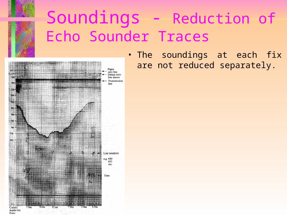
• The soundings at each fix are not reduced separately.
Soundings - Reduction of Echo Sounder Traces
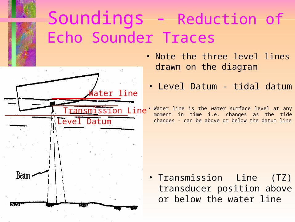
• Note the three level lines drawn on the diagram
• Level Datum - tidal datum
Level DatumTransmission Line • Water line is the water surface level at any
moment in time i.e. changes as the tide changes - can be above or below the datum line
• Transmission Line (TZ) transducer position above or below the water line
Water line
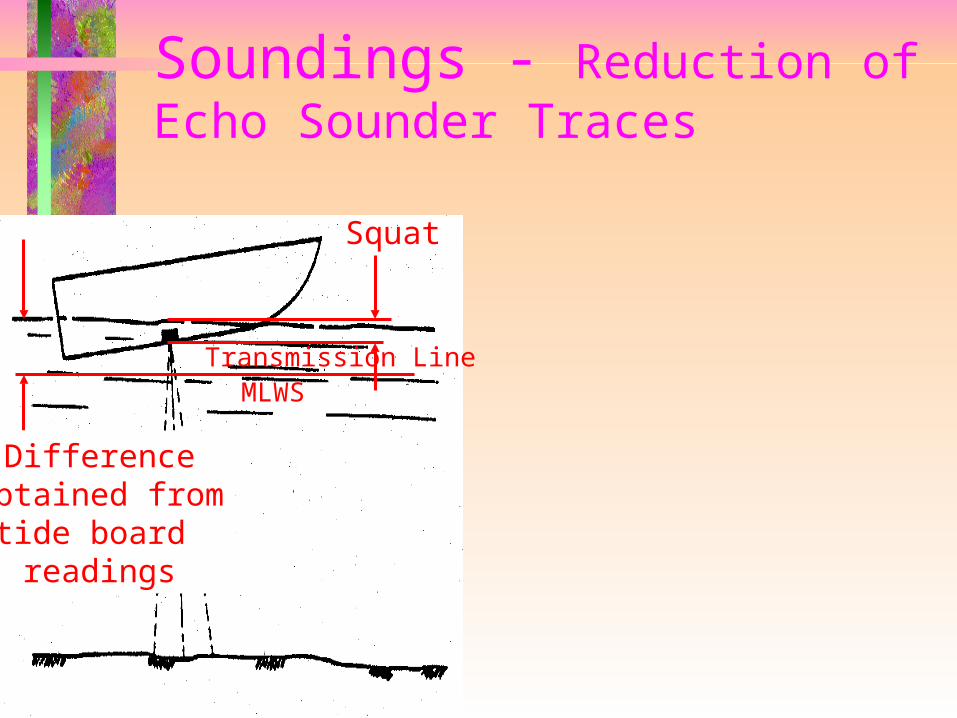
Soundings - Reduction of Echo Sounder Traces
MLWS
Differenceobtained from
tide board readings
Squat
Transmission Line
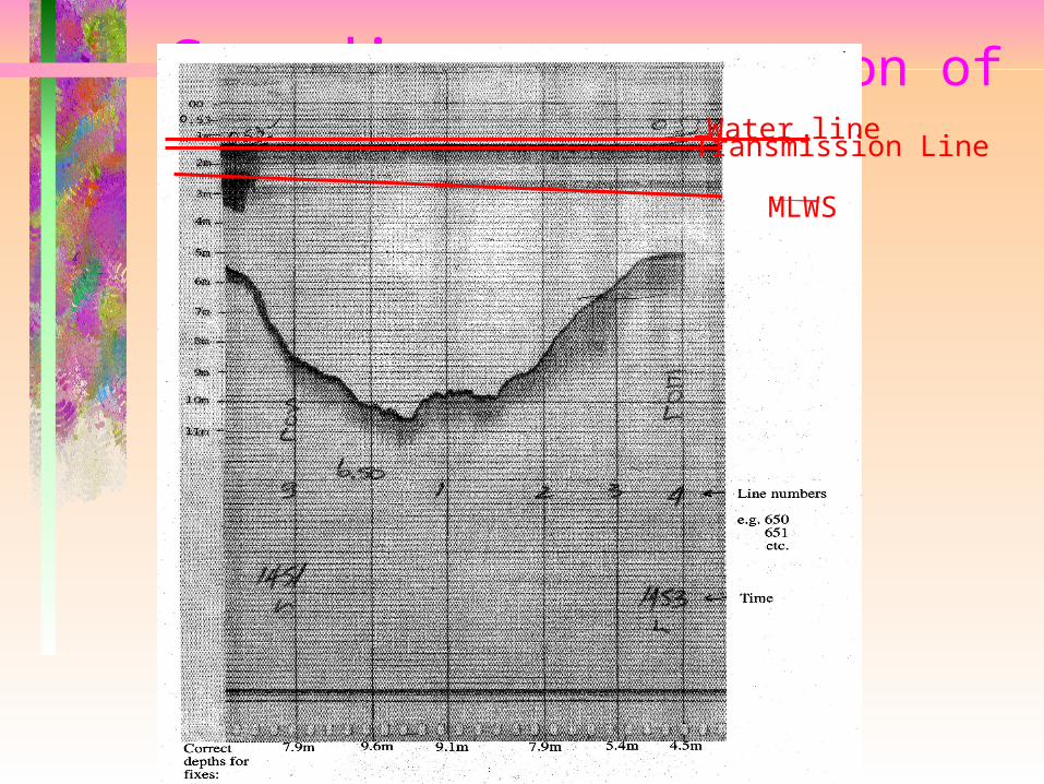
Soundings - Reduction of Echo Sounder Traces
MLWS
Transmission LineWater line