
move 2.0: extension innovative contract maasvlakte oil terminal and ...
Upload
delftsoftwaredaysCategory
view
197download
1
Maasvlakte 2
ir. William Borst
DSD 2 November 2015
Monitoring Maasvlakte 2 impact
2
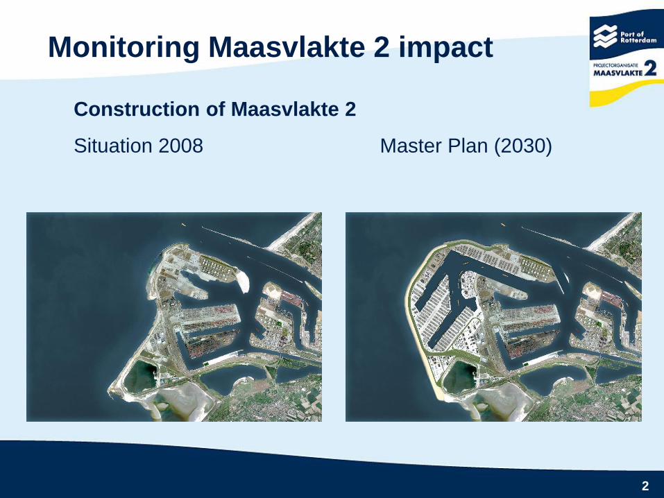
Monitoring Maasvlakte 2 impact
Construction of Maasvlakte 2
Situation 2008 Master Plan (2030)

3
Monitoring Maasvlakte 2 impact
Development stages : 2009 thr 2011

4
Monitoring Maasvlakte 2 impact
Environmental Impact Assessement
Effects of offshore sand extraction are assumed to be caused
by the dispersion of silt from borrow area by the overflow of
TSHD:
Tide
Currents
Waves
The impact assessment was based on 300 million m3 of sand
to be extracted.

5
Monitoring Maasvlakte 2 impact
The EIA identified the following effect chain:
Turbity increase by overflow tshd
Extra fines in the water column
Less sunlight penetration
Less primary production (algae)
Less growth of marine life (shell fish)
Thus Insufficient food for “animals” on red lists (ducks)
The silt content in the possible borrow areas was between 1,5
and 2,5 %.
Please note that Maasvlakte 2 borders a Nature 2000 area.

6
Monitoring Maasvlakte 2 impact
Reclamation is by sand extraction from borrow area 10 km
offshore with Trailing Suction Hopper Dredger (TSHD).
Construction started offshore in January 2009

7
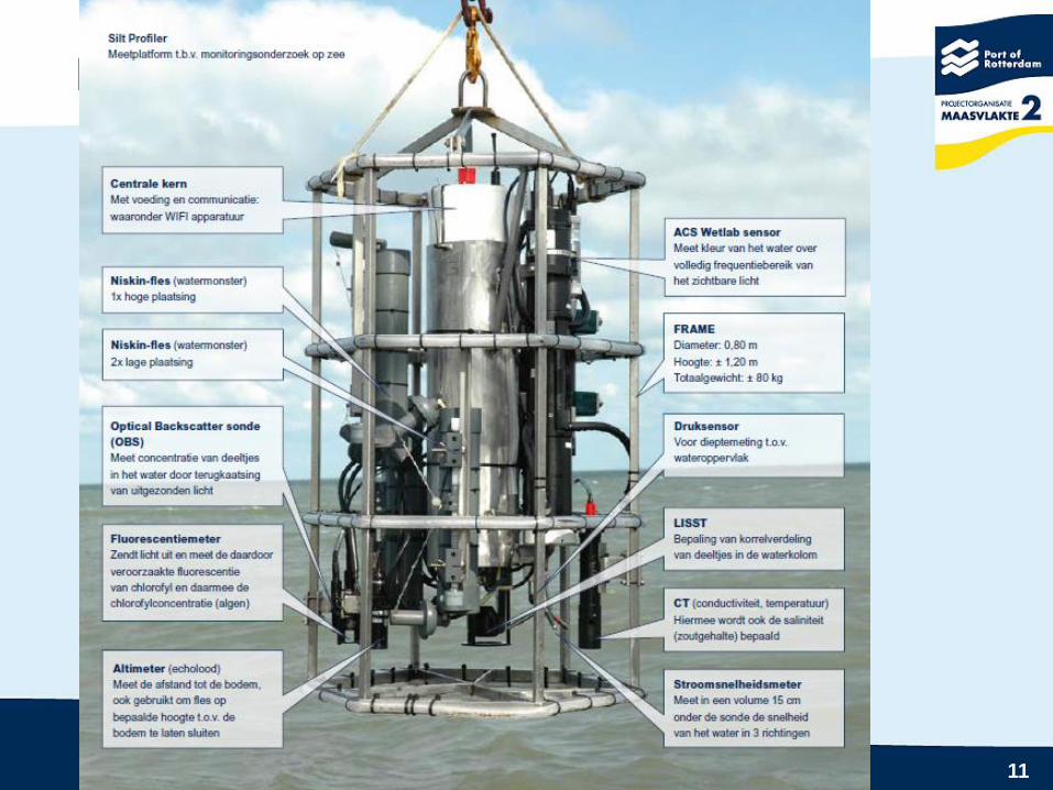
The sand extraction permit stipulates w.r.t. to monitoring:
Every fortnight during construction
At three representative cross sections
Vertical profile measurements (silt concentration)
Monitoring Maasvlakte 2 impact

8

9
Monitoring Maasvlakte 2 impact

10
Monitoring Maasvlakte 2 impact
POR decided that the permit conditions were “clear” and concrete
but not very practical.
Hence an other approach was proposed to the authorities
Deltares & IVM had carried out a pilot project for POR in 2007 in
which remote sensing data was assimilated in Delft 3D.
This approach resulted in a new model : MoS2
“Model Supported Modelling of Suspended Matter
This was, first of all, a hindcast model with a.o. real meteo data.
The POR vertical profiles (in-situ data) were used for validation
For the years 2003 till 2011 Silt Atlases were produced.
11
Monitoring Maasvlakte 2 impact


