Platinum sponsor: FSUE Roslesinforg (Russia) Gold sponsors: DigitalGlobe (USA)
DigitalGlobe OverviewSee a Better World.
© DigitalGlobe
Stephen Wood
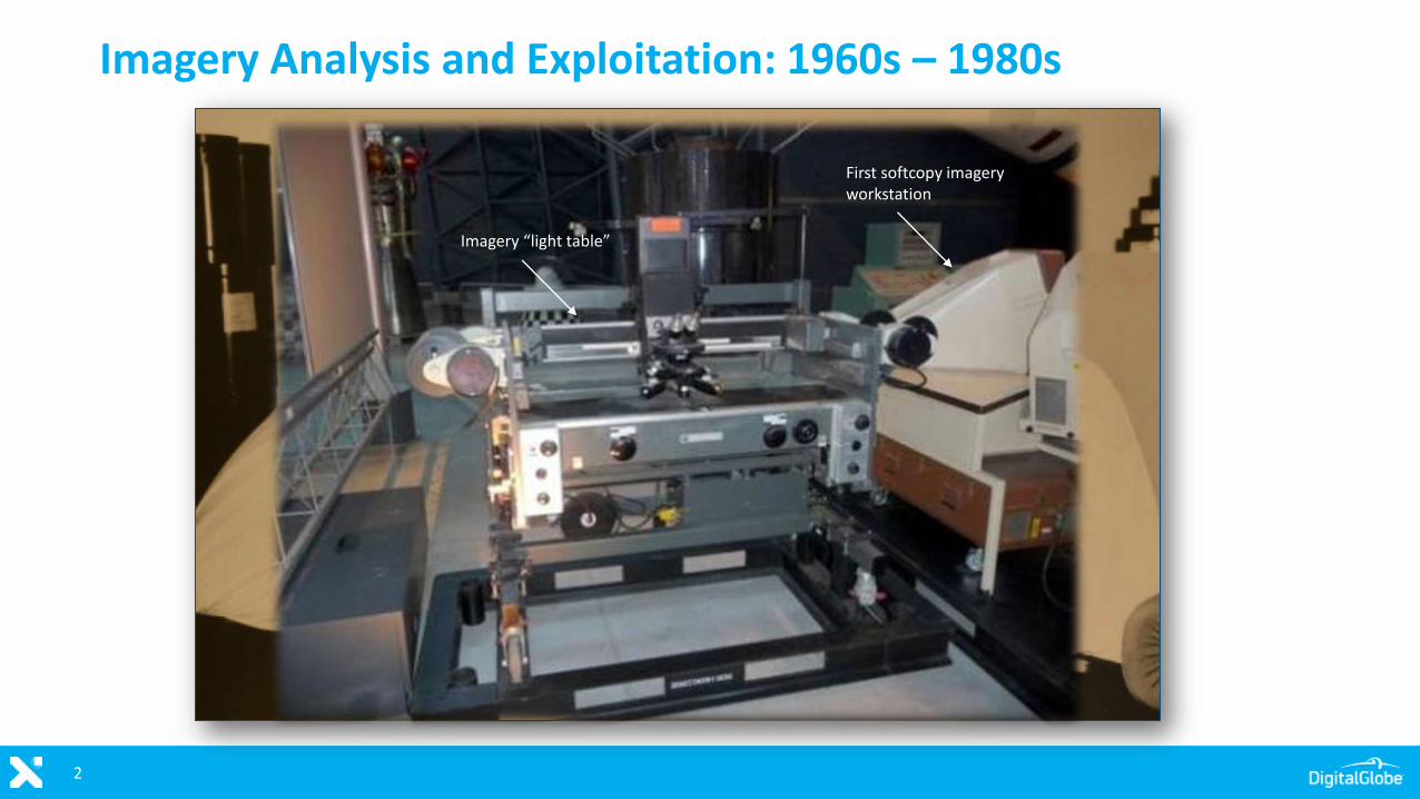
Imagery Analysis and Exploitation: 1960s – 1980s
2
First softcopy imagery workstation
Imagery “light table”
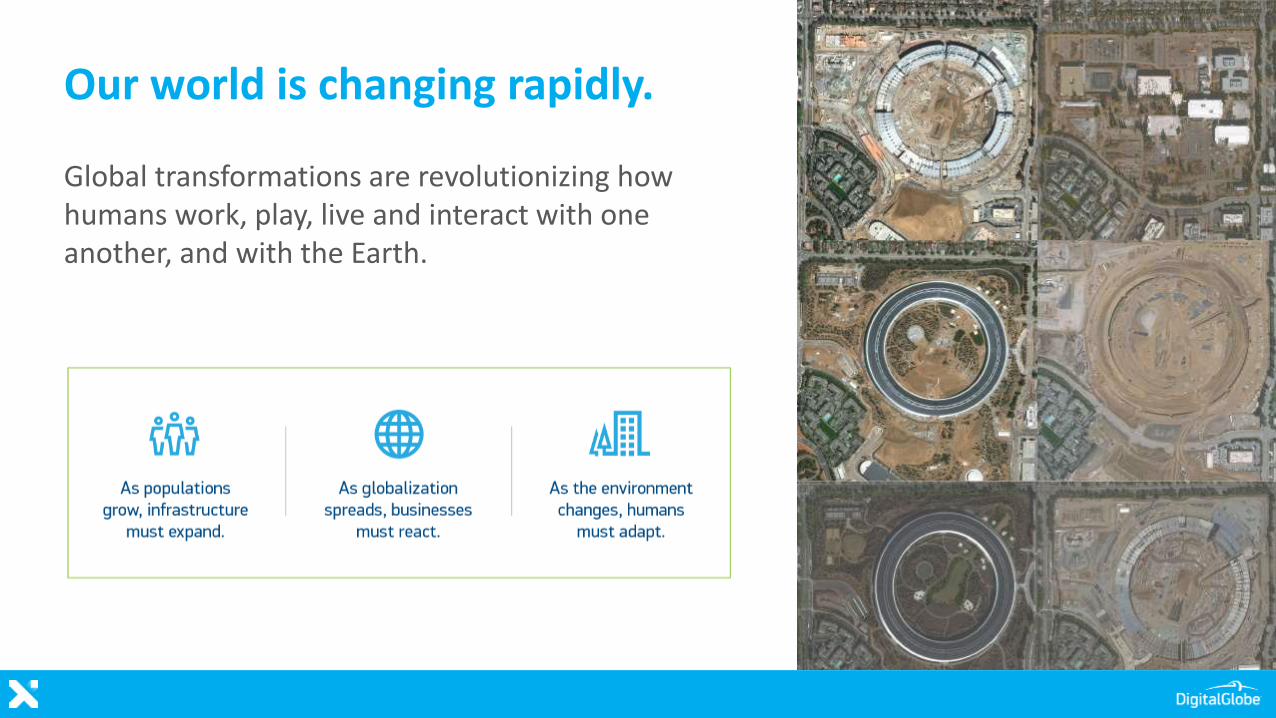
Our world is changing rapidly.
Global transformations are revolutionizing how humans work, play, live and interact with one another, and with the Earth.
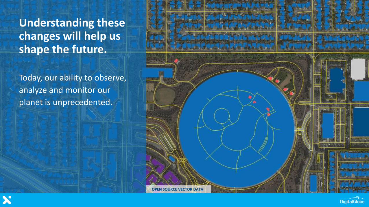
Understanding these changes will help us shape the future.
Today, our ability to observe,
analyze and monitor our
planet is unprecedented.
OPEN SOURCE VECTOR DATA
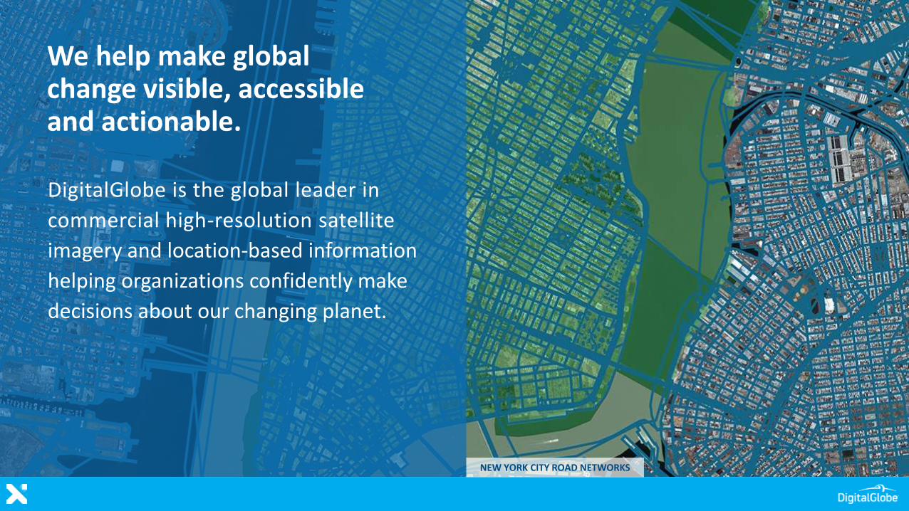
We help make global change visible, accessible and actionable.
DigitalGlobe is the global leader in
commercial high-resolution satellite
imagery and location-based information
helping organizations confidently make
decisions about our changing planet.
NEW YORK CITY ROAD NETWORKS
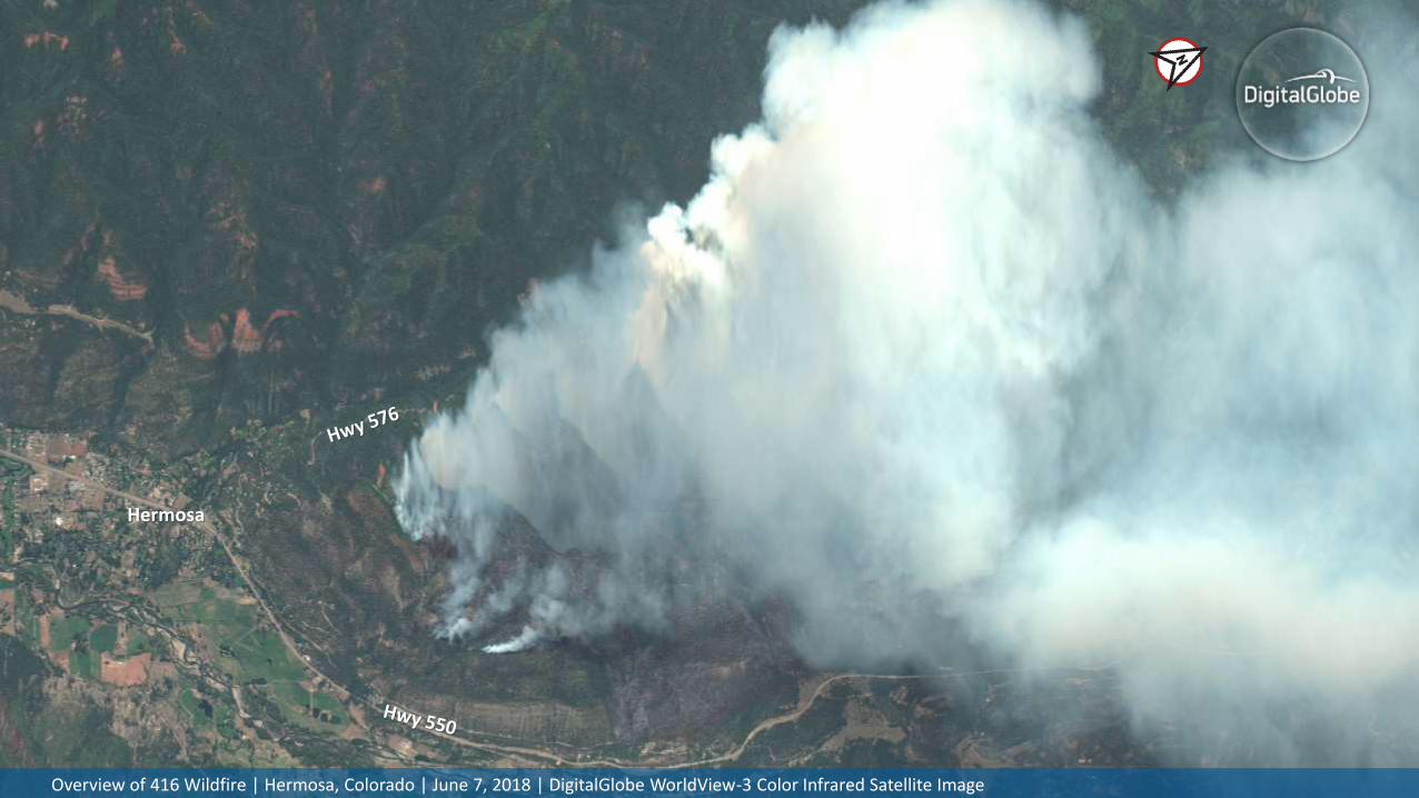
7Overview of 416 Wildfire | Hermosa, Colorado | June 7, 2018 | DigitalGlobe WorldView-3 Color Infrared Satellite Image
Hermosa
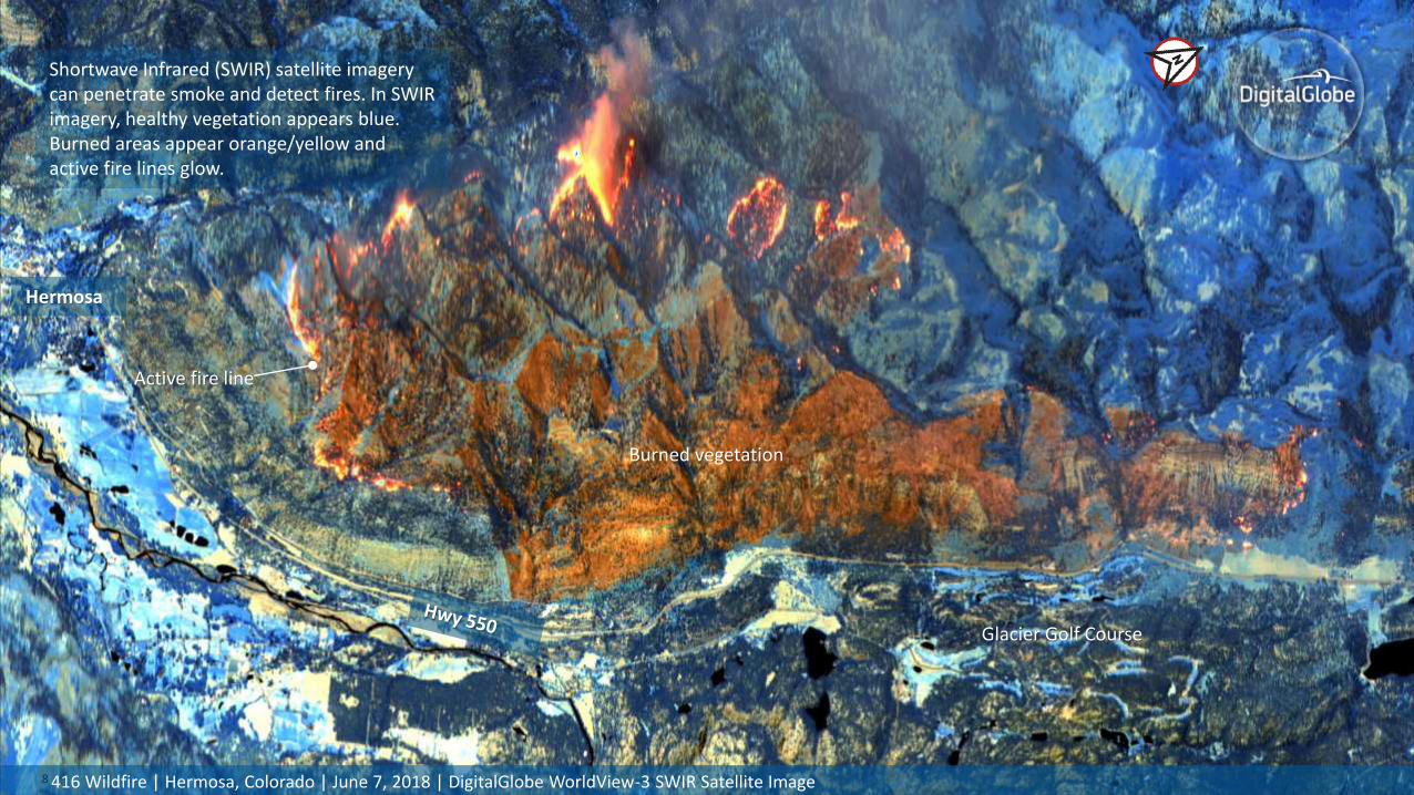
88 416 Wildfire | Hermosa, Colorado | June 7, 2018 | DigitalGlobe WorldView-3 SWIR Satellite Image
Hermosa
Active fire line
Burned vegetation
Shortwave Infrared (SWIR) satellite imagery can penetrate smoke and detect fires. In SWIR imagery, healthy vegetation appears blue. Burned areas appear orange/yellow and active fire lines glow.
Glacier Golf Course
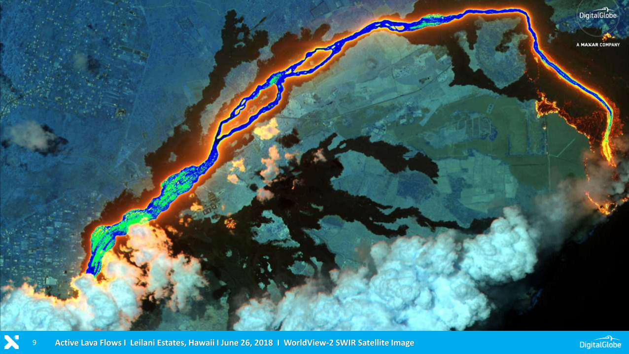
9 Active Lava Flows I Leilani Estates, Hawaii I June 26, 2018 I WorldView-2 SWIR Satellite Image
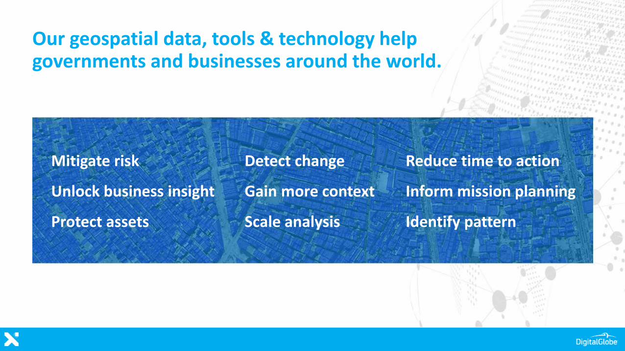
Mitigate risk
Unlock business insight
Protect assets
Our geospatial data, tools & technology help governments and businesses around the world.
Detect change
Gain more context
Scale analysis
Reduce time to action
Inform mission planning
Identify pattern
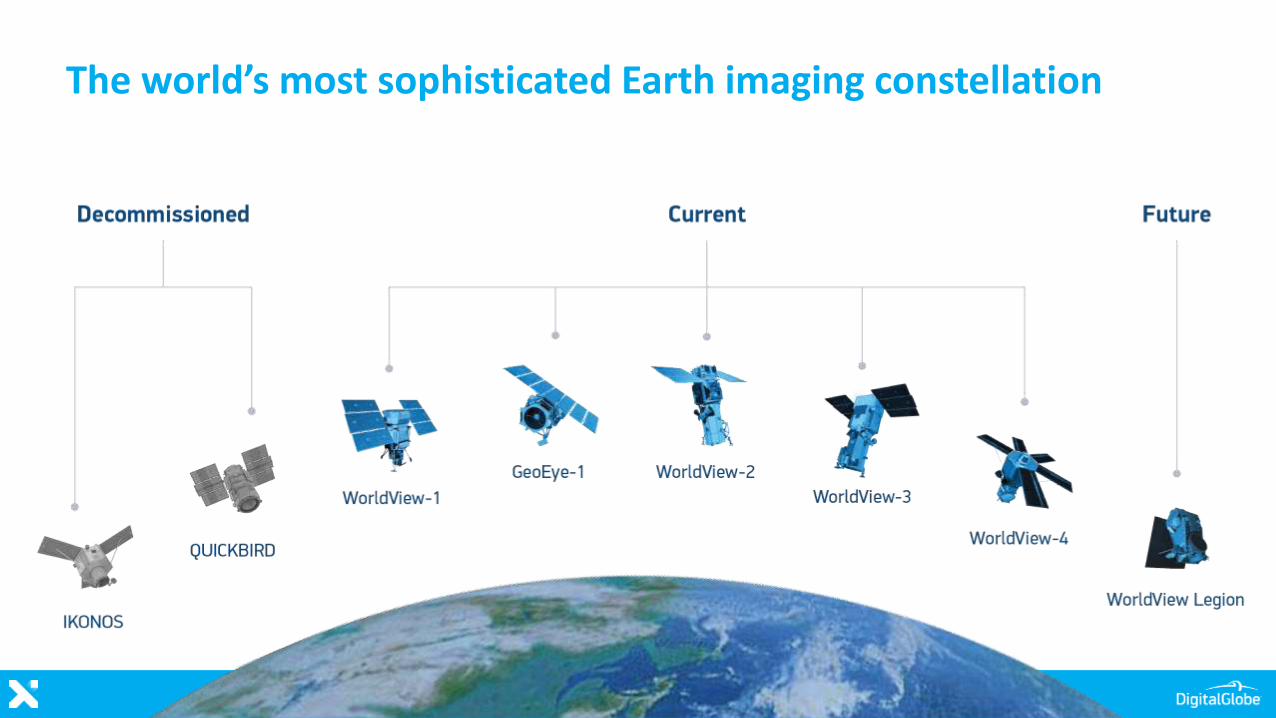
The world’s most sophisticated Earth imaging constellation
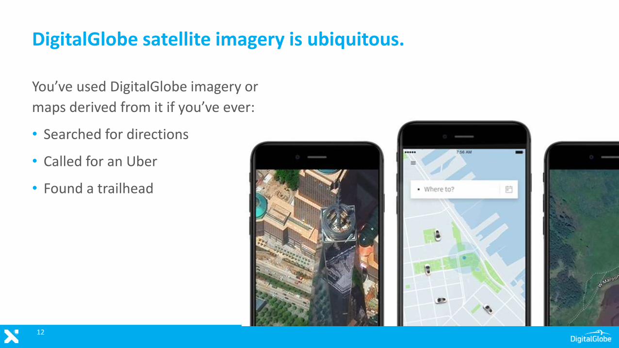
You’ve used DigitalGlobe imagery or
maps derived from it if you’ve ever:
• Searched for directions
• Called for an Uber
• Found a trailhead
DigitalGlobe satellite imagery is ubiquitous.
12
13
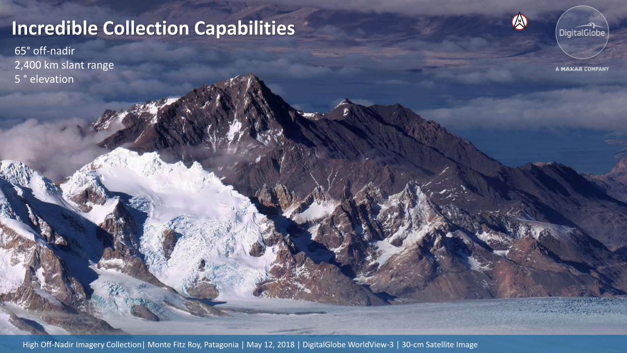
Incredible Collection Capabilities
High Off-Nadir Imagery Collection| Monte Fitz Roy, Patagonia | May 12, 2018 | DigitalGlobe WorldView-3 | 30-cm Satellite Image
65° off-nadir2,400 km slant range5 ° elevation
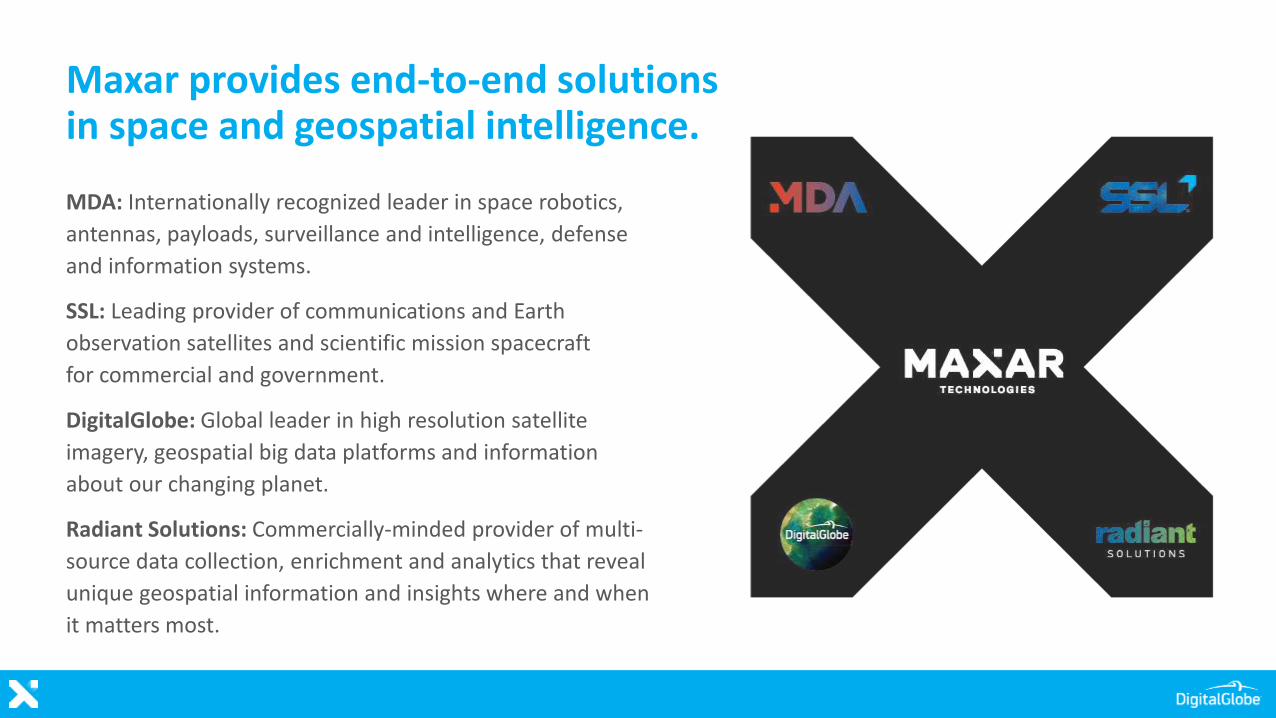
Maxar provides end-to-end solutions in space and geospatial intelligence.
MDA: Internationally recognized leader in space robotics,
antennas, payloads, surveillance and intelligence, defense
and information systems.
SSL: Leading provider of communications and Earth
observation satellites and scientific mission spacecraft
for commercial and government.
DigitalGlobe: Global leader in high resolution satellite
imagery, geospatial big data platforms and information
about our changing planet.
Radiant Solutions: Commercially-minded provider of multi-
source data collection, enrichment and analytics that reveal
unique geospatial information and insights where and when
it matters most.
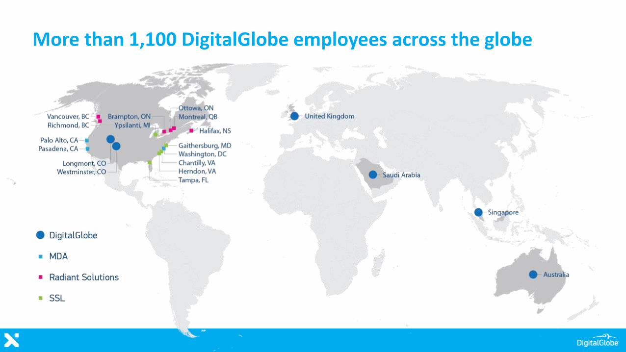
More than 1,100 DigitalGlobe employees across the globe
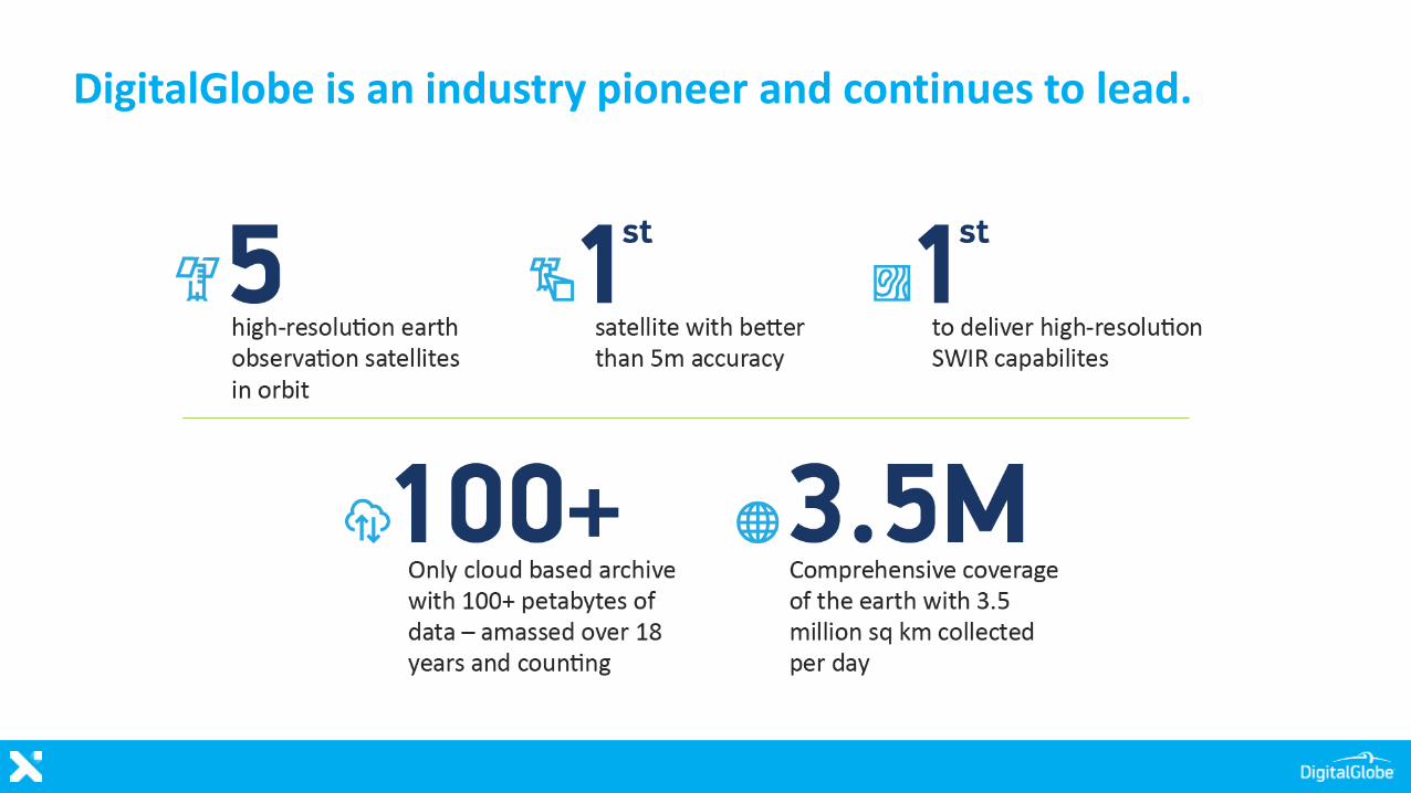
DigitalGlobe is an industry pioneer and continues to lead.
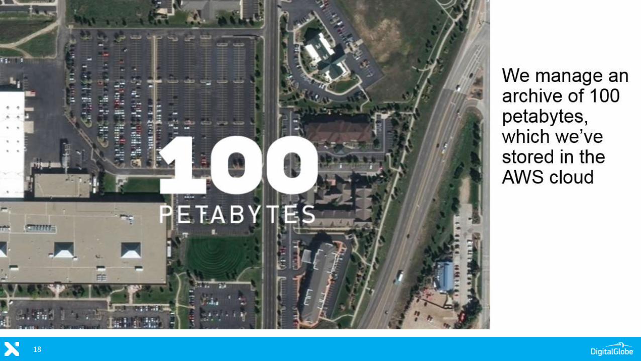
18
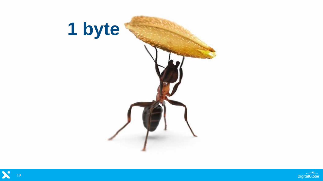
19
1 byte
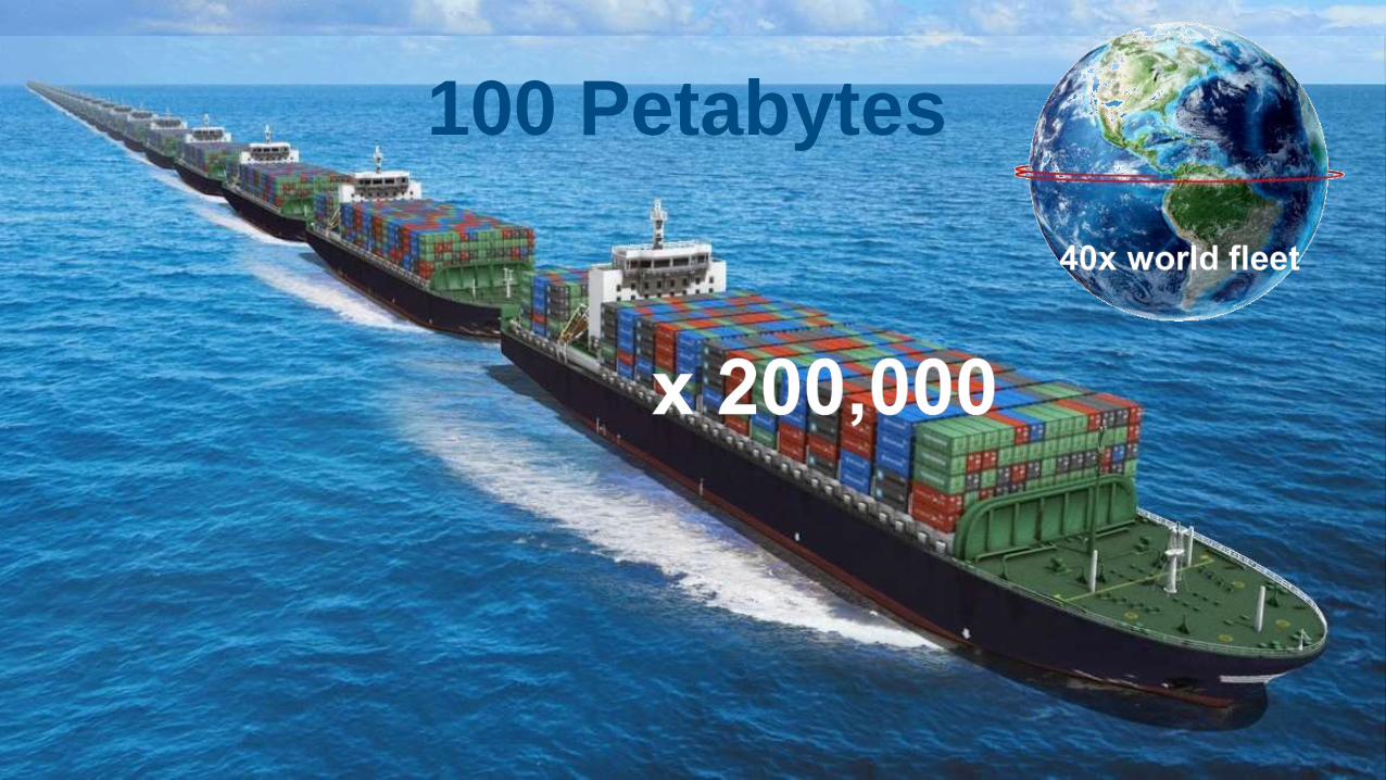
100 Petabytes
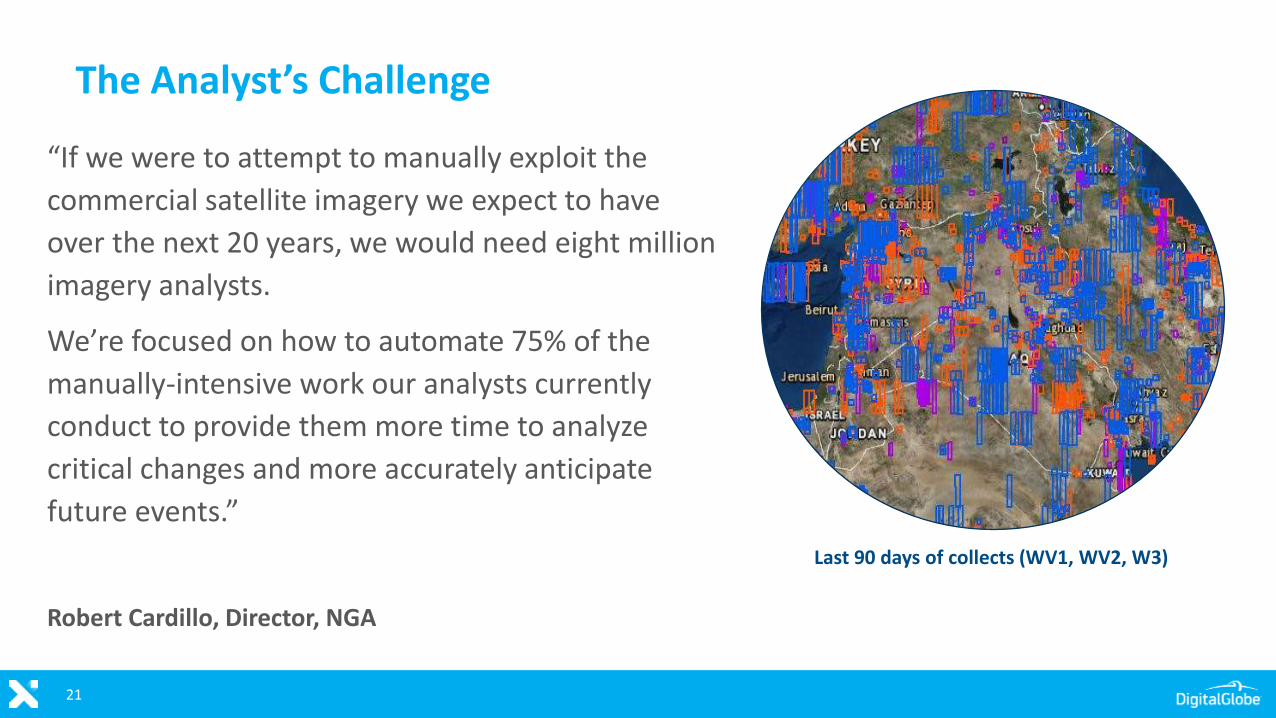
The Analyst’s Challenge
21
“If we were to attempt to manually exploit the
commercial satellite imagery we expect to have
over the next 20 years, we would need eight million
imagery analysts.
We’re focused on how to automate 75% of the
manually-intensive work our analysts currently
conduct to provide them more time to analyze
critical changes and more accurately anticipate
future events.”
Robert Cardillo, Director, NGA
Last 90 days of collects (WV1, WV2, W3)
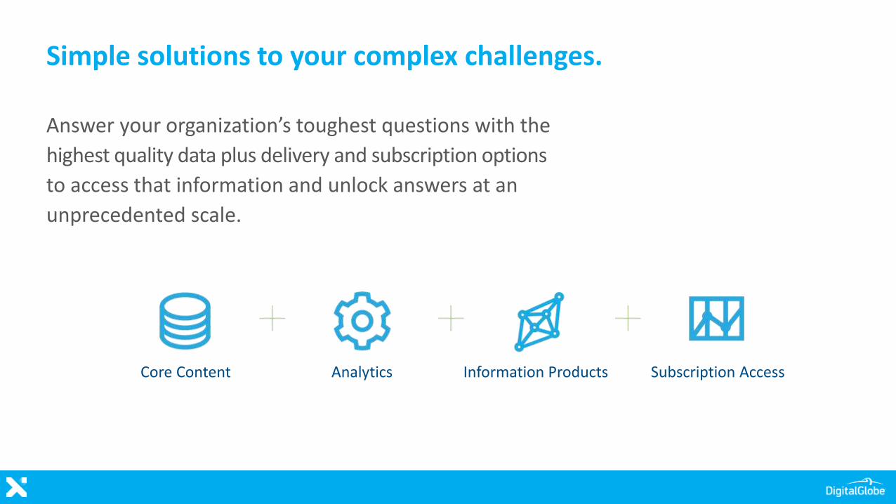
Simple solutions to your complex challenges.
Answer your organization’s toughest questions with the
highest quality data plus delivery and subscription options
to access that information and unlock answers at an
unprecedented scale.
Core Content Analytics Information Products Subscription Access
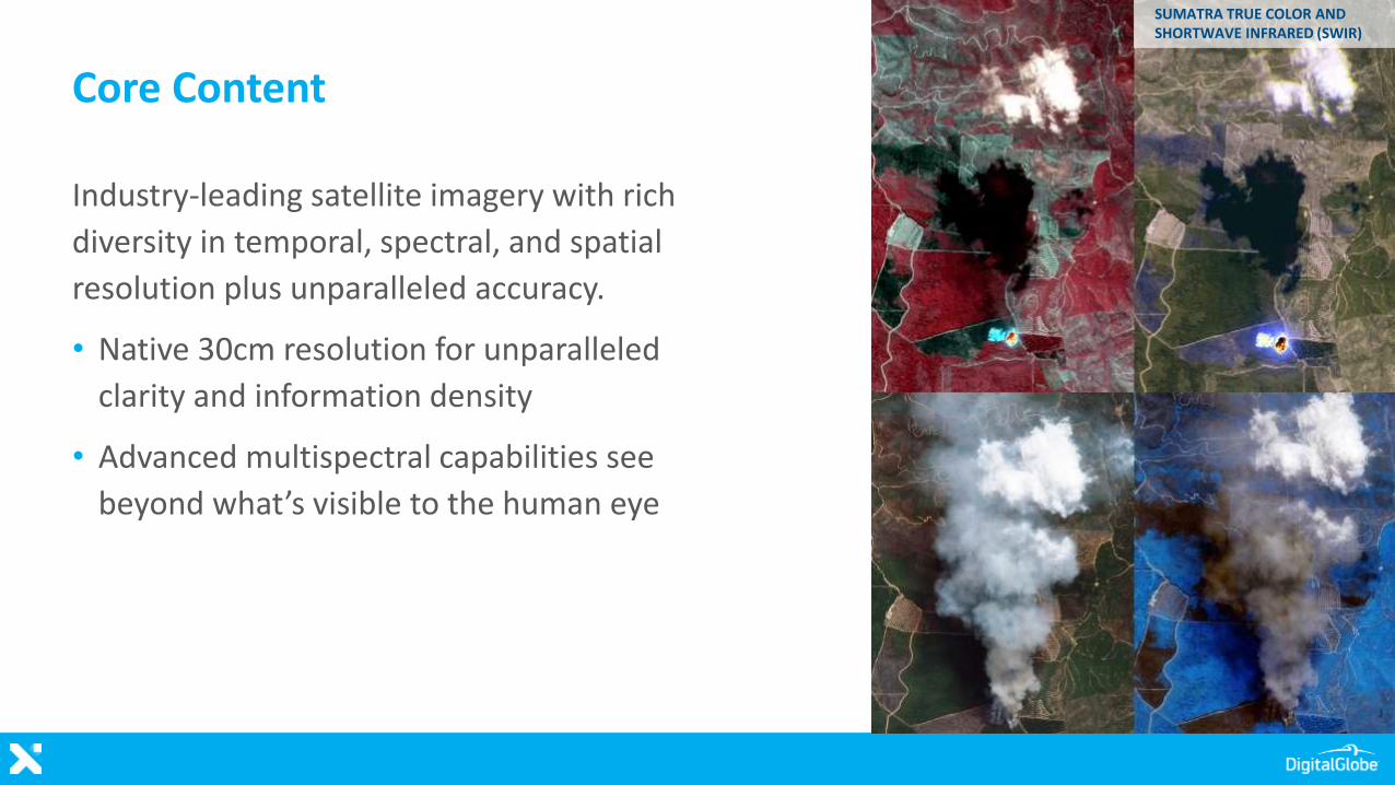
Core Content
Industry-leading satellite imagery with rich
diversity in temporal, spectral, and spatial
resolution plus unparalleled accuracy.
• Native 30cm resolution for unparalleled
clarity and information density
• Advanced multispectral capabilities see
beyond what’s visible to the human eye
SUMATRA TRUE COLOR AND SHORTWAVE INFRARED (SWIR)
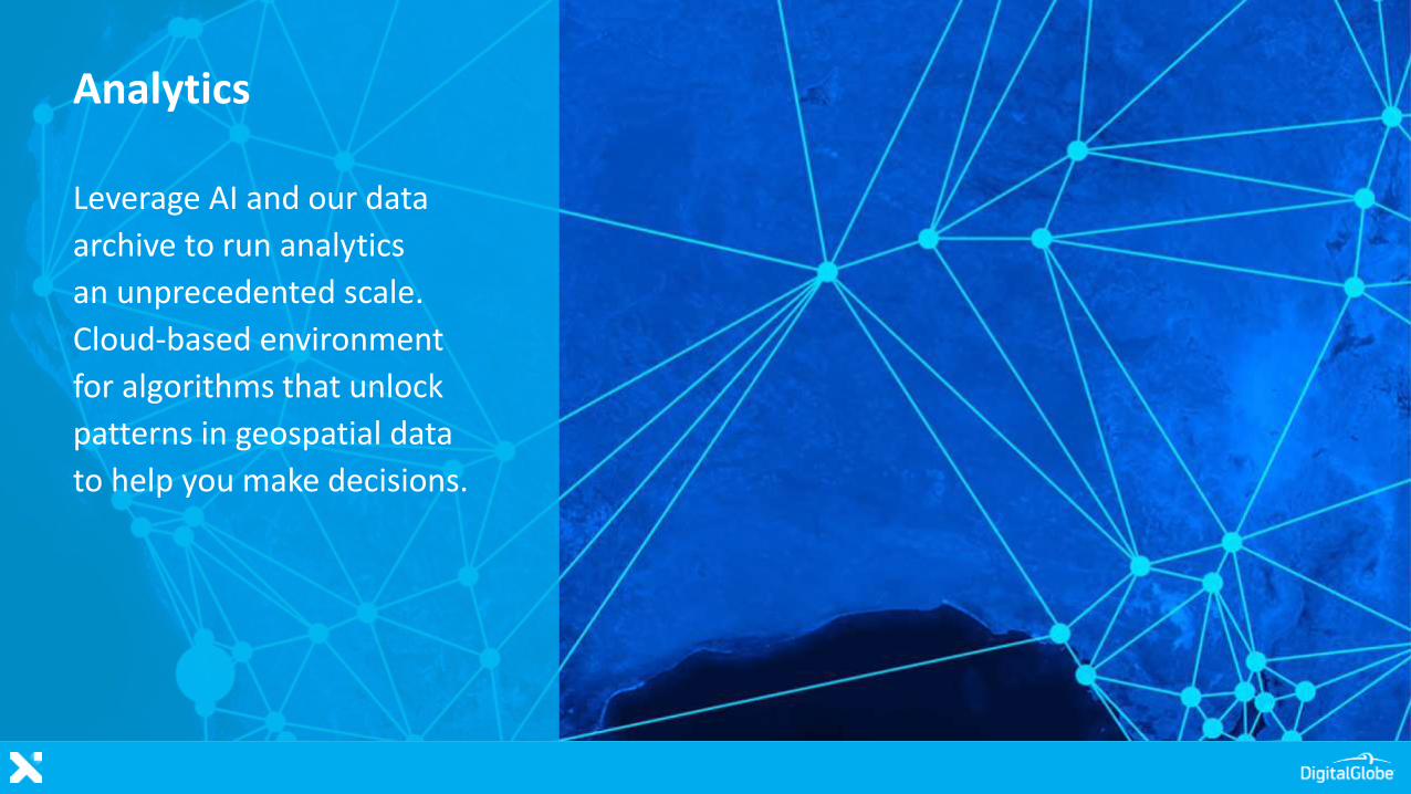
Analytics
Leverage AI and our data
archive to run analytics
an unprecedented scale.
Cloud-based environment
for algorithms that unlock
patterns in geospatial data
to help you make decisions.
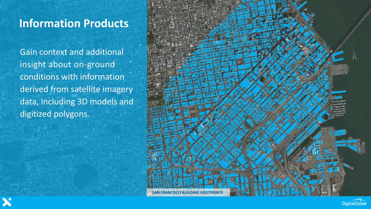
Gain context and additional
insight about on-ground
conditions with information
derived from satellite imagery
data, including 3D models and
digitized polygons.
Information Products
SAN FRANCISCO BUILDING FOOTPRINTS
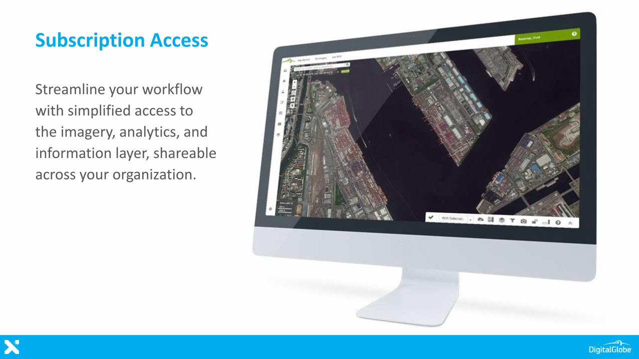
Subscription Access
Streamline your workflow
with simplified access to
the imagery, analytics, and
information layer, shareable
across your organization.
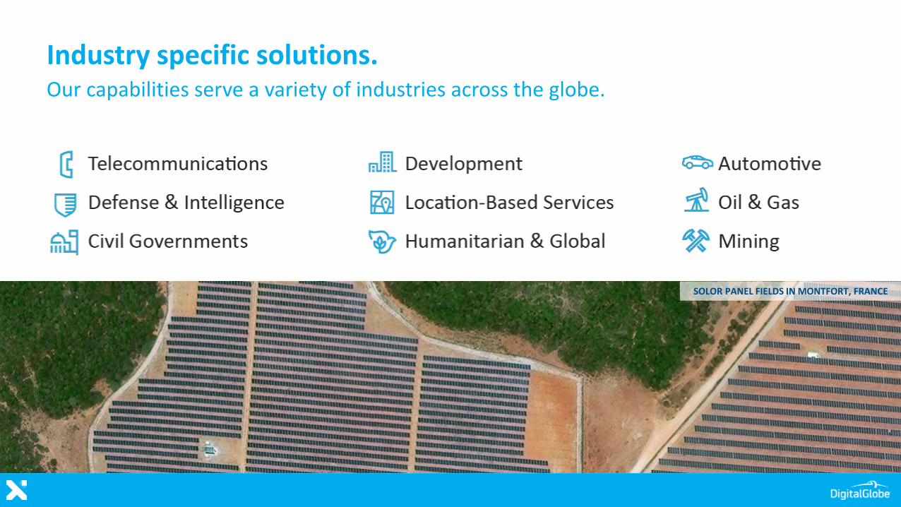
Industry specific solutions.Our capabilities serve a variety of industries across the globe.
SOLOR PANEL FIELDS IN MONTFORT, FRANCE
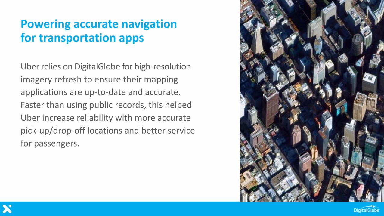
Powering accurate navigation for transportation apps
Uber relies on DigitalGlobe for high-resolution
imagery refresh to ensure their mapping
applications are up-to-date and accurate.
Faster than using public records, this helped
Uber increase reliability with more accurate
pick-up/drop-off locations and better service
for passengers.
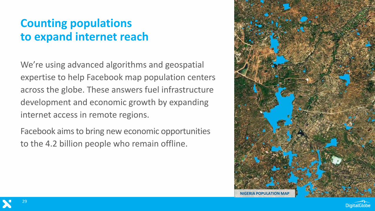
Counting populations to expand internet reach
We’re using advanced algorithms and geospatial
expertise to help Facebook map population centers
across the globe. These answers fuel infrastructure
development and economic growth by expanding
internet access in remote regions.
Facebook aims to bring new economic opportunities
to the 4.2 billion people who remain offline.
NIGERIA POPULATION MAP
29
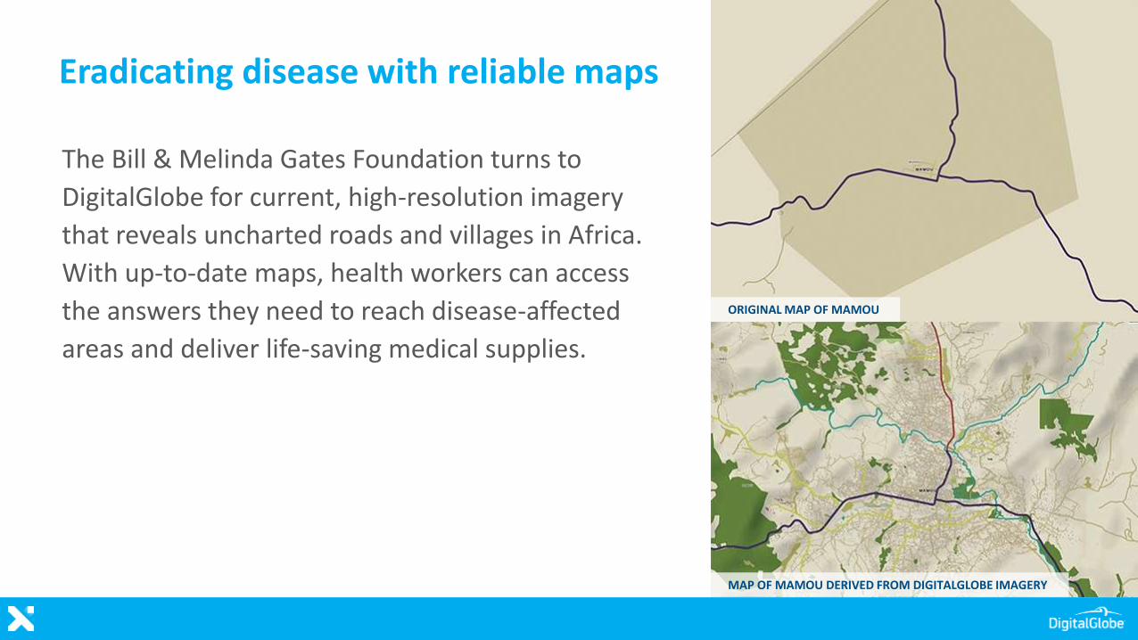
Eradicating disease with reliable maps
The Bill & Melinda Gates Foundation turns to
DigitalGlobe for current, high-resolution imagery
that reveals uncharted roads and villages in Africa.
With up-to-date maps, health workers can access
the answers they need to reach disease-affected
areas and deliver life-saving medical supplies.
ORIGINAL MAP OF MAMOU
MAP OF MAMOU DERIVED FROM DIGITALGLOBE IMAGERY
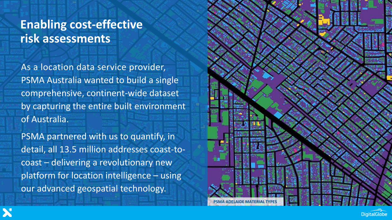
Enabling cost-effective risk assessments
As a location data service provider,
PSMA Australia wanted to build a single
comprehensive, continent-wide dataset
by capturing the entire built environment
of Australia.
PSMA partnered with us to quantify, in
detail, all 13.5 million addresses coast-to-
coast – delivering a revolutionary new
platform for location intelligence – using
our advanced geospatial technology.PSMA ADELAIDE MATERIAL TYPES
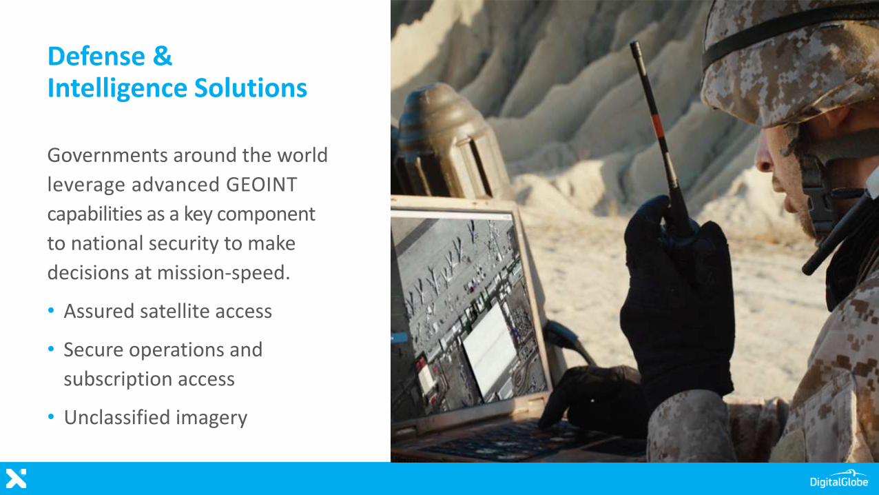
Governments around the world
leverage advanced GEOINT
capabilities as a key component
to national security to make
decisions at mission-speed.
• Assured satellite access
• Secure operations and
subscription access
• Unclassified imagery
Defense & Intelligence Solutions
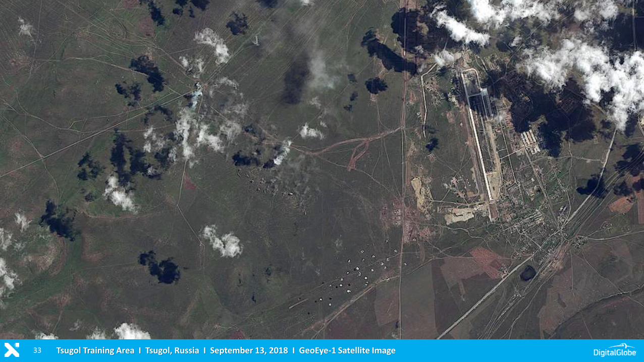
33 Tsugol Training Area I Tsugol, Russia I September 13, 2018 I GeoEye-1 Satellite Image
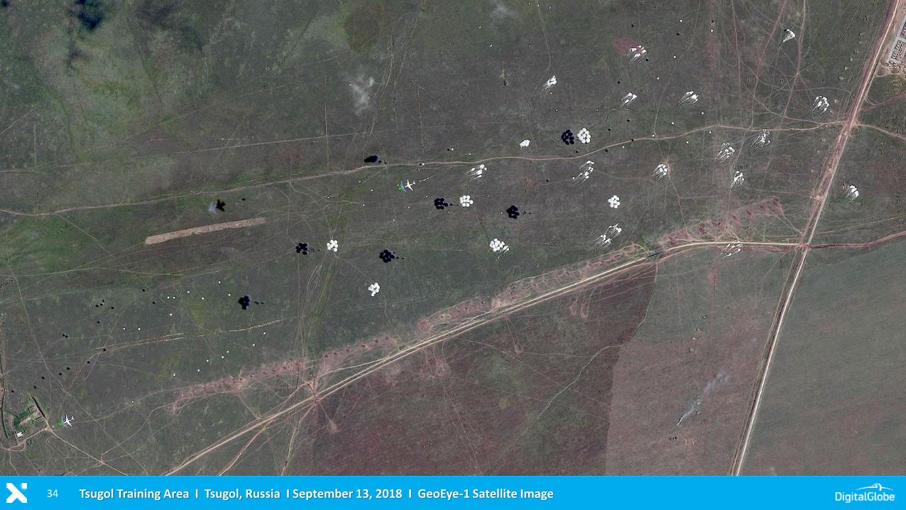
34 Tsugol Training Area I Tsugol, Russia I September 13, 2018 I GeoEye-1 Satellite Image
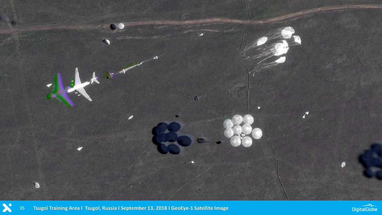
35 Tsugol Training Area I Tsugol, Russia I September 13, 2018 I GeoEye-1 Satellite Image
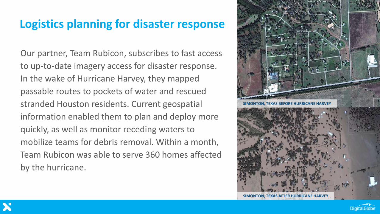
Logistics planning for disaster response
Our partner, Team Rubicon, subscribes to fast access
to up-to-date imagery access for disaster response.
In the wake of Hurricane Harvey, they mapped
passable routes to pockets of water and rescued
stranded Houston residents. Current geospatial
information enabled them to plan and deploy more
quickly, as well as monitor receding waters to
mobilize teams for debris removal. Within a month,
Team Rubicon was able to serve 360 homes affected
by the hurricane.
SIMONTON, TEXAS BEFORE HURRICANE HARVEY
SIMONTON, TEXAS AFTER HURRICANE HARVEY
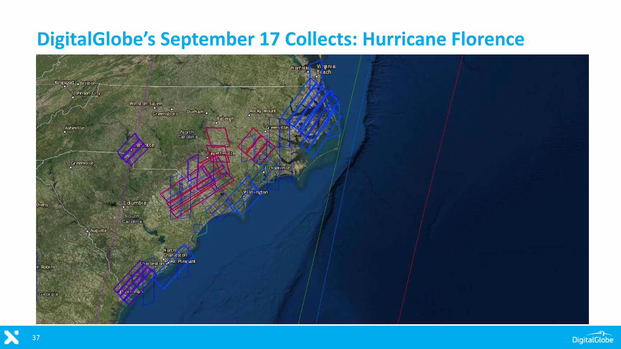
DigitalGlobe’s September 17 Collects: Hurricane Florence
37
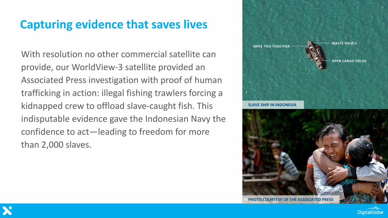
Capturing evidence that saves lives
With resolution no other commercial satellite can
provide, our WorldView-3 satellite provided an
Associated Press investigation with proof of human
trafficking in action: illegal fishing trawlers forcing a
kidnapped crew to offload slave-caught fish. This
indisputable evidence gave the Indonesian Navy the
confidence to act—leading to freedom for more
than 2,000 slaves.
SHIPS TIED TOGETHERMASTS VISIBLE
OPEN CARGO HOLDS
SLAVE SHIP IN INDONESIA
PHOTO COURTESY OF THE ASSOCIATED PRESS