
Digital Portfolio
14
September 2011 Amber Luscombe WSA2 DIGITAL PORTFOLIO Fluvial Erosion | House-Scapes
-
Upload
amber-luscombe -
Category
Documents
-
view
217 -
download
1
description
2nd Year WSA student. Digital Portfolio of first term work.
Transcript of Digital Portfolio

1
September 2011Amber Luscombe WSA2
DIGITAL PORTFOLIOFluvial Erosion | House-Scapes

2 3
FLUVIAL EROSIONIntroductionThis portfolio showcases the work produced and the processes taken throughout the duration of the Digital Practices and Methodology module, beginning September 2011 and ending Decem-ber 2011.The portfolio begins with showing the process taken from a single ‘inspiration word’, through to a final concept which eventually informs studio work. Each piece of work has been set as a submission throughout the 11 weeks in addition to my own developmental work, eventually leading into the studio project of this term – Urban Conditions.
4 5
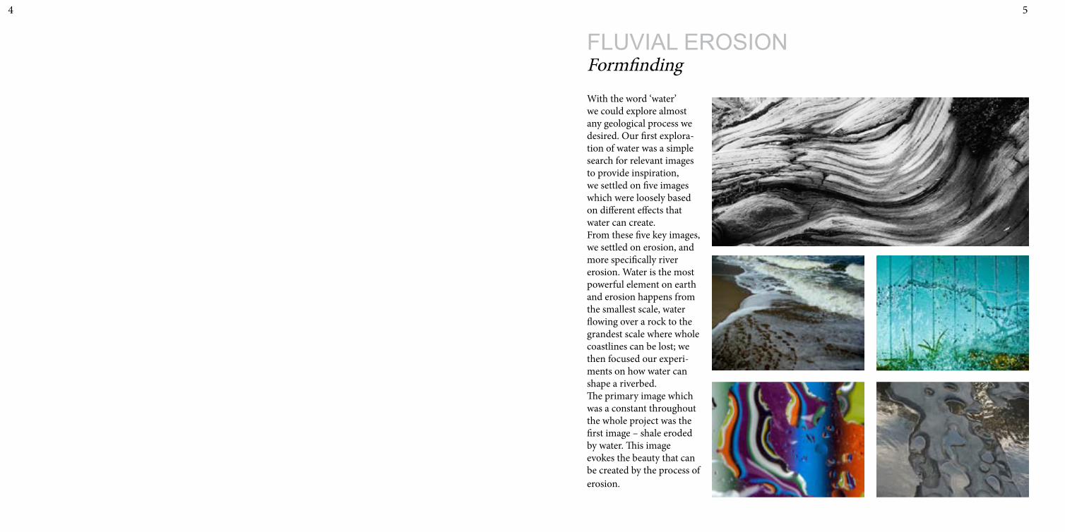
FLUVIAL EROSIONFormfindingWith the word ‘water’ we could explore almost any geological process we desired. Our first explora-tion of water was a simple search for relevant images to provide inspiration, we settled on five images which were loosely based on different effects that water can create. From these five key images, we settled on erosion, and more specifically river erosion. Water is the most powerful element on earth and erosion happens from the smallest scale, water flowing over a rock to the grandest scale where whole coastlines can be lost; we then focused our experi-ments on how water can shape a riverbed.The primary image which was a constant throughout the whole project was the first image – shale eroded by water. This image evokes the beauty that can be created by the process of erosion.

6 7
FormfindingDigital Model
PRO
DU
CED
BY
AN
AU
TOD
ESK
ED
UC
ATI
ON
AL
PRO
DU
CT
PRODUCED BY AN AUTODESK EDUCATIONAL PRODUCT
PRO
DU
CED
BY A
N A
UTO
DESK
EDU
CA
TION
AL PR
OD
UC
T
PRODUCED BY AN AUTODESK EDUCATIONAL PRODUCT
To further expand our exploration on our geological process, we were required to build a 3DS Max digital model to show how river erosion can manipulate a solid mass to create an eroded form. The final model represents a solid cylindrical mass which has been eroded by the constant flow of water and therefore creating the smooth contoured form; the concept being that by applying different parameters representing lighter or stronger water flow – the form can be manipulated. Other digital experiments involved showing the running of water as particles over the form, and representing how particles of material may be removed via the eroding flow of water.

8 9
FormfindingPhysical Experiments
To explore how water may run over an already contoured surface, physical experiments using plaster and dye were conducted. Whilst conducting the experiment, we observed that the water takes the easiest route to the exit, and where there is no obvious exit or release, the water collects and forms a pool of water. We took this as our main analogy to inform studio, where the flow of water represents people flow and the contours of the rock represent contours of the site.
Foam moulds Plaster cast taken from foam mould
10 11
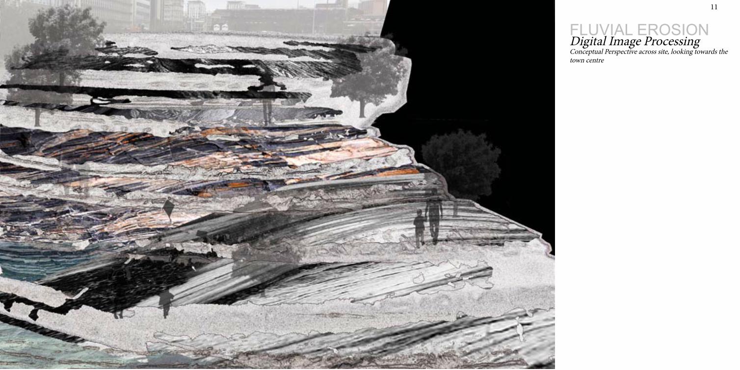
FLUVIAL EROSIONDigital Image ProcessingConceptual Perspective across site, looking towards thetown centre

12 13
FLUVIAL EROSIONPraxis/Drafting
Praxis/DraftingLaser Cut ModelThe laser cut model has been taken from the bottom East corner of the proposed building where there is a large profiled public entrance. This was modelled so that the angles and ge-ometries of this complex plane could be under-stood and inform design. It is composed of thin corrugated card, laser cut then stacked, creating a beautifully contoured surface which bends in two directions.
Laser Cut Model
2d planar sections taken from model
3DS Max model
Location of laser model
14 15
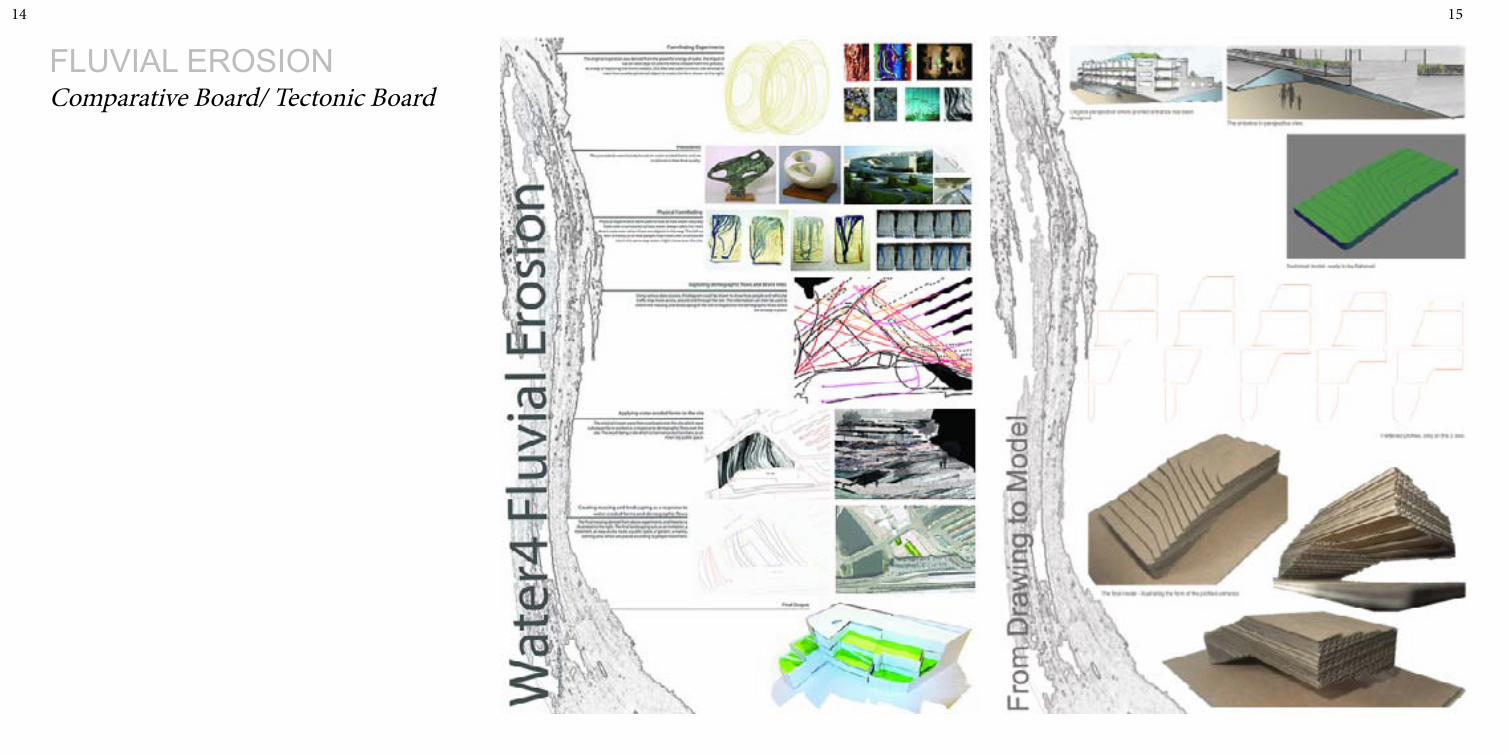
FLUVIAL EROSIONComparative Board/ Tectonic Board

16 17
HOUSE-SCAPESIntroductionThis studio project was informed heav-ily by the previous fluvial erosion project, therefore there was already a direction and theme of water.The site was heavily influenced by the prox-imity of the River Taff, the Cardiff Central Railway Station, the surrounding large scale buildings, the Millennium Stadium and the main road running alongside, therefore influencing design decisions made.The brief required a social housing unit with 1:2 residential to public and minimum twenty housing units. This portfolio shows how the final proposal was reached and the components which were involved within it.
18 19
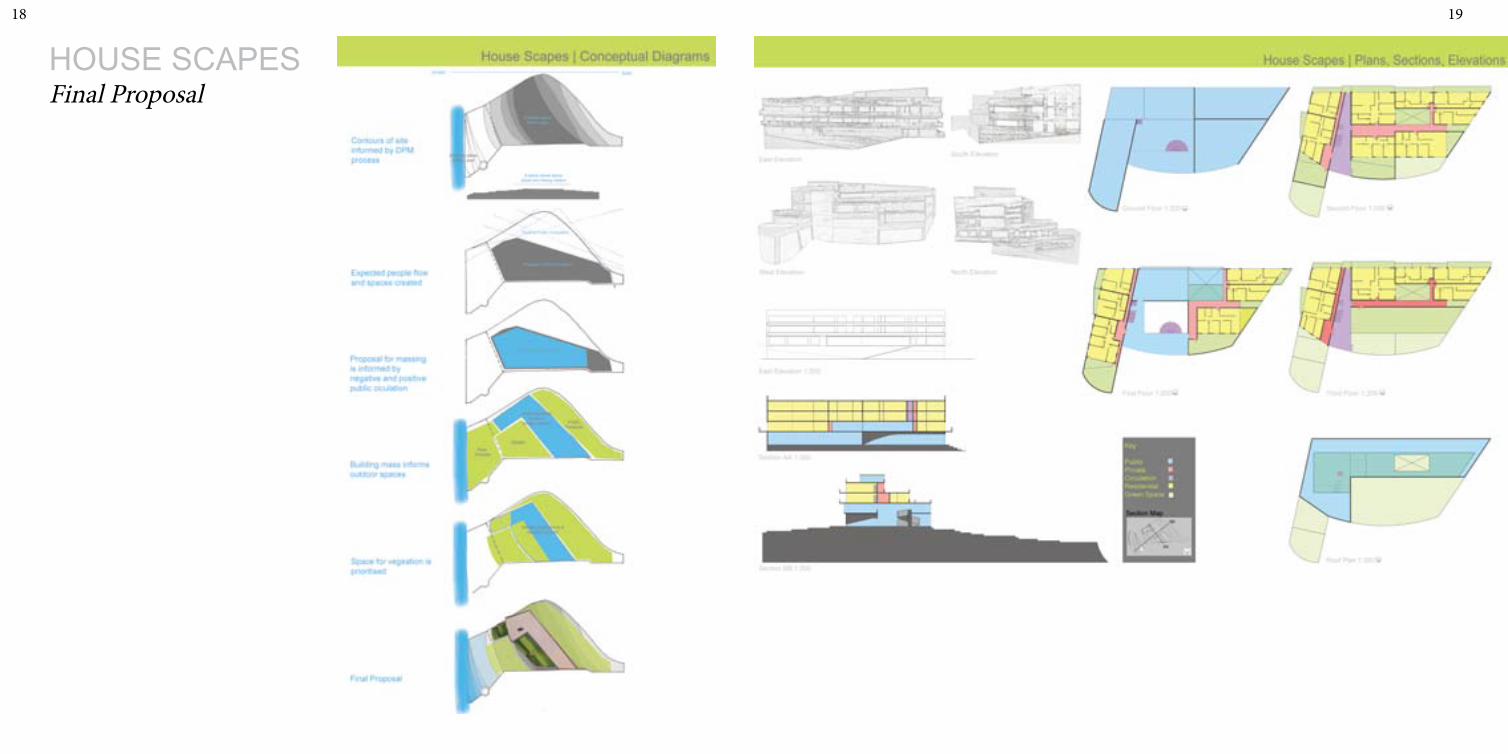
HOUSE SCAPESFinal Proposal

20 21

22 23
Site layout/Landscaping
24 25
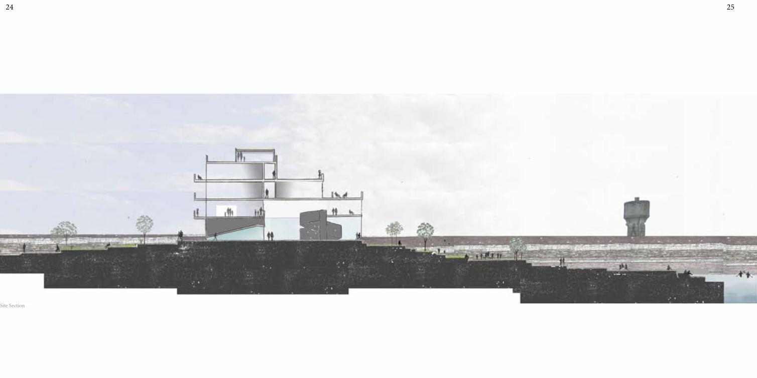
Site Section

26
HOUSE SCAPESPlug-in Model
