DEVELOPMENT MANAGEMENT INFORMATION GUIDELINE...
27
SUBDIVISION OF LAND 6 DEVELOPMENT MANAGEMENT INFORMATION GUIDELINE SERIES This booklet explains the process and requirements for subdividing property.
Transcript of DEVELOPMENT MANAGEMENT INFORMATION GUIDELINE...

SUBDIVISION OF LAND 6
DEVELOPMENT MANAGEMENT INFORMATION GUIDELINE SERIES
This booklet explains the process and requirements for subdividing property.

04 Frequently asked questions about subdivision
10 Preparing and submitting an application for subdivision
40 The decision and thereafter
50 Contact details
28 The process after submission
48 Subdivision confirmation and implementation
Contents
This booklet forms part of a series published by the City of Cape Town to help you understand and make better use of the planning system
LANGUAGE POLICY: In line with the City of Cape Town’s language policy, any booklet in this series is also available in Afrikaans and isiXhosa on request by e-mailing [email protected].
LEGAL DISCLAIMER: Although based on law, the information provided in this booklet is presented in an informal and plain language format for the purposes of providing advice on development matters and procedures to customers and members of the public. Should there be any discrepancy with provisions in the underlying legislation, the actual legislation takes precedence and should be consulted directly. Alternatively, please obtain independent professional advice on the matter. The City of Cape Town does not accept any liability for any action taken on the basis of the information contained herein.
http://planning.capetown.gov.za

FREQUENTLY ASKED QUESTIONS ABOUT SUBDIVISION
Why does the City need to approve a subdivision?
Since the City – and specifically its Development Management Department – is by law responsible for managing development within its municipal borders, landowners who want to subdivide land must apply to the City.
In assessing the application, the City must ensure that:
• the subdivision and development would be appropriate for the area;
• the development would be of a sufficient standard;
• the subdivision and development would have the least possible negative impact
• no harm is done to the environment; and
• that there are available municipal services to the subdivided portions.
What is land subdivision, and when is an application for subdivision required?
Usually, subdivision of property can happen in two ways, namely in the form of larger ‘township establishment’ or a smaller subdivision.
• When the owner of a large property decides to develop it, such a person may apply to the City of Cape Town to have the property (called ‘the parent property’) cut into smaller portions or land units (called ‘the subdivided portions’). The subdivided portions are individually registered in the Deeds Office, and developed separately. This is known as ‘township establishment’.
• In the case of smaller properties, a property owner may decide to cut off a vacant or underutilised portion of the property to have it separately registered from the main house. A new land unit is then created, and can be developed according to the land use rights applicable to the property. The new subdivided portion(s) need to be registered with the Deeds Office. This is often also called ‘infill development’ or ‘densification’.
4 CITY OF CAPE TOWN: DEVELOPMENT MANAGEMENT INFORMATION 5SUBDIVISION OF LAND

TITLE DEED
If I want to subdivide my property, what other applications may be required?
In addition to subdivision, more than one other type of planning approval may be required, depending on your proposal.
Most often, these related applications can be submitted and processed at the same time as the application for subdivision.
For more information, contact your local district planning office.
What is cadastral property information, and why is it important for subdivision?
The cadastral information of your property includes all details regarding the ownership, location, dimensions, value and use of the property. In short, it could be regarded as the ‘legal description’ of your property.
The City of Cape Town uses this information to identify different land units and the way in which they can be developed. Since the cadastral information of your property will determine whether you can go ahead with an application for subdivision, it is important to first get hold of it.
Your property’s cadastral information consists of two documents. Firstly, you will need to carefully study the property description on your title deed. Secondly, the title deed is normally accompanied by a survey diagram drawn up by a land surveyor after having surveyed and measured the property. This diagram is registered and held by the Surveyor-General. From this information, you will be able to establish whether subdivision is possible on your property.
These may include the following:• Removal of title deed restrictions (in other words,
removal of a condition that prohibits subdivision)• Rezoning (in other words, changing a property’s zoning
to subdivisional area when a new zone or zonings are proposed, so that subdivision may take place)
• Consent use • Site development plan approval (typically in the case
of cluster developments)
6 CITY OF CAPE TOWN: DEVELOPMENT MANAGEMENT INFORMATION 7SUBDIVISION OF LAND
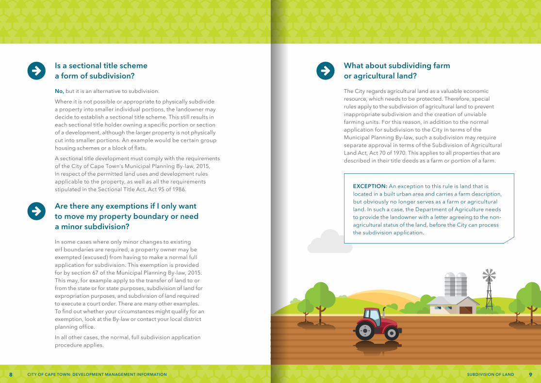
Are there any exemptions if I only want to move my property boundary or need a minor subdivision?
In some cases where only minor changes to existing erf boundaries are required, a property owner may be exempted (excused) from having to make a normal full application for subdivision. This exemption is provided for by section 67 of the Municipal Planning By-law, 2015. This may, for example apply to the transfer of land to or from the state or for state purposes, subdivision of land for expropriation purposes, and subdivision of land required to execute a court order. There are many other examples. To find out whether your circumstances might qualify for an exemption, look at the By-law or contact your local district planning office.
In all other cases, the normal, full subdivision application procedure applies.
Is a sectional title scheme a form of subdivision?
No, but it is an alternative to subdivision.
Where it is not possible or appropriate to physically subdivide a property into smaller individual portions, the landowner may decide to establish a sectional title scheme. This still results in each sectional title holder owning a specific portion or section of a development, although the larger property is not physically cut into smaller portions. An example would be certain group housing schemes or a block of flats.
A sectional title development must comply with the requirements of the City of Cape Town’s Municipal Planning By-law, 2015, in respect of the permitted land uses and development rules applicable to the property, as well as all the requirements stipulated in the Sectional Title Act, Act 95 of 1986.
What about subdividing farm or agricultural land?
The City regards agricultural land as a valuable economic resource, which needs to be protected. Therefore, special rules apply to the subdivision of agricultural land to prevent inappropriate subdivision and the creation of unviable farming units. For this reason, in addition to the normal application for subdivision to the City in terms of the Municipal Planning By-law, such a subdivision may require separate approval in terms of the Subdivision of Agricultural Land Act, Act 70 of 1970. This applies to all properties that are described in their title deeds as a farm or portion of a farm.
EXCEPTION: An exception to this rule is land that is located in a built urban area and carries a farm description, but obviously no longer serves as a farm or agricultural land. In such a case, the Department of Agriculture needs to provide the landowner with a letter agreeing to the non-agricultural status of the land, before the City can process the subdivision application.
8 CITY OF CAPE TOWN: DEVELOPMENT MANAGEMENT INFORMATION 9SUBDIVISION OF LAND

PREPARING AND SUBMITTING AN APPLICATION FOR SUBDIVISION
Advice before I apply: Who can help?
To ensure a successful outcome to any application, it is always a good idea to meet with an official of your local district planning office before you tackle the application process. This is called a pre-application consultation. The official will be able to give you advice on the feasibility of your proposal as well as any specific factors you should take into account.
In addition, since some proposals involve complicated technical issues or require detailed subdivision plans, you may also wish to approach a town planning consultant or land surveyor to help you prepare your application.
NB: Such a pre-application consultation is a requirement where:- the physical development area of a subdivision
is larger than a hectare; and/or- the area is subject to certain rezoning
and restrictive title conditions.For more information, ask your local district planning office or consult the other brochures in this series.
If you appoint a consultant, you will have to give that person power of attorney
(the authority to act on your behalf) to serve as your agent and submit the application for you.
1110 SUBDIVISION OF LANDCITY OF CAPE TOWN: DEVELOPMENT MANAGEMENT INFORMATION

It is important to check that you fully comply with these requirements when preparing and submitting your application for subdivision. If not, it may be considered incomplete and will be returned for you to make corrections and improvements.
Also keep in mind that the list above is not necessarily complete. Depending on the nature of your planned development and any unique circumstances, your local district planning office may need additional information to help them process and assess your application. This may include a site development plan or a preliminary sketch plan to illustrate your proposal. Rather be sure and check with them beforehand.
• A completed and signed application form
• Power-of-attorney letter signed by you (if someone else will act on your behalf)
• The bondholder’s permission for the proposed subdivision (if the property is bonded)
• A locality plan (a plan that shows the parent property in relation to its surroundings)
• A copy of an approved Surveyor-General’s diagram/noting sheet/general plan extract of the parent property
• A copy of the relevant title deed/deed of transfer
• Where the title deed is perhaps unclear, a conveyancer’s certificate confirming that there are no restrictive conditions prohibiting the proposed subdivision
• A proposed subdivision plan
• A phasing plan (if applicable)
• A motivation report explaining what makes the proposal desirable, as well as its likely impact on the surroundings
• A copy of an environmental impact assessment/heritage impact assessment/record of decision (if required by law)
• A copy of a transport impact assessment/transport impact statement (if applicable)
• A separate civil services report (for larger developments)
• A flood line certificate and separate contour plan (if applicable)
• Typical unit types (plan and external face) (if applicable)
• Department of Agriculture approval letter (where agricultural land is involved)
• Supporting documents in respect of any other land use management application submitted at the same time
To be valid and complete, applications for subdivision should generally include the following supporting information and documents:
Supporting information/documents
1312 SUBDIVISION OF LANDCITY OF CAPE TOWN: DEVELOPMENT MANAGEMENT INFORMATION
About application forms and fees
A single, standard application form is available from your local district planning office during office hours, or on the City of Cape Town’s website. This form must be completed and included with your submission. Your local district planning office can help you complete this form if you want them to, and will also be able to provide you with an estimate of the application fees payable.
The City of Cape Town charges a set tariff for processing land use management applications. This tariff must be paid in full after you receive an invoice that will be given to you following your submission. If not, your application cannot be further processed. For a complete list of land use management tariffs and application fees, please consult the City’s website or contact your local district planning office. Once the fee has been calculated, the district planning office will provide you with an invoice which can be settled at any City cash office, or participating commercial outlet. The receipt issued after payment can be submitted to the district office, or if you paid electronically, the City should automatically receive payment notification. If the City has not received confirmation, you may be required to provide proof of payment, so please retain proof in case it is needed.
The total fee payable depends on the application type, the extent or complexity of the proposal, and the amount of public participation required.
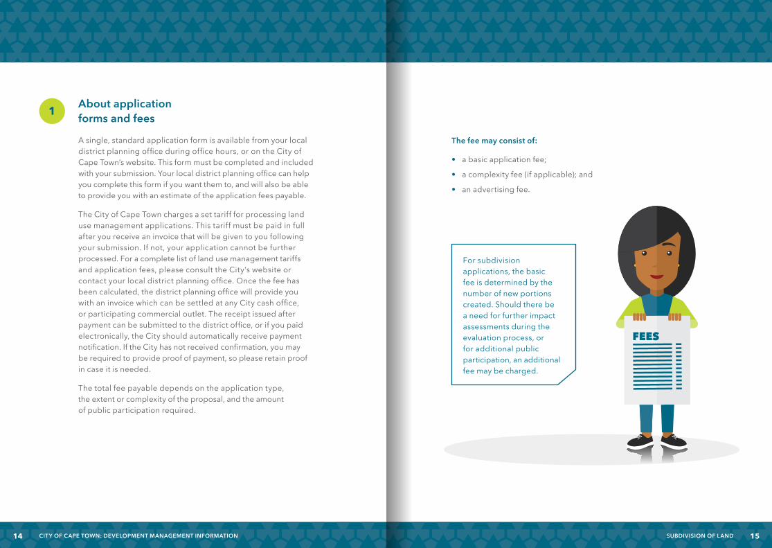
The fee may consist of:
• a basic application fee;
• a complexity fee (if applicable); and
• an advertising fee.
1
For subdivision applications, the basic fee is determined by the number of new portions created. Should there be a need for further impact assessments during the evaluation process, or for additional public participation, an additional fee may be charged.
FEES
1514 SUBDIVISION OF LANDCITY OF CAPE TOWN: DEVELOPMENT MANAGEMENT INFORMATION
What are the requirements regarding street naming and numbering?
If new roads (whether public of private) will be created as part of your proposed subdivision, it is important that you identify the suggested names for these roads, along with a street number for each property, upfront. If these names and numbers are in line with Council’s policy and standards for street naming and numbering, they will be approved at the same time as the subdivision application.
General requirements:
- To prevent confusion, street names should not already occur in the immediate area. (Contact your local district planning office to determine this.)
- Street names should not be offensive.
- Street numbering should be in line with Council’s specific standards and conventions, which are available from either your local district planning office or the City’s website.
About the subdivision plan
When applying for subdivision (or rezoning to subdivisional area), your application should include a detailed proposed subdivision plan. This plan should at least include the following information:
• The scale, true north, the suburb name, title and legend, the date and the plan/drawing number (amended or revised plans should have successive numbers)
• The name and details of the person or firm responsible for the design
• Sufficient existing and proposed dimensions to confirm the drawing scale, and to indicate the size of the subdivided portions
• Typical plot sizes, or the size of individual portions
• An indication of the boundary of the application area or parent property, all cadastral boundaries as well as proposed subdivision lines, indicated so as to be clearly distinguishable from one another
• Proposed individual portions or plots, numbered consecutively
• Proposed complex name in the case of a group housing complex
• Accurate position of existing buildings or structures on the site (including any structures to be demolished), as well as immediately adjacent sites
• Proposed building lines where the existing buildings would be close to the newly created cadastral boundaries
• Contours with intervals of between 1 m and 5 m, extended beyond subject site boundaries
2
• Both existing and proposed street names (whether public or private), and street or unit numbers, together with proposed or proclaimed street widths
• Sufficient information regarding the surrounding area (e.g. adjacent plots, erf numbers, streets, etc.) so that the proposal can be accurately illustrated within the context of its surroundings
1716 SUBDIVISION OF LANDCITY OF CAPE TOWN: DEVELOPMENT MANAGEMENT INFORMATION
• 1:50-year flood-line (where applicable)• LO co-ordinate grid intersections with grid values• Any physical restrictions or natural features (such as streams,
sloping banks, large trees or significant vegetation) which might influence the layout
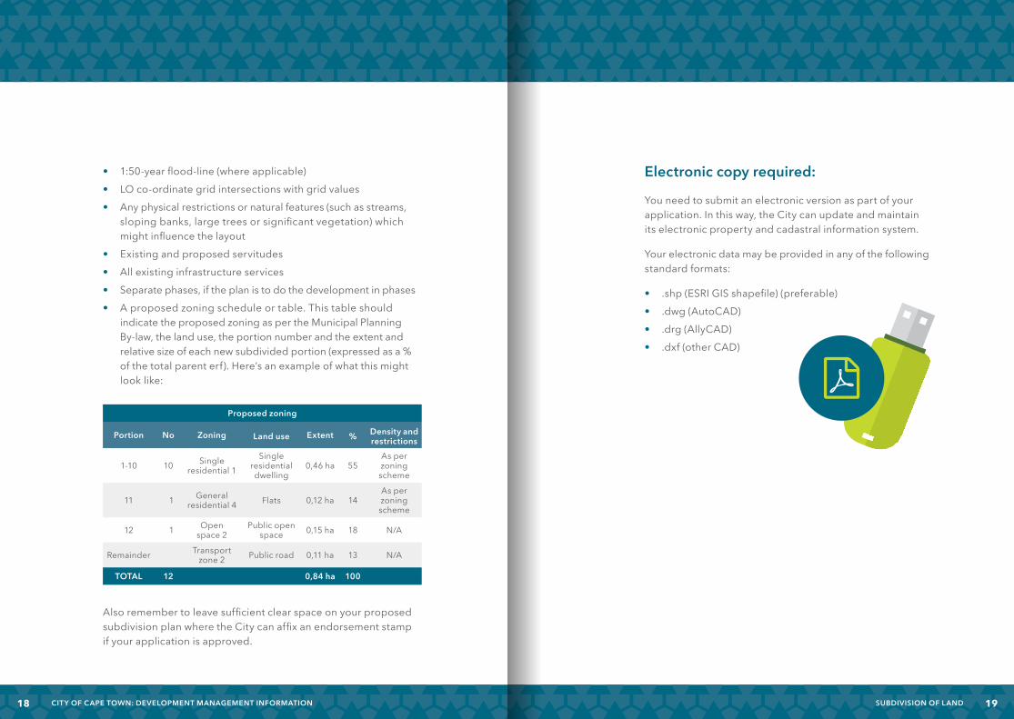
• Existing and proposed servitudes• All existing infrastructure services• Separate phases, if the plan is to do the development in phases• A proposed zoning schedule or table. This table should
indicate the proposed zoning as per the Municipal Planning By-law, the land use, the portion number and the extent and relative size of each new subdivided portion (expressed as a % of the total parent erf). Here’s an example of what this might look like:
Also remember to leave sufficient clear space on your proposed subdivision plan where the City can affix an endorsement stamp if your application is approved.
Electronic copy required:
You need to submit an electronic version as part of your application. In this way, the City can update and maintain its electronic property and cadastral information system.
Your electronic data may be provided in any of the following standard formats:
• .shp (ESRI GIS shapefile) (preferable)• .dwg (AutoCAD)• .drg (AllyCAD)• .dxf (other CAD)
Proposed zoning
Portion No Zoning Land use Extent % Density and restrictions
1-10 10 Single residential 1
Single residential dwelling
0,46 ha 55As per zoning scheme
11 1 General residential 4 Flats 0,12 ha 14
As per zoning scheme
12 1 Open space 2
Public open space 0,15 ha 18 N/A
Remainder Transport zone 2 Public road 0,11 ha 13 N/A
TOTAL 12 0,84 ha 100
1918 SUBDIVISION OF LANDCITY OF CAPE TOWN: DEVELOPMENT MANAGEMENT INFORMATION
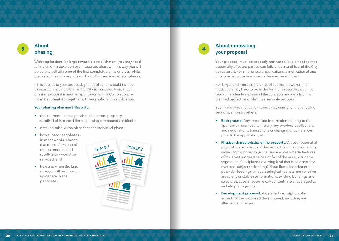
About phasing
With applications for large township establishment, you may need to implement a development in separate phases. In this way, you will be able to sell off some of the first completed units or plots, while the rest of the units or plots will be built or serviced in later phases.
If this applies to your proposal, your application should include a separate phasing plan for the City to consider. Note that a phasing proposal is another application for the Cty to approve. It can be submitted together with your subdivsion application.
Your phasing plan must illustrate:
• the intermediate stage, when the parent property is subdivided into the different phasing components or blocks;
• detailed subdivision plans for each individual phase;
• how subsequent phases – in other words, phases that do not form part of the current detailed subdivision – would be serviced; and
• how and when the land surveyor will be drawing up general plans per phase.
3 About motivating your proposal
Your proposal must be properly motivated (explained) so that potentially affected parties can fully understand it, and the City can assess it. For smaller-scale applications, a motivation of one or two paragraphs in a cover letter may be sufficient.
For larger and more complex applications, however, the motivation may have to be in the form of a separate, detailed report that clearly explains all the concepts and details of the planned project, and why it is a sensible proposal.
Such a detailed motivation report may consist of the following sections, amongst others:
• Background: Any important information relating to the application, such as site history, any previous applications and negotiations, transactions or changing circumstances prior to the application, etc.
• Physical characteristics of the property: A description of all physical characteristics of the property and its surroundings, including topography (all natural and man-made features of the area), slopes (the rise or fall of the area), drainage, vegetation, floodplains (low-lying land that is adjacent to a river and subject to flooding), flood lines (lines that predict potential flooding), unique ecological habitats and sensitive areas, any unstable soil formations, existing buildings and structures, access routes, etc. Applicants are encouraged to include photographs.
• Development proposal: A detailed description of all aspects of the proposed development, including any alternative schemes.
4
PHASE 2
PHASE 2PHASE 1
2120 SUBDIVISION OF LANDCITY OF CAPE TOWN: DEVELOPMENT MANAGEMENT INFORMATION

• Desirability: To be desirable (acceptable), a development should improve the social, economic and physical circumstances of all parties involved, and should not cause any significant harm to existing or future users of the premises, surrounding residents or property owners, the surrounding natural, cultural, man-made or heritage environment, the local authority or the public at large.
Pay particular attention to the following when discussing the desirability of your proposal:
– Socio-economic impact
– The degree to which the planned development complies with City and other relevant local area plans, statutory planning frameworks or land use policies
– Any potential ways in which immediate neighbours or their existing rights as well as the surrounding community may be affected, and measures to control this
– Proposed layout, including street pattern, density of the development/plot sizes, and the provision of open space or community facilities
– Arrangements to provide sufficient access to the site and manage any possible traffic impact (including discouraging through traffic, traffic-calming measures, pedestrian movement, parking and cycle routes, etc.)
– The provision of required services and infrastructure, and any impact on external services
– Any potential ways in which the environment and heritage resources may be affected, and measures to control this
– The suitability of the site for the planned development in terms of its location, accessibility and physical characteristics
– The conservation-worthiness of existing buildings, structures, vegetation and other natural features on the site
– Compatibility of proposed development with surrounding land uses and spatial structure
– The visual impact of the planned development when looking at it from outside
2322 SUBDIVISION OF LANDCITY OF CAPE TOWN: DEVELOPMENT MANAGEMENT INFORMATION
About impact assessments or other approvals
In complex cases, specific detailed studies may be required to determine the likely impact of a proposed development on its surroundings, or you may have to obtain other prerequisite approvals.
These may include the following:
• Atrafficimpactassessment(TIA)and/orpermissionfromtheProvincial Roads Engineer
DefinitionofTIA:Astudythatassessesthetrafficandsafetyimplicationsrelatingtoaspecificdevelopment,suchaswhetherexistingroadswouldbeabletoaccommodatetheadditionaltrafficvolumesgeneratedbythenewdevelopment.
• An environmental impact assessment (EIA) DefinitionofEIA:Astudythatevaluatesthelikely
environmentalimpactofaproposedprojectordevelopmentandidentifiesoptionstominimiseenvironmentaldamage.
• A heritage impact assessment (HIA) DefinitionofHIA:Astudytoevaluatetheimpactthatthe
proposeddevelopmentwillhaveontheculturalheritageresourcesinthearea,andtorecommendanoverallapproach totheconservationofthoseresources.
• Department of Agriculture permission for subdivision of agricultural land
Ask your local district planning office to help you identify whether any of these are required for your application to avoid delays or possible rejection. Remember, if any of these are required, the City’s Development Management Department cannot assess your application before you have provided them will all the information.
Quick self-assessment checklist
Use the following checklist before you submit your application to minimise errors and omissions, prevent any delays or comebacks, and ensure speedy processing:
APPLICATION ASPECT/ELEMENT
Have the prescribed application forms been completed, signed and dated correctly?
If relevant, does the application include a power-of-attorney letter and/or bondholder’s consent?
Has the proposed subdivision plan been prepared to the City’s requirements? In other words, is it appropriately scaled and coloured, and does it include an accurate proposed zoning schedule?
Do the plan author’s name and details appear on the subdivision plan, along with a plan/drawing number and date?
Is the parent property clearly defined and a copy of its existing Surveyor-General’s diagram included?
Are proposed subdivision portions correctly numbered?
Are all existing services/infrastructure/servitudes and other restrictions illustrated on the proposed subdivision plan? Have these been addressed?
Are proposed street names and numbers indicated on the proposed subdivision plan and are they in line with the City’s policy?
Is an electronic copy of the proposed subdivision included?
If a phased subdivision is proposed, has a separate phasing plan and application been submitted?
If consolidation of land parcels is also proposed, has application been made?
Does the application include a copy of the relevant title deed as well as any impact assessments/records of decision?
Does the application include the Department of Agriculture’s permission (in the case of agricultural land)?
Is the application properly motivated (in terms of desirability as well as statutory frameworks and policies)?
5
2524 SUBDIVISION OF LANDCITY OF CAPE TOWN: DEVELOPMENT MANAGEMENT INFORMATION

Ready to submit:
The public counters at Council’s local district planning offices are open to receive applications on weekdays from 08:00 to 14:30. These specific slots have been set so that the City can use its time effectively to capture data and process applications. Alternatively, you may submit your application from the comfort of your home or office through the planning portal on the City’s website.
If the planning officials spot any errors, omissions or shortcomings in your application, either during the initial check or later assessment, you will be contacted in writing or by SMS to submit the additional information or corrections as soon as possible, so that processing of your application can continue.
8 47 5
11110 2
8 47 5
11110 2
OnceaCityofficialhasaccepted your application you will receive a unique
reference number. Please use this in all future
correspondence or progress enquiries in connection with
your application.
2726 SUBDIVISION OF LANDCITY OF CAPE TOWN: DEVELOPMENT MANAGEMENT INFORMATION

THE PROCESS AFTER SUBMISSION
What happens after I have submitted my application?
Following submission, applications for subdivision typically go through the following general steps:
Step 1 Your application may require public participation, advertising and formal consultation with all interested and affected parties or surrounding property owners. In addition, the application may have to be circulated internally in the City to all relevant line departments for their comments.
Step 2 Keep in contact with your local district planning office to monitor progress with the processing of your application.
Step 3 Respond to any objections received against the application during the consultation processes and consider any amendments or revisions that the City requests, and then resubmit your reworked application to the local district planning office for final assessment and decision.
Step 4 If your application is approved, the subdivision approval (including your endorsed subdivision plan) will be issued, and will be valid for five years. If no appeals are received, the City will send a written approval letter to you and to any objectors. An appeal can be submitted against the decision as well as against any conditions of approval that the City may have imposed. Where appeals have been received, these will be decided by the appeals authority, namely the Executive Mayor.
Step 5 Your land surveyor will now survey the property and prepare the general plan or diagram for submission to the Surveyor-General for approval.
Step 6 Your consultant will obtain the City’s approval for the design of all the civil infrastructure and services required for the subdivision (such as water, electricity, roads, sewerage, etc.), after which the on-site development of civil infrastructure will start.
Step 7 Once infrastructure works have been completed and you have complied with all relevant conditions of approval, the City will issue a subdivision and a rates clearance certificate on application by your conveyancing attorney, and will take ownership of any public infrastructure.
Step 8 Your conveyancing attorney will now apply to the Deeds Office for the newly created land units or erven to be registered and transferred to their new owners. At this stage, the subdivision becomes permanent and the new erven come into being.
Step 9 Once the City has approved the building plans, construction on the newly created portions of land may start.
28 CITY OF CAPE TOWN: DEVELOPMENT MANAGEMENT INFORMATION 29SUBDIVISION OF LAND

How will the Development Management Department process my application?
Once they have accepted your application as valid and complete, the staff at your local district planning office will do the following:
• Capture your application on the system and issue you with a unique reference number.
• Properly inspect your application to check for validity and completeness.
• Acknowledge receipt and notify you in writing if any further outstanding information or documents are required.
• Allocate your application to a case or administrative officer and advise you accordingly. The case officer will again check whether all required information has been submitted, and will notify you in writing whether anything further is required from you. The case officer will also determine whether advertising is required. If so, the officer will arrange for the required advertising as well as circulation to internal and external departments.
• Notify you of any comments and objections received so that you may respond.
• Assess the desirability of your development proposal and write a report with a recommendation to the decision-making authority (either an authorised official or the Municipal Planning Tribunal), who will decide on your application.
• Notify you and any objectors of the decision and offer all parties the opportunity to appeal.
• If no appeals are received, provide you with a final notification of the decision.
• If an appeal is received, provide you with a final notification once the appeal authority (the Executive Mayor) has decided on the appeal.
30 CITY OF CAPE TOWN: DEVELOPMENT MANAGEMENT INFORMATION 31SUBDIVISION OF LAND
How can I check on progress with my application?
Although the City will send you correspondence to inform you of progress with your application, you may at any stage of the process also contact the relevant case officer to enquire. Please have your reference number and the name and contact number of your case officer handy when making enquiries. If you have submitted your application via the website, you can also monitor it online.
Why is advertising required, and how is it done?
In terms of planning law and various zoning schemes, the City has a duty to consult the public by advertising a proposal to all interested and affected parties before assessing and deciding on an application. Public consultation or advertising may take various forms, including:
• registered notices to surrounding property owners or community organisations;
• a notice in the press; or • a notice put up on the site.
The minimum public consultation required may vary substantially based on the nature of the application. Such minimum requirements are explained in more detail in Council’s Notification Policy. Therefore, it is best to contact your local district planning office for an estimate of the likely extent, format and cost of the public consultation for your specific proposal. Also note that all documents submitted along with your application are considered public record, which means that the public will be able to view and inspect them.
Where advertising is required in terms of any other legislation (such as the National Environmental Management Act, Act 107 of 1998), this may be combined with advertising required in terms of the Municipal Planning By-law.
32 CITY OF CAPE TOWN: DEVELOPMENT MANAGEMENT INFORMATION 33SUBDIVISION OF LAND
Can I object to my neighbour’s application?
Yes. Once you become aware of a proposed development that might affect you, contact your local district planning office for more information on the application itself and the closing date for objections. All applications are available for public inspection at the local district planning office during the consultation period, which is normally 30 days.
If, once you have reviewed the application, you believe that the proposed development would have any negative effect on you whatsoever, you may provide the City with written comment on, or objections to, the application within the required period. If you need any help in this regard, such as with understanding how the proposed development might affect you in future, feel free to contact your local district planning office and speak to a planning official, or obtain independent advice. In addition, if you have objected to a proposal and it is eventually approved, you will also have the right to appeal against any such decision.
What if members of the public object to my application?
Following the public consultation process, the City will send you any comments or objections received with regard to your application. You will be asked to formally respond to any such comments or objections within a specific period. It is in your interest to respond as soon as you receive the objections so that processing of your application can continue. But remember, even if your application is approved, objectors still have the right to appeal the decision.
You may also wish to make changes to your application to address any concerns raised by objectors during the public participation process. However, if these changes are considered substantial and may have a more negative impact on interested and affected parties than originally thought, the City may have to re-advertise the application in its changed form, which will result in further advertising costs.
Once all comments and responses have been considered, the Development Management Department will make a final assessment of the desirability of your application and will then make a recommendation to the decision-making authority.
34 CITY OF CAPE TOWN: DEVELOPMENT MANAGEMENT INFORMATION 35SUBDIVISION OF LAND

How long will it take for my subdivision application to be processed?
The time taken to process your application will depend on:
• the nature, extent and complexity of your proposal;
• how much public participation is required;
• whether decision-making powers have been delegated to officials, or whether Municipal Planning Tribunal needs to decide; and
• whether or not any appeals are received.
The City generally tries to process planning applications within the timeframe prescribed in its Municipal Planning By-law. This timeframe is 180 days, plus another 90 days where an appeal is submitted. But remember, the 180 days do not necessarily start on the day of submission of the application. It may start on any of the following three dates:
• The date on which the case officer determines that the application is complete and no advertising needs to take place
• If advertising needs to take place and there are no objections, the closing date for comments or objections by interested and affected parties. Normally, the public has 30 days to comment on an advertised proposal. This may be extended by another 14 days on request.
• If advertising needs to take place and comments/objections are received, the date on which the applicant responds to the comments/objections.
If your application is of a small scale and straightforward, you may even receive a decision sooner than indicated above.
Can I change my application to address any concerns or objections?
Yes, either in response to any objections raised during the public consultation process, or as requested by the Development Management Department in connection with a specific problem they have identified during assessment.
However, if such a change is considered substantial or may lead to a different or greater negative impact than initially thought, the City may have to re-advertise your application, which may mean further advertising costs.
36 CITY OF CAPE TOWN: DEVELOPMENT MANAGEMENT INFORMATION 37SUBDIVISION OF LAND

What criteria will the Development Management Department use to assess and decide on my application for new or additional land use or development rights?
In considering applications, the City looks at how desirable the proposed development is against the requirements of section 99 of the Municipal Planning Bylaw. For easy reference, section 99 appears below:
Section 99: Criteria for deciding application:
1) An application must be refused if the decision-maker is satisfied that it fails to comply with the following minimum threshold requirements:
a) the application must comply with the requirements of this By-law; b) the proposed land use must comply with or be consistent with the
municipal spatial development framework, or if not, a deviation from the municipal spatial development framework must be permissible;
c) the proposed land use must be desirable as contemplated in subsection (3); and
d) in the case of an application for a departure to alter the development rules relating to permitted floor space or height, approval of the application would not have the effect of granting the property the development rules of the next subzone within a zone.
2) If an application is not refused under subsection (1), when deciding whether or not to approve the application, the decision maker must consider all relevant considerations including, where relevant, the following:
a) any applicable spatial development framework; b) relevant criteria contemplated in the development management
scheme; c) any applicable policy approved by the City to guide decision making;
d) the extent of desirability of the proposed land use as contemplated in subsection (3);
e) impact on existing rights (other than the right to be protected against trade competition);
f) in an application for the consolidation of land unit – i) the scale and design of the development; ii) the impact of the building massing; iii) the impact on surrounding properties; and g) other considerations prescribed in relevant national or provincial
legislation.
3) The following considerations are relevant to the assessment under subsection (1)(c) of whether, and under subsection (2)(d) of the extent to which, the proposed land use would be desirable:
a) economic impact; b) social impact; c) scale of the capital investment; d) compatibility with surrounding uses; e) impact on the external engineering services; f) impact on the safety, health and wellbeing
of the surrounding community; g) impact on heritage; h) impact on the biophysical environment; i) traffic impacts, parking, access and other transport related
considerations; and j) whether the imposition of conditions can mitigate an adverse
impact of the proposed land use.
4) An application in respect of an existing use or construction work which has commenced in contravention of this by-law must be dealt with in terms of section 130.
5) No decision required to be made in terms of this by-law may be delayed pending the creation of a policy to guide decision-making on the matter.
38 CITY OF CAPE TOWN: DEVELOPMENT MANAGEMENT INFORMATION 39SUBDIVISION OF LAND

THE DECISION AND THEREAFTER
Who makes the decision?
Once the Development Management Department has finished its assessment and made a recommendation, a decision can be taken.
Depending on the type and nature of the application and whether objections have been received, final decision-making powers may be delegated to:
• an authorised official in the Department;
OR
• the Municipal Planning Tribunal, which consists of external professionals and officials appointed by the City.
You (together with any objectors) will be informed in writing of the decision and the further processes involved. Should the application be approved, the City will most likely impose certain conditions of approval that you or the developer must comply with when carrying out the development. These conditions may include obtaining approval for a site development plan, providing certain infrastructural services for the proposed development, paying bulk infrastructure contribution levies, or taking steps to reduce possible negative impacts.
What are bulk infrastructure contribution levies, and who should pay them?
In terms of the Municipal Planning By-law, the City may expect a developer to make a financial contribution to the additional external bulk infrastructure needed to serve the development area. Bulk infrastructure includes roads, water networks and purification plants, sewerage networks and electricity infrastructure that are not necessarily located on the application site, but serve the broader area. These contributions are called bulk infrastructure contribution levies.
The City’s Engineering Department calculates these levies based on the number of potential residential units or the amount of business floor space created, and the expected additional demand this would place on the City’s infrastructure. The levy may be substantial. Developers should therefore factor them into their planning and feasibility studies. The levies are usually imposed as a condition of approval and must be paid before the development can start. Contact your nearest district planning office or the City’s Engineering Department for an estimate.
4140 SUBDIVISION OF LANDCITY OF CAPE TOWN: DEVELOPMENT MANAGEMENT INFORMATION
Rights of appeal: What if my application is refused or I don’t agree with the conditions imposed?
Along with the decision itself, you as well as any objectors will also be informed of your rights of appeal against the decision in terms of the Municipal Planning By-law. Such an appeal may be submitted to the Executive Mayor. This must be done within the time period indicated in the notice of the decision, which usually is 21 days from the date of notification.
For an appeal to be valid, it has to:
• be in writing and be accompanied by substantiating reasons and all relevant documents; and
• be received by the City within 21 days from the date of notification.
For more information or assistance in connection with appeals, contact your local district planning office.
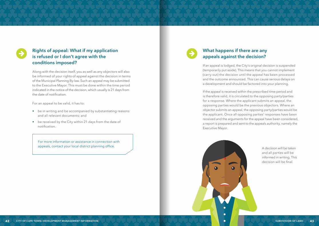
What happens if there are any appeals against the decision?
If an appeal is lodged, the City’s original decision is suspended (temporarily put aside). This means that you cannot implement (carry out) the decision until the appeal has been processed and the outcome announced. This can cause serious delays on a development and should be factored into your planning.
If the appeal is received within the prescribed time period and is therefore valid, it is circulated to the opposing party/parties for a response. Where the applicant submits an appeal, the opposing parties would be the previous objectors. Where an objector submits an appeal, the opposing party/parties would be the applicant. Once all opposing parties’ responses have been received and the arguments for the appeal have been considered, a report is prepared and sent to the appeals authority, namely the Executive Mayor.
A decision will be taken
and all parties will be informed in writing. This decision will be final.
4342 SUBDIVISION OF LANDCITY OF CAPE TOWN: DEVELOPMENT MANAGEMENT INFORMATION

What happens after a decision has been taken?
• Once any appeals have been resolved and the City has issued a final approval letter with an endorsed subdivision plan, your land surveyor will survey the parent property and will then prepare and submit either a survey diagram (for smaller applications) or a general plan (for subdivisions involving more than ten portions) to the Surveyor-General for approval. Remember, if you are dealing with a general plan, it will also have to reflect the approved street names for the development.
• After approval by the Surveyor-General, an electronic copy of the diagram or plan should be submitted to the GIS officer at your local district planning office, who will ensure that the new erven are captured on the City’s property database.
• You may now also prepare and submit infrastructure design plans to the City’s services (electricity, water, roads) departments for approval. On-site installation of services infrastructure can start as soon as the designs have been approved.
• If you were required to prepare and submit a site development plan as part of your application process, the details of the site development plan also need to be implemented at this stage. A site development plan may regulate the design of matters such as parking areas, landscaping, external finishes and materials.
For more information on site development plants, consult the relevant brochure in this series.
SITE DEVELOPMENT
PLAN
4544 SUBDIVISION OF LANDCITY OF CAPE TOWN: DEVELOPMENT MANAGEMENT INFORMATION
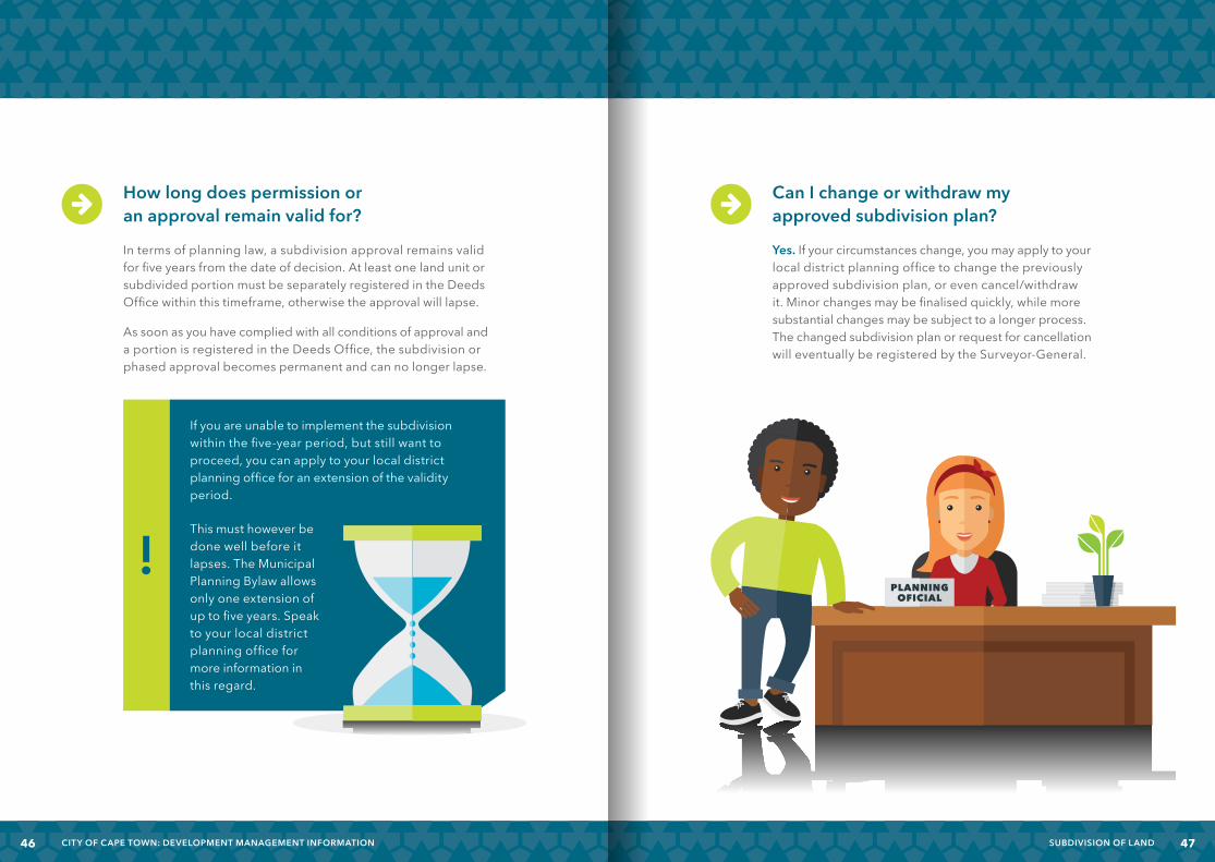
Can I change or withdraw my approved subdivision plan?
Yes. If your circumstances change, you may apply to your local district planning office to change the previously approved subdivision plan, or even cancel/withdraw it. Minor changes may be finalised quickly, while more substantial changes may be subject to a longer process. The changed subdivision plan or request for cancellation will eventually be registered by the Surveyor-General.
How long does permission or an approval remain valid for?
In terms of planning law, a subdivision approval remains valid for five years from the date of decision. At least one land unit or subdivided portion must be separately registered in the Deeds Office within this timeframe, otherwise the approval will lapse.
As soon as you have complied with all conditions of approval and a portion is registered in the Deeds Office, the subdivision or phased approval becomes permanent and can no longer lapse.
If you are unable to implement the subdivision within the five-year period, but still want to proceed, you can apply to your local district planning office for an extension of the validity period.
This must however be done well before it lapses. The Municipal Planning Bylaw allows only one extension of up to five years. Speak to your local district planning office for more information in this regard.
4746 SUBDIVISION OF LANDCITY OF CAPE TOWN: DEVELOPMENT MANAGEMENT INFORMATION
SUBDIVISION CONFIRMATION AND IMPLEMENTATION
Whatdoessubdivisionconfirmation mean, and when does it happen?
Subdivision confirmation is obtained by means of two certificates, namely a section 137 transfer certificate (or subdivision clearance certificate) and a rates clearance certificate.
• Once the contractors have completed the infrastructure works to the City’s standards, you or your conveyancing attorney may apply for subdivision clearance to the clearance officer at your local district planning office. This occurs on a separate form. Along with this form, you will need to submit written proof of compliance from all the respective City services departments involved, such as electricity, health, roads and water. If the planning office is satisfied with all these documents and happy that all other provisions have been met, your section 137 transfer certificate will be issued.
• Only once the section 137 transfer certificate has been issued, a separate rates clearance certificate can be issued by the City’s rates office, subject to their requirements.
With both these certificates in hand, your conveyancing attorney then applies to the Deeds Office to register the newly created units/erven and transfer them to their new owners. As soon as the first unit has been separately registered and transferred, the subdivision approval is ‘confirmed’ and becomes permanent.
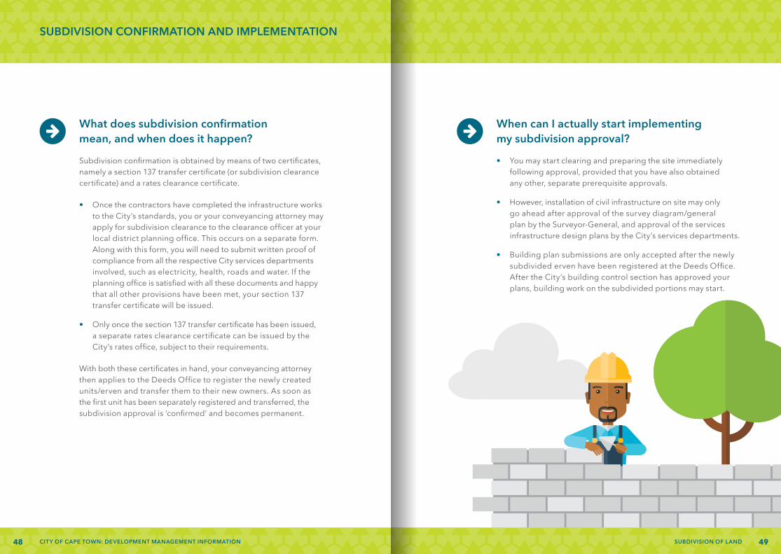
When can I actually start implementing my subdivision approval?
• You may start clearing and preparing the site immediately following approval, provided that you have also obtained any other, separate prerequisite approvals.
• However, installation of civil infrastructure on site may only go ahead after approval of the survey diagram/general plan by the Surveyor-General, and approval of the services infrastructure design plans by the City’s services departments.
• Building plan submissions are only accepted after the newly subdivided erven have been registered at the Deeds Office. After the City’s building control section has approved your plans, building work on the subdivided portions may start.
48 CITY OF CAPE TOWN: DEVELOPMENT MANAGEMENT INFORMATION 49SUBDIVISION OF LAND

CONTACT DETAILS
Helderberg District
Somerset West Administrative Building, cnr. Andries Pretorius and Victoria streets
Postal address: PO Box 19, Somerset West, 7129
Contact number: 021 444 4619
Mitchells Plain/Khayelitsha District
Stocks and Stocks Complex, Ntlazane Road, Ilitha Park, Khayelitsha
Postal address: Private Bag X93, Bellville, 7535
Contact number: 021 360 1101
Cape Flats District
Ledger House, cnr. Aden Avenue and George Street, Athlone
Postal address: PO Box 283, Athlone, 7760
Contact number: 021 684 4369
Southern District
Plumstead Administrative Building, cnr. Main and Victoria roads
Postal address: Private Bag X5, Plumstead, 7801
Contact number: 021 444 7721
Table Bay District
Media City Building, 2nd Floor, cnr. Adderley Street and Hertzog Boulevard, Cape Town
Postal address: PO Box 4529, Cape Town, 8000
Contact number: 021 400 6444
Blaauwberg District
Municipal Building, 87 Pienaar Road, Milnerton
Postal address: PO Box 35, Milnerton, 7435
Contact number: 021 444 0561
Northern District
Kraaifontein Administrative Building, Brighton Road
Postal address: PO Box 25, Kraaifontein, 7569
Contact number: 021 444 1062
Tygerberg District
Parow Administrative Building, cnr. Voortrekker Road and Tallent Street
Postal address: Private Bag X4, Parow, 7499
Contact number: 021 444 7843
For any further questions about land use management issues, contact your nearest development management office on the numbers provided below:
5150 SUBDIVISION OF LANDCITY OF CAPE TOWN: DEVELOPMENT MANAGEMENT INFORMATION

http://planning.capetown.gov.za