Developing Biophysical Products for Landsat · Developing Biophysical Products for Landsat Rama...
19
Developing Biophysical Products for Landsat Rama Nemani, Sangram Ganguly, Jennifer Dungan NASA Ames Research Center Landsat Science Team Meeting Sioux Falls, August 2011
Transcript of Developing Biophysical Products for Landsat · Developing Biophysical Products for Landsat Rama...
Developing Biophysical Products for Landsat
Rama Nemani, Sangram Ganguly, Jennifer Dungan NASA Ames Research Center
Landsat Science Team Meeting Sioux Falls, August 2011
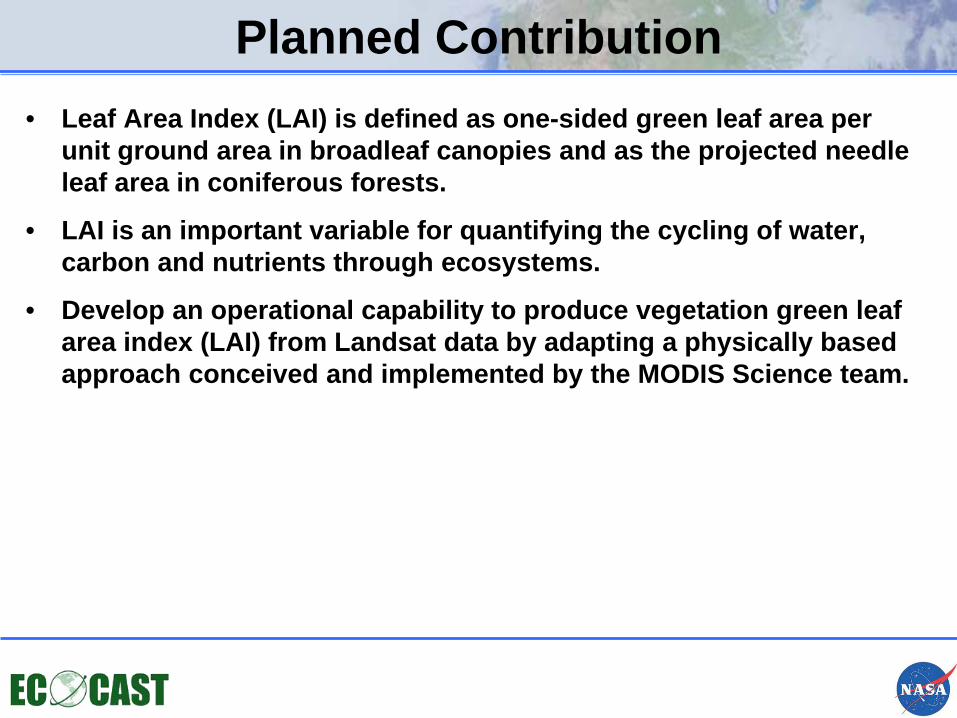
Planned Contribution • Leaf Area Index (LAI) is defined as one-sided green leaf area per
unit ground area in broadleaf canopies and as the projected needle leaf area in coniferous forests.
• LAI is an important variable for quantifying the cycling of water, carbon and nutrients through ecosystems.
• Develop an operational capability to produce vegetation green leaf area index (LAI) from Landsat data by adapting a physically based approach conceived and implemented by the MODIS Science team.
Motivation
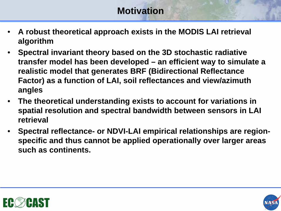
• A robust theoretical approach exists in the MODIS LAI retrieval algorithm
• Spectral invariant theory based on the 3D stochastic radiative transfer model has been developed – an efficient way to simulate a realistic model that generates BRF (Bidirectional Reflectance Factor) as a function of LAI, soil reflectances and view/azimuth angles
• The theoretical understanding exists to account for variations in spatial resolution and spectral bandwidth between sensors in LAI retrieval
• Spectral reflectance- or NDVI-LAI empirical relationships are region-specific and thus cannot be applied operationally over larger areas such as continents.
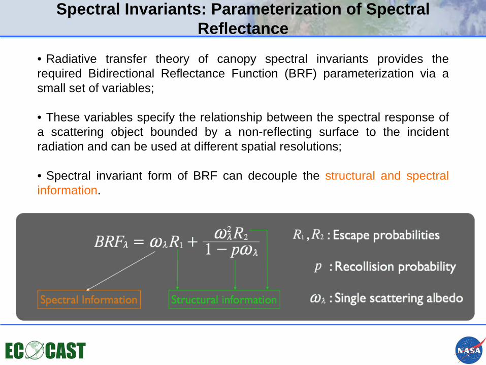
• Radiative transfer theory of canopy spectral invariants provides the required Bidirectional Reflectance Function (BRF) parameterization via a small set of variables;
• These variables specify the relationship between the spectral response of a scattering object bounded by a non-reflecting surface to the incident radiation and can be used at different spatial resolutions;
• Spectral invariant form of BRF can decouple the structural and spectral information.
Spectral Invariants: Parameterization of Spectral Reflectance
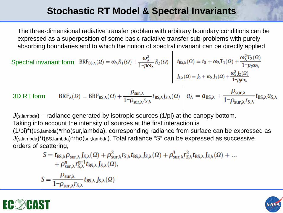
Stochastic RT Model & Spectral Invariants
The three-dimensional radiative transfer problem with arbitrary boundary conditions can be expressed as a superposition of some basic radiative transfer sub-problems with purely absorbing boundaries and to which the notion of spectral invariant can be directly applied
J(s,lambda) – radiance generated by isotropic sources (1/pi) at the canopy bottom. Taking into account the intensity of sources at the first interaction is (1/pi)*t(BS,lambda)*rho(sur,lambda), corresponding radiance from surface can be expressed as J(s,lambda)*t(BS,lambda)*rho(sur,lambda). Total radiance “S” can be expressed as successive orders of scattering,
Spectral invariant form
3D RT form
Surface Reflectances Process
• The 2005 Global Land Survey (GLS) dataset was obtained from EDC DAAC
• GLS scenes were processed using LEDAPS from GSFC for radiometric calibration and atmospheric corrections to obtain surface reflectances
• MODIS Collection 5 (MCD43A4) NBAR surface reflectance product utilized for testing reflectance consistency
• 30-m NLCD landcover map is also used as input to LAI estimation
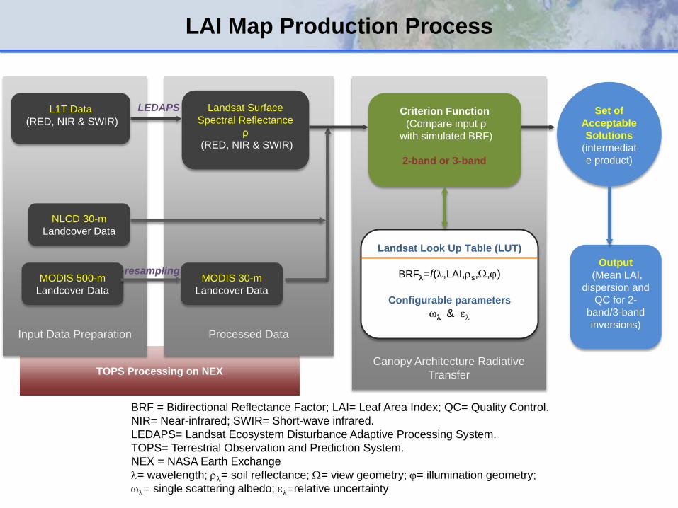
TOPS Processing on NEX
Canopy Architecture Radiative
Transfer
I
Input Data Preparation
Processed Data
L1T Data (RED, NIR & SWIR)
NLCD 30-m Landcover Data
MODIS 500-m Landcover Data
Landsat Surface Spectral Reflectance
ρ (RED, NIR & SWIR)
MODIS 30-m Landcover Data
LEDAPS
Landsat Look Up Table (LUT)
BRFλ=f(λ,LAI,ρs,Ω,ϕ)
Configurable parameters ωλ & ελ
Criterion Function (Compare input ρ
with simulated BRF) 2-band or 3-band
Output (Mean LAI,
dispersion and QC for 2-
band/3-band inversions)
Set of Acceptable Solutions
(intermediate product)
BRF = Bidirectional Reflectance Factor; LAI= Leaf Area Index; QC= Quality Control. NIR= Near-infrared; SWIR= Short-wave infrared. LEDAPS= Landsat Ecosystem Disturbance Adaptive Processing System. TOPS= Terrestrial Observation and Prediction System. NEX = NASA Earth Exchange λ= wavelength; ρλ= soil reflectance; Ω= view geometry; ϕ= illumination geometry; ωλ= single scattering albedo; ελ=relative uncertainty
LAI Map Production Process
resampling
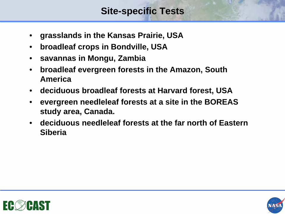
Site-specific Tests
• grasslands in the Kansas Prairie, USA • broadleaf crops in Bondville, USA • savannas in Mongu, Zambia • broadleaf evergreen forests in the Amazon, South
America • deciduous broadleaf forests at Harvard forest, USA • evergreen needleleaf forests at a site in the BOREAS
study area, Canada. • deciduous needleleaf forests at the far north of Eastern
Siberia
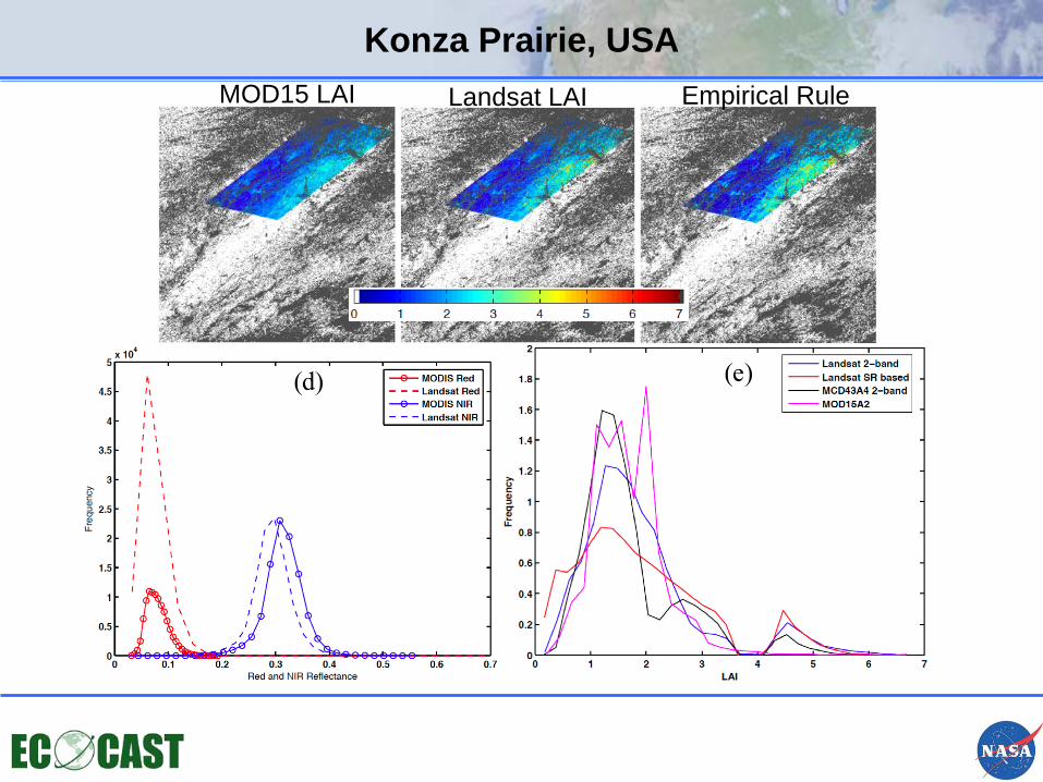
Konza Prairie, USA MOD15 LAI Landsat LAI Empirical Rule
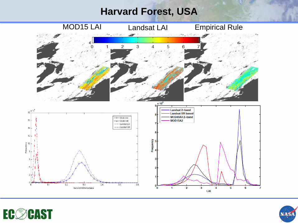
Harvard Forest, USA MOD15 LAI Landsat LAI Empirical Rule
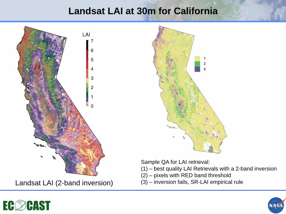
Landsat LAI at 30m for California
Landsat LAI (2-band inversion)
Sample QA for LAI retrieval: (1) – best quality LAI Retrievals with a 2-band inversion (2) – pixels with RED band threshold (3) – inversion fails, SR-LAI empirical rule
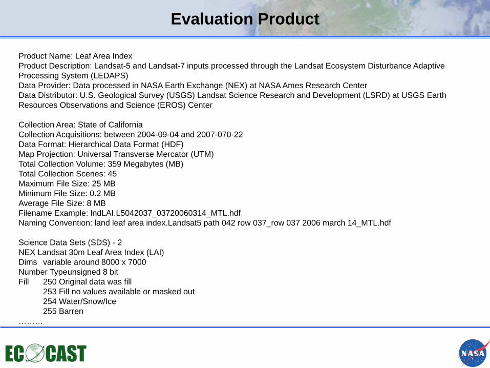
Evaluation Product
Product Name: Leaf Area Index Product Description: Landsat-5 and Landsat-7 inputs processed through the Landsat Ecosystem Disturbance Adaptive Processing System (LEDAPS) Data Provider: Data processed in NASA Earth Exchange (NEX) at NASA Ames Research Center Data Distributor: U.S. Geological Survey (USGS) Landsat Science Research and Development (LSRD) at USGS Earth Resources Observations and Science (EROS) Center Collection Area: State of California Collection Acquisitions: between 2004-09-04 and 2007-070-22 Data Format: Hierarchical Data Format (HDF) Map Projection: Universal Transverse Mercator (UTM) Total Collection Volume: 359 Megabytes (MB) Total Collection Scenes: 45 Maximum File Size: 25 MB Minimum File Size: 0.2 MB Average File Size: 8 MB Filename Example: lndLAI.L5042037_03720060314_MTL.hdf Naming Convention: land leaf area index.Landsat5 path 042 row 037_row 037 2006 march 14_MTL.hdf Science Data Sets (SDS) - 2 NEX Landsat 30m Leaf Area Index (LAI) Dims variable around 8000 x 7000 Number Type unsigned 8 bit Fill 250 Original data was fill 253 Fill no values available or masked out 254 Water/Snow/Ice 255 Barren ………
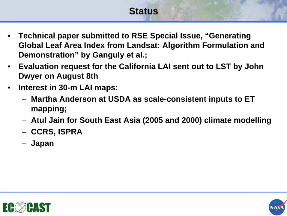
Status
• Technical paper submitted to RSE Special Issue, “Generating Global Leaf Area Index from Landsat: Algorithm Formulation and Demonstration” by Ganguly et al.;
• Evaluation request for the California LAI sent out to LST by John Dwyer on August 8th
• Interest in 30-m LAI maps: – Martha Anderson at USDA as scale-consistent inputs to ET
mapping; – Atul Jain for South East Asia (2005 and 2000) climate modelling – CCRS, ISPRA – Japan
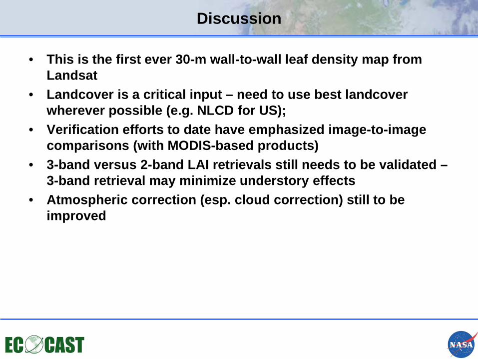
Discussion
• This is the first ever 30-m wall-to-wall leaf density map from Landsat
• Landcover is a critical input – need to use best landcover wherever possible (e.g. NLCD for US);
• Verification efforts to date have emphasized image-to-image comparisons (with MODIS-based products)
• 3-band versus 2-band LAI retrievals still needs to be validated – 3-band retrieval may minimize understory effects
• Atmospheric correction (esp. cloud correction) still to be improved
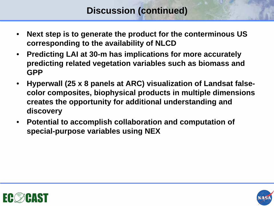
Discussion (continued)
• Next step is to generate the product for the conterminous US corresponding to the availability of NLCD
• Predicting LAI at 30-m has implications for more accurately predicting related vegetation variables such as biomass and GPP
• Hyperwall (25 x 8 panels at ARC) visualization of Landsat false- color composites, biophysical products in multiple dimensions creates the opportunity for additional understanding and discovery
• Potential to accomplish collaboration and computation of special-purpose variables using NEX
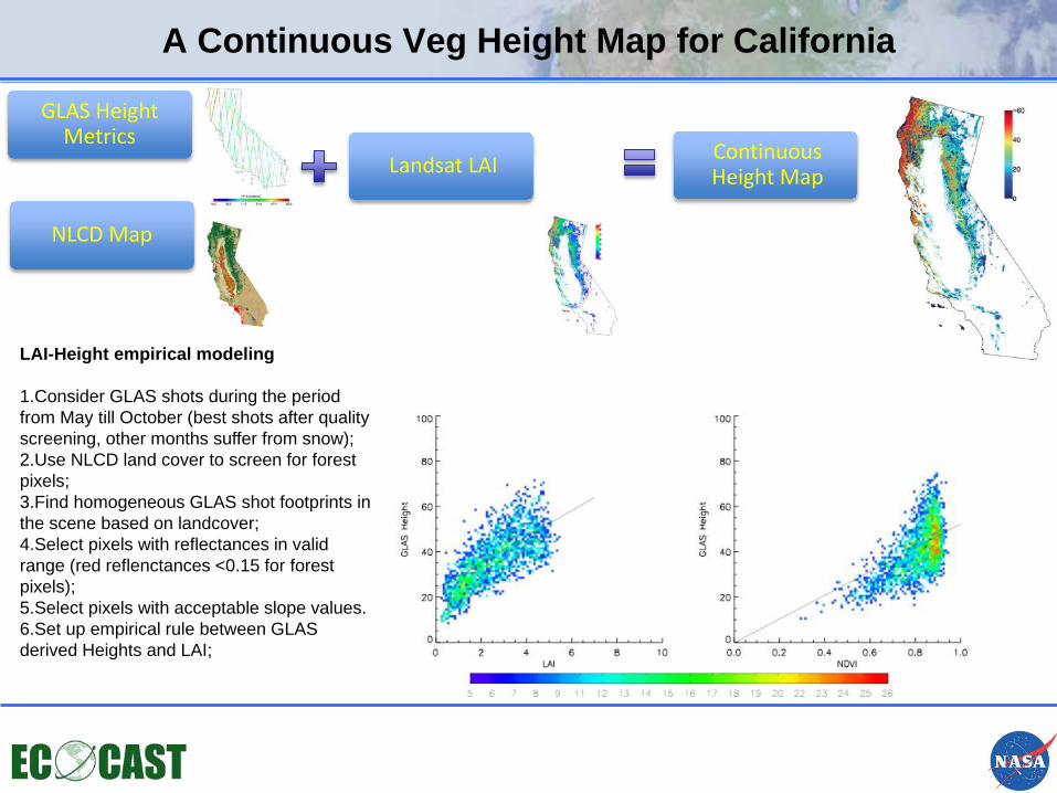
A Continuous Veg Height Map for California
GLAS Height Metrics
Landsat LAI Continuous Height Map
LAI-Height empirical modeling 1.Consider GLAS shots during the period from May till October (best shots after quality screening, other months suffer from snow); 2.Use NLCD land cover to screen for forest pixels; 3.Find homogeneous GLAS shot footprints in the scene based on landcover; 4.Select pixels with reflectances in valid range (red reflenctances <0.15 for forest pixels); 5.Select pixels with acceptable slope values. 6.Set up empirical rule between GLAS derived Heights and LAI;
NLCD Map
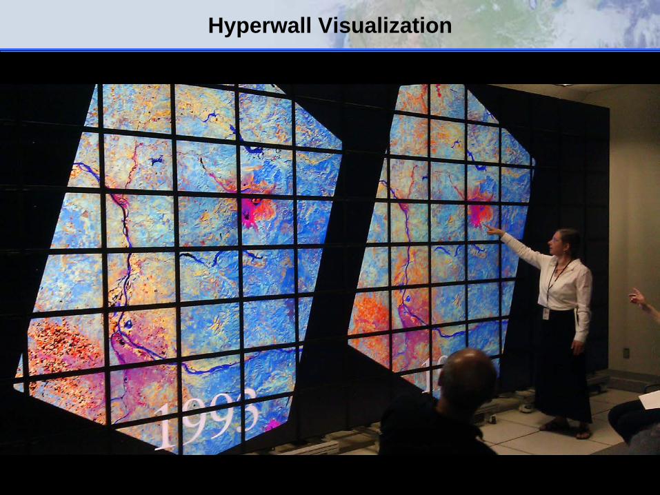
Hyperwall Visualization
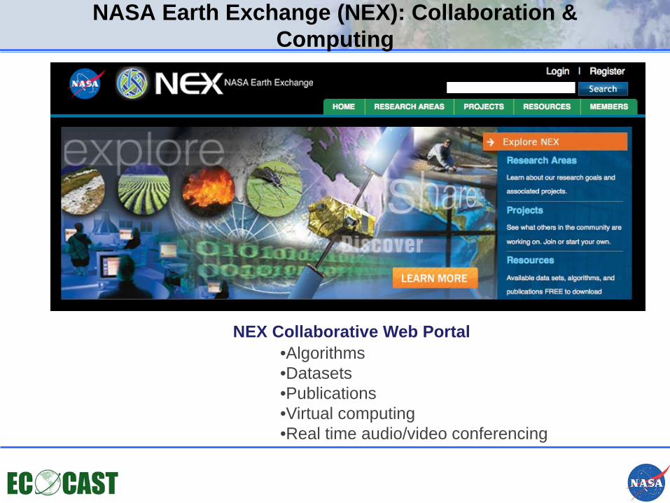
NASA Earth Exchange (NEX): Collaboration & Computing
NEX Collaborative Web Portal •Algorithms •Datasets •Publications •Virtual computing •Real time audio/video conferencing
Thank you!