Developing a Climate and Water Database for the Arab Regioncss.escwa.org.lb/SDPD/3431/ps7-2.pdf ·...
20
Wael Seif ACSAD RICCAR- EGM 6 th Meeting 7-8/12/2014 Developing a Climate and Water Database for the Arab Region
Transcript of Developing a Climate and Water Database for the Arab Regioncss.escwa.org.lb/SDPD/3431/ps7-2.pdf ·...
Wael Seif
ACSAD
RICCAR- EGM 6th Meeting 7-8/12/2014
Developing a Climate and Water
Database for the Arab Region
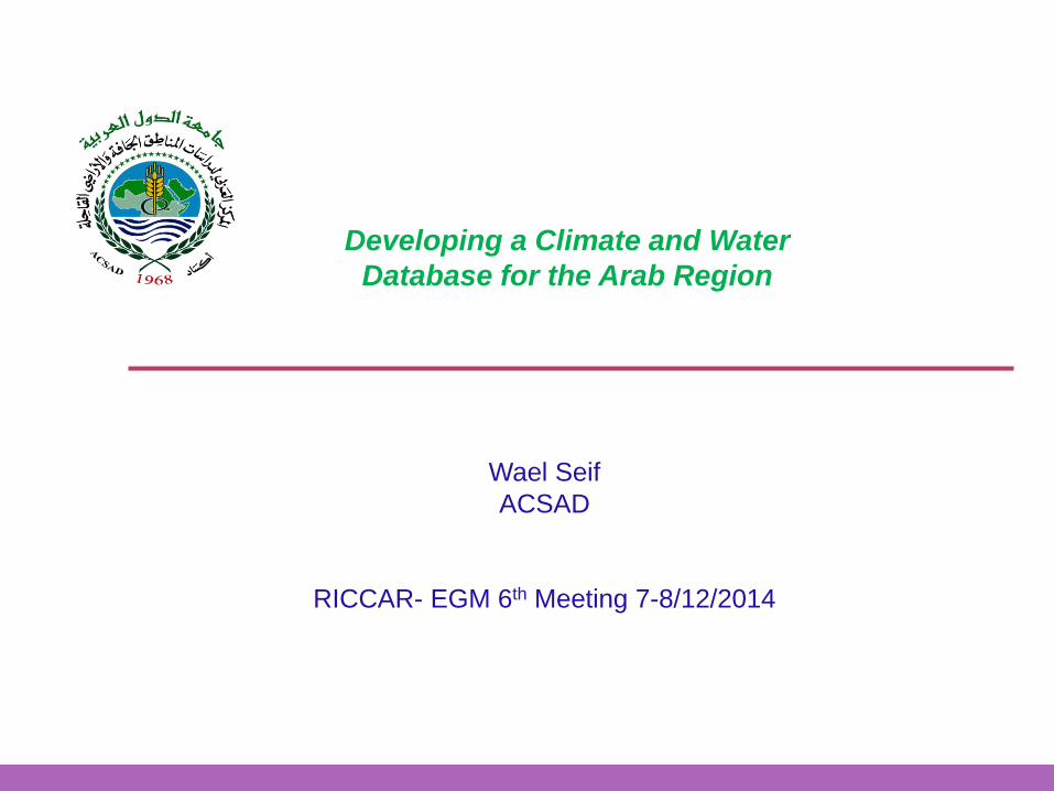
Data Data Processing
Information Generated by different Tools: GIS, Models, Etc
Decision Making Better Water Management
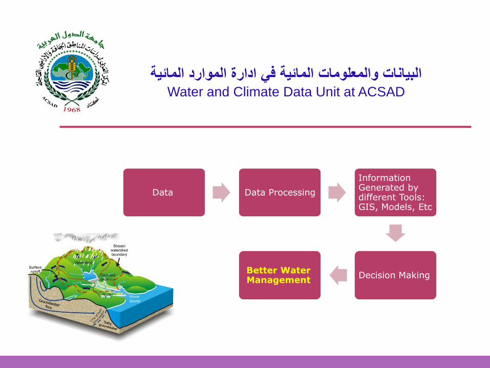
البيانات والمعلومات المائية في ادارة الموارد المائيةWater and Climate Data Unit at ACSAD
البيانات والمعلومات المائية في ادارة الموارد المائيةWater and Climate Data Unit at ACSAD
Data
•Climate data: Precipitation, Temperature, etc.
•Hydrological data
•Topographic data
•Soil data
•etc
Processing
• Database
• Data analysis
Information
Tools
for generating information and for supporting decision makers
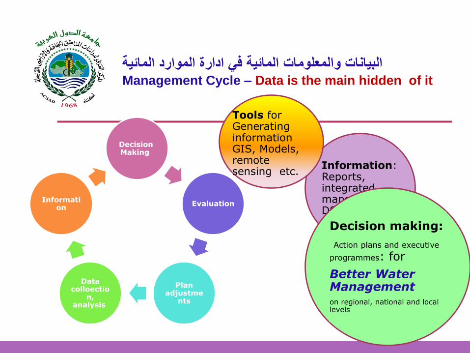
البيانات والمعلومات المائية في ادارة الموارد المائيةManagement Cycle – Data is the main hidden of it
Decision Making
Evaluation
Plan adjustme
nts
Data colloectio
n, analysis
Information
Information: Reports, integrated maps and DSS platform
Decision making:
Action plans and executive
programmes: for
Better Water Management on regional, national and local levels
Tools for Generating information GIS, Models, remote sensing etc.
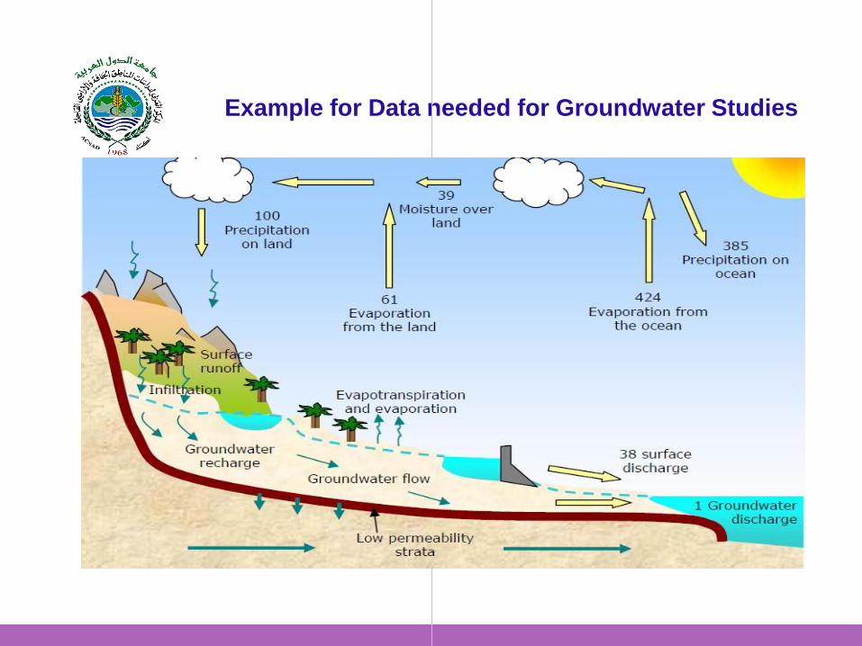
Example for Data needed for Groundwater Studies

A Groundwater Model:
1. Is a toll that translates the natural System into physical System
2. It uses physical laws to represent the system and mathematics to solve the equations represent the system
Accuracy is still a matter of discussion Calibration: observed data is needed
Example: Groundwater Modelling
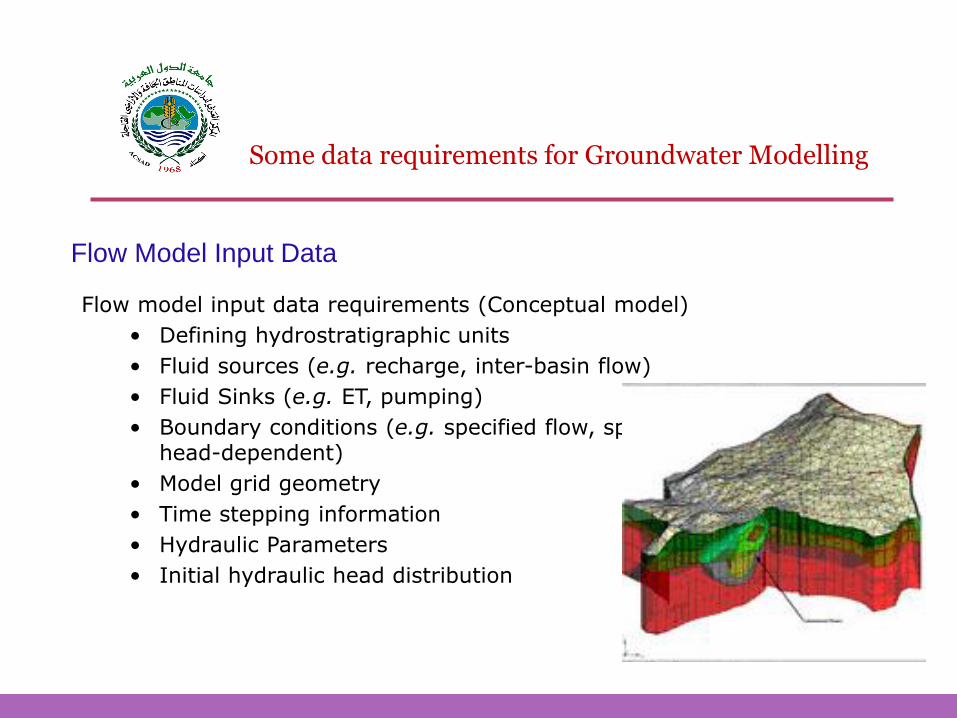
Flow Model Input Data
Flow model input data requirements (Conceptual model)
• Defining hydrostratigraphic units
• Fluid sources (e.g. recharge, inter-basin flow)
• Fluid Sinks (e.g. ET, pumping)
• Boundary conditions (e.g. specified flow, specified head, head-dependent)
• Model grid geometry
• Time stepping information
• Hydraulic Parameters
• Initial hydraulic head distribution
Some data requirements for Groundwater Modelling
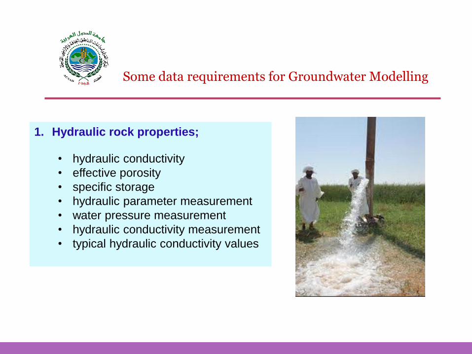
1. Hydraulic rock properties;
• hydraulic conductivity
• effective porosity
• specific storage
• hydraulic parameter measurement
• water pressure measurement
• hydraulic conductivity measurement
• typical hydraulic conductivity values
Some data requirements for Groundwater Modelling
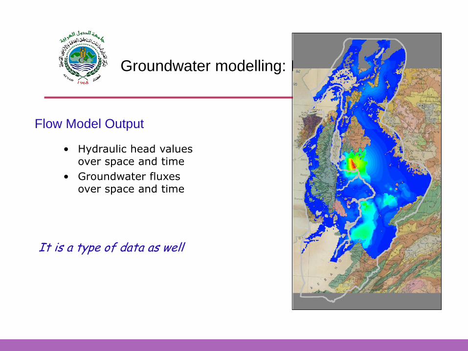
Flow Model Output
Groundwater modelling: Basics and equations
• Hydraulic head values over space and time
• Groundwater fluxes over space and time
It is a type of data as well
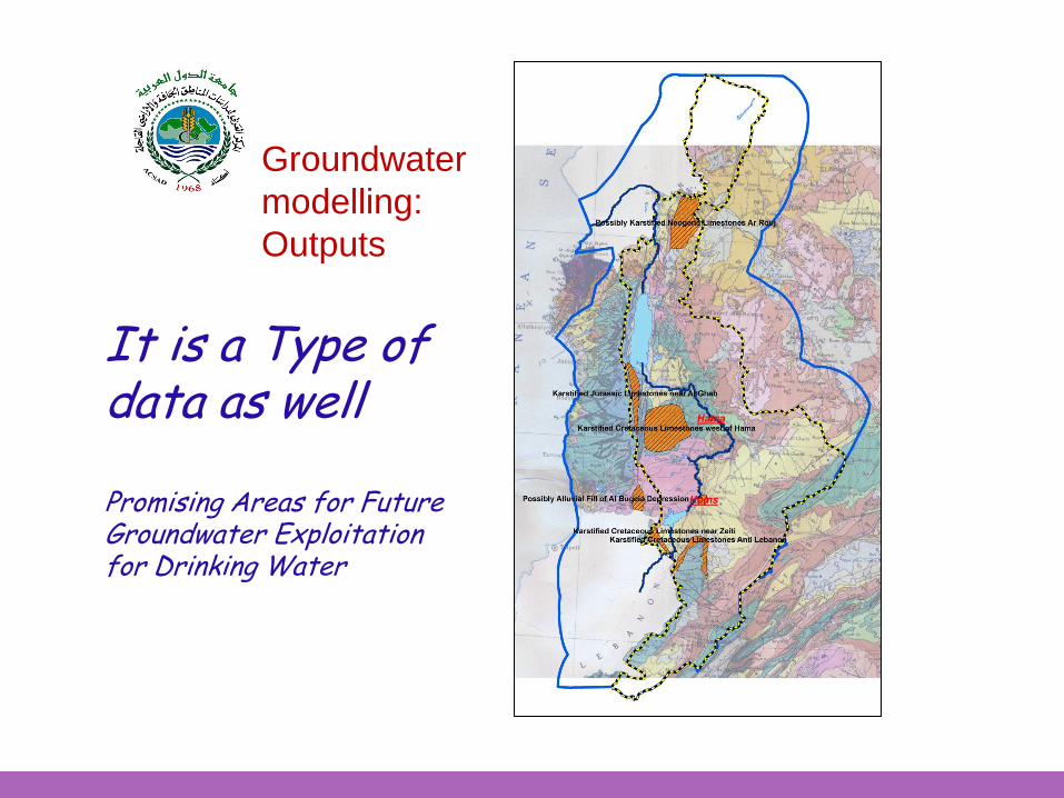
It is a Type of data as well Promising Areas for Future Groundwater Exploitation for Drinking Water
Groundwater
modelling:
Outputs

WEAP MODFLOW
Coupling Modflow with
WEAP
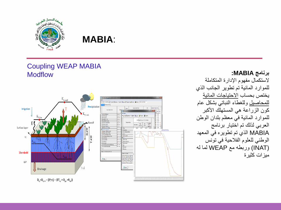
MABIA:برنامج
الستكمال مفهوم اإلدارة المتكاملة
للموارد المائة تم تطور الجانب الذي
االحتاجات المائة ختص بحساب
وللغطاء النبات بشكل عام للمحاصل
كون الزراعة ه المستهلك األكبر
للموارد المائة ف معظم بلدان الوطن
العرب لذلك تم اختار برنامج
MABIA الذي تم تطوره ف المعهد
الوطن للعلوم الفالحة ف تونس
(INAT ) وربطه معWEAP لما له
مزات كثرة
MABIA:
Coupling WEAP MABIA
Modflow
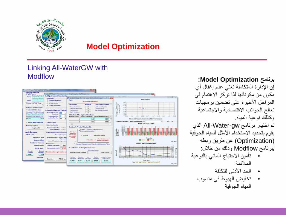
Model Optimization
:Model Optimizationبرنامج
إن اإلدارة المتكاملة تعن عدم إغفال أي
مكون من مكوناتها لذا تركز االهتمام ف
المراحل األخرة على تضمن برمجات
تعالج الجوانب االقتصادة واالجتماعة
.وكذلك نوعة الماه
الذي All-Water-gwتم اختار برنامج
قوم بتحدد االستخدام األمثل للماه الجوفة
(Optimization ) عن طرق ربطه
:وذلك من خالل Modflowببرنامج
تأمن االحتاج المائ بالنوعة •
المالئمة
الحد األدنى للتكلفة•
تخفض الهبوط ف منسوب •
الماه الجوفة
Linking All-WaterGW with
Modflow
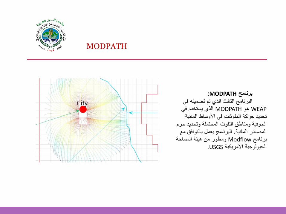
MODPATH
:MODPATH برنامج
البرنامج الثالث الذي تم تضمنه ف
WEAP هوMODPATH ستخدم ف الذي
تحدد حركة الملوثات ف األوساط المائة
الجوفة ومناطق التلوث المحتملة وتحدد حرم
البرنامج عمل بالتوافق مع . المصادر المائة
ومطور من هئة المساحة Modflowبرنامج
.USGSالجولوجة األمركة
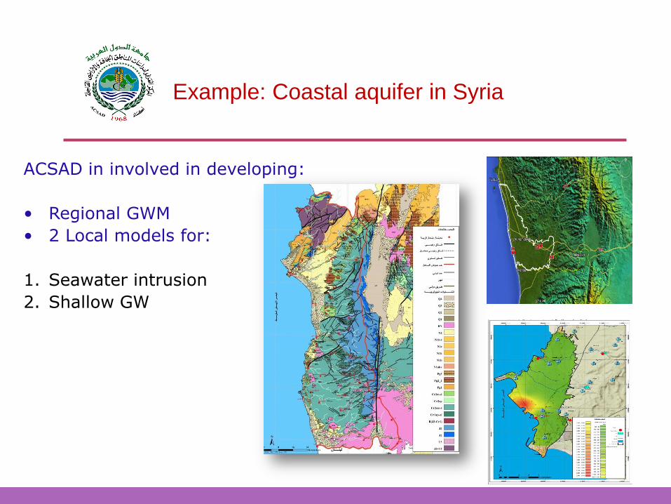
ACSAD in involved in developing:
• Regional GWM
• 2 Local models for:
1. Seawater intrusion
2. Shallow GW
Example: Coastal aquifer in Syria
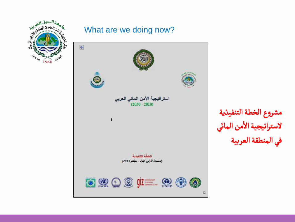
الخطة التنفيذية مشروع من المائي
أالستراتيجية اال
العربيةفي المنطقة
What are we doing now?
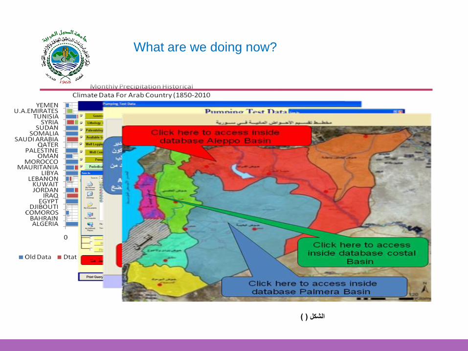
What are we doing now?
) (الشكل
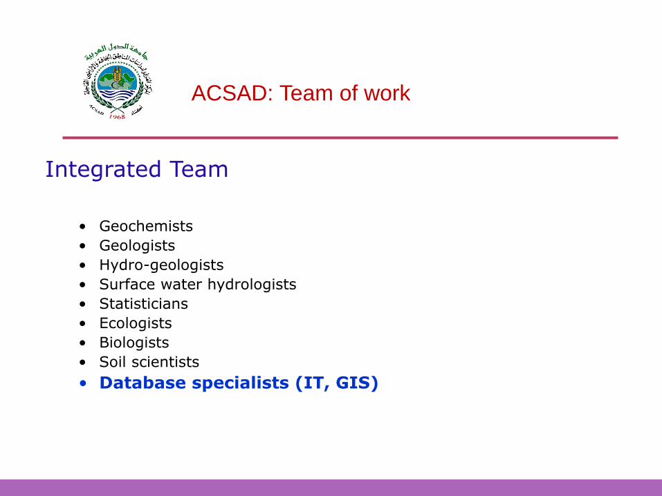
ACSAD: Team of work
• Geochemists
• Geologists
• Hydro-geologists
• Surface water hydrologists
• Statisticians
• Ecologists
• Biologists
• Soil scientists
• Database specialists (IT, GIS)
Integrated Team
ACSAD, W. Seif Cairo 7-8 /12/2014
Thank you for your Attention