Data Management Integrative End-To-End From Sensor to GIS · Data Management Integrative End-To-End...
26
the reliable factor in information technology Data Management Integrative End-To-End Geodata Collection: From Sensor to GIS Dr. Rinaldo Wurglitsch Solution Development Manger
Transcript of Data Management Integrative End-To-End From Sensor to GIS · Data Management Integrative End-To-End...

the reliable factor in information technology
Data Management
Integrative End-To-End Geodata Collection: From Sensor to GISDr. Rinaldo WurglitschSolution Development Manger
the reliable factor in information technology
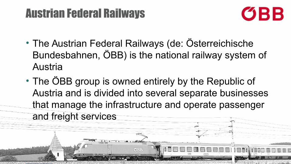
Austrian Federal Railways
• The Austrian Federal Railways (de: Österreichische Bundesbahnen, ÖBB) is the national railway system of Austria
• The ÖBB group is owned entirely by the Republic of Austria and is divided into several separate businesses that manage the infrastructure and operate passenger and freight services

the reliable factor in information technology
Austrian Federal Railways - Statistics
Source: ÖBB Annual Report
• carried 464 million passengers
• ~ 5,700 km (~ 3,500 route miles)
• 10,780 km of track
• 1,230 locomotives
• 3,136 passenger vehicles
• employed 42,893
ÖBB Infrastructure Corp.
• employed 17,612 staff

the reliable factor in information technology
Project Vision
RLS
ALS
TLS
from LiDAR Mission
(Light Detection And Ranging)
to Linear Asset Management
MLS
End-To-End LiDAR Data Processing
for Linear Assets
the reliable factor in information technology
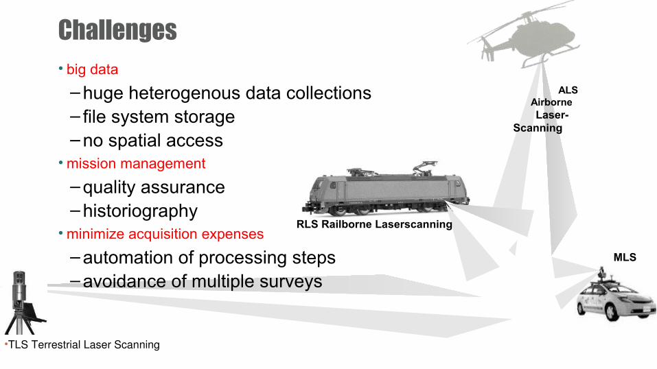
Challenges• big data
– huge heterogenous data collections– file system storage– no spatial access
• mission management
– quality assurance– historiography
• minimize acquisition expenses
– automation of processing steps– avoidance of multiple surveys
RLS Railborne Laserscanning
ALS Airborne Laser-
Scanning
•TLS Terrestrial Laser Scanning
MLS
the reliable factor in information technology
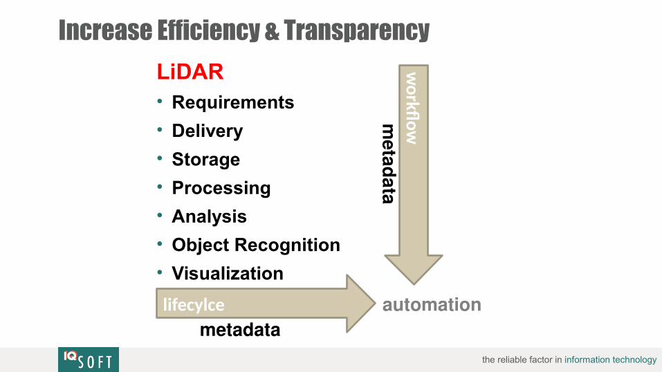
Increase Efficiency & Transparency
LiDAR• Requirements
• Delivery
• Storage
• Processing
• Analysis
• Object Recognition
• Visualizationw
orkfo wmetad ata
lifecylcemetadata
automation

the reliable factor in information technology
geostoregeostore
Making Available …
OptionalYour logo
Here(Remove Red Box)
resultsresults
3D visualization
GIS objects
mission data
data acquisitiondata acquisition
• Digital Aerial Images
• Digital Orthophotos• Pointclouds• Trajectories• Digital Terrain
Models• Mission Report• …
AutomaticProcessing• CSW catalog• Object Recognition• Pointcloud
Extraction• …

the reliable factor in information technology
Process Flow
requirementsdefinition
datacollection
data storage& preparation
result calculation
data delivery
Quality Managementdriven by metadata
• user request• process flow• handover results

the reliable factor in information technology
Requirements Definition
requirements definitionrequirements definition data collectiondata collection data storingdata storing result calculationresult calculation data deliverydata delivery
Define ISO conform Metadata
Requirements Definition Template
ISO 19115 "Geoinformation – Metadaten"

the reliable factor in information technology
geostoregeostore
Geodata & Metadata Store
Metadata StoreMetadata Store
BLOB
Geodata Store
BLOB
CSWCatalog-Service
Up/Download
Service
• Digital Aerial Images• Digital Orthophotos• Pointclouds• Trajectories• Digital Terrain Models• Mission Report• …
requirements definitionrequirements definition data collectiondata collection data storingdata storing result calculationresult calculation data deliverydata delivery

the reliable factor in information technology
CSW Catalog Integration within GIS
• Searching CSW and • download from geodata storerequirements definitionrequirements definition data collectiondata collection data storingdata storing result calculationresult calculation data deliverydata delivery

the reliable factor in information technology
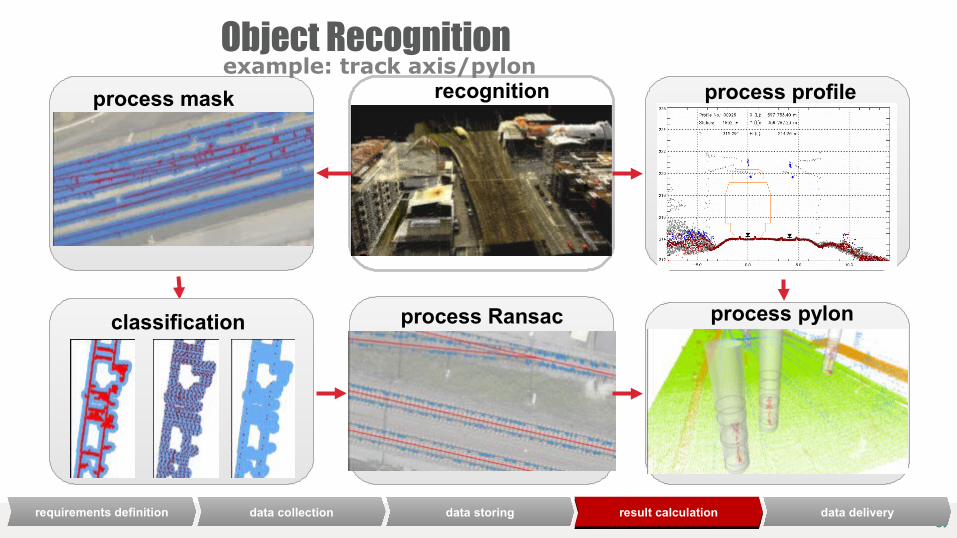
Object Recognition
• remote sensing delivers railway corridor recordings
• automated processing with innovative methods of object recognitionis applied to
automated processing
requirements definitionrequirements definition data collectiondata collection data storingdata storing result calculationresult calculation data deliverydata delivery
the reliable factor in information technologyrequirements definitionrequirements definition data collectiondata collection data storingdata storing result calculationresult calculation data deliverydata delivery
Object Recognitionprocess mask process profile
classification process Ransac process pylon
recognitionexample: track axis/pylon
the reliable factor in information technology

the reliable factor in information technology
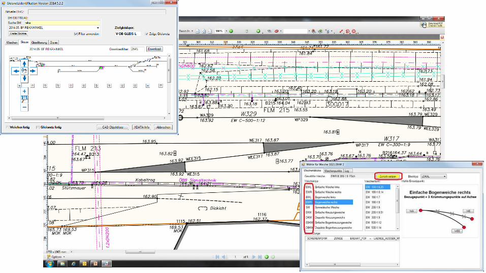
Integration with existing datae.g: railway track
inventorygeodata
Object: track
extraction & recognition
fusion
geodetic site plans
pointclouds
orthophotosassets
buildingsObject A: trackresiding in
rail geometry db
Object B: trackresult from recognition
Object C: trackextracted from
geodetic site plans
metadata A metadata B metadata C
track geometry
„One Truth“„Golden Record“
requirements definitionrequirements definition data collectiondata collection data storingdata storing result calculationresult calculation data deliverydata delivery
the reliable factor in information technology
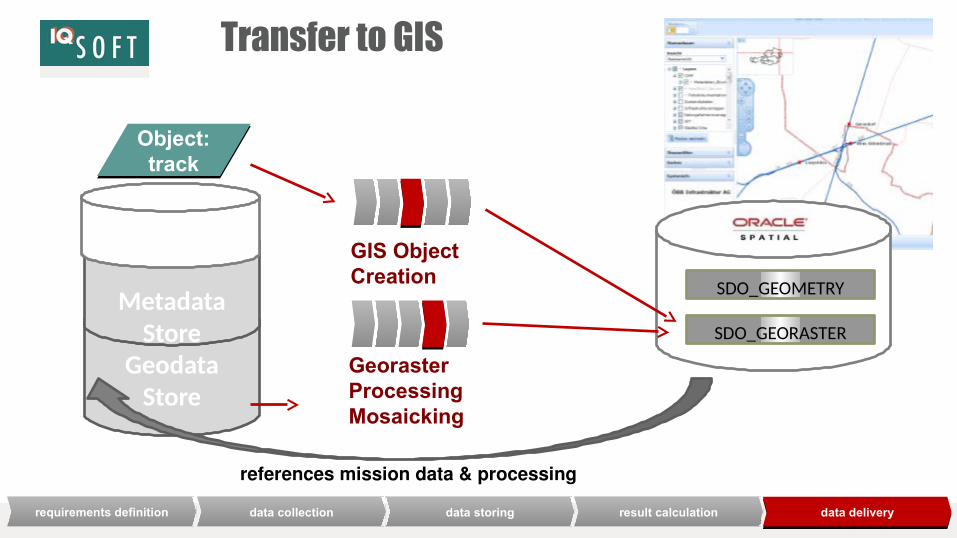
Transfer to GIS
GeodataStore
Metadata Store
Object: track
Georaster ProcessingMosaicking
GIS ObjectCreation
SDO_GEORASTER
SDO_GEOMETRY
references mission data & processing
requirements definitionrequirements definition data collectiondata collection data storingdata storing result calculationresult calculation data deliverydata delivery
the reliable factor in information technology

the reliable factor in information technology
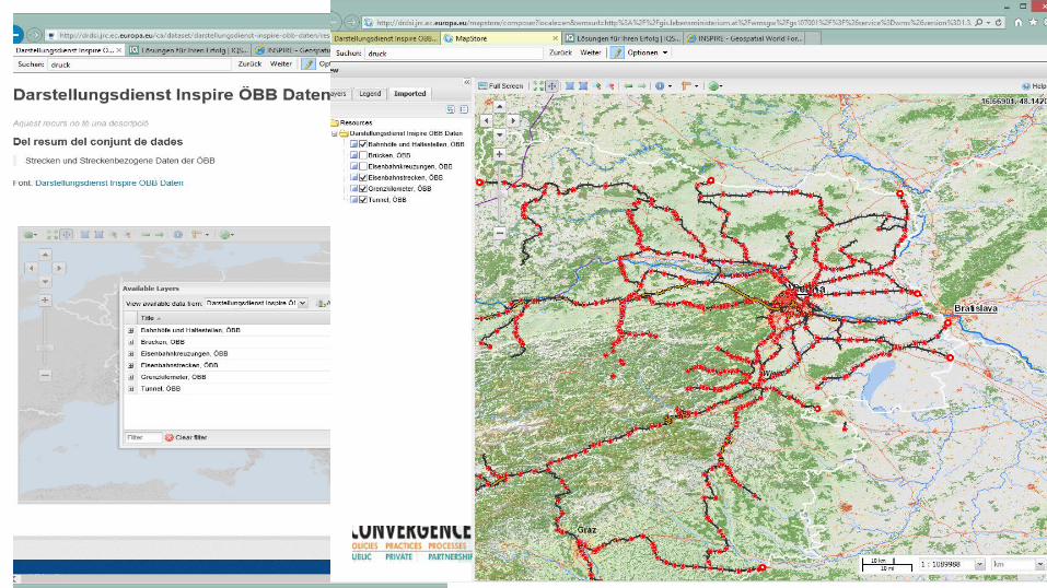
Interactive 3D Visualization System
3D Viewer
• Seamless Navigation• Absolute Coordinate System• Vector Data and Label Integration
GeodataStore
Metadata Store
Object: track
requirements definitionrequirements definition data collectiondata collection data storingdata storing result calculationresult calculation data deliverydata delivery
Lösungen für Ihren Erfolg
IQSOFT - Gesellschaft für Informationstechnologie m.b.H.
Linea AssetPointcloud Streaming
vector data
WebGLDirectX
Pointcloud Streaming
geoJSON…
Scene, Viewframe, 3d Themes, Animation

the reliable factor in information technology

the reliable factor in information technology
GUI GIS
geodata suite : solution overviewgeodata suite : loader
metadata collection
CSW
geodata metadata
content check
CAD … … …
pre-processing (extent extraction, …)
technical check
geodata suite : store
pointcloud store
...
GIS store
mosaic store
layer store
search and download
Administrationsystem-management
geodata suite : deliverygeodata suite: processor
WPS
mosaic creation
GIS layer creation
pointcloud creation
object recognition
..…
DTM georaster creation
coloring pointcloud
generating pointcloud Level of details
point-cloud
stream
WMS
WFS

the reliable factor in information technology
Oracle Spatial
Oracle Spatial Objects in use:
• Oracle Pointcloud
• Oracle Mosaic
• SDO Geometry
• SDO Georaster
• Custom Coordinate Systems
Statistics per 100 km:
number of points1,7 Mio. points
storage on filesystem~ 750 GB
storage in geostore~ 400 GB
storage of Oracle Spatial objects SDO_ PC & Georaster ~ 400 GB
resolution of raster5 cm
density of points15 points per m²

the reliable factor in information technology

the reliable factor in information technology

the reliable factor in information technology
Summay
• Optimize railway planning, construction and maintenance
• Stores and processes more than 8 billion points of objects along railway tracks
• Enables LiDAR data to be viewed with existing infrastructure vector data
• Provides comprehensive metadata about railway tracks trough CSW
• Delivers data through open services

the reliable factor in information technologyw w w. i q s o f t . a t
AQ&

the reliable factor in information technology
OVERVIEW
• The Austrian Federal Railways (German: Österreichische Bundesbahnen, ÖBB) is the national railway system of Austria
• The ÖBB group is owned entirely by the Republic of Austria and is divided into several separate businesses that manage the infrastructure and operate passenger and freight services
CHALLENGES / OPPORTUNITIES• big data: huge heterogenous data collections, file system
storage, no spatial access• mission management: quality assurance, historiography• minimize acquisition expenses: automation of processing
steps, avoidance of multiple surveys
SOLUTIONS• Oracle Database 12c Enterprise Edition
• Spatial Option with Pointcloud and GeoRaster,• Oracle Fusion Middleware 11.1.1.7
• MapViewer
RESULTS• Direct and uniform access to pointcloud data• Lowering costs of geodata usage by service access• Consolidation of raster, vector and pointcloud data in a
central repository• Increase of quality using metadata• Lowering process costs using homogenous processes
Austrian Federal Railwaysinfra:geodata