
Data Management and Operations Division
58
ESO, Karl-Schwarzschild-Str. 2, 85748 Garching bei München, Germany Data Management and Operations Division Phase 3 User Documentation ESO External Data Products Standard Doc. No.: GEN-SPE-ESO-33000-5335 Issue: 3 Date: 22/05/2012 Prepared: J. Retzlaff Name Date Signature Approved: M. Arnaboldi Name Date Signature Released: F. Comerón Name Date Signature European Organisation for Astronomical Research in the Southern Hemisphere Organisation Européenne pour des Recherches Astronomiques dans l’Hémisphère Austral Europäische Organisation für astronomische Forschung in der südlichen Hemisphäre
Transcript of Data Management and Operations Division

ESO, Karl-Schwarzschild-Str. 2, 85748 Garching bei München, Germany
Data Management and Operations Division
Phase 3 User Documentation
ESO External Data Products Standard
Doc. No.: GEN-SPE-ESO-33000-5335
Issue: 3
Date: 22/05/2012
Prepared: J. Retzlaff Name Date Signature Approved: M. Arnaboldi Name Date Signature Released: F. Comerón Name Date Signature
European Organisation for Astronomical Research in the Southern Hemisphere
Organisation Européenne pour des Recherches Astronomiques dans l’Hémisphère Austral
Europäische Organisation für astronomische Forschung in der südlichen Hemisphäre

ESO External Data Products
Standard
Doc: Issue Date Page
GEN-SPE-ESO-33000-5335 3 22/05/2012 2 of 58
ESO, Karl-Schwarzschild-Str. 2, 85748 Garching bei München, Germany
CHANGE RECORD
ISSUE DATE SECTION/PARA. AFFECTED
REASON/INITIATION DOCUMENTS/REMARKS
1 27.11.2010 All EDP standard initialised to support the ESO Public Surveys Phase 3 Workshop, ESO Garching, 30.11.2010.
2 07.03.2011 2.1 Keyword ASSOMi added. 3.2.1, 3.2.2 NJITTER, DIT, NDIT changed to
optional for the VISTA deep tile and deep pawprint image.
3.2.3 List of header keywords refers to the VISTA deep stripes image (added to caption).
3.2.4 Mandatory keyword PHOTSYS added for source lists.
2.8 Optional keywords added to describe the sky coverage in terms of footprint coordinates.
3.2.5
Data format definition for multi-band source lists added.
3 Subsections restructured. 3 22/05/2012 All Document re-structured in view of
additional format standards for catalogues, VST imaging, spectra. VISTA/VIRCAM, started previously in §3.8.1, now §3.2
1.3 Recommendation added to avoid adding new HIERARCH keywords.
2.1 Convention for multi-valued PROG_ID keyword added
2.4, 3 Requirements for processing provenance detailed/expanded.
3 RA, DEC keywords required. 3.1 Added. 3.2.1 Comment for PHOTZP given in the
header example for the VISTA tile image corrected.
4 Added. Appendix A Added.

ESO External Data Products
Standard
Doc: Issue Date Page
GEN-SPE-ESO-33000-5335 3 22/05/2012 3 of 58
ESO, Karl-Schwarzschild-Str. 2, 85748 Garching bei München, Germany
TABLE OF CONTENTS Purpose and Scope ................................................................................................................................. 5 List of Applicable Documents .................................................................................................................. 5 List of Reference Documents .................................................................................................................. 5 Overview .................................................................................................................................................. 6 1 General requirements ....................................................................................................................... 6
1.1 FITS data format ........................................................................................................................ 6 1.2 Filenames .................................................................................................................................. 7 1.3 Propagation of original keywords ............................................................................................... 7
2 Keywords for External Data Products ............................................................................................... 8 2.1 Primary EDP keywords .............................................................................................................. 8 2.2 Data product category ............................................................................................................. 10 2.3 Science products and associated ancillary data ...................................................................... 11 2.4 Processing Provenance ........................................................................................................... 12
2.4.1 PROV keywords ............................................................................................................... 12 2.4.2 Provenance extension ...................................................................................................... 13
2.5 Data-specific keywords ............................................................................................................ 14 2.6 World coordinate system keywords ......................................................................................... 15 2.7 Specific image characterization ............................................................................................... 15 2.8 Spatial coverage of a data product .......................................................................................... 15 2.9 Image photometric zeropoint ................................................................................................... 16 2.10 Near-infrared observations and VISTA .................................................................................. 16 2.11 Data quality parameters ......................................................................................................... 17 2.12 ESO public imaging surveys .................................................................................................. 17 2.13 Checksums and reserved header keywords .......................................................................... 17 2.14 Science catalogues ................................................................................................................ 18 2.15 User-provided keywords ........................................................................................................ 19
3 Imaging data products ..................................................................................................................... 20 3.1 Generic image data format ...................................................................................................... 20
3.1.1 Astrometry ........................................................................................................................ 21 3.1.2 Photometry ....................................................................................................................... 21 3.1.3 Weight maps ..................................................................................................................... 21 3.1.4 Further guidelines ............................................................................................................. 22
3.2 VISTA/VIRCAM ....................................................................................................................... 22 3.2.1 VISTA tile image ............................................................................................................... 23 3.2.2 VISTA pawprint image ...................................................................................................... 28 3.2.3 VISTA stripes image ......................................................................................................... 31 3.2.4 VISTA source list .............................................................................................................. 34 3.2.5 VISTA multi-band source list ............................................................................................ 36
4 Science catalogue data ................................................................................................................... 40 4.1 Format specifications ............................................................................................................... 40
4.1.1 Simple catalogue format ................................................................................................... 40 4.1.1.1 Specific guidelines for survey catalogues ................................................................. 41 4.1.1.2 Catalogue Revisions ................................................................................................. 42
4.1.2 Multi-file catalogues format for large catalogues .............................................................. 42 4.1.2.1 Specific guidelines for survey catalogues ................................................................. 44 4.1.2.2 Incremental Catalogue Data Releases ..................................................................... 45
4.1.3 Column definitions ............................................................................................................ 45 4.1.3.1 Data types ................................................................................................................. 46 4.1.3.2 Physical values ......................................................................................................... 47 4.1.3.3 Missing data .............................................................................................................. 47 4.1.3.4 Unique identifier constraint ........................................................................................ 48
4.2 Catalogue types ....................................................................................................................... 48 4.2.1 Astronomical source catalogue ........................................................................................ 48
4.2.1.1 Unique source identifier ............................................................................................ 48

ESO External Data Products
Standard
Doc: Issue Date Page
GEN-SPE-ESO-33000-5335 3 22/05/2012 4 of 58
ESO, Karl-Schwarzschild-Str. 2, 85748 Garching bei München, Germany
4.2.1.2 Equatorial coordinates (J2000) ................................................................................. 49 4.2.1.3 Galactic coordinates .................................................................................................. 49 4.2.1.4 Example for a colour index ........................................................................................ 49
4.2.2 Multi-epoch photometric catalogue ................................................................................... 50 4.2.2.1 Data link definition ..................................................................................................... 51
4.2.3 Catalogue of variables ...................................................................................................... 52 4.2.3.1 Subsamples .............................................................................................................. 52
4.3 Instructions for catalogue submission ...................................................................................... 52 4.3.1 Phase 3 data collection and release ................................................................................. 52 4.3.2 Catalogue name ............................................................................................................... 53 4.3.3 Catalogue Title ................................................................................................................. 54 4.3.4 Catalogue Release number .............................................................................................. 54
Appendix A Sybase IQ Reserved Words ........................................................................................ 55

ESO External Data Products
Standard
Doc: Issue Date Page
GEN-SPE-ESO-33000-5335 3 22/05/2012 5 of 58
ESO, Karl-Schwarzschild-Str. 2, 85748 Garching bei München, Germany
Purpose and Scope External data products are high-level data products based on ESO observations, provided by the astronomical community, generally consisting of fully reduced and calibrated imaging and spectroscopic data, ancillary products, catalogues etc., which enable immediate scientific exploitation. Phase 3 denotes the process in which principal investigators of ESO observing programmes return their reduced data products to ESO for storage in the ESO archive and subsequent data publication to the scientific community.1 To ensure the successful integration of External Data Products (EDPs) into the archive, ESO supports the users in carrying out the Phase 3 process by defining ESO/EDP data standards, by devising procedures and providing the infrastructure for the delivery of EDPs, and by supplying tools for the data preparation. This document specifies the data standard that EDPs have to comply with for successful completion of Phase 3. This document is intended to provide the information for the users to prepare their data for the submission through Phase 3. It defines the structure and data format of reduced data products starting from high-level requirements down to the detailed definitions of FITS keywords per instrument and type of data product. The procedures and tools that support the data provider in validating the compliancy of data products with the EDP standard will be discussed in the ESO Phase 3 User Guide to the Data Submission Process [1] (see below). The target audience consists of principal investigators and their collaborators who return reduced data products resulting from ESO observations for public release to the astronomical community through the ESO archive.
List of Applicable Documents
[AD1] ESO Phase 3 User Guide to the Data Submission Process, Doc. No.: GEN-SPE-ESO-33000-5336, Issue 2, Date: 09.03.2011 http://www.eso.org/sci/observing/phase3/p3userguide.pdf
[AD2] Definition of the Flexible Image Transport System (FITS), FITS Standard Version 3.0, 2008 July 10, FITS Working Group Commission 5: Documentation and Astronomical Data International Astronomical Union, http://fits.gsfc.nasa.gov/iaufwg/
[AD3] ESO Data Interface Control Document, Doc. No.: GEN-SPE-ESO-19400-0794, Issue: 5, Date: 8 July 2011
List of Reference Documents
[RD1] Calabretta & Greisen, 2002, Astronomy & Astrophysics, 395, 1077-1122
[RD2] The UCD1+ controlled vocabulary, Version 1.23, IVOA Recommendation 02 April 2007, http://www.ivoa.net/Documents/latest/UCDlist.html
1 See http://www.eso.org/sci/observing/phase3 for the main entry point to the ESO Phase 3.

ESO External Data Products
Standard
Doc: Issue Date Page
GEN-SPE-ESO-33000-5335 3 22/05/2012 6 of 58
ESO, Karl-Schwarzschild-Str. 2, 85748 Garching bei München, Germany
Overview This document starts by defining the general data format requirements for External Data Products to be submitted through Phase 3 (§1). Section 2 contains the definitions of all keywords applicable in the context of EDPs. The details may be skipped on a first reading. The following sections define the ESO/EDP standard in terms of the mandatory and optional FITS keywords to be used for the characterization of Phase 3 data products according to data product type, starting with imaging (§3) (§3.2 applies to the VISTA public imaging surveys), then science catalogues (§4). Here, the reader may directly jump to the section of interest, hence concentrate on the relevant subsections according to the data to be submitted. After having studied these parts the Phase 3 user will understand the data format structure, specific calibration and characterization requirements and the list of required FITS keywords. To specify required and optional FITS header keywords, the following style is used throughout this document. Mandatory header keywords are typeset in bold face, for example: NAXIS1 = %d / Length of data axis 1 Optional header keywords, in contrast, are typeset in normal face, for example: CSYER1 = %f / Systematic error The format strings %c, %d, %f, and %s correspond to the data types boolean, integer number, floating point number, and character string, respectively. The Phase 3 Release Validator2 is a java-based tool to be run locally on your system before uploading the data to ESO. It helps verifying the formal compliance of the data release with respect to the required standard. Throughout this document you will find the green tick mark symbol displayed next to each data format requirements that is checked by the validator. Requirements marked by the red tick mark symbol can be checked only after the data have been completely submitted to ESO and the PI has closed the release. Then, the Phase 3 release content validation takes places at ESO.
1 General requirements 1.1 FITS data format All types of scientific data products must generally conform to the Definition of the Flexible Image Transport System (FITS), FITS Standard Version 3.0 [2]. Furthermore, the data format must comply with the specifications published in the ESO Data Interface Control Document [3], if applicable in the context of EDPs. For ancillary files, which are associated to science products without being directly searchable, any file format including the FITS format is accepted.
Image data compression Integer format imaging data may be submitted in compressed FITS format using the Rice compression algorithm as implemented in the fpack utility (http://heasarc.gsfc.nasa.gov/fitsio/fpack/), which provides lossless data compression (a.k.a. tile compression). In contrast, the compression of floating point imaging data using fpack is inherently lossy and its benefit must be balanced carefully against potential data degradation.
2 Go to http://www.eso.org/sci/observing/phase3/validator.html to find more information about the Phase 3 validator and to download the tool.
✓
✓
✓

ESO External Data Products
Standard
Doc: Issue Date Page
GEN-SPE-ESO-33000-5335 3 22/05/2012 7 of 58
ESO, Karl-Schwarzschild-Str. 2, 85748 Garching bei München, Germany
The Phase 3 data provider is responsible for flagging compressed data in the accompanying Phase 3 data release description, data format section. The usage of a lossy compression scheme should be indicated explicitly together with an assessment of the resulting effect on data quality.
Unsupported formats The tiled-table convention for compressing FITS binary tables (http://fits.gsfc.nasa.gov/tiletable.pdf) is not supported by the Phase 3 infrastructure.
1.2 Filenames
Maximum filename size For any file the total length of its name, including the suffix, is limited to a maximum of 68 characters.
Uniqueness of filenames Filenames must be unique within a given Phase 3 data release as the user-defined directory structure on the Phase 3 FTP area cannot be preserved during the archive process. In practical terms it means if multiple subdirectories are used on the Phase 3 FTP server to organize the data of a release, the data provider needs to make sure that there are no files having the same file name (in different directories of course). With regard to updating releases it means that a new version of any file must have a name different from the old version.
Filename suffixes Filename extensions are generally in lower case (.fits, .tar, .jpg etc.) The filenames of science data products and associated (‘ancillary’) FITS files are subject to the permitted set of filename suffixes: .fits FITS, uncompressed .fits.fz FITS, compressed (using fpack)
1.3 Propagation of original keywords External Data Products can be considered at the top of the hierarchy of data products in terms of processing level, and their metadata values must be obtained from the information present in the lower level products. Therefore, it is generally requested for proper archive ingestion that EDPs carry over keyword information from the original raw observational data as elaborated in the next sections. Furthermore, it is recommended to preserve as much of the original information about the observation as possible. If the product was generated based on a single raw science file, the original keywords can be propagated in a one-to-one fashion. If the product is based on more than one raw science file, the keywords of the raw file, which had been acquired first in terms of MJD-OBS, can be propagated to the product. However, keywords that do not apply to the data product as a whole should not be propagated. The propagation of keywords should have no bearing on the keywords that are being updated in the course of the data calibration process, e.g. the WCS keywords.
✓
✓
✓

ESO External Data Products
Standard
Doc: Issue Date Page
GEN-SPE-ESO-33000-5335 3 22/05/2012 8 of 58
ESO, Karl-Schwarzschild-Str. 2, 85748 Garching bei München, Germany
2 Keywords for External Data Products 2.1 Primary EDP keywords Primary EDP keywords go into the primary HDU of the FITS file (if not compressed). Please refer to sections §2 ff. for the applicability of these keywords depending on the specific observational technique, type of data product, and possibly the instrument. Type3 Keyword Description (S) ORIGIN Observatory or facility where the data were originally obtained (not
where data processing was done). Can be adopted from the original data. Normally, set to ESO or ESO-PARANAL.
(S) TELESCOP ESO Telescope designation. To be adopted from the original data. (S) INSTRUME Instrument name. To be adopted from the original data. (S) FILTER
FILTERi Filter name. To be adopted from the appropriate keyword of the raw data, e.g. HIERARCH ESO INS FILT1 NAME To identify a band-merged data product, i.e. a data product that results from the combination of data acquired in multiple spectral bands, the value shall be set to FILTER = ‘MULTI’, and the individual filter names shall be stored in keywords FILTERi where i is a sequential number starting from 1, without leading zeros.
(S) OBJECT Should be set to the target designation as given by the Principal Investigator, for instance OBJECT = ‘NGC3603’.
(R) RA DEC
Equatorial coordinates in decimal degrees (J2000). Image/tile centre4, barycentre of image arrays in MEF format; spectroscopic target position; centre of the survey field in case of catalogues.
(R) EQUINOX Standard FK5 (years). EQUINOX is mandatory if the reference frame is FK5 or FK4. EQUINOX = 2000.0 is tolerated for the ICRS coordinate reference frame.
(S) RADECSYS Coordinate reference frame. Preferentially ICRS or FK5. (R) EXPTIME Total integration time per pixel (in seconds).
For an imaging data product resulting from the co-addition of multiple exposures pointing at the same sky position (with a tolerance given by a small fraction of the instrumental field of view), EXPTIME should represent the total integration time per pixel obtained in the centre of the image. If the product has been constructed from exposures whose positions were offset from each other in order to sample a region of the sky being larger than the instrumental FOV then the total integration time may vary across the image array. In this case EXPTIME should be set to the nominal total integration time obtained in at least 50% of the image array taking into account the chosen offset pattern. Note that EXPTIME as given in the original raw data almost never represents the proper number of EXPTIME for the product, specifically if detector sub-integrations are involved.
3 The capital letters I, L, R, and S indicate the keyword’s data type integer number, boolean, floating point number, and string type, respectively. 4 Assuming image pixel coordinates starting from (1,1), then the centre of a simple (i.e. single) image of dimension NAXIS1*NAXIS2 is located at (0.5*NAXIS1+0.5, 0.5*NAXIS2+0.5).

ESO External Data Products
Standard
Doc: Issue Date Page
GEN-SPE-ESO-33000-5335 3 22/05/2012 9 of 58
ESO, Karl-Schwarzschild-Str. 2, 85748 Garching bei München, Germany
Type3 Keyword Description (R) TEXPTIME Arithmetic sum of the integration time of all exposures included in
this product (in seconds). Note that an exposure’s integration time is DIT*NDIT if sub-integrations are involved.
(R) MJD-OBS Specifies the start of the observation in terms of the modified Julian date; the start of the earliest observation if the data product results from the combination of multiple observations. To be adopted from the original data.
(R) MJD-END Specifies the end of the observation; the end of the latest observation if the data product results from the combination of multiple observations.
(S) PROG_ID PROGIDi
The identification code assigned to each observing run by the Observing Programme Committee (OPC) in the format PPP.C-NNNN(R). Normally, PROG_ID should be copied from the keyword HIERARCH ESO OBS PROG ID of the original data. If more than one, the value shall be PROG_ID = MULTI, and the individual programme IDs shall be stored in keywords PROGIDi, where i is an integer index between 1 and 99, with no leading zeros.
(I) OBIDi Set of Observation block IDs to identify the original observations this product results from. The Observation block IDs is a unique numeric ID that was assigned to the observation block by the Observation Handling Subsystem. Normally, OBIDi should be copied from the keyword HIERARCH ESO OBS ID of the original data. If the product includes data from n observations, OBIDi with index i running from 1 to n should be provided. On the contrary, a given Observation block ID must be listed in all the products that are based on this observation.
(L) M_EPOCH TRUE if resulting from a combination of multiple epochs. This flag indicates that the data product includes observations obtained in more than one epoch. The exact definition of an epoch, particularly the associated time scale, depends on the scientific goals and is at the discretion of the programme P.I. The VISTA public survey programmes UltraVISTA, VIDEO and VVV are expected to deliver multi-epoch data products.
(L) SINGLEXP TRUE if resulting from single exposure. (I) NCOMBINE Number of raw science data files that were combined to generate
this data product. Calibration data files do not contribute to this count.
(S) OBSTECH Technique used during the observation according to Table 1. OBSTECH can each take more than one value; it is recommended to limit the number of entries to at most three. The values should be separated with commas, with no blank spaces. This provides the means to describe a wide range of observations. If more than one value is present, the entries should as a rule follow the ‘‘general-to-specific’’ order. Normally, OBSTECH should be adopted from the keyword HIERARCH ESO DPR TECH of the original data.
(S) FLUXCAL Certifies the validity of PHOTZP if set to ABSOLUTE, otherwise UNCALIBRATED.
(S) PROCSOFT Indicates the reduction software system including its version number used to produce this data product.
ESO External Data Products
Standard
Doc: Issue Date Page
GEN-SPE-ESO-33000-5335 3 22/05/2012 10 of 58
ESO, Karl-Schwarzschild-Str. 2, 85748 Garching bei München, Germany
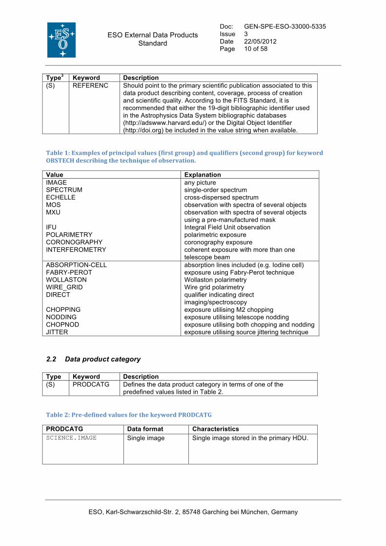
Type3 Keyword Description (S) REFERENC Should point to the primary scientific publication associated to this
data product describing content, coverage, process of creation and scientific quality. According to the FITS Standard, it is recommended that either the 19-digit bibliographic identifier used in the Astrophysics Data System bibliographic databases (http://adswww.harvard.edu/) or the Digital Object Identifier (http://doi.org) be included in the value string when available.
Table 1: Examples of principal values (first group) and qualifiers (second group) for keyword OBSTECH describing the technique of observation.
Value Explanation IMAGE any picture SPECTRUM single-order spectrum ECHELLE cross-dispersed spectrum MOS observation with spectra of several objects MXU observation with spectra of several objects
using a pre-manufactured mask IFU Integral Field Unit observation POLARIMETRY polarimetric exposure CORONOGRAPHY coronography exposure INTERFEROMETRY coherent exposure with more than one
telescope beam ABSORPTION-CELL absorption lines included (e.g. Iodine cell) FABRY-PEROT exposure using Fabry-Perot technique WOLLASTON Wollaston polarimetry WIRE_GRID Wire grid polarimetry DIRECT qualifier indicating direct
imaging/spectroscopy CHOPPING exposure utilising M2 chopping NODDING exposure utilising telescope nodding CHOPNOD exposure utilising both chopping and nodding JITTER exposure utilising source jittering technique
2.2 Data product category Type Keyword Description (S) PRODCATG Defines the data product category in terms of one of the
predefined values listed in Table 2. Table 2: Pre-‐defined values for the keyword PRODCATG
PRODCATG Data format Characteristics SCIENCE.IMAGE Single image Single image stored in the primary HDU.

ESO External Data Products
Standard
Doc: Issue Date Page
GEN-SPE-ESO-33000-5335 3 22/05/2012 11 of 58
ESO, Karl-Schwarzschild-Str. 2, 85748 Garching bei München, Germany
SCIENCE.MEFIMAGE MEF image Multiple images stored in multi-extension FITS format (MEF).
SCIENCE.SRCTBL Source list FITS binary table resulting from the detection of sources on an image (both single image or MEF image, including merged multi-band source lists).
SCIENCE.SPECTRUM 1-d spectrum Single target 1-dimensional spectrum.
SCIENCE.CATALOG Scientific catalogue (single file format)
Single FITS binary table. Normally, the final product of a survey programme.
SCIENCE.MCATALOG Scientific catalogue (multi-file format)
Metadata definitions for a catalogue submitted in a tile-by-tile fashion, i.e. partitioned in multiple FITS binary tables
SCIENCE.CATALOGTILE Scientific catalogue (multi-file format)
Data file for a catalogue submitted in a tile-by-tile fashion, i.e. partitioned in multiple FITS binary tables
2.3 Science products and associated ancillary data The ESO Archive is directly searchable for science data products using the respective query forms available on the ESO Archive web pages. Ancillary data products are associated to scientific data products to support their exploitation without being directly searchable through the ESO Archive interfaces. Certain science data products require the submission of specific ancillary products as given in the data format definitions, for instance mosaicked images, like the VISTA tile image, require a weight map image to be associated. Moreover, depending on the kind of scientific data, the data provider can deliver additional ancillary products. Typical examples are preview images, graphics or reports generated in the course of the data reduction process. The file type of ancillary products may be, for instance, JPEG or PNG image, PS or PDF graphics, ASCII text, or in FITS file format. Ancillary data products are defined in the FITS header of the corresponding science data product in terms of the following indexed keywords. Type5 Keyword Description (S) ASSONi The list of files associated to this data product. i is a sequential
number starting from 1. If n files are associated to the product, the indexed keywords ASSONi and ASSOCi should appear n times (i=1,…,n).
(S) ASSOCi Specifies the product category of the associated file given by ASSONi according to Table 3.
(S) ASSOMi Specifies the md5sum of the associated file given by ASSONi. Applies to non-FITS files only.
5 The capital letters I, L, R, and S indicate the keyword’s data type integer number, boolean, floating point number, and string type, respectively.

ESO External Data Products
Standard
Doc: Issue Date Page
GEN-SPE-ESO-33000-5335 3 22/05/2012 12 of 58
ESO, Karl-Schwarzschild-Str. 2, 85748 Garching bei München, Germany
Guidelines • Each ancillary file must be associated to at least one science file.
• An associated FITS file like a weightmap cannot contain other associations in turn, i.e. nested
associations are not supported.
• In case ancillary data products are in FITS format, they shall not contain the header keyword PRODCATG. Instead, the category should be defined by the keywords ASSOC* of the referencing science data product.
Table 3: Examples for categories of associated ancillary files given by the indexed keyword ASSOCi.
Category Description ANCILLARY.WEIGHTMAP Weight map describing the pixel-to-pixel variation of the statistical
significance of the image array, usually in terms of the inverse variance. The weight map should be a FITS file having the same structure, i.e. number of FITS extensions, if any, and dimensions as the FITS file that contains the image data array.
ANCILLARY.PREVIEW Preview of the data product normally using one of the common graphics file formats such as JPEG, PNG, GIF, etc. For image data products the preview usually consists of an appropriately downscaled version of the image. For spectra the preview typically consists of a line plot for which the PS or PDF formats may be considered.
2.4 Processing Provenance 2.4.1 PROV keywords Type Keyword Description (S) PROVi Processing provenance in terms of the list of science files originating this
data product. i is a sequential number starting from 1 with no leading zeros. PROVi should appear as many times as needed to identify the complete set of science data files this product has been generated from. PROVi are pointers to files in the ESO Archive, which can be original raw data or (intermediate) data products depending on the level of reduction. Raw files are specified in terms if their ARCFILE name, e.g. 'VCAM.2010-03-27T08:58:58.083.fits'. Data products may be referenced by their ARCFILE name, or, alternatively, by their ORIGFILE name supposed that they belong to the same Phase 3 data collection as the referencing product file. ARCFILE and ORIGFILE references should not be mixed within the same file.
Guidelines • PROVi keywords must reside in the primary HDU of the FITS file; • PROVi records represent pointers to files rather than pointers to FITS extensions, i.e. there is
no trailing extension number in square brackets (see also the examples below); • The requirement that PROV must refer to files in the ESO archive has the consequence that
intermediate products to be referenced must be submitted to ESO not later than the products

ESO External Data Products
Standard
Doc: Issue Date Page
GEN-SPE-ESO-33000-5335 3 22/05/2012 13 of 58
ESO, Karl-Schwarzschild-Str. 2, 85748 Garching bei München, Germany
resulting thereof. It means for example that one cannot submit extracted source lists in the first data release and then the originating images afterwards in the second release.6
• If the processing provenance exceeds 999 records, then it is required to record the complete list of files in one dedicated FITS binary table (BINTABLE) extension instead of using header keywords (cf. §2.4.2). The header should not contain any PROVi keyword in this case to avoid ambiguity.
Example 1: The shallow H-band survey image (16 seconds effective exposure time, part of VVV survey Data Release 1, archived under ADP.2011-06-24T14:56:11.033) originates from 12 raw science data files (6 pawprints with 2 jitter positions each) identified by their ARCFILE names. PROV1 = 'VCAM.2010-03-27T08:58:58.083.fits' / Originating raw science file PROV2 = 'VCAM.2010-03-27T08:59:10.530.fits' / Originating raw science file PROV3 = 'VCAM.2010-03-27T08:59:24.541.fits' / Originating raw science file PROV4 = 'VCAM.2010-03-27T08:59:36.978.fits' / Originating raw science file PROV5 = 'VCAM.2010-03-27T08:59:51.043.fits' / Originating raw science file PROV6 = 'VCAM.2010-03-27T09:00:03.446.fits' / Originating raw science file PROV7 = 'VCAM.2010-03-27T09:00:18.266.fits' / Originating raw science file PROV8 = 'VCAM.2010-03-27T09:00:30.706.fits' / Originating raw science file PROV9 = 'VCAM.2010-03-27T09:00:44.764.fits' / Originating raw science file PROV10 = 'VCAM.2010-03-27T09:00:58.834.fits' / Originating raw science file PROV11 = 'VCAM.2010-03-27T09:01:12.852.fits' / Originating raw science file PROV12 = 'VCAM.2010-03-27T09:01:25.349.fits' / Originating raw science file Example 2: The 60-seconds Ks-band image (belonging to the VHS survey, DR1, archived as ADP.2011-10-01T03:24:40.897) was produced by co-addition of six reduced pawprint images, which are referenced in terms of their ORIGFILE names. Both tiles and reduced pawprints belong to the VHS data collection, DR1. PROV1 = 'v20100524_00479_st.fits.fz' / Originating science product file PROV2 = 'v20100524_00481_st.fits.fz' / Originating science product file PROV3 = 'v20100524_00483_st.fits.fz' / Originating science product file PROV4 = 'v20100524_00485_st.fits.fz' / Originating science product file PROV5 = 'v20100524_00487_st.fits.fz' / Originating science product file PROV6 = 'v20100524_00489_st.fits.fz' / Originating science product file Example 3: The multi-band source list (belonging to the VMC survey, DR1, archived as ADP.2011-09-22T15:44:47.833) was extracted from the 3 survey images in Y, J and Ks bands as recorded in terms of their ORIGFILE names. Both, source list and reduced images belong to the same data collection. PROV1 = 'vmc_er1_05h36-069d27_y_image_684806.fits.fz' /Originating image file PROV2 = 'vmc_er1_05h36-069d27_j_image_684837.fits.fz' /Originating image file PROV3 = 'vmc_er1_05h36-069d27_ks_image_684857.fits.fz'/Originating image file
2.4.2 Provenance extension If the processing provenance exceeds 999 records, it is required to record the complete list of files in one dedicated FITS binary table extension instead of using header keywords. This scheme is aimed at very deep NIR observations, typically imaging, in which several thousand raw files are co-added
6 Except for the initial submission of catalogue data resulting from VISTA public surveys (May/June 2012), which is expected to comprise more data than the corresponding first ESO data releases of 2011. Therefore, it is acceptable in this case to set PROVi to ORIGFILE of the Phase 3 files even if they are to be submitted later.

ESO External Data Products
Standard
Doc: Issue Date Page
GEN-SPE-ESO-33000-5335 3 22/05/2012 14 of 58
ESO, Karl-Schwarzschild-Str. 2, 85748 Garching bei München, Germany
(‘stacked’) to obtain the final result. The header should not contain any PROVi keyword in this case to avoid ambiguity. Each science data product, for which processing provenance is recorded using the dedicated FITS extension (and not in terms of PROVi keywords), must include the following flag in the primary FITS header: PROVXTN T / TRUE if proc. provenance recorded in FITS Extn. The originating science files are recorded in the table column labelled PROV. The table has as many records as needed to identify the complete set of science data files the product has been generated from. The requirements and guidelines for the definition of provenance records listed in the previous section (§2.4.1) apply here as well. FITS header definition for the Phase 3 provenance extension: XTENSION= 'BINTABLE' / FITS Extension first keyword EXTNAME = 'PHASE3PROVENANCE' / Defines Phase 3 processing provenance BITPIX = 8 / Number of bits per data pixel NAXIS = 2 / Number of data axes NAXIS1 = %d / Length of data axis 1 NAXIS2 = %d / Length of data axis 2 PCOUNT = 0 / Parameter count GCOUNT = 1 / Group count TFIELDS = %d / Number of fields in each row TTYPE1 = 'PROV' / Label for field 1 TFORM1 = 'A35' / Data format of field 1 CHECKSUM= %s / HDU checksum DATASUM = %s / Data unit checksum END
2.5 Data-specific keywords Type Keyword Description (S) BUNIT Describes the physical unit of the array value. The value of this
keyword should conform to the recommendations outlined in the ESO DICD [AD3], Chapter 8. For imaging data “ADU” (Analog-to-Digital converter Unit), or “ADU/s” for exposure time-normalised data are widely used, and the actual physical scale is given in terms of the photometric zeropoint (PHOTZP). For data that is calibrated to absolute flux BUNIT may be, for instance, ‘W m^-2’ or ‘Jy’.
(R) DATAMIN Specifies the minimum valid physical value across the pixel array in units defined by BUNIT.
(R) DATAMAX Specifies the maximum valid physical value across the pixel array in units defined by BUNIT.
(R) GAIN Specifies the detector sensitivity in number of electrons per data unit (averaging across all exposures making up this data product). Thus, if the data was normalized by exposure time, the 'Effective gain' is the detector gain scaled by the total exposure time.

ESO External Data Products
Standard
Doc: Issue Date Page
GEN-SPE-ESO-33000-5335 3 22/05/2012 15 of 58
ESO, Karl-Schwarzschild-Str. 2, 85748 Garching bei München, Germany
2.6 World coordinate system keywords Type Keyword Description (R) CRVALi Coordinate value at reference pixel. (R) CRPIXi Reference pixel in axis i. (S) CTYPEi Pixel coordinate system. (S) CUNITi Specifies the unit of the coordinate transformation. For celestial
coordinate systems the default unit is “degree”, i.e., CUNIT1 = 'deg' and CUNIT2 = 'deg'.
(R) CDi_j Transformation matrix element. (R) CDELTi Alternative for the CDi_j matrix representation. Deprecated for
images, but may be used for extracted, i.e. one-dimensional, spectra.
(R) CSYERi Systematic error in axis i (unit given by CUNITi, usually degree). (R) CRDERi Random error in axis i (unit given by CUNITi, usually degree).
CRDER1 and CRDER2 may be set both to 1/√2 times the RMS accuracy of the astrometric registration if errors are isotropic (and similarly for CSYERi).
Example of WCS keywords for an image: CRVAL1 = 53.11604 / 03:32:27.8, RA at ref pixel CRVAL2 = -27.791 / -27:47:27.6, DEC at ref pixel CRPIX1 = 433.780 / Ref pixel in X CRPIX2 = 410.550 / Ref pixel in Y CTYPE1 = 'RA---TAN' / pixel coordinate system CTYPE2 = 'DEC--TAN' / pixel coordinate system CD1_1 = 4.12200000000E-05 / Transformation matrix element CD1_2 = 0. / Transformation matrix element CD2_1 = 0. / Transformation matrix element CD2_2 = -4.12200000000E-05 / Transformation matrix element EQUINOX = 2000. / Standard FK5 (years) RADECSYS= 'ICRS ' / Coordinate reference frame
2.7 Specific image characterization Type Keyword Description (S) IMATYPE Specific image type, according to Table 7. (L) ISAMP Flag to indicate if the imaging data represents multiple
disconnected regions, i.e. a sampling of the sky (ISAMP=‘T’), or one contiguous fraction of the sky (ISAMP=‘F’ or unset).
(L) APMATCHD TRUE if the tabulated fluxes, magnitudes, and parameters derived thereof like colours etc. were aperture-matched in order to correct for possible PSF variations across different bands.
2.8 Spatial coverage of a data product Type Keyword Description

ESO External Data Products
Standard
Doc: Issue Date Page
GEN-SPE-ESO-33000-5335 3 22/05/2012 16 of 58
ESO, Karl-Schwarzschild-Str. 2, 85748 Garching bei München, Germany
(R) FPRAia Footprint’s RA in degrees (J2000). The footprint is defined in terms of the N vertices of a geodesic polygon7. Each vertex is identified by the index i, an integer number running from 1 to N, without leading zero. If the footprint consists of multiple disjoint regions an alphabetic code a in the range A through Z is appended to the keyword to identify each region. For a simply connected footprint the suffix a should be blank.
(R) FPDEia Footprint’s Declination in degrees (J2000). (R) SKYSQDEG Actual total sky coverage of the image or catalogue in units of
square degrees.
2.9 Image photometric zeropoint Type Keyword Description (R) PHOTZP Photometric zeropoint that relates the pixel data to total
magnitudes (MAG) according to the equation MAG=-2.5*log(data)+PHOTZP,
i.e. any applicable scaling with exposure time should be absorbed into PHOTZP.
(R) PHOTZPER Optional keyword to indicate the (1 sigma) uncertainty of the photometric zeropoint PHOTZP.
(S) PHOTSYS may take either the value ‘VEGA’ or ‘AB’ to indicate whether the photometric zero point is expressed in Johnson magnitudes or in Oke’s AB photometric system, respectively. In case of tabular data PHOTSYS applies to the photometric parameters at large (like source flux, magnitude, color) unless the photometric system is otherwise specified, e.g. per parameter.
2.10 Near-infrared observations and VISTA Type Keyword Description (R) DIT Detector integration time, if uniform for all exposures included in
this product. To be obtained from the keyword HIERARCH ESO DET DIT of the original data.
(I) NDIT Number of sub-integrations, if uniform for all exposures included in this product. To be obtained from the keyword HIERARCH ESO DET NDIT of the original data.
(I) NJITTER Number of jitter positions per observation if uniform. (I) NOFFSETS Number of offset positions per observation if uniform. (I) NUSTEP Number of microstep positions per observation if uniform. NIR image data products qualify for the keywords listed above if, and only if, all exposures and observations contributing to the given product share the same value for the respective parameter. If, for example, the product has been created from exposures taken with different detector integration time, the keyword DIT should not be defined in the FITS header.
7 The ordered list of vertices should encircle the polygon in a counter-clockwise sense in the conventional equatorial coordinate system with North up and East to the left. The last vertex in the list connects back to the first. In order to avoid ambiguities in direction, vertices need to be less than 180° apart in both coordinates.

ESO External Data Products
Standard
Doc: Issue Date Page
GEN-SPE-ESO-33000-5335 3 22/05/2012 17 of 58
ESO, Karl-Schwarzschild-Str. 2, 85748 Garching bei München, Germany
2.11 Data quality parameters Type Keyword Description (R) ABMAGLIM 5-sigma limiting AB magnitude. The quoted magnitude should
refer to the total flux of a point source. (R) MAGLIMi 5-sigma limiting AB magnitude in FILTERi for band-merged data
products where i is a sequential number starting from 1, without leading zeros. The quoted magnitude should refer to the total flux of a point source.
(R) ABMAGSAT Saturation limit for point sources (AB magnitude). (R) PSF_FWHM Spatial resolution (arcsec). Quality parameter measured from
the image. Average size of the point spread function expressed as the full width at half maximum in arcseconds.
(R) ELLIPTIC Average ellipticity of point sources defined as (1-b/a) with a and b denoting the major and minor axes of the source profile, resp.
(R) SNR Signal to noise ratio per pixel. (R) SPEC_RES Average spectral resolution (resolving power) as determined for
this spectrum.
2.12 ESO public imaging surveys For VISTA public surveys the tiling of the sky has been defined at the beginning of the preparation of observations using the Survey Area Definition Tool (SADT). The respective coordinates identifying each survey tile on the sky in terms of RA, DEC and PA, are given in the original (i.e. raw) observational data by the following header keywords. HIERARCH ESO OCS SADT TILE RA = 180121.456 / Tile RA [HHMMSS.TTT] HIERARCH ESO OCS SADT TILE DEC = -312956.4 / Tile Declination [DDMMSS.TTT] HIERARCH ESO OCS SADT TILE OFFANGLE = 60.598 / Tile rotator offset angle [deg] For public surveys it is required that the survey tile coordinates are propagated to the resulting data products like tile images and source lists. Type Keyword Description (R) TL_RA Tile RA as defined using the Survey Area Definition Tool
[HHMMSS.TTT]. (R) TL_DEC Tile Declination as defined using the Survey Area Definition Tool
[DDMMSS.TTT]. (R) TL_OFFAN Tile rotator offset angle as defined using the Survey Area
Definition Tool (in degrees). Note: Orientation on the sky, opposite sign convention than the position angle on the sky.
(L) M_TILE TRUE if data covers more than one survey tile. (S) EPS_REG ESO public survey region name; to be specified for survey
programmes targeting multiple regions like the VIDEO survey.
2.13 Checksums and reserved header keywords The keywords CHECKSUM and DATASUM shall be included in the submitted data products; they will be used to validate the integrity of the data after transfer to ESO and before archival storage. Improper checksums will prevent successful ingestion into the archive. Keywords that are reserved to record certain information related to the ESO archival process are listed in . If these keywords exist in the header of the submitted data, their content may be overwritten in the

ESO External Data Products
Standard
Doc: Issue Date Page
GEN-SPE-ESO-33000-5335 3 22/05/2012 18 of 58
ESO, Karl-Schwarzschild-Str. 2, 85748 Garching bei München, Germany
course of archival with new information. As a consequence any previous content will get lost. Therefore, the data creator should not use these keywords to deliver any relevant information. Table 4: List of reserved header keywords
Type Keyword Description (S) ARCFILE Provides the name under which the file is stored in the ESO
science archive. (S) CHECKSUM Provides a Cyclic Redundant Check (CRC) calculation for each
HDU. It uses the ASCII encoded 1’s complement algorithm. (S) DATASUM Data unit checksum. (S) ORIGFILE Records the original file name, as assigned at the instrument
workstation; for EDPs ORIGFILE records the filename as given by the data provider.
Example of reserved header keywords: ARCFILE = 'ADP.2010-08-19T09:33:11.951.fits' / Archive file name CHECKSUM= 'CYMRAEGLLENYDDOL' / HDU checksum DATASUM = '3141592653' / Data unit checksum ORIGFILE= 'FORS1-IMG231.19.fits' / Original file name
2.14 Science catalogues This section provides a summary of keywords to define science catalogues, particularly the catalogues resulting from ESO Public Survey including multi-colour photometric source catalogues, multi-epoch photometry (a.k.a. light curves), catalogues of variables, proper motion catalogues, and target catalogues for spectroscopic surveys. Furthermore, these keywords apply to all ESO observing programmes delivering their final results in tabular form, for example galaxy redshift catalogues or catalogues of stellar properties and chemical abundances. Please consult §4 for detailed keyword definitions and instructions for their application in the context of different types of scientific catalogues. Type Keyword Description
(S) TTYPEi Name of the parameter.
(S) TFORMi Data format string.
(S) TCOMMi Verbal description.
(S) TUCDi Unified content descriptor.
(S) TDISPi Recommended display format.
(S) TUNITi Physical units and scale.
(S) TUTYPi Pointer to a concept expressed in a VO data model.
(R) TDMINi Minimum valid physical value.
(R) TDMAXi Maximum valid physical value.

ESO External Data Products
Standard
Doc: Issue Date Page
GEN-SPE-ESO-33000-5335 3 22/05/2012 19 of 58
ESO, Karl-Schwarzschild-Str. 2, 85748 Garching bei München, Germany
(I) TNULLi Undefined value for data type B, I, J or K.
(L) TINDXi TRUE if database index is defined or required.
(L) TPRICi TRUE for principal catalogue columns.
(S) TXLNKi Defines a data link if set to CATALOG, ARCFILE or ORIGFILE.
(S) TXP3Ci Defines the target of this data link in terms of the Phase 3 collection name.
(S) TXP3Ri Defines the target of this data link in terms of the Phase 3 release number.
(S) TXCTYi Defines the name of the target column of this catalogue data link in terms of its TTYPEi.
2.15 User-provided keywords Normally, for a given EDP, the keywords defined herein just form a subset of keywords characterizing the data; in fact, the data provider is encouraged to include further keywords to characterize the data in more detail, to a level that seems to be adequate from the scientific point of view. In order to avoid (meta)data inconsistencies the data provider has the responsibility to ensure that user-defined keywords do not conflict with the EDP keywords as defined throughout §2. When adding further keywords to the FITS header, data providers are strongly encouraged to use 8-character FITS standard keywords instead of HIERARCH keywords. Note that lower case characters shall not be used for keyword names according to [2], §4.1.2.1 therein.

ESO External Data Products
Standard
Doc: Issue Date Page
GEN-SPE-ESO-33000-5335 3 22/05/2012 20 of 58
ESO, Karl-Schwarzschild-Str. 2, 85748 Garching bei München, Germany
3 Imaging data products 3.1 Generic image data format This section defines the generic format for (astronomical) images, i.e. two-dimensional data arrays recording flux in a given band as a function of celestial coordinates. Higher-level products based on imaging data, namely extracted source lists and catalogues, will be covered in §3.2.4 and §4, respectively. To specify required and optional FITS header keywords, the following style is used throughout this document. Mandatory header keywords are typeset in bold face, for example: NAXIS1 = %d / Length of data axis 1 Optional header keywords, in contrast, are typeset in normal face, for example: CSYER1 = %f / Systematic error The format strings %c, %d, %f, and %s correspond to the data types boolean, integer number, floating point number, and character string, respectively. Table 5: FITS header for the generic image data format
SIMPLE = T / Standard FITS format (NOST-100-2.0) BITPIX = %d / Number of bits per data pixel NAXIS = 2 / Number of data axes NAXIS1 = %d / Length of data axis 1 NAXIS2 = %d / Length of data axis 2 EXTEND = T / Extensions may be present BZERO = %f / real = fits-value*BSCALE+BZERO BSCALE = %f / real = fits-value*BSCALE+BZERO BUNIT = %s / Physical unit of array values BLANK = %d / Value used for NULL pixels ORIGIN = 'ESO-PARANAL' / European Southern Observatory DATE = %s / Date the file was written DATAMAX = %f / Maximum pixel value DATAMIN = %f / Minimal pixel value TELESCOP= %s / ESO Telescope designation INSTRUME= %s / Instrument name FILTER = %s / Filter name OBJECT = %s / Target designation RA = %f / Image centre (J2000.0) DEC = %f / Image centre (J2000.0) EQUINOX = %.0f / Standard FK5 (years) RADECSYS= %s / Coordinate reference frame EXPTIME = %f / Total integration time per pixel (s) TEXPTIME= %f / Total integration time of all exposures (s) MJD-OBS = %.8f / Start of observations (days) MJD-END = %.8f / End of observations (days) DATE-OBS= %s / Date the observation was started (UTC) TIMESYS = 'UTC ' / Time system used PROG_ID = %20s / ESO programme identification M_EPOCH = %c / TRUE if resulting from multiple epochs NCOMBINE= %d / # of combined raw science data files PROVi = %s / Originating science file OBSTECH = %s / Technique of observation PRODCATG= 'SCIENCE.IMAGE' / Data product category IMATYPE = %s / Specific image type ISAMP = %c / TRUE if image represents partially sampled sky FLUXCAL = 'ABSOLUTE' / Certifies the validity of PHOTZP

ESO External Data Products
Standard
Doc: Issue Date Page
GEN-SPE-ESO-33000-5335 3 22/05/2012 21 of 58
ESO, Karl-Schwarzschild-Str. 2, 85748 Garching bei München, Germany
CRVAL1 = %f / Coordinate value at ref pixel CRVAL2 = %f / Coordinate value at ref pixel CRPIX1 = %f / Ref pixel in X CRPIX2 = %f / Ref pixel in Y CTYPE1 = %s / pixel coordinate system CTYPE2 = %s / pixel coordinate system CUNIT1 = %s / Unit of coordinate transformation CUNIT2 = %s / Unit of coordinate transformation CD1_1 = %f / Transformation matrix element CD1_2 = %f / Transformation matrix element CD2_1 = %f / Transformation matrix element CD2_2 = %f / Transformation matrix element CSYER1 = %f / Systematic error CSYER2 = %f / Systematic error CRDER1 = %f / Random error CRDER2 = %f / Random error PHOTZP = %f / Photometric zeropoint MAG=-2.5*log(data)+PHOTZP PHOTZPER= %f / Uncertainty on PHOTZP PHOTSYS = %s / Photometric system VEGA or AB GAIN = %f / Number of electrons per data unit ABMAGLIM= %f / 5-sigma limiting AB magnitude for point sources ABMAGSAT= %f / Saturation limit for point sources (AB mags) PSF_FWHM= %f / Spatial resolution (arcsec) ELLIPTIC= %f / Average ellipticity of point sources PROCSOFT= %s / Data reduction software/system with version no. REFERENC= %s / Bibliographic reference ASSONi = %s / Name of associated file ASSOCi = %s / Category of associated file CHECKSUM= %s / HDU checksum DATASUM = %s / Data unit checksum COMMENT END
3.1.1 Astrometry Celestial coordinates shall be assigned to image pixels using the FITS convention for world coordinates (Calabretta & Greisen, 2002, Astronomy & Astrophysics, 395, 1077-1122) [RD1] in which image distortions should be taken into account if need be. For celestial coordinates the International Celestial Reference System (ICRS) is the preferred standard. It is recommended to quantify the uncertainties of the astrometric registration using the FITS keywords CSYERi and CRDERi for the systematic and random parts to the error budget, respectively (see below for more details).
3.1.2 Photometry The flux scale of imaging data should refer to a suitable photometric system. It should be specified either logarithmically in terms of the zero point magnitude or in terms of the linear scaling factor depending on the usual practice for the type of observation under consideration. The zero point magnitude can be defined with respect to the Johnson system where fluxes are normalized with respect to Vega, or using the AB photometric system (Oke & Gunn, 1983). It is recommended to provide an estimate of the uncertainty of the photometric/flux calibration quantifying the total error budget including all possible systematics, e.g. the illumination effect unless it has been corrected for.
3.1.3 Weight maps Many observational techniques, for instance the common jitter or dither techniques, imply that several exposures, with mutual offsets, are co-added to form the final product and the statistical significance of the pixel data may significantly vary across the image array. In this case it is required to provide the

ESO External Data Products
Standard
Doc: Issue Date Page
GEN-SPE-ESO-33000-5335 3 22/05/2012 22 of 58
ESO, Karl-Schwarzschild-Str. 2, 85748 Garching bei München, Germany
statistical significance of each pixel, usually in terms of a number that is proportional to the inverse variance of the signal. This additional data array is often called weight map or confidence map. It has the same dimensions as the image array and can be submitted as an associated data product with product category declared in the header of the science file as follows: ASSOC1 = 'ANCILLARY.WEIGHTMAP'/ Associated weight map image ASSON1 = %s / Name of associated file
3.1.4 Further guidelines • Instrumental signatures are to be removed from the pixel data by applying appropriate data
reduction and calibration procedures. Depending on instrument it usually includes overscan and bias subtraction, flatfield correction, correction for (chip-to-chip) gain variations, detector linearity correction, cross talk correction, illumination correction, and correction for pixel scale variation across the field of view.
• For imaging data the ESO filter designation must be recorded in the data product. • Required image quality parameters: RMS astrometric accuracy, flux uncertainty, limiting
magnitude (AB), saturation limit, PSF width and ellipticity. • For the temporal characterization: each image must record the time of observation in terms of
the Julian date. This basically requires properly propagating this information from the raw data to the final product.
3.2 VISTA/VIRCAM
Overview Table 6 gives an overview of the specific VISTA/VIRCAM data product types and their characteristics. The corresponding header keyword settings are listed in Table 7. The footprint shape specifies the sky coverage of the imaging data as given by the combination of the instrumental design and the observing strategy. For VISTA the three footprint shapes, “Pawprint”, “Vertical stripes”, and “Tile”, cover the variety of products resulting from the ESO public survey programmes. The attribute “deep” in the product description indicates if the data product is based on multiple observations. The flag ISAMP indicates if the imaging data represents multiple disconnected regions, i.e. a sampling of the sky (ISAMP=‘T’), or one contiguous fraction of the sky (ISAMP=‘F’ or unset). The flag SINGLEXP indicates if the product is the result of one single exposure. The column labeled “Source list” indicates the potential availability of source tables extracted from the imaging products. Specific data formats are defined for single-band sources lists and multi-band source lists in §3.2.4 and 3.2.5, respectively. Table 6: Overview of VISTA data product types and their characteristics
Data product description
VISTA footprint shape
Single/ multiple OBs
Sampled/ contiguous sky
Number of disconnected regions sampled
Source list
VISTA tile Tile Single contiguous 1 ✓
VISTA deep tile Tile Multi contiguous 1 ✓
VISTA pawprint Pawprint Single sampled 16 ✓
VISTA deep pawprint Pawprint Multi sampled 16 ✓

ESO External Data Products
Standard
Doc: Issue Date Page
GEN-SPE-ESO-33000-5335 3 22/05/2012 23 of 58
ESO, Karl-Schwarzschild-Str. 2, 85748 Garching bei München, Germany
VISTA stripes8 Vertical stripes Single sampled 4 ✓
VISTA deep stripes Vertical stripes Multi sampled 4 ✓
VISTA single exposure9
Pawprint Single sampled 16 n/a
Table 7: Summary of VISTA data product formats and corresponding keyword settings
Data product description PRODCATG IMATYPE ISAMP SINGLEXP
VISTA tile VISTA deep tile
SCIENCE.IMAGE TILE F F
VISTA pawprint VISTA deep pawprint
SCIENCE.MEFIMAGE PAWPRINT T F
VISTA stripes VISTA deep stripes
SCIENCE.MEFIMAGE VSTRIPES T F
VISTA single exposure SCIENCE.MEFIMAGE PAWPRINT T T
VISTA tile’s source list VISTA deep tile’s source list
SCIENCE.SRCTBL TILE F F
VISTA pawprint’s source list VISTA deep pawprint’s source list
SCIENCE.SRCTBL PAWPRINT T F
VISTA stripes’s source list VISTA deep stripes’s source list
SCIENCE.SRCTBL VSTRIPES T F
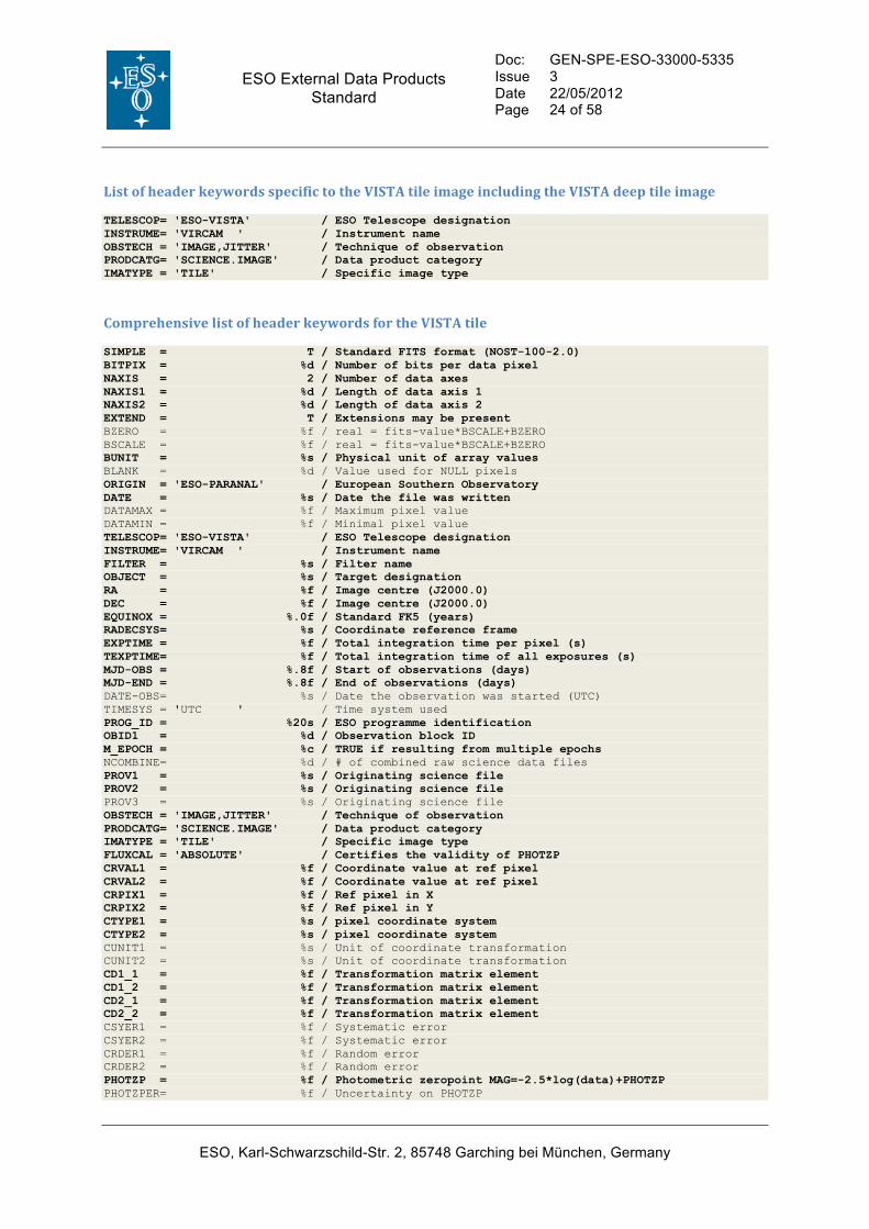
3.2.1 VISTA tile image The VISTA tile is the basic building block of VISTA public surveys. The tile is a filled area of sky fully sampled (filling in the gaps in a pawprint) by combining multiple pawprints. Because of the detector spacing the minimum number of pointed observations (with fixed offsets) required for reasonably uniform coverage is 6, which would expose each piece of sky, except for the edges of the tile, on at least 2 camera pixels. An observation executed with the VISTA/VIRCAM template “VIRCAM_img_obs_tile6” results in a tile as data product. The VISTA tile image comes in two flavours to distinguish whether data have been combined from one or from multiple observations. The “normal” VISTA tile is based on a single observation, which has to be identified by the keyword OBID1. If the original data, which has been combined to form the final tile, was obtained in more than one observation block, the data product is termed VISTA deep tile image, and the complete set of original observations should be listed using the indexed keyword OBIDi. The presence of the keyword OBID2 indicates the multi-OB character, i.e. the fact that the respective data product forms a deep tile image. The VISTA tile stores the data array in the FITS file’s primary HDU. The VISTA tile requires a number of specific keywords related to data acquisition, data quality and public surveys as listed below. 8 The ultra deep part of the UltraVISTA public imaging survey is expected to result in stripes as data products. 9 Single exposures acquired with VISTA are usually not considered final data products, which is why this product type will be insignificant in view of VISTA public survey deliveries.
ESO External Data Products
Standard
Doc: Issue Date Page
GEN-SPE-ESO-33000-5335 3 22/05/2012 24 of 58
ESO, Karl-Schwarzschild-Str. 2, 85748 Garching bei München, Germany
List of header keywords specific to the VISTA tile image including the VISTA deep tile image
TELESCOP= 'ESO-VISTA' / ESO Telescope designation INSTRUME= 'VIRCAM ' / Instrument name OBSTECH = 'IMAGE,JITTER' / Technique of observation PRODCATG= 'SCIENCE.IMAGE' / Data product category IMATYPE = 'TILE' / Specific image type
Comprehensive list of header keywords for the VISTA tile
SIMPLE = T / Standard FITS format (NOST-100-2.0) BITPIX = %d / Number of bits per data pixel NAXIS = 2 / Number of data axes NAXIS1 = %d / Length of data axis 1 NAXIS2 = %d / Length of data axis 2 EXTEND = T / Extensions may be present BZERO = %f / real = fits-value*BSCALE+BZERO BSCALE = %f / real = fits-value*BSCALE+BZERO BUNIT = %s / Physical unit of array values BLANK = %d / Value used for NULL pixels ORIGIN = 'ESO-PARANAL' / European Southern Observatory DATE = %s / Date the file was written DATAMAX = %f / Maximum pixel value DATAMIN = %f / Minimal pixel value TELESCOP= 'ESO-VISTA' / ESO Telescope designation INSTRUME= 'VIRCAM ' / Instrument name FILTER = %s / Filter name OBJECT = %s / Target designation RA = %f / Image centre (J2000.0) DEC = %f / Image centre (J2000.0) EQUINOX = %.0f / Standard FK5 (years) RADECSYS= %s / Coordinate reference frame EXPTIME = %f / Total integration time per pixel (s) TEXPTIME= %f / Total integration time of all exposures (s) MJD-OBS = %.8f / Start of observations (days) MJD-END = %.8f / End of observations (days) DATE-OBS= %s / Date the observation was started (UTC) TIMESYS = 'UTC ' / Time system used PROG_ID = %20s / ESO programme identification OBID1 = %d / Observation block ID M_EPOCH = %c / TRUE if resulting from multiple epochs NCOMBINE= %d / # of combined raw science data files PROV1 = %s / Originating science file PROV2 = %s / Originating science file PROV3 = %s / Originating science file OBSTECH = 'IMAGE,JITTER' / Technique of observation PRODCATG= 'SCIENCE.IMAGE' / Data product category IMATYPE = 'TILE' / Specific image type FLUXCAL = 'ABSOLUTE' / Certifies the validity of PHOTZP CRVAL1 = %f / Coordinate value at ref pixel CRVAL2 = %f / Coordinate value at ref pixel CRPIX1 = %f / Ref pixel in X CRPIX2 = %f / Ref pixel in Y CTYPE1 = %s / pixel coordinate system CTYPE2 = %s / pixel coordinate system CUNIT1 = %s / Unit of coordinate transformation CUNIT2 = %s / Unit of coordinate transformation CD1_1 = %f / Transformation matrix element CD1_2 = %f / Transformation matrix element CD2_1 = %f / Transformation matrix element CD2_2 = %f / Transformation matrix element CSYER1 = %f / Systematic error CSYER2 = %f / Systematic error CRDER1 = %f / Random error CRDER2 = %f / Random error PHOTZP = %f / Photometric zeropoint MAG=-2.5*log(data)+PHOTZP PHOTZPER= %f / Uncertainty on PHOTZP

ESO External Data Products
Standard
Doc: Issue Date Page
GEN-SPE-ESO-33000-5335 3 22/05/2012 25 of 58
ESO, Karl-Schwarzschild-Str. 2, 85748 Garching bei München, Germany
PHOTSYS = %s / Photometric system VEGA or AB GAIN = %f / Number of electrons per data unit ABMAGLIM= %f / 5-sigma limiting AB magnitude for point sources ABMAGSAT= %f / Saturation limit for point sources (AB mags) PSF_FWHM= %f / Spatial resolution (arcsec) ELLIPTIC= %f / Average ellipticity of point sources PROCSOFT= %s / Data reduction software/system with version no. REFERENC= %s / Bibliographic reference ASSON1 = %s / Name of associated file ASSOC1 = %s / Category of associated file ASSON2 = %s / Name of associated file ASSOC2 = %s / Category of associated file TL_RA = %f / Tile RA [HHMMSS.TTT] TL_DEC = %f / Tile Declination [DDMMSS.TTT] TL_OFFAN= %f / Tile rotator offset angle [deg] EPS_REG = %s / ESO public survey region name NJITTER = %d / Number of jitter positions NOFFSETS= %d / Number of offset positions NUSTEP = %d / Number of microstep positions DIT = %f / Integration Time NDIT = %d / Number of sub-Integrations CHECKSUM= %s / HDU checksum DATASUM = %s / Data unit checksum COMMENT END
Comprehensive list of header keywords for the VISTA deep tile image
SIMPLE = T / Standard FITS format (NOST-100-2.0) BITPIX = %d / Number of bits per data pixel NAXIS = 2 / Number of data axes NAXIS1 = %d / Length of data axis 1 NAXIS2 = %d / Length of data axis 2 EXTEND = T / Extensions may be present BZERO = %f / real = fits-value*BSCALE+BZERO BSCALE = %f / real = fits-value*BSCALE+BZERO BUNIT = %s / Physical unit of array values BLANK = %d / Value used for NULL pixels ORIGIN = 'ESO-PARANAL' / European Southern Observatory DATE = %s / Date the file was written DATAMAX = %f / Maximum pixel value DATAMIN = %f / Minimal pixel value TELESCOP= 'ESO-VISTA' / ESO Telescope designation INSTRUME= 'VIRCAM ' / Instrument name FILTER = %s / Filter name OBJECT = %s / Target designation RA = %f / Image centre (J2000.0) DEC = %f / Image centre (J2000.0) EQUINOX = %.0f / Standard FK5 (years) RADECSYS= %s / Coordinate reference frame EXPTIME = %f / Total integration time per pixel (s) TEXPTIME= %f / Total integration time of all exposures (s) MJD-OBS = %.8f / Start of observations (days) MJD-END = %.8f / End of observations (days) DATE-OBS= %s / Date the observation was started (UTC) TIMESYS = 'UTC ' / Time system used PROG_ID = %20s / ESO programme identification OBID1 = %d / Observation block ID OBID2 = %d / Observation block ID OBIDn = %d / Observation block ID M_EPOCH = %c / TRUE if resulting from multiple epochs NCOMBINE= %d / # of combined raw science data files PROV1 = %s / Originating science file PROV2 = %s / Originating science file PROV3 = %s / Originating science file OBSTECH = 'IMAGE,JITTER' / Technique of observation PRODCATG= 'SCIENCE.IMAGE' / Data product category IMATYPE = 'TILE' / Specific image type FLUXCAL = 'ABSOLUTE' / Certifies the validity of PHOTZP

ESO External Data Products
Standard
Doc: Issue Date Page
GEN-SPE-ESO-33000-5335 3 22/05/2012 26 of 58
ESO, Karl-Schwarzschild-Str. 2, 85748 Garching bei München, Germany
CRVAL1 = %f / Coordinate value at ref pixel CRVAL2 = %f / Coordinate value at ref pixel CRPIX1 = %f / Ref pixel in X CRPIX2 = %f / Ref pixel in Y CTYPE1 = %s / pixel coordinate system CTYPE2 = %s / pixel coordinate system CUNIT1 = %s / Unit of coordinate transformation CUNIT2 = %s / Unit of coordinate transformation CD1_1 = %f / Transformation matrix element CD1_2 = %f / Transformation matrix element CD2_1 = %f / Transformation matrix element CD2_2 = %f / Transformation matrix element CSYER1 = %f / Systematic error CSYER2 = %f / Systematic error CRDER1 = %f / Random error CRDER2 = %f / Random error PHOTZP = %f / Photometric zeropoint MAG=-2.5*log(data)+PHOTZP PHOTZPER= %f / Uncertainty on PHOTZP PHOTSYS = %s / Photometric system VEGA or AB GAIN = %f / Number of electrons per data unit ABMAGLIM= %f / 5-sigma limiting AB magnitude for point sources ABMAGSAT= %f / Saturation limit for point sources (AB mags) PSF_FWHM= %f / Spatial resolution (arcsec) ELLIPTIC= %f / Average ellipticity of point sources PROCSOFT= %s / Data reduction software/system with version no. REFERENC= %s / Bibliographic reference ASSON1 = %s / Name of associated file ASSOC1 = %s / Category of associated file TL_RA = %f / Tile RA [HHMMSS.TTT] TL_DEC = %f / Tile Declination [DDMMSS.TTT] TL_OFFAN= %f / Tile rotator offset angle [deg] EPS_REG = %s / ESO public survey region name NJITTER = %d / Number of jitter positions NOFFSETS= %d / Number of offset positions NUSTEP = %d / Number of microstep positions DIT = %f / Integration Time NDIT = %d / Number of sub-Integrations CHECKSUM= %s / HDU checksum DATASUM = %s / Data unit checksum COMMENT END
Notes regarding keyword definitions
• MJD-OBS should be set to MJD-OBS of the first exposure contributing to this data product. • MJD-END—the end of observations can be obtained in an approximate fashion using MJD-
OBS of the last exposure contributing to this data product and adding the total exposure time of this exposure, i.e. MJD-END = MJD-OBS+(DIT*NDIT)/86400 in which MJD-OBS, DIT and NDIT refer to the last exposure.
• EXPTIME—for a VISTA tile being filled using the standard pattern of 6 pointed observations with fixed offsets with NJITTER exposures per pointing, EXPTIME should be set to the product 2*NJITTER*NDIT*DIT. The factor 2 reflects that most of the pixels of the final co-added image receive the contributions of at least two observations except for two narrow stripes along the edges, which receive just ‘single’ exposure time. For a VISTA deep tile image resulting from the co-addition of N_OBS observations, each of them using the standard pattern of 6 pointed observations with fixed offsets with NJITTER exposures per pointing, EXPTIME should be set to the product 2*N_OBS*NJITTER*NDIT*DIT. The factor 2 reflects that most of the pixels of the final co-added image receive the contributions of at least two observations except for two narrow stripes along the edges, which receive just ‘single’ exposure time. If the N_OBS observations do not share the same individual exposure time, i.e. NJITTER, NDIT, and DIT, then EXPTIME should be set to the sum
€
2 × NJITTER(i) × NDIT(i) × DIT(i)i=1
N _OBS
∑

ESO External Data Products
Standard
Doc: Issue Date Page
GEN-SPE-ESO-33000-5335 3 22/05/2012 27 of 58
ESO, Karl-Schwarzschild-Str. 2, 85748 Garching bei München, Germany
If individual exposures were rejected before combination into the tile, EXPTIME should be adjusted accordingly.
• TEXPTIME—for a VISTA tile being filled using the standard pattern of 6 pointed observations with fixed offsets with NJITTER exposures per pointing, TEXPTIME should be set to the product 6*NJITTER*NDIT*DIT. If individual exposures were rejected before combination into the tile, TEXPTIME should be adjusted accordingly. For a VISTA deep tile image resulting from the co-addition of N_OBS observations, each of them using the standard pattern of 6 pointed observations with fixed offsets with NJITTER exposures per pointing, EXPTIME should be set to the product 6*N_OBS*NJITTER*NDIT*DIT. If the N_OBS observations do not share the same individual exposure time, i.e. NJITTER, NDIT, and DIT, then TEXPTIME should be set to the arithmetic sum of 6*NJITTER*NDIT*DIT. If individual exposures were rejected before combination into the tile, TEXPTIME should be adjusted accordingly.
• ASSON1 and ASSOC1 are compulsory for VISTA tiles to associate the respective weight image, also known as confidence map (see §3.1.3). Further instances of the indexed keywords ASSONi and ASSONi may be used to associate more data products if needed.
Header example for the VISTA tile image
SIMPLE = T / Standard FITS format (NOST-100-2.0) BITPIX = 32 / Number of bits per data pixel NAXIS = 2 / Number of data axes NAXIS1 = 12711 / Length of data axis 1 NAXIS2 = 15605 / Length of data axis 2 EXTEND = F / Extensions may be present BZERO = 0. / real = fits-value*BSCALE+BZERO BSCALE = 0.17677670 / real = fits-value*BSCALE+BZERO BUNIT = 'ADU ' / Physical unit of array values ORIGIN = 'ESO-PARANAL' / European Southern Observatory DATE = '2009-10-19T08:51:39' / Date the file was written TELESCOP= 'ESO-VISTA' / ESO Telescope designation INSTRUME= 'VIRCAM ' / Instrument name FILTER = 'Z ' / Filter name OBJECT = 'Orion ' / Target designation RA = 84.589675 / Image centre (J2000.0) DEC = -1.66818 / Image centre (J2000.0) EQUINOX = 2000. / Standard FK5 (years) RADECSYS= 'FK5 ' / Coordinate reference frame EXPTIME = 48.0 / Total integration time per pixel (s) TEXPTIME= 144.0 / Total integration time of all exposures (s) MJD-OBS = 55123.36921823 / Start of observations (days) MJD-END = 55123.37191074 / End of observations (days) DATE-OBS= '2009-10-19T08:51:40.4482' / Date the observation was started (UTC) TIMESYS = 'UTC ' / Time system used PROG_ID = '60.A-9285(B)' / ESO programme identification OBID1 = 429633 / Observation block ID M_EPOCH = F / TRUE if resulting from multiple epochs NCOMBINE= 6 / # of combined raw science data files PROV1 = 'VCAM.2009-10-19T08:51:40.455.fits' / Originating science file PROV2 = 'VCAM.2009-10-19T08:52:22.519.fits' / Originating science file PROV3 = 'VCAM.2009-10-19T08:53:06.147.fits' / Originating science file PROV4 = 'VCAM.2009-10-19T08:53:48.218.fits' / Originating science file PROV5 = 'VCAM.2009-10-19T08:54:28.653.fits' / Originating science file PROV6 = 'VCAM.2009-10-19T08:55:09.089.fits' / Originating science file OBSTECH = 'IMAGE,JITTER' / Technique of observation PRODCATG= 'SCIENCE.IMAGE' / Data product category IMATYPE = 'TILE' / Specific image type FLUXCAL = 'ABSOLUTE' / Certifies the validity of PHOTZP CRVAL1 = 8.452566863325E+01 / Coordinate value at ref pixel

ESO External Data Products
Standard
Doc: Issue Date Page
GEN-SPE-ESO-33000-5335 3 22/05/2012 28 of 58
ESO, Karl-Schwarzschild-Str. 2, 85748 Garching bei München, Germany
CRVAL2 = -1.557574307279E+00 / Coordinate value at ref pixel CRPIX1 = 6.3555000E+03 / Ref pixel in X CRPIX2 = 7.8025000E+03 / Ref pixel in Y CTYPE1 = 'RA---TAN' / pixel coordinate system CTYPE2 = 'DEC--TAN' / pixel coordinate system CD1_1 = -2.4540050E-05 / Transformation matrix element CD1_2 = 9.1546004E-05 / Transformation matrix element CD2_1 = -9.1547488E-05 / Transformation matrix element CD2_2 = -2.4447898E-05 / Transformation matrix element CRDER1 = 0.0000108 / Random error (degree) CRDER2 = 0.0000108 / Random error (degree) PHOTZP = 23.844 / Photometric zeropoint MAG=-2.5*log(data)+PHOTZP PHOTZPER= 0.01 / Uncertainty on PHOTZP PHOTSYS = 'VEGA ' / Photometric system VEGA or AB ABMAGLIM= 22.58 / 5-sigma limiting AB magnitude for point sources ABMAGSAT= 15.41 / Saturation limit for point sources (AB mags) PSF_FWHM= 0.97 / Spatial resolution (arcsec) ELLIPTIC= 0.05619717 / Average ellipticity of point sources PROCSOFT= 'CASU VDFS v1.0' / Data reduction software/system with version no. REFERENC= '2010Msngr.139....6A' / Bibliographic reference ASSON1 = 'v20091018_00296_st_tl_conf.fits' / Name of associated file ASSOC1 = 'ancillary.weightmap' / Category of associated file TL_RA = 53805.976 / Tile RA [HHMMSS.TTT] TL_DEC = -13321.600 / Tile Declination [DDMMSS.TTT] TL_OFFAN= -15.0050 / Tile rotator offset angle [deg] NJITTER = 1 / Number of jitter positions NOFFSETS= 6 / Number of offset positions NUSTEP = 1 / Number of microstep positions DIT = 6.0000000 / Integration Time NDIT = 4 / Number of sub-Integrations CHECKSUM= 'CYMRAEGLLENYDDOL' / HDU checksum DATASUM = '1123581321' / Data unit checksum END
3.2.2 VISTA pawprint image The 16 non-contiguous images of the sky produced by the VISTA IR camera, with its 16 non-contiguous detector chips are termed VISTA pawprint image. The data are stored in 16 image extensions of the multi-extension FITS file. According to the usual technique of observation in the NIR regime (jitter mode or offset sky), typically, the pawprint is the result of multiple exposures. An observation executed with the VISTA/VIRCAM template “VIRCAM_img_obs_tile1” for example results in a pawprint as data product. Similar to the VISTA tile, the VISTA pawprint image comes in two flavors to distinguish whether data have been combined from one or from multiple observations. The “normal” VISTA pawprint is based on a single observation, which has to be identified by the keyword OBID1. If the original data, which has been combined to form the final pawprint image, was obtained in more than one observation block, the data product is termed VISTA deep pawprint image, and the complete set of original observations should be listed using the indexed keyword OBIDi. The presence of the keyword OBID2 indicates the multi-OB character, i.e. the fact that the respective data product forms a deep pawprint image. OBIDi should appear as many times as needed to identify the full set of observations of which data have been included to generate this product. The data of the VISTA deep pawprint image are stored in 16 image extensions of the multi-extension FITS file. The VISTA pawprint image requires a number of specific keywords related to data acquisition, data quality and public surveys as listed below. List of header keywords specific to the VISTA pawprint image
TELESCOP= 'ESO-VISTA' / ESO Telescope designation

ESO External Data Products
Standard
Doc: Issue Date Page
GEN-SPE-ESO-33000-5335 3 22/05/2012 29 of 58
ESO, Karl-Schwarzschild-Str. 2, 85748 Garching bei München, Germany
INSTRUME= 'VIRCAM ' / Instrument name OBSTECH = 'IMAGE,JITTER' / Technique of observation PRODCATG= 'SCIENCE.MEFIMAGE' / Data product category IMATYPE = 'PAWPRINT' / Specific image type ISAMP = T / TRUE if image represents partially sampled sky
Comprehensive list of header keywords for the VISTA pawprint in the primary HDU
SIMPLE = T / Standard FITS format (NOST-100-2.0) BITPIX = 8 / Number of bits per data pixel NAXIS = 0 / Number of data axes EXTEND = T / Extensions may be present ORIGIN = 'ESO-PARANAL' / European Southern Observatory DATE = %s / Date the file was written TELESCOP= 'ESO-VISTA' / ESO Telescope designation INSTRUME= 'VIRCAM ' / Instrument name FILTER = %s / Filter name OBJECT = %s / Target designation RA = %f / Image centre (J2000.0) DEC = %f / Image centre (J2000.0) EQUINOX = %.0f / Standard FK5 (years) RADECSYS= %s / Coordinate reference frame EXPTIME = %f / Total integration time per pixel (s) TEXPTIME= %f / Total integration time of all exposures (s) MJD-OBS = %.8f / Start of observations (days) MJD-END = %.8f / End of observations (days) DATE-OBS= %s / Date the observation was started (UTC) TIMESYS = 'UTC ' / Time system used PROG_ID = %20s / ESO programme identification OBID1 = %d / Observation block ID M_EPOCH = %c / TRUE if resulting from multiple epochs SINGLEXP= %c / TRUE if resulting from single exposure NCOMBINE= %d / # of combined raw science data files PROV1 = %s / Originating science file PROV2 = %s / Originating science file PROV3 = %s / Originating science file OBSTECH = 'IMAGE,JITTER' / Technique of observation PRODCATG= 'SCIENCE.MEFIMAGE' / Data product category IMATYPE = 'PAWPRINT' / Specific image type ISAMP = T / TRUE if image represents partially sampled sky FLUXCAL = 'ABSOLUTE' / Certifies the validity of PHOTZP PROCSOFT= %s / Data reduction software/system with version no. REFERENC= %s / Bibliographic reference ASSON1 = %s / Name of associated file ASSOC1 = %s / Category of associated file ASSON2 = %s / Name of associated file ASSOC2 = %s / Category of associated file TL_RA = %f / Tile RA [HHMMSS.TTT] TL_DEC = %f / Tile Declination [DDMMSS.TTT] TL_OFFAN= %f / Tile rotator offset angle [deg] EPS_REG = %s / ESO public survey region name NJITTER = %d / Number of jitter positions NOFFSETS= %d / Number of offset positions NUSTEP = %d / Number of microstep positions DIT = %f / Integration Time NDIT = %d / Number of sub-Integrations CHECKSUM= %s / HDU checksum DATASUM = %s / Data unit checksum COMMENT END
Comprehensive list of header keywords for the VISTA pawprint10 in the image extensions.
10 Applicable to the VISTA deep pawprint image in the same way.

ESO External Data Products
Standard
Doc: Issue Date Page
GEN-SPE-ESO-33000-5335 3 22/05/2012 30 of 58
ESO, Karl-Schwarzschild-Str. 2, 85748 Garching bei München, Germany
XTENSION= 'IMAGE ' / FITS Extension first keyword BITPIX = %d / Number of bits per data pixel NAXIS = 2 / Number of data axes NAXIS1 = %d / Length of data axis 1 NAXIS2 = %d / Length of data axis 2 PCOUNT = 0 / Parameter count GCOUNT = 1 / Group count EXTNAME = %s / FITS Extension name INHERIT = T / Primary header keywords are inherited BZERO = %f / real = fits-value*BSCALE+BZERO BSCALE = %f / real = fits-value*BSCALE+BZERO BUNIT = %s / Physical unit of array values BLANK = %d / Value used for NULL pixels DATAMAX = %f / Maximum pixel value DATAMIN = %f / Minimal pixel value CRVAL1 = %f / Coordinate value at ref pixel CRVAL2 = %f / Coordinate value at ref pixel CRPIX1 = %f / Ref pixel in X CRPIX2 = %f / Ref pixel in Y CTYPE1 = %s / pixel coordinate system CTYPE2 = %s / pixel coordinate system CUNIT1 = %s / Unit of coordinate transformation CUNIT2 = %s / Unit of coordinate transformation CD1_1 = %f / Transformation matrix element CD1_2 = %f / Transformation matrix element CD2_1 = %f / Transformation matrix element CD2_2 = %f / Transformation matrix element CSYER1 = %f / Systematic error CSYER2 = %f / Systematic error CRDER1 = %f / Random error CRDER2 = %f / Random error PHOTZP = %f / Photometric zeropoint MAG=-2.5*log(data)+PHOTZP PHOTZPER= %f / Uncertainty on PHOTZP PHOTSYS = %s / Photometric system VEGA or AB GAIN = %f / Number of electrons per data unit ABMAGLIM= %f / 5-sigma limiting AB magnitude for point sources ABMAGSAT= %f / Saturation limit for point sources (AB mags) PSF_FWHM= %f / Spatial resolution (arcsec) ELLIPTIC= %f / Average ellipticity of point sources CHECKSUM= %s / HDU checksum DATASUM = %s / Data unit checksum END
Comprehensive list of header keywords for the VISTA deep pawprint in the primary HDU
SIMPLE = T / Standard FITS format (NOST-100-2.0) BITPIX = 8 / Number of bits per data pixel NAXIS = 0 / Number of data axes EXTEND = T / Extensions may be present ORIGIN = 'ESO-PARANAL' / European Southern Observatory DATE = %s / Date the file was written TELESCOP= 'ESO-VISTA' / ESO Telescope designation INSTRUME= 'VIRCAM ' / Instrument name FILTER = %s / Filter name OBJECT = %s / Target designation RA = %f / Image centre (J2000.0) DEC = %f / Image centre (J2000.0) EQUINOX = %.0f / Standard FK5 (years) RADECSYS= %s / Coordinate reference frame EXPTIME = %f / Total integration time per pixel (s) TEXPTIME= %f / Total integration time of all exposures (s) MJD-OBS = %.8f / Start of observations (days) MJD-END = %.8f / End of observations (days) DATE-OBS= %s / Date the observation was started (UTC) TIMESYS = 'UTC ' / Time system used PROG_ID = %20s / ESO programme identification OBID1 = %d / Observation block ID OBID2 = %d / Observation block ID OBIDn = %d / Observation block ID

ESO External Data Products
Standard
Doc: Issue Date Page
GEN-SPE-ESO-33000-5335 3 22/05/2012 31 of 58
ESO, Karl-Schwarzschild-Str. 2, 85748 Garching bei München, Germany
M_EPOCH = %c / TRUE if resulting from multiple epochs NCOMBINE= %d / # of combined raw science data files PROV1 = %s / Originating science file PROV2 = %s / Originating science file PROV3 = %s / Originating science file OBSTECH = 'IMAGE,JITTER' / Technique of observation PRODCATG= 'SCIENCE.MEFIMAGE' / Data product category IMATYPE = 'PAWPRINT' / Specific image type ISAMP = T / TRUE if image represents partially sampled sky FLUXCAL = 'ABSOLUTE' / Certifies the validity of PHOTZP PROCSOFT= %s / Data reduction software/system with version no. REFERENC= %s / Bibliographic reference ASSON1 = %s / Name of associated file ASSOC1 = %s / Category of associated file ASSON2 = %s / Name of associated file ASSOC2 = %s / Category of associated file TL_RA = %f / Tile RA [HHMMSS.TTT] TL_DEC = %f / Tile Declination [DDMMSS.TTT] TL_OFFAN= %f / Tile rotator offset angle [deg] EPS_REG = %s / ESO public survey region name NJITTER = %d / Number of jitter positions NOFFSETS= %d / Number of offset positions NUSTEP = %d / Number of microstep positions DIT = %f / Integration Time NDIT = %d / Number of sub-Integrations CHECKSUM= %s / HDU checksum DATASUM = %s / Data unit checksum COMMENT END
Notes regarding keyword definitions
• MJD-OBS should be set to MJD-OBS of the first exposure contributing to this data product. • MJD-END—the end of observations can be obtained in an approximate fashion using MJD-
OBS of the last exposure contributing to this data product and adding the total exposure time of this exposure, i.e. MJD-END = MJD-OBS+(DIT*NDIT)/86400 in which MJD-OBS, DIT and NDIT refer to the last exposure.
• EXPTIME—for a VISTA pawprint being the result of NJITTER exposures, EXPTIME should be set to the product NJITTER*NDIT*DIT. If individual exposures were rejected before combination into the pawprint image, EXPTIME should be adjusted accordingly. For a VISTA deep pawprint image resulting from the co-addition of N_OBS observations, each of them consisting of NJITTER exposures, EXPTIME should be set to the product N_OBS*NJITTER*NDIT*DIT. If the N_OBS observations do not share the same individual exposure time, i.e. NJITTER, NDIT, and DIT, then EXPTIME should be computed by direct summing of the individual exposure times. If individual exposures were rejected before combination into the pawprint image, EXPTIME should be adjusted accordingly.
• TEXPTIME should equal EXPTIME for the VISTA pawprint image (including the deep pawprint).
• SINGLEXP—must be set TRUE if the pawprint image results from one single exposure. Otherwise, SINGLEXP does not have to be included.
• ASSON1 and ASSOC1 are compulsory for the VISTA pawprint to associate the respective weight image, also known as confidence map (see §3.1.3). Further instances of the indexed keywords ASSONi and ASSONi may be used to associate more data products if needed.
3.2.3 VISTA stripes image The VISTA stripes image consists of 4 vertical stripes sampling a total of about 0.73 square degrees of the 1˚ by 1.5˚ patch of one VISTA tile. The VISTA stripes image results from the co-addition of 3 pointed observations vertically offset by ca. 1/3 of the detector size. The dedicated VIRCAM/VISTA

ESO External Data Products
Standard
Doc: Issue Date Page
GEN-SPE-ESO-33000-5335 3 22/05/2012 32 of 58
ESO, Karl-Schwarzschild-Str. 2, 85748 Garching bei München, Germany
template “VIRCAM_img_obs_tile3” allows preparing the respective sequence within a single observation. The data of the VISTA stripes image are stored in 4 image extensions of a multi-extension FITS file. The stripes image is the baseline layout for the ultra deep part of the UltraVISTA public imaging survey. According to the observing strategy chosen for this particular programme, the VISTA stripes image will consist of 3 OBs each at least, corresponding to the 3 pointing positions. Following the terminology introduced earlier for VISTA tiles and pawprints resulting from multiple OBs, the respective UltraVISTA products are called deep stripes image. The FITS header templates listed below apply to the VISTA deep stripes image. It is not foreseen that VISTA public imaging programmes deliver the stripes image resulting from a single OB. List of header keywords specific to the VISTA stripes image
TELESCOP= 'ESO-VISTA' / ESO Telescope designation INSTRUME= 'VIRCAM ' / Instrument name OBSTECH = 'IMAGE,JITTER' / Technique of observation PRODCATG= 'SCIENCE.MEFIMAGE' / Data product category IMATYPE = 'VSTRIPES' / Specific image type ISAMP = T / TRUE if image represents partially sampled sky
Comprehensive list of header keywords for the VISTA deep stripes image in the primary HDU
SIMPLE = T / Standard FITS format (NOST-100-2.0) BITPIX = 8 / Number of bits per data pixel NAXIS = 0 / Number of data axes EXTEND = T / Extensions may be present ORIGIN = 'ESO-PARANAL' / European Southern Observatory DATE = %s / Date the file was written TELESCOP= 'ESO-VISTA' / ESO Telescope designation INSTRUME= 'VIRCAM ' / Instrument name FILTER = %s / Filter name OBJECT = %s / Target designation RA = %f / Image centre (J2000.0) DEC = %f / Image centre (J2000.0) EQUINOX = %.0f / Standard FK5 (years) RADECSYS= %s / Coordinate reference frame EXPTIME = %f / Total integration time per pixel (s) TEXPTIME= %f / Total integration time of all exposures (s) MJD-OBS = %.8f / Start of observations (days) MJD-END = %.8f / End of observations (days) DATE-OBS= %s / Date the observation was started (UTC) TIMESYS = 'UTC ' / Time system used PROG_ID = %20s / ESO programme identification OBID1 = %d / Observation block ID OBID2 = %d / Observation block ID OBIDn = %d / Observation block ID M_EPOCH = %c / TRUE if resulting from multiple epochs NCOMBINE= %d / # of combined raw science data files PROV1 = %s / Originating science file PROV2 = %s / Originating science file PROV3 = %s / Originating science file OBSTECH = 'IMAGE,JITTER' / Technique of observation PRODCATG= 'SCIENCE.MEFIMAGE' / Data product category IMATYPE = 'VSTRIPES' / Specific image type ISAMP = T / TRUE if image represents partially sampled sky FLUXCAL = 'ABSOLUTE' / Certifies the validity of PHOTZP PROCSOFT= %s / Data reduction software/system with version no. REFERENC= %s / Bibliographic reference ASSON1 = %s / Name of associated file ASSOC1 = %s / Category of associated file ASSON2 = %s / Name of associated file ASSOC2 = %s / Category of associated file TL_RA = %f / Tile RA [HHMMSS.TTT]

ESO External Data Products
Standard
Doc: Issue Date Page
GEN-SPE-ESO-33000-5335 3 22/05/2012 33 of 58
ESO, Karl-Schwarzschild-Str. 2, 85748 Garching bei München, Germany
TL_DEC = %f / Tile Declination [DDMMSS.TTT] TL_OFFAN= %f / Tile rotator offset angle [deg] EPS_REG = %s / ESO public survey region name NJITTER = %d / Number of jitter positions NOFFSETS= %d / Number of offset positions NUSTEP = %d / Number of microstep positions DIT = %f / Integration Time NDIT = %d / Number of sub-Integrations CHECKSUM= %s / HDU checksum DATASUM = %s / Data unit checksum COMMENT END
Comprehensive list of header keywords for the VISTA (deep) stripes image in the image extensions
XTENSION= 'IMAGE ' / FITS Extension first keyword BITPIX = %d / Number of bits per data pixel NAXIS = 2 / Number of data axes NAXIS1 = %d / Length of data axis 1 NAXIS2 = %d / Length of data axis 2 PCOUNT = 0 / Parameter count GCOUNT = 1 / Group count EXTNAME = %s / FITS Extension name INHERIT = T / Primary header keywords are inherited BZERO = %f / real = fits-value*BSCALE+BZERO BSCALE = %f / real = fits-value*BSCALE+BZERO BUNIT = %s / Physical unit of array values BLANK = %d / Value used for NULL pixels DATAMAX = %f / Maximum pixel value DATAMIN = %f / Minimal pixel value CRVAL1 = %f / Coordinate value at ref pixel CRVAL2 = %f / Coordinate value at ref pixel CRPIX1 = %f / Ref pixel in X CRPIX2 = %f / Ref pixel in Y CTYPE1 = %s / pixel coordinate system CTYPE2 = %s / pixel coordinate system CUNIT1 = %s / Unit of coordinate transformation CUNIT2 = %s / Unit of coordinate transformation CD1_1 = %f / Transformation matrix element CD1_2 = %f / Transformation matrix element CD2_1 = %f / Transformation matrix element CD2_2 = %f / Transformation matrix element CSYER1 = %f / Systematic error CSYER2 = %f / Systematic error CRDER1 = %f / Random error CRDER2 = %f / Random error PHOTZP = %f / Photometric zeropoint MAG=-2.5*log(data)+PHOTZP PHOTZPER= %f / Uncertainty on PHOTZP PHOTSYS = %s / Photometric system VEGA or AB GAIN = %f / Number of electrons per data unit ABMAGLIM= %f / 5-sigma limiting AB magnitude for point sources ABMAGSAT= %f / Saturation limit for point sources (AB mags) PSF_FWHM= %f / Spatial resolution (arcsec) ELLIPTIC= %f / Average ellipticity of point sources CHECKSUM= %s / HDU checksum DATASUM = %s / Data unit checksum END
Notes regarding keyword definitions
• MJD-OBS should be set to MJD-OBS of the first exposure contributing to this data product. • MJD-END—the end of observations can be obtained in an approximate fashion using MJD-
OBS of the last exposure contributing to this data product and adding the total exposure time of this exposure, i.e. MJD-END = MJD-OBS+(DIT*NDIT)/86400 in which MJD-OBS, DIT and NDIT refer to the last exposure.

ESO External Data Products
Standard
Doc: Issue Date Page
GEN-SPE-ESO-33000-5335 3 22/05/2012 34 of 58
ESO, Karl-Schwarzschild-Str. 2, 85748 Garching bei München, Germany
• EXPTIME—for a VISTA deep stripes image resulting from the co-addition of 3 deep pawprint images offset by ca. 1/3 of the detector size, having total exposure time Texp each, EXPTIME should be set to 2*Texp .
• TEXPTIME—for the example given above TEXPTIME should be set to 3*Texp . • ASSON1 and ASSOC1 are compulsory for VISTA pawprint to associate the respective weight
image, also known as confidence map (see §3.1.3). Further instances of the indexed keywords ASSONi and ASSONi may be used to associate more data products if needed.
3.2.4 VISTA source list The VISTA source list provides the file format for the tabular data of sources extracted from VISTA imaging data products. Typically the VISTA source list is pipeline-produced, using the nightly calibrations and is delivered on an image-by-image basis. The single-band source catalogue extracted from one VISTA tile is the prototypical example but a VISTA source list may origin from other images types like the VISTA pawprint as well. Any VISTA source list is necessarily associated to its originating image due to its processing provenance. The VISTA source list is based on the FITS binary table format. Each data array of the originating image gives rise to one binary table extension in the FITS file. Thus, the source list of a VISTA tile contains one single binary table extension while the source list of VISTA pawprint contains 16 binary table extensions. The primary HDU does not contain data. The VISTA source list adopts a number of keywords that characterize the originating imaging observation to facilitate direct archive queries. List of header keywords specific to the VISTA source list
TELESCOP= 'ESO-VISTA' / ESO Telescope designation INSTRUME= 'VIRCAM ' / Instrument name OBSTECH = 'IMAGE,JITTER' / Technique of observation PRODCATG= 'SCIENCE.SRCTBL' / Data product category IMATYPE = %s / Specific image type ISAMP = %c / TRUE if image represents partially sampled sky Comprehensive list of header keywords for the VISTA source list in the primary HDU
SIMPLE = T / Standard FITS format (NOST-100-2.0) BITPIX = 8 / Number of bits per data pixel NAXIS = 0 / Number of data axes EXTEND = T / Extensions may be present ORIGIN = 'ESO-PARANAL' / European Southern Observatory DATE = %s / Date the file was written TELESCOP= 'ESO-VISTA' / ESO Telescope designation INSTRUME= 'VIRCAM ' / Instrument name FILTER = %s / Filter name OBJECT = %s / Target designation RA = %f / Image centre (J2000.0) DEC = %f / Image centre (J2000.0) EQUINOX = %.0f / Standard FK5 (years) RADECSYS= %s / Coordinate reference frame EXPTIME = %f / Total integration time per pixel (s) TEXPTIME= %f / Total integration time of all exposures (s) MJD-OBS = %.8f / Start of observations (days) MJD-END = %.8f / End of observations (days) DATE-OBS= %s / Date the observation was started (UTC) TIMESYS = 'UTC ' / Time system used PROG_ID = %20s / ESO programme identification OBID1 = %d / Observation block ID OBID2 = %d / Observation block ID OBIDn = %d / Observation block ID M_EPOCH = %c / TRUE if resulting from multiple epochs SINGLEXP= %c / TRUE if resulting from single exposure

ESO External Data Products
Standard
Doc: Issue Date Page
GEN-SPE-ESO-33000-5335 3 22/05/2012 35 of 58
ESO, Karl-Schwarzschild-Str. 2, 85748 Garching bei München, Germany
PROV1 = %s / Originating science file PROV2 = %s / Originating science file PROV3 = %s / Originating science file OBSTECH = 'IMAGE,JITTER' / Technique of observation PRODCATG= 'SCIENCE.SRCTBL' / Data product category IMATYPE = %s / Specific image type ISAMP = %c / TRUE if image represents partially sampled sky PROCSOFT= %s / Data reduction software/system with version no. REFERENC= %s / Bibliographic reference ASSON1 = %s / Name of associated file ASSOC1 = %s / Category of associated file TL_RA = %f / Tile RA [HHMMSS.TTT] TL_DEC = %f / Tile Declination [DDMMSS.TTT] TL_OFFAN= %f / Tile rotator offset angle [deg] EPS_REG = %s / ESO public survey region name CHECKSUM= %s / HDU checksum DATASUM = %s / Data unit checksum COMMENT END
Comprehensive list of header keywords for the VISTA source list in the binary table extensions
XTENSION= 'BINTABLE' / FITS Extension first keyword BITPIX = 8 / Number of bits per data pixel NAXIS = 2 / Number of data axes NAXIS1 = %d / Length of data axis 1 NAXIS2 = %d / Length of data axis 2 PCOUNT = 0 / Parameter count GCOUNT = 1 / Group count TFIELDS = %d / Number of fields in each row TTYPEi = %s / Label for field i TFORMi = %s / Data format of field i TUNITi = %s / Physical unit of field i EXTNAME = %s / FITS Extension name INHERIT = T / Primary header keywords are inherited NXOUT = %d / Length of image data axis 1 NYOUT = %d / Length of image data axis 2 TCRVL3 = %f / Coordinate value at ref pixel TCRVL5 = %f / Coordinate value at ref pixel TCRPX3 = %f / Ref pixel in X TCRPX5 = %f / Ref pixel in Y TCTYP3 = %s / Pixel coordinate system TCTYP5 = %s / Pixel coordinate system TC3_3 = %f / Transformation matrix element TC3_5 = %f / Transformation matrix element TC5_3 = %f / Transformation matrix element TC5_5 = %f / Transformation matrix element FPRA1 = %f / Footprint (J2000.0) FPDE1 = %f / Footprint (J2000.0) FPRA2 = %f / Footprint (J2000.0) FPDE2 = %f / Footprint (J2000.0) FPRA3 = %f / Footprint (J2000.0) FPDE3 = %f / Footprint (J2000.0) FPRA4 = %f / Footprint (J2000.0) FPDE4 = %f / Footprint (J2000.0) PHOTSYS = %s / Photometric system VEGA or AB ABMAGLIM= %f / 5-sigma limiting AB magnitude for point sources ABMAGSAT= %f / Saturation limit for point sources (AB mags) PSF_FWHM= %f / Spatial resolution (arcsec) ELLIPTIC= %f / Average ellipticity of point sources CHECKSUM= %s / HDU checksum DATASUM = %s / Data unit checksum END
Notes regarding keyword definitions

ESO External Data Products
Standard
Doc: Issue Date Page
GEN-SPE-ESO-33000-5335 3 22/05/2012 36 of 58
ESO, Karl-Schwarzschild-Str. 2, 85748 Garching bei München, Germany
• IMATYPE and ISAMP characterize the VISTA image type from which sources have been extracted as specified in Table 7. ISAMP must be set to ‘T’ (true) if IMATYPE is ‘PAWPRINT’ or ‘VSTRIPES’.
• The keywords that characterize the observation at large, namely ORIGIN, TELESCOP, INSTRUME, FILTER, OBJECT, EQUINOX, RADECSYS, EXPTIME, TEXPTIME, MJD-OBS, MJD-END, PROG_ID, OBIDi, M_EPOCH, SINGLEXP, OBSTECH, IMATYPE, ISAMP, REFERENC, TL_RA, TL_DEC, TL_OFFAN, EPS_REG, should be adopted from the original image from which the sources were extracted.
• PROV1—reference to the image data product from which this source list was extracted. Provided that image and source list are being released through the same data collection, PROV1 has to be set to the filename of the image under which it is submitted or it can refer to the filename in the preceding data release. At the time of archiving the data, the system will substitute the filenames with unique ESO archive identifiers. If the image has been submitted to and archived by ESO at an earlier time and it is not part of the preceding data release, PROV1 has to be set to the ESO archive identifier, which has been assigned to the respective file at the time of archiving.
3.2.5 VISTA multi-band source list This section specifies the content and data format for lists of tabulated sources, which are produced on a tile-by-tile basis by combining the data obtained through different filters, subsequently denoted multi-band source lists11. All the six VISTA public imaging surveys have planned to deliver products of this type every six months as per ESO public survey policies (cf. http://www.eso.org/sci/observing/phase3/policies_eps). Characteristics
• The multi-band source list results from the combination of imaging data acquired in two or more spectral bands defined by the instrument’s filter set.
• Source lists are produced in a tile-by-tile fashion. Therefore, each one is uniquely associated with its originating VISTA tile on the sky.
• Multi-band source lists are typically based on the calibrations obtained in the single night. Of course, this does not preclude multi-band source lists based on a global calibration, if it is available.
• Fluxes and magnitudes should be aperture-matched, i.e. a correction should be applied to compensate PSF variations across the different bands.
• Each multi-band source list should include the source position in equatorial coordinates with respect to the standard equinox of J2000.0 in decimal degrees (i.e., ICRS position or FK5-based system).
• Each multi-band source list must have one column that uniquely identifies each source within the respective file or FITS extension. The source identifier may be defined in compliance to the IAU Recommendations for Nomenclature using a pattern like <Acronym> J<HHMMSS.ss+DDMMSS.s>, for example “VHS J123456.78+001234.5”.
• Variable sources should be flagged in the multi-band source list using a dedicated Boolean column named “VARFLAG”.
• The sky coverage, or footprint, of the multi-band source list should be defined in terms of the N vertices of a geodesic polygon using equatorial coordinates (J2000).
• For each band the approximate limiting magnitude should be provided to characterize the data product. Usually this information can be adopted from the respective single-band source list.
11 The term source list was chosen in contrast to the survey source catalogues, which are data products processed to a higher level where not only bands but also tiles are merged and a global calibration across tiles is required. The survey catalogues represent part of the annual survey data releases, as described in the ESO policies for data product delivery, see http://www.eso.org/sci/observing/phase3/policies_eps.

ESO External Data Products
Standard
Doc: Issue Date Page
GEN-SPE-ESO-33000-5335 3 22/05/2012 37 of 58
ESO, Karl-Schwarzschild-Str. 2, 85748 Garching bei München, Germany
• Depending on the adopted data reduction strategy multi-band source lists can be produced from one or more of the following types of VISTA imaging data products: VISTA tile image, pawprint image, and stripes image, VISTA (single-band) source list.
List of header keywords defining the VISTA multi-‐band source list
TELESCOP= 'ESO-VISTA' / ESO Telescope designation INSTRUME= 'VIRCAM ' / Instrument name FILTER = 'MULTI ' / Band-merged data product OBSTECH = 'IMAGE,JITTER' / Technique of observation PRODCATG= 'SCIENCE.SRCTBL' / Data product category IMATYPE = %s / Specific image type ISAMP = %c / TRUE if image represents partially sampled sky
Comprehensive list of header keywords for the VISTA multi-‐band source list in the primary HDU
SIMPLE = T / Standard FITS format (NOST-100-2.0) BITPIX = 8 / Number of bits per data pixel NAXIS = 0 / Number of data axes EXTEND = T / Extensions may be present ORIGIN = 'ESO-PARANAL' / European Southern Observatory DATE = %s / Date the file was written TELESCOP= 'ESO-VISTA' / ESO Telescope designation INSTRUME= 'VIRCAM ' / Instrument name FILTER = 'MULTI ' / Band-merged data product FILTER1 = %s / Filter name FILTER2 = %s / Filter name FILTER3 = %s / Filter name OBJECT = %s / Target designation RA = %f / Image centre (J2000.0) DEC = %f / Image centre (J2000.0) EQUINOX = %.0f / Standard FK5 (years) RADECSYS= %s / Coordinate reference frame MJD-OBS = %.8f / Start of observations (days) MJD-END = %.8f / End of observations (days) DATE-OBS= %s / Date the observation was started (UTC) TIMESYS = 'UTC ' / Time system used PROG_ID = %20s / ESO programme identification OBID1 = %d / Observation block ID OBID2 = %d / Observation block ID OBIDn = %d / Observation block ID M_EPOCH = %c / TRUE if resulting from multiple epochs PROV1 = %s / Originating science file PROV2 = %s / Originating science file PROV3 = %s / Originating science file OBSTECH = 'IMAGE,JITTER' / Technique of observation PRODCATG= 'SCIENCE.SRCTBL' / Data product category APMATCHD= %c / TRUE if fluxes are aperture-matched IMATYPE = %s / Specific image type ISAMP = %c / TRUE if image represents partially sampled sky PROCSOFT= %s / Data reduction software/system with version no. REFERENC= %s / Bibliographic reference ASSON1 = %s / Name of associated file ASSOC1 = %s / Category of associated file TL_RA = %f / Tile RA [HHMMSS.TTT] TL_DEC = %f / Tile Declination [DDMMSS.TTT] TL_OFFAN= %f / Tile rotator offset angle [deg] EPS_REG = %s / ESO public survey region name CHECKSUM= %s / HDU checksum DATASUM = %s / Data unit checksum COMMENT END
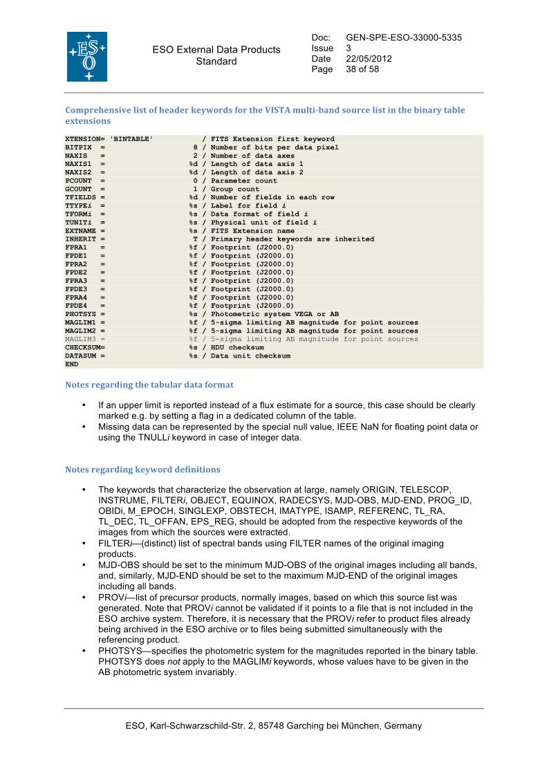
ESO External Data Products
Standard
Doc: Issue Date Page
GEN-SPE-ESO-33000-5335 3 22/05/2012 38 of 58
ESO, Karl-Schwarzschild-Str. 2, 85748 Garching bei München, Germany
Comprehensive list of header keywords for the VISTA multi-‐band source list in the binary table extensions
XTENSION= 'BINTABLE' / FITS Extension first keyword BITPIX = 8 / Number of bits per data pixel NAXIS = 2 / Number of data axes NAXIS1 = %d / Length of data axis 1 NAXIS2 = %d / Length of data axis 2 PCOUNT = 0 / Parameter count GCOUNT = 1 / Group count TFIELDS = %d / Number of fields in each row TTYPEi = %s / Label for field i TFORMi = %s / Data format of field i TUNITi = %s / Physical unit of field i EXTNAME = %s / FITS Extension name INHERIT = T / Primary header keywords are inherited FPRA1 = %f / Footprint (J2000.0) FPDE1 = %f / Footprint (J2000.0) FPRA2 = %f / Footprint (J2000.0) FPDE2 = %f / Footprint (J2000.0) FPRA3 = %f / Footprint (J2000.0) FPDE3 = %f / Footprint (J2000.0) FPRA4 = %f / Footprint (J2000.0) FPDE4 = %f / Footprint (J2000.0) PHOTSYS = %s / Photometric system VEGA or AB MAGLIM1 = %f / 5-sigma limiting AB magnitude for point sources MAGLIM2 = %f / 5-sigma limiting AB magnitude for point sources MAGLIM3 = %f / 5-sigma limiting AB magnitude for point sources CHECKSUM= %s / HDU checksum DATASUM = %s / Data unit checksum END Notes regarding the tabular data format
• If an upper limit is reported instead of a flux estimate for a source, this case should be clearly marked e.g. by setting a flag in a dedicated column of the table.
• Missing data can be represented by the special null value, IEEE NaN for floating point data or using the TNULLi keyword in case of integer data.
Notes regarding keyword definitions
• The keywords that characterize the observation at large, namely ORIGIN, TELESCOP, INSTRUME, FILTERi, OBJECT, EQUINOX, RADECSYS, MJD-OBS, MJD-END, PROG_ID, OBIDi, M_EPOCH, SINGLEXP, OBSTECH, IMATYPE, ISAMP, REFERENC, TL_RA, TL_DEC, TL_OFFAN, EPS_REG, should be adopted from the respective keywords of the images from which the sources were extracted.
• FILTERi—(distinct) list of spectral bands using FILTER names of the original imaging products.
• MJD-OBS should be set to the minimum MJD-OBS of the original images including all bands, and, similarly, MJD-END should be set to the maximum MJD-END of the original images including all bands.
• PROVi—list of precursor products, normally images, based on which this source list was generated. Note that PROVi cannot be validated if it points to a file that is not included in the ESO archive system. Therefore, it is necessary that the PROVi refer to product files already being archived in the ESO archive or to files being submitted simultaneously with the referencing product.
• PHOTSYS—specifies the photometric system for the magnitudes reported in the binary table. PHOTSYS does not apply to the MAGLIMi keywords, whose values have to be given in the AB photometric system invariably.

ESO External Data Products
Standard
Doc: Issue Date Page
GEN-SPE-ESO-33000-5335 3 22/05/2012 39 of 58
ESO, Karl-Schwarzschild-Str. 2, 85748 Garching bei München, Germany
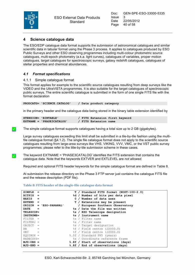
ESO External Data Products
Standard
Doc: Issue Date Page
GEN-SPE-ESO-33000-5335 3 22/05/2012 40 of 58
ESO, Karl-Schwarzschild-Str. 2, 85748 Garching bei München, Germany
4 Science catalogue data The ESO/EDP catalogue data format supports the submission of astronomical catalogues and similar scientific data in tabular format using the Phase 3 process. It applies to catalogues produced by ESO Public Surveys and other ESO observing programmes including multi-colour photometric source catalogues, multi-epoch photometry (a.k.a. light curves), catalogues of variables, proper motion catalogues, target catalogues for spectroscopic surveys, galaxy redshift catalogues, catalogues of stellar properties and chemical abundances.
4.1 Format specifications 4.1.1 Simple catalogue format This format applies for example to the scientific source catalogues resulting from deep surveys like the VIDEO and the UltraVISTA programmes. It is also suitable for the target catalogues of spectroscopic public surveys. The entire scientific catalogue is submitted in the form of one single FITS file with the format declaration PRODCATG= 'SCIENCE.CATALOG' / Data product category in the primary header and the catalogue data being stored in the binary table extension identified by XTENSION= 'BINTABLE' / FITS Extension first keyword EXTNAME = 'PHASE3CATALOG' / FITS Extension name The simple catalogue format supports catalogues having a total size up to 2 GB (gigabytes). Large survey catalogues exceeding this limit shall be submitted in a tile-by-tile fashion using the multi-file catalogue format (§4.1.2). The single file catalogue format does not apply to the scientific source catalogues resulting from large-area surveys like VHS, VIKING, VVV, VMC, or the VST public survey programmes; please refer to the title-by-tile submission scheme in these cases. The keyword EXTNAME = 'PHASE3CATALOG' identifies the FITS extension that contains the catalogue data. Note that the keywords EXTVER and EXTLEVEL are not allowed. Required and optional FITS header keywords for the simple catalogue format are defined in Table 8. At submission the release directory on the Phase 3 FTP server just contains the catalogue FITS file and the release description (PDF file). Table 8: FITS header of the single-‐file catalogue data format
SIMPLE = T / Standard FITS format (NOST-100-2.0) BITPIX = %d / Number of bits per data pixel NAXIS = 0 / Number of data axes EXTEND = T / Extensions may be present ORIGIN = 'ESO-PARANAL' / European Southern Observatory DATE = %s / Date the file was written TELESCOP= %s / ESO Telescope designation INSTRUME= %s / Instrument name FILTER = %s / Filter name FILTERi = %s / Filter name OBJECT = %s / Target designation RA = %f / Field centre (J2000.0) DEC = %f / Field centre (J2000.0) EQUINOX = %.0f / Standard FK5 (years) RADECSYS= %s / Coordinate reference frame MJD-OBS = %.8f / Start of observations (days) MJD-END = %.8f / End of observations (days)
✓
✓

ESO External Data Products
Standard
Doc: Issue Date Page
GEN-SPE-ESO-33000-5335 3 22/05/2012 41 of 58
ESO, Karl-Schwarzschild-Str. 2, 85748 Garching bei München, Germany
DATE-OBS= %s / Date the observation was started (UTC) TIMESYS = 'UTC ' / Time system used PROG_ID = %20s / ESO programme identification PROGIDi = %20s / ESO programme identification PROVi = %s / Originating science file OBSTECH = %s / Technique of observation PRODCATG= 'SCIENCE.CATALOG' / Data product category REFERENC= %s / Bibliographic reference ABMAGLIM= %f / 5-sigma limiting AB magnitude for point sources MAGLIMi = %f / 5-sigma limiting AB magnitude for point sources SKYSQDEG= %f / Sky coverage in units of square degrees FPRAi = %f / Footprint (J2000.0) FPDEi = %f / Footprint (J2000.0) CHECKSUM= %s / HDU checksum DATASUM = %s / Data unit checksum END ====> xtension 1 XTENSION= 'BINTABLE' / FITS Extension first keyword EXTNAME = 'PHASE3CATALOG' / FITS Extension name BITPIX = 8 / Number of bits per data pixel NAXIS = 2 / Number of data axes NAXIS1 = %d / Length of data axis 1 NAXIS2 = %d / Length of data axis 2 PCOUNT = 0 / Parameter count GCOUNT = 1 / Group count TFIELDS = %d / Number of fields in each row TTYPEi = %s / Label for field i TFORMi = %s / Data format of field i TCOMMi = %s / Description for field i TDISPi = %s / Display format for field i TUNITi = %s / Physical unit of field i TUCDi = %s / Unified content descriptor of field i TUTYPi = %s / Utype of field i TDMINi = %f / Minimum valid physical value of field i TDMAXi = %f / Maximum valid physical value of field i TINDXi = %c / TRUE if database index exists for field i TPRICi = %c / TRUE if field i represents principal parameter TXLNKi = %s / Type of data link represented by field i TXP3Ci = %s / Data link target collection name TXP3Ri = %d / Data link target release number TXCTYi = %s / Data link target catalogue’s TTYPE CHECKSUM= %s / HDU checksum DATASUM = %s / Data unit checksum END
4.1.1.1 Specific guidelines for survey catalogues For UltraVISTA and VIDEO the characterization of each survey catalogue in terms of coverage and flux limit using the following keywords is mandatory. FILTERi = %s / Filter name PHOTSYS = %s / Photometric system VEGA or AB MAGLIMi = %f / 5-sigma limiting AB magnitude for point sources SKYSQDEG= %f / Sky coverage in units of square degrees FPRAi = %f / Footprint (J2000.0) FPDEi = %f / Footprint (J2000.0) EPS_REG = %s / ESO public survey region name
ESO External Data Products
Standard
Doc: Issue Date Page
GEN-SPE-ESO-33000-5335 3 22/05/2012 42 of 58
ESO, Karl-Schwarzschild-Str. 2, 85748 Garching bei München, Germany
4.1.1.2 Catalogue Revisions The policies for ESO public surveys foresee that new data is released once per year. According to the progress of observations a new catalogue data release may exceed the previous one in terms of survey area, depth, spectral coverage (i.e. number of different filters), or a combination thereof. To release a revised version of a simple catalogue, the new FITS file that replaces the previous data altogether is submitted via Phase 3 as a superseding release of the same data collection. The name and title of the catalogue remains unchanged while the version number is automatically incremented by one. Other release options (“updating or complementing”) do not apply to simple catalogues.
4.1.2 Multi-file catalogues format for large catalogues This format applies to large-area survey programmes, which produce extensive scientific catalogues in excess of the 2 GB volume limit, namely VHS, VIKING, VVV, VMC, VST-Atlas, KIDS, and VPHAS+. The multi-file catalogue format supports the data preparation and submission of large survey catalogues in a tile-by-tile fashion. The catalogue data are submitted in the form of multiple FITS files, each of them corresponding to one survey tile as defined during Phase 2. Then, the data files will be automatically concatenated during archive ingestion to appear as one single catalogue unit in the ESO Catalogue Facility. Using the multi-file format each survey catalogue consists of one metadata file and N (>1) associated catalogue data files. The metadata file, which contains the global definitions for the entire catalogue in the primary header, is declared by PRODCATG= 'SCIENCE.MCATALOG' / Data product category The binary table extension of the metadata file specifies the structure of the catalogue in terms of the complete set of catalogue column definitions (Table 9), but usually does not contain data, i.e., the binary table may have zero rows. The associated catalogue data files have PRODCATG= 'SCIENCE.CATALOGTILE' / Data product category in the primary header and contain all the catalogue data together with a minimum set of mandatory keywords in their binary table extensions (Table 10). The multi-file catalogue format supports catalogue data files with a total size up to 2 GB (gigabytes). The keyword EXTNAME = 'PHASE3CATALOG' identifies the FITS extension that contains the catalogue (meta)data. Note that the keywords EXTVER and EXTLEVEL are not allowed. The column definitions in the metadata file apply to all data files of this catalogue. Each catalogue data file must define column labels (TTYPEi) and data types (TFORMi) consistent with the definition provided in the metadata file. The other column-related keywords do not need to be repeated. The tile-by-tile submission scheme is no replacement for source merging in the overlapping region of adjacent survey tiles. In practice, the Phase 3 data provider will define the final catalogue tiles (without overlaps) at last after cross-calibration and merging the data in overlapping image areas. Table 9: FITS header of the metadata file in multi-‐file catalogue format
SIMPLE = T / Standard FITS format (NOST-100-2.0) BITPIX = %d / Number of bits per data pixel NAXIS = 0 / Number of data axes
✓
✓
✓

ESO External Data Products
Standard
Doc: Issue Date Page
GEN-SPE-ESO-33000-5335 3 22/05/2012 43 of 58
ESO, Karl-Schwarzschild-Str. 2, 85748 Garching bei München, Germany
EXTEND = T / Extensions may be present ORIGIN = 'ESO-PARANAL' / European Southern Observatory DATE = %s / Date the file was written TELESCOP= %s / ESO Telescope designation INSTRUME= %s / Instrument name FILTER = %s / Filter name FILTERi = %s / Filter name OBJECT = %s / Target designation RA = %f / Field centre (J2000.0) DEC = %f / Field centre (J2000.0) EQUINOX = %.0f / Standard FK5 (years) RADECSYS= %s / Coordinate reference frame MJD-OBS = %.8f / Start of observations (days) MJD-END = %.8f / End of observations (days) DATE-OBS= %s / Date the observation was started (UTC) TIMESYS = 'UTC ' / Time system used PROG_ID = %20s / ESO programme identification PROGIDi = %20s / ESO programme identification OBSTECH = %s / Technique of observation PRODCATG= 'SCIENCE.MCATALOG' / Data product category REFERENC= %s / Bibliographic reference ABMAGLIM= %f / 5-sigma limiting AB magnitude for point sources MAGLIMi = %f / 5-sigma limiting AB magnitude for point sources SKYSQDEG= %f / Sky coverage in units of square degrees FPRAi = %f / Footprint (J2000.0) FPDEi = %f / Footprint (J2000.0) CHECKSUM= %s / HDU checksum DATASUM = %s / Data unit checksum END ====> xtension 1 XTENSION= 'BINTABLE' / FITS Extension first keyword EXTNAME = 'PHASE3CATALOG' / FITS Extension name BITPIX = 8 / Number of bits per data pixel NAXIS = 2 / Number of data axes NAXIS1 = %d / Length of data axis 1 NAXIS2 = %d / Length of data axis 2 PCOUNT = 0 / Parameter count GCOUNT = 1 / Group count TFIELDS = %d / Number of fields in each row TTYPEi = %s / Label for field i TFORMi = %s / Data format of field i TCOMMi = %s / Description for field i TDISPi = %s / Display format for field i TUNITi = %s / Physical unit of field i TUCDi = %s / Unified content descriptor of field i TUTYPi = %s / Utype of field i TDMINi = %f / Minimum valid physical value of field i TDMAXi = %f / Maximum valid physical value of field i TINDXi = %c / TRUE if database index exists for field i TPRICi = %c / TRUE if field i represents principal parameter TXLNKi = %s / Type of data link represented by field i TXP3Ci = %s / Data link target collection name TXP3Ri = %d / Data link target release number TXCTYi = %s / Data link target catalogue’s TTYPE CHECKSUM= %s / HDU checksum DATASUM = %s / Data unit checksum END Table 10: FITS header of the catalogue data file in multi-‐file catalogue format
SIMPLE = T / Standard FITS format (NOST-100-2.0)

ESO External Data Products
Standard
Doc: Issue Date Page
GEN-SPE-ESO-33000-5335 3 22/05/2012 44 of 58
ESO, Karl-Schwarzschild-Str. 2, 85748 Garching bei München, Germany
BITPIX = %d / Number of bits per data pixel NAXIS = 0 / Number of data axes EXTEND = T / Extensions may be present ORIGIN = 'ESO-PARANAL' / European Southern Observatory DATE = %s / Date the file was written TELESCOP= %s / ESO Telescope designation INSTRUME= %s / Instrument name FILTER = %s / Filter name FILTERi = %s / Filter name OBJECT = %s / Survey field/tile designation RA = %f / Survey field/tile centre (J2000.0) DEC = %f / Survey field/tile centre (J2000.0) EQUINOX = %.0f / Standard FK5 (years) RADECSYS= %s / Coordinate reference frame MJD-OBS = %.8f / Start of observations (days) MJD-END = %.8f / End of observations (days) DATE-OBS= %s / Date the observation was started (UTC) TIMESYS = 'UTC ' / Time system used PROG_ID = %20s / ESO programme identification PROGIDi = %20s / ESO programme identification PROVi = %s / Originating science file OBSTECH = %s / Technique of observation PRODCATG= 'SCIENCE.CATALOGTILE' / Data product category REFERENC= %s / Bibliographic reference ABMAGLIM= %f / 5-sigma limiting AB magnitude for point sources MAGLIMi = %f / 5-sigma limiting AB magnitude for point sources SKYSQDEG= %f / Sky coverage in units of square degrees FPRAi = %f / Footprint (J2000.0) FPDEi = %f / Footprint (J2000.0) CHECKSUM= %s / HDU checksum DATASUM = %s / Data unit checksum END ====> xtension 1 XTENSION= 'BINTABLE' / FITS Extension first keyword EXTNAME = 'PHASE3CATALOG' / FITS Extension name BITPIX = 8 / Number of bits per data pixel NAXIS = 2 / Number of data axes NAXIS1 = %d / Length of data axis 1 NAXIS2 = %d / Length of data axis 2 PCOUNT = 0 / Parameter count GCOUNT = 1 / Group count TFIELDS = %d / Number of fields in each row TTYPEi = %s / Label for field i TFORMi = %s / Data format of field i CHECKSUM= %s / HDU checksum DATASUM = %s / Data unit checksum END The processing provenance (PROVi) records the list of original science files that were used as input to produce the data of this catalogue file. Normally these are again Phase 3 science data products like images or source lists depending on the details of the reduction strategy.
4.1.2.1 Specific guidelines for survey catalogues For VHS, VIKING, VVV, VMC, VST-Atlas, KIDS, and VPHAS+ the characterization of each survey catalogue in terms of flux limit per filter and total sky coverage is mandatory. They must be defined in the metadata file: FILTERi = %s / Filter name
✓

ESO External Data Products
Standard
Doc: Issue Date Page
GEN-SPE-ESO-33000-5335 3 22/05/2012 45 of 58
ESO, Karl-Schwarzschild-Str. 2, 85748 Garching bei München, Germany
PHOTSYS = %s / Photometric system VEGA or AB MAGLIMi = %f / 5-sigma limiting AB magnitude for point sources SKYSQDEG= %f / Sky coverage in units of square degrees EPS_REG = %s / ESO public survey region name
4.1.2.2 Incremental Catalogue Data Releases Using the multi-file catalogue format in combination with the tile-by-tile delivery scheme supports incremental catalogue data releases for large-area surveys, i.e. annual data releases corresponding to their observational progress in terms of surveyed sky area. Each incremental data release adds new data to the previously released catalogue without the need to resubmit the previous data all over again. However, to avoid degeneracy in the resulting combined source catalogue careful planning and bookkeeping of the content of the tiles delivered by the survey team is required. Incremental releases are setup using the Phase 3 release manager by creating an “updating or complementing” release for the same data collection that has been defined for the initial release of this catalogue. For consistency reasons, the catalogue data to be submitted as incremental release must follow exactly the same column definitions as given in the first release. At the time of submission the release directory on the Phase 3 FTP server should contain N catalogue data files (according to the number of tiles), the catalogue metadata file, and the release description (PDF file). Note that the global catalogue parameters defined in the metadata file, like MJD-OBS, MJD-END, SKYSQDEG, always refer to the entire catalogue resulting from joining the data of the incremental release with the initial release. After the initial release the catalogue structure is essentially frozen. Therefore, the incremental release scheme is incompatible with the aim of adding new catalogue parameters (i.e. a new column) or otherwise changing the column definitions. In this case the “superseding” release scheme is the appropriate choice.
4.1.3 Column definitions Each catalogue parameter is defined in terms of the following keywords indexed with i between 1 and 999 without leading zero. Type Keyword Description (S) TTYPEi Name of the parameter. Every column of the catalogue shall be
assigned a concise, unique, case-insensitive name. E.g., ‘KMAG’ and ‘Kmag’ should be interpreted as the same name. It is required that the character string to be composed only of upper and lower case letters, digits, and the underscore (‘_’, decimal 95, hexadecimal 5F) character. The reserved keywords listed in Appendix A, page 55, must not be used as column names. Because of the case-insensitive interpretation, this means for instance that both ‘DEC’ and ‘Dec’ are invalid.
(S) TFORMi Data format string according to Table 11. Note in particular the constraint that numerical data must be scalar.
(S) TCOMMi Verbal description (68 characters max). (S) TUCDi Unified content descriptor according to the UCD1+ controlled
vocabulary to describe astronomical data quantities, version 1.23, IVOA 02 April 2007,
✓
✓
✓
✓
✓

ESO External Data Products
Standard
Doc: Issue Date Page
GEN-SPE-ESO-33000-5335 3 22/05/2012 46 of 58
ESO, Karl-Schwarzschild-Str. 2, 85748 Garching bei München, Germany
http://www.ivoa.net/Documents/latest/UCDlist.html [RD2]. CDS provides and maintains tools that help data providers to assign UCD1+ to astronomical measurements, see: http://cdsweb.u-strasbg.fr/UCD/tools.htx
(S) TDISPi Recommended format for displaying an ASCII text representation of the contents of this column. The permitted display format codes for each type of data (i.e., character strings, logical, integer, or real) are given in Table 12.
(S) TUNITi Units and scale in which the physical quantity in this column is expressed. The unit string consists of a (base) unit possibly preceded, with no intervening spaces, by a single character (two for deca) representing scale factors mostly in steps of 103. The value of this keyword should conform to the recommendations outlined in the ESO DICD [AD3], Chapter 8. Please also refer to [AD2], Sect. 4.3, for further guidance.
(S) TUTYPi Description of the catalogue column content in terms of a pointer to a concept expressed in a VO data model (optional).
(R) TDMINi Floating point number specifying the minimum valid physical value represented in the respective column of the catalogue, exclusive of any special values. Applies to numeric data type columns.
(R) TDMAXi Floating point number specifying the maximum valid physical value represented in the respective column of the catalogue, exclusive of any special values. Applies to numeric data type columns.
(I) TNULLi Shall contain the integer that represents an undefined value for data type B, I, J or K. The keyword must not be used in case of any other data type.
(L) TINDXi Setting this flag (TRUE) signifies that this parameter is considered important for searching and defining subsamples of the data. Based on this input a database index may be defined for this parameter to make database queries efficient.
(L) TPRICi Setting this flag (TRUE) defines the set of principal catalogue columns, which may be displayed by default. In addition, a data access service may return the set of principal catalogue columns unless the user has requested otherwise.
(S) TXLNKi If this column represents a data link, this keyword should be set to one of the string values ‘CATALOG’, ‘ARCFILE’ or ‘ORIGFILE’ to indicate the type of link. See §4.2.2.1 for instructions how to define data links.
(S) TXP3Ci Defines the target of this data link in terms of the Phase 3 collection name.
(S) TXP3Ri Defines the target of this data link in terms of the Phase 3 release number.
(S) TXCTYi Defines the name of the target column of this catalogue data link in terms of its TTYPEi.
4.1.3.1 Data types The data types supported for science catalogues are listed in Table 11. The provider of catalogue data selects a format appropriate to the form, range of values, and accuracy of the data. Note that vector-valued fields must be expanded into scalars before catalogue submission. It means for instance that the definition TFORMi=’5E’ is not supported and must be transformed into 5 separate columns, each one having TFORMi=’E’ (or, equivalently ‘1E’).
✓
✓
✓
✓

ESO External Data Products
Standard
Doc: Issue Date Page
GEN-SPE-ESO-33000-5335 3 22/05/2012 47 of 58
ESO, Karl-Schwarzschild-Str. 2, 85748 Garching bei München, Germany
Empty catalogue columns (where the repeat count specified in the value of the TFORMi keyword of the header is 0) are not permitted. Table 11: Supported data types for science catalogues
TFORMi Description 8-bit Bytes L Logical 1 nA String of n characters n B Unsigned 8-Bit Integer (Byte) 1 I 16-Bit Integer 2 J 32-Bit Integer 4 K 64-Bit Integer 8 E Single Precision Floating-Point 4 D Double Precision Floating-Point 8 Table 12: Valid TDISPi format values in BINTABLE extensions for catalogues
Field Value Data type Aw Character Lw Logical Iw.m Integer Fw.d Floating-point, fixed decimal notation Ew.dEe Floating-point, exponential notation Gw.dEe General; appears as F if significance not lost, else E. Dw.dEe Floating-point, exponential notation Notes: w is the width in characters of displayed values, m is the minimum number of digits displayed, d is the number of digits to right of decimal, and e is number of digits in exponent. The .m and Ee fields are optional.
4.1.3.2 Physical values Catalogues to be submitted via Phase 3 must directly store the physical values for each parameter without any scaling. The keywords TZEROi and TSCALi should not be used in the header definition and the Phase 3 validator raises an error if one of these keywords is present.
4.1.3.3 Missing data Sometimes a measurement could not be obtained for all parameters of a catalogue record, for example drop-outs in a multi-colour photometric catalogue. The fact that information is missing must be represented in the respective catalogue fields using the special NULL value according to Table 13. Entire columns that do not contain any valid data (dummy columns, padding) are not accepted and must be removed from the catalogue before data submission. Table 13: Representation of the special NULL value
TFORMi NULL representation L A 0 byte (hexadecimal 00) indicates a NULL value. nA Null strings are defined by the presence of an ASCII NULL as
the first character. B, I, J, K Null values are given by the value of the associated TNULLi
keyword.
✓
✓

ESO External Data Products
Standard
Doc: Issue Date Page
GEN-SPE-ESO-33000-5335 3 22/05/2012 48 of 58
ESO, Karl-Schwarzschild-Str. 2, 85748 Garching bei München, Germany
E, D The IEEE NaN (“Not a Number”) is used to represent null values.
Note that special IEEE values other than ‘NaN’, e.g. ‘Infinity’, are not permitted in Phase 3 science catalogue data.
4.1.3.4 Unique identifier constraint Each catalogue has one column that serves as unique identifier for its records and which is indicated by the value of the UCD attribute: TUCDi = 'meta.id;meta.main' / Unified content descriptor The identifier should be of string or integer data type having a minimum data type size to ensure global uniqueness in the context of the entire catalogue. For catalogues in multi-file format it means that the identifier must be unique with respect to the union set of all catalogue tiles. The unique identifier must not assume the special NULL value. See §4.2.1.1 for the application of this concept in the context of source catalogues.
4.2 Catalogue types 4.2.1 Astronomical source catalogue The source catalogue represents the high-level – often the final – data product of every astronomical survey including the nine ESO public imaging surveys currently running at the ESO/VISTA and VST facilities. The source catalogue normally contains exactly one entry for each source that has been detected and characterized during the survey programme, recording its best estimates for position, flux for each passband (i.e. apparent magnitudes), colours, morphology and other parameters depending on the scientific objectives. Following the guidelines for catalogue data preparation ensures both, smooth ingestion into the ESO Archive and, subsequently, efficient access and data exploitation by the community.
4.2.1.1 Unique source identifier Every source catalogue must have a unique source identifier, defined according to the IAU recommendations for nomenclature using the schema12
<prefix> J<hhmmss.s±ddmmss.s>
or, alternatively,
<prefix> J<hhmmss.ss±ddmmss.ss>
where prefix denotes the survey programme. The source identifier serves as a reference key and must be recorded in any other catalogue that contains measurements for the given source, including for instance multi-epoch photometric data collections or catalogues of variables. The source identifier must not assume the special NULL value. Table 14: Example of the source catalogue with source identifiers.
SOURCE_ID RAJ2000 DEJ2000 GAUSSIAN_SIGMA ELLIPTICITY … VHS 130248.6-‐621027.1
12 See also the “Specifications concerning designations for astronomical radiation sources outside the solar system” issued by the Task Group on Astronomical Designations of IAU Commission 5 (http://cdsweb.u-strasbg.fr/Dic/iau-spec.html).
✓
✓
✓
✓
ESO External Data Products
Standard
Doc: Issue Date Page
GEN-SPE-ESO-33000-5335 3 22/05/2012 49 of 58
ESO, Karl-Schwarzschild-Str. 2, 85748 Garching bei München, Germany
VHS 130248.9-‐621027.4 VHS 130250.1-‐621011.1 … Survey PIs and data providers are responsible for the definition of source identifiers and their consistent application across different data products and Phase 3 releases. The unified content descriptor (UCD) meta.id;meta.main shall be set to identify the catalogue column that represents the source identifier as in this example: TTYPE1 = 'SOURCE_ID ' / Label TFORM1 = '22A ' / Data format TCOMM1 = 'VHS source designation' / Description TUCD1 = 'meta.id;meta.main' / Unified content descriptor
4.2.1.2 Equatorial coordinates (J2000) Every source catalogue must contain at least Right Ascension and Declination in decimal degrees (J2000) to specify the celestial position of each source. The two coordinates must be identified in the FITS header by pos.eq.ra;meta.main and pos.eq.dec;meta.main set in the corresponding TUCDi keywords, for example: TTYPE2 = 'RAJ2000 ' / TFORM2 = 'E ' / TCOMM2 = 'Right ascension in decimal degrees (J2000)' / TUNIT2 = 'deg ' / TUCD2 = 'pos.eq.ra;meta.main' / Unified content descriptor TTYPE3 = 'DEJ2000 ' / TFORM3 = 'E ' / TCOMM3 = 'Declination in decimal degrees (J2000)' / TUNIT3 = 'deg ' / TUCD3 = 'pos.eq.dec;meta.main' / Unified content descriptor
4.2.1.3 Galactic coordinates Surveys primarily targeting galactic regions may include galactic coordinates (l,b) in addition, for example: TTYPE4 = 'GLON ' / TFORM4 = 'E ' / TCOMM4 = 'Galactic longitude' / TUNIT4 = 'deg ' / TUCD4 = 'pos.galactic.lon' / Unified content descriptor TTYPE5 = 'GLAT ' / TFORM5 = 'E ' / TCOMM5 = 'Galactic latitude' / TUNIT5 = 'deg ' / TUCD5 = 'pos.galactic.lat' / Unified content descriptor
4.2.1.4 Example for a colour index Multi-band source catalogues should generally contain colour indices for each source in order to facilitate efficient queries including colour constraints. Each survey team is free to identify suitable colours according to their scientific objectives. The colour definitions should be documented in the data release description associated to each catalogue. Example for the definition of the J-H colour index in the FITS header of a catalogue file:
✓

ESO External Data Products
Standard
Doc: Issue Date Page
GEN-SPE-ESO-33000-5335 3 22/05/2012 50 of 58
ESO, Karl-Schwarzschild-Str. 2, 85748 Garching bei München, Germany
TTYPE12 = 'J_H ' / TFORM12 = 'E ' / TCOMM12 = 'J-H colour index' / TDISP12 = 'F8.4 ' / TUNIT12 = 'mag ' / TUCD12 = 'phot.color;em.IR.J;em.IR.H' / Unified content descriptor TINDX12 = T /
4.2.2 Multi-epoch photometric catalogue The multi-epoch photometric catalogue is aimed at photometric light curves, i.e. time series of source flux measurements obtained in variability studies like the VVV – VISTA Variables in the Via Lactea survey programme. This type of catalogue, which records flux and possibly other parameters as a function of time, is always linked to a source catalogue (§4.2.1) that contains all sources being studied including their equatorial coordinates. In case of VVV the first-epoch multi-colour catalogue may serve this purpose. Table 15: Example of the multi-‐epoch catalogue VVV_MPHOT (schematically)
PHOT_ID SOURCE_ID MJD KSMAG KSERR … 1000001 VVV 130248.9-‐621027.4 1000002 VVV 130248.9-‐621027.4 1000003 VVV 130248.9-‐621027.4 1000004 VVV 130250.1-‐621011.1 1000005 VVV 130250.1-‐621011.1 1000006 VVV 130250.1-‐621011.1 … Table 16: Example of the associated source catalogue VVV_CAT
SOURCE_ID RAJ2000 DEJ2000 ZMAG1 YMAG1 JMAG1 HMAG1 KSMAG1 … VVV 130248.9-‐621027.4 VVV 130250.1-‐621011.1 VVV 130258.6-‐621027.1 … Table 15 illustrates the structure of the multi-epoch catalogue. Each record consists of the measurements for one source obtained at one epoch. PHOT_ID serves as unique identifier for this catalogue according to §4.1.3.4, using integer sequential numbers in this case. This column has the unified content descriptor meta.id;meta.main. SOURCE_ID identifies the astronomical source or object each flux measurement belongs to13 and establishes the link to the source catalogue (Table 16). This allows to build archive services that query photometric data based on position or other source properties. MJD (modified Julian date) specifies the epoch of observation for each measurement. Other time coordinates, like JD, are possible as well. The parameters KSMAG and KSERR represent the measurement recorded in this example. To summarize the requirements, the multi-epoch photometric catalogue consists of:
• One record (i.e. catalogue row) per source and epoch; • One column for the unique identifier of each measurement; • One column for the source identifier according to the associated source catalogue; • One column for the time coordinate;
13 The definition of unique source identifiers and their consistent application across different catalogues belongs to the responsibilities of the PI of the programme.

ESO External Data Products
Standard
Doc: Issue Date Page
GEN-SPE-ESO-33000-5335 3 22/05/2012 51 of 58
ESO, Karl-Schwarzschild-Str. 2, 85748 Garching bei München, Germany
• N columns for the measured (photometric) parameters according to the objectives of the scientific programme.
• No time-independent information. Note: Further results based on the analysis of the light curve data, for instance mean magnitude, indicator for flux variability like amplitude or likelihood of variation, variable type, period, phase etc. are recorded depending on the scientific objectives of the programme in a separate variability catalogue. The “Catalogue of Variables in the Via Lactea” (VVV_VAR) is designed for this purpose.
4.2.2.1 Data link definition The FITS extension header of the multi-epoch photometric catalogue defines the data link to the source catalogue VVV_CAT using the dedicated keywords TXLNKi, TXP3Ci, TXP3Ri, and TXCTYi associated to the SOURCE_ID column with column number 2 in this case (cf. Table 17). TXLNKi has the fixed string value ‘CATALOG’ to indicate the data link. TXP3Ci and TXP3Ri define the Phase 3 catalogue name VVV_CAT and the Phase 3 data release number 1, respectively. TXCTYi defines the column in the source catalogue which contains the source identifier, which is also labelled SOURCE_ID in this example. Table 17: FITS extension header for the multi-‐epoch photometric catalogue example VVV_MPHOT
XTENSION= 'BINTABLE' / Binary table BITPIX = 8 / Required value NAXIS = 2 / Required value NAXIS1 = 38 / Number of bytes per row NAXIS2 = 8984450 / Number of rows PCOUNT = 0 / Normally 0 (no varying arrays) GCOUNT = 1 / Required value TFIELDS = 4 / Number of columns in table EXTNAME = 'PHASE3CATALOG' / TTYPE1 = 'PHOT_ID ' / TFORM1 = 'J ' / TCOMM1 = 'Photometric data point identifier (running number)' / TUCD1 = 'meta.id;meta.main' / TPRIC1 = T / TTYPE2 = 'SOURCE_ID' / Label TFORM2 = '22A ' / Data format TCOMM2 = 'VVV source identifier (catalogue data link)' / Description TUCD2 = 'meta.id' / Unified content descriptor TXLNK2 = 'CATALOG' / Data link type TXP3C2 = 'VVV_CAT' / Data link to Phase 3 catalogue VVV_CAT TXP3R2 = 1 / Data link release number of VVV_CAT TXCTY2 = 'SOURCE_ID' / Data link catalogue’s TTYPE TTYPE3 = 'MJD ' / TFORM3 = 'D ' / TCOMM3 = 'Date of observations' / TDISP3 = 'F12.6 ' / TUNIT3 = 'days ' / TUCD3 = 'time.epoch' / TINDX3 = T / TTYPE4 = 'KSMAG ' / TFORM4 = 'E ' / TCOMM4 = 'Ks magnitude' / TUNIT4 = 'mag ' / TUCD4 = 'phot.mag;em.IR.K' / TINDX4 = T / TPRIC4 = T / TTYPE5 = 'KSERR ' / TFORM5 = 'E ' / TCOMM5 = 'Error of Ks magnitude' /
ESO External Data Products
Standard
Doc: Issue Date Page
GEN-SPE-ESO-33000-5335 3 22/05/2012 52 of 58
ESO, Karl-Schwarzschild-Str. 2, 85748 Garching bei München, Germany
TUNIT5 = 'mag ' / TUCD5 = 'stat.error;phot.mag;em.IR.K' / TINDX5 = F / TPRIC5 = F / CHECKSUM= 'IGaKJESKIEYKIEYK' / HDU checksum DATASUM = '3598906350' / data unit checksum END
4.2.3 Catalogue of variables The catalogue of variables, which results from variability studies like the VVV – VISTA Variables in the Via Lactea survey programme is primarily defined by its specific content, e.g. mean magnitude, indicator for flux variability like amplitude or likelihood of variation, variable type, period, phase, etc. The PI is responsible for the exact definition of these parameters, driven by the scientific objective of the programme. Phase 3 requires that these parameters definitions be documented, formally in terms of FITS keywords (TTYPEi, TCOMMi, TUCDi, etc.), and informally in the data release description. Furthermore, given that the catalogue of variables represents a subtype of the source catalogue (§4.2.1), the requirements specified therein apply as well, meaning that the catalogue must include the unique source identifier and equatorial (J2000) coordinates.
4.2.3.1 Subsamples If the catalogue of variables contains a subset of sources published in another Phase 3 source catalogue, then this link should be made explicit using the data link keywords. The formalism is the same as for the multi-epoch photometric catalogue (§4.2.2), for instance TTYPE2 = 'SOURCE_ID' / Label TFORM2 = '22A ' / Data format TCOMM2 = 'VVV source identifier (catalogue data link)' / Description TUCD2 = 'meta.id' / Unified content descriptor TXLNK2 = 'CATALOG' / Data link type TXP3C2 = 'VVV_CAT' / Data link to Phase 3 catalogue VVV_CAT TXP3R2 = 1 / Data link release number of VVV_CAT TXCTY2 = 'SOURCE_ID' / Data link catalogue’s TTYPE assuming that the catalogue of variables has the source identifier defined in column #2, referring to the multi-colour catalogue named VVV_CAT with release number 1.
4.3 Instructions for catalogue submission 4.3.1 Phase 3 data collection and release The Phase 3 process for catalogues relies on the same concepts of data collection and data release as the submission and release for other types of data like images or spectra. The Phase 3 Release Manager is the tool to manage these entities. 14 Each catalogue is represented by one and only one Phase 3 data collection. Therefore, for each new catalogue to be submitted, a dedicated Phase 3 data collection must be defined using the Phase 3 Release Manager. In this step, the data provider is prompted to enter name and title of the data collection, which refers to the catalogue in this case. Subsequent submissions extending or revising an existing catalogue need to be submitted as a further data release to the same data collection to ensure consistent management of versions including the proper automatic tagging.
14 http://www.eso.org/rm

ESO External Data Products
Standard
Doc: Issue Date Page
GEN-SPE-ESO-33000-5335 3 22/05/2012 53 of 58
ESO, Karl-Schwarzschild-Str. 2, 85748 Garching bei München, Germany
4.3.2 Catalogue name The catalogue name is identical to the Phase 3 data collection name. This name is a string identifier, which must be defined as Phase 3 data collection name by the data provider before starting the first data submission. This determines the corresponding directory on the Phase 3 FTP server where the data then need to be transferred to. The name cannot be modified later. The catalogue name is used to define catalogue data links (see, e.g., §4.2.2.1). The catalogue name is a character string composed of upper-case letters (A–Z), digits (0–9), and the underscore (‘_’, decimal 95, hexadecimal 5F) character. Spaces are not allowed. The string should have between 5 and 20 characters. Specifically, the string shall match the (Perl) regular expression: ^[A-Z_][A-Z0-9_]{4,19}$. This constraint is validated by the system when a new Phase 3 data collection is created using the Release Manager. Because the catalogue/collection name is employed as unique identifier in the context of the Phase 3 system, not just in the context of your Phase 3 programme, names should be sufficiently specific. Therefore, for instance, the name VIDEO_CDFS_CAT should be preferred over just CDFS_CAT. It is generally a good idea to prepend the catalogue/collection name with the (abbreviated) programme name. Subsequent versions of a given catalogue share the same name, i.e. the combination of catalogue name and catalogue version number (see below) uniquely identifies each catalogue instance stored in the ESO archive. For this reason the catalogue name, and Phase 3 data collection name in general, should not contain a number indicating its version. See Table 18 for examples. Table 18: Overview of Phase 3 catalogue data deliveries from the ESO/VISTA public survey programmes
Name Title Content
UVISTA_DEEP_CAT Deep Near-Infrared Catalogue of the COSMOS Field
Aperture-matched source catalogue in YJHKs and NB118 based on the deep stacked images.
UVISTA_UDEEP_CAT Ultra-deep Near-Infrared Catalogue of the COSMOS Field
Aperture-matched source catalogue in the YJHKs and NB118 based on the stacked images of the ultra-deep part of the survey.
VIKING_CAT VIKING J-Band Selected ZYJHKs Source Catalogue
Merged multi-band source catalogue with aperture-matched photometry in ZYJHKs for all objects selected and defined in J-band.
VMC_CAT VISTA Magellanic Survey YJKs Source Catalogue
Homogeneous epoch-merged and band-merged master source catalogue in YJKs
VMC_VAR VISTA Magellanic Survey Catalogue of Variables
Mean magnitude, amplitude/likelihood of variation (when possible), variable type (i.e. RR Lyrae stars, Cepheids, late-type giants, eclipsing binaries).
VMC_MPHOT VISTA Magellanic Survey Multi-Epoch Photometry
Homogeneous catalogue of multi-epoch photometric data points listing the measured magnitude as a function of source ID and time of observation (also known as light curve).
VVV_CAT ZYJHKs Catalogue in the Via Lactea
Homogeneous source catalogue with aperture-matched photometry on the whole survey area (bulge and plane region) based on the first-epoch data.
VVV_VAR Catalogue of Variables in the Via Lactea
Mean magnitude, amplitude/likelihood of variation (when possible), variable type (i.e. RR Lyrae stars, Cepheids, late-type giants, eclipsing binaries).

ESO External Data Products
Standard
Doc: Issue Date Page
GEN-SPE-ESO-33000-5335 3 22/05/2012 54 of 58
ESO, Karl-Schwarzschild-Str. 2, 85748 Garching bei München, Germany
VVV_MPHOT Multi-Epoch Ks-Band Photometry in the Via Lactea
One homogeneous catalogue of multi-epoch Ks photometry in the VVV bulge and plane region.
VHS_DES_CAT VHS-DES Source Catalogue Merged multi-band source catalogue with aperture-matched photometry in JHKs.
VHS_ATLAS_CAT VHS-ATLAS Source Catalogue
Merged multi-band source catalogue with aperture-matched photometry in YJHKs.
VHS_GPS_CAT VHS-GPS Source Catalogue Merged multi-band source catalogue with aperture-matched photometry in J and Ks.
VIDEO_ELIAS_CAT Deep ZYJHKs Catalogue of the ELIAS-S1 field
Combined multi-band source catalogue with aperture-matched photometry in ZYJHKs based on the deep (i.e. stacked) images.
VIDEO_XMM_CAT Deep ZYJHKs Catalogue of the XMM-LSS field
Combined multi-band source catalogue with aperture-matched photometry in ZYJHKs based on the deep (i.e. stacked) images.
VIDEO_CDFS_CAT Deep ZYJHKs Catalogue of the Chandra Deep Field South
Combined multi-band source catalogue with aperture-matched photometry in ZYJHKs based on the deep (i.e. stacked) images.
4.3.3 Catalogue Title The catalogue title is identical to the Phase 3 data collection title. Analogous to the name, the title for the Phase 3 data collection is defined by the data provider before starting the first data submission. The title allows for a brief significant text description of the content with a maximum length of 68 characters. It is used for display purposes in the context of the entire ESO Science Archive, not just in the context of your Phase 3 programme. Subsequent versions of a given catalogue/collection share the same title (as well as the name). Therefore, the Phase 3 catalogue/collection title should not contain any number indicating the data release version either. The Phase 3 support scientist (ESO/ASG) may modify the PI-provided title of a Phase 3 data collection/catalogue with regard to the overall alignment across the ESO Science Archive.
4.3.4 Catalogue Release number The catalogue release number is identical to the Phase 3 data release number, sometimes also referred to as “release tag”. The Phase 3 Release Manager automatically generates this index, numbering subsequent versions of the catalogue/data collection, when the Phase 3 user creates a new data release. The catalogue release number is required to define catalogues data links (§4.2.2.1).
ESO External Data Products
Standard
Doc: Issue Date Page
GEN-SPE-ESO-33000-5335 3 22/05/2012 55 of 58
ESO, Karl-Schwarzschild-Str. 2, 85748 Garching bei München, Germany
Appendix A Sybase IQ Reserved Words Source of information: http://infocenter.sybase.com/help/index.jsp?topic=/com.sybase.infocenter.dc38151.1510/html/iqrefbb/Alhakeywords.htm
SQL reserved words
active add all algorithm
alter and any append
as asc auto backup
begin between bigint binary
bit bottom break by
calibrate calibration call cancel
capability cascade case cast
certificate char char_convert character
check checkpoint checksum clientport
close columns comment commit
committed comparisons computes conflict
connect constraint contains continue
convert create cross cube
current current_timestamp current_user cursor
date dbspace dbspacename deallocate
debug dec decimal declare
decoupled decrypted default delay
delete deleting density desc
deterministic disable distinct do
double drop dynamic elements
else elseif enable encapsulated
encrypted end endif escape
except exception exclude exec

ESO External Data Products
Standard
Doc: Issue Date Page
GEN-SPE-ESO-33000-5335 3 22/05/2012 56 of 58
ESO, Karl-Schwarzschild-Str. 2, 85748 Garching bei München, Germany
execute existing exists explicit
express externlogin fastfirstrow fetch
first float following for
force foreign forward from
full gb goto grant
group grouping having hidden
history holdlock identified if
in inactive index index_lparen
inner inout input insensitive
insert inserting install instead
int integer integrated intersect
into iq is isolation
jdk join kb key
lateral left like lock
logging login long mb
match membership message mode
modify namespace natural new
no noholdlock nolock not
notify null numeric of
off on open optimization
option options or order
others out outer over
pages paglock partial partition
passthrough password plan preceding
precision prepare primary print
privileges proc procedure proxy
publication raiserror range raw
readcommitted readonly readpast readtext

ESO External Data Products
Standard
Doc: Issue Date Page
GEN-SPE-ESO-33000-5335 3 22/05/2012 57 of 58
ESO, Karl-Schwarzschild-Str. 2, 85748 Garching bei München, Germany
readuncommitted readwrite real recursive
reference references release relocate
remote remove rename reorganize
repeatable repeatableread reserve resizing
resource restore restrict return
revoke right rollback rollup
root row rowlock rows
save savepoint schedule scroll
secure select sensitive serializable
service session set setuser
share smallint soapaction some
space sqlcode sqlstate start
stop subtrans subtransaction synchronize
syntax_error table tablock tablockx
tb temporary then ties
time timestamp tinyint to
top tran transaction transactional
transfer tries trigger truncate
tsequal unbounded uncommitted union
unique uniqueidentifier unknown unsigned
update updating updlock url
user utc using validate
values varbinary varchar variable
varying virtual view wait
waitfor web when where
while window with withauto
with_cube with_lparen with_rollup within
word work writeserver writetext

ESO External Data Products
Standard
Doc: Issue Date Page
GEN-SPE-ESO-33000-5335 3 22/05/2012 58 of 58
ESO, Karl-Schwarzschild-Str. 2, 85748 Garching bei München, Germany
xlock xml


![MASTER SPECIFICATIONS Division 26 · PDF fileMASTER SPECIFICATIONS Division 26 – ELECTRICAL Release 1.0 [March] 2017 Released by: Northwestern University Facilities Management Operations](https://static.fdocuments.net/doc/165x107/5a790fa47f8b9a7b548ca142/master-specifications-division-26-master-specifications-division-26-electrical.jpg)