Dagger Flat 2005-2
8
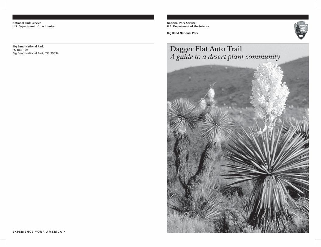
National Park Service U.S. Department of the Interior Big Bend National Park PO Box 129 Big Bend National Park, TX 79834 EXPERIENCE YOUR AMERICA™ National Park Service U.S. Department of the Interior Big Bend National Park Dagger Flat Auto Trail A guide to a desert plant community
Transcript of Dagger Flat 2005-2
National Park Service U.S. Department of the Interior
Big Bend National Park PO Box 129 Big Bend National Park, TX 79834
E X P E R I E N C E Y O U R A M E R I C A ™
National Park Service U.S. Department of the Interior
Big Bend National Park
Dagger Flat Auto Trail A guide to a desert plant community
Cra
ig B
arri
ng
ton
4 Dagger Flat Auto Trail 5
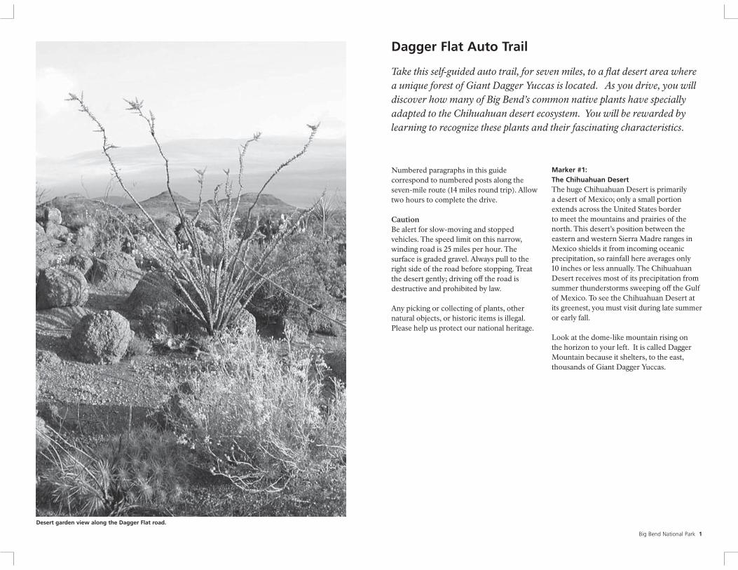
Desert garden view along the Dagger Flat road.
Numbered paragraphs in this guide correspond to numbered posts along the seven-mile route (14 miles round trip). Allow two hours to complete the drive.
Caution Be alert for slow-moving and stopped vehicles. The speed limit on this narrow, winding road is 25 miles per hour. The surface is graded gravel. Always pull to the right side of the road before stopping. Treat the desert gently; driving off the road is destructive and prohibited by law.
Any picking or collecting of plants, other natural objects, or historic items is illegal. Please help us protect our national heritage.
Dagger Flat Auto Trail
Take this self-guided auto trail, for seven miles, to a flat desert area where
a unique forest of Giant Dagger Yuccas is located. As you drive, you will
discover how many of Big Bend’s common native plants have specially
adapted to the Chihuahuan desert ecosystem. You will be rewarded by
learning to recognize these plants and their fascinating characteristics.
Marker #1: The Chihuahuan Desert The huge Chihuahuan Desert is primarily a desert of Mexico; only a small portion extends across the United States border to meet the mountains and prairies of the north. This desert’s position between the eastern and western Sierra Madre ranges in Mexico shields it from incoming oceanic precipitation, so rainfall here averages only 10 inches or less annually. The Chihuahuan Desert receives most of its precipitation from summer thunderstorms sweeping off the Gulf of Mexico. To see the Chihuahuan Desert at its greenest, you must visit during late summer or early fall.
Look at the dome-like mountain rising on the horizon to your left. It is called Dagger Mountain because it shelters, to the east, thousands of Giant Dagger Yuccas.
Big Bend National Park 1
6 7
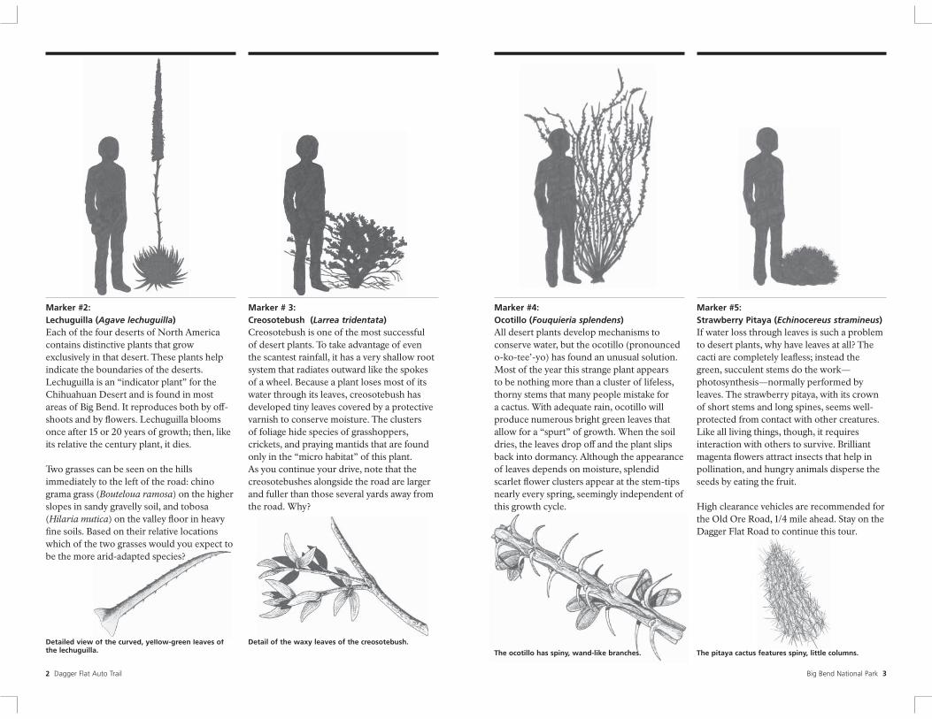
Marker #2: Lechuguilla (Agave lechuguilla) Each of the four deserts of North America contains distinctive plants that grow exclusively in that desert. These plants help indicate the boundaries of the deserts. Lechuguilla is an “indicator plant” for the Chihuahuan Desert and is found in most areas of Big Bend. It reproduces both by off -shoots and by fl owers. Lechuguilla blooms once after 15 or 20 years of growth; then, like its relative the century plant, it dies.
Two grasses can be seen on the hills immediately to the left of the road: chino grama grass (Bouteloua ramosa) on the higher slopes in sandy gravelly soil, and tobosa (Hilaria mutica) on the valley floor in heavy fine soils. Based on their relative locations which of the two grasses would you expect to
Detailed view of the curved, yellow-green leaves of
be the more arid-adapted species?
the lechuguilla.
2 Dagger Flat Auto Trail
Marker # 3: Creosotebush (Larrea tridentata) Creosotebush is one of the most successful of desert plants. To take advantage of even the scantest rainfall, it has a very shallow root system that radiates outward like the spokes of a wheel. Because a plant loses most of its water through its leaves, creosotebush has developed tiny leaves covered by a protective varnish to conserve moisture. The clusters of foliage hide species of grasshoppers, crickets, and praying mantids that are found only in the “micro habitat” of this plant. As you continue your drive, note that the creosotebushes alongside the road are larger and fuller than those several yards away from the road. Why?
Detail of the waxy leaves of the creosotebush.
Marker #4: Ocotillo (Fouquieria splendens) All desert plants develop mechanisms to conserve water, but the ocotillo (pronounced o-ko-tee’-yo) has found an unusual solution. Most of the year this strange plant appears to be nothing more than a cluster of lifeless, thorny stems that many people mistake for a cactus. With adequate rain, ocotillo will produce numerous bright green leaves that allow for a “spurt” of growth. When the soil dries, the leaves drop off and the plant slips back into dormancy. Although the appearance of leaves depends on moisture, splendid scarlet flower clusters appear at the stem-tips nearly every spring, seemingly independent of this growth cycle.
The ocotillo has spiny, wand-like branches.
Marker #5: Strawberry Pitaya (Echinocereus stramineus) If water loss through leaves is such a problem to desert plants, why have leaves at all? The cacti are completely leafless; instead the green, succulent stems do the work— photosynthesis—normally performed by leaves. The strawberry pitaya, with its crown of short stems and long spines, seems well-protected from contact with other creatures. Like all living things, though, it requires interaction with others to survive. Brilliant magenta flowers attract insects that help in pollination, and hungry animals disperse the seeds by eating the fruit.
High clearance vehicles are recommended for the Old Ore Road, 1/4 mile ahead. Stay on the Dagger Flat Road to continue this tour.
The pitaya cactus features spiny, little columns.
Big Bend National Park 3
8 9
Marker #6: Texas Persimmon (Diospyros texana) DRIVE SLOWLY TO THE WASH AHEAD.
Green vegetation lines this “wash” although water flows down it only occasionally. Compared with the surrounding slope, the wash bottom is only slightly wetter, yet it’s moist enough to allow different types of plants to grow. The Texas persimmon thrives here and provides sweet fruit for the wildlife that uses the wash as a trail.
CAUTION: Washes may fl ash fl ood during rainstorms. Do not enter this wash if water is fl owing across road.
The Texas persimmon has oval hairy leaves, a sweet black fruit, and a smooth grey bark.
4 Dagger Flat Auto Trail
Marker #7: Torrey Yucca (Yucca torreyi) Many people associate the desert with the cactus family, but the Chihuahuan Desert tends to be dominated instead by woody plants such as the yuccas and lechuguilla. Yuccas and cacti share some of the same adaptations to the desert environment: spiny protection and the ability to store moisture—usually in the roots—until needed. A less obvious shared trait is nighttime transpiration—the exchange of water for carbon dioxide. Other less drought-resistant plants transpire under the desert sun at the risk of losing precious moisture.
The Torrey yucca is the most common
Detail drawing of the leaf of the torrey yucca.
yucca in Big Bend and can be found in most locations throughout the park.
Marker # 8: Sotol (Dasylirion Ieiophyllum) You are now in the foothills of the Deadhorse Mountains. Although you have climbed only about 400 feet from the beginning of this road, the surrounding plant community now includes sotol. This plant prefers mid-elevations where slightly more rain falls. Sotol is found in a distinct band of vegetation known as the sotol grassland that surrounds the park’s higher mountains. The “heart” of the sotol was baked for food by Native American Indians.
The ribbon-like leaves of the sotol have distinctive curved teeth on the margin.
Marker #9: Igneous Hills Notice that the hills before you are a diff erent color than those behind you. These hills are the eroded remains of a volcanic sill, a body of dark volcanic rock that was injected between layers of light-colored limestone. Soils weathered from the sill are more acidic than the surrounding limestone soils, producing more favorable growing conditions for some plants than for others. Look for a change in plant cover as you pass beyond the dark sill.
Big Bend National Park 5
10 11
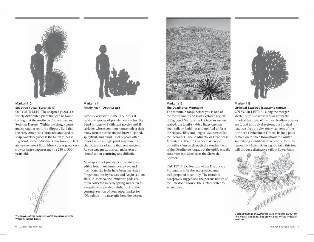
Marker #10: Soaptree Yucca (Yucca elata) ON YOUR LEFT. The soaptree yucca is a widely distributed plant that can be found throughout the northern Chihuahuan and Sonoran Deserts. Within the shaggy trunk and spreading roots is a slippery fl uid that the early Americans extracted and used as soap. Soaptree yucca is the tallest yucca in Big Bend: some individuals may tower 30 feet above the desert floor. Most yuccas grow very slowly; large soaptrees may be 250 to 300 years old.
The leaves of the soaptree yucca are narrow with whitish, curling f bers.
Dagger Flat Auto Trail
Marker #11: Prickly Pear (Opuntia sp.)
Almost every state in the U. S. hosts at least one species of prickly pear cactus. Big Bend is home to 8 different species and 11 varieties whose common names refl ect their many forms: purple-tinged, brown-spined, spinyfruit, and blind. Prickly pears often hybridize, so a single plant may have the characteristics of more than one species. As you can guess, this can make exact identification confusing and diffi cult.
Most species of prickly pear produce an edible fruit in mid-summer. Sweet and nutritious, the fruits have been harvested for generations by natives and Anglo settlers alike. In Mexico, the immature pads are often collected in early spring and eaten as a vegetable or pickled relish. Look in the gourmet section of your supermarket for “Nopalitos” — a tasty gift from the desert.
Marker #12: The Deadhorse Mountains The mountain range before you is one of the most remote and least explored regions of Big Bend National Park. Once an ancient seabed, the fossil-studded limestone has been split by faultlines and uplifted to form the ridges, cliffs, and long valleys now called the Sierra del Caballo Muerto, or Deadhorse Mountains. The Rio Grande has carved Boquillas Canyon through the southern end of the Deadhorse range, but the uplift actually continues into Mexico as the Sierra del Carmen.
CAUTION: Exploration of the Deadhorse Mountains is for the experienced and well-prepared hiker only. The terrain is deceptively rugged and the porous nature of the limestone allows little surface water to accumulate.
Marker #13: Littleleaf Leadtree (Leucaena retusa) ON YOUR LEFT. All along the meager shelter of this shallow arroyo grows the littleleaf leadtree. While most leadtree species are found in tropical regions, the littleleaf leadtree likes the dry, rocky canyons of the northern Chihuahuan Desert. Its long pods remain on the tree throughout the winter, simplifying identification when the fern-like leaves have fallen. After a good rain, this tree will produce distinctive yellow fl ower balls.
Detail drawings showing the yellow f ower balls, fern-like leaves, and long, fat brown pods of the littleleaf leadtree.
Big Bend National Park 6 7
13
Marker #14: Candelilla (Euphorbia antisyphiitica) ON YOUR LEFT. Candelilla thrives in the surrounding limestone soils. Although candelilla looks like a clump of slender, spineless cacti, it is actually related to the poinsettia and castor-bean. Through “convergent evolution,” similar plants have solved the problems of living in harsh deserts in many of the same ways. As succulents, both candelilla and cactus are able to store water in the stems; both ar e leafless to help avoid water loss; and both are covered with a protective, waxy coating that conserves water. The wax covering the candelilla plants is so thick, it is processed and can be found as an ingredient in chewing gum, cosmetics, car wax, shoe polish, and many other products.
The candelilla features leaf ess, gray-green leaves.
8 12 Dagger Flat Auto Trail
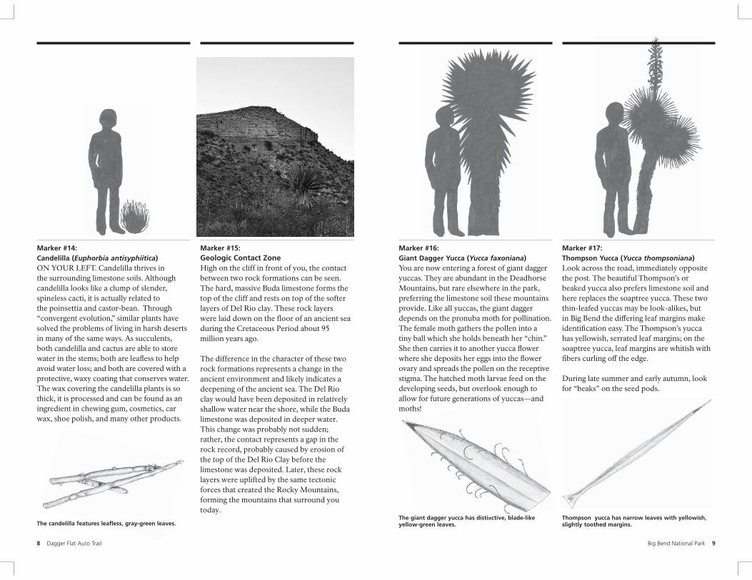
Marker #15: Geologic Contact ZoneHigh on the cliff in front of you, the contact between two rock formations can be seen. The hard, massive Buda limestone forms the top of the cliff and rests on top of the softer layers of Del Rio clay. These rock layers were laid down on the floor of an ancient sea during the Cretaceous Period about 95 million years ago.
The difference in the character of these two rock formations represents a change in the ancient environment and likely indicates a deepening of the ancient sea. The Del Rio clay would have been deposited in relatively shallow water near the shore, while the Buda limestone was deposited in deeper water. This change was probably not sudden; rather, the contact represents a gap in the rock record, probably caused by erosion of the top of the Del Rio Clay before the limestone was deposited. Later, these rock layers were uplifted by the same tectonic forces that created the Rocky Mountains, forming the mountains that surround you today.
Marker #16: Giant Dagger Yucca (Yucca faxoniana) You are now entering a forest of giant dagger yuccas. They are abundant in the Deadhorse Mountains, but rare elsewhere in the park, preferring the limestone soil these mountains provide. Like all yuccas, the giant dagger depends on the pronuba moth for pollination. The female moth gathers the pollen into a tiny ball which she holds beneath her “chin.” She then carries it to another yucca fl ower where she deposits her eggs into the fl ower ovary and spreads the pollen on the receptive stigma. The hatched moth larvae feed on the developing seeds, but overlook enough to allow for future generations of yuccas—and moths!
The giant dagger yucca has distinctive, blade-like yellow-green leaves.
Marker #17: Thompson Yucca (Yucca thompsoniana) Look across the road, immediately opposite the post. The beautiful Thompson’s or beaked yucca also prefers limestone soil and here replaces the soaptree yucca. These two thin-leafed yuccas may be look-alikes, but in Big Bend th e differing leaf margins make identi fication easy. The Thompson’s yucca has yellowish, serrated leaf margins; on the soaptree yucca, leaf margins are whitish with fibers curling off the edge.
During late summer and early autumn, look for “beaks” on the seed pods.
Thompson yucca has narrow leaves with yellowish, slightly toothed margins.
Big Bend National Park 9
14 15
Marker #18: Honey Mesquite (Prosopis glandulosa) Notice the small tree on the left side of the road, opposite the signpost. Both the leadtree and the honey mesquite are members of the legume family, as their compound leaves and “pea pods” clearly show. The mesquite is more abundant today than in the past. Long term climate variation was already leading to a decline of native grassland habitat. In addition, during the ranching era of the Big Bend, cattle ate the sweet pods of mesquite once the grasses became less abundant. The hard seeds of the mesquite pass through the digestive tract of cattle, which transport the seeds some distance away from the mother tree, increasing the spread of the mesquite.
Close-up view of the thorns and compound leaves of the honey mesquite.
10 Dagger Flat Auto Trail
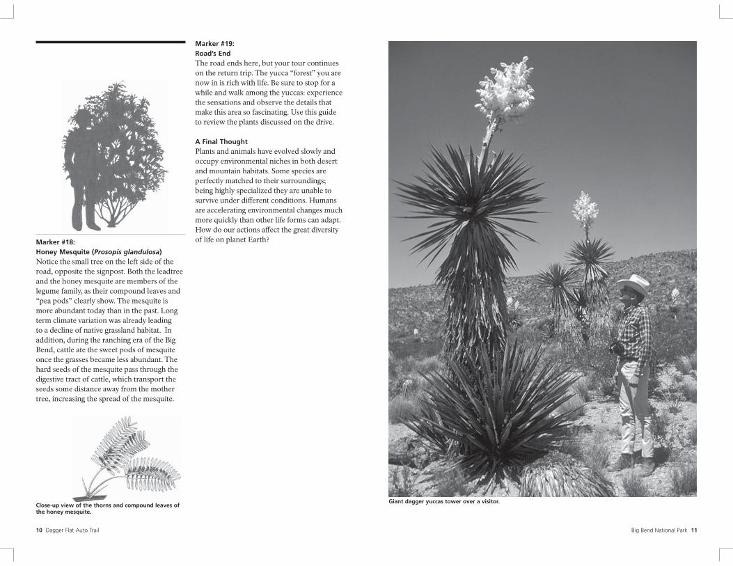
Marker #19: Road’s End The road ends here, but your tour continues on the return trip. The yucca “forest” you are now in is rich with life. Be sure to stop for a while and walk among the yuccas: experience the sensations and observe the details that make this area so fascinating. Use this guide to review the plants discussed on the drive.
A Final Thought Plants and animals have evolved slowly and occupy environmental niches in both desert and mountain habitats. Some species are perfectly matched to their surroundings; being highly specialized they are unable to survive under diff erent conditions. Humans are accelerating environmental changes much more quickly than other life forms can adapt. How do our actions affect the great diversity of life on planet Earth?
Giant dagger yuccas tower over a visitor.
Big Bend National Park 11
16 Big Bend National Park 17
The National Park Service was established on August 25, 1916. . . “to conserve the scenery and the natural and historic objects and the wildlife. . . and to provide for the enjoyment of the same in such manner and by such means as will leave them unimpaired for the enjoyment of future generations.”
Authorized by congress in 1935, and established in June 1944, Big Bend National Park preserves the most representative example of the Chihuahuan Desert ecosystem in the United States.
As conservation educators, the park’s Division of Interpretation and Visitor Services provides guided walks, talks, evening slide programs, workshops, and other educational activities as well as written materials such as this trail guide.
Written by Alan Van Valkenburg 2005 text revision by Park Ranger Angelina Yost Original art by Cynthia Parr Designed by Park Ranger Eric Leonard
The Big Bend Natural History Association, established in 1956 as a private, non-profit organization, champions the mission of the National Park Service in facilitating popular interpretation of the scenic, scientifi c, and historic values of Big Bend and encourages research related to those values. The Association conducts seminars and publishes, prints, or otherwise provides books, maps, and interpretive materials on the Big Bend region. Proceeds fund exhibits, fi lms, interpretive programs, seminars, museum activities, and research.
Produced by the Division of Interpretation and Visitor Services. Printed with funds provided by the Big Bend Natural History Association. December, 2005
12 Dagger Flat Auto Trail
Ro
n R
ath
ke
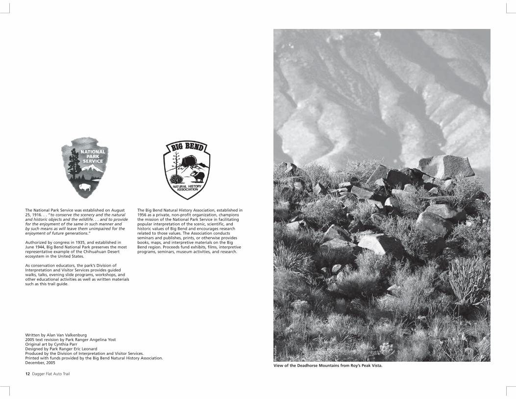
View of the Deadhorse Mountains from Roy’s Peak Vista.