csis the New Silk Road - Amazon Web Services · focused on defense and security; regional...
30
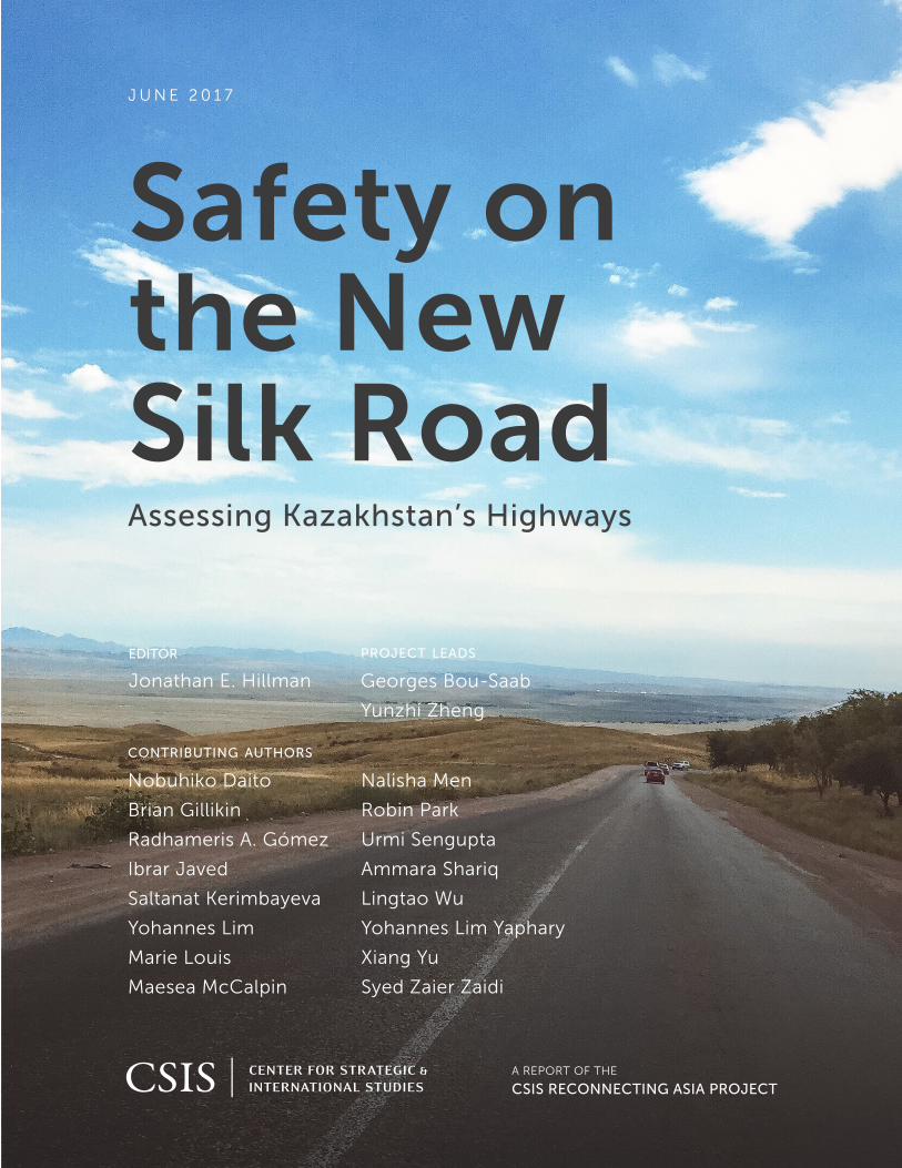
JUNE 2017 A REPORT OF THE CSIS RECONNECTING ASIA PROJECT Safety on the New Silk Road Assessing Kazakhstan’s Highways EDITOR Jonathan E. Hillman PROJECT LEADS Georges Bou-Saab Yunzhi Zheng CONTRIBUTING AUTHORS Nobuhiko Daito Brian Gillikin Radhameris A. Gómez Ibrar Javed Saltanat Kerimbayeva Yohannes Lim Marie Louis Maesea McCalpin Nalisha Men Robin Park Urmi Sengupta Ammara Shariq Lingtao Wu Yohannes Lim Yaphary Xiang Yu Syed Zaier Zaidi
-
Upload
truongtuyen -
Category
Documents
-
view
213 -
download
0
Transcript of csis the New Silk Road - Amazon Web Services · focused on defense and security; regional...
COVER PHOTO ADOBE STOCK
1616 Rhode Island Avenue NW
Washington, DC 20036
202 887 0200 | www.csis.org
J U N E 2 0 1 7
A REPORT OF THE
CSIS RECONNECTING ASIA PROJECT
Safety on the New Silk RoadAssessing Kazakhstan’s Highways
editor
Jonathan E. Hillman
project leads
Georges Bou-Saab
Yunzhi Zheng
contributing authors
Nobuhiko Daito
Brian Gillikin
Radhameris A. Gómez
Ibrar Javed
Saltanat Kerimbayeva
Yohannes Lim
Marie Louis
Maesea McCalpin
Nalisha Men
Robin Park
Urmi Sengupta
Ammara Shariq
Lingtao Wu
Yohannes Lim Yaphary
Xiang Yu
Syed Zaier Zaidi

Blank

JUNE 2017
Safety on the New Silk Road Assessing Kazakhstan’s Highways
EDITOR Jonathan E. Hillman
PROJECT LEADS Georges Bou-Saab Yunzhi Zheng
CONTRIBUTING AUTHORSNobuhiko Daito Brian Gillikin Radhameris A. Gómez Ibrar Javed Saltanat Kerimbayeva Yohannes Lim Marie Louis Maesea McCalpin Nalisha Men
Robin Park Urmi Sengupta Ammara Shariq Lingtao Wu Yohannes Lim Yaphary Xiang Yu Syed Zaier Zaidi
A Report of the CSIS RECONNECTING ASIA PROJECT

About CSIS
For over 50 years, the Center for Strategic and International Studies (CSIS) has worked to develop solutions to the world’s greatest policy challenges. Today, CSIS scholars are providing strategic insights and bipartisan policy solutions to help decisionmakers chart a course toward a better world.
CSIS is a nonprofit organization headquartered in Washington, D.C. The Center’s 220 full-time staff and large network of affiliated scholars conduct research and analysis and develop policy initiatives that look into the future and anticipate change.
Founded at the height of the Cold War by David M. Abshire and Admiral Arleigh Burke, CSIS was dedicated to finding ways to sustain American prominence and prosperity as a force for good in the world. Since 1962, CSIS has become one of the world’s preeminent international institutions focused on defense and security; regional stability; and transnational challenges ranging from energy and climate to global health and economic integration.
Thomas J. Pritzker was named chairman of the CSIS Board of Trustees in November 2015. Former U.S. deputy secretary of defense John J. Hamre has served as the Center’s president and chief executive officer since 2000.
CSIS does not take specific policy positions; accordingly, all views expressed herein should be understood to be solely those of the author(s).
© 2017 by the Center for Strategic and International Studies. All rights reserved.
Center for Strategic & International Studies 1616 Rhode Island Avenue, NW Washington, DC 20036 202-887-0200 | www.csis.org

| III
Contents
IV Tables and Figures
V Acknowledgments
VI Executive Summary
1 CHAPTER 1 | Introduction
4 CHAPTER 2 | Analysis
5 Quality Assessment
7 Crash Assessment
10 Limitations
11 CHAPTER 3 | Recommendations
14 CHAPTER 4 | Conclusion
15 Appendix A. CAREC Routes
16 Appendix B. Crash Calculations
18 About the Editor and Contributing Authors

IV | CSIS Reconnecting Asia Project
Tables and Figures 12 Table 1. Summary of Countermeasures
13 Table 2. Countermeasures for CAREC Roads
15 Table 3. CAREC Routes, 2015
3 Figure 1. Traffic Accidents in Kazakhstan
4 Figure 2. Major Roads Analyzed
6 Figure 3. Asian Highway Network Surface Conditions
7 Figure 4. Asian Highway Network Crash and Fatality Rates
8 Figure 5. Crash Severity of Six Roads in CAREC Corridor
9 Figure 6. Collision Type per CAREC Road Segment
9 Figure 7. Reasons for Crashes per CAREC Road Segment
10 Figure 8. Critical Crash Rates per Road Segment (CAREC)

Safety on the New Silk Road | V
Acknowledgments This study was a double experiment. The first experiment was tackling an unfamiliar issue. For teaching us about road safety, and tapping their network of fellows, we are indebted to Brendan Halleman and Michael Dreznes of the International Road Federation. Along with Ian Hughes, who drew from his experience as a consultant for the Asian Development Bank, Brendan and Mike served as the review committee for this report. We are also grateful to Lord George Robertson and his colleagues at the FIA Foundation for their assistance and encouragement.
The second experiment was testing a new model for scholarly collaboration. We convened an international team of specialists, who worked across time zones and juggled their own scholarly and professional pursuits. This report is the product of their diverse perspectives and collective expertise. We are grateful for the energy and enthusiasm they brought to this endeavor, which could serve as a model for investigating other aspects of Asia’s infrastructure competition and for CSIS’s research more broadly.
For their willingness to chart this unknown territory with us, special thanks are due to CSIS’s Brzezinski Institute on Geostrategy, Caterpillar Inc., and Bechtel Group for their generous support.

VI | CSIS Reconnecting Asia Project
Executive Summary For developing economies like Kazakhstan, Asia’s infrastructure push offers opportunities to improve road safety. In Kazakhstan, road crashes are estimated to cost $9 billion annually, or nearly 4 percent of gross domestic product (GDP). Kazakhstan is also a keystone for regional infrastructure investment programs such as the United Nations’ Asian Highway Network (AHN), the Asian Development Bank’s Central Asia Regional Economic Cooperation (CAREC) program, and more recently, China’s “Belt and Road” initiative. To help set priorities within these overlapping initiatives, this study analyzes road quality and crash data covering approximately 13,000 kilometers of highways, or 13.4 percent of Kazakhstan’s highway network. Within this sample, most roads are undivided with two lanes and rated below “good” condition. Most crashes are related to infrastructure deficiencies and noncompliance of the drivers to traffic rules and regulations. A series of maps identifies priority areas for improvement. Building on this analysis and a review of international best practices, cost-effective infrastructure measures are recommended for improving connectivity and road safety.

| 1
01
Introduction Road safety is a local challenge with global public health and development implications. Every year, road crashes kill 1.25 million people and injure more than 50 million people around the world, exceeding deaths from malaria and HIV-related illnesses.1 As the leading killer of young people between the ages of 15 and 29 years, road crashes push households into poverty and strain national healthcare systems.2 Road traffic deaths and injuries cost many developing countries from 2 to 5 percent of GDP each year.3 In these and other ways, the human and economic toll is staggering.
Road safety is worse in low- and middle-income countries (LMIC), where rates can be more than double those in high-income countries (HIC). 4 While plateauing globally since 2007,5 road fatalities in LMIC are expected to increase to almost 2 million per year by 2020.6 In Central Asia, road accidents are the 6th leading cause of death. This is higher than the global ranking (8th) and the ranking in Western Europe (24th), where serious efforts have been made to improve road safety. Most traffic crashes are preventable, and there is considerable evidence that interventions can improve road safety.7 Developed countries that have been successfully implementing these interventions have experienced corresponding reductions in road traffic deaths since the 1960s.8
Long overlooked, road safety has recently gained more attention internationally and within Central Asia. In September 2015, road safety was added to the UN Sustainable Development Goals.9 This agenda targets a 50 percent reduction in the absolute number of road traffic deaths and injuries by 2020 and aims to provide access to safe, affordable, and sustainable transport systems for all road users by 2030. In October 2016, CAREC ministers endorsed a road safety strategy that aims to cut in half the number of fatalities by 2030. This implies saving 23,000 lives
1 World Health Organization, Global Status Report on Road Safety 2015 (Geneva, 2015), http://www.who.int/violence_injury_prevention/road_safety_status/2015/en/. 2 Nak Moon Sung and Mauricio Ríos, “Road Crashes Have More Impact on Poverty Than You Probably Thought,” The World Bank Group Transport for Development Blog, February 25, 2015, http://blogs.worldbank.org/transport/road-crashes-have-more-impact-poverty-you-probably-thought. 3 Ibid. 4 Fred Wegman, “The Future of Road Safety: A Worldwide Perspective,” IATSS [International Association of Traffic and Safety Sciences] Research 40, no. 2 (January 2017), https://doi.org/10.1016/j.iatssr.2016.05.003. 5 World Health Organization, Global Status Report on Road Safety 2015. 6 Wegman, “The Future of Road Safety.” 7 Heidi Worley, “Road Traffic Accidents Increase Dramatically Worldwide,” Population Reference Bureau, March 2006, http://www.prb.org/Publications/Articles/2006/RoadTrafficAccidentsIncreaseDramaticallyWorldwide.aspx. 8 Ibid. 9 World Health Organization, “UN General Assembly Adopts a Resolution on Improving Global Road Safety,” April 15, 2016, http://www.who.int/violence_injury_prevention/media/news/2016/15_04/en/.

2 | CSIS Reconnecting Asia Project
and 250,000 serious injuries every year, amounting to approximately $16 billion per year.10 Meeting these ambitious goals will require resources and support from government officials.
For developing economies like Kazakhstan, Asia’s infrastructure push offers opportunities to improve road safety. Among the 52 European and Central Asian countries examined in the World Health Organization’s most recent report on road safety, Kazakhstan has the highest road traffic death rate.11 Illustrating accidents by road segment, Figure 1 underscores the scale and severity of this challenge. Poor road infrastructure is a major exacerbating factor. An estimated 17 percent of Kazakhstan’s highways fall below internationally recognized minimum standards, and only 3 percent of its highways meet the highest standard.12 In Kazakhstan, road crashes are estimated to cost $9 billion annually, or nearly 4 percent of GDP.13 The number of vehicles registered in Kazakhstan has more than doubled over the last decade,14 and as incomes and motorization rates continue rising, so will the importance of road safety. To address these challenges, the government of Kazakhstan is developing a wide-ranging national road safety strategy.15
Executing that strategy will require setting investment priorities. Every economy has finite resources to maintain, upgrade, and build roads. To be sure, road safety is not the only concern for infrastructure planning, which must balance a range of economic and social goals. In Kazakhstan, where roughly 45 percent of the population lives in rural areas, increasing roadway access is not only important for the safe transport of goods but also for creating access to emergency services, schools, and employment centers.16 Nor is infrastructure planning the only factor impacting road safety, which also depends on improving driver behavior and raising public awareness. Yet there is a strong link between bringing highways up to international standards and improving road safety.17
Improved roads can also contribute to greater regional connectivity, particularly in Central Asia, where large gaps remain. Kazakhstan is a keystone for regional infrastructure investment programs such as the United Nations’ Asian Highway Network (AHN), the Asian Development Bank’s Central Asia Regional Economic Cooperation (CAREC) program, and more recently, China’s “Belt and Road” initiative. Domestically, an estimated $9 billion in infrastructure investment is planned under the Nurly Zhol program, which was announced by Kazakhstan’s President Nursultan Nazarbayev in November 2014.18 How can these programs, and the
10 Asian Development Bank, Safely Connected: A Regional Road Safety Strategy for CAREC Countries, 2017–2030, (February 2017), http://dx.doi.org/10.22617/RPT178658-2. 11 Ibid. 12 Rafis Abazov, “Kazakhstan Welcomes China’s Belt and Road Initiative,” HKTDC Research, April 20, 2016, http://hkmb.hktdc.com/en/1X0A5WB1/hktdc-research/Kazakhstan-Welcomes-China%E2%80%99s-Belt-and-Road-Initiative. 13 Asian Development Bank, Safely Connected. 14 Government of Kazakhstan, “Automobile Transportation,” http://stat.gov.kz/getImg?id=ESTAT099960. 15 Yerbolat Uatkhanov, “Kazakhstan Develops Road Safety Plan, Fatalities Decline,” The Astana Times, May 7, 2017, http://astanatimes.com/2017/05/kazakhstan-develops-road-safety-plan-fatalities-decline/. 16 Committee on Statistics of the Ministry of National Economy of the Republic of Kazakhstan, Women and Men in Kazakhstan 2009–2013 (Astana, 2014), stat.gov.kz/getImg?id=ESTAT086608. 17 World Health Organization, Global Status Report on Road Safety 2015. 18 Republic of Kazakhstan, “Nurly Zhol: the $9 Billion Path to the Future,” Invest in Kazakhstan 2015, http://kazakhstan.newsdeskmedia.com/Images/Upload/Kazakhstan_2015/PDFs/Nurly_Zhol.pdf.

Safety on the New Silk Road | 3
associated infrastructure investments, be prioritized and leveraged to ensure they advance both the national connectivity and safety agendas?
Figure 1. Traffic Accidents in Kazakhstan
This report tackles that question in three parts. It begins by assessing road quality and crash data for selected AHN and CAREC roads. Using these findings, cost-effective safety measures are recommended to strengthen Kazakhstan’s road network. These recommendations are based on a review of international best practices. Finally, a conclusion notes the limitations of this study and suggests areas for further research.

4 | CSIS Reconnecting Asia Project
02
Analysis This section analyzes approximately 13,000 kilometers of roads (illustrated in Figure 2), equivalent to 13.4 percent of Kazakhstan’s highway network.19 It compares road quality to international standards and examines crash data. The quality analysis suggests that most roads are undivided with two lanes and rated below “good” condition. The crash analysis suggests that most crashes are related to infrastructure deficiencies and noncompliance of the drivers to traffic rules and regulations. A series of maps identifies priority areas for improvement.
Figure 2. Major Roads Analyzed
19 Republic of Kazakhstan Statistics Committee 2016, “Statistics Committee Official Internet Resource,” http://www.stat.gov.kz/faces/wcnav_externalId/homeNumbersTransport;jsessionid=e-1E0f0SrTLxCqy3wCI4lPZYcvDpydkS3WNPe9KhyCxgGlAl3j_H!481998659!-1837500658?_adf.ctrl-state=qk2b29ewk_43\&_afrLoop=584959611053105#%40%3F_afrLoop%3D584959611053105%26_adf.ctrl-state%3Dh463pvdyw_4.

Safety on the New Silk Road | 5
The roads examined are part of two overlapping connectivity efforts. Supported by the United Nation’s Economic and Social Commission for Asia and the Pacific (UN-ESCAP), the AHN aims to improve the highway systems in Asia by maximizing use of the continent’s existing highways.20 The CAREC program aims to accelerate economic growth and poverty reduction by facilitating the movement of goods and people through sustainable, safe, and user-friendly transport and trade networks.21
Quality Assessment
This section compares road conditions to international best standards and practices for safe road design and management. Of the roads examined, 76 percent are undivided two-lane roads, and more than 50 percent have not been upgraded to asphalt concrete. As Figure 3 shows, 45 percent of the AHN road segments have less than half of their surface in good condition. Studies have found that poor pavement conditions increase safety risks,22 with rougher pavement affecting light passenger vehicles even more than heavy freight vehicles. 23 Poor surfaces lead to higher speed variation between vehicles, making collisions more likely. Unpaved and poorly maintained roads also increase vehicle maintenance costs. In sum, roadway surfaces can impact both safety and efficiency.24
These challenges are evident along the AHN. Design standards for the AHN were set in 1995 to standardize guidelines and minimum requirements across member countries.25 Significant work remains to meet these requirements. Poor signage and potholes increase driving risks, particularly at night and in rural areas.26 Although most roadway segments are categorized as having “good” or “fair” road surface conditions, the lack of sidewalks in urban areas and settlements and inadequate shoulders create dangerous conditions for road users. Of course, classification alone is no guarantee of safety. A Class I roadway segment provides the highest pavement standards for safety, yet roads containing Class I segments resulted in 325 accidents and 109 fatalities in 2010, roughly 58 percent of total accidents and 51 percent of total fatalities.
20 United Nations Economic and Social Commission for Asia and the Pacific, “Asian Highway,” http://www.unescap.org/our-work/transport/asian-highway/about. 21 Asian Development Bank, CAREC Transport and Trade Facilitation Strategy 2020 (Astana, 2014), https://www.adb.org/sites/default/files/institutional-document/34107/files/carec-ttfs-2020.pdf; Central Asia Regional Economic Cooperation, “Regional Cooperation at Work in Central Asia,” http://www.carecprogram.org/index.php?page=carec-program. 22 Peter Christensen and Arild Ragnow, The Condition of the Road Surface and Safety: The Importance of Rut Depth, Roughness (IRI) and Changes in Cross-Slope for Road Safety (Oslo: Institute of Transport Economics, 2006). 23 Bernie-Anne King, “The Effect of Road Roughness on Traffic Speed and Road Safety” (BA diss., University of Southern Queensland, 2014). 24 American Association of State Highway Transportation Officials (AASHTO), A Policy on Geometric Design of Highways and Streets (Washington, DC: 2011). 25 United Nations Economic and Social Commission for Asia and the Pacific, Asian Highway Classification and Design Standards (Washington, DC: 2015), http://www.unescap.org/resources/classification-and-design-standards. 26 Transport Corridor Europe-Caucasus-Asia (TRACECA), Logistics Processes and Motorways of the Sea II–LOGMOS Master Plan–Annex 9.1. Kazakhstan Country Profile (2013). http://www.traceca-org.org/fileadmin/fm-dam/TAREP/65ta/Master_Plan/MPA9.1KZ.pdf.

6 | CSIS Reconnecting Asia Project
Figure 3. Asian Highway Network Surface Conditions
Three characteristics of the CAREC roads were evaluated: cross-sectional, horizontal, and vertical geometry. Importantly, these roads lack paved shoulders, which are useful for improving traffic safety.27 The roads are essentially straight, which is preferable to roadways with sharp curves. However, it should be noted that very long tangents may make drivers drowsy, which increases the risk of a crash.28 Three of the six routes29 contain some steep grades (greater than 5 percent) and should be examined further with attention to combinations of horizontal curve and vertical grade.30 Four out of six CAREC routes will be upgraded from two-lane undivided highways to four-lane divided carriageways, which are expected to decrease road crashes due to overtaking and head-on collisions.
27 AASHTO, A Policy on Geometric Design of Highways and Streets; Rune Elvik et al., The Handbook of Road Safety Measures (United Kingdom: Emerald Group Publishing, 2004); Frank Gross and Paul P. Jovanis, “Estimation of the Safety Effectiveness of Lane and Shoulder Width: Case-Control Approach,” Journal of Transportation Engineering 133, no. 6 (2007), http://dx.doi.org/10.1061/(ASCE)0733-947X(2007)133:6(362)#sthash.XRIWFKoO.dpuf; PIARC, Roadway Safety Manual (Paris: World Road Association, 2003). 28 China Communications First Highway Survey Design and Research Institute, Design Specification for Highway Alignment (Beijing: Ministry of Transport of the People’s Republic of China, 2006), http://www.lancarver.com/upfiles/pdf/2014-04-04/040416355562.pdf. 29 The three routes are Karaganda-Burylbaital-Kurty, Taldykorgan-Kalbatau, and Atyrau-Astrakhan. 30 Karin Bauer and Douglas Harwood, “Safety Effects of Horizontal Curve and Grade Combinations on Rural Two-Lane Highways,” Transportation Research Record: Journal of the Transportation Research Board 2398 (2013), http://dx.doi.org/10.3141/2398-05.

Safety on the New Silk Road | 7
Crash Assessment
Different crash analyses were conducted on AHN and CAREC roads, depending on the availability of data. For AHN roads, a crash rate per kilometer of roadway was calculated. This method provides a comparison per kilometer, so that it becomes easier to initially identify high crash locations before resorting to other methods, particularly for rural roadways (see Appendix B for more details).31 Using this method, Figure 4 indicates segments with a crash-per-kilometer rate greater than 0.05. The colors of the roads indicate crash frequency; lighter shades represent fewer crashes, and darker shades represent a greater number of crashes. Stars indicate the number of fatalities sustained from traffic accidents, with larger stars corresponding to higher numbers of fatalities. Areas with darker lines and larger stars indicate high-risk areas in greater need of effective countermeasures. As Figure 4 shows, crashes are concentrated in an arc along Kazakhstan’s eastern periphery. If east-west overland trade expands in the coming years, as promoters of regional connectivity initiatives expect,32 these areas could experience additional traffic.
Figure 4. Asian Highway Network Crash and Fatality Rates
31 U.S. Department of Transportation Federal Highway Administration, Roadway Safety Information Analysis: A Manual for Local Rural Road Owners (Washington, DC: 2010), https://safety.fhwa.dot.gov/local_rural/training/fhwasaxx1210/s3.cfm. 32 Wade Shepard, “The Western Europe-Western China Expressway to Connect the Yellow Sea with the Baltic,” Forbes, July 10, 2016, https://www.forbes.com/sites/wadeshepard/2016/07/10/the-western-europe-western-china-expressway-to-connect-the-yellow-sea-with-the-baltic/#59cd12b36c95.

8 | CSIS Reconnecting Asia Project
Four analyses were conducted for the CAREC corridors. Figure 5 plots crash severity and shows that Karaganda-Burylbaital-Kurty is the road segment with the most fatalities for all types of crashes. Figure 6 shows the main types of crashes reported per road segment. Figure 7 shows the causes of the crashes per road segment, suggesting that overtaking error and speed were the leading causes. Crash investigations tend to overestimate driver error and underestimate other factors, including poor road design, so these results should be viewed cautiously. Finally, critical crash rates per road segment were calculated (see Appendix B for further details). Figure 8 illustrates the critical crash rate for each of the six CAREC corridors, with darker road segments indicating a higher rate.
Figure 5. Crash Severity of Six Roads in CAREC Corridor

Safety on the New Silk Road | 9
Figure 6. Collison Type per CAREC Road Segment
Figure 7. Reasons for Crashes per CAREC Road Segment
0
50
100
150
200
250
Single VehicleRun-Off
Head-On Pedestrian Other
Num
ber o
f Cra
shes
Collision Type
Collision Type per CAREC Road Segment
Karaganda-Burylbaital-Kurty
Taldykorgan-Kalbatau
Atyrau-Astrakhan
Uzynagash-Otar
Zhetybai-Zhanaozen
Beyneu-Akjigit
0
50
100
150
200
250
Speed OvertakingError
DriverFatigue
DrunkDriving
Other
Num
ber o
f Cra
shes
Reason for Crashes
Reasons for Crashes per CAREC Road Segment
Karaganda-Burylbaital-KurtyTaldykorgan-Kalbatau
Atyrau-Astrakhan
Uzynagash-Otar
Beyneu-Akjigit
Zhetybai-Zhanaozen

10 | CSIS Reconnecting Asia Project
Figure 8. Critical Crash Rates per Road Segment (CAREC)
Limitations
This analysis has several limitations. First, although it draws from the latest publicly available sources, the underlying quality and crash data would benefit from being updated. For example, it is possible that roads have been improved since the data was collected. Furthermore, better crash reporting could influence the results. It is not unusual for crashes to be underreported in rural areas. Second, additional data sources could facilitate a deeper analysis. Particularly useful would be information about road usage. By adjusting for how heavily roads are used, it would be possible to identify areas where crashes are statistically more likely despite better road conditions. These results can be updated as additional data becomes available.

Safety on the New Silk Road | 11
03
Recommendations
This section recommends infrastructure measures to improve Kazakhstan’s road safety and regional connectivity. To be sure, infrastructure improvements are necessary but not sufficient. Enforcing traffic laws,33 increasing public awareness,34 and educating drivers35 are also critical safety measures, but they are beyond the scope of this study. In this section, cost-effective road safety solutions are recommended based on the preceding analysis and a literature review of international best practices.
Combining quality and crash analysis, Table 1 provides a menu of countermeasures to minimize road crashes, fatalities, and critical injuries. On-the-ground inspections will help road authorities decide which of these countermeasures are most appropriate for a given road segment. The CAREC data allows for a more localized set of recommendations. Table 2 summarizes these recommendations and associates them with individual road segments.
This study also underscores the importance of road safety audits, data collection, and information sharing. Road safety audits can be conducted at any stage of a roadway life-cycle to provide greater insight. They require time and resources, but studies have found the benefits far exceed costs.36 Data collected from road safety audits could be shared with international institutions and the public more broadly. In recent years, Kazakhstan has been making more information available through its Ministry of National Economy37 and road authorities.38 Providing regular updates with greater detail on road quality and crashes would help inform policy decisions and related research. It would also demonstrate Kazakhstan’s progress in this important area.
33 Dominic Zaal, Traffic Law Enforcement: A Review of the Literature (Monash University Accident Research Center, 1994), 2, http://www.monash.edu/__data/assets/pdf_file/0019/216343/muarc053.pdf. 34 Judy J. Fleiter, Ioni M. Lewis, and Barry C. Watson, “Promoting a More Positive Traffic Safety Culture in Australia: Lessons Learnt and Future Directions” (paper presented at the Australasian College of Road Safety Conference, Adelaide, Australia, November 6–8, 2013), 1, http://eprints.qut.edu.au/64494/2/64494.pdf. 35 Ashish Verma et al., “Recommendations for Driver Licensing and Traffic Law Enforcement in India Aiming to Improve Road Safety,” Current Science 100, no. 9 (May 10, 2011): 1375, http://www.currentscience.ac.in/Volumes/100/09/1373.pdf. 36 PIARC, Roadway Safety Manual. 37 Ministry of National Economy of the Republic of Kazakhstan, “Official Statistics Operational Data,” http://www.stat.gov.kz/faces/wcnav_externalId/homeNumbersTransport?_adf.ctrl-state=qk2b29ewk_43&_afrLoop=595406511412525#%40%3F_afrLoop%3D595406511412525%26_adf.ctrl-state%3D14nel4fmy_4. 38 Kazavtozhol, http://kazautozhol.kz/index.php/ru/.

12 | CSIS Reconnecting Asia Project
Table 1. Summary of Countermeasures
Primary Contributor to Road Crash Infrastructure Improvement
Run-Off Crashes on Curves
Sign and Pavement Marking Improvements
Central Hatching
Post-Mounted Delineators and Chevrons
Edge Lines
Shoulder and Edge Line Rumble Strips
Pavement Markings Over Rumble Strips
Adequate Driver Rest Areas
Motorcycle Attenuating Devices
“Forgiving” Poles
Advanced Warning Signs
Traffic Calming Measures
High-Friction Surface Technologies
Run-Off Crashes on Straight Portions
Sign and Pavement Marking Improvements
Shoulder and Edge Line Rumble Strips
Pavement Markings Over Rumble Strips
Roadside Cable Barriers
Wider Longitudinal Pavement Markings
Safety Edges
Adequate Driver Rest Areas
“Forgiving” Poles
Head-On Crashes
Raised Pavement Markers
Median Barriers
Central Hatching
Centerline Rumble Strips
Crashes at Junctions/Intersections
On-Pavement Horizontal Signing
Longitudinal Channelizers
Traffic-Calming Measures
Advanced Warning Signs
High-Friction Surface Technologies
Automated Enforcement
Pedestrians Crashes
On-Pavement Horizontal Signing
Traffic-Calming Measures
Sidewalks in Urban Areas
Speed
Traffic-Calming Measures
Speed Displays
Automated Enforcement
Overtaking Traffic-Calming Measures
Automated Enforcement
Fatigue
Sign and Pavement Marking Improvements
Shoulder and Edge Line Rumble Strips
Pavement Markings Over Rumble Strips
Adequate Driver Rest Areas
U-turns
On-Pavement Horizontal Signing
U-turn Lanes
Traffic-Calming Measures
Clear Advanced Signage

Safety on the New Silk Road | 13
Table 2. Countermeasures for CAREC Roads
Countermeasures for CAREC Roads
Road Segments Primary Crash Type
Primary Cause Low-Cost Countermeasures
Atyrau-Astrakhan
Head-on
Crash Overtaking Error
Raised Pavement Markers
Median Barriers
Central Hatching
Centerline Rumble Strips
Traffic-Calming Measures
Automated Enforcement
Uzynagash-Otar
Beyneu-Akjigit
Karaganda-Burylbaital-Kurty
Single Vehicle Run-off
Overtaking Error
Sign and Pavement Marking Improvements
Central Hatching
Post-Mounted Delineators and Chevrons
Edge Lines
Shoulder and Edge Line Rumble Strips
Pavement Markings Over Rumble Strips
Adequate Driver Rest Areas
Motorcycle Attenuating Devices
“Forgiving” Poles
Advanced Warning Signs
Traffic-Calming Measures
Automated Enforcement
Roadside Cable Barriers
Wider Longitudinal Pavement Markings
Safety Edges
Zhetbai-Zhanaozen
Taldykorgan-Kalbatau Single
Vehicle Run-off
Speeding
Sign and Pavement Marking Improvements
Central Hatching
Post-Mounted Delineators and Chevrons
Edge Lines
Shoulder and Edge Line Rumble Strips
Pavement Markings Over Rumble Strips
Adequate Driver Rest Areas
Motorcycle Attenuating Devices
“Forgiving” Poles
Advanced Warning Signs
Roadside Cable Barriers
Wider Longitudinal Pavement Markings
Safety Edges
Traffic-Calming Measures
Speed Displays
Automated Enforcement

14 | CSIS Reconnecting Asia Project
04
Conclusion
By continuing to improve its roads, Kazakhstan can become a leader for connectivity and road safety in Central Asia. This study highlighted areas where further work will help achieve those twin goals and recommended specific infrastructure improvements. The analytical results and recommendations can be updated as additional data becomes available. Working with international institutions, Kazakhstan has been building its capacity in these areas. Those efforts could become even more important in the future as new trade routes emerge between Asia and Europe and as incomes and motorization rates within Kazakhstan rise. As the region changes, building and managing safe roads will remain a wise investment.

Safety on the New Silk Road | 15
Appendix A. CAREC Routes Table 3. CAREC Routes, 2015
Road Segment
Length (km)
Avg. Annual Daily
Traffic (AADT) 2015
Cross Section
Horizontal Geometry
Vertical Geometry Proposed
Improvements
Karaganda-Burylbaital-
Kurty 888 8,700
Two-lane two-way
Soft shoulders
Essentially straight
Some short and large radii curves
Runs across cross-country terrain and
flatland
Some steep grades (more than 5%) for 4%
of total length
Four-lane two-way divided
90 bridges, overhead crossings
and traffic interchanges
Taldykorgan-Kalbatau
662 2,792
Two-lane two-way
Soft shoulders
Essentially straight
Numerous large radii curves
Runs across cross-country terrain and
flatland
Some steep grades (more than 5%) for 5%
of total length
Four-lane two-way divided, and two-
lane
Dangerous curves straightening
74 bridges, overhead crossings,
and traffic interchanges
Atyrau-Astrakhan
277 4,674
Two-lane two-way
Soft shoulders
Essentially straight
Some short and large radii curves
Runs across cross-country terrain and
flatland
Some steep grades (more than 5%) for 2%
of total length
Two-lane with dangerous curves
straightening
34 bridges, overhead crossings,
and traffic interchanges
Uzynagash-Otar
96 6,061
Two-lane two-way
Soft shoulders
Essentially straight
Some large radii curves
Runs across cross-country terrain and
flatland
No steep grades
Four-lane two-way divided
13 bridges, overhead crossings,
and traffic interchanges
Beyneu-Akjigit
84 1,138
Two-lane two-way
Soft shoulders
Essentially straight Runs across flatland
No steep grades
Two-lane with dangerous curves
straightening
Zhetybai-Zhanaozen
73 5,460 NA
Essentially straight
Some large radii curves
Runs across cross-country terrain and
flatland
No steep grades
Four-lane two-way divided, and two-
lane
Dangerous curves straightening
3 overhead crossings and traffic
interchanges

16 | CSIS Reconnecting Asia Project
Appendix B. Crash Calculations The following equation was used to calculate crash rate per roadway kilometer of the AHN in 2010 (see pages 7–8):
LNCR∗
=
where
R = crashes per kilometer for the road segment expressed as crashes per one kilometer of roadway per year
C = total number of crashes in study period
N = number of years of data
L = length of the roadway segment in kilometers
This method does not account for traffic volume. Instead, the length of the roadway is used as the measure of exposure.
Applying a similar method, a fatality-per-kilometer rate for the AHN in 2010 was calculated using the following equation (see pages 10–11):
LNDR∗
=
where
R = fatalities per kilometer for the road segment expressed as deaths per one kilometer of roadway per year
D = total number of fatalities in study period
N = number of years of data
L = length of the roadway segment in kilometers
Using the following equation, a “critical crash rate per road segment” was calculated for CAREC routes in 2015 (see page 8):
MMC
CCC aac 2
1++=

Safety on the New Silk Road | 17
where
Cc = critical crash rate
Ca = average crash rate
C = assuming a 99.5 percent level of confidence (where C = 2.576)
M = 100-million vehicle-miles exposure
Hence, the following equation is used to find the 100-million vehicle-miles exposure:
000,000,100365∗∗∗
=tLAADTMVM
where
L = segment length in kilometers
T = time period (in this case, t is 1 year, focusing the analysis on a base case AADT scenario for one year)

18 | CSIS Reconnecting Asia Project
About the Editor and Contributing Authors
Georges Bou-Saab is a Ph.D. candidate at Iowa State University completing a degree in civil engineering with an emphasis on transportation and co-majoring in environmental engineering. He is a 2016 Oak Ridge Institute for Science and Education (ORISE) research fellow at the U.S. Environmental Protection Agency, a 2017 International Road Federation fellow, and a Lifesavers traffic safety fellow.
Nobuhiko Daito is a program analyst at Northern Virginia Transportation Commission, evaluating public transportation systems performance and improvement plans. He has a Ph.D. in public policy from George Mason University, where he is presently a research fellow at the Center for Transportation Public-Private Partnership Policy.
Brian Gillikin is earning a master’s degree in public policy and management at Carnegie Mellon University. During the 2017/2018 academic year, he will be in Estonia as a Boren Fellow, where he will study Russian, technology, and governance.
Radhameris A. Gómez is a recent Ph.D. graduate in transportation engineering from the University of Massachusetts at Amherst. She was a 2013–2014 U.S. Fulbright Scholar in Spain.
Jonathan E. Hillman is a fellow with the CSIS Simon Chair in Political Economy and director of the Reconnecting Asia Project. Prior to joining CSIS, he served as a policy adviser at the Office of the U.S. Trade Representative, where he directed the research and writing process for essays, speeches, and other materials explaining U.S. trade and investment policy.
Ibrar Javed is a graduate of the Public Policy and Management Program at Heinz College, Carnegie Mellon University.
Saltanat Kerimbayeva is a master’s candidate in international public policy and management at the University of Southern California and an assistant to a member of Kazakhstan’s Parliament.
Marie Louis is a member of the Ordre des ingénieurs du Québec. She earned a doctorate degree in civil engineering with a concentration in sustainable transit network planning and design and a master of science in engineering management from the University of Massachusetts at Amherst.
Maesea McCalpin is program coordinator and research assistant for the Reconnecting Asia project at the Center for Strategic and International Studies. She earned her master’s degree in international relations from American University in Washington, D.C.
Nalisha Men is a recent college graduate from Tufts University with majors in international relations and architectural studies.

Safety on the New Silk Road | 19
Robin Park is researcher for the Reconnecting Asia project at the Center for Strategic and International Studies. She earned her master’s degree in public policy and management from Carnegie Mellon University.
Urmi Sengupta is a recent public policy and management graduate from Carnegie Mellon University. Before graduate school, she worked in public schools in Pune, India.
Ammara Shariq completed her master of science in public policy and management from Carnegie Mellon University. Her interests include international research and development.
Lingtao Wu is a postdoctoral research associate at the Center for Transportation Safety within Texas A&M Transportation Institute (TTI). His main research interests are crash data analysis, traffic safety modeling, and countermeasure evaluation.
Yohannes Lim Yaphary is an International Road Federation (IRF) Fellow from Indonesia. Currently, he is a Ph.D. student at the Department of Architecture and Civil Engineering and Department of Mechanical and Biomedical Engineering at City University of Hong Kong.
Xiang Yu is a graduate student in the Department of Urban and Environment Policy and Planning at Tufts University.
Syed Zaier Zaidi is deputy director (engineer) for the National Highway Authority in Pakistan. He holds a master’s degree in transportation engineering from the University of Central Florida and is a 2008 IRF fellow, also serving as IRF-fellows alumni association coordinator for South Asia.
Yunzhi Zheng is a recent graduate from the Public Policy and Management Program at Heinz College, Carnegie Mellon University. She also earned dual B.A. degrees in international studies and Japanese studies from Ohio State University.

Blank

Blank

COVER PHOTO ADOBE STOCK
1616 Rhode Island Avenue NW
Washington, DC 20036
202 887 0200 | www.csis.org
J U N E 2 0 1 7
A REPORT OF THE
CSIS RECONNECTING ASIA PROJECT
Safety on the New Silk RoadAssessing Kazakhstan’s Highways
editor
Jonathan E. Hillman
project leads
Georges Bou-Saab
Yunzhi Zheng
contributing authors
Nobuhiko Daito
Brian Gillikin
Radhameris A. Gómez
Ibrar Javed
Saltanat Kerimbayeva
Yohannes Lim
Marie Louis
Maesea McCalpin
Nalisha Men
Robin Park
Urmi Sengupta
Ammara Shariq
Lingtao Wu
Yohannes Lim Yaphary
Xiang Yu
Syed Zaier Zaidi