Cross Comparison of Spatially Enabled Databases: PostGIS, SQL
Cross Comparison of Spatially Enabled Databases: PostGIS,
SQL Server and JASPA
Leo Hsu and Regina Obehttp://www.postgis.ushttp://www.bostongis.comhttp://www.postgresonline.comhttp://www.paragoncorporation.com
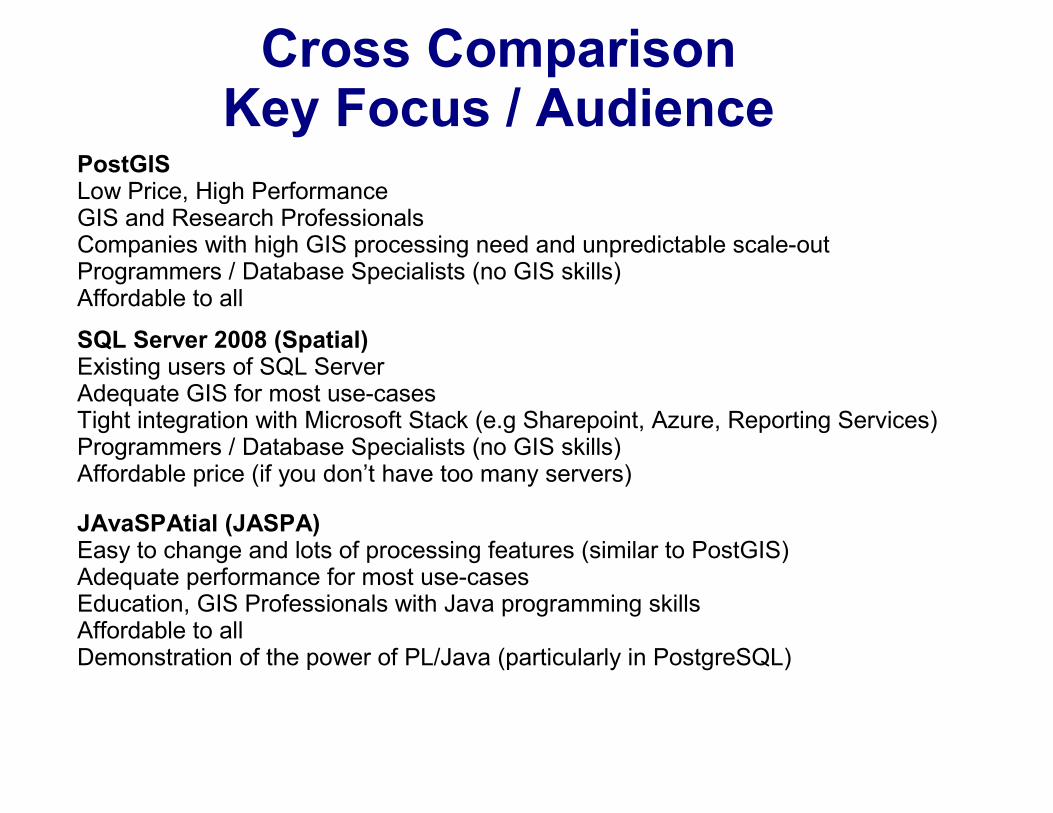
Cross Comparison Key Focus / Audience
PostGISLow Price, High PerformanceGIS and Research ProfessionalsCompanies with high GIS processing need and unpredictable scale-outProgrammers / Database Specialists (no GIS skills) Affordable to all
SQL Server 2008 (Spatial)Existing users of SQL ServerAdequate GIS for most use-casesTight integration with Microsoft Stack (e.g Sharepoint, Azure, Reporting Services)Programmers / Database Specialists (no GIS skills)Affordable price (if you don’t have too many servers)
JAvaSPAtial (JASPA)Easy to change and lots of processing features (similar to PostGIS)Adequate performance for most use-casesEducation, GIS Professionals with Java programming skillsAffordable to allDemonstration of the power of PL/Java (particularly in PostgreSQL)
Cross Comparison Main Platform Differentiation
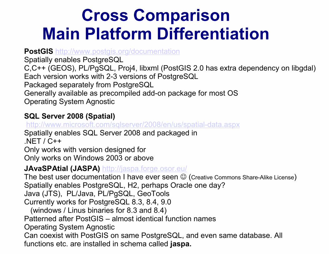
PostGIS http://www.postgis.org/documentationSpatially enables PostgreSQLC,C++ (GEOS), PL/PgSQL, Proj4, libxml (PostGIS 2.0 has extra dependency on libgdal)Each version works with 2-3 versions of PostgreSQLPackaged separately from PostgreSQLGenerally available as precompiled add-on package for most OSOperating System Agnostic
SQL Server 2008 (Spatial)http://www.microsoft.com/sqlserver/2008/en/us/spatial-data.aspxSpatially enables SQL Server 2008 and packaged in.NET / C++Only works with version designed forOnly works on Windows 2003 or above
JAvaSPAtial (JASPA) http://jaspa.forge.osor.eu/The best user documentation I have ever seen ☺ (Creative Commons Share-Alike License)Spatially enables PostgreSQL, H2, perhaps Oracle one day? Java (JTS), PL/Java, PL/PgSQL, GeoToolsCurrently works for PostgreSQL 8.3, 8.4, 9.0(windows / Linus binaries for 8.3 and 8.4)
Patterned after PostGIS – almost identical function namesOperating System AgnosticCan coexist with PostGIS on same PostgreSQL, and even same database. All functions etc. are installed in schema called jaspa.
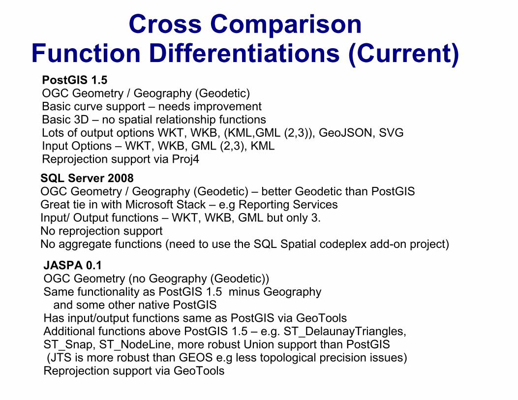
Cross Comparison Function Differentiations (Current)PostGIS 1.5OGC Geometry / Geography (Geodetic)Basic curve support – needs improvementBasic 3D – no spatial relationship functionsLots of output options WKT, WKB, (KML,GML (2,3)), GeoJSON, SVGInput Options – WKT, WKB, GML (2,3), KMLReprojection support via Proj4
SQL Server 2008OGC Geometry / Geography (Geodetic) – better Geodetic than PostGISGreat tie in with Microsoft Stack – e.g Reporting ServicesInput/ Output functions – WKT, WKB, GML but only 3.No reprojection supportNo aggregate functions (need to use the SQL Spatial codeplex add-on project)
JASPA 0.1OGC Geometry (no Geography (Geodetic))Same functionality as PostGIS 1.5 minus Geographyand some other native PostGIS
Has input/output functions same as PostGIS via GeoToolsAdditional functions above PostGIS 1.5 – e.g. ST_DelaunayTriangles,ST_Snap, ST_NodeLine, more robust Union support than PostGIS(JTS is more robust than GEOS e.g less topological precision issues)Reprojection support via GeoTools
Cross Comparison Third Party Support
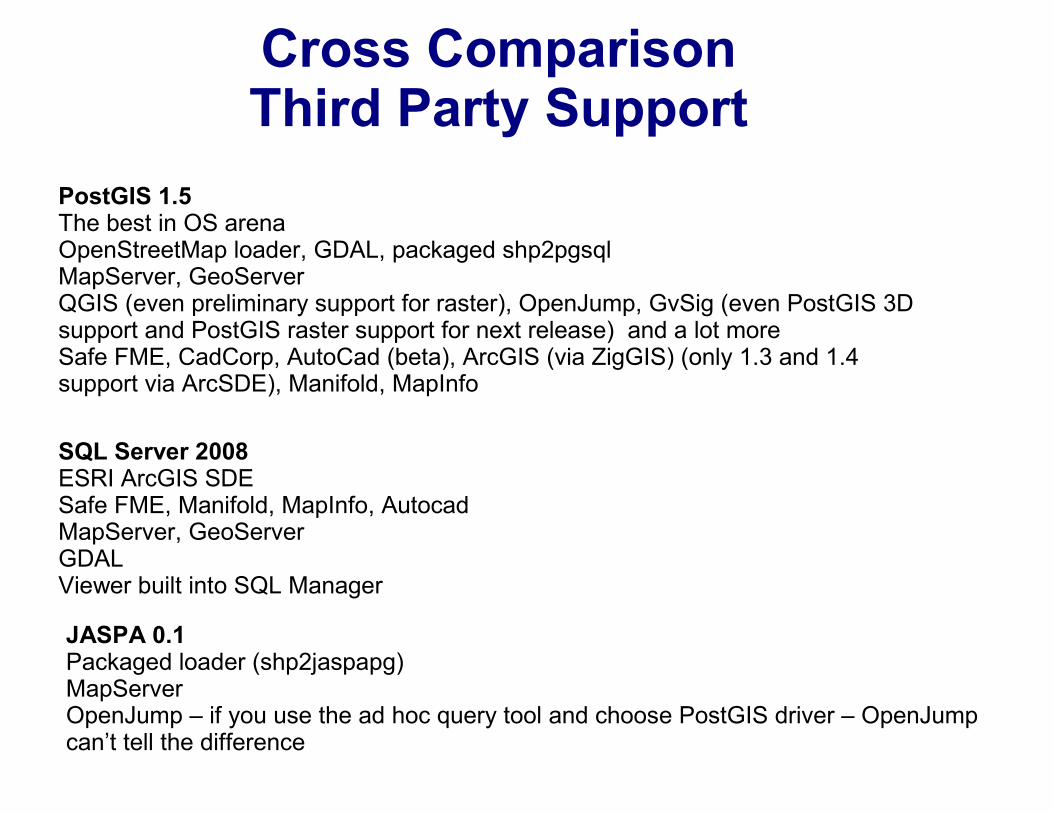
PostGIS 1.5The best in OS arenaOpenStreetMap loader, GDAL, packaged shp2pgsqlMapServer, GeoServerQGIS (even preliminary support for raster), OpenJump, GvSig (even PostGIS 3D support and PostGIS raster support for next release) and a lot moreSafe FME, CadCorp, AutoCad (beta), ArcGIS (via ZigGIS) (only 1.3 and 1.4 support via ArcSDE), Manifold, MapInfo
SQL Server 2008ESRI ArcGIS SDESafe FME, Manifold, MapInfo, AutocadMapServer, GeoServerGDALViewer built into SQL Manager
JASPA 0.1Packaged loader (shp2jaspapg)MapServerOpenJump – if you use the ad hoc query tool and choose PostGIS driver – OpenJump can’t tell the difference
Cross Comparison Syntax (Create a Geometry point)
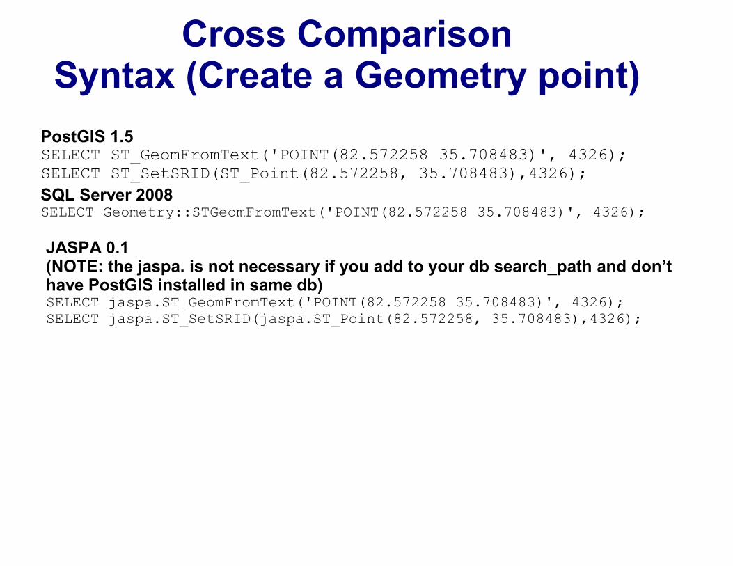
PostGIS 1.5 SELECT ST_GeomFromText('POINT(82.572258 35.708483)', 4326);SELECT ST_SetSRID(ST_Point(82.572258, 35.708483),4326);
SQL Server 2008SELECT Geometry::STGeomFromText('POINT(82.572258 35.708483)', 4326);
JASPA 0.1 (NOTE: the jaspa. is not necessary if you add to your db search_path and don’t have PostGIS installed in same db)SELECT jaspa.ST_GeomFromText('POINT(82.572258 35.708483)', 4326);SELECT jaspa.ST_SetSRID(jaspa.ST_Point(82.572258, 35.708483),4326);
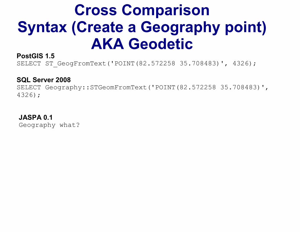
Cross Comparison Syntax (Create a Geography point)
AKA GeodeticPostGIS 1.5 SELECT ST_GeogFromText('POINT(82.572258 35.708483)', 4326);
SQL Server 2008SELECT Geography::STGeomFromText('POINT(82.572258 35.708483)', 4326);
JASPA 0.1 Geography what?
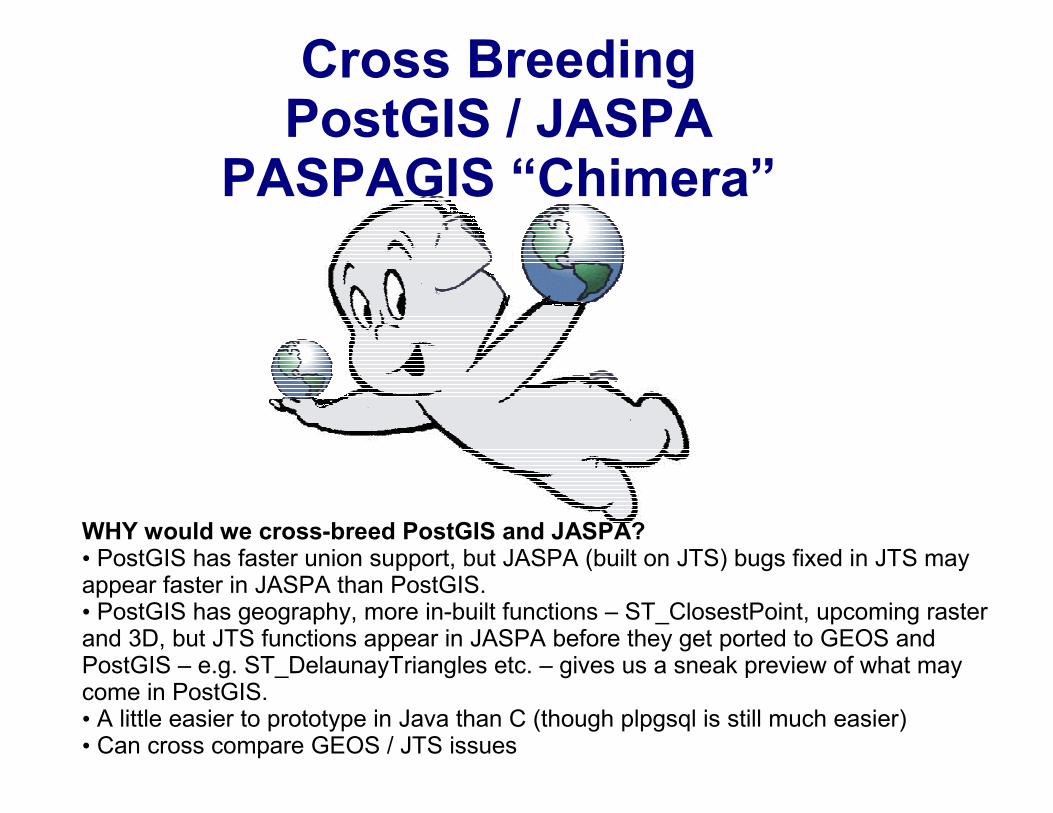
Cross Breeding PostGIS / JASPA
PASPAGIS “Chimera”
WHY would we cross-breed PostGIS and JASPA?• PostGIS has faster union support, but JASPA (built on JTS) bugs fixed in JTS may appear faster in JASPA than PostGIS.• PostGIS has geography, more in-built functions – ST_ClosestPoint, upcoming raster and 3D, but JTS functions appear in JASPA before they get ported to GEOS and PostGIS – e.g. ST_DelaunayTriangles etc. – gives us a sneak preview of what may come in PostGIS.• A little easier to prototype in Java than C (though plpgsql is still much easier)• Can cross compare GEOS / JTS issues
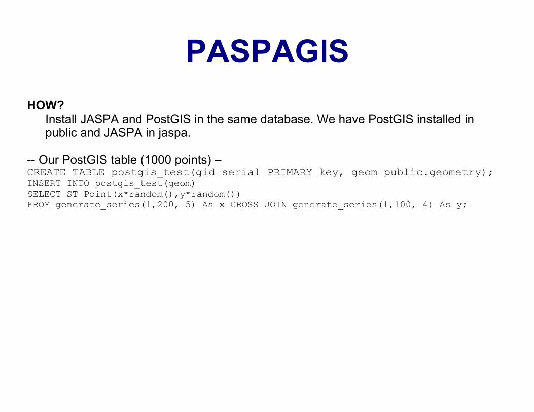
PASPAGIS
HOW?Install JASPA and PostGIS in the same database. We have PostGIS installed in public and JASPA in jaspa.
-- Our PostGIS table (1000 points) –CREATE TABLE postgis_test(gid serial PRIMARY key, geom public.geometry);INSERT INTO postgis_test(geom)SELECT ST_Point(x*random(),y*random())FROM generate_series(1,200, 5) As x CROSS JOIN generate_series(1,100, 4) As y;
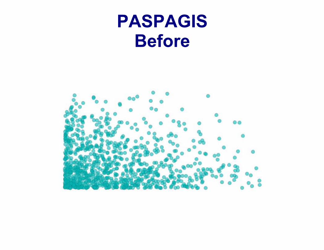
PASPAGISBefore
PASPAGISDelaunay Triangles Test
-- Creates 1972 triangles and pretty fast (under 1.5 secs on standard Windows 7 box) --
CREATE TABLE postgis_deltriang(gid serial PRIMARY key, geom public.geometry);
INSERT INTO postgis_deltriang(geom)SELECT
(ST_Dump(jaspa.ST_DelaunayTriangles(jaspa.ST_GeomFromEWKB(
ST_AsEWKB(ST_Collect(geom))
))::public.geometry)).geom
FROM postgis_test;
PASPAGISDelaunay Triangles Test
-- Creates 1972 triangles (Shorter syntax but relying on autocasting) –-- Works because JASPA’s native form is bytea (presumably EWKB) – it has
no type called geometry-- PostGIS can autocast to bytea that Jaspa surprisingly understandsCREATE TABLE postgis_deltriang(gid serial PRIMARY key, geom
public.geometry);
INSERT INTO postgis_deltriang(geom)SELECT (ST_Dump(
jaspa.ST_DelaunayTriangles( ST_Collect(geom) )::geometry )
).geom
FROM postgis_test;
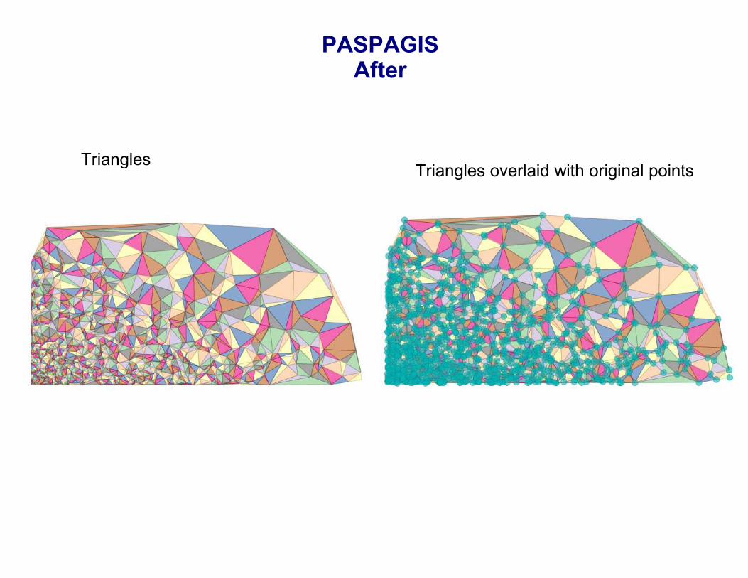
PASPAGISAfter
TrianglesTriangles overlaid with original points
Cross Comparison Function Improvements PostGIS 2.0 (Alpha)
PostGIS 2.0 (Experimental Builds available for Windows 32-bit) Raster (main focus raster/geometry operations and raster analysis)Better 3D (TINS, Polyhedral Surfaces)3D relationship functions (ST_3DIntersects, ST_3DClosestPoint, ST_3DShortestLine, ST_3DDistance, ST_3DDWithin ..and more (for everything but TINS)GML input/output for 3D (all 3D geometries)Lots more functions – ST_Split, ST_Snap, ST_ValidDetail, ST_ConcaveHull, ST_MakeValid and more -> http://www.postgis.org/documentation/manual-svn/ch12.html#NewFunctions_2_0Improved Topology support following SQL/MM ISO with additional goodies like AsGML3D spatial index (maybe) (but definitely by 2.1)KNN GIST (if using PostgreSQL 9.1+) (maybe) (but definitely by 2.1)Lots of functions rely on GEOS 3.3 (And a LOT OF WORK is being done in GEOS 3.3 to make Union etc. more robust).
Cross Comparison Function Improvements
SQL Server Denali 2010 (Alpha)
Faster indexing and index wizard support than 2008Nearest Neighbor Query Plan (similar idea to coming KNN GIST in PostGIS)Faster relationship checks for PointsBetter CLR supportCurved support for both Geometry and Geography (sounds impressive)Improved Geography (single hemisphere limit lifted)New functions STShortestLineTo (both for geometry and geography) (similar to PostGIS 1.5 ST_ShortestLine (for geometry))Aggregate functions (e.g. UnionAggregate, EnvelopeAggregate (similar to PostGIS ST_Extent for geometry), CollectionAggregate, ConvexHullAggregate - etc even for Geography)Persist Computed Column that returns spatial type (e.g. can create a computed column that returns a point like STCentroid, similar to PostgreSQL functional indexes, but it’s persisted so no need for recalc if output)
Cross Comparison Function Improvements JASPA 0.2
Roadmap
JASPA 0.2GeographySupport for HSQLDB
PostGIS in Action
Buy PostGIS in Action:http://www.postgis.us/page_buy_book