Critical Infrastructures and Urban Resilience in the Rome ... · Critical Infrastructures and Urban...
23
Critical Infrastructures and Urban Resilience in the Rome context ENEA UTMEA activities Alberto Tofani- ENEA Vittorio Rosato – ENEA Maurizio Pollino - ENEA Critical infrastructures and urban resilience: mapping assets, actors and data Rome, 21/04/2015
Transcript of Critical Infrastructures and Urban Resilience in the Rome ... · Critical Infrastructures and Urban...
Critical Infrastructures and Urban Resilience in the Rome context
ENEA UTMEA activities
Alberto Tofani- ENEA Vittorio Rosato – ENEA Maurizio Pollino - ENEA
Critical infrastructures and urban resilience: mapping assets, actors and data Rome, 21/04/2015

Summary
• Introduction
• RoMA project
• CAPT: Territorial Protection and Analysis Centre
• CIPRNet project
• The ENEA CI Risk Assessment Module
• Architecture
• Data Ontology
• Data Flow
• Conclusion

Introduction
Decision Support System
Primary Services and Mobility
Cultural heritage protection
Citizen’s security Risk assessment of Critical
Infrastructures
Public Administration/Authorities CI Operators

RoMA Project
• RoMA is an Italian project
• Funded by MIUR (Ministry of Education, Universities and Research)
• Call “Smart Cities and Communities and Social Innovation”
• Start date: November 2013
• Duration: 36 months
• Partners:11
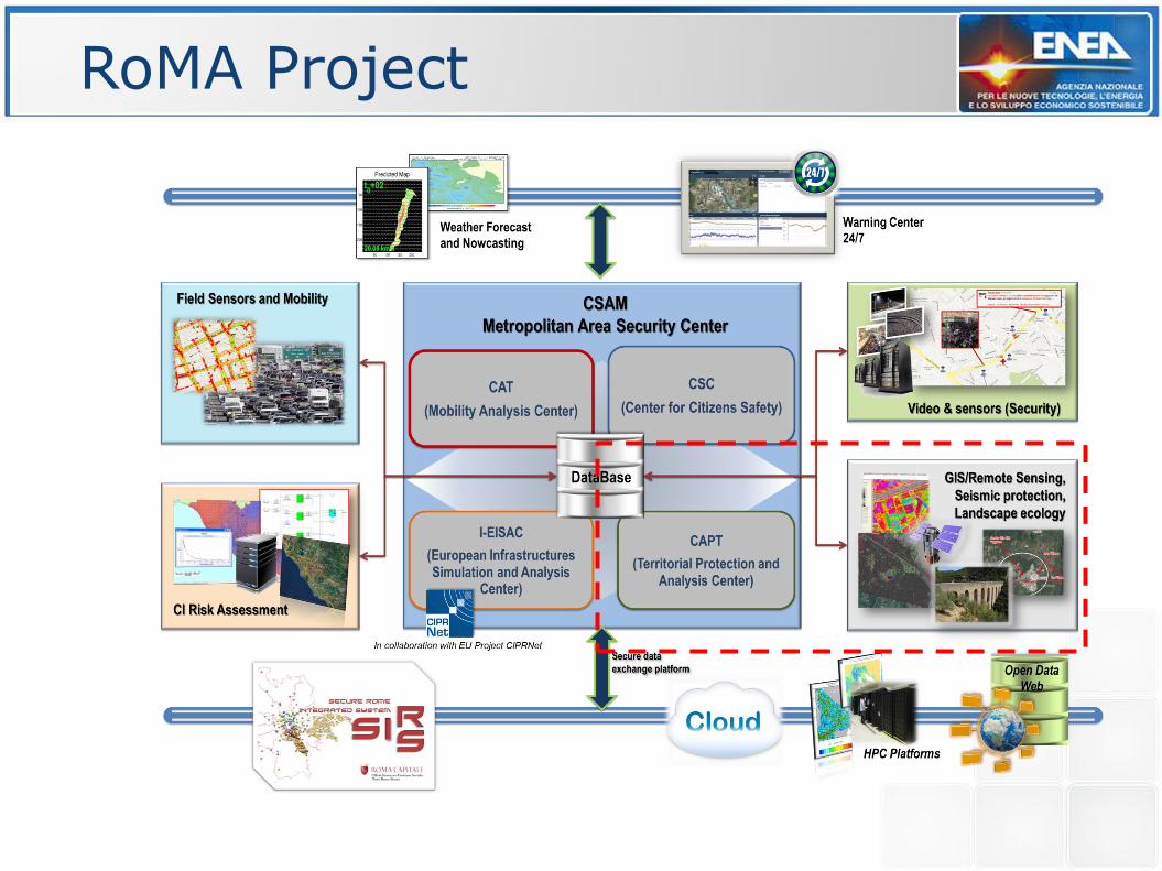
RoMA Project
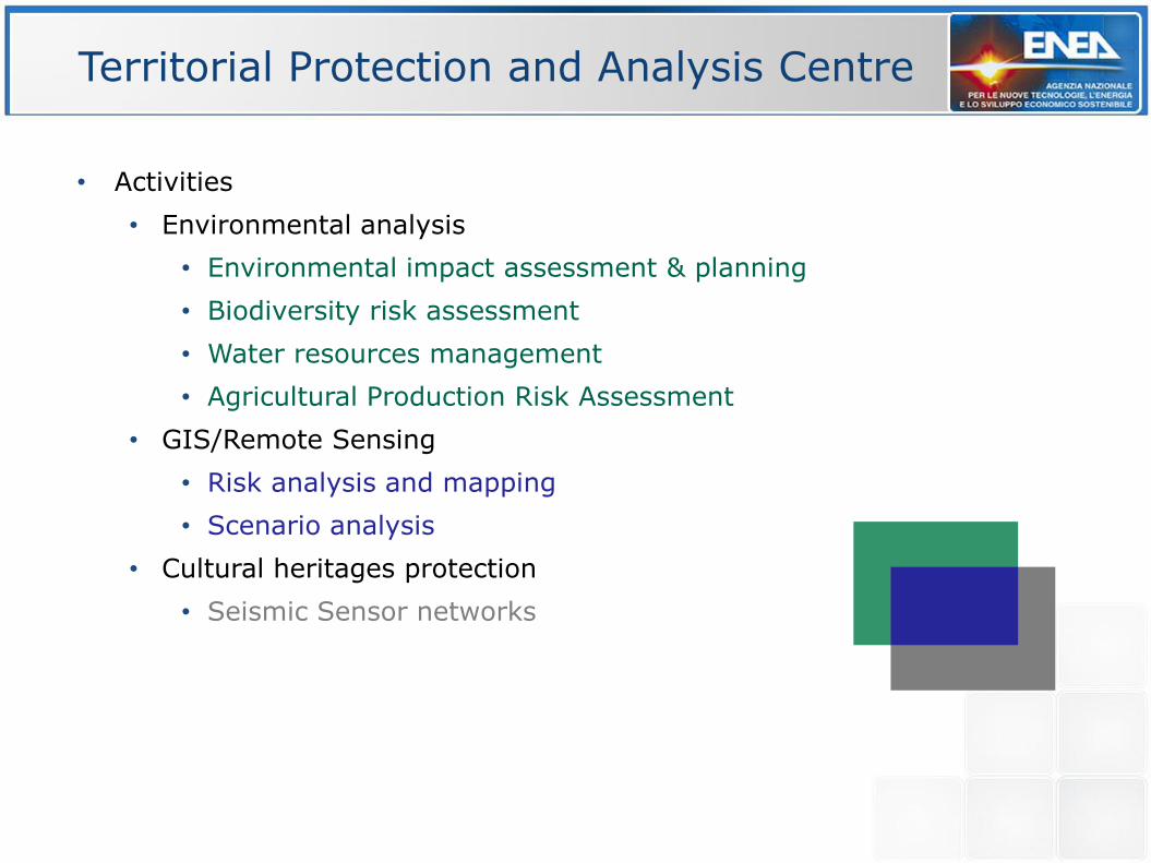
Territorial Protection and Analysis Centre
• Activities
• Environmental analysis
• Environmental impact assessment & planning
• Biodiversity risk assessment
• Water resources management
• Agricultural Production Risk Assessment
• GIS/Remote Sensing
• Risk analysis and mapping
• Scenario analysis
• Cultural heritages protection
• Seismic Sensor networks

CAPT activities
Regione Lazio (Parco Di Veio)
Spoleto (Ponte delle Torri)
Regione Basilicata (Centro Oli Val D’Agri)

RoMA Project

CIPRNet Project
• Critical Infrastructures Preparedness and Resilience Research Network is a FP7 funded project
• Network of Excellence in Critical Infrastructure Protection (CIP)
• Start date: March 2013
• Duration: 48 months
• Partners:12

To build a Virtual Centre of Competence and Expertise in CIP (VCCC)
• Network of facilities to offer support from research to CI
stakeholders
• (multi)national emergency management, CI operators, policy makers,
and the society
• It will form the foundation for the European
Infrastructures Simulation & Analysis Centre (EISAC) by 2020
10
VCCC capabilities
EISAC: European Infrastructures Simulation and Analysis Centre
CIPRNet Objective

16.02.2015 11 ENEA/UBC Staff Exchange Program
VCCC facilities
• Virtual laboratories with newly developed capabilities, based on
modelling, simulation and analysis of complex systems and multiple
critical infrastructures:
• tools and models for what-if analysis,
• tools and models for decision support;
• A repository of
• realistic scenarios of critical events
• simulation models (infrastructure simulation, climatic change
predictions, short term weather forecast), and analytical tools
• literature of the CIPRNet and beyond, training material for different
audiences
• A scheme for consulting experts within the CIPRNet consortium
• an online-glossary for CIP terms (CIPedia).

CIPRNet CI Risk Assessment Module
• Objective: to design a new technological tool implementing a CI Risk Assessment Module
• to increase the resilience of CI by predicting impact scenarios produced by natural hazards and by estimating the impact of CI components failures on the infrastructure’s services (in terms of service loss or reduction) and the consequences that these services perturbations might have on population and environment.
• to provide what-if capabilities
• to improve the management options for mitigating the risks for emergency managers
• To improve CI operators contingency plans
• The CI Risk Assessment Module will be one of the key capabilities of the long standing objective of the CIPRNet NoE consortium, that is, the establishment of the EISAC initiative (European Infrastructures Simulation and Analysis Centre).
• This RoMA project will consolidate and deploy, at the City scale, within the DSS the CI Risk Assessment Module

CIPRNet CI Risk Assessment Module
CI Risk Assessment
Module
CIPRNet GIS Database
Web GIS Interface
External data: sensors data, public data, CI data, …..

CIPRNet CI Risk Assessment Workflow
The Risk Assessment Loop - 24/7 RA of CI components in a given area . Threats sources: natural events
Sensing Natural Phenomena
Predicting Natural Events
Predicting Damage Scenario
Predicting Impacts
Predicting Consequences
CIPRNet DB
Service on demand
Synthetic natural events simulator
Synthetic damage simulator

CIPRNet CI Risk Assessment Workflow
Sensing Natural Phenomena
Predicting Natural Events
Predicting Damage Scenario
Predicting Impacts
Predicting Consequences
CIPRNet DB
R(Ti,CI j
x) = Pr(Ti )V(CI j
x,Ti )I (CI j
x)
Pr(Ti )Probability of occurrence of the
threat Ti
V(CI j
x,Ti )Vulnerability of the j-th CI component of the
x-th CI w.r.t. threat Ti
I (CI j
x)Impact relative to the loss of the j-th CI component
produces upon failure (e.g. CI, environment, population)

CIPRNet CI Risk Assessment Workflow
CI Risk Assessment
Engine
CIPRNet GIS Database
Web GIS Interface
External data: sensors data, public data, CI data, …..

Data Ontology and Structure
• Administrative layers
• Primary services (hospitals, schools, etc.)
• Morphology and Land Cover
• Geology & Landslides
• Seismic risk
• Hydrogeological Risk & Hazard
BA
SIC D
ATA
• Census Data (population, buildings, industrial
activities, etc.) and other statistical data
• Parcels and Indicators
Socio-economical
• Seismic event data (epicentre and magnitude), PGA and
Shake Maps
• Weather forecast
• Rainfall: Nowcasting data
Quasi-real time data
Territorial layers and maps
• Parametric catalogue of damaging earthquakes
• Inventory of Landslide Phenomena
• Historical data of rainfall and thermometry
Historical events
DA
MA
GE
SCEN
AR
IO
• Electric (Generating Stations, Substations, Transmission
Lines, Electric Interconnects, Transmission Zones,
Electric Distribution Territories)
• Natural Gas and Oil (Natural Gas Pipelines, Natural Gas
Interconnects, Natural Gas Facilities, Natural Gas
Production Regions, LNG Receiving Terminals)
• Road network and Railways
Technological Infrastructure
IMP
AC
TS
CO
NSE
QU
ENC
E A
NA
LYSI
S
Public Data Data accessible after DSS log in
Private and strategic data
Commercial Data

Data Flow and processing
Pu
blic
dat
a
GEODATABASE
DSS GEOGRAPHIC INTERFACE (geoSDI)
EISAC NODE
PROCESSING ENVIRONMENT (Data Retrieving , Spatial analysis, Runtime processing etc.)
Co
mm
erc
ial
Dat
a P
riva
te a
nd
st
rate
gic
dat
a
GIS SERVERS
WMS
Login INPUT DATA
Seismic real time events (ISIDe)
Meteo Nowcasting (Himet)
Other data…
Map service dataflow
GUI & setting dataflow
Geometry dataflow
Admin or User

Seismic event (epicentre and
magnitude)
ISIDe (INGV) real time seismic events .csv
GIS
layer
DSS geographic interface (geoSDI)
WMS
Shake Maps (PGA), Macroseismic Intensity
and Damage
ISTAT Census Data Shape
file
Vulnerability Index (Iv)
GIS
layer
GIS
layer
CI Data
Exte
rnal
so
urc
es
CIP
RN
et G
eoD
B (
Post
GIS
) D
SS
Example of Data Flow: Earthquake scenario

Example of Data Flow: Heavy Rainfall scenario
Precipitation Maps (15÷90 min)
Nowcasting Data (precipitation mm/h)
NetCDF
DSS geographic interface (geoSDI)
WMS
Expected impact on CI elements
Meteorological time series
.csv
Vulnerability
GIS layer
& Tables
CI Data
Exte
rnal
so
urc
es
CIP
RN
et G
eoD
B (
Post
GIS
) D
SS
Forecast NetCDF
Precipitation Maps (0÷48 hours)
GIS
layer
GIS
layer
Conclusion(1)
• Data & functionalities of the CI Risk Assessment Workflow for Rome (running on an ENEA server)
• Upon completion the system will allow
• 24/7 RA for all CI considering interdependencies phenomena
• Synthetic natural events simulator (Earthquake, Heavy Rainfall)
• Synthetic damage simulator
• Current implementation
• 24/7 RA for the Rome electrical distribution grid (ACEA network)
• Heavy rainfall & Earthquake data flow
• Electrical grid-SCADA dependencies module
• We start the design of the interface between the CI Risk Assessment Module and the ACEA informative systems
• The module will be continuously updated as more CI operators (e.g. ACEA ATO2 S.p.a for the water domain) will be involved
• The module will be continuously updated as more external data will be available (e.g. Lightning data)

Conclusion(2)
• The RoMA project will continue the institutional design of I-EISAC by enhancing collaborations and commitment by
• The Presidency of the Council of Ministers
• The Department of Civil Protection
• The National Institute of Geophysics and Volcanology (INGV)
• CI operators and stakeholders
• Other institutions of the Ministry of Interiors (Fire Brigades, Regional and Local implementation of Civil Protections, City Security Offices)

Thanks for the attention
• www.ciprnet.eu
• Please consider to contribute and participate to the following events
The 10th International Conference on Critical Information Infrastructures Security Berlin, Germany, October 5–7, 2015 Deadline for submissions is 8th May 2015
TIEMS 2015 Annual Conference: “Evolving threats and vulnerability landscape: the new challenges for the emergency management”. Rome – 30th September – 2nd October 2015. Deadline for submissions is 31st May 2015
ITALY