
CORAL REEFS, MANGROVES AND SEAGRASSES A SOURCEBOOK … · 2013-09-12 · with contributions from...
200
with contributions from Miguel Fortes and Peter Saenger Case Studies from Angel Alcala, Marlin Atkinson, Rolf Bak, Maya Borel Best, Barbara Brown, William Causey, Chou Loke Ming, Sue Clarke, Alasdair Edwards, Richard Grigg, Gregor Hodgson, Ove Hoegh-Guldberg, Terry Hughes, Cynthia Hunter, Catherine Isebor, Robert Johannes, Tim McClanahan, John McManus, John Ogden, Ross Robertson, Garry Russ, Bernard Salvat, Yacouba Sankare, A Sasekumar, Sam Snedaker and Suharsono. and illustrations by Christopher McLelland CORAL REEFS, MANGROVES AND SEAGRASSES: A SOURCEBOOK FOR MANAGERS Frank Talbot and Clive Wilkinson
Transcript of CORAL REEFS, MANGROVES AND SEAGRASSES A SOURCEBOOK … · 2013-09-12 · with contributions from...
with contributions fromMiguel Fortes and Peter Saenger
Case Studies fromAngel Alcala, Marlin Atkinson, Rolf Bak, Maya Borel Best, Barbara Brown, William Causey,Chou Loke Ming, Sue Clarke, Alasdair Edwards, Richard Grigg, Gregor Hodgson, Ove Hoegh-Guldberg, Terry Hughes, Cynthia Hunter, Catherine Isebor, Robert Johannes, Tim McClanahan, John McManus, John Ogden, Ross Robertson, Garry Russ, Bernard Salvat, Yacouba Sankare, A Sasekumar, Sam Snedaker and Suharsono.
and illustrations byChristopher McLelland
CORAL REEFS, MANGROVES AND SEAGRASSES:A SOURCEBOOK FOR MANAGERS
Frank Talbot and Clive Wilkinson

This report has been produced for the sole use of the party who requested it. The application oruse of this report and of any data or information (including results of experiments, conclusions,and recommendations) contained within it shall be at the sole risk and responsibility of that party.AIMS does not provide any warranty or assurance as to the accuracy or suitability of the whole orany part of the report, for any particular purpose or application. Subject only to any contrary non-excludable statutory obligations neither AIMS nor its personnel will be responsible to the partyrequesting the report, or any other person claiming through that party, for any consequences of itsuse or application (whether in whole or part).
©Australian Institute of Marine Science, 2001Cartoons and sketches by Christopher McLelland ©Christopher McLelland, 2001
Copies available from:
Science CommunicationAustralian Institute of Marine SciencePMB No. 3, Townsville Mail CentreTownsville Q 4810. AustraliaFax: (07) 4771 6138Email: [email protected]
The National Library of Australia Cataloguing-in-Publication data:
Talbot, Frank, 1930- .Coral reefs, mangroves and seagrasses : a sourcebook for managers.
ISBN 0 642 32208 2.
1. Marine resources conservation. 2. Marine ecology. 3.Marine resources - Management. I. Wilkinson, Clive R. II.Australian Institute of Marine Science. III. Title.
577.7
ii

CONTENTS
ACKNOWLEDGMENTS v
INTRODUCTION 1
1 How to use this book to solve problems 3
A WHAT COASTAL MANAGEMENT IS ABOUT 6A2 Problems of Management and Planning 7A3 Seeking Solutions 9A4 The Value of Tropical Coastal Resources 11
B DAMAGE TO COASTAL ECOSYSTEMS AND HOW TO PREVENT IT 18B5 Coral Reefs 19B6 Mangroves 35B7 Seagrasses 39
C MANAGING COASTAL ECOSYSTEMS 48Ci MANAGEMENT CASE STUDIES 48
C8 Managing Australia's Great Barrier Reef 49C9 Two Management Models for Philippine Marine Reserves 53C10 Overfishing and Marine Protected Areas in East Africa 58C11 Partial Management Success in El Nido, Palawan 62C12 Sustainable forestry of mangroves - Matang 64C13 Replanting Mangrove Forests in Bangladesh 66C14 Planning Restoration of Healthy Coastal Systems in Indonesia 68
Cii MANAGEMENT NEEDS AND METHODS 72C15 Do Your Coastal Ecosystems Need Management? 73C16 Marine Protected Areas 77C17 Integrated Coastal Management for Sustainable Use 84
D CASE STUDIES OF HUMAN IMPACTS ON COASTAL ECOSYSTEMS 94D18 Overfishing 95D19 Sewage and Sediment 110D20 Mining 116D21 Forestry 119D22 Introduced Species 125D23 Oil and Oil Mining 127D24 Construction, Building and Dredging 134D25 Multiple Effects 139
iii

E SUSTAINING COASTAL RESOURCES 152E26 Education and Training 153E27 Monitoring: Simple and accurate methods for monitoring in shallow
tropical waters 157E28 The Law and Coastal Resource Management 167E29 The Potential of Tourism 172E30 Restoration 175
CONCLUSION 184
SUGGESTED READING 187
LIST OF ACRONYMS 189
BOXESBox 1 Tourism, fishing and logging values in Palawan 10Box 2 The value of tourism 15Box 3 Fishing on breeding aggregations 26Box 4 Oil and the Gulf conflict 29Box 5 Mining reefs in Jakarta Bay 34Box 6 Global climate change and sea level rise 42Box 7 Transplanting seagrasses 47Box 8 Value of cyanide fishing versus hook and line fishing 54Box 9 Blast fishing destroys coral reefs 57Box 10 Monitoring and survey methods 61Box 11 Less ozone and more UV radiation 76Box 12 What are sustainable activities on a coral reef? 92Box 13 Cyanide and the live fish trade 98Box 14 Coral bleaching 108Box 15 Can damaged coral reefs be restored? 115Box 16 Tourist checklist 144Box 17 More food from the reef? 156Box 18 Recognising stress in mangroves 165Box 19 Reefs as breakwaters: the cost of replacement 177Box 20 Monitoring a regenerating mangrove forest 180
iv

ACKNOWLEDGMENTS
We first conceived the idea for this book about 5 years ago, when there were fewguidelines to management of tropical coastal areas, particularly coral reefs. Since then,some excellent books have been produced (see suggested reading) but often these arerather long. Sometimes they are very technical, using the language of science andmanagement theory. We have written this book for the practising resource manager indeveloping countries, who may have limited training in science but is still required tomanage complex ecosystems.
The basis for the book is a series of real case studies showing both the successes andfailures in marine ecosystems and attempts to manage them. These case studies havebeen provided by experts from around the world (specifically acknowledged on the titlepage and after each contribution). We very much appreciate the valuable input of theseauthors and wish to thank them particularly for their generous contributions of time andpictures. As editors, we have had the challenging task of condensing and simplifyingrigorous scientific work into a format suitable for our intended readership. We trust wehave remained faithful to the essential themes of your studies. Thank you all.
Two people provided special contributions. Peter Saenger of Southern Cross Universityin Lismore, Australia, provided most of the input on mangrove forests and many of thephotographs and Mike Fortes of the Marine Science Institute of the University of thePhilippines in Manila guided us through the material on seagrass beds. Our specialthanks to you.
This book is a contribution to the International Coral Reef Initiative (ICRI) and itsoperational programme, the Global Coral Reef Monitoring Network. We are particularlygrateful for the financial support of partners of ICRI: the Department of State andNational Oceanic and Atmospheric Administration (NOAA) of the government of theUSA. The major financial support for coordination of the GCRMN has come principallythrough the help of Jamie Reaser, Peter Thomas, Brooks Yeager, and Adrienne Stefan ofthe Department of State, and Ned Cyr, Charles Ehler and Arthur Paterson of NOAA.Their support has been supplemented by generous contributions by the homeinstitutions of Clive Wilkinson (Australian Institute of Marine Science – AIMS) and FrankTalbot (Graduate School of the Environmental, Macquarie University). WWF in Europethrough Carel Drijver, IUCN in the USA via John Waugh and Jordan West, and the GreatBarrier Reef Research Foundation through David Windsor, have contributed additionalfunds for production, as has the CORDIO project and Sida via Olof Linden. We thankthese donors.
v

These financial contributions have enabled us to reduce the cost of this book for thetarget audience, coastal resource managers in developing countries.
We wish to thank the four co-sponsors of the GCRMN: the Intergovernmental OceanographicCommission of UNESCO, with particular thanks to Ned Cyr and Patricio Bernal; theUnited Nations Environment Programme, via Agneta Nilsson; IUCN offices in the USA;and the World Bank, via Marea Hatziolos and Andy Hooten. The Global Secretariat of ICRIhas also provided considerable support, especially Bernard Salvat, Francis StaubGenevieve Verbrugge, Olof Linden, Robert Jara and Ed Gomez.
The Director and staff of the Australian Institute of Marine Science have supported theproduction of this book and provided photographs. GBRMPA also assisted withphotographs. Special mention goes to the staff of Science Communication: Liz Tynan,Steve Clarke and Wendy Ellery. Fiona Alongi assisted with the layout. Hugh Sweatmankindly read and commented on the manuscript.
Finally, thanks to Margaret Stoneman who helped usenormously with the editing, translating our messy text intothe product you have before you, and to Chris McClellandwho provided the inspirational cartoons – without them wewould still be talking about how to get our messages acrossin print. Sue Talbot and Madeleine Nowak kept us sane andinspired us to continue, while Hoo'mi kept us amused.
vi
Coral Reefs, Mangroves and Seagrasses
1. INTRODUCTION
Already 11% of all coral reefs have been damaged beyond recovery or totally destroyed.Another 16% were wrecked in 1998 by climate change related coral bleaching. Withouteffective management, another 30% of the world’s reefs will become seriously depletedin the next 20 to 40 years - which is a very short time in human history. While thisdamage is occurring all over the world, the causes are mostly local – what is happeningat each site.
This estimate excludes the 1998 coral bleaching caused by higher sea surface temperatures.This bleaching will add to the damage but the full extent is unknown. Most reef damagehas been caused by human impacts, usually accidental or unintentional, and is oftenexaggerated by natural stresses. We now know enough to prevent most of this local damage.
More than 50% of the world’s mangrove forests have been cleared withoutunderstanding the enormous value of these muddy coastal forests. Seagrass beds havehad similar losses in many areas. Both these systems are rich nurseries for coastal fishand prawns, and both act to protect fragile shorelines from erosion.
Economists and managers have begun to measure the dollar value of these resources tocoastal and marine fisheries, and to shoreline protection. They are finding that these valuesare surprisingly high; far higher than the money obtained by chopping down mangrovetrees or pulling trawl nets through seagrass beds. It makes good economic sense tomanage these coastal resources sustainably and this book will help managers do this.
We use real life situations to draw conclusions and give practical advice on themanagement of coral reefs, mangrove forests and seagrass beds. We outline where therehave been real successes and failures, and provide methods for improved management ofcoastal resources, based on these case studies. Damaged habitats lose much of theireconomic value and often have bad impacts on other resources nearby.
1
This book is written for resource managers and educators.
Its goal is to provide information and practical examples to help preventfurther damage to coral reefs and other tropical coastal ecosystems.

The information in this book is drawn from the best available expertise of scientists andmarine resource managers. Our aim is to highlight the dominant issues and suggestachievable solutions to what are sometimes complex situations. We have written the bookfor the resource manager in the field, who may be working without a lot of scientific supportand literature. It is written in basic language and avoids technical terms where possible,because we realise that many managers use English as their second or third language.
It will also be useful to fishery managers, regional and town planners, tourist developers,marine park managers, traditional reef owners and others. We include useful referencesand we have concentrated on material that is available from international agencies likeUNESCO, UNEP and IUCN. We particularly refer readers wanting more information toUNESCO's Coral Reef Management Handbook1 and the IUCN's Guidelines for MarineProtected Areas2 .
2
Coral Reefs, Mangroves and Seagrasses
1 Edited by Richard Kenchington and Brydget Hudson.2 Edited by Graeme Kelleher, 1999.

1 How to use this book to solve problems
This section will help you to identify problems, and where in this book you will find helpand information.
The economic value of coastal environments
To help governments understand the importance of coastal environments and to makesound planning decisions, it is helpful for the manager to know the economic and othervalues of these systems. Those who make the final decisions on the fate of coral reefs,mangroves and seagrass beds may feel that other competing uses have a higher value,because they are more obviously money producing, but they are often wrong. ChapterA4, The Value of Tropical Coastal Resources, p.11, gives some of the real values of theseimportant shallow water coastal systems. All values are in US dollars.
Human impacts
You may have a problem with a particular human impact (for example, sediment orsewage, or overfishing), or potential problems that come from coastal development.Most of the major human impacts are discussed in Section B, DAMAGE TO COASTALECOSYSTEMS AND HOW TO PREVENT IT, p.18; this section will refer you to other placesin the text where impacts are discussed.
Discussions of your kind of habitat
You may have difficulty in the management of a particular kind of coral reef, mangroveforest, or seagrass area (for example, lagoonal mangroves or a fringing coral reef).Check through the case history studies in Section D, CASE STUDIES OF HUMANIMPACTS ON COASTAL ECOSYSTEMS, p.94, to find an area similar to yours, which mayprovide insights into your problems.
Does your habitat really need management?
While your problem may be obvious, in many cases it is not clear whether an area reallyneeds management. You may find help with methods to find this out in Chapter C15, DoYour Coastal Ecosystems Need Management?, p.73.
What kind of management is needed?
Different management strategies can be used, and some of these are given in thechapters in Section C, MANAGING COASTAL ECOSYSTEMS, p.48. The case histories inthis section (Chapters C8-C14) give examples of successful and less successfulmanagement methods.
A Sourcebook for Managers
3

Creating Marine Protected Areas
Setting aside Marine Protected Areas (MPAs) is now an accepted way of protectingbreeding fish and providing good habitats for tourism. Help on how to set up an MPAcan be found in Chapter C16, p.77.
Integrated Coastal Management (ICM)
The best system being developed for the long-term sustainable management of coastal resourcesgoes wider than the coast and includes the land and rivers which affect the coastal zone.It is called Integrated Coastal Management (ICM), or Integrated Coastal Zone Management(ICZM), or Integrated Coastal Area Management (ICAM). All refer to the same process.We use ICM, the shorter name, and the principles involved are in Chapter C17, IntegratedCoastal Management for Sustainable Use, p.84. This is the most important developmentin coastal resources management; it urgently needs to be used widely.
Education and training
Education of stakeholders (those with interests or some involvement in the in the coastalzone) and the training for coastal managers is important. You will find a discussion ofthese in Chapter E26, Education and Training, p.153.
4
Coral Reefs, Mangroves and Seagrasses
Pontoon, on Agincourt Reef, used by tourist operatorsPhoto: Ray Berkelmans ©GBRMPA

A Sourcebook for Managers
5
Measuring change: for better or for worse
To understand whether management (or the lack of it) is having an effect requires anunderstanding of change from year to year. Change is measured by various monitoringmethods. These can tell you whether the system is in good health, is improving, or isgetting worse. Simple but accurate monitoring methods are given in Chapter E27,Monitoring, p.157.
In some circumstances it may be possible to take active measures to aid recoverythrough restoration. The scope to do so varies. To learn more of these measures andwhat might be achievable, refer to Chapter E30, Restoration, p.175.
Legal issues
The law has an important role in the management of coastal resources. While it will notsolve all problems of damage and conflict, it has an important role in the process. Themost relevant aspects of the law and its role are discussed in Chapter E28, The Law andCoastal Management, p.167.
Tourism
Tourism has become a most important value of tropical coasts, particularly coral reefareas. The last section lists some of the tourist’s needs in what is a very competitivemarket. See Chapter E29, The Potential of Tourism p.172.

A WHAT COASTAL MANAGEMENT IS ABOUT
CONTENTSA2 Problems of Management and Planning 7A3 Seeking Solutions 9
3.1 Environmental Impact Assessment (EIA) 93.2 Integrated Coastal Management (ICM) 9
A4 The Value of Tropical Coastal Resources 114.1 Increasing pressures on the coast 114.2 Products extracted directly 114.3 Tourism and other direct uses 154.4 Hidden Values 164.5 Non-use values 164.6 The need to consider all values 17
6

A2 Problems of management and planning
Most planning and management of coastal resources in the past has been sectoral (a termused to describe management for a single interest group). A single department may planand manage one marine resource interest such as fishing, tourism, or harbours; or anothermay administer the control of sewage; or a third may give approval and permits forindustrial pollution.
Competition between such departments is common, and there are always difficulties inlimiting and defining the responsibilities of each. The result is often that severaldepartments have some responsibility over the same coastal resource and this oftenproduces conflicts. This makes it very difficult for a resource manager to do anything,particularly in working with the major users and getting their trust.
There is also a more serious problem. Each department (sector) has a job to do, butdevelopments that are right for one sector may damage the resources for other sectorsand work against the efforts of other departments. So one side may get profits from adevelopment, but other sides may lose. For example, clearing mangroves for forestry orfor waterfront housing will benefit some, but this will reduce the long-term value offishing because a major nursery area for fish and prawns has been removed.
7
Often the winner is the resource user or the department that has most political power ormoney, and fishing communities are often the least powerful. The result may be confusionrather than good planning, with decisions not achieving the best economic and socialbenefits for the communities. Single sector management is a poor way to manage or plan.
There are different levels of control in each part of government for any particular area:planning for the future involves the national government (whole country); and shorterterm or regional plans involve provincial or regional governments; and local authorities makedecisions that affect the immediate villages, towns, cities. Somehow all levels need towork together.
Unfortunately higher levels of government often do not respect local authorities, whichare in direct contact with the communities and know what is best for them. So, frequently,such plans result in overlapping responsibilities and in conflicts, rather than cooperationwith sound management and planning.
A further complication is that a damaging impact (e.g. sediment from forest cutting,mining or agriculture upstream) may damage a fishery or a tourist coral reef but such aninland source is outside the control of coastal agencies or resource users.
8
Coral Reefs, Mangroves and Seagrasses

A Sourcebook for Managers
9
A3 Seeking solutions?
3.1 Environmental Impact Assessment (EIA)
Most countries have developed legislation to assess the impact on the natural systemsand on other users of a development before it takes place (environmental impactassessment legislation or EIA). Although this is important and may result in a softeningof the impacts, much experience has shown that such legislation rarely works well,particularly when the environmental impact assessment is done by the company orgovernment department that is doing the development. The impact assessment isdifficult and may be too narrow in scope, or biased in favour of the development.
Often the EIA process may alert the developer to possible damaging problems and thesemay be reduced. Comments by other users and the public when the EIA is published orduring a formal period for consultation, may also force the developer to reduce the impact.But often the assessment is poorly done and may only look at physical impact on theenvironment, while ignoring important issues such as the social impacts or the economicimpacts. Many small proposals are also a problem because the Environmental ImpactAssessment may show that one hotel and its pollutants will make little impact on a coralreef. But the combined effects of five hotels in the area could destroy the reef they all need.
EIA rarely stops a development, even when the study of total costs and benefits to societyshows that the costs are too high and that it should not go ahead. This is because thedevelopment has usually been planned, financed and often already given informal approval.Most developers have bought the land and drawn up the development plans, before theyare required to do an EIA and it is then too late in the process. What is needed is a broadplan for the whole coastal region first, as shown below.
3.2 Integrated Coastal Management (ICM)
Although an EIA can be useful, we need broader methods that guarantee the best socialand economic benefits to communities and users of coastal resources, and also consideractivities in the catchment area. This means wider planning and much better discussionand cooperation between all users, controllers and planners of coastal areas. The needgets greater as coastal populations increase or development occurs, which multiplies thepressures on coastal and marine areas. Many coastal areas have been seriously damagedand have valuable resources lost due to poor management and planning.

Integrated Coastal Management (see chapter C17, p.84) is a method that considers thebroader coastal zone. This is necessary because land and sea affect each other throughrivers, estuaries and wetlands. Coastal resources of coral reefs, mangrove forests andseagrass beds protect the land from storm erosion. But agriculture, forestry, industry,mining, housing developments, and the building of dams, harbours and roads may havedamaging impacts on these coastal resources. Bad land and river use damages estuaries,fills harbours with silt, pollutes fisheries, kills seagrass beds, destroys mangroves, converts coralreefs to algal reefs and degrades the local tourist economy. These changes (like removalof mangroves, coral reefs and seagrass beds) can increase erosion of coasts and islands(see case study on coral mining in D20, p.116).
Most systems on the coast are linked together, and planning, development and managementmust take this into account. Some form of Integrated Coastal Management is the onlysensible solution. This is not a simple process, because the coast has many users whoaffect each other but, only by involving all interested groups will sound and lastingpolicies be developed.
From G. Hodgson & J. A. Dixon, 1988.
10
Coral Reefs, Mangroves and Seagrasses
BOX 1 TOURISM, FISHING AND LOGGING VALUES IN PALAWAN
Sediment from logging in Palawan, Philippines, caused rapid and severe damage tocoral reefs in Bacuit Bay, and affected tourism and fisheries. A major economic studycompared 10 years of logging with continuing tourism and fishing in the bay.
In a striking result, the values projected over 10 years show that "no-logging" will yield$41.6 million more than "logging". The reason is that tourism and fishing are badlyaffected if logging continues.
If there was no logging, tourism and fishing would yield $75.5 million over the 10 years.But when the forests are cut, heavy sediment flows result, and this revenue would dropto $21 million. Add to this only $12.9 million from forestry itself, and the losses arevery large. The government’s action was to ban logging and make a marine reserve.

A Sourcebook for Managers
11
A4 The value of tropical coastal resources
4.1 Increasing pressures on the coast
The number of people living along tropical coasts is very large and increasing. Thepopulation of Southeast Asian countries was estimated to reach 375 million in the year2000, with 224 million (60%) living on the coast. Populations are also increasing onmany tropical islands in the Pacific and Indian oceans and the Caribbean Sea.
The pressures on tropical marine resources increase with the growing population and anunderstanding of the values of coral reefs, mangroves and seagrass beds is essential forthe manager. This is particularly important when there are competing uses and wherecommunities are trying to get the most sustainable, long-term value from their coastalresource. Government decision-makers usually think in terms of money (costs andbenefits). Because political terms are short, politicians rarely think about the long term(10s to 100s of years) and non-money concepts like biodiversity, ecology and aestheticsare ignored. Yet long-term sustainability is vital for the community.
Managers are often asked to support their recommendations and decisions witheconomic values and informed arguments. These shallow marine resources haveimportant values to be considered before development is considered, because thecommunity may in fact lose and not gain money from a development in the long term.
4.2 Products extracted directly
It is easy to measure the values of products that can be extracted and sold (direct extractiveuse values), such as fish, molluscs, crustaceans and beche-de-mer for food; trochus;curio objects (corals, shells); live corals and fish for the aquarium trade; rock and sandfor construction and cement manufacture; and mangrove wood for building or firewood.
Fisheries
The weight of fish on a coral reef can be very large but will vary from reef to reef. Theweight of fish on Pacific reefs ranges from 12 to 237 tonnes per sq km. But the sustainableyearly catch is much less, ranging from below 1 tonne/sq km/yr to above 19 tonnes/sq km/yr.
5 tonnes/sq km/yr of fish is a reasonable sustainable average from most healthy, growingcoral reefs. But research in Fiji suggests that yields up to 10 tonnes/sq km/yr are

12
Coral Reefs, Mangroves and Seagrasses
sustainable. Fisheries scientists consider that Caribbean reefs (down to 30 m deep) maysustain a yearly harvest of 15 tonnes/sq km/yr if crustaceans and shellfish are included.
$$ To convert these weights, you need to multiply by the average value to thefisher families (either in prices obtained in the market or money needed toreplace this food or income). If the value is $1 per kilogram – then 15tonnes/sq km/yr means a value of $15,000 per sq km every year; if the valueis $10 per kg, then it is $150,000 per sq km/yr.
If tuna or other oceanic species that feed along the edge of reefs (e.g. Spanish mackerel- Scomberomoridae) are included, the catch may be larger. Greater annual catches are alsopossible when schooling plankton feeders (fusiliers - caesionids) are also fished, as muchof their food comes from the open ocean. The annual yield depends on total fishing time,the gear that fishers use, where they fish (e.g. off the edge of the reef) and what they fish for.Mangroves and seagrasses are also important in coastal fisheries and are often close to
coral reefs. Fish, which shelter in the reef by day, may feed kilometres away in seagrassbeds at night. Seagrass beds are highly productive and can produce more organic matter(for the same area) than Peruvian coastal areas with nutrient upwelling, which are someof the richest in the world. They yield food fish (particularly rabbitfish - siganids), andprovide shelter for juvenile fishes and prawns, which later move to other habitats wherethey may be fished as adults. Juvenile fishes can also be harvested for cage culture.Seagrass beds may support hundreds of species of fish, e.g. 318 species were reportedfrom beds in Thailand. They may support 5 times more fish than live on muddy bottoms.
Mangrove waterways are important fish habitats and may have high fish catch rates ofbetween 1.3 and 8.8 kg per hour. The fish weight of the total catch is higher in more productive mangroves (measured by leaf fall and by carbon content of the sediments).Mangrove creeks are also important as nurseries for young fish and prawns, and someadults feed in mangrove forests at high tide. They also support large, edible crabs.
Traditional fisheries provide a vital source of protein in tropical coastal countries

An area of 40,000 hectares of managed mangrove forest in western Malaysia supports afishery worth $100 million or about $2,500 per ha per year. It produces a further $300per ha from sustainably managed logging, yielding a combined total $280,000/sq km/yrfrom fishing and forestry.
$$ The dollar value of the catch from a mangrove fringed shoreline in the Gulf orPanama was $95,000 per km from shrimp, other crustaceans and fish, and inMalaysia the mangrove fishery was worth $250,000/sq km/yr.
Aquarium fish and living corals
If managed correctly, collection of live fish and corals for aquariums can be sustainableand very profitable. This trade is now a multimillion dollar business but all fish should becollected in either traps or nets. These methods are slower than using cyanide but thefish live longer and other reef fish are not killed. Small and juvenile fish are left alive forthe next time. Corals and aquarium fish are best collected from special areas that areleased or sold to the collector, who will have a direct interest to make sure there is nooverharvesting. Also, only fast growing corals like staghorn species (Acropora spp.)should be sold. International trade in coral is restricted by CITES (see chapter E28 TheLaw and Coastal Resource Management, p.167) but some local trade may be permitted.
$$ The live aquarium fish trade is a major employer and has yielded over $1 million per year in Sri Lanka (see www.aquariumcouncil.org).
Sand and coral rock for lime and building
Coral reefs usually produce excess sand that is washed over the back by currents andwaves. This sand flows off the reef into deep water, so some can be harvested carefullywith little damage to the reef. Dredging should be conducted only in areas wherecurrents flow away from the reef. Similarly, some rock can be harvested off the back ofreefs but care should be taken not to lower the reef so that waves can cause erosion.
For long term sustainability, the amount of rockremoved should not exceed the growth of thesmall to medium sized coral boulders. Or it maybe better to take all the rock from one smallreef, rather than take small amounts off manysmall reefs (see Maldives case study in D20,p.116, and Box 19, p.177).
$$ It cost $10 million per km to build walls to protect the main Maldives island because there had been too much mining of coral rock and sand from the reef, and reclaimed land had pushed the shoreline seaward.
A Sourcebook for Managers
13
Groynes replacing lost reef protection

14
Coral Reefs, Mangroves and Seagrasses
Mangrove wood, bark and leaves
Mangroves have been cut for centuries for building timber, firewood, charcoal productionand bark for tanning. For example, mangrove poles have been cut in Kenyan and Tanzanianestuaries for some 2,000 years and taken to Arabian countries. They are now beingclear-felled for pulp and woodchips for making paper and the Japanese rayon industry. InNicaragua, many young trees 10-12 years old are cut for poles. Mangroves can be harvestedat a 20-30 year rotation time as a sustainable resource (e.g. in Malaysia, Thailand andBangladesh). They can also be used for curio and cabinet timbers and for traditionalmedicines. Leaves are widely used to feed cattle and goats in India, Bangladesh, Pakistan,East Africa and the Middle East. The leaves of Rhizophora mangle increased milk yieldin cattle.
$$ The 40,000 hectares of managed mangrove forest in Matang, West Malaysia yield$10 million in timber and charcoal and over $100 million in fish and prawnsevery year.
Seagrass beds
Seagrass beds have many other values apart from supporting fisheries. They provide astable structure for the settlement of many larvae and provide food and shelter. Theyhave high biological productivity and trap detritus and cycle nutrients, which also helpsto stabilise shallow seabeds and protect the shoreline. Seagrasses are collected forcompost, craftware and food.
$$ Half a hectare of seagrass has been valued at nearly $15,000 annually andseagrass prawn fisheries from Cairns Harbour in Australia yielded 178 tonnes peryear, valued at $1 million.
Sustainability
Most economic assessment methods only consider short time scales when valuingresources (discount rates of 3 to 5 years). Fishes and corals can take a long time toreplenish: tropical fisheries may take 5 years or more to recover from over-exploitationand coral reefs may take 20 years to recover from large-scale destruction. The growthof mangrove trees varies in different places but they can usually be harvested over a 20-30 year cycle.
All of these direct extractive values can be obtained continuously when the reefs,mangroves and seagrass beds are exploited carefully and sustainably but they lose theirvalue if they are over-harvested. There is direct evidence that a number of theseextractive values are declining rapidly in many places. If harvesting is reduced orstopped, they will usually recover.

A Sourcebook for Managers
15
BOX 2 THE VALUE OF TOURISM
Tourism is the best way of earning money from coral reefs and still conserving them.Look at some of these figures:
$$ In 1990, Caribbean tourism earned $8.9 billion, and employed over 350,000 people.
$$ Bonaire is a 288 sq km island in the Caribbean, 100 km north of Venezuela, witha population of about 10,000. The island is surrounded by a marine park fromthe shore to 60 m deep and the coral reefs in this park are visited by SCUBAdivers. The economic activities (hotels, dive operators, restaurants, etc.)associated with Bonaire’s coral reefs earn about $23 million annually. The costof managing the park is under $1 million.
$$Australia’s 2,000 km long Great Barrier Reef yields about $1 billion annually from tourism.
4.3 Tourism and other direct uses
The largest non-extractive value is tourism, which is increasing rapidly. For example, thenumber of tourist visitors to Fiji increased by 10 times from 1976 to 1986. In Queensland,Australia, the Great Barrier Reef attracts over 2 million touristsannually and they spend over $1 billion.
Tourists are attracted to the beauty of corals and fishes, clear waterand clean beaches for swimming, snorkelling and SCUBA-diving,relaxing, sun-bathing, sailing and walking. Coral reefs that are notoverfished are major attractions when they have masses ofcolourful small fish, as well as big fishes like large grouper(gropers), sharks and manta rays. Overfished areas, beaches dirtywith plastic and other garbage, and areas where sewage hasreduced coral diversity or replaced corals with seaweeds, chasetourists away (see chapter E29 The Potential of Tourism, p.172).
Large old-growth mangrove forests, sometimes including nature trails on board walks,can also be used to attract tourists e.g. some have monkey populations. There are alsoimportant social and educational values of a well-managed coastal zone to the localcommunity. School children can learn a lot about biology and the environment by visitinga mangrove forest.
16
Coral Reefs, Mangroves and Seagrasses
Reefs also create safe harbours for fishing and tourist boats, and mangrove channels areimportant, protected transport systems for small boats between villages in many parts ofthe world.
4.4 Hidden values
These values can only be measured when the asset is destroyed.
The main indirect use value is protection of coastlines, particularly fragile coral islandsand muddy shores. Virtually all coastlines in the tropics are protected either by coralreefs, mangrove forests or seagrass beds. These systems often are interdependent;mangroves may protect coral reefs from silt and be protected themselves by the coralreefs from strong wave action.
Coral reefs protect coastal buildings and towns on low foreshores from very high seas(see 20.1, Coral mining, reef erosion and rehabilitation: The Maldives, p.116, and Box 19,p.177). Seagrass beds trap silt and protect mangroves and beaches from erosion. If theyare removed, the damage bill and replacement costs can be huge. These potential lossesshould be considered when major constructions, sewage outfalls, port developments,dredged channels and forest clear-cutting or coastal agricultural developments are planned.
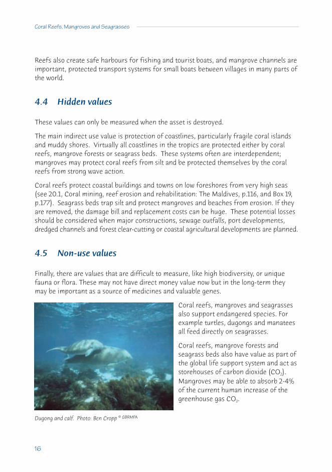
4.5 Non-use values
Finally, there are values that are difficult to measure, like high biodiversity, or uniquefauna or flora. These may not have direct money value now but in the long-term theymay be important as a source of medicines and valuable genes.
Coral reefs, mangroves and seagrassesalso support endangered species. Forexample turtles, dugongs and manateesall feed directly on seagrasses.
Coral reefs, mangrove forests andseagrass beds also have value as part ofthe global life support system and act asstorehouses of carbon dioxide (CO2).Mangroves may be able to absorb 2-4%of the current human increase of thegreenhouse gas CO2.
Dugong and calf. Photo: Ben Cropp © GBRMPA

4.6 The need to consider all values
Coastal industries may compete with each other. For example, clear cutting of forestsinland will release millions of tons of sediment that may damage coastal fisheries; oroverfishing may result in more algal growth on coral reefs that make them unattractivefor tourists.
Where new developments are planned on islands or along coasts, it is important that thevalues of development be carefully considered and weighed against the possible loss ofother values. To make sure that a new development does not do more damage than it isworth, a broad analysis of all coastal values is needed. Sometimes, no development maybe more valuable than replacing coastal resources but it is essential to have some dollarvalues to argue this. (See chapter A2 on Problems of Management and Planning, p.7, andchapter C17 on Integrated Coastal Management for Sustainable Use, p.84).
A Sourcebook for Managers
17
The price of paradise?This tourist development in the Maldives used coral to build jetties and for reclamation. Then it had to replacenatural reef protection with built barriers, using more coral. A costly, destructive exercise and what is left for the tourists to see?

B DAMAGE TO COASTAL ECOSYSTEMS AND HOW TO PREVENT IT
CONTENTSB5 Coral Reefs 19
5.1 Stresses to coral reefs 195.2 Sediment 205.3 Organic and inorganic pollution 225.4 Overfishing 245.5 Crown-of-thorns starfish and other predators 275.6 Oil pollution 285.7 Heavy metals 305.8 Pesticides and other complex molecules 315.9 Tourism 325.10 Engineering practices, and sand and rock mining 33
B6 Mangroves 356.1 Damage to mangroves 356.2 The removal of mangrove forests 366.3 Water balance 366.4 Excessive silting 366.5 Acid sulphate soils 376.6 Pollution 376.7 Natural impacts 376.8 Preventing decline and loss of value 37
B7 Seagrasses 397.1 Stresses to seagrasses 397.2 Sediment 397.3 Nutrient loading 407.4 Pollution 417.5 Physical disturbance 417.6 Climate change 417.7 Non-sustainable development 447.8 Institutional problems 447.9 Some consequences of seagrass loss 457.10 How can we stop seagrass decline? 457.11 What is being done? 467.12 Artificial seagrasses 47
18

19
B5 Coral reefs
5.1 Stresses to coral reefs
The 3 major human stresses to coral reefs around the world are:• sediment;• inorganic and organic pollution; and• overfishing.
There are other lesser threats caused by people, often only having local impacts such as:• oil pollution;• heavy metals and pesticides;• engineering activities;• destructive fishing (dynamite, cyanide);• coral mining;• physical damage from boat anchors; or• uncontrolled tourism.
The other major stress that is caused indirectly by humans is through global climate changeand the massive bleaching and mortality event of 1998 is an example of this (see Boxes 6p.42 and 14 p.108). Unfortunately there is little a reef manager can do about this, so wewill leave it out of this discussion.
There are also ‘natural’ stresses, which have caused damage to coral reefs for thousandsof years and still do so. Very large population increases of crown-of-thorns starfish(Acanthaster planci) can destroy most of the corals on a reef in the Indo-Pacific. Heavywave action from tropical storms may break more fragile corals, and large coral bouldersbreak off in storms and smash across reefs due to wave surge. Heavy rainfall can resultin too much fresh water pouring into bays and reefs near river mouths, which can causecoral death.

20
Coral Reefs, Mangroves and Seagrasses
In this section, we describe how corals can be affected by various stresses and what canbe done to prevent damage. In all management actions there must be monitoring, tomake sure that the actions are put in place.
5.2 Sediment
Coral reefs do not grow very well where there is a lot of sediment, particularly nearmajor rivers. Sediment reduces the light and smothers the corals and only a few speciescan withstand moderate sediment. Poor management will increase sediment runoff.
Sediment consists of fine particles of soil (terrigenous material), particularly silicates, whichremain suspended in the water much longer than larger particles. Fine sediments can beresuspended up from the bottom by strong winds and waves in water less than about 20 mdeep. The larger particles can bury corals and kill them, because heavy sediments aredifficult to remove. Sediments from the land also carry nutrients and fertilisers.
Coral reef sediments are calcium carbonate (calcareous) and make the water milky.They fall out onto the bottom of lagoons, bays and channels but can be resuspended intothe water by waves, dredging and coral mining.
Where sediments come from and why
Sediment can damage coral reefs near large rivers and streams. It is caused by erosionresulting from:
• forestry, particularly clear-cutting of tropical forests;• agriculture, especially ploughing between crops;• raising of cattle and other animals, particularly over-grazing; and• clearing of land for housing or industrial development.
Coral being buried and killed by sedimentClean healthy corals

A Sourcebook for Managers
21
Sediment also comes from:
• dredging of ports and boat marinas;• clearing of mangrove forests (which trap sediments);• bottom fish trawling; and• cleaning of prawn and fishponds after harvest.
Symptoms and impacts
When sediment is present, the water is dirty brown to green, with low visibility. Damageis not obvious at first but sediment reduces the light energy available for photosynthesisby corals and reef algae. This also results in grazing animals (parrotfishes, sea-urchins)having less food. The growth rates of corals are slowed and many develop diseases (suchas white- and black-band disease) because of the energy used for removing sediments.Corals may be attacked by animals boring through sediment piled around their bases, orbe killed by being smothered in sediment.
Management action
It is essential to reduce the sediment that can flow onto coral reefs. This may meancontrolling activities 10s to 100s of kilometres away (sometimes well outside the controlof local governments or reef managers). Actions can be taken to reduce sediment.
Forestry: Clear-cutting of tropical forestsshould be reduced and, where possible, widestrips of forest left alongside all streams.Cleared forests lose 120 to 200 tons of soil perhectare every year but natural forests only loseabout 2 tons or less per hectare. Recommendsustainable harvesting of trees (see Box 1Tourism and logging values in Palawan, p.10, andmanagement case study C11, p.62, where thePhilippine government protected the reefs byrestricting forestry).
Agriculture: Suggest ploughing only in dry seasons to reduce soil loss and sedimentpollution. ‘Green’ sugar cane farming costs less in money and time and increases yields,because without burning the green trash on the ground keeps water in the soil. Withreplanting in drilled holes, annual soil loss drops from 70 to 500 tonnes per hectare(30 to 200 tons per acre) to less than 4 tonnes per hectare. Other erosion preventativetechniques can also be used (e.g. terracing, crop selection).
Logging roads cause even more silt runoff thanthe tree clearing itself

22
Coral Reefs, Mangroves and Seagrasses
Overgrazing by cattle: The large catchments are the greatest source of sediment andnutrient pollution on the Great Barrier Reef. Recommend reducing the number of animalsand keeping enough grass on the land to prevent soil loss during wet seasons.
Development: Land clearing for development should be done in dry seasons, to preventeconomic losses to reef tourism. Using simple bund walls and/or silt screens arounddevelopments will greatly reduce sediment runoff.
Mining: Contain all mining wastes in holding ponds and tailings dams to allow sedimentsto settle. Use these sediments later to fill the mining sites.
Dredging: Deposit dredge spoil well away from coral reefs.
Aquaculture: Use mud pumped out of ponds as landfill or to increase mangrove treegrowth, otherwise it will pollute other ponds and reefs.
Fish trawling: Some countries have banned large trawlers within 3 miles of the coast toprotect subsistence fishing and seagrass beds, and to reduce sediment disturbance(e.g. Indonesia).
5.3 Organic and inorganic pollution
Human, agricultural and industrial wastes contain organic compounds - proteins, sugars,starches, cellulose, fats and many bacteria. Marine bacteria break down organic pollutionand increase inorganic pollution, which fertilises waters with excess nitrate, nitrite, ammoniumand phosphate (and other minerals) and causes eutrophication - increased growth ofalgae. Sediment runoff also contains large concentrations of nitrogen and phosphorous.
Nutrient levels favour the growth of planktonic algae and large macroalgae, which wouldnormally grow slowly in low nutrient waters. Where there is overfishing, the problemgets worse when grazing fish (like parrotfish and rabbitfish) are removed as thesenormally prevent the algae from overshadowing and replacing the corals.
Where and why
Pollution is very common around cities, towns and farms, because wastes often flowdirectly into rivers and the ocean. Pollution will increase as populations grow, unless goodcontrol and prevention are started.
Much pollution settles out onto the bottom and when strong winds blow over shallowareas (less than 20 m), nutrients trapped in the sediments are released back up into thewater and may stimulate algal blooms. Primary and secondary treated sewage stillcontains much nitrate and phosphate. Only tertiary treated sewage is safe to releaseonto coral reefs (see case study 19.2 on Mamala Bay, Coral recovery after removing asewage outfall: Hawaii, p.113).

A Sourcebook for Managers
23
Symptoms and impacts
The water looks green with much algal plankton (phytoplankton) which reduces light.Thick algal turf or large macroalgae cover the bottom and smother corals (see case study18.2, The collapse of a coral reef: Jamaica, p.99).
Organic pollution increases many coral diseases and also it helps the growth of animalcompetitors, like filter-feeding sponges, polychaete worms, boring molluscs and ascidianswhich out-compete the corals. Many of these also bore into and weaken coral skeletons.(See case study 19.1 Damage and recovery: Kaneohe Bay, Hawaii, p.110).
Bottom sediments in polluted areas are grey or black, because excess organic matterbreaks down to hydrogen sulphide.
Management actions
Prevent sewage and agricultural pollution of coastal waters by:• treating sewage to secondary or, preferably, tertiary standard;• using the wastes as fertiliser for fields or forestry crops (particularly mangroves); or• pumping the sewage into much deeper water.
Sewage: Treatment of sewage andindustrial wastes is expensive forgovernments. Recommend thatindustries follow pollution controlmeasures, particularly near coastalwaterways. New industries should be‘encouraged’ to treat their organic wastes.
Tourist resorts: To prevent damage toreefs and beaches, request that touristoperators treat sewage and wastes totertiary level to remove nitrogen andphosphorous. Do not allow sewage(treated or untreated) to flow intolagoons but use it for agriculture, towater gardens or golf courses, or pumpit into deep water. Reduce artificialfertiliser use on golf courses and lawns.
Forestry: Reduce clear felling of forests and land clearing. Ask Departments ofAgriculture to develop programmes to reduce soil losses.

24
Coral Reefs, Mangroves and Seagrasses
Agriculture: Ploughing of fields should be reduced during wet seasons. Request thatwastes from chicken and pig farms and cattle feed lots are properly treated. Someindustries can gain additional income by recycling the wastes or by producing otherproducts e.g. stock food.
Aquaculture and fishing: Pond effluent should be used to fertilise forests, not pollutecoral reefs. Trawlers should not be allowed to operate close to coral reefs.
5.4 Overfishing
Overfishing happens in most areas wherepopulations expand and technologies increase.Overfishing removes both the breeding adultsand small fish before they can grow, and somany fishermen turn to using very small meshtraps or dynamite.
Fish are important for the health of a coralreef and can also act as an indicator system.Without normal fish populations, reefs degrade(see case study of Jamaica, in D18, p.99).
Fish play the following important coral reef roles:• feed on plankton (damselfish - pomacentrids, unicorn fish - acanthurids, fusiliers
- caesionids);• graze on algae growing on rocks (parrotfish - scarids, surgeonfish - acanthurids,
rabbit fish - siganids);• clean up corals and also feed on them (butterfly fish -chaetodontids);• eat sea urchins and starfish (triggerfish - ballistids, pufferfish - tetrodontids);• feed on other animals like sponges, worms, crabs, molluscs (snappers – lutjanids
and lethrinids, angelfish - pomacanthids;• feed on other fish (grouper - serranids, snappers); and• scavenge on damaged or sick fish (some sharks).
Changes in the fish populations will affect reefs. For example, if algal grazers aretrapped or speared, large algae may smother corals and stop new corals settling.Fishermen often have special techniques to catch triggerfish but if they are removed,sea urchins and some starfish can grow out of control, especially if algal grazing fish arealso removed (see management case study C10, Overfishing and the Marine ProtectedAreas in East Africa, p.58). Sea urchins can erode corals and cause them to collapse (seecase study 18.3, A reef under stress: Okinawa, p.102).
Overfishing means smaller fish and fewer fish, especially if the juveniles are caught

A Sourcebook for Managers
25
Where and why
Overfishing usually occurs when large populations have few opportunities for employment.People go fishing for food, and cash to buy food and consumer goods. Fishing pressureincreases when land for farming decreases or becomes barren (see case study 18.1, Thedeath of a coral reef: Bolinao, p.95).
Reefs off east Africa, across Asia, in some Pacific islands and in most of the Caribbeanare overfished due to large human populations. Now large boats are fishing remotereefs of the Indo-Pacific using destructive methods (cyanide, muro ami and explosives).
Symptoms and impacts
Overfished reefs have few fish and these are small. Normal reefs should have thousandsof fish, including large ones weighing over 100 kg (grouper and large wrasses). Touristsstay away from reefs with damaged coral and few fish.
The first fish removed with heavy line fishingare the groupers and snappers. Increasedfishing, particularly spearfishing, leaves onlysmall fish.
Abandoned fish traps, nets snared on corals,ropes and lines, and sometimes scars fromblast and muro ami fishing (broken andflattened corals) or large areas of dead coralfrom cyanide fishing are good signs ofoverfishing.
The fish in markets can be a good indicator of overfishing - when reef fish are verysmall, or there are only oceanic fish (tuna, flying fish) this is evidence for overfishing.
Management actions
The best solution is to establish large Marine Protected Areas (MPAs) with about 25% ofthe reefs set aside as no fishing reserves and put strict control on damaging practices(see management case study C9 on Apo and Sumilon islands, p.53). Protected areasshould coincide with tourist resorts, so that fishers can earn money carrying tourists.
MPAs use several methods to stop overfishing:• restrict the number of fishermen;• control mesh size of nets and traps, or prevent them being used;• limit areas open to spearfishing; and• stop taking of fish during the breeding season.
Flattened corals - evidence of blast fishing

26
Coral Reefs, Mangroves and Seagrasses
To be effective, these restrictions must be supported bythe local population. Planning and management ofMPAs should involve the local population, otherwisethey will fail.
If possible, provide alternative forms of employment,either in tourism, industrial development, cooperativemariculture, or consider shifting fishing populations toareas where there is employment. All this requires goodgovernment coordination and the encouragement ofeconomic expansion.
From Robert Johannes, Hobart.
Watch for external predators
BOX 3 FISHING ON BREEDING AGGREGATIONS
A number of important food fishes aggregate in large numbers to spawn at a fewspecial sites on a coral reef. If fishermen learn the place and the times of thesespawning aggregations, they can easily catch most of the breeding fish on that reef.Some snappers, triggerfish and groupers spawn this way.
Different methods of fishing have been used on spawning aggregations. Line fishermenoften learn of these places. But destructive methods, like cyanide (for the live fishtrade), dynamite, and spearfishing have also been used. Whatever method is used,this kind of fishing is very damaging because it targets the healthy breeding fish, andstocks may not recover for many years, if at all. The big losers are local fishermenwho can lose an important part of their catch, and the catches of their children.
This is a key area for reef managers. By protecting these few small areas on a coralreef, a reef manger can protect the breeding populations of valuable food fish.
Message: Find out where and when the breeding aggregations occur and try toprotect these areas as Marine Protected Areas. Educate the local communityon the need to protect the breeding populations, and look out for outsidefishermen who may raid these areas during the breeding season.

A Sourcebook for Managers
27
5.5 Crown-of-thorns starfish and other predators
The crown-of-thorns starfish (COTS - Acanthaster planci) are the major natural predatorsof Indo-Pacific corals. They normally occur as very few, large individuals in reef lagoons.Recent population outbreaks or plagues have devastated whole reefs, with up to 90%mortality of corals. The starfish prefer branching corals, because they can hang on tothem easier, whereas the large head corals (e.g. Porites) are often not affected, becausethe starfish are washed off by waves. These recent outbreaks may have been morefrequent and damaging than before, and could threaten the ecology of some reefs.
Where and why
Crown-of-thorns plagues are more prevalent on reefs around large islands and continents,than on atolls. The starfish prefer calm water like lagoons and are rarely found wherethere are large waves or strong currents or in muddy water.
The following have been suggested causes for possible increases in plagues: more nutrientpollution from the land could increase the plankton food for crown-of-thorns larvae;overfishing of fish predators of juvenile starfish (e.g. snappers); or removal of large fishand giant triton predators of adult starfish.
Symptoms and impacts
Evidence of crown-of-thorns starfish is seen as clean, white areas of coral skeletonwhere the predators have eaten the coral polyps. During plagues, there are large areasof white or green-brown dead coral and the reef resembles a graveyard. Crown-of-thornsfeeding scars are different from bleached or diseased corals. Starfish scars are circularand clean, with no diseased tissue around them. The scars can be anywhere on thecoral; look near the scars for COTS hiding under corals or amongst staghorn branches.
Diseased corals have dead patches surrounded by a band of dying tissue and then thereis live coral. Bleaching normally occurs on the tops of corals and there are often areaswhere corals are half bleached (less colour than normal). With severe bleaching, all thecorals may be white but in big COTS plagues there are millions of the predators. Evidenceof past outbreaks is difficult to find.
Management actions
Control of these predators is difficult or impossible. It is better to prevent the pollutionand overfishing that may trigger the outbreaks. It may be necessary to kill crown-of-thorns starfish on reefs around tourist resorts and in national parks to protect valuablecoral. But this is very time consuming and expensive. If this has to be done, the bestmethod is to use large, mechanical syringes (the type used on cattle or sheep) to injectsmall volumes of the swimming pool chemical ‘dry acid’ into each starfish. Or else,

28
Coral Reefs, Mangroves and Seagrasses
collect them and allow them to die on land, because cutting them in half will not killthem. Protection of valuable tourist areas by killing the starfish may be necessary tomaintain incomes from tourism.
Drupella
Drupella is a small shell (gastropod mollusc) that can occur in very large numbers amongstbranching corals. Drupella have possibly increased because of overfishing of the molluscpredators, particularly some snapper species (Lethrinids). Drupella is too small for diversto collect in large numbers, so control is difficult.
Possibly the only thing a resource manager can do is reduce pollution and prevent overfishing.
5.6 Oil pollution
Oil pollution involves 2 impacts:• immediate damage from large oil spills; and• often subtle, long-term changes from slow leakage from oil wells, terminals and
refineries (see case studies on Panama, 23.1, p.127; Aruba, 23.2, p.129).
Oil from spills, pumped bilges and spilt shipping fuel,can be driven by winds and tides over the water fordays to weeks, before the lighter compoundsevaporate and the oil becomes heavy and sinks.Floating oil and associated toxic compounds are mostdamaging during the first few days after the spill.Usually there is little damage to coral reefs, unless theoil settles out on fringing reefs and reef flats duringlow tides. Oil is particularly damaging to mangrovesand seagrasses. There was little damage to reefs fromoil spills during the Gulf Conflict in 1991 (see Box 4 Oiland the Gulf Conflict). The light and toxic compoundseventually evaporate, or winds and waves break upthe oil.
Pollution of oil and chemicals, which may be in small amounts but continue for a long time(chronic pollution), is very damaging to corals and may cause slow death and poor recovery.
Where and why
Oil pollution is common around oil rigs, terminals, ports and shipping channels,particularly when ships dump their ballast water. This will increase unless governmentsand international agencies force stricter rules on oil and shipping industries.

A Sourcebook for Managers
29
Occasionally large oil spills occur when ships hit coral reefs or break up in storms,particularly old, rusty tankers because IMO (International Maritime Organisation)regulations are frequently ignored.
Symptoms and impacts
Obvious symptoms are slicks, the smell of oil and fuel and tar balls on beaches. There areno distinctive signs of oil damage underwater. Oil has little impact on the corals themselves,because it either floats and is carried away by the winds and tides, or it sinks into the sands.Corals can normally shed oil by producing mucus but toxic compounds can cause damage.Chronic oil pollution may cause a loss of, or slow, coral growth and stop reproduction.
The use of detergents and dispersants on oil spills near coral reefs is often more damagingthan the oil itself. These compounds are usually toxic themselves and they may dissolvethe oil into tiny droplets that settle out directly onto corals and other reef animals.
From Helge Vogt.
BOX 4 OIL AND THE GULF CONFLICT
Corals in the Persian Gulf along the coast of Saudi Arabia survived the largest oil spillon record, with few visible effects up to 3.5 years after the Gulf Conflict.
The largest oil spill in the world occurred during the Gulf Conflict in 1991 when 6 to 8million barrels of oil entered the sea in the northern Persian Gulf. In addition, morethan 1 million barrels of oil were burned in the Kuwait oilfields. It was expected that allthis oil would cause major damage to the coral reefs. Also, huge clouds of smoke fromthe burning oil reduced the sunlight, and lowered temperatures below normal.Researchers measured corals in permanent transects using video cameras in 1992,1993 and 1994. Healthy corals covered 25% of the bottom when the transects werefirst measured, and then there was a small but steady increase in live coral cover overthe next two years.
The conclusion was that Saudi Arabian coral reefs showed no detectable damage afterthe Gulf Conflict. But this environment is a harsh one for corals at any time, with verylow temperatures in winter and the corals have developed in an area where there isprobably some oil leaking all the time.
Message: Oil usually floats over corals and rarely harms them directly. A managerneeds to get good advice before using oil dispersants, which can do moredamage than the oil. A good monitoring programme will help detect damage.

30
Coral Reefs, Mangroves and Seagrasses
Management actions
It is usually best to do nothing if oil spills near coral reefs but wait until the oil floats awayand is broken up by the wind, unless booms can be deployed and oil removal is possible.Dispersants should not be used over reefs, because dispersed oil causes more damage.Very severe damage will occur if oil drifts into mangroves, therefore dispersants should beused (over deep water) to prevent the oil drifting inshore. Plans to deal with oil spills shouldbe formed in advance, including methods like booms and skimmers to remove the oil.
Good computer simulation programmes can predict where oil spills will go, using simpleinformation like wind direction and speed, tides and current patterns. These programmescan be set up for sensitive areas, like mangrove reserves or tourist beaches.
Chronic pollution from oil industries should be treated like other pollution, with allwastewaters either treated or impounded in holding ponds. Managers and governmentscan penalise shipping companies that spill oil and force them to pay fines under MARPOL(The International Convention of the Prevention of Pollution from Ships - see E28, TheLaw and Coastal Resource Management, p.167). Shipping companies are very careful inAustralia because of recent heavy fines.
5.7 Heavy metals
These are metals like lead, mercury, cadmium, copper, chromium and arsenic that pollutethe ocean from industry, mining and the burning of fossil fuels.
Where and why
The major sources are cities, mining and industry e.g. most lead from car and truck fuelis washed out of the air and off streets and into the ocean. Most mercury pollutioncomes from liquids dumped by industry and gold mining. Heavy metal pollutionincreases with development, unless special measures are used to stop pollution.
Symptoms and impacts
There is no good information or examples of reefsdamaged by heavy metals and some research workin Phuket, Thailand suggests that heavy metals maynot be a large problem to corals. Usually otherimpacts (overfishing and sewage pollution) aremore damaging. Heavy metals may accumulate inthe food chain, especially in predatory fish, whichcan affect humans. Heavy metals can disrupt thenormal reproduction of many animals.
Management actions
The control of heavy metal pollution is similar to other pollution: prevent pollutingindustries; treat sewage and industrial wastes; and build bund walls and holding ponds toprevent pollution from mining. Older pesticides with mercury and arsenic should bephased out in developing countries.
5.8 Pesticides and other complex molecules
These include pesticides: insecticides - DDT, heptachlor, aldrin, dieldrin, lindane, chlordane(chlorinated hydrocarbons), malathion, parathion (organophosphates), carbaryl (carbamates);herbicides - atrazine, paraquat (triazines), 2,4-D, 2,4,5-T (phenoxy compounds), trifluralin,diphenamid; and other pollutants such as PCBs (polychlorinated biphenyls) and dioxins.Compounds like DDT are used to control mosquitoes.
Where and why
Pesticides are essential for many cash crops that are susceptible to pests and weeds e.g.rice, cotton, corn, cocoa, coffee. However, pesticides are often used as ‘insurance’ againstpossible problems, so that only 0.1% or less hits the target pest. The rest ends up in thesoil, rivers and the ocean. Pests are also developing resistance, so that greater concentrationsof pesticides are then used (the ‘pesticide treadmill’).
Symptoms and impacts
There are no known effects on coral reefs. Many of these compounds remain in thewater and sediments for many years (e.g. chlorinated hydrocarbons last up to 15 years).Sometimes accidents or deliberate spills by industry, e.g. dumping of PCBs, can causemassive fish kills.
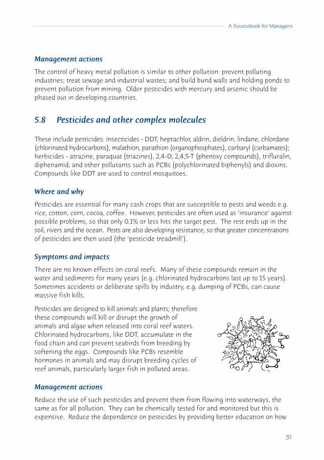
Pesticides are designed to kill animals and plants; thereforethese compounds will kill or disrupt the growth ofanimals and algae when released into coral reef waters.Chlorinated hydrocarbons, like DDT, accumulate in thefood chain and can prevent seabirds from breeding bysoftening the eggs. Compounds like PCBs resemblehormones in animals and may disrupt breeding cycles ofreef animals, particularly larger fish in polluted areas.
Management actions
Reduce the use of such pesticides and prevent them from flowing into waterways, thesame as for all pollution. They can be chemically tested for and monitored but this isexpensive. Reduce the dependence on pesticides by providing better education on how
A Sourcebook for Managers
31

32
Coral Reefs, Mangroves and Seagrasses
to control pests using natural methods (biological control). Dispose of old stocks ofcompounds safely (incineration) rather than dump them into rivers.
5.9 Tourism
Good tourism provides the best economic return from coral reefs for the leastenvironmental impact - provided that it is well developed and managed. Coral reeftourism is probably the largest growing ‘industry’ in the world but polluted or overfishedreefs attract few tourists.
Where and why
The best tourist destinations have clean beaches and coral reefs in clean water (see Box16 Tourist checklist, p.144). The Red Sea, Southeast Asia, East Africa, the South Pacific,Australia and the Caribbean islands are the major tourist sites. Many tourist operatorsdo not know how to use ‘best practice’ or they are after the ‘quick buck’, thereforesound government guidelines and control are needed.
Symptoms and impacts
There are 3 types of tourism impacts: development, operation and tourist activities. Thebuilding of resorts on soft soil slopes without attention to erosion can dump large amountsof sediment that can damage reefs for many years. Resorts are often built too close tothe beach or on sand dunes that are liable to erosion by storm waves. They have also beenbuilt on landfill in shallow water and out on solid jetties. In some cases, boat channels ordocks have been cut into reefs. Such developments may change current movements andcause increased erosion of beaches. Poor operations can also release pollution onto thereefs (see forms of pollution in 5.2, 5.3, 5.4, 5.8 above).
Poor operation of tourist resorts will result in sewage and garbage ending up in the waterand over the reefs. Also overfishing near resorts will reduce the fish that tourists cometo see. A live fish in the water is often worth 10 or 100 times more for divers andphotographers than a fish on a plate.
Uncontrolled tourists (and local residents) often collect corals and shells, and damagecorals through poor diving technique, carelessness or lack of knowledge. This can beprevented by educating the tourist, the tourist operators and the guides. Where touristsdo fish, there should be strict limits on the places where fishing is allowed and how manyfish can be taken. Catch-and-release fishing should be encouraged (this is becomingmore popular).

A Sourcebook for Managers
33
Management actions
Provide good advice to owners and managers to improve the construction and operationof tourist resorts, including waste treatment. Resort managers can help with tourist education and by using well-trained dive and fishing boat operators.
5.10 Engineering practices, and sand and rock mining
Coral reefs are damaged by most modifications, such as:• cutting and blasting channels through the reefs;• building groynes, piers, wharves and rock walls;• reclaiming land using solid fill;• the construction phase of tourist resorts;• dredging of marinas and harbours;• building airports on coral reefs; and• collection and dredging of sand and rock.
Where and why
These happen to increase living areas or protect structures from wind and wave action.More engineering is being used to modify the coastal environment as populations andtourism developments increase.
Symptoms and impacts
Dredging increases sediment pollution, erosion of beaches and reef flats, and results inthe death of corals because of sediment build-up or changed current patterns. Carefulengineering can avoid the most severe consequences e.g. through the use of EnvironmentalImpact Assessments. Channels cut through the reef speed water flow on and off reefflats, and may result in sand loss from reef flats and beaches through the new passes.
Seawalls and groynes alter current patterns with sand building up in front and erosionbehind (therefore more walls are constructed and so on). Dredging of sand and rockincreases erosion of beaches and the collapse of buildings (see case study 20.1 on theMaldives, p.116).
Management actions
If there is careful consultation between engineers, reef scientists and managers beforeany modifications start, damage can be minimised. Problems and great expense can beavoided if reef scientists and managers are involved.

34
Coral Reefs, Mangroves and Seagrasses
From Barbara Brown and Clive Wilkinson.
BOX 5 MINING REEFS IN JAKARTA BAY
Until recently there were many beautiful coral reefs and islands within Jakarta Bay,Indonesia. Now, about 5 of the reefs and islands have completely disappeared andsome others are unrecognisable as coral reefs. The beauty of these reefs wasdescribed vividly by scientists early last century.
What happened?
Firstly, the reefs lie in one of the world's most polluted bays. Each day, the sewage,industrial and agricultural wastes of more than 10 million people in Jakarta and nearbytowns enter into this shallow bay, creating conditions that are unsuited to coralgrowth.
Secondly, there has been massive land clearing for agriculture, industry and housingand the sediments have changed the bay into a muddy basin.
Thirdly, some of the reefs have been so extensively dredged for limestone and sand,that they have actually disappeared beneath the waves.
Two of the Jakarta Bay islands (Air Kecil, Ubi Kecil) disappeared in 1983. Dredgingremoved so much of the protecting coral and sand that they eroded and sank belowthe surface. In 1985, a third island (Ubi Besar) was close to total collapse, and 3 otherislands have eroded markedly during the last 50 years. Now, all the reefs in the bayare severely damaged with coral cover less than 5% and very low coral diversity.
The pollution has completely changed the ecology of the bay, such that very fewanimals can live in the sediments and the fish and shellfish (cockle) industries thatonce flourished have been abandoned.
What is the future?
Even if the pollution could be cleaned up, there would not be much chance forrecovery of many of these reefs, because the pollution buried in the sediments willtake many years to break down and wash away. And some of the reefs have beentaken away and can now be seen as the cement in the large buildings of Jakarta.
Message: Sometimes it is necessary to admit that some reefs have been lost and justforget about them. But in this case there are many reefs nearby, somanagement is needed to save these.

A Sourcebook for Managers
35
B6 Mangroves
6.1 Damage to mangroves
Mangroves are a valuable resource in the tropics, being used traditionally for timber andfirewood, building materials and mine supports, fishing traps, charcoal and tannin production.
Mangrove channels are very valuable nursery areas for fish and prawns. At high tides,the mangrove forests are used as feeding areas by fish and other marine animals.Mangroves support a diversity of associated animal species, some of them endangered.
Mangrove areas are also cleared for fish and prawn ponds, salt production, industry andhousing development, as well as port and airport construction. All of these remove treesand leave large bare patches within mangrove forests, or wide areas of salt tolerant grasses, stagnant ponds, changed water flows and compacted soil surfaces.
Controlled mangrove harvesting canprovide resources continuously and be asustainable industry. But if the harvestingof the trees is faster than the rate ofreseeding and regrowth, or they aretotally removed, then the followingproblems can occur:
• major losses of prawn and fishnursery areas and crab fisheries;
• increased erosion of the mangrove area and the land behind the mangroves withcoastal damage (including prawn ponds);
• intrusion of salt water into farming land following this erosion;• loss of sediment filtering and trapping by mangroves, resulting in more sediment
flowing on to seagrass beds and coral reefs;• exposure of acid sulphate soils and acid leaching; • loss of old trees that provide seeds and propagules;• loss of biodiversity of plants and associated animals;• fire in areas where mangroves die or dry out; and• gaps in the canopy cause higher death rates of newly settled young trees through
increased light and evaporation.

36
Coral Reefs, Mangroves and Seagrasses
6.2 The removal of mangrove forests
Most mangrove damage is caused by clearing with bulldozers, chainsaws, axes andmachetes, and the most severe human impact is total removal of the mangrove forest.This is usually done for export wood chips, to make fish and prawn ponds, for portconstruction and channels, and for conversion of mangroves for other uses such ashousing, industry, roads and grazing land.
Many village users make lesser impacts by cutting somemangroves for firewood, charcoal, poles, and bark fortannin and for medicinal purposes. In the Philippinesmangroves are removed in forests and dug out to make‘miracle pools’ that trap fish when the tide falls.
6.3 Water balance
If water flows into mangrove forests are changed the trees may die, become sick, growmore slowly or fail to reproduce. Mangroves that are cut off from the sea by roads,dykes or dam construction will soon die.
Reducing the flow of fresh water by building dams or diverting rivers will kill or damagemost mangroves, because the salt concentration will increase, particularly affectingthose species that do not like normal seawater. Higher than normal salt concentrationscan also kill mangroves, particularly in wide shallow areas with restricted flow and highevaporation rates. Increasing flows of fresh water for long periods will kill or damagemost mangroves.
The following human actions can change this water balance by:• building channels for shipping;• making earth bunds that can change or stop water flows;• damming rivers; and• increasing freshwater flooding from deforestation inland.
Mangroves may die, or become sickly and reduce growth and generation of seedlings,from such actions (see Box 18: Recognising stresses in mangroves, p.165).
6.4 Excessive silting
Silting and sediment flow increases where there is deforestation, poor agricultural practice, road building or city development. This mainly happens during heavy rains andmonsoons, particularly when forest clearing increases the amount and speed of water flowing off the hillsides. Too much sediment can cover the aerial roots, or change thewater balance (see above).
A Sourcebook for Managers
37
6.5 Acid sulphate soils
Mangrove soils often become extremely acid when waterlogged sediments which arehigh in sulphides (from the bacterial decay of past leaf litter, silt with organic materialfrom leaves, wood, plankton and seaweeds) are exposed to the air or water with a highoxygen content. The result is sulphuric acid, which can stress or kill plants and animalsin nearby waterways and transport heavy metals
6.6 Pollution
Many pollutants damage mangroves. Mangroves are reasonably resistant to increasednutrients (such as sewage), but pollutants from industry and pesticides can affect or killmangroves and associated animals (see 21.2, Loss of lagoonal mangroves: Ivory Coast,p.122). Major oil spills have also killed large areas of mangroves and chronic oil spillsmay continue to stress them. In Panama, however, young mangroves are regrowing aftera major spill in 1986 (see 23.1 on the oil spill at Bahia las Minas, Panama, p.127 and 23.3on the oil industry and mangroves in Nigeria, p.131).
6.7 Natural impacts
Natural stresses like drought, freshwater flooding (sometimes with heavy loads of sediment),erosion and bank collapse, lightning strikes and leaf eating insects (sometimes in hugenumbers) damage mangroves. The trees are very resistant to wind and waves (smallboats often shelter in mangrove creeks in storms) but really violent storms cause seriousdamage in more exposed mangrove areas. This damage will be increased if the mangrovesare thinned, or there are gaps caused by prawn ponds or other constructions.
Recognising mangrove stress
Mangroves show many signs when they are stressed. Changes occur in their aerial roots,bark and growth rates, terminal shoots, leaf size and colour, flowers and fruit may bedeformed (see Box 18, p.165).
6.8 Preventing decline and loss of value
Often decision-makers with little environmental and fisheries knowledge consider thatmangroves are muddy, mosquito infested swamps that should be cleared and filled in. Thisdoes not recognise their true value as economically important coastal ecosystems (see chapterA4, The Value of Coastal Resources, p.11). Mangroves are also often cleared for prawnfarms or fishponds, because the land does not belong to anybody or is government land.

38
Coral Reefs, Mangroves and Seagrasses
The full economic value of mangroves should be measuredbefore decision-makers consider removing them. Thesevalues include sustainable forestry, nursery areas for prawnscrabs and fish, protection of coasts etc. These must beadded to the estimated costs of providing coastal protectionfrom storms, and the costs of compensation and employmentto displaced fishers and villagers. Careful environmentaland economic assessments should be made to preventremoval of mangroves that will result in larger problems inthe future.
Planned changes to water and land in the catchment area need to be assessed forimpacts downstream in the mangrove forests. These include coastal works like harbours,channels, estuarine land fills and causeways, and changes to river systems and estuariesby damming rivers, intensive agriculture, forest clearing, forest replanting and otherearthworks (see C17 on Integrated Coastal Management, p.84).
Mangroves must be managed like an investment, where the interest earned is thesustained productivity of the trees and waterways - the long-term value to thecommunity. Sustainable use of mangrove forests need:
• good forestry practice (understanding growth rates and wood production, howmuch can be removed annually, the rate of natural reseeding, etc.);
• full economic assessment of all mangrove values (fisheries, coastal protection, etc.);• monitoring of the forests and other coastal areas to detect change or loss;• education of all users and decision-makers; and• inclusion of mangroves in Integrated Coastal Management.
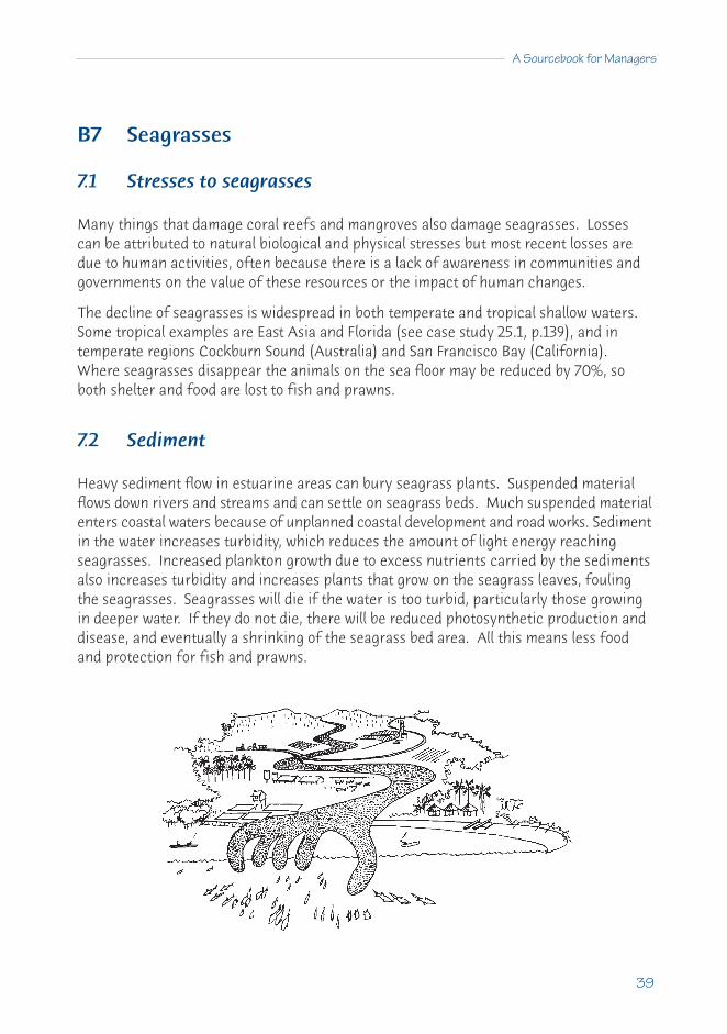
A Sourcebook for Managers
39
B7 Seagrasses
7.1 Stresses to seagrasses
Many things that damage coral reefs and mangroves also damage seagrasses. Lossescan be attributed to natural biological and physical stresses but most recent losses aredue to human activities, often because there is a lack of awareness in communities and governments on the value of these resources or the impact of human changes.
The decline of seagrasses is widespread in both temperate and tropical shallow waters.Some tropical examples are East Asia and Florida (see case study 25.1, p.139), and intemperate regions Cockburn Sound (Australia) and San Francisco Bay (California).Where seagrasses disappear the animals on the sea floor may be reduced by 70%, soboth shelter and food are lost to fish and prawns.
7.2 Sediment
Heavy sediment flow in estuarine areas can bury seagrass plants. Suspended materialflows down rivers and streams and can settle on seagrass beds. Much suspended materialenters coastal waters because of unplanned coastal development and road works. Sedimentin the water increases turbidity, which reduces the amount of light energy reachingseagrasses. Increased plankton growth due to excess nutrients carried by the sedimentsalso increases turbidity and increases plants that grow on the seagrass leaves, foulingthe seagrasses. Seagrasses will die if the water is too turbid, particularly those growingin deeper water. If they do not die, there will be reduced photosynthetic production anddisease, and eventually a shrinking of the seagrass bed area. All this means less foodand protection for fish and prawns.

40
Coral Reefs, Mangroves and Seagrasses
Where sediments come from and why
Heavy sedimentation may occur when there has been extensive sub-tidal and inter-tidalland reclamation (Singapore), major agricultural cultivation (Philippines), or mining(Philippines, Thailand, Malaysia). Catchment area runoff includes sand, silt and claycaused by deforestation, slash and burn agriculture (‘kaingin’ in the Philippines), andindustrial and urban development. Boat traffic and dredging for harbours and channelsalso increases sediment suspension.
7.3 Nutrient loading
The major long-term threat to seagrass beds around the world is from increased coastalnutrients. This is a particular problem in estuaries and bays with reduced tidal flushing.Nutrient loading (eutrophication) is caused by many factors:
• wastewaters which reach the coast from industrial, commercial and domesticactivities;
• inadequate sewage treatment systems;• boat discharges of human and fish wastes;• stormwater drain runoff carrying organic waste and fertilisers;• rivers coming from heavily fertilised agriculture; and• from excess nutrients washed out of soils because of increased erosion from bad
pastoral or agricultural practice.
Impacts
The direct impact of nutrients is more growth of plants that shade the seagrasses fromlight. This will reduce their health and all the commercial species that use seagrass bedsfor food and shelter. There are 3 main kinds of plants that compete with seagrasses for light:
• free-floating plant plankton (diatoms and dinoflagellates) reduce light reachingthe bottom;
• large algae which grow on the bottom and overshadow seagrasses; and• small algae (epiphytes) that grow on seagrass leaves, prevent light reaching the
leaves and weigh them down.
If seagrasses disappear from a bay or an estuary, which has happened in many tropicaland temperate areas around the world, it indicates that something is going wrong. (Seecase study 25.1, Stress from water management and land-use practices: Florida Bay,p.139). Seagrasses are good indicators of overall ecosystem health.
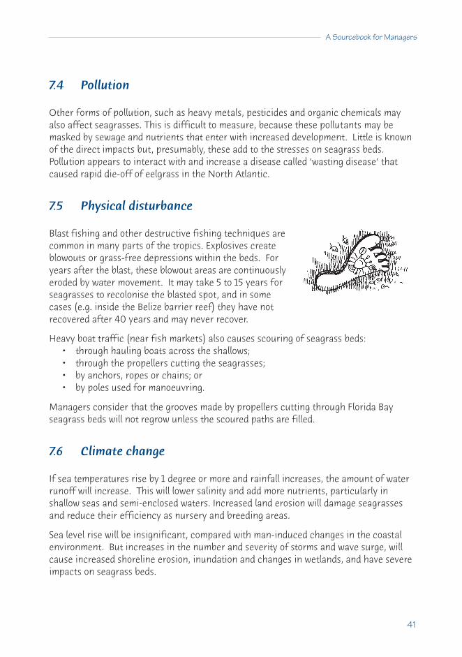
A Sourcebook for Managers
41
7.4 Pollution
Other forms of pollution, such as heavy metals, pesticides and organic chemicals mayalso affect seagrasses. This is difficult to measure, because these pollutants may bemasked by sewage and nutrients that enter with increased development. Little is knownof the direct impacts but, presumably, these add to the stresses on seagrass beds.Pollution appears to interact with and increase a disease called ‘wasting disease’ thatcaused rapid die-off of eelgrass in the North Atlantic.
7.5 Physical disturbance
Blast fishing and other destructive fishing techniques arecommon in many parts of the tropics. Explosives createblowouts or grass-free depressions within the beds. Foryears after the blast, these blowout areas are continuouslyeroded by water movement. It may take 5 to 15 years forseagrasses to recolonise the blasted spot, and in somecases (e.g. inside the Belize barrier reef) they have notrecovered after 40 years and may never recover.
Heavy boat traffic (near fish markets) also causes scouring of seagrass beds:• through hauling boats across the shallows; • through the propellers cutting the seagrasses; • by anchors, ropes or chains; or • by poles used for manoeuvring.
Managers consider that the grooves made by propellers cutting through Florida Bayseagrass beds will not regrow unless the scoured paths are filled.
7.6 Climate change
If sea temperatures rise by 1 degree or more and rainfall increases, the amount of waterrunoff will increase. This will lower salinity and add more nutrients, particularly inshallow seas and semi-enclosed waters. Increased land erosion will damage seagrassesand reduce their efficiency as nursery and breeding areas.
Sea level rise will be insignificant, compared with man-induced changes in the coastalenvironment. But increases in the number and severity of storms and wave surge, willcause increased shoreline erosion, inundation and changes in wetlands, and have severeimpacts on seagrass beds.

42
Coral Reefs, Mangroves and Seagrasses
BOX 6 GLOBAL CLIMATE CHANGE AND SEA LEVEL RISE
Human activities are changing the atmosphere and the world's climate. Burning offossil fuels (oil and coal), clearing of forests, more industry and intense farming are alladding ‘greenhouse' gases (carbon dioxide, methane, and nitrous oxide) into the airand warming the earth. The process is gradual and major effects may only be obviousin 20 to 30 years, but there are some effects already.
Greenhouse warming, global climate change and sea level rise are all getting a lot ofpublicity in the media, but there is little that a localenvironmental manager can do about it.
There will be 4 main effects of Global Climate Change:• sea levels will rise;• coral bleaching will probably increase;• rainfall and weather patterns will change; and • there may be large changes in currents and winds.
Another associated effect is: decreased ozone and moreultraviolet radiation (See Box 11).
Sea level rise: Sea level is rising at about 5 cm every 10 years, which is less than therate that coral reefs can grow upwards. A rise of 0.5 m in the next 100 years may notseem much, but people on many low lying sandy islands will have to move to higherislands or build expensive protective barriers.
Reef growth will keep up with sea level rise, but islands cannot accumulate new sandand rock fast enough to stay above the rising sea. A combination of storms andrising sea level will push seawater over low islands and contaminate the fresh waterlens under the sands.
Agriculture will be reduced and underground drinking water will become too salty.Therefore, low lying countries should start planning for sea level rise now by notbuilding near the shore, making plans to move towns away from the beach, andprobably assisting people on some low lying islands move to higher islands or othercountries. Building of sea walls will probably cause more damage by increasing beacherosion.
Coral bleaching: Increases in air, and particularly sea temperatures are causing morebleaching of corals. This is happening in all coral reef regions and is killing largeareas of corals (see Box 14, p108).
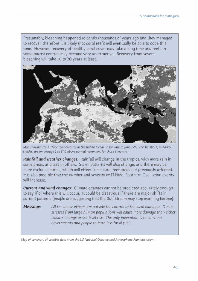
A Sourcebook for Managers
43
Presumably, bleaching happened to corals thousands of years ago and they managedto recover, therefore it is likely that coral reefs will eventually be able to cope thistime. However, recovery of healthy coral cover may take a long time and reefs insome tourist centres may become very unattractive. Recovery from severebleaching will take 10 to 20 years at least.
Map showing sea surface temperatures in the Indian Ocean in January to June 1998. The 'hotspots', in darkershades, are on average 1 to 3°C above normal maximums for those 6 months.
Rainfall and weather changes: Rainfall will change in the tropics, with more rain insome areas, and less in others. Storm patterns will also change, and there may bemore cyclonic storms, which will effect some coral reef areas not previously affected.It is also possible that the number and severity of El Niño, Southern Oscillation eventswill increase.
Current and wind changes: Climate changes cannot be predicted accurately enoughto say if or where this will occur. It could be disastrous if there are major shifts incurrent patterns (people are suggesting that the Gulf Stream may stop warming Europe).
Message: All the above effects are outside the control of the local manager. Directstresses from large human populations will cause more damage than eitherclimate change or sea level rise. The only prevention is to convincegovernments and people to burn less fossil fuel.
Map of summary of satellite data from the US National Oceanic and Atmospheric Administration.

44
Coral Reefs, Mangroves and Seagrasses
7.7 Non-sustainable development
In some developing countries, development means more exploitation of the environmentand no conservation or protection. The latter are not seen as necessary or sociallyimportant, but rather as expensive and time-consuming options that either slow down orstop development.
Environmental goals, such as ecological sustainability, can appear to be in conflict witheconomic goals which are dominant. But this is a short-sighted attitude. Over-exploitingnatural resources may yield some quick monetary gain but it is short lived, leaving nofoundation for the future. To ignore or underrate environmental goals does not makesound economic sense. Ultimately, it is the environment which produces the resourceson which the economy is built.
For long term sustainability and income growth, environmental and economic goals needto be considered together and kept in balance. Information and knowledge about thelong term impacts of environmental damage cannot be ignored, if communities are toachieve their full economic potential.
7.8 Institutional problems
There is not enough knowledge and understanding of Integrated Coastal Management inthe government and private institutions of most tropical developing countries. There areoften overlapping responsibilities in different government departments, so that either nodepartment takes responsibility, or there is conflict between different parts of governmentabout who is in charge.
Traditional free-access fisheries, with more and more fishermen and better techniques,are not sustainable but no alternative has been developed that is acceptable to the users.Few governments have an overall policy on coastal development and management toguide government departments. There may also be no public support or inadequateimplementation of existing laws that are designed to protect resources.
As long as seagrass beds are not considered as a vital part of the coasts and of lessimportance than coral reefs, they will continue to degrade rapidly and reduce the qualityof other linked ecosystems, including coral reefs.

A Sourcebook for Managers
45
7.9 Some consequences of seagrass loss
Less vigorous growth and production by seagrasses, and major reductions in their areawill result in serious changes to coastal ecosystems. There will be:
• less shelter for adult food fishery species;• less shelter for developing young of important food species (prawns, fish), which
are often harvested in other areas as adults;• less food for important food species that feed on seagrasses directly;• less shelter and food for molluscs, crustaceans and others that are eaten by
commercial species; and• loss of the function of seagrasses in stabilising sandy bottoms and slowing water
movement, which will mean more coastal erosion.
Loss of seagrasses will have such major impacts on shallow coasts and estuaries that itmay threaten the livelihood of local people who depend on coastal resources.
7.10 How can we stop seagrass decline?
It is important to identify the factors that damage seagrass beds and identify which arethe most serious. Recommendations to prevent seagrass decline include:
• monitoring seagrasses to understand what is happening;• banning or regulating coastal construction on or close to seagrass beds;• improving wastewater treatment;• controlling surface runoff and undertaking earthworks outside heavy rain seasons;• preventing cutting of mangroves and foreshore use that increases erosion;• banning the dumping of dredged material and industrial waste in and near
seagrass beds;• regulating boat traffic to prevent direct damage and erosion;• reducing the use of fine meshed nets, trawling in shallow waters and blast fishing;• monitoring and regulating fertiliser use, educating farmers to use it wisely;• regulating seaweed, shellfish and fish harvesting;• carefully assessing and regulating harbour and channel dredging; and• restoring seagrass beds and continuing to develop expertise in this.
Cooperative agreements between countries and joint training for managers and users ofcoastal resources (including seagrasses), as well as improving public understanding, areimportant. Sound understanding of Integrated Coastal Management at the highest governmental level is essential to prevent these resources being steadily lost (see C17Integrated Coastal Management, p.84).

46
Coral Reefs, Mangroves and Seagrasses
7.11 What is being done?
We need to know more about the function and importance of seagrasses. Putting a realmonetary value on seagrass beds (the ‘goods and services’ they provide), is essential.
$$ A value of over $30,000 per hectare was estimated for eelgrass beds in temperatePuget Sound and prawns from seagrasses within the harbour of tropical Cairns, onAustralia's east coast, total 178 tonnes (valued at $1million) annually.
To determine the real values of seagrasses is difficult but figures show that seagrassesare very valuable. It is essential that they are not destroyed, for long-term sustainablecoastal development.
Some countries are developing nationalplans, e.g. the Philippines, which has aNational Seagrass Management Plan.
This plan, still to be implemented, hasfive major components:
• finding out where the seagrassesare (resource mapping and survey);
• learning about seagrasses (research and development);• informing people about seagrasses (information dissemination, education, training
and publication);• developing laws and regulations for sustainable use and protection (policy and
legislation); • managing seagrasses so they are sustainable (environmental management).
The regrowing or rehabilitation of seagrass beds (see Section E, 30.3 on restoring seagrass beds p.181) was possible in Calancan Bay, Philippines (see Box 7, Transplantingseagrasses, p.47), where a mining company successfully replanted seagrass beds.Indonesia has incorporated policies to protect seagrasses and Singapore has protectedseagrasses around the island of Pulau Semakau to protect coral reef productivity in thearea. Thailand has provided funds to the Phuket Marine Station to protect reefs and seagrasses. Malaysia is also earmarking seagrass beds for protection.
The United Nations Environment Programme (UNEP) has a regional project in the Asia-Pacific region to assess the effects of river flows of sediment, nutrients and pollutants on seagrass beds, wetlands and coral reefs.

A Sourcebook for Managers
47
7.12 Artificial seagrasses
Artificial seagrasses may be a useful supplement to improve and rehabilitate verydamaged areas and replace the nursery function of the beds. Artificial seagrasses havebeen used to investigate and monitor fish recruitment and changes in biomass. In theSingapore River, artificial seagrass increased fish and shrimp numbers and specieswithin 3 months, and provided feeding areas for introduced seabass juveniles (Latescalcarifer). At Cape Bolinao, Philippines, artificial seagrasses were used to improve thebiodiversity and productivity of a degraded poor area. There were more fish species inthe artificial seagrass than in natural seagrasses in the area.
BOX 7 TRANSPLANTING SEAGRASSES
Methods and techniques for transplanting and restoring seagrass beds have beendeveloped over the past 10 years (see 30.3, p.181). Although the techniques have notcompletely restored a whole seagrass bed, there is one good example from CalancanBay, Philippines. A causeway was built using copper mine tailings. The area nearbywas planted with seagrasses and after 2 years, it changed from a bare mud area to arich seagrass bed.
After 5 years, the transplants completely covered the bottom, and now have the samebiomass and productivity as before the tailings were dumped, and fish species increasedfrom 2 to 17 in 1989 to 22 to 34 in 1990. These beds are now the same as naturallygrown seagrasses. In some places, transplanted seagrasses have grown slowly, probablybecause they were the wrong species for the habitat or the conditions were poor.
Where seagrasses have been destroyed by pollution or siltation, they cannot berestored until the damaging impacts have been stopped.
Message: It is best not to allow destruction of a seagrass area but, if one isdestroyed, the area can be restored. The problem is that it takes a lot oftime and money.
From Mike Fortes, Marine Science Institute, University of the Philippines.

48
C MANAGING COASTAL ECOSYSTEMS
Ci Management case studies
CONTENTSC8 Managing Australia's Great Barrier Reef 49
8.1 Full consultation 508.2 Multi-user zoning 508.3 Catchment area pollution and management needs 518.4 Lead agency 52
C9 Two Management Models for Philippine Marine Reserves 539.1 Sumilon Reserve: A history of failed agreements 539.2 Apo Reserve: Community support yields success 559.3 Conclusions 56
C10 Overfishing and Marine Protected Areas in East Africa 5810.1 Economic and environmental benefits of marine parks 5810.2 Conflicts between tourism and fishing 5810.3 Impacts due to overfishing 5910.4 Changes after setting up a marine park 59
C11 Partial Management Success in El Nido, Palawan 6211.1 Reefs more valuable than forestry 6211.2 The need for integrated management 63
C12 Sustainable forestry of mangroves - Matang 6412.1 Managing mangrove forestry sustainably 6412.2 Fishing yields maintained at high levels 64
C13 Replanting Mangrove Forests in Bangladesh 66C14 Planning Restoration of Healthy Coastal Systems in Indonesia 68
14.1 Why have an action plan for restoration? 6814.2 Defining the problem 6914.3 Developing an action plan 6914.4 Measuring changes resulting from the action plan 70

49
C8 Managing Australia’s Great Barrier Reef
This is a special case study because it covers such a large area and management hasbeen generally successful. There are many reasons why managing the Great BarrierReef (GBR) has been different to managing other areas. These are:
• the GBR is a very large system (2,000 km long) with most reefs closely connectedby currents which supply fresh larvae;
• many reefs of the GBR are remote from land (more than 30 km offshore);• population density on the nearby coast is very low; • fishing and other exploitation is moderate and there is no subsistence fishing;• the economic status of the local population is relatively high;• the local people have a high conservation ethic and strongly support the need for
management;• there is strong support from all levels of government and there are adequate funds
for effective management; and • there is a strong marine and social science community able to provide valuable
data and support for management.
The Great Barrier Reef Marine Park (GBRMP) contains about 2,800 separate reefs along2,000 km of coastline in an area of 350,000 sq km of broad continental shelf. It is by farthe largest protected coastal area in the world being actively managed.
The GBRMP was set up by the Australian Government in 1975 after there had been anactive public campaign to stop oil drilling and mining on the GBR. An Act of Parliamentin 1975 established a single lead agency, the Great Barrier Reef Marine Park Authority(GBRMPA), with the task of planning and managing the GBR with a specific goal:
"to provide for the protection, wise use, understanding and enjoyment of theGreat Barrier Reef in perpetuity through the care and development of theMarine Park."

50
Coral Reefs, Mangroves and Seagrasses
8.1 Full consultation
Management of the GBRMP was largely successful because of the above reasons andbecause the GBRMPA undertook extensive consultation with local populations, placingparticular emphasis on talking to farmers, fishing groups (both recreational and commercial),the tourist industry, non-governmental organisations (NGOs) and the indigenouscommunities along the coast. All these people are represented on a special advisorybody (Consultative Committee), which provides direct advice to the senior committee(The Authority). This is a four person committee with one each from the AustralianGovernment, the State Government of Queensland, the broader community and theindigenous people.
Inter-government support is further helped by a Ministerial Council of two Ministersfrom the National and State governments, who meet once or twice each year to avoiddisputes between governments. Within each part of the coast, there is a local advisorycommittee, which provides direct input into zoning of that part of the reef.
8.2 Multi-user zoning
A special feature of the GBRMP, compared to other types of protected areas (e.g. NationalParks), has been dividing the area into 7 different zones. These are to cater for all usersand also to ensure that significant areas are conserved and protected.
The major direct activities being controlled are fishing, collecting and tourism.
The largest human threat to the areas surroundingthe reefs is fishing by trawlers. In 1981, it was proposedthat at least 10% of the sandy bottoms would beclosed to fishing, now that figure is 15% to 30%.
There are 2 zones for the sandy bottoms around the2,800 reefs:
• General Use Zone (in 80% of the area) - trawlfishing is permitted.
• Habitat Protection Zone and other categories(in the remaining 20%) - trawling is banned.
Balancing competing uses

A Sourcebook for Managers
51
On the reefs themselves there are 4 zones, permitting different intensities of use:• Habitat Protection Zone (76% of reefs) - all fishing is allowed e.g. commercial and
recreational fishing, including spearfishing, but trawling, some collection ofanimals and spearfishing with SCUBA are all banned.
• Conservation Park Zone (2% of reefs) - here commercial fishing, spearfishing andcollection of animals are banned, while allowing recreational fishing.
• National Park Zone (21% of reefs) - accentuates protection of the reefs, by onlyallowing tourism but preventing all fishing and collecting. In some areas there is aBuffer Zone that allows for the catching of pelagic fish.
• Preservation Zone (1% of reefs) - this prevents entry by all people, exceptscientists doing research under very strict conditions.
Tourism is allowed in all zones, except the Preservation Zone. However, operators areallowed to place tourist pontoons on only 60% of all reefs, usually with only one structureon each reef.
All zones are protected by legislation and are intended to remain unchanged for 5 years,after which they can be renegotiated and rezoned for a similar period.
8.3 Catchment area pollution and management needs
Although most of the reefs are a long way offshore, sediment and nutrient pollution aretwo major threats to the inner reefs and to waters around the other reefs. The largestsources of sediment are from two major rivers that drain large areas ofdry, cattle grazing lands. Heavy rains after drought result in majoroutflows of sediment into the GBR Lagoon, which damages inner andmiddle-shelf reefs. GBRMPA is attempting to involve farmers inreducing stocking rates to lower sediment runoff.
Sugar cane and banana farming are the second biggest source of sediment pollution.These are being markedly reduced through joint projects with the farmers, Departmentsof Agriculture and the reef managers. Many farmers, including those who are also keenfishermen on the reefs, have changed to green tillage of crops (leaving the trash on theground as compost and not burning crops). This can reduce sediment runoff from canefields by 20 to 100 times.
The major sources of nutrient pollution (nitrate and phosphate) on the GBR are fromcattle grazing, cane and banana farming, domestic sewage and tourist activities, in thatorder. All tourist resorts and boats must install tertiary treatment of wastes or transferwastewater to suitable sewerage plants on the mainland. Most cities and towns on thecoast are installing secondary treatment plants. Cane and banana farmers are regulatingtheir use of fertiliser and now leaving natural vegetation barriers around streams to minimiserunoff loss. Controlling nutrient loss from over-grazed dry lands is a more difficult process.

52
Coral Reefs, Mangroves and Seagrasses
8.4 Lead agency
Probably the most important success factor has been establishing the single lead agency,the GBR Marine Park Authority. GBRMPA is supported by an Australian GovernmentAct, with a matching act passed by the State of Queensland. GBRMPA is responsible forplanning and overall management of the GBR Marine Park (allocating reefs for the placementof tourist pontoons, setting the tourist carrying capacity of reefs, issuing permits forscientific research etc.). The State Department of the Environment is responsible forthe day-to-day management and enforcement, through the use of rangers in the field.
GBRMPA has substantial government funding that is now supplemented by a day fee of$4 from all tourists visiting the reef. After completing zoning for the whole GBR, GBRMPAdeveloped strategic plans for the next 5 years and 25 years. A widely representative groupof 60 organisations took 3 years to map out strategic directions for the GBRMP to ensure:that the GBR remains a healthy, high biodiversity environment; that all activities in thearea are sustainable; and that there is continued strong community education and supportfor management.
Message: This is a special case but the lessons are clear: before attempting large areamanagement, it is essential to have strong government, industry andcommunity support; and it is essential to have a strong lead agency. It isalso essential to have high capacity in planning, monitoring, educationand enforcement, and to interact with and consult all the stakeholders.

A Sourcebook for Managers
53
C9 Two management models for Philippinemarine reserves
Sumilon and Apo islands: a lesson about the need for community support
9.1 Sumilon Reserve: A history of failed agreements
Sumilon Island (Lat. 9° 21’ N., Long. 123° 23’ E.) is 2 km from the southern tip of the largePhilippine island of Cebu. The surrounding reef is only 0.5 sq km and about 100 fishersfrom two local towns (Santander and Oslob on Cebu) fish in the area using traditionalgears - hook and line, gill nets, traps and spears.
Protection initiated
Sumilon Reserve was formed in 1974, to protect 25% of the reef, under an agreementbetween Silliman University and the Oslob Municipal Council. The people of Oslob andSantander were persuaded by biologists that the benefits of increased fish yields mightbe expected in 3-5 years. The fishers at first seemed unclear of the restriction but, bythe late 1970s and early 1980s, there was a perception that the yields had increased.
Protection lost
In early 1980, new mayors were elected to the two towns who did not support the reserveand in that year several serious fishing violations occurred. The University appealed to thenational government and Sumilon Reserve was declared a nationally protected fish sanctuaryand this order is still in place. The Governor of Cebu and the mayors of the two townsresented this, because Sumilon is part of Cebu and was being interfered with by a nationalgovernment, and because a university from another island (Negros) was given control.
Fishermen began using the reserve again. In May 1984, there were threats against thecaretaker of the reserve and he was removed for his own safety. Destructive fishingtechniques (explosives, ‘muro ami’ drive net fishing) were used in the reserve. Afterover 9 years of protection, the reserve collapsed and the amount of fish in it declinedsignificantly. A decline in fisheries yields in areas adjacent to the reserve suggested thatfish had previously been leaving the reserve and were part of the catch in these areas -and that the reserve had been effective.
The development of the island
A hotel was planned for the island, then built, and an ad hoc decision was made to stopall fishing by the Santander and Oslob councils from the beginning of planning in1987/88. On completion of the resort in January 1992, this protection was revoked for

54
Coral Reefs, Mangroves and Seagrasses
the non-reserve area and fishing began again. As before, the reserve was not effectivelypoliced and there were again violations. A large fish corral was set up in the reserveand, although this was later dismantled, fish traps were commonly seen in the reserveduring 1992-1994. Also it was rumoured that visitors were spearfishing with SCUBAgear in the reserve.
The tourist resort has now failed and is being sold.
This complex management history at Sumilon Islandshows protection can result in significant increasesin fish biomass that will increase nearby fisheries.Unregulated fishing in separate periods of 2 and 1.5years eliminated fish biomass gains accumulatedover 5 and 9 years of marine reserve protection.Slow, hard-won gains can be quickly lost.
Broken agreements
Sumilon Reserve was severely fished down in 1984 and 1992 because local fishers andmunicipal government ignored national law. An agreement was finally reached with theOslob Municipality, to maintain the fish reserve and provide a guardhouse and caretaker,but fishing in the reserve continued in 1994. There was no active caretaker, althoughthe construction of a guardhouse was completed in December 1995. The Oslob mayorand the caretaker maintain that line fishing is permitted in the reserve and this hascontinued up until at least late 1998. Such fishing is a clear violation of the national law,which has declared the area a ‘no take’ reserve.
Sumilon Reserve has been a management failure. Community support for the concept isstill lacking 20 years after it was initiated.
BOX 8 VALUE OF CYANIDE FISHING VERSUS HOOK AND LINE FISHING
It may seem strange, but hook and line fishing is much more profitable than cyanidefishing if you measure it over 25 years. Economist Herman Caesar of the World Bankshowed there will be a net loss to Indonesia of $46 million if cyanide fishing is allowedin Indonesia. This is mostly due to losses by not attracting tourists to damaged reefswithout fish.
In spite of the approximately $500 million return from the fishing, the same reefs iffished sustainably with hook and line produce a net profit to Indonesia of $322 millionmore than cyanide fishing (costed over 25 years at a 10% discount rate).

A Sourcebook for Managers
55
9.2 Apo Reserve: Community support yields success
Apo Island (Lat. 9o 21’ N., Long. 123o 16’ E.) is a volcanic, mainland island surrounded by acoral reef of 1.06 sq km, approximately 5 km south of Negros Island and under the controlof the municipality of Dauin on Negros. Unlike Sumilon, which was uninhabited, thereare 500 permanent residents on the island.
Education and conservation
A programme of education and conservation by Silliman University in 1979 led to the ideaof a marine sanctuary, and this was agreed to by Dauin municipality and the university in1982. Protection of a 0.45 km strip of the coral reef (about 10% of that reef) began inthat year. A community centre was constructed to assist in management of the reserveand this now serves as a meeting site.
Community support for a comprehensive marine conservation plan
In 1985, the Apo community endorsed a comprehensive marine reserve/sanctuary planand the entire island was declared a marine reserve. The reserve included the sanctuary,where no anchoring, fishing or removal of anything was allowed, and the wider reservearea, where there was to be fishing only by traditional means.
The plan banned all destructive fishing methods within 500 m of the island. Scientificadvice was provided by the university, a Marine Management Committee was set up, withmainly local residents, and enforcement was given to the Philippine Constabulary. LikeSumilon, studies at Apo showed that good protective management results in significantincreases in fish biomass and there is evidence that local fish yields outside the area increase.
Two small tourist resorts have started on Apo island that cater to the middle range of themarket This has meant that increased money is available to the community throughaccommodation, the supply of food, use of boats to ferry tourists around and the sale ofcurios. It was estimated in 1998 that the reserve contributes $500 per hectare per yearinto the local economy and also has made the island famous as an ecotourism site.
A success for the whole community
Apo Reserve has been very successful, with the community actively involved in theMarine Management Committee (now with its own building). Small tourist facilities havebenefited the local economy and encouraged local craft industries. The sanctuary is nowa well-known dive site, attracting "ecotourists" and creating pride in the community.

56
Coral Reefs, Mangroves and Seagrasses
9.3 Conclusions
The Sumilon Reserve failed because the planning and the setting up of the reserve didnot adequately involve the whole community. Silliman University’s actions were thoughtto be selfish, and because they came from another island and another province, theywere misunderstood. The benefits of increased fishing yield (and to a lesser extenttourism) are long term (3-5 years) and not understood by fishers, particularly when apolitician seeking election promises to take the island and reserve from the (distant)university and give it back to the fishers themselves.
The management of the Apo reserve and sanctuary succeeded because local communitysupport for the reserve concept was actively maintained, with original ideas andconcepts evolving from the community, and implementation and maintenance achievedby them. Considerable community discussion led to the emergence of ‘core groups’which formed the basis of the marine management committee. The residents themselvesidentified their needs and management problems, resulting in the concept of thereserve, with guidance from educators.
The marine management committee was involved in the drafting of the municipalordinance to establish the reserve/sanctuary, for surveillance and collection of visitorfees and donations, and in the construction of the community education centre. Thislatter activity (planning, constructing and maintaining a marine education andcommunity centre) was a critical factor in keeping up the enthusiasm of the residents.
From Garry R. Russ, James Cook University, Australia and Angel C. Alcala, Philippines.
Message: Protection of marine areas will not work unless there is active involvementand consultation with the local users, who then must have an active rolein managing the resources.

A Sourcebook for Managers
57
BOX 9 BLAST FISHING DESTROYS CORAL REEFS
Since World War II, dynamite or blast fishing has become widespread and is now commonlyused by many communities. As fishing pressures and populations increase, some fishermenfeel that they are forced to use these more damaging methods to feed their families.
Blast fishing is a cheapand easy way to catchfish. But the explosiondestroys the coral andkills many other fishes,particularly juveniles, inthe blast area. Somefishermen have beenkilled using explosives,and others have lostfingers and hands.
Fish need shelter from larger predators, particularly at night, but explosives destroyboth the coral that is their shelter and the food that fish eat, like small fishes andother invertebrates.
Where blast fishing is common, the reefs are flattened, coral shelter is reduced andthe large breeding fish disappear. Then, only the small, quick-growing fish remain, sothat the traditional fishermen do not catch enough fish to eat and even the blastfishermen get reduced catches.
This type of fishing should NOT BE PERMITTED. It is not sustainable, and destroysreefs that could produce fish on a continuous basis in the future. It is totally bannedin most island and coastal countries with coral reefs but explosives are still used inremote areas where there is no control.
The best ways to combat blast fishing are to involve and educate the whole community,and to provide alternative employment for fishermen.
It is essential to educate fishermen, and their wives and children by showing them thatthe damage caused will prevent them and their children catching fish in the futureand will not attract tourists.
Message: It is essential that blast fishing be stopped because it causes severedamage to coral reefs. Probably the best way is to educate the communityabout the damages and losses caused and assist them in self management.

58
Coral Reefs, Mangroves and Seagrasses
C10 Overfishing and marine protected areas in East Africa
10.1 Economic and environmental benefits of marine parks
Marine parks and protected areas serve many purposes. This has been shown in EastAfrica, where marine parks set up by the Kenyan government have produced economicand environmental benefits. The reason for these parks was to attract foreign touristsand foreign exchange to help in Kenya's economic development.
The marine parks have rivalled many of East Africa's famous safari parks, as manyvisitors come to the beach to relax after watching animals on the dry plains. As well asbringing in money, the marine parks have shown how management can be used toincrease fish stocks and improve the health of coral reefs.
10.2 Conflicts between tourism and fishing
There is almost a continuous fringing coral reef along the south coast of Kenya thatprotects the coral sand beaches from destructive monsoon waves and currents. Thesereefs support important fisheries and also have a high diversity of plants and animals.The calm lagoons behind the reefs are very important because most of the fishers arepoor and only have small and unstable canoes or outriggers for fishing. These lagoonsare also the areas used by tourists for swimming, coral viewing and other water sports.
All these uses of the lagoons create conflicts, particularly when the tourist wants to lookat fish while fishermen want to catch them.
There are also conflicts between tourism that brings inexport money, and the Fisheries Department whichwants to increase fish catches to feed the increasinghuman population.
The number of fishers has increased steadily over the lastfew decades and fish catches now are quite low (1 to 4 kgper person per day), which suggests that the fishery isnear the limit of exploitation. Therefore it has beenessential to introduce some zoning of uses to reduce the conflict between attractingtourists and catching food.
There are clearly some limits for governments when they try resource developments thatare incompatible and there are also limits to free-for-all development.
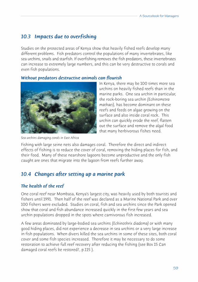
A Sourcebook for Managers
59
10.3 Impacts due to overfishing
Studies on the protected areas of Kenya show that heavily fished reefs develop manydifferent problems. Fish predators control the populations of many invertebrates, likesea urchins, snails and starfish. If overfishing removes the fish predators, these invertebratescan increase to extremely large numbers, and this can be very destructive to corals andeven fish populations.
Without predators destructive animals can flourishIn Kenya, there may be 100 times more seaurchins on heavily fished reefs than in themarine parks. One sea urchin in particular,the rock-boring sea urchin (Echinometramathaei), has become dominant on thesereefs and feeds on algae growing on thesurface and also inside coral rock. Thisurchin can quickly erode the reef, flattenout the surface and remove the algal foodthat many herbivorous fishes need.
Fishing with large seine nets also damages coral. Therefore the direct and indirecteffects of fishing is to reduce the cover of coral, removing the hiding places for fish, andtheir food. Many of these nearshore lagoons become unproductive and the only fishcaught are ones that migrate into the lagoon from reefs further away.
10.4 Changes after setting up a marine park
The health of the reef
One coral reef near Mombasa, Kenya’s largest city, was heavily used by both tourists andfishers until 1991. Then half of the reef was declared as a Marine National Park and over100 fishers were excluded. Studies on coral, fish and sea urchins since the Park openedshow that coral and fish abundance increased quickly in the first few years and seaurchin populations dropped in the spots where carnivorous fish increased.
A few areas dominated by large-bodied sea urchins (Echinothrix diadema) or with manygood hiding places, did not experience a decrease in sea urchins or a very large increasein fish populations. When divers killed the sea urchins in some of these sites, both coralcover and some fish species increased. Therefore it may be necessary to do somerestoration to achieve full reef recovery after reducing the fishing (see Box 15 Candamaged coral reefs be restored?, p.115 ).
Sea urchins damaging corals in East Africa

Fishing
The creation of the Mombasa Park protected area has had two opposing effects on fishing.
• On one hand, there was a marked increase in fish harvest close to the Park. Thosefishers that remained caught 35% to 50% more fish near the Park than further away.
• On the other, the total fish catch went down by about 35%, because: – the total available fishing ground was reduced; and– many fishers who used to fish in and around the area stopped fishing, rather
than being forced to compete in the reduced fishing areas.
But if the park had not been set up, the pre-park fishing levels would not have beensustained as the health of the reefs was already visibly declining. Furthermore, fishing isonly one of the economic values of the reef. Once benefits from other uses such astourism are taken into account, there was a net gain for the region.
One way of balancing competing uses while still optimising fishing potential may be tocreate smaller parks (~ 5 km2). These may be able to protect fish stocks and producemore fish nearby to compensate for some overfishing in nearshore areas.
Protected areas should be carefully designed toprotect fish stocks, large reproducing fish andspecies diversity, while still maintaining the fishcatches required by developing countries withexpanding populations.
From Tim McClanahan, Wildlife Conservation Society, Coral Reef Conservation Project,Mombasa, Kenya.
60
Coral Reefs, Mangroves and Seagrasses
Message: There are no magic solutions to our demand for marine resources, andsetting limits and enforcing them may be the only way to sustain fishproduction at the present high levels. Marine parks are a proven way ofproducing both economic and environmental benefits.

A Sourcebook for Managers
61
BOX 10 MONITORING AND SURVEY METHODS
Throughout this book we often refer to a manual* of monitoring and survey methods.This manual was developed jointly between 1984 and 1994 by marine scientists fromfive ASEAN countries: Indonesia, Malaysia, Philippines, Singapore and Thailand, inconjunction with the Australian Institute of Marine Science in Townsville.
The manual contains methods to assess coral reefs, mangrove forests, seagrass beds,soft sediment bottoms and tropical fisheries as well as guides for preparingmonitoring programmes and databases.
The methods were specifically developed to be very basic and applicable in a range ofecosystems by people without extensive experience. For example, there are simplemethods to assess the cover of coral over large areas then get better detail at chosensites along line transects. There are also quadrat methods to count young corals andmethods to count the numbers of settling larvae on ceramic tiles.
We have recommended the coral reef methods particularly, as they are in usethroughout large areas of the Indo-Pacific and were recommended by the Global CoralReef Monitoring Network, as well as forming the basis for the development of theReef Check methods (www.ReefCheck.org).
*English, S., Wilkinson, C., Baker, V. (1997). Survey Manual for TropicalMarine Resources, 2nd Edition. Australian Institute of Marine Science,Townsville, 390pp.

C11 Partial management success in El Nido, Palawan
Some management success - but not complete
El Nido (Lat. 11°N., Long. 119°E.) is one of the best dive sites in the world for tourists andis already a large money earner for the local population and for the Philippines. Thegovernment has gone to considerable efforts to protect this valuable resource, butthings are not going exactly to plan.
The forests of Palawan covered 92% of the island in 1968, but cover decreased to about70% in 1980 and to 50% in 1987, because of timber logging and slash-and-burn agriculture.Large-scale logging of the forests commenced around El Nido in 1985 and immediatelythe increased sediment runoff into Bacuit Bay began smothering and killing the corals.
11.1 Reefs more valuable than forestry
A detailed ecological and economic study in 1988 of the relative values of coral reefs andextractive forestry in this Philippine island, showed that the reefs were more valuablethan the forests. The reefs could provide more sustainable income from fishing andtourism than the income from removing the timber.
Following this study, both the provincial government of Palawan and the national Philippinesgovernment banned commercial logging, and the Department of Environment and NaturalResources strictly enforced bans on slash-and-burn agriculture. The area around El Nido,Bacuit Bay, is now a Marine Reserve, with a humanpopulation of 22,000.
Enforcement of both regulations has clearly worked as theold logged, and slash and burn areas have new cover ofyoung trees and the reefs appear to have recovered well.
In spite of this encouraging news, at the end of 1996 market-sized fish and invertebrateshad been markedly reduced by small-scale artisanal overfishing. Previously commonorganisms, such as giant clams (Tridacna) are now rare or very small, while lobster,trochus, green snails and edible holothurians are all gone. Once there were large fish (aslarge as 50 cm and more) including grouper, sweetlips, parrotfish, humphead wrasseetc., but now there are few, and these are small, even at the most remote dive spots.
The NGOs and government departments have had some difficulties working together atEl Nido. Most importantly, there is no attempt to control fishing, other than trawling.
62
Coral Reefs, Mangroves and Seagrasses
Many fishermen are recent immigrants, and have come to Palawan from neighbouringprovinces, because there are few fish left back home. In El Nido they are experiencingserious difficulties catching enough fish, and they expect that the situation will deterioratequickly. Dynamite fishing still occurs (two fishermen were blown up in one week) andthere is some cyanide fishing.
There are two reasons for the rapid loss of fish stocks:• growth of the population from 11,600 people in 1980 to 22,000 in 1995, has
created a large demand for local fish; and• ice is now available and an exporter sends 15-20 tonnes of iced fish per month to
wealthy people in Manila. Much dried fish is also exported.
11.2 The need for integrated management
This case shows the difficulty of managing coral reefs and the need for an integratedmanagement strategy (refer to A3, p.9, and C17, p.84 on Integrated CoastalManagement). There were once many fish in the Marine Reserve of El Nido, which isrelatively isolated (there is no road access most of the year), and has a low humanpopulation. But now the high-valued commercial fish and shellfish are virtually all gone.The corals so far remain in excellent condition, so that control of land use reducing siltcan prevent damage to some marine resources.
Management controlled one problem, the source of sediment that was damaging thereefs, but did not stop overfishing. A reef without fish is like a city without people.
From Gregor Hodgson, Institute of the Environment, University of California at LosAngeles, USA.
A Sourcebook for Managers
63
Message: Management plans should seek to control all damaging activities on acoral reef. Excessive sediment flow onto the reefs was identified as aproblem and controlled; but fishing, including blast fishing, was notcontrolled so now there are few fish left to attract tourists.

C12 Sustainable forestry of mangroves - Matang
There has been a sustainable forestry project on the west coast of Peninsular Malaysiafor about 90 years. The Larut Matang area was originally declared a forestry reserve bythe British colonial government at the start of the last century; it has been continued bythe Malaysian Forestry Department with considerable success since independence.
12.1 Managing mangrove forestry sustainably
Of the 40,700 hectares in the area, 35,000 are clear felled on a regular rotation cycle toproduce poles for scaffolding, building fish traps, housing and finally for conversion tocharcoal. This leaves over 5,000 ha to maintain forest diversity and also protect a speciesof monkey that feeds on a variety of mangrove leaves. The forestry alone is worth over$10 million per year.
A staged thinning cycle
Plots in the forest are sold off to 55 charcoal contractors who are responsible formanagement. Their first task is to ensure that there is sufficient new settlement ofmangrove trees, mostly Rhizophora apiculata, with lesser amounts of Avicennia, Sonneratiaand Bruguiera species. With so many adult trees in the area, there is usually sufficientnatural seed production to resettle the cleared areas but where this fails the farmer re-seedsthe area with preferred species.
The first thinning is at around 17 years to produce long straight poles for building; a secondthinning is done after about 22 years; and each forest plot is clear felled after 30 yearsto produce logs that are converted into charcoal for domestic cooking and roadside foodstalls. This is a conservative management cycle, as scientists from nearby Universiti SainsMalaysia estimate that the minimum cycle could be about 25 years.
12.2 Fishing yields maintained at high levels
An even higher annual return, of $2,500 per ha, comes from the extensive fisherysupported by this large mangrove area. The forests are the nursery area for a $100million plus industry in fish, prawns, crabs and cockles collected either from within theforest creeks or the banks immediately offshore.
64
Coral Reefs, Mangroves and Seagrasses

With a combined return of $2,800 per ha per year, this has beena very successful forestry and fishing project that is clearlysustainable. But there are limits. There is recent evidence ofoverfishing of mangrove related species and the fisheryurgently needs management to ensure it remains sustainable.
Scattered plots the key to success
One of the key success features about Matang is that the plots are scattered throughoutthe total area, so that at any one time there are no large clear felled areas that would besubject to erosion. This is another feature in management of mangrove forests; theyshould be cut in strips perpendicular to the shore so that long lengths of the bank arenot left exposed to erosion.
From A. Sasekumar, University of Malaya and Clive Wilkinson.
A Sourcebook for Managers
65
Message: Mangrove forests can be managed sustainably and produce big returns,but the important lessons are to leave sufficient areas for seed productionand to prevent shoreline erosion.

C13 Replanting mangrove forests in Bangladesh
Bangladesh has a population of around 100 million and lies at the head of the Bay ofBengal to which the Ganges-Brahmaputra-Megna river system delivers 2 billion tons ofsediment annually. It forms the world’s largest estuarine, tide-dominated delta. About80% of the land area of Bangladesh is formed of delta sediments, some as deep as 5 km.Averaged over the past twenty years, delta sediments have increased the land area ofBangladesh by 35 sq km per year. Cyclonic storms are funnelled into the Bay of Bengalevery monsoon season, and have a devastating impact on the low Bengali coastline witha high death and damage toll. These major cyclones rework large amounts of the deltasediments each year.
What the mangroves were like
This rapidly changing coastline over the eastern two-thirds of Bangladesh does notsupport diverse mangrove vegetation. The much more stable Sundarbans area further tothe west supports a rich mangrove forest forming the basis of an important forest industry.In addition, the extensive Sundarbans mangrove forests provide protection during cyclonesto the western part of the coastline and, in order toextend this protection eastwards, a major mangroveplanting programme was undertaken.
The success of mangrove plantings
So far over 120,000 ha have been planted withmangroves, predominantly of high quality timberspecies such as Sonneratia apetala (for timber),Excoecaria (for newsprint and matches) andAvicennia marina (for firewood).
Plantations were started by local village communitiesplanting small seedlings supervised by the ForestryDepartment. Growth was rapid and within 7 years athinning of the plantation was necessary. Within 14years, the plantations can be harvested and asecond rotation of mangroves planted in their place.
The result is a self-repairing barrier to wave action
Although the plantation sites are initially unstable, the sediments are rapidly trapped,and the soil becomes more stable. Protection from cyclones rapidly follows. It is too earlyto assess the timber production value of the programme.
66
Coral Reefs, Mangroves and Seagrasses
Mangrove nursery

The plantations clearly accelerate the accretion of new land and they help to protectcoastal agricultural land and villages from cyclonic storms and storm driven tidal surges.During one storm in 1990 in the Sitakunda area just north of Chittagong, about 25% of a2 km seawall built of 2 tonne, steel reinforced concrete blocks was smashed and someconcrete blocks were moved inland by up to 100m. In contrast, mangrove trees in aplantation just south of the seawall sustained damage to less than 1% of the trees andmost of the damaged trees had recovered within 6 months. Nearby coastal areas thatlacked seawall protection and were protected only by mangroves suffered no moredamage during the storm than areas protected by the seawall. The mangroves survivedrelatively undamaged because they were flexible and, unlike the concrete wall, did notpresent a rigid barrier to the wave and current action. Equally important, the mangrovebarrier is self-repairing.
The main objectives of the mangrove forest plantings were to increase coastal stabilityand protection and to provide timber resources. But these extensive plantations havealso brought about coastal habitat enhancement. Spotted mangrove deer make substantialuse of the plantations as do a range of other wildlife and aquatic fauna and flora.
Management actions needed
These plantations need forestry management. A number of insect pests have affectedsome of the plantations, causing some mortality and a decrease in wood quality.Increasing the species diversity of these plantations has been a management aim. Thisshould improve the mangrove forest and also have ecological advantages.
What is happening now
This experience has shown that mangrove plantations can be established and managedsuccessfully and that they have considerable potential value in stabilising coastal landand protecting it from storms and erosion. Mangrove plantations in certain areas mayprovide more long-term coastal protection than solid engineering structures, becausethey are flexible, and they may be more economical, because they are self-repairing.
From Peter Saenger, Director, Centre for Coastal Management, Southern CrossUniversity, Australia.
A Sourcebook for Managers
67
Message: Coastal managers should plan for inevitable change in rapidly changingenvironments rather than attempt to control or prevent the processes ofchange. Planting mangroves for harvesting is better than just trying toprotect coastal mangrove forests.

C14 Planning restoration of healthy coastal systems in Indonesia
The coastal area of SW Sulawesi comprises a mainland shore and a broad shelf 40 km widewith hundreds of islands and reefs (the Spermonde Archipelago), running north and southof Lat. 5°S. The islands have fringing coral reefs and there are also abundant coral patchreefs. Seagrass beds grow on the sandy bottom between the reefs, and mangroves usedto be abundant along the coast. The shelf is in an area with the highest diversity ofmarine species in the world.
The coast is densely populated and Ujung Pandang, the capital of South Sulawesi, is thebiggest city and most important port in eastern Indonesia. Land degradation inland is causingpeople to move towards the coast and there is 5% annual population growth in the region.
14.1 Why have an action plan for restoration?
The area was a highly productive shallow-water shelf and the mostimportant fisheries province of Indonesia, with 90% of the catchbeing taken from a zone within 8 km from the shore. Fish andother marine animals are harvested from both the reefs and theopen sea and fish, prawns and seaweeds are cultivated in brackishponds (tambaks) along the shore.
Most fishermen still use traditional methods but technological anddynamite fishing, and also the use of coral for building material,are steadily reducing the harvest off the reefs. In addition, theremoval of most of the mangroves has meant the loss of animportant nursery area for small fish and crustaceans. Industrywas growing at 14% a year until the recent turmoil.
Rivers are carrying human sewage and industrial waste into thesea, and agriculture is adding sediment and fertiliser nutrients.Road development, harbour works and dredging, and works in thedrainage areas of rivers all add more damage to the land and tocoastal systems.
Governments decided to act as the fishery could no longer sustainthe production of food. An Action Plan was developed throughcooperation between the Hasanuddin University in Ujung Pandangand specialists from universities and research institutes in Holland.
68
Coral Reefs, Mangroves and Seagrasses
Remembering how itused to be

14.2 Defining the problem
The first step was to define the problem, the responsible agency and the probable causesof the problem.
The problem was the lack of sustainability of the fisheries. The problem was so great,and covered such a big area, that the only agency that could be considered to haveresponsibility and authority that could lead to solutions was the Council for ProvincialPlanning and Development (BAPPEDA).
BAPPEDA considered the problem to be due chiefly to the following:• pollution from nutrients and sediment from agriculture; pollution from waste
products and nutrients from households, industries and tambaks (aquaculture ponds);• erosion of the coast due to reduced input of river sand because of river damming;• decline of seagrass meadows because of all the above;• destruction of coral reefs by dynamite fishing, harvesting of coral blocks and
sediment overflow;• decline of many reef organisms (fishes, crustaceans), as a result of the cutting of
the mangrove forests and removing sheltering nursery grounds;• overfishing; and• the local population feeling they have no influence or responsibility for their
resources, due to lack of support from authorities.
14.3 Developing an action plan
Definitions
A limited area was defined for the plan (due to limited funds, people and time). This was70 km of coastline and 40 km off the coast, around the river Jeneberang, and off the cityof Ujung Pandang. The plan was to be developed and implemented over about 10 years.
Objectives
The general management objective was: ‘sustainable use of the coastal resources inSW Sulawesi'.
The broad objectives for management were to prevent or reverse the problems that wereconsidered to be leading to a steady loss of production in the system (listed above).
A Sourcebook for Managers
69
Actions
The first effort was to make an inventory of possible actions that could be undertaken.These included:
• measures against erosion by agro-forestry, irrigation improvement, providingalternatives to destructive uses of the resources, improvement of betteragricultural practices, and regulation of addition of manure;
• regulating waste products by improvement of sewerage, water purification,restriction of tambak (fish pond) culture and its waste products, and regulation ofnavigation;
• replanting of mangroves;• control of fishing, by place, time and methods, and providing alternatives; and• co-management, to give the people involved more control over their resources and
involvement and influence with BAPPEDA, and a more secure living.
Limitations
In all such action plans, there are limitations that must be understood and taken intoaccount if the action plan is to succeed. Understanding these helps in the setting up ofthe plan, and helps to set priorities. Limitations included:
• the realities of physical conditions like climate, water-movements, soilcharacteristics and conditions;
• socio-economic conditions like employment, capital input, production techniques,population growth, international competition;
• cultural conditions like the involvement of local populations and existingmanagement strategies; and
• political conditions like the relationship between local politics and the nationalgovernment in Jakarta.
14.4 Measuring changes resulting from the action plan
To put an action plan into place, it is necessary to see whether it is working and whether thedesired improvements are taking place. Monitoring is needed to answer questions such as:
• Are the areas of mangroves increasing?• Are the seagrass beds spreading?• Are there more fish?• Are the fish larger and have they reached breeding age?• Is there less or more sewage entering the sea?• Has the fertiliser use on the fields changed?• Has the income per person increased or reduced? • Is the plan being accepted and supported by the local people that it affects?
70
Coral Reefs, Mangroves and Seagrasses

These are only a sample of areas where measurements are needed for this action plan. Aset of measures must be developed for each plan that attempts to:
• change human behaviour;• improve the environment;• improve a yield or make certain it is sustainable; and• develop new uses of natural resources.
Only this way can we recognise success or areas where further work needs to be done.
After 3 years study of the area, the teams created the action plan over 2 years, and theplan is expected to be put into action over a 10 year period. It is hoped that it will resultin a healthy and productive coastal ecosystem on the Spermonde shelf of SW Sulawesi.
From Maya Borel Best, Natural History Museum, the Netherlands.
A Sourcebook for Managers
71
Developments like this can be used for cage culture - a productive, sustainable activity.But they can also be misused as holding pens for the live reef fish trade, which is often based on the unsustainable,destructive practice of cyanide fishing.

72
Cii Management needs and methods
CONTENTSC15 Do Your Coastal Ecosystems Need Management? 73
15.1 Lessons about shallow tropical coastal systems 7315.2 Interaction between shallow coastal systems 7415.3 Long distance impact 7415.4 How to tell if management is needed 7515.5 Other reasons for management 75
C16 Marine Protected Areas 7716.1 A guide to Marine Protected Areas (MPAs) 7716.2 How to select Marine Protected Areas 7816.3 How to plan Marine Protected Areas 7916.4 Implementing the plan 82
C17 Integrated Coastal Management for Sustainable Use 8417.1 Problems of coastal management 8417.2 What is Integrated Coastal Management (ICM) 8517.3 Basic principles of ICM 8617.4 Good practice in ICM 8617.5 How to implement successful ICM 8717.6 What can go wrong with ICM 8917.7 How to obtain local Participation in ICM 91

73
C15 Do your coastal ecosystems need management?
To determine whether your ecosystem needs management you should consider
many factors.
15.1 Lessons about shallow tropical coastal systems
The case studies (D18 to D25) show that reefs, mangroves and seagrass beds are easilydamaged. For example:
• Overfishing can seriously damage a rich fishery and can actually destroy a reeffish population if spawning aggregations are removed. This will reduce futureincomes of local fishers.
• Coral reefs can also change to less productive reefs that are covered in large algaeand nearby seagrass beds can die.
• Both coral reefs and seagrass beds can be killed by sediment, sewage and otherpollutants from nearby or catchment area discharges.
• After mangroves are removed for firewood or building, there is often erosion ofmuddy shores.
• Unsustainable coral and sand removal can cause reefs to become rubble areaswith no corals and few fish, or lower the protective barrier of the reef so thatstorm waves penetrate inland.
Many studies show that recovery, although possible, is neither common nor easy.Therefore the message is to prevent damage if possible, rather than rely on cleaning upthe problem afterwards.
74
Coral Reefs, Mangroves and Seagrasses
Marine habitats are often damaged by natural catastrophes but, if this happens, theyalmost always recover. If a coral reef is severely damaged by a cyclone, it will regrowfrom coral left living (old bases, broken loose pieces) and from settlement of youngcorals, and in 10-15 years can become a flourishing reef again.
However stresses from human impacts are often the real cause for permanent damage.• Coral reefs, mangroves or seagrass beds may show little or no change under low,
continuing environmental stress until there is some natural damage (like acyclone). Then recovery may be slow or not happen at all because the humanstresses are continuing.
• Sometimes ecosystems may be under steadily increasing stresses but appear quitenormal. Then, when the stress reaches a breaking point, they collapse and do notrecover until the stressing factors are removed.
• When there is change or damage, it is always easier to look for one damagingfactor. But often several stresses work together without one being the major cause.
15.2 Interaction between shallow coastal systems
There are often interactions between the three tropical shallow water coastal systems, sothat damage to one may affect the other. For example:
• Loss of mangroves may allow more sediment to reach reefs or seagrass beds anddamage them.
• Many coral reef fishes leave the reefs at night to feed in the seagrass beds andgood commercial fisheries will be lost or reduced if the seagrass beds are lost.
• Many reef fish live as juveniles in seagrass beds and in mangrove forests, so ifthese seagrasses or mangroves are reduced reef fish will also be reduced.
These are linkages we know about. There may be others we do not yet understand butwe do know that damage to one coastal system will impact on others.
15.3 Long distance impact
The case studies show that often the damage comes from outside the area, whereanother group of owners or government agencies have control. But all human activitiesin the coastal zone will have an impact, usually negative. The most damaging impactsare major developments - mining, forestry or agriculture - on the land which result ininputs to coastal waters. Sewage with increased population, sediment from large urbandevelopments, clear cutting of forests or harbour dredging, pollution from industry, andpesticides and nutrients from agriculture are some of the damaging consequences.

15.4 How to tell if management is needed
If management is not obviously needed, introducing management may cause more socialproblems than it solves. If you are doubtful, watch or monitor the system until you havereason to introduce controls.
The need for management may be obvious
Often those who use the resources of the reef, mangrove forests or seagrass beds cansee that they are stressed by noting some of the following changes:
• Water may no longer be clear, but brownish and full of sediment (and it may beknown where the sediment is coming from such as: new mines, carelessdevelopment or poor agricultural practices).
• The water may be green from the growth of algae in the water (phytoplankton)due to sewage, detergents or fertilisers, or major blooms of red-coloured algaemay occur and result in fish deaths (and harmful algal blooms poisoning humanpopulations).
• Fewer fish may be caught in the area or they may be smaller.• There may be loss of the most important fish species.• Pollution from industry may cause fish kills.• Corals may be dying or the coral cover may be much reduced.• Mangrove trees may be dying or leaves discoloured, curling or falling off;• There may be no new young trees growing.• The seagrass bed may be getting smaller over the years or getting patchy.
Where change is not obvious, monitoring (observing,measuring and counting - see Chapter E27 Monitoring,p.157) over some time, such as a year or more, canhelp show whether changes are taking place, andwhether the reef or ecosystem is getting worse or is improving.
15.5 Other reasons for management
There may be reasons for management other than evidence that the systems arechanging for the worse, for example:
• an influx of new fishers or other resource users, that might overfish the resourcesin the future;
• a major increase in population close to the area;• a polluting mine or industry is being developed; or• land-use changes that could damage the shallow coastal systems (e.g. clear-felling,
causing severe sediment flows, or massive new agriculture developments).
A Sourcebook for Managers
75
76
Coral Reefs, Mangroves and Seagrasses
BOX 11 LESS OZONE AND MORE UV RADIATION
Ozone (O3, different from Oxygen O2) in the upper atmosphere, plays an importantrole by absorbing ultraviolet radiation (UV). Otherwise the full UV level of radiationfrom the sun would disrupt life on earth by breaking DNA and killing exposed cells.
Chlorofluorocarbons (or CFCs) were used until recently in a lot of pressure packsprays, refrigerators and air conditioners. Waste CFCs float into the upperatmosphere, where they break down to release free reactive chlorine, which breaksdown ozone molecules.
As this ozone shield thins, the amount of UV radiation reaching the earth increasesmarkedly, particularly in the higher latitudes and near the poles. This is causingdamage to some plants, including plant plankton (phytoplankton) and animal larvae inthe sea.
The ‘Ozone Hole’ will have less impact in the tropics and on coral reefs, because therehas always been a lot of sunlight, including large amounts of UV. Animals and plantshave developed mechanisms to cope with this high level of radiation by producingthicker skins or UV absorbing compounds. In addition, increases in the amount of UVradiation will be much less in the tropics.
Message: This is not an immediate problem for managers of tropical coastal resources.
Even under-use of the resource may suggest that management is necessary to improveeconomic return for local people.
All management should be planned to cause improvements in the system with minimaland gradual changes to the activities of the human users. At all stages, the users shouldbe informed, consulted and where possible involved in management.
A Sourcebook for Managers
77
C16 Marine Protected Areas
16.1 A guide to Marine Protected Areas (MPAs)
Integrated Coastal Management or ICM (see next chapter, C17, p.84) is the best methodto plan for the management of the whole coastal zone, which includes the watershedcatchment area and all activities that occur on nearby land or sea or both, now andplanned for the future. The declaration of Marine Protected Areas (MPAs) should be onepart of the overall management plan for the coastal zone. MPAs are a good way to giveeffective management to particularly valuable areas, such as coral reefs, mangroves, fishand bird breeding grounds etc.
MPAs can be large or small. They can be established for asingle purpose, or multiple purposes, or have zones fordifferent uses. Therefore, they can be used by a nation orcommunity to achieve many goals. They may be for long-term protection of sustainable local fishing, or to improvetourist facilities, or to protect a World Heritage site, or tomaintain biological diversity, or any other purpose.
A Marine Protected Area has been defined as: ‘Any area ofinter-tidal or sub-tidal terrain, together with its overlying waters and associated flora,fauna, historical and cultural features, which has been reserved by legislation to protectpart or all of the enclosed environment’. (IUCN, in Kelleher 1999). MPAs can provide forthe primary goal of marine conservation and management, i.e. ‘the protection,restoration, wise use, understanding and enjoyment of the marine heritage of the worldin perpetuity.’ Note that the IUCN goal covers both ‘wise use’. (that is, uses that areecologically sustainable and do not destroy the marine resource - and which are alsogood economic practice), as well as ‘conservation and protection'.
MPAs are an important method to achieve sustainable fisheries. There is evidence thatabout 25% of the fishing area should be totally protected from fishing for good fisheriesmanagement. This area is needed to allow enough fish to grow to breeding size andproduce the new larvae that will recruit new juveniles into the areas outside the MPA. Aprotected area is also essential to provide baseline information on what an unfished areashould look like for management, and as a demonstration tool for the community tounderstand the fishery. Also, an MPA can be used to attract tourists, particularly SCUBAdivers and snorkellers who observe the fish but do not take them.

78
Coral Reefs, Mangroves and Seagrasses
16.2 How to select Marine Protected Areas
The mechanisms to select which part, and how much, of a marine area to put into anMPA are different from those used in selecting areas on the land. The reasons may besimilar, such as:
• to maintain the ecosystem so that it will continue to support the animals andplants there;
• to ensure that use of species (such as fishing and gathering shellfish) issustainable; or
• to preserve biodiversity.
But the difference is that water can flow in all directions, so habitats in the sea do nothave clear boundaries and cannot be precisely defined.
Most species are not restricted to a specific site and many free-swimming animals havelarge habitat ranges. The larvae of bottom living species can be carried by water currentsfor hundreds of kilometres. Therefore, similar animals and plants can be found over alarge geographic range, occurring wherever substrate and water quality are suitable.This has some disadvantages for management, because the source of larval recruits ofsome fishes may come from far away areas, often outside the boundaries of the country.But this has an advantage for biodiversity management, because reef species with wide-spreading larvae and wide distributions are less likely to go extinct (there are fewrecorded cases of marine extinction).
This is very different from the huge numbers of land species that have gone forever.Extinction is more likely for marine species that brood larvae or care for their youngdirectly. But it is still difficult to say that a particular habitat is critical for endangeredspecies. The big exceptions are those areas that are essential for marine mammals, seaturtles, sea birds and a few known endemic species.
Therefore, tropical marine conservation has concentrated more on:• protecting areas with good examples of natural habitat, particularly areas to be
visited by locals and tourists (or for World Heritage, if really outstanding);• special protected areas for breeding birds, turtles and mammals; and• habitats where important commercial or recreational species live or breed, and
where conservation of stocks is necessary.
Following are some arguments for selecting particular areas to set up as MPAs:• Biogeographic/biodiversity importance - whether the area either contains rare
habitats or represents a good natural example of a special habitat in the world; orwhether it contains unique or unusual geological features that should be protected.

A Sourcebook for Managers
79
• Ecological importance - whether the area is important for the maintenance ofecological processes or life-support systems e.g. source of larvae for downstreamareas; or whether the area is a complete ecosystem, or if it can be combined withanother protected area to form a complete system.
• Economic importance - whether it would make an economic contribution totraditional users if fishing or gathering were controlled to ensure that the areamakes a maximum contribution of larvae or adults for surrounding areas; orwhether it has particular value as a tourist diving and viewing area.
• Social importance - is the area valuable to local, national or internationalcommunities because of its heritage, historical, cultural, traditional, aesthetic,educational or recreational qualities?
• Scientific importance - is the area valuable for research and monitoring?• International or National significance - could this area be listed on the World
Heritage List or made a National Park of great value or declared as a BiosphereReserve or considered as part of an international or national conservationagreement e.g. Biodiversity, Ramsar etc.?
• Practicality and feasibility - how isolated is the area from outside destructiveforces? Will the local and regional people accept the area as an MPA and supportits use for education, tourism or recreation? Can the area be managed to includesome existing local uses that fit in with existing management regimes?
16.3 How to plan Marine Protected Areas
There are general principles for preparing management and zoning plans for MPAs ofwhatever size or function.
Objectives
It is important to set out very carefully the objectives in planning an MPA. These may besimple for a small and single purpose MPA, or there may be many different objectives fora large, multipurpose MPA. By the time the planning process is over, all the stakeholders(those involved or interested in the area) should understand and agree to the objectivesof the MPA.
Forming a planning team
Planning MPAs is a multidisciplinary process that will require people with different skillsand qualifications. The number of key participants should be few to work properly,therefore they should be the best people. Such a planning team will work most effectivelyif they understand the whole picture, and this will help the team concentrate on the keyelements and not get bogged down in small details. Time should be spent educating thegroup, defining clear goals and discussing the key elements, problems, progress, and activities.

80
Coral Reefs, Mangroves and Seagrasses
Different countries and economies will have different skills available for a team, but ifpossible, the expertise should include coastal zone planning, resource economics, ecology,sociology and environmental engineering. Government experts, university specialists,and consultants can help provide the needed expertise as the plan develops. A goodmanager of the planning team is important to coordinate activities and ensure goodcommunications and consensus on decisions. Advice from a wider field of specialists(parks and tourism, pollution, fisheries, forestry) can also be sought as the work of theteam develops.
Developing the plan
A 5 stage process can be used to prepare management or zoning plans:
1 Initial Information gathering and preparation: It is important to use available dataand information to start the process. This should include literature on the area in governmentdepartments and perhaps in universities. It should also be remembered that there maybe traditional owners or users who have very important, long-term information.
First, a simple description of the area should be made e.g. how big, what physical andbiological resources are there, how are people using the resources. As with all planning; there will never be enough data, nor a perfect plan. Data will be gathered as planningproceeds and management is working. The planning process should continue even ifyou know that more information will be gathered later. Where it is possible and relevant,information should be sought on:
• coral, fish and other important animals;• major currents and tide flows;• commercial and recreational fisheries;• traditional fisheries and gleaning;• traditional rights and practices;• mariculture and juvenile collection;• shell, coral and aquarium collecting;• endangered species (e.g. dugongs, turtles, etc.);• bird or turtle breeding colonies;• tourist activities, boating and resorts;• SCUBA diving and spearfishing;• research and education;• adjacent land uses and catchment activities; and• shipping and defence uses.
Also, to give some idea of what current changes are occurring or will occur, as muchinformation as is available should be collected on trends, based on changes in pastfisheries, future estimates of population, new hotels, diving tourists, etc.
2 Public participation and consultation: Before starting, the planning team shouldconsult with users, interested groups and the public. They should be asked to comment

A Sourcebook for Managers
81
on the accuracy and usefulness of the review literature and suggest what to put in theproposed plan, including different zones of use. It has been found that unless the majorityof users and people in the area are involved in the process and support the MPA, it willfail (see case study C9 Two Management Models for Philippine Marine Reserves, p.53).
All forms of communication must be considered - print, maps, posters, talks, videos etc.and sent to all groups - local authorities, religious leaders, fishing cooperatives, schools,women’s groups, etc. Special efforts must be made to communicate with peoples who donot use printed matter in their daily life. Extra time should be set aside for direct contactwith affected peoples using methods that are familiar to them e.g. village or religiousmeetings. This contact is important, as many people may agree with proposals, but notspeak out above those who protest vigorously.
The planning team must ensure that there are people ready to answer all questions andrequests for information and be available to talk to meetings. People who are contactedshould feel that their comments are important and will be considered by the planningteam. This stage opens the first discussion with those who will have to live with the finalresults of the planning. It is vital that it is done well.
3 Preparation of the draft plan: From the above stage, the planning team will havereceived much information about how the stakeholders (those who are affected by orinterested in the plan) have reacted. This information should be reflected in the DraftPlan. It may also show that further information, or better information, should be gatheredat this stage. Planning should not be delayed until scientific surveys are completed, asthis can severely slow the process. The Draft Plan should be as simple and clear as possible,and it should avoid unnecessary restrictions on human uses.
The Draft Plan should include papers, maps and photographs explaining the plan for theusers and the general public (or their representatives). Specific goals and objectivesshould be defined for restrictions on the use of an area in the plan (e.g. stop fishing onspawning aggregations; or stopping destructive fishing), and, if there are multiple zones, the goals and objectives for each zone should be outlined.
4 Public participation or consultation: The team should ask the community,government and other users and parties, including NGOs and special interest groups, toreview the Draft Plan, emphasising that the plan can be changed in response to communitywishes. Similar emphasis should be made on direct communication so that all people aregiven the chance to state their concerns and suggestions as in 2 above. All comments bythe community should be summarised by the planning team and communicated back tothe people. This process may take several rounds, each time with a new draft, to ensurethere is general acceptance of the final plan.
5 The final plan: The Final Plan, developed after considering the comments andinformation from users, interested parties, agencies and organisations, should beprepared with precise maps and descriptions of zones and limitations. The plan normally
82
Coral Reefs, Mangroves and Seagrasses
has then to be checked by government lawyers. The plans are submitted to government andthe team should encourage the early approval of the plans through legislation, if this is needed.
16.4 Implementing the plan
Funding
No plan can be implemented without resources but there are ways to minimise the amount.Resources are essential because implementation3 demands continuing education andcommunication with the users, as well as surveillance, enforcement and monitoring. Noplan is perfect and, because conditions change, no plan lasts for more than a few years.Therefore, the plan will have to be renewed if conditions change or if parts are notworking. The plan is almost certain to fail if there are no resources to implement it.
Training
The people who will implement the plan must be well trained. They must understand theobjectives and the details of the plan, and also they should understand the people whoare affected by the plan and what are their attitudes toward the plan. Careful and formaltraining of staff is necessary.
Public education and interpretation
Public education may now be easier, because the people were involved in developing theplan, but education should still be carefully planned. The people who will be directly affectedby the plan need to understand the reasons for the plan, so the objectives should beclearly communicated to them. This will mean regular meetings and discussions withtown and village communities.
Surveillance and enforcement
The management authority will need to do some surveillance and enforcement to seehow the area is being used and whether the MPA rules are being implemented. Thecommunity will always do the best monitoring and enforcement if they feel they have:ownership of the site and use of its resources, and will gain benefits because of the plan.However, if they do not feel the plan will help them, they will not accept the MPA and therules to protect it, and will break them. This is why public education and interpretationis most important.
3 See UNESCO's "Coral Reef Management Handbook" eds. Richard A. Kenchington and BrydgetE.T. Hudson (1987) for more detail on implementation.

A Sourcebook for Managers
83
If every fisherman, tour guide operator orvillager is watching out for those who breakthe MPA rules, surveillance and enforcementis cheaper and more effective. If the localsreally police themselves, they will alert theauthorities about outsiders who break the lawor will deal with them themselves.
Monitoring
Monitoring is needed to see whether the plan is working. In Chapter E27 there are manysimple monitoring methods, but which ones are used will depend on the expectedoutcomes of the plan. If one objective is to increase the abundance or size of fish, thenthe fishermen may help with the monitoring themselves, or the people who work in themarkets can measure this. If the amount of coral cover on the bottom is expected toimprove, then simple line intercept counts can be done once a year.
It would be wise to ask advice from specialists in sampling methods before planning amonitoring plan, or else the plan may have too much, or too little monitoring. All tropicalmarine systems change a bit every year with variations in the amount of recruitmentetc., therefore monitoring will have to continue for a few years to show clear results ofthe MPA. But, without a monitoring programme in place, the manager has no ideawhether the plan is working or not. Nor, more importantly, how to improve the plan andhow to convince people who doubt the value of the MPA.

84
Coral Reefs, Mangroves and Seagrasses
C17 Integrated coastal management for sustainable use
17.1 Problems of coastal management
Coastal areas are under more pressure, because increasing populations result inactivities that damage coral reefs and other ecosystems e.g. more industry and housingdevelopment, agriculture, forestry, tourism, fishing etc. In addition, anything done in thecatchment area or in another part of the coast will almost certainly impact on anycoastal area.
The specific problems are:
• There are many different ecosystems (coral reefs, mangroves, seagrasses, estuaries,sandy shores) within the coastal zone, which all require different types of management.
• Each of these ecosystems provides a wide range of economic benefits to many differentpeople but only some of these benefits are included in national economic analyses.
• Economic and social development of coastal resources is more varied than in otherareas e.g. international tourism compared to subsistence fishing.
• Population density on the coasts is particularly high and is increasing, becausedisadvantaged people migrate to the coast when other resources are depleted.These people often lack political power and influence.
• Traditional legal, administrative, planning and management arrangements often serveindividual sectors (e.g. fisheries), which can cause conflicts with other user groups.
4 Much material for this Section comes from: Burbridge P.R., Burbridge, V. & Clark, S. (1996) "Discussion Paperon Applicable Knowledge for The Pragmatic Development of Sustainable Coastal Resources Management Initiatives" prepared for UNESCO.
A Sourcebook for Managers
85
• These traditional arrangements often treat the marine and terrestrial parts of thecoastal zone as unconnected parts e.g. they do not consider that sediment comingdown rivers damages coastal resources.
• Agencies serving different sectors rarely co-operate for integrated development,because they fear a loss of authority without gaining clear benefits.
• The gap between traditional and sectoral management of coastal development isgrowing. Traditional management developed by trial and error within smallpopulations but increasing populations and economic development often bypasstraditional management, particularly during strong economic development.
• Policy makers are often ill informed about the sustainable benefits of the coastalzone for local populations. These values include: food and income from fish,invertebrates and algae; building materials such as timber, rock and sand;medicinal and cultural products; and local economic opportunities in tourism,curios etc.
All these problems mean that new co-operative approaches must be tried.
17.2 What is Integrated Coastal Management (ICM)
Integrated Coastal Management (ICM) is a continuing process of involving all people andgovernment agencies using, or managing, a coastal area in the planning and on-goingmanagement to minimise damage, and maintain and maximise long term economic andsocial benefits. ICM is a new process to create a co-operative environment that reducesor eliminates conflicts over resource use.
ICM is better for planning sustainable use than single sector management, because it asksdecision makers to consider all possible interests (stakeholders), factors and problems inthe area. ICM can also prevent future problems by keeping resource users informed aboutthe goals and objectives of management. Starting ICM may be slow, because mostexisting political and administrative mechanisms are not set up for co-operative, multi-sectoral planning.
ICM is also called Integrated Coastal Area Management (ICAM) or Integrated CoastalZone Management (ICZM). These are 3 names for the same thing - we use the shorterversion ICM.
ICM co-operation means that coastal planning and management:• involves all parts of the coast (usually the watersheds, the coast and out to deep
water);• integrates all management sectors, so that no single sector (e.g. fishing,
agriculture, forestry, industrial development, tourist or town planning agencies)makes changes without considering the effect on others; and
• works within national, regional and local policies of development, investment,economics and cultural issues - and may affect them.

86
Coral Reefs, Mangroves and Seagrasses
17.3 Basic principles of ICM
These are the golden rules for successful coastal management:
1 Equity - Planning and management should aim for the equitable use of coastal resourcesby many users and not for the exclusive use by one economic or cultural group.
2 Sustainability - Management should ensure that human use and development are sustainable so that:• the resources maintain productivity;• they continue to provide sustainable benefits to a wide group of users;• they are not degraded beyond natural levels of recovery; and• activities do not damage nearby systems.
3 Impact minimisation - Management should favour sustainable, non-destructive activities and reduce or eliminate destructive practices. Damaging developments should be placed to minimise impacts on the ecosystem, e.g. water flows should not bechanged so that flooding, erosion or contamination of underground water is increased.
4 Involvement - Combined bottom-up and top-down approaches are preferable to ensure both the public and government support objectives and management plans.
5 Funding - Sufficient funds should be available for background studies to gather biological, physical, ecological, sociological, cultural and economic information about the area.
6 Patience - Sufficient time must be allowed for background studies, to develop communityinvolvement and confidence, and to involve all levels of government in the planning process. At least 5 years (time and funds) should be allowed to see some results.
7 Communication - There must be good communication and information sharing between all stakeholders (users, communities, governments and managers).
17.4 Good practice in ICM
If ICM is going to work:• a clearly defined area must be identified that is experiencing problems and needs
management;• the people and government must be convinced that management is needed and
ICM is the best method; • all users should know that management will provide advantages but will mean
some compromises by the users in loss of or restricted access to resources;• a lead agency must be identified and given enough authority to undertake ICM
planning and implementation; and• the local people must be involved in the process and given sufficient authority to
do much of the local enforcement, in return for sustainable benefits.

A Sourcebook for Managers
87
17.5 How to implement successful ICM
Set achievable objectives progressively
All participants must realise that ICM is a continuous process of testing, improving andback and forth communication for 5 to 10 years and longer. Management should startwith small, achievable objectives and gradually build up by trial and error to largerobjectives. Projects should be designed to have several increasing stages e.g. each 3 to 5years. The long term objective is to provide sustainable economic and social benefits toall users, without causing too much damage to coastal resources.
Identify the problems, determine the area
Before starting, all participants must understand that there are problems and identifythe major issues for management. This happens when users recognise that resource useis unsustainable. This process should start at the local level, but may be lead by governmentor NGOs, and involves asking all stakeholders what are the major problems and whatshould be done to solve them. These problems and issues should be circulated to all forcomment and revised as a priority list. This list forms the basis for management action.
It is essential to determine the area to be managed. If it is too small, then outsideinfluences, such as pollution or overfishing nearby, will make management impossible. Ifthe area is too large, it will be too complex and difficult to manage and enforce, soparticipants will become discouraged and management will fail. If possible, the areashould include a complete ecosystem e.g. a group of islands with reefs, an estuary withmangroves. All stakeholders should be involved in setting the boundaries and thesemust be communicated widely.
The area should include all major human activities affecting the coast and ideally includethe rivers and streams that impact on the coast. The area should also be one unit of control,containing one or several local governments that can work together for resource management.
Set goals and timetables co-operatively
The project should have clear goals acceptable to all people involved. To do this, all thepeople must be involved in discussing and determining the goals, which should have a clearmeaning to all e.g. improve fisheries, attract tourists, keep water clean and healthy. Sometimesinternational objectives, like maintaining biodiversity or protecting valuable ecosystems,may be included, but these are usually of secondary importance to user communities.
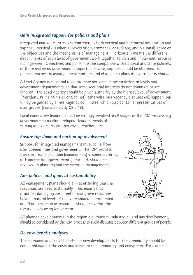
88
Coral Reefs, Mangroves and Seagrasses
Gain integrated support for policies and plans
Integrated management means that there is both vertical and horizontal integration andsupport. Vertical - is when all levels of government (Local, State, and National) agree onthe objectives and the mechanisms of management. Horizontal - means the differentdepartments of each level of government work together to plan and implement resourcemanagement. Objectives and plans must be compatible with national and state policies,or there will be no government support. Likewise, support should be obtained frompolitical parties, to avoid political conflicts and changes to plans if governments change.
A Lead Agency is essential to co-ordinate activities between different levels andgovernment departments, so that some sectional interests do not dominate or areignored. The Lead Agency should be given authority by the highest level of government(President, Prime Minister or Cabinet), otherwise inter-agency disputes will happen, butit may be guided by a inter-agency committee, which also contains representatives ofuser groups (see case study C8 p.49).
Local community leaders should be strongly involved at all stages of the ICM process e.g.government councillors, religious leaders, heads offishing and women's co-operatives, teachers etc.
Ensure top-down and bottom-up involvement
Support for integrated management must come fromuser communities and government. The ICM processmay start from the bottom (communities) in some countries,or from the top (governments), but both should beinvolved in planning and the eventual management.
Aim policies and goals at sustainability
All management plans should aim at ensuring that theresources are used sustainably. This means thatpractices damaging coral reef or mangrove resourcesbeyond natural levels of recovery should be prohibitedand that extraction of resources should be within thenatural levels of replenishment.
All planned developments in the region e.g. tourism, industry, oil and gas development,should be considered by the ICM process to avoid disputes between different groups of people.
Do cost-benefit analyses
The economic and social benefits of new developments for the community should becompared against the costs and losses to the community and ecosystem. For example,

A Sourcebook for Managers
89
developing tourism will bring more income and employment to the area but will meanthat some populations may be moved and fishing effort may be reduced. Communityacceptance of development will occur if there is understanding that there will beincreased benefits.
Monitor and review
ICM projects should include a database that will continually gather data on the performanceof planned activities. This will involve setting up a monitoring programme to assesscritical goals of the project e.g. is erosion being reduced, are fish stocks increasing, iscoral health better, are incomes increasing? The data from monitoring form the basis forregular reviews of the goals and objectives. These reviews should provide an early warningof unexpected effects and focus on improving the effectiveness of management.
17.6 What can go wrong with ICM
A manager should be aware of all the things that can go wrong and stop effectiveplanning and management. Integrated Coastal Management can fail because of thefollowing factors.
Poor information and understanding
Conflict can occur when users and governments have poor information and understandingof all the benefits of coastal resources, and how human activities can damage these. Amanager needs to integrate ecological, social and economic information in the earlystages of planning. It is important to identify early: what information is needed tounderstand how the system works, what are the benefits and what natural and humanimpacts damage the resources. If the data are not available, the ICM process should notbe stopped, because data may be available from similar coastal areas nearby. Oftengovernment departments, universities, colleges and NGOs have good information on thearea that is not published.
Conflicts and poor co-operation between organisations
This happens when organisations and people have difficulty co-operating to manage thearea because of cultural, social, religious, political and economic differences (e.g. strongtop-down governments).
Things that can block or interfere with ICM are: a lack of government support; politicalchanges in the government, and instability; confused legal definition of the coastal area(does it start at low or high water mark?); no understanding of the carrying capacity ofthe system; no control of what happens in upstream catchment areas (e.g. sediment fromclearing of forests, pollution from industry).

90
Coral Reefs, Mangroves and Seagrasses
Often different parts of government haveresponsibility for parts of the coastal zone andpeoples, which leads to arguments over the laws anddepartments which have decision making power.Therefore, there may be conflicting decisions or nodecisions at all.
No clear lead agency
If no agency is identified, government agencies and different levels of government (local,state and national) will dispute responsibility for the area. Sectoral planning (lookingafter only one resource or community e.g. fisheries and fishermen) is the old way ofmanaging coastal areas but this can break down if other factors, resources and usercommunities are not involved (see Palawan case study C11 p.62, where forestry wascontrolled but not fishing).
Conflicts between users and managers
Conflicts may arise between different groups of people: over the definition of theproblem and likely causes; or because they do not recognise that integrated managementcan bring advantages; or because groups will not compromise and reduce some rights oraccess to resources (e.g. between fishermen and tourist developers). Likewise, there willbe conflicts: if participants have different goals and objectives; do not acknowledge theLead Agency and cooperate with it; or are not prepared to participate in planning andhelp enforce management decisions.
Low budgets
ICM may fail if there is not enough money for planning, community consultation,education and communication (e.g. no sector or department will want to pay for it all).When funding stops and the government people leave, the local community may notcontinue the management, because they do not understand its benefits.
Few trained people
Integrated management can fail if there are not enough people employed or trained todo the planning and management, or if there is a lack of people with legal, social scienceor ecosystem science expertise in the planning teams.
No enforcement
Integrated management may break down when management agencies do not haveenough power to control more powerful developers or groups, or if there are no rangersto control use. Enforcement is most effective if the local users are the front line ofcontrol over illegal or damaging practices (see case study C9, p.53).
Lost in red tape

Poor communication
ICM may stop or go in the wrong direction if there is poor communication between allthe people involved because of different languages or social status.
Different standards
Often there are many different standards between agencies for planning andmanagement. These may include permitted concentration levels of pollution, areas thatcan be used for tourism etc.
17.7 How to obtain local Participation in ICM
If local communities do not accept the need for coastal zone management and participatein planning, management and enforcement, then there is little chance of success.
1 Seek local involvement: Planners should identify all potential stakeholders, including those who visit the area occasionally, inform them of management proposalsand seek their advice and assistance.
2 Good communication: Planners should ensure good communication and information sharing among community groups, managers, scientists and policy makers. Special communication methods should be used to help users understand the problems, management issues and possible solutions. The community may help by assembling information about traditional management practices and incorporating these, where possible, within ICM.
3 Support local decision-making mechanisms: Existing local mechanisms (local community organisations, fishing cooperatives, religious groups) should be encouragedand strengthened to help community involvement. Where these are not present, care should be taken to ensure that any new mechanisms are acceptable to local communities.Training can be given to local leaders to improve capacity for self management.
4 Benefit local communities: Management plans should ensure that local communities continue to gain access to existing resources and to new resources through gradual development e.g. of mariculture, tourism.
5 Community education and involvement: Education of the principles behind ICM is essential for the community. Different education programmes, materials and equipmentshould be provided to communities e.g. school children, community leaders, senior citizens. Community-level monitoring is an important way for users to increase understanding of causes of resource degradation, and observe tangible benefits and project success.
A Sourcebook for Managers
91

92
Coral Reefs, Mangroves and Seagrasses
BOX 12 WHAT ARE SUSTAINABLE ACTIVITIES ON A CORAL REEF?
Often the difference between sustainable and unsustainable activities is one ofdegree. Some fishing is fine, too much and it quickly gets destructive. Thesechecklists give a quick guide to good and bad practice.
SUSTAINABLE
• Moderate fishing (subsistence, professional and recreational) that is lowenough to allow recruitment of new young fish and replacement of breedingadults, even when poor years occur.
• Moderate removal of shellfish, coral, other marine animals and plants can besustainable, if it does not change the reef over time.
• Well planned and regulated coastal human developments, including touristhotels, which do not allow nutrients (sewage, fertiliser and industrial pollution),toxic chemicals and metals to flow into reef waters.
• Developments (domestic, tourist, industrial, port and road building) thatprevent sediment flows onto a reefs.
• Farming and forestry activities inland which do not add sediment and nutrientsto inshore reef waters.
• Tourist boating which does not smash corals by grounding and anchoring, butuses well made permanent moorings.
• Tourist diving and coral viewing where coral is not touched and broken, and fishnot speared.
• Carefully managed reef-top walking by tourists that is limited to marked tracks.
A sustainable approach to fishingLow impact tourist operations

A Sourcebook for Managers
93
NON-SUSTAINABLE
• Too much mining of coral sand and rock that lowers the protective barrier andresults in waves eroding the shoreline.
• Over-fishing that significantly reduces fish numbers, or removes the largebreeding fish, or removes most of the grazers by traps and nets (this encouragesalgal growth).
• Fishing by destructive methods such as fish poisons (e.g. cyanide), explosivesand muro-ami fishing (smashing rocks or poles down on corals to chase fishinto nets).
• Spearfishing that removes sedentary fishes and changes fish behaviour so that tourist viewing is less enjoyable.
• Over-using shellfish and other reef organisms until they are ‘mined’ away.• Poorly planned and unregulated coastal town and industry development that
allows pollutants and sediment into the coastal waters.• Inland farming and forestry that pours sediment and nutrients into streams and
coastal waters.• Tourist hotels and golf courses that do not control the flow of sediment, sewage,
insecticides and fertiliser nutrients into coastal waters.• Unregulated reef-top walking that smashes coral and damages large areas.• SCUBA diving or snorkelling tourists who are not educated to protect corals and
leave corals and shells. Untrained and unregulated, tourists will stand on andbreak corals and collect corals and shells.
Development can be very damagingPhoto: Andrew Elliott ©GBRMPA
Constant gleaning eliminates species

94
D CASE STUDIES OF HUMAN IMPACTS ON COASTAL ECOSYSTEMS
CONTENTSClassification of Case Studies 95
D18 Overfishing 9518.1 The death of a coral reef: Bolinao 9518.2 The collapse of a coral reef: Jamaica 9918.3 A reef under stress: Okinawa 10218.4 Compounding problems: Pulau Seribu and Jakarta Bay, Indonesia 105
D19 Sewage and Sediment 11019.1 Damage and recovery: Kaneohe Bay, Hawaii 11019.2 Coral recovery after removing a sewage outfall: Hawaii 113
D20 Mining 11620.1 Coral mining, reef erosion and rehabilitation: The Maldives 116
D21 Forestry 11921.1 Unsustainable mangrove use: Nicaragua 11921.2 Loss of lagoonal mangroves: Ivory Coast 122
D22 Introduced Species 12522.1 Problems with introduced mangrove palm: Gulf of Guinea 125
D23 Oil and Oil Mining 12723.1 The oil spill at Bahia las Minas: Panama 12723.2 Long-term effects of an oil refinery on coral reefs: Aruba 12923.3 The oil industry and mangroves: Nigeria 131
D24 Construction, Building and Dredging 13424.1 The costs of rapid wealth: the reefs of Singapore 13424.2 Coral reef impact and recovery after harbour dredging: Thailand 137
D25 Multiple Effects 13925.1 Stress from water management and land-use practices: Florida Bay 13925.2 Steady coral loss from multiple human impacts:
the Tiuhura reefs, Moorea 14525.3 Changes on the reefs at San Blas Point: Panama 148

95
Classification of Case Studies
The cause of breakdown of a coral reef, a mangrove forest or a seagrass bed may sometimesbe obvious. A single factor can be seen to cause the breakdown, such as silt from adredging operation smothering a seagrass bed, or a causeway blocking normal waterflow across a shallow mangrove area and killing the mangroves. But often there is nosimple answer as different impacts reinforce each other. The following case histories aregrouped under headings we think are the major reasons for breakdown. In some cases itis clear there is more than one impact (see D25). In the first four, overfishing played arole in reef destruction.
D18 Overfishing
18.1 The death of a coral reef: Bolinao
Population increase
The Bolinao reefs lie off northwestern Luzon, one of the largest Philippine islands. Theseare in the tropics (Lat. 16.5°N) with relatively high rainfall and mountains over 1,000 mnearby. Bolinao town has more than 50,000 people, with 20,000 depending on fishingdirectly or indirectly for a living. Within 25 years, there will be more than 100,000people competing for the same resources, because pressures on the land are increasingand forcing many more to seek a living from the sea.
What the reefs were like
These are predominantly fringing reefs that extend down to about 20 to 30 m, withbroad shallow flats behind these that contain numerous small patch reefs with manycoral and fish species. There are extensive beds of seagrasses around these patches.

Up to 1980, both corals and fish were relatively abundant with more than 350 species of fish,sea turtles, crustaceans, molluscs and seaweeds ending up in the local market each year.
What it is like now
By 1986, more than 60% of coral patches on the reef flat and lagoon floor were dead andthere was severe destruction of corals on the outer reef slopes. The reefs in the 1990swere producing only a small fraction of the fish catch of the 1970s, and coral cover onthe other reefs had been markedly reduced.
What happened
Fishing pressures on these coral reefs are excessive, with a wide range of methods used,including many damaging ones. Before 1980, fishing pressures were high but coral coverwas good. Then the government encouraged the use of large ‘V' nets, hundreds ofmetres along each side, to force fish into a heart-shaped trap. Fish on the seagrass flatsbecame as rare as those on the coral slopes.
At approximately the same time thefishermen expanded the poison fishingtechnique used to catch fish for the exportaquarium trade. They started using sodiumcyanide to stun fish for food. At the sametime dynamite fishing became more common,mostly using dangerous homemade bombs.By 1988, divers could hear as many as 10blasts per hour around Bolinao.
The reef became so severely degraded that the local military came under considerablepressure to stop blast fishing. One day, 5 people were found shot dead on a fishing boatcontaining homemade bombs. Following uproar and accusations, blast fishing firstslowed but then began to rise again.
As excessive force was clearly inappropriate, a nationwide programme was used withtelevision advertisements. Local teachers also spoke against blasting and local militarycommanders confiscated boats and put them on display. This whole programme helpedreduce blasting rates by 90% in the late 1990s.
The scarcity of fish longer than 10 cm on the reef slope led spearfishers to use car tyrecompressors to go deeper and fish longer from 1990. But they did not understand the dangersand many either died from ‘the bends' (decompression sickness), or suffered paralysis.
Why did it happen?
As farm land around Bolinao and elsewhere could no longer be subdivided among expandingfamilies, many turned to reef fishing as the only way to make a living in an area which
96
Coral Reefs, Mangroves and Seagrasses

has virtually no industry and other job possibilities.Overfishing damaged both the reefs and seagrass beds andseverely depleted populations of fish and sea urchins.
At first, they used traditional methods but, as catches dropped,the fishermen turned to destructive methods. These havedestroyed the coral cover and reduced the ability of the reef tosustain fish populations. The reefs are now virtually dead.
What are the chances of recovery?
These reefs could recover in 10-20 years if there was a major reduction in fishingpressure and some active management, such as establishing and enforcing marineprotected areas. In a 6-year study around Bolinao in 1992, the University of thePhilippines and the University of Rhode Island recommended that:
• there was a need to reduce population growth;• alternative forms of livelihood should be developed, such as tourism, improved
agriculture and mariculture;• the number of people fishing the coral reefs should be reduced by half to be
sustainable;• blast and cyanide fishing and compressor diving should be banned; and• a marine reserve system should be established.
Without all of these measures, the reefs are unlikely to recover and developsustainable fisheries.
What is happening now?
A programme started in 1993 by the University of the Philippines and the HaribonFoundation has been working on community development and understanding. Theprogramme includes alternative livelihood schemes and the implementation of marinereserves. An open-pit limestone mine for a cement factory was planned nearby and alsoa petrochemical plant may be built on very porous limestone soils. A big battle developedto stop the cement factory and succeeded. Big factories may provide some jobs but theyalso risk the survival of the reef as a sustainable resource for the people of Bolinaobecause of pollution and sediment.
From John McManus, Director, National Centre for Atlantic and Caribbean ReefResearch, RSMAS, University of Florida.
A Sourcebook for Managers
97
Message: Coastal resources cannot continue to provide food and other resources toever increasing populations. In the end, the only control method must bereducing population pressures through population control and providingthe people with means of obtaining a living other than by exploitinglimited resources.
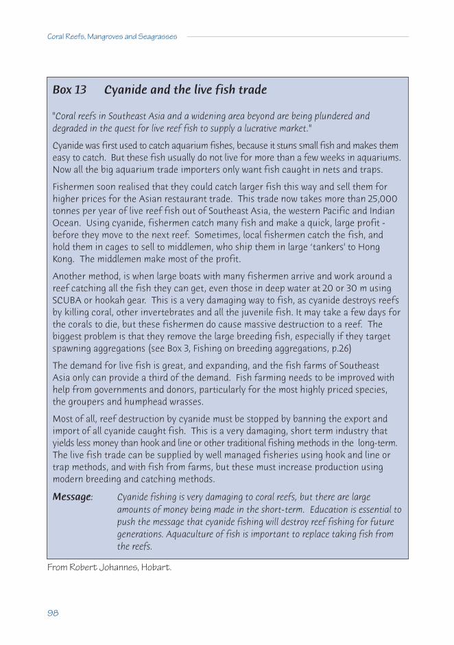
From Robert Johannes, Hobart.
98
Coral Reefs, Mangroves and Seagrasses
Box 13 Cyanide and the live fish trade
"Coral reefs in Southeast Asia and a widening area beyond are being plundered and degraded in the quest for live reef fish to supply a lucrative market."
Cyanide was first used to catch aquarium fishes, because it stuns small fish and makes themeasy to catch. But these fish usually do not live for more than a few weeks in aquariums.Now all the big aquarium trade importers only want fish caught in nets and traps.
Fishermen soon realised that they could catch larger fish this way and sell them forhigher prices for the Asian restaurant trade. This trade now takes more than 25,000tonnes per year of live reef fish out of Southeast Asia, the western Pacific and IndianOcean. Using cyanide, fishermen catch many fish and make a quick, large profit -before they move to the next reef. Sometimes, local fishermen catch the fish, andhold them in cages to sell to middlemen, who ship them in large ‘tankers' to HongKong. The middlemen make most of the profit.
Another method, is when large boats with many fishermen arrive and work around areef catching all the fish they can get, even those in deep water at 20 or 30 m usingSCUBA or hookah gear. This is a very damaging way to fish, as cyanide destroys reefsby killing coral, other invertebrates and all the juvenile fish. It may take a few days forthe corals to die, but these fishermen do cause massive destruction to a reef. Thebiggest problem is that they remove the large breeding fish, especially if they targetspawning aggregations (see Box 3, Fishing on breeding aggregations, p.26)
The demand for live fish is great, and expanding, and the fish farms of Southeast Asia only can provide a third of the demand. Fish farming needs to be improved withhelp from governments and donors, particularly for the most highly priced species,the groupers and humphead wrasses.
Most of all, reef destruction by cyanide must be stopped by banning the export andimport of all cyanide caught fish. This is a very damaging, short term industry thatyields less money than hook and line or other traditional fishing methods in the long-term.The live fish trade can be supplied by well managed fisheries using hook and line ortrap methods, and with fish from farms, but these must increase production usingmodern breeding and catching methods.
Message: Cyanide fishing is very damaging to coral reefs, but there are largeamounts of money being made in the short-term. Education is essential topush the message that cyanide fishing will destroy reef fishing for futuregenerations. Aquaculture of fish is important to replace taking fish fromthe reefs.

18.2 The collapse of a coral reef: Jamaica
A coral fringed Caribbean island
Jamaica is a true tropical island (Lat.18°N.) in the central Caribbean. It is large (235 x 82 km)and mountainous, with its highest peak reaching over 2,200 m. It is an independentnation with a population of 2.6 million people. The island and surrounding reefs lie inclear tropical water. Fish are an important food, with most fishing being conducted withbasic equipment.
What the reefs were like - rich reefs, full of fish
Most of the reefs lie close to the coast and were once considered the richest coral reefsin the Caribbean. They have also been the best studied And, in the late 1970s, there wasa high diversity of corals, which covered 50-70% of the bottom (surveys made along 240km of coastline).
What the reefs are like now - from coral to seaweeds
The reefs have lost almost all the rich living coral they had in the 1950s, 60s and 70s,because of a series of events. They are now dominated by large attached algae, whichonce were rare. These are now seaweed reefs along hundreds of kilometres. The weightof fish caught on the reefs has also dropped to one fifth of what it was in the 1960s andthe fish being caught are much smaller than before.
What happened - human stress has added to nature’s violence
Three events hit the Jamaican reefs in the 1980s and they collapsed. The first, HurricaneAllen, struck in 1980 and caused major damage to the large elkhorn and staghorn corals,and also tore up the gorgonians and sponges. Some algae grew on these bare surfacesbut large populations of the black spined sea urchin (Diadema antillarum) grazed themdown. Soon small corals started to settle from new larvae.
The second was in 1983, when a disease spread across the Caribbean and killed 99% ofthe black spined sea urchins. Thus, without grazing fish or sea urchins there was aspectacular growth of large algae (Sargassum, Lobophora and Dictyota), which wereuncommon on the reefs before. The algae covered 90% of the reefs in about two yearsand young corals could not settle, smaller corals were overshadowed and only a few largesolid corals were left (Montastrea annularis).
The third was another hurricane (Gilbert) in 1988, which damaged both the algae andmost remaining corals. The algae grew back within weeks from the bases and remnants,but destroyed corals did not regrow. Coral cover had dropped down to only about 3% andthe reefs have more than 90% cover of algae.
A Sourcebook for Managers
99

Coral reefs are often severely damaged by tropical cyclonic storms but they usuallyregrow in 10 to 20 years from broken pieces, as well as receiving new recruitment ofjuveniles. But these reefs were already under large human stress before the cyclonicstorms. Overfishing had removed almost all the fish that ate algae, as well as the predatorsof the algal grazing sea urchins. The large urchin populations had no predators andalmost no competition for food from fish. There was enough nutrient pollution comingoff the land (farming, untreated sewage) to ensure rapid growth of algae.
Why it has happened - overuse of reefs
Overfishing was the reason why these rich coral reefs collapsed. Fishing pressure was 2to 3 times what the reef fish populations could sustain. Fishing first removed the largepredatory fishes - sharks, snappers, jacks and groupers. The sea urchin predators weregreatly reduced (triggerfish, porgies and toadfish). The remaining grazing fishes(parrotfish and surgeonfish) were removed either in fine-mesh fish traps or byspearfishing. Now, virtually no fish reach normal breeding size.
The reefs would have recovered from the natural impacts of storms and disease, but theoverfishing and some pollution combined to kill off these coral reefs, because the algaetook over the bottom and smothered everything.
100
Coral Reefs, Mangroves and Seagrasses
Figure 1 Coral cover on Jamaica's reefs Figure 2 Algal cover on those reefs

The reefs will not recover withoutmanagement action
The reefs are unlikely to recoverbecause heavy fishing pressure isremoving the algal grazers. Fish arebeing reduced to below spawning sizeover wide areas of the Caribbean andnew fish recruitment must becomereduced.
Human impact through overfishinghas allowed the algae to out-competethe corals. Some corals are starting tosettle now but recovery is very slow.
Possible management actions
The only way for these reefs to recover will be to reduce fishing pressure and landpollution. It would be helpful to set up marine protected areas where fish can grow andbreed, and hopefully the corals will regenerate. These areas would allow adult fish tomove out into the fished areas and increase yields for fishermen.
From Terence Hughes, James Cook University, Australia.
A Sourcebook for Managers
101
Diseased coral is on the increase in the Caribbean - coastalstresses may be involved
Message: The reason for the decline of coral reefs is often complex and may involveseveral factors. Here it was storms that caused the major damage but thereal problem was overfishing.

18.3 A reef under stress: Okinawa
Damaged by fishing, and also by sewage and other pressures
The Japanese island of Okinawa (Lat. 26° to 27°N.) is the largest of the southern RyukyuIslands. Coral reefs have flourished there because the warm north-flowing Kuroshiocurrent flows around these islands, providing suitable temperatures for reef growth. Thecurrent brings fish, coral and other animal larvae from coral reefs to the south. Thewhole island was surrounded by a well-developed fringing reef.
The reefs originally had very high numbers of coral species and had a high percentageof coral cover. On the nearby Kerima Islands, there are still extensive fringing reefs, withsome small platform or patch reefs.
Badly damaged reefs
Most of the reefs around Okinawa look asthough a bulldozer has flattened them.
Except for a small area on the northwestcorner, where a clean water currentsweeps by the island, the percentage ofthe bottom covered by coral is either zeroor less than 5%. The water is cloudy andgreen from suspended sediment and algalplankton; and only a thin mat or lawn ofturf algae covers the coral rock base.
The dead coral rock also has the appearance of being carved with an ice cream scoop.The surface is pitted with numerous round depressions caused by the grazing activitiesof millions of sea urchins (Echinometra mathaei). These hide during the day in the cracksand crevices of the reef but come out at night and thoroughly graze the lawn of algae,
scraping down the coral rock surface. Thisgrazing removes any new coral recruits andalso undermines the few remaining corals, sothat they collapse and break up.
The one remaining area of coral reef is invadeddaily by another ‘plague'. Literally thousandsof novice divers line up to enter the water ontheir first dive. There is much evidence oftheir activities with the few remaining coralshaving many broken branches.
102
Coral Reefs, Mangroves and Seagrasses

What happened to the reefs
The reefs were used extensively in the past for food and curios and fishing has been soheavy that there are few fish to be seen on Okinawa reefs now. The fish that occur onthe Kerima islands are also being threatened by continued active fishing. Spearfishing isa common activity, often with SCUBA gear (this practice has now been banned in most ofthe world).
1.25 million people live on the island and most wastes are dumped untreated into the sea.This has resulted in a high level of nutrients in the shallow waters and reef flats aroundthe islands. The wastes of the small to medium size industries on Okinawa are also addedto this. Heavy loads of red clay sediment wash off the land during development andfrom farming. These run directly into the sea, because most of the rivers and streamshave been lined with concrete to ensure a rapid runoff of water.
Recently, large areas of the island have been converted into golf courses to attractgolfing tourists from the rest of Japan. These courses are heavily fertilised and treatedwith pesticides, with the excess flowing onto the reefs. Another major impact has beenthrough major engineering developments on the coast. Virtually the entire coastline hasbeen ‘protected' with concrete walls, and many ports and groynes have been constructedusing tetrapods - massive concrete blocks with four projecting arms.
Damage by many factors
Two major human impacts working together have caused the collapse of the reefs:• There has been massive overfishing of virtually all fish. This includes the natural
predators of the sea urchins (triggerfish, pufferfish, snappers and bream); andthose fish that are grazers (parrotfishes, surgeonfishes). Fishing has beenconducted with lines, nets, traps and, recently, by spearfishing.
• The increased levels of pollution by nutrients from sewage, industry and farminghave stressed the corals and provided ideal conditions for the growth of algae(both bottom growing algae and free planktonic algae in the water).
During the war, Okinawa suffered considerable damage and the island stressesincreased when special efforts were made to reconstruct Okinawa after the end of thewar in 1946. The reefs, although stressed, continued to grow until a second, and possiblyunrelated, impact hit them. A massive infestation by the crown-of-thorns starfish(Acanthaster planci) hit the island in 1972 and wiped out large areas of corals. Althoughan enormous and expensive effort was undertaken to remove the starfish, the starfishcontinued eating corals until almost all of the reefs were bare.
After this impact, the reefs should have recovered with new corals arriving, like all thereefs on the smaller islands around Okinawa. But the reefs did not recover, althoughthere are plenty of corals nearby to provide new larvae. The reason that corals do not
A Sourcebook for Managers
103

grow now is that any new juvenile corals are rapidly eaten down by the large populationsof sea urchins that graze every night. Thus, there is no new growth of coral rock(calcification) but instead there is considerable erosion of rock by the urchins and othereroding organisms.
Economic losses
This means that the reefs around Okinawa are gradually, but surely, disappearing andthis may increase the need for more concrete walls and groynes. In addition, the reefsthemselves are no longer the rich source of coral reef fish they once were. To allow thereefs to grow back may be a cheaper alternative in the long term. This will keepOkinawa a popular destination for tourists escaping the cooler regions. Tourists wishingto dive or snorkel to see coral reefs must either pass through Okinawa to the KerimaGroup, or continue further south to Ishigaki Island, or leave Japanese territory.
The chances for recovery?
The chances for recovery are very low if currentactivities continue.
With the coral almost gone and the reef convertedto one dominated by algae and sea urchins, corallarvae have little chance of surviving at presentand fish cannot return because of heavy fishingpressure and no coral reef shelter.
Need for management
Conservation does not have a high priority in Japan. There were no managementguidelines to prevent these impacts and the principal stresses on the reef still continue.Management is needed to improve the reefs. It would involve:
• declaring large marine areas of the island as reserves with no fishing;• reducing pollution by treating sewage and lowering runoff from the agricultural
fields; and• preventing the construction of more walls, groynes and ports.
From Chou Loke Ming, National University of Singapore and Clive Wilkinson.
104
Coral Reefs, Mangroves and Seagrasses
Invading sea urchins inhibit coral recovery
Message: Overfishing is the major problem on these reefs compounded by pollutionand shoreline destruction. A major programme is necessary to reverse allthese damaging impacts.

18.4 Compounding problems: Pulau Seribu and Jakarta Bay, Indonesia
A problem of overfishing, city pollution and natural disasters
Jakarta Bay on the Indonesian Island of Java had many coral islands and surrounding reefs(see Box 5 Mining reefs in Jakarta Bay, p.34). These reefs were mapped in 1874 anddescribed as being spectacularly beautiful in 1928, so there is a good historical baseline.
Stretching out 80 km north of Jakarta is a line of islands known as the Pulau Seribu, orThousand Islands. Jakarta (Lat. 6°S.) is the capital of Indonesia, with a population that hasincreased from 1 million 30 years ago, to more than 10 million today and is still growing.
The city is on the southern end of the bay and allthe pollution from the port and city flows intoshallow coastal waters. This shallow water alsoreceives much sediment because of considerableexcavation of building materials (sand, coralshingle and rock) and agricultural activities.
What the coral reefs were like
The reefs in the Bay and Pulau Seribu were once described as spectacular, with manyspecies and high percentage cover of coral. In 1979, the inner (southern) reefs of PulauSeribu (Pulau Pari group) had particularly high diversity and cover on sheltered sides ofislands. Even in 1985, the reefs further north in Pulau Seribu had similar high coraldiversity and moderate cover.
What the reefs are like today
Reef surveys between 1985 and 1992 showed that many reefs further north in the PulauSeribu chain maintained high coral diversity and moderate cover of coral up to 40%. Butsome reefs had surprisingly low coral cover. The southern reefs had coral cover valuesof 20-30%. Much of the low coral cover was initially due to a crown-of-thorns outbreak(see Section B 5.5, p.27.) in the 1970s and a severe coral bleaching episode in 1983 (seeBox 14, p.108). But coral recovery has been prevented by heavy dynamite fishing over a10 year period and other human impacts. The wide variations in coral cover on reefs faraway from Jakarta occurred because guards on privately owned islands and tourist resortislands chased fishermen away, whereas other reefs had many dynamite scars.
A Sourcebook for Managers
105
Coral shingle and rock mined for many uses

Results from surveys in 1995 are even more alarming, with coral cover down to below10% on some islands. It appears that many of the corals had been eaten by a new lowlevel outbreak of the crown-of-thorns starfish in 1994/95.
Many of the islands now have tourist resorts, that were built with little planning orunderstanding of the consequences. This has considerably damaged some reefs,because corals were used for building and channels were dredged through the reef andwalls, jetties and helicopter landing stages were constructed that changed currentpatterns, resulting in serious erosion of reef flats and islands.
Catches of fish from Pulau Seribu reefs have declined markedly recently such thatfishermen are now turning to other fishing methods. In the early 1980s, 200 fishermenon the islands caught 1,200 tons of fish per year by small-scale muro ami. In 1992,catches were less that 200 tons. Some families have switched to other livelihoods suchas growing seaweeds (Eucheuma).
What has happened?
The major stresses are overfishing and pollution from Jakarta and the tourist resorts onmany of the islands. Fishing pressures have continued to increase including the use ofdestructive methods like muro ami, explosives and poisons. There has also been overharvesting of giant clams (Tridacna), the collection of aquarium fishes and invertebrates,and continued mining of coral, even though the Pulau Seribu chain has been designatedas a Marine Protected Area (MPA).
Pollution from Jakarta Bay and the coast is already reaching the inner reefs andapparently creeping out to the middle reefs of the chain. In addition, few of the manytourist resorts have sewage treatment systems, so that nutrient rich waste water flowsdirectly onto the reef flats, causing coral death and disease.
What are the chances of recovery?
These reefs should recover from low levels of infrequent damage but the chances of recoveryfrom such regular human disturbance are extremely low. Natural impacts, such ascrown-of-thorns starfish outbreaks and coral bleaching, reduce the chance of recovery.
Pulau Pari reef is an example of slow recovery. In 1981, there was severe bleaching (seeBox 14 Coral bleaching, below) of corals on the shallow reef flats and slopes of thesheltered southern side. About 80-90% of corals died on the reef flat, because of higherwater temperatures, long hours of sunshine and low sea levels during that El Niño year,when coral bleaching also occurred in many other areas of Indonesia. Recovery on PulauPari has been patchy since then.
For the first 4 years, few corals grew back and some parts recovered to near normal,whereas other areas have shown little recovery. Now the new corals consist of only afew species, mostly Porites, that tolerate severe conditions of temperature and exposure
106
Coral Reefs, Mangroves and Seagrasses

to air. The diverse Acropora coral community has not come back and it is probable thatpollution from Jakarta, Pari Island and also the large number of ships using the channelnearby have contributed to the lack of recovery.
What is being done?
The Indonesian Government has declared large parts of Pulau Seribu as a MarineProtected Area. While this is sound policy, there are not enough resources to prepare aneffective MPA management plan and enforce the regulations. Tourist resorts continue tobe developed with little regulation and pollution from Jakarta is continuing to spreadtowards the outer reefs. This pollution is often seen as blooms of phytoplankton,particularly dinoflagellates, over the reefs. Such blooms indicate the potential for toxicalgal blooms, which adds another concern for management. Much of the dynamitefishing has been controlled but other damaging fishing practices have continued and thereefs continue to show damage.
Future outlook for the reefs and management needs
The future for the inner reefs does not seem good. This may also be the case for theouter reefs, if the current levels of human and natural stresses continue to pressurethese reefs. If they are to recover urgent and effective management to reduce overfishingand to curb the pollution from the resorts is needed. Without this the reefs will notrecover when hit by natural disturbances. With good management, the diversity andquantity of corals on the reef will increase and a richer fishery can be sustained.
From Dr Barbara Brown, University, Newcastle-upon-Tyne, United Kingdom and DrSuharsono, LIPI, Indonesia.
A Sourcebook for Managers
107
Message: The damage to these reefs is from a mix of human and natural factors.Recovery will be slow unless the human damage is reduced, particularlyoverfishing, sewage pollution and engineering changes to the islands.

108
Coral Reefs, Mangroves and Seagrasses
BOX 14 CORAL BLEACHING
Bleaching occurs when corals lose their colour and turn white, and now it is becomingmore common. The coral either throws out the little brightly coloured algae that live inits tissues (symbiotic algae or zooxanthellae) or the algae lose their chlorophyll pigments.
It can happen when corals are stressed, such as pollution or rapid changes in salinity,light or temperature, but most bleaching is due to temperature rises of just a fewdegrees above normal.
Bleaching appears to be worse in corals that are already stressed, either by pollutionor sediments. The zooxanthellae that live in all reef-building corals are essential forcoral life, because they provide most of the carbon energy and help the corals laydown calcium carbonate skeleton. So loss of them slows coral growth, stopsreproduction or can result in coral death.
Since 1979, there have been five major mass-bleaching events with about 60 separateincidents, which covered thousands of square kilometres of coral reef. Strongbleaching and death of corals occurred in islands of the Pacific such as Samoa, theCook Islands, and French Polynesia. This usually coincides with El Niño, SouthernOscillation years, when warm water (called the ‘Pacific warm pool’) moves south andeast and reaches these islands.
Corals on the Great Barrier Reef bleached in 1998; white fully bleached; mauve half bleached.

A Sourcebook for Managers
109
The severe bleaching in 1998 suggests that this is getting worse. Massive bleachingwas reported in the Indian Ocean, when a warm pool of water moved over the Maldivesinto the Seychelles, Sri Lanka and India. There was also bleaching in East Africa, theMiddle East and Asia. Bleaching is also increasing in the Caribbean.
Big questions face scientists and managers. Has coral bleaching really increased sincethe 1980s, or are more people looking and it is better reported? If bleaching is increasing,it is probably due to the global climate change and could get worse (See Box 6).
But all corals do not react the same way. Some coralspecies do not bleach when others are completely white.Some species recover after a short period of bleaching,while mortality may be as high as 95% in others.
• Will this cause changes in the speciescomposition on coral reefs?
• How long will it take reefs to recover?• How much does bleaching slow coral growth
rates and reproduction? and • How will this affect coral reefs in the future?
These are now major questions for coral reefscientists.
There are also big questions for reef managers.• Will bleaching increase in future?• What impacts will bleaching have on reef
fisheries?• Will recovery be rapid enough to prevent large economic losses for operators
and communities that depend on tourist incomes?
Message: There is nothing that a reef manager can do about coral bleaching, exceptrequest that communities and governments decrease their use of fossilfuels. Keeping coral reefs clean of pollution and sediments will probably reduce bleaching or speed up coral recovery afterwards. It is essential thatreef managers assist communities by explaining what is happening.
From Ove Hoegh-Guldberg, University of Queensland, Australia.

D19 Sewage and sediment
Dumping of raw or partly treated sewage into tropical seas causes damage. Coral reefsnormally live in clear water with low nutrients (low nitrogen and phosphorous). Additionof nutrients will encourage the growth of algae and filter feeding animals rather than corals.
Seagrasses are also damaged by too many nutrients (e.g. sewage or fertilisers) washingoff the land. Light necessary for growth of seagrass leaves is reduced by too muchplankton in the water; also many small algae grow on the leaves, reduce light to them,weigh them down and cause disease. In the following case, both silt and algae killed ahuge coral area in Kaneohe Bay.
19.1 Damage and recovery: Kaneohe Bay, Hawaii
Damage from sewage and silt is reversed
This is a 3-stage story of reversals: increasing damage up to 1978; partial recovery to mid1980s; and then more damage.
Kaneohe Bay (Lat. 21.5° N.) is the largest bay in the Hawaiian Islands (13.5 km by 4.5km). It is on the northeast side of Oahu, facing the trade winds and has a barrier coralreef protecting the mouth of the bay and 60 patch reefs inside. There are two naturalchannels to the ocean at each end and a 17 m deep ship-channel was dredged along thelength of the bay. The mean depth, however, is about 8 m and the average time it takesfor clean water to enter the bay is about 13 days and slightly longer in the southern bay.
The 100 sq km catchment area for the bay receives about 140-240 cm of rainfall peryear. But occasional storms can pour about 2 million cubic metres of water per day intothe bay. This happened in 1965 and 1987, when the whole bay was covered with a 1 mfreshwater layer that killed shallow corals in the south and central parts. The volume inthese freshwater floods has increased, because many streams have been covered inconcrete and water runs off more rapidly because houses, roads and parking lots coverthe land that was once covered in forest.
Population growth
The traditional land use with small taro patches has changed to large scale farming ofpineapple, sugarcane, rice, cattle, horses and goats. The population around the bayincreased from 5,400 to 67,000 people in the past 50 years, with many new housingdevelopments, shopping centres and roads. Nearly 60% of the shoreline has beenmodified by seawalls, harbours, dredging and filling for fishponds. A US Navy base was
110
Coral Reefs, Mangroves and Seagrasses

built at the entrance to the bay and removed 15 million cubic metres of reef for landfilland to allow seaplanes to land. They cut the channel through the reef.
Stage 1: What the bay was like and how it changed
Up to the 1960s, the Bay had clean water with the northern coral reefs being the bestdeveloped. They included most of the coral species and other bottom animals found inthe Hawaiian Islands, as well as a rich fish populations. They were called ‘coral gardens’.
But by the 1970s, the water in the southern end became a dirty, green colour fromincreased plankton due to sewage and sediment increases. Populations of sponges,tunicates, colonial zooanthids, polychaetes and motile gastropods all increased,particularly the filter feeders, and the detritus and mud eaters.
This southern part of the bay now had only 6 species of coral reef fishes, while thecleaner northern bay still had 40 species. Large fleshy algae became abundant on thereef slopes and reef tops. The green bubble alga (Dictyosphaeria cavernosa) smotheredand replaced corals on the central reefs and species of the green alga Ulva dominatedthe southern reefs.
In the late 1960s, fishermen changed to gill nets and surround nets and increased thefish catch by 4 times. But by the early 1980s, catches began dropping and havecontinued to drop.
What caused the change
The output of sewage from the town and the Naval Base increased from 4,000 to 20,000cubic metres per day, when the population grew between 1960 and 1970. These addednutrients caused the growth of phytoplankton and bottom algae. The increase insediment from farming and development added more stress to the corals and reducedwater visibility.
Half the shoreline was also modified by seawalls, harbours and fishponds. Surface reefswere dredged, land was reclaimed for the naval base and the ship channel was dredged.These disturbances combined to cause changes but the primary problem was sewageand sediment.
Stage 2: Removal of sewage and the recovery of Kaneohe Bay
In 1977-78, the sewage was diverted away from the southern bay and into a deep oceanoutfall beyond the bay entrance. Within 2 weeks, the plankton blooms and the bottomfilter and detritus feeders started dying. After one year, populations of sponges,tunicates, zooanthids and polychaete worms were down by 80% in the southern bay andby 35% over the whole bay.
A Sourcebook for Managers
111

Improvement continued and after 10 years,the chlorophyll (from phytoplankton) wasdown 40%, the water was clearer, coralcover had doubled and algae on manyreefs had reduced. The water was stillgetting clearer as nutrients in thesouthern bay sediments washed out to sea.The Kaneohe Bay coral lagoon showed realrecovery and coral cover increased. Theimprovements should have continued, withonly the major freshwater floodsthreatening the coral reefs.
Stage 3: Decline again in Kaneohe Bay
The coral cover increased to an average of about 50% on the better reefs by 1983, withthe cover of fleshy algae around 1%. Since then there has been a steady decline in coralcover, while the cover of algae is increasing (up to 10% in many places). The reasons forthe decline in the corals and increases in algae are because: nutrients from about 3,000septic tanks continue to flow into the bay; there are now many more boats in the baywhich release sewage and other pollution; and the sediments still have trapped nutrientsand heavy metals which are gradually being released. Thus, it appears that these reefswill continue to come under stress from the developments on the land and may neverfully recover to the ‘coral garden’ state that was there before 1960.
What management action is needed?
Houses in rural areas of the central and northern areas are steadily being connected tothe sewerage system, which should further improve water quality (see case study 19.2below). A Kaneohe Bay Master Plan is being developed, which should help controlfishing, land and shoreline development, water quality and urban and rural runoff.
From Marlin Atkinson and Cynthia Hunter, Hawaii Institute of Marine Biology.
112
Coral Reefs, Mangroves and Seagrasses
Message: A mix of problems caused reef decline but when the sewage and sedimentwere reduced there was recovery. This was short lived because continuedhuman population growth added more nutrient pollution. All sources ofnutrients entering this enclosed bay must be minimised to solve ongoingpollution problems.
Monitoring progress of coral regrowth

19.2 Coral recovery after removing a sewage outfall: Hawaii
Severe damage to a coral reef from a sewage outfall in Mamala Bay andrecovery after its removal to deep water.
Mamala Bay is a shallow coastal bay 30 km long, in front of Honolulu City and on theleeward side of the Hawaiian island of Oahu (Lat. 21°N, 157°W.). Honolulu has about 1million people and has nearly doubled in population since 1959.
What was it like?
Before 1955, there were good coral reefs throughout the Bay but that year a sewageoutfall was built discharging directly onto the reef.
In 1975, Rick Grigg started a study which showed that the outfall had a strong impactover an area 2 km to the east and 4km to the west of the outfall. Corals were eitherabsent or very reduced in abundance.
The bottom within 1 km of the outfall becamecovered in half-metre high mounds formed bythe tube-building polychaete worm, Chaetopterus.The green alga, Ulva, was common and the seaurchin Echinothrix diadema was abundant,eroding and excavating corals along theaffected 6 km strip. But about 6 km from theoutfall at 10 m depth, healthy, living coralscovered about 70% of the bottom.
In 1978 the outfall was moved into deeper water (70 m) and extended 2.9 km offshore.The sewage was also treated to an advanced primary level. After this, the Chaetopterusmounds disappeared within a year, leaving behind a flat, highly eroded limestone bottom,virtually barren of corals.
Steady improvement over fifteen years
Although there was no obvious recovery in 1978, corals and other animals gradually cameback to the area during the next 15 years. By 1993 coral cover had increased to between10-25%. There were more corals on uneven areas and less on flat areas. Recovery in allareas was slowed down by large hurricanes in 1982 and 1992.
A Sourcebook for Managers
113
Sewage outfall in Mamala Bay

How did it happen and will it recover fully?
The sewage outfall was the major influence on the coral reef before 1977 and haddestroyed most corals in shallow water (12 m) with Chaetopterus mounds replacing them.The coral cover of the bottom before the outfall must have been around 60 or 70%,because this is what is found at distances well away from the outfall.
After the outfall was moved to deeper water, coral recovery has been slow and thehurricanes have destroyed some newly settled corals. But recovery is happening andmature reefs are likely to come back with large corals and a high percentage coral cover.At the present rate it may take 50 years to get complete recovery. No managementactions are needed.
From Rick Grigg, Department of Oceanography of the University of Hawaii, USA.
114
Coral Reefs, Mangroves and Seagrasses
Message: This is a direct example of the damage caused by sewage pollution; andthe reversal when the sewage is turned off – a ‘good news’ story..

A Sourcebook for Managers
115
BOX 15 CAN DAMAGED CORAL REEFS BE RESTORED?
Can managers help restore coral reefs? Can local communities help by reducingfishing or by reducing pests? If so, how long will it take for reefs to recover? Canrestoration be speeded up? Is the cost of restoration worth the uncertain benefits?
Recent studies show that managers can solve some problems and be confident aboutthe results of management. Corals are often smothered by large algae that increasebecause of nutrient pollution, or the removal of fishes and urchins (herbivores). So ifcommunities, dive clubs, and fishermen can remove large algae with wire brushes,coral will grow back and reef health will be restored.
The reef manager should monitor the corals for the long-term effects of wirebrushing, determine how often brushing is needed, and analyse the costs andbenefits. The benefits of scrubbing, however, will be reduced if over-fishing continuesto remove the herbivores or pollution is not reduced. The algae will just grow back andcontinuous brushing will be needed to keep the reefs clean, therefore restorationshould be used along with other management methods.
In Kenya in the early 1990s, heavily fished reefs became infested with sea urchins,because the predators, particularly the red-lined triggerfish, were fished out (therewere 10 to 20 fishermen per sq km). Sea urchins became so abundant that theygrazed all algae to such low levels that the other fish and small invertebrates that fedon or lived in the algae were reduced. Therefore, the large populations of sea urchinscaused a big reduction in the reef fisheries. Managers tried to restore the infestedreefs by removing the sea urchins. The fishermen were kept out of one area beforeand after reducing the sea urchins. In the other area, fishing continued as usual:
• Where no fishing was allowed, there was an increase in parrotfish and otherfish as well as coral abundance;
• Where fishing continued, the algae and seagrass grew over the bottom and onlysmall wrasses and damselfishes increased. Coral cover was reduced on theover-fished reefs, because of algal growth.
Message: There are no quick fixes to restoring coral reefs. But sometimesrestoration, combined with control of fishing and pollution, may be theonly way to permanently restore degraded reefs. If the community can beinvolved, this will reduce costs and they will help in the long termmanagement of the reef.
From Tim McClanahan, The Wildlife Conservation Society, Kenya.
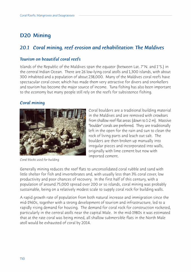
D20 Mining
20.1 Coral mining, reef erosion and rehabilitation: The Maldives
Tourism on beautiful coral reefs
Islands of the Republic of the Maldives span the equator (between Lat. 7°N. and 1°S.) inthe central Indian Ocean. There are 26 low-lying coral atolls and 1,300 islands, with about300 inhabited and a population of about 238,000. Many of the Maldives coral reefs havespectacular coral cover, which has made them very attractive for divers and snorkellersand tourism has become the major source of income. Tuna fishing has also been importantto the economy but many people still rely on the reefs for subsistence fishing.
Coral mining
Coral boulders are a traditional building materialin the Maldives and are removed with crowbarsfrom shallow reef flat areas (down to 1-2 m). Massive"boulder" corals are preferred. They are traditionallyleft in the open for the rain and sun to clean therock of living parts and leach out salt. Theboulders are then broken up manually intoirregular pieces and incorporated into walls,originally with lime cement but now withimported cement.
Generally mining reduces the reef flats to unconsolidated coral rubble and sand withlittle shelter for fish and invertebrates and, with usually less than 3% coral cover, lowproductivity and poor chances of recovery. In the first half of this century, with apopulation of around 75,000 spread over 200 or so islands, coral mining was probablysustainable, being on a relatively modest scale to supply coral rock for building walls.
A rapid growth rate of population from both natural increase and immigration since themid-1960s, together with a strong development of tourism and infrastructure, led to arapidly rising demand for housing. The demand for coral rock for construction rocketed,particularly in the central atolls near the capital Male. In the mid-1980s it was estimatedthat at the rate coral was being mined, all shallow submersible flats in the North Maleatoll would be exhausted of coral by 2014.
116
Coral Reefs, Mangroves and Seagrasses
Coral blocks used for building

Population pressure has been particularly intense on the island capital of Male itself,where about 25% of the nation live on a 2 sq km island. This rapid growth has also led toan acute shortage of land for housing, schools, power plants, hospitals, etc. In an attemptto remedy this some land has been "reclaimed" from the sea, increasing the size of Malefrom 110 to 185 ha. (See Box 19 Reefs as breakwaters: the cost of replacement, p.177)
Coral reefs may not recover after mining
Natural recovery of areas that have been mined seems to be very slow and is almost non-existent where mining has been particularly intense (no recovery after 25 years). This isprimarily because:
• the mined areas offer little shelter to grazers such as fish which clean surfaces forsettlement of corals and other invertebrates; and
• the mobile degraded surface leads to mechanical abrasion and smothering of mostcorals that do succeed in settling.
Management and human help in recovery
The government of the Maldives took measures to limit coral mining and in particularbanned the mining of reefs that protected inhabited islands. Substitutes were needed,and hollow concrete blocks were considered, but these need carefully controlled conditionsto be strong enough. Solving these management issues was much more difficult thanexpected because there were strong social, cultural and economic implications.
The feasibility of restoring the reefs was also tested. Where corals have been removedfrom the top of small flat platform reefs (faros) in the Male atoll they have not recovered.They lack silt-free, stable, grazed surfaces for coral settlement. Also the lack of structureand shelter for grazers after mining prevented fish and other grazers living and usingthe degraded reef flats.
Four sets of artificial reef structures were tried on the reef flats. Within one year fishpopulations on all the concrete artificial structures were restored to levels the same orgreater than those on healthy, unmined reef flats. Coral recruitment was also high, withup to 31 corals per sq m after the first year, with fast growth giving substantial coralcover after 3.5 years. Only on the cheapest structures (chain link fencing anchored tothe reef by paving slabs) was recovery poor.
Because there was no shortage of coral larvae reaching the artificial structures, actuallytransplanting corals to speed up the process was found not to be cost-effective, andwould make no difference in 5-10 years.
A Sourcebook for Managers
117
But restoration has a high cost
While the experiments were a success, the cost of the artificial structures was high, atUS $ 40-310 per sq m. While a good part of the cost was in the large paving slabs neededto anchor the structures to withstand storms and other anchoring methods could perhapsbe found, it is clear that such approaches could only be cost-effective on reefsprotecting valuable land (see Box 19, p.177).
From Alasdair Edwards, Barbara Brown and Sue Clarke of the University of Newcastle, UK.
118
Coral Reefs, Mangroves and Seagrasses

D21 Forestry
21.1 Unsustainable mangrove use: Nicaragua
Over-harvesting threatens a rich mangrove resource and its associated fisheries
Mangroves on the Pacific Coast of Nicaragua in Central America are an importantresource in the subsistence life-styles of local villagers. Mangroves provide wood, andminimise storm damage from hurricanes on coasts like the Heroes y Martires de Veracruzregion. The mangroves also provide a rich fishing habitat for local villagers, where theygill net for mullet, cast-net for shrimps and dig for shellfish. Local mangrove deerpopulations are also hunted.
The mangroves act as nursery grounds forlagoon and near-shore fisheries, especiallymangrove dependent shrimps (Penaeus,Trachypenaeus) and fishes (Micropogon, Mugil,Centropomus and Lutjanus).
The mangrove waterways are the only means of communication and transport betweenvillages and towns, and many small boats carry people and produce (including mangrovepoles), because there are few roads in this part of Nicaragua.
Mangrove losses
Luxuriant mangroves up to 25m high fringe all of the waterways and include Rhizophoraracemosa, R. harrisonii and R. mangle, with occasional large trees of Avicennia germinans.More inland, there are salt flats (known as ‘salinas’), which are bare but fringed by thelocally endemic mangrove Avicennia bicolor. Laguncularia racemosa and Concarpus erectusbushes are found on sandy areas.
Around Heroes y Martires de Veracruz, the mangroves are still in reasonable conditionbut show signs of over-use including loss of large trees and patches of over-cutting.Around Corinto harbour and around Las Penitas, there is intensive pole cutting and polesare seen being carried in many small boats. While the mangroves are still reasonablyhealthy, there are clear signs of over-harvesting. If this continues the mangrove forestswill degrade rapidly and the communities will lose valuable fishing and timber resources.
What is happening
The collection of poles, firewood and commercial collection of bark for tanning, are themajor uses of mangroves. Pole cutting for building and firewood from Rhizophora mangle
A Sourcebook for Managers
119

and R. harrisoni is very intense and most poles are relatively straight, 2-4m long with adiameter of 5-10 cm, showing that the prime targets are young trees, about 10-15 yearsold. The bark is removed by pounding the poles and not used. The other species are notused much, although Avicennia germinans is used as firewood in the dry season.Bark is removed from large (over 10m) Rhizophora trees as large sheets and sold to localtanneries. Many large dead debarked trees are seen but they are not cut down forfirewood, because they become hard and dry if too large.
These two local uses are in clear conflictand lead to inefficiencies. One usercuts young trees for poles, whichprevents the trees growing large enoughfor the bark collectors. It is alsoinefficient, because the bark from thepoles is wasted, while the dead trees leftstanding after bark collection dry outand are too hard to cut down. Becauseboth groups target different tree sizes,over-exploitation is the end result.
What chances for recovery
Clear signs of over-exploitation are obvious, although the mangroves are still inreasonable condition. The mangrove forests will recover if they are well managed and allthe mangrove users are involved.
Management actions needed
Two approaches are suggested:• Establish some permanent plots where there is no harvesting, in consultation with
local residents. These plots can then be used to measure ‘mean annualincrements’ of standing timber to how much timber can be cut sustainably.
• Make lists of forest product harvesting with help from the local residents, toestimate harvest rates for all areas. (The density of standing debarked treesshould be estimated, as well as measuring tree regrowth after pole removal).
With these data, it will be possible to assess the value of the harvest. More efficient useof forest products should be investigated, including:
• using the bark from poles;• collecting firewood from the debarked larger trees;• better extraction of tannins from bark;• alternative sources of tannins; and• finding alternative sources of firewood.
120
Coral Reefs, Mangroves and Seagrasses
Removing bark from mangrove trees

What is happening now
The staff of the Science Faculty, University of Leon, now have a small field station in theregion and have started a collaborative, broad-ranging mangrove research programmewith the local communities. They have technical assistance from CATIE (the CentroAgronomico Tropical de Investigacion y Ensenanza), funded by the IUCN RegionalWetlands Programme.
This study will determine what rates ofharvesting are sustainable, what rotation timesshould be used and what effects continuedmangrove harvesting will have, particularlyon the fisheries and shoreline protection.
This information is important for managementplans. Finding the right balance betweenharvesting the mangroves and preservinggood fishery habitats can be valuable andsustainable (see management case study C12 on Matang p.64)
From Peter Saenger, Director, Centre for Coastal Management at the Southern CrossUniversity, Australia.
A Sourcebook for Managers
121
Mangrove forests can be sustainable resources, ifcarefully managed

21.2 Loss of lagoonal mangroves: Ivory Coast
Over-harvesting, plus pollution and canals put mangrove forests at risk
The West African country of Ivory Coast (Cote d’Ivoire) (Lat. 6°N.), has a population of around15 million, and borders the Gulf of Guinea between Liberia to the west and Ghana to theeast. It has a coastline length of 540 km and an annual rainfall between 1,000-2,000 mmpunctuated by two dry periods.
As a result of past sea level and climatic changes, most of the mangrove vegetation isconfined to semi-enclosed coastal lagoons or embayments, generally with little tidalexchange and limited (and strongly seasonal) freshwater input. Mangroves are found inthe extensive coastal lagoon system including in the lagoons Aby, Ebrie, Grand Lahou andFresco. Over 50% of the country’s population also lives close to the coastal lagoons withthe result that mangrove habitats are encroached on for towns, roads, ports and airportsand are also heavily exploited by an urban population (mainly for wood). They aresubjected to the wastes from those urban centres.
What the mangroves were like
Well-developed mangrove communities were once found in all of the coastal lagoons. Forexample, around Fresco, particularly the lagoon Ngi, four mangrove zones were readilydistinguishable, including:
• a tree zone of Avicennia germinans 15-18 m high;• a tree zone of Rhizophora racemosa 8-10 m high;• a shrub zone of Dalbergia ecastaphyllum 4 m high (mixed with Hibiscus tiliaceus,
Drepanocarpus lunatus and Acrostichum aureum); and• a grassland zone of Paspalum vaginatum 0.8 m high.
Similar formations occurred throughout the coastal lagoon system.
What the mangroves are like now
The extent of these lagoonal mangroves has been much reduced (with the best estimatesnow at 15,000 hectares) and several species, which could be expected to occur, are nolonger found (including the trees Rhizophora mangle, R. harrisoni and Laguncularia racemosa).Mangrove remnants attaining heights of around 20m are found only around Abata toMossou, around Grand Bassam and Fresco.
What happened
The development of large towns with many industries caused some major changes to themangrove vegetation. Around the capital, Abidjan, industrial pollution has adversely
122
Coral Reefs, Mangroves and Seagrasses

affected the coastal lagoons (e.g. Laguna Ebrie) and their associated mangroves, leadingto the disappearance of mangroves in many areas. The decline in water quality has beenmagnified by sand mining from the coastal lagoon system, while the effects on themangroves have been increased by the intense cutting of the red mangrove (Rhizophoraracemosa) for firewood used for cooking and the smoking of fish.
Almost all of the mangrove forests of the Ivory Coast lagoons have been damagedthrough changing water flows, primarily due to the building of the canal de Vridi, whichprovides permanent access for the port of Abidjan. This 2.7 km long canal, completed in1950, cuts directly through the coastal dunes system and provides an opening to thelagoons that did not previously exist, while the old mouth at Grand Bassam is nowgenerally sanded up. Not only has this changed the tidal circulation within the entirelagoonal system but it has also altered salinity patterns drastically. These changes havebeen further compounded by the construction of 6 dams on the rivers flowing into thecoastal lagoon systems.
Sewage treatment is very limited throughout the countryand raw sewage is discharged into the coastal lagoons andthe rivers flowing into them. For example, it is estimatedthat 186 cubic metres of untreated sewage flows into Ebrielagoon from Abidjan each day. Because of this pollutionand limited tidal exchange of the lagoons, eutrophicationis widespread. In the lower salinity areas of the rivers,water hyacinth, Eichhornia crassipes, is a major problemand it is flushed into the lagoonal system, decaying andreducing concentrations of oxygen during the wet season.
What are the chances of recovery
To restore the lagoonal mangrove systems, three separate initiatives need to beundertaken, followed by a fourth active programme:
• woodcutting of mangroves needs to be controlled and regulated, at least in someareas of the lagoons;
• pollution inputs to the lagoons need to be reduced either by treatment facilities, orby deep ocean discharges;
• the destruction of mangrove areas for other land uses needs to be drasticallyreduced; and
• active replanting programmes need to be undertaken in those areas whererestoration is feasible.
If these four measures are well done, the lagoons will recover and their values will be restored.
A Sourcebook for Managers
123

What is happening now
With the establishment of a Direction de l’Environment within the Ministere de l’Environmentet de Tourisme, studies into the degradation of the lagoons are in progress. However,there are no specific measures for mangrove protection although a small mangrovereserve has been established at Les isles Ehotiles in Aby Lagoon. A deep ocean outfallhas been under construction since 1992, which will divert some of Abidjan’s sewage fromthe lagoonal system directly to the Gulf of Guinea.
Recently the Global Environment Facility(GEF) established a programme to improvecoastal water quality along the entire Gulf ofGuinea coast to preserve biodiversity. Thisproject, called the "Gulf of Guinea LargeMarine Ecosystem Project", aims at: theprevention and control of land-based sourcesof industrial and urban pollution. Theproject also seeks novel ways to achieve thisand one of the first steps has been toestablish a pilot project to use mangroves asa productive wetland to produce wood, whilereducing the effects of sewage.
A second GEF project has recently commenced to use biological control to eradicatewater hyacinth from the rivers and lagoons of Ivory Coast. While this is an importantstep forward, management of the catchment to regulate all inputs into the coastal lagoonsystems is necessary, or the water hyacinth problem will occur again. If sewagetreatment using mangroves proves to be as successful as pilot studies indicate, then apermanent improvement of the coastal lagoons is within sight.
From Yacouba Sankare and Peter Saenger, Director, Centre for Coastal Management atthe Southern Cross University, Australia.
124
Coral Reefs, Mangroves and Seagrasses
Mangroves and their creeks are important fishnurseries and forestry resources

D22 Introduced species
22.1 Problems with introduced mangrove palm: Gulf of Guinea
Invasion by an introduced species
The Gulf of Guinea lies in the tropical part of the Atlantic coast of Africa and is the mostdensely settled coastal region of the continent. It has a hot and humid climate that hasallowed the luxuriant development of mangrove forests in the deltas of the big rivers.The mangroves on the Volta, Niger, Cross, Wouri and Ogooee have extensive tracts ofmangroves that form the basis of the lifestyle of the coastal villagers (see case study21.2, p.122).
Mangrove palm introduced and spread
The mangrove palm, Nypa fruticans, is known from ancient fossils from the area (25 millionyears before the present) but died out. The palm was re-introduced into Nigeria fromthe Singapore Botanic Gardens into Calabar in 1906 and Oron in 1912. The species thenspread slowly through the Niger, Imo, Bonny and Cross Rivers. Its spread seems to haveaccelerated over the past few years and it has now reached the Wouri estuary in Cameroon,where it is spread by local villagers who use it for thatching. Some palms have also beenfound at the mouth of the Volta River in Ghana, perhaps also planted by villagers.
What is happening
Nypa is common in mangroves in the high rainfall areas of Southeast Asia and oftenforms pure stands along low salinity rivers. Its introduction into the Niger delta with itshigh rainfall has allowed the species to establish and spread and it is now found in all thehigh rainfall deltas of the Gulf of Guinea. It occurs in very dense stands and preventsthe regeneration of native mangrove species. As other mangroves, such as Rhizophora,are cut for firewood, Nypa gradually replaces the native species.
More significantly, Nypa forms dense fringes along the river edges but, because thisspecies has neither proproots, nor butresses nor upright aerial roots to hold the muddybanks together, the Nypa dominated river banks are more susceptible to erosion andslumping during high river flows than banks edged with other mangroves.
Nypa is now too widespread to be removed easily from the mangroves of the Gulf ofGuinea. The cost of removing it would be much too high and it is now permanent. Thedamage caused by its spread could be reduced if there was regionally coordinated actionto reduce the amount of Nypa and prevent it spreading further. But in all the countries
A Sourcebook for Managers
125

with Nypa (Ghana, Nigeria, Cameroon) there is no legislation to control themanagement, use or protection of mangroves.
What is happening now?
Because of the lack of government action, the only control being attempted is by non-government organisations (NGOs). These groups are educating villagers about Nypaand the problems of its spread. At the same time, they are encouraging villagers to useexisting Nypa palms for thatching and alcohol production in an attempt to remove itfaster than it is able to regenerate. Elsewhere, there are small-scale projects removingNypa and replanting with the local mangrove trees.
From Peter Saenger, Director, Centre for Coastal Management at the Southern CrossUniversity, Australia.
126
Coral Reefs, Mangroves and Seagrasses
Message: There are around 70 mangrove species in the world and introductions canbe dangerous to the environment. Any accidental introductions should betaken extremely seriously and they should be removed when they are first seen.

D23 Oil and oil mining
23.1 The oil spill at Bahia las Minas: Panama
The effects of a massive oil spill on mangroves, seagrasses and corals
The spill occurred in the Republic of Panama at a refinery in the Bahia Las Minas, a bayjust east of the Caribbean entrance of the Panama Canal (Lat. 9°24’ N, Long. 79°52’ W).The coast is heavily indented, with major mangrove stands, though these have beenaffected by solid causeways built between the islands, changed water flow and heatedwater from electricity generation. The bay itself has numerous small islets and two largeislands. The spill, 38.3 million litres (240,000 barrels), leaked from a ruptured storagetank into the sea and was held in the area for six days by onshore winds.
The area of pollution included a biological reserve and marine research laboratory onPunta Galeta Reef, run by the Smithsonian Tropical Research Institute, where informationon the area had been previously gathered and recorded by scientists. This allowed for anunusual before-and-after study to be undertaken, with the aim of showing both the immediateand long-term effects of the oil spill.
What the area was like before the spill
The land has been changing over many years with drainage of swamps, the cutting offorests, excavation, dredging and landfill. In spite of this, there were large areas ofmature stands of mangroves, platforms with fringing reefs and large areas of seagrassbeds. Reefs sampled before the spill had corals covering between 15-27% of the reefsurface in shallow water (less than 3 m) and 17-38% at a depth of 3-6 m.
What happened to the coral reefs, mangroves and seagrass beds
The oil reached the coral reefs 12 days after the spill and accumulated along the seawardedge of the reef for over a week due to seasonal low tides. This is the area of most coralgrowth and there was mass mortality of corals, sea urchins and other invertebrates. Thearea stank of rotting animals.
Three months after the oil spill, the corals showed extensive effects, many having died orshowed damage. Coral cover of the bottom had been reduced by 76% in shallow waterunder 3 m and by 56 % in water from 3-6 m in depth. Corals on non-oiled reefs over thesame time period showed no change. Oiled corals that lived showed reduced rate ofgrowth, increased number of injuries and slower recovery from injury. Rapid re-growthof algae has increased their abundance in reefs previously occupied mainly by corals andsoft corals (zoanthids).
A Sourcebook for Managers
127

Many mature mangrove trees died after the spill over a large areas (75 hectares). Someof the seedlings were not killed and over the next three years the bare areas becamedensely covered in seedlings, in spite of the fact that a substantial amount of oil is stillpresent in the mud. It will take many decades for a mature mangrove forest to developand there is some indication that the growth rate of shoots may be affected. Some, butnot all, of the attached fauna and flora on mangrove roots were badly affected by the oil.For example, a dominant mussel on roots (Mytilopsis sallei) was absent three years afterthe spill and the barnacle (Balanus improvisus) was still reduced in abundance. Mangrovesediments still contain substantial quantities of oil and will continue to be a source ofchronic contamination.
While the seagrass beds below low tide may have been affected by the oil, there was nomeasurable difference a year later. While some changes in the organisms on and underthe seagrasses were measured, there were no catastrophic changes.
How can management help?
There is little that management can do except see that:• oil transfer and storage equipment are regularly maintained and checked to
prevent spills;• that containment lagoons or areas around tanks and pipes are adequate;• that recovery systems are in place and kept up-to-date; and• that chronic minor spillage which could affect recovery is prevented.
(see case study 23.2, p.129 on the Aruba refinery)
From B.D. Keller & J.B.C. Jackson5 .
128
Coral Reefs, Mangroves and Seagrasses
5 Keller, B.D. & Jackson, J.B.C. (1991). Long-term Assessment of the Oil Spill at Bahia Las Minas,Panama: Interim Report, Vols1 & 2. US Department of the Interior, Minerals ManagementService, New Orleans.

23.2 Long-term effects of an oil refinery on coral reefs: Aruba
The subtle effects of continuous, slight oil pollution
Aruba is a Caribbean Island about 27 km north of the coast of South America and 12° Northof the Equator. The Island is 300 km long by 90 km wide. Aruba is an independent nationstate, which has increased in population over the past 10 years from 65,000 to over80,000. Tourism and an oil refinery drive the economy. The coral reefs are becoming anincreasingly important tourist attraction.
What the reefs are like
The coral reefs are fringing reefs close to the shore, stretching along the southwesterncoast of the island. They are well-developed, with very uniform coral communities andspecies composition, and consist of large branched colonies of coral (Acropora) in shallowwater down to 2 m. At around 4 m, there are abundant massive and heavy columnarcolonies (Montastraea). Deeper than 8 m there is a mixture of species.
Effects of the oil refinery and terminal on the reefs
The oil refinery was built in 1923 on thesoutheastern tip of the island, where thealmost continuous current flows to thenorthwest past the refinery and then overmost of the reefs. Shallow water corals infront of the refinery are mostly dead orbroken, with almost no live corals nearbyand 25% or less coral cover as far as 10 kmdown the coast. In deeper water (5 m)both the coral cover and the structuralcomplexity are very reduced, andsometimes there are no live corals.
In contrast, there is a normal reef with 50 to 60% coral cover on the other side of therefinery. The cover of live corals and their diversity slowly increases further downcurrent away from the oil refinery, until it is almost normal about 9 km away from therefinery. The number of new juvenile corals is 10 times less near the refinery than inother areas. All the affected areas have dead coral stumps and fragments, indicatingthere was once very rich coral growth.
A Sourcebook for Managers
129
Environmental damage from oil refinery worsened by its location. Photo: Rolf Bak

Why did it happen?
There are two distinct effects of the refinery:• physical damage nearby due to construction and ship movements, with nothing
but rubble; and• the pollution of the reefs along the direction of the current (showed by dead coral
skeletons still standing upright).
The reefs in front of the refinery have been physically battered by ongoing constructionand ship activity, and most corals are smashed in this area. The downstream changesseem to be due to pollution carried by the current away from the refinery. Coral cover isreduced downstream, diversity is low and there are very few new juveniles. The effectsare visible as far away as 15 km in shallow and 10 km in deeper water.
What are the chances of recovery?
Even if the physical damage around the refinery could be stopped, it seems unlikely thatthe corals in front could recover, because gradual pollution from the refinery continues.This refinery is considered to be well managed and spills are apparently kept to a minimum.But the local people say that spills and leakages of hydrocarbon, dispersants and wastewaterdo occur. This steady leakage of pollutants continues to destroy the corals downstreamin a slow and almost invisible way. Because oil pollution takes a long time to show up,local scientists expect that this slow degradation will continue and damage will get worsefurther along the reef. Therefore the reefs downstream of the refinery are unlikely torecover until the pollution is stopped.
What can be done?
There appear to be only two solutions: close the refinery, as it was built in the wrongplace; or clean up its operations significantly. Special attention should also be placed onensuring that all the other activities, like towns and tourists resorts, are not adding tothe problem with more pollution.
From Rolf Bak, Carmabi Foundation, Netherlands Antilles and Netherlands Institute ofSea Research, Netherlands.
130
Coral Reefs, Mangroves and Seagrasses

23.3 The oil industry and mangroves: Nigeria
The Niger River delta dominates the 835 km long Nigerian coast on the Gulf of Guinea intropical West Africa. The delta has high rainfall and very humid conditions and the riverhas washed sediments down to form a delta, with outer sandy barrier islands, an inlandfreshwater flood plain and extensive brackish mangrove forests between them.
What the mangroves were like
The delta mangroves cover approximately 700,000 ha and are the largest, continuousmangrove area in Africa. Early accounts describe these ‘endless walls of mangroves’,largely dominated by Rhizophora racemosa reaching heights of 20 m, although 10-12 m ismore common. Other significant tree species are Avicennia germinans, Rhizophora mangleand R. harrisonii. The timber resources of these mangrove forests are over 280 millioncubic metres.
What happened to the mangroves
The coastal people of the Niger delta are dependent on local resources, with fishing amajor activity. Now numerous pressures are changing the delta mangroves, particularlyhabitat loss, coastal erosion, pollution, cutting mangroves for firewood and collectingmangrove bark for tanning. The pressures of the local people have damaged somemangrove areas but the discovery of oil in the mid-1950s has caused major impacts.
Nigeria currently produces about 1.6 million barrels per day from more than 4,000 oilwells in the Niger Delta and the nearby coastal areas; and 23 of the 62 large oilfieldsoccur in the Niger Delta mangroves. There are 7 oil terminals in the delta (at Bonny,Brass, Qua Iboe, Forcados, Escravos, Pennington and Warrie) and 3 refineries (Port Harcourt,Warrie and Kaduna). There are also 8,000 km of seismic lines (20-30 m wide) and oilpipelines crossing the mangroves. Oil spills are common and random water analysesshowed oil concentrations in 1980 between 10.4 and 64.9 parts per million (ppm). Thereforemost surface waters are contaminated and not drinkable, which has forced some localpeople to leave.
Between 1970 and 1982 there were 1,581 oil spills, of 2 billion barrels of oil. In July 1970,the Bonu II oil well had a blowout, which caused widespread loss of leaves and killed alltrees in the most polluted areas. Other major spills were the Elf Obagi 21 blowout in 1972and the Texaco blowout, and the Agip Oyakama pipeline rupture in 1980. These accidentskilled mangrove seedlings and trees, reduced productivity of plant plankton and largerwater plants, and damaged the food chains of fishes.
In January 1980 the Funiwa oil blowout released 200,000 barrels of oil about 5 kmoffshore which flowed back into the mangroves. The oil was trapped in the delta and
A Sourcebook for Managers
131

spread by the tides, affecting the villages of Fishtown, Sengana, Kulanma and OtuaIsland. Most mangroves became leafless after 6 months and, after 14 months, 23,000 haof mangroves were affected, with 338 ha totally killed; 90% of the damage occurredwithin 5 km of the river mouth.
Mangroves are affected by impacts otherthan oil spills and slow leaks.
Gas flares that burn off waste hydrocarbonscreate lots of heat (Shell's IMO-1 flarestation) and damage the mangroves aroundfor 150 m. Mangrove growth outside thisarea is reduced and productivity lowereddue to increased soil temperatures.
The seismic lines allow seawater to flow into the brackish and freshwater swamp areas,causing widespread tree death. Massive destruction of approximately 20,000 ha aroundthe Tsekelewu Oil Field in the Niger Delta was seen using aerial photographs. The destructionwas caused by higher salinity water coming in from the sea because of seismic exploration.Salt concentration normally decrease away from the sea but suddenly increased at thesaline/freshwater mixing zone. Here the seismic lines caused the greatest damage,including the death of all Avicennia germinans trees.
What are the chances of recovery?
Because the mangroves in the Niger Delta cover a large area, the damage caused by theoil industry is affecting only some parts and would be reversible. To reduce futurethreats to these mangroves will require the following:
• reduce oil spills and other damaging activities;• improve clean-up capacity;• improve techniques for mangrove rehabilitation; and• establish more effective surveillance and management.
Management actions needed
The National Institute of Oceanography and Marine Resources has recommended thatmangrove forest reserves be established to replace trees cut by coastal people. It hasalso suggested that the price of gas should be cheaper for coastal communities to reduce
132
Coral Reefs, Mangroves and Seagrasses
Oil spills can devastate mangroves

the use of mangroves for domestic cooking. In addition, the oil industry needs toimprove its operations.
What is happening now
All 11 oil producing companies established the Clean Nigeria Association (CNA) in 1981,as a non-profit cooperative to increase their ability to respond to major crude oil spillagesand to back-up each company's clean-up capability. However, this has not been adequateand oil is still leaking. The oil industry has set aside funds to study the ecology andrestoration of delta plants and animals.
The Federal Environmental Protection Agency was established in 1988 to protect theenvironment, and restore and preserve the ecosystems of Nigeria. More recently, aNational Coastal Management Authority was proposed within the EPA to regulate andmanage all coastal resources. But no mangrove protection has occurred, although theCross River National Park, east of the Niger Delta, contains some mangroves. There isalso a 25,000 ha mangrove forest reserve in the delta but it is not patrolled.
The Global Environment Facility (GEF) has established an intergovernmental programmeto improve water quality along the entire Gulf of Guinea coast to preserve biodiversity.This ‘Gulf of Guinea Large Marine Ecosystem Project’ aims to prevent and control land-based sources of industrial and urban pollution and seeks new ways to achieve this. Apriority for Nigeria will be to identify which mangrove areas should be rehabilitated.
From Catherine Isebor from the National Institute of Oceanography and MarineResources, Lagos, Nigeria and Peter Saenger, Director, Centre for Coastal Managementat the Southern Cross University, Australia.
A Sourcebook for Managers
133

D24 Construction, building and dredging
24.1 The costs of rapid wealth: the reefs of Singapore
The Singapore reefs are near the Equator (Lat. 1°9’ N, Long. 103°50’ E). They lie betweenthe Indian Ocean and the South China Sea or Java Sea and in a narrow passage that isparticularly important for shipping. These reefs receive influences (and larvae) fromboth the Indian Ocean and the Java Sea.
The types of coral reef
The reefs are typical small platforms, some with coral cays, sitting in approximately 20m of water. There are some deeper trenches up to 60 m further offshore.
What has happened
The land area of Singapore has been increased by more than 10% in the past 35 yearsand another 5% will be added in the next few years. This has occurred through massiveland ‘reclamation' along the southern coastline, using sediment dredged from the coastalshelf and sand imported from nearby countries. However, much of the fine sedimentremains suspended in the water after the dredging or from leakage out of the landfill.This has resulted in a big reduction in water visibility and the sediments are continuallybeing stirred up by the massive amount of shipping that passes through the Port ofSingapore. There is also dumping of sediment dredged from deepening the shipping lanes.
Sediment damages corals directly by settling on them and also by reducing the amount oflight energy that the corals receive. The increasing loads of sediment have resulted indecreased coral reef growth - once the reefs grew below 10 m depth but corals occurnow in only 5 m or less.
Some of the inner islands (Pulau Sakra and P. Bukam) were converted for industrial usee.g. oil refineries, ports etc. with large scale building of rock walls and dredging ofshipping channels. These islands no longer have coral reefs.
The eastern half of one of the larger islands (Pulau Semakau) has been enclosed by bundwalls for use as a garbage dump. For the next 50 years, Singapore's solid wastes will bedumped here and then covered to make a larger island. Unfortunately, toxic waste andfine sediments will leach out from the dump, thereby polluting the adjacent reefs, unlessproper controls are implemented.
Fishing activity has decreased on these reefs as the fishermen can earn more money inindustry or by assisting in the port. However, a few years ago there was much collecting
134
Coral Reefs, Mangroves and Seagrasses

of live corals, other invertebrates and fish off the reefs for the local aquarium trade.There are strong efforts to control this collection.
What it is like now
The only reefs in relatively good condition are those in the far south (e.g. Raffles Lighthouse)and those controlled by the military.
On most other reefs, live corals only extend down to about 5 m, with dead coral on theslopes down to 10 m. Corals growing in shallow water appear healthy and are verydiverse, which indicates that if the water cleared up, they would grow much deeper.
Why has this happened?
The priorities for the government and people ofSingapore have been to increase economicactivity as fast as possible but many aspects ofthe environment have been sacrificed. This isnow changing rapidly, as the economy is one ofthe strongest in the world. The government isactively trying to improve the environmentalquality of the island and adjacent waters.
What are the chances for recovery?
Much recent attention has been focused on the reefs in the press. A major exercise wasconducted by the Singapore Institute of Biology, Singapore Underwater Federation andthe Singapore Yacht Club, when they trained 150 divers to monitor coral reefs usingtransect tapes.
Recently an attempt was made to transplant corals to another site from a reef that wasbeing filled in. There was a lot of publicity about success but when scientists from theNational University of Singapore conducted proper monitoring, they showed very lowsurvival rates. These scientists have undertaken extensive coral reef studies elsewherein Asia and are able to advise governments on how to manage reefs.
The numbers of Singapore people who go SCUBA diving have increased dramatically inthe region but many divers must travel to nearby Malaysia or other regions to ‘see' coralreefs in clear water.
Management actions
There are current plans before the government to include 4 reef areas as MarineProtected Areas. These have been incorporated into the country's Green Plan but existas paper parks without the formation of a management agency or plans.
A Sourcebook for Managers
135

What is happening now?
The Singapore Government has the goal of cleaning up the environment and hasconnected all Singapore houses to sewage treatment systems. Industrial wastes must betreated on site before being discharged into the sewerage system. Therefore much lesspollution is now coming off the land.
The Singapore River and Kallang Basin were particularly polluted and unfit for marinelife. The government started cleaning up the rivers in 1977 and now much marine lifehas returned to the river and harbour and the water is cleaner. However, similarmanagement emphasis has not yet been put on the coral reefs.
From Chou Loke Ming, National University of Singapore and Clive Wilkinson.
136
Coral Reefs, Mangroves and Seagrasses
Message: Singapore is a country that progressed rapidly from developing to wealthy status.A consequence of development is that the flourishing coral reefs have beensteadily degraded. Can Singapore use its wealth to reverse some of the damage?

24.2 Coral reef impact and recovery after harbour dredging: Thailand
What the reefs were like
On the sheltered south-east corner of Phuket island, on Thailand’s west coast, intertidalcoral reefs stretch out from the shore for up to 200 m. They may be exposed to the airfor 4 hours at low spring tides and are extensively gleaned by villagers searching for fish,shellfish and octopus. The coral-covered reef slope drops away for 3 m and ends in softsediments. There is high seasonal rainfall (300 mm per month in the wet season) andfine sediments (chiefly clay minerals kaolinite and illite) are washed into the sea. Thisresults in turbid water (with solids as high as 40 mg per litre), with visibility of less than 1m. The reefs in the area are dominated by massive boulder corals (Porites, Goniastrea,Platygyra and Favites) with some Acropora and Pocillopora at the reef edge. The coralspecies present are very tolerant to sediment.
Dredging
In 1986-87 dredging to build a deep-water channel and port continued for9 months. The sediments were placedbehind a bund wall but very fineparticles escaped and accumulated onthe reef flat. Sediment from the maindredging activities also reached thereef because onshore winds carried thedumped material back from offshoredumping sites. Frequently the pipesthat carried the sediments from thedredge to the fill site broke and leaked.Suspended sediment concentrationswere many times natural levels (as highas 286 mg per litre) at the reef edge.
What happened to the corals
Reefs at the site were monitored for 6 years before dredging and also at a reference site800 m away. The dredging had a major effect on coral cover and species diversity at thedredge site, but not at the site 800 m away. The living coral cover of the dominantmassive coral (Porites lutea) declined by 25% at the end of dredging and other massivecorals also showed a marked decline in abundance. The sediment from dredging alsocoincided with exceptionally low tides, due to normal seasonal depression in mean sea
A Sourcebook for Managers
137
Plumes of sediment from dredging Photo: D. Shanahan ©GBRMPA

level in December-May and even lower tides than the previous five years (due to an ElNiño event). Sediment became ‘baked’ on the upper, exposed surface of the corals as thesun dried them. In spite of being very sediment resistant, the corals could not shed thesediment when submerged and the ‘baked’ areas died.
Recovery
A year after the dredging ceased (July 1988), coral recovery at the site was well underway, with Porites lutea growing rapidly back to its former abundance. The massive coralsdied on their upper surfaces but often the sides that were underwater remained alive.Mean sea level was also higher in 1988. Corals rapidly grew from their living sides tocover the dead upper surfaces.
Conclusion: The story in brief
• Increased sediment from dredging caused major coral damage and reduced coralcover on intertidal reef flats.
• Human interference was compounded by natural factors; with unusually low waterlevels, sediment settling on the corals and strong sun baking the sediment hard.
• Engineering difficulties delayed dredging to the worst time of year, when the tideswere lowest.
• Return to normal water quality resulted in rapid regeneration of the corals on thereefs. The corals were sediment tolerant and fast growing species and were onlypartially damaged. Higher water levels than usual helped re-growth.
From Barbara Brown, Marine Sciences and Coastal Management, University ofNewcastle, UK.
138
Coral Reefs, Mangroves and Seagrasses
Message: Sediments do cause a lot of damage to corals but, if the sediment pollution canbe stopped, corals can recover rapidly, particularly if there are sediment resistantspecies there.

D25 Multiple effects
Often many human impacts are the cause of damage to shallow water habitats,sometimes also added to by natural impacts.
25.1 Stress from water management and land-use practices: Florida Bay
In 1992, Florida Bay was on the verge of collapsing, largely due to major man-made changesin the flow of freshwater into the Greater Everglades estuary which flows into the Bay. Itsoon became evident that the continued problems of Florida Bay, in turn, threatened theUSA's only living barrier coral reef. It put at risk marine environments of great biologicaland economic significance.
Florida Bay is a large (250 x 80 km) shallow bay with hundreds of mangrove covered islands.Its vast seagrass beds and hard-bottom habitats make it a critical link in an enormousecosystem. This system stretches from a chain of inland lakes, through the vast Evergladesestuary and coastal mangrove forests, then across the Bay and through the coral keys(islands) to its fringing coral reefs.
What happened
The clearest signal that the ecosystem was on the edge of collapse came when the seagrassbeds suffered a massive die-back in 1987. But this was only one of a series of symptomssignaling that water quality had declined including: major losses of corals; and occasionalblooms of bottom and plankton algae - one resulting in a destructive ‘red tide’.
Changes in the quality, quantity, timing and spread of fresh water entering the bay throughthe Everglades were major reasons for the problems in Florida Bay. Water quality aroundthe Florida Keys was worsened further by nutrients from sewage disposal systems (evensome open sewage pits). Stormwater runoff, containing heavy metals, fertilisers, insecticidesand other pollutants, added to the damage.
Other factors degrading the water are nutrients from house boats; poor flushing ofcanals and embayments; build-up of organic debris along the shoreline; sedimentation;lack of hurricanes; and environmental changes associated with global climate changeand sea level rise.
A Sourcebook for Managers
139

Why did it happen
There have been major landscape changes in south Florida and on the coral keys(islands) along the Bay. One of the biggest was a project in the 1940s to drain the freshwater marshes and provide irrigation from a massive system of canals. 2,240 km ofcanals were dug by the US Army Corps of Engineers.
This opened the door for extensive urban and agricultural growth. With a massive 50%reduction in wetlands area, the timing and flow of water was altered throughout theSouth Florida ecosystem. In addition, Lake Okeechobee near the headwaters of thesystem was being polluted with agricultural runoff and the coastal estuaries weredamaged with excessive freshwater during storm events. Other problems came from theintroduction of harmful exotic plants.
Before efforts were made to drain the South Florida wetlands, the landscape had threekey qualities:
• it was extremely flat, with no more than a 6.1 m drop in elevation over the 160 kmbetween Lake Okeechobee and Florida Bay;
• the landscape had varied flora, fauna and habitats; and • most importantly, the landscape was determined by the rainfall pattern, it was a
dynamic water storage system, with a shallow, widely spread flow.
This has now changed.
Massive reshaping of the land and a verysubstantial increase in population, withassociated agriculture, urbandevelopment and other human activities,is now putting the entire South Floridaecosystem in peril.
The collective consequences of these human impacts have affected all living things inthe region - plants, animals and people. From the headwaters through the Florida Keysto the coral reef, the natural system is under great strain.
The changes now threaten the wellbeing of South Florida’s multibillion dollar tourism,agricultural, trade and fishing industries, which are the economic backbone of the regionand the state. To ensure the long term economic viability of these industries, massiveamounts now have to be spent to correct the environmental errors of the past.
140
Coral Reefs, Mangroves and Seagrasses
Vast areas of marshland were drained for agriculturePhoto: Andrew Elliott ©GBRMPA

By the late 1980s the Florida Keys coastal and coral reef ecosystem was suffering:• deteriorating water quality throughout the region,• a major seagrass die-off, • significant loss of living coral cover on reefs, • declining reef fish populations, • the die-off of the long-spined urchin, • the spread of coral diseases, and • the impacts of coral bleaching.
To this was added another threat: oil drilling off the Florida Keys.
Commercial and recreational users, environmentalists, scientists and resource managersall agreed that the greatest threat to the natural resources and the economy of the Keyswas the deterioration in water quality.
What has been done
The US Congress stepped in and passed a newlaw, the Florida Keys National Marine Sanctuaryand Protection Act (FKNMS Act), signed byPresident Bush in 1990. The Act designated9,600 sq km (2,800 square nautical miles) ofcoastal waters off the Florida Keys as the FloridaKeys National Marine Sanctuary.
There was instant prohibition of any oil drilling,including mineral and hydrocarbon leasing,exploration, development or production withinthe Sanctuary. The legislation also prohibitedthe operation of tank vessels (ships) more than50 m long in an internationally recognised "Areato Be Avoided" within the Sanctuary.
The FKNMS Act called for the US Secretary ofCommerce to consult with appropriate federal,state and local government authorities, and with aSanctuary Advisory Council (SAC). The objectivewas to develop a comprehensive managementplan and implement regulations to achieveprotection and preservation of living and otherresources of the Florida Keys marine environment.
A Sourcebook for Managers
141
Rich reef life the Sanctuary protects Photo: Susan Scherner for the Florida KeysNational Marine Sanctuary

Much of the Sanctuary (65%) is in State waters and there are also overlaps inresponsibility between State and Federal agencies over areas in and near the Sanctuary,so it was imperative that planning was an inter/intra-agency effort. With many anddiverse users of the area's resources, it was equally important that the public have astrong role in developing the total management plan.
The SAC consists of members of various user groups; local, state and federal agencies;scientists; educators; environmental groups; and private citizens. During planning,numerous public workshops were held to get input from knowledgeable individuals on awide range of topics that could be implemented in the management of the Sanctuary.
The Final Management Plan was developed over six years by the Department ofCommerce's Office of National Marine Sanctuaries in NOAA (National Oceanic andAtmospheric Administration). It contained 10 Action Plans (covering channel/reefmarking, education, enforcement, mooring buoys, research, regulation, submergedcultural resources, volunteers, water quality and zoning) to manage the Sanctuary.
The two Action Plans that attracted the most public attention during the development ofthe management plan were:
1 The Water Quality Action Plan – developed to restore the water quality in the FloridaKeys and to reverse the degradation that had taken place. This action plan identifiedthe sources of the water quality problems and the technical and infrastructuralsolutions that are available.
2 The Marine Zoning Plan – developed in the Marine Sanctuary to assist in theprotection of the biological diversity of the marine environment in the Keys. Fiveseparate zone types have been established to reduce user conflicts and lessen theconcentrated impact to marine organisms on heavily used reefs. Those five zonetypes are: • Wildlife Management Areas;• Ecological Reserves;• Sanctuary Preservation Areas;• Special Use Areas (Research-Only); and• Existing Management Areas.
Three of the zone types in the Marine Zoning Plan are ‘no-take’ areas and establishingthe 23 separate Marine Reserves was the most controversial part of the wholemanagement planning process. Commercial and recreational fishermen lobbiedpoliticians vigorously against the location and extent of the reserves.
142
Coral Reefs, Mangroves and Seagrasses

Management challenge
The Florida Keys comprises one of the USA’s most biologically diverse environments,surrounded by one of the country's most diverse socio-economic settings. The attractionof the living coral reefs and the need to conserve its rich marine life may seem simple.Yet it is the complexity of this unique marine environment and the activities of its manyusers that challenges managers. They must find a balance between protection andcontinued use. It is a major challenge but a community so closely linked to theenvironment has to find a workable and sustainable balance between the environmentand the economy.
The completion of the final management plan for the Sanctuary addresses thatchallenge. At times the debate was long and intense, but solutions were found andcompromises were made. Many local people joined in the process and helped to ensurea common sense approach. People have begun to understand how easily coastal systemscan be damaged and are now supporting the Final Management Plan. This is one of themany steps that have to be taken toward sustainability.
From John Ogden, Director of the Florida Institute of Oceanography and Billy D. Causey, Superintendent, Florida Keys National Marine Sanctuary (NOAA).
A Sourcebook for Managers
143

BOX 16 TOURIST CHECKLIST
Positive Negative❑ calm and peaceful country ❑ reports of war or terrorism
❑ safe streets ❑ tourists report burglaries & mugging
❑ hotel rooms are safe ❑ thefts from hotel rooms
❑ tap water is clean and safe ❑ stories of sickness
❑ food is safe to eat ❑ dangerous driving in region
❑ no nasty diseases e.g. Malaria ❑ smells of sewage, open drains
❑ no garbage on streets & beaches ❑ dirty beaches, litter on seafloor
❑ seawater is clean ❑ corals dull, water dirty
❑ no garbage floating around ❑ few fish, scared fish
❑ corals are healthy, not broken ❑ mostly rocks or broken corals
❑ many fishes and some big ones ❑ no fish to be seen, or only little ones
❑ good fresh seafood ❑ same food as at home
❑ exotic food and fresh fruit ❑ no exotic foods or fruits
❑ exciting local cultures ❑ nothing to do at night
❑ local artwork and curios ❑ curios all imported and plastic
❑ chance to learn something new ❑ only television for entertainment
❑ ‘ecotourism' experiences ❑ hotel and trip expenses too high
❑ good value for money ❑ no education on environment or culture
144
Coral Reefs, Mangroves and Seagrasses
Who would pay to look at this?Tourists like to see views like thisPhoto: Steve Parish ©Steve Parish Publishing Pty Ltd.

25.2 Steady coral loss from multiple human impacts: the Tiuhura reefs, Moorea
Human pressure and natural events change a reef over 35 years
The Tiuhura reefs are on the north west coast of Moorea, the sister island of Tahiti inFrench Polynesia (Lat. 17°30’ S, Long. 149°55’ W). The island is volcanic with mountainsrising to 1,200 m in the centre and is surrounded by a narrow coastal belt where most ofthe 10,000 people live. The main economic activity is tourism and most of the hotels, forabout 1,000 tourists, are on the northern side.
Fringing coral reefs
The island is surrounded by a lagoon, beyond which is a fringing reef, partly emerging atlow tide. A channel 7 m deep separates the fringing reef from the main barrier reef,which extends out about 1 km from the shore. The barrier reef consists of many smallpatch reefs that join to form a continuous barrier on the outer edge facing the sea.
The Tiuhura reefs are typical of the central Pacific with a low diversity of reef animals,especially corals, because of wide isolation across Pacific. But in spite of having fewspecies, the reef used to have high coral cover and an abundance of fish. The outerslope is still well covered in corals down to a sandy plain at 30 to 40 m depth, before thefinal slope that goes down thousands of metres. Large waves from the trade winds driveclean oceanic water over the fore reef and into the lagoon. This mixes with watercoming from the west in the channel before emptying back into the ocean through thepass, the main break in the reef.
Moorea is one of the best-studied reefs in the Pacific because a French research stationhas been looking at the reefs for 28 years.
What has happened
The reef has been affected by a combination of natural events and human impacts.
Natural impacts: In the 1970s, the crown-of-thorns starfish damaged the barrier reef,destroying most of the staghorn corals (particularly Acropora spp.) and also caused somedamage to the dominant massive coral heads (Porites). In 1982, and again in 1992, severecyclones hit French Polynesia. On Tiuhura, the damage was not severe but the stormsfurther damaged the corals that had been attacked by the crown-of -thorns starfish, orwere weakened by the increasing levels of pollution. There was also a lot of coralbleaching in the area in 1991 and 1994, with the death of 20% of the living coral eachtime, particularly Acropora in the lagoon and Pocillopora on the outer slopes.
A Sourcebook for Managers
145

Human impacts: There was dredging to collect rock and sand from the reef flats forbuildings and roads in the 1970s and in the 1980s. A large channel, 20 m wide and 4 mdeep, was dredged along the shoreline to support the tourist industry and to help establisha major resort near the main pass. The tourist industry has grown from virtually zero toover 1,000 beds in the past 30 years. The resident population remains small but manytourists come over from Tahiti for weekends. All this results in low level fishing pressurein the area.
Sewage and wastewater have minimal treatment before being pumped into the lagoon,and they still contain large amounts of nitrogen and phosphate nutrients.
Shell collecting by tourists has removed most ofthe larger shells on the shallow reef flats.Tourist activities are now mostly focused onsnorkeling, SCUBA diving and using jet skis inthe shallow water, and SCUBA diving and sharkfeeding on the outer slope.
Reef condition now
The fringing reef is now bare with only the occasional Porites colony. The barrier reef,which used to have high coral cover in the 1960s and early 1970s, in not much better andthe inner part is now dominated by sea urchins and large fleshy algae (Sargassum,Turbinaria), which virtually cover 100% of the bottom in the eastern areas. There werenone there 30 years ago. Sea urchins (Echinothrix, Diadema and Echinometra) arecommon and they are scraping away at the few remaining coral colonies of Porites,Acropora and Pocillopora.
The outer reef is dominated by calcareous algae, with smaller populations of Turbinariafurther down the slope. The only corals that resemble the populations of the 1960s and1970s are found in the spur and groove formations of the outer slope. And even thesehave suffered from cyclones and bleaching.
What damaged the reefs
The reefs were not able to recover normally from natural stresses like storms, crown-of-thornsstarfish and bleaching, because they were also stressed by sediment and dredgingdamage, changed water flow patterns and pollution. The combination of human andnatural stress has changed them from rich coral reefs to seaweed reefs.
146
Coral Reefs, Mangroves and Seagrasses

How to improve the reef
Fringing reefs: The water flow conditions and continuous human impacts have changedthe fringing reef so much that it is unlikely to grow back the previous coral communities.If all engineering activities are stopped, some coral should grow back on the outer partsof the fringing reef.Outer barrier reef: If human activities on the outer barrier reef and the slope can becontrolled and the pollution from the hotels can be stopped, then the corals will growback and take over some of the bottom from the large algae and sea urchins. TheTurbinaria algae will continue to grow well if they are fertilised by nutrient rich watersfrom the land, so only sewage treatment that removes nutrients will encourage corals todominate again.
What the government is doing
Local government recognises that they must control human activities and have declareda protected zone on the reef and banned all dredging. The government is now workingon a larger management plan to regulate all activities along the whole northern coast andin the lagoon. An important first step will be to ensure that all sewage coming from thenorth coast is fully treated to reduce the nutrients that are the major problem. Thisshould eventually extend to all sewage runoff from the island.
From Bernard Salvat of the CRIOBE Station on Moorea.
A Sourcebook for Managers
147
25.3 Changes on the reefs at San Blas Point: Panama
A Caribbean reef damaged mainly by natural disaster but also by human impacts
The reefs at San Blas Point
This reef system is located immediately to the east of San Blas Point (Lat. 10°5’ S, Long.78°5’ E), which is about 100 km east of the Caribbean entrance of the Panama Canal.San Blas Point is at the western end of an area known in Panama as the Comarca de SanBlas and called Kuna Yala by the local Kuna people, who govern it as an autonomous regionwithin Panama. This is in the most tropical, southern part of the Caribbean and is one ofthe few areas outside the hurricane belt.
The San Blas Point reef system, which covers about 15 km2, consists of several hundredsmall coral patch reefs set in extensive seagrass beds in a shallow (0.5-15m deep) lagoon.That lagoon is surrounded by emergent fringing reefs on both the seaward (north) andleeward sides. A submarine extension of the fringing reef continues several kilometresout to sea on the seaward side.
On the mainland coast there are well-developed mangrove forests to the west and southof the Point. Several small rivers flow in at the head of a bay that extends about 7 km tothe south of the San Blas Point reefs. They discharge occasionally (about 10 times a year)and briefly (less than a day) and cover the entire reef system with dirty water after heavy rains.
The reefs before
In 1970, these patch reefs had abundant cover of Agaricia corals, large mounds of Poritesporites in shallower water and thickets of Acropora cervicornis at between 1 and 10 m depth.
The reefs today
Coral populations declined considerably during the 1980s. Five reefs that were measuredin 1985 to 1987 had an average of 32% coral cover (already down from the 1970s). By1992, those reefs only had 8% coral cover. The amount of large fleshy algae (macroalgae)covering the bottom had increased from 32% to 76%. Other studies showed similardeclines, with coral cover dropping from 40% to 20% during the 1980’s. These changeswere part of a general pattern of reef decline along the coast of Panama and elsewherein the Caribbean. Reefs that are 5-20 km east of San Blas Point, in an area of sandy cays10-15 km offshore have shown fewer changes than the reefs nearer the land during thatsame period.
148
Coral Reefs, Mangroves and Seagrasses

Impacts on the reefs
There have been a many natural and human impacts in the area between 1970 and 1998.
Natural impacts: In early 1983, a disease killed 99% of the black sea urchin (Diademaantillarum) on San Blas reefs. In mid 1983, there was severe coral bleaching and manycorals died and were replaced by macroalgae. Every summer since then there has beensome coral bleaching, with another major event (less destructive than that in 1983)occurring in 1995. The algae have been able to grow unchecked because there are veryfew grazing sea urchins in many habitats and this has seriously affected coralrecruitment, survival and recovery.
There have been large increases in sediment discharge onto inshore reefs in other partsof the Caribbean coast of Panama, due to greatly increased land clearing. This has beenone cause for declines in coral cover to those reefs. However, this has not occurred atSan Blas, where the human population is still low (about 40,000 people in 1990 alongsome 220 km of coastline), there has been little land clearing, especially inland from thecoast and agriculture is restricted to traditional shifting cultivation of subsistence crops.In addition Kunas actively prevent non-Kunas from clearing land and living in Kuna Yala.
Human impacts: The Kuna population living on six islands along the southern edge ofthe San Blas Point reef system was about 7,000 at the 1990 census.
A Sourcebook for Managers
149
Overcrowding in the San Blas Islands

Mangrove forests and seagrass beds have only been lightly disturbed. Some mangroveshave been cut for building materials and firewood but there has been no major clearingand little reduction in the overall mangrove area. Sand and mud has been removedmanually from some of the shallowest seagrass beds for landfill but this has affectedmuch less than 1% of the seagrass area.
Direct human impacts on the reefs include removal of live and dead coral and seagrassfor landfill, and cash and subsistence fishing. These impacts come from the localpopulation, both as a result of their needs and needs that arise from tourism. San BlasPoint is the area most heavily used by tourists in Kuna Yala. They include both daytrippers from cruise liners that call several times each week throughout most of the yearand visitors to several small hotels who arrive by light plane from Panama City.
Household garbage and sewage are dumped into the sea, often directly over the reefs.Sewage is discharged from outhouses at the water’s edge of the six inhabited islands.However, water flow is good through the lagoon and reefs and effluent usually is rapidlyswept out into deep water. There are few noticeable effects of nutrient enrichment fromsewage, except within a few meters off shore from the inhabited islands.
The Kuna population doubled between1960 and 1990 and villages haveoutgrown the small islands. As a resultpeople have manually taken live corals,coral rock and seagrass sod as land fill.Effects of this are most noticeable inthe tops of the shallower areas of reefswithin several kilometres of theinhabited islands. Coral populations arenow considerably reduced in the shallows(under 2 m deep) near these islands.
Cash fishing occurs for lobsters, conch, octopus, Mithrax crabs, and some groupers andsnappers. As a result adult lobster, crabs and conch have become rare, although octopusstill seem fairly common and large predatory reef fishes have not been eliminated. Thereis subsistence fishing for fin-fishes, including both non-reef species (small tunas,mackerels, jacks) and reef species. However, fishing is mainly by line, or by seine (forjacks), and the use of traps, spearguns and gill nets is low. Poisons and explosives havenever been used for fishing. Probably due to the abundance of non-reef fishes, fishingon reef fish populations has not yet caused serious declines.
150
Coral Reefs, Mangroves and Seagrasses
Figure 3 San Blas population growth

What happened
The most likely reason for the algal takeover of reefs is the loss of the grazing sea urchinDiadema, rather than increased nutrients and sediment. While human impacts on reefsare seen close to the islands and these are adding to the loss of coral, the main impacton corals has arisen through bleaching and indirect effects of the Diadema die-off.Fishing has had relatively modest effects on most species, until the late 1990s.
Most fishing is done by free-diving and Kunas do not permit their own fishers to useSCUBA. Hence species restricted to shallow water, such as conchs, are the only onesthat have suffered heavily. Species that commonly extend into deeper habitats effectivelyhave refuges in those habitats that should help maintain their populations.
The chances of recovery
Populations of the sea urchin Diadema have shown little tendency to increase (at least tillthe late 1990s) and the continued bleaching events, reduces the long-term chances forrecovery of the corals and reduction in macroalgae. In addition the local human populationis increasing rapidly, as are the numbers of tourists. This will increase coral removal forlandfill, increase fishing, and add more sewage and garbage. While human impacts havebeen relatively modest to date, they are bound to increase. The chances for recovery ofthe rich coral growth of the 1970s seem poor.
A closed season for lobster fishing exists (during the period when strong trade windsmake such fishing difficult) but is largely ignored. Unlike the situation with land tenurethere is no system of individual or family ownership of reef areas or their resources. Thiswill make control of future overfishing difficult.
From Ross Robertson, Smithsonian Tropical Research Institute (STRI), Panama.
A Sourcebook for Managers
151

E SUSTAINING COASTAL RESOURCES
CONTENTSE26 Education and Training 153
26.1 The need for training 15326.2 Who to educate 15326.3 Specific training 155
E27 Monitoring 15727.1 Why monitor? 15727.2 Monitoring fish populations 15827.3 Monitoring corals 16127.4 Monitoring seagrass beds 16427.5 Monitoring mangrove forests 165
E28 The Law and Coastal Resource Management 16728.1 National laws 16728.2 International laws and conventions 169
E29 The Potential of Tourism 17229.1 Fishing for tourists 17229.2 What does the international tourist want 172
E30 Restoration 17530.1 Coral reefs 17530.2 Mangroves 17830.3 Seagrass beds 181
152

E26 Education and training
26.1 The need for training
Management of coastal resources can only succeed if the local people are well informedand agree. There is a need to educate and train local communities in self-management,particularly to understand the benefits of good management as well as the consequencesof no action.
Most communities know that their resources are steadily being depleted but often theydo not understand the reasons. Governments usually do not have the resources to enforceregulations effectively, therefore education and awareness raising of all stakeholders isthe best mechanism to have self-enforcement of management rules. An essential componentof education is actual participation; that means visiting the area and assessing andmonitoring status and trends.
26.2 Who to educate
Education in schools
The best means to get good management of coral reefs and other systems is througheducation at all levels. The future users and leaders can be informed in primary,secondary and tertiary schools about the principles of ecosystems, good managementand threats to systems.
But this education needs good teaching resources, particularly teaching guides that includeexamples from the region. Courses should include field trips to nearby habitats so studentscan see the problems for themselves and conduct projects about ecosystem health.
153

The management team can assist schools prepare these materials and provide people to givetalks to schools. Resource managers, scientists and NGOs can convert scientific knowledgeinto plain language texts and translations into local languages for schools and colleges.
Educating the public
All people involved with the resources (stakeholders) need to be identified (see C17Integrated Coastal Management for Sustainable Use, p.84). These include communityand religious leaders, village cooperatives and groups (such as women's associations),fishermen, tourist operators and local government officials.
The best management teachers for local communities are often other villagers who havesuccessfully managed their areas. These people are trusted more than governmentofficials and scientists and also talk the same language. This may mean bringing inpeople from successful projects elsewhere to talk to local people in their own language.
Many communities do not use all possibleresources from a reef. The barriers are eithercultural or a lack of awareness. Thus it may bepossible to reduce harvesting pressures on somethreatened resources by helping communitiesuse other resources. It may be useful to askoutside communities who use differentresources to educate on the use of newresources e.g. different invertebrates such asmolluscs, squid, sea cucumbers, sea urchins, ormaking different cultural and curio objects (seeBox 17 More food from the reef, p.156).
All education material must be prepared to fit the normal methods of communication inthe community. All possible means have to be considered: direct talking to communitygroups; videos; radio; maps and posters; as well as written papers and pamphlets; andinvolving religious leaders. The management team should get the messages into thelocal media - newspapers, radio and television.
Material should be prepared in the language of the community. Simple words should beused so that people understand the message. For example, the scientific names of fishare not understood by local people because they use local names (and these can varywithin a country). Words and concepts, like sustainable development, biodiversity andendangered species are rarely understood by the public. Therefore, these need to beinterpreted for the public and decision-makers. For example: "sustainable use meansthat you and your children will be able to catch enough fish to feed your family everyyear if you manage the area wisely".
154
Coral Reefs, Mangroves and Seagrasses

Educating government officials
Often senior decision-makers have little background knowledge on coastal resources.Therefore, resource managers can provide short briefings on important topics, preferablywell before the decision making time. The staff who assist senior decision-makers areoften happy to get short courses or part-time training so that they understand howecosystems function and what are the stresses. They are then able to give better adviceto their bosses.
26.3 Specific training
Training in communication
A big problem identified in many countries is that scientists and resources managers donot know how to communicate well with the media and public. Often good mechanismsof educating and informing the public are not used. Most local media outlets seek ‘goodnews' stories such as finding new species, interesting symbioses, as well as articles onthe importance of ecosystems and how they function. Journalists often look for storiesbut find that scientists are unwilling to communicate or they use complex scientific jargon.
Therefore, there is a need to train scientists and managers incommunication skills and the local media people are usuallywilling to help with such training.
Training in coastal management
Most countries don't have enough trained people to plan and manage existing MarineProtected Areas or new ones being considered. Often there are 1 or 2 top universities orcolleges, so there is a need to spread the expertise to smaller teaching institutes.Providing better teaching materials (e.g. books and videos based on local examples) canhelp this. Also, developed countries and agencies providing aid funds can help withuniversity post-graduate scholarships based on environmental problems or examplesfrom the region.
A Sourcebook for Managers
155
Message: Education and participation are the keys to success for Integrated CoastalManagement. With good broad education, you can reach out into thecommunity and have a chance that they will help you manage the resourcessustainably. Without education, there is little chance of success. Make surethat education is high on the list of tasks for your office.

156
Coral Reefs, Mangroves and Seagrasses
BOX 17 MORE FOOD FROM THE REEF?
Many communities do not take all the food that is possible from coral reefs. Insteadthey obtain only the particular species of fish and invertebrates that they havetraditionally used. Often there are other food species that they could use but do not,because they do not have the special techniques or traditions. These unused kinds offoods may not be seen as important in their society.
Learning from others can help a community use more reef foods, and cook them innew ways to make them more acceptable.
For example, many tons of invertebrates can be taken sustainably from a reef. SomePhilippine communities take the about equal amounts of edible invertebrate food andfish from the same reefs. It is estimated that some reefs can support an annual harvestof 15 tonnes year of invertebrate food per square kilometre. But in other parts of thePhilippines, many of these invertebrate species are not used, because thecommunities do not know the fishing methods.
Social traditions determine the preferred foods and fishing techniques. But bothtraditions and techniques can change over time. Often a new technique has beenlearnt in one community, and then knowledge of its success has been transferred toother islands.
Although there is a limit to the sustainable yield from a coral reef, there are alwayslessons that one community can learn from another on how to use reefs better. A reefmanager can use modern methods, like videos and workshops, to help educate communitiesin new methods. Another valuable method is to ask successful men and women toteach new skills to other groups, because they will often believe them more thanscientists or reef managers.
Message: It is essential to understand how communities use coral reefs to assistthem in managing those resources. Lessons learnt in one community maybe useful in another.
From John McManus, Director, National Centre for Atlantic and Caribbean ReefResearch, RSMAS, University of Florida.

E27 Monitoring
Simple and accurate methods for monitoring in shallow tropical waters
27.1 Why monitor?
We can measure resources by surveying, that is gathering data or information aboutresources in the ecosystem once and we may count or measure many things. A surveycan give data and information on the status or health of a system (e.g. diseased orhealthy corals or mangroves) and the resources being used (e.g. fish, shells, timber).
With monitoring we seek information about change over years, so the surveys, or partsof them, are repeated using the same or similar methods. Monitoring should be repeatedfor several years at least to be useful, because some things can change naturally betweenseasons or years (like the growth of large algae). It is essential to monitor only thoseimportant parts of the system that are needed for resource management (e.g. commercialfish species, or percent cover of coral on the bottom), otherwise monitoring takes too longand is too expensive. Monitoring will tell of changes or trends that happen in the systemas indications of over-use or damage, or whether the system being managed is improving.
For example:
A Marine Protected Area (MPA) set up by government on a degraded coral reef may includea zone totally protected from fishing. The objective is to allow more fish to reach breedingsize and increase recruitment of young fish into the areas near the MPA. Managers,fishermen and the public will want to know whether the MPA results in larger, or morebreeding fish and increased catches in the area to compensate for the lost fishing in theprotected area. Simple monitoring will help answer these questions.
Fish that are targets for fishermen can be counted and their size estimated using a visualmethod (see below) before the MPA is established and counted again one year later, andevery year after that. This will show whether the size and/or number of target fishspecies is increasing. These results should be communicated to the fishermen; betterstill the fishermen should be involved in the monitoring.
One or more measures should be monitored for each management objective in the MPAto see whether the management regulations are working. Regulations are set up to solveproblems and monitoring is used to see if the regulations are working.
Monitoring can also measure whether a system is recovering from damage e.g. a reefdamaged by a tropical storm, sediment, or an oil spill. If the corals are not recovering,there may be other stresses to remove before the corals will come back.
A Sourcebook for Managers
157

Monitoring is also used to anticipate change. If something is being planned that mayhave an impact, like logging in the catchment, or development of an industry, ordredging of the harbour, or an increase in divers or fishing pressure, monitoring shouldbe done before and after the activity. This will show the real impact, rather than whateither the developers or conservationists claim.
Remember
There are changes in all natural ecosystems. Therefore, monitoring may be needed for along time to show improvement due to management decisions, because of naturalvariations e.g. changes in annual fish recruitment. Stressed systems may show littlechange for a long time, therefore management must be continued for some years toshow improvements. Also remember that there are often several impacts at one time. Asystem being stressed by sediment or pollution may show few changes but may collapseand not recover if there is further pressure e.g. a tropical storm or a freshwater flood.
Coral reefs, mangrove forests and seagrass beds can all be monitored in various ways butone of the best ways is to monitor resources that are harvested and collected, becausethese are the things of most importance to local communities.
Monitoring made easy - self monitoring by users
Monitoring can be complex or simple. Most changes can be monitored easily by thepeople using the resources. Self-monitoring by the people who consider they own theresource is often the best. The users can monitor resources to show change, e.g. loss oflarge fish, changes in % coral cover, reduced recruitment of corals, reduced area ofseagrass beds, or dying tips on mangrove branches. More complex methods may then beneeded to confirm the early warning signals provided by the users.
27.2 Monitoring fish populations
Market assessment
A good method to measure fish populations is to study the catches over time. This canbe done in the local markets (if they exist) where most fish are sold. It is relatively easy tocount and measure important species and record the prices paid for them. Fishermencan keep simple records of catches: how far they travel; how long it takes to catch abasket of fish; when they catch particular species. This basic monitoring can showwhether there is a reduction or increase in common species, or the fishes are smaller orlarger, or fishing effort is increasing.
158
Coral Reefs, Mangroves and Seagrasses

Visual fish counts on coral reefs
An excellent and inexpensive way to monitorthe fishes is to have a diver carefully countfishes over three 50m lengths or transectsof reef. The lengths measured are best donewith water resistant (fibreglass) measuringtapes on a wind-up reel. In water that is notso clear (e.g. such as in mangroves orseagrass areas) visual methods do not workand it is better to use nets for assessing theamount of fish present.
Sets of counts should be done in the major areas of a reef: shallow and deep areas of thefore reef facing the prevailing winds; and on the back reef. If the MPA is large,monitoring should be done on many reefs. At each place, use 3 transects separated byabout 100 m. Each transect is 50 m long and laid on the coral. We suggest that youmark the start of the transect the first time by hammering in a steel stake (steel fencepost, or 1 m length of reinforcing bar). A second stake at the end will make it easier tomonitor that same site again. This ensures that you are measuring similar areas insuccessive counts. After marking the transect leave the area for 20 minutes or morebefore counting to allow the fish population to get back to normal.
A Sourcebook for Managers
159
Figure 4 Counting fish with transects

The diver then swims slowly along the line counting the fish in a 5 m band (2.5 m eachside of the line) and records the fishes on a sheet which has all the names of commonfishes. Make sure that the list includes fishes that are the preferred targets of fishermen,such as groupers, snappers, sweetlips, emperors and surgeonfishes.
This monitoring will show whether the fishery is changing. Butterfly fishes, angelfishesand other easily identifiable small reef fishes are easy to recognise and will show if thereare structural changes in the corals. Divers need testing to see how well they measure the5m strip by eye, practice and comparison with counts by other divers to improve accuracy.
Using a beam trawl net for monitoring fish in seagrass beds
Seagrass meadows are important places for juvenile fish and prawns to shelter, feed andgrow. Fish and prawns are most easily collected in a small beam trawl, towed by a boat.The best is 1-2 m across (1.5 m is a good size) and can have different mesh sizes fordifferent purposes (3-10 mm for prawns and juvenile fish; 10-20 mm for adult fish).
The trawl can be pulled behind an outboard powered boat of moderate horsepower (orlarger fishing boat), for a fixed distance (or for a fixed time if the same power is usedand wind speeds do not change much). Three or more trawls, separated by 50-100 m,should be made at each monitoring site. It is very important to trawl both night and day,and at different times of year e.g. every 1 to 3 months, because fish and prawns change theirmovements between day and night, and migrate or breed at different times of the year.
160
Coral Reefs, Mangroves and Seagrasses
Figure 5 Small seine net

Net fishing in mangrove forests
Two methods are recommended: gill nets for all mangrove areas; and encircling nets forintertidal areas in mangrove forests. Encircling nets can be carefully laid around amangrove area at high tide and fish, prawns and crabs can be collected when the tidegoes out. It is best to encircle a larger area of mangroves with a net preferably longerthan 600 m to prevent all the larger fish from being scared away. Lay the net veryquietly, so it is better to hammer in the holding stakes for the net at an earlier low tide.Using a fine net, the recommended mesh being 10-20 mm (English et al. 1997). Severalreplicate samples should be taken at both day and night. The encircling net should belaid during both day and night high tides, with dark nights being better than moonlit nights.
Gill nets of different mesh sizes are good for monitoring fish other than small juveniles.These can be set in mangrove creeks, across main mangrove channels, or in mangroveforests to catch fish moving during the high tide. At least 3 or more samples should betaken from each site.
27.3 Monitoring corals
Coral cover measure, using the line transect method
Measuring the amount of coral on the bottom is a very common measure of the coral reefhealth. Coral may be lost after pollution by sewage, or sediment, or by destructive fishingmethods (muro ami, dynamite, or cyanide). Also coral cover may decrease if there isoverfishing, particularly if the grazing fishes are removed in traps or nets because coralscan be overgrown by large algae (see case studies 18.1, p.95 and 18.2, p.99). Loss of coralusually means a loss of fish and shellfish production, and unattractive reefs for tourists.
The line transect (line intercept transect) method is simple, needs no complexequipment and can give a good measure of % coral cover. Lay 5 lines at both shallow anddeep areas of the fore-reef, each 20 m long, roughly parallel to the reef crest. It is best tomeasure corals and fish on the same transect, so the first 20 m of each fish transect isused, and 2 other 20 m transects are used along the 50 m fish transects.
SCUBA divers swim along the line andmeasure the length of line covering differentcorals, algae, dead coral, rubble, sand, etc.This can give a percentage measure of coraland algae in the area. Broad categories ofcoral are used because it is often difficult toidentify coral species.
Measuring of the same transects should berepeated every 1 or 2 years, so steel (concrete
A Sourcebook for Managers
161

reinforcing steel is fine) stakes should be used to mark the transects. Two similarmethods are recommended depending on the expertise of the person doing themonitoring: the Reef Check methods6 are more basic and for use by less trained people;the GCRMN methods7 need more training and provide more detail.
Manta tows
These are used to study large reef areas to get the ‘big picture’. Other methods givemuch greater detail for smaller areas but manta tows give an estimate of the health ofthe whole reef. They are also useful for estimating coral cover (see figure 6 below) andcounting crown-of-thorns starfish numbers, or other large organisms like giant clams. Itis also possible to record damage from anchors, dynamite blasts and the amount ofbleaching or disease.
Figure 6 Schematic representations for percent cover can be used to estimate quantities, relativehealth or damage
6 Reef Check methods in www.ReefCheck.org7 GCRMN methods in English et al. 1997
162
Coral Reefs, Mangroves and Seagrasses

The materials needed include a small outboard powered boat, a 17 m tow line and a flatmanta board to hang on to and to attach writing paper or slates (see figure 7 below). Itis best to use SCUBA but monitoring can be done with a snorkel if the water is clear. Atrained pair of divers alternate between being towed and driving the boat.
The recommended method is a series of 15 two-minute tows. After 2 minutes of towing,the boat is stopped and the observer writes up the data. After 15 tows the diver anddriver exchange and repeat the process until all the reef has been surveyed. Visibilityshould be not less than 6 m.
Careful training and annual re-training of the divers in the use of all methods isnecessary to make sure that the results are consistent, and change is not due todifferences between the divers.
Figure 7 Manta tow board and associated equipment
A Sourcebook for Managers
163
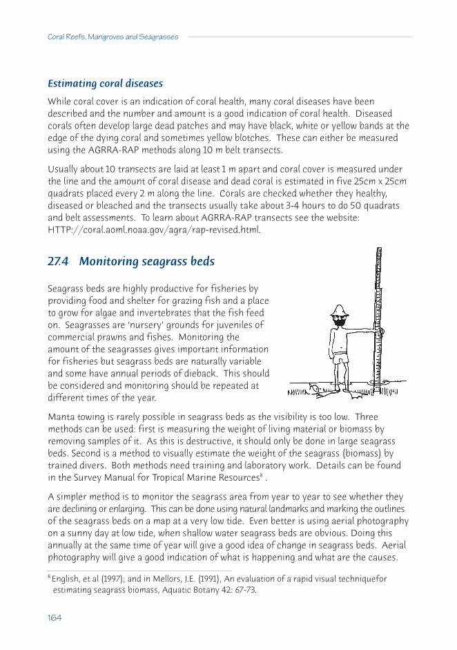
Estimating coral diseases
While coral cover is an indication of coral health, many coral diseases have beendescribed and the number and amount is a good indication of coral health. Diseasedcorals often develop large dead patches and may have black, white or yellow bands at theedge of the dying coral and sometimes yellow blotches. These can either be measuredusing the AGRRA-RAP methods along 10 m belt transects.
Usually about 10 transects are laid at least 1 m apart and coral cover is measured underthe line and the amount of coral disease and dead coral is estimated in five 25cm x 25cmquadrats placed every 2 m along the line. Corals are checked whether they healthy,diseased or bleached and the transects usually take about 3-4 hours to do 50 quadratsand belt assessments. To learn about AGRRA-RAP transects see the website:HTTP://coral.aoml.noaa.gov/agra/rap-revised.html.
27.4 Monitoring seagrass beds
Seagrass beds are highly productive for fisheries byproviding food and shelter for grazing fish and a placeto grow for algae and invertebrates that the fish feedon. Seagrasses are ‘nursery’ grounds for juveniles ofcommercial prawns and fishes. Monitoring theamount of the seagrasses gives important informationfor fisheries but seagrass beds are naturally variableand some have annual periods of dieback. This shouldbe considered and monitoring should be repeated atdifferent times of the year.
Manta towing is rarely possible in seagrass beds as the visibility is too low. Threemethods can be used: first is measuring the weight of living material or biomass byremoving samples of it. As this is destructive, it should only be done in large seagrassbeds. Second is a method to visually estimate the weight of the seagrass (biomass) bytrained divers. Both methods need training and laboratory work. Details can be foundin the Survey Manual for Tropical Marine Resources8 .
A simpler method is to monitor the seagrass area from year to year to see whether theyare declining or enlarging. This can be done using natural landmarks and marking the outlinesof the seagrass beds on a map at a very low tide. Even better is using aerial photographyon a sunny day at low tide, when shallow water seagrass beds are obvious. Doing thisannually at the same time of year will give a good idea of change in seagrass beds. Aerialphotography will give a good indication of what is happening and what are the causes.
8 English, et al (1997); and in Mellors, J.E. (1991), An evaluation of a rapid visual techniqueforestimating seagrass biomass, Aquatic Botany 42: 67-73.
164
Coral Reefs, Mangroves and Seagrasses
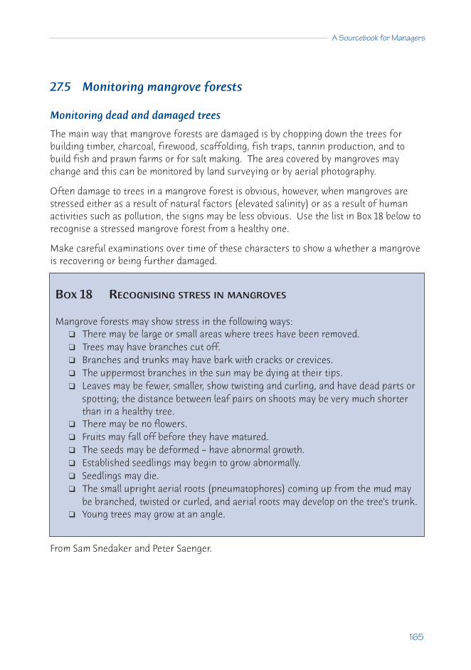
27.5 Monitoring mangrove forests
Monitoring dead and damaged trees
The main way that mangrove forests are damaged is by chopping down the trees forbuilding timber, charcoal, firewood, scaffolding, fish traps, tannin production, and tobuild fish and prawn farms or for salt making. The area covered by mangroves maychange and this can be monitored by land surveying or by aerial photography.
Often damage to trees in a mangrove forest is obvious, however, when mangroves arestressed either as a result of natural factors (elevated salinity) or as a result of humanactivities such as pollution, the signs may be less obvious. Use the list in Box 18 below torecognise a stressed mangrove forest from a healthy one.
Make careful examinations over time of these characters to show a whether a mangroveis recovering or being further damaged.
From Sam Snedaker and Peter Saenger.
A Sourcebook for Managers
165
BOX 18 RECOGNISING STRESS IN MANGROVES
Mangrove forests may show stress in the following ways:❑ There may be large or small areas where trees have been removed.❑ Trees may have branches cut off.❑ Branches and trunks may have bark with cracks or crevices.❑ The uppermost branches in the sun may be dying at their tips.❑ Leaves may be fewer, smaller, show twisting and curling, and have dead parts or
spotting; the distance between leaf pairs on shoots may be very much shorterthan in a healthy tree.
❑ There may be no flowers.❑ Fruits may fall off before they have matured.❑ The seeds may be deformed – have abnormal growth.❑ Established seedlings may begin to grow abnormally.❑ Seedlings may die.❑ The small upright aerial roots (pneumatophores) coming up from the mud may
be branched, twisted or curled, and aerial roots may develop on the tree's trunk.❑ Young trees may grow at an angle.
Counting the number and size of trees
This is an accurate method but is takes time and experience or training. Trees arecounted and their diameter measured at chest height in a series of plots (quadrats)along a transect. A transect line should run (if possible) from the seaward edge of themangrove forest back to its inland edge and run through typical mangroves of the area.Two or three transects must be made in each area monitored. In each major mangrovetype along the transect line, mark out 3 replicate plots, 10 m x 10 m or plots that arelarge enough to have at least 40-100 trees in them. The plots should be permanentlymarked with stakes driven well into the ground.
Each tree larger than 4 cm circumference should be identified, measured around atchest height and its position plotted (see English et al. 1997), or it should be marked witha permanent tag so it can be identified again. All seedlings should be counted. Wherethere is more than one large trunk at chest height, all should be separately counted andmeasured. It is recommended to hammer a nail half into the stem 10 cm below themeasuring point, to get the same spot for the next measure.
Finally
In all measures, it is essential that the data collected must be recorded and stored in asafe place for future years. When entering the data into a computer, each measure shouldbe checked by a second person because many errors can be introduced here which willruin careful field work. Data should be entered into database packages that allow foreasy statistical analysis. These points are outlined in the back of English et al. 1997.
Segment 27.5 from Peter Saenger, Director, Centre for Coastal Management, SouthernCross University.
166
Coral Reefs, Mangroves and Seagrasses
E28 The law and coastal resource management
The law plays a vital role in the management of coastal resources. While it is notpossible to use legal mechanisms to solve all problems of damage or conflicts in the useof resources, the law and legal regulations are an important part of the process9 . Plansto conserve and manage coastal resources must be compatible with laws at all levels ofgovernment – local, state or province, and national. In addition, many plans may alsoneed to consider international or regional laws, treaties and conventions. Remember thatyou may be able to use regional or international laws to support plans for coastalconservation e.g. Ramsar Convention on Biological Diversity.
Resource managers should examine the laws to determinewhich levels of government have control and power over theresources or areas they are trying to manage and which actsand regulations of parliament govern the resources. Oftenthere will be several laws for the same resources. Nationallaws are normally the most important but international lawsand conventions that a country has signed may provide importantsupport for protection or management of natural resources.
28.1 National laws
In most countries, national laws will over-rule state or province, and local laws. Thereforemanagers should understand the laws of the country that control the use and protectionof coastal areas and resources. The definition of coastal boundaries is an important example:
• does national control start at high or low tide, mean or spring tides?• does the national responsibility start at the 3 or 12 mile limit? • what will be the impacts of the 200 mile Exclusive Economic Zone?• where does state or local control start?
Managers need to determine which government departments are involved in, and havecontrol over, the coastal zone. These departments may have many laws that have somecontrol over coastal resources, even though they do not mention them in the title, e.g. aTransport Department may have the power to build an airport or a shipping port anywherethat is regarded as being in the national interest. This may be through an importantresource, such as a mangrove forest or a coral reef.
9 For more information refer: Coral Reef Management Handbook 2nd Edition, UNESCO, pp47-51; and The Law of the Sea:Priorities and Responsibilities in Implementing the Convention, IUCN.
A Sourcebook for Managers
167

Managers with a good understanding of the laws affecting their resources will find thattheir work is easier. They can also make suggestions how the law can be changed to improvethe management of renewable natural resources and the sustainability of those resources.
Overlapping or conflicting law
Usually one or more government departments (national, state and local), as well astraditional owners (with local traditions and laws) are legally involved in the resourcebeing managed. Rather than having conflicts over the resource, such situations demandcollaboration. Management or advisory groups or committees may be necessary toslowly work out the right way to manage the resources and sort out different laws.
It is common for different agencies of the same government to have conflicting needs.Environment and National Parks agencies try to protect the environment and endangeredspecies. Forestry, Agriculture and Fisheries departments try to get the most money andthe most jobs out of the resources.
Agriculture and Fisheries departments are now trying to reduce impacts, so that the activitiesare sustainable. Farming methods are being improved to reduce sediment runoff.Fisheries and the health of coral reefs, mangroves and seagrass beds are interlinked.Overfishing can damage coral reefs. Loss of seagrass beds and mangrove forests certainlyreduces fisheries. Consultation between Forestry and Conservation agencies can adviseon forestry methods that will reduce the amount of erosion and sediment in rivers thatflows into estuaries or onto coral reefs.
Conflicts can be avoided so that resource managementachieves the goal of sustainable resource use.Conflict between different agencies is often thelargest problem for a resource manager and thereason why some management plans fail (see C17Integrated Coastal Management for SustainableUse, p.84).
Tourism departments have a strong interest in an undamaged environment, with theincome derived from tourism often being greater than fisheries or forestry. In mostcountries, tourism is the fastest growing industry.
Water and Irrigation departments can also have major effects on shallow water coastalecosystems. Their laws often impact on estuaries and the coast, and their catchmentlaws and regulations, and possible ‘environmental flows’ (where water is deliberatelyreleased to help fisheries), need consideration. Industry departments have laws affectingindustrial pollution and sewage release, which are important to the coastal manager.
168
Coral Reefs, Mangroves and Seagrasses
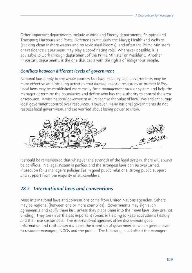
Other important departments include Mining and Energy departments; Shipping andTransport; Harbours and Ports; Defence (particularly the Navy); Health and Welfare(seeking clean inshore waters and no toxic algal blooms); and often the Prime Minister’sor President’s Department may play a coordinating role. Whenever possible, it isadvisable to work through department of the Prime Minister or President. Anotherimportant department, is the one that deals with the rights of indigenous people.
Conflicts between different levels of government
National laws apply to the whole country but laws made by local governments may bemore effective at controlling activities that damage coastal resources or protect MPAs.Local laws may be established more easily for a management area or system and help themanager determine the boundaries and define who has the authority to control the areaor resource. A wise national government will recognise the value of local laws and encouragelocal government control over resources. However, many national governments do notrespect local government and are worried about losing power to them.
It should be remembered that whatever the strength of the legal system, there will alwaysbe conflicts. No legal system is perfect and the strongest laws can be overturned.Protection for a manager’s policies lies in good public relations, strong public supportand support from the majority of stakeholders.
28.2 International laws and conventions
Most international laws and conventions come from United Nations agencies. Othersmay be regional (between one or more countries). Governments may sign suchagreements and ratify them but, unless they place them into their own laws, they are notbinding. They are nevertheless important forces in helping to keep ecosystems healthyand their use sustainable. The international agencies often disseminate goodinformation and ratification indicates the intention of governments, which gives a leverto resource managers, NGOs and the public. The following could affect the manager:
A Sourcebook for Managers
169

• United Nations Convention on the Law of the Sea (UNCLOS): This was agreed toin 1982 and defines marine boundaries (e.g. a country may control the fisheries to200 nautical miles offshore). The International Tribunal for the Law of the Seadecides on disputes between governments over boundaries.
• The United Nations Conference on Environment and Development (UNCED):This major international conference in Rio de Janeiro in 1992 passed a resolutionon protecting the environment called Agenda 21. Chapter 17 of this documentdealt specifically with the marine environment. Many governments agreed toAgenda 21.
• World Heritage Convention: The Convention for the Protection of the WorldCultural and Natural Heritage in 1972 was designed to protect both culturalheritage (like the temples of Borobodur, Indonesia) and specific natural sites ofoutstanding world value (e.g. the Belize Barrier Reefs, the Great Barrier Reef).This is the highest international protection of a marine site and is only used forsites of great natural value, and only with the full approval of the national government.
• The International Convention of the Prevention of Pollution from Ships(MARPOL): The MARPOL convention deals with the release of ballast water andthe dumping of pollutants. This convention gives governments the power to fineowners of ships that release pollutants, usually oil, into territorial waters. Usingspecial chemical analysis techniques, the source of oil can often be traced back toa particular ship.
• International Convention on Wetlands (Ramsar): This convention was held inRamsar, Iran, in 1971 and is commonly known as the Ramsar Convention. Over100 countries have signed this convention, which is to encourage the wise use(defined as sustainable use) of wetlands which includes coral reefs, mangrovesand seagrass areas. Many coastal wetlands act as either breeding or feedinggrounds for migratory birds.
• The Convention on International Trade in Endangered Species of Wild Faunaand Flora (CITES): This was prepared in 1973 and has been updated several timessince then. Countries who signed this convention agree to prevent trade in rareand endangered species and their products. Coral reef products like corals, giantclams, other shells and turtles are on the CITES list.
• The Convention on Biological Diversity: This convention encourages theintegration of biological diversity conservation with sectoral activities such asfisheries and other natural resource use. It aims to protect large resources ofbiodiversity and coral reefs are a particular target.
170
Coral Reefs, Mangroves and Seagrasses

• Small Island Developing States (SIDS): This grouping calls for the planning andsustainable development of these states, that are in some cases very small and inneed of support. Many of these are coral reef atolls or islands with few resourcesother than coral reefs and mangrove forests.
There are others that relate to climate change issues: United Nations Framework Conventionon Climate Change (1992) and the two that deal with the ozone hole: the Vienna Conventionfor the Protection of the Ozone Layer (1985) and the Montreal Protocol on Substancesthat Deplete the Ozone Layer (1987). Another important Convention was that forSustainable Development that was formed after the Rio meeting in 1992 – CSD operatesdirectly though the UN General Assembly and links all agencies involved in resourcemanagement and conservation. All these impact on marine resources but are outsidethe immediate interest of the local resource manager.
Agreements with adjacent countries
There may also be regional arrangements (e.g. as in the ASEAN countries, central Americanstates), or agreements with a single neighbouring country and these could affect the manager.You should look these up for your region.
A Sourcebook for Managers
171
Message: Resource managers should establish contact with people and departments withexpertise in the law. These people can assist managers in preparing their casefor conservation of resources which can include the legal language thatgovernments use.

E29 The potential of tourism
29.1 Fishing for tourists
Many countries in the tropics have found thatdeveloping the tourism potential of selected coastalareas can generate rapid income growth, with benefitsthat flow right through the community. It is a serviceindustry that capitalises on an area's natural resources,without depleting them. Properly managed, it can be aninfinitely renewable resource.
With so much scope to earn foreign exchange, thetourism industry is appealing to many countries. Thismeans they are competing to attract international tourists. To win in this market, it isimportant to avoid getting a bad reputation. Tourists who have a bad experience talk aboutit and news travels fast. But if they enjoy their holiday, they may well come back.Popular resorts earn more money for the whole community.
29.2 What does the international tourist want
Tourists are little different from the rest of us. Many of the things that they want in orderto enjoy their holidays are the same things we all wish for in our day to day lives. Whatis different is the priority they attach to some of these things. Plus the fact that, ifconditions are not to their liking, they have the option to go somewhere else, taking theirmoney with them.
Safety and security
The first thing the tourists asks - is it safe to walk at night without getting beaten orrobbed? Are there wars or terrorists? Tourists want hotels that are safe from thieves.These are mostly beyond the control of the environmental manager but there are waysthat they can assist.
Action: Encourage good street lighting and pressure the police to keep thieves away. Touristoperators should make resorts safe with good staff, security guards and building security.
A clean and healthy area
The next worry is health - diseases and accidents. The environmental manager can helpmake drinking water safe, which also makes it easier to ensure safe food. Malaria and
172
Coral Reefs, Mangroves and Seagrasses

other diseases are hard to control, even if rooms are air conditioned or screened. Touristsmay need education on dangers (e.g. opening windows in air-conditioned rooms, need totake malaria pills).
Action: Assist in removing mosquito breeding sites, clean up rubbish dumps and burygarbage. Educate guests and staff of risks in the area.
Clean beaches and streets
Tourists do not like rubbish on streets and beaches, smells from open drains and poorlymaintained sewage systems.
Action: Inform local government of the need for clean streets and beaches. Educate thelocal population that rubbish will keep tourists away and provide rubbish bins and emptythem regularly. Train staff to clean up the general area and the beach.
Clean clear seawater
Tourists expect the bright blue waters advertised in the brochures - not warning signsthat the waters are unsafe for swimming. They want to see corals and fish, not plasticbags, bottles and cans.
Action: Regulate the sediment runoff into the streams and sea. Ensure that alldevelopments have sewage treatment systems that are regularly maintained. Pay divestaff to clean rubbish off dive sites.
Beautiful coral reefs
Clean, healthy coral reefs bring money from tourists for the community; sick reefs anddead corals keep tourists away. Smashed and broken corals can be prevented bygood management.
Action: Control flow of pollution and sediment from land. Educate local fishermen to protectcoral reefs and teach tourists to dive carefully and not stand on corals, or collect coralsand shells. Install permanent mooring buoys at the best sites to prevent anchor damage.
A Sourcebook for Managers
173
Unhappy tourists take their money home
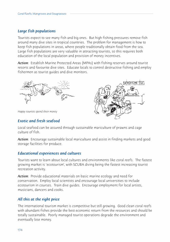
Large fish populations
Tourists expect to see many fish and big ones. But high fishing pressures remove fisharound many dive sites in tropical countries. The problem for management is how tokeep fish populations in areas, where people traditionally obtain food from the sea.Large fish populations are very valuable in attracting tourists, so this requires botheducation of the local population and provision of money incentives.
Action: Establish Marine Protected Areas (MPAs) with fishing reserves around touristresorts and favourite dive sites. Educate locals to control destructive fishing and employfishermen as tourist guides and dive monitors.
Exotic and fresh seafood
Local seafood can be assured through sustainable mariculture of prawns and cageculture of fish.
Action: Encourage sustainable local mariculture and assist in finding markets and goodstorage facilities for produce.
Educational experiences and cultures
Tourists want to learn about local cultures and environments like coral reefs. The fastestgrowing market is ‘ecotourism', with SCUBA diving being the fastest increasing touristrecreation activity.
Action: Provide educational materials on basic marine ecology and need forconservation. Employ local scientists and encourage local universities to includeecotourism in courses. Train dive guides. Encourage employment for local artists,musicians, dancers and cooks.
All this at the right price
The international tourism market is competitive but still growing. Good clean coral reefswith abundant fishes provide the best economic return from the resources and should betotally sustainable. Poorly managed tourist operations degrade the environment andeventually lose money.
174
Coral Reefs, Mangroves and Seagrasses
Happy tourists spend their money

E30 Restoration
30.1 Coral reefs
Restoration or rehabilitation of a coral reef is a very expensive process and should onlybe considered in very special cases e.g. when a ship has hit a major tourist reef or whenthe corals have been lost near a major tourist resort. Normally it is best to allow naturalrestoration of the reef by removing damaging human impacts. This will mean thatvaluable resources can be used for other management needs.
Natural change
Coral reefs are always changing with a balance between natural damage and recovery.Therefore there is never a ‘perfect reef’. Normal, natural impacts, particularly storm damage,diseases and the crown-of-thorns starfish, can damage reefs and it may take decades forthe coral to regrow after severe damage. This regrowth of the coral reef will continueuntil the next major natural impact. Most reefs therefore, can be considered in a stateof recovery. But when there is no recovery from a natural impact or recovery is slow, thisis a signal to the resource manager that other damaging stresses may be involved.
Recovery from human impacts
In the past few decades, there have been major increases in human impacts such thatmany reefs are not recovering. Some of these reefs are now lost and may never recover.Before restoration of coral reefs can be effective, it is essential that the major humanimpacts either are removed or at least reduced (this usually means reducing nutrientpollution from sewage and agriculture, silt from roads and poor land practice, pollutantsfrom industry and overfishing). If these are not done the reef may never recover.
When the negative human impact ceases, the first stage in recovery is for new corallarvae to settle (but see case study 18.3, p.102), grow and then other organisms willfollow. Reefs often recover well, with good coral cover of the faster growing species inabout 10 to 20 years. It may take hundreds of years before large boulder (or brain)corals recover (some of the largest corals are over 1,000 years old). But even withoutolder corals, the reef will still be productive for fishes, shellfish and crustaceans, andmost tourists will not notice the difference.
A Sourcebook for Managers
175

There are some cases of coral reef recovery but note that, in the last two cases below,there was some management help for the recovery.
• Corals in Thailand killed by short-term dredging regrew when the dredgingstopped (case study 24.2, p.137).
• A dead coral reef slowly recovered in Mamala Bay, Hawaii when sewage impactswere stopped after the outfall pipe was extended into deeper water (case study19.2, p.113).
• Coral recovered in Kaneohe Bay after major changes were made in thesurrounding townships reducing both sewage and sediment input into the Bay(case study 19.1, p.110).
• Removing sea urchins and algae as well as reducing fishing, in Kenya helpedrestore parts of a coral reef (management case study C10, p.58 and Box 15, p.115).
• Corals did not recover without help on the tops of small reefs after coral mining inthe Maldives, because loose sand and moving rubble provided no base for youngcorals to settle (case study 20.1, p.116). When structures were built providing a basefor coral settling there was regrowth but the structures needed were very costly.
Corals can be transplanted andglued to coral rock, or tiedtogether with string into bundlesin areas without major waveaction. But this is expensive andusually only done where there is aspecial viewing area for tourists.
Recently there have been some proposals to restore coral reefs using electricity andchicken wire. This is extremely expensive and not practical for almost all cases, becausethe area restored is very small: compared to the scale of damage that occurs on coralreefs; and compared to the budgets available for reef managers.
176
Coral Reefs, Mangroves and Seagrasses

A Sourcebook for Managers
177
BOX 19 REEFS AS BREAKWATERS: THE COST OF REPLACEMENT
The self-repairing breakwater
One of the functions coral reefs perform is that of self-repairing breakwaters. Whenhealthy, reef ecosystems tend to be accreting systems, or at least in equilibrium with theeroding power of the waves. They also tend to be sources of sand for the lagoons andbeaches they protect. This sand comes from the continual death and breakdown ofcalcareous algae, the corals themselves, and other invertebrate animals with silica orcalcium carbonate based skeletons (e.g. crabs, urchins, molluscs, sponges) living onthe reef.
If mining or other human activity degrades reefs they tend to start eroding, graduallylosing their efficiency as breakwaters as waves pound them to sand and rubble. Theshoreline that they protected will therefore be subjected to greater wave energy andmay move further inland.
The "reclamation" (infilling of the lagoon andbackreef areas) of some 60ha of land on the southside of Male in the Maldives (see case study 20.1,p.116) extended the shoreline about 250 m seawardsand took almost a million cubic metres of infill.
The corals were more or less wiped out to about 15mdepth because of the high levels of sediment. Notonly was the protecting reef destroyed but theshoreline was moved seaward outside itsequilibrium position on the south side of the islandwhich is exposed to oceanic swells.
The results of the loss of protection: replacement at high cost
In 1987, soon after this infilling "reclamation" was completed,2.5-5.0 m swell waves from the south-east (originatingfrom a storm off western Australia) pounded the islandfor two days, removing 20-30% of the infill and inundatingalmost all of the reclaimed land on the island.
The cost of building detached breakwaters made ofconcrete tetrapods to replace the protection given by theold reef, and also to protect the new non-equilibriumshore-line, was very high - at $10,000 per linear metre, ora total of $14 million.
From Alasdair Edwards of the University of Newcastle-upon-Tyne.

30.2 Mangroves
Much more restoration has been achieved with mangroves and it is possible to restoremangrove forests that have been damaged. It is possible to plant whole new forests orreplace parts but only a few species of the 70 trees and shrubs have been used in suchprojects. True mangrove restoration would involve replacing the species that were thereoriginally but most projects attempt to grow valuable timber and charcoal species whichgrow rapidly, rather than restore the whole ecosystem.
The largest replanting of mangroves has been afterdamage by cyclones in Thailand, Vietnam, China andBangladesh. Large numbers of 2 mangrove species(Sonneratia apetala, Avicennia officinalis) werereplanted in Bangladesh in 120,000 hectares of newland formed by sediment deposited after cyclones. Thetrees stabilised the coastal area and are providing asource of harvestable timber on a regular rotation basis.
The following will help to determine whether a site is suitable for planting or replanting:• Muddy areas with normally low wave action and sheltered planting sites, because
the young seedlings cannot withstand strong winds or fierce currents (barriers thatstop wave action but still allow tidal flooding can be used to protect young plants).
• The soil should be stable but not eroding.• Mangroves will grow best where there is high rainfall or an abundant freshwater
supply (a mix of salt and freshwater is best for most species).• Mangroves will not grow well in higher salinity than normal seawater (as in some
shallow or enclosed areas where there is evaporation from hot sun).• It is important that the young plants be inundated by the tide regularly but they
should also be exposed to air for reasonable periods.• The presence of seagrasses, naturally regenerating mangrove seedlings or
scattered grasses indicates that the site may be worth planting.• Some mangrove species need shade and will not thrive in open sites.• Generally very little preparation of the site is needed but sometimes it is necessary
to clear debris (e.g. coconut or banana trunks, leaves, bamboo, tree branches).• Some sites may have a high acid content, particularly those in drier land, from the
oxidation of acid sulphate soils. There may also be toxic levels of aluminium insuch soils. To restore natural soil condition it is necessary that such soils are wellflushed by incoming tides and fresh water from rain runoff.
178
Coral Reefs, Mangroves and Seagrasses

• If the site is infested with Acrostichum fern, it is important to clear the site fully.• In some sites predators may be important (monkeys in some places, crabs that
may eat seedlings) and tests should be made before extensive planting.• It is also important that the local inhabitants of the planted area be involved and
be supportive of the project.
Natural regeneration
If the regeneration is natural with wild propagules (seedlings) that reach the site, thefinal forest will be more similar to the original mangrove forest. It is also cheaper, requiresless labour, there is less soil disturbance and seedlings establish more vigorously. Butthere must be a sufficient natural supply of seedlings, which can usually be checked bydetermining that there are many seed bearing trees in the area (for the genus Rhizophorathe number of seed bearing trees should be 12 trees per hectare). Soil conditions needto be good for natural generation, there should not be excessive amounts of weeds ordebris and the water flow of the site should not be disturbed (e.g. by old pond walls,roads or causeway construction).
Artificial regeneration
Mangroves should be planted where there is insufficient natural regeneration using:• seedlings collected and replanted on the site;• ripe seeds (or young propagules collected from the parent plant) planted directly
on the site; or• seedlings or small trees raised under nursery conditions and then planted.
This last of these methods is not the easiest but it allows species to be chosen and allowsthe introduction of genetically selected or improved trees, if available.
Selection
The selection of mangroves, in order of importance should be dependent on:• the species that grow naturally in the locality (which should do best);• the availability of seeds and propagules;• the objective of the planting project (e.g. wood, coastal protection);• the species come from the similar soil and water conditions.
It may be useful to get expert technical advice to check this list when the reasons forplanting have been determined. But local people with a minimum of technical guidancecan do most of the actual planting of the forest.
A Sourcebook for Managers
179

Monitoring
It is essential to monitor the progress of the mangrove forest, using similar methods for aforest on land. Some of these methods are given in Box 20 below.
180
Coral Reefs, Mangroves and Seagrasses
BOX 20 MONITORING A REGENERATING MANGROVE FOREST
To ensure that a replanted mangrove forest is developing successfully, and that it iscost effective, the following can be monitored:
❑ Observe differences in species (some may be more successful than others).❑ Measure rate of growth annually (e.g. number of successful seedlings per
hectare, height of trees, diameter at breast height, and volume of wood).❑ Monitor growth characteristics (including fruiting and resistance to pests).❑ Record the amount of seedling death.❑ Record pests and disease (and methods used to prevent this).❑ Record rubbish accumulation (and steps to minimise this).❑ Record impacts of grazing, cutting, loss through fish pond building (and also of
control methods e.g. fencing to reduce impacts).❑ Record methods to achieve optimum numbers of seedlings per hectare (degree
of thinning, or replanting, or natural regeneration).❑ Estimate costs of each mangrove forest project (including money spent on land
purchase and legal costs).❑ Assess the restored mangrove ecosystem (this can be compared for flora, fauna,
and the physical environment of the restored forest with undisturbedecosystems nearby).
❑ Objectively judge the success and cost of the restoration project against theoriginal objectives.

30.3 Seagrass beds
Removing the problem is the solution
Seagrass restoration is best achieved by removing the problems that caused the declinein the first place. Solutions are possible but the real task is to identify the problems,rank them in order of severity and then deal with them. The best solution is to reduce orremove the problem and allow the seagrass communities to re-establish naturally.
Some recommendations for achieving healthy seagrass habitats and encouragingrecovery of their associated marine life include:
• improving wastewater treatment;• controlling surface runoff;• regulating boat traffic;• restricting fish, shellfish and seaweed harvest by providing alternative livelihoods
(especially in developing countries);• enforcing regulations against unsustainable coastal practices, such as blast
fishing and using fine-mesh nets; and• restoring seagrass beds.
The rapid recoveries of the Singapore River and an estuary in Connecticut demonstratethat coastal ecosystems can recover. But only after significant reduction in nutrientloading and impacts of physical disturbances, along with the concerted effort anddetermination of the community.
There is little information available on the rate of seagrass recovery, which makes it hardto predict how long such recovery might take. For example, 70 years after the eel grass‘wasting disease’ occurred along the North Atlantic coast most areas had recovered butin some places eel grasses never grew back.
Seagrass recovery from physical disturbance and catastrophic decline depends on newcolonisation by seeds (propagules) and the overgrowth of bare substratum throughexpansion of the underground parts. In highly mobile sediment conditions, recovery ishelped by a balance between the rates at which new shoots grow and old grasses die off,suggesting the importance of both factors for successful growth and seagrass recovery.
Replanting a second best option
Unfortunately, most of the efforts towards environmental protection have not dealt withthe source of the problems: by improving land based development activities and restoringwater quality. Instead, they have concentrated on replanting and, sometimes, usingartificial seagrasses. Given that developing countries may lack the resources and time toreduce human impacts, such replanting may be the only practical option in the short
A Sourcebook for Managers
181

term. It can produce useful results and quite quickly. In the longer term, the best resultswill come from dealing with the problems at their source.
Methods and techniques for seagrass bed transplantation and restoration have beendeveloped over the past 10 years. While there have been no complete restorationsuccesses as yet, positive gains have been made (see Box 7, p.47). Transplantedseagrasses often show slow growth rates and some species have been more successfulthan others. After areas in Florida were dredged for real estate development, planting ofseagrass clumps was moderately successful with the genus Halodule but failed withThalassia. Other people successfully replanted Thalassia in Tampa Bay, Florida, afterdipping the clumps in a 10% solution of napthalene acetic acid to stimulate growth.
Studies10 have nevertheless shown that, within one year of transplanting, seagrasses caneffectively speed up the cleanup process and help towards returning the environment toa healthy productive ecosystem.
The recommended way is to cut out plugs of seagrass and transplant them into similarsized holes in the sediments. The new plants are relatively undisturbed in their originalsediment and the success rate is high. A cheaper alternative, which works for almostany seagrass species, is to tape 4 - 5 shoots to a bent wire coat-hanger and push thelong free end into the sediment. These clumps are planted about 0.5 m apart.
Artificial seagrasses
Artificial seagrass has been used with some successas a way of attracting fish larvae and improving thetotal amount of fish and shellfish in degradedcoastal areas. In Singapore, there was an increase infish and shrimp three months after plantingartificial seagrasses in the Singapore River. Thestructures became good habitats for restockedseabass (Lates calcarifer).
The technique was used in the Philippines to improve the biodiversity and productivity ofa biologically desolate area in Cape Bolinao and also to mitigate the impacts of mine tailingsin Calancan Bay (see Box 7). At Cape Bolinao, the number of fishes in the artificial seagrasssignificantly exceeded that found in natural seagrass beds in the area. 62% of the specieswere new to that specific area, including many species not found in adjacent seagrassbeds. This shows active fish recruitment by the artificial seagrassses and demonstratesthat they are useful for improving and rehabilitating otherwise desolate areas.
182
Coral Reefs, Mangroves and Seagrasses
10 Phillips, R.C. "Transplant Methods" in Seagrass Research Methods, ed. Phillips, R.C. and McRoy, C.P. UNESCO, Paris pp1-210.

In Calancan Bay a 1,000 sq m area ‘planted’ with artificial seagrasses attracted manymore of the natural fish fauna of the bay. There was also a measure of success inresisting decay and fouling, despite the massive colonisation by plants attaching to theartificial grasses. The number of fish species found in the artificial seagrass areas was46.2% of those found in the nearby seagrass bed and 86% of that found in the transplantedseagrass areas.
A Sourcebook for Managers
183
Message: It is most important to remove the problems first (sediment flows, pollution,damaging boat activities, overfishing and trawling) and then consider whetherreplanting natural seagrasses, or even artificial seagrasses, is worth theconsiderable effort in time and cost.

Conclusion
We have shown in many of our case studies that it is easy to damage or destroycoastal values and ecosystems. Damaged tropical coasts are all too common andmany coastal states have found, too late, that their coasts are degrading.
Actions cause damage if they result in:
• mangrove forests permanently reduced;• shallow water areas with seagrass beds filled in for more land;• unchecked city pollution dirtying lagoons, estuaries and the coastal sea;• careless dredging of harbours, and poor forestry and agricultural practice inland,
which add silt and nutrients and make the water brown or green;• fishing with methods that damage the reef; or• overfishing that reduces the size of fish caught and finally lowers the whole catch
by removing breeding adults. It can even reduce the productivity of coral reefsand turn them into algal reefs.
Actions like these are extremely shortsighted, chasing away tourists and steadilylowering coastal income. Not only do they spoil the chance to improve livingstandards, they actually lead to hardship. Families which have got their livelihoodfrom the reef for generations may find it hard even to feed themselves.
184

Many coastal habitats will recover if the pressures are removed but to restore aseverely damaged habitat may be impossible, if the major marine resources havebeen removed. Even if it is possible, it may be prohibitively expensive and takemany years to recover. If damage is evident, then the earlier you can start withgood management, the greater the chance of success. Only well managed reefscan provide sustainable resources for the people.
The right way to conserve coastal resources is to learn from the lessons of others– from both the good and bad examples. With good management you can gainhigh economic returns from your tropical coasts without destroying them andthey can produce good profits indefinitely. It is likely that the highest values willbe from fisheries and from tourism.
Tropical coasts need the following to keep their highest sustainable value:• healthy mangroves in protected bays and estuaries;• rich flourishing seagrass beds;• coral reefs with good coral cover and with good populations, and good variety of
fish and shellfish;• some areas set aside as replenishment areas for fish and other animals to ensure a
good supply of larvae to other areas; and• clear unpolluted water.
A Sourcebook for Managers
185

Good management can achieve this but we have shown that the coastal zonemust be managed in an integrated way. The worst pollutants from coastal citiesare usually sewage, industrial wastes, and silt from land development and harbourdredging. But there may even be more damage from inland forestry andagriculture. These activities need to be well managed so that silt and nutrients donot pour into the coastal zone down the rivers – and this is also a loss to the land.While it is always tempting to fill in shallow areas and cut mangroves, this isdangerous. Shallow waters with seagrass beds and mangrove areas are essentialto sustain coastal fisheries.
With simple but careful monitoring you can prepare a regular ‘state of theenvironment’ report, so that changes can be seen which check the success orfailure of management actions. These reports are useful to convince decision-makers that conservation action is necessary.
186
Coral Reefs, Mangroves and Seagrasses
Rich rewards can result from good coastal management.
Good management of hotels, tourist diving operations, fishing andboating can be sustainable. These can drive an economy and providemany jobs.
From fisheries alone, the yield can be hundreds of thousands of dollarsfrom a few kilometres of coastline.
Well-managed tourism that leaves the key tropical habitats in a naturalstate will often provide more money and work than can be obtained fromdirect exploitation, including fishing.
The best results come from integrated management of the wholecoastal zone.

Suggested reading
The following are particularly useful references:
Brown, B.E. (1997). Integrated Coastal Management: South Asia. Department ofMarine Sciences and Coastal management, University of Newcastle, Newcastleupon Tyne, United Kingdom.
English, S., Wilkinson, C. and Baker, V. (1997). Survey Manual for Tropical MarineResources, 2nd Edition. Australian Institute of Marine Science, Townsville, 390pp
Kelleher, G. (1999). Guidelines for Marine Protected Areas. World ConservationUnion, Washington D.C., 107pp
Kenchington, R.A. and Hudson, B.E.T. (eds) (1987). UNESCO Coral ReefManagement Handbook, 2nd Edition. UNESCO ROSTEA, Jakarta, 321pp
Other useful references include:
Field, C. (1998). Rationale and Practices of Mangrove Aforestation. Marine &Freshwater Research 49:353-358.
Grigg, R.W. (1995). Coral Reefs in an Urban Environment in Hawaii: a complex casehistory controlled by natural and anthropogenic stress. Coral Reefs 14: 253-266
IUCN (1995) The Law of the Sea: Priorities and Responsibilities in Implementing theConvention. World Conservation Union, Washington D.C., 156pp
Keller, B.D. and Jackson, J.B.C. (1991). Long-term Assessment of the Oil Spill at BahiaLas Minas, Panama: Interim Report, Volumes 1 & 2. US Department of the Interior,Minerals Management Service, New Orleans.
Mellors, J.E. (1991), An evaluation of a rapid visual technique for estimating seagrassbiomass, Aquatic Botany 42: 67-73.
Phillips, R.C. (1990). Transplant Methods. Seagrass Research Methods, ed. Phillips,R.C. and McRoy, C.P. UNESCO, Paris 210pp.
187

Pollnac, R.B. and Crawford, B.R. (2000). Assessing Behavioral Aspects of CoastalResource Use. Proyek Pesisir Publications Special Report. Coastal Resources CenterCoastal Management Report #2226, University of Rhode Island, Narragansett 139 pp.
Saenger, P and Bellan, M.P. (1995). University of Toulouse press, Toulouse. 96pp.
Salm, R.V., Clark, J.R. and Siirila, E. (2000). Marine and Coastal Protected Areas: AGuide for Planners and Managers. IUCN Washington DC 371 pp.
188
Coral Reefs, Mangroves and Seagrasses

List of Acronyms
AGRRA Atlantic and Gulf Reef AssessmentAIMS Australian Institute of Marine ScienceASEAN Association of South East Asian NationsBAPPEDA Council for Provincial Planning and DevelopmentCATIE Centro Agronomico Tropical de Investigacion y EnsenanzaCFC ChlorofluorocarbonCITES The Convention on International Trade in Endangered Species of Wild
Fauna and FloraCOTS Crown-of-thorns starfish (Acanthaster planci)CNA Clean Nigeria AssociationCSD Convention for Sustainable DevelopmentDNA Deoxyribonucleic AcidEIA Environmental Impact AssessmentEPA Environmental Protection AgencyFKNMS Florida Keys National Marine SanctuaryGBR Great Barrier ReefGBRMP Great Barrier Reef Marine ParkGBRMPA Great Barrier Reef Marine Park AuthorityGEF Global Environment FacilityICRI International Coral Reef InitiativeICAM Integrated Coastal Area ManagementICM Integrated Coastal ManagementICZM Integrated Coastal Zone ManagementIMO International Maritime OrganisationIUCN World Conservation UnionMARPOL International Convention of the Prevention of Pollution from ShipsMPA Marine Protected AreaNGO Nongovernmental organisationNOAA National Oceanic and Atmospheric Administration (of USA)Ramsar International Convention on WetlandsRAP Rapid Assessment ProtocolSAC Sanctuary Advisory CouncilSCUBA Self-contained underwater breathing apparatusSIDS Small Island Developing StatesUNEP United Nations Environment ProgrammeUNESCO United Nations Educational Scientific and Cultural OrganisationUV Ultraviolet radiation
189
Hoo'mi

190
Coral Reefs, Mangroves and Seagrasses
Supporting Organisations
AIMS - Australian Institute Of Marine Science
AIMS is one of Australia’s key research agencies and the only one committed primarily tomarine research, with an emphasis on tropical marine science. It undertakes researchand development to generate new knowledge in marine science and technology, and topromote its application in industry, government and environmental management. Theresearch programme involves medium- to long-term research that is geared towardsimproved understanding of marine systems and the development of a capability topredict the behaviour of complex tropical marine systems. In the past 25 years theInstitute has established a sound reputation for high quality research on coral reef andmangrove ecosystems, and on the water circulation around our coasts and continentalshelf. Researchers have not only published extensively in scientific journals but have alsowritten field guides, books and monographs for regional use. This work supports a widerange of studies for effective coral reef management.Contact: Clive Wilkinson ([email protected]) or Web site: www.aims.gov.au
CORDIO – COral Reef Degradation in the Indian Ocean
CORDIO is a regional, multi-disciplinary program developed to investigate the ecologicaland socio-economic consequences of the mass bleaching of corals during 1998 andsubsequent degradation of coral reefs in the Indian Ocean. CORDIO is an operatingprogram within ICRI. The objectives are to determine the: biophysical impacts of thebleaching and mortality of corals and long-term prospects for recovery; socio-economicimpacts of the coral mortality and options for mitigating these through management anddevelopment of alternative livelihoods for peoples dependent on coral reefs; andprospects for restoration and rehabilitation of reefs to accelerate their ecological andeconomic recovery. CORDIO assists and coordinates with the GCRMN in the IndianOcean with monitoring and running the Node in East Africa. The participating countriesare: Kenya, Tanzania, Mozambique, Madagascar, Seychelles, India, Maldives, Sri Lanka,Reunion, Comores, Mauritius and Chagos. Program Coordination Contacts: Olof Linden, David Souter, Dept. Biology andEnvironmental Sciences, University of Kalmar, 391 82 Kalmar, Sweden([email protected]; [email protected]).CORDIO South Asia: Dan Wilhelmsson, CORDIO, c/o Stockholm International WaterInstitute, Sveav. 59, 113 59 Stockholm, Sweden; ([email protected]) CORDIO East Africa: David Obura, CORDIO, PO Box 10135, Bamburi, Kenya;([email protected])

CORDIO Island States: Jean Pascal Quod, ARVAM (Agence pour la Recherche etla Valorisation Marine) 14, Rue du Stade de l’Est, 97490 Sainte Clotilde, LaRéunion; ([email protected])
GBRRF - Great Barrier Reef Research Foundation
The Great Barrier Reef Research Foundation was established to build on theworld-class science flowing from the collective knowledge of the world’s leadingtropical marine researchers.
Its guiding aim is to foster research applications, informed by internationaldevelopments, to ensure the sustainability, conservation, protection andresponsible use and management of all the world’s reefs and to encourage theapplication of the outcomes for the benefit of coral reefs globally
To achieve this, the Foundation raises funds from non-government sources andapplies these on the advice of its International Scientific Advisory Committee.The GBRRF actively pursues collaborative research and the coordinateddissemination of information, for incorporation into policy-making.
The Foundation is pleased to support the publication of this valuable sourcebookto aid in the conservation of the world’s coral reefs for the benefit of all whoshare our goals. www.barrierreef.org
GCRMN - Global Coral Reef Monitoring Network
The GCRMN is an operational unit of ICRI formed in 1995 with contributionsfrom the governments of USA and other countries, and co-sponsored by theIntergovernmental Oceanographic Commission of UNESCO, the UNEnvironment Programme, IUCN, the World Bank, and co-hosted at AIMS and TheWorld Fish Center (ICLARM) which runs ReefBase, the global coral reefdatabase. Equal emphasises is placed on biophysical and socioeconomicmonitoring to gather data, observe trends and raise awareness, especially viaStatus of Coral Reefs of the World reports every 2 years (www.reefbase.org). TheGCRMN encourages and coordinates coral reef monitoring by: communities andvolunteers using Reef Check methodology; government environment andfisheries departments using methods developed in Southeast Asia; and highresolution monitoring by researchers. The GCRMN functions as a network ofindependent Regional Nodes that coordinate training, monitoring and databases
A Sourcebook for Managers
191
in participating countries (contacts): Middle East, Fareed Krupp([email protected]); South-west Indian Ocean, Lionel Bigot,([email protected]); Eastern Africa, David Obura([email protected]); South Asia, ([email protected]); South EastAsia, Jamie Oliver ([email protected]); East Asia, Marine Parks Center of Japan([email protected]); Australia PNG, Hugh Sweatman([email protected]); Southwest Pacific - IOI-Pacific Islands, Robin South([email protected]); Southeast, Central Pacific, ‘Polynesia Mana’, Bernard Salvat([email protected]); Micronesia, ‘MAREPAC’, Carol Emaurois([email protected]); US Hawaiian Islands, Dave Gulko([email protected]); US Caribbean, Donna Turgeon([email protected]); Mesoamerican Barrier Reef, Marea Hatziolos([email protected]); Eastern Caribbean, Allan Smith ([email protected]);Northern Caribbean, Dulcie Linton, ([email protected]); SouthernTropical America, Jaime Garzón-Ferreira ([email protected]). Globalcontacts: Clive Wilkinson, ([email protected]) and Jamie Oliver([email protected]); or www.gcrmn.org
ICRI - International Coral Reef Initiative
ICRI was launched in 1994 in response to the 1992 UNCED Rio Earth Summit and theconcerns of Small Island Developing States about the declining status of coral reefs. ICRIis partnership of countries, UN agencies, NGOs, development banks, foundations andscientific bodies, with the objectives of mobilising global support for coral reef actionsvia diplomatic and international flora. USA chaired the first ICRI Secretariat (1995-96),followed by Australia (1997-98), France (1999-2000), and the Philippines and Sweden(2001-02). ICRI held international workshops in the Philippines (May 1995, with 40countries), and Townsville Australia (November 1998, with 50 countries - InternationalTropical Marine Ecosystems Management Symposium) to develop A Call to Action, aFramework for Action, and a Renewed Call to Action. Ten Regional ICRI workshops havealso been held to assemble the concerns of over 100 countries. ICRI represents coral reefpartners on international fora, such as: the UNEP and IOC governing councils,Conventions on Sustainable Development, Biological Diversity, Framework Conventionon Climate Change; Global Meetings of Regional Seas Conventions and Action Plans,Global Plan of Action to Protect the Marine Environment from Land-based Activities,Global Conference on Sustainable Development in Small Island Developing States, andCITES. Membership of the ICRI Coordination and Planning Committee includes allinterested countries and agencies, which meet each 6 months. ICRI Global Secretariat:Robert Jara ([email protected]) or Olof Linden ([email protected]).www.ICRIforum.org
192
Coral Reefs, Mangroves and Seagrasses

IUCN - The World Conservation Union
Founded in 1948, IUCN brings together States, government agencies and a diverse rangeof non-governmental organizations in a unique world partnership: over 900 members inall spread across nearly 140 countries. As a Union, IUCN seeks to influence, encourageand assist societies throughout the world to conserve the integrity and diversity ofnature and to ensure that any use of natural resources is equitable and ecologicallysustainable. Through its network of regional and country offices, expert Commissionsand member organizations, and Marine Program, IUCN supports a variety of coral reefconservation and management efforts that promote: protection of critical habitats andthreatened species; design of management plans with stakeholder participation;development of ecological and socio-economic assessment methodologies; enhancedcapacity building for sustainable management; and support of effective governancestructures. IUCN is an original partner of the International Coral Reef Initiative (ICRI)and a founding co-sponsor of the Global Coral Reef Monitoring Network (GCRMN).Contact: Carl Lundin E-mail: [email protected] or Web site: www.iucn.org
WWF – The Worldwide Fund for Nature
WWF is the largest and most experienced conservation body in the world with 4.7 millionmembers in 100 countries. The mission is to protect nature and the biological diversitythat we all need to survive. WWF has an active coral reef programme coordinatedthrough WWF in the Netherlands with activities in all oceans. They have established 11high priority coral reef regions for conservation to maintain the natural ecologicalcharacter including the entire suite of biodiversity and natural resources. WWF works inpartnership with other communities and NGOs to establish Marine Protected Areas toprotect valuable biodiversity for future generations. Contact: Carel Drijver E-mail: [email protected]
A Sourcebook for Managers
193


