Click to edit Master title style ESRI’S ANSWER TO VIEWERS ArcGIS Explorer:
P O R T L A N D
Converting Sewer and Stormwater assets to Esri’s LGIM…Why, how and what did the City of Portland, ME get out of it?
Jessica Gooch – Asset Management TechnicianCity of Portland Maine, Water Resources Division

P O R T L A N D
Why did the City do this? Utilize the ELA that the City has with Esri
Leverage the LGIM and ArcGIS for Water Utilities tools – Editing, Networking, App Development
Standards, standards, standards Adhere to specific standards for both GIS and Sewer/Stormwater Utility standards
Protocols, SOPs and procedures Establish editing workflows, procedures and protocols to ensure timely data collection and integration
The City of Portland is an MS4 community (Municipal Separated Sewer System). The MS4 is a permit that we hold with the EPA concerning the separated stormwater system targeted to improve water quality by outreach, BMP’s, daily maintenance operations (mapping, evaluating the system, street sweeping, catch basin cleaning etc.) and inspections and assessments.
The City of Portland has a CMOM (Capacity, Management, Operations and Maintenance) plan that requires that the City have an Asset Management Plan for its sewer and stormwater assets.
EPA Administrative order to have an asset management plan which includes knowing where all of our sewer and stormwater assets are located, what condition they are in and have the ability to manage these assets long term
P O R T L A N D
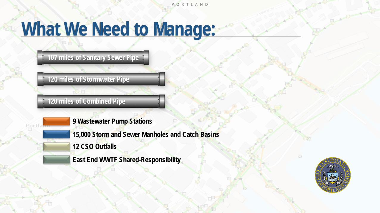
What We Need to Manage:
120 miles of Stormwater Pipe
120 miles of Combined Pipe
107 miles of Sanitary Sewer Pipe
9 Wastewater Pump Stations
15,000 Storm and Sewer Manholes and Catch Basins12 CSO Outfalls
East End WWTF Shared-Responsibility

P O R T L A N D
Asset Information
GISCity Works
CCTVHydraulic Model
RiskMatrix
FailureModel
CostInformation
MaintenancePractices
Short TermRenewalProjects
Long TermPlanningBudget
Renewal Plan
Risk Analysis
LOF
COF
Asset Management
P O R T L A N D
Asset Management Water Resources DivisionPortland, ME
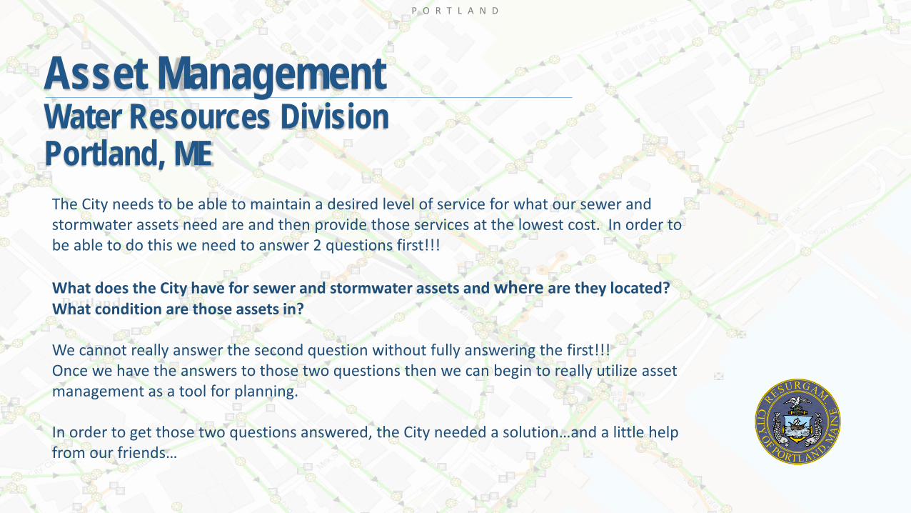
The City needs to be able to maintain a desired level of service for what our sewer and stormwater assets need are and then provide those services at the lowest cost. In order to be able to do this we need to answer 2 questions first!!!
What does the City have for sewer and stormwater assets and where are they located?What condition are those assets in?
We cannot really answer the second question without fully answering the first!!!Once we have the answers to those two questions then we can begin to really utilize asset management as a tool for planning.
In order to get those two questions answered, the City needed a solution…and a little help from our friends…
P O R T L A N D
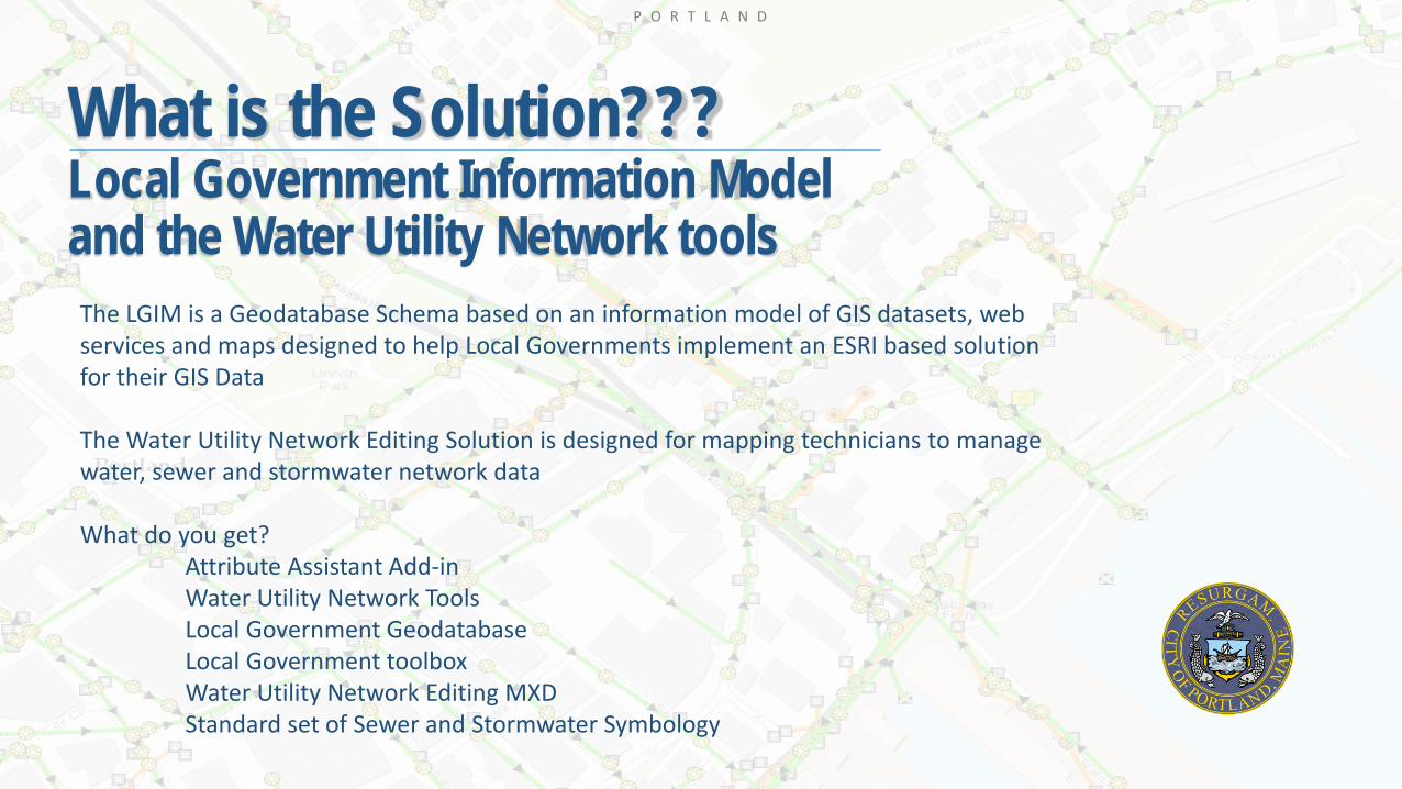
What is the Solution???Local Government Information Model and the Water Utility Network tools
The LGIM is a Geodatabase Schema based on an information model of GIS datasets, web services and maps designed to help Local Governments implement an ESRI based solution for their GIS Data
The Water Utility Network Editing Solution is designed for mapping technicians to manage water, sewer and stormwater network data
What do you get?Attribute Assistant Add-in Water Utility Network ToolsLocal Government GeodatabaseLocal Government toolboxWater Utility Network Editing MXDStandard set of Sewer and Stormwater Symbology
P O R T L A N D
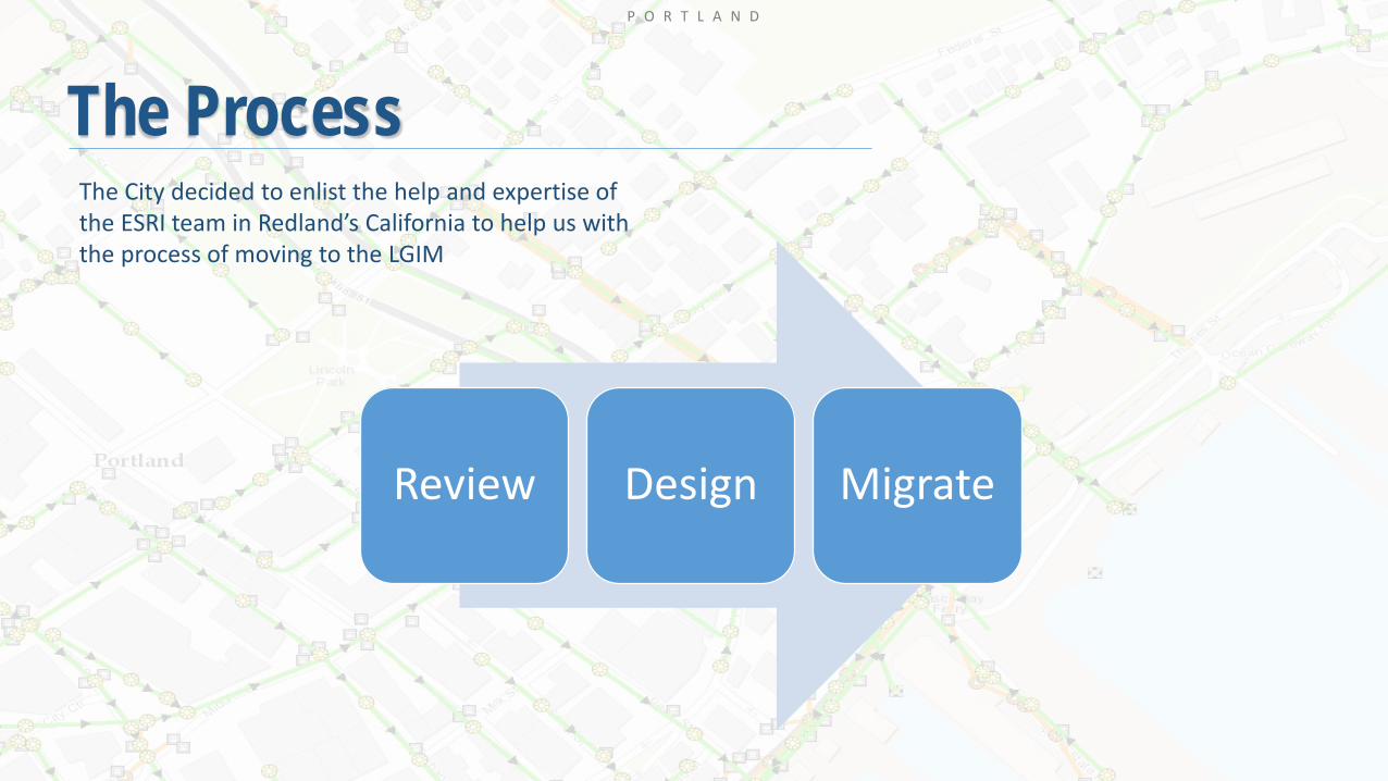
The Process
Review Design Migrate
The City decided to enlist the help and expertise of the ESRI team in Redland’s California to help us with the process of moving to the LGIM
P O R T L A N D
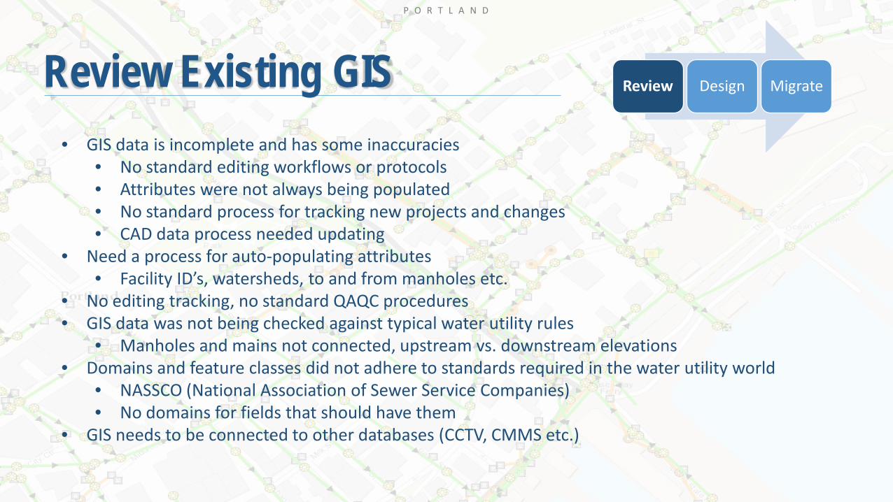
Review Existing GIS Review Design Migrate
• GIS data is incomplete and has some inaccuracies • No standard editing workflows or protocols• Attributes were not always being populated• No standard process for tracking new projects and changes • CAD data process needed updating
• Need a process for auto-populating attributes• Facility ID’s, watersheds, to and from manholes etc.
• No editing tracking, no standard QAQC procedures• GIS data was not being checked against typical water utility rules
• Manholes and mains not connected, upstream vs. downstream elevations • Domains and feature classes did not adhere to standards required in the water utility world
• NASSCO (National Association of Sewer Service Companies)• No domains for fields that should have them
• GIS needs to be connected to other databases (CCTV, CMMS etc.)

P O R T L A N D
Review SchemasReview our original schema and see where it fits in (and where it doesn’t) to the Local Government Information Model.
VS.
Original Feature DatasetLGIM Feature Dataset
Review Design Migrate
P O R T L A N D
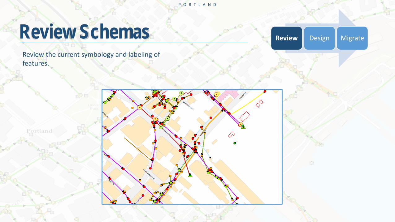
Review SchemasReview the current symbology and labeling of features.
Review Design Migrate

P O R T L A N D
X-Ray for Arc Catalog
Add-In tool used to develop, refine and document geodatabase designsSimple spreadsheet interface to update your schemasAnalyze the differences between two geodatabase designsMerge two different designs in to a new gdbReplace and reorder fieldsUpdate field aliases and descriptionsCreates a data dictionary
Review Design Migrate

P O R T L A N D
X-Ray for Arc Catalog – Feature Classes
P O R T L A N D
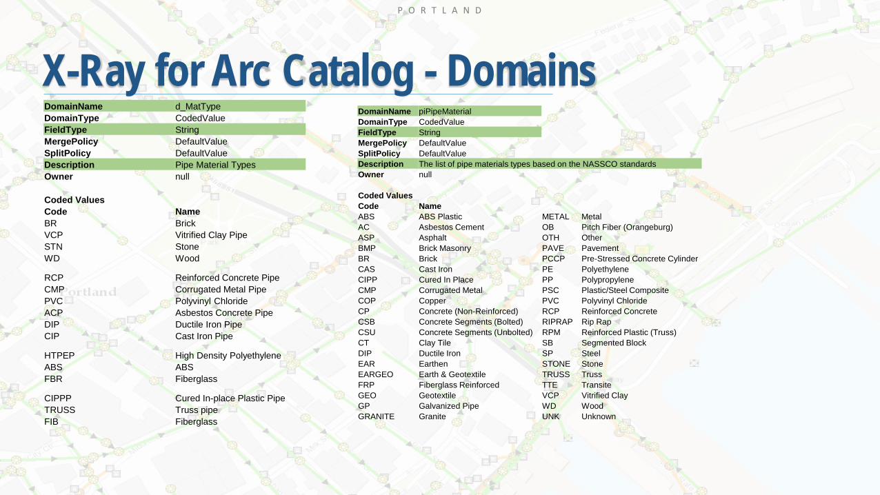
X-Ray for Arc Catalog - DomainsDomainName d_MatTypeDomainType CodedValueFieldType StringMergePolicy DefaultValueSplitPolicy DefaultValueDescription Pipe Material TypesOwner null
Coded ValuesCode NameBR BrickVCP Vitrified Clay PipeSTN StoneWD Wood
RCP Reinforced Concrete PipeCMP Corrugated Metal PipePVC Polyvinyl ChlorideACP Asbestos Concrete PipeDIP Ductile Iron PipeCIP Cast Iron Pipe
HTPEP High Density PolyethyleneABS ABSFBR Fiberglass
CIPPP Cured In-place Plastic PipeTRUSS Truss pipeFIB Fiberglass
DomainName piPipeMaterialDomainType CodedValueFieldType StringMergePolicy DefaultValueSplitPolicy DefaultValueDescription The list of pipe materials types based on the NASSCO standardsOwner null
Coded ValuesCode NameABS ABS Plastic METAL MetalAC Asbestos Cement OB Pitch Fiber (Orangeburg)ASP Asphalt OTH OtherBMP Brick Masonry PAVE PavementBR Brick PCCP Pre-Stressed Concrete CylinderCAS Cast Iron PE PolyethyleneCIPP Cured In Place PP PolypropyleneCMP Corrugated Metal PSC Plastic/Steel CompositeCOP Copper PVC Polyvinyl ChlorideCP Concrete (Non-Reinforced) RCP Reinforced ConcreteCSB Concrete Segments (Bolted) RIPRAP Rip RapCSU Concrete Segments (Unbolted) RPM Reinforced Plastic (Truss)CT Clay Tile SB Segmented BlockDIP Ductile Iron SP SteelEAR Earthen STONE StoneEARGEO Earth & Geotextile TRUSS TrussFRP Fiberglass Reinforced TTE TransiteGEO Geotextile VCP Vitrified ClayGP Galvanized Pipe WD WoodGRANITE Granite UNK Unknown

P O R T L A N D
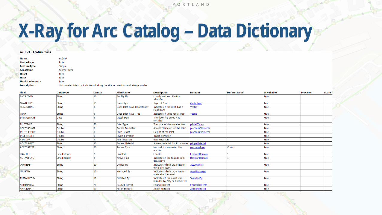
X-Ray for Arc Catalog – Data Dictionary
Domains
P O R T L A N D
X-Ray for Arc Catalog – Data Dictionary
P O R T L A N D
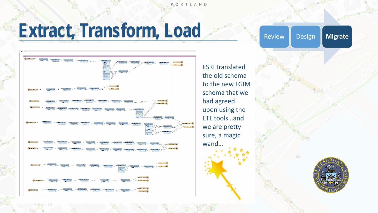
Extract, Transform, Load Review Design Migrate
ESRI translated the old schema to the new LGIM schema that we had agreed upon using the ETL tools…and we are pretty sure, a magic wand…
P O R T L A N D
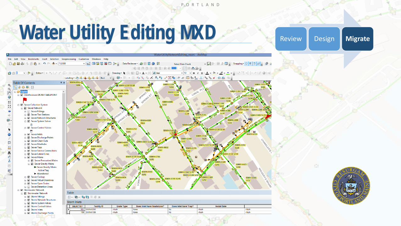
Water Utility Editing MXD Review Design Migrate
P O R T L A N D
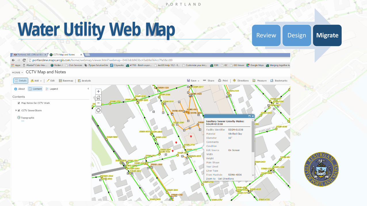
Water Utility Web Map Review Design Migrate
P O R T L A N D
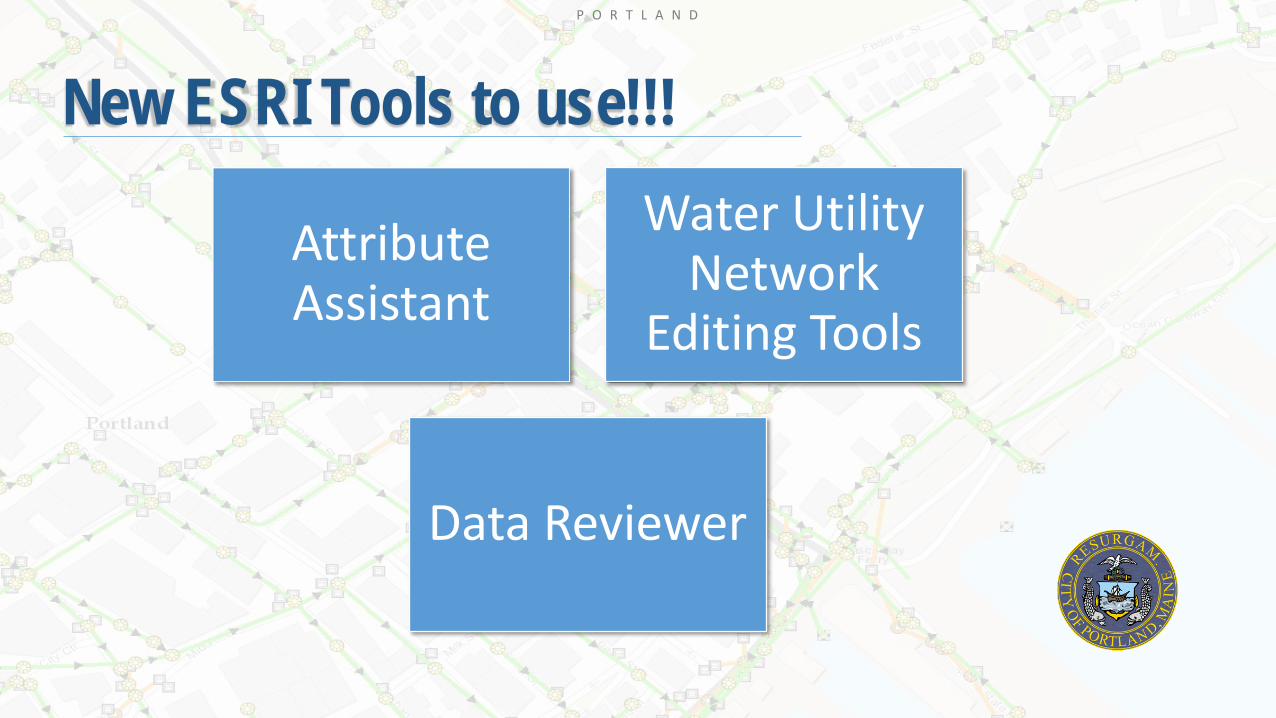
New ESRI Tools to use!!!
Attribute Assistant
Water Utility Network
Editing Tools
Data Reviewer

P O R T L A N D
Attribute AssistantWhat does it do, how does it work???• Used as part of our editing workflow• Populate attributes when you create new features or
modify existing features• Rules are be created that can sequentially number
features that are unique to that feature class – Facility ID
• Server or file geodatabase setup• Dynamic Value Table – where you set up the rules
• Value Methods – GENERATE_ID, INTERSECTING_FEATURE
• On Create, On Change, On Change Geometry, On Manual
• Generate ID Table – Where the sequential counter info is stored
P O R T L A N D
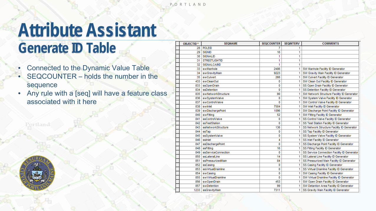
Attribute AssistantGenerate ID Table• Connected to the Dynamic Value Table• SEQCOUNTER – holds the number in the
sequence• Any rule with a [seq] will have a feature class
associated with it here
P O R T L A N D
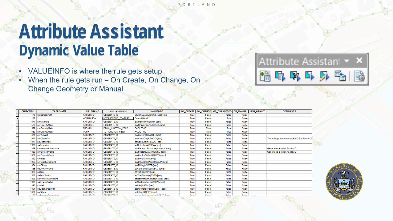
Attribute AssistantDynamic Value Table• VALUEINFO is where the rule gets setup• When the rule gets run – On Create, On Change, On
Change Geometry or Manual

P O R T L A N D
Water Utility Network Editing Tools
• Water Utility Network Editing Toolbar• Water Utility Network Reporting Toolbar• Water Utility Network Editing Construction
Tools
The Water Utility Network Editing solution includes 2 editing toolbars and a set of ArcMap construction tools that the City can now use as part of its editing workflow

P O R T L A N D
Water Utility Network Editing Tools
• Connect and disconnect geometric network features• Validate features – validates subtypes, attribute domains, geometric network rules, relationship rules• Connection checker – all junctions connect to an edge, all edges connect to another edge• Split lines at selected points• Merge geometric network lines• Create jump overs or jump unders for intersecting lines• Add laterals at connections or line locations• Connect selected point to closest existing point• Establish flow direction, established digitized flow direction, show/hide flow arrows• Flip selected

P O R T L A N D
Water Utility Network Editing Tools
• Run isolation traces – valves, upstream and downstream traces• Flow accumulation• Add/Remove a flag• Add/Remove a barrier• Profiling • Summary isolation trace• Summary flow accumulation • Change operable status of a valve• Clear trace results
P O R T L A N D
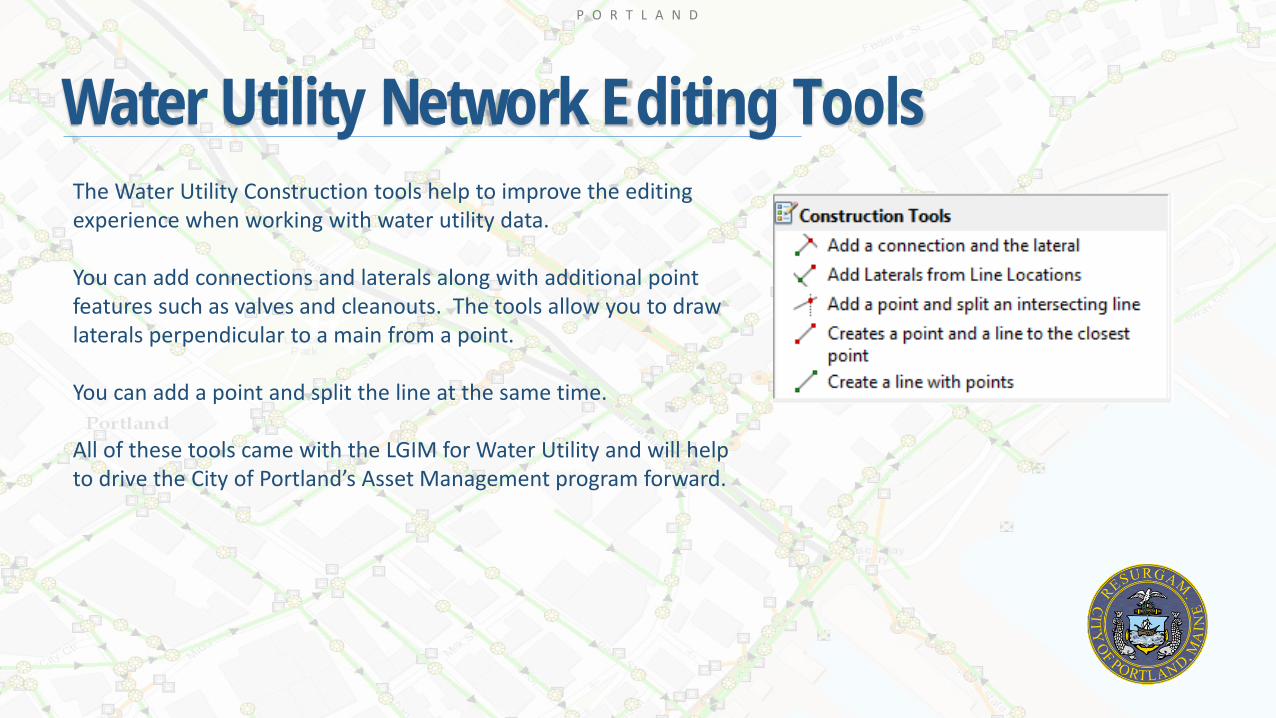
Water Utility Network Editing ToolsThe Water Utility Construction tools help to improve the editing experience when working with water utility data.
You can add connections and laterals along with additional point features such as valves and cleanouts. The tools allow you to draw laterals perpendicular to a main from a point.
You can add a point and split the line at the same time.
All of these tools came with the LGIM for Water Utility and will help to drive the City of Portland’s Asset Management program forward.

P O R T L A N D
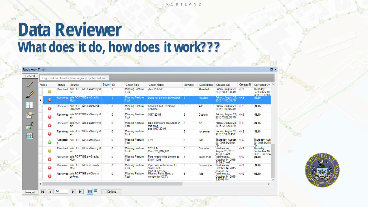
Data ReviewerWhat does it do, how does it work???
Built in data checks
Quality control
Increase efficiencies
Retain organizational knowledge
Report and monitor data health and error trends
P O R T L A N D
Data ReviewerWhat does it do, how does it work???
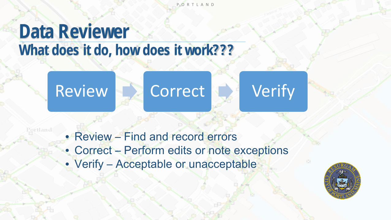
• Review – Find and record errors• Correct – Perform edits or note exceptions• Verify – Acceptable or unacceptable
Review Correct Verify

P O R T L A N D
Data ReviewerWhat does it do, how does it work???
Review Correct Verify
P O R T L A N D
Data ReviewerWhat does it do, how does it work???
Review Correct Verify
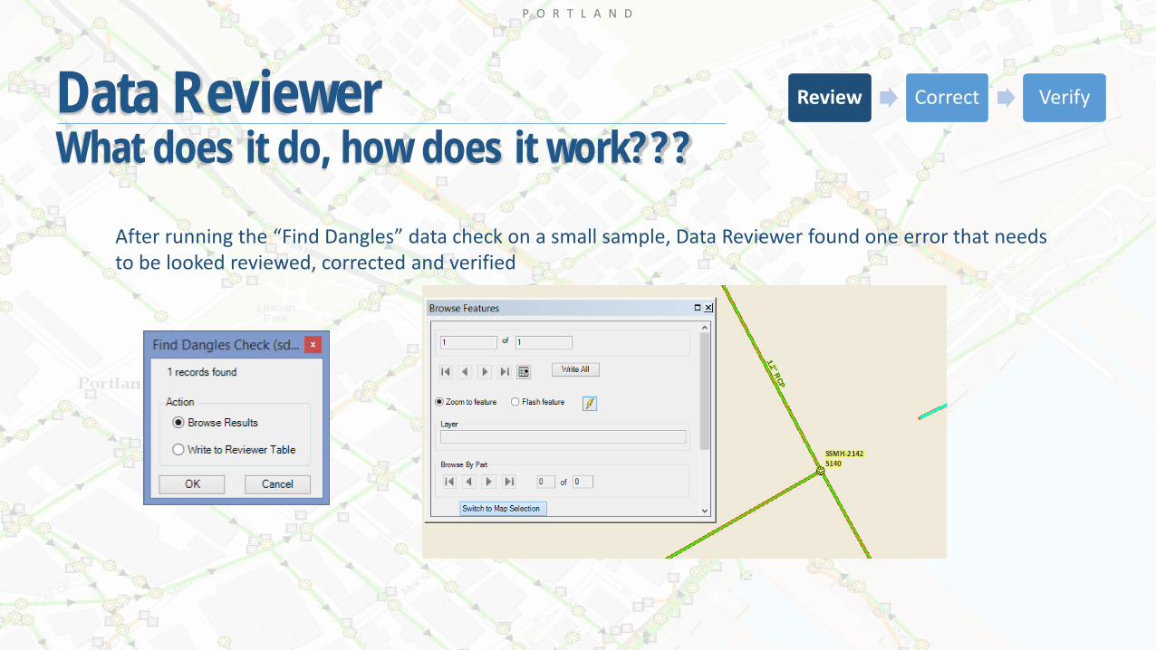
After running the “Find Dangles” data check on a small sample, Data Reviewer found one error that needs to be looked reviewed, corrected and verified
P O R T L A N D
Data ReviewerWhat does it do, how does it work???
Review Correct Verify

P O R T L A N D
Data ReviewerWhat does it do, how does it work???
Review Correct Verify
P O R T L A N D
Data ReviewerWhat does it do, how does it work???
P O R T L A N D
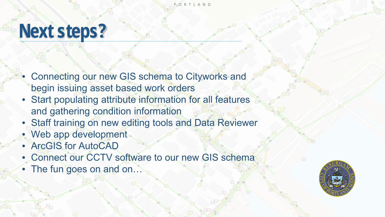
Next steps?
• Connecting our new GIS schema to Cityworks and begin issuing asset based work orders
• Start populating attribute information for all features and gathering condition information
• Staff training on new editing tools and Data Reviewer• Web app development • ArcGIS for AutoCAD• Connect our CCTV software to our new GIS schema• The fun goes on and on…

P O R T L A N D
Thank you!!!
Jessica Gooch – Asset Management TechnicianCity of Portland, [email protected]