Continuously Operating Reference Stations
16
Continuously Operating Reference Stations Shannon Huber Norwood Multi-County Extension Agent Alabama Cooperative Extension System
Transcript of Continuously Operating Reference Stations
Continuously Operating Reference Stations
Shannon Huber Norwood
Multi-County Extension Agent
Alabama Cooperative Extension System
CORS Background
• What is CORS?
– Coordinated by the National Geodetic Survey
(NGS) of the National Oceanic and
Atmospheric Administration (NOAA),
Continuously Operating Reference Station
(CORS) sites provide GPS measurements in
support of 3-dimensional positioning activities.
CORS Background
• Traditional CORS Users
– Department of Transportation
– Surveying Industry
• Used for what?
– Subsidence
– Road construction
– Monitor water levels
– Crustal movement
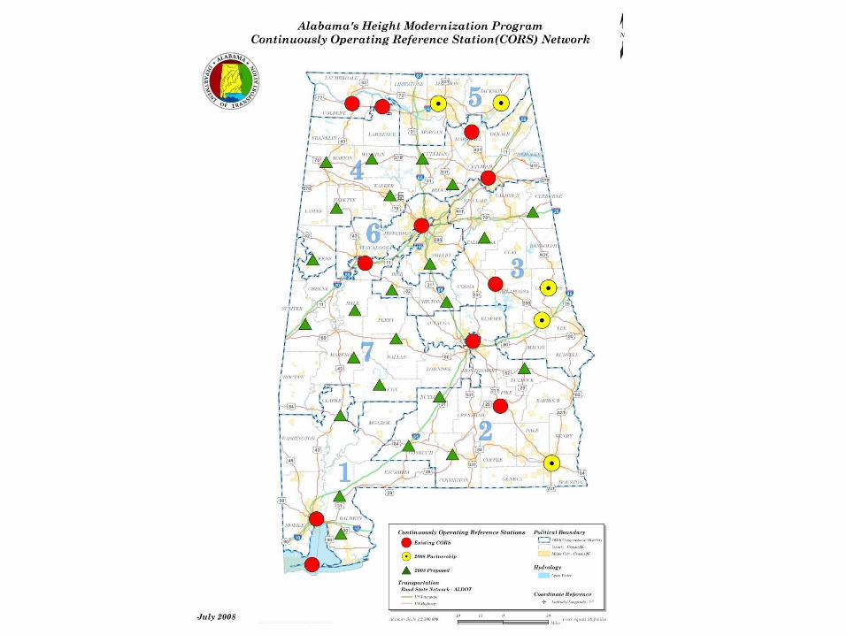
CORS in Alabama
• Department of Revenue recipient of grant funds through the Height Modernization Project
• Alabama Department of Transportation sets up and maintains the state’s CORS sites
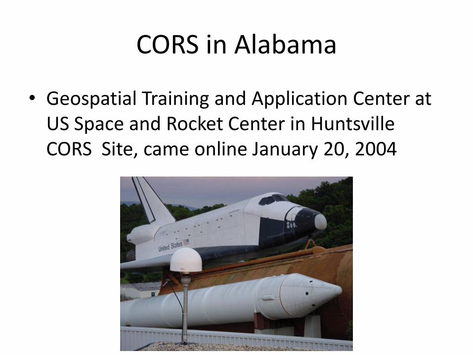
CORS in Alabama
• Geospatial Training and Application Center at US Space and Rocket Center in Huntsville CORS Site, came online January 20, 2004
CORS in Alabama
• Henk van Riessen with InTime, Inc. partnered with Chris Johnson at the US Space and Rocket Center
• Tested the use of CORS for correction signal with auto-steer equipment
• Original system was a lot of wiring cobbled together
• Testing done at the Tennessee Valley Research and Extension Center and on a local farm
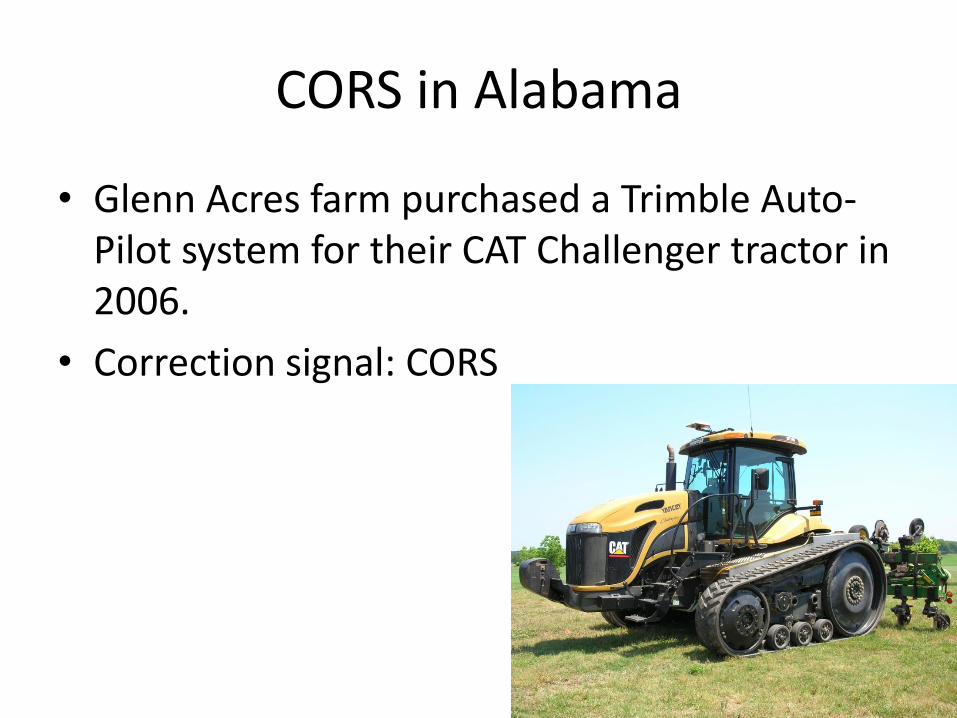
CORS in Alabama
• Glenn Acres farm purchased a Trimble Auto-Pilot system for their CAT Challenger tractor in 2006.
• Correction signal: CORS
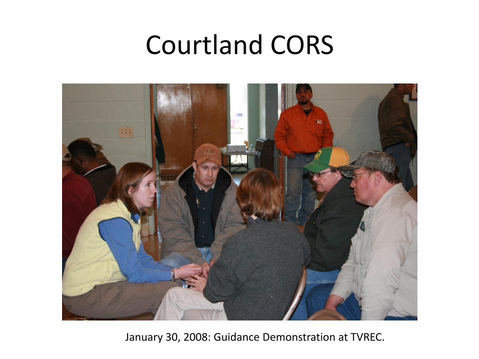
Courtland CORS
January 30, 2008: Guidance Demonstration at TVREC.
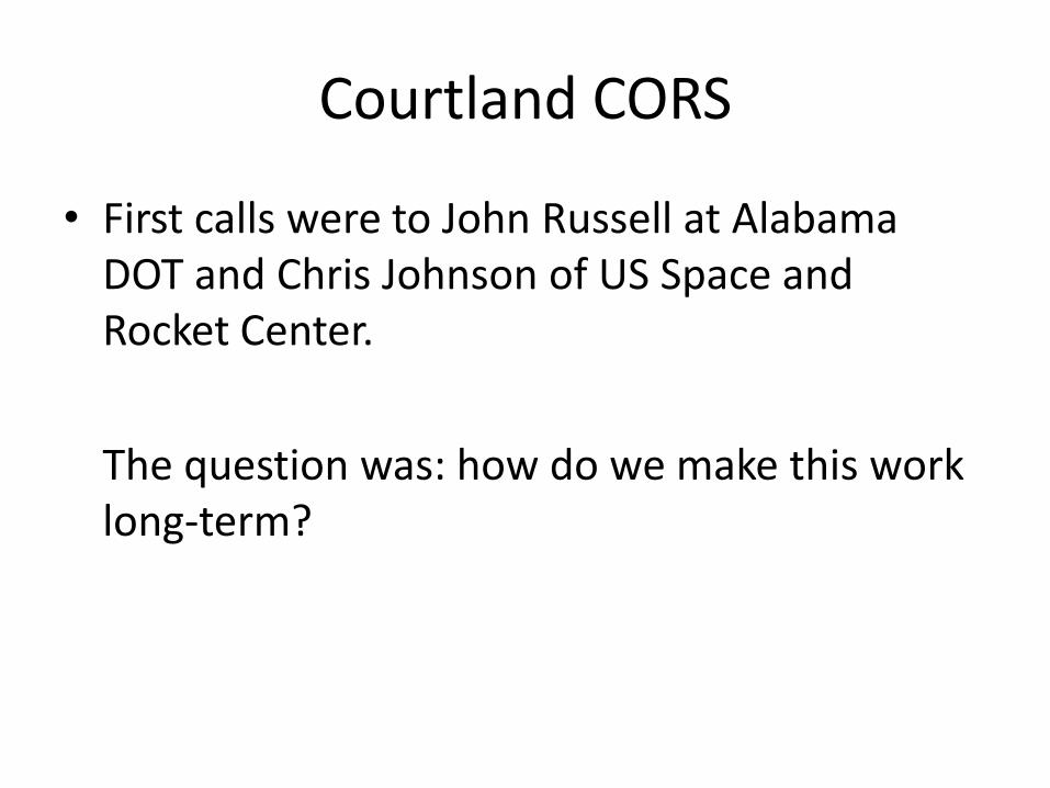
Courtland CORS
• First calls were to John Russell at Alabama DOT and Chris Johnson of US Space and Rocket Center.
The question was: how do we make this work long-term?
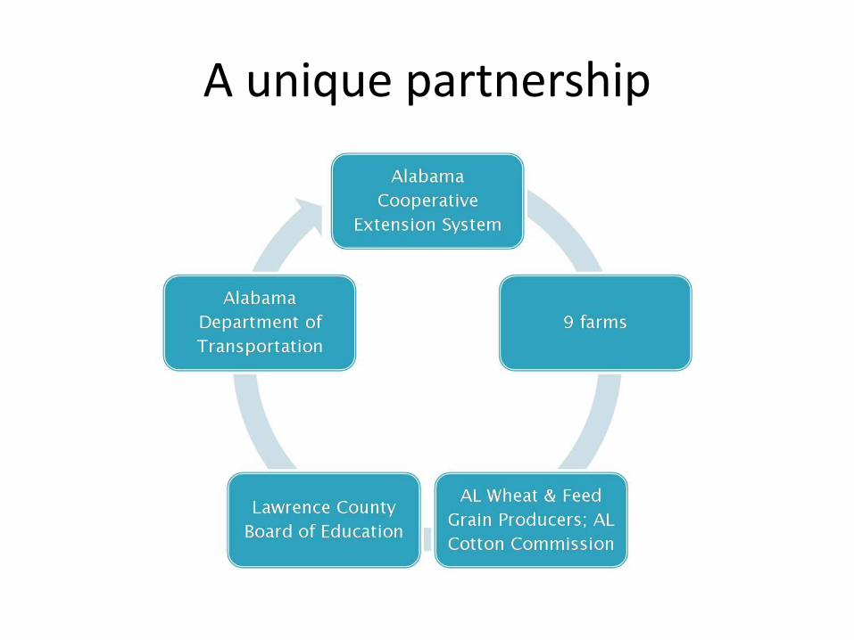
A unique partnership

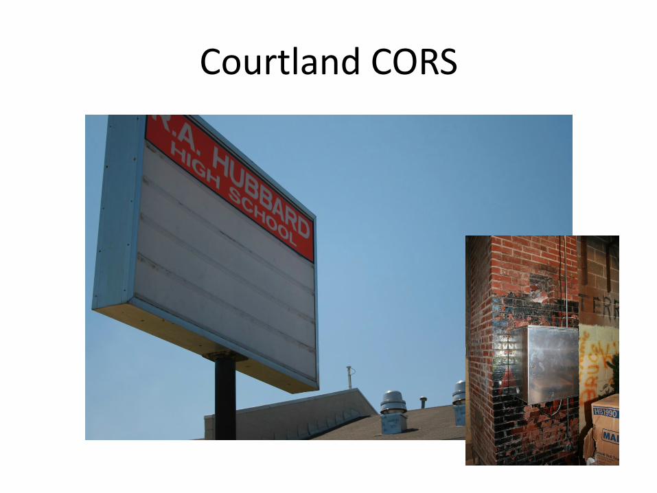
Courtland CORS
• March 11, 2008…
ON-LINE!!!
Courtland CORS
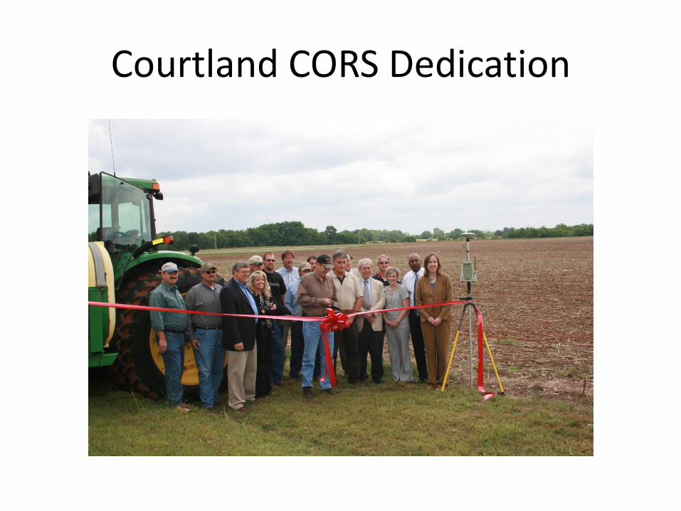
Courtland CORS Dedication
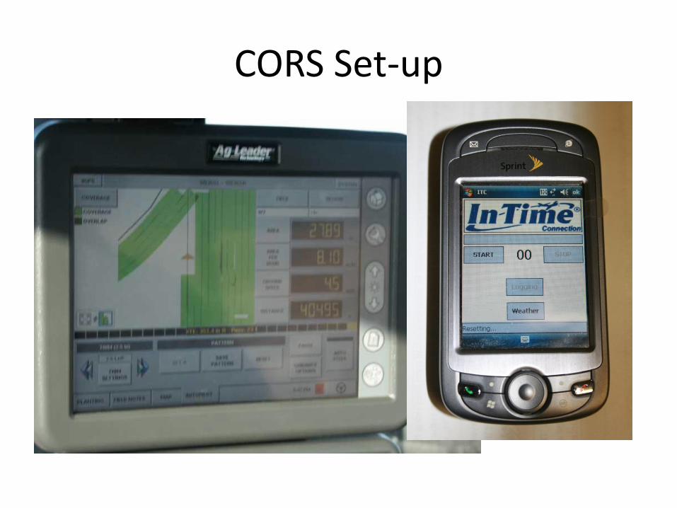
CORS Set-up