Continental Drift and Plate Tectonics All images from ng.html#anchor5567033 unless otherwise noted.
41
Continental Drift and Plate Tectonics All images from http://pubs.usgs.gov/publications/text/ understanding.html#anchor5567033 unless otherwise noted.
-
Upload
kevin-mcdowell -
Category
Documents
-
view
216 -
download
0
Transcript of Continental Drift and Plate Tectonics All images from ng.html#anchor5567033 unless otherwise noted.
Continental Drift and
Plate Tectonics
All images from
http://pubs.usgs.gov/publications/text/understanding.html#anchor5567033
unless otherwise noted.
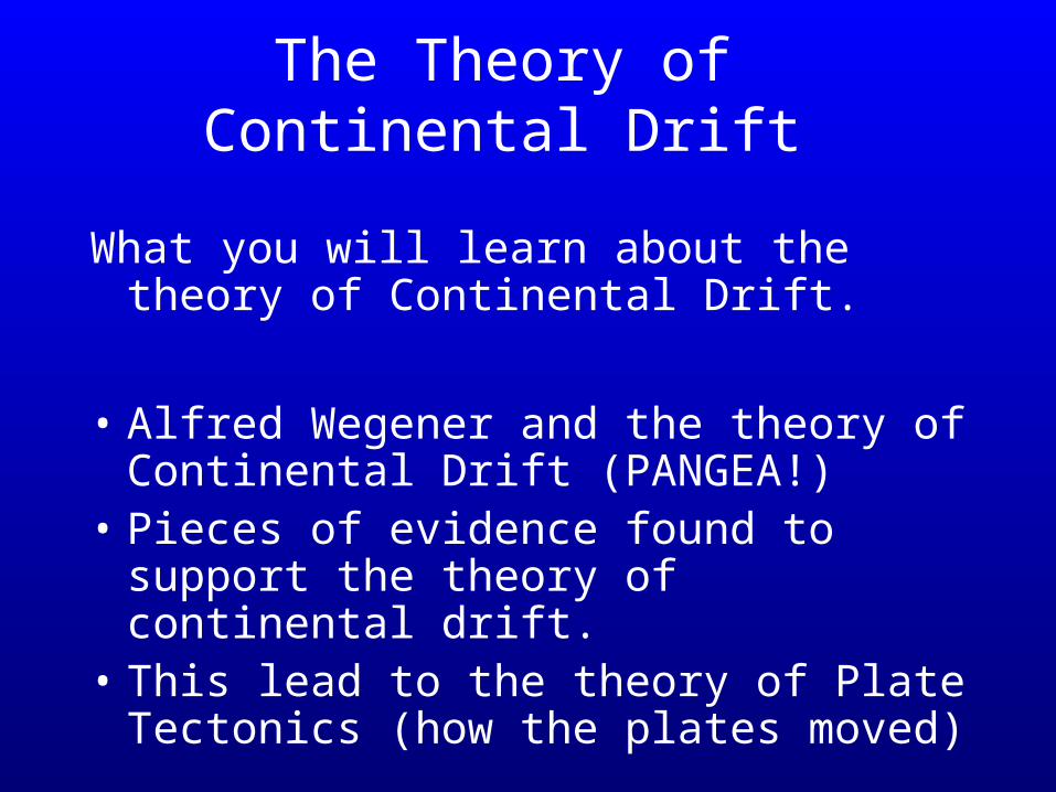
The Theory of Continental Drift
What you will learn about the theory of Continental Drift.
• Alfred Wegener and the theory of Continental Drift (PANGEA!)
• Pieces of evidence found to support the theory of continental drift.
• This lead to the theory of Plate Tectonics (how the plates moved)
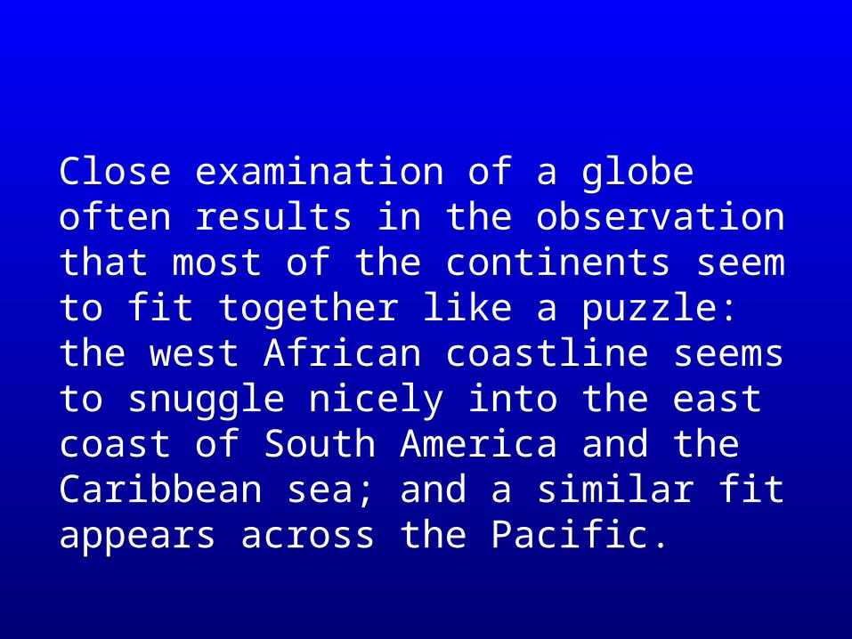
Close examination of a globe often results in the observation that most of the continents seem to fit together like a puzzle: the west African coastline seems to snuggle nicely into the east coast of South America and the Caribbean sea; and a similar fit appears across the Pacific.
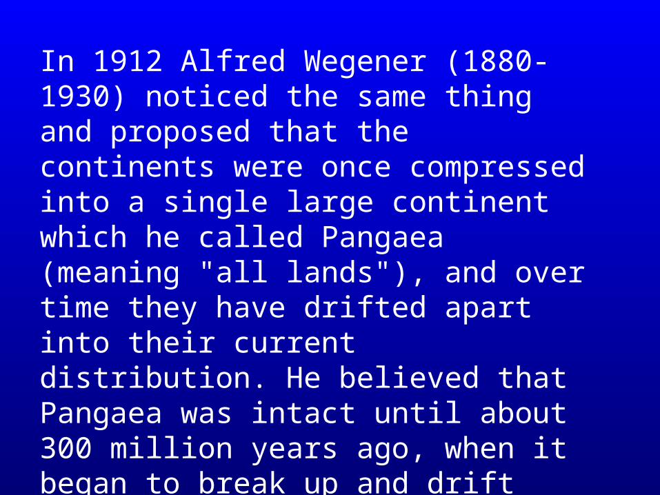
In 1912 Alfred Wegener (1880-1930) noticed the same thing and proposed that the continents were once compressed into a single large continent which he called Pangaea (meaning "all lands"), and over time they have drifted apart into their current distribution. He believed that Pangaea was intact until about 300 million years ago, when it began to break up and drift apart.
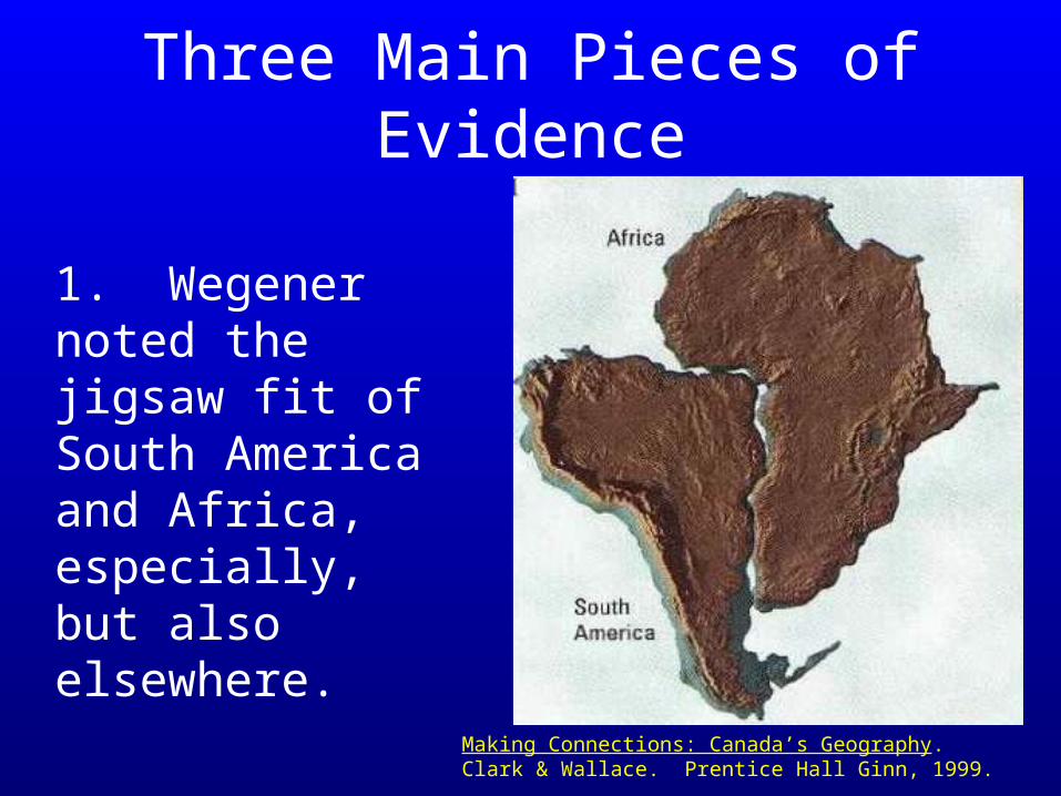
1. Wegener noted the jigsaw fit of South America and Africa, especially, but also elsewhere.
Making Connections: Canada’s Geography. Clark & Wallace. Prentice Hall Ginn, 1999.
Three Main Pieces of Evidence
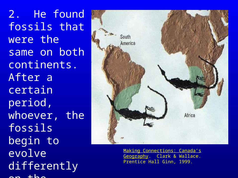
2. He found fossils that were the same on both continents. After a certain period, whoever, the fossils begin to evolve differently on the different continents.
Making Connections: Canada’s Geography. Clark & Wallace. Prentice Hall Ginn, 1999.
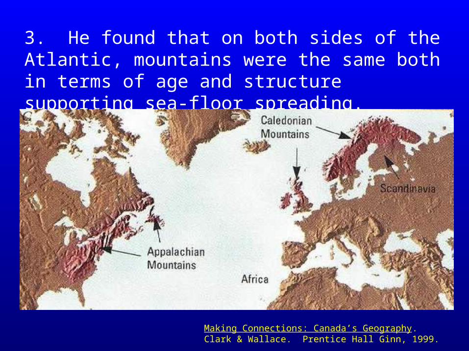
3. He found that on both sides of the Atlantic, mountains were the same both in terms of age and structure supporting sea-floor spreading.
Making Connections: Canada’s Geography. Clark & Wallace. Prentice Hall Ginn, 1999.
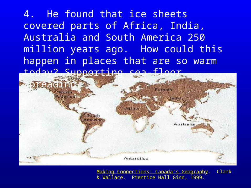
4. He found that ice sheets covered parts of Africa, India, Australia and South America 250 million years ago. How could this happen in places that are so warm today? Supporting sea-floor spreading.
Making Connections: Canada’s Geography. Clark & Wallace. Prentice Hall Ginn, 1999.
As technology progressed two other evidences were added to Wegner’s Theory. One is called Sea Floor Spreading. This will be explained in class.
•Do not worry about understanding Magnetic signature for your test.
The other is called Magnetic Signature. Rocks that are formed in Polar regions take on a ‘Polar’ characteristic and rocks formed near the Equator take on an ‘Equatorial’ signature. Huge rocks and mountains with Equatorial signatures have been found in Polar regions and vica versa!
Problem? Wegener's hypothesis of continental drift lacked a geological mechanism to explain how the continents could drift across the earth's surface.
….thus, the theory of PLATE TECTONICS!
It wasn’t until the the 1960s that the theory of plate tectonics was advanced to explain how the continents could separate.
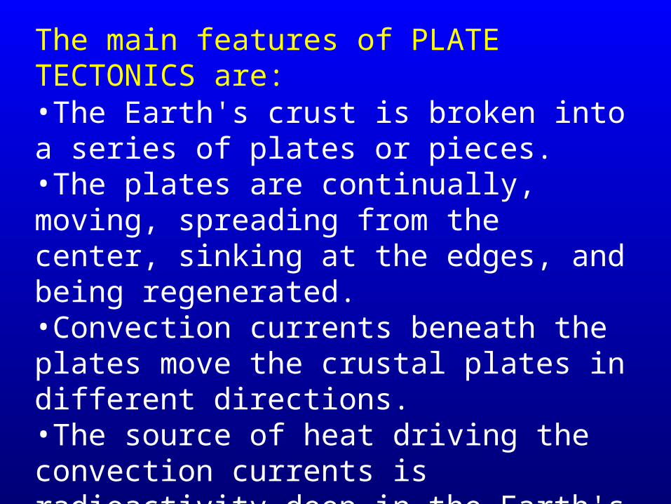
•The Earth's crust is broken into a series of plates or pieces.•The plates are continually, moving, spreading from the center, sinking at the edges, and being regenerated. •Convection currents beneath the plates move the crustal plates in different directions. •The source of heat driving the convection currents is radioactivity deep in the Earth's mantle.
The main features of PLATE TECTONICS are:
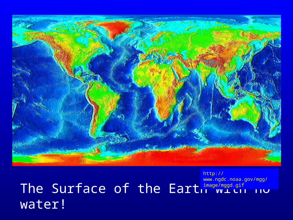
The Surface of the Earth with no water!http://www.ngdc.noaa.gov/mgg/image/mggd.gif
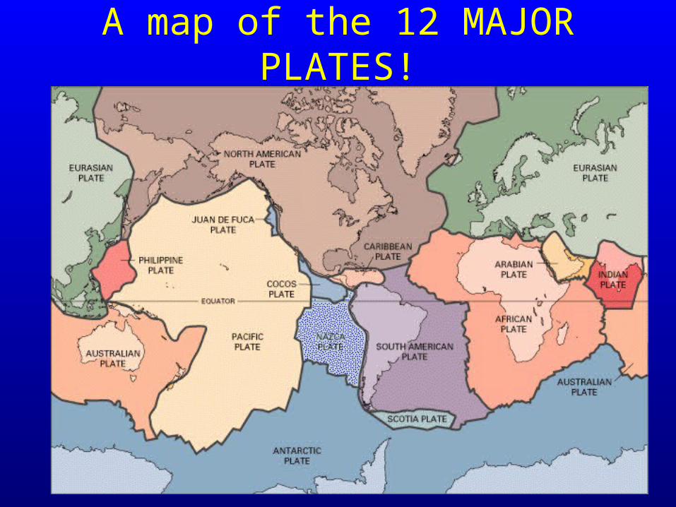
A map of the 12 MAJOR PLATES!
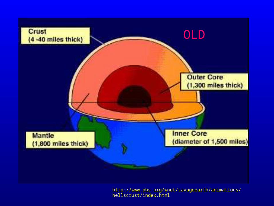
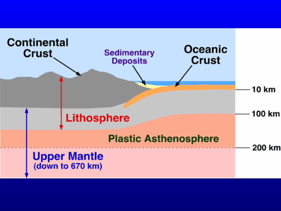
In order for the theory of plate tectonics to be proven, the internal structure of the earth had to be redrawn. The solid part of the earth, the part that is exposed to the atmosphere or covered by the hydrosphere (the oceans) is known as the lithosphere (or the crust), had to be broken up into two parts. The lithosphere now is made up of the crust and at the bottom of the lithosphere and at the very top of the mantle we added a new sphere called the asthenosphere.
The asthenosphere is not a solid and not a liquid – it is plastic in nature.
http://www.pbs.org/wnet/savageearth/animations/hellscrust/index.html
OLD
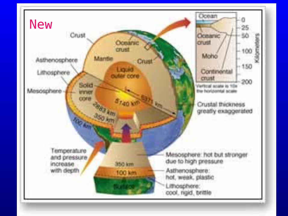
New
So let’s explain what’s happening!
• the outer surface of the Earth is a thin crust of fragile rock, fractured like the cracked shell of an egg• the pieces of the shell are Earth's tectonic plates -- there are 12 major ones -- and they float along on vast set of convection currents in the asthenosphere• the asthenosphere churns like a fluid• the plates on top of the asthenosphere move according to the direction of the currents.
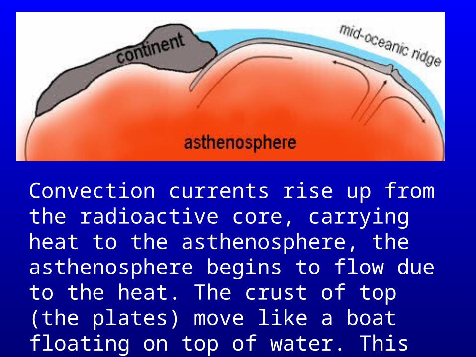
Convection currents rise up from the radioactive core, carrying heat to the asthenosphere, the asthenosphere begins to flow due to the heat. The crust of top (the plates) move like a boat floating on top of water. This boat can move in many directions.

So what is happening on the earth?…
• Some plates are moving apart (ridges of volcanoes)• Some plates are colliding. If they collide they can
either buckle (mountains form) or some plates will slide beneath each other (trenches form).
• Some plates are slipping beside each other (faults occur, which create earthquakes)
• Often earthquakes and volcanoes occur at all of the plate boundaries due to these processes.
• These processes form very interesting features both within the ocean and on land.
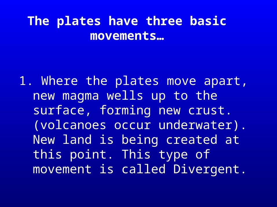
1. Where the plates move apart, new magma wells up to the surface, forming new crust. (volcanoes occur underwater). New land is being created at this point. This type of movement is called Divergent.
The plates have three basic movements…
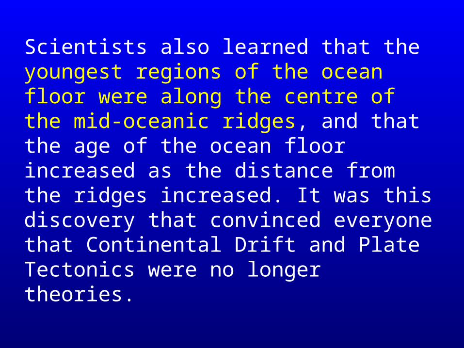
Scientists also learned that the youngest regions of the ocean floor were along the centre of the mid-oceanic ridges, and that the age of the ocean floor increased as the distance from the ridges increased. It was this discovery that convinced everyone that Continental Drift and Plate Tectonics were no longer theories.
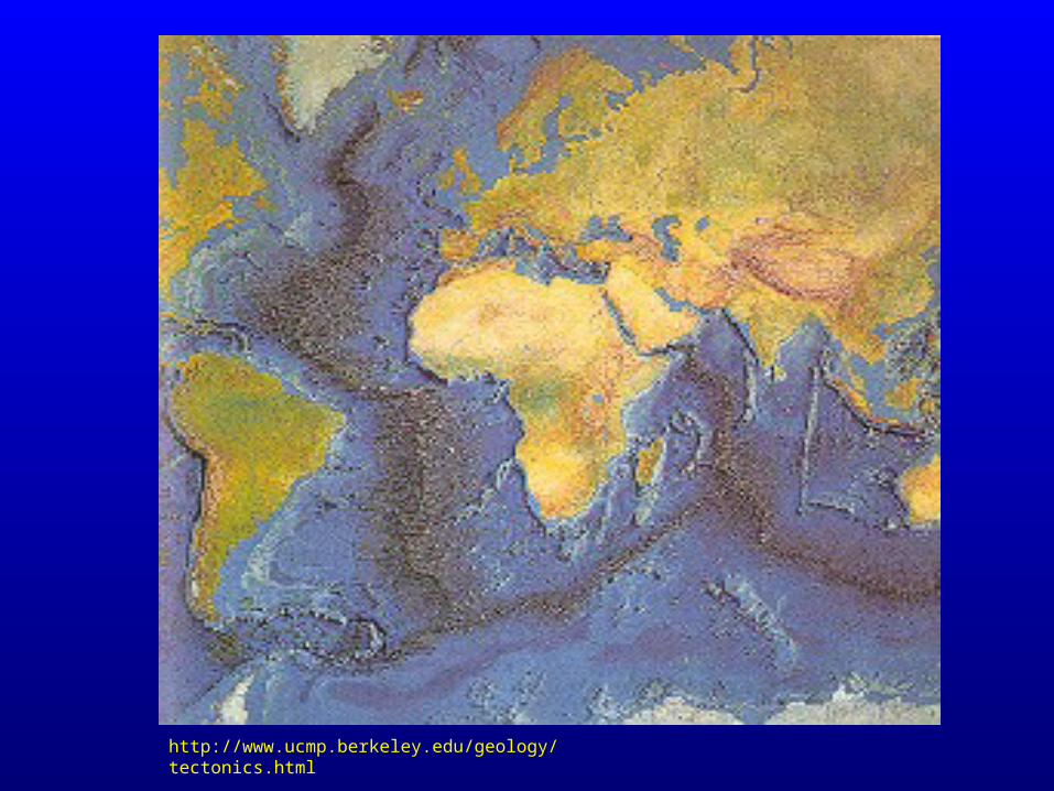
http://www.ucmp.berkeley.edu/geology/tectonics.html
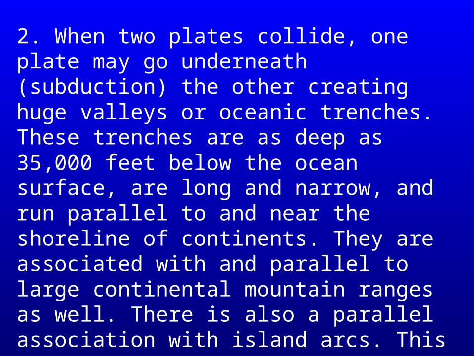
2. When two plates collide, one plate may go underneath (subduction) the other creating huge valleys or oceanic trenches. These trenches are as deep as 35,000 feet below the ocean surface, are long and narrow, and run parallel to and near the shoreline of continents. They are associated with and parallel to large continental mountain ranges as well. There is also a parallel association with island arcs. This type of plate movement is called Convergent.
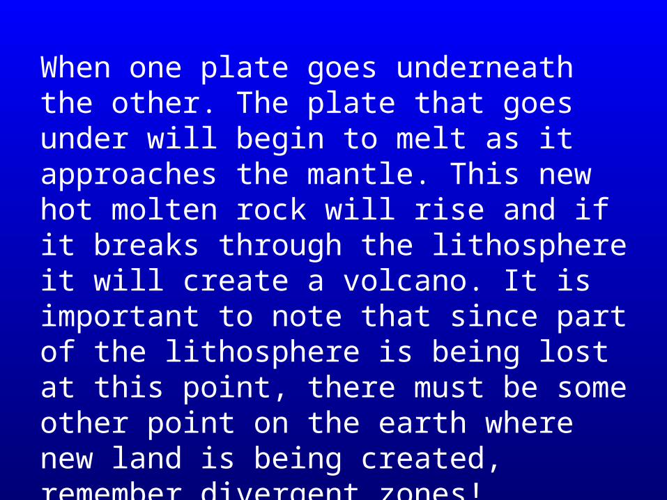
When one plate goes underneath the other. The plate that goes under will begin to melt as it approaches the mantle. This new hot molten rock will rise and if it breaks through the lithosphere it will create a volcano. It is important to note that since part of the lithosphere is being lost at this point, there must be some other point on the earth where new land is being created, remember divergent zones!

3. In some parts of the world plates are rubbing up against each other creating tremendous friction. When these plates actually slip (move) they release this energy in the form of earthquakes. Eg. The San Andreas fault. This type of movement is called Transform.
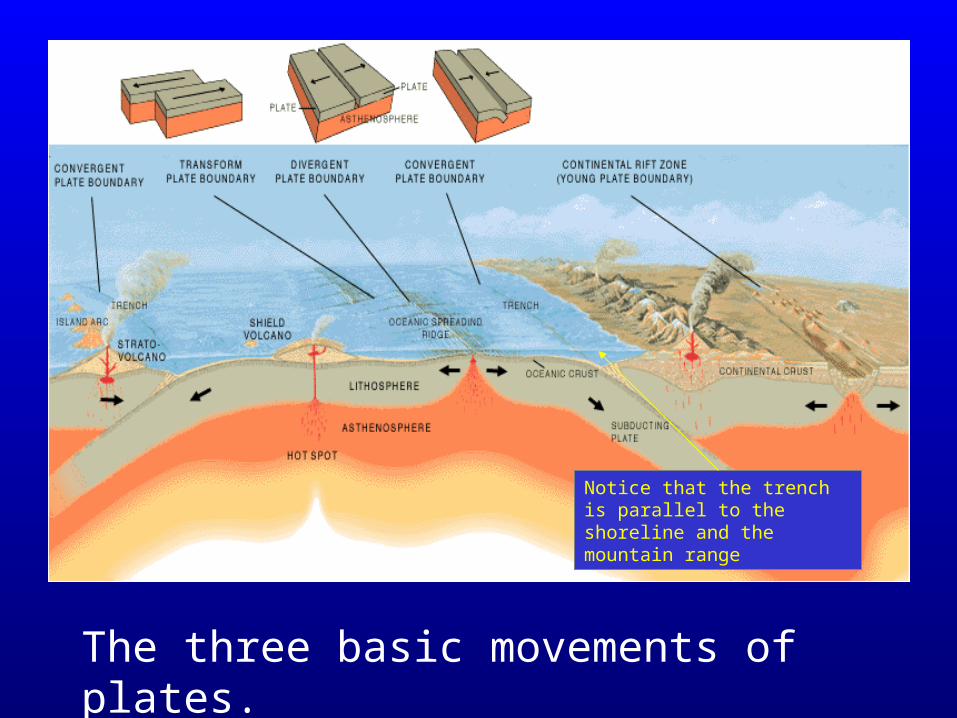
The three basic movements of plates.
Notice that the trench is parallel to the shoreline and the mountain range
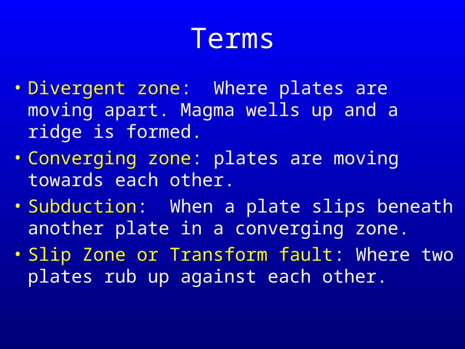
Terms
• Divergent zone: Where plates are moving apart. Magma wells up and a ridge is formed.
• Converging zone: plates are moving towards each other.
• Subduction: When a plate slips beneath another plate in a converging zone.
• Slip Zone or Transform fault: Where two plates rub up against each other.
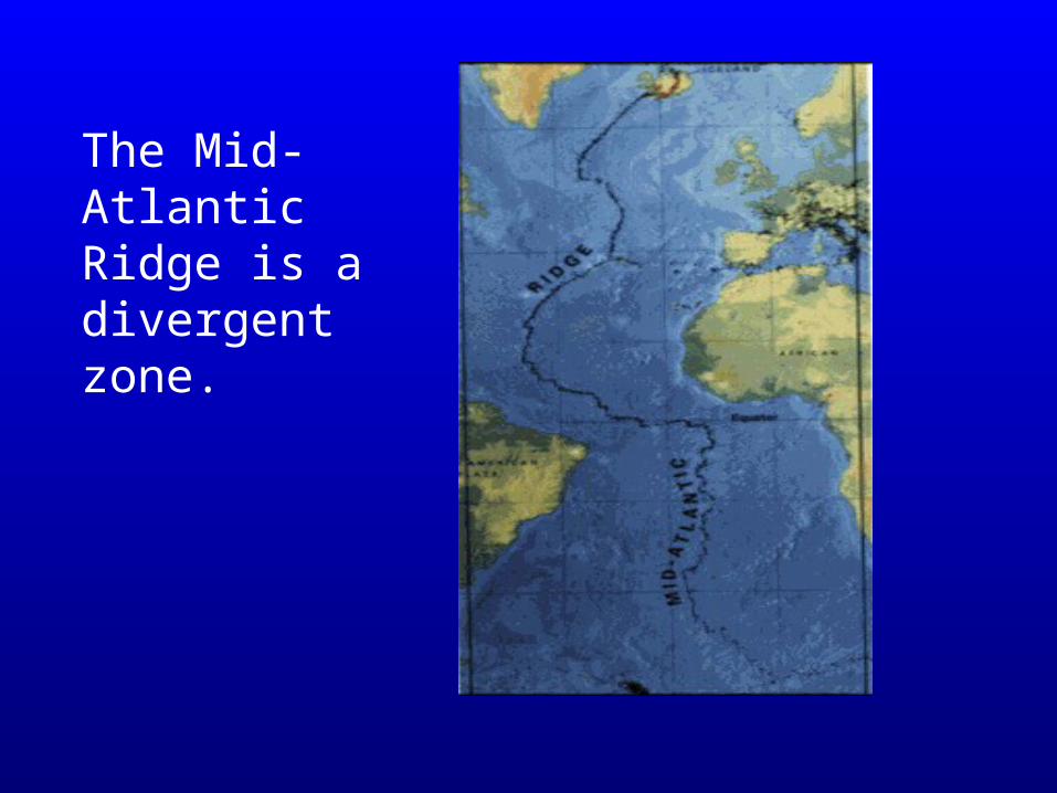
The Mid-Atlantic Ridge is a divergent zone.
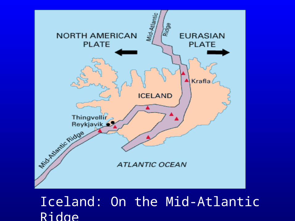
Iceland: On the Mid-Atlantic Ridge
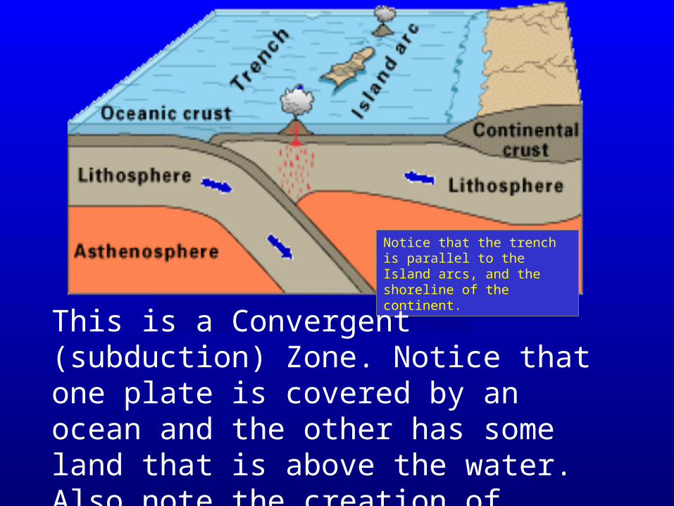
Notice that the trench is parallel to the Island arcs, and the shoreline of the continent.
This is a Convergent (subduction) Zone. Notice that one plate is covered by an ocean and the other has some land that is above the water. Also note the creation of Island Arcs.
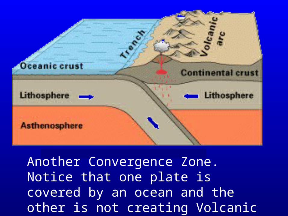
Another Convergence Zone. Notice that one plate is covered by an ocean and the other is not creating Volcanic arcs.
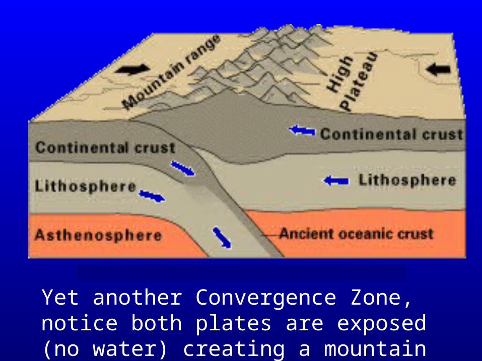
Yet another Convergence Zone, notice both plates are exposed (no water) creating a mountain range.
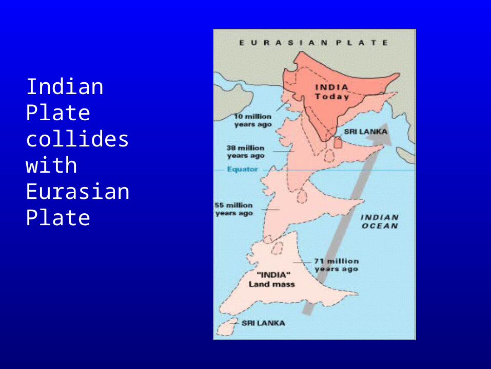
Indian Plate collides with Eurasian Plate
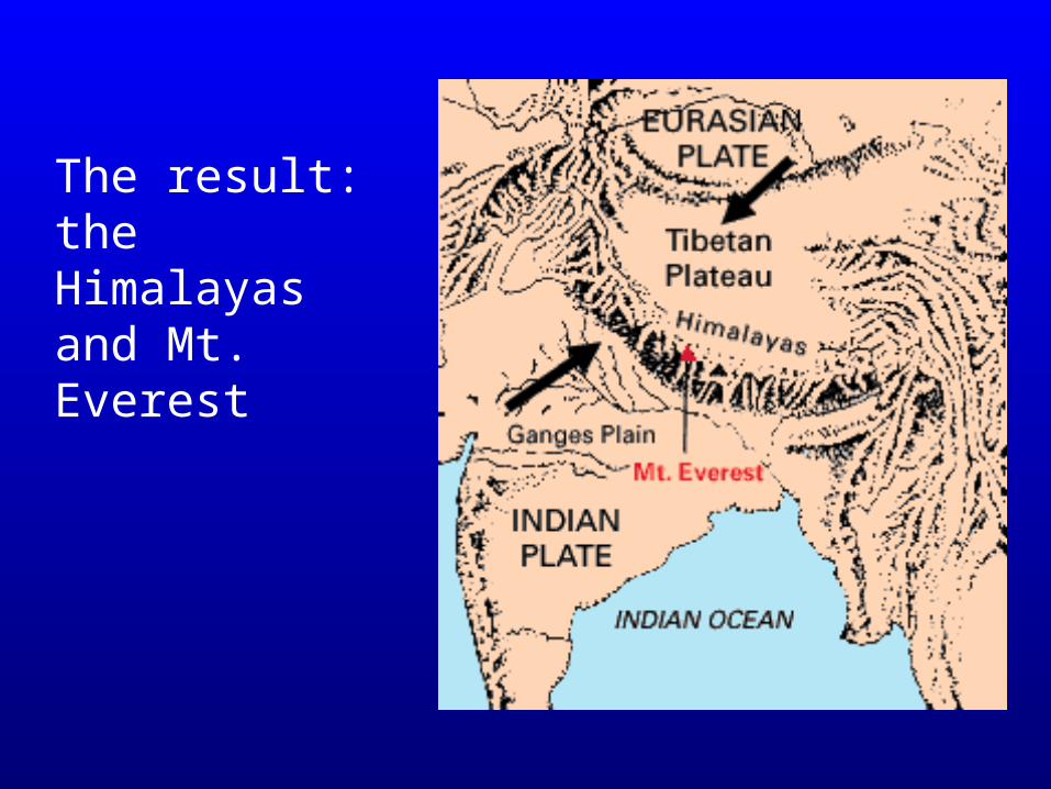
The result: the Himalayas and Mt. Everest
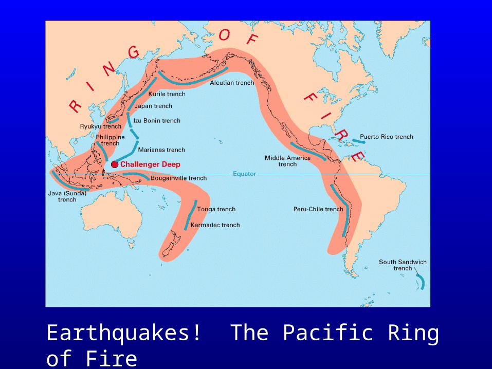
Earthquakes! The Pacific Ring of Fire
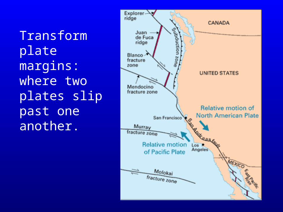
Transform plate margins: where two plates slip past one another.
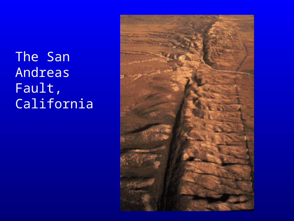
The San Andreas Fault, California
http://sts.gsc.nrcan.gc.ca/page1/geoh/quake/figures.htm
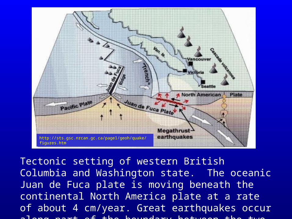
Tectonic setting of western British Columbia and Washington state. The oceanic Juan de Fuca plate is moving beneath the continental North America plate at a rate of about 4 cm/year. Great earthquakes occur along part of the boundary between the two plates.
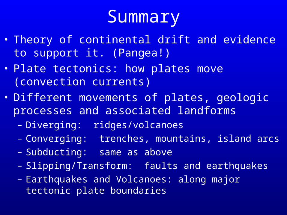
Summary• Theory of continental drift and evidence to support it.
(Pangea!)• Plate tectonics: how plates move (convection currents)• Different movements of plates, geologic processes
and associated landforms– Diverging: ridges/volcanoes– Converging: trenches, mountains, island arcs– Subducting: same as above– Slipping/Transform: faults and earthquakes– Earthquakes and Volcanoes: along major tectonic plate
boundaries

The End!