Coney Island Creek Resiliency Study - NYCEDC
26
Coney Island Creek Resiliency Study March 9, 2016
Transcript of Coney Island Creek Resiliency Study - NYCEDC
Coney Island Creek Resiliency Study
March 9, 2016
2 Edit Footer Here
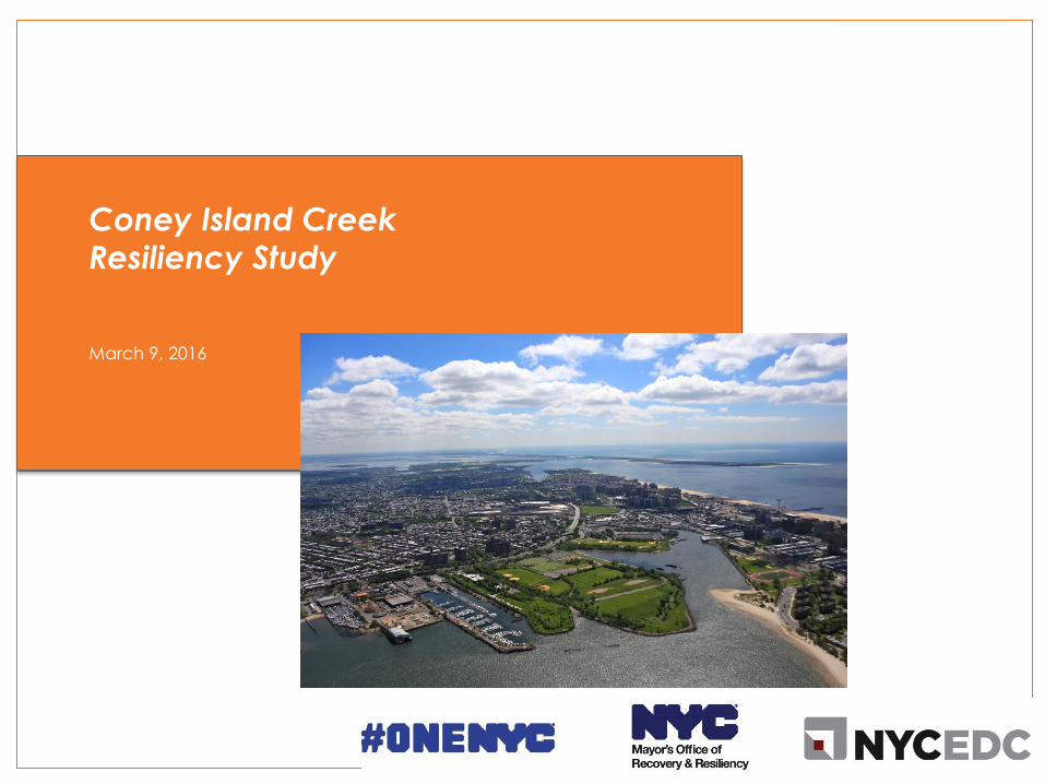
Our Just
and
Equitable
City
Our
Sustainable
City
Our
Resilient
City
OneNYC: Our Four Visions On April 22nd, Mayor Bill de Blasio released a new long-term strategic plan to
address our most pressing challenges and builds on prior efforts.
2
Our
Growing,
Thriving
City
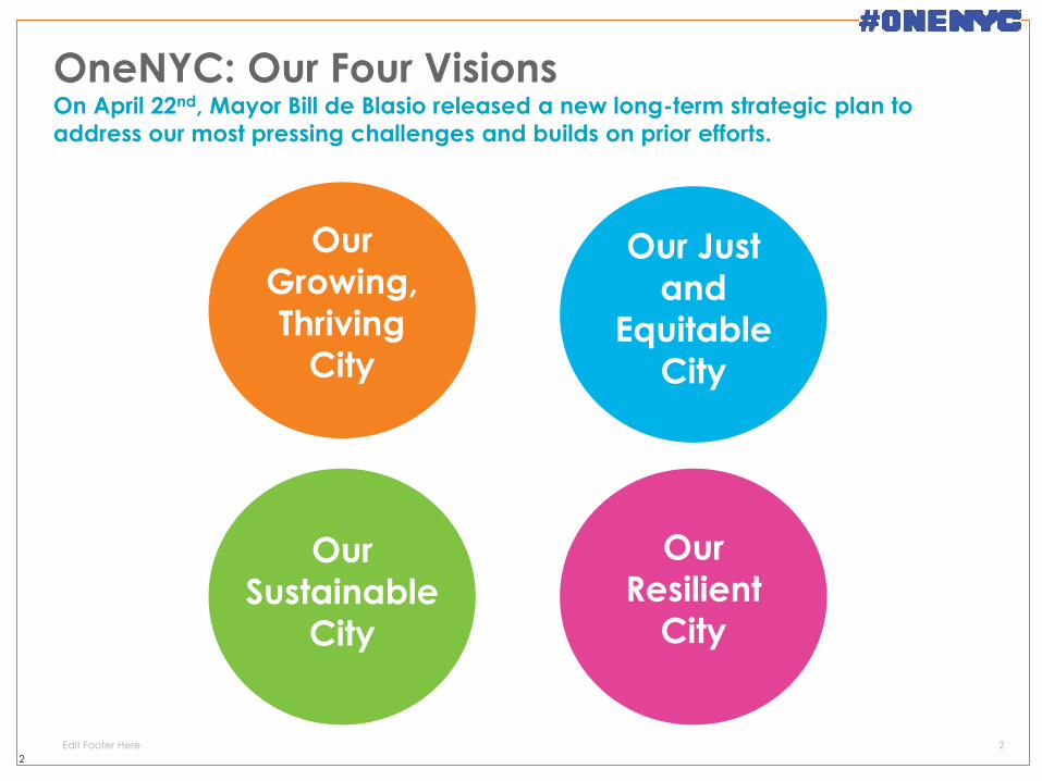
Neighborhoods Every city neighborhood will be safer by strengthening community, social, and economic resiliency
Buildings The city’s buildings will be upgraded against changing climate impacts
Infrastructure Infrastructure systems across the region will adapt to enable continue services
New York City’s coastal defenses will be strengthened
against flooding and sea level rise Coastal Defense
OneNYC: Our Resilient City This plan builds on existing efforts and strengthens and expands the City’s
commitment to a multilayered approach to resiliency.
3
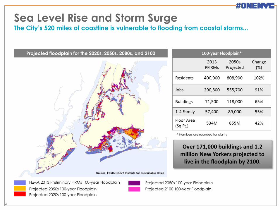
Source: FEMA; CUNY Institute for Sustainable Cities
Projected floodplain for the 2020s, 2050s, 2080s, and 2100
Sea Level Rise and Storm Surge The City’s 520 miles of coastline is vulnerable to flooding from coastal storms...
4
* Numbers are rounded for clarity
FEMA 2013 Preliminary FIRMs 100-year Floodplain
Projected 2020s 100-year Floodplain
Projected 2050s 100-year Floodplain
Projected 2080s 100-year Floodplain
Projected 2100 100-year Floodplain
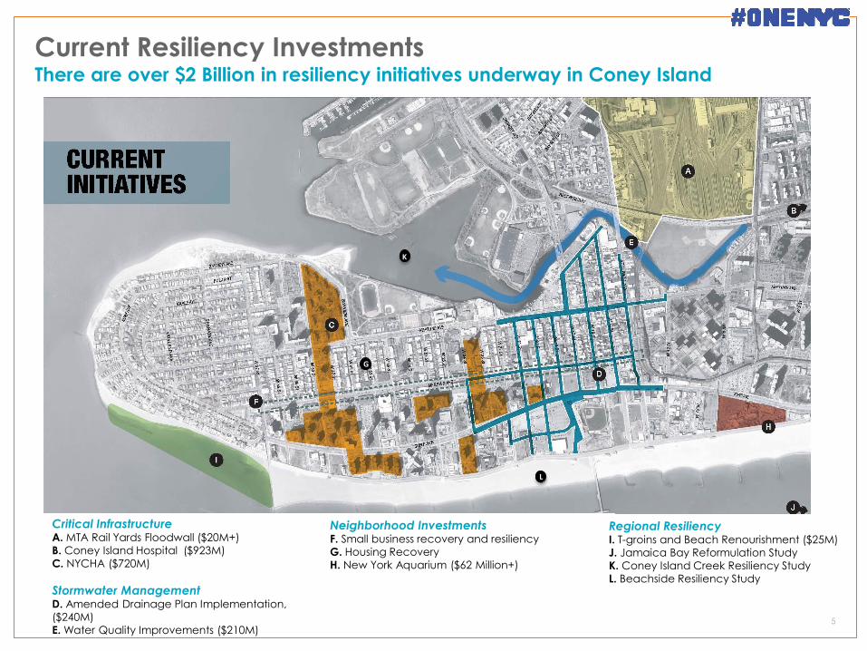
Current Resiliency Investments There are over $2 Billion in resiliency initiatives underway in Coney Island
5
Critical Infrastructure A. MTA Rail Yards Floodwall ($20M+)
B. Coney Island Hospital ($923M)
C. NYCHA ($720M)
Stormwater Management D. Amended Drainage Plan Implementation,
($240M)
E. Water Quality Improvements ($210M)
Neighborhood Investments F. Small business recovery and resiliency
G. Housing Recovery
H. New York Aquarium ($62 Million+)
Regional Resiliency I. T-groins and Beach Renourishment ($25M)
J. Jamaica Bay Reformulation Study
K. Coney Island Creek Resiliency Study L. Beachside Resiliency Study
G
K
L
Coney Island Creek Resiliency Study
A first step in a long-term strategy to protect the life, property,
and livelihoods of Coney Island & Gravesend communities
from the effects of storm surge and sea level rise.
A shared City-community agenda for resiliency grounded in
sound science and developed to USACE standards with a
goal of FEMA certification.
An opportunity to improve the ecology and water quality of
the Creek while strengthening the potential for community
resilience by enhancing public spaces.
A critical component of a comprehensive regional solution for
coastal flooding that extends from Jamaica Bay to the low-
lying areas of Gravesend Bay to Manhattan Beach.
6
What is this study?
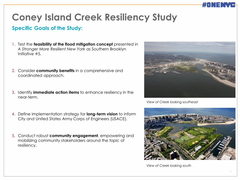
Coney Island Creek Resiliency Study
1. Test the feasibility of the flood mitigation concept presented in
A Stronger More Resilient New York as Southern Brooklyn
Initiative #5.
2. Consider community benefits in a comprehensive and
coordinated approach.
3. Identify immediate action items to enhance resiliency in the near-term.
4. Define implementation strategy for long-term vision to inform
City and United States Army Corps of Engineers (USACE).
5. Conduct robust community engagement, empowering and
mobilizing community stakeholders around the topic of
resiliency.
7
Specific Goals of the Study:
View of Creek looking southeast
View of Creek looking south
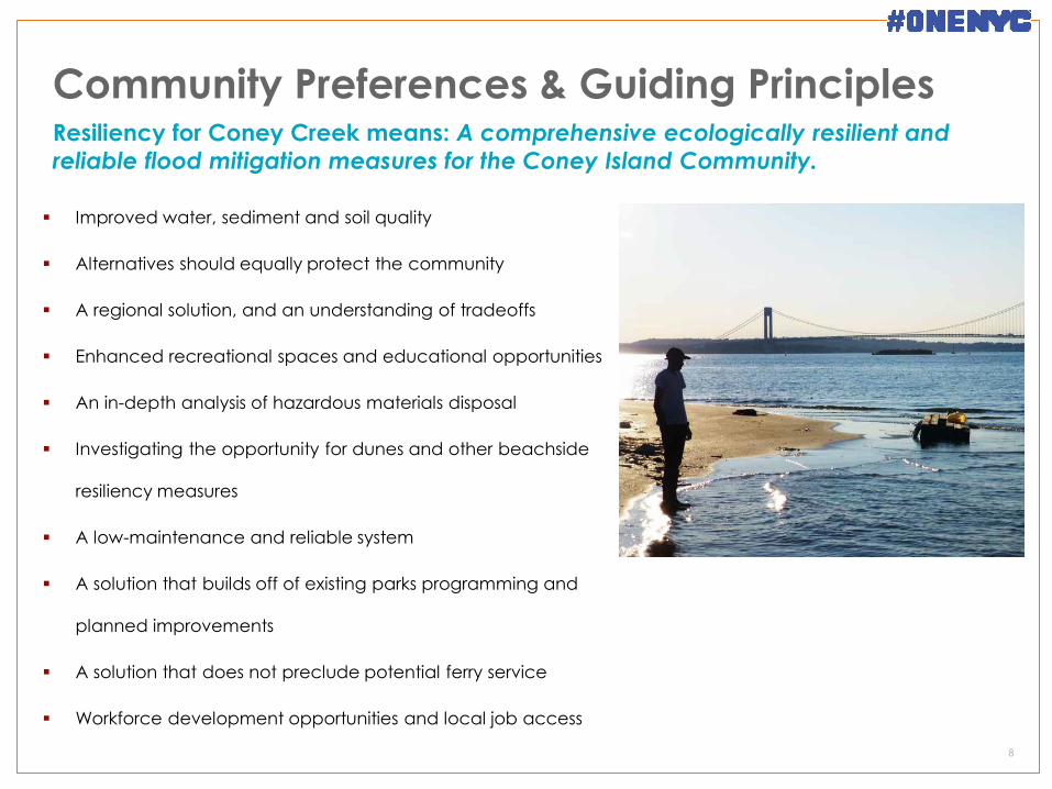
Community Preferences & Guiding Principles
Improved water, sediment and soil quality
Alternatives should equally protect the community
A regional solution, and an understanding of tradeoffs
Enhanced recreational spaces and educational opportunities
An in-depth analysis of hazardous materials disposal
Investigating the opportunity for dunes and other beachside
resiliency measures
A low-maintenance and reliable system
A solution that builds off of existing parks programming and
planned improvements
A solution that does not preclude potential ferry service
Workforce development opportunities and local job access
8
Resiliency for Coney Creek means: A comprehensive ecologically resilient and
reliable flood mitigation measures for the Coney Island Community.
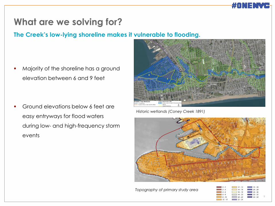
What are we solving for?
Majority of the shoreline has a ground
elevation between 6 and 9 feet
Ground elevations below 6 feet are
easy entryways for flood waters
during low- and high-frequency storm
events
9
The Creek’s low-lying shoreline makes it vulnerable to flooding.
Topography of primary study area
Historic wetlands (Coney Creek 1891)
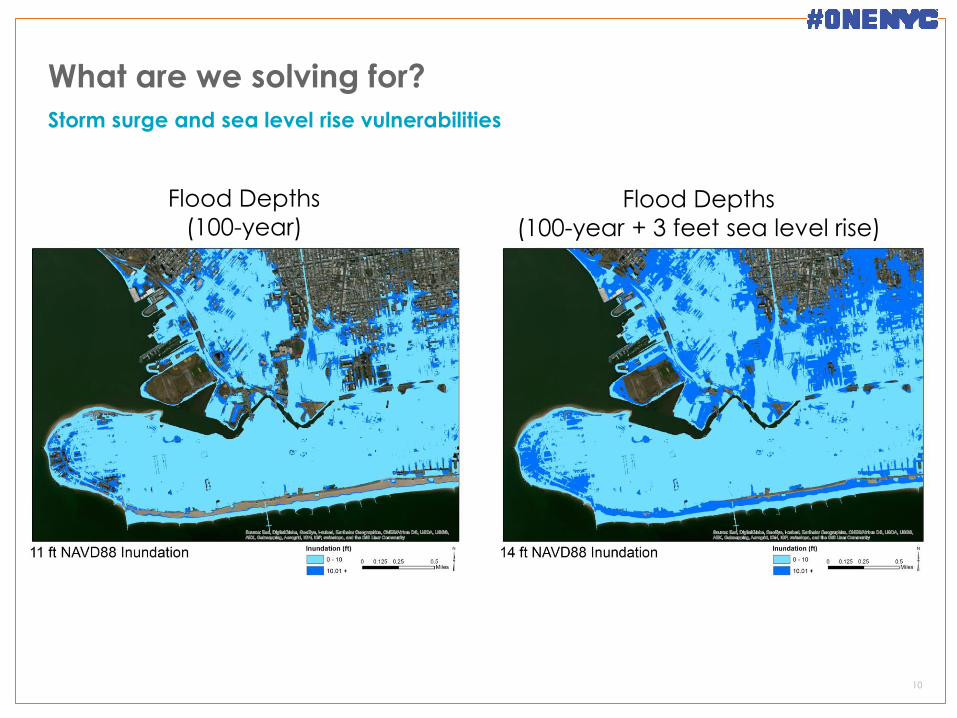
What are we solving for?
10
Storm surge and sea level rise vulnerabilities
Flood Depths
(100-year) Flood Depths
(100-year + 3 feet sea level rise)
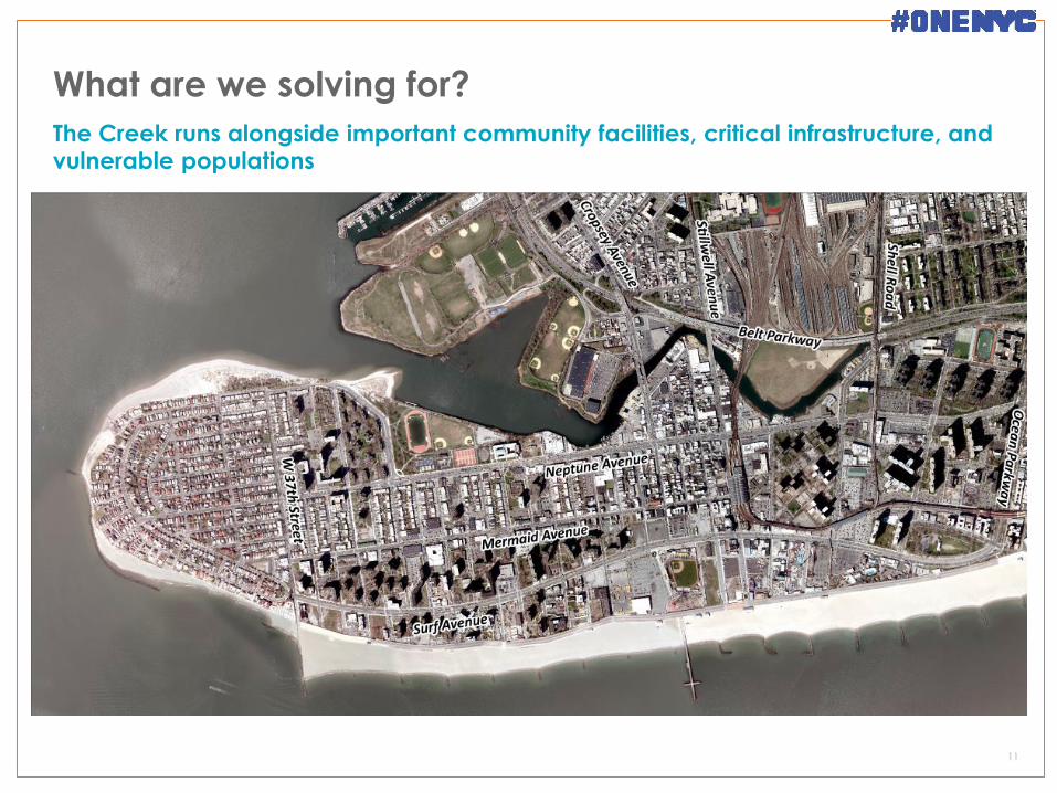
What are we solving for?
11
The Creek runs alongside important community facilities, critical infrastructure, and vulnerable populations
Topography of primary study area
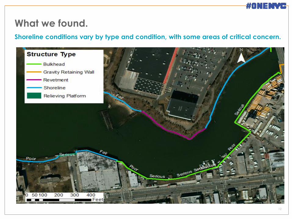
What we found.
12
Shoreline conditions vary by type and condition, with some areas of critical concern.
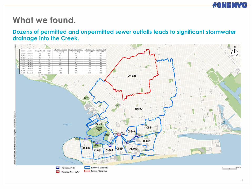
What we found.
13
Dozens of permitted and unpermitted sewer outfalls leads to significant stormwater drainage into the Creek.
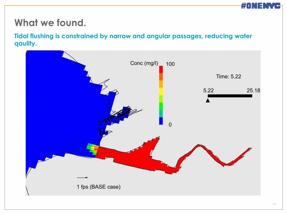
What we found.
14
Tidal flushing is constrained by narrow and angular passages, reducing water qaulity.
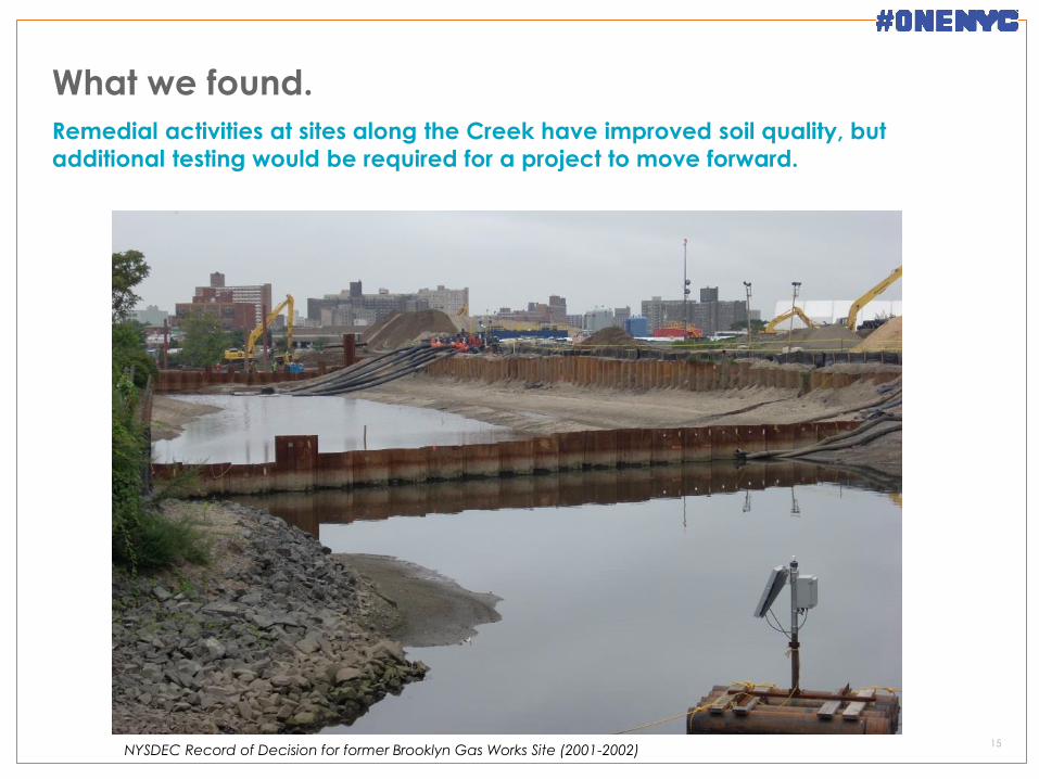
What we found.
15
Remedial activities at sites along the Creek have improved soil quality, but
additional testing would be required for a project to move forward.
NYSDEC Record of Decision for former Brooklyn Gas Works Site (2001-2002)
What we found.
16
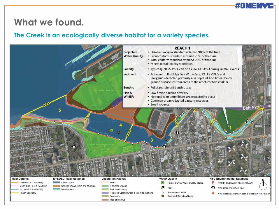
The Creek is an ecologically diverse habitat for a variety species.
NYSDEC Record of Decision for former Brooklyn Gas Works Site (2001-2002)
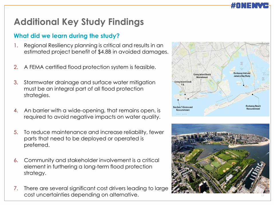
Additional Key Study Findings
1. Regional Resiliency planning is critical and results in an estimated project benefit of $4.8B in avoided damages.
2. A FEMA certified flood protection system is feasible.
3. Stormwater drainage and surface water mitigation must be an integral part of all flood protection strategies.
4. An barrier with a wide-opening, that remains open, is required to avoid negative impacts on water quality.
5. To reduce maintenance and increase reliability, fewer parts that need to be deployed or operated is preferred.
6. Community and stakeholder involvement is a critical element in furthering a long-term flood protection strategy.
7. There are several significant cost drivers leading to large
cost uncertainties depending on alternative.
17
What did we learn during the study?
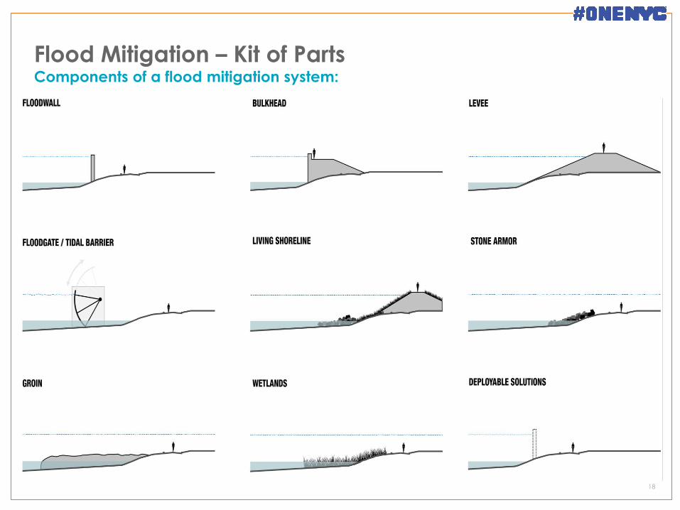
Flood Mitigation – Kit of Parts
18
Components of a flood mitigation system:
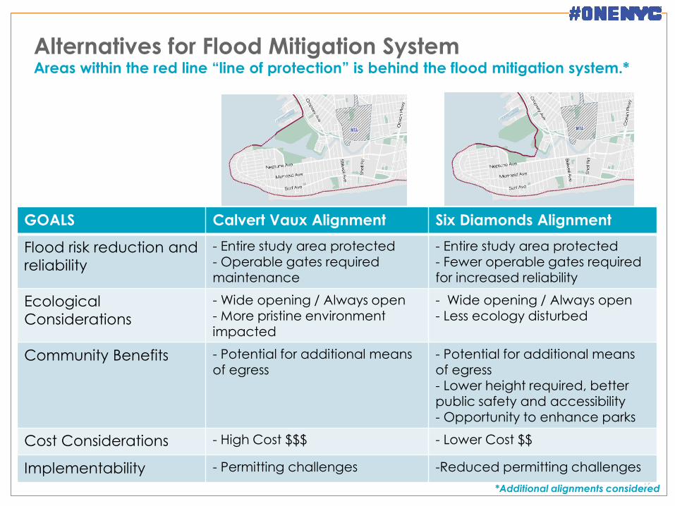
Alternatives for Flood Mitigation System
19
Areas within the red line “line of protection” is behind the flood mitigation system.*
GOALS Calvert Vaux Alignment Six Diamonds Alignment
Flood risk reduction and
reliability
- Entire study area protected - Operable gates required maintenance
- Entire study area protected - Fewer operable gates required for increased reliability
Ecological
Considerations
- Wide opening / Always open
- More pristine environment impacted
- Wide opening / Always open
- Less ecology disturbed
Community Benefits - Potential for additional means of egress
- Potential for additional means of egress - Lower height required, better public safety and accessibility
- Opportunity to enhance parks
Cost Considerations - High Cost $$$ - Lower Cost $$
Implementability - Permitting challenges -Reduced permitting challenges
*Additional alignments considered
Flood Mitigation
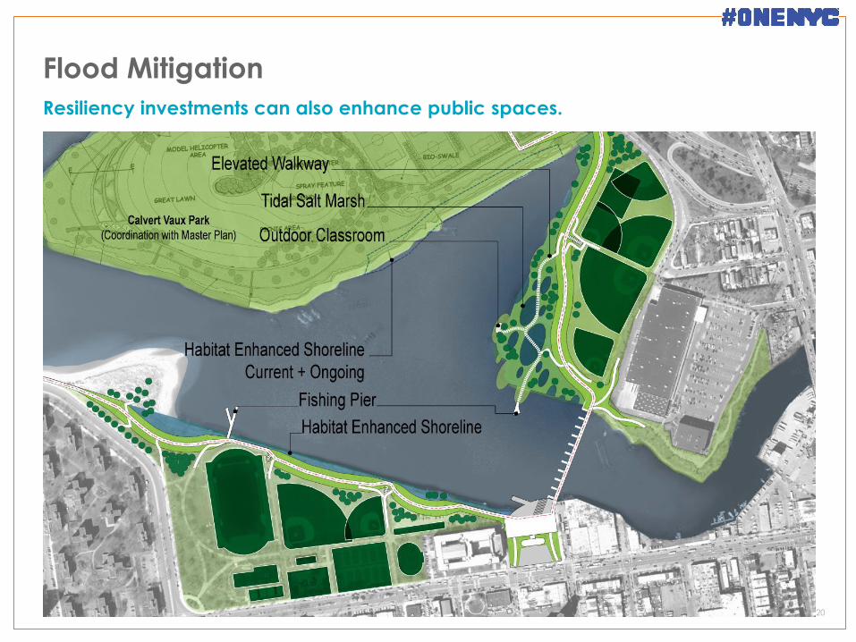
20
Resiliency investments can also enhance public spaces.
Flood Mitigation
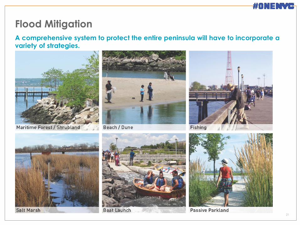
21
A comprehensive system to protect the entire peninsula will have to incorporate a variety of strategies.
Flood Mitigation
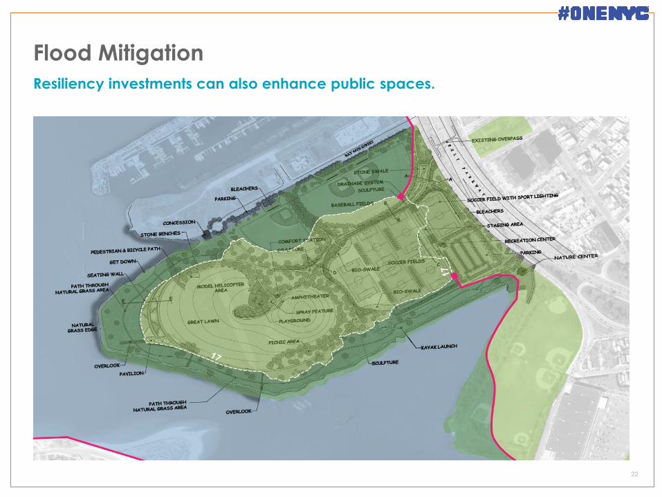
22
Resiliency investments can also enhance public spaces.
Flood Mitigation
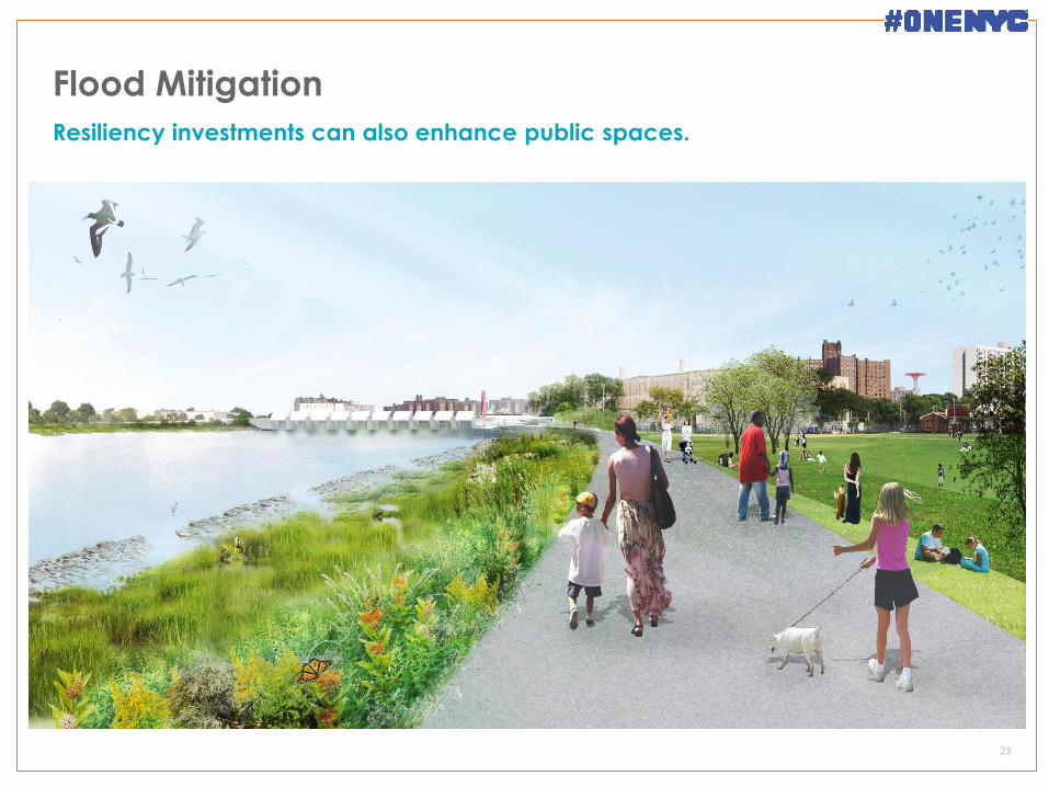
23
Resiliency investments can also enhance public spaces.
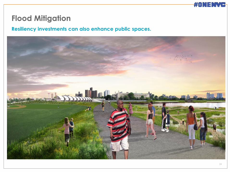
Flood Mitigation
24
Resiliency investments can also enhance public spaces.
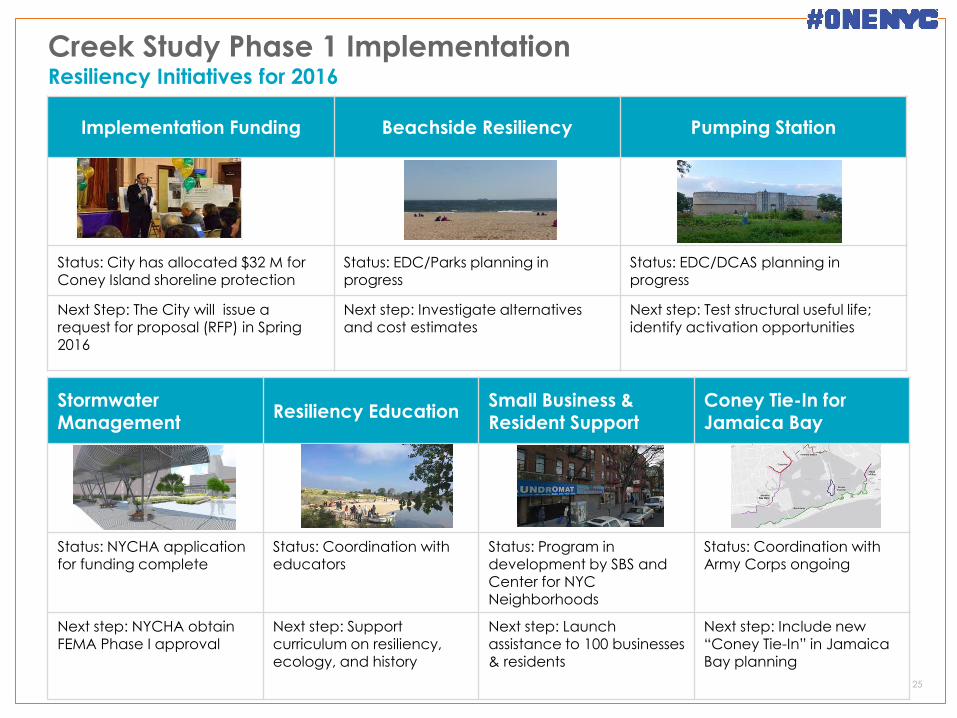
Stormwater Management
Resiliency Education Small Business & Resident Support
Coney Tie-In for Jamaica Bay
Status: NYCHA application for funding complete
Status: Coordination with educators
Status: Program in development by SBS and Center for NYC Neighborhoods
Status: Coordination with Army Corps ongoing
Next step: NYCHA obtain FEMA Phase I approval
Next step: Support curriculum on resiliency,
ecology, and history
Next step: Launch assistance to 100 businesses
& residents
Next step: Include new “Coney Tie-In” in Jamaica
Bay planning
Creek Study Phase 1 Implementation Resiliency Initiatives for 2016
25
Implementation Funding Beachside Resiliency Pumping Station
Status: City has allocated $32 M for Coney Island shoreline protection
Status: EDC/Parks planning in progress
Status: EDC/DCAS planning in progress
Next Step: The City will issue a request for proposal (RFP) in Spring 2016
Next step: Investigate alternatives and cost estimates
Next step: Test structural useful life; identify activation opportunities
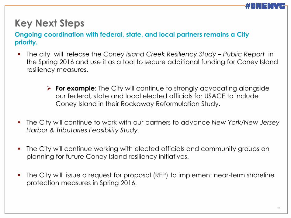
Key Next Steps
26
Ongoing coordination with federal, state, and local partners remains a City
priority.
The city will release the Coney Island Creek Resiliency Study – Public Report in
the Spring 2016 and use it as a tool to secure additional funding for Coney Island
resiliency measures.
For example: The City will continue to strongly advocating alongside our federal, state and local elected officials for USACE to include
Coney Island in their Rockaway Reformulation Study.
The City will continue to work with our partners to advance New York/New Jersey
Harbor & Tributaries Feasibility Study.
The City will continue working with elected officials and community groups on
planning for future Coney Island resiliency initiatives.
The City will issue a request for proposal (RFP) to implement near-term shoreline
protection measures in Spring 2016.