Communicating with Story Maps - Joseph Kerski · Communicating with Story Maps Joseph Kerski, ......
83
Communicating with Story Maps Joseph Kerski, PhD GISP [email protected] Twitter: http://josephkerski.com/twitter YouTube: http://www.youtube.com/geographyuberalles Story Maps: Multimedia Map Based Communication Tools
Transcript of Communicating with Story Maps - Joseph Kerski · Communicating with Story Maps Joseph Kerski, ......

Communicating with Story Maps
Joseph Kerski, PhD GISP [email protected]
Twitter: http://josephkerski.com/twitter
YouTube: http://www.youtube.com/geographyuberalles
Story Maps: Multimedia Map Based Communication Tools

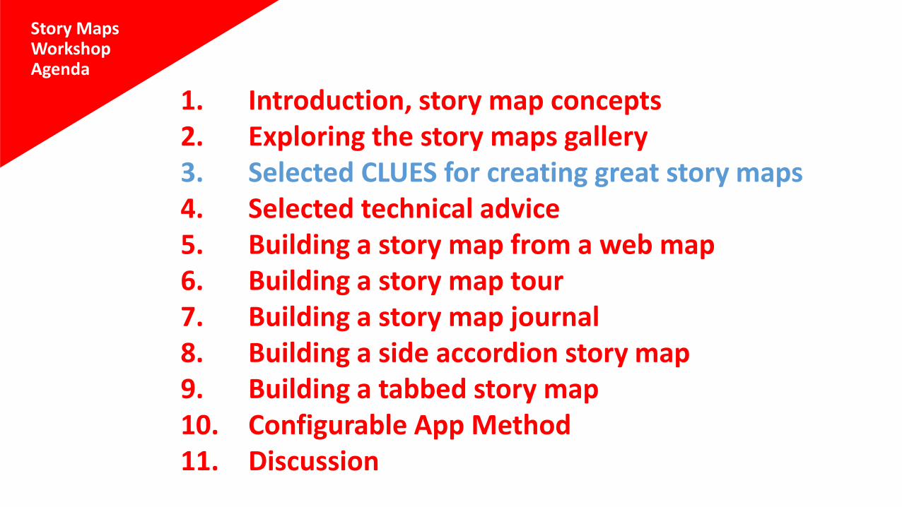
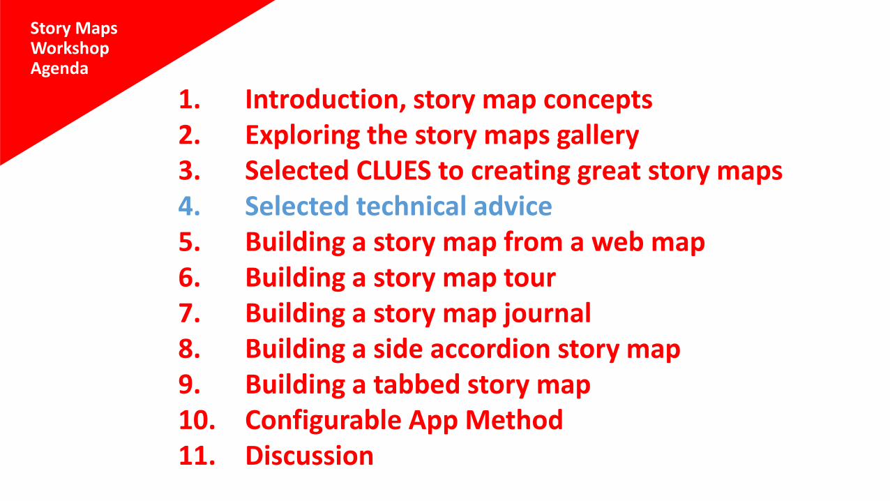
Story MapsWorkshopAgenda
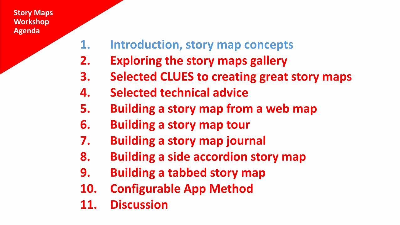
1. Introduction, story map concepts2. Exploring the story maps gallery3. Selected CLUES to creating great story maps4. Selected technical advice5. Building a story map from a web map6. Building a story map tour7. Building a story map journal8. Building a side accordion story map9. Building a tabbed story map10. Configurable App Method11. Discussion
1
Introduction and story map concepts
It’s the story…
Story Maps are simple web apps that combine interactive maps,
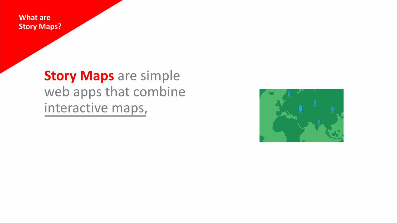
What areStory Maps?
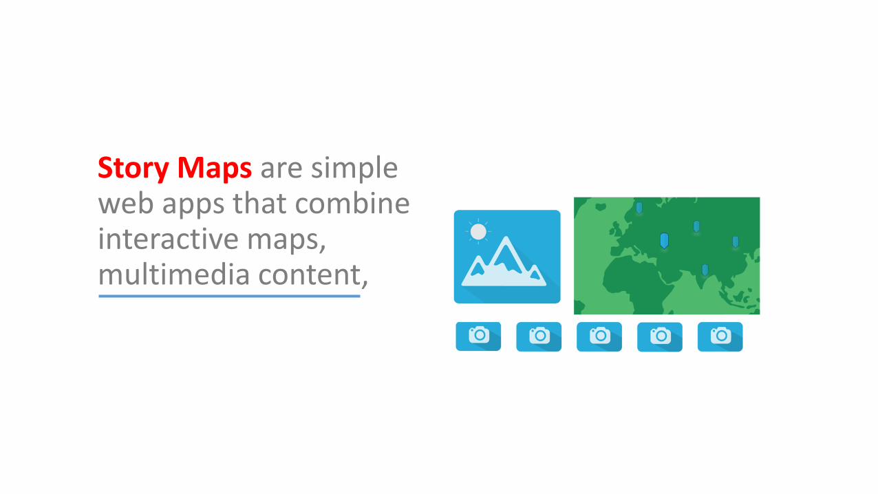
Story Maps are simple web apps that combine interactive maps, multimedia content,
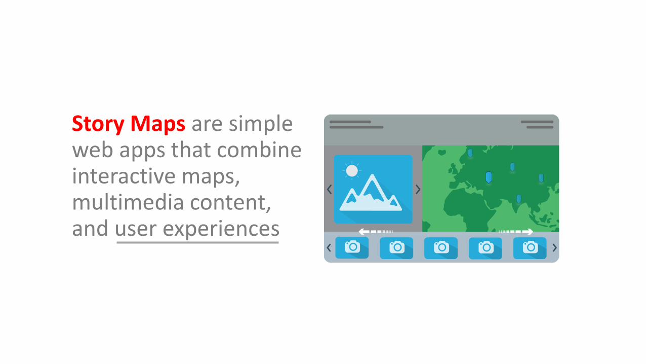
Story Maps are simple web apps that combine interactive maps, multimedia content, and user experiences
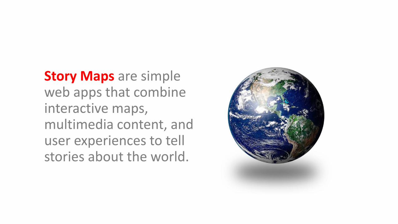
Story Maps are simple web apps that combine interactive maps, multimedia content, and user experiences to tell stories about the world.

Story Maps are hosted by Esri in the cloud. (But you can opt to host them yourself.)
Story Maps incorporate builder functions that enable you to build a sophisticated story with no GIS or web development skills.
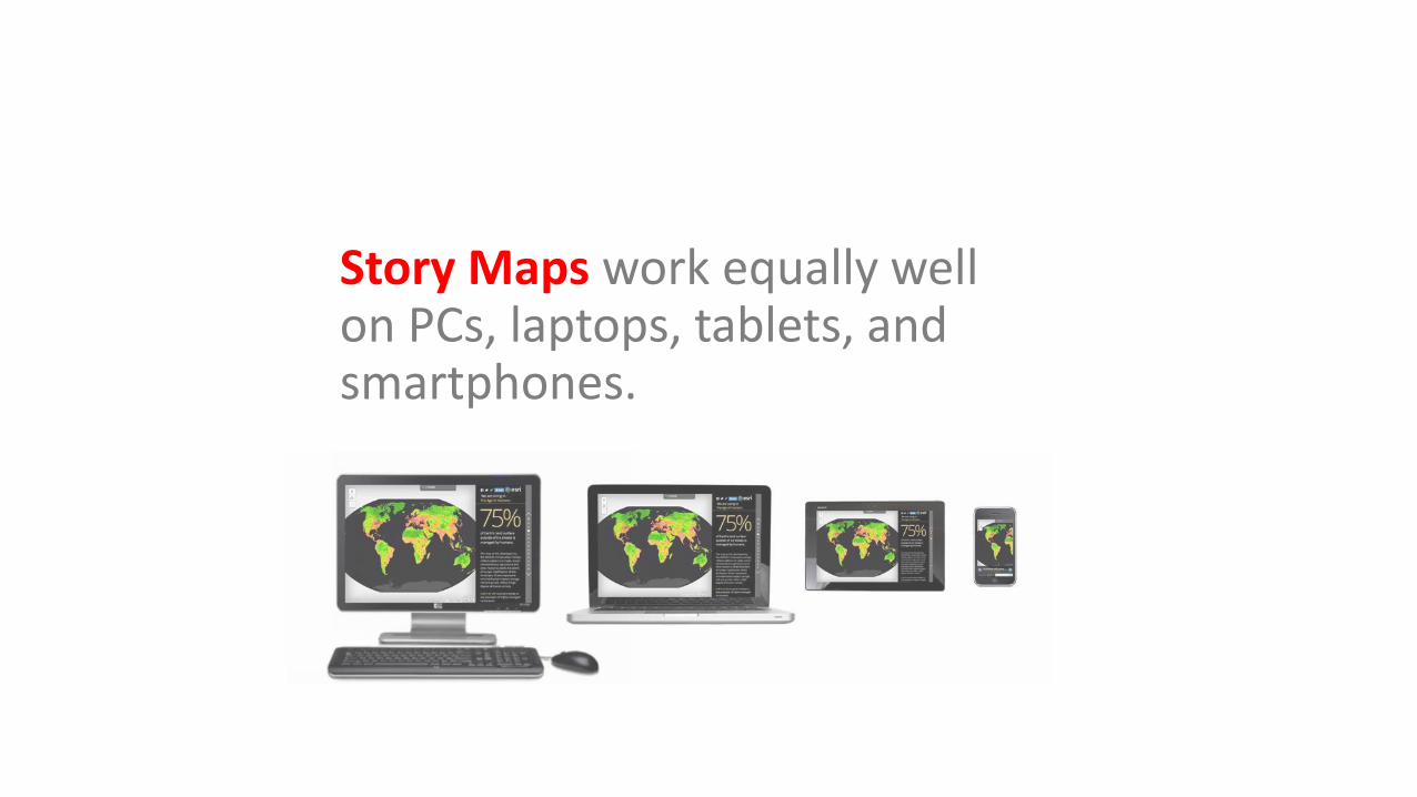
Story Maps work equally well on PCs, laptops, tablets, and smartphones.
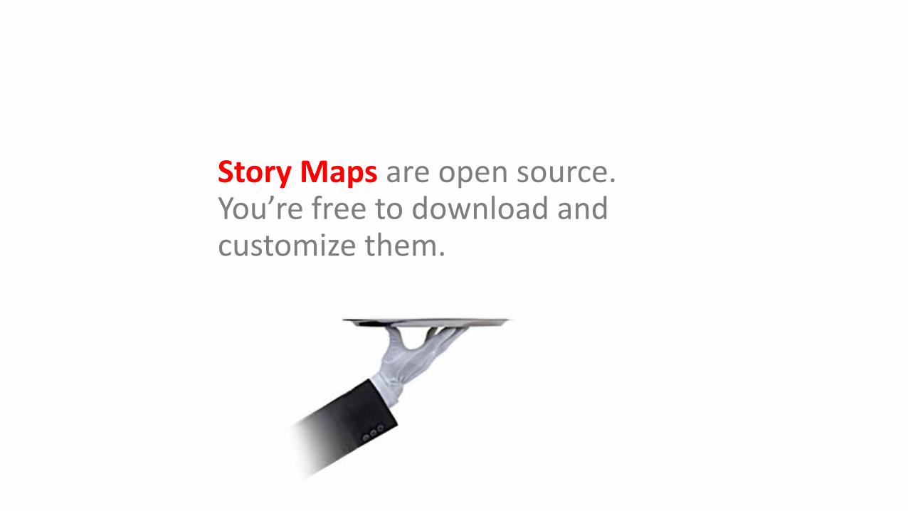
Story Maps are open source. You’re free to download and customize them.
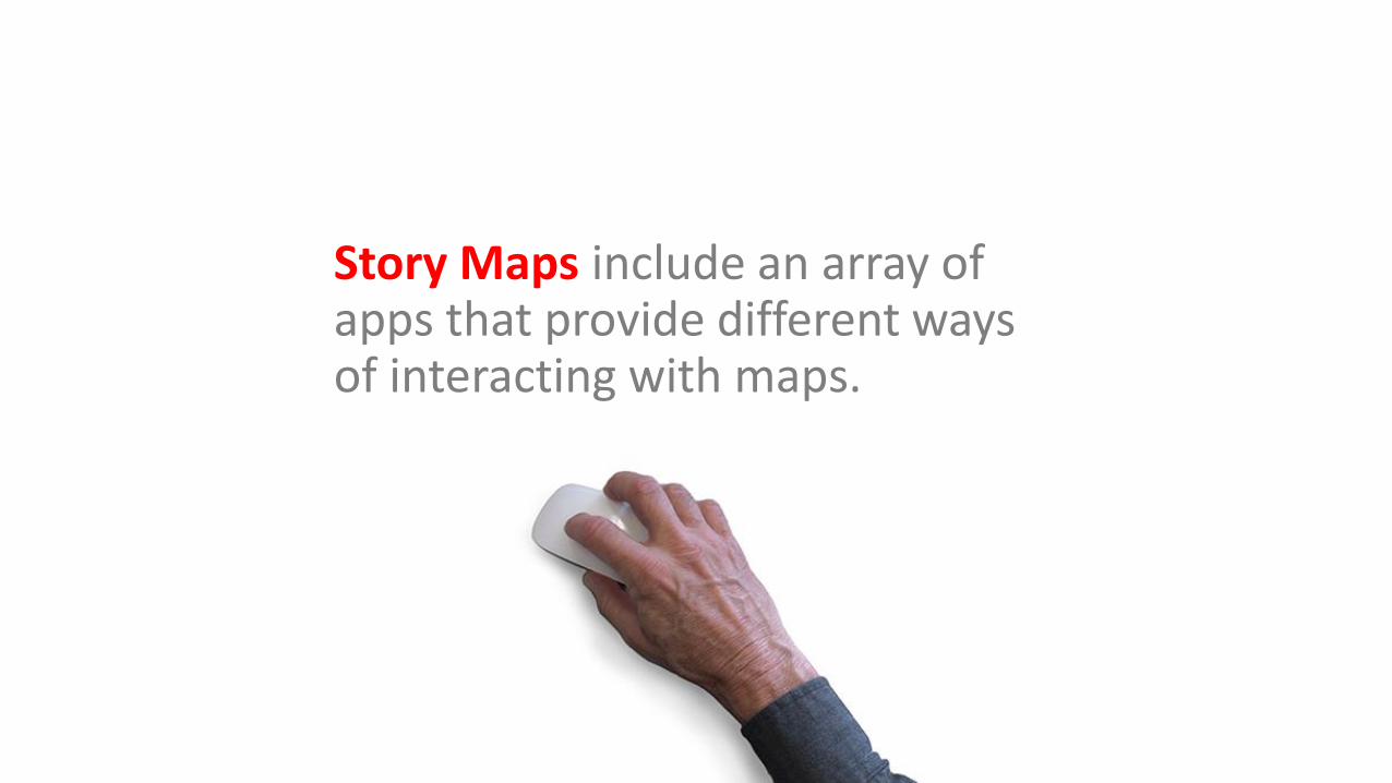
Story Maps include an array of apps that provide different ways of interacting with maps.
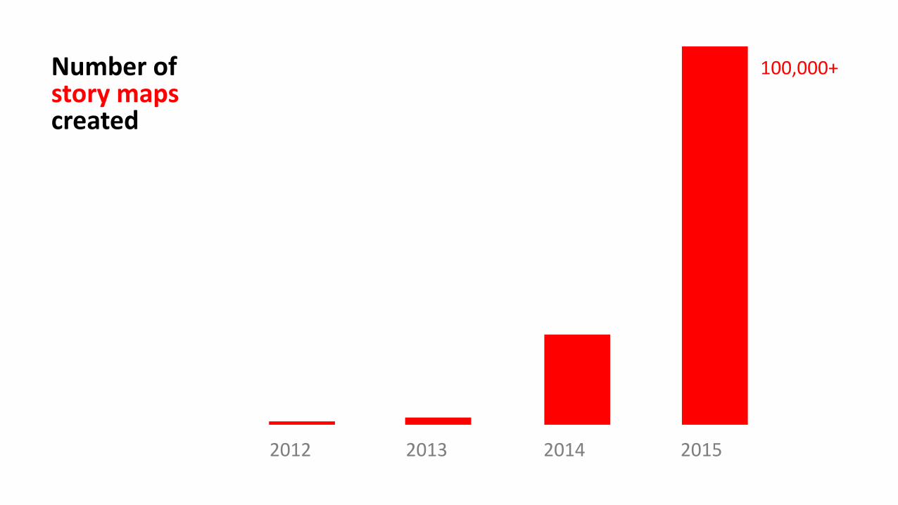
Number ofstory maps created
2012 2013 2014 2015
100,000+
• One of the huge advantages of Story Maps is the low entry barrier. You don't need to be a GIS specialist or a web developer to create a Story Map.
Why story maps?
— Maps Mania Blog
Ourapps
Sequential narratives• Story Map Tour
• Story Map Journal
Ourapps
Sequential narratives• Story Map Tour
• Story Map Journal

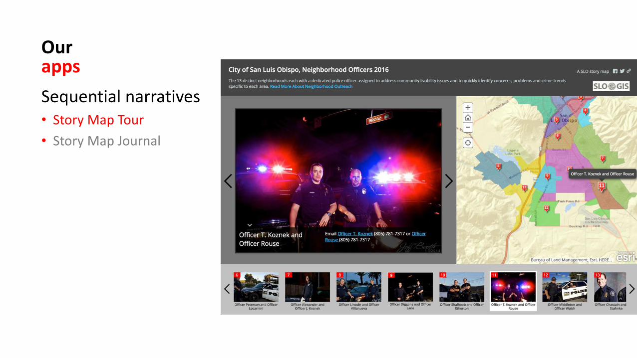
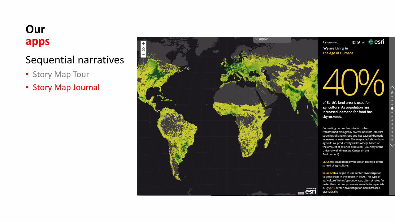
Ourapps
Sequential narratives• Story Map Tour
• Story Map Journal
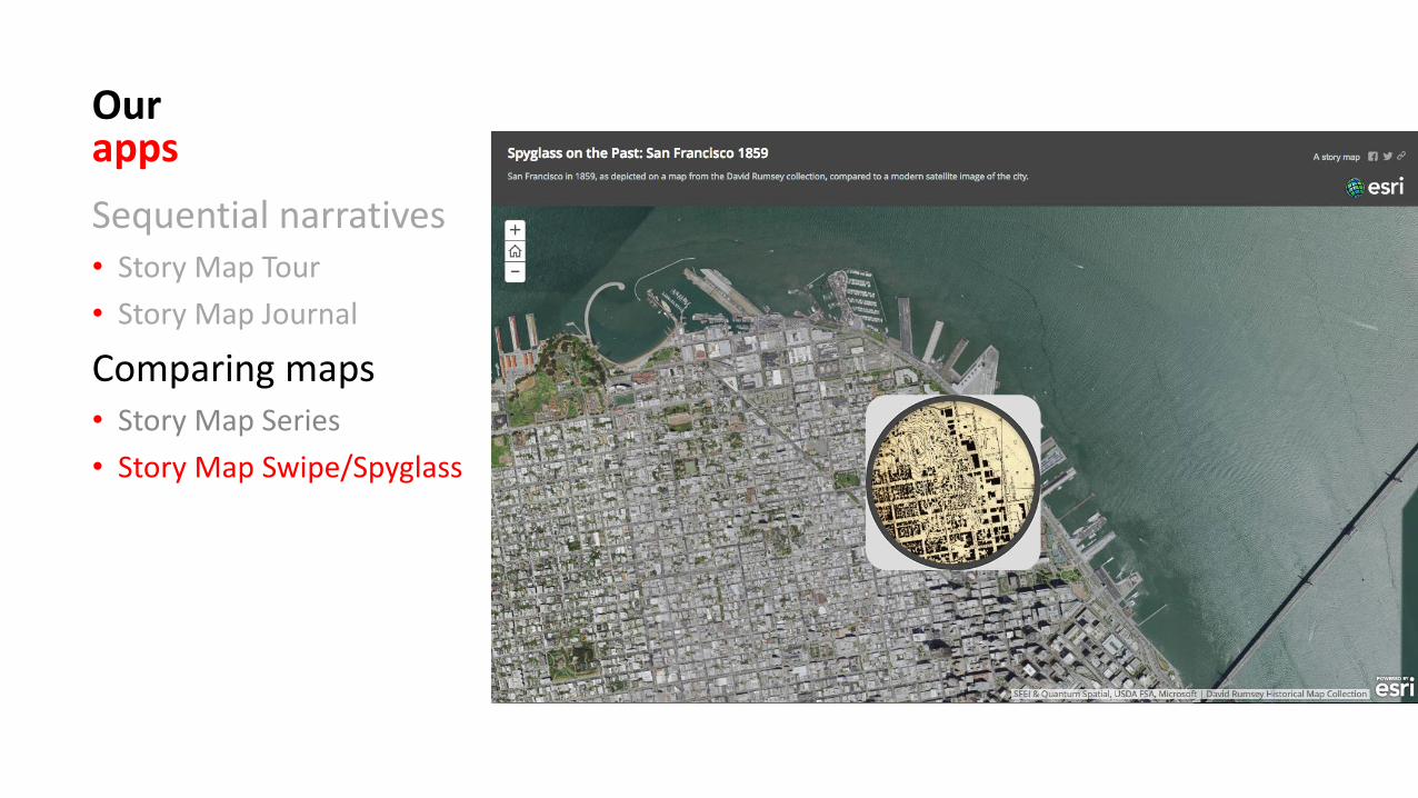
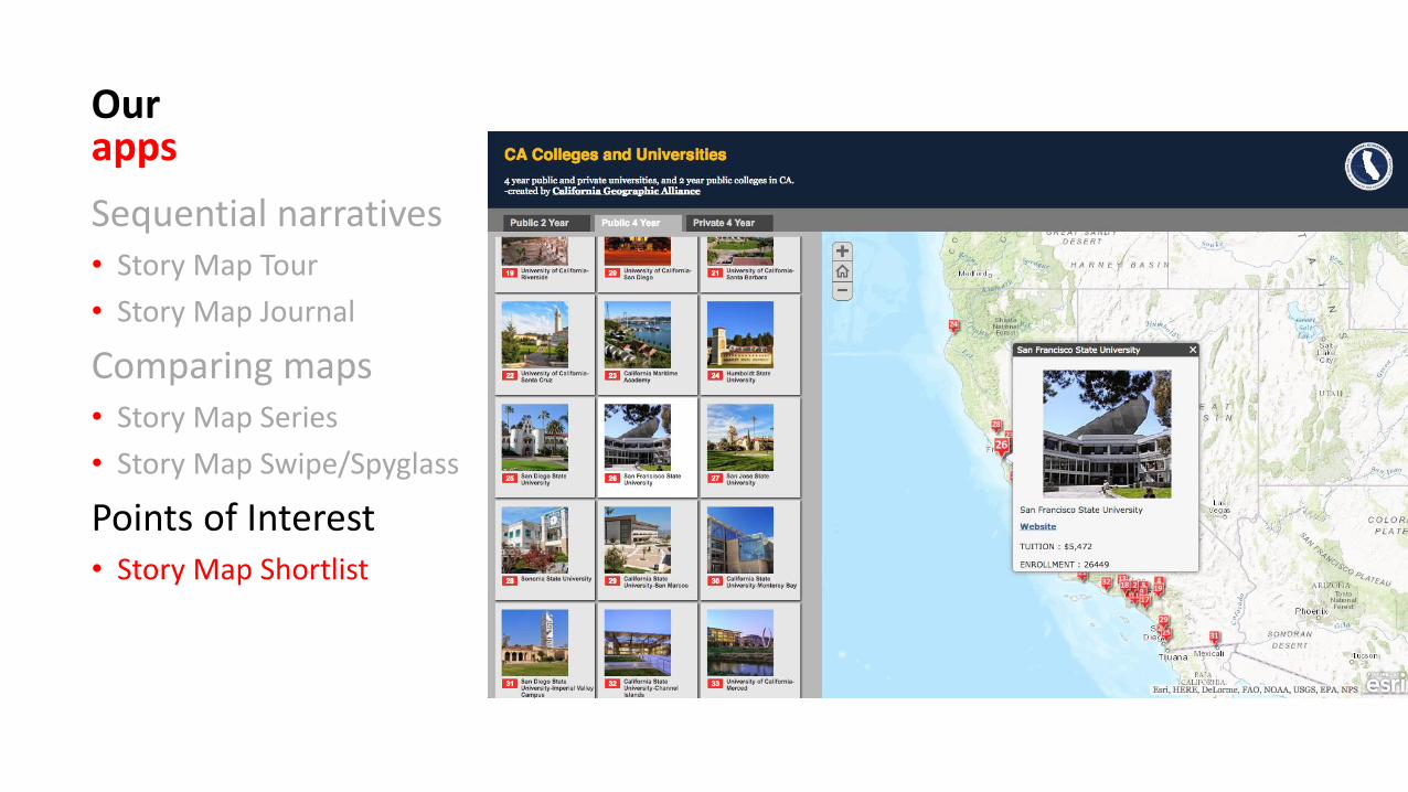
Comparing maps• Story Map Series
• Story Map Swipe/Spyglass
Ourapps
Sequential narratives• Story Map Tour
• Story Map Journal
Comparing maps• Story Map Series
• Story Map Swipe/Spyglass
Ourapps
Sequential narratives• Story Map Tour
• Story Map Journal
Comparing maps• Story Map Series
• Story Map Swipe/Spyglass
Points of Interest• Story Map Shortlist
Ourapps
Sequential narratives• Story Map Tour
• Story Map Journal
Comparing maps• Story Map Series
• Story Map Swipe/Spyglass
Points of Interest• Story Map Shortlist
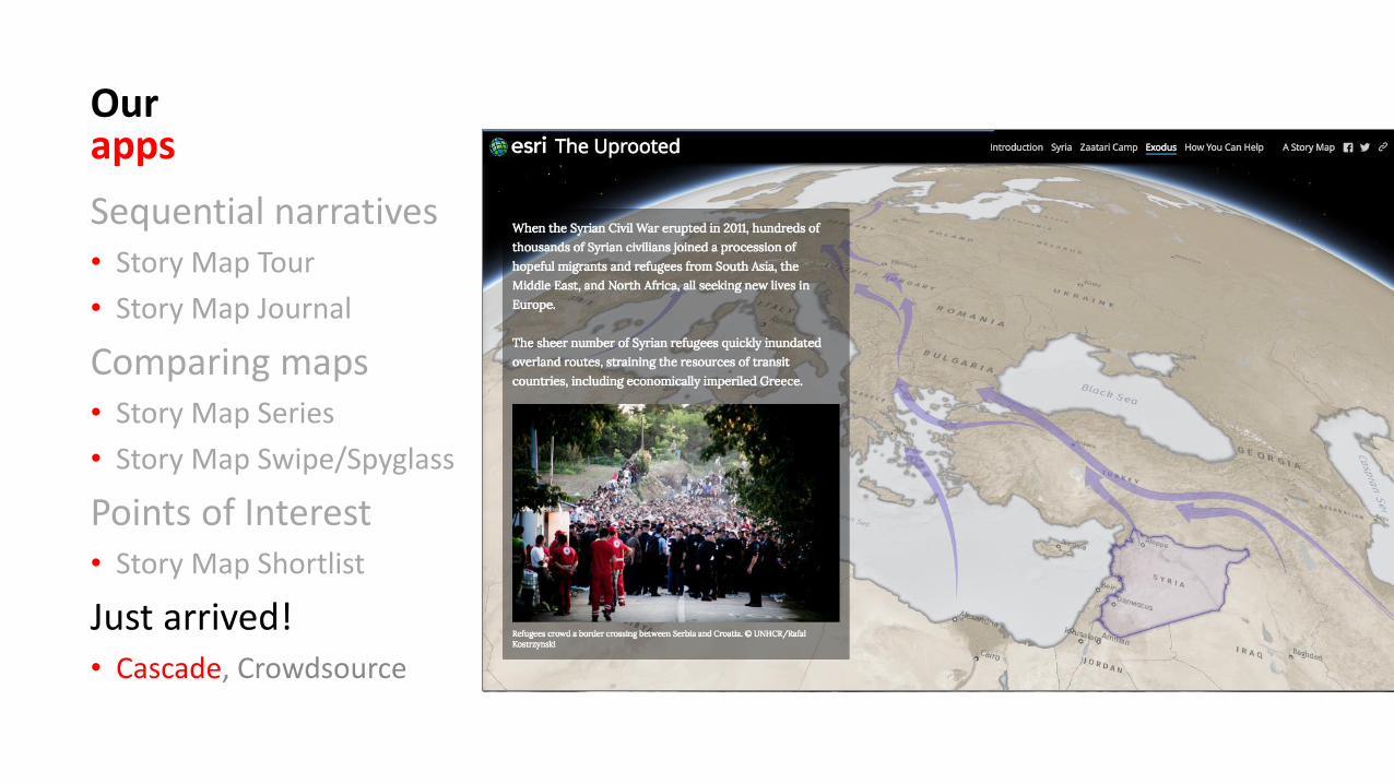
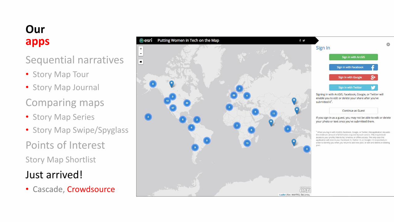
Just arrived!• Cascade, Crowdsource
Ourapps
Sequential narratives• Story Map Tour
• Story Map Journal
Comparing maps• Story Map Series
• Story Map Swipe/Spyglass
Points of InterestStory Map Shortlist
Just arrived!• Cascade, Crowdsource
Story MapsWorkshopAgenda
1. Introduction, story map concepts2. Exploring the story maps gallery3. Selected CLUES to creating great story maps4. Selected technical advice5. Building a story map from a web map6. Building a story map tour7. Building a story map journal8. Building a side accordion story map9. Building a tabbed story map10. Configurable App Method11. Discussion
2
Exploring theStory Maps galleryAn online interactive library.
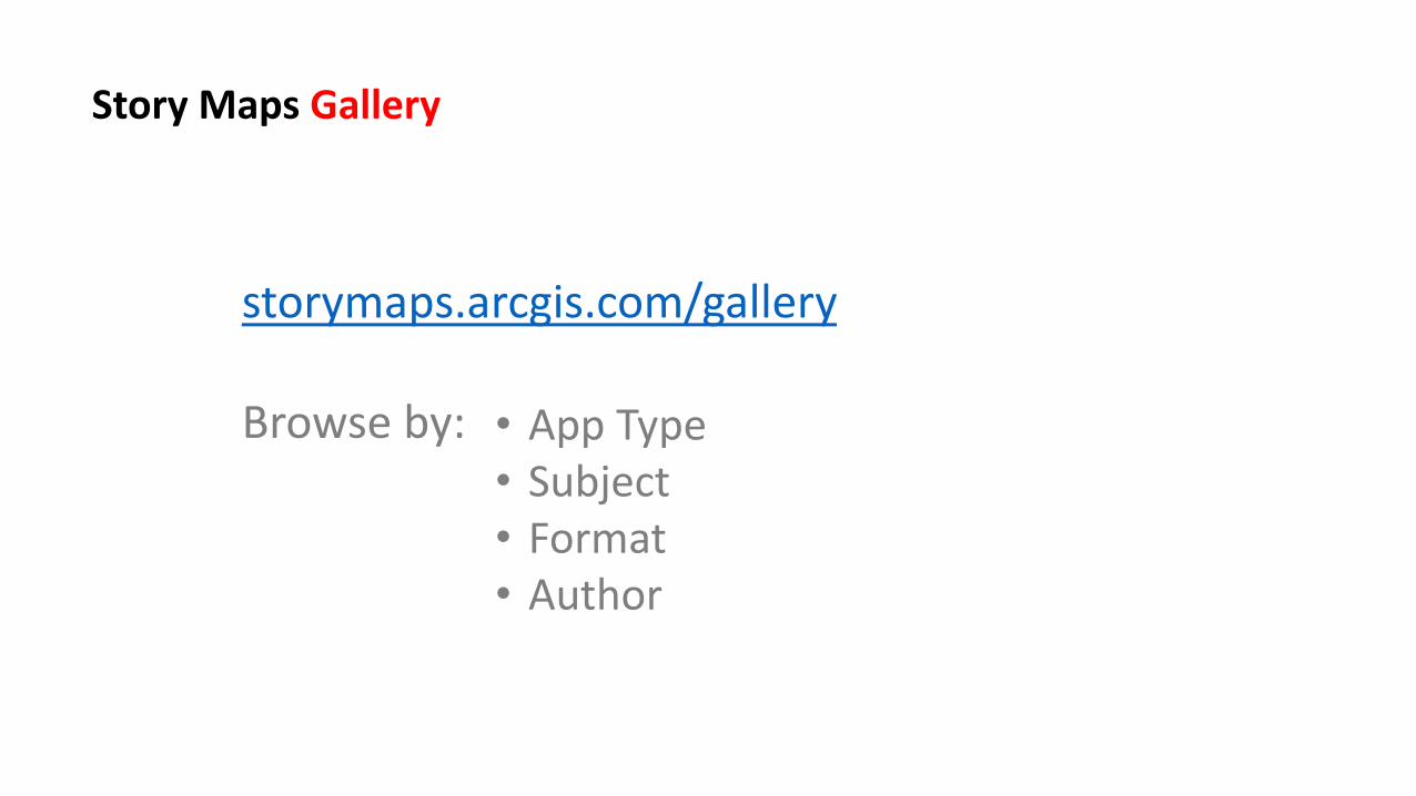
storymaps.arcgis.com/gallery
Browse by:
Story Maps Gallery
• App Type• Subject• Format• Author
Spend 4 minutes to find a story map that is interesting and/or one that you might be able to use in your own instruction or research.
Be prepared to share with the class.
Activity
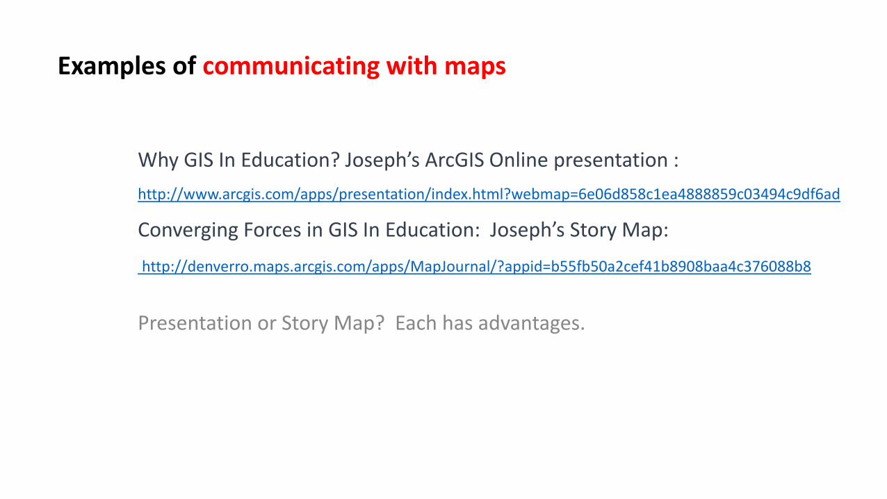
Why GIS In Education? Joseph’s ArcGIS Online presentation :
http://www.arcgis.com/apps/presentation/index.html?webmap=6e06d858c1ea4888859c03494c9df6ad
Converging Forces in GIS In Education: Joseph’s Story Map:
http://denverro.maps.arcgis.com/apps/MapJournal/?appid=b55fb50a2cef41b8908baa4c376088b8
Presentation or Story Map? Each has advantages.
Examples of communicating with maps
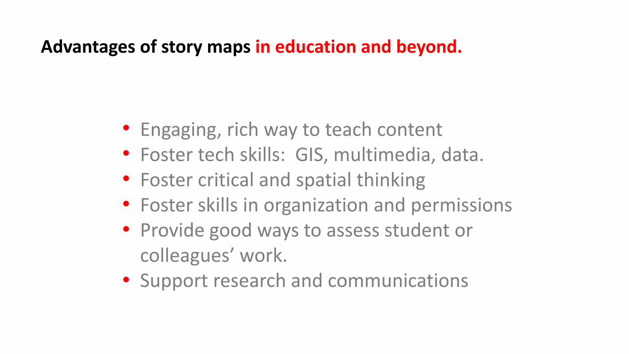
Engaging, rich way to teach contentFoster tech skills: GIS, multimedia, data.Foster critical and spatial thinkingFoster skills in organization and permissionsProvide good ways to assess student or colleagues’ work.Support research and communications
Advantages of story maps in education and beyond.
•
•
•
•
•
•
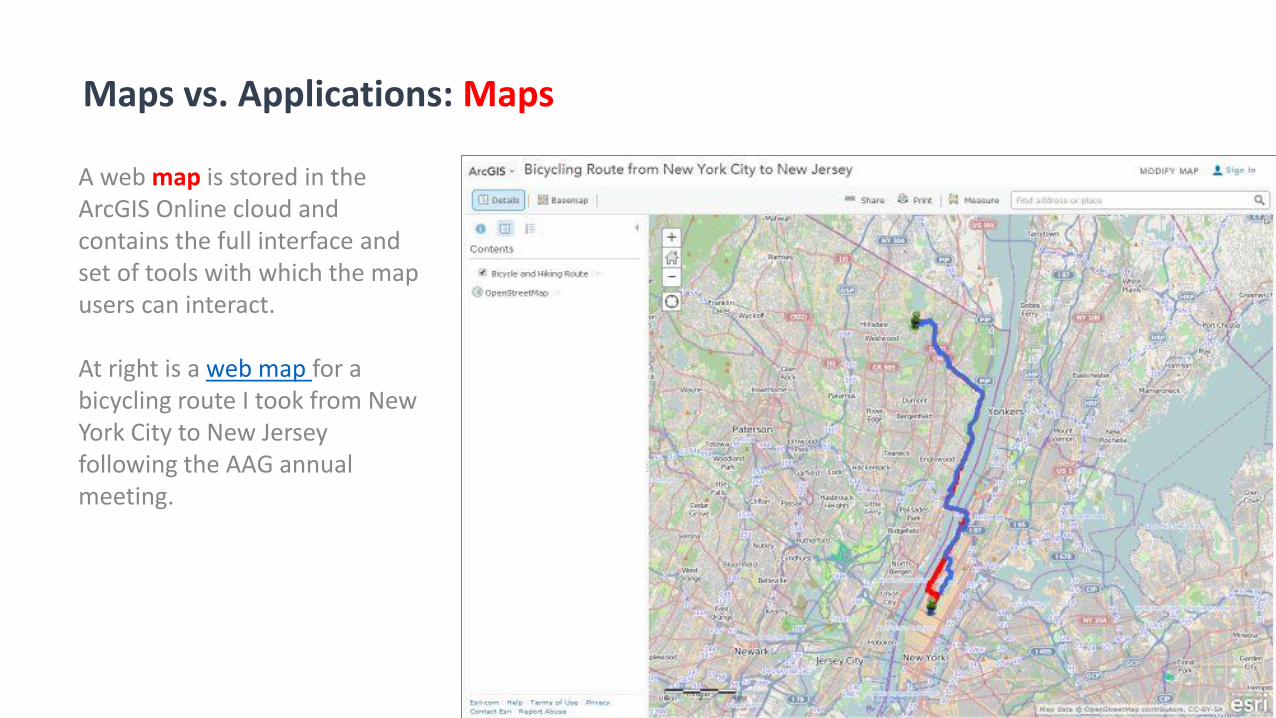
A web map is stored in the ArcGIS Online cloud and contains the full interface and set of tools with which the map users can interact.
At right is a web map for a bicycling route I took from New York City to New Jersey following the AAG annual meeting.
Maps vs. Applications: Maps
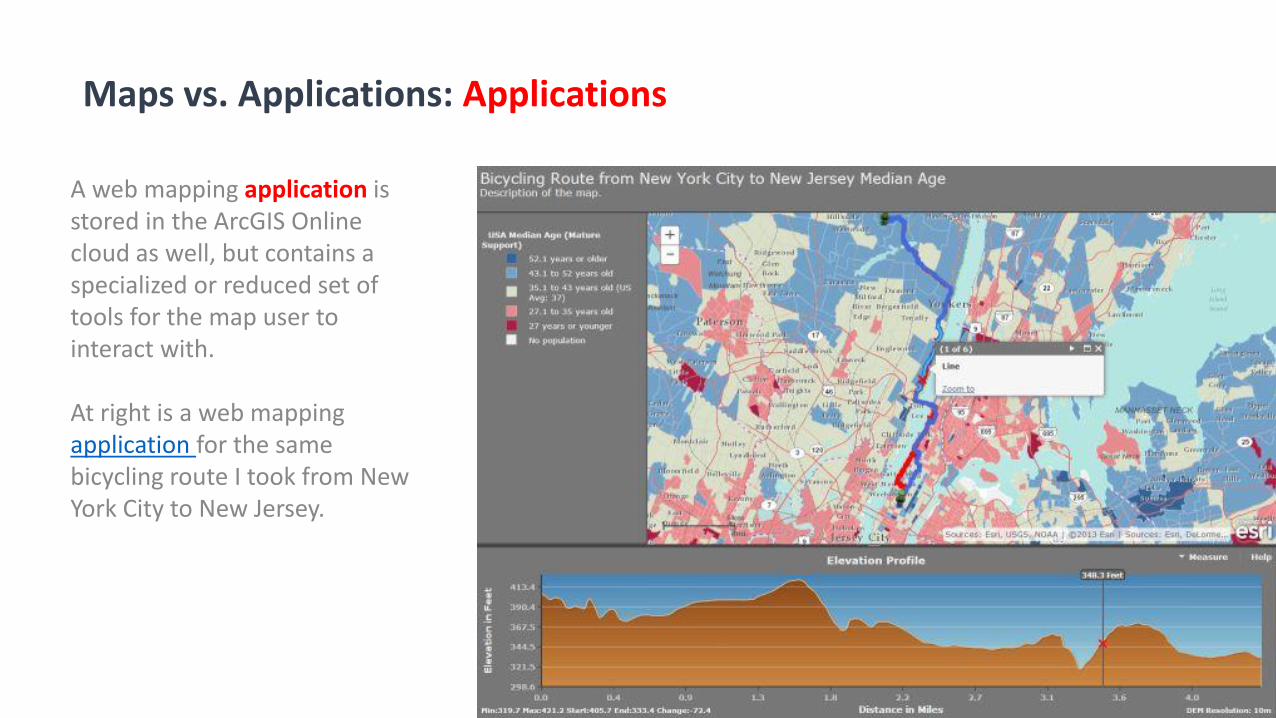
A web mapping application is stored in the ArcGIS Online cloud as well, but contains a specialized or reduced set of tools for the map user to interact with.
At right is a web mapping application for the same bicycling route I took from New York City to New Jersey.
Maps vs. Applications: Applications
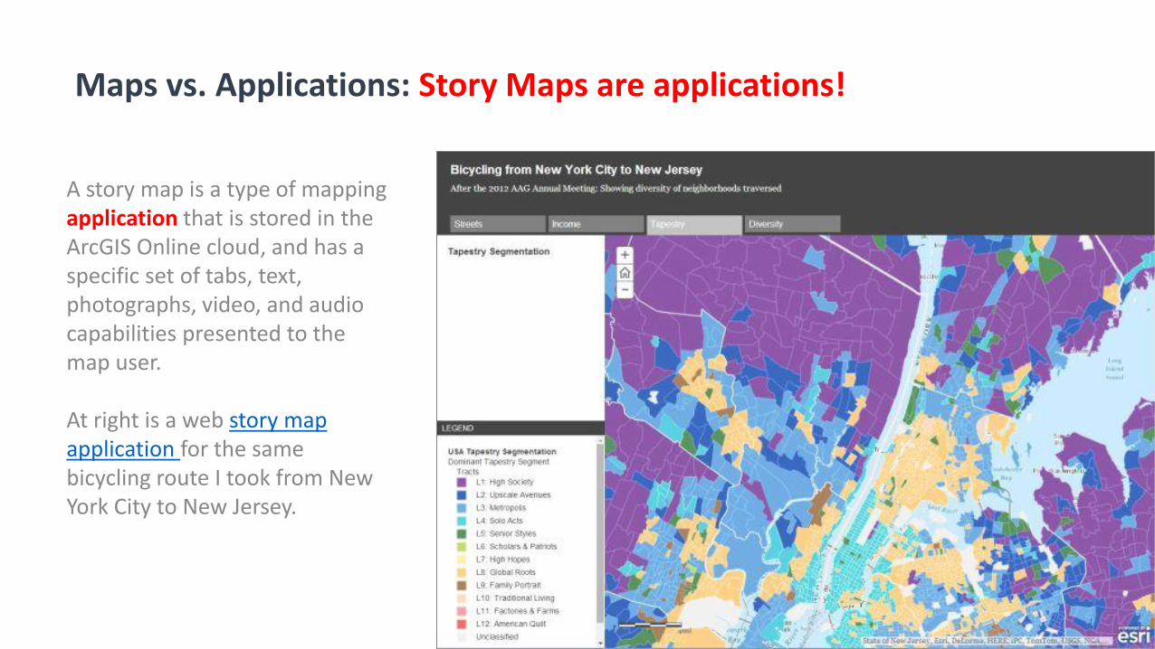
A story map is a type of mapping application that is stored in the ArcGIS Online cloud, and has a specific set of tabs, text, photographs, video, and audio capabilities presented to the map user.
At right is a web story map application for the same bicycling route I took from New York City to New Jersey.
Maps vs. Applications: Story Maps are applications!
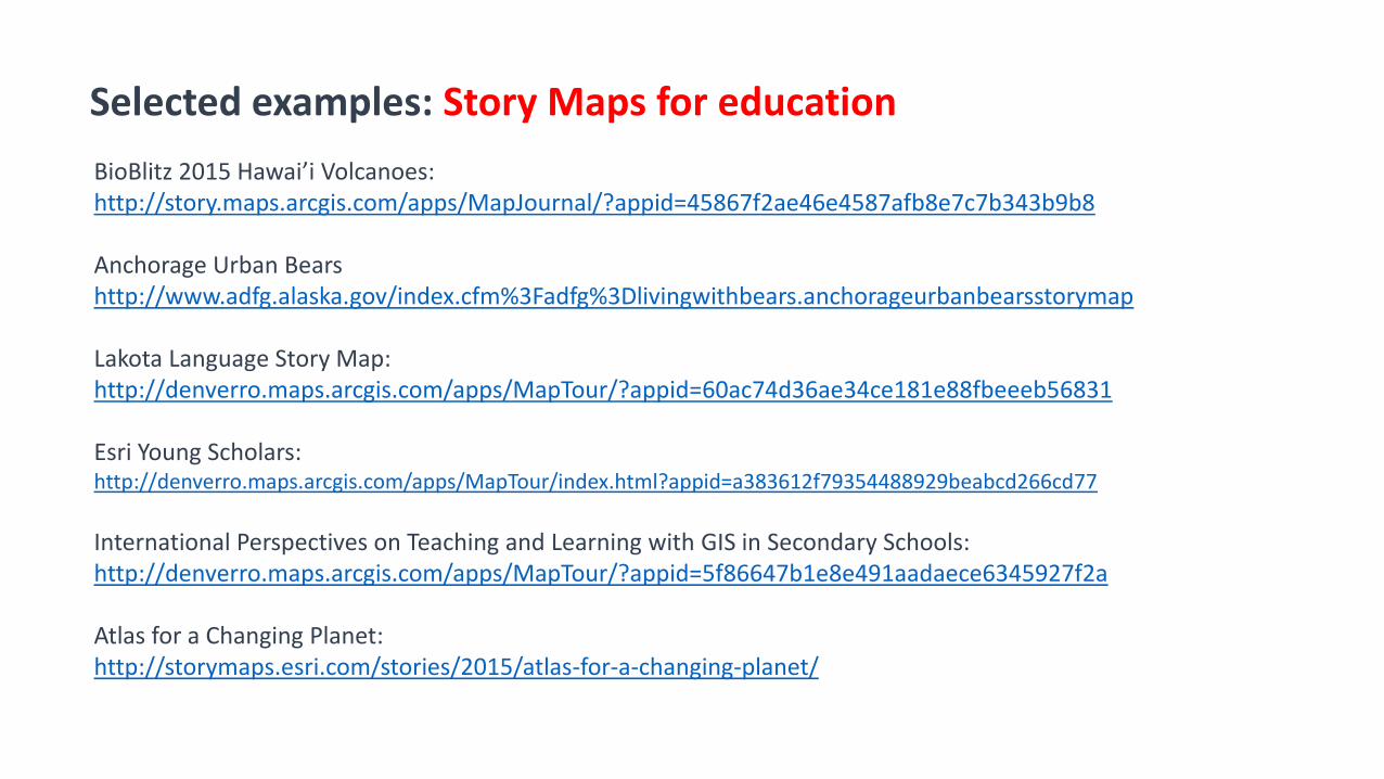
BioBlitz 2015 Hawai’i Volcanoes:http://story.maps.arcgis.com/apps/MapJournal/?appid=45867f2ae46e4587afb8e7c7b343b9b8
Anchorage Urban Bearshttp://www.adfg.alaska.gov/index.cfm%3Fadfg%3Dlivingwithbears.anchorageurbanbearsstorymap
Lakota Language Story Map:http://denverro.maps.arcgis.com/apps/MapTour/?appid=60ac74d36ae34ce181e88fbeeeb56831
Esri Young Scholars: http://denverro.maps.arcgis.com/apps/MapTour/index.html?appid=a383612f79354488929beabcd266cd77
International Perspectives on Teaching and Learning with GIS in Secondary Schools:http://denverro.maps.arcgis.com/apps/MapTour/?appid=5f86647b1e8e491aadaece6345927f2a
Atlas for a Changing Planet:http://storymaps.esri.com/stories/2015/atlas-for-a-changing-planet/
Selected examples: Story Maps for education
Story MapsWorkshopAgenda
1. Introduction, story map concepts2. Exploring the story maps gallery3. Selected CLUES for creating great story maps4. Selected technical advice5. Building a story map from a web map6. Building a story map tour7. Building a story map journal8. Building a side accordion story map9. Building a tabbed story map10. Configurable App Method11. Discussion
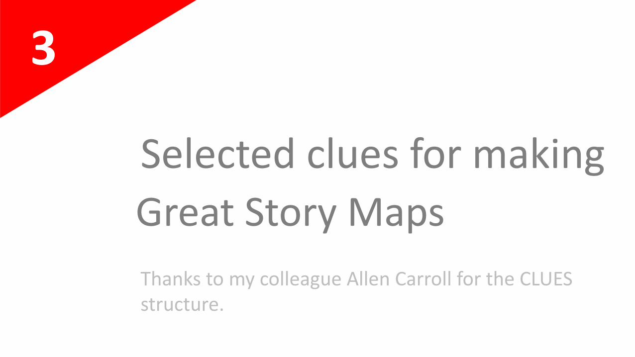
3
Selected clues for making
Great Story Maps
Thanks to my colleague Allen Carroll for the CLUES structure.
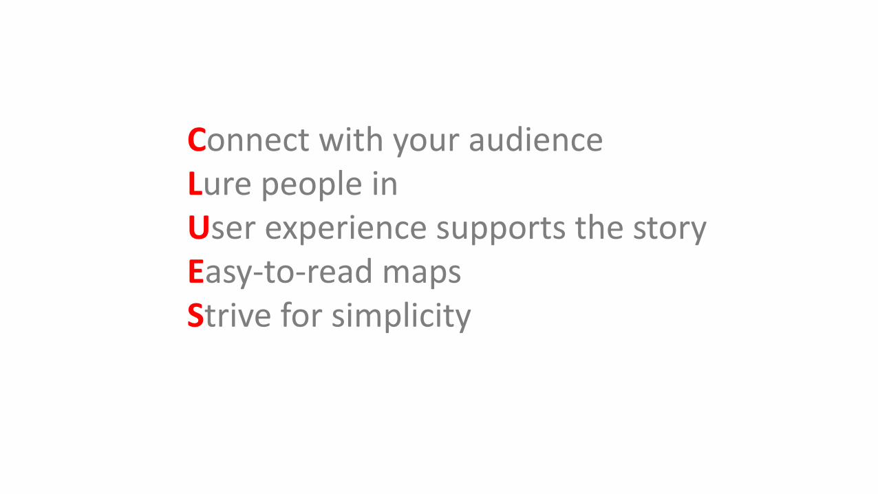
Connect with your audienceLure people inUser experience supports the storyEasy-to-read mapsStrive for simplicity
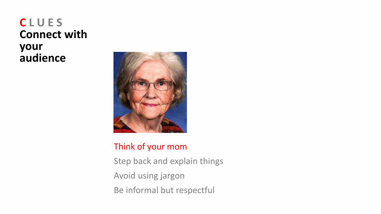
C L U E SConnect with your audience
Think of your mom
Step back and explain things
Avoid using jargon
Be informal but respectful
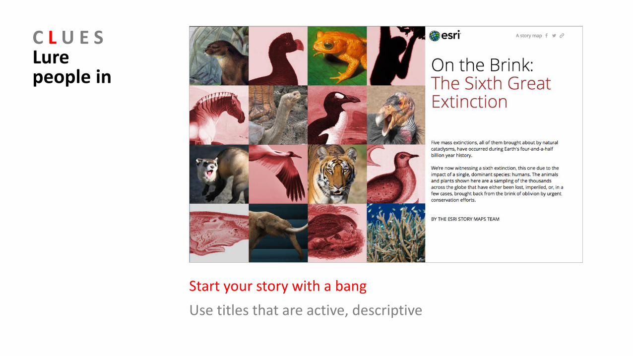
C L U E SLure people in
Start your story with a bang
Use titles that are active, descriptive
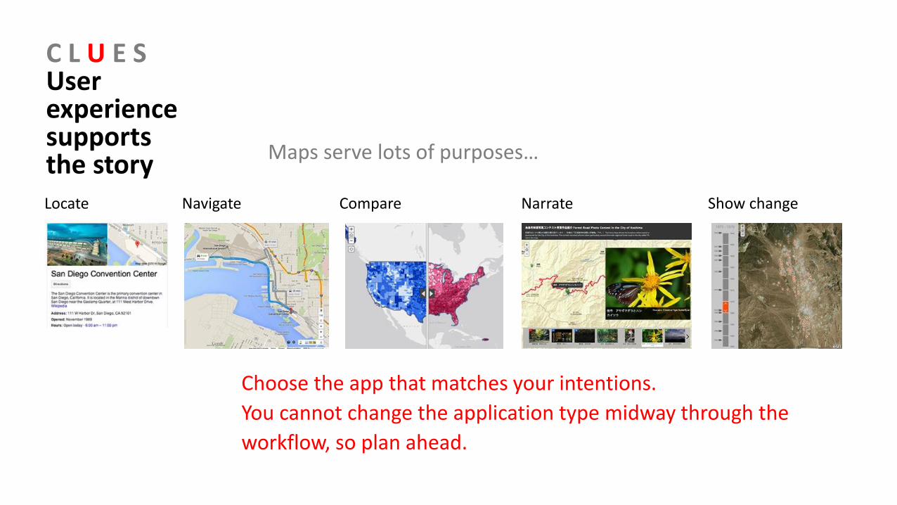
C L U E SUser experience supports the story
Choose the app that matches your intentions.
You cannot change the application type midway through the
workflow, so plan ahead.
Locate Navigate Compare Narrate Show change
Maps serve lots of purposes…
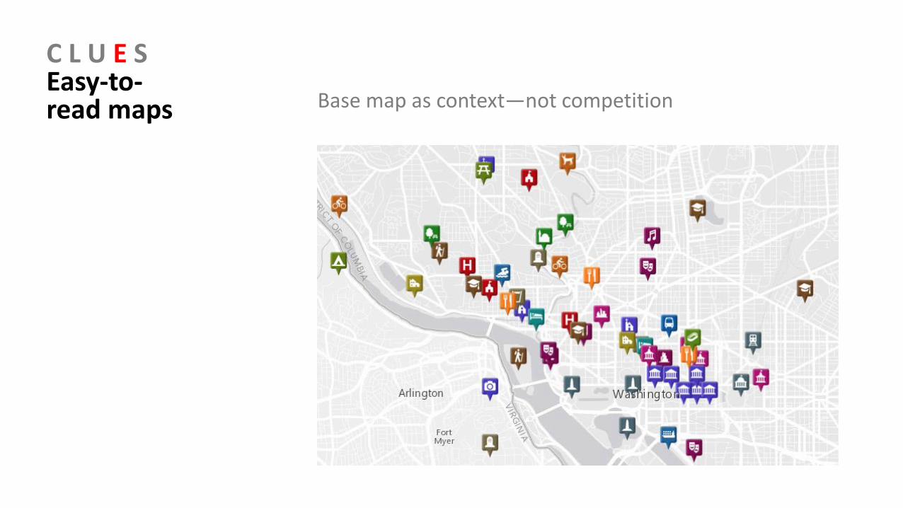
C L U E SEasy-to-read maps Base map as context—not competition
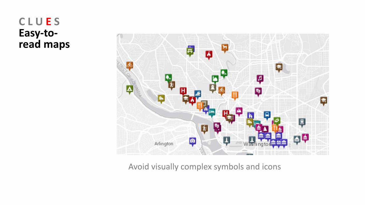
C L U E SEasy-to-read maps
Avoid visually complex symbols and icons
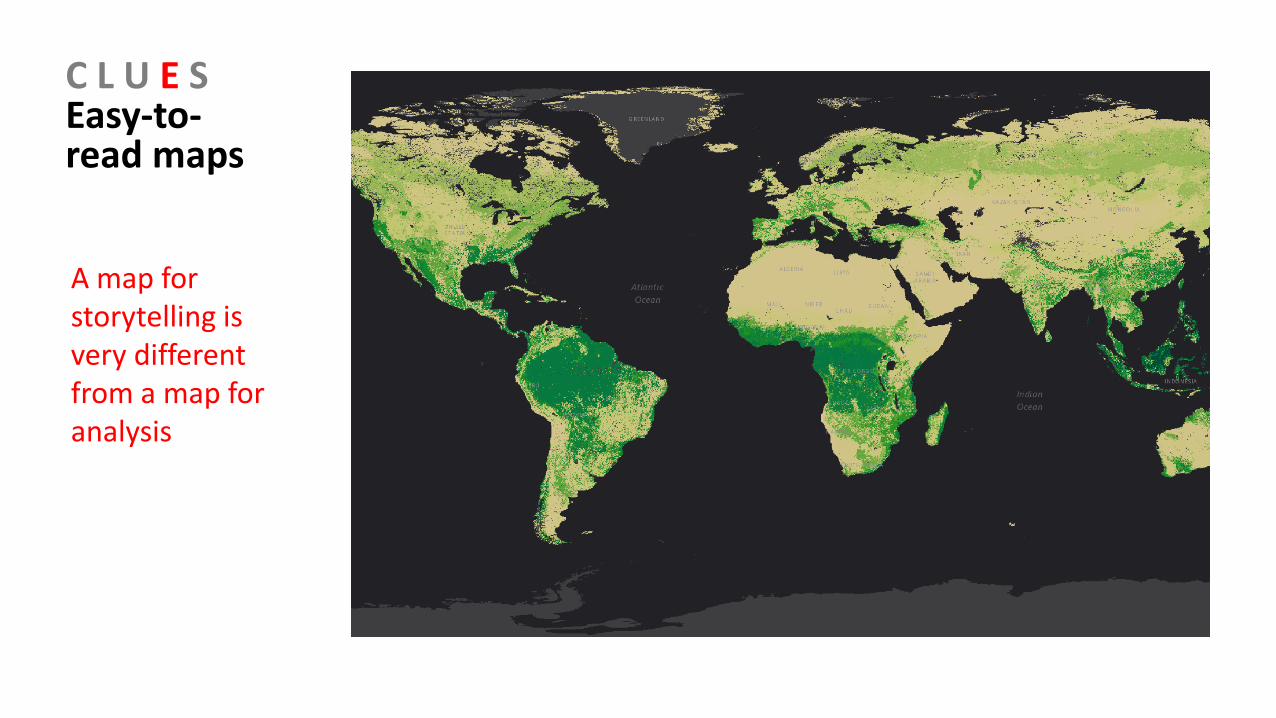
C L U E SEasy-to-read maps
A map for storytelling is very different from a map for analysis
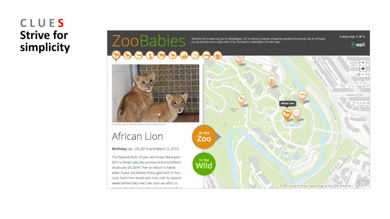
C L U E SStrive for simplicity
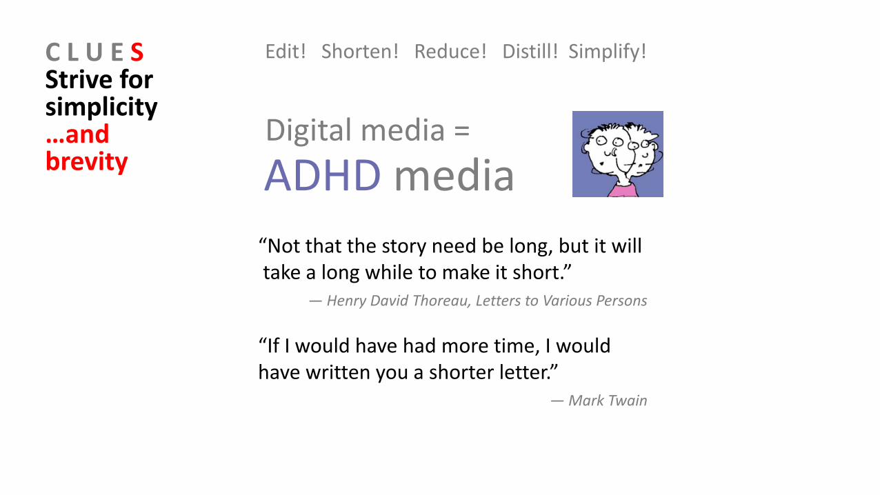
C L U E SStrive for simplicity …and brevity
Edit! Shorten! Reduce! Distill! Simplify!
Digital media =
ADHD media
“Not that the story need be long, but it will take a long while to make it short.”
― Henry David Thoreau, Letters to Various Persons
“If I would have had more time, I would have written you a shorter letter.”
― Mark Twain
Story MapsWorkshopAgenda
1. Introduction, story map concepts2. Exploring the story maps gallery3. Selected CLUES to creating great story maps4. Selected technical advice5. Building a story map from a web map6. Building a story map tour7. Building a story map journal8. Building a side accordion story map9. Building a tabbed story map10. Configurable App Method11. Discussion

4
Selected technical advice
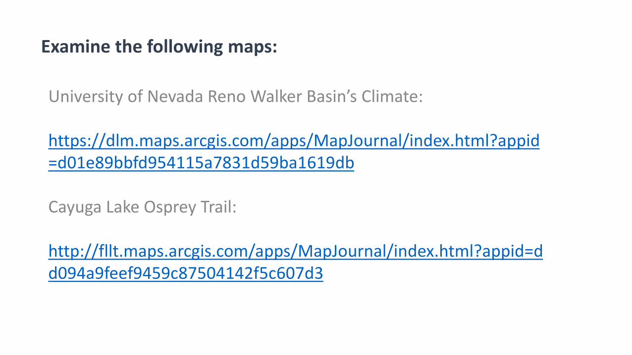
University of Nevada Reno Walker Basin’s Climate:
https://dlm.maps.arcgis.com/apps/MapJournal/index.html?appid=d01e89bbfd954115a7831d59ba1619db
Cayuga Lake Osprey Trail:
http://fllt.maps.arcgis.com/apps/MapJournal/index.html?appid=dd094a9feef9459c87504142f5c607d3
Examine the following maps:
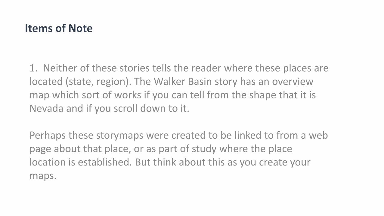
1. Neither of these stories tells the reader where these places are located (state, region). The Walker Basin story has an overview map which sort of works if you can tell from the shape that it is Nevada and if you scroll down to it.
Perhaps these storymaps were created to be linked to from a web page about that place, or as part of study where the place location is established. But think about this as you create your maps.
Items of Note
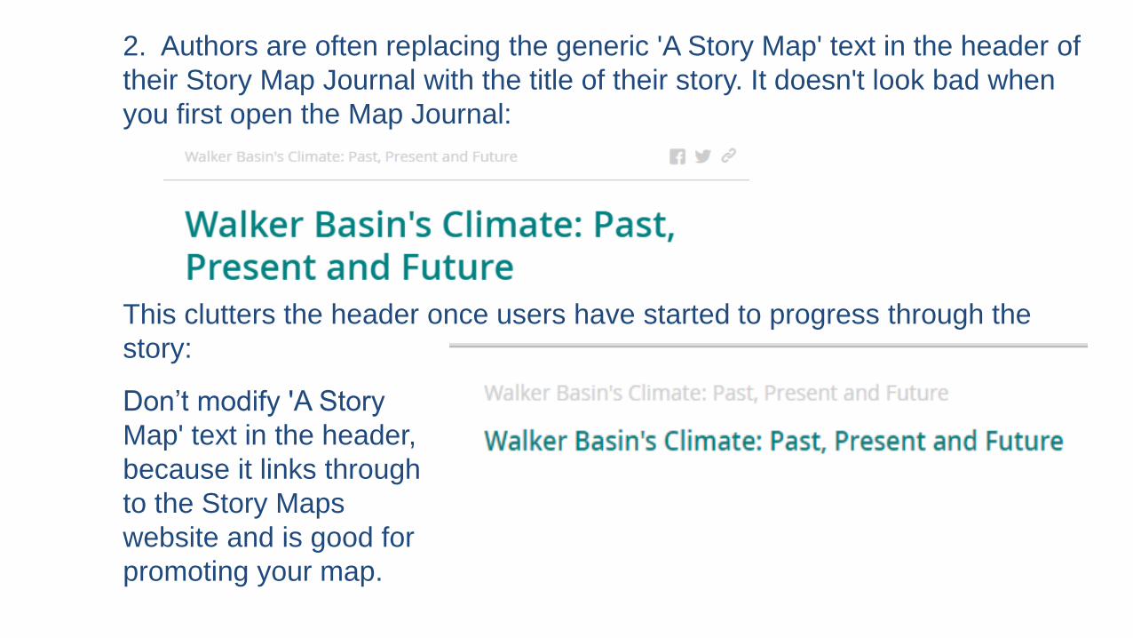
2. Authors are often replacing the generic 'A Story Map' text in the header of
their Story Map Journal with the title of their story. It doesn't look bad when
you first open the Map Journal:
This clutters the header once users have started to progress through the
story:
Don’t modify 'A Story
Map' text in the header,
because it links through
to the Story Maps
website and is good for
promoting your map.
3. Pay attention to image size! Authors are using huge images in their stories which slow down the load time. Examples: Picture of the osprey in the home section takes ages to load; so does the home image in Walker Basin. Flickr, Twitter, FB, etc. you can upload any image and those systems handle and optimize them.
Currently if you specify their image via a direct URL, such as https://s3.amazonaws.com/ospreytrail/COVER2fishing+os+blodgett.jpg for the opening osprey pic, it will be used as-is, and thus will be slow to load.
Storymaps may be able to support automatic compression on the fly in the future in ArcGIS Online. For best results, place images into Flickr, and then add them into their story maps via Flickr. For example if that is done with the Osprey picture it improves the load time, and automatically gives a much smaller image size that still looks good if the end-user clicks the button to expand the image.
4. Curation for your site: Check URLs, images, and so on: Use the “My Stories” zone!
5. Use folders in ArcGIS Online and in multimedia web sites to keep things organized.
6. Keep TABS on TABS in your web browser, including (1) in which tabs you are logged in, and (2) careful use of the “Back” button.
Story MapsWorkshopAgenda
1. Introduction, story map concepts2. Exploring the story maps gallery3. Selected CLUES to creating great story maps4. Selected technical advice5. Building a story map from a web map6. Building a story map tour7. Building a story map journal8. Building a side accordion story map9. Building a tabbed story map10. Configurable App Method11. Discussion
5
Building a story map from a web map
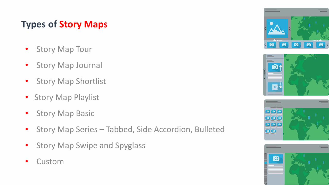
• Story Map Tour
• Story Map Journal
• Story Map Shortlist
• Story Map Playlist
• Story Map Basic
• Story Map Series – Tabbed, Side Accordion, Bulleted
• Story Map Swipe and Spyglass
• Custom
Types of Story Maps

1. Publish ArcGIS Online map to a web application. Choose story map for the application type. These are stored on the Esri-hosted server.
2. Download and customize story map templates for your own use. Upload story maps and related files to your own server.
For both methods:
Story maps are based on ArcGIS Online maps!
If you change the map, the story map (and other) applications change as well!
Two main ways to create Story Maps
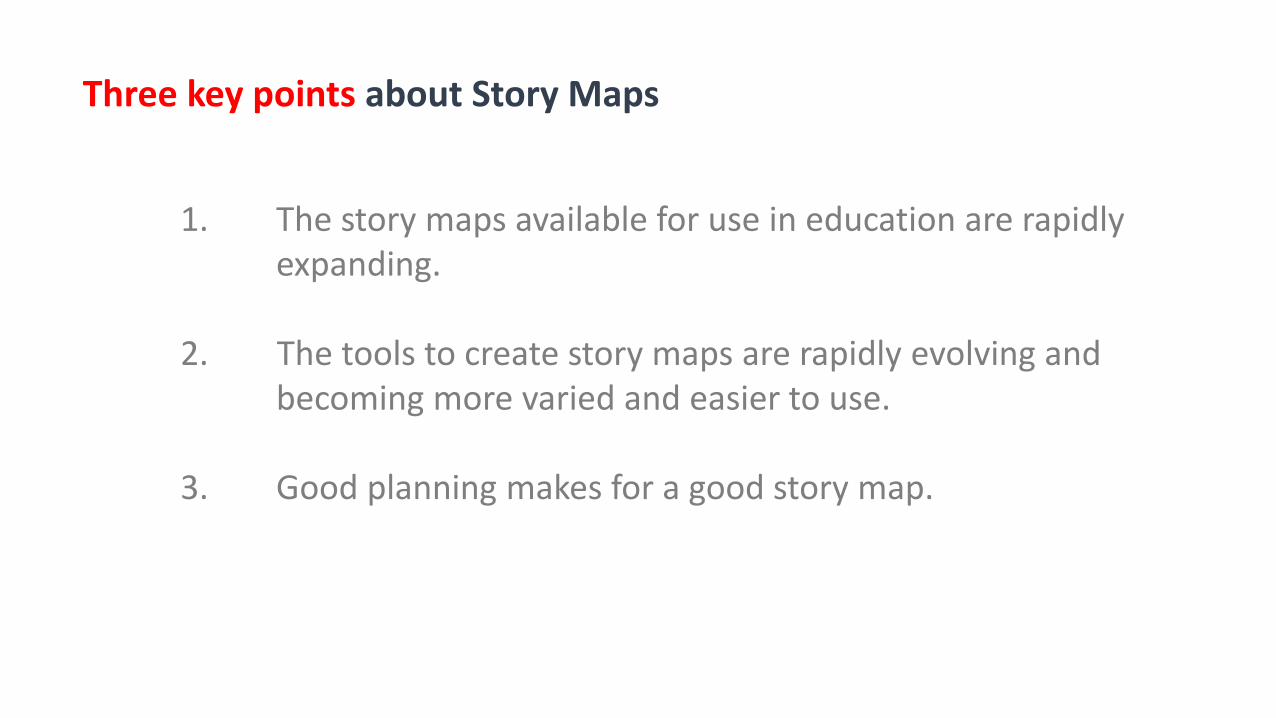
1. The story maps available for use in education are rapidly expanding.
2. The tools to create story maps are rapidly evolving and becoming more varied and easier to use.
3. Good planning makes for a good story map.
Three key points about Story Maps
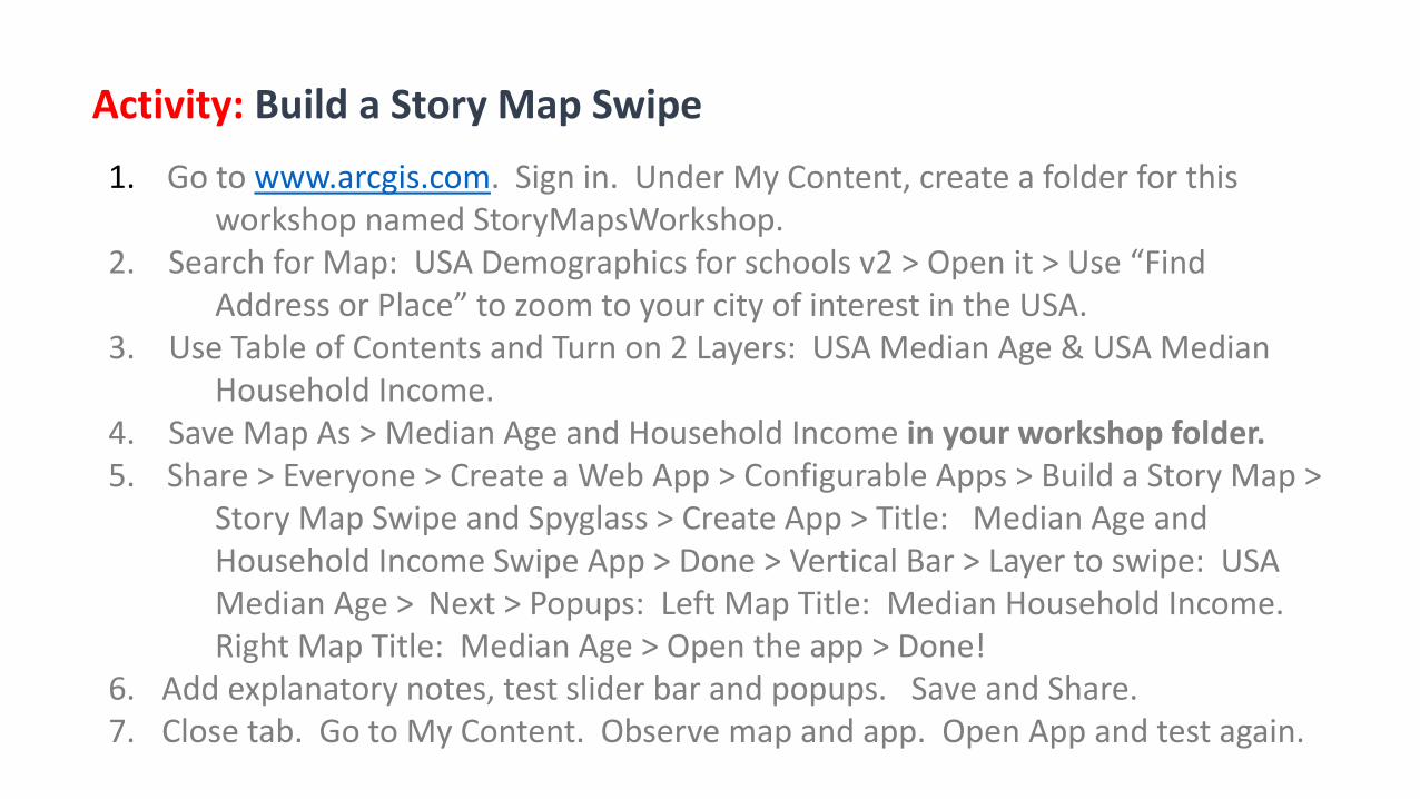
1. Go to www.arcgis.com. Sign in. Under My Content, create a folder for this workshop named StoryMapsWorkshop.
2. Search for Map: USA Demographics for schools v2 > Open it > Use “Find Address or Place” to zoom to your city of interest in the USA.
3. Use Table of Contents and Turn on 2 Layers: USA Median Age & USA Median Household Income.
4. Save Map As > Median Age and Household Income in your workshop folder. 5. Share > Everyone > Create a Web App > Configurable Apps > Build a Story Map >
Story Map Swipe and Spyglass > Create App > Title: Median Age and Household Income Swipe App > Done > Vertical Bar > Layer to swipe: USA Median Age > Next > Popups: Left Map Title: Median Household Income. Right Map Title: Median Age > Open the app > Done!
6. Add explanatory notes, test slider bar and popups. Save and Share. 7. Close tab. Go to My Content. Observe map and app. Open App and test again.
Activity: Build a Story Map Swipe
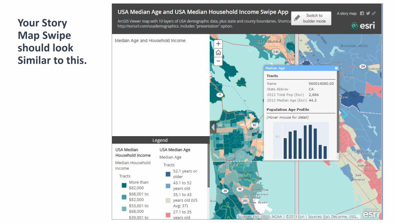
Your Story Map Swipe should lookSimilar to this.
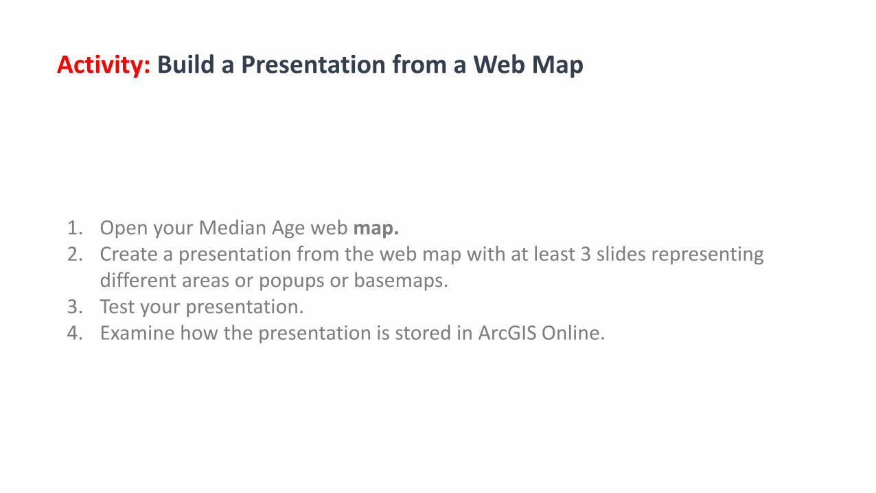
1. Open your Median Age web map.2. Create a presentation from the web map with at least 3 slides representing
different areas or popups or basemaps.3. Test your presentation.4. Examine how the presentation is stored in ArcGIS Online.
Activity: Build a Presentation from a Web Map
Story MapsWorkshopAgenda
1. Introduction, story map concepts2. Exploring the story maps gallery3. Selected CLUES to creating great story maps4. Selected technical advice5. Building a story map from a web map6. Building a story map tour7. Building a story map journal8. Building a side accordion story map9. Building a tabbed story map10. Configurable App Method11. Discussion
6
Building aStory Map Tour
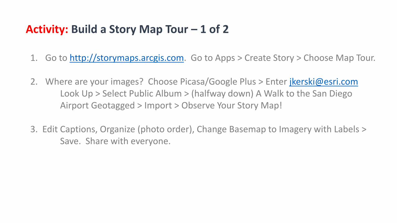
1. Go to http://storymaps.arcgis.com. Go to Apps > Create Story > Choose Map Tour.
2. Where are your images? Choose Picasa/Google Plus > Enter [email protected] Up > Select Public Album > (halfway down) A Walk to the San Diego Airport Geotagged > Import > Observe Your Story Map!
3. Edit Captions, Organize (photo order), Change Basemap to Imagery with Labels > Save. Share with everyone.
Activity: Build a Story Map Tour – 1 of 2
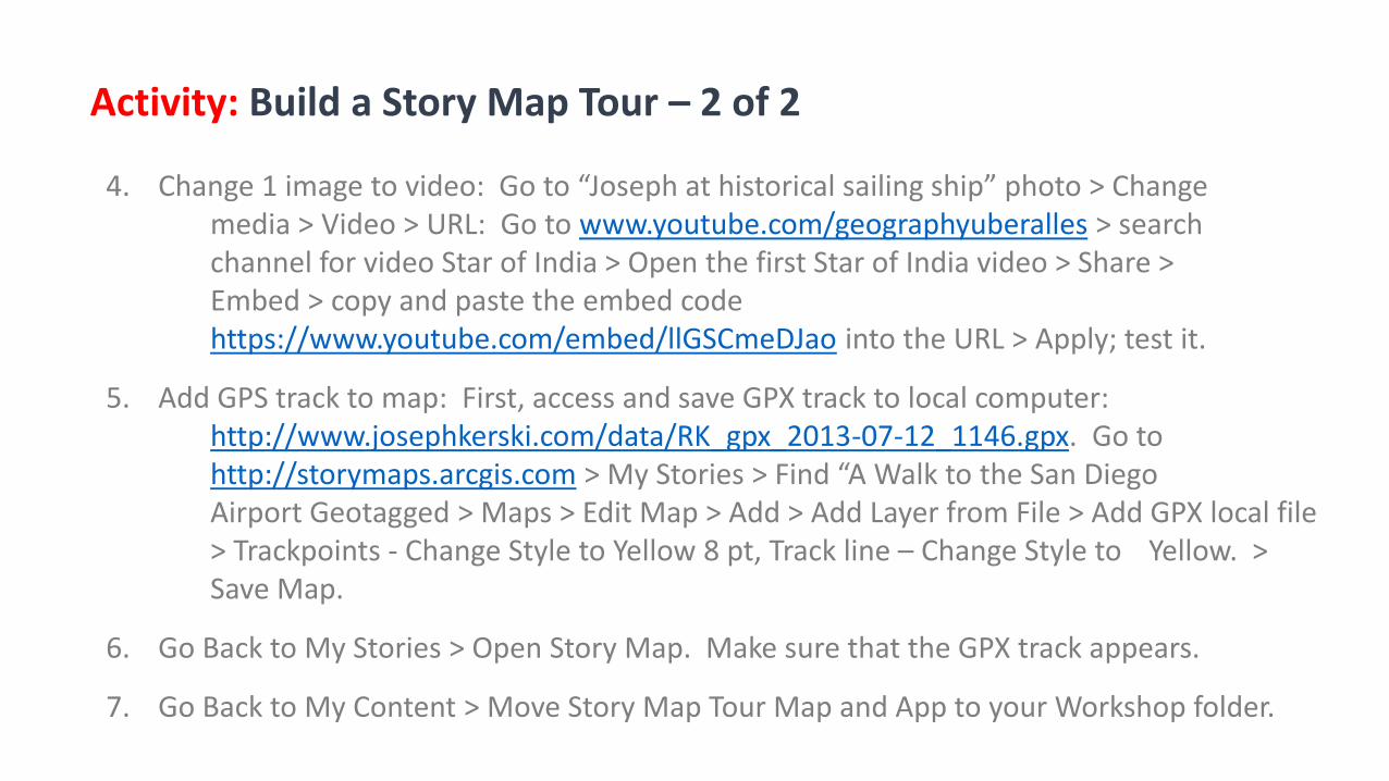
4. Change 1 image to video: Go to “Joseph at historical sailing ship” photo > Change media > Video > URL: Go to www.youtube.com/geographyuberalles > search channel for video Star of India > Open the first Star of India video > Share > Embed > copy and paste the embed code https://www.youtube.com/embed/llGSCmeDJao into the URL > Apply; test it.
5. Add GPS track to map: First, access and save GPX track to local computer: http://www.josephkerski.com/data/RK_gpx_2013-07-12_1146.gpx. Go to http://storymaps.arcgis.com > My Stories > Find “A Walk to the San Diego Airport Geotagged > Maps > Edit Map > Add > Add Layer from File > Add GPX local file > Trackpoints - Change Style to Yellow 8 pt, Track line – Change Style to Yellow. > Save Map.
6. Go Back to My Stories > Open Story Map. Make sure that the GPX track appears.
7. Go Back to My Content > Move Story Map Tour Map and App to your Workshop folder.
Activity: Build a Story Map Tour – 2 of 2
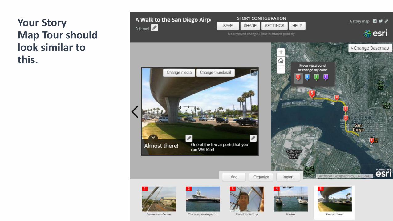
Your Story Map Tour should look similar to this.
Story MapsWorkshopAgenda
1. Introduction, story map concepts2. Exploring the story maps gallery3. Selected CLUES to creating great story maps4. Selected technical advice5. Building a story map from a web map6. Building a story map tour7. Building a story map journal8. Building a side accordion story map9. Building a tabbed story map10. Configurable App Method11. Discussion
7
Building aStory Map Journal
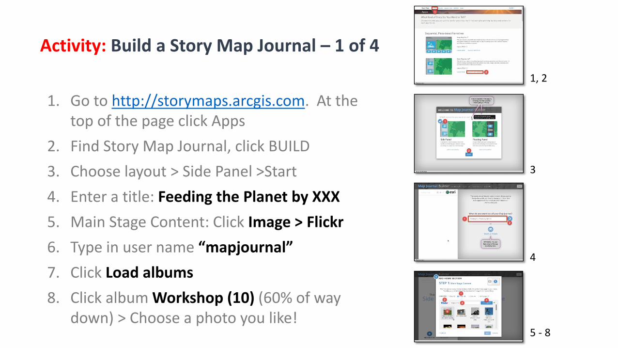
1. Go to http://storymaps.arcgis.com. At the top of the page click Apps
2. Find Story Map Journal, click BUILD
3. Choose layout > Side Panel >Start
4. Enter a title: Feeding the Planet by XXX
5. Main Stage Content: Click Image > Flickr
6. Type in user name “mapjournal”
7. Click Load albums
8. Click album Workshop (10) (60% of way down) > Choose a photo you like!
Activity: Build a Story Map Journal – 1 of 4
1, 2
3
4
5 - 8

Add Home Section
Activity: Build a Story Map Journal – 2 of 4
9 9. Confirm Fill is checked > click Next
10. Add text (make it up!) into the text block
11. Click Add > Home section is done!
10 - 11Add Section
12. Click Add Section > Enter title Current Crop Yields
13. Content: Click Map
14. Click Select a web map then Select a map 12 - 14
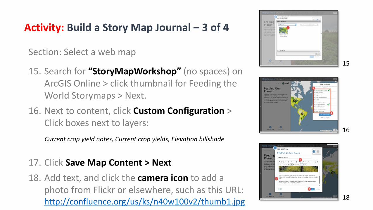
Section: Select a web map
Activity: Build a Story Map Journal – 3 of 4
18
15. Search for “StoryMapWorkshop” (no spaces) on ArcGIS Online > click thumbnail for Feeding the World Storymaps > Next.
16. Next to content, click Custom Configuration > Click boxes next to layers:
Current crop yield notes, Current crop yields, Elevation hillshade
17. Click Save Map Content > Next
18. Add text, and click the camera icon to add a photo from Flickr or elsewhere, such as this URL: http://confluence.org/us/ks/n40w100v2/thumb1.jpg
15
16
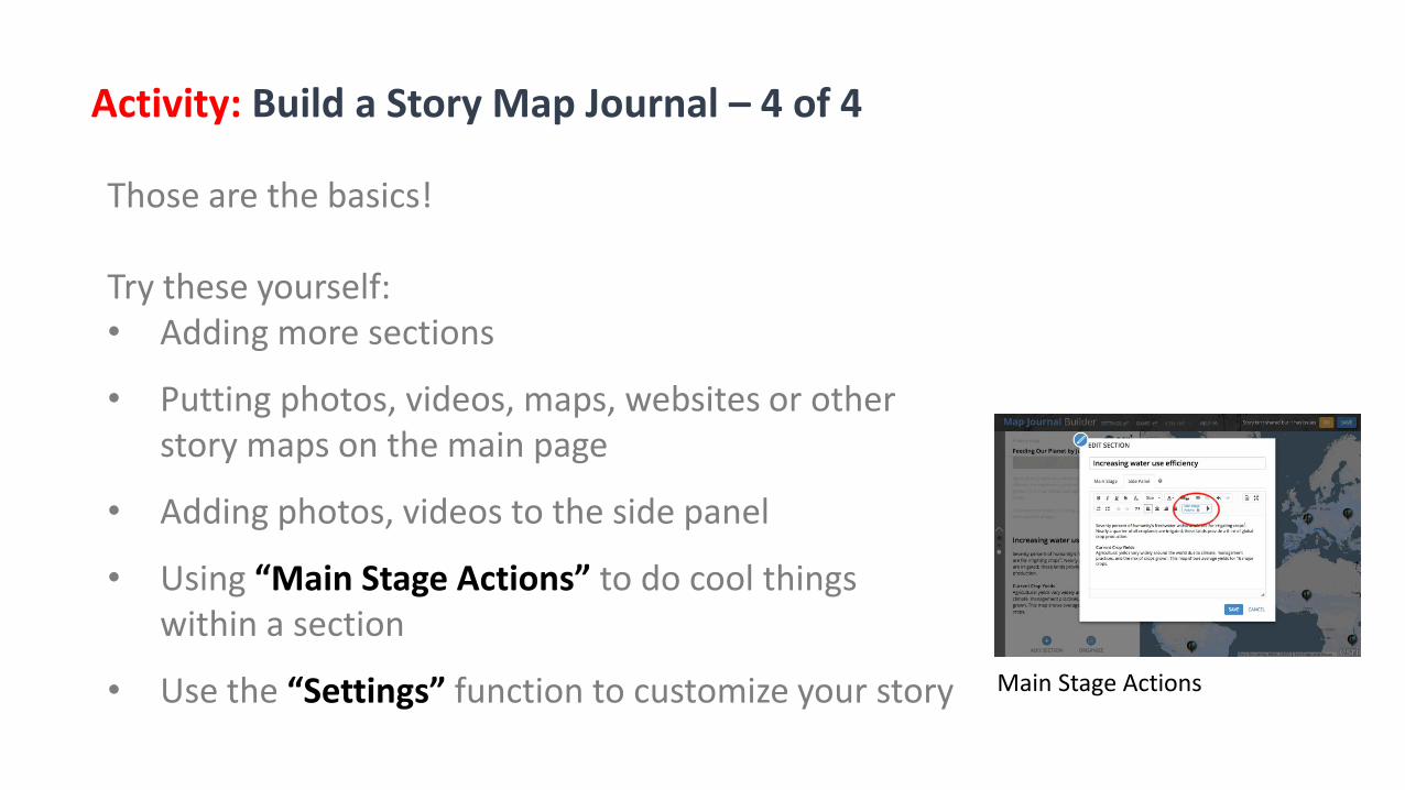
Those are the basics!
Try these yourself:• Adding more sections
• Putting photos, videos, maps, websites or other story maps on the main page
• Adding photos, videos to the side panel
• Using “Main Stage Actions” to do cool things within a section
• Use the “Settings” function to customize your story
Activity: Build a Story Map Journal – 4 of 4
Main Stage Actions
Story MapsWorkshopAgenda
1. Introduction, story map concepts2. Exploring the story maps gallery3. Selected CLUES to creating great story maps4. Selected technical advice5. Building a story map from a web map6. Building a story map tour7. Building a story map journal8. Building a side accordion story map9. Building a tabbed story map10. Configurable App Method11. Discussion
8
Building a side accordion story map
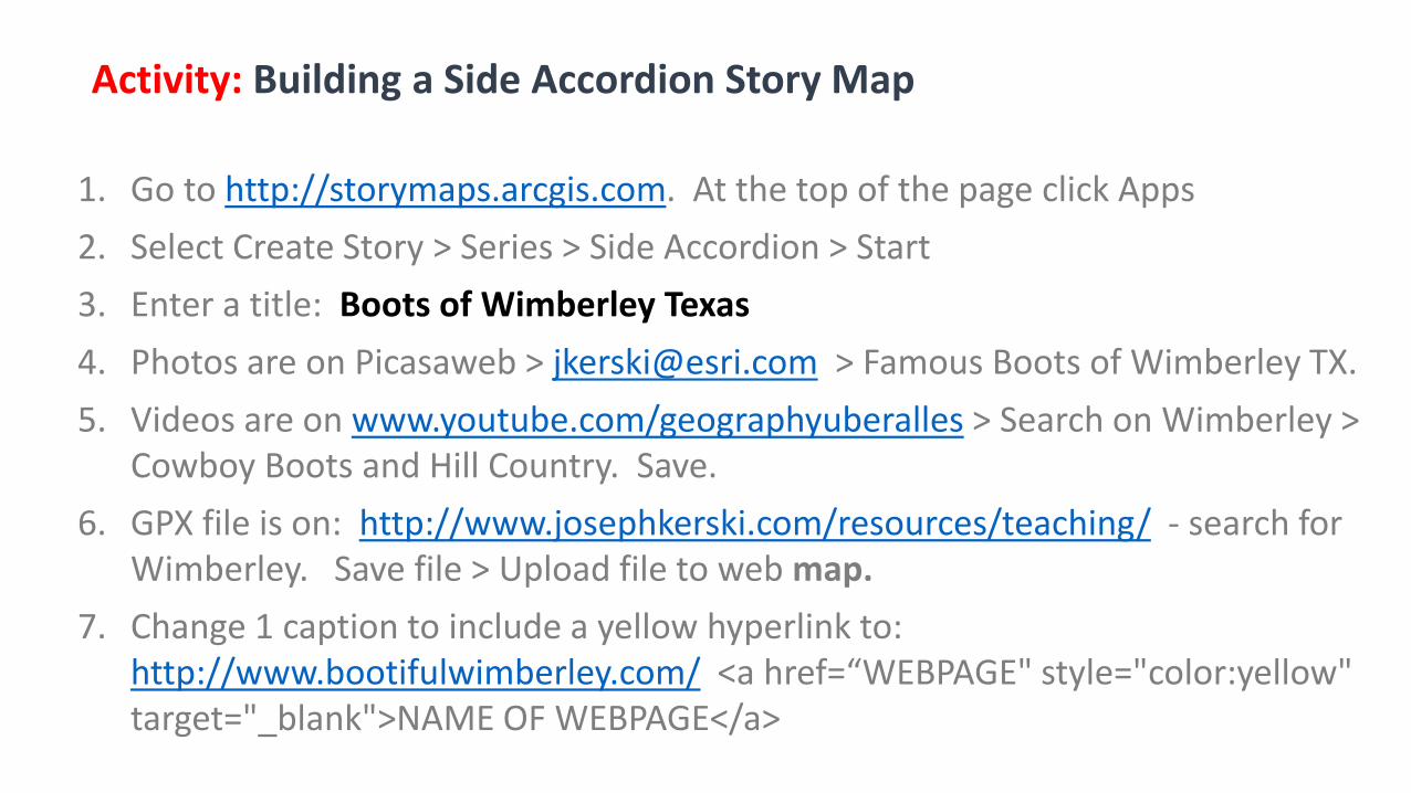
1. Go to http://storymaps.arcgis.com. At the top of the page click Apps
2. Select Create Story > Series > Side Accordion > Start
3. Enter a title: Boots of Wimberley Texas
4. Photos are on Picasaweb > [email protected] > Famous Boots of Wimberley TX.
5. Videos are on www.youtube.com/geographyuberalles > Search on Wimberley > Cowboy Boots and Hill Country. Save.
6. GPX file is on: http://www.josephkerski.com/resources/teaching/ - search for Wimberley. Save file > Upload file to web map.
7. Change 1 caption to include a yellow hyperlink to: http://www.bootifulwimberley.com/ <a href=“WEBPAGE" style="color:yellow" target="_blank">NAME OF WEBPAGE</a>
Activity: Building a Side Accordion Story Map
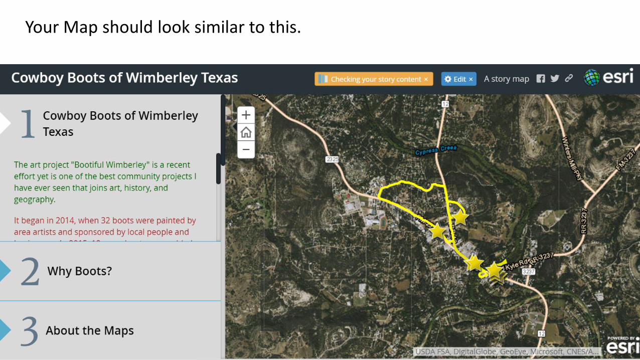
Your Map should look similar to this.

Story MapsWorkshopAgenda
1. Introduction, story map concepts2. Exploring the story maps gallery3. Selected CLUES to creating great story maps4. Selected technical advice5. Building a story map from a web map6. Building a story map tour7. Building a story map journal8. Building a side accordion story map9. Building a tabbed story map10. Configurable App Method11. Discussion
9
Building a tabbed story map
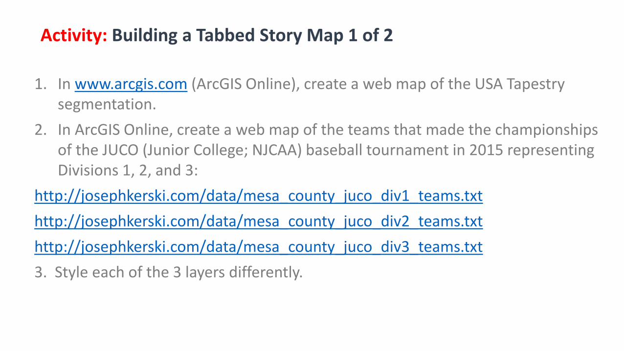
1. In www.arcgis.com (ArcGIS Online), create a web map of the USA Tapestry segmentation.
2. In ArcGIS Online, create a web map of the teams that made the championships of the JUCO (Junior College; NJCAA) baseball tournament in 2015 representing Divisions 1, 2, and 3:
http://josephkerski.com/data/mesa_county_juco_div1_teams.txt
http://josephkerski.com/data/mesa_county_juco_div2_teams.txt
http://josephkerski.com/data/mesa_county_juco_div3_teams.txt
3. Style each of the 3 layers differently.
Activity: Building a Tabbed Story Map 1 of 2
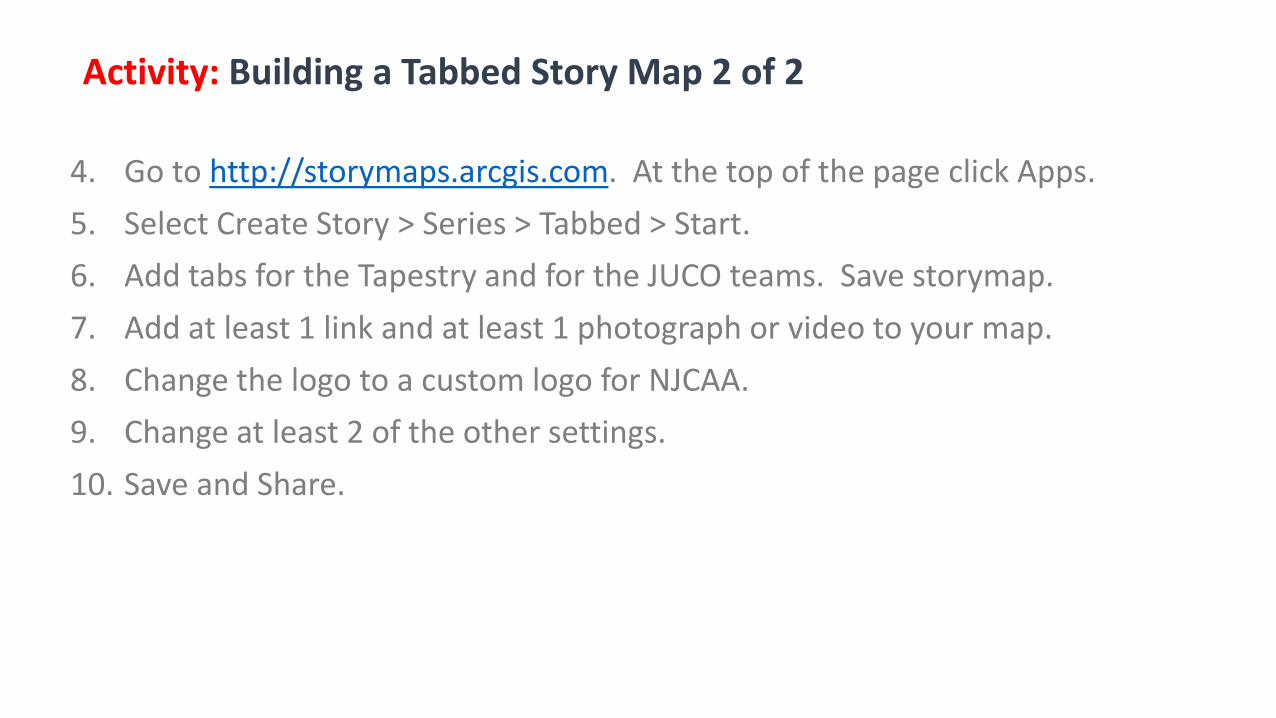
4. Go to http://storymaps.arcgis.com. At the top of the page click Apps.
5. Select Create Story > Series > Tabbed > Start.
6. Add tabs for the Tapestry and for the JUCO teams. Save storymap.
7. Add at least 1 link and at least 1 photograph or video to your map.
8. Change the logo to a custom logo for NJCAA.
9. Change at least 2 of the other settings.
10. Save and Share.
Activity: Building a Tabbed Story Map 2 of 2
Story MapsWorkshopAgenda
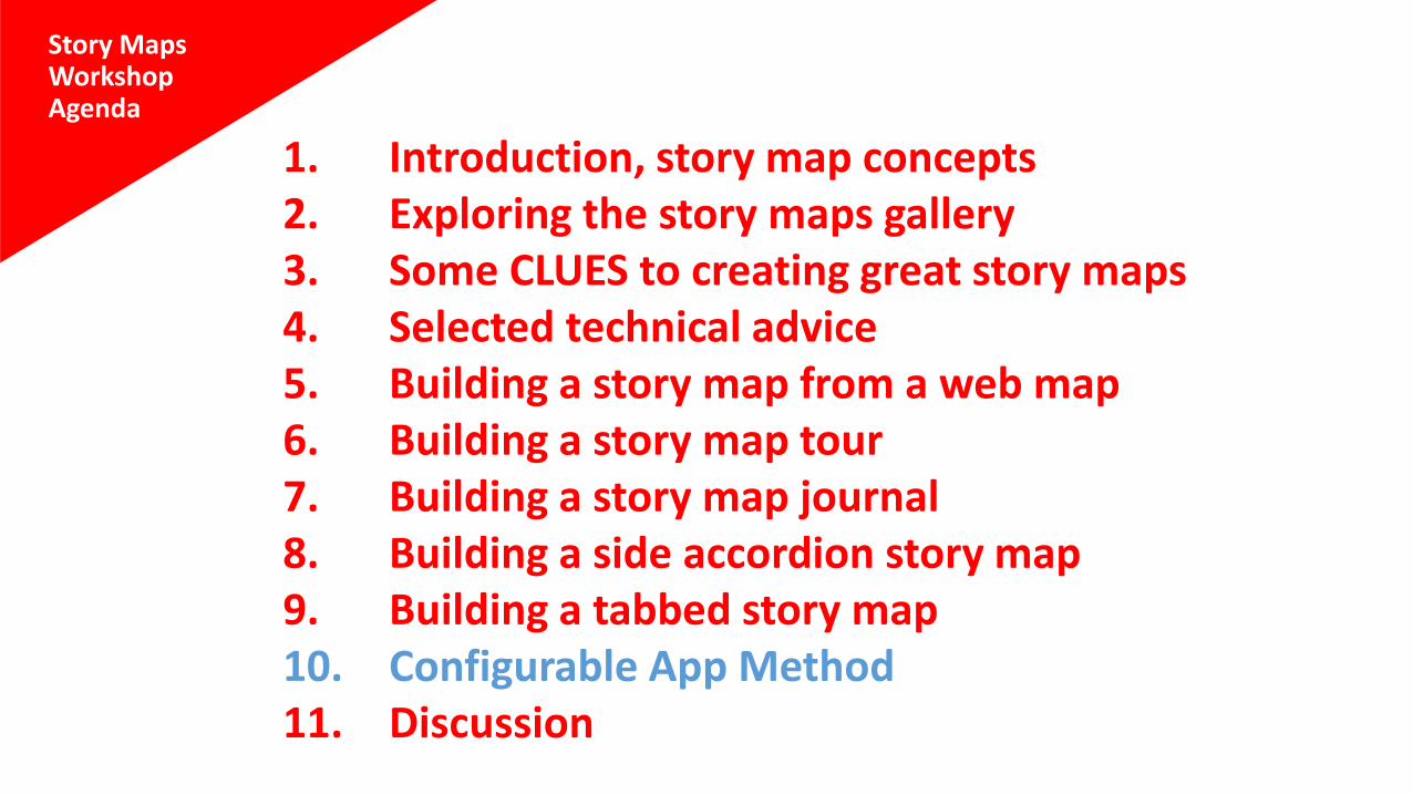
1. Introduction, story map concepts2. Exploring the story maps gallery3. Some CLUES to creating great story maps4. Selected technical advice5. Building a story map from a web map6. Building a story map tour7. Building a story map journal8. Building a side accordion story map9. Building a tabbed story map10. Configurable App Method11. Discussion
Configurable app method
10
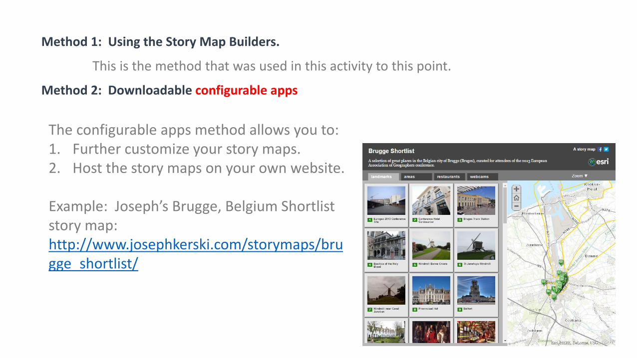
The configurable apps method allows you to:1. Further customize your story maps.2. Host the story maps on your own website.
Example: Joseph’s Brugge, Belgium Shortlist story map:http://www.josephkerski.com/storymaps/brugge_shortlist/
Method 1: Using the Story Map Builders.
This is the method that was used in this activity to this point.
Method 2: Downloadable configurable apps
Story MapsWorkshopAgenda
1. Introduction, story map concepts2. Exploring the story maps gallery3. Some CLUES to creating great story maps4. Selected technical advice5. Building a story map from a web map6. Building a story map tour7. Building a story map journal8. Building a side accordion story map9. Building a tabbed story map10. Configurable App Method11. Discussion

11
Questions andDiscussion
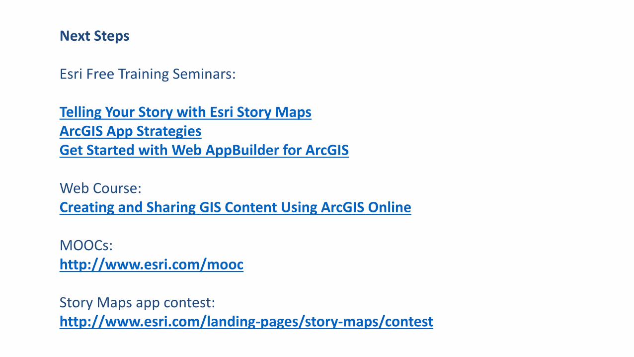
Next Steps
Esri Free Training Seminars:
Telling Your Story with Esri Story MapsArcGIS App StrategiesGet Started with Web AppBuilder for ArcGIS
Web Course:Creating and Sharing GIS Content Using ArcGIS Online
MOOCs:http://www.esri.com/mooc
Story Maps app contest:http://www.esri.com/landing-pages/story-maps/contest
Communicating with Story Maps
Joseph Kerski, PhD GISP [email protected]
Twitter: http://josephkerski.com/twitter
YouTube: http://www.youtube.com/geographyuberalles
Story Maps: Multimedia Map Based Communication Tools