Clipper Snips - Trailer/Sailors 2006 to... · of Clipper Snips. The authors of the newsletter...
32
The authors of the newsletter disclaim any and all responsibility for any kind of injury or damages sustained which may result from the application of any or all ideas or suggestions appearing in any articles of Clipper Snips . The authors of the newsletter furthermore give no warranty, express or implied, as to the merchantability, fitness for purpose, advertised qual- ity, or any other matter of any products advertised in Clipper Snips or appearing in any articles of said newsletter. Clipper Snips Winter/Spring 2010 Trailer/Sailors Association The magazine of the Trailer/Sailors Association www.trailersailors.org 2 Presidents Column Mike Nelson Articles 3 Travel Tips Susan Coppedge 4 A Preventable Dockside Tragedy Kevin Ritz 6 Open Letter to All T/SA Members David Craigie 7 The Knockddown and Righting of a Sailboat Karl J. Schmitt 8 Canadian VHF Radio Weather Reports Howard Staley 14 Ramp Report—St. Mary’s River John Ulmer 16 To Write or Not to Write Henk Vanderhulst Cruises 11 2010 North Channel Early Bird Special John Clement 12 2010 North Channel Cruise John Clement 28 Bay of Islands Pixie Houghwout & Ralph Folsom Other News 10 Book Review—The Sailors Book of Small Cruising 25 Roy Eaton—Canadian Safe Boating Council - Volunteer Award 26 Welcome New Members 26 Farewell—Tom Larimer T/SA Wear for sale T/SA Tee-shirts Temporarily unavailable For T/SA Hats ($13US) Flags ($16US), contact: David Craigie at [email protected]
Transcript of Clipper Snips - Trailer/Sailors 2006 to... · of Clipper Snips. The authors of the newsletter...

The authors of the newsletter disclaim any and all responsibility for any kind of injury or damages sustained which may result from the application of any or all ideas or suggestions appearing in any articles of Clipper Snips. The authors of the newsletter furthermore give no warranty, express or implied, as to the merchantability, fitness for purpose, advertised qual-ity, or any other matter of any products advertised in Clipper Snips or appearing in any articles of said newsletter.
Clipper Snips Winter/Spring 2010
Trailer/Sailors Association The magazine of the
Trailer/Sailors Association www.trailersailors.org
2 Presidents Column Mike Nelson Articles 3 Travel Tips Susan Coppedge 4 A Preventable Dockside Tragedy Kevin Ritz 6 Open Letter to All T/SA Members David Craigie 7 The Knockddown and Righting of a Sailboat Karl J. Schmitt
8 Canadian VHF Radio Weather Reports Howard Staley 14 Ramp Report—St. Mary’s River John Ulmer
16 To Write or Not to Write Henk Vanderhulst Cruises 11 2010 North Channel Early Bird Special John Clement
12 2010 North Channel Cruise John Clement
28 Bay of Islands Pixie Houghwout & Ralph Folsom
Other News 10 Book Review—The Sailors Book of Small Cruising 25 Roy Eaton—Canadian Safe Boating Council -
Volunteer Award
26 Welcome New Members 26 Farewell—Tom Larimer
T/SA Wear for sale
T/SA Tee-shirts
Temporarily unavailable
For T/SA Hats ($13US) Flags ($16US),
contact: David Craigie at [email protected]

2
President’s Column By Mike Nelson I’ll start off with some comments on the state of our Association. We entered 2010 with 272 mem-bers as of February. We ended up last year with 293 members. Factoring in annual attrition, we are a bit ahead of last year. A nice number of new members came from our revised gift membership program. I want to acknowledge the work by our Treasurer, Howard Staley, in suggesting a simpler gift membership process and cost, and for his ef-forts in commu-nicating with those members who were tardy in renewing. Mike Forbes has put some im-proved proce-dures in place to welcome new members in a way that we hope leads to a higher renewal rate among them. So, it appears that we are sur-viving the economic downturn, and membership is staying relatively steady around 300. Last summer’s North Channel cruise had fewer participants than preceding years, probably reflect-ing the economic situation for many members. This year we are going back to our traditional one-plan main cruise, to be co-led by John Clement, David Craigie, and myself. You can read about it elsewhere in this issue. In addition, John Clement is again offering his one-week introductory cruise to the North Channel during the week preceding the main cruise. You may notice that we plan to launch the main cruise in Spanish this year. We stopped using Spanish the past few years because of some un-friendly policies, such as low barrier wires cutting off the upper parking lot from the launch ramp, and some awkward rules about temporary docking.
I am happy to report that John Clement, our super diplomat, happened to be in Spanish last year at a time when the marina and town managers were discussing the future. John communicated to them several of the reasons we stopped using their fa-cilities. They immediately made some changes, including the removal of the barrier wires, and in-dicated they would work to encourage our return. In an attempt to economize, and to cope with ever-increasing mailing costs, we have been increasing our use of e-mail to contact members for certain items. We sent out renewal reminder notices via e
-mail again this year. We also sent out invita-tions to the fall annual meeting via e-mail. I sent out the first president’s letter via e-mail a few months ago, and plan a few more issues over the course of the year. I see us relying on e-mail more in com-
ing years as a way to quickly and economically communicate with members, so be sure that you keep us appraised of any changes in your e-mail address. Let Rick Haynie, the manager of our da-tabase, know of any changes in your personal in-formation. Clipper Snips will remain a paper pub-lication sent by mail for the foreseeable future. I hope to see many of you on the water this sum-mer. Fair winds.

3
Travel Tips By Susan Coppedge Over the years I’ve developed a list of things I need to do before we head off on a trip, boating or otherwise. However, having just returned from a trip to the Florida Keys, I found I had to add a few NEW ITEMS to my checklist, so I thought I’d share them:
Don’t assume anything about the Marina if you have not been there before. Call in advance to ensure they accept credit cards and have FRESH WATER (potable) and PUMP-OUT facilities available. Thanks to Bob Rouda for warning us that South Dade Marina (which came highly recom-mended) required cash or a check, no credit cards (perish the thought of looking for an ATM pulling a boat!). We were also surprised to learn that they had no pump-out facility or fresh water available (thankfully we had pre-filled our water tanks). We generally carry our own hose and motor flush, but had to flush away the salt water with “brackish” water rather than fresh water.
Advise CREDIT CARD companies in ad-
vance of your travel plans. Both Discover and VISA temporarily froze our accounts, suspecting fraud. They left a message on our HOME PHONE ad-vising us to call them – thankfully our “dog sitter” was able to call our cell with the special phone number to reach the Fraud Unit at each to unfreeze our credit cards.
Rx Drugs – Ensure that you won’t run out dur-ing your trip. We were due to run out of two prescriptions while away (for only 2 weeks). When I tried to pick up the next “30 day supply” the drugstore advised us that we couldn’t renew them until a date that was 3 days AFTER our departure. We had 2 choices - (1) refill them “later”
at a CVS in Florida or (2) call our insur-ance company to see if we could get a “Vacation Waiver.” Our plan did allow for the vacation waiver, but there was a 24 hour delay before it became effective. Also, I could NOT renew the prescriptions using the telephone prompts as I normally do.
EARPLUGS – buy some disposable foam ear plugs to block out loud music, banging halyards (NOT ours!), bumping dinghies, and other noises (thanks to Ilona Rouda for giving me a pair!).
Get and pack a 50’ electrical cord (whether or not you think you’ll need it). Strong winds (forecast to clock from southerly to northeasterly with possible thundershow-ers) sent us to a marina – thankfully it was within walking distance of Home Depot (and 25’ would have been too short).
Definition—Boom 1). Laterally mounted pole to which a sail is fastened Often used during jibing, to shift crew members to a fixed, horizontal position. 2) Called boom for sound that's made, when hitting the heads of crew, while tacking

4
A Preventable Dockside Tragedy
By Kevin Ritz We were a live-aboard family with three active children at a freshwater marina on a tributary of the Willamette River near Portland, Oregon. Other kids were already swimming in the cove because it was that kind of day— hot and lazy. This was a common practice by adults as well as children dur-ing the warm summer of 1999. Our sons Ian, age 10, and Lucas, age 8, asked to swim with their friends. Permission was granted, subject to close adult supervision by parents including their mother, a graduate nurse. The boys were both wearing Type II PFD life jackets, so it was great fun and presumably safe to play in the water. Our children were schooled in aquatic safety. Being young professional people, my wife, Sheryl, and I had taken every precaution we could for peace of mind in a water environment. On the inside of the dock, the kids were having a great time floating down with the river current on an inner tube. Lucas moved away from the others toward his mother, who was keeping pace on the dock with the children’s water activity. As he ap-proached the ladder to get out of the water, he let out a loud gasp, immediately rolling onto his back in his life jacket, apparently unconscious. Sheryl yelled to the other kids to help him and jumped into the water herself. As the kids approached Lu-cas, they felt a slight tingly sensation in the water and immediately backed off. Upon hitting the wa-ter downstream from Lucas, Sheryl’s extremities went numb and she experienced extreme difficulty moving her limbs, which, at the time, she attrib-uted to fear. Somehow, Sheryl managed to pull Lucas to the dockside where others assisted in get-ting him onto the dock. I arrived moments later after hearing the commo-tion and, along with another onlooker, started giv-ing him CPR, which we continued until the para-medics took over approximately 15 to 20 minutes later. Our beloved Lucas was pronounced dead at 6:30 pm at Portland’s Emanuel Hospital. One mo-ment he was laughing and playing—an instant
later, his short life was over, leaving our hearts broken forever. As parents we suffered agonies of “how did this happen?” This question then turned into “why did this happen?” We relived every moment trying to sort out what we did or didn’t do. It was not until the next morning that we were able to start unrav-eling the pieces of the mystery. The first assump-tion was that he drowned. However, he was wear-ing the best life jacket money could buy, which kept his face out of the water even though he was unconscious. He was pulled from a floating posi-tion only moments after rolling onto his back and CPR was started immediately. Also, at no time during CPR could we detect a heartbeat and his color was good. Neither of these observations would indicate drowning. As Sheryl was telling me what had happened, she said she had never been so fearful in her life as to have her extremities tingle and go numb to the point where she could hardly move while in the water. Ian then related to me for the first time that he also felt a tingling as he approached his brother. Upon hearing all this it seemed clear to me that he did not drown, but that somehow, some way, AC electricity was present in the water where the kids were swimming. Our Lucas had been electrocuted. I then called the County Coroner’s office, request-ing an autopsy if they had not already done so, be-cause knowledge of the circumstances and com-mon sense pointed to electrocution, not drowning. They argued that there were no burns on his body. I pointed out that Lucas had been in an electrolytic solution, which eliminated the resistance of the skin (ordinarily skin resistance results in burns when an individual is electrocuted on land). To my complete horror, they responded that they would not even know how to test for something like that. I told them that testing was not difficult and that I was going to test the water in the area. I then called the local Sheriff’s Department and left a message telling them my suspicions. With my digital voltmeter, I went to the area where Lucas had been, put the negative lead to a ground, dropped the positive lead into the water, and im-mediately got AC voltage. I notified the Sheriff’s

5
Department, reporting what I had found and that I wanted to get someone to confirm my test. They agreed to send out some deputies while I called in an electrician. He arrived later that morn-ing, tracing the electricity to a powerboat that was in the area where the kids had been swimming. Concerns about liability soon unleashed a stream of other investigators, all of whom were suddenly interested in determining the source of the current. The local utility company wound up sending a team. The owner and manager of the marina ar-rived. More deputies were called. Meanwhile, the electrician and I continued our investigation, fo-cusing on the powerboat. We found a 12V wire lying on top of an AC wire, which had gotten hot enough to melt its own insulation and that of the hot (black) AC wire. This put 120V AC into the entire ground system of the boat, including the en-gines and propellers. This, coupled with lack of an AC safety ground, forced the voltage and electrical current into the surrounding water. Freshwater is not a good electrical conductor; therefore the AC was unable to reach ground at a sufficient current to potentially trip the breaker. Because of its high salinity, the human body is a much better conduc-tor of electricity than freshwater. (Saltwater is more conductive than the human body, which ex-plains why electric shock deaths have not occurred in saltwater.) As Lucas approached the ladder, he passed into the field of AC current and, for a brief moment, completed the circuit to ground. His heart was stopped instantly; the insidious path of electri-cal current took the life of our son. At first we considered this a freak accident—a unique set of circumstances that just happened to us. But this event completely changed my life and my focus. I was determined to understand how this could happen and to do everything I could to keep it from happening again. I did not want anyone else to suffer the pain we had suffered. I, with the collaboration of my business partner, wrote a cou-ple of articles for The American Boat and Yacht Council (ABYC), describing the accident and the action that I have taken to create public and profes-sional awareness of the problem, to provide educa-tion and a better understanding of the concepts in-volved, and to encourage the following of the ABYC standards and the use of ground fault-type
devices onboard boats and in marinas. I determined to enhance my own knowledge so that I would have a solid understanding of the workings of AC currents in freshwater environ-ments. With Andy Tufts, my business partner, we have done that using many different avenues, not the least of which was with ABYC. We are now both ABYC Master Technicians. Also, the thrust of our marine business changed significantly from emphasis primarily on sales to one concentrating on keeping boats electrically safe using ABYC standards. Our business motto became “Safer Boating Begins With A Safe Boat.” On-line, I also started checking out freshwater drownings with the suspicion that many were possibly electrical cur-rent related. Much has happened in the years since and all of it good. The awareness of “electric shock drowning” as a serious freshwater issue has significantly in-creased. A USCG-funded ABYC grant imple-mented by Capt. David Rifkin and James Shafer has greatly added to the understanding of how AC current behaves in freshwater. The truth is that most people electrically shocked in freshwater, unlike my son, are drowned. This is because of skeletal muscle paralysis caused by low levels of AC current using the body as part of its return path to its source. This is what Sheryl experienced when she jumped into the water to rescue Lucas. That she didn’t drown or get electrocuted was due to the voltage gradient of the electrical current from its source. She entered the water farther from the faulty boat leak than Lucas. Depending upon several bodily factors, a range of say 15 to 30 milliamps (mA) of AC current will create muscle paralysis, and the drowning of even good swim-mers is the result. An AC current flow of around 100 mA will put the heart into fibrillation, and death will likely follow within seconds. This is a very serious problem, but it is preventable. First and foremost, no one should go in the water at a marina. Signs should be posted on every pier warning people to stay out of the water. Since not everyone will read this article and since people often ignore signs (as happened in the case of 19 year old girl in 2005) or may fall into the water accidentally, the only certain cure is to have GFCI-

6
type devices installed on boats that would auto-matically interrupt the flow of electricity in the case of a fault. There have been at least 60 need-less fatalities and 100 unwarranted casualties from freshwater electrically-induced faults. The unfortunate reality is that currently there is no post-mortem evidence available to coroners to as-certain whether electricity was involved in a drowning. Nor do most law enforcement personnel have the technical skills or tools to investigate this type of accident. This lack of knowledge, training, and tools leads to questions about how many deaths have occurred due to faulty wiring on boats. Some time after Lucas’s death, two Multnomah County River Deputies and I conducted a random sampling of 50 boats in three freshwater marinas in the Portland area. We found 13 boats leaking potentially lethal electrical current into the water.
An open letter to all T/SA members and committee Recently I was bestowed with the highest honor that I have ever received; the 2009 T/SA Life Membership Award. I am greatly humbled and I want to thank everyone. I have been honored several times in my life, mostly in the line of duty as a firefighter. While I truly appreciated the ribbons, pins and monogrammed shirts, their value pales in comparison to an award that is given by my sailing friends. In truth, I should be the one heaping accolades on you, my fellow trailer/sailors. Were it not for you, I would not be living the sailing dream today that I am. If not for T/SA it is unlikely that I would have ever trailed our Hunter 26, Incipient to the Florida Keys. It is even less probable that I would have gone north to the Great Lakes or the east coast or anywhere else. Were it not for the T/SA, where else would I have found a network of friends that have opened their doors to Joyce and I? So, THANK YOU everyone from both Joyce and I. This is a true honor and I really appreciate being the 2009 recipient. David Craigie
A ratio of 26 percent of faulty boat wiring leads one to wonder if the number of reported electrical deaths in freshwater is only the tip of the iceberg. If you have any doubts about your boat, it should be inspected by an ABYC-certified technician. Do not depend on an electrician with experience only on land. Let’s boat safely and save lives. For more information, contact Kevin Ritz: [email protected].

7
the water. The Mac then quickly righted herself, and in the process bent and broke the mast just above the spreader. From the Captain and First Mate we learned that it happened so fast that there was no time to react or to grab any safety gear. The Captain remembers thinking of becoming entangled in the rigging, but indeed the recollections of both are hazy. The Captain was significantly bruised as he tum-bled about in the entry way, but was not seriously hurt. The First Mate stayed in her seat and simply held on to the wheel, tightly. They recall that little or no water entered the cock-pit during the moments the Mac was down, and later none was found in the cabin below, although it was a colossal mess! With assistance from the following sailboat, the sails, rigging and mast were salvaged and the Mac then returned to the marina under her own power. In retrospect, this is the first and only “first hand” knowledge I have of a MacGregor 26X being knocked down. She was properly rigged and bal-lasted for the weather conditions of the moment, sailed as she should be, and performed as Mr. MacGregor said she would do, that is, she righted her self! Lesson to be learned, there is no time to grab or don safety gear when an incident occurs! And, weather conditions can abruptly change in mo-ments with little or no advance warning. The new mast for the Mac is on the way ($1700 with shipping) and shortly she will be re-rigged and rejoin the local fleet. Thank you,
The Knockdown & Righting of a
Sailboat! Karl J. Schmitt, Carpe Diem of St. Louis, MO. June, 2009 Early this spring a close friend of mine was sailing on a small Midwestern Prairie Lake to render as-sistance to a grounded sailboat. A second sailboat followed close behind. The weather conditions were heavy overcast and a light rain was falling. The wind was unstable, gusty and blowing briskly, but suitable for careful sailing. Typical, but not unusual conditions we have found for this particular Prairie Lake. My friend’s sailboat is a late 90’s MacGregor 26X, was sailing fully rigged with main and jib, the wa-ter ballast tank full and sealed and the rather heavy 45 hp motor was up and stowed. Adding to the weight aloft was roller furling for the jib and boom furling for the mainsail. They were sailing close hauled and hard on the wind, at about hull speed, with the captain stand-ing in the cabin entry way looking forward and the first mate sitting at the helm. Both are competent and experienced sailors and of “retirement matur-ity”. Just a short distance from the grounded sailboat they were broadsided by a very strong gust (or puff) of wind on the starboard side, which quickly and positively knocked the Mac down. Then, just as quickly the gust abated and the Mac righted herself. From the grounded and following sailboat, which were both by chance watching the incident and had a clear view and recollection, we learned first hand that; The Mac was very quickly knocked down. The tip of the mast submerged. The Mac veered to port while dragging the sails in

8
Canadian VHF Radio Weather Reports……. ….. a solution for easy
Listening By Howard Staley
Two years ago, Kathy and I were on Henk’s North Channel sailing trip to Brit. What a great trip; it was in new waters (to us), with a variety of cruising that included sailing the open waters of Georgian Bay to motoring the Small Craft Pas-sage. Good kayaking also. I was the trip’s “weatherman”. AKA, the guy who listens to the weather every evening, summarizes it and reports to Henk and the other sailors in our group. A problem I had when listening to the VHF weather, was the usually lengthy wait for relevant weather specifically for North Channel. It seemed that you had to wait for all kinds of weather report-ing, for Lake Superior, for Southern Lake Huron, for Notice to Shipping, Water Levels, etc., until they got to Recreational Boating Report for North Channel forecasts. By then I would miss the NC report because I got lost on the drone of information coming my way. So, I penciled a chart of the sequence of each weather reporting segment and their elapsed time. Then, whenever I tuned into the forecast, I could approximately determine when the next NC weather segment was going to be reported. I could then listen more attentively at a specific time, and not miss the NC weather. Since the forecast re-peated every 25 minutes or so, this chart was a big time saver! Below is the chart I made to make weather listen-ing more informative. I hope that it will be helpful to you this next NC cruising season. How to use the chart: Basically it is a matter of finding which segment of the weather report is currently being reported, then determine how many minutes until the seg-ment that you want, that is, the Recreational Boating Report for North Channel segment, will be reported.
The weather report is broadcast in ten segments, with the Recreational Boating Report for North Channel, segment being number 6. (see the chart) When you tune into the VHF weather, you must first determine which segment they are broadcast-ing (1 through 10). Then look in that segment’s third column, called “Approx. Minutes till NC Re-port”, to see how many minutes, from now, to when the North Channel segment starts. Easy! For example, if it is 0830 when you tune into the weather forecast, and you determine that the “Water Levels” segment (#9) is currently being reported, you are about 18 minutes (as read from the third column) from the next Recreational Boating Report for North Channel. You should start listening with close attention (and pencil and paper in hand) at about 0845. Hope this helps enhance your weather forecast lis-tening.
My Mom said she learned how to swim when someone took her out in the lake and threw her off the boat. I said, “Mom, they weren't trying to teach you how to swim." -Paula Poundstone

9
Environment Canada's Weather Service Received on VHF Radio, Channels 8 and 9, in North Channel
Chart Showing: Approximate wait time until Recreational Boating for North Channel Segment
( Note that the broadcast repeats approximately every 25 minutes. )
Approx. Segment Minutes Approx. till Segment Minutes NC Weather Topic Segment Detail
No. Duration Report
1 2 10 Technical Synopsis High & Low Systems and Movement, Ridges and Troughs
2 4 8 Wind Western Lake Superior
Eastern Lake Superior
Whitefish Bay (Superior)
Northern Lake Huron
Southern Lake Huron
Georgian Bay
3 2 4 MAFOR (Report for each of the above areas) MAFOR Codes (write them down)
4 1 2 Wave Height Lake Superior
Northern Lake Huron
Southern Lake Huron
Georgian Bay
5 1 1 Extended Marine Forecast for three days out
6 1 Recreational Boating Report for the North Channel Covers Weather in North Channel only
7 2 24 Report current Condi-tions At Lake Huron's Ports and Buoys
8 4 22 Notice to Ship-ping Informational Notices regarding Buoys,
Lights,
that are out of position or inconsistent with charts
9 1 18 Water Levels Lake Superior
Lake Huron
10 7 17 Security Notices to Mariners Safety Notices: e.g.., dredging, shoaling,
sunk, aground
and disabled boats, extraordinary tows, etc.
10
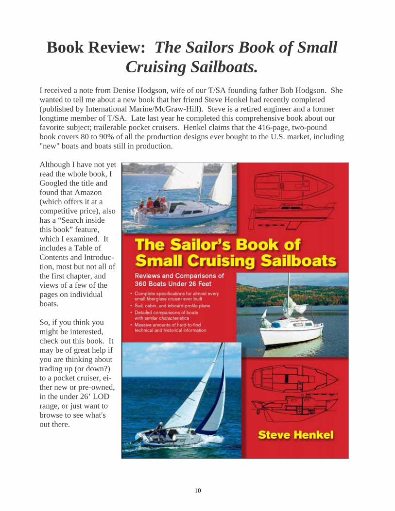
Book Review: The Sailors Book of Small Cruising Sailboats.
I received a note from Denise Hodgson, wife of our T/SA founding father Bob Hodgson. She wanted to tell me about a new book that her friend Steve Henkel had recently completed (published by International Marine/McGraw-Hill). Steve is a retired engineer and a former longtime member of T/SA. Late last year he completed this comprehensive book about our favorite subject; trailerable pocket cruisers. Henkel claims that the 416-page, two-pound book covers 80 to 90% of all the production designs ever bought to the U.S. market, including "new" boats and boats still in production. Although I have not yet read the whole book, I Googled the title and found that Amazon (which offers it at a competitive price), also has a “Search inside this book” feature, which I examined. It includes a Table of Contents and Introduc-tion, most but not all of the first chapter, and views of a few of the pages on individual boats. So, if you think you might be interested, check out this book. It may be of great help if you are thinking about trading up (or down?) to a pocket cruiser, ei-ther new or pre-owned, in the under 26’ LOD range, or just want to browse to see what's out there.

11
2010 North Channel “Early Bird Special” Cruise For two years “Taranui”, with the help of “Eventide” and of “Incipient” has led a 1 week “Early Bird” cruise in the North Channel tailored to boats with sailing experience but little or no specific North Channel experience. In 2010 we plan to offer this option again. The “Early Bird Special” will assemble at Spanish, Ontario on July 10th (one week before the main cruise), and leave the following morning. We plan a week of relatively lazy cruising suitable for experienced boats, and also for skippers with little or no cruising experience who seek a relaxed week of familiarization with cruising in the North Channel. This cruise is intended for capable sailors with properly equipped vessels (see the article “Are you ready for the North Channel”, and the list of required/recommended equipment posted on the T/SA web site), and with the basic knowledge of the nautical rules of the road. This cruise will end by joining with the kick-off pot-luck dinner of the main North Channel “Sailabration” cruise. If after the “Early Bird Special” you want to continue cruising you can register to join all or part of the main 2 week cruise. There is no specific float plan for the “Early Bird Special”. The intention is to sail where and when the wind dictates, and to anchor for the night in anchorages the leaders enjoy visiting. We plan to visit a marina in mid-week for pump out, supplies, fuel etc. and will hold at least one pot luck dinner during the cruise. (Please plan a dish to share, and bring a variety of snacks etc. for sharing at other times). We plan a pancake breakfast, weather permitting, somewhere where we find good blueberry picking. Bring some pancake mix, and a burner removable from the boat if you have one. This cruise is limited to ten boats. If you wish to join please send me an email with the subject titled “Early Bird Special Sign-up”. Please include the following information: Boat name, make, length (model), name of skipper and crew, home port, and the date/location you plan to launch. All those interested in registering should read the article “Are you Ready for the North Channel?” which is available in the cruising section of the T/SA web site. Remember that while the leaders are willing to share their experience, you remain fully responsible for your own boat and crew. Additional information such as preparation (entering Canada, things to bring, etc) and Regula-tions (vessel requirements) can also be found on www.trailersailors.org. Updated cruise informa-tion will be posted on this website, as well as on our Yahoo discussion group.
2008 Intro cruise headed through the Little Current Bridge

12
North Channel Cruise 2010. The main cruise in the North Channel this year will be a little different. This year we celebrate the memory of former cruise leader and T/SA president Wayne Bell, with a “Sailabration”, a cruise taking us to a number of Wayne’s favourite destinations, and trying to respect the style of leadership he brought during his time as cruise leader, and subsequently as president of T/SA. The Sailabration will be led by a team of John Clem-ent, Mike Nelson, and Dave Craigie (each with many North Channel miles under our keels, and each glad to have called Wayne “friend”). T/SA has benefitted from wise and inspirational leadership over the years, beginning with Bob Hodgson our founder. Those of us who have cruised with T/SA in the North Channel have fond memories of Wayne. Wayne, together with Debbie on “Bells Toil” was one of the first cruise leaders I sailed with back in the early 90’s. Many of the ideas I followed in leading later cruises were copied from Wayne, from the hand-out lists of participants to the emphasis on socializing, meeting others, and enjoying our time together. The Float Plan for 2010 will launch at Spanish, Ont., on July 17th, where we will start with a Saturday eve-ning pot-luck dinner together, then on Sunday will head west through the picturesque Whalesback Channel to Long Point. Here we will gather blueberries, share blueberry pancakes, hike to the hilltop vistas, and visit each other’s boats. The next stop planned is Gore Bay, for shore time, pump-outs and pizza, before we head east to the beautiful Benjamins for two nights at anchor, then on through Little Current, including pump-out, shop stop and fabu-lous ice-cream. (Option for a marina night in Little Current or on to anchor at Heywood). The following day we’ll head east to Covered Portage to hike the cliffs, detour to Killarney for their iconic fish and chips, with an option the next night for either Thomas Bay or a second night at Covered Portage. Heading back east, our first stop will be two nights at either Mary Ann Cove, (with hiking possibilities and the option of a day trip to the Pool and Topaz Lake) or at more remote McGregor. (We may split the fleet for this stop, due to size of the anchorages). Then back through Little Current again (Wayne loved the ice cream shop on the boardwalk), with choice of a marina night at Little Current or continuing a few miles further to anchor at Sturgeon Cove. The final night afloat will see us at Shoepack for the traditional last night fireside pot luck dinner ashore, be-fore we head back to Spanish for haul-out and drive home. Those who are able to join for just the first week might launch at Spanish, and return on Sat 24th to haul out. Those able to join only for the second week might plan to launch at Little Current on Sat 24th, and return to Little Current on Sat 31st, for haul-out. Wayne believed in the social side of sailing. We are planning to include a number of different informal so-cial events and idea sharing. Email your suggestions to any of the leadership team. Remember that while the leaders are willing to share their experience, you remain fully responsible for your own boat and crew. To register, please send your boat name, make, length (model), name of skipper and crew, home port, and the date/location you plan to launch to [email protected] Fair Winds (Yes, I adopted Wayne’s favourite sign-off too) John Clement Catalina 25, Taranui

13
2010 North Channel Cruise Float Plan Date Destination Sat 17 Spanish Sun 18 Long Point Mon 19 Long Point Tues 20 Gore Bay Wed 21 Gore Bay Thur 22 Benjamins Fri 23 Benjamins Sat 24 Little Current (marina) or Heywood (anchor) options. Sun 25 Covered Portage Mon 26 Covered Portage or Thomas Bay option Tues 27 Mary Anne Cove or McGregor option Wed 28 Mary Anne Cove or McGregor option Thurs 29 Little Current (marina) or Sturgeon Cove (anchor) options Fri 30 Shoepack for final potluck and farewells Sat 31 Spanish for haul-out Additional information such as preparation (entering Canada, things to bring, etc) and Regulations (vessel requirements) can also be found on www.trailersailors.org. Updated cruise information will be posted on the T/SA website, as well as on the Yahoo discussion group.
Exploring McGregor Bay—2009

14
RAMP REPORT - ST. MARYS RIVER
BY JOHN ULMER At the extreme western end of Lake Huron’s North Channel is an often overlooked, but very interesting cruising ground. It’s really the mouth of the St. Marys River and includes St. Joseph Island, Drummond Island and the many small islands between them. A longer cruise could in-clude Cockburn Island and the western end of Manitoulin Island. Unfortunately, Drummond Island and many of the small islands north of it are on the American side of the border, while St. Joseph Island, Cock-burn Island and Manitoulin Island are on the Ca-nadian side. With border security the way it is today, crossing from one side to the other may not be easy. For that reason, I will provide two separate reports on this area. This one will con-centrate on St. Joseph’s Island and the Canadian side. Because it is off the beaten track, you will find this end of the North Channel much less crowded than the western end. What’s more, much of the boating here is done by fishermen, and they tend to go back to their docks each night, leaving you with the anchorages all to yourself. St. Joseph Island has two nice towns to visit. Richards Landing is at the northern end of the island, and Hilton Beach is on the eastern side. Both have good marinas right in town, giving you easy walking access to everything the towns have to offer. The main point of interest on the island is the ruins of Fort St. Joseph on the island’s southwest corner. The fort is now a Canadian Heritage Park and is very interesting, but it is not easy to visit by boat. It’s a long way from the nearest harbor at Whiskey Bay on the island’s southern
end, but if the weather is good, you might be able to anchor near the fort and dinghy ashore. If you like watching the big ships, St. Joseph Is-land is the place for you. The water flowing past the western side of the island is the St. Marys River, the main shipping route between Lake Superior and Lake Huron. Anchor anyplace on the western side of the island and you’re sure to see a steady parade of lakers go by. The area between St. Joseph Island and Drum-mond Island is filled with many small, tree cov-ered islands of all shapes and sizes. The water here can get shallow, but it's easy to judge the depth by the color of the water, and unlike the rest of the North Channel, there are few rocks. Some of the closer islands belong to Canada, but most of them are in American waters. Make sure you know where the border is, and if you plan to cross the border, check with someone knowledgeable for the proper procedure. The best place to start a cruise of St. Joseph Is-land is at the tiny hamlet of Bruce Mines on the Canadian mainland. It’s located on Rt. 17, about 30 miles east of Sault Ste. Marie. To get to the ramp from either the east or the west, just follow Rt. 17 into town. In the center of town you will see a sign for the boat ramp. Follow the sign to the ramp and marina. The town is very small, the signs are clear, and the ramp is just a block away from the center of town. The ramp is one lane concrete, 14 feet wide. It is 27 feet long and 4 1/2 feet deep at the end, giving an angle of 9.5 degrees and a slope of 16 percent. There is a drop off 5 feet before the end of the dock. Keep in mind that all water levels were measured in 2007 when the water level was about a foot low. It costs $4 to launch and parking is free. Over-night parking is safe and right next to the ramp. See the dock master at the end of the pier for de-tails. He is both friendly and helpful. If you need a dock, they are available for $1.35 a foot, including electricity.

15
For more information call the Bruce Mines Mu-nicipal Marina at (705) 785 3201. Contact me for ramp information at the numbers and addresses below.
Email: [email protected] Phone: (330) 854 3796
Snailmail: John Ulmer 659 South Canal St. Canal Fulton, OH 44614
Ramp at Bruce Mines
Islands at the Southern end of St. Joseph Island
Ship on St. Mary’s River

16
To write or not to write, that is the question.
I think it was a fellow by the name of Shakespray (or some-thing) who wrote that line? For the last few weeks I was having a hard time deciding whether or not to write an account of my sailing adventures of the past summer. Having done so several times over the past few years, I won-der if the readers of Clipper Snips really need another of my musings. Oh well…. here we go. --------------------------------------------------------- For several years now, I have used Tobermory as my starting point for making my way up to the North Channel. I decide to do so again this year (2009). Leaving my home in Sarnia on the evening of July 19, I arrive in Tobermory at 11 pm and park where the parking is free, and bed down in “Go Gently”. At 7 am I wake up refreshed and get a good breakfast in a restaurant. Then a walk to the Harbor-master to pay my $ 10 ramp-fee, and now I am ready to get “G G” launched. At 10:30 she is ready to get her keel wet. But there is much business at the ramp. If you want a helping hand: give a helping hand. One other boat that is being launched is “Wanderer” owned by John & Sandra Manson. Around 11:30 “Wanderer” and “Go Gently” leave port together and head for Cove Isl, anchoring in what I call “Otter Slot” on the south side of Cove Isl. This is only about 3 NM from Tobermory. The Mansons with their dog aboard head back to T. and I start completing the rigging and getting “G G” ship shape for the long haul to Killarney. An hour or two and all is in order. What concerned me a little was that while anchored in this rather narrow space, a cruise-boat from Tobermory came by twice, at a good clip, practically passing right over my anchor. This “Great Blue Heron” has more than 100 passen-gers aboard and I get lots of hand-waving plus real waving from their wake!! If I had been aware of this Cruise-boat coming through, I would have anchored more in the western end.
Other than that, the Otter Slot makes a pretty good anchorage and is handy in case you wish to leave from this area to sail North. In previous years I have made use of the Cove Isl. Harbor which is more secluded, but also a bit harder to get to and out of. This slot behind the Otter islands is easier, and when you wish to go North, you can go along the East shore of Cove. Isl. straight up to Club Isl. Or, like I do this time; go directly to Killarney. After a restful night I am up at 6:30, have a quick break-fast and am on my way by 7:20. Go Gently and I have not been on the water for about 11 months, so this is a good time to check that all is well with boat and self. All is quiet; sunny and not a ripple on the water. That means a lengthy trip on the iron jenny! I’d rather be sailing! Due to activities at home I am late this year, and this caused me to miss out on the pot-luck and captains meeting in Little Current. Too bad! I reach Killarney shortly after 4 pm. After topping up my water and fuel, I make my way to Covered Portage Cove, dropping the hook at 6 pm. Here I have a pleasant surprise: I find 5 other TSA boats at anchor. I quickly get aboard my trusty kayak “Libby” and make the rounds, greeting the folks on: Xanadu, Impulse, Sea Otter and Double D. Gord & Mary MacDonald on their recently acquired motor vessel Sea Hawk, invite me over for supper, which I gladly accept. Wednesday July 22 dawns bright and we are promised a pleasant day. All of us make it up to the Overlook in the morning. At my age it is getting to be a bit of a job to get up there. But, even though I have done so many times over the past years, I enjoy the view every time again. After lunch, more TSA boats start arriving and before long, there is a whole fleet of us! The later arrivals are: Swal-low, Research, Caity, Taranui, Maija Lisa, Incipient, Muddy Wench and Cajun Magic. So once again I get into Libby and do the rounds, saying Hallo, but also getting short messages etc on a card for Wayne & Debbie Bell. Over the next couple of weeks I contact 28 boats for this purpose. Later I mail this card full of love and compassion from Gore Bay. Later we were to receive the sad news that Wayne had passed away. He was a good sailor, a prominent member of TSA, and a good friend to many of us. Before bed-time, I enjoy a good, long kayak trip. The next morning I get to munch on scrumptious Blueberry pan-cakes aboard Incipient! Wow! This on top of my oatmeal! This day starts with a cloud-cover. Several of the boats leave Covered Portage Cove for Haywood Isl. Eventide and Day-dreamer are also with us. We have a following breeze, but I would like it to be a little stronger. I see a few spinnakers and I go wing/wing, using my whisker-pole and getting up to 5 kts at times. G G and I are still a good team and we manage to get ahead of the others. I anchor in the east end of Browning Cove, have a swim and a bath and before long I’m joined by several others. I enjoy a pleasant dinner aboard the good restaurant Taranui. Friday July 24 starts by being overcast. I kayak to the other end of the Cove and check what the others are planning to do. Several are thinking of anchoring at Rausch. I lift the hook a little after ten. I try tacking towards Little Current but before long I find that a bit too frustrating and kick the motor into gear. When getting close to the western finger-docks, I spot an empty space and manage a perfect landing, which at

17
times can be tricky due to the current. Well; what do you know. I end up at the same dock as several other TSA boats. But nobody is “home”. I meet up with several friends in the Anchor Inn and later we have a get-together aboard Grand Finale. Expecting to find several of our boats in Bell’s Cove, I head that way. But the only one there is Windemere owned by Glen Parsons, a new TSA member. Through the night we get much rain and thunder and lightning. The next morning the rain does not stop until close to 11 am. There are about seven of our boats anchored in Sturgeon Cove. The radio informs me that they are about to leave for Croker Isl. By the time I get under way, they are all ahead of me. So, I take up the challenge. “Sik ‘em, Go Gently!!” The breeze is just right and with a bit of juggling with the sail-set and the whisker-pole, G G and I are at times doing better than 7 kts. We catch up and pass all, except that speedy F 27 Tri-Surf-N. I am pleased to see that the Davidsons are back in the North Channel, and as soon as we are at anchor and settled in, I make my way over to them to renew our friendship, which goes back quite a number of years. They have two grand-children aboard. Croker is a good place to be with the cool east wind: we are well sheltered. Our whole fleet gets settled in and there is much dinghying back and forth. On the morning of July 26 (Sunday) we all enjoy a very pleasant get-together ashore for coffee etc. The planned blueberry pancake brunch fell by the way-side due to threatening weather. But the rain stayed away. “Libby” and I make our way around Secretary Isl. which proves to be a bit of a rough ride at times. Later in the day most of us make our way by dinghy or kayak to the north beach of Croker Cove for a pleasant get-together. We get a nice bon-fire going, and then it does not feel so cold! The weather sure could be a bit warmer! But we enjoy ourselves just wandering around, talking and watching the youngsters running with the dogs. When it is time to head back to our boats, it has gotten a bit rough and for some it proves a fair job to make it back! The next morn-ing we are all planning to make our way through Little De-troit and then on to Laurier for the night. Some want to drop in at Spanish for supplies etc. I am having a bad time getting my stern anchor up. I set it in about 2 ½ ft of water, but the bottom here is marl, a kind of heavy clay. And that sure takes a hold of my CQR! Normally I can lift it using my kayak. But this time: no way! I walk over to it in the mud, but when I try lifting it, my feet go down without the anchor coming up! What now…? I can just get Go Gently over the anchor after lifting the rudder up, and then with some mighty heaving it lets go. And so I am on my way! This is not my only problem! When I try to start my out-board, she won’t turn over. Did I use too much juice lately, and depleted the battery? I realize that I have not motored all that much in the last two
days, but have listened to radio and stereo a fair bit, so there is the answer! I wish my Yamaha had a pull start. Now I have to remove the cover plus another cover before I can put the starter cord around the flywheel. Lucky for me: it starts with one pull! Another problem is, that you cannot put the covers back on now that the motor is running! So…. I get going as it is. I motor through “The Pig Farm” below South Benjamin before there is enough wind to start sailing. I keep the motor in idle for now. You need a good set of way-points to navi-gate around the bottom end of South Benjamin. Before long I’m on reefed main and 1/3 jib. It is quite rough, especially when heading west in McBean Channel! I’m again thankful for my Rapid Reef System! It works great, especially for a single-handler. The plan was
to go through Little Detroit, but we find that with this west wind it is wise to head into Hotham Harbor. While head-ing West on McBean Channel, Blue Max and Go Gently are having some fun tacking into the fairly strong wind as we head for the entrance to Hotham. We are pretty evenly matched! That was a rough ride! But Fun! Around noon most of the group is safely at anchor just to the north of Hotham Isl. and well protected from the west wind. This is a
good spot, but getting in you better be aware of a bad sub-merged rock as you make your turn. Co-ordinates for the anchorage: N 46 – 083 / W 82-158. On this bright, sunny afternoon we enjoy a nice get-together around Blue Max. Our Honorary member Bob and his wife from Jetstream are also present; they go around all the anchored boats and toss a nice chocolate bar aboard!! Sae Bridd is also here and so I get a chance to renew my friendship with them. And let me not forget the yummy spa-ghetti I get to enjoy aboard Maija Lisa. This was altogether a very pleasant day. The early morning of July 28 starts of with heavy rain. Lucky for us, it does not last. Most of us head for Spanish for supplies etc. Just one push of the button starts my Yamaha, but I keep her running all the way to Spanish in order to fully charge my battery. I walk into town and join a party of us at Vance’s Restau-rant for a nice fish meal. Back at the marina I manage to get through to my wife Sia on the phone: all is well at home. Maija Lsa and Go Gently leave together and head for the anchorage behind Laurier Isl. There is still a strong wind from the west. We try going through the narrow passage, but I find that there is not enough depth and so we have to go to the west around Wilfred and Laurier Islands which means going along a lee shore in quite rough weather: not too pleas-ant! But at six o’clock we join the other seven boats. Would you believe it! Grant McPhail comes over to me and hands me a nice hot meal: wow! Then I do the rounds of the other boats to say my Good-bye, because most of the others are going for haul-out the next day while I plan to head west.

18
And so; the morning of July 29 sees our boats all heading in different directions. Tri-Surf-N and Go Gently plan to head for Long Point together. As we pull up our hooks, guess who is just coming in to the anchorage?! It is Dave Edgerton in Wavedancer. I had been hoping to meet up with Dave for several days, but no luck. We radio him and he agrees to join us. Since the strong wind is still from the west, we do a lot of tacking, which is exciting in a way, but also tiring es-pecially when single-handing. We keep this up for 7 NM up the Whales Back Channel. That is 7 NM in a straight line; no telling how many miles we actually do. As we go trough the narrows, Dave decides that he has had enough and heads for John’s Hrbr. I try calling him but have no luck, also in the next few days. A little after two, Tri-Surf-N and I drop our hooks in a nice shallow (3 ft) bay at Long Point. We have this bay all to ourselves! We are well sheltered from the west wind which is still strong. Other than that the weather is very nice. I do a fair bit of kayaking, have a swim and then a snooze. Then I get invited aboard Tri-Surf-N for a tasty Spaghetti supper of which I get to take the left-overs home with me! Wow again! The next morning the Davidsons are off to Bell River for haul-out. I enjoy the day with loafing, a swim, kayaking and snoozing. Let me not forget the chore of house-keeping. I like to keep a neat boat. I also do a few odd jobs; those always seem to crop up somehow! A couple of seams on the bimini are coming loose and need stitching before ripping further. I find my needles but fail to find suitable thread. For jobs like that, I like using fishing line; mono-filament. But I seem to have left this at home. So I kayak around to the other boats at anchor to see if I can beg some. One helpful boater gives me a whole spool! And so; before long that job is done. Next I go rock-walking and blueberry hunting. There is a good harvest along a ridge that nobody has discovered. I take enough for a nice meal of blueberry pancakes and leave the rest for the bears. They need them to fatten up for their long winter sleep. In the evening Libby (my Kayak) and I go for a very long ride outside Long Point Cove. This is a really good area for that. Before bed-time I do my chart-work for the trip to Gore Bay and the return to the Benjamins. I would have liked to stay here for another day, because I have al-ways enjoyed Long Point, but I should try to hook up with Murray Cleland and others. I am kind of sorry that I did not climb the over-look, but remembering how steep it is to go up there, I decide to leave that for the younger folks. I’ve been active enough as it is! The next morning is Friday, the last day of July. I’m off at 10 am, leaving this pleasant anchorage behind. The wind is in my favor for the 21 NM to Gore Bay, giving me a great ride broad-reaching all the way at around 6 kts. I had to put Libby on a longer leash, because at times she tried to nuzzle up to Go Gently! Whenever I arrive at Gore Bay, I make my way to the shallows in order to anchor away from other boats, rather than taking a dock. Before long I’m walking the main street. Well… here is a surprise! I had been trying to reach Murray Cleland on the radio. And here he comes walking towards me! We have a hearty re-union and before long the rest of
the Cleland Clan shows up! I do some shopping and mail the card with messages for the Bells. Then I visit with Murray and family on D dock. They all make me feel like I’m part of the group. When I get up the next morning, I find a lot of Canadian wildlife aboard! Thousands of tiny flies are everywhere. It is best to let them be; eventually they will fly off by them-selves. A fast walk up to a public telephone and a call home puts me at ease: all is well. The Clelands and I plan to meet up again. And then I’m off at 10 am. This should be a good and fast sail to the Benjamins. The wind is from the south and the sky is blue. And I have a good boat under me. What more do I want! The water is fairly rough and so, Charley, my autohelm lets me down; he is all over the map! That leaves me no choice but to hand steer. I have to put Libby on a long leash again. Otherwise she acts like a small dog and wants to nuzzle up to the rear end of Go Gently! By the way: my daughter Linda in Florida has a Chihuahua called “Libby”. And the model name of my kayak happens to be “Liberty”. So, I decided that “Libby” is a suitable name. It proves to be a tough bit of sailing for 2 ½ hrs at better than 6 kts, but it is exciting sailing! Finding a good spot to drop the hook in Benjamin Bay proves to be not so easy. There are a lot of boats at anchor and twice it happened that I had to move because some skip-pers have way too much rode out. Next, I have to move once more because the wind turns and it becomes too choppy for my liking. After four tries, I’m finally settled. For the rest of the afternoon we are in for rain and a mostly dark sky. But a quiet night. And so it is Sunday again; Aug. 2. What shall I do with the day? First a swim after breakfast. Then I take Libby out for a long spin. The sky has cleared, but it is quite windy. Trying to exit the Bay by way of the narrow gap between North and South Benjamin is a no-go! So I paddle around the east and south side of South B., and check out the neat anchorages in South Benjamin. Amazing: there are no sailboats here at all. Usually you will find at least half a dozen tied up. But not this time! So I go back to where I came from. Now what? Just then Jason Cleland and a friend drop by to say hallo. Jason and Tara are on their bigger boat “Surprise”, anchored in Croker Cove. We make some so-so plans for going east tomorrow. Even though it is now quite rough in the Bay, I make my way to the north shore and check out all the neat little hidy-holes, having a chat with a few of the folks at anchor there. I have a tough paddle back to Go Gently, because the wind has increased even more! Using my kayak, I bring out my second anchor and make sure both are set well. My next effort is to walk across to the south side of South B. Walking up the long, fairly steep incline is good exercise. And don’t get lost on the rest of the walk! But, finding a few handfuls of nice, juicy blueberries restores my energy. Ending up at the high overlook at the south end, I meet up with some nice folks who are willing to take some pic-tures of me, with the Sow and Pigs rocks as back-ground. I return the favor. This gives a good view of what I call “The Pig Farm”. So I am now a pig-farmer! After this walk,

19
I meet up with a couple of nice people who come from Ot-tawa, where they sail their 22 ft “Karma” on the Ottawa River. We have a good meal together aboard their boat and I give them the info needed to get a membership for T/S A. During my five weeks of sailing in the north, I do this five times. I wonder what the results will be. I often wish we had up to date forms or so. Then I go back to the north shore to get some of the red, coarse sand that I had spotted earlier. This is meant for the bottom of our bird-bath at home. By now it is late and I better get to bed. Yes: I’m up early with plans to get as far east as possible. But first I intend to surprise “Surprise” by going to their lair at Croker. Well, wouldn’t you know it! They surprise me instead by coming out just as I am about to enter! And so we are on our way together. We have to motor until rounding Elm Isl. But from there on we enjoy some very good, fast sailing. The wind has come up and is in our favor. Our two boats are mostly neck-and-neck. We don’t even stop at Little cur-rent, but go through the 12 o’clock bridge. I make radio contact with Taranui: we may meet at Thomas Bay on Wednesday if all goes well. Once past the bridge, it gets rougher and windier. I have to hand-sail Go Gently, and at times she is on her ear! But I manage to keep up with Surprise most of the way. I’m hav-ing a tough time of it, especially after Haywood Isl. But once into Lansdown Channel things settle down. Just before 4 pm we are at anchor in Covered Portage Cove. That was 40 NM of fast sailing; my knot-meter shows a max. of 7.4 KN! No wonder I’m tired. By 8.30 I am in bed! Sometime the next morning I decide to move to where the Cleland Clan have their three boats anchored and tied to shore. They are at the east end close to the entrance. All eight of them plus myself climb up to the over-look and enjoy a pleasant time up there. Since Jason and Tara want to leave for the Bustards, they go down before the others and I decide to go down as well. They start to maneuver Surprise out of the tangle of lines etc, which proves to be a bit of a job. I watch with interest from the comfort of Libby. Just when I go back to my boat, a strong blast of wind comes up. I realize with a shock that my Delta anchor is dragging and Go Gently is heading for the rocks that are close at hand!! It’s a good thing that my CQR anchor is handy in its storage pipe on the back rail. I quickly throw it overboard, hoping for the best! And yes….it holds and those rocks are not get-ting any closer. But I am now sideways to the wind which is not so good! Jason manages to move my Delta further out and it sets OK. But it is getting very windy and uncomfort-able in this corner. I am discovering that under certain bot-tom conditions the CQR does a better job than the Delta.
Should I switch them around? What to do next? We talk it over and decide that we better move to a more benign corner. I go and investigate in Libby. When I get out of the Cove and around the corner, I find quite a group of boats at anchor, but there is still room for us close to shore and out of the wind. This is perfect! So now we have the chore of moving our boats out of that bad corner without being blown onto the rocks. Jason gives a helping hand, but then he and Tara have to leave: they both have jobs to get back to. Murray hops aboard my boat and gets my boat and anchor up. Before long our three boats are safely tied up to the rocks with a well-set anchor out. That proved to be a lot of work! I get an invite from Rosalind to come and
share her delicious blueberry pan-cakes. She does not have to call me twice for that! After all that I’m ready for a snooze. And then a good supper aboard Rosalinda. The evening turns out nice and I take Libby for a spin. (Sometimes I think that I’m taking my daughter’s “Libby” for a walk!) There is a neat little gunk-hole just to the east of us, just big enough for about three boats. I go check this out, but there is a boat already in, tied up to shore in such a way that the whole hole is occupied.
This has been a good and busy day to enjoy. Except for that one tense moment! Aug 5. All three boats leave CPC at 9 am. Both Rosa-linda boats (old & new) head for Little Current. It is a good jib-sail for Go Gently to Killarney. I manage to squeeze in at the public dock. For lunch I have fish’n chips, and then walk over to The Mountain Lodge. This is quite a place. It would be neat to spend a week here with my wife! But it would cost quite a few dollars. I buy gas and some other supplies. Taranui drops in: they are heading for Thomas Bay, and I am soon on their tail. Again a very good Jib-sail. It is rather breezy even in this Bay. So I better set both anchors, drop-ping the second one by way of using Libby. I set them at about 45 degrees. John and Irene Clement and son Eric come over to Go Gently for a meal of Blueberry pancakes and some gamming. It turns into a pleasant evening but rather cool. I had put up my dodger before the company came aboard. And we are quite cozy! The new day bring pleasant weather. I go aboard Taranui for a cup of coffee and to say goodbye: they are leaving for Little current and I’ll be alone for a while. This is a good time to do something about that anchor problem. I want my CQR on the bow roller and the Delta in the pipe on the stern rail. This would be easy if I had a third anchor, but I don’t. I could tie up to shore, but that is a bit of a chore. There is a breeze so I need to have one anchor set. This takes a bit of thinking and head-scratching!! The bow-anchor rode passes through a fairlead on the roller, which makes it more of a problem. (See if you can figure it out). After an hour and some coffee I have it all done and under control. A couple on a powerboat nearby have been watching these

20
Then some jam on top and I have a great desert! Later the sky is dark but we get no rain (yet). But sure enough: in the morning there is a dark sky and lots of rain and thunder! Later in the morning the rain stops but it remains dark. I go for a long kayak ride and after lunch, decide to up anchor and head for the Bustards. Just then Murray Cleland calls: they are anchored in the Bustards, so that works out well! It only takes me 1 ½ hrs to join them. They are tied up to shore side-ways and they can step off the boat right onto shore. I wonder if they might get a visitor such as a raccoon!? We have a get-together and sup-per aboard Rosa Linda and make our plans for our trip down to the bottom of Georgian Bay. The evening was pleasant to sit in the cockpit. But the next morning starts with a dark sky. I’m busy doing my laundry and other chores. Then I kayak over to Rosa Linda to plan a kayak excursion to the other side of the Bus-tards. We leave at 12:30, going down Wicks Channel and through a narrow slot, just wide enough for the kayaks. Murray and Rosalind have their clear plastic umbrella up and with the breeze in the back, they are doing well, enjoying a free ride. I think I’ll have to get one of those things! The sky has cleared and it is a very pleasant day for some tripping around. Before five we are back at the boats and ready for a good meal aboard Go Gently. During the night I hear the call of a Loon; this is always music to my ears! Aug. 11 dawns with sunshine, but it does not last long. Dark clouds are soon rolling in. I go for a long rock-walk and then Murray and I do some way-point work on his GPS. Shortly after 11 am we are off for our trip to Black Bay, go-ing the outside route. The sky has cleared and we enjoy a gorgeous day without wind; so it is motoring all the way. At 2:30 our hooks are down behind Golden Sword Isl. I show the Clelands the beauties of Linda’s Isl. For those who don’t know: some years ago my daughter Linda explored this small island and claimed it for herself. It’s at 45-478//80-405. When we get back to the boats, the wind has come up and we decide to move to Cardinal Cove. One time, when we were here, there were hundreds of Cardinal Flowers along the shore. So I decided to call this pleasant small anchorage Cardinal Cove. It’s at: 45-482//80-4055. Here we are totally out of the wind and after veggie-burgers etc. aboard Rosa Linda, we have a pleasant evening together. When going into this Cove you have to watch out for some rocks to star-board. Also in Black Bay, there are two bad rock ledges to watch for. Remember that song from Oklahoma: “Oh what a beau-tiful mornin’”? Well, that’s the way it is on this new day! But…. as I get ready to go for a swim, I see a large leach right at the boarding ladder! No swim this morning! I have a sponge-bath instead. Other than that, it’s a real summer day. We go for a two hour kayak trip up Black Creek, up to the beaver-dam. Then, at 2 pm we are on our way to Britt. I have a terrific jib-sail all the way up the river to Britt. Both boats take a transient dock at St Amants so we can get gas and other sup-plies. I call home and am glad to find all is OK there. The three of us enjoy a meal at The Little Britt Inn and at
proceedings with interest, so I paddle over to explain what was going on. Next I paddle out of the bay and guide a larger sailboat in: they are not too sure about the entry. I invite them over for coffee aboard Go Gently in the evening. Then I kayak over to an island where I found a good crop of Blackberries last year. Again I end up with a good amount of these. What shall I do with these? Ah ha….I make a stiff mix of pancake flour, mix in a handful of berries, and put about a cup of this in a saucepan. With a heat diverter between flame and pan, I produce a nice cobbler of about an inch thick! Now some maple syrup on top and voila! Yum yum! Do you remember the story of “Excalibur”? This was the sword that only King Arthur managed to pull from a rock. While walking around on that island, I noticed the handle of a table knife sticking straight up out of the rocks. It took a bit of a pull, but it came free and is now part of my cutlery collection. In the evening Kathy and Dave (?) come over for coffee and they bring a very tasty blueberry pie which they had bought in Killarney. They leave me part of the left-over, which I appreciate. Early the next morning I kayak over to “Eros”. I’m in-vited aboard and when they find out that I have not been able to phone my dear wife Sia for some time, I get to use their cell-phone and so I’m happy to learn that all is well at home. Next I go for some rock-walking on Thomas Isl. and then I’m off going through Collins Inlet, sailing at a snails pace, but enjoying the scenery as always. Before long the Yamaha has to take over. Up above is a nice blue sky with mackerel clouds. Once out of Collins Inlet, I go down Beaverstone Bay to the anchorage at Muskrat, where I drop the hook at a little after two pm. This is the first time that Go Gently is the only boat here! Even though it was a sunny day, it was quite cold with a south wind. In the evening, Cirrostratus clouds are coming in from NW, telling me that a change in the weather is due. I put my dodger back up and then I redo most of that an-chor work again because I have decided that the heavier, longer chain would serve me better on the bow-anchor. Later in the evening the wind is down and I kayak around the entry island and then climb this to the top. In the past a group of us have spent a pleasant evening with singing around a camp-fire. Good memories! After my breakfast the next morning, I find that the weather is not bad at all, although cool. What will this day bring? I leave Muskrat shortly after 9 am. Once I get outside Beaverstone, I’m into rough water. As I am heading for The Bad River, I am motoring into unpleasant waves of about 5 to 6 ft. The weatherman tells me that they are 8 ft, but he is exaggerating. Nonetheless this is not a pleasant ride! Before 1 pm I have the anchor down in calm water. There are only six large sailboats in. Later in the afternoon, after having done a few needed jobs, the weather starts to become unpleasant and I move to a calmer part of the bay and put down my second anchor. It was a good thing that I left the dodger in place! It is quite cozy in the boat. For supper I make two of those delicious blackberry cobblers: they turn out great! Five inch across, one inch thick.

21
7 pm we are off to Olga Bay. This anchorage is another of my favorites. It is quiet and secluded. We agree that we had a good day again, busy but pleasant! And the next morning is again the best of summer weather. We make good use of the day! I’m up before the others and take Libby for a spin. Around here I usually meet up with several beavers. But not this time. However I get to enjoy a courtship dance by two loons, with lots of loon-laughter. Then I surprise a raccoon, but he takes off before I get a picture. After lunch we go for a long and interesting kayak trip around Olga Isl. down Whitefish Channel. We have some fun trying to find a passage to the other side. Af-ter some searching we find a narrow channel with a very short portage, and we are now on our way to the Lighthouse. The Clelands make me jealous umbrella-sailing their kayak. On the way back we pass some interesting lava rocks with beautiful orange lichen. At 4 pm we are back at our boats. Before having supper aboard Rosa Linda, I clean up with a swim, bath and shave. We both get our way-points in for the trip to Franklin Isl. Aug.14. We have about 27 NM ahead of us. As I usually do, I go kay-aking and rock-walking in order to lim-ber up for the day. We leave this nice anchorage at around 11 am, destination Nadeau bay off Shawanaga Inlet. At first we enjoy some good sailing, but that changes to motor-sailing. We make good time and at 5 pm we are in this well protected bay. It is again a nice evening and a good night for sleeping. But in the morning it looks like we are in for different weather. I take “Libby” for a walk into the next bay, where Sia and I saw a couple of big bears some years ago. However this year I get to see little wildlife. Too bad! At 11 am we are on our way to Franklin Isl. We get the south wind right on the nose, so; it is motoring all the way. As we are about to enter our anchorage on the west coast of Franklin, we are practically cut off by about fifteen big ciga-rette boats! In previous years I have enjoyed several pleasant days here. But not this time!! Murray had already decided not to enter and they are on their way to Snug Harbor. I have a hard time extracting my Go Gently from this crowded and stinky anchorage. I loose sight of R L, but then we think of looking into Regatta Bay. That also proves too crowded. What next? By way of the narrow Canoe Channel we make for Kilcoursie off Killbear Park. There is a dedicated anchor-age and as usual it is rather busy, but we do find a spot that is not too bad. There is quite a nice beach close by, as well as nature trails. If you go ashore you are asked to get a day-pass. This is a very busy and popular Provincial Park and busy in the vacation season. I go to visit a dear friend of Sia and myself who owns a cottage on the south side of Rose Isl. Her hus-band passed away a few years ago, but she still comes here with family.
On my way back to Kilcoursie I see a number of Mirror Dinghies racing. Many years ago I used to own one of those 12 ft sailing dinghies. I kayak over to two trailerable sail-boats and give these folks all the particulars and advantages of becoming members of T/S A. During the five weeks of my sailing I have done this about five times. You never know: we could use more members. Close by is a neat island called Davy Isl. It interests me because of a geological feature: the whole island is tilted. I kayak around it and take a number of pictures. Later we do our way-points for tomorrow and play a card-game. Monday Aug. 17. At eleven we are off for our next target. We plan to anchor in Echo Bay. But first we stop in at the well-known Henry’s Fish Restaurant on Fryingpan Isl. where we enjoy a delicious meal. I take lake trout and have enough to take a piece back to the boat. Our trip to here was nothing to write home about: mostly wind on the nose. At six o’clock
we are at anchor in Echo Bay. Even though my kayak painter is floating line, I manage to wind it around the prop. Sitting in the kayak, I have to take my prop off to free the painter. It is still in good condition luckily. Then we play cards again aboard Rosa Linda. I have to find my way to Go Gently in the dark! Next morning we plan to do some exploring by kayak. It is a dark morn-ing and we might get some rain. The plan is to go around Sans Souci Isl. but the creek that used to be naviga-
ble is now all choked up with weeds. Too bad! We are kay-aking in the rain and singing: “”Singing in the rain. I’m singing in the rain””. We are having fun exploring new terri-tory. Later we check out and anchor in Garden Channel. This is a good anchorage to keep in mind. Leaving this place, we have some interesting fun sailing in variable winds for the next two hours. We are mostly close hauled and pinching it. There is a beautiful sunset. At about 8 pm we arrive at Twelve Mile Bay where we anchor in a neat cove at coordinates 45-055//80-045. This is again a good secluded bay and there are a few larger sail-boats in. The red sunset promised us a nice day. And that is what we get! I go out in Libby to explore the area: it is new to me and quite interesting! We take it easy until lunch-time and then we are on our way again for the next 20 NM. I sail most of it, but it is tricky sail-handling and mostly by way of buoyed channel. And there is a fair bit of motorboat traffic. At 3 pm the wind dies and we motor for the last two hours. We have a bit of a hard time to find “Lost Bay”. No wonder they gave it that name! It is a nice secluded bay, but we get quite a breeze in and so I set a second anchor, which proves to be a smart thing! This is a bay on the west coast of Beau Soleil Isl. which is a federal park with quite a number of nice anchorages and lots of trails to explore. It was sunny and warm all day; all told a very pleasant day!

22
We have a hearty meal of spaghetti aboard Rosa Linda, and go to bed early. Next morning I take Libby out for a jaunt of about two hours. It is fun to explore unknown territory and several bays. A float-plane lands and takes off several times and I get a little concerned about my safety, until the pilot waves at me; so long as he knows I’m there, all should be well. On the way back I buck up against the wind and when I am at Go Gently, I figure I’ve had enough exercise for the day! So I have some lunch and a snooze. But; at two o’clock Murray and Rosalind wake me up. They insist that I come on a trail-walk! I tell them I have done enough for today. Oh well; OK then. I’ll go a little way with them! After three hours we are back at Lost Bay!! We start off by getting a good walking stick each. This is not all easy going; we have rocks and forest and what not! Oh… and twice we find quite fresh bear-droppings in the middle of the trail! A little scary! At the half-way mark we come to Chipawa Bay where we rest and swim. On the way back we get some rain and pesky mosquitoes. But we are happy and singing! At 5:30 we are back at Lost Bay. Just then heavy rain and thunder starts. And the wind picks up. It is only one minute kayaking to our boats, but we barely make it in time!! A squall line comes through and after that it becomes really bad and a bit frightening. Boy; am I ever glad that I have both anchors down! My tail-end is very close to the rocks at times, but all goes well. Both boats are violently being flipped from left to right. The lightning is constant but after about an hour this very bad front moves off to the south-west. We had planned a nice meal aboard Go Gently, but since the wind is still up, we decide against that. To S-W of us, the lightning and very black sky indicate tornado weather. This is later confirmed over the radio. At Collingwood the situation is bad. Friday Aug.21 gives us a pleasant morning and a chance to dry out a few things. Libby has accumulated more than two buckets of water from all that rain, which is quite a job to bail out. Two years ago I made a nice plastic cover which kept her dry. But a couple of weeks ago, as I was scrubbing it clean, it broke in four pieces. The plastic had become brittle. Since then and in the days to come, I have regretted this very much. I will need to make a new one before long. Around ten we leave Lost Bay. It is still very windy from the south. After motoring about 8 NM we come into Penetang Harbor and stop off at a marina for gas and water. I try phoning Sia, but find that the phone connections are bro-ken due to yesterday’s bad weather. We call for dockage at the municipal marina across the bay in Penetanguishene and ask for some help with docking because of the wind. As we enter the dock basin, we are being pushed in by the wind. Two young ladies help Rosa Linda and they are OK. But I’m pushed towards the dock bow in and the one helper is not able to do a thing! In a way I’m glad that she could not get a hold, because she might have broken an arm! Even though I have my outboard in reverse, the prop is cavitating and the wind drives my boat into the dock. That sure stops me!!
Once I have secured my boat, I find that the anchor on the bow-roller had hit and the nice mahogany bowsprit is now split! That will be quite a job to fix once I get home! I can reach Sia only by borrowing a cell-phone. She tells me they also had bad weather. The bad news is: she has again a bout of pneumonia! And I get to hear that she got a phone-call from the police in Tobermory that my van which, is parked in the free municipal parking lot, has been spray painted by vandals; luckily not broken into! Murray and I decide to stay at the docks for the night. When I go to pay, I tell about my ramming the dock. The harbor-master feels so bad about this, that we both get free dockage! We soon meet up with friends of the Clelands. They are launching their boat “Black Eagle”, which is also a MacGregor 26X. The three boats will be sailing together for the next few days and later Surprise with Jason and Tara will join us. In the morning Black Eagle is loaded up and made ready, and shortly after noon we are off to Beau Soleil. At first I try some jib-sailing but the wind is weak and fickle. A little later it becomes exciting and I’m actually tacking on jib alone! We end up anchoring at Cedar Beach, but around four I de-cide this is too open and I move to Chimney Bay and anchor out of the north wind. There are quite a number of boats at anchor, but I find a good spot and enough room for the other two boats. I try calling them on VHF, but have no luck. Since it is quite cold, I put up my dodger. That’s much bet-ter! At 5:30 I decide to go look for the others. It is still rather windy with some rain. But I’m in the mood for a kayak ride. I end up going all the way back to Cedar Beach while search-ing for two MacGregors at anchor. While heading back north against the wind, I even check a few bays without and sign of them! Where can they be? After two hours, I’m back at my boat. Finally I get a hold of Murray. He explains their position and by way of the chart, I see why I could not find them: they are in a secluded bay, rather tricky to enter! It’s called Treasure Bay. After breakfast the next morning, I leave and make my way to Treasure Bay, where I find the other two boats tied up to a floating dock in this small, shallow bay. I decide to anchor. It is quiet here with just the three of our boats. Talk about hiding from the world! After lunch we leave and I anchor in Papoose Bay while the others tie up to the public dock. It remains breezy and rather cool. Jason and Tara are also here in Surprise. We have a pleasant afternoon together, going ashore and doing some walking. J and T have to leave; after all, they are still tied to their jobs! But us five are retired and so, we can go and play! And that is just what we do. Near papoose Point are two small islands with some very interesting large rocks. These are erratics brought here long ago by the glaciers of the last Ice-age. We find one large slab of rock that is resting on only three very small points! So we all take turns lying underneath and acting as if we are being crushed, while our picture is taken. Quite impressive! With others, we act as if we can push them over. And so we have lots of laughs, just like a bunch of kids! Even though it is cold and windy, we enjoy a good meal ashore at a picnic table. Then coffee aboard Rosa Linda, and shortly after 8:30

23
I am back at Go Gently and into bed. Monday Aug. 24 is our last day together. At eight o’clock I’m already out in Libby and make Thumb Point in 15 min-utes. There are some neat photo-ops here and I get several good shots. One large round rock is on a slope towards the water and looks ready to be pushed in! While I make believe that is what I’m doing, someone takes my picture. It turns out great! Then I go to Finger Point for some more of the same. When I am back, we enjoy another good meal to-gether. I am beginning to feel a bit like “Freddy the Free-loader” due to all the times others have fed me! But I can’t just say “No” can I? Thanks once again dear friends! The weather forecast for the next day sounds very favor-able for my trip back to Tobermory. The others agree with me that the predictions for wind, waves and the rest of it, sound good. And so, after hearty farewells, I make my way to Lost Bay, which is about 7 NM. Again, the forecast is Fair/winds 11-16 KTS/SW/, wave height less than 6 ft. All: decreasing. So, I feel pretty confident about my plan to make for the east coast of the Bruce Peninsula. I do my chart-work. It will be 10 to 12 hrs. I check out the boat and amount of gas etc. All looks OK. And the red sunset also promises a good day! The next morning I’m up at five and lift the hook at six. The rest of my story you could read about in the previous Clipper Snips where you discover that I had a VERY BAD DAY!!! From Tobermory and back Go Gently was in her watery element for 5 ½ weeks and took me 563 NM without major incidents. Except for that one miserable day. But that was not her fault! I don’t know how far Libby carried me, but I’m sure that was also quite a few miles! And another thing::: Quite a number of our sailing friends complained about the cool weather. In Aug 2008 I submitted an article entitled “Our Spotless Sun.” This told about how our Sun has very little acne at present. And that this lack of spots would mean less warmth for our earth. Well; there may be some truth to that! However, it also meant that we were troubled less by hordes of mosquitoes! Personally, I found it more pleasant to go for a swim, be-cause due to the cooler air, the water seemed warmer!
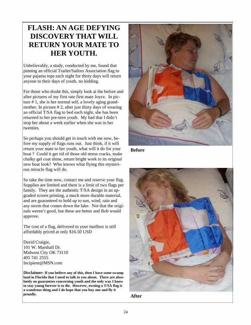
24
FLASH: AN AGE DEFYING DISCOVERY THAT WILL RETURN YOUR MATE TO
HER YOUTH. Unbelievably, a study, conducted by me, found that pinning an official Trailer/Sailors Association flag to your pajama tops each night for thirty days will return anyone to their days of youth, no kidding. For those who doubt this, simply look at the before and after pictures of my first rate first mate Joyce. In pic-ture # 1, she is her normal self, a lovely aging grand-mother. In picture # 2, after just thirty days of wearing an official T/SA flag to bed each night, she has been returned to her pre-teen youth. My bad that I didn’t stop her about a week earlier when she was in her twenties. So perhaps you should get in touch with me now, be-fore my supply of flags runs out. Just think, if it will return your mate to her youth, what will it do for your boat ? Could it get rid of those old stress cracks, make chalky gel coat shine, return bright work to its original new boat look? Who knows what flying this mysteri-ous miracle flag will do. So take the time now, contact me and reserve your flag. Supplies are limited and there is a limit of two flags per family. They are the authentic T/SA design in an up-graded screen printing, a much more durable material, and are guaranteed to hold up to sun, wind, rain and any storm that comes down the lake. Not that the origi-nals weren’t good, but these are better and Bob would approve. The cost of a flag, delivered to your mailbox is still affordably priced at only $16.50 USD David Craigie, 101 W. Marshall Dr. Midwest City OK 73110 405 741 2555 [email protected] Disclaimer: If you believe any of this, then I have some swamp land in Florida that I need to talk to you about. There are abso-lutely no guarantees concerning youth and the only way I know to stay young forever is to die. However, owning a T/SA flag is a wondrous thing and I do hope that you buy one and fly it proudly.
Before
After

25
Roy Eaton bestowed volunteer award from Canadian Safe Boating Council
In Toronto, on Sunday, January 10th, Roy Eaton was awarded the prestigious Volunteer of the Year, a National Award by the Canadian Safe Boating Council of Canada (CASBA). During the Gala Evening at the Sheraton Hotel Centre, over 100 enthusiastic people were present, including Margaret and Jim Van Camp from Little Current, who surprised Roy and his wife Margaret by attending. I flew in from New York City to honour the Eatons, for whom I have the highest regard, and also to attend the To-ronto Boat Show. Roy Eaton's Award was presented by Host Ted Rankine, who told how Roy began the Cruisers Net, and how popular it has become every summer to boaters in the North Channel. The alliance of the Canadian Safe Boating Council members are committed to learning competence in boating and preventing boating injuries across the seas, from Halifax and St. Johns, to Vancouver and the Yukon. The evening was devoted to honouring the winners of an annual CASBC competition celebrating outstanding achievements in safe and responsible boating. Two recipients were from British Columbia, one from the North West Territories, Roy and two others from Ontario and one from New Brunswick. Ted Rankine, Host and Organizer of the Dinner hailed Roy; "This is the highest honour, celebrating a body of work that has contributed to a safe marine environment. We've seen the database of callers on the Cruiser Network since you've begun. It is amazing how your listeners and callers have increased. This year, 5,848 calls were recorded from 1,003 individual boats. Reports from those who nominated you have told about how you helped a boater with a fish hook embedded in his hand. How you have relayed good news: "Hello Grandma!" And how you have helped in times of difficulty: "Please call home." Roy began in a cramped office near the bar at the Anchor Inn. Bruce O'Hare, the owner, is so generous, that he has funded the growth of the network. The following year, Roy moved up to the sec-ond floor conference room, where boaters now come to land to visit Roy, listen in and help him record boat names and numbers. Cruising World Magazine wrote a feature about sailing and boating in the North Channel on Roy and Bruce. I have stood in the back of the room during the summer to hear Roy's broadcast, writing that he is "Manitoulin's Summer Morning Man." After that, I go and have a delicious breakfast at the restaurant below. "It's still a shock to receive this award, " Roy said, standing at the podium, thanking everyone for the Plaque of Honour he received. "To think that a number of people took the time to nominate me is greatly appreciated. All of you present are invited to call in this summer when you are the region. If you have a problem or need help, I give out my home phone number."

26
Roy rises at 5 AM during July and August to prepare the morning's broadcast of weather, news and sports scores. He does a feature, "This Day in History," and shares historical facts about Little Current and the surrounding area. He also tells of local happenings, dinners, shows and what to do on the island and events along the North Channel. Roy had become an informal ambassador for Manitoulin Island operating on the local VHF Marine Channel. The Canadian Coast Guard, listening and admiring his daily broadcasts, realized he has become so valuable, he is listed with the Thunder Bay Coast Guard, which has responsibility in this region and the Trenton Air Search and Rescue Team. The channel was changed to Channel 71 to become the formal home of the Little Current Cruisers Net, broadcast from the Anchor Inn. Roy's unique voice blends his authority as a former teacher and principal, a practiced sailboat captain plying the North Channel, with his personal warmth and constant tinges of humour, his marvelous irony at times, and fun. But he is all business when he opens his daily broadcast with :"Is there any emergency, medical or priority traffic?" He has helped with a gamut of emergencies, helping to solve them as quickly as possible. Each broadcast ends with call-is, and boats over a 50 mile radius call in with name and location. Boaters have come to love Roy’s broadcast so much, that they come to The Anchor Inn to the second floor to meet him, bring a burgee of their yacht club to pin on the wall, and then go downstairs to have a deli-cious breakfast at The Anchor Inn. That's what I do. It has been an honour for me to fly up to be with Margaret and Roy Eaton, and Margaret and Jim Van Camp to celebrate just one of Roy’s charitable and memorable network. Hail to Roy Eaton, Recipient of Canadian Volunteer of the Year for 2009, and to Bruce O'Hare, who supports him from the sidelines, and to the constant, tireless work of the Canadian Safe Boating Council. Good morning boaters, I've attached an article which appears in this week's Manitoulin Expositor. I'd like to add that seven awards were presented by the Canadian Safe Boating Council that eve-ning. Two recipients from British Columbia, one to a man in the North West Territories, in addi-tion to my award there were two other recipients from Ontario, and one from New Brunswick. What a honour to be part of this national group. Over this past while, we have been talking about Man Overboard actions. Coincidentally, one award was entitled "Rescue of the Year" and went to a man who saved his friend from the waters of the Strait of Georgia off Vancouver Island. His friend who fell overboard was a very experi-enced fisherman who spent his whole life on the water but it only took a moment of inattention to toss him into the cold waters. It was very moving to hear the story of the rescue. The other awards were for Marine Professional of the Year, Clean Marina (won by Mainer's Cove Marina just south of Parry Sound), Best Boating Safety Initiative, Safeguarding the Environment, and a Special Recognition Award. In accepting my award, it really is to be shared with so many of you who have assisted over the years when I have been able to do a broadcast, to those who have donated so we could have the best equipment available and to those of you who have dropped in and helped record the calls. This past year, there was an average of 96 calls a day, with the record being 162 calls in one day at the height of season. In particular, as the article states, the support of the Anchor Inn from the very beginning has been invaluable. Without their support, we simply wouldn't have a Cruisers Net, thank you Bruce & Kelly O'Hare and Rob Norris.
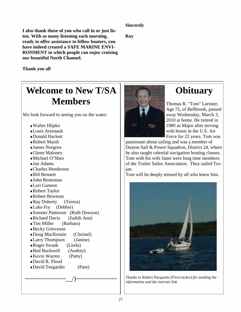
27
I also thank those of you who call in or just lis-ten. With so many listening each morning, ready to offer assistance to fellow boaters, you have indeed created a SAFE MARINE ENVI-RONMENT in which people can enjoy cruising our beautiful North Channel. Thank you all
Sincerely Roy
Obituary Thomas R. "Tom" Larimer, Age 75, of Bellbrook, passed away Wednesday, March 3, 2010 at home. He retired in 1980 as Major after serving with honor in the U.S. Air Force for 22 years. Tom was
passionate about sailing and was a member of Dayton Sail & Power Squadron, District 24, where he also taught celestial navigation boating classes. Tom with his wife Janet were long time members of the Trailer Sailor Association. They sailed Tro-jan. Tom will be deeply missed by all who knew him.
Thanks to Robert Pacquette (Firecracker) for sending the information and the internet link
Welcome to New T/SA Members
We look forward to seeing you on the water:
Walter Hlipko Louis Arsenault Donald Hackett Robert Marsh James Norgren Glenn Maloney Michael O’Shea Jan Adams Charles Henderson Bill Bennett John Reuteman Lori Gannon Robert Taylor Robert Bowman Ray Doherty (Teresa) Luke Fry (Debbie) Sumner Patterson (Ruth Dawson) Richard Davis (Judith Ann) Tim Miller (Barbara) Becky Grieveson Doug MacKenzie (Christel) Larry Thompson (Janine) Roger Swank (Linda) Bud Buckwell (Audrey) Kevin Warren (Patty) David R. Flood David Teegardin (Pam)
~~~~~~~~~~~~__/)~~~~~~~~~~~~

28
THE BAY OF ISLANDS excerpted with permission from the 35th Anniver-sary 2010 Edition Well-Favored Passage: The Magic of Lake Huron’s North Channel Pixie Haughwout and Ralph Folsom available via [email protected] Fellow Trailer Sailors launching at Spanish and Little Current typically skip the nearby Bay of Is-lands. Heavily cottaged, we have done some seri-ous gunkholing there in search of North Channel magic.....minus the cottages. The excerpt below appears in the 2010 edition of our cruising guide, which now also includes a Georgian Bay Bonus, and coverage in the USA of Drummond, Mackinac and Les Cheneaux Islands. We discount the price of WELL-FAVORED PASSAGE to TSA mem-bers. Hope to see you on the water! BAY OF ISLANDS From the peaks of the La Cloche Mountains an extended finger of rocky ridge thrusts southward into the North Channel about twenty miles east of McBean Channel. In so doing, the La Cloche Pen-insula creates two bays: McGregor on the east and Bay of Islands on the west. Each is a potpourri of islands, hundreds of them in all shapes and sizes. These islands are in reality lesser mountain peaks, like those of the mainland. Between them the wa-ter lies very deep. Both bays were discovered long ago by cottagers who first came with the railroad around World War I and have been coming ever since. For boaters, the attraction of the Bay of Is-lands is its well marked channels, the hideaway river port of Whitefish Falls, warm water, serene anchorages, and gunkholing galore. These oppor-tunities are scantily revealed on chart 2286, but fully exposed on chart 2207. Great Lakes Cruising Club map 1 also has excellent coverage. Bay of Islands can be entered only from the west. Its north shore can be approached directly from the Barren Islands. From Louisa Rocks head south-
east to the Luard Rock green buoy then east to the first set of easily identified channel marks off Hunt Point on Great La Cloche Island. From the
south, along Waubuno Channel, give Halfway Island and the islets around it good berth before turning east to enter the bay and pick up Luard Rock. The Bay funnels winds east and west; the seas calm down after Flat Point. From Hunt Point and Wells Island onwards the old steamer passage to Whitefish Falls is well marked and deep, but we would not navigate it without chart 2207 or GLCC map 1. Shoal-draft boats and out-
WHITEFISH RIVER ENTRANCE FROM BAY VILLA FUEL DOCK

29
board dinghies can poke around the roughly eight- by three-mile bay. Proceed slowly, keep a lookout and use a depth finder if you have one. The speed-sters darting around are mostly local cottagers who know where the rocks are. The sheltered Bay of Islands is especially suitable to canoeing or kayak-ing. WHITEFISH FALLS Nestled into the northeast corner of the Bay of Is-lands, the red-cottaged village of Whitefish Falls lies along the Whitefish River. Its claim to fame is that the first Ontario nickel was discovered nearby, even before the vast deposits at Sudbury were found. As a resort community, Whitefish Falls began to develop in the 1930s under an enterpris-ing partnership consisting of two couples called Stump and Spry. They began Holiday Lodge in 1935, established the general store, and operated a grocery boat service that brought dockside shop-ping to the cottagers in the Bay of Islands. At its mouth, the narrow Whitefish River carries six feet at chart datum. A quarter of a mile up the river on the south side is a small launch ramp and municipal dock with five feet of water alongside at chart datum. Nearby, Riverside Marine (705-285-4353) can handle small boat repairs and storage. Upriver, pump-out and Farquhar’s ice cream are at the Hilly Acres Marina. On either side of the Whitefish River mouth resorts provide amenities. Forbes Holiday Resort (705-285-4251) is on the north, Bay Villa Lodge (705-285-4266) on the south with fuel, Farquhar’s, showers and free Wi
-Fi. Bill Kloepfer, the former owner of Forbes Resort, was happy to share decades of local boat-ing knowledge and hilarious stories about bears. We have adapted several of them into Bill’s Bear Story (below). Whitefish Falls, about fifteen miles from Trans-Canada 17, is a convenient point of departure for kayakers, canoeists, or boat campers to cruise Bay of Islands and the Benjamins. There is a general store in town that has a good selection of edibles, homemade pies and take-out dinners (Th, F, Sat). The Red Dog Grill is accessible by dinghy or short walk. They have premium draft beers and scrumptious burgers. South of Moose Point lies Haystack Harbour, a large, beautiful anchorage. You will know you are there when you see the geodesic home that is one of very few cottages.
The major entertainments are fishing and swim-ming in warm water. A dinghy ride or walk of a mile or so upriver from the municipal dock will bring you to the falls of Whitefish Falls. The Community Centre hosts a distinguished, juried Art Show mid-July.
WHITEFISH FALLS MUNICIPAL DOCK
THREE ROCK COVE
NORTHWEST CORNER OF THREE ROCK COVE

30
BILL’S BEAR STORY Once upon a time in the sleepy village of White-fish Falls there was a big black bear who liked pies and made phone calls. Really, this bear did exist and ravaged dozens of pies by breaking into the local bakery. One day a fisherman was making a call inside the all-glass phone booth behind Forbes cottages. As he was dialing, the bear ambled over, stood up and put his island-sized paw on the glass. No doubt about it, this bear wanted to make a col-lect call. Keeping his cool, the fisherman managed to call Bill Kloepfer in his office. Bill gathered up his pots and pans (always at the ready) and came over sounding like a complete marching band. The bear, no doubt thinking his call could wait, ambled off in the general direction of the bakery. Bill’s customer ran for his boat and set a course 180 de-grees away from that bear. THE ISLAND LODGE The Island Lodge (800-461-1119), a resort on the east end of Ireson Island in the Bay of Islands, has dockage and a restaurant open to boaters for breakfast and dinner every day in season. The new owners, Sylvia and Al, and the resort’s managers, Blair and Sandy, welcome cruisers. Their à la carte dinner menu offers a high level of cuisine. Good wines, savory sauces, wicked chocolate des-serts. Moderately expensive. Getting there with your own boat along the south side of Ireson north of buoy UA 13 off the steamer passage is easy with a little eyeball navigation. Passage is clear nearly all the way to the east end of Ireson where two small islands lie just west of the resort. There
is an uncharted, submerged rock slightly west of the first small island close to where chart 2207 in-dicates depths of 1.8 meters. Anchor in 13 feet over mud near the Lodge’s main decks. Good all-weather protection. THREE ROCK COVE The Bay of Islands has the image of being cot-taged-out. Yet just a little gunkholing will take you to isolated warm-water anchorages. We found one not far from Whitefish Falls in the first large bay south of that village. Coming out of the river,
swing wide to the west to avoid the shoals off the peninsula south of Whitefish. Turn east into the bay beneath that peninsula north of Pig Island and its satellites. It is deep all along the Pig Island side. Round Pig Island at its very deep eastern edge and presto, no cottages. There is 20 feet of water until the very visible rocky shoals mid-way along the island. Moose Point shore lies across from Pig Island to the south. Northern pike like these waters. The best anchorage is on the Moose Point shore between an islet and point of land located before the rocky shoals. Entrance is easily made from the east by heading for the three prominent reddish-brown rocks on the point (the far side). See photo. We sounded 15 feet at chart datum in the center
SANDBAR AT ENTRANCE TO HAYSTACK HARBOUR
MIKE CANOES THE BAY OF ISLANDS

31
with room for one or two boats tied to shore and protection in all but easterlies. Across from Three Rock Cove to the north there is an alternative an-chorage behind a rock face jutting out from the island. Anchorage is in 10 to 15 feet open to the east and south. HAYSTACK HARBOUR* South of Moose Point lies Haystack Harbour, a large, beautiful anchorage. You will know you are there when you see the geodesic home that is one of very few cottages. Haystack is so big that our favorite anchorage is right in the middle in 20 feet of water with wrap-around views. A more intimate and sheltered anchorage in 12 feet of wa-ter open only to the south is in the Moose Point cove directly east and out of sight of the dome
house. Further east along the Moose Point shore there are small islands and more anchoring possi-bilities. Perch, pickerel and pike also call Hay-stack Harbour home. Getting to Haystack Harbour requires some care. West of Whitefish Falls pick up green buoy UA23. Head southwest to the first set of red and green island daymarks. Reds are to port. Mid-way be-tween these marks and the next set heading south (this is a secondary channel linking Whitefish Falls and Birch Island) swing southeast out of the marked channel towards the narrow entrance to Haystack Harbour located between the western tip of Moose Point and the large island off that tip. Favor the island shore. We failed to favor that side in a low water year and went hard aground on some nasty un-milkjugged rocks. As you ap-proach the entrance to Haystack, there is a sizeable sand bar (see photo) well above water at chart da-tum coming out from the island shore. Swing
around the sandbar favoring the tip of Moose Point. There is at least six feet of water for passage between the sand bar and the tip. Follow the Moose Point shore passing a small island with a red cottage to starboard into Haystack Harbour. Voila, the geodesic home is now in sight. After exploring Haystack Harbour, unless your boat is very shallow draft, we do not recommend continuing southwest along the buoyed secondary channel to Birch Island. Drawing three feet in a chart datum year, we made it safely to Birch Island but the memories are frightening. LA CLOCHE CHANNEL To reach an exceptional place, proceed with care to the La Cloche Channel. This large easy to sail or motor bay has only a scattering of hazards. At its northwestern end, Jumbo Bay with Perch Cove in its north corner is a harmonious anchorage with only the call of the loon for company. To get there using chart 2207 or GLCC map 1 turn off the Bay of Islands steamer channel at red/green buoy UY near Brush Island heading east. You are now on a marked channel to Birch Island on the La Cloche Peninsula. Follow the channel to Birch Island, then swing southwest proceeding between Childs Island and the La Cloche Peninsula to La Cloche Channel, paying attention to the charted hazards. Alternatively, there is a shortcut to the La Cloche Channel between the western end of Childs Island and the islands opposite it, one of which is marked Agawa Island on chart 2207. From buoy UY pass one red daymarker to starboard, then turn south-east at the black daymark on the south side of Brush Island located near a double-doored tan boathouse. Head through a deep, curving channel framed by Childs and Agawa islands. There is a big rock ledge in the center of the channel north of the sizeable islet south of Childs. On chart 2207, this shows as a 08 depth. Milkjugged in some years, pass on either side of the rock and proceed cautiously. Odds are you will be the only boat at anchor in Jumbo Bay. Look for the Inuksuk on the southern point into its northwest cove, where you will find 10 feet of water over mud, with bass and perch nearby. Bon voyage! Captain Pixie and First Mate Ralph

32
Forwarding Service Requested
Trailer/Sailors Association Dated Material Please Deliver Promptly
Clipper Snips Publisher 2002 Ford Circle Milford, OH 45150
PRSRT STD U.S. Postage
PAID Milford, OH Permit #271
The Trailer/Sailors Association is a non-profit organization formed more than 20 years ago. Its members provide a exchange of ideas and information about all aspects of sailing trailerable sailboats. Our more than 400 members are scattered across the USA and Canada, and the diversity of their experiences enrich the asso-ciation and heightens our collective interest in small sailboat cruising. Clipper Snips, published in a Winter, Spring, and Fall issues, is the official publication of the organization, providing cruising articles, association announcements, how-to articles, and free classified ads.
Association Officers:
Trailer/Sailors Association
President: Mike Nelson, (937)-767-9487 [email protected] Contact him about T/SA official business.
Launch Ramp Advisor: John Ulmer, (330)-854-3796, [email protected] Contact him for ramp info.
Clipper Snips Editor: Kathy Blackwood, (705)-748-0359, [email protected] Contact her about article submissions.
Clipper Snips Publisher: Gregg MacMillan, (800)-771-3171, [email protected]
TrailSail List Manager: Mike Nelson, moderator, (937)-767-9487, [email protected] Contact him to join the list.
TrailSail Editor: Bob Rouda, associate moderator, (651)-481-0226 [email protected]
Public Relations: Gary Schafer, (248)-649-4911, [email protected] Contact him for PR.
Webmaster: Chris Holderness, (519)-741-0199, [email protected] Contact him about web site issues.
Membership Secretary : Rick Haynie, (260-447-2323) [email protected] Contact him about your personal directory information.
Assistant Membership Secretaries: Carolyn and Mike Richards, (810) 227-8336 [email protected]
New Member Secretary: Mike Forbes, (317)-872-0232 [email protected] Contact him about new memberships.
Treasurer : Howard Staley, (513)-933-8114, [email protected] Contact him about your dues.