Cleddau and Pembrokeshire Coastal Rivers … Cleddau and Pembrokeshire Coastal Rivers Management ......
18
Cleddau and Pembrokeshire Coastal Rivers Management Catchment Summary Date
Transcript of Cleddau and Pembrokeshire Coastal Rivers … Cleddau and Pembrokeshire Coastal Rivers Management ......

Cleddau and Pembrokeshire Coastal Rivers Management Catchment Summary Date

Page 2 of 18 www.naturalresourceswales.gov.uk
Contents
1. Background to the management catchment summary .................................................... 3
2. The Cleddau and Pembrokeshire Coastal Rivers Management Catchment .................... 4
3. Current Status of the water environment ......................................................................... 7
4. The main challenges ...................................................................................................... 10
5. Objectives and measures .............................................................................................. 11
6. What next? ..................................................................................................................... 16
7. Water Watch Wales ....................................................................................................... 16

Page 3 of 18 www.naturalresourceswales.gov.uk
1. Background to the management catchment summary This management catchment summary supports the current consultation on the updated river basin management plans. Along with detailed information on the Water Watch Wales website, this summary will help to inform and support delivery of local environmental improvements.
Natural Resources Wales has adopted the ecosystem approach. This means being more joined up in how we manage the environment and its natural resources to deliver economic, social and environmental benefits for a healthier, more resilient Wales. It means considering and regulating the environment as a whole, rather than dealing with individual aspects separately; weighing up and setting priorities for the many competing demands on our natural resources in a more integrated way. Partnership working is essential to achieve our ambition. By working together in this management catchment we will:
understand the issues in catchments and how they interact
understand how the issues are affecting the current local benefits and future uses of water
involve local people, communities, organisations and businesses in making decisions by sharing evidence
identify which issues to tackle as a priority.
The Water Framework Directive provides a major overarching framework for river basin management. The Floods Directive sets out a strategic approach to flood risk management planning. A flood risk management plan has been produced for consultation in parallel to the river basin management plan and can also be found on our website. The flood risk management plan details how we propose to manage flood risk across the river basin district by prioritising those communities that are most at risk of flooding and detailing the measures we intend to take to manage their risk.
The flood risk management plan and the river basin management plan will shape important decisions, direct considerable investment and action, and deliver significant benefits to society and the environment.
As part of the consultation we are asking you for your input on priority opportunities and how we can make these summary documents as useful and relevant to the management catchment as possible. Within the river basin management plan consultation documents are a number of consultation questions; these will provide a useful starting point to gather your ideas in order to improve not only this document but partnership options to ensure that we work together to provide the best environmental options. We encourage you to look at the river basin management plans and respond to the consultation questions which you can find on our website.

Page 4 of 18 www.naturalresourceswales.gov.uk
2. The Cleddau and Pembrokeshire Coastal Rivers Management Catchment
Figure 1 Cleddau and Pembrokeshire Coastal Rivers Management Catchment
The area covered by this management catchment summary includes the catchment areas of the rivers Eastern and Western Cleddau, the Milford Haven Waterway (the 'Haven'), and smaller rivers such as the Nevern, Gwaun, Solva and Ritec). The area stretches from Moylegrove, on the north Pembrokeshire coast, to just west of Pendine on the Carmarthenshire coast.
The area is largely of a lowland nature although the two larger rivers, the Eastern and Western Cleddau, drain partially from the Preseli Hills. The land is sparsely populated, for the most part, with urban development usually within the floodplains of the larger rivers, which has created a number of flooding problems. Straddling the Western Cleddau, the market town of Haverfordwest is the largest urban area, and serves as Pembrokeshire’s administrative and commercial hub. Other significant urban areas are the coastal towns of Tenby, Pembroke Dock, Milford Haven and the busy ferry port of Fishguard, which (like Pembroke) offers ferry services to Ireland.
The catchment is characterised by intensive agriculture, mainly dairy farming, although sheep rearing and early potato growing are locally important. Dairy farming in particular plays an important part in the local economy. Pembrokeshire produces 50% of Welsh potatoes and 25% of Welsh milk.
Below their tidal limits, the Eastern and Western Cleddau join to form the Daugleddau, an extensive tidal reach of important ecological value. Downstream of the Cleddau Bridge, the
Page 5 of 18 www.naturalresourceswales.gov.uk
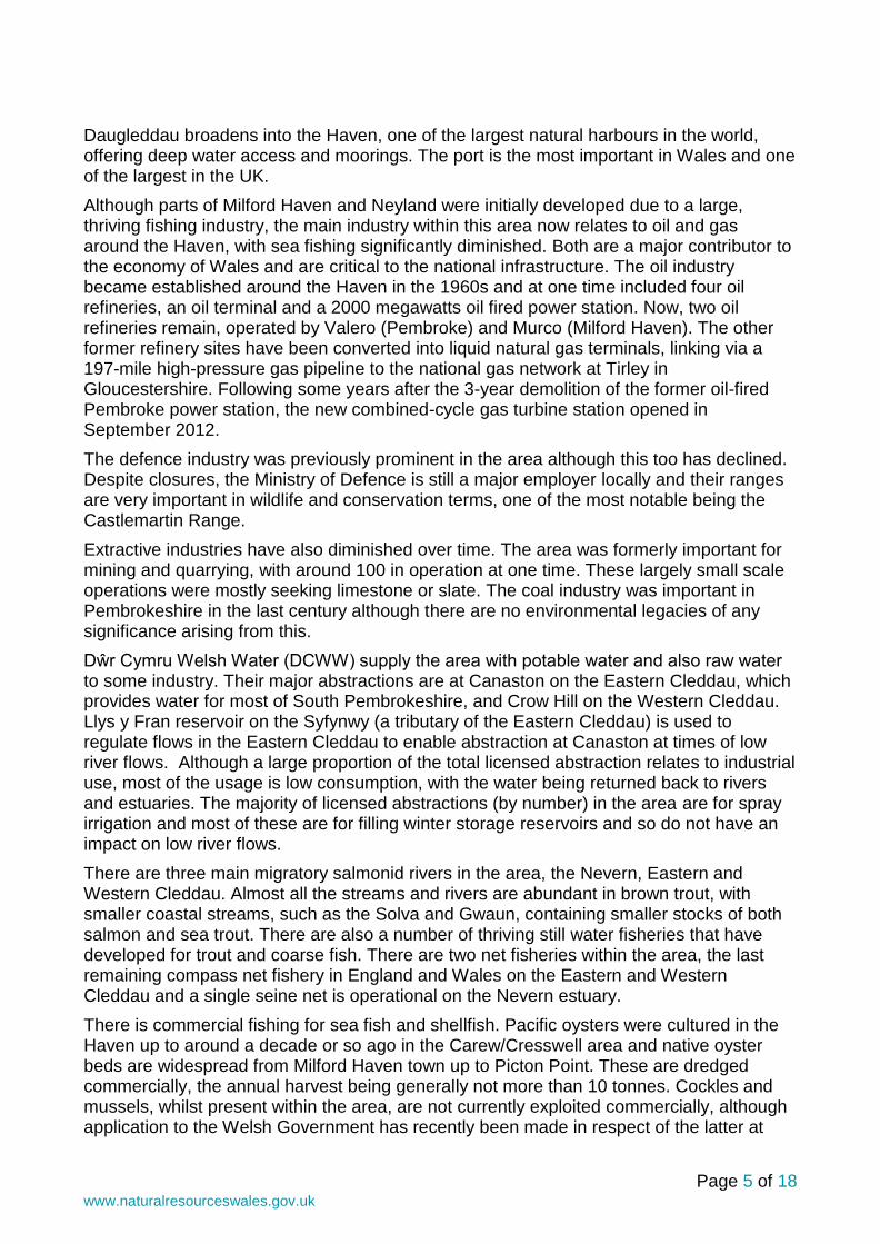
Daugleddau broadens into the Haven, one of the largest natural harbours in the world, offering deep water access and moorings. The port is the most important in Wales and one of the largest in the UK.
Although parts of Milford Haven and Neyland were initially developed due to a large, thriving fishing industry, the main industry within this area now relates to oil and gas around the Haven, with sea fishing significantly diminished. Both are a major contributor to the economy of Wales and are critical to the national infrastructure. The oil industry became established around the Haven in the 1960s and at one time included four oil refineries, an oil terminal and a 2000 megawatts oil fired power station. Now, two oil refineries remain, operated by Valero (Pembroke) and Murco (Milford Haven). The other former refinery sites have been converted into liquid natural gas terminals, linking via a 197-mile high-pressure gas pipeline to the national gas network at Tirley in Gloucestershire. Following some years after the 3-year demolition of the former oil-fired Pembroke power station, the new combined-cycle gas turbine station opened in September 2012.
The defence industry was previously prominent in the area although this too has declined. Despite closures, the Ministry of Defence is still a major employer locally and their ranges are very important in wildlife and conservation terms, one of the most notable being the Castlemartin Range.
Extractive industries have also diminished over time. The area was formerly important for mining and quarrying, with around 100 in operation at one time. These largely small scale operations were mostly seeking limestone or slate. The coal industry was important in Pembrokeshire in the last century although there are no environmental legacies of any significance arising from this.
Dŵr Cymru Welsh Water (DCWW) supply the area with potable water and also raw water to some industry. Their major abstractions are at Canaston on the Eastern Cleddau, which provides water for most of South Pembrokeshire, and Crow Hill on the Western Cleddau. Llys y Fran reservoir on the Syfynwy (a tributary of the Eastern Cleddau) is used to regulate flows in the Eastern Cleddau to enable abstraction at Canaston at times of low river flows. Although a large proportion of the total licensed abstraction relates to industrial use, most of the usage is low consumption, with the water being returned back to rivers and estuaries. The majority of licensed abstractions (by number) in the area are for spray irrigation and most of these are for filling winter storage reservoirs and so do not have an impact on low river flows.
There are three main migratory salmonid rivers in the area, the Nevern, Eastern and Western Cleddau. Almost all the streams and rivers are abundant in brown trout, with smaller coastal streams, such as the Solva and Gwaun, containing smaller stocks of both salmon and sea trout. There are also a number of thriving still water fisheries that have developed for trout and coarse fish. There are two net fisheries within the area, the last remaining compass net fishery in England and Wales on the Eastern and Western Cleddau and a single seine net is operational on the Nevern estuary.
There is commercial fishing for sea fish and shellfish. Pacific oysters were cultured in the Haven up to around a decade or so ago in the Carew/Cresswell area and native oyster beds are widespread from Milford Haven town up to Picton Point. These are dredged commercially, the annual harvest being generally not more than 10 tonnes. Cockles and mussels, whilst present within the area, are not currently exploited commercially, although application to the Welsh Government has recently been made in respect of the latter at

Page 6 of 18 www.naturalresourceswales.gov.uk
Angle Shelf. Application for classification has also been made in recent years in relation to Carpet Shell Clams and Razors.
Pembrokeshire is renowned as a holiday area, with the population increasing two-fold during the peak season. Coastal towns, such as Tenby and Saundersfoot, being especially popular with tourists. Bordered on three sides by the sea, the water environment is one of Pembrokeshire’s greatest assets. It is fringed by spectacular sandy beaches, rugged cliffs, and wooded estuaries. Water sports are mostly restricted to the tidal and coastal areas, although canoeing and sailing are practised at Llys-y-frân Reservoir. The Pembrokeshire Coast National Park and surrounding waters are the centre of a wide variety of activity. Throughout the Daugleddau and the Haven, recreational and commercial boating, jet-skiing and waterskiing are popular. Off the coastal beaches, because of the prevailing conditions, surfing and windsurfing have become one of the most popular activities. Some of the best SCUBA diving sites in Wales are to be found in this region too, with Dale, St Bride’s Bay and Skomer popular. And with 29 European Union designated bathing waters, swimming is a popular activity.
The river and estuary is a Special Area of Conservation as is approximately 75% of Pembrokeshire’s 186 mile coastline. The un-spoilt natural landscape and healthy water environment attracts visitors and the local economy relies heavily on this tourism with £470 million in tourist revenue in 2011 (Pembrokeshire County Council STEAM report, 2011). The Pembrokeshire Marine SAC is the third largest marine SAC in the UK, covering an area of 138,069 hectares. The site extends from near Abereiddy in north Pembrokeshire all the way round to Manorbier in South Pembrokeshire and includes the coast of the islands of Ramsey, Skomer, Grassholm, Skokholm, the Bishops and Clerks, and The Smalls (21 miles offshore). It also encompasses almost the entire Milford Haven Waterway. The Skomer Marine Nature Reserve (the only MNR in Wales) also occurs within the site.
On 31 March 2014 a Cleddau and Pembrokeshire Coastal Rivers management catchment workshop was held at Bluestone National Park Resort, Narberth. During this event the benefits of the catchment were captured. These included:
Natural beauty and landscape
Wildlife and biodiversity
Vibrant rural community and economy
Leisure and cultural opportunities
Coastline, seascape and marine environment
We continue to work in collaboration with a range of partners and sectors in innovative ways so that we can achieve even more together. A flavour of some of the projects that have been delivered within this management catchment over the last 3 years together with projects in development are included below:
Table 1. Partnership projects in the management catchment
Project Name Project Description Partners Funding sources
Llys y Fran A project to train volunteers to engage with farms and carry out soil sampling to inform future WFD improvements.
DCWW, Pembrokeshire Rivers Trust
WFD TSO Fund, DCWW

Page 7 of 18 www.naturalresourceswales.gov.uk
2.1 Key facts We use the term water bodies to help understand and manage the water environment. A water body is part, or the whole, of a river, lake, ground water or coastal water. The number and type of water bodies in the management catchment is shown in the table below.
Table 2. New building blocks, number and types of water bodies
Number of water bodies Natural Artificial Heavily Modified Total
River* 43 0 2 45
Lake 0 0 5 5
Coastal 5 0 0 5
Estuarine 4 0 0 4
Groundwater 4 0 0 4
Total 56 0 7 63
*River water bodies includes canals and surface water transfers
There are areas in the catchment where the water environment is recognised as being of particular importance, including rare wildlife habitats, bathing waters or areas around drinking water sources. These areas are known collectively as protected areas and are detailed in the table below. Table 3. Number and type of protected area
Protected Area Number
Bathing Waters 20
Drinking Water Protected Areas 13
Natura 2000 and Ramsar sites 17
Nitrate Vulnerable Zones 1560ha
Shellfish Waters 1
Urban Waste Water Treatment Directive - Sensitive areas
0
3. Current Status of the water environment We assess the condition of water bodies through monitoring which produces an annual classification. The current status for each water body is shown in figure 2. Note, since 2009, we have updated some of the systems we use to classify water bodies, including changes to some standards and water body boundaries.

Page 8 of 18
Figure 2 The current status of the Cleddau and Pembrokeshire Coastal Rivers Management Catchment (new building blocks, 2013 interim classification)

Page 9 of 18 www.naturalresourceswales.gov.uk
Case study Milford Haven Waterway and the Daugleddau Special Areas of Conservation are in unfavourable status and several of the corresponding Water Framework Directive stretches are at moderate status for water quality. The biggest factor affecting water quality is high nutrient levels. NRW have a scientific body of evidence that, simply put, the Haven is "full" and there is no capacity for new discharges. We have declared the Milford Haven Catchment at amber risk of becoming a Nitrate Vulnerable Zone; amber status is a term recognised by Welsh Government and stakeholders such as industry and the farming unions. We are therefore working as a partnership to create a forum connecting land managers with other ecosystem users. A pilot scheme with the First Milk Dairy in Haverfordwest has developed a process to offset or bank nutrient reduction credits in order to instigate a new treatment plant. nutrient reduction takes the form in funding nutrient minimisation plans for dozens of farms in the Daugleddau catchment. links will be made to academia to assess monitor and review improvements within the Haven. the outcome will create ecosystem resilience where the quality of water will support a diverse ecology and not stifle economic development. future projects will see NRW increasing our partnership with the agricultural community to implement measures to hopefully prevent the declaration of a Nitrate Vulnerable Zone: this already includes providing advice and guidance on the planning and construction of new farm slurry stores; a controversial issue which raises concerns from public and other regulatory partners who , like NRW, wish to preserve and improve landscape, biodiversity and the quality of life in Pembrokeshire whilst not hindering rural development. Without these new ways of working Milford Haven could become a Nitrate Vulnerable Zone which may result in NRW opposing future development with the catchment if there is adverse effect on site integrity because iof discharges through direct discharge or aerial disposition. To that end these projects must satisfy the precautionary principle and we need to have confidence in the measures implemented.

Page 10 of 18 www.naturalresourceswales.gov.uk
4. The main challenges We have carried out a programme of investigations to better understand the causes as to why water bodies are failing to meet the required standards. The results of our findings are summarised in Figure 3.
Figure 3. Reason for not achieving good status.
Our investigations have identified six water bodies that are failing because of agriculture and rural land management, including the Nevern, Western Cleddau and Syfynwy and another 11 that are very likely to be failing due to this pressure. Artificial barriers which prevent fish migrating and reaching their spawning grounds are a reason for failure in three rivers including Westfield Pill, Pembroke River and Cartlett Brook. Discharges from wastewater treatment works is identified as a reason for failure on the Anghof, and four others including Narbeth Brook and Brandy Brook are very likely to have this as a reason for failure.
4.1 Workshop feedback on challenges We need to work together to ensure the overall aims of the Water Framework Directive are met, in order to work together effectively we need to agree on the issues and solutions. The following section includes some of the issues that were raised as part of the workshop; however it is not a full list. All of the comments received will be taken into account and the following is just a flavour of these comments:
Flooding – water and asset management.
Diffuse rural pollution / land management, including nutrients, pesticides and sediment.
Forestry felling issues – sediment mobilisation.
Community engagement, awareness-raising and communications.
INNS (Invasive Non-Native Species), especially Killer Shrimp, Himalayan Balsam and Japanese Knotweed.

Page 11 of 18 www.naturalresourceswales.gov.uk
5. Objectives and measures This section outlines what we are aiming to achieve and the proposed new measures that need to be put in place. We aim to develop a single integrated programme of measures by 2021 that meets Water Framework Directive objectives:
Prevent deterioration in status Water body status will not be allowed to deteriorate from the current reported status.
Achieve the objectives for protected areas Achieve the standards set by the relevant directive under which they were designated. For water dependent Natura 2000 sites we will aim to achieve conservation objectives, achieving good status by 2021 is a milestone towards this objective.
Aim to achieve good overall status for surface and ground waters Implement measures to achieve good overall status where they are technically feasible and not disproportionately costly.
5.1 Measures We have reviewed the reasons why water bodies are failing to achieve objectives and identified potential measures .Measures are divided into two groups. National measures apply to the whole of Wales, or the United Kingdom. In general these set the legislative, policy or strategic approach. Examples include a national ban on using a particular chemical or a national strategy for prioritising and funding the remediation of abandoned mines. Local measures are specific to the river basin district or a part of it. For example, the removal of invasive plants along a length of designated river or a local campaign targeting misconnections across an industrial estate. Many of the actions listed will also have multiple benefits. For example, sustainable urban drainage (SuDs) schemes help to reduce urban pollution, sewage pollution and changes to water levels.
A list of all national measures, both new and existing, and the local measures at the water body scale are detailed on Water Watch Wales. If you know about any others or want to suggest new measures, please tell us in your response to the consultation. The river basin management plan will become a statutory document hence the importance of ensuring that the correct measures are identified through this consultation.
The table below summarises the local measures for the management catchment, including those identified for protected areas. The high level categories describe the types of action required and broadly the options that are available, including voluntary and regulatory measures. At the local scale some of the options described might not be considered appropriate. There is overlap between some categories.
Table 4. Summary of local measures
Measure Description No. of water
bodies
Address air pollution Emissions controls to reduce nitrogen and acidic depostion. Some overlap with "acidification restoration".
9
Address point source pollution
Investigate and regulate pollution from point sources. Overlaps with "reduce pollution from sewage discharges" and "other waste water discharges".
11
Complete first cycle All ongoing WFD investigations from first cycle 5

Page 12 of 18 www.naturalresourceswales.gov.uk
Measure Description No. of water
bodies
investigation programme.
Drainage and water level management
Investigate and implement changes to land drainage regimes and structures to restore water levels.
25
Dredging and silt management
Includes reducing siltation at source through land management, and implementing sustainable dredging and silt disposal regimes.
6
Improve fish passage and habitat
Remove or modify barriers to fish passage 4
Improve flows and water levels
Reduce impacts of regulated flows and abstractions, restore more natural flow regimes, implement options to improve water levels, such as water efficiency and recycling measures, alternative sources and supplies.
27
Manage invasive non-native species
Eradication and/or management of invasive non-native species in line with current national invasive species Action Plans. Includes biosecurity good practice, such as "CHECK-CLEAN-DRY" and Be Plant Wise.
38
Mine water and contaminated land remediation
Coal and metal mine, and contaminated land remediation - including passive and active mine water treatment, capping of spoil, removal of wastes to landfill, and channel diversion
5
Mitigate impacts of flood and coastal defences
Reduce impacts of flood defence structures and operations - improve connectivity, habitat, and morphology by implementing options through capital and maintenance programmes, such as soft engineering, opening culverts, upgrading tidal flaps, changing dredging and vegetation management. Includes the national habitat creation programme to address coastal squeeze.
6
Mitigate impacts of shipping, navigation and dredging
Assess and implement options for adapting dredging regimes and reducing the impacts of physical modifications.
7
New Investigation Includes investigations for all new failures, deterioration, and drinking water protected areas.
35
Other sustainable land and marine management practices
Includes measures to mitigate impacts from construction and maintenance of infrastructure, including within military training sites.
5
Reduce pollution from septic tanks
Target actions to ensure septic tanks are maintained correctly. Where necessary issue formal works notices to owners to relocate or replace tanks and soakaways.
3
Reduce pollution from Reducing pollution from continuous and 7

Page 13 of 18 www.naturalresourceswales.gov.uk
Measure Description No. of water
bodies
sewage discharges intermittent discharges, includes additional treatment at sewage treatment works (e.g. phosphate stripping), investigating and tackling sewer blockages, and implementing sustainable drainage to reduce surface water drainage to sewers.
Specific habitat and feature works
Restoration and/or conservation of specific habitat and features, including natural (e.g. caves, geological outcrops) and human structures (e.g. bridges, ruins).
2
Sustainable access and recreation management
Reduce the impacts of erosion, disturbance and damage from both water-based and terrestrial access, including tackling illegal off-roading.
7
Sustainable agricultural practices
Implement basic and additional measures such as correct management of slurry, silage, fuel oil, and agricultural chemicals; clean and dirty water separation; nutrient management planning; buffer strips and riparian fencing; cover crops and soil management. In N2k sites changes to grazing regimes may be required, includes scrub management. Within NVZs comply with storage and spreading regulations.
45
Sustainable fisheries management
Includes meaures for both freshwater and marine fisheries to reduce and mitigate impacts
3
Sustainable woodland and forestry management
Restore the riparian zone, disconnect forest drains, monitor the effectiveness of the 5 principle risks associated with forestry and use forestry and woodland to reduce diffuse pollution.
10
Tackle misconnections and urban diffuse pollution
Investigate and solve misconnections to surface water drains (at residential and commercial properties) and implement sustainable drainage schemes (SuDS) to reduce diffuse pollution.
4
Waste management Includes appropriate management of spoil and sludge, illegal fly-tipping and litter
7
Actions already under way include:
Schemes to improve fish passage at Westfield Pill and Canaston weir, East Cleddau
Habitat improvements by Pembrokeshire Rivers Trust and Afonydd Cymru in collaboration with Natural resources Wales
Farmers and landowners are working with our catchment officers to improve land management for the benefit of the water environment.

Page 14 of 18 www.naturalresourceswales.gov.uk
5.2 Workshop feedback on priorities and solutions Concerns on current status raised at the workshop have been highlighted in Section 3, solutions and priorities were also discussed. In respect of some of the issues raised on the day, the following solutions were flagged:
Diffuse rural pollution / land management. Proposed solutions: Improve Glastir uptake through reduction of ‘red tape’; educate land managers in win-win solutions, particularly highlighting financial incentives; investigate poor application of buffer strips; alternative uses for slurry; improved partnership working; targeted education in impact of pesticide/herbicide use on drinking water quality.
Community engagement, awareness-raising and communications.
Case study – Westfield Pil - Fish pass project 2012
The Rosemarket Stream is a coastal stream that discharges into the tidal Cleddau estuary at Neyland marina, Pembrokeshire. The Rosemarket Stream failed Water Framework Directive criterion for both eels and salmonids (2010 diagnostics).
A WFD ‘walkover survey’ conducted by Fisheries Team identified pipes set into the lower bund at Westfield Pil as being an obstruction to upstream fish migration. This obstruction was thought to be a significant factor in preventing the WFD’s objectives from being met.
In 2012, a collaborative partnership project between NRW and Pembrokeshire County Council replaced the old bund and pipes with a ‘super active baffle’ Larinier fish pass and bristle mat eel pass.
The fish pass has improved access for a wide variety of fish species including: Eels; lamprey; trout; salmon; mullet; bass & flounder.
Further fish passage improvements have been undertaken on the Rosemarket Stream in partnership with Pembrokeshire Rivers Trust. This work will help to ensure that WFD objectives are met by 2027.

Page 15 of 18 www.naturalresourceswales.gov.uk
Proposed solutions: Rivers Trust can assist in identification of priority issues; volunteer-assisted tree-planting initiatives; sources of industry-related funding identified.
INNS (Invasive Non Native Species) Proposed solutions: National guidance/strategy urgently required; further volunteer initiatives.
5.3 Alternative objectives We have identified a small number of water bodies where because of the nature of the problem or the required measures we propose an extended deadline or less stringent objective (less than good). In each case we have provided a justification.
Table 5. proposed alternative objectives and justifications
Alternative objective
Justifications
Number of
water bodies
Water body
Less stringent objective
Technically infeasible – ubiquitous and persistent chemical
1 Nyfer
5.4. Opportunities for partnerships There are several external funding opportunities, which could support projects that contribute towards Water Framework Directive outcomes. Each fund has its own priorities, budgetary allocation and application process. Types of funding for consideration include:
European funds – The EU provides funding from a broad range of programmes.– go to the Welsh European Funding Office website for more information.
Lottery funding – such as Heritage Lottery Fund, Postcode Lottery and BIG Lottery Fund which have a range of programmes from £5000 up to £millions.
Charities, trusts & foundations – there are many of these operating and they often have a specific focus – either geographically or topically and will support local charities and projects.
Businesses and sponsorship opportunities – including making the most of the Welsh carrier bag charge!
Public bodies – local authorities, Welsh Government, UK Government and NRW may have annual funding opportunities or one-off competitions for their priority areas.
Crowd funding – gathering support from a wide range and number of funders, often including individuals and usually using the internet to raise awareness for a specific project needing funds.
Trading – increasingly funders are looking to support organisations with longer term sustainability in mind so developing trading opportunities can be something to consider too.
Your local County Voluntary Council and Wales Council for Voluntary Action will have up to date information on opportunities such as these as well as a host of other support available.

Page 16 of 18 www.naturalresourceswales.gov.uk
6. What next? This summary is intended to be a snap shot of the management catchment and should enable you to be able to access further detail using Water Watch Wales. We welcome your views on how we can improve how we do this.
The summary supports the current consultation on the updated river basin management plans. We encourage you to look at the river basin management plans and respond to the consultation questions which you can find on our website.If you have any questions, please e-mail:
[email protected] / [email protected]
7. Water Watch Wales During the implementation phase of the first river basin management plan many of our partners and stakeholders requested access to data and information to assist them in helping to deliver local environmental improvements. It was quite clear early on that the first plan was difficult to navigate and access at a local scale. Consequently with both the support and input from the river basin district liaison panels a web based tool has been developed. This tool is called Water Watch Wales. This is an interactive spatial web-based tool that provides supporting information and data layers which can assist partners.
We are continuing to develop this tool and see it as a critical link between the more strategic river basin management plan and local delivery. It should enable the user to access information on:
classification data at the water body scale
reasons for not achieving good status
objectives
measures/actions, including protected area information
partnership projects
Data can be retrieved in a number of formats (spreadsheets and summary reports). A user guide together with frequently asked questions is included with the tool and can be accessed from a link on the home page.

Page 17 of 18 www.naturalresourceswales.gov.uk
Figure 4. Opening screen shot for Water Watch Wales

Published by: Natural Resources Wales Cambria House 29 Newport Road Cardiff CF24 0TP 0300 065 3000 (Mon-Fri, 8am - 6pm) [email protected] www.naturalresourceswales.gov.uk © Natural Resources Wales All rights reserved. This document may be reproduced with prior permission of Natural Resources Wales