City of Escondido Report On The Initiative … PURPOSE OF REPORT ... SITR's Media Campaign ......
39
City of Escondido Report On The Initiative Measure to Adopt “The Lakes Specific Plan” **** Report Prepared Pursuant to Elections Code § 9212 and City Council Directive from June 25, 2014 City Council Meeting **** July 23, 2014
Transcript of City of Escondido Report On The Initiative … PURPOSE OF REPORT ... SITR's Media Campaign ......
City of Escondido Report On The Initiative Measure to Adopt
“The Lakes Specific Plan” ****
Report Prepared Pursuant to Elections Code § 9212 and City Council Directive from
June 25, 2014 City Council Meeting ****
July 23, 2014

TABLE OF CONTENTS
Page
City of Escondido Elections Code Report -i- “The Lakes Specific Plan” Initiative
1.0 INTRODUCTION ............................................................................................................ 1
2.0 DESCRIPTION OF COUNTRY CLUB PROPERTY ..................................................... 1
3.0 PURPOSE OF REPORT................................................................................................... 1
4.0 THE DISPUTE BETWEEN SITR, THE RESIDENTS SURROUNDING THE COUNTRY CLUB, AND THE CITY .............................................................................. 2
4.1. SITR Litigates Validity of Residents’ Initiative ................................................... 3
4.2. SITR's Media Campaign ....................................................................................... 4
4.3. SITR Files Numerous Encroachment Lawsuits Against Individual Homeowners ......................................................................................................... 4
4.4. SITR Litigates Validity of Ordinance No. 2013-10 and Seeks Millions of Dollars Against City Based on an Alleged “Regulatory Taking” .................... 6
4.5. SITR Spreads Chicken Excrement Over Abandoned Fairways Located Closest to Adjacent Homes And Is Cited By The APCD For A Public Nuisance ................................................................................................................ 7
4.6. SITR Now Seeks Approval of the Voters to Adopt “The Lakes Specific Plan” ...................................................................................................................... 8
5.0 DEVELOPMENT HISTORY OF COUNTRY CLUB PROPERTY AND SURROUNDING COMMUNITY ................................................................................... 8
5.1. Executive Summary .............................................................................................. 8
5.2. Comprehensive Development History of “Golden Circle Valley” Retirement Community ....................................................................................... 12
6.0 IMPACTS OF THE DEVELOPMENT PROPOSED BY SITR INITIATIVE ON EXISTING LAND USES, AESTHETICS, FINANCES, OPEN SPACE AND PUBLIC INFRASTRUCTURE ............................................................................ 27
6.1. Impacts on Existing Land Uses and Aesthetics .................................................. 27
6.2. Financial Impacts ................................................................................................ 29
6.3. Open Space Impacts ............................................................................................ 31
6.4. School Impacts .................................................................................................... 31
Page
City of Escondido Elections Code Report -ii- “The Lakes Specific Plan” Initiative
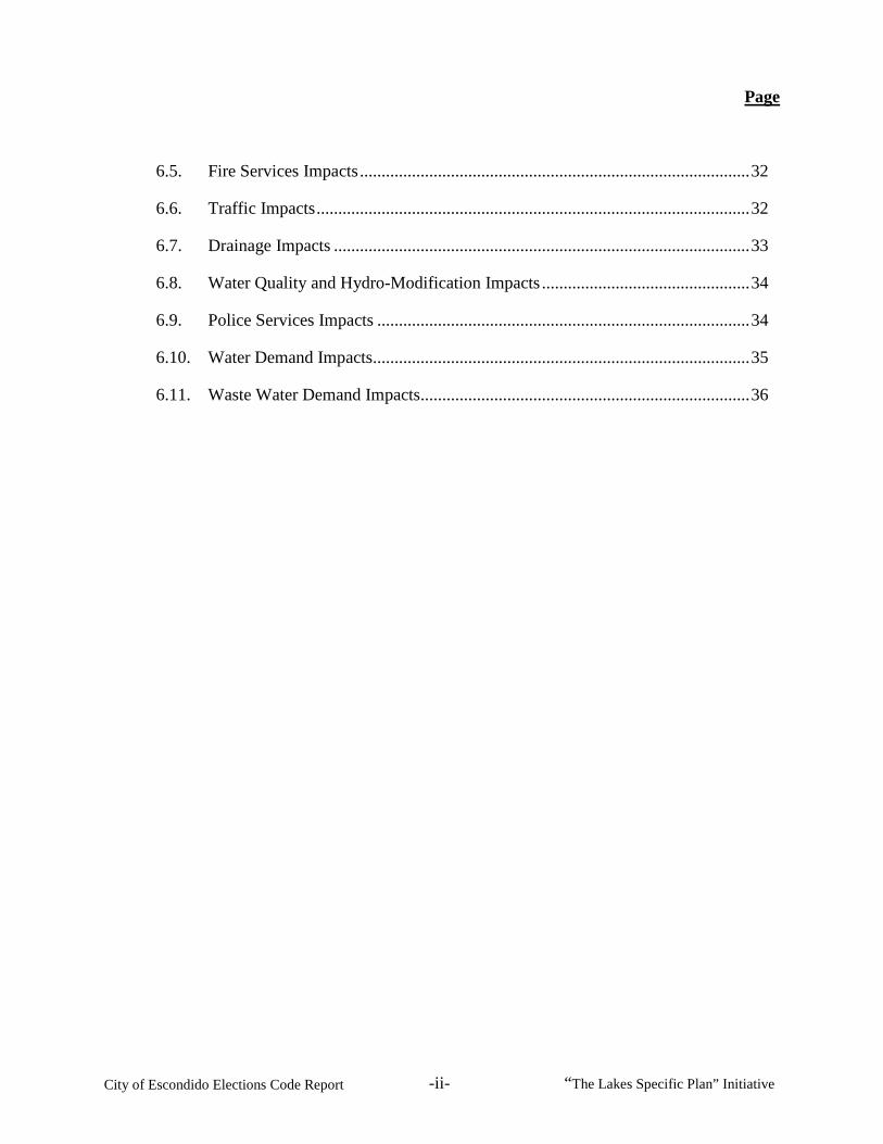
6.5. Fire Services Impacts .......................................................................................... 32
6.6. Traffic Impacts .................................................................................................... 32
6.7. Drainage Impacts ................................................................................................ 33
6.8. Water Quality and Hydro-Modification Impacts ................................................ 34
6.9. Police Services Impacts ...................................................................................... 34
6.10. Water Demand Impacts....................................................................................... 35
6.11. Waste Water Demand Impacts ............................................................................ 36

City of Escondido Elections Code Report -1- “The Lakes Specific Plan” Initiative
1.0 INTRODUCTION
On June 17, 2014 the San Diego County Registrar of Voters verified the sufficiency of a petition to place on the ballot, “An Initiative Measure To Adopt The Lakes Specific Plan” (the “SITR Initiative”).1 The SITR Initiative concerns the real property which historically has been used as the Escondido Country Club (hereinafter, the “Country Club” or the “Country Club Property”).2 At the regularly-scheduled City Council meeting on June 25, 2014, the City Clerk certified to the City Council the sufficiency of the signatures on the petition. On that same date, the Escondido City Council accepted the sufficiency of the petition and ordered the preparation of this report.
2.0 DESCRIPTION OF COUNTRY CLUB PROPERTY
The Country Club Property comprises approximately 110 acres in northwest Escondido, generally located west of Nutmeg Street, north of El Norte Parkway, and east of Woodland Parkway. The Country Club Property includes the following San Diego County Assessor Parcel Numbers: 224-210-53-00, 224-430-04-00, 224-211-05-00, 224-431-02-00, 224-211-15-00, 224-211-12-00, 224-491-01-00, 224-211-11-00, 224-490-06-00, 224-230-36-00, 224-431-01-00, 224-431-03-00, 224-811-28-00, and 224-230-43-00.3
3.0 PURPOSE OF REPORT
Elections Code § 9212(a) permits the legislative body to refer a proposed initiative measure to any city agency or agencies for a report on:
• The initiative’s fiscal impact.
• The initiative’s impact on internal consistency of the city’s general plan (including the housing element), specific plans, and zoning matters.
• The initiative’s effect on the use of land, funding for infrastructure of all types, and the ability to attract and retain business.
• The initiative’s impact on the uses of vacant parcels of lands, agricultural lands, open space, traffic congestion, areas designated for revitalization, and similar impacts.
• “Any other matters the legislative body requests to be in the report.”
1 Ex. 1. The exhibits referenced in this report (designated with “Ex. ___”) are included in the Appendix of Exhibits submitted to the City Council concurrently with this report, entitled “Appendix of Exhibits for City of Escondido Report on The Initiative Measure to Adopt The Lakes Specific Plan” (“Appendix”). 2 Ex. 2, SITR Initiative. 3 Ex. 2, § 2(A)(1).
City of Escondido Elections Code Report -2- “The Lakes Specific Plan” Initiative
The report must be presented to the legislative body within 30 days after the elections officer certifies to the legislative body the sufficiency of the petition. (Elec. Code, § 9212(b).) The Legislature designed Elections Code § 9212 (and the parallel statute applicable to initiatives presented to counties embodied in Elections Code § 9211) “to better inform [] the electorate and [legislative body] about proposed initiatives.” (DeVita v. County of Napa (1995) 9 Cal.4th 763, 777-778.)
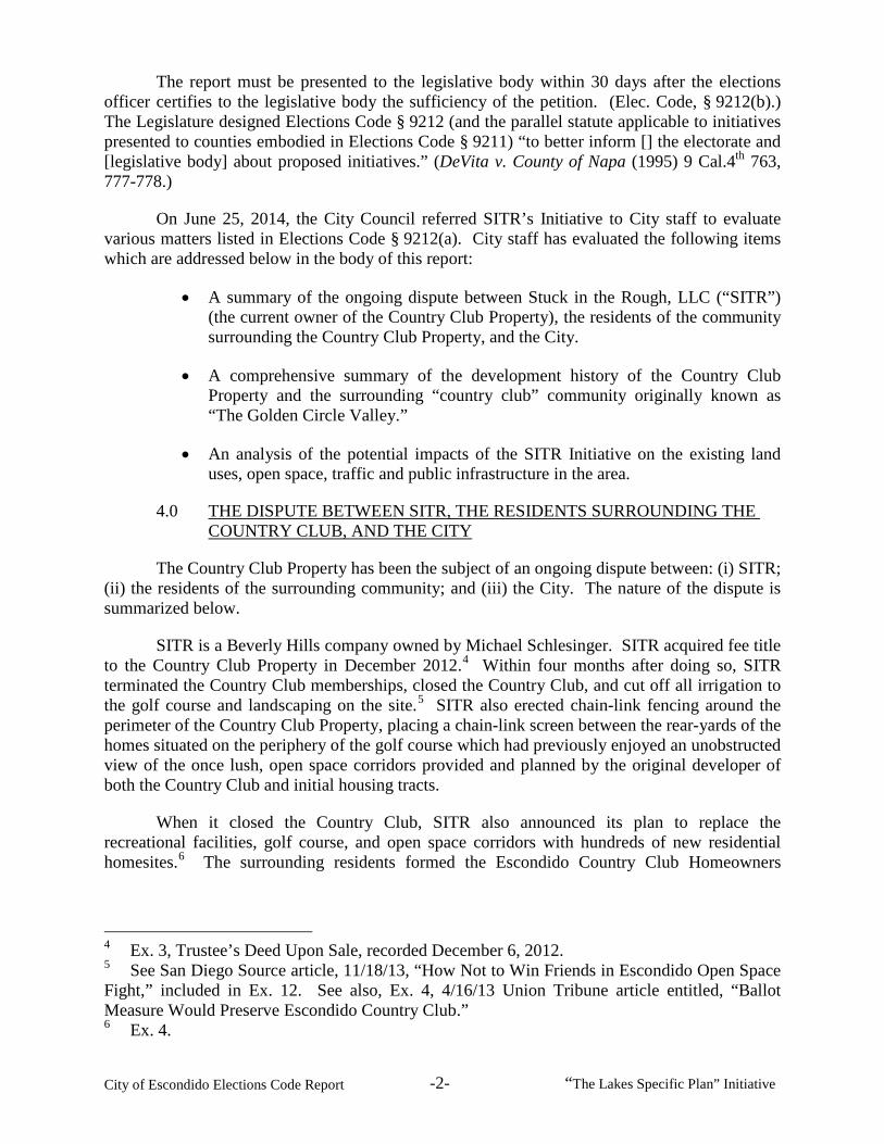
On June 25, 2014, the City Council referred SITR’s Initiative to City staff to evaluate various matters listed in Elections Code § 9212(a). City staff has evaluated the following items which are addressed below in the body of this report:
• A summary of the ongoing dispute between Stuck in the Rough, LLC (“SITR”) (the current owner of the Country Club Property), the residents of the community surrounding the Country Club Property, and the City.
• A comprehensive summary of the development history of the Country Club Property and the surrounding “country club” community originally known as “The Golden Circle Valley.”
• An analysis of the potential impacts of the SITR Initiative on the existing land uses, open space, traffic and public infrastructure in the area.
4.0 THE DISPUTE BETWEEN SITR, THE RESIDENTS SURROUNDING THE COUNTRY CLUB, AND THE CITY
The Country Club Property has been the subject of an ongoing dispute between: (i) SITR; (ii) the residents of the surrounding community; and (iii) the City. The nature of the dispute is summarized below.
SITR is a Beverly Hills company owned by Michael Schlesinger. SITR acquired fee title to the Country Club Property in December 2012.4 Within four months after doing so, SITR terminated the Country Club memberships, closed the Country Club, and cut off all irrigation to the golf course and landscaping on the site.5 SITR also erected chain-link fencing around the perimeter of the Country Club Property, placing a chain-link screen between the rear-yards of the homes situated on the periphery of the golf course which had previously enjoyed an unobstructed view of the once lush, open space corridors provided and planned by the original developer of both the Country Club and initial housing tracts.
When it closed the Country Club, SITR also announced its plan to replace the recreational facilities, golf course, and open space corridors with hundreds of new residential homesites.6 The surrounding residents formed the Escondido Country Club Homeowners
4 Ex. 3, Trustee’s Deed Upon Sale, recorded December 6, 2012. 5 See San Diego Source article, 11/18/13, “How Not to Win Friends in Escondido Open Space Fight,” included in Ex. 12. See also, Ex. 4, 4/16/13 Union Tribune article entitled, “Ballot Measure Would Preserve Escondido Country Club.” 6 Ex. 4.

City of Escondido Elections Code Report -3- “The Lakes Specific Plan” Initiative
Organization (“ECCHO”), for the purpose of preventing the conversion of the Country Club Property into a housing development.7
In April 2013, ECCHO filed a Notice of Intent to Circulate Petition for an Initiative Measure entitled, “Citizens’ Property Rights Initiative” (the “Residents’ Initiative”).8 The Residents’ Initiative proposed to amend the City’s general plan, designating the Country Club Property for open space, golf course, active recreational, or other similar uses. The City Clerk certified the sufficiency of the signatures on the petition to the City Council on August 14, 2013.9 On that same date, and in accordance with Elections Code § 9215, the City Council adopted Ordinance No. 2013-10, implementing the Residents’ Initiative.10
In response to the Residents’ Initiative, SITR engaged in a multi-pronged effort to promote SITR’s plans to redevelop the Country Club Property. SITR’s effort is summarized below:
4.1. SITR Litigates Validity of Residents’ Initiative
On June 26, 2013, SITR filed in the San Diego County Superior Court a Petition for Writ of Mandate and Complaint for Declaratory and Injunctive Relief, entitled Stuck in the Rough v. City of Escondido, et al., SDCSC Case No. 37-2013-00054876-CU-WM-NC (the “Invalidation Lawsuit”). SITR named as defendants the City, ECCHO, and the individual proponents of the Residents’ Initiative. Among other things, the Invalidation Lawsuit was a pre-election challenge that sought to prohibit the City Clerk from certifying the signatures on the petition. The Invalidation Lawsuit also sought a judicial order declaring the Residents’ Initiative to be illegal.11
On July 24, 2013, the Court denied SITR’s application seeking to prevent the City Clerk from certifying the signatures on the petition for the Residents’ Initiative.12 Accordingly, as required by law, on July 29, 2013, the City Clerk executed a “Certificate of Sufficiency” of the 7 Ex. 5, mission statement from ECCHO website. 8 Ex. 6, 4/17/13 Notice to Circulate Petition re: Citizens’ Property Rights Initiative. 9 Ex. 7, City Clerk staff report and certificate of sufficiency re: Residents’ Initiative. 10 Ex. 8, CC Ordinance No. 2013-10. The Residents’ Initiative and Ordinance No. 2013-10 also require an amendment to City’s zoning code and map, designating the Country Club Property for “Open Space Private.” The City will process the required zoning changes and, to the extent SITR seeks to redevelop the Country Club Property for different uses, will continue to solicit applications from SITR for redevelopment consistent with the City’s General Plan and zoning requirements. The zoning provisions applicable to open-space-designated parcels permit (and conditionally permit) a large variety of private uses, including:: 1) agricultural uses such as field crops, orchards, vineyards and grazing; 2) colleges and universities; 3) common open space and recreational areas in planned communities; 4) country clubs; 5) equestrian centers and stables; 6) land-banks, mitigation sites, and conservations preserves; 7) preschool, elementary and secondary schools; 8) information and interpretive centers; 9) any variety of recreational uses, such as parks, playgrounds, sports activities, swimming areas, picnicking areas, golf courses, historic and cultural sites, band shells and stages; and 10) retreat centers. (Ex. 9, Escondido Municipal Code, §§ 33-41 and 33-42.) 11 Ex. 10, Complaint filed in Invalidation Lawsuit. 12 Ex. 11, minute order in Invalidation Lawsuit.

City of Escondido Elections Code Report -4- “The Lakes Specific Plan” Initiative
signatures on the petition, declaring that the “petition contained at least 5,956 verified signatures,” reflecting the minimum 10% of registered voters in Escondido.13 As noted, the City Council then adopted the Residents’ Initiative, without alteration, on August 14, 2013 pursuant to Elections Code § 9215.14
Because the Invalidation Lawsuit sought to prevent the City Clerk and City Council from acting on the Residents’ Initiative, the City’s Council’s August 14, 2013 adoption of the Residents’ Initiative (as permitted by the Court) rendered the Invalidation Lawsuit effectively “moot.” Nevertheless, the Invalidation Lawsuit is still pending on appeal with respect to an issue concerning the Court’s denial of a request by some of the defendants for attorney’s fees.
4.2. SITR’s Media Campaign
After the City Council adopted Ordinance No. 2013-10, SITR launched a two-pronged media campaign. First, SITR addressed the merits of its plans, and encouraged and contributed to several newspaper articles touting the benefits of SITR’s proposed redevelopment plans for the Country Club. Second, SITR asserted that by adopting the Residents’ Initiative, the City Council was frivolously exposing the citizens to a huge damages award and bankruptcy. Following the City Council’s vote, SITR released a statement through its publicist, stating: “Today was a bad day for Escondido taxpayers. The City’s gambling with public money on the hopes it will win a risky case and not end up with a taxpayer-funded bailout.”15
NBC7.com also ran an article reporting that SITR’s spokesperson explained that “there is still a legal battle ahead” and that “there have been cases where the developer was compensated hundreds of millions of dollars, an amount that could potentially bankrupt the City of Escondido.”16 SITR’s spokesman stated that SITR’s claims against the City “would leave Escondido on the hook for up to $100 million.”
4.3. SITR Files Numerous Encroachment Lawsuits Against Individual Homeowners
Beginning in October 2013, SITR retained two law firms to file numerous “encroachment lawsuits” against individual residents throughout the community.17
The lawsuits allege that the individual homeowners unlawfully installed yard and wall improvements extending to some degree into SITR’s golf course. The lawsuits contain claims for “encroachment,” “trespass,” and “declaratory relief,” seeking both monetary damages and
13 Ex. 7. 14 Ex. 8, CC Ordinance No. 2013-10. 15 See sample collection of articles compiled in Ex. 12, including: 1) San Diego Source article, 11/18/13, “How Not to Win Friends in Escondido Open Space Fight;” 2) Union Tribune article, 11/17/13, “County Club Items Being Auctioned;” and 3) KPBS article, 11/14/13, “Escondido Golf Course Dispute Could Become Landmark Private Property Rights Case.” 16 Ex. 13, NBC7.com article, 8/15/13, “Escondido City Council Votes in Favor of Green Designation for Golf Course.” 17 Ex. 14, compilation of case summaries for encroachment lawsuits filed by SITR against individual homeowners in community.

City of Escondido Elections Code Report -5- “The Lakes Specific Plan” Initiative
injunctive relief compelling the removal of the encroachments.18 SITR filed a total of 24 “encroachment lawsuits” against individual homeowners, three of which were filed against the President, Treasurer and Director of ECCHO, respectively. The encroachment lawsuits include the following actions filed in the San Diego County Superior Court:
1) SITR v. Swadley, SDCSC Case No. 37-2013-00073610-CU-BC-NC (filed on October 31, 2013);
2) SITR v. Mullenniex, SDCSC Case No. 37-2013-00073617-CU-BC-NC (filed on October 31, 2013);
3) SITR v. Delaurentis, SDCSC Case No. 37-2013-00073621-CU-OR-NC (filed on October 31, 2013);
4) SITR v. Fawley, SDCSC Case No. 37-2013-00073626-CU-OR-NC (filed on October 31, 2013);
5) SITR v. Rogers, SDCSC Case No. 37-2013-00080116-CU-OR-NC (filed on October 31, 2013);
6) SITR v. Mainwaring, SDCSC Case No. 37-2013-00080113-CU-OR-NC (filed on December 17, 2013);
7) SITR v. Wonacott, SDCSC Case No. 37-2013-00080120-CU-OR-NC (filed on December 17, 2014);
8) SITR v. Martin, SDCSC Case No. 37-2013-00080131-CU-OR-NC (filed on December 17, 2014);
9) SITR v. Johnsgard, SDCSC Case No. 37-2013-00080135-CU-OR-NC (filed on December 17, 2014);
10) SITR v. Ahler, SDCSC Case No. 37-2013-00073625-CU-OR-NC (filed on December 17, 2013);
11) SITR v. Schaefer, SDCSC Case No. 37-2013-00080116-CU-OR-NC (filed on December 17, 2013);
12) SITR v. Boyd, SDCSC Case No. 37-2013-00080125-CU-OR-NC (filed on December 17, 2013);
13) SITR v. Carter, SDCSC Case No. 37-2013-00080129-CU-OR-NC (filed on December 17, 2013);
14) SITR v. Croghan, SDCSC Case No. 37-2013-00080134-CU-OR-NC (filed on December 17, 2013);
18 See, e.g., Complaint for Encroachments and Trespass filed in SITR v. Swadley, SDCSC Case No. 37-2013-00073610-CU-BC-NC, included in Ex. 15.
City of Escondido Elections Code Report -6- “The Lakes Specific Plan” Initiative
15) SITR v. Hodges, SDCSC Case No. 37-2013-00080136-CU-OR-NC (filed on December 17, 2013);
16) SITR v. Kennedy, SDCSC Case No. 37-2014-00008201-CU-OR-NC (filed March 25, 2014);
17) SITR v. Mandelbaum, SDCSC Case No. 37-2014-00008204-CU-OR-NC (filed March 25, 2014);
18) SITR v. Maebert, SDCSC Case No. 37-2014-0008226-CU-BC-NC (filed March 25, 2014);
19) SITR v. Larue, SDCSC Case No. 37-2014-00008236-CU-BC-NC (filed March 25, 2014);
20) SITR v. Everest, SDCSC Case No. 37-2014-00008246-CU-BC-NC (filed March 25, 2014);
21) SITR v. Clauson, SDCSC Case No. 37-2014-00008251-CU-OR-NC (filed March 25, 2014);
22) SITR v. DeJong, SDCSC Case No. 37-2014-00008253-CU-OR-NC (filed March 25, 2014);
23) SITR v. Wesolowski, SDCSC Case No. 37-2014-00008258-CU-OR-NC (filed March 25, 2014); and
24) SITR v. Fieldman, SDCSC Case No. 37-2014-00008263-CU-OR-NC (filed March 25, 2014).19
4.4. SITR Litigates Validity of Ordinance No. 2013-10 and Seeks Millions of Dollars Against City Based on an Alleged “Regulatory Taking”
On November 6, 2013, SITR filed another action against the City seeking: 1) to invalidate Ordinance No. 2013-10 on various grounds; and 2) monetary damages based on SITR’s allegation that the City’s action constituted a “regulatory taking” of the Country Club Property. SITR also asserted claims that the City violated SITR’s “due process” rights and deprived SITR of “equal protection” in violation of the United States and California Constitutions.
SITR claims it was entitled to redevelop its Country Club Property with residential home sites in a manner consistent with the Country Club’s “R-1-7” zoning and “Urban I” general plan designation in effect prior to the City’s adoption of Ordinance No. 2013-10. Although the historic use of the Country Club Property for golf course, country club, and recreational purposes was (and always has been) permitted under the City’s zoning and general plan designations with a special or conditional use permit, SITR claims that the underlying zoning and general plan designations entitled SITR (at its election) to convert the Country Club Property into a residential housing development. 19 Ex. 14.
City of Escondido Elections Code Report -7- “The Lakes Specific Plan” Initiative
Among other reasons, the City disputes SITR’s claims for the following reasons:
• The Country Club development was originally proposed, approved and developed as the “centerpiece” of (and catalyst for) the surrounding development;
• The “country club” community which evolved over time was approved with substandard home sites specifically on account of the fact that the Country Club provided the open-space and green-space corridors needed to offset the substandard, overbuilt nature of the home sites;
• A landowner, as a matter of law, has no “right” to develop its property in accordance with the existing zoning or general plan designation (see, e.g., HFH, Ltd. v. Superior Court (1975) 15 Cal.3d 508, 515 [holding that mere down-zoning of property does not constitute a “taking” under the United States and California Constitutions, explaining that “the courts of this state and the United States Supreme court firmly rejected the notion that the diminution of value of previously unrestricted land by imposition of zoning could constitute a taking impermissible in the absence of compensation.”]; Morse v. County of San Louis Obisbo (1967) 247 Cal.App.2d 600, 602-603 [“[L]andowners have no vested right in existing or anticipated zoning ordinances.”]; and Long Beach Equities v. County of Ventura (1991) 231 Cal.App.3d 1016, 1040 [upholding County’s down-zoning of property to open space allowing for minimal development and reasoning that the “[d]iminution in expected value, even if that loss is severe, does not constitute a taking.”]);
• In addition to the City’s retention of full discretionary land-use authority over any proposed redevelopment of the Country Club Property, any such development would be subject to full environmental review under the California Environmental Quality Act (“CEQA”); and
• Any subdivision of the Country Club Property would necessarily be subject to the California Subdivision Map Act, requiring the processing of tentative maps with the City over which the City would retain discretionary authority for approval.
SITR’s “takings” litigation against the City is currently pending in San Diego County Superior Court.
4.5. SITR Spreads Chicken Excrement Over Abandoned Fairways Located Closest to Adjacent Homes And Is Cited By The APCD For A Public Nuisance
As reported in the San Diego Union Tribune, in April 2014, SITR paid a firm to spread chicken manure over many of the abandoned fairways situated closest to the residential home sites existing along the periphery of the golf course. SITR did that even though it no longer irrigates or maintains the golf course. On April 14, 2014, the County’s Air Pollution Control District cited SITR for creating a public nuisance. The citation was issued after inspectors determined that the chicken excrement created a “Level 5” odor, which represents the worst rating under the County’s “smell-scale.” As explained by the inspector for the Air Pollution

City of Escondido Elections Code Report -8- “The Lakes Specific Plan” Initiative
Control District, “Level 5 is bad. Level 5 will just about make you gag.”20 According to the County, SITR could face “fines of $10,000 a day for dumping chicken excrement on a number of abandoned fairways.”21
4.6. SITR Now Seeks Approval of the Voters to Adopt “The Lakes Specific Plan”
SITR has now decided to take the matter to the voters. In March 2014, SITR began circulating its petition to place the SITR Initiative on the ballot.22 If approved, the SITR Initiative would repeal Ordinance No. 2013-10 and again amend the City’s general plan, general plan land use map, zoning code, and official zoning map, with respect to the Country Club Property.23 It would enact “The Lakes Specific Plan,” which would permit the Country Club Property to be redeveloped with up to 430 new residences.
5.0 DEVELOPMENT HISTORY OF COUNTRY CLUB PROPERTY AND SURROUNDING COMMUNITY
5.1. Executive Summary
Originally developed in the 1960s, the Country Club served as the centerpiece and catalyst for a developer’s master plan to develop a new retirement community in northwest Escondido. At that time, Mr. Morgan Stivers (“Stivers”) owned several hundred acres of undeveloped land in the area. In 1962, he submitted a plan to develop his acreage with 1,030 homesites.24 In order to attract the “out of town” retired and semi-retired homebuyers needed for this new community, Stivers oriented the development plan around a new 9-hole golf course, community and recreation center, open space, and related amenities that would serve as the centerpiece of the retirement community. According to Stivers, the golf course, community center, and recreational amenities were “necessary” for the new retirement development to be “successful.”25 A graphic of the original “Golden Circle Valley” tentative map boundary in relation to the Country Club area’s current development pattern is depicted on the following page of this report.
20 Ex. 16, Union Tribune article, dated April 9, 2014, entitled, “Stench Rankles Escondido Club Neighbors.” 21 Ex. 17, Union Tribune article, dated April 14, 2014, entitled, “Chicken Manure Stink Could be Costly.” 22 See Notice of Intent to Circulate Petition re: SITR Initiative included in Ex. 2. 23 Ex. 2. 24 Ex. 21, minutes from 12/12/62 Escondido Planning Commission (“PC”) meeting; Ex. 22, minutes from 12/26/62 PC meeting; Ex. 23, 12/26/62 letter from City Clerk to PC; Ex. 24, 12/26/62 application by Stivers for special use permit allowing “golf course and community center in R-1 zone;” Ex. 25, Notice of Proposed Special Use Permit; Ex. 26, minutes from 1/22/63 PC meeting; Ex. 27, minutes from 2/12/63 PC meeting; Ex. 28, PC Resolution No. 389. 25 Ex. 24.

City of Escondido Elections Code Report -9- “The Lakes Specific Plan” Initiative

City of Escondido Elections Code Report -10- “The Lakes Specific Plan” Initiative
In February 1963, the City approved Stivers’ application for the golf course, park/open space site, and community/recreation center, as well as the entire 1,030-unit development then known as the “Golden Circle Valley” subdivision.26 The approval was memorialized in the tentative map for the Golden Circle Valley subdivision, and the special use permit for the golf course and related facilities embodied in Planning Commission Resolution No. 389.27
Shortly after the City approved the original plan, Stivers transferred his project to H.L. Curfew of Royart Corporation.28 Royart continued to move forward with the development as planned and approved, and completed the 9-hole golf course and recreational facilities in 1964.29 By March of 1964, the 9-hole golf course was completed and in operation.30 Royart, however, sought to enlarge the scope of the development to include additional adjoining property not included in the original approvals.31 The expanded scope of the development included additional land and a larger, 18-hole golf course and a modified housing layout surrounding the reconfigured golf course. To some degree, this necessitated “starting over” on the entitlements needed for the golf course, community/recreation center, and the new housing layouts surrounding the facilities.32 Thus, in May 1964, the Planning Commission adopted Resolution No. 478, approving the reconfigured golf course, open space/park, and community and recreation center. Resolution No. 478 replaced Resolution No. 389.33
The expanded nature of the proposed development proceeded on a “piecemeal” basis. The overall Golden Circle Valley development started with the development of the originally smaller Country Club Property and 9-hole golf course (completed and operational in 1964) and the development of individual subdivisions situated along the periphery of the golf course. The County Club expanded the development (to include an 18-hole golf course) a few years later.34
The first five housing tracts in the Golden Circle Valley were developed by the developer of the Country Club (and its immediate successor-in-interest), who completed nearly half of the dwelling units originally proposed. The remaining subdivisions in Golden Circle Valley were completed by different ownerships generally in accordance with the “master plan” originally proposed by Stivers and Royart.
According to the sworn declarations of Stivers and Royart (the original owners and developers of all the property within the “Golden Circle Valley” master plan), the Country Club 26 Ex. 27; Ex. 28. 27 Ex. 27; Ex. 28. 28 Ex. 28; Ex. 29, grant deed from Stivers to Royart, recorded June 1963. 29 Ex. 18, booklet entitled “Echoes of the Escondido Country Club—1962 to 1992,” pp. 3 and 6. 30 Ex. 18, p. 6. 31 Ex. 30, minutes from 4/14/64 PC meeting; Ex. 31, 4/24/64 Royart Application for Special Use Permit for “Community and Recreation Center;” Ex. 32, applications for special use permit for golf course and recreational facilities; Ex. 33, PC Resolution No. 474 to hold public hearing on application for “constructing, maintaining and operating a golf course and related facilities, and a community and recreation center at the Golden Circle Development;” Ex. 18, pp. 3 and 6. 32 Ex. 34, minutes from 5/12/64 PC meeting. 33 Ex. 34; Ex. 35, PC Resolution No. 478. 34 Ex. 18, pp. 3 and 6.

City of Escondido Elections Code Report -11- “The Lakes Specific Plan” Initiative
was “necessary” for the new retirement community they envisioned. Thus, Royart’s development of the Country Club necessarily needed to precede the sale of homes to be developed around the Country Club.35
In addition to developing the Country Club, Royart also subdivided the first three housing tracts for the retirement community, including: (1) Golden Circle Unit No. 2, a 187-lot subdivision primarily consisting of single-family residences flanking the northwesterly legs of the golf course for which the final map was recorded in July 1964;36 (2) the Golden Circle Annex, a 37-unit condominium complex located adjacent to the golf course and community/recreational center for which the final map was recorded in December 1964;37 and (3) Escondido Tract No. 103, a 98-lot single-family subdivision located along the northerly periphery of the golf course for which the final map was recorded in May 1965.38
Significantly, Golden Circle Unit No. 2 and Escondido Tract No. 103 were approved with “below minimally-sized lots,” in return for the open space and recreational amenities provided in connection with the Country Club.39 The City also approved setback and parking variances for numerous lots within those subdivisions due to the substandard nature of the lots and the open space/recreational amenities provided by the Country Club.
In 1966, Prudential Savings and Loan Association (“Prudential”) acquired Royart’s entire project, which included the unsold lots in the already subdivided housing tracts, the Country Club, and the balance of the undeveloped property included within Royart’s original proposed senior-citizen retirement community. Prudential completed the expansion of the golf course (to include an additional 9 holes, making it an 18-hole golf course), and two more single-family subdivisions located adjacent to the southeasterly legs of the golf course. These housing tracts included: (1) “Escondido Tract No. 149,” a 19.4 acre tract subdivided into 79 single-family residential lots;40 and (2) “Escondido Tract No. 180,” a 16.6 acre tract subdivided into 65 single-family residential lots.41 As with the earlier tracts, the City granted setback variances for several home sites, including substantial rear-yard setbacks for homes “backing up” to the golf course.42
35 Ex. 31; Ex. 24. 36 Ex. 36, final map recorded on July 29, 1964 for Golden Circle Unit No. 2. 37 Ex. 37, final map for Golden Circle Annex recorded on December 29, 1964. 38 Ex. 38, final map for Escondido Tract No. 103 recorded on May 11, 1965. 39 Ex. 39, 2/25/65 letter from PC to CC re: waivers for Tract No. 103; Ex. 40, 1966 application, agenda report, correspondence and PC Resolution No. 708, approving setback and parking variances for numerous lots within Golden Circle Unit No. 2 and Escondido Tract No. 103 (Planning Case No. 66-65-V); Ex. 41, July 1968 application, minutes and PC Resolution No. 956, approving parking variance for numerous lots within Golden Circle Unit No. 2 (Planning Case No. 68-59-V); Ex. 42, October/November 1970 application, agenda report, minutes and PC Resolution No. 2202, approving variances for numerous lots within Golden Circle Unit No. 2 (Planning Case No. 70-118-V; Ex. 43, application, negative declaration, correspondence, agenda report and minutes for Escondido Tract No. 481. 40 Ex. 44, final map for Escondido Tract No. 149, recorded on October 14, 1969. 41 Ex. 45, final map for Escondido Tract No. 180, recorded on August 17, 1973. 42 Ex. 52, 1971 application, minutes, agenda report and resolution approving set back variance for Lot 28, Escondido Tract No. 149 (Planning Case No. 71-32-V).

City of Escondido Elections Code Report -12- “The Lakes Specific Plan” Initiative
By 1973, Royart and its successor, Prudential, had completed the subdivision of the Country Club Property and the first five housing tracts. These housing tracts combined for a total of over 458 dwelling units—nearly half of the units included in Stivers’ originally proposed retirement community.
The balance of the (undeveloped) property within the proposed retirement community was thereafter conveyed to various ownerships, with individual subdivisions being processed and developed throughout the 1970s and 1980s. The entirety of the acreage included within Royart’s retirement community had been fully subdivided by 1989. This included a total of 977 housing units (53 units fewer than the 1,030-unit “Golden Circle Valley” tentative map originally approved by the City but later abandoned by Royart in favor of Royart’s proposed enlarged development).
All of these subdivisions were planned and designed to complement and incorporate the Country Club open space and recreational amenities integral to, and serving as the catalyst for, the entire retirement community. The developers used the Country Club, golf course, open space and recreational amenities as the primary selling-point to draw out-of-town homebuyers to the new community. Royart launched a “massive advertising campaign” in 1964, running ads in newspapers, magazines and the nationally-published Reader’s Digest. Royart also ran advertisements on radio throughout southern California. The ads touted the new “Golden Circle Valley” community as a “completely self-contained community” with “a dozen different pleasures to choose from” such as golf, tennis, swimming and the new “Town Hall.”43 A later proposed subdivision (marketed as “Encanto del Sol” or “Enchantment Under the Sun”) touted the “built-in” nature of the recreational features, highlighting the golf, swimming, tennis and “beautiful scenery” suitable for “quiet walks” right at the back door.44 The marketing campaign for these “golf course homes” also promised “an unparalleled combination of luxury, beauty, comfort and convenience creating extraordinary, lasting value.”45
The Country Club and surrounding community is fully developed and for years has been referred to simply as the “Country Club” area of the Escondido community. The Country Club operated for nearly 50 years, serving to benefit the community that was planned and developed around it. The City’s General Plan originally designated the Country Club Property for golf-course/open-space use and most recently designated it as “urbanized,” reflecting the fully developed condition of the area. At no time has the Country Club been designated as a “revitalization” area. While SITR repeatedly refers to the Country Club Property as “blighted,” the City has never designated it as “blighted.”
5.2. Comprehensive Development History of “Golden Circle Valley” Retirement Community
A. Development of Country Club and First Five Housing Tracts by Original Developer of “Golden Circle Valley”
43 Ex. 18, p.5, “Invest in Your Future” advertisement in Daily Times Advocate dated, March 30, 1964 . 44 Ex. 18, p.11, “Encanto del Sol” advertisement. 45 Ex. 18, p.12, “Encanto del Sol” advertisement.

City of Escondido Elections Code Report -13- “The Lakes Specific Plan” Initiative
Having acquired several hundred acres of raw, undeveloped land in and around the northwesterly portion of Escondido, in 1962, Stivers began processing entitlements for the development of a new retirement community centered around significant open space, golf course and recreational facilities intended to draw “out of town” homebuyers to the area. The specific development plans for the area evolved over time, but the area was ultimately developed in a manner generally consistent with Stivers’ original plan—to develop a “country club” retirement community featuring expansive open space corridors, viewsheds and recreational amenities that served as the intended “centerpiece” of the community. The specific land use proposals and approvals for the Country Club and surrounding retirement community are discussed below.46
1) The City Approves the Country Club Special Use Permit and “Golden Circle Valley” Tentative Map in 1963
In 1962, Stivers processed a tentative map for the “Golden Circle Subdivision,” calling for the development of several hundred acres of land in the northwestern portion of Escondido.47 The subdivision proposed 1,030 dwelling units, a 9-hole golf course, an open space/park parcel, a community/recreational center, and two parcels devoted to “religious worship.”48
In accordance with the “R-1” zoning ordinance in effect at the time, the golf course and community/recreation center had to be processed under the “special use permit” procedures embodied in the City’s zoning ordinance (Ordinance No. 371).49 In support the special use permit, Stivers declared in sworn testimony that the golf course and recreational facilities were “necessary” for the successful completion of the overall retirement community Stivers sought to develop:
“This request is submitted in conjunction with the Tentative Map for Golden Circle Subdivision, which is to be a senior citizens development. The construction of golf course and community center buildings is necessary for the successful completion of the overall project.”50
On February 12, 1963, the Planning Commission held a hearing on Stivers’ application for special use permit.51 As of that time, the interests in Stivers’ application and tentative map had been transferred to the Royart Corporation.52 The Planning Commission adopted Resolution No. 389, approving the overall development, the construction of a 9-hole golf course, an open-space/park facility, a community center, and two parcels to be used for religious worship.53 On 46 See also “Golden Circle Valley Subdivision” graphic and chart reproduced at page 9 of this report, depicting and describing the various subdivisions of the Country Club community actually developed in and around the Country Club Property. 47 Ex. 21, minutes from 12/11/62 PC meeting; Ex. 22, minutes from 12/26/62 PC meeting; Ex. 23, 12/26/62 letter from City Clerk to PC; Ex. 24, 12/26/62 application for Special Use Permit. 48 Ex. 28, PC Resolution No. 389, pp.1-1C, 2-3, 5-8 of “Final Text of Special Use Permit” attached to resolution (“Special Use Permit Text”). 49 Ex. 23. 50 Ex. 24. 51 Ex. 27, minutes from 2/12/63 PC meeting. 52 Ex. 28, p.1 of Special Use Permit Text. 53 Exs. 27 and 28.

City of Escondido Elections Code Report -14- “The Lakes Specific Plan” Initiative
that same date, the Planning Commission approved the “Golden Circle Valley” tentative map for the master planned housing development.54 In light of the open-space corridors and recreational facilities integrated into the proposed retirement community, the Planning Commission approved minimally-sized home sites (on Lots 1 through 1,030), narrow lot widths and narrow widths for the internal street system of the proposed community.55
The Planning Commission conditioned the issuance of the special use permit on a number of significant items.56 First, with one noted exception, none of the home sites could be given a final inspection or occupied until the golf course, park, recreation and community center facilities had been constructed, inspected, and certified by the City Engineer.57 In addition, the parcels devoted to golf course, open space, community center and church purposes were to be permanently reserved for such purposes.58
2) The City Approves Final Map for Golden Circle Unit No. 1 in May 1963
With the tentative map and special use permit approved in February 1963 (for the entire “Golden Circle Valley” retirement community), on May 1, 1963, the City Council approved Royart’s final map for “Golden Circle Unit No. 1.”59 Recorded on May 14, 1963, the final map for Golden Circle Unit No. 1 was the first legal subdivision covering a portion of the Golden Circle Valley retirement community. The recordation of the final map for Golden Circle Unit No. 1 created 163 legal lots, 156 of which were for single-family-residences on “minimally-sized” lots with small square footages, narrow lot-widths, and shallow depths.60 It also created the legal lots for the community center and recreational facilities (shown as Lots 96, 97, and 98 on the final map) and the golf course and open space (shown as Lots 99, 100 and 105). In addition, Lot 162 was created for the development of multi-family uses.
54 Ex. 27. 55 Ex. 28, pp.1C-2 of Special Use Permit Text [“It appearing that in consideration of the proposed development, the character of the recreation facilities to be provided, the maintenance of gross area requirements for parking areas, and the size of the single family dwellings to be erected on the lots within Golden Circle, that the lot size prescribed for R-1 zone should be reduced to the minimum size as shown on said attached tentative map, and that the applicant be permitted to establish certain local streets shown on the tentative map as 50 foot width streets instead of 60 foot width streets as would be required for a normal subdivision, and that the applicant further shall be permitted to construct, maintain, and operate park, recreation and community center facilities as indicated on said attached map and as outlined in detail hereafter.”]. 56 Ex. 28, pp. 2-10 of Special Use Permit Text. 57 Ex. 28, ¶¶ 2-3 of Special Use Permit Text. The exception to this requirement concerned the developer’s construction of five model homes and one four-unit apartment complex, which could be completed prior to completion of the recreational facilities. 58 Ex. 28, ¶ 4. 59 Ex. 46, final map for Golden Circle Unit No. 1, recorded May 14, 1963. 60 As shown on the final map, the vast majority of the single family residential home sites in Golden Circle Unit No. 1 were less than 5,000 square feet and had lot widths generally between 55 and 60 feet.
City of Escondido Elections Code Report -15- “The Lakes Specific Plan” Initiative
3) Royart Records Use Restrictions Permanently Restricting the Golf Course, Open Space and Community Center Lots to Park and Community Center Use on June 17, 1963
As required by Resolution No. 389, on June 17, 1963, Royart recorded a “Declaration of Restrictions” expressly applicable to the legal lots created through the recordation of the final map for Golden Circle Unit No. 1.61 These restrictions were imposed as “mutual, beneficial restrictions under a general plan or scheme of improvement of all the lands in the tract and the future owners of those lands.”62 The restrictions imposed rules and covenants concerning the permitted and prohibited uses of the single family residences. In addition, Lots 96, 97 and 98 (the community and recreational center lots) were “restricted to Community Center use only.” Lots 99, 100, and 105 (the golf course and open space/park lots) were “restricted to golf course or park use only.”63
4) The City Approves a Revised (or “Replacement”) Tentative Map for the Entire Golden Circle Valley Retirement Community on July 9, 1963
On July 9, 1963, the Planning Commission considered (and approved) Royart’s application to revise the previously-approved tentative map for the overall Golden Circle Valley development and to amend the special use permit (embodied in Resolution No. 389) accordingly.64 The revised tentative map proposed slightly larger lots to accommodate homes with proper side-yard set-backs, to increase the size of the golf course and to modify the street pattern within the residential areas to allow for better traffic circulation.65 The action taken by the Planning Commission on July 9, 1963, pertained to the overall Golden Circle Valley development, not just the area included within the previously-recorded final map for Golden Circle Unit No. 1. On that same date, the Planning Commission also approved Royart’s separate request for set-back variances on all lots within Golden Circle Unit No. 1.66 The setback variances were granted based on the finding that Royart had provided substantial acreage for the golf course and park/open space.67
5) Royart Pursues Alternative Plan of Development in 1964
After the final map for Golden Circle Unit No. 1 was recorded in 1963, Royart decided to reconfigure the home site and golf course parcels created by the recordation of the final map. Royart thereafter processed a new final map for the area, known as “Golden Circle Unit No. 2.”
61 Ex. 47, Declaration of Restrictions recorded on June 17, 1963. 62 Ex. 47, p.1. 63 Ex. 47, ¶ 7(n). 64 Ex. 48, minutes from 7/9/63 PC meeting. 65 Ex. 48; Ex. 49, “Replacement” Tentative Map for Golden Circle Valley. 66 Ex. 48; Ex. 50, PC Resolution No. 417. 67 Ex. 51, application and PC Resolution No. 417, approving Royart’s request for setback variances for all lots within Golden Circle Unit No. 1; see Application for Variance included within Ex. 51, explaining: “Since many acres of park and golf course have been provided, this minor reduction in side yard sky area will not be detrimental or injurious to adjacent properties.”

City of Escondido Elections Code Report -16- “The Lakes Specific Plan” Initiative
On April 16, 1964, the Planning Commission considered and approved Royart’s final map for the “Golden Circle Unit No. 2” subdivision.68 Golden Circle Unit No. 2 included the same area that was previously subdivided in Golden Circle Unit No. 1, as well as additional land not included in Golden Circle Unit No. 1.69 Golden Circle Unit No. 2 consisted of a larger, 186-lot subdivision, reconfiguring the street and lot layout to some degree, and slightly enlarging and modifying the boundary of the golf course lots.
As with Golden Circle Unit No. 1, Golden Circle Unit No. 2 created three lots to be devoted to the community center and recreational facilities (shown as Lots 1, 2 and 3 on the final map), three lots for the golf course and open space amenities (shown as Lots 185, 186 and 142), and one lot intended for multi-family dwelling units (shown as Lot 4).70
At the April 16, 1964 Planning Commission meeting, Royart also raised an issue concerning its revised plan for development of the Golden Circle Valley retirement community. Royart sought to develop additional land outside the perimeter of the area subject to the approved “Golden Circle Valley” tentative map and special use permit embodied in Resolution No. 389.71 Accordingly, Royart proposed that future subdivisions be processed as “regular subdivisions,” presumably on a “subdivision-by-subdivision” basis and by adoption of a new special use permit that would include the enlarged golf course.72
On that same date, the Planning Commission set a public hearing for the issuance of a special use permit “for the purpose of constructing, maintaining and operating a golf course and related facilities, and a community and recreational center at the Golden Circle development.”73 The property subject to the proposed permit included the three community center lots, as well as Lots 185 and 186 designated on the final map for Golden Circle Unit No. 2 for golf course use. In addition, the proposed permit covered an expanded area not previously included in Resolution No. 389 or the approved tentative map.74
On May 12, 1964, the Planning Commission held a hearing on Royart’s application for a new special use permit to “construct, maintain and operate a golf course and related facilities,
68 Ex. 30, minutes from 4/14/64 PC meeting. 69 Compare final map for Golden Circle Unit No. 1 (Ex. 46) with final map for Golden Circle Unit No. 2 (Ex. 36); see also Ex. 30. 70 Ex. 36. 71 Ex. 30; Ex. 32, Royart applications for special use permit for golf course and recreational facilities; Ex. 31. 72 Ex. 30. As noted, the original special use permit (PC Resolution 389 included in Ex.28) authorized the development of a 9-hole golf-course over the parcels labeled “Lot A” on the tentative map. See also Ex. 18, p. 3. 73 Ex. 33, Resolution No. 474 setting hearing on Royart applications. See also Ex. 31, Royart application for special use permit; and Ex. 32, Royart applications for golf course and community/recreation center. 74 See legal description set forth in PC Resolution No. 478 (Ex. 35, p.1) identifying Lots 96, 97, 98, and 105 [of Golden Circle Unit No. 1], Lots 185, 186 and “A” [of Golden Circle Unit No. 2], and additional land described as encompassing portions of Lot 3, Block 14 of Rancho los Vallecitos de San Marcos; and Sections 5 and 6 of Township 12 South, Range 2 West, San Bernardino Base and Meridian.

City of Escondido Elections Code Report -17- “The Lakes Specific Plan” Initiative
and a community and recreational center at the Golden Circle Development.”75 The Planning Commission adopted Resolution No. 478, approving Royart’s application for a special use permit.76 Resolution No. 478 authorized Royart to construct the following facilities in connection with its enlarged development proposal:
• A golf course, golf pro shop, dressing rooms and storage space, one putting green, and one driving range.
• A recreation and community facilities area containing:
o A woodworking room, lapidary room, library room, ceramics room, sewing room, an arts room, and a film processing room.
o A swimming pool, concrete shuffle board courts, croquet court, horseshoe pits, patio area, and bowling green.
• A town hall building with a kitchen, cafeteria, stage, dressing rooms, club rooms, and administrative offices.
• An open park and recreational area.
• Incidental uses similar in character and no more detrimental than the above-listed uses as determined by the Planning Commission.77
The special use permit embodied in Resolution No. 478 included the same area subject to Resolution No. 389, plus the enlarged area not included in the original land-use application. As determined by the Planning Commission when adopting Resolution No. 478, Resolution No. 478 “replaced” the previously-adopted Resolution No. 389 which covered a smaller geographic area.78
6) The City Approves (and Royart Records) the Final Map for Golden Circle Unit No. 2 in July 1964
The Planning Commission approved Royart’s “revised” tentative map for the Golden Circle Valley subdivision in July 1963.79 The revised tentative map reconfigured the internal street system of the housing tract and golf course parcels previously subdivided in Golden Circle Unit No. 1.80 Accordingly, Royart needed to process a new final map incorporating the previously subdivided property (in Golden Circle Unit No. 1) and some additional land extending outside the Golden Circle Unit No. 1 boundary. On July 21, 1964, the City Council approved the final map for Golden Circle Unit No. 2, which Royart recorded on July 29, 1964.81
75 Ex.34, minutes from 5/12/64 PC meeting. 76 Ex. 34; Ex. 35. 77 Ex. 35, pp.2-3. 78 Ex. 34; Ex. 35. 79 Ex. 48, minutes from 7/9/63 PC meeting. 80 Compare “Replacement” Tentative Map for Golden Circle Subdivision approved in July 1963 (Ex. 49) with final map for Golden Circle Unit No. 1 (Ex. 46, pp. 3-4.) 81 Ex. 36.

City of Escondido Elections Code Report -18- “The Lakes Specific Plan” Initiative
Golden Circle Unit Number 2 consisted of 186 numbered lots and an additional lot designated as “Lot A.” Lots 1, 2, and 3 included the same community/recreation center parcels that were designated as Lots 96, 97, and 98 in Golden Circle Unit No. 1. Lots 185, 186 and 141 included the reconfigured golf course and park lot previously designated as Lots 99, 100 and 105 in Golden Circle Unit No. 1.82
The remaining 179 lots consisted of single-family residential home sites. Just like the home sites created in Golden Circle Unit No. 1, the Golden Circle Unit No. 2 home sites were minimally sized (on the order of 5,000 square feet or less), had narrow lot widths (60 feet or less), and shallow lot depths (less than 100 feet). As the City later acknowledged when granting several setback and parking variances for numerous home sites in Golden Circle Unit No. 2, the housing tract was predominated by “below minimally sized lots” due specifically to the fact that “the central recreation area and golf course compensated for these small lots.”83
On July 31, 1964, Royart recorded another “Declaration of Restrictions,” specifically applicable to lots subdivided in Golden Circle Unit No. 2.84 Like the prior restrictions, the new restrictions imposed certain rules and covenants concerning the uses of the single-family residences. The new restrictions, however, were not applicable to the lots devoted to golf course, park and recreational use.85
On August 14, 1964, Royart recorded an amendment to the restrictions, adding a provision requiring that at least one member of each home site to be 50 years or older, and prohibiting anyone under the age of 16 from residing or occupying any home in the community.86 Royart recorded another amendment to the restrictions on September 23, 1964, increasing the minimum age of residents from 16 to 18.87
7) Royart Subdivides 37-Unit Condominium Complex (“Golden Circle Annex” aka “Fairway Park”) in December 1964
In September 1964, Royart applied for a special use permit to allow the development of a 37-unit condominium complex on Lot 4 of Golden Circle Unit No. 2.88 On November 10, 1964, the Planning Commission approved both the tentative map and special use permit for the “Fairway Park” condominium complex (embodied in Resolution No. 516).89 The text of the special use permit for the condominium complex makes express reference to (and approves) the recreational and community facilities adjoining the condominium complex.90
82 Compare Ex. 36, pp. 3, 6-7, and 12, with Ex. 46, pp. 3-6. 83 See 11/24/70 agenda report included in Ex. 42. 84 Ex. 53. 85 Ex. 53. 86 Ex. 54. 87 Ex. 55. 88 Ex. 56, application for special use permit for 37-unit condominium complex. 89 Ex. 57, minutes from 11/10/64 PC meeting; Ex. 58, PC Resolution No. 516. 90 Ex. 59.

City of Escondido Elections Code Report -19- “The Lakes Specific Plan” Initiative
On December 1, 1964, the City Council approved and certified the final map for the “Golden Circle Annex” (i.e., “Fairway Park”). Royart recorded the final map on December 29, 1964.91 Golden Circle Annex consisted of a 37-unit condominium complex, wholly contained within Lot 4 of Golden Circle Unit No. 2. The condominium complex is situated adjacent to the recreational/community center facilities constructed on Lots 1, 2 and 3 of Golden Circle Unit No. 2.
8) Royart Subdivides Escondido Tract No. 103 in May 1965
In February 1965, Royart submitted a tentative map proposing a 93 lot, single-family residential subdivision, primarily along the northern periphery of the golf course parcels subdivided in Golden Circle Unit No. 2.92 In light of the adjacency of the golf course, Royart requested that the City “suspend” the requirement to place alleys at the rear of the lots and to allow Royart to exceed the maximum block length of 1,320 feet.93 The City’s “Staff Development Committee” reviewed Royart’s proposal and concurred with the requested waivers. In addition, the committee recommended a “waiver of lots having less than 50 foot street frontage.”94 On February 23, 1965, the Planning Commission approved Royart’s tentative map, approved the requested waiver of alleys at the rear of lots backing up to golf course, and allowed Royart to exceed the maximum block length due to terrain and the general layout of the surrounding area.95 The City Council approved and certified the final map for Escondido Tract No. 103 on March 24, 1965.96
9) Prudential (Royart’s Successor) Obtains Conditional Use Permit for Clubhouse Allowing for Bar, Restaurant, and Snack-Bar Facilities on Lots 1, 2, and 3 of Golden Circle Unit No. 2 in 1968
On November 14, 1967, William Godbey (on behalf of the Escondido Country Club and Prudential) applied for a conditional use permit (“CUP”) allowing for the construction of a “clubhouse” and related amenities (such as alcohol sales, restaurant, and snack bar) on the parcels previously approved for community and recreational amenities in Resolution No. 478.97 In support of the request, the Escondido Country Club declared that it was “involved in the operation of an 18 hole championship golf course and that the golf course is not complete because of the lack of adequate clubhouse facilities. . . .”98 The Planning Commission originally approved the CUP on December 12, 1967 when it adopted Resolution No. 865.99 Thereafter, Escondido Country Club requested amendments to the CUP due, in part, to issues concerning Escondido Country Club’s inability to obtain an alcohol license if the facilities serving alcohol were not open to the general public.100 On June 25, 1968, the Planning Commission adopted
91 Ex. 37. 92 Ex. 60, 2/15/65 letter to planning department. 93 Ex. 60. 94 Ex. 61, 2/23/65 letter to Planning Commission. 95 Ex. 62, 2/25/65 letter from City Clerk to City Council. 96 Ex. 38, final map for Escondido Tract No. 103, recorded on 5/11/65. 97 Ex. 63, 11/14/67 application for conditional use permit. 98 Ex. 63; Ex. 64, 12/12/67 agenda report re: Prudential’s application for conditional use permit. 99 See reference to PC Resolution No. 865 in PC Resolution No. 884 included in Ex. 65. 100 Ex. 65.
City of Escondido Elections Code Report -20- “The Lakes Specific Plan” Initiative
Resolution No. 944, amending the conditions allowing for the general public to patronize the bar, restaurant, and snack-bar facilities.101
10) Royart and Prudential Obtain Numerous Set-Back and Parking Variances For Home Sites Throughout Golden Circle Unit No. 2 and Escondido Tract No. 103 Specifically on Account of the Golf Course and Recreational Facilities “Compensating” for the Substandard Lots
The zoning ordinance in effect at the time Royart sought to develop the home sites in Golden Circle Unit No. 2 and Escondido Tract No. 103, required a minimum 5 yard setbacks on either side of the home and, for lots that did not abut alleys, one of the side-yards had to be at least 10 feet wide. In addition, the required rear-yard setback for all single-family dwellings was 20 feet. The zoning ordinance also required each single-family home site to have a structure suitable to accommodate two “off-street” parking spaces.
Upon obtaining approval of the final maps for Golden Circle Unit No. 2 (in 1964) and Escondido Tract No. 103 (in 1965), Royart applied for setback and parking variances for numerous home sites throughout the housing tracts. On October 11, 1966, the Planning Commission adopted Resolution No. 708, reducing the minimum side-yard setbacks from “5 and 10 foot side yards to 5 foot side yards and from 20 foot rear yard required to a 10 foot minimum rear yard.”102 This variance applied to 59 home sites scattered throughout the two housing tracts. For one of the home sites, the Planning Commission reduced the rear yard setback to 8 feet.103 The Planning Commission also granted the requested variance for the minimum “two vehicle” off-street parking structure to one vehicle with respect to 6 home sites located within Golden Circle Unit No. 2.104 On January 10, 1967, the Planning Commission granted another variance to the side-yard setbacks as to Lot 138 in Golden Circle Unit No. 2.105
In 1966, Prudential Savings and Loan Association (“Prudential”) acquired all of Royart’s holdings.106 Those holdings included the unsold home sites in Golden Circle Unit No. 2, and Escondido Tract No. 103, the Country Club Property, and a large amount of acreage which at that time had not been subdivided.107 101 Ex. 66, PC Resolution No. 944. Resolution No. 944 was amended again in October 1968, to allow for certain signage at the clubhouse. (Ex. 67, PC Resolution No. 994.) 102 Ex. 40, application, minutes, agenda report, correspondence and PC Resolution No. 708, approving setback and parking variances for numerous lots throughout Golden Circle Unit No. 2 and Escondido Tract No. 103. 103 Ex. 40, PC Resolution No. 708, § 2. 104 Ex. 40, PC Resolution No. 708, § 3. 105 Ex. 68, application, minutes, agenda report and PC Resolution No. 738 approving requested variance for Lot 138. 106 Prudential acquired all of Royart’s holdings by way a trustee’s deed recorded on December 28, 1966. (Ex. 69.) Although Prudential conveyed all of its holdings to Unger Pacific, Inc. on March 31, 1971, Prudential held a deed of trust on the property and ultimately reacquired the same holdings held by Unger Pacific, Inc. by way of a trustee’s deed in August 1973. (Ex. 69.) Prudential, in turn, conveyed those holdings to the “Escondido Golf and Land Company” on the same date. (Ex. 69.) 107 See legal description for Trustee’s Deed Upon Sale to Prudential recorded 12/28/66, included

City of Escondido Elections Code Report -21- “The Lakes Specific Plan” Initiative
Because some of the previously-issued variances had expired for several home sites for which construction had not commenced, in October 1970, Prudential applied for new setback and parking variances. Gary Day, the “manager of the Escondido Country Club development,” acknowledged the variances were needed for these “substandard lots.”108 City staff recommended approval specifically because the developer had “compensated” for the “below minimally sized lots” with the recreation area and golf course that were central to the development:
“The variances have now expired, and this application is to cover those not constructed thereupon. The previous variances were granted because it was felt that these lots were created under a criteria that allowed below minimum sized lots since the central recreation area and golf course compensated for these small lots.”109
On November 24, 1970, the Planning Commission adopted Resolution No. 2202, approving the Country Club’s request for setback and parking variances.110
Numerous other variances were approved for home sites within the Country Club community as requested by Royart and Prudential, including (among others): 1) a side-yard setback variance for Lot 14, Blk 1, Tract No. 103, to accommodate patio-cover that would “be facing the golf course” and would “not be close to anyone’s home;”111 2) a side-yard setback variance for Lot 138 of Golden Circle Unit No. 2; and 3) a single-vehicle “off street” parking variance for 54 lots located in Golden Circle Unit No. 2.112
11) Prudential Completes Subdivision of Escondido Tract No. 149 in October 1969
Having acquired Royart’s holdings in 1966, Prudential recorded the final map for Escondido Tract No. 149 on October 14, 1969.113 This subdivision consisted of 79 single-family residences on a 19.4 acre site. The property is located along the southerly edge of the most southeasterly leg of the golf-course. Like the earlier housing tracts, many of the lot depths were insufficient for constructing homes, prompting Prudential to seek and obtain setback variances for numerous lots backing up to the golf course.114
12) Prudential Completes Subdivision of Escondido Tract No. 180 in August 1973
in Ex. 69. 108 See Application for Variance executed October 29, 1970, included within Ex. 42. 109 See Agenda Report dated 11/24/70 included in Ex. 42. 110 See minutes from 11/24/70 PC meeting included in Ex. 42. 111 Ex. 82, application, minutes, agenda report and PC Resolution No. 2259 approving setback variance. 112 Ex. 71, application, minutes, agenda report and PC Resolution No. 956 adopted approving variance on account of “substandard lots.” 113 Ex. 44. 114 See Agenda Report for requested variance on Lot 28, Escondido Tract No. 149, dated 4/13/71 included in Ex. 52.

City of Escondido Elections Code Report -22- “The Lakes Specific Plan” Initiative
On August 17, 1973, Prudential recorded the final map for Escondido Tract No. 180.115 This was a single-family residential subdivision containing 65 homesites on a 16.6 acre property. The subdivision is situated on the southeasterly edge of the most southerly leg of the golf course.
B. Development of Remaining “Golden Circle Valley” Housing Tracts
Royart and its successor, Prudential, developed the golf course, community and recreational center, clubhouse, and first five housing tracts within the “Golden Circle Valley” community. By 1973, a total of 458 residential units had been created, including: 1) 179 SFR units in Golden Circle Unit No. 2; 2) 98 SFR units in Escondido Tract No. 103; 3) 37 multi-family dwelling units in Golden Circle Annex; 4)79 SFR units in Escondido Tract No. 149; and 5) 65 SFR units in Escondido Tract No. 180.
The remaining undeveloped acreage (within the original Golden Circle Valley tentative map) was conveyed to different ownerships and developed over time. Like the initial tracts, all of these housing tracts were developed specifically in contemplation of the permanence of the Country Club golf course, open space, and recreational facilities serving as the catalyst to this new “country club” retirement community. The additional housing tracts developed included the following:
1) Escondido Tract No. 196
This housing tract was subdivided by “Country Club Homes” in 1973 and 1974, and is located just north of Escondido Tract No. 103.116 The overall tract contains three sub-tracts, which were subdivided by separate final maps. Escondido Tract 196-A (recorded 6/13/1973 in Tract Map No. 7661) contains 44 single-family residences. Escondido Tract 196-B (recorded in June 1974 in Tract Map No. 7984) contains 46 single-family residences. Escondido Tract 196-C (recorded 9/19/74 in Tract Map 8025) contains 41 single-family residences. Escondido Tract No. 196, in total, created 131 single-family lots.
2) Escondido Tract No. 221
This is a multi-family project subdivided by Leadership Housing System on April 10, 1974, when it recorded Tract Map No. 7917. This approximately 30-acre site is located immediately to the north of Golden Circle Unit No. 2 and Escondido Tract No. 103.117 A good portion of the southerly boundary of the site is located on the periphery of the most northerly legs of the golf course. The development consists of a 134-unit planned unit condominium project, designed with the express objective “to develop a recreationally-oriented retirement housing neighborhood which will meet current housing demands in the area and have a harmonious relationship with the existing golf course and the general neighborhood.”118 The development was specifically “designed for older families” and was “oriented to the adjacent
115 Ex. 45. 116 Ex. 72, final maps for Escondido Tract Nos. 196-A, 196-B and 196-C. 117 Ex. 73, final maps, EIR and related documents for Escondido Tract No. 221. 118 See planning department comments on EIR, p. 1, dated 3/27/73, included in Ex. 73.
City of Escondido Elections Code Report -23- “The Lakes Specific Plan” Initiative
golf course, both for recreation and additional open space.”119 The developer advertised and marketed the development towards semi-retired and retired homebuyers.120
3) Escondido Tract No. 305
Dickerson Company subdivided this single-family development in 1977. It contains a total of 61 homesites. It is located along the westerly and southerly perimeter of the most southerly leg of the golf course. It was also subdivided in two separate tracts (Escondido Tract No. 305-A and Escondido Tract No. 305-B).121 Tract No. 305-A (containing 35 single-family residences) was recorded on November 14, 1977, as Tract Map No. 8721. Tract No. 305-B (containing 26 single-family residences) was recorded on December 5, 1977, as Tract Map No. 8747.122
4) Escondido Tract No. 326
Dutton Vernon, Inc. subdivided this 13 unit, single-family subdivision in 1978. It is located on the northwest corner of Nutmeg Street and Country Club Lane. Each of the lots are located on the golf course. The subdivision was recorded on June 22, 1978 as Tract Map No. 8900.123
5) Escondido Tract No. 338
Concurrently with Escondido Tract No. 326, Dutton-Vernon, Inc. subdivided this 16-unit, single-family subdivision in June 1978. This subdivision is surrounded on all sides by the golf course and Country Club Lane. Dutton-Vernon, Inc. recorded the final map on June 22, 1978, as Tract Map No. 8901.124
6) Escondido Tract No. 358
This is a “Planned Unit Approval” for a 44-unit condominium complex subdivided by Biddie/Carter in October 1978 (as Tract Map No. 9008).125 Portions of the complex are located along the northerly edge of the northeast legs of the golf course. Another large portion of the complex is completely surrounded by the golf course and designed as an “island” within the golf-course.
7) Escondido Tract No. 503
This is a multi-family development subdivided in 1982 by Wendick Development, Inc.126 It is located directly across Country Club Lane from the clubhouse and recreational facilities. It contains 38 multi-family dwelling units.
119 See 5/22/73 Agenda Report, ¶ 6, included in Ex. 73. 120 See minutes from 5/22/73 PC meeting included within Ex. 73. 121 Ex. 74, final maps for Escondido Tract Nos. 305-A and 305-B. 122 Ex. 74. 123 Ex. 75, final map for Escondido Tract No. 326. 124 Ex. 76, final map for Escondido Tract No. 338. 125 Ex. 77, final map for Escondido Tract No. 358. 126 Ex. 78, final map for Escondido Tract No. 503.

City of Escondido Elections Code Report -24- “The Lakes Specific Plan” Initiative
8) Escondido Tract No. 530
TDS & Associates subdivided this single-family housing development on May 6, 1987, when it recorded the final maps for Tract Nos. 530-A and 530-B as Tract Map Nos. 11803 and 11804, respectively.127 It contains a total of 76 single-family residences, and fronts both Country Club Lane and El Norte Parkway. It is located just south of the Country Club and golf course facilities.
9) Escondido Tract No. 568
This is a 6 lot subdivision fronting Country Club Lane and bounded by the golf course on the rear.128 This property was held by David Price (who also owned the Country Club) at the time,129 and was developed to replace the maintenance yard used for the golf course. The property was subdivided on November 30, 1989, when Tract Map No. 12513 was recorded.
10) Summary of Dwelling Units Developed in “Golden Circle Valley”
As noted previously, Royart and its successor, Prudential, completed the subdivision of the first 5 housing tracts in the Golden Circle Valley. These tracts combined for a total of 458 dwelling units. The remaining subdivisions combined for an additional 519 units, including: (1) 131 SFR units in Escondido Tract No. 196; (2) 134 multi-family units in Escondido Tract No. 221; (3) 61 SFR units in Escondido Tract No. 305; (4) 13 SFR units in Escondido Tract No. 326; (5) 16 SFR units in Escondido Tract No. 338; (6) 44 multi-family units in Escondido Tract No. 358; (7) 38 multi-family units in Escondido Tract No. 503; (8) 76 SFR units in Escondido Tract No. 530; and (9) 6 SFR units in Escondido Tract No. 568.
In total, the Golden Circle Valley community planned and proposed by the original developer was actually developed with 977 dwelling units – 53 units shy of the 1,030–unit “Golden Circle Valley” tentative map approved by the City (but later abandoned by Royart in favor of the enlarged Country Club development). At the time the City approved the tentative map in 1963, the property was subject to the City’s “R-1” zoning ordinance which allowed for smaller lots. In 1966, the property was rezoned to “R-1-7,” imposing 7,000 sf minimum lot sizes. While Golden Circle Unit No. 2 and Escondido Tract No. 103 were approved under the prior “R-1” zoning ordinance, the single-family subdivisions which followed were subject to the larger, 7,000 sf minimum lot size requirement.
C. Other Development Proposals Within Country Club Community
1) The City Approves Unger-Pacific’s Request to Rezone Entire 350 Acres in Golden Circle Valley to “Planned Development (P-D)” in 1971
127 Ex. 79, final maps for Escondido Tract Nos. 530-A and 530-B. 128 Ex. 80, final map for Escondido Tract No. 568. 129 Escondido Golf and Land Company conveyed its interests in the Country Club and other holdings in the area to David Price on July 30, 1985.

City of Escondido Elections Code Report -25- “The Lakes Specific Plan” Initiative
In 1971, Prudential conveyed its remaining holdings in the Country Club, golf course, open space, recreational facilities, unsold lots in the subdivided tracts, and undeveloped acreage, to Unger Pacific, Inc. (“Unger”).130 Unger sought to move forward with the development of the remaining undeveloped acreage and proposed a “rezoning” of the entire 350 acres comprising the “country club” community to Planned Development (P-D).131 At that time, the only “subdivided” housing tracts included Golden Circle Unit No. 2, the Golden Circle Annex condominium complex, Escondido Tract 103, and Escondido Tract No. 149. This included 359 single-family residences, 1 condominium complex with 37 units, a commercial site, and the golf-course and club facilities.
The purpose of the proposed “Planned Development” was not to increase the density of the area as originally planned, but to provide more flexibility in developing the remainder of the community without the necessity of obtaining variances for substandard lots (which had been the practice up to that date).132 Staff was in favor of the proposal in order “to allow the flexibility without the requirement of variances.” Staff also noted that the proposal was in conformance with the City’s General Plan.133 As proposed, the remaining development would accommodate an additional 670 units, for a total of 1,032 units (as identified in the original tentative map for the “Golden Circle Valley”).
On July 27, 1971, the Planning Commission adopted Resolution No. 2313, recommending approval of the proposed zone change of the 350 acres to Planned Development, and Resolution No. 2314, recommending approval of the preliminary development plan proposed by Unger.134 On August 25, 1971, the City Council adopted Ordinance No. 1449, rezoning the area to Planned Development.135
On February 16, 1972, however, the City Council adopted Ordinance No. 1489, repealing Ordinance No. 1449, and reinstating the prior zoning.
2) The Campana Company Proposes 444-Unit Condominium Complex Located on Various Parcels Surrounding Golf Course in 1974
In 1974, the Campana Company (“Campana”) proposed a new, 444-unit condominium project for various undeveloped parcels situated around the Country Club Property. Campana submitted its Environmental Impact Report for the project in September 1974.136 The EIR for the project provided some background on the land-use history of the country-club area and noted that the underlying zoning for the entire area remained “R-1-7” until 1971, when it was rezoned to PUD.137 The EIR noted that the “property remained zoned PD for approximately a year until 130 Ex. 69. 131 Ex. 81, applications, studies, correspondence, resolutions and ordinances concerning Unger Pacific’s area-wide request for zone change in 1971. 132 Ex. 81. 133 See 7/27/71 agenda report included in Ex. 81. 134 See PC Resolution Nos. 2313 and 2314 included in Ex. 81. 135 See CC Ordinance No. 1449 included in Ex. 81. 136 Ex. 83, EIR for “A Retirement-Oriented Condominium Development” and related documents. 137 See EIR for Campana Project, p.26, included in Ex. 83.

City of Escondido Elections Code Report -26- “The Lakes Specific Plan” Initiative
the PD zoning was revoked because of a legal problem, thereby restoring the original R-1-7 zoning.”138 The EIR also identified the amount of developed acreage actually developed up to that date, including: Golden Circle Unit No. 2 (184 dwelling units on 42.8 acres), Tract No. 103 (98 dwelling units on 25.5 acres), Tract No. 149 (79 units on 19.4 acres) and Tract No. 180 (65 units on 16.4 acres).139
Campana’s proposed condominium project never went forward. As discussed above, the parcels proposed for development by Campana were developed under different ownerships over time.
3) The Country Club’s Proposed 7-Lot Subdivision (Escondido Tract No. 481) in 1981
In January 1980, the Escondido Country Club submitted an application for a small subdivision within the Country Club Property.140 The Escondido Country Club proposed to construct 7 single-family residences on an approximately 2-acre site.141 As set forth in the Agenda Report for the May 26, 1981 Planning Commission meeting, although zoned R-1-7, the “Land Use Element and the Open Space Element of the General Plan identify this property as ‘Golf Course’ designation—an Open Space category. The existing and surrounding zoning however, would be consistent with a Low Density Residential classification on the General Plan.”142
When evaluating the proposed subdivision, City staff emphasized that “one of the more significant issues” pertained to constructing additional home sites within the golf course, when the golf course and recreational facilities were “an integral part” of the development of the area. Nevertheless, it was City staff’s opinion that the relatively small proposed subdivision over 2.0 acres would not materially affect the surrounding land uses or the golf course. As explained in the City’s Agenda Report for the May 26, 1981 Planning Commission meeting:
“When the golf course was first constructed under a Conditional Use Permit, (64-15-58) it was an integral part of the Country Club development, which included the golf course, club house, associated recreational facilities, and units one and two of the Golden Circle Subdivision. As a part of that approval, several variances were granted with regard to setbacks, lot sizes, street widths, etc., for the proposed residences. These variances were justified, in the main, due to their proximity to adjacent open space or recreational areas, including the golf course. In addition, it is clear that the subsequent sales and sale price of many units in the Country Club area were based on their proximity to and views of the golf course. It seems obvious from past actions that the existing golf course was intended to remain as an integral of a planned
138 EIR for Campana Project, p. 26, included in Ex. 83. 139 Table 1 EIR for Campana Project, p. 26, included in Ex. 83. This summary omits the 37 condominium project developed in connection with the Golden Circle Annex project. 140 Ex. 43. 141 See Agenda Report, p. 1, included in Ex. 43. 142 Agenda Report, p.1, included in Ex.43.

City of Escondido Elections Code Report -27- “The Lakes Specific Plan” Initiative
community. With regard to this particular piece of property, it would appear that this subdivision could be approved and constructed without significantly reducing either the area or playability of the existing golf course. The concern of surrounding property owners as well as staff is that future proposals of this kind, if approved, could result in a degradation or elimination of the existing golf course facility, to the detriment of the surrounding area.”143
The Escondido Country Club never moved forward with this proposed subdivision.
6.0 IMPACTS OF THE DEVELOPMENT PROPOSED BY SITR INITIATIVE ON EXISTING LAND USES, AESTHETICS, FINANCES, OPEN SPACE AND PUBLIC INFRASTRUCTURE
This section of the report addresses the anticipated impacts of the development proposed by the SITR Initiative on existing land uses, aesthetics, open space, public finances, and public infrastructure. Because the initiative proponents have not provided the various economic, traffic and related reports upon which its initiative is based, the City is not in a position at this time to evaluate the specifics of those reports or the assumptions upon which SITR’s consultant reports may or may not be based. Given the statutory deadline for presenting this report to the City Council, there insufficient time to conduct a comprehensive impact analysis that might otherwise be performed if time permitted.
6.1. Impacts on Existing Land Uses and Aesthetics.
For nearly half a century the Escondido Country Club golf course has existed as the ‘signature’ open space in northwestern Escondido. The development was initially conceived in 1962 as a 9-hole golf course, open space, with related amenities involving approximately 1,000 home sites. The Country Club plan was expanded and reconfigured in 1964 to comprise an approximate 110-acre 18-hole golf course, open space/park, and community and recreation center surrounded by adjacent residential development. A detailed history of the golf course and surrounding residential development can be found in the preceding section of this report.
Aside from the golf course and its related amenities, the primary surrounding land uses comprise single family detached residential units, with several multi-family and attached residential projects interspersed around the golf course to establish a cohesive residential community. Nearly one-half of the approximately 1,000 units were initially developed by the developer/owner of the Country Club or his immediate successor within 10 years of the golf course’s creation. However, later developments associated within the Country Club area maintained compatibility with the overall vision that revolved around promoting a land use pattern oriented toward the Country Club’s environment.
Of the approximate 1,000 homes associated with the Country Club’s development, nearly 300 residential units share a common property boundary with the golf course and/or recreation center (approximately 120 single-family units, and 180 multi-family units). Associated with the approval of many of these residences bordering the golf course, and other developments in the Country Club area, were numerous concessions and variances that deviated from adopted
143 See Agenda Report, p.3, included in Ex.43.
City of Escondido Elections Code Report -28- “The Lakes Specific Plan” Initiative
development standards. The concessions and variances included significantly reduced lot sizes and setbacks, modified street widths, reduced parking, and increased densities for various housing projects within the area. Approval of these ‘sub-standard’ lots, modified streets and increased densities was justified by findings that relied upon the open space provided by the golf course as a primary rationale for supporting the variations to adopted codes. Included in the rationale was that such variances and concessions were standard development practices found in golf course communities.
The open vistas and viewsheds associated with the golf course establish a community character and aesthetic quality for the neighborhood that provides a unique scenic resource for the entire city. In addition to home sites directly bordering the golf course are adjacent residences that, either by association or orientation, were developed in such a manner so as to relate to and benefit from proximity to the golf course. This included orienting home site view corridors toward the golf course and/or providing vehicular access around and through golf course links, as well as permitting golf carts on public streets to strengthen the entire community’s connection with the Escondido Country Club.
The SITR Initiative proposes to reconfigure the 110-acre facility with development of 430 single family residences, 5.7 acres of parks, buffer areas, trails, swimming pool and community center. Due to the thirty-day time restriction imposed by Elections Code § 9212(b), there is insufficient time to conduct a detailed analysis of the land use and aesthetic impacts which is typically done for such developments. The following discussion, however, provides a brief assessment:
A. Land Use Impact – Physical Division of an Established Community
For the past 50 years the Escondido Country Club golf course has been the primary unifying component for development in the immediate vicinity. However, the effort to establish and maintain the Country Club environment extends beyond the golf course. Land use decisions involving residential development patterns and densities, orientation, architecture, setback variances, modified street designs, and including businesses (i.e. restaurants, pro shop) and themed signage, etc. have focused on promoting a ‘country club community.’ Residential development in this established community is centered around the golf course, whether directly abutting the golf course property or oriented toward the links and fairways. Development as proposed in the SITR Initiative would alter the existing country club community, effectively eliminating the established theme and vision created for the area.
B. Land Use Impact – Conflicts with Land Use Plans, Policies and Regulations
While the country club environment, along with its theme and vision, would be eliminated by the development as proposed in the SITR Initiative, impacts from prior land use decisions would potentially impact existing property owners and conflict with land use plans and policies. Certain residential properties abutting the golf course were granted variances that greatly reduced rear yard setbacks significantly below the adopted 20-foot minimum depths. Additionally, many residential developments were approved with significantly increased intensities by reducing lot sizes or increasing densities. The SITR Initiative would potentially generate land use impacts by establishing new two-story housing adjacent to existing residences

City of Escondido Elections Code Report -29- “The Lakes Specific Plan” Initiative
with sub-standard yard areas. Conflicts with land use plans and policies are further exacerbated by the proposed development because it conflicts with the rationale for increasing development intensities in other areas based in reliance on the golf course’s open space offsetting the impact.
C. Aesthetic Impact – Scenic Vistas
Projects that obstruct, interrupt, or detract from a scenic vista that is visible from a public viewpoint, including a roadway, recreational area, designated trail, scenic vista or highway are determined to generate significant visual impacts. Since its construction, the Country Club golf course has served as a scenic resource for the community substantiated by the residential development patterns that orient toward the golf course. Public roadways that serve the community extend along the golf course perimeter and traverse fairways in multiple locations offering unobstructed views of the grounds and surrounding hillsides.
The development proposed in the SITR Initiative would have potentially adverse impacts to scenic resources as a result of future development activity. The proposed 430 units on areas that served as golf course fairways would eliminate the scenic vistas and potentially block views of surrounding hillsides. The loss of these scenic vistas would be considered a potentially significant aesthetic impact given that over 71% of the golf course’s original acreage (78.6 acres) would be developed for residential purposes.
6.2. Financial Impacts
The specific plan proposed by the SITR Initiative states that the project will result in the construction of a number of public infrastructure improvements, facilities and amenities, including water and wastewater infrastructure, passive and active space, lakes, ponds, trails, community center, Olympic-size pool, tennis courts, public streets and offsite traffic improvements. The specific plan also identifies a number of potential financing mechanisms for the construction and ongoing maintenance of these improvements; some of these mechanisms are tied to whether the facilities are made available to the public or available solely to the property owners and residents within the specific plan boundary or surrounding neighborhood. The community center is proposed to be constructed prior to occupancy of the “residential areas”. However, if the approval of a financing plan for the ongoing maintenance of the community center is delayed for reasons beyond control of the developer, the specific plan states that developer can be issued occupancy permits for the residences.
A. Financial Impact – General Fund
The project proposed by the SITR Initiative would potentially generate new General Fund revenue from property tax generated by the sales of the 430 new homes, potential increase in assessed valuation of land and improvements on other non-residential property (e.g. community center) should it remain as private property, and potential increased sales tax revenue from the new residents who are likely to shop in Escondido. Assuming an average sales price of $450,000-$500,000 for the 430 homes on the 3,650 - 7,000 SF lots, the annual property tax revenue at buildout is estimated at $251,000 - $279,000. This, as discussed in more detail below, would be offset by maintenance and operations costs for City facilities and services to serve the new residents, including police and fire service, road maintenance, library, parks and open space.
City of Escondido Elections Code Report -30- “The Lakes Specific Plan” Initiative
B. Financial Impact – Construction of Offsite Transportation Improvements and Potential for Condemnation
The specific plan proposed by the SITR Initiative identifies a number of offsite street improvements that it deems necessary to mitigate the project’s traffic impacts. Potential funding mechanisms include payment of traffic impact fees, developer constructed improvements, formation of assessment districts and/or reimbursement agreements. However, some of these improvements involve activities outside the SPA and would require cooperation and approval of third parties, including other public entities and agencies or private parties. Therefore, the implementation of these measures is predicated on the timely cooperation and approval by these third parties and could potentially result in the need for the City to initiate condemnation proceedings or waive the improvements.
C. Financial Impact – Water Service
The specific plan area proposed by the SITR Initiative is within two water districts: Rincon Del Diablo Municipal Water District (Rincon) and the City of Escondido (west of Gary Lane). Water service for the former golf course was provided by a combination of City, Rincon and well water. The specific plan indicates that the entirety of the specific plan area would be supplied with Rincon water. While the City has the ability to serve all properties within the City limits, the same does not apply to Rincon unless a negotiated agreement is reached between the service providers.
D. Financial Impact – Recreational Facilities and Active Open Space Areas
The specific plan proposed by the SITR Initiative identifies a number of public recreational amenities, including the community center, Olympic-size swimming pool and tennis courts, as well as active open space areas including parks and multi-use pathways (trails). Potential funding mechanisms include the developer-funded open space preservation program, and payment of impact fees. The developer-funded open space preservation program consists of a $1M contribution to the City to acquire, preserve, protect and improve park space throughout the City. However, the specific plan states this contribution shall be used to achieve the purpose and objectives set forth in the plan, which calls for specific facilities within the SPA. While no preliminary cost estimate has been prepared by the City, it is likely that the proposed facilities within the SPA would use all available funds from this source, and additional funding sources would likely be needed to construct all the anticipated improvements. Use of the improvements by the general public is linked to the type of financing mechanism and does not guarantee public access to all proposed facilities.
E. Financial Impact – Maintenance and Operations Costs
The $1M contribution proposed by the SITR Initiative does not appear to be intended or available for ongoing maintenance and operations (M&O) costs, nor has any specific funding mechanism or endowment been proposed for the ongoing M&O. Typically, maintenance and operations of a public community facility is financed by the City’s General Fund. No financial analysis has been provided regarding the significant ongoing maintenance costs of a community center, pool, tennis courts, and other amenities that have been described as being intended for public use. Information from the City of Poway indicated that the city’s municipal 50-meter pool

City of Escondido Elections Code Report -31- “The Lakes Specific Plan” Initiative
(similar to Olympic size facility) requires a $210,000 annual budget for costs associated with equipment maintenance, security, chemicals and energy (heat and cooling). These costs do not include salaries for staffing. Information from the City of Carlsbad, who maintains both 25-meter and 50-meter swimming pools indicated that the maintenance and operation costs (including staffing) for their Olympic pool exceeds $500,000 annually.
6.3. Open Space Impacts
The 110-acre golf course and recreational facilities included within the Country Club Property represent the largest block of open space in northwestern Escondido. For several decades after construction in the early 1960s, the facility operated as a private golf course, swimming pool, tennis courts and related recreational uses. During its later years of operation, the facility was maintained under private ownership and opened to the public for use on a fee basis. The development contemplated in the SITR Initiative proposes to develop 430 single family residences, 5.7 acres of parks, buffer areas, trails, swimming pool and community center on the 110-acre site.
Due to the statutory time restriction on the report, there is insufficient time to conduct a detailed analysis of the open space impacts associated with the development. Nevertheless, the proposed development will obviously have a significant impact on the open space provided in connection with the County Club Property, which includes vast acreage for golf course and open space. The development of residential units as proposed in SITR Initiative would reduce approximately 110 acres of designated open space to 27.2 acres (which includes buffer areas in and around the development not devoted to parks), constituting a 75% reduction. The open space featured in the Country Club Property would largely be replaced by housing, eliminating viewsheds and the visual respite the open space and green areas provided to the surrounding residents.
6.4. School Impacts
The development proposed by the SITR Initiative is served by three public school districts: 1) Escondido Union School District; 2) Escondido Union High School District; and 3) San Marcos Unified School District. The Escondido school districts’ boundaries encompass approximately 95 acres on the eastern portion of the specific plan area proposed in the SITR Initiative. Marcos Unified School District’s boundary encompasses approximately 15 acres of the western portion of this area.
Escondido Union School District provides public education services to K-8 students. The assigned schools for proposed “Lakes Specific Plan” are Reidy Creek Elementary School located at 2869 N. Broadway, and Rincon Middle School located at 925 Lehner Ave.
Escondido Union High School District provides 9-12 public education. The assigned school for the proposed specific plan is Escondido High School located at 1535 North Broadway.
San Marcos Unified School District provides K-12 educational services. The assigned schools for the proposed specific plan are Richland Elementary School located at 910 Borden Road, Woodland Park Middle School located at 1270 Rock Springs Road, and Mission Hills High School located at 1 Mission Hills Court.
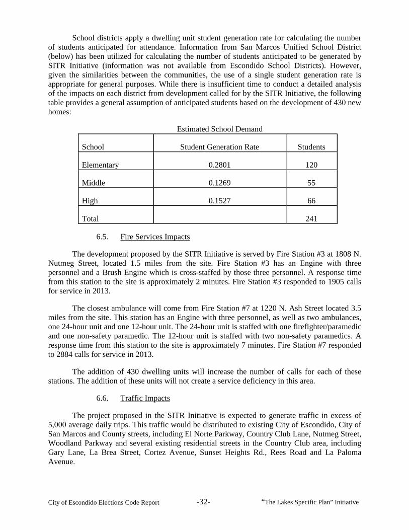
City of Escondido Elections Code Report -32- “The Lakes Specific Plan” Initiative
School districts apply a dwelling unit student generation rate for calculating the number of students anticipated for attendance. Information from San Marcos Unified School District (below) has been utilized for calculating the number of students anticipated to be generated by SITR Initiative (information was not available from Escondido School Districts). However, given the similarities between the communities, the use of a single student generation rate is appropriate for general purposes. While there is insufficient time to conduct a detailed analysis of the impacts on each district from development called for by the SITR Initiative, the following table provides a general assumption of anticipated students based on the development of 430 new homes:
Estimated School Demand
School Student Generation Rate Students
Elementary 0.2801 120
Middle 0.1269 55
High 0.1527 66
Total
241
6.5. Fire Services Impacts
The development proposed by the SITR Initiative is served by Fire Station #3 at 1808 N. Nutmeg Street, located 1.5 miles from the site. Fire Station #3 has an Engine with three personnel and a Brush Engine which is cross-staffed by those three personnel. A response time from this station to the site is approximately 2 minutes. Fire Station #3 responded to 1905 calls for service in 2013.
The closest ambulance will come from Fire Station #7 at 1220 N. Ash Street located 3.5 miles from the site. This station has an Engine with three personnel, as well as two ambulances, one 24-hour unit and one 12-hour unit. The 24-hour unit is staffed with one firefighter/paramedic and one non-safety paramedic. The 12-hour unit is staffed with two non-safety paramedics. A response time from this station to the site is approximately 7 minutes. Fire Station #7 responded to 2884 calls for service in 2013.
The addition of 430 dwelling units will increase the number of calls for each of these stations. The addition of these units will not create a service deficiency in this area.
6.6. Traffic Impacts
The project proposed in the SITR Initiative is expected to generate traffic in excess of 5,000 average daily trips. This traffic would be distributed to existing City of Escondido, City of San Marcos and County streets, including El Norte Parkway, Country Club Lane, Nutmeg Street, Woodland Parkway and several existing residential streets in the Country Club area, including Gary Lane, La Brea Street, Cortez Avenue, Sunset Heights Rd., Rees Road and La Paloma Avenue.

City of Escondido Elections Code Report -33- “The Lakes Specific Plan” Initiative
Typically, projects of this size and scope would be required to prepare a Traffic Impact Analysis (“TIA”) in advance of project approval. The TIA would analyze the current level of service of the surrounding streets and intersections. In addition, the TIA would determine the direct and cumulative impact that the project would have on surrounding streets and intersections. Lastly, the TIA would recommend measures to mitigate traffic impacts to below a level of significance and analyze the effectiveness of these mitigation measures. Because a Traffic Impact Analysis has not been provided by the project proponent, the current and future levels of services cannot be confirmed. In addition, it cannot be determined if the proposed mitigation measures are adequate to mitigate traffic impacts to below a level of significance.
It is anticipated that project traffic will use streets that are not fully improved. Portions of El Norte Parkway (Rees Road to Nutmeg) and Nutmeg (Gary Lane to El Norte Parkway) are narrower than City standards and lack sidewalks. The ability of these roadways to accept the anticipated additional vehicle, pedestrian and bicycle traffic cannot be confirmed.
Country Club Lane currently has a special designation as a golf cart zone resulting in a reduced speed limit of 25mph. The Traffic Impact Analysis conducted for the 2012 General Plan Update estimated that Country Club Lane carried approximately 5,000 average daily trips (Year 2011) between Nutmeg Street and Center City Parkway. It is anticipated that volumes west of Nutmeg are lower than 5,000 ADT.
The additional proposed trips are likely to change the character of the roadway. Currently, there are a number of intersections along Country Club Lane (Golden Circle Drive to Center City Parkway) that are controlled with stop signs for all directions. Additional traffic generated from the area subject to the specific plan proposed in the SITR Initiative is likely to result in poor levels of service at stop controlled intersections along Country Club Lane and may require signalization or other traffic control measures. In addition, the elimination of the golf course is likely to result in removal of the golf course reduced speed zone designation. Due to current geometric design of Country Club lane for low speeds, traffic impact from additional traffic volume from the Specific Plan area will require a traffic calming plan.
According to the Traffic Impact Analysis for the 2012 General Plan Update, it is estimated that El Norte Parkway carried approximately 29,700 average daily trips (Year 2011) between Nutmeg Street and I-15 South-bound Ramps, with a Level of Service of D.
6.7. Drainage Impacts
Large portions of the proposed specific plan area proposed by the SITR Initiative are within FEMA mapped 100-year floodplain areas that convey drainage from both on and offsite areas. Most of the drainage conveyance occurs within a system of natural and improved channels. However, there are existing pipelines within and directly downstream of the specific plan area that have been identified within the City’s Drainage Master Plan as not having adequate capacity to convey anticipated runoff.
Page C-40 of “The Lakes Specific Plan” proposed by the SITR Initiative states that “Stormwater runoff will increase with planned development of the SPA.” The SPA further states that detention ponds will be used “at major discharge points to reduce peak developed condition runoff to levels approaching pre-development condition peak flows.” These statements indicate that the project’s drainage impacts may not be fully mitigated and that mitigation may not be

City of Escondido Elections Code Report -34- “The Lakes Specific Plan” Initiative
implemented at all discharge points. It is expected that without full mitigation increases in storm water runoff draining to systems with inadequate capacity would increase the potential for flooding of the surrounding areas.
Typically, projects of this size and scope would be required to prepare a detailed grading and drainage plan and a drainage analysis in advance of project approval. The drainage analysis would determine the anticipated discharge rates from the site and from areas upstream of the site. Projects would then be conditioned to construct drainage improvements as necessary to convey anticipated discharge rates through the site. In addition, projects would be conditioned to improve downstream drainage facilities as necessary to convey increased flow rates anticipated from the site. Because neither a drainage analysis nor a grading and drainage plan have been provided by the project proponent, the effectiveness of the proposed detention ponds cannot be evaluated. Based on information available, it cannot be determined if the project would result in drainage impacts to surrounding areas. Projects within FEMA mapped 100 year floodplain areas are required to elevate new buildings above the 100 year flood elevation. Because a grading plan has not been provided, it is unclear if the homes within the specific plan area are proposed to be elevated above 100 year flood elevations. Prior to placement of fill in the FEMA mapped floodplain, the applicant would be required to process a revision to the FEMA floodplain maps in accordance with FEMA standards.
6.8. Water Quality and Hydro-Modification Impacts
The project proposed by the SITR Initiative drains to San Marcos Creek which discharges into Lake San Marcos and ultimately into Batiquitos Lagoon. In the 2012, 303(d) list,144 San Marcos Creek is listed as impaired for DDE,145 phosphorous, selenium and sediment toxicity. Lake San Marcos is listed as impaired for Ammonia as N and Nutrients.
Typically, projects of this size and scope would be required to prepare a Water Quality Technical Report (WQTR) in advance of project approval. The WQTR would analyze the potential impacts to water quality and provide calculations for treatment measures sized to retain or treat the anticipated pollutants of concern. In addition, the WQTR would determine the amount of storage necessary to detain peak flows to avoid impacts to downstream water bodies. Because a Water Quality Technical Report has not been provided by the project proponent, the effectiveness of the proposed detention ponds to treat or retain pollutants in the water cannot be confirmed. In addition, it cannot be determined if the project would result in hydro-modification of downstream water bodies, based on information provided by the project proponent.
6.9. Police Services Impacts
The development proposed by the SITR Initiative development is located two miles from the police station and within the 43 Beat of the Escondido Police Department in the North-West area of the city. The 43 Beat encompasses the area from Valley Parkway on the south to the northern City limits. Its eastern boundary is Centre City Parkway and extends to the western 144 “303(d) list” refers to the California Clean Water Act § 303(d) list compiled by the California State Water Resources Control Board. 145 DDE is the abbreviation for Dichlorodiphenyldichloroethylene, a reproductive toxicant for bird species.

City of Escondido Elections Code Report -35- “The Lakes Specific Plan” Initiative
City limits. From July 13, 2013 to July 13, 2014, Escondido Police Officers responded to 7,516 calls for service on the 43 Beat.
The area of the proposed development is located within the Escondido Country Club. During the same time period, officers responded to 334 calls for service in the Country Club area. The addition of 430 residences will increase the calls for service in this area; however officers will be able to meet the existing response time goals with existing staffing.
6.10. Water Impacts
Escondido’s water supply originates primarily from two sources: local water, derived from precipitation and stored in surrounding lakes, and imported water from the San Diego County Water Authority. Potable water is treated at the City’s treatment plant on East Valley Parkway and conveyed to rate payers through a series of reservoir tanks, pumping and piping systems. The Escondido Country Club golf course was supplied potable water for irrigation by the City of Escondido Utilities through two meters, 1-3 inch and 1- 4 inch, as well as by the Rincon Water District through two meters, 1-3 inch and 1- 4 inch.
1. Prior Water Usage
The volume of water through all four meters was included for three consecutive years, fiscal years 2011, 2012, and 2013 then the average annual daily usage was calculated. These totals were based on usage prior to irrigation being terminated at the golf course. Additionally, because irrigation use is extremely seasonal the peak month of July was extracted for the same years (in the case of Escondido it was the July reads that were used).
Country Club Golf Course - Irrigation
Service Agency
Meter/ Account #
Meter Size
Average Annual
Average Annual Daily Peak Month
Peak Month Average
Daily
Inches Gallons Gallons/Day July-Gallons Gallons/Day
Rincon 94-0400-1 4 14,007,000 38,567 2,804,663 90,473
Rincon 94-0200-1 3 7,126,333 19,524 1,507,344 48,624
Escondido 1376774 4 18,514,666 50,725 4,000,674 129,054
Escondido 1416910 3 2,182,666 5,980 350,672 11,312
Totals 41,830,665 114,796 8,663,353 279,463
2. Estimated Water Usage from Proposed Development
While there is insufficient time to conduct a detailed analysis of the impacts to the city’s water treatment plant regarding upgraded infrastructure needs to accommodate the SITR

City of Escondido Elections Code Report -36- “The Lakes Specific Plan” Initiative
Initiative, information from the City’s Water Master Plan has been incorporated for general estimating purposes to calculate future water demands (see following table). The estimated water demand indicates the SITR Initiative would generate a net increase of anticipated daily water usage totaling approximately 173,585 more gallons than when the golf course irrigation was operational and 453,048 more gallons than currently used for the site.
Estimated Water Demand
Proposed Use Quantity Units Gallons/Acre Gallons/DU Totals
Single Family Residential 430 Dwellings
490 210,700
Active Parks 5.7 acres 2,980 19,524 16,986
Passive Landscaping 13.2 acres 0
0
Lakes & Ponds 8.3 acres 27,152
225,362
Gallons Per Day Totals
453,048
6.11. Wastewater Impacts
Escondido’s wastewater is treated at the Hale Avenue Resource Recovery Facility (HARRF) treatment plant at 1521 S. Hale Avenue. Wastewater is conveyed over land and discharged through an ocean outfall. The City’s Wastewater Master Plan did not assume residential development associated with the SITR Initiative. While there is insufficient time to conduct a detailed analysis of the impacts to the HARRF regarding upgraded infrastructure needs to accommodate the proposed Initiative, information from the City’s Waste Water Master Plan has been incorporated for general estimating purposes. Based on an average of 200 gallons of daily wastewater generated by each of the 430 units proposed, it is anticipated that approximately 86,000 gallons of daily wastewater will be generated by project.