Citizen’s Guide to Colorado’s Water Heritage€™s Guide to Colorado’s Water Heritage This...
19
Transcript of Citizen’s Guide to Colorado’s Water Heritage€™s Guide to Colorado’s Water Heritage This...


Citizen’s Guide to Colorado’s Water HeritageThis Citizen’s Guide to Colorado’s Water Heritage is part of a series of educational booklets designed to provide Colorado citizens with balanced and accurate information on a variety of subjects related to water resources. Copyright 2004 by the Colorado Foundation for Water Education. ISBN 0-9754075-3-8
AcknowledgementsThe Colorado Foundation for Water Education thanks the following people and organizations for their review, comment, and assistance. The authors and the Foundation are solely responsible for the contents of this Guide.
Gregory A. HicksJared OrsiDevon G. PeñaSteven C. SchulteDick StenzelMichael WelshKen and Ruth Wright
Peggy Ford, Greeley MuseumsWright Family Foundation
Editor: Karla A. BrownDesign: R. Emmett Jordan
Colorado Foundation for Water Education1580 Logan St., Suite 410Denver, Colorado 80203303-377-4433www.cfwe.org
Officers President: Diane Hoppe, State Representative 1st Vice President: Justice Gregory J. Hobbs, Jr., Colorado Supreme Court 2nd Vice President: Becky Brooks, Colorado Water Congress Secretary: Wendy Hanophy, Colorado Division of Wildlife Assistant Secretary: Lynn Herkenhoff, Southwestern Water Conservation District Treasurer: Tom Long, Summit County Commissioner Assistant Treasurer: Matt Cook, Coors Brewing At Large: Taylor Hawes, Northwest Council of Governments Rod Kuharich, Colorado Water Conservation Board Lori Ozzello, Northern Colorado Water Conservancy District
Board of Trustees Rita Crumpton, Orchard Mesa Irrigation DistrictLewis Entz, State SenatorFrank McNulty, Colorado Division of Natural ResourcesJohn Redifer, Colorado Water Conservation BoardJeanne Beaudry, Roaring Fork ConservancyTom Pointon, AgricultureJohn Porter, Colorado Water CongressChris Rowe, Colorado Watershed NetworkRick Sackbauer, Eagle River Water and Sanitation DistrictGerry Saunders, University of Northern ColoradoAnn Seymour, Colorado Springs UtilitiesReagan Waskom, Colorado State University
All photographs are used with permission and remain the property of the respective photogra-phers (©2004). All rights reserved.
Mission Statement
The mission of the Colorado Foundation
for Water Education is to promote a better
understanding of water issues through educa-
tional opportunities and resources, so Colorado
citizens will understand water as a limited
resource and make informed decisions. The
Foundation does not take an advocacy position
on any water issue.
StaffKarla A. Brown, Executive DirectorKevin Darst, Staff WriterCarrie Patrick, Administrative Assistant
Preface
Citizen’s Guide to Colorado’s Water Heritage | 1
he Citizen’s Guide to Colorado’s Water
Heritage is part of an ongoing educational series
providing information on key water resource topics such
as Colorado water law, water quality, and conservation.
This work draws together the expertise of six prominent historians and
scholars from throughout Colorado and the West. The theme uniting their
pieces is: Water & Community: how water shapes Colorado’s culture,
history, and identity. Selecting the “settling in” era of Colorado’s first 100
years, this guide highlights each of the major river basins throughout the
state, addressing topics from Puebloan reservoirs in Mesa Verde, to the
Reclamation Era and the construction of big dams. The Foundation is also
particularly excited to bring to the public’s attention Colorado’s Native
American, Hispano, and Anglo contributions to our water heritage.
This guide is premised on the idea that informed decision-makers and
those interested in water resource issues need to understand the histori-
cal context in which these resources have shaped Colorado’s cultural and
economic identity.
As prominent British historian John Edward
Emerich said, “The study of history strength-
ens, and straightens, and extends the mind.”
Our task is to offer what we can learn from the
past, to help us better navigate the future.
Karla Brown
Executive Director
he Citizen’s Guide to Colorado’s Water
Heritage T
C O L O R A D O F O U N D A T I O N F O R W A T E R E D U C A T I O N
Introduction 1
Harvesting Water: Ancient Puebloan Reservoirs of Mesa Verde ...........................................4
Invisible Rivers: The Struggle of Early American Explorers to Map Colorado’s Rivers ......9
Sin agua no hay vida: Colorado’s Acequias—A Water Democracy ..........................................14
An Irrigated Legacy: The Union Colony .................................................................................9
Mingled Waters: The Diverse Identity of the Arkansas River Basin ...................................9
Building the Vision: Taylor, Aspinall, and Water for Western Colorado .................................9
Colorado Water History Timeline ................................................................9
Table of Contents
C I T I Z E N ’ S G U I D E T O C O L O R A D O ’ W A T E R H E R I T A G E | 32 | C O L O R A D O F O U N D A T I O N F O R W A T E R E D U C A T I O N
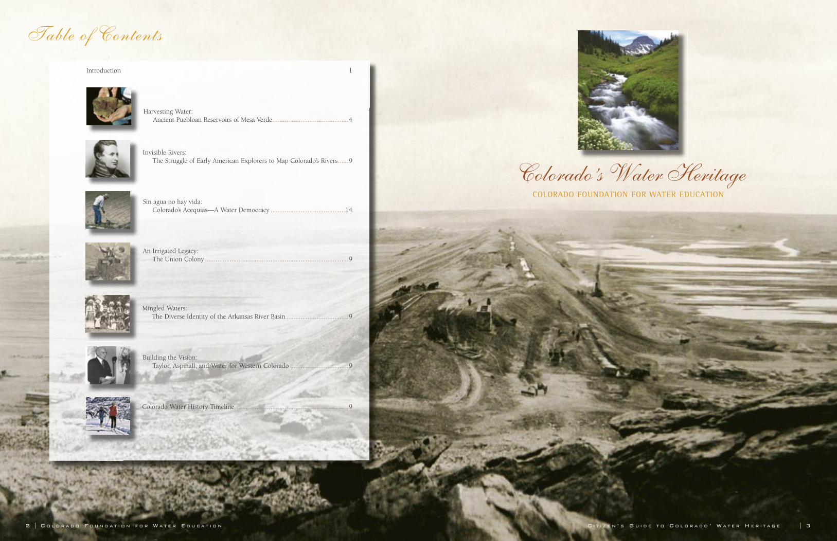
Colorado’s Water HeritageCOLORADO FOUNDATION FOR WATER EDUCATION
4 | C O L O R A D O F O U N D A T I O N F O R W A T E R E D U C A T I O N
TEditor’s Note: Ken and Ruth Wright are co-founders of the Wright Paleohydrologial Institute, a nonprofit public foundation dedi-cated to furthering the knowledge of past civilizations through the study of ancient water management. Ken is also chief engineer and founder of Wright Water Engineers in Denver, Colorado. Ruth practiced as an attor-ney for more than 40 years, also serving as a state legislator and member of the Northern Colorado Water Conservancy District Board.
Between 1995 and 2003, the Wrights and a team of engineers, archeologists, historians and soil and plant specialists researched four potential water reservoirs in Mesa Verde National Park in southwestern Colorado. It was the first paleohydrological study of the ancient use and handling of water at Mesa Verde National Park.
he cliff dwellings, pit houses, kivas, and intricate pottery of Mesa Verde have long fascinated scientists and the public alike. Making their homes in a desert of sandstone cliffs, sagebrush mesas, and baking sun, these industrious and hardy ancestral Puebloans learned to settle and thrive. Through preserved seeds, grains of pollen, and the tell-tale character of the soil, archeologists discovered that they were dryland farmers growing corn, beans, and squash. But anyone who has ventured out into the hot mid-day sun of Mesa Verde knows that a reliable source of drinking water is essential for survival. To support a population that at its peak reached into the thousands, could the ancient Puebloans have relied solely on the vagaries of rainfall and groundwater seeps? Scholars speculated that they also knew how to harvest and store water.
Between 1995 and 2003, we and our team of engineers, archeologists, historians and soil and plant specialists conducted scientific research at four potential water reservoirs in Mesa Verde National Park. Building on sporadic clues uncovered and documented by scientists since the turn of the century, we conducted Mesa Verde National Park’s first paleohydrological study of the ancient use and handling of water. The results would lay to rest years of speculation about the ability of these prehistoric people to use and manage their water resources. What we found was remarkable; these early Americans were good public works engineers.
Puebloans of Mesa VerdeNomadic early Native Americans
camped on the sagebrush mesas and can-yon valleys of what is now southwest Colorado as early as 8,500 years ago. As hunter-gatherers, they made baskets, used stone implements, but had no pottery and
did not grow food. In Mexico, perhaps 5,000 to 6,000 years
ago, a natural woody grass (teocinte) that grew in the highlands was domesticated by the local Indians. By choosing the best seeds from year to year, the prehistoric Mexicans eventually produced what we call maize (corn)—the “magical plant”—which trans-formed the Americas. About 1,000 B.C., maize somehow made its way to south-western Colorado. It turned out to be an insurance policy against famine, and many found this new food source so productive they settled down to tend their fields instead of roaming from camp to camp.
Three thousand years ago people from what is known as the Basketmaker II period relied on the lush river corridors of the Animas and La Plata rivers. They supple-mented their maize-based diet with squash, piñon nuts, grass seeds, deer, rabbit, and even big horn sheep and wild turkey. Water for drinking and cooking could easily be tapped from the local rivers and small side creeks. Following the river corridors, they settled primarily in the Durango area, also spreading north to Tamarron, south to the Pine River Valley near Ignacio, and west to the Dolores River Basin.
Then, around A.D. 550, their descen-dants discovered the fertile soils of Mesa Verde. During what is known as the Basketmaker III period, small groups of these tenacious stone-age farmers began to venture beyond the reliable flowing waters of the Animas and La Plata rivers and to settle in the forested highlands of Mesa Verde. Most of Mesa Verde’s canyons supplied flowing water only during storms or spring runoff, if then. Tenuous water supplies were provided by small springs or by digging shallow wells by hand, tapping groundwater in the canyon sands. Water would have been fetched with ceramic jars, and carried back to their dwellings.
But Mesa Verde was a good choice
for settling down. It had rich loess, a deposit of soil carried by the winds from Monument Valley about 16,000 years ago. Thick forests of pine and juniper pro-vided privacy, security, isolation, building materials, and fuel. Bounties of sunshine warmed the south-facing canyons and tablelands. Still, it was dry.
Perhaps the Puebloans biggest chal-lenge in Mesa Verde was its aridity—an average of 18 inches of rainfall and only 13 to 15 inches at lower elevations. These set-tlers had to rely on their creativity, leader-ship, and community spirit to survive, even flourish, in spite of the dearth of water. Dryland farming atop mesas and down in the canyons relied on limited groundwater, snowmelt, and occasional summer rains. But maize was adaptable to a wide variety of environmental conditions. Crop failure was common, but they persisted.
Their housing technique—half dug into the soil, half above—made them independent of caves and overhangs. It also allowed for larger communities with a more complex social order and its related benefits. During the cold, hard winters, they retreated into their pit houses and kivas to exploit the earth’s warmth and avoid exposure to howling winds and plunging temperatures. Around A.D. 750, the population of southwestern Colorado was well over 3,000 people for the first time in prehistory. As their pottery-mak-ing skills improved, their culture became known as the Pueblo I period.
Kiva: \Ki”va\ [Hopi name, sacred cham-ber.] A large chamber built under, or in, the houses of a Pueblo village, used as an assembly room in religious rites or as a men’s dormitory. It is commonly lighted and entered from an opening in the roof.
C I T I Z E N ’ S G U I D E T O C O L O R A D O ’ S W A T E R H E R I T A G E | 5
Harvesting WaterAncient Puebloan Reservoirs of Mesa Verde
By Ken and Ruth Wright
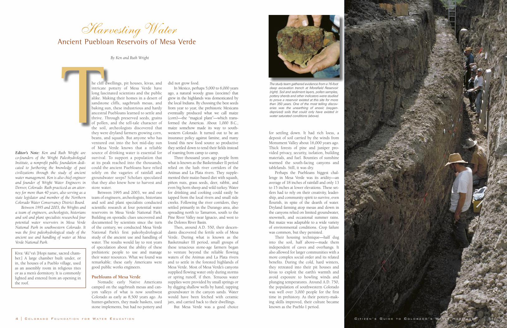
The study team gathered evidence from a 16-foot deep excavation trench at Morefield Reservoir (right). Soil and sediment layers, pollen samples, pottery sherds and other indicators were studied to prove a reservoir existed at this site for more than 350 years. One of the most telling discov-eries was the unearthing of anoxic (oxygen-deprived) soils that could only have existed in water saturated conditions (above).
6 | C O L O R A D O F O U N D A T I O N F O R W A T E R E D U C A T I O N C I T I Z E N ’ S G U I D E T O C O L O R A D O ’ S W A T E R H E R I T A G E | 7
The Paleohydrological InvestigationIn October 1995, we and our team of
specialists, mostly volunteers from Wright Water Engineers, began our detailed study of four potential reservoir sites. The team surveyed the topography of the landscape at each location, collected soil samples, and conducted rainfall-runoff determinations, ceramic analyses, surface infiltrations tests, tree ring evaluations, pollen analyses, and a variety of other tests attempting to unravel the mysterious function of these sites.
Not long after field surveys began, evi-dence started to indicate that sites previ-ously thought to be dance platforms or just unusual topographic mounds, were actually the remains of long ago silted-in water stor-age ponds, now named Morefield, Mummy Lake, Sagebrush, and Box Elder reservoirs.
There is also evidence that natural rock depressions were used for collecting and storing water. For instance, near Spruce Tree House, which dates to the early 13th century, there is a 500-gallon depression.Another natural depression below Mug House also served as a cistern. At Two-Story House located on the right-hand cliff of the Mancos River 4,000 feet south of the park boundary, there are very deep potholes in a small wash just northwest of the site that tend to hold water all year long. This cliff house was made famous by W.H. Jackson,
who published the first photograph of a cliff dwelling on Mesa Verde in 1874.
Our focus, however, was on large pub-lic works projects for the whole commu-nity. Morefield Canyon Reservoir was the first site studied. Preliminary excavations showed that the Puebloans dug a shallow pond in the thalweg (canyon bottom) of Morefield Canyon about A.D. 750. Clearing of timber and farming in the upper parts of the valley would have increased runoff down the normally dry channel. Any rains that came, especially late summer monsoon rains, would then occasionally flow down the canyon floor, filling the pond. Soil cores, sediment analyses, and archeological finds showed accumulated sediments and maize pollen that could only have been transported by flowing water. When these finds were dated, they were also shown to predate a neighboring great kiva by 80 years, indicating that a stable water supply was a first priority.
As with modern reservoirs, runoff also brought silt and sand into the water hole. To maintain enough space for adequate storage, the Puebloans would regularly dredge the reservoir using sticks, antlers, stones, and baskets. Dredging took a lot of organization and energy, but was necessary for maintaining the water resource. A deer antler excavated from Morefield Reservoir, carbon dated to A.D. 860, shows reservoir dredging occurred at the same time the community was in the middle of a massive construction project for their Great Kiva. Evidently, water resources were sufficient for a population large enough to grow maize, cut timber, and provide for reser-voir and kiva workers. And the Pueblo I people clearly knew how to excavate. The great kiva they built in Morefield Canyon between A.D. 829 and A.D. 865 measures 55 feet wide and 7 feet deep. Carefully designed and constructed, it must have made a fine place for religious rituals, meetings, and winter shelter.
Around A.D. 900, drier weather pat-terns prevailed, and the Mesa Verde popu-lation seems to have decreased. We do not know why, but emigration likely played a part. The whole southwest also was under-going a population decline at this time, but evidence shows that Mesa Verde, because
of its good location, soils and rainfall, was hit less hard than elsewhere. We know this because operation of Morefield Reservoir continued throughout this period without interruption. By this time, dredged sedi-ments had formed a berm around the res-ervoir and silt buildup no longer allowed water to flow into the pond without inter-vention. By about A.D. 900, the reservoir stood 6 to 7 feet higher than the water hole of 150 years before. But rather than dig-ging another reservoir, these early settlers did a smart thing—they built an inlet canal to divert water farther upstream.
It appears that the reservoir building successes of the Morefield Canyon peo-ple also inspired their “cousins” in Prater Canyon immediately to the west. Called Box Elder Reservoir by modern-day archeolo-gists, construction of this reservoir started in A.D. 800, using precisely the same tech-nology and on an east-west line with their neighbors’ public works project.
Throughout this period, the Prater Canyon community grew to about 300 residents who enjoyed the land, water, and sunshine of the west slope of the canyon bottom. Pollen studies from sediment lay-ers in Box Elder Reservoir showed that maize agriculture was extensive. Erosion and sediment buildup also shortened the life of this reservoir. By A.D. 950, it became too costly in effort and manpower to maintain, and it ceased to store water. However, the Prater Canyon people did continue to occupy the area, with frequent visits to nearby Morefield Canyon, where they would enjoy the great kivas (there were now two of them) and at the same time, perhaps collect a few jars of water. An ancient foot trail still goes up and over the ridge to Morefield Canyon, about an hour’s hike.
Around this same time, two mesa-top communities less than five miles distant were also constructing their own domestic water storage ponds. Up on the mesa, the hydrology was quite different from the canyon floor. Without a natural channel created by the canyon bottom, how could they find and direct suffi-cient water to fill a reservoir? Modern engineers probably would not even have attempted such a project.
Fortunately, the Puebloans knew more about the hydrology of mesa runoff than we modern engineers. The silt and clay soils of Mesa Verde have some unique properties. The silt and clay particles, when com-pacted by bare feet and sandals and when
puddled with rainfall, would float up to form an impervious surface allowing nearly 100 percent runoff. Even a small half-acre of these compacted soil areas could create enough runoff for successful water har-vesting. Surveyed between1998 and 2001, these two storage ponds are known as Far View and Sagebrush reservoirs.
Conditions were becoming more and more difficult for the early Puebloans. Fires and lumber harvesting had thinned the forests, and increased runoff had gullied the lush valley bottoms, result-ing in less groundwater being readily available. By A.D. 1100, Morefield and Sagebrush reservoirs, for some reason, were abandoned.
Tree ring and other evidence indicate that from about A.D. 1135 to A.D. 1180, it became very dry. The drought was so extensive that, even along the South Platte River, sand dunes formed. The hardy peo-ple of Mesa Verde withstood the drought, but by A.D. 1180 even Far View Reservoir was abandoned. The women of nearby Far View Village, Pipe Shrine House, and Coyote Village now had to trek down into the Little Soda Creek canyon some 500 feet below to gather water from a spring. Not long after, the ancient Puebloans began moving away from the canyon floors and mesa tops into the canyon walls, where they transferred their public works exper-tise into the construction of fortress-like cliff dwellings. For drinking water, they
relied solely on ground water springs, seeps, and small hand-dug wells.
Then around A.D. 1275, another drought settled on the region. Again, it hit hard. By this time the population of Mesa Verde was dropping. According to archaeologist Dr. David Breternitz, the last timber was placed at the most well-known cliff house of Chapin Mesa, Cliff Palace, in A.D. 1287. Life at Mesa Verde had become too uncertain, and a better life along the Rio Grande, at Casas Grande in Arizona and at Paquime in old Mexico, beckoned. By A.D. 1300, Mesa Verde was com-pletely deserted. Their wonderful Mesa Verde, home for nearly 800 years, was left behind. Both pushed and pulled out of their ancestral home, the Mesa Verde communities vanished.
We know that the ancient Puebloans of Mesa Verde and other native peoples of southwest Colorado did not just dis-appear; they moved on. Coincident with the abandonment of southwest Colorado, from A.D. 1250 to A.D. 1300, popula-tion increased in the northern Rio Grande basin near what is now Taos and Santa Fe. Steve Lekson of the University of Colorado found that people in at least one of the Rio Grande Basin settlements, Pinnacle Rock, began making pottery similar to the Pueblo Mesa Verde style in about 1300. To this day, many native peoples in the southwest have an oral tradition of having their ori-gins in the Mesa Verde region.
Harvesting WaterAncient Puebloan Reservoirs of Mesa Verde
Four Major Reservoirs UncoveredEstablished by Congress in 1906, Mesa Verde National Park covers an approxi-
mately 52,000 acre tract in southwest Colorado. Building on sporadic clues uncov-ered by scientists since the turn of the century, the park’s first paleohydrological study of the ancient use and handling of water uncovered four major reservoirs constructed and used by ancestral Puebloans.
Reservoir Name
Location Reservoir Life Span
(A.D.)
Size/Capacity
Morefield Morefield Canyon 750-1100 4 feet deep, 50-foot diameter;120,000 gallons
Far View(Mummy Lake)
Chapin Mesa 950-1100 4.6 feet deep (depth of water storage), 90-foot diameter;80,000 gallons
Sagebrush Un-named mesa 950-1100 5.2 feet deep, 70-foot diam-eter; up to 90,000 gallons
Box Elder Prater Canyon 800-950 20 feet deep, 220-foot max. diameter; 100,000 gallons
who published the first photograph of a cliff dwelling on Mesa Verde in 1874.
lic works projects for the whole commu-nity. Morefield Canyon Reservoir was the first site studied. Preliminary excavations showed that the Puebloans dug a shallow pond in the thalweg (canyon bottom) of Morefield Canyon about A.D. 750. Clearing of timber and farming in the upper parts of the valley would have increased runoff down the normally dry channel. Any rains that came, especially late summer monsoon rains, would then occasionally flow down the canyon floor, filling the pond. Soil cores, sediment analyses, and archeological finds showed accumulated sediments and maize pollen that could only have been transported by flowing water. When these finds were dated, they were also shown to predate a neighboring great kiva by 80 years, indicating that a stable water supply
The Paleohydrological Investigation
specialists, mostly volunteers from Wright Water Engineers, began our detailed study of four potential reservoir sites. The team surveyed the topography of the landscape at each location, collected soil samples, and conducted rainfall-runoff determinations, ceramic analyses, surface infiltrations tests, tree ring evaluations, pollen analyses, and a variety of other tests attempting to unravel the mysterious function of these sites.
dence started to indicate that sites previ-ously thought to be dance platforms or just unusual topographic mounds, were actually the remains of long ago silted-in water stor-age ponds, now named Morefield, Mummy Ancient Puebloans filled Mummy Lake by col-
lecting runoff from packed soil surfaces, and directing that water into a ditch flowing towards the reservoir.
The purpose of this small structure (top) located just beside the excavated reservoir, is not yet fully understood. Some think it may have been a settling pond to remove sediment from incoming water. Others hypothesize it is actually the remains of an original, smaller reservoir. Ken Wright, co-founder of the Wright Paleohydrological Institute, led the first full-scale study of potential reservoir sites in Mesa Verde National Park.
8 | C O L O R A D O F O U N D A T I O N F O R W A T E R E D U C A T I O N
Harvesting WaterAncient Puebloan Reservoirs of Mesa Verde
Learning from the Mesa Verde PeopleThe ancestral Puebloans of Mesa Verde
were able to plan, build, and operate public works projects in southwestern Colorado more than 1,000 years ago. The evidence they left behind has provided ample proof of their civil engineering achievements that spanned hundreds of years. But the reservoirs of Mesa Verde did not guarantee a lavish supply of water to the Puebloans. Analysis shows that Mummy Lake, for example, was likely never more than a sea-sonal source of domestic water for nearby residents. They did not store water to irri-gate crops; they lived on the annual aver-age of 18 inches of rainfall.
We can learn a lot from the early Mesa Verde people. For instance, com-munity-wide efforts are vital to success, and water supply is a commodity for which our expectations should be mod-est and for which our willingness to pay should be higher. Planning for the future can be uncertain and long and extensive droughts may commence little by little without our even being fully cognizant of a climate change. We learned that the early Mesa Verde people were talented water managers, good public works engi-neers, that they had a reliable social structure, good organization abilities and strong community values. We can be proud of their accomplishments.
ReferencesLarry V. Benson. et al., Ancient Maize From
Chacoan Great Houses: Where Was It Grown? National Academy of Sciences 100 No. 22 (2003): 13111-13115.
David A. Breternitz, The 1969 Mummy Lake Excavations, Site 5MV833 (Boulder, Colorado: Wright Paleohydrological Institute, 1999).
David A. Breternitz, Arthur H. Rohn, Jr., and Elizabeth A. Morris, eds. Prehistoric Ceramics of the Mesa Verde Region. Ceramic Series No. 5 (Flagstaff, Arizona: Museum of Northern Arizona, 1974).
William M. Ferguson, The Anasazi of Mesa Verde and the Four Corners (Niwot, Colorado: University of Colorado Press, 1996).
Kathleen Fiero, (1993) Two-Story House Preservation Project, 5MT12028, Ute Mountain Tribal Park.
Richard G. Holloway, Pollen Analysis of Four Reservoir Sites, 5MV833, 5MV1931, 5MV1936, and 5MV4505, Mesa Verde National Park, Colorado. Draft. (Flagstaff, Arizona: Quaternary Services, 2004).
Stephen H. Lekson, et al., Migrations in the Southwest: Pinnacle Ruin, Southwestern New Mexico, Kiva 68, No. 2 (2002): 73-101.
William D. Lipe, Mark D. Varien, and Richard H. Wilshusen, eds., Colorado Prehistory: A Context for the Southern Colorado River Basin (Denver: Colorado Council of Professional Archaeologists, 1999).
Ricardo J. Salvador, In The Encyclopedia of Mexico: History, Culture and Society (Chicago, Illinois: Fitzroy Dearborn Publishers, 1997).
Jack E. Smith, The 1972 and 1974 Excavations of a Potential Reservoir (Site 5MV1936) Mesa Verde National Park, Colorado (Boulder, Colorado: Wright Paleohydrological Institute, 1999).
Jack E. Smith and Ezra B. Zubrow, 1967 Excavations of Site 5MV1931, Morefield Canyon Mesa Verde National Park, Colorado (Boulder, Colorado: Wright Paleohydrological Institute, 1993).
Kenneth R. Wright, Water for the Anasazi (Kansas City, Missouri: Public Works Historical Society, 2003).
ReferencesLarry V. Benson. et al., Ancient Maize From
David A. Breternitz, The 1969 Mummy Lake
David A. Breternitz, Arthur H. Rohn, Jr.,
William M. Ferguson, The Anasazi of Mesa
Kathleen Fiero, (1993) Two-Story House
were able to plan, build, and operate public works projects in southwestern Colorado more than 1,000 years ago. The evidence they left behind has provided ample proof
that spanned hundreds of years. But the reservoirs of Mesa Verde did not guarantee
Analysis shows that Mummy Lake, for example, was likely never more than a sea-sonal source of domestic water for nearby residents. They did not store water to irri-gate crops; they lived on the annual aver-
Mesa Verde people. For instance, com-munity-wide efforts are vital to success,
Invisible RiversThe Struggle of Early American Explorers to Map Colorado’s Rivers
By Jared Orsi
e don’t usually think of Colorado rivers as being important for navigation.
We have interstates for that. Road signs point the way to all destinations. The McDonald’s, Motel 6, and Conoco station at the next inter-change take care of travelers’ needs for food, shelter, and fuel along the way.
In the 19th century, however, rivers were the interstates. Rivers were the great highways that guided travelers to the most important places, led them to centers of human habita-tion, and provided for the needs of the human body and psyche along the way.
Rivers meant food, shelter, energy, and, of course, water. They meant congregating, trading, and traveling. They were lifelines for the native peoples of the mountains and plains. Along the rivers and their tributaries, berries and willows grew. Birds flocked. Game abounded. Away from the rivers, the arid land-scape offered potential starvation, dehydration, disorientation, discomfort, even death.
Two of Colorado’s great rivers, the Platte to the north and the Arkansas to the south, take shape high in Colorado’s
Rocky Mountains. Not surprisingly, these were the avenues that brought the first Americans to Colorado: Zebulon Pike in 1806 and Stephen Long in 1820.
Between the two rivers, the short grass prairie of the High Plains rises to more than 6,000 feet in elevation. Although Native Americans managed to make good use of this environment, its austerity appalled the first Spanish and American visitors. It was a space of climatic extremes, almost entirely devoid of shelter, with few sizable tributaries to moisten the landscape. One often had to travel 25 miles or more to find the nearest water, which may have seeped from aquifers to fill buffalo wal-lows and other depressions.
In such a landscape, to control the riv-ers was to control the country, and by the opening of the 19th century, rivers held con-siderable geopolitical importance. On the Missouri River the Sioux exacted tribute and concessions in exchange for allowing passage upstream. The Spanish courted the Pawnees
on the Republican River in hopes of inducing
e don’t usually think of Colorado rivers as being important for navigation.
the way to all destinations. The McDonald’s, Motel 6, and Conoco station at the next inter-change take care of travelers’ needs for food, shelter, and fuel along the way. W
C I T I Z E N ’ S G U I D E T O C O L O R A D O ’ S W A T E R H E R I T A G E | 9
About the Author: Jared Orsi is an assistant professor of history at Colorado State University, where he teaches courses on U.S. and Latin American history. He is the author of Hazardous Metropolis: Flooding and Urban Ecology in Los Angeles and the editor of a special volume of the Journal of the West that examines water history in the North American West. Currently he is writing a book on American nationalism and the Zebulon Pike expedition of 1806-1807.
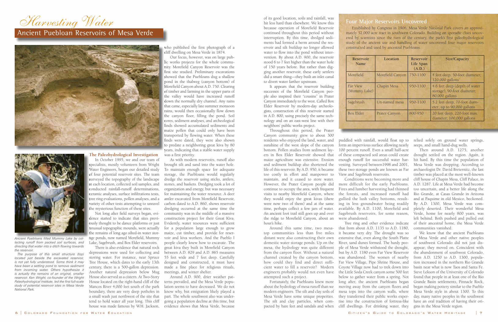
Morefield Canyon (top) is the site of Morefield Reservoir. In 2000, the Bircher Fire burned off thick sagebrush to reveal this reservoir which can now be seen as a small depression in the foreground. Studies indicate that between 750-1100 A.D., ancient Puebloans filled the reservoir using a channel cut through the valley floor. Ruth Wright (above), co-founder of the Institute, also served as head photographer for the investigation.
10 | C O L O R A D O F O U N D A T I O N F O R W A T E R E D U C A T I O N C I T I Z E N ’ S G U I D E T O C O L O R A D O ’ S W A T E R H E R I T A G E | 1110 | C O L O R A D O F O U N D A T I O N F O R W A T E R E D U C A T I O N C I T I Z E N ’ S G U I D E T O C O L O R A D O ’ S W A T E R H E R I T A G E | 11
Invisible RiversThe Struggle of Early American Explorers to Map Colorado’s Rivers
them to capture Lewis and Clark on their way downstream. Meanwhile, James Wilkinson, the highest ranking American army officer, plotted an invasion of New Spain via the Arkansas, and the United States and Spain nearly went to war over the question of which western river formed the boundary between their ter-ritories. To the east, Aaron Burr floated the Ohio and Mississippi rivers urging westerners to secede from the Union. With Thomas Jefferson having recently doubled the size of the United States by acquiring Louisiana, a territory of unknown extent that was defined by the watersheds of western rivers, the young nation was at once ambitious and vulnerable.
Zebulon Pike
In the summer of 1806, Army General James Wilkinson ordered Zebulon Pike to follow the rivers west.
The purposes of the expedition remain murky. On one hand, Pike’s ostensible mission was to find the headwaters of the Arkansas and Red rivers, which lay in uncharted territory claimed by both the United States and Spain. He was also instructed to make alliances with the powerful Pawnee and Comanche tribes who controlled the rivers of the central plains. In this respect, Pike’s expedition was part of a larger Jeffersonian-era project to extend the nation’s tenuous control over its western empire by mapping the rivers and making treaties with the peoples who lived along them.
On the other hand, however, at the time he issued Pike’s orders, Wilkinson was plotting to monopolize the fur trade, to launch a filibustering effort into New Spain, and also possibly to split the western states and territories from the union. Pike was his spy. It is unclear how much Pike knew of the double mission on which he was embarking, but regardless, whatever Pike discov-ered would benefit both Jeffersonian exploration and the schemes of those who would use that project as cover for advancing their own treacherous interests.
Leaving St. Louis in July, Pike’s expedition soon reached some Pawnee villages near the present Kansas-Nebraska line. From there, struggling overland without a river to follow, they frequent-ly lacked food, water and firewood, and they periodically lost their way. They even adopted the desperate measure of following the
trail of their Spanish pursuers, calculating that the Spaniards “had good guides, and were on the best route for wood and water.”
Once the party struck the Arkansas River in October, its for-tunes improved. As they neared what is now Colorado, they came upon vast herds of bison. “I will not attempt to describe the droves [of bison],” Pike recorded. “Suffice it to say, that the face of the prairie was covered with them…their numbers exceeded imagina-tion.” That night the men “feasted sumptuously.”
Yet as he made his way upstream along the Arkansas River, Pike actually knew little about western rivers. Like other Americans, his understanding of geography was clouded by misunderstand-ings and half-truths formed in the East and informed by the Enlightenment, a European intellectual revolution that sought among other things, to discover and catalogue the laws of nature. Pike brought these ideas to the West and used them to interpret what he saw. In the end, these notions led him astray.
First was the idea of continental symmetry. Enlightenment geographers held that North America was roughly symmetrical: the geography of the West more or less mirrored the geography of the East.
What did that mean for Pike? It meant–erroneously–that the Rockies, which almost no Americans had seen and none had reported on, must be about the size of the Appalachians.
So when Pike stood on the banks of the Arkansas on November 15 near modern Las Animas and spied a mountain he called “the Grand Peak,” he compared it to the Alleghenies. And having no idea how large it was, he assumed it was much closer than it actu-ally was. The possibility that you could see a mountain 120 miles away was not something his mind could grasp.
Two days later, he wrote in his journal: “Marched…with an idea of arriving at the mountains, but found at night, no visible difference in their appearance.”
A week later, near modern Pueblo, he still expected a day’s journey to the mountain. Although he was still more than 40 miles away, he took three men and scant supplies and headed for the peak, planning to scale its heights and return the following day.
Here, Pike was operating from another Enlightenment mis-conception about rivers, namely that there was a single height of land from which all the great western rivers flowed. From that peak, he expected to be able to see the headwaters of the Arkansas, the Red, and the Platte, and possibly the Missouri, Yellowstone, Columbia, Colorado, and Rio Grande. Not only would a view from “the Grand Peak” help him find his objec-tives, the headwaters of the Arkansas and the Red, but it would reveal the origin of the rivers that were so crucial to controlling the future of North America.
Pike never made the top. Three days later, on Thanksgiving Day, Pike finally admitted defeat. “The summit of the Grand Peak…now appeared at the distance of 15 or 16 miles from us, and as high again as what we had ascended, and would have taken a whole day’s march to have arrived at its base…I believe that no human being could have ascended to its pinical (sic).”
In December, upon resuming his upstream march, he then
In the summer of 1806, Army General James Wilkinson mistakenly followed a tributary northward and mislabeled it the headwaters of the Arkansas. Further north, he discovered another large river frozen over and heading northeast, which he correctly identified as the South Platte, one of the few things he actually got right during his time in the mountains.
Turning southwest, he found another watershed, and here Pike was failed once again by faulty knowledge of geography. General Wilkinson had instructed him to travel south after find-ing the Arkansas headwaters and descend the Red River, which Alexander von Humboldt, one of the era’s most famous geogra-phers, had suggested was the next major watershed south of the Arkansas River.
So when Pike crossed the mountains and found a broad river valley, everything seemed to match. The fatigued and frostbitten men must have rejoiced—they thought they were on their way home.
The only problem was that Humboldt was wrong. The Red River does not rise in the Rockies, but in northwest Texas, 300 miles away. Pike’s party spent several grueling weeks stumbling and sledding downstream, barely surviving the Royal Gorge, only to discover they were back at the very spot on the plains near mod-ern Canon City they had passed one month before. Brutal weeks in the Rocky Mountain winter had yielded only the rediscovery of the very river they had been following since late October.
What to do now? If he was still on the Arkansas, then where was the Red?
To the southwest loomed the Sangre de Cristo Mountains—impossible, it seemed, to cross. Even with his crew frostbitten, poorly clothed, and nearly starving, Pike decided that on the yon-der side of those mountains must be the Red River.
After struggling to crest the Sangre de Cristos, the party finally spied an enormous park—the San Luis Valley—with a broad river running through it.
The Red? No, that was still in Texas. The river before them was the Rio Grande, but Pike took it for the Red. Exhausted, the party settled into a small stockade they constructed on the Conejos River, a tributary of the Rio Grande. Pike was in Spanish territory. It was February.
Fortunately, perhaps, given the sorry state of the men, the Spaniards finally found him. They arrested him and took him first to Santa Fe and then to Chihuahua, before escorting him across Texas and back to American territory.
Pike had not reached his central objective: the headwaters of the Red River, which many took as the boundary between the United States and New Spain. That boundary would remain in dispute until the Adams-Onís Treaty of 1819.
In his defense, however, two other early American expedi-tions also failed to find the river’s elusive headwaters. Another party, led by Thomas Freeman and Peter Custis earlier in 1806, also tried to ascend the river from its mouth and was turned back by Spanish troops.
The third party was led by Major Stephen Long.
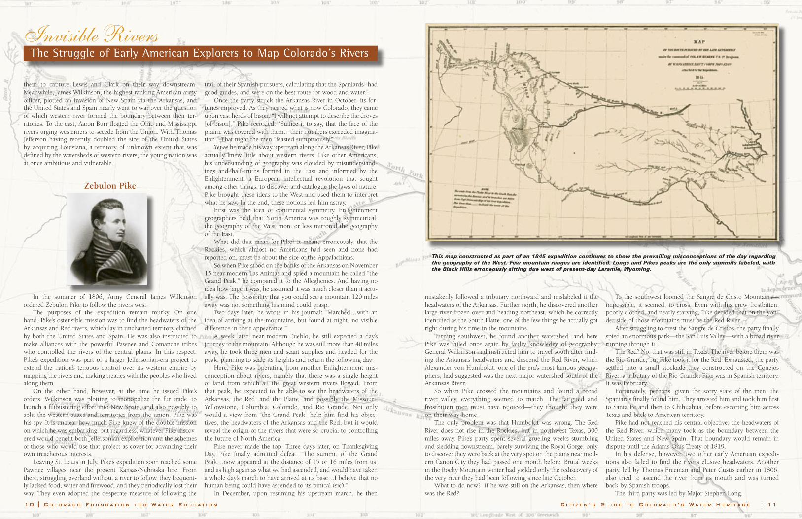
This map constructed as part of an 1845 expedition continues to show the prevailing misconceptions of the day regarding the geography of the West. Few mountain ranges are identified. Longs and Pikes peaks are the only summits labeled, with the Black Hills erroneously sitting due west of present-day Laramie, Wyoming.
C I T I Z E N ’ S G U I D E T O C O L O R A D O ’ S W A T E R H E R I T A G E | 1312 | C O L O R A D O F O U N D A T I O N F O R W A T E R E D U C A T I O N
Invisible RiversThe Struggle of Early American Explorers to Map Colorado’s Rivers
Major Stephen Long
Thirteen years later, even with the U.S.-Spanish boundary settled, much of the border remained unmapped. This, along with the desire to check British influence over Indian tribes and the fur trade renewed American interest in western geography. Once again the rivers were seen as the key to mastery of the West. In 1820, therefore, Major Stephen Long, an officer for the Army Topographical Engineers, led another expedition to locate the headwaters of the ever-important rivers of Colorado: the Platte, the Arkansas, and the Red, the last of which was still thought to rise somewhere between Pikes Peak and Santa Fe. Long found the Colorado terrain no more hospitable than Pike.
Following the Platte River westward, Long and his party sight-ed the mountains on June 30, 1820, and like Pike, they underes-timated the distance to them. Arriving at the Rockies a week later, Long decided not to follow his instructions to find the headwaters of the Platte, and instead turned his party southward along the base of the mountains. He left no record to explain his decision, but the expedition was badly under-supplied, and perhaps short-ages of water, food and fuel, as well as the men’s frequent illness, persuaded him to hurry.
Whatever the reason, the men got a rude welcome to the Front Range monsoon season on July 12, when an afternoon thunderstorm blackened the sky, and rain pelted the explorers.
The stream on which they camped swelled and grew “thick with buffalo dung” emitting “a most intolerable stench.” The men settled the sandy water in a kettle, skimmed floating dung from the surface, and used the water to boil meat soup.
After that disagreeable supper, the party detoured for a suc-cessful ascent of Pikes Peak. And then Long abandoned the second objective of his expedition to find the headwaters of the Arkansas—perhaps again sensitive to low supplies and late season.
Turning south from the Arkansas in search of the elusive Red River, Long learned as Pike had the hardships of travel on the plains away from the rivers. Water was scarce—and foul when they did find it. Buffalo chips provided their only fuel. By July 27, when the men chased wolves away from a bison kill, they had been reduced to a brutish state, only marginally successful com-petitors at the top of the Plains food chain.
Finally, on July 29, probably near the present Colorado-New Mexico border, a violent storm struck. Unable to find dry fuel, the party huddled around a sputtering camp fire. The rain turned to hail, then back to rain, pelting the horses so hard they refused to walk except with the wind. With “water pouring in streams from our moc-casins (sic),” the men straggled on. That night there was no dinner.
Given such hardships, the party can perhaps be forgiven for wishfully thinking that the dry stream bed on which it had camped a few days later was a tributary of the Red River. Believing that, the party decided to follow the river downstream instead of continuing overland. Several more days of hunger and exhaus-tion followed before water finally appeared in the river bed about 100 miles downstream. The river, however, turned out to be the Canadian, a tributary of the Arkansas. On September 13, the party stumbled into Fort Smith, Arkansas, the third expedition to miss the headwaters of the Red River, whose origins would not be firmly established until 1852.
Long has been often chided for his failure to find the head-waters of the Arkansas and the Red, two rivers that formed
the southwestern boundary of the U.S. under the recently completed treaty
with Spain. Ultimately how-
ever, that failure was of little consequence, as Mexico’s independence in 1821 and its subsequent internal turmoil eliminated the last imperial competition for control of the Plains and Rockies. Instead, recent histori-ans have remembered Long for his impor-tant contribution of furthering the tradi-tion of army scientific exploration, which would pave the way for the expansion of American commerce, geographic knowl-edge, military control, and transportation in the West for the next several decades.
The Great American DesertNot surprisingly, Pike and Long took
a dim view of land between the Rockies and the Mississippi. Pike compared the Plains to the “sandy deserts of Africa” and declared that they would never be densely settled. And Long, on his map of the expe-dition, famously labeled the region the “Great American Desert.” Such pessimism helped discourage settlement of the Plains for decades.
The rivers explored by Pike and Long became the highways that brought hun-dreds of thousands of overland traders and emigrants to Colorado and the West between the 1840s and 1860s. Like the early explorers, however, these travelers found that whenever they strayed from the rivers, whether by design or by accident,
they invariably became lost, hungry, thirsty and demoralized. Consequently, few people paused to stop on their way to the Rockies, and whites did not settle the Plains in large numbers until the 1870s and 1880s, when railroads—many of whose routes had been surveyed by Army engineers following Long’s example—replaced rivers as the primary avenues of transport and made overland travel substantially easier.
The explorers’ forecasts seem unduly pessimistic in retrospect, and yet we might take a lesson from them, for we, too, depend on the water in the rivers. The drought of the late 1880s and 1890s, the Dust Bowl of the 1930s, and the depleted aquifers and forest fires of the early 21st century remind us that Stephen Long’s generation was not the only one to call the High Plains a desert. It likely won’t be the last.
ReferencesHarlin M. Fuller and LeRoy Hafen, ed. The
Journal of Captain John R. Bell, Official Journalist for the Stephen H. Long Expedition to the Rocky Mountains, 1820 (Glendale, Calif.: The Arthur Clark Company, 1957).
William H. Goetzmann, Army Exploration in the American West, 1803-1863 (New Haven: Yale University Press, 1959).
William H. Goetzmann, Exploration and
Empire: The Explorer and the Scientist in the Winning of the American West (New York: Alfred A. Knopf, 1966).
William H. Goetzmann, New Lands New Men: America and the Second Great Age of Discovery (New York: Viking, 1986).
Donald Jackson, ed. The Journals of Zebulon Montgomery Pike (2 vols.) (Norman: University of Oklahoma Press, 1966).
Edwin James, Account of An Expedition from Pittsburgh to the Rocky Mountains (2 vols.) (Philadelphia: Carey and Lea, 1823).
W. Eugene Hollon, The Lost Pathfinder: Zebulon Montgomery Pike (Norman: University of Oklahoma Press, 1949).
Howard Lamar, ed. The New Encyclopedia of the American West (New Haven: Yale University Press, 1998).
Roger L. Nichols and Patrick L. Halley. Stephen Long and American Frontier Exploration (Newark: University of Delaware Press, 1980).
Elliott West, The Contested Plains: Indians, Goldseekers, and the Rush to Colorado (Lawrence: University Press of Kansas, 1998).
“The Handbook of Texas Online,” http://www.tsha.utexas.edu/handbook/online
Thirteen years later, even with the U.S.-Spanish boundary
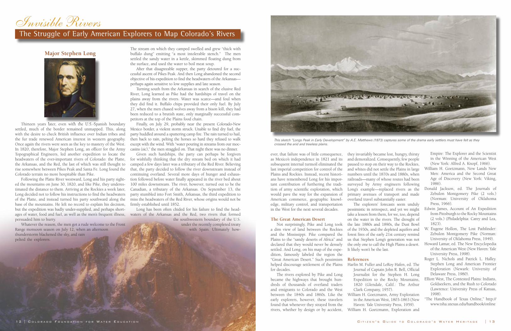
This sketch “Longs Peak in Early Development” by A.E. Matthews (1873) captures some of the drama early settlers must have felt as they crossed the arid and treeless plains.
Sin agua no hay vida*Colorado’s Acequias—A Water Democracy
* Without water there is no life
By Gregory A. Hicks and Devon G. PeñaPhotographs by Karen Mendoza
Editor’s Note: This chapter is based on the authors’ earlier work on the Hispano irri-gation communities of the San Luis Valley, “Community Acequias in Colorado’s Rio Culebra Watershed: A Customary Commons in the Domain of Prior Appropriation,” 74 Colorado Law Review 387-486 (2003). That article, and the sources cited there offer a more extended consideration of the subject matter. The authors wish to acknowledge the contribu-tion of Virginia Sanchez of Denver, who shared her knowledge of the acequia communities of Huerfano and Las Animas counties.
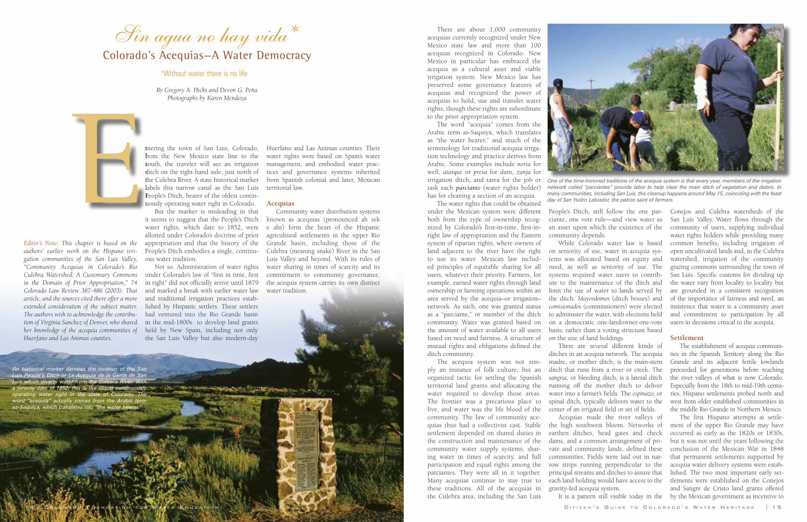
ntering the town of San Luis, Colorado, from the New Mexico state line to the south, the traveler will see an irrigation ditch on the right-hand side, just north of the Culebra River. A state historical marker labels this narrow canal as the San Luis People’s Ditch, bearer of the oldest contin-uously operating water right in Colorado.
But the marker is misleading in that it seems to suggest that the People’s Ditch water rights, which date to 1852, were allotted under Colorado’s doctrine of prior appropriation and that the history of the People’s Ditch embodies a single, continu-ous water tradition.
Not so. Administration of water rights under Colorado’s law of “first in time, first in right” did not officially arrive until 1879 and marked a break with earlier water law and traditional irrigation practices estab-lished by Hispanic settlers. These settlers had ventured into the Rio Grande basin in the mid-1800s to develop land grants held by New Spain, including not only the San Luis Valley but also modern-day
Huerfano and Las Animas counties. Their water rights were based on Spain’s water management, and embodied water prac-tices and governance systems inherited from Spanish colonial and later, Mexican territorial law.
AcequiasCommunity water distribution systems
known as acequias (pronounced ah sek e ahs) form the heart of the Hispanic agricultural settlements in the upper Rio Grande basin, including those of the Culebra (meaning snake) River in the San Luis Valley and beyond. With its rules of water sharing in times of scarcity and its commitment to community governance, the acequia system carries its own distinct water tradition.
There are about 1,000 community acequias currently recognized under New Mexico state law and more than 100 acequias recognized in Colorado. New Mexico in particular has embraced the acequia as a cultural asset and viable irrigation system. New Mexico law has preserved some governance features of acequias and recognized the power of acequias to hold, use and transfer water rights, though these rights are subordinate to the prior appropriation system.
The word “acequia” comes from the Arabic term as-Saquiya, which translates as “the water bearer,” and much of the terminology for traditional acequia irriga-tion technology and practice derives from Arabic. Some examples include noria for well, atarque or presa for dam, zanja for irrigation ditch, and tarea for the job or task each parciante (water rights holder) has for cleaning a section of an acequia.
The water rights that could be obtained under the Mexican system were different both from the type of ownership recog-nized by Colorado’s first-in-time, first-in-right law of appropriation and the Eastern system of riparian rights, where owners of land adjacent to the river have the right to use its water. Mexican law includ-ed principles of equitable sharing for all users, whatever their priority. Farmers, for example, earned water rights through land ownership or farming operations within an area served by the acequia–or irrigation–network. As such, one was granted status as a “parciante,” or member of the ditch community. Water was granted based on the amount of water available to all users based on need and fairness. A structure of mutual rights and obligations defined the ditch community.
The acequia system was not sim-ply an instance of folk culture, but an organized tactic for settling the Spanish territorial land grants and allocating the water required to develop those areas. The frontier was a precarious place to live, and water was the life blood of the community. The law of community ace-quias thus had a collectivist cast. Stable settlement depended on shared duties in the construction and maintenance of the community water supply systems, shar-ing water in times of scarcity, and full participation and equal rights among the parciantes. They were all in it together. Many acequias continue to stay true to these traditions. All of the acequias in the Culebra area, including the San Luis
People’s Ditch, still follow the one par-ciante, one vote rule—and view water as an asset upon which the existence of the community depends.
While Colorado water law is based on seniority of use, water in acequia sys-tems was allocated based on equity and need, as well as seniority of use. The systems required water users to contrib-ute to the maintenance of the ditch and limit the use of water to lands served by the ditch. Mayordomos (ditch bosses) and comisionados (commissioners) were elected to administer the water, with elections held on a democratic one-landowner-one-vote basis, rather than a voting structure based on the size of land holdings.
There are several different kinds of ditches in an acequia network. The acequia madre, or mother ditch, is the main-stem ditch that runs from a river or creek. The sangria, or bleeding ditch, is a lateral ditch running off the mother ditch to deliver water into a farmer’s fields. The espinazo, or spinal ditch, typically delivers water to the center of an irrigated field or set of fields.
Acequias made the river valleys of the high southwest bloom. Networks of earthen ditches, head gates and check dams, and a common arrangement of pri-vate and community lands, defined these communities. Fields were laid out in nar-row strips running perpendicular to the principal streams and ditches to assure that each land holding would have access to the gravity-fed acequia system.
It is a pattern still visible today in the
Conejos and Culebra watersheds of the San Luis Valley. Water flows through the community of users, supplying individual water rights holders while providing many common benefits, including irrigation of open uncultivated lands and, in the Culebra watershed, irrigation of the community grazing commons surrounding the town of San Luis. Specific customs for dividing up the water vary from locality to locality but are grounded in a consistent recognition of the importance of fairness and need, an insistence that water is a community asset and commitment to participation by all users in decisions critical to the acequia.
SettlementThe establishment of acequia communi-
ties in the Spanish Territory along the Rio Grande and its adjacent fertile lowlands proceeded for generations before reaching the river valleys of what is now Colorado. Especially from the 18th to mid-19th centu-ries, Hispano settlements probed north and west from older established communities in the middle Rio Grande in Northern Mexico.
The first Hispano attempts at settle-ment of the upper Rio Grande may have occurred as early as the 1820s or 1830s, but it was not until the years following the conclusion of the Mexican War in 1848 that permanent settlements supported by acequia water delivery systems were estab-lished. The two most important early set-tlements were established on the Conejos and Sangre de Cristo land grants offered by the Mexican government as incentive to
ntering the town of San Luis, Colorado, from the New Mexico state line to the south, the traveler will see an irrigation ditch on the right-hand side, just north of the Culebra River. A state historical marker labels this narrow canal as the San Luis People’s Ditch, bearer of the oldest contin-uously operating water right in Colorado. E
14 | C O L O R A D O F O U N D A T I O N F O R W A T E R E D U C A T I O N C I T I Z E N ’ S G U I D E T O C O L O R A D O ’ S W A T E R H E R I T A G E | 15
An historical marker denotes the location of the San Luis People’s Ditch or La Acequia de la Gente de San Luis which diverts water from the Culebra River. With a priority date of 1852, this is the oldest continuously operating water right in the state of Colorado. The word “acequia” actually comes from the Arabic term as-Saquiya, which translates into “the water bearer.”
One of the time-honored traditions of the acequia system is that every year, members of the irrigation network called “parciantes” provide labor to help clear the main ditch of vegetation and debris. In many communities, including San Luis, this cleanup happens around May 15, coinciding with the feast day of San Ysidro Labrador, the patron saint of farmers.

Sin agua no hay vida Colorado’s Acequias—A Water Democracy
populate and stabilize frontier regions. The population of the settlements grew
steadily and rapidly. After establishment of the first acequia community at San Luis in 1851, the San Luis People’s Ditch was constructed in April 1852, and six other acequias were established in the Culebra watershed by the end of 1855. Eight others were to follow between early 1856 and the time of the transfer of political jurisdiction from New Mexico to Colorado Territory in 1861. By that time, more than 1,700 people were living in the Culebra area. Throughout this peri-od the lands south of the Arkansas River were still part of New Mexico Territory, and Hispano set-tlers looked to the law and water cul-ture of New Mexico to define their water rights and show them how to gov-ern their community water systems.
Even through-out the organiza-tion of the Colorado Territory in 1861, and early years of statehood, the Mexican water rights regime persisted. Colorado session laws of the time recognized and protected acequia institutions. Legislation was passed in 1866 for Costilla and Conejos counties, and extended in 1872 to Huerfano and Las Animas counties, giving acequia authori-ties the legal power to insist upon the con-tribution of labor by persons using water supplied by acequias and outlining the duties and election of mayordomos. More importantly, in contradiction to Colorado’s
modern-day water laws, the same 1866 and 1872 statutes recognized a preference for water use by agricultural acequias over industrial and milling use—irrespective of priority—and required public acequias to prioritize agricultural water uses over non-agricultural uses during the farming season, irrespective of water right decree dates. In addition, irrigation of forage crops could be limited where necessary to assure water availability for more essential food
crops for people.The recognition and protection of ace-
quia institutions can be seen as part of a broader pattern of integration of Hispano communities into the life of the new Colorado Territory. Annual resolutions in Colorado session laws of the period were translated into Spanish for distribution in the southern counties. Benjamin Harrison Eaton (who would later become governor of Colorado) and others such as Lafayette Head, a member of the territorial legislative
assembly and later of the state senate, recog-nized the value of acequia institutions in the localities where they had been established.
Accommodation of acequia practices should not be surprising. While it is now commonly believed that Colorado has never had any water law but the law of prior appropriation and “first in time, first in right,” early water agreements indicate a more complex picture. Water laws during the territorial period and early statehood
suggests strongly that the com-mitment to prior appropriation, and especially the com-plete preference for senior rights in times of scarcity, may not have been as unqualified as the courts of the state were later to insist.
Nine new ace-quia ditch systems were established in the Culebra water-shed from 1861-1882. All appear to have maintained the customary prac-tice of allowing new ditch networks
when consensus could be achieved that there was water available and that the new project would not interfere with existing acequias. None seems to have departed from the older New Mexico-derived law.
This pattern of accommodation began to change as water management became codified into territorial law during the late 1870s and early 1880s. In the Culebra watershed, the United States Freehold & Emigration Company’s attempt to obtain water to develop its upland tracts away
from the river led to the first challenge of acequia water rights. That challenge culmi-nated in 1889 in a set of water decrees that established priorities among the Culebra acequia ditches, and ultimately significant-ly reduced the amount of water decreed to the acequias. Thereafter, acequia practices of water sharing and administration by mayordomos for the benefit of the com-munity continued, but rights were increas-ingly understood and exercised with refer-ence to their prior-ity dates. There were continual disputes among existing ace-quia rights holders, and between them and new appropria-tors. A continuing process of readjust-ment of water rights through litigation and governmental actions unfolded in the years after the 1889 decrees.
The reduction in the amount of water decreed to the ace-quias was especially harmful because of the cycles of water availability in this high alpine desert where farming suc-cess depends on the vagaries of available annual snow melt. As a result of reduced water rights, the acequias lost the use of water that otherwise would have been available for restoring moisture to the subsoil during good water years. And, ironically, the transfer of water from åthe acequias to U.S. Freehold did not pro-duce the hoped-for sustainable develop-ment on U.S. Freehold lands. A succes-sion of settlers came and went. Sustained
farming success proved difficult on the high bench lands away from the riparian zones settled by the acequia farmers.
Switching to a system of date-decreed water rights presented a major shift in the way the acequias were managed. Despite formal changes in law, water manage-ment along many San Luis Valley acequias continues to follow practices and customs grounded in older principles of Mexican water law. Water is still viewed as an asset
tied to the landscape and to the communi-ty economy it has created, belonging to the community that built the irrigation struc-tures that first made the water available.
The majority of acequias in the Upper Rio Grande are highly informal, loosely-organized civic associations. Few acequias are formally incorporated as ditch associa-tions or ditch companies, and even those that are formally organized tend to orga-nize their affairs and make their decisions in a way that follows historical patterns of
government by consensus. Conformity to the ways of Colorado prior appropriation law does not obscure the fact that ace-quia parciantes continue to divide up water based on earlier legal tradition. In recent years, the parciantes of the San Luis People’s Ditch have initiated discussions to review and revise their bylaws to bring them in line with these traditional Hispano values and customs, including officially restoring the original name of the San Luis
People’s Ditch to “La Acequia de la Gente de San Luis.” Yet this resistance to mod-ernization does not mean that acequias exist in a timeless, unchanging and romantic prehistory. Instead, this pres-ent-day commit-ment to older tradi-tions appears firmly grounded in a con-viction that adher-ence to acequia practices is consis-tent with sustainable agriculture and with the preservation of the social fabric of the community.
The annual spring ditch cleanup is one such practice that continues today, when parciantes provide labor and supplies to clear the acequia madre of debris and vegetation that has accumulated over the course of the winter. The maintenance and operation of the acequias relies on a deep-rooted tradition of mutual aid and commu-nal labor. In many communities, including San Luis, the cleanup happens near May 15, coinciding with the feast day of San Ysidro Labrador, the patron saint of farmers.
C I T I Z E N ’ S G U I D E T O C O L O R A D O ’ S W A T E R H E R I T A G E | 1716 | C O L O R A D O F O U N D A T I O N F O R W A T E R E D U C A T I O N
Much of the San Luis Valley was settled as part of Mexican land grants until it became Colorado Territory in 1861.
The Luis Baca Ranch in Saguache County was part of the Baca Land Grant, established in 1860.
Sin agua no hay vida Colorado’s Acequias—A Water Democracy
Persistent ValuesThere are many traditions and cultur-
al influences shaping Colorado’s history of irrigated agriculture. But Colorado’s steadfast commitment to the system of prior appropriation should not marginal-ize the contribution of other traditions. Sustainable agricultural economies exist and survive, more and less intact, within the context of the prevailing legal order. The effort to develop more-refined water policies for our own time means that we cannot afford to marginalize as quaint or as primitive watershed management traditions that are long-established and that might serve society well were they incorporated into modern water law. The persistence of acequia values of com-munity and equity may in our own time help to redeem the harm that can occur when water is severed from landscape and from the social context that brought the water to the land.
About the AuthorsGregory Hicks is professor of law at the
University of Washington in Seattle, where he teaches courses in water law, property and natural resources policy. He is a graduate of the University of Texas Law School and Yale University. He also studied at Oxford University as a Rhodes Scholar. He and his family have a small ranch served by the San Francisco acequia near San Luis Colorado where they grow hay and a few apples.
Devon Peña is a professor of anthropol-ogy and ethnic studies at the University of Washington, Seattle.He has spent many years conducting fieldwork in the acequia com-munities of the Cuelebra watershed near San Luis Colorado.
References:
Herbert O. Brayer, William Blackmore.The Spanish-Mexican Land Grants of New Mexico and Colorado 1863-1878 (Denver, Colorado: Bradford-Robinson, 1949).
Charles L. Briggs and John R. Van Ness, Land, Water, and Culture: New Perspectives on Hispanic Grants (Albuquerque, New Mexico: University of New Mexico Press, 1987).
Alvar Ward Carlson, Rural Settlement Patterns in the San Luis Valley: A Comparative Study, The Colorado Magazine 44, No. 111 (1967).
Francis T. Cheetham, The Early Settlements of Southern Colorado, The Colorado Magazine 5, No. 1 (1928).
Malcolm Ebright, Sharing the Shortages, Water Litigation and Regulation in Hispanic New Mexico, 1600-1850, New Mexico Historical Review 76, No. 3 (2001).
Joseph C. Gallegos, Acequia Tales: Stories from a Chicano Centennial Farm, Chicano Culture, Ecology, Politics: Subversive Kin. Devon Peña, ed., (Tucson, Arizona: The University of Arizona Press, 1998).
Wells A. Hutchins, The Community Acequia: Its Origins and Development, Southwest Historical Quarterly 31, No. 261 (1928).
Jose A. Rivera, Acequia Culture: Water, Land and Community in the Southwest (Albuquerque, New Mexico: University of New Mexico Press, 1998).
Richard L. Nostrand, The Century of Hispano Expansion, New Mexico Historical Review 62, No. 361 (1987).
Marc Simmons, Spanish Irrigation Practices in New Mexico, New Mexico Historical Review 47, No. 135 (1972).
John R. and Christine M. Van Ness, eds., Spanish and Mexican Land Grants in New Mexico and Colorado (Manhattan, Kansas: Sunflower University Press, 1980).
References:
Herbert O. Brayer, William Blackmore.The
Alvar Ward Carlson, Rural Settlement
Francis T. Cheetham, The Early Settlements
Malcolm Ebright, Sharing the Shortages,
18 | C O L O R A D O F O U N D A T I O N F O R W A T E R E D U C A T I O N
Agriculture is the main source of income in the areas surrounding the town of San Luis (below). Combining community values with modern and traditional technologies, irrigated crops such as corn, beans, and alfalfa, as well as small livestock operations, help sustain the local economy.
C I T I Z E N ’ S G U I D E T O C O L O R A D O ’ S W A T E R H E R I T A G E | 19
ow easy it is for modern Coloradans to for-get that our tree-lined boulevards, rolling close-cut lawns and elaborate cityscapes are an illusion of bounty that was created over the past 150 years. Most striking in this semi-arid desert has been the greening of the land. And underpinning our current prosperity is a history of hard work by the state’s early settlers to divert and control our rivers and creeks, coaxing slowly from the arid plains much of the landscape we see today. Like the Native American and Hispanic settlers before them, the Anglo pioneers’ establishment of productive agri-culture was the first step towards perma-nent settlement of the West.
First TryThe first Anglo agricultural cooperative
colony that settled in Colorado was orga-nized in 1869 by Carl Wulsten. According to Wulsten, the purpose of the colony was to “ameliorate the physical condition of the poorer class of Germans, who were condemned by cruel fate to work in the greasy, ill-ventilated and nerve-destroy-ing factories of the great city of Chicago.”
Organized as the German Colonization Company, each member contributed to a fund designed to defray the costs of transportation, construction, seed, stock and agricultural implements. Two hundred and fifty colonists left Chicago in February 1870, destined for a site Wulsten selected in the Wet Mountain Valley, south of Canon City.
But these city folk were inexperienced farmers and did not know how to grow crops at an elevation of 8,000 feet. With dissension in their ranks and failure star-ing them in the face, the colony began to break up in the autumn of 1870. Most of the settlers moved on to Pueblo, Canon City, or Denver. Those who stayed in the valley abandoned the cooperative experiment, divided up their property, and settled on other federal lands in the Wet Mountain area.
The Union Colony Story The Union Colony claims distinction
as the first successful communal farm-ing endeavor in the untamed territory of Colorado. The project was conceived by
HAbout the Author: Dick Stenzel retired from the State Engineer’s Office in 2002 after 25 years of service. He held numerous positions while working for the Division of Water Resources. When he retired he was the Division One Engineer for the Colorado Division of Water Resources. Currently he works part time as a Senior Water Resource Engineer with the Applegate Group. He also serves as a basin advisor for the South Platte River Basin for the Statewide Water Supply Initiative that is currently underway.
An Irrigated LegacyThe Union Colony
By Dick Stenzel
20 | C O L O R A D O F O U N D A T I O N F O R W A T E R E D U C A T I O N C I T I Z E N ’ S G U I D E T O C O L O R A D O ’ S W A T E R H E R I T A G E | 2120 | C O L O R A D O F O U N D A T I O N F O R W A T E R E D U C A T I O N C I T I Z E N ’ S G U I D E T O C O L O R A D O ’ S W A T E R H E R I T A G E | 21
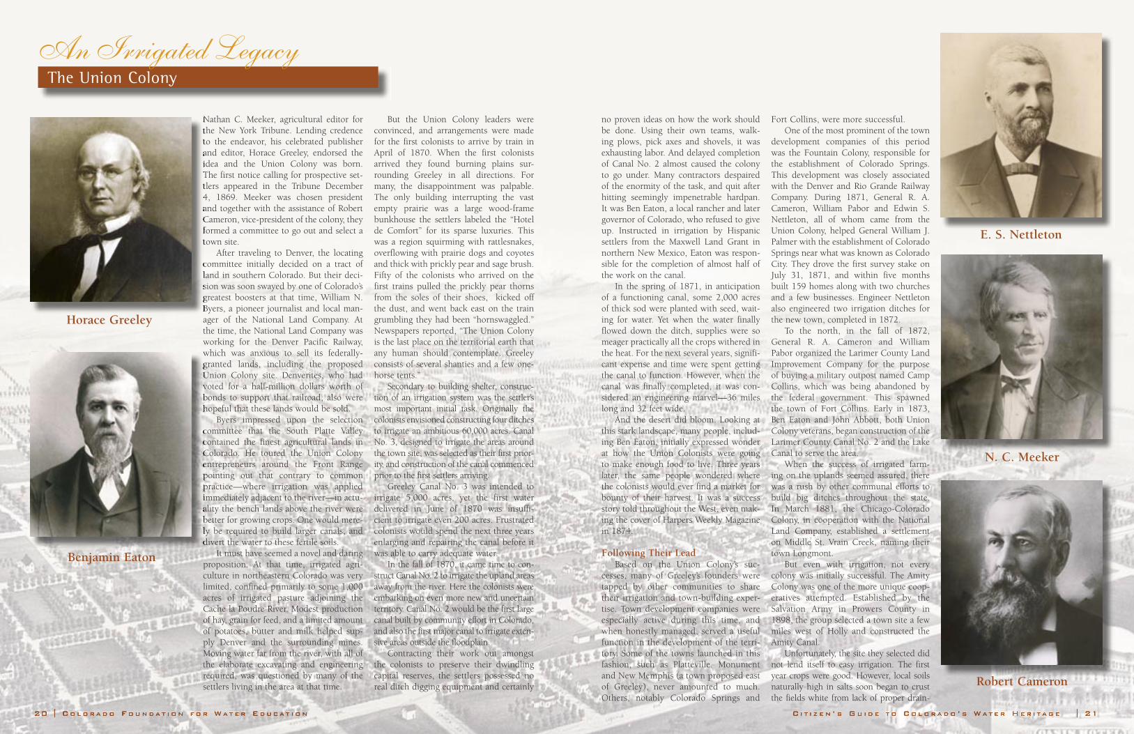
Nathan C. Meeker, agricultural editor for the New York Tribune. Lending credence to the endeavor, his celebrated publisher and editor, Horace Greeley, endorsed the idea and the Union Colony was born. The first notice calling for prospective set-tlers appeared in the Tribune December 4, 1869. Meeker was chosen president and together with the assistance of Robert Cameron, vice-president of the colony, they formed a committee to go out and select a town site.
After traveling to Denver, the locating committee initially decided on a tract of land in southern Colorado. But their deci-sion was soon swayed by one of Colorado’s greatest boosters at that time, William N. Byers, a pioneer journalist and local man-ager of the National Land Company. At the time, the National Land Company was working for the Denver Pacific Railway, which was anxious to sell its federally-granted lands, including the proposed Union Colony site. Denverites, who had voted for a half-million dollars worth of bonds to support that railroad, also were hopeful that these lands would be sold.
Byers impressed upon the selection committee that the South Platte Valley contained the finest agricultural lands in Colorado. He toured the Union Colony entrepreneurs around the Front Range pointing out that contrary to common practice—where irrigation was applied immediately adjacent to the river—in actu-ality the bench lands above the river were better for growing crops. One would mere-ly be required to build larger canals, and divert the water to these fertile soils.
It must have seemed a novel and daring proposition. At that time, irrigated agri-culture in northeastern Colorado was very limited, confined primarily to some 1,000 acres of irrigated pasture adjoining the Cache la Poudre River. Modest production of hay, grain for feed, and a limited amount of potatoes, butter and milk helped sup-ply Denver and the surrounding mines. Moving water far from the river, with all of the elaborate excavating and engineering required, was questioned by many of the settlers living in the area at that time.
But the Union Colony leaders were convinced, and arrangements were made for the first colonists to arrive by train in April of 1870. When the first colonists arrived they found burning plains sur-rounding Greeley in all directions. For many, the disappointment was palpable. The only building interrupting the vast empty prairie was a large wood-frame bunkhouse the settlers labeled the “Hotel de Comfort” for its sparse luxuries. This was a region squirming with rattlesnakes, overflowing with prairie dogs and coyotes and thick with prickly pear and sage brush. Fifty of the colonists who arrived on the first trains pulled the prickly pear thorns from the soles of their shoes, kicked off the dust, and went back east on the train grumbling they had been “hornswaggled.” Newspapers reported, “The Union Colony is the last place on the territorial earth that any human should contemplate. Greeley consists of several shanties and a few one-horse tents.”
Secondary to building shelter, construc-tion of an irrigation system was the settler’s most important initial task. Originally the colonists envisioned constructing four ditches to irrigate an ambitious 60,000 acres. Canal No. 3, designed to irrigate the areas around the town site, was selected as their first prior-ity, and construction of the canal commenced prior to the first settlers arriving.
Greeley Canal No. 3 was intended to irrigate 5,000 acres, yet the first water delivered in June of 1870 was insuffi-cient to irrigate even 200 acres. Frustrated colonists would spend the next three years enlarging and repairing the canal before it was able to carry adequate water.
In the fall of 1870, it came time to con-struct Canal No. 2 to irrigate the upland areas away from the river. Here the colonists were embarking on even more new and uncertain territory. Canal No. 2 would be the first large canal built by community effort in Colorado, and also the first major canal to irrigate exten-sive areas outside the floodplain.
Contracting their work out amongst the colonists to preserve their dwindling capital reserves, the settlers possessed no real ditch digging equipment and certainly
Nathan C. Meeker, agricultural editor for the New York Tribune. Lending credence to the endeavor, his celebrated publisher and editor, Horace Greeley, endorsed the idea and the Union Colony was born. The first notice calling for prospective set-tlers appeared in the Tribune December 4, 1869. Meeker was chosen president and together with the assistance of Robert Cameron, vice-president of the colony, they formed a committee to go out and select a town site.
committee initially decided on a tract of land in southern Colorado. But their deci-sion was soon swayed by one of Colorado’s greatest boosters at that time, William N. Byers, a pioneer journalist and local man-
which was anxious to sell its federally-granted lands, including the proposed Union Colony site. Denverites, who had voted for a half-million dollars worth of bonds to support that railroad, also were hopeful that these lands would be sold.
committee that the South Platte Valley contained the finest agricultural lands in Colorado. He toured the Union Colony entrepreneurs around the Front Range pointing out that contrary to common practice—where irrigation was applied immediately adjacent to the river—in actu-ality the bench lands above the river were better for growing crops. One would mere-ly be required to build larger canals, and divert the water to these fertile soils.
Horace Greeley
Benjamin Eaton
no proven ideas on how the work should be done. Using their own teams, walk-ing plows, pick axes and shovels, it was exhausting labor. And delayed completion of Canal No. 2 almost caused the colony to go under. Many contractors despaired of the enormity of the task, and quit after hitting seemingly impenetrable hardpan. It was Ben Eaton, a local rancher and later governor of Colorado, who refused to give up. Instructed in irrigation by Hispanic settlers from the Maxwell Land Grant in northern New Mexico, Eaton was respon-sible for the completion of almost half of the work on the canal.
In the spring of 1871, in anticipation of a functioning canal, some 2,000 acres of thick sod were planted with seed, wait-ing for water. Yet when the water finally flowed down the ditch, supplies were so meager practically all the crops withered in the heat. For the next several years, signifi-cant expense and time were spent getting the canal to function. However, when the canal was finally completed, it was con-sidered an engineering marvel—36 miles long and 32 feet wide.
And the desert did bloom. Looking at this stark landscape, many people, includ-ing Ben Eaton, initially expressed wonder at how the Union Colonists were going to make enough food to live. Three years later, the same people wondered where the colonists would ever find a market for bounty of their harvest. It was a success story told throughout the West, even mak-ing the cover of Harpers Weekly Magazine in 1874.
Following Their LeadBased on the Union Colony’s suc-
cesses, many of Greeley’s founders were tapped by other communities to share their irrigation and town-building exper-tise. Town development companies were especially active during this time, and when honestly managed, served a useful function in the development of the terri-tory. Some of the towns launched in this fashion, such as Platteville, Monument and New Memphis (a town proposed east of Greeley), never amounted to much. Others, notably Colorado Springs and
Fort Collins, were more successful.One of the most prominent of the town
development companies of this period was the Fountain Colony, responsible for the establishment of Colorado Springs. This development was closely associated with the Denver and Rio Grande Railway Company. During 1871, General R. A. Cameron, William Pabor and Edwin S. Nettleton, all of whom came from the Union Colony, helped General William J. Palmer with the establishment of Colorado Springs near what was known as Colorado City. They drove the first survey stake on July 31, 1871, and within five months built 159 homes along with two churches and a few businesses. Engineer Nettleton also engineered two irrigation ditches for the new town, completed in 1872.
To the north, in the fall of 1872, General R. A. Cameron and William Pabor organized the Larimer County Land Improvement Company for the purpose of buying a military outpost named Camp Collins, which was being abandoned by the federal government. This spawned the town of Fort Collins. Early in 1873, Ben Eaton and John Abbott, both Union Colony veterans, began construction of the Larimer County Canal No. 2 and the Lake Canal to serve the area.
When the success of irrigated farm-ing on the uplands seemed assured, there was a rush by other communal efforts to build big ditches throughout the state. In March 1881, the Chicago-Colorado Colony, in cooperation with the National Land Company, established a settlement on Middle St. Vrain Creek, naming their town Longmont.
But even with irrigation, not every colony was initially successful. The Amity Colony was one of the more unique coop-eratives attempted. Established by the Salvation Army in Prowers County in 1898, the group selected a town site a few miles west of Holly and constructed the Amity Canal.
Unfortunately, the site they selected did not lend itself to easy irrigation. The first year crops were good. However, local soils naturally high in salts soon began to crust the fields white from lack of proper drain-
An Irrigated Legacy The Union Colony
E. S. Nettleton
N. C. Meeker
Robert Cameron

22 | C O L O R A D O F O U N D A T I O N F O R W A T E R E D U C A T I O N C I T I Z E N ’ S G U I D E T O C O L O R A D O ’ S W A T E R H E R I T A G E | 23
age. Even during the first year, water could be seen standing in the low places east of the settlement. Crops failed, orchards withered, and the land which had produced from 15 to 20 tons of sugar beets per acre and two and one-half tons of alfalfa hay would not produce any crop. Subsidence, where the soil surface gradually sinks or suddenly collapses, even caused some of the larger build-ings to settle. After a few years, conditions became so bad that one by one, the colonists began to move on.
The Salvation Army spent thousands of dollars to reclaim the land in an attempt to save the colony. Eventually, a drainage project succeeded in reducing the salinization problems and the land was again put under cultiva-tion. Although the Amity Canal is still in use today, improve-ments came too late to benefit the Amity colonists or to preserve their unique settlement.
In 1882, the town of Sterling was started under the guidance of Greeley pioneers who helped develop the town’s irrigation canals diverting water from the South Platte River. Other Union Colonists started the Platte and Beaver Canal and Land Company, which constructed two ditches in the Brush area. The Fort Morgan Irrigation Ditch was also con-structed by Union Colony men.
Another Union Colonist, William Pabor, acting as an agent of Denver’s Colorado Loan and Trust Company, visited the Grand Valley in western Colorado in the fall of 1883. Traveling west from Grand Junction, he identified promising lands on which to boom a town and set out orchards. Upon returning to Denver, Pabor quickly started promoting the area, returning the next year to estab-lish the Fruita Town and Land Company.
Who Gets the Water?Greeley’s Union Colony was also funda-
mental to the formulation and promotion of Colorado’s system of water rights man-agement. And it didn’t take long for water right disputes to emerge. Heavy use of the Cache la Poudre River, coupled with sev-eral unseasonably dry years, precipitated
serious water conflicts between Greeley and Fort Collins in the summer of 1874.
By the first of July there was not enough water in the river to supply both the Fort Collins and Greeley ditches. Fort Collins’ ditches further upstream were full of water, but the Greeley ditches—although they had been constructed earlier—were run-
ning dry. Greeley irrigators demanded their share of the river. Nathan C. Meeker, formulating Greeley’s position, wrote in an editorial for the Greeley Tribune that the principle of prior appropriation—those who claimed the water first should
have first priority in times of drought—must be recognized. He argued that until this policy was adopted statewide, capital investment in irrigation would not be secure. Greeley main-tained that its senior priority gave it the right to use what little water was in the stream. But the citizens of Fort Collins weren’t buying it.
Ultimately both sides recog-nized the need for some kind of stream regulation. It was obvi-ous that the doctrine of ripar-ian rights where the landowner along a stream had an automatic right to use its water was inap-plicable in the arid American West. That year the two towns agreed to split the Cache la Poudre, and shortly thereafter rains brought the river flows back to normal and the issue went away for a while.
But soon more ditches were being proposed to take water out of the Poudre River. In 1878, when Ben Eaton began construc-tion of the 53-mile-long Larimer Weld canal with over two-and-a-half times the capacity of Greeley’s Canal No. 2, irrigators through-out the South Platte Valley began to fear for their water. Greeley’s Nathan Meeker had warned that men with money might divert “the whole of the river at the can-yon to water Box Elder valley and
the region toward Pierce, leaving the Cache la Poudre desolate.” Now his warning seemed about to be realized. The Greeley irrigators were worried; so were those near Fort Collins. In fact, no other event did so much to provoke the formalization of the Colorado water-rights system as the con-struction of this sizeable canal.
have first priority in times of drought—must be recognized. He argued that until this policy was adopted statewide, capital investment in irrigation would not be secure. Greeley main-tained that its senior priority gave it the right to use what little water was in the stream. But the citizens of Fort Collins weren’t buying it.
nized the need for some kind of stream regulation. It was obvi-ous that the doctrine of ripar-ian rights where the landowner along a stream had an automatic right to use its water was inap-plicable in the arid American West. That year the two towns agreed to split the Cache la Poudre, and shortly thereafter rains brought the river flows back to normal and the issue went away for a while.
being proposed to take water out of the Poudre River. In 1878, when Ben Eaton began construc-tion of the 53-mile-long Larimer Weld canal with over two-and-a-half times the capacity of Greeley’s Canal No. 2, irrigators through-out the South Platte Valley began to fear for their water. Greeley’s Nathan Meeker had warned that
An Irrigated Legacy The Union Colony
Harper’s Weekly was one of the most popular illustrated newspapers of the 1800s. In this 1874 edition, the Union Colony and Colorado irriga-tion made the front page in an engraving captioned “letting water into a side sluice-way” in reference to what are now called “headgates.”
Pioneers in Water MeasurementThe Union Colonists were also pioneers in water measurement. Edwin Nettleton,
who came out with the Union Colony and helped construct and improve both the original Union Colony ditches as well as many other ditches in the Arkansas and South Platte River Basins, became Colorado’s second state engineer, the state’s top administra-tor of water rights.
A talented engineer and inventor born in 1831, Nettleton recognized the need for devices to accurately measure water from canals. He recommended the use of the rect-angular weir, a U-shaped structure built across a canal or stream that measures water discharge. The rectangular weir became the most popular measuring device used in Colorado until the development of the Parshall flume in the 1920s.
In 1883, as a precursor to the continuous real-time gauging stations of modern times, Nettleton installed a gauging station on the Cache La Poudre with a continuous self-recording device. A year later, he designed and invented the Colorado Current Meter to measure the velocity of water. This device was very similar to the Price meter invented W. G. Price in 1885—the standard meter used today by the U.S. Geological Survey and the Colorado Division of Water Resources.
The general public was fascinated with this new device for measuring water. When Nettleton came to measure the Greeley Canal No. 3, the Greeley Tribune provided the following description:
“…about as large as the butter end of a churn dasher.....with this improved system …after much toil and calculation, one may almost say that the very drops of heaven are called down and numbered and sent out to fill the land with corn and flowers.”
A statewide irrigation convention was convened in Denver, December 5-7, 1878. About 50 men representing 29 ditch com-panies and agricultural districts in the South Platte Valley came together to dis-cuss how to determine priorities, record water rights, measure streams and draft legislation for submission to the state leg-islature. Although the Arkansas and the Rio Grande watersheds did have irrigation systems at that time, they did not send any representatives. So it was that the men from Greeley took the lead.
Their work served as the template for leg-islation ultimately enacted by the Colorado General Assembly in 1879. Setting nation-wide precedent, the legislature established a system for court adjudication of water rights under Colorado’s constitutional prior appropriation doctrine, with administration by public officials—local water commis-sioners—to divide the stream according to the court-decreed priorities. These same people later convinced subsequent gen-eral assembly’s that a State Engineer and Division Engineers were needed to assist and supervise the water commissioners.
•••Irrigated agriculture is one of the cor-
nerstones of Colorado’s early development. Yet it took the collective endeavors, deter-mination, and inventiveness of the Union Colony members to set the precedent for large-scale irrigation in Colorado. They accomplished what many thought a fruit-less endeavor: watering the dry prairies to produce profitable crops. Along the way, their expertise also helped shape many irri-gation-dependent communities through-out the state. More far-reaching, perhaps, were their insights into the workings of a detailed system of how to manage and divide up water when there is not enough
to go around. An integral part of Colorado’ legacy to water management, these basic doctrines would soon be implemented across the West and in arid nations across the world.
References:Robert G. Athearn, The Coloradans,
University of New Mexico Press (1976)Grace Greenwood, New Life in New Lands:
Notes of Travel, J. B. Ford And Company (1873)
Jane E. Norris and Lee G. Norris, Written in Water: The Life of Benjamin Eaton (1990)
Other Publications:A Hundred Years of Irrigation in Colorado
1852-1952, The Colorado Water Conservation Board and Colorado Agricultural & Mechanical College (1952)
Workers take a break from digging a ditch near the Pleasant Valley School in Greeley. Most early settlers possesed no experience or equipment for building irrigation canals, and ended up using their own teams, plows, pick-axes and shovels.
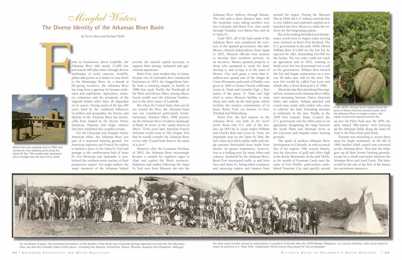
Mingled WatersThe Diverse Identity of the Arkansas River Basin
By Kevin Darst and Michael Welsh
From its headwaters above Leadville, the Arkansas River falls nearly 11,000 feet and travels 900-plus miles through diverse landscapes of rocky canyons, foothills, plains and prairie as it makes its way down to the Mississippi River. As a thread of life-giving resources, the Arkansas River has long been a gateway for human settle-ment and exploration. Agriculture, indus-try, commerce and the prosperity of the regional Indian tribes have all depended on its waters. During much of the last 400 years, fated by the combined influences of politics and geography, the history and identity of the Arkansas River has inextri-cably been shaped by the diverse Native American, Hispanic and Anglo cultures that have inhabited this complex terrain.
For the Cheyenne and Arapaho Native American tribes, the Arkansas River was part of a treasured hunting ground. For American explorers and French fur traders it marked a piece of the Santa Fe Trail and passage to the southwestern hub of Santa Fe. For Mexicans and Spaniards, it sym-bolized the northern-most reaches of their prospective empire. For Anglo settlers, the water resources of the Arkansas helped
provide the natural capital necessary to support their mining, industrial and agri-cultural aspirations.
Bent’s Fort, near modern-day La Junta, became one of Colorado’s first commercial businesses in 1833; the Guggenheim fam-ily built a smelting empire in Pueblo in 1888 that made Pueblo the Pittsburgh of the West; and Horace Tabor, among others, found wealth near the Arkansas’ headwa-ters in the silver mines of Leadville.
But when the United States first cast its eye toward the West, the Arkansas basin was not considered particularly fertile. Lieutenant Zebulon Pike’s 1806 journey up the Arkansas River revealed a landscape as bleak, he wrote, as the “sandy deserts of Africa.” Forty years later, historian Francis Parkman would write in The Oregon Trail that he would consider the Arkansas River a river only “if sand beds deserve the name of a river.”
However, after the Louisiana Purchase of 1803, the Arkansas River increasingly became a conduit for explorers eager to chart and exploit the West’s resources. Explorers and traders following the Santa Fe Trail west from Missouri ran into the
C I T I Z E N ’ S G U I D E T O C O L O R A D O ’ S W A T E R H E R I T A G E | 2524 | C O L O R A D O F O U N D A T I O N F O R W A T E R E D U C A T I O N
Arkansas River midway through Kansas. The trail spilt a short distance later, with the mountain route taking travelers west into Colorado and Bent’s Fort, then south through Trinidad, over Raton Pass and on to Santa Fe.
Until 1821, all of the land south of the Arkansas River was considered the terri-tory of the Spanish government. But after Mexico claimed independence from Spain in 1821, Mexican officials were anxious to develop their northern territory. As an incentive, Mexico granted property to those who promised to work the land, develop it, and occupy it in the name of Mexico. One such grant, a more than 4-million-acre spread east of the Sangre de Cristo Mountains and south of Pueblo, was given in 1844 to former French nobleman Ceran St. Vrain and Cornelio Vigil, a Taos justice of the peace. St. Vrain and Vigil tried to entice Mexican families to raise sheep and cattle on the land grant, which includes the modern communities of La Junta, Rocky Ford, Las Animas, La Veta, Trinidad and Walsenburg.
Bent’s Fort, the first outpost on the Arkansas River, was built on the river’s north shore—the U.S. side of the bor-der—in 1833 by St. Louis traders William and Charles Bent and Ceran St. Vrain. An important stop on the Santa Fe Trail, the fort’s three-foot-thick adobe walls and sin-gle entrance barricaded those inside from attacks. Its greater importance, however, was as a trading post for many tribes and cultures. Anchored by the Arkansas River, Bent’s Fort intercepted traffic to and from Taos and Santa Fe, luring tribal commerce and attracting traders and hunters from
around the region. During the Mexican War in 1846, the U.S. military used the fort to rest soldiers and replenish supplies as it marched into New Mexico to claim the ter-ritory for the burgeoning nation.
But as fur trading dwindled and already-scarce wood went to wagon trains moving west, business at Bent’s Fort declined. The U.S. government in the early 1840s offered William Bent $12,000 for the fort but he rejected the offer, demanding $16,000 for the facility. The two sides could not reach an agreement and in 1852, wanting to build a new fort but determined not to sell to the government, William Bent burned the fort and began construction on a new one 40 miles east, still on the river. The new fort would be called Fort Lyon and rebuilt after a flood destroyed it in 1866.
About the time Bent abandoned his origi-nal fort, tensions in the Arkansas River Valley were mounting between Native American tribes and settlers. Indians attacked and scared away many early settlers who came to cultivate the land, frustrating attempts at settlement in the area. Finally, at the 1850 Fort Laramie Treaty Council, the U.S. government and the tribes came to an agreement, designating the range between the South Platte and Arkansas rivers as the Cheyenne and Arapaho tribes’ hunting grounds.
The spark of modern Arkansas River development in Colorado, as with so much else of the region’s 19th century history, was the discovery of gold and silver high in the Rocky Mountains. In the mid-1850s, at the mouth of Fountain Creek near the ruins of Fort Pueblo, gold-seekers estab-lished Fountain City and quickly moved
up into the Pikes Peak area. By 1859, the aptly named “fifty-niners” were hurrying up the Arkansas Valley along the Santa Fe Trail to the Pikes Peak gold fields.
Pressure was mounting to secure these areas for Anglo settlement. In the fall of 1860 another tribal council was convened on the Arkansas River. This time the tribes gave up all their former hunting grounds, except for a small reservation between the Arkansas River and Sand Creek. The latter would be the site of the first of the basin’s two prominent massacres.
For hundreds of years, the sandstone formations of the Garden of the Gods near Colorado Springs attracted not only the Ute Mountain Utes, but also the nomadic tribes of the plains—including the Apache, Comanche, Kiowa, Pawnee, Arapaho and Cheyenne. Although
the Utes were forcibly moved to reservations in southern Colorado after the 1879 Meeker Massacre, as a tourist attraction, they were asked to return to perform in a “Shan Kive” celebration (1913) where they posed for this photograph.
In the 1870s, George Swink helped found the town of Rocky Ford and diverted water from the Arkansas River to irrigate melons this region would soon become known for.
Bent’s Fort was originally built in 1835, and served as a key stopping point along the Santa Fe Trail. This modern-day reconstruc-tion is located near the town of La Junta.
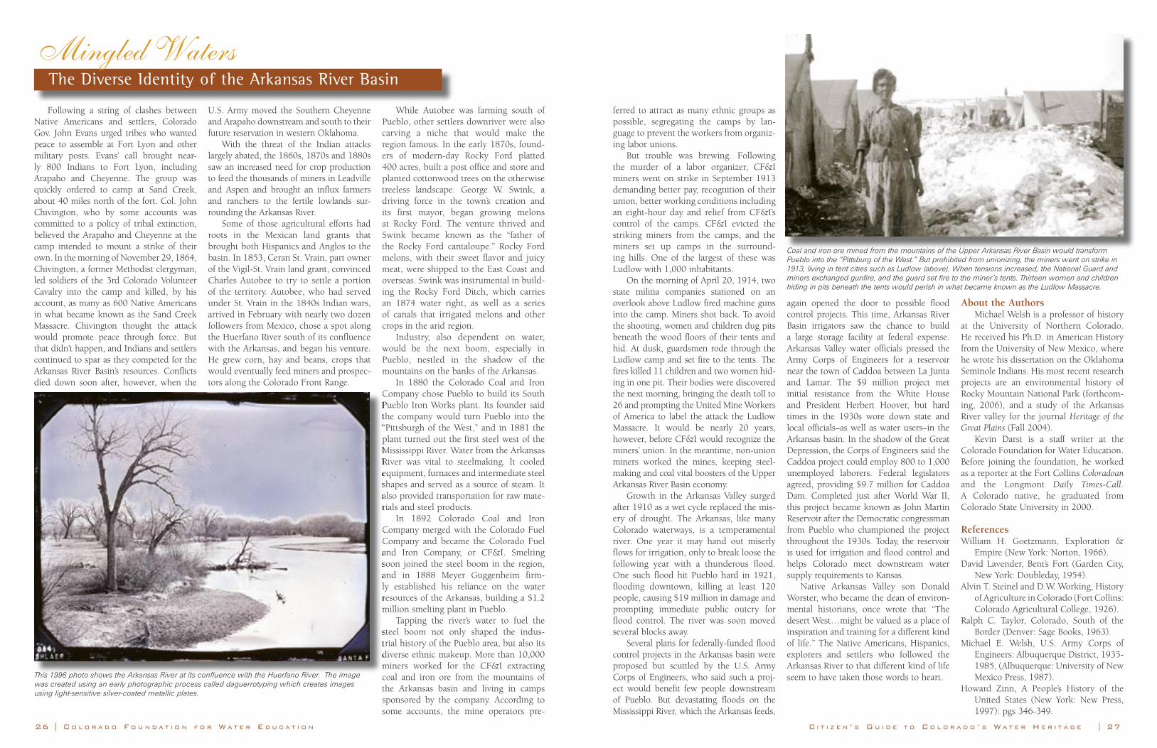
26 | C O L O R A D O F O U N D A T I O N F O R W A T E R E D U C A T I O N C I T I Z E N ’ S G U I D E T O C O L O R A D O ’ S W A T E R H E R I T A G E | 27
Following a string of clashes between Native Americans and settlers, Colorado Gov. John Evans urged tribes who wanted peace to assemble at Fort Lyon and other military posts. Evans’ call brought near-ly 800 Indians to Fort Lyon, including Arapaho and Cheyenne. The group was quickly ordered to camp at Sand Creek, about 40 miles north of the fort. Col. John Chivington, who by some accounts was committed to a policy of tribal extinction, believed the Arapaho and Cheyenne at the camp intended to mount a strike of their own. In the morning of November 29, 1864, Chivington, a former Methodist clergyman, led soldiers of the 3rd Colorado Volunteer Cavalry into the camp and killed, by his account, as many as 600 Native Americans in what became known as the Sand Creek Massacre. Chivington thought the attack would promote peace through force. But that didn’t happen, and Indians and settlers continued to spar as they competed for the Arkansas River Basin’s resources. Conflicts died down soon after, however, when the
U.S. Army moved the Southern Cheyenne and Arapaho downstream and south to their future reservation in western Oklahoma.
With the threat of the Indian attacks largely abated, the 1860s, 1870s and 1880s saw an increased need for crop production to feed the thousands of miners in Leadville and Aspen and brought an influx farmers and ranchers to the fertile lowlands sur-rounding the Arkansas River.
Some of those agricultural efforts had roots in the Mexican land grants that brought both Hispanics and Anglos to the basin. In 1853, Ceran St. Vrain, part owner of the Vigil-St. Vrain land grant, convinced Charles Autobee to try to settle a portion of the territory. Autobee, who had served under St. Vrain in the 1840s Indian wars, arrived in February with nearly two dozen followers from Mexico, chose a spot along the Huerfano River south of its confluence with the Arkansas, and began his venture. He grew corn, hay and beans, crops that would eventually feed miners and prospec-tors along the Colorado Front Range.
While Autobee was farming south of Pueblo, other settlers downriver were also carving a niche that would make the region famous. In the early 1870s, found-ers of modern-day Rocky Ford platted 400 acres, built a post office and store and planted cottonwood trees on the otherwise treeless landscape. George W. Swink, a driving force in the town’s creation and its first mayor, began growing melons at Rocky Ford. The venture thrived and Swink became known as the “father of the Rocky Ford cantaloupe.” Rocky Ford melons, with their sweet flavor and juicy meat, were shipped to the East Coast and overseas. Swink was instrumental in build-ing the Rocky Ford Ditch, which carries an 1874 water right, as well as a series of canals that irrigated melons and other crops in the arid region.
Industry, also dependent on water, would be the next boom, especially in Pueblo, nestled in the shadow of the mountains on the banks of the Arkansas.
In 1880 the Colorado Coal and Iron Company chose Pueblo to build its South Pueblo Iron Works plant. Its founder said the company would turn Pueblo into the “Pittsburgh of the West,” and in 1881 the plant turned out the first steel west of the Mississippi River. Water from the Arkansas River was vital to steelmaking. It cooled equipment, furnaces and intermediate steel shapes and served as a source of steam. It also provided transportation for raw mate-rials and steel products.
In 1892 Colorado Coal and Iron Company merged with the Colorado Fuel Company and became the Colorado Fuel and Iron Company, or CF&I. Smelting soon joined the steel boom in the region, and in 1888 Meyer Guggenheim firm-ly established his reliance on the water resources of the Arkansas, building a $1.2 million smelting plant in Pueblo.
Tapping the river’s water to fuel the steel boom not only shaped the indus-trial history of the Pueblo area, but also its diverse ethnic makeup. More than 10,000 miners worked for the CF&I extracting coal and iron ore from the mountains of the Arkansas basin and living in camps sponsored by the company. According to some accounts, the mine operators pre-
Mingled Waters The Diverse Identity of the Arkansas River Basin
Pueblo Iron Works plant. Its founder said the company would turn Pueblo into the “Pittsburgh of the West,” and in 1881 the plant turned out the first steel west of the Mississippi River. Water from the Arkansas River was vital to steelmaking. It cooled equipment, furnaces and intermediate steel shapes and served as a source of steam. It also provided transportation for raw mate-rials and steel products.
and Iron Company, or CF&I. Smelting soon joined the steel boom in the region, and in 1888 Meyer Guggenheim firm-ly established his reliance on the water resources of the Arkansas, building a $1.2 million smelting plant in Pueblo.
steel boom not only shaped the indus-trial history of the Pueblo area, but also its diverse ethnic makeup. More than 10,000 miners worked for the CF&I extracting coal and iron ore from the mountains of
ferred to attract as many ethnic groups as possible, segregating the camps by lan-guage to prevent the workers from organiz-ing labor unions.
But trouble was brewing. Following the murder of a labor organizer, CF&I miners went on strike in September 1913 demanding better pay, recognition of their union, better working conditions including an eight-hour day and relief from CF&I’s control of the camps. CF&I evicted the striking miners from the camps, and the miners set up camps in the surround-ing hills. One of the largest of these was Ludlow with 1,000 inhabitants.
On the morning of April 20, 1914, two state militia companies stationed on an overlook above Ludlow fired machine guns into the camp. Miners shot back. To avoid the shooting, women and children dug pits beneath the wood floors of their tents and hid. At dusk, guardsmen rode through the Ludlow camp and set fire to the tents. The fires killed 11 children and two women hid-ing in one pit. Their bodies were discovered the next morning, bringing the death toll to 26 and prompting the United Mine Workers of America to label the attack the Ludlow Massacre. It would be nearly 20 years, however, before CF&I would recognize the miners’ union. In the meantime, non-union miners worked the mines, keeping steel-making and coal vital boosters of the Upper Arkansas River Basin economy.
Growth in the Arkansas Valley surged after 1910 as a wet cycle replaced the mis-ery of drought. The Arkansas, like many Colorado waterways, is a temperamental river. One year it may hand out miserly flows for irrigation, only to break loose the following year with a thunderous flood. One such flood hit Pueblo hard in 1921, flooding downtown, killing at least 120 people, causing $19 million in damage and prompting immediate public outcry for flood control. The river was soon moved several blocks away.
Several plans for federally-funded flood control projects in the Arkansas basin were proposed but scuttled by the U.S. Army Corps of Engineers, who said such a proj-ect would benefit few people downstream of Pueblo. But devastating floods on the Mississippi River, which the Arkansas feeds,
again opened the door to possible flood control projects. This time, Arkansas River Basin irrigators saw the chance to build a large storage facility at federal expense. Arkansas Valley water officials pressed the Army Corps of Engineers for a reservoir near the town of Caddoa between La Junta and Lamar. The $9 million project met initial resistance from the White House and President Herbert Hoover, but hard times in the 1930s wore down state and local officials–as well as water users–in the Arkansas basin. In the shadow of the Great Depression, the Corps of Engineers said the Caddoa project could employ 800 to 1,000 unemployed laborers. Federal legislators agreed, providing $9.7 million for Caddoa Dam. Completed just after World War II, this project became known as John Martin Reservoir after the Democratic congressman from Pueblo who championed the project throughout the 1930s. Today, the reservoir is used for irrigation and flood control and helps Colorado meet downstream water supply requirements to Kansas.
Native Arkansas Valley son Donald Worster, who became the dean of environ-mental historians, once wrote that “The desert West…might be valued as a place of inspiration and training for a different kind of life.” The Native Americans, Hispanics, explorers and settlers who followed the Arkansas River to that different kind of life seem to have taken those words to heart.
About the AuthorsMichael Welsh is a professor of history
at the University of Northern Colorado. He received his Ph.D. in American History from the University of New Mexico, where he wrote his dissertation on the Oklahoma Seminole Indians. His most recent research projects are an environmental history of Rocky Mountain National Park (forthcom-ing, 2006), and a study of the Arkansas River valley for the journal Heritage of the Great Plains (Fall 2004).
Kevin Darst is a staff writer at the Colorado Foundation for Water Education. Before joining the foundation, he worked as a reporter at the Fort Collins Coloradoanand the Longmont Daily Times-Call.A Colorado native, he graduated from Colorado State University in 2000.
ReferencesWilliam H. Goetzmann, Exploration &
Empire (New York: Norton, 1966).David Lavender, Bent’s Fort (Garden City,
New York: Doubleday, 1954).Alvin T. Steinel and D.W. Working, History
of Agriculture in Colorado (Fort Collins: Colorado Agricultural College, 1926).
Ralph C. Taylor, Colorado, South of the Border (Denver: Sage Books, 1963).
Michael E. Welsh, U.S. Army Corps of Engineers: Albuquerque District, 1935-1985, (Albuquerque: University of New Mexico Press, 1987).
Howard Zinn, A People’s History of the United States (New York: New Press, 1997): pgs 346-349.
Coal and iron ore mined from the mountains of the Upper Arkansas River Basin would transform Pueblo into the “Pittsburg of the West.” But prohibited from unionizing, the miners went on strike in 1913, living in tent cities such as Ludlow (above). When tensions increased, the National Guard and miners exchanged gunfire, and the guard set fire to the miner’s tents. Thirteen women and children hiding in pits beneath the tents would perish in what became known as the Ludlow Massacre.
This 1996 photo shows the Arkansas River at its confluence with the Huerfano River. The image was created using an early photographic process called daguerrotyping which creates images using light-sensitive silver-coated metallic plates.

28 | C O L O R A D O F O U N D A T I O N F O R W A T E R E D U C A T I O N
Building the VisionTaylor, Aspinall, and Water for Western Colorado
By Steven C. Schulte
Isolated, geographically-challenging, a region of high peaks, mountain val-leys, plateaus and low deserts, Colorado’s Western Slope is filled with magnificent history—from the legacy of the Ute Indians to fantastic mining rushes. According to most estimates, 60 to 75 percent of the water in the Colorado River originates in the high mountains of the Western Slope. Mountain streams quickly move water down from the region’s 14,000-foot peaks. Yet by the time the rivers reach the lower desert regions of the Colorado–Utah state line, they are whittled away by intense summer heat, evaporation, and massive irrigation diversions.
Not surprisingly, control and manipu-lation of water is at the center of Western Colorado’s political culture. While relative-ly rich in water, the Western Slope is poor in population compared to other parts of the state. Though the high mountains act as catch-basins for tremendous amounts of water, historically, the Western Slope has had a difficult time retaining this precious substance for its own use due to lack of political clout.
Two political leaders more than any other have reflected the Western Slope’s attempt to grapple with its water problems: Edward T. Taylor and Wayne N. Aspinall. Both were products of the irrigation pio-neers–that first generation of settlers who benefited directly from the region’s com-mitment to irrigated agriculture. Both men enjoyed long careers in state and national politics, serving in state government and as congressmen for the Western Slope. Both also rose to power through a combi-nation of political skill and longevity, and
exerted enormous influence on local and national water policy. By examining the careers of these two leaders, 75 years of Colorado’s 20th century water history can be illuminated.
Edward T. Taylor
Edward T. Taylor, known today as one of the giants of Colorado political history, was first lured to Colorado with tales of booming mine towns and pioneer inde-pendence. Born in Illinois in 1858, Taylor ventured to Colorado in 1881, moving to the rowdy mining town of Leadville where he served for two years as the town’s first high school principal. Thinking that per-haps law might be an easier profession, in 1884 Taylor obtained a law degree from the University of Michigan and went on to hold a series of political offices in the Glenwood Springs area, as well as serving in the Colorado State Senate from 1896 to
C I T I Z E N ’ S G U I D E T O C O L O R A D O ’ S W A T E R H E R I T A G E | 29
Edward Taylor represented what he liked to call “the Big Fourth,” Colorado’s 4th Congressional District comprised of 22 Western Slope counties. In commemoration of Taylor’s advocacy for western Colorado’s water, Taylor Park Reservoir located in the Upper Gunnison River Basin (below), was dedicated in his name in 1937.
1908. That same year, he won election to the U.S. House of Representatives by tak-ing a strong position against the growing federal presence in the management of the West’s public lands. Taylor would serve as the Western Slope’s sole congressman until his death in 1941.
Throughout his long career, Taylor proved to be a vigorous defender of the region’s water interests, setting an example for later politicians. Taylor represented what he liked to call “the Big Fourth,” Colorado’s 4th Congressional District. Comprised of 22 Western Slope counties, the district covered an area large enough to hold several eastern states.
In one of his first political coups, in 1921 Taylor led the way to rename the Grand River into the Colorado River. Before this time the river was only called the Colorado after the junction of the Green and Grand rivers in Utah. But with this semantic trick, Taylor reinforced that the mainstem of the Colorado River originated in his state, a tactic that would give many later day Colorado politicians a seeming advantage in water-related nego-tiations with other states.
During his time in Washington, Taylor gained national renown as a molder of Western natural resource policy. Specifically, Taylor assumed a major role in shap-ing federal policy regarding the Upper Colorado River Basin’s water future. Taylor supported the movement for a Colorado River compact, advising Colorado water lawyer Delph Carpenter on the shape of the bill that would empower the seven Colorado River Basin states to enter into interstate water treaty negotiations.
Yet his most significant political lega-cies were tactics employed to assure the Western Slope’s water future against per-ceived water grabs from the more populous eastern portion of the state. Taylor had always suspected the Eastern Slope of want-ing to divert the waters of the Western Slope without adequate compensation. His worst fears became reality in the movement for the Colorado-Big Thompson Project (C-BT)
during the years of the 1930s Depression.Colorado’s populous Eastern Slope had
long coveted Western Slope water as a means to augment its inadequate supplies. As far back as the 1880s, residents of the South Platte Valley had shown an interest in tapping the headwaters of the Grand River for use on the eastern plains. Then, in the early 1930s, East Slope newspaper editors, politicians, and water users organized into the Northern Colorado Water Conservancy District to pro-pose the Colorado-Big Thompson Project: a massive diversion project which would take water from the headwaters of the Colorado River through a maze of tunnels, reservoirs, and ditches, to bring about 300,000 acre-feet of water annually to the Front Range. While the C-BT project had to overcome an amazing number of logistical and engineering obsta-cles, its primary political hurdle was presented by Congressman Edward T. Taylor.
Taylor paternalistically regarded every drop of water on the Western Slope as his to protect and control. When Eastern Slope interests began advancing plans to divert his water, the congressman’s domain was being trespassed upon. Since Colorado’s Western Slope generated some 70 percent of the all the annual flow in the Colorado River, Taylor took it as one his primary duties to fight for the use and control of that water on behalf of the Colorado’s 22 western counties. Taylor insisted that every drop of water taken from the Western Slope should be replaced by the construction of additional reservoir storage facilities for that part of the state. This became known as the “acre-foot-for-acre-foot” provision. Without such an agreement, Taylor made it clear he would use his power as chairman of the House Interior Committee’s appropriations subcommittee, to block any legislation. “The boys [on the House Appropriation Committee] will stay by me,” Taylor warned Front Range water interests.
The Colorado-Big Thompson Project became law in 1937. And although Taylor’s original demand of acre-foot-for-acre-foot compensation would not be realized, the project’s ultimate form owed much to Taylor’s
early opposition and demands for compen-satory storage. More importantly, this idea would continue to hover over future East and West Slope water negotiations.
A new political element had come together to build consensus for the C-BT Project. State political leaders recognized that Colorado’s eastern and western halves needed to work together or the entire state would suffer. Leaders like Thomas Nixon and Charles Hanson (represent-ing the Northern Colorado region), Byron Rogers, Glenwood Springs attorney Frank Delaney, Governor Teller Ammons, and Wayne Aspinall, a Grand Junction attorney, state senator, and member of the newly created Colorado Water Conservation Board, brought the state’s diverse interests together and negotiated the compromise that became the vast CB-T Project.
Edward Taylor had blazed a trail, establishing a lasting tradition emulated by many modern-day politicians, of protect-ing the Western Slope’s water. His path underscored the necessity for the under-populated Western Slope to find strong, well-positioned political leaders who could command the power and resources to pro-tect the region’s threatened and valuable water resources. Upon his death, Grand Junction Daily Sentinel Editor Walter Walker, another fierce advocate of Western Slope water protection, referred to Taylor
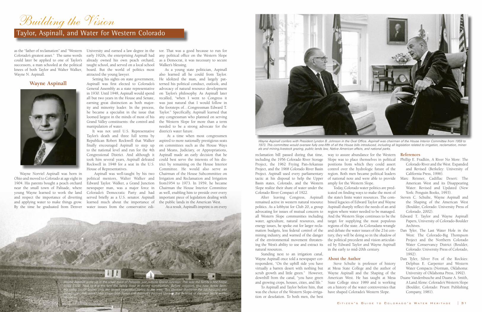
30 | C O L O R A D O F O U N D A T I O N F O R W A T E R E D U C A T I O N C I T I Z E N ’ S G U I D E T O C O L O R A D O ’ S W A T E R H E R I T A G E | 31
as the “father of reclamation” and “Western Colorado’s greatest asset.” The same words could later be applied to one of Taylor’s successors, a man schooled at the political knees of both Taylor and Walter Walker, Wayne N. Aspinall.
Wayne Aspinall
Wayne Norviel Aspinall was born in Ohio and moved to Colorado at age eight in 1904. His parents bought a peach orchard near the small town of Palisade, where young Wayne learned to work the land and respect the importance of diverting and applying water to make things grow. By the time he graduated from Denver
University and earned a law degree in the early 1920s, the enterprising Aspinall had already owned his own peach orchard, taught school, and served on a local school board. But the world of politics most attracted the young lawyer.
Setting his sights on state government, Aspinall was first elected to Colorado’s General Assembly as a state representative in 1930. Until 1948, Aspinall would spend all but two years in the House and Senate, earning great distinction as both major-ity and minority leader. In the process, he became a specialist in the issue that loomed largest in the minds of most of his Grand Valley constituents: the control and manipulation of water.
It was not until U.S. Representative Taylor’s death and three full terms by Republican Robert Rockwell that Walker finally encouraged Aspinall to step up to the national level and run for the 4th Congressional District. And although it took him several years, Aspinall defeated Rockwell in 1948 for a seat in the U.S. House of Representatives.
Aspinall was well-taught by his two political mentors, Walter Walker and Edward Taylor. Walker, a Grand Junction newspaper man, was a major force in Colorado’s Democratic Party and had served briefly as a U.S. senator. Aspinall learned much about the importance of water issues from the conservative edi-
tor. That was a good because to run for any political office on the Western Slope as a Democrat, it was necessary to secure Walker’s blessing.
As a young state politician, Aspinall also learned all he could from Taylor. He idolized the man, and largely pat-terned his political conduct, outlook, and advocacy of natural resource development on Taylor’s philosophy. As Aspinall later recalled, “when I went to Congress it was just natural that I would follow in the footsteps of…Congressman Edward T. Taylor.” Specifically, Aspinall learned that any congressman who planned on serving the Western Slope for more than a term needed to be a strong advocate for the district’s water future.
At a time when most congressmen aspired to more nationally prestigious seats on committees such as the House Ways and Means, Judiciary, or Appropriations, Aspinall made an early decision that he could best serve the interests of his dis-trict by remaining on the House Interior Committee. He would also serve as Chairman of the House Subcommittee on Irrigation and Reclamation and Irrigation from1954 to 1973. In 1959, he became Chairman the House Interior Committee as well, enabling him to preside over every important piece of legislation dealing with the public lands in the American West.
As a result, Aspinall’s imprint is on every
Building the Vision Taylor, Aspinall, and Water for Western Colorado
Wayne Aspinall confers with President Lyndon B. Johnson in the Oval Office. Aspinall was chairman of the House Interior Committee from 1959 to 1973. This committee would oversee fully one-fifth of all the House bills introduced, including all legislation related to irrigation, reclamation, miner-als and mining,livestock grazing, public lands law, Native American affairs, and national parks.
Wayne Aspinall grew up in the small town of Palisade, just outside Grand Junction. This was the family’s first home (circa 1904). Next to it is the tent the family lived in during construction. Before irrigation, this now fertile farm-ing valley could sustain only the desert vegetation native to the area. This contrast illustrates the background and experiences that would help shape both Taylor and Aspinall’s policies towards the defense of Western Slope water resources.
reclamation bill passed during that time, including the 1956 Colorado River Storage Project, the 1962 Frying Pan-Arkansas Project, and the 1968 Colorado River Basin Project. Aspinall used every parliamentary tactic at his disposal to help the Upper Basin states, Colorado, and the Western Slope realize their share of water under the Colorado River Compact of 1922.
After leaving Congress, Aspinall remained active in western natural resource politics. As a lobbyist for Club 20, a group advocating for issues of mutual concern to all Western Slope communities including water, agriculture, natural resources, and energy issues, he spoke out for larger recla-mation budgets, less federal control of the mining industry, and warned of the danger of the environmental movement threaten-ing the West’s ability to use and extract its natural resources.
Standing next to an irrigation canal, Wayne Aspinall once told a newspaper cor-respondent, “On the uphill side you have virtually a barren desert with nothing but scrub growth and little green.” However, downhill from the canal, “you have green and growing crops, houses, cities, and life.”
To Aspinall and Taylor before him, that was the choice of the Western Slope–irriga-tion or desolation. To both men, the best
way to assure abundance for the Western Slope was to place themselves in political positions from which they could assert control over the hydrologic future of the region. Both men became political leaders of national note and were able to provide amply for the Western Slope.
Today, Colorado water politics are pred-icated on finding ways to make the most of the state’s finite water resources. The com-bined legacies of Edward Taylor and Wayne Aspinall sharply reflect the needs of an arid region where water needed to be managed. And the Western Slope continues to be the target for supplying the most populous regions of the state. As Coloradans wrangle and debate the water issues of the 21st cen-tury, they will be doing so in the shadow of the political precedent and vision articulat-ed by Edward Taylor and Wayne Aspinall in the early to mid-20th century.
About the AuthorSteve Schulte is professor of history
at Mesa State College and the author of Wayne Aspinall and the Shaping of the American West. He has taught at Mesa State College since 1989 and is working on a history of the water controversies that have shaped Colorado’s Western Slope.
ReferencesPhillip E. Fradkin, A River No More: The
Colorado River and the West. Expanded and Revised (Berkeley: University of California Press, 1996).
Marc Reisner, Cadillac Desert: The American West and its Disappearing Water. Revised and Updated (New York: Penguin Books, 1993).
Steven C. Schulte, Wayne Aspinall and the Shaping of the American West (Boulder, Colorado: University Press of Colorado, 2002).
Edward T. Taylor and Wayne Aspinall Papers, University of Colorado-Boulder Archives.
Dan Tyler, The Last Water Hole in the West: The Colorado-Big Thompson Project and the Northern Colorado Water Conservancy District (Boulder, Colorado: University Press of Colorado, 1992).
Dan Tyler, Silver Fox of the Rockies: Delphus E. Carpenter and Western Water Compacts (Norman, Oklahoma: University of Oklahoma Press, 1992).
Duane Vandenbusche and Duane A. Smith, A Land Alone: Colorado’s Western Slope (Boulder, Colorado: Pruett Publishing Company, 1981).

Introduction
C I T I Z E N ’ S G U I D E T O C O L O R A D O ’ S W A T E R H E R I T A G E | 34
750 Puebloans begin building drinking water reservoirs in Mesa Verde area
1300 Puebloans abandon Mesa Verde cliff dwell-ings due to drought
1539-1542 Spanish explorer Coronado journeys up the Rio Grande River
1776 Friars Escalante and Dominguez explore western Colorado and name many rivers and streams
1800 Beaver trap-ping begins in the streams of the Central Rockies
1835 Bent’s Fort trading post built on Lower Arkansas River
1852 Hispanic set-tlers start town of San Luis and con-struct the San Luis People’s Ditch, the oldest continuous-ly operating water right in Colorado
1859 David K. Wall diverts water from Clear Creek for farming near Golden
1864 Cherry Creek Flood devastates Denver and Auraria
1867 John W. Smith builds the 24-mile City Ditch to deliver South Platte River water to Denver
1870 Union Colony founds town of Greeley and begins to divert waters of the South Platte River
1871 Chicago-Colorado Colony founds Longmont and begins canal construction
1500700 1800 185014,000BC
14,000 BC First humans arrive in Colorado
1500 Ute Indians inhabit southern mountain areas; Cheyenne, Arapahoe, Kiowa, Comanche, Pawnee and Sioux tribes arrive later
1682 Robert La Salle explores the Colorado region and claims it for France
1803 USA makes the Louisiana Purchase from France, acquir-ing Colorado and other lands making up the Mississippi, Arkansas and Missouri River watersheds as far the Continental Divide
1858 Gold found near Pikes Peak; gold rush begins
1861 Colorado Territory created by Congress
1870 Colorado Territory population: 39,864
1876 Colorado adopts its constitution and is admitted to the Union
1870
1879 Colorado adopts first laws requiring court decrees of water rights and estab-lishing a system of water commis-sioners to enforce those rights
1881 T. C. Henry begins construc-tion of the Rio Grande Canal, completed in 1884; thought to be the largest canal system in the USA at that time
1883 High Line Canal and Antero Reservoir com-pleted to divert water from the South Platte River to Denver and other nearby communities
1885 E. F. Hurdle installs Colorado’s first centrifugal ground water pump, near Eaton
1887 Artesian aqui-fer accidentally discovered in the San Luis Valley
1888 Union Colony irrigation project completed in Greeley
1894 Walter Scott Cheeseman’s new Denver Union Water Company consolidates the assets of 11 water companies and obtains an exclu-sive water fran-chise in Denver
1902 Bureau of Reclamation founded
1910 Uncompahgre River Project, Colorado’s first federal water proj-ect, is completed after six years; diverts Gunnison River water via tunnel to the Uncompahgre Valley for farming
1921 Arkansas River unleashes a devastating flood
in Pueblo
1922 Colorado River Compact negoti-ated to divide the Colorado River waters among seven western states
1923 Rio Grande floods the town of Alamosa
1880 190018901860
1937 Colorado General Assembly creates water con-servancy and con-servation districts across the state
1947 Colorado-Big Thompson Project completed, a trans-mountain water diver-sion moving water from the Colorado River to the northern areas of the Eastern Slope. It provides for irrigation of about 720,000 acres of land, municipal and industrial use, hydro-electric power, and recreation.
1956 Congress approves the Colorado River Storage Project Act, authorizing construction of Glen Canyon, Flaming Gorge, Cuerecanti (Aspinall unit) and Navajo dams
1965 Cherry Creek flood causes extensive dam-age in Denver; Groundwater Management Act passed
1968 Congress authorizes construc-tion of the Central Arizona Project and five water storage projects in Colorado and Utah. Four of Colorado’s five pro-posed projects were not built: the West Divide, Fruitland Mesa, Savory Pothook, and San Miguel projects. The fifth, the Animas-La Plata Project, began construction in 2002.
1973 Colorado General Assembly adopts instream flow and lake level laws
1975 Initial work on the Frying Pan-Arkansas Project completed. The proj-ect diverts water from the Western Slope and dams the Arkansas River to provide water for agricultural irriga-tion, municipal and industrial uses. In addition to irrigating some 280,600 acres in the Arkansas Valley, the project also supplies Front Range cities such as Pueblo, Colorado Springs and Aurora
1976 Big Thompson Flood
1977 Congress adopts Clean Water Act
1989 EPA vetoes construction of the proposed Two Forks Dam which would have sup-plied metro Denver areas
1992 Construction of the Closed Basin Project completed. The Closed Basin Project is a net-work of 170 wells that draw water from shallow aquifers of the “Closed Basin” which underlies about two-thirds of the San Luis Valley and has no direct hydrologic connec-tion to the Rio Grande River. These wells are pumped into the Rio Grande River to help meet the state’s compact obligations to New Mexico and other downstream states
2002 Severe drought hits Colorado and the West; Animas-La Plata Project begins construction of a 120,000 acre-foot reser-voir near Durango.
1867 Denver estab-lished as per-manent seat of government
1920 19501930 19701960 1980 2000
1880 Colorado population: 194,327
1881Ute tribes are removed to reservations
1888Last Indian raid into Colorado; Mesa Verde ruins discov-ered
1890Colorado population: 413,249
1900Cripple Creek is second richest gold camp in the world
1910Colorado population: 799,024; first airplane flight in Denver
1920-1933Great Depression
1931Colorado population tops 1 million
1973Eisenhower Tunnel constructed
1974Desegregation of schools via busing
1982State economy shaken by closure of oil shale fields
2002Colorado population: 4.25 million
1950s-60sTourism and ski industry blossoms
1870 Union Colony 1922 Colorado River 1977 Congress
Colorado’s Water Heritage
1887 Artesian aqui-
32 | C O L O R A D O F O U N D A T I O N F O R W A T E R E D U C A T I O N
1910 1940

Colorado Foundation for Water EducationP.O. Box 300158
Denver, Colorado 80203303-377-4433
www.cfwe.org
About the CoverA collage of historical and modern images reflects the diverse people and landscapes of Colorado’s water heritage.
1. Ute Indians, 1913 2. Mesa Verde 3. Aspinall Homestead, Palisade 4. Little Domiguez Creek 5. Farming with draft horses, San Luis 6. Town of San Luis 7. Reservoir construction near Greeley 8. Nathan Meeker 9. Glass plate negative of digging a ditch near Greeley held by
City of Greeley archivist Peggy Ford 10. 1871 water deed to Jared Brush
1
2
3
45
6
7
89
10