Ch 7 - Circular Motion Circular motion: Objects moving in a circular path.
The Dabbling Duck is a great place to meet up for breakfast, morning coffee, lunch or afternoon tea. The welcome is warm and the food is a treat. A 5 mile circular walk from the Dabbling Duck cafe in Shere, Surrey. The walking route explores large sections of the adjacent Albury Estate taking in pastures, woodland, Albury village, heathland and the formal park with chance to enjoy great views across the rolling hills.
Getting thereShere is located between Guildford and Dorking, just south of the A25. It is easiest to park in the free village car park. Turn off the A25 into Upper Street and follow this as it swings left – look out on the left for the small blue ‘P’ sign which leads you into the village car park. From the car park, you need to make your way to the Dabbling Duck cafe to begin your walk. Exit the car park back to the junction with Upper Street. Turn left along the pavement for just a few paces, and then cross over with care to turn right into Middle Street. You’ll find the Dabbling Duck just a little way along on the right.
Approximate post code GU5 9HF.
Walk SectionsStart to Chantry Lane
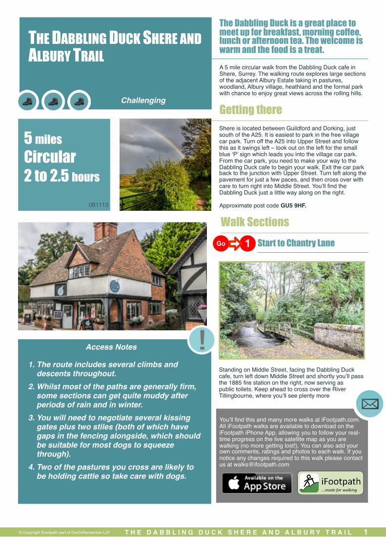
Standing on Middle Street, facing the Dabbling Duck cafe, turn left down Middle Street and shortly you’ll pass the 1885 fire station on the right, now serving as public toilets. Keep ahead to cross over the River Tillingbourne, where you’ll see plenty more
T H E D A B B L I N G D U C K S H E R E A N D A L B U R Y T R A I L 1
1. The route includes several climbs and descents throughout.
2. Whilst most of the paths are generally firm, some sections can get quite muddy after periods of rain and in winter.
3. You will need to negotiate several kissing gates plus two stiles (both of which have gaps in the fencing alongside, which should be suitable for most dogs to squeeze through).
4. Two of the pastures you cross are likely to be holding cattle so take care with dogs.
THE DABBLING DUCK SHERE AND ALBURY TRAIL
5 miles Circular 2 to 2.5 hours
Go 1
Access Notes
© Copyright iFootpath part of OneToRemember LLP
Challenging
You’ll find this and many more walks at iFootpath.com. All iFootpath walks are available to download on the iFootpath iPhone App, allowing you to follow your real-time progress on the live satellite map as you are walking (no more getting lost!). You can also add your own comments, ratings and photos to each walk. If you notice any changes required to this walk please contact us at [email protected]
061113
dabbling ducks, this time of the feathered variety.
Immediately after crossing the river, turn right along Lower Street, which runs alongside the river. Follow Lower Street which soon passes between a number of pretty old cottages including the half timbered Old Forge on the left. Ignore Orchard Road off to the left, simply keep straight ahead signed to the Ford. On the right you’ll pass the village allotments and immediately beyond these you’ll come to a junction of paths.
Keep right here, using the footbridge to cross the ford. Follow the lane steadily uphill and, as you reach the first properties, fork left onto the narrow footpath which is immediately after the wide gate into the Old Rectory. Follow this footpath with a tall wall on the left and as this ends, the path leads down into a dip where you’ll find a crossroads with a narrow lane, Chantry Lane.
Chantry Lane to Water Lane
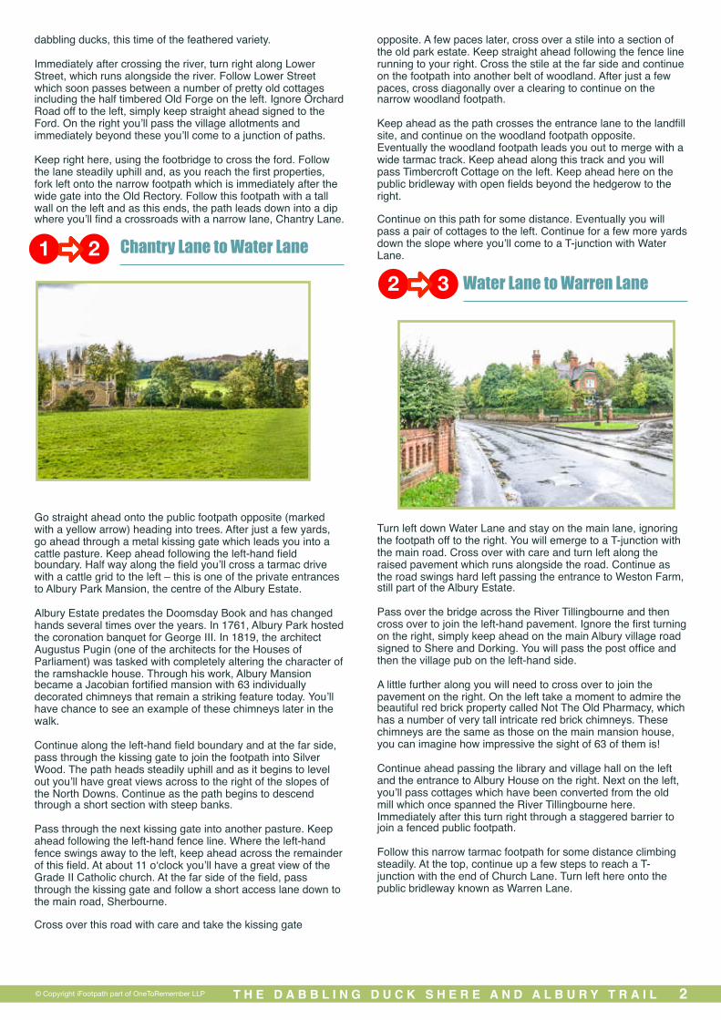
Go straight ahead onto the public footpath opposite (marked with a yellow arrow) heading into trees. After just a few yards, go ahead through a metal kissing gate which leads you into a cattle pasture. Keep ahead following the left-hand field boundary. Half way along the field you’ll cross a tarmac drive with a cattle grid to the left – this is one of the private entrances to Albury Park Mansion, the centre of the Albury Estate.
Albury Estate predates the Doomsday Book and has changed hands several times over the years. In 1761, Albury Park hosted the coronation banquet for George III. In 1819, the architect Augustus Pugin (one of the architects for the Houses of Parliament) was tasked with completely altering the character of the ramshackle house. Through his work, Albury Mansion became a Jacobian fortified mansion with 63 individually decorated chimneys that remain a striking feature today. You’ll have chance to see an example of these chimneys later in the walk.
Continue along the left-hand field boundary and at the far side, pass through the kissing gate to join the footpath into Silver Wood. The path heads steadily uphill and as it begins to level out you’ll have great views across to the right of the slopes of the North Downs. Continue as the path begins to descend through a short section with steep banks.
Pass through the next kissing gate into another pasture. Keep ahead following the left-hand fence line. Where the left-hand fence swings away to the left, keep ahead across the remainder of this field. At about 11 o‘clock you’ll have a great view of the Grade II Catholic church. At the far side of the field, pass through the kissing gate and follow a short access lane down to the main road, Sherbourne.
Cross over this road with care and take the kissing gate
opposite. A few paces later, cross over a stile into a section of the old park estate. Keep straight ahead following the fence line running to your right. Cross the stile at the far side and continue on the footpath into another belt of woodland. After just a few paces, cross diagonally over a clearing to continue on the narrow woodland footpath.
Keep ahead as the path crosses the entrance lane to the landfill site, and continue on the woodland footpath opposite. Eventually the woodland footpath leads you out to merge with a wide tarmac track. Keep ahead along this track and you will pass Timbercroft Cottage on the left. Keep ahead here on the public bridleway with open fields beyond the hedgerow to the right.
Continue on this path for some distance. Eventually you will pass a pair of cottages to the left. Continue for a few more yards down the slope where you’ll come to a T-junction with Water Lane.
Water Lane to Warren Lane
Turn left down Water Lane and stay on the main lane, ignoring the footpath off to the right. You will emerge to a T-junction with the main road. Cross over with care and turn left along the raised pavement which runs alongside the road. Continue as the road swings hard left passing the entrance to Weston Farm, still part of the Albury Estate.
Pass over the bridge across the River Tillingbourne and then cross over to join the left-hand pavement. Ignore the first turning on the right, simply keep ahead on the main Albury village road signed to Shere and Dorking. You will pass the post office and then the village pub on the left-hand side.
A little further along you will need to cross over to join the pavement on the right. On the left take a moment to admire the beautiful red brick property called Not The Old Pharmacy, which has a number of very tall intricate red brick chimneys. These chimneys are the same as those on the main mansion house, you can imagine how impressive the sight of 63 of them is!
Continue ahead passing the library and village hall on the left and the entrance to Albury House on the right. Next on the left, you’ll pass cottages which have been converted from the old mill which once spanned the River Tillingbourne here. Immediately after this turn right through a staggered barrier to join a fenced public footpath.
Follow this narrow tarmac footpath for some distance climbing steadily. At the top, continue up a few steps to reach a T-junction with the end of Church Lane. Turn left here onto the public bridleway known as Warren Lane.
T H E D A B B L I N G D U C K S H E R E A N D A L B U R Y T R A I L 2
1 22 3
© Copyright iFootpath part of OneToRemember LLP

Warren Lane to Albury Cricket Field
The bridleway soon leads you into a sunken path through woodland. Follow the main path as it swings right, ignoring the two smaller paths off to the left. Follow this path as it climbs and, some way up, you’ll come to a pair of gates each side of the path. Take a moment here to catch your breath and to enjoy the views over to the right, taking in a vast expanse of the rolling Surrey Hills.
Keep ahead on the path which continues to climb into a denser section of woodland, Albury Warren. Stay on the main sunken path and you will emerge to a T-junction with a wider, relatively level track. Turn left along this track and follow it, ignoring any smaller paths off left and right. You will probably pass between a number of timber stacks.
Eventually you will reach a small clearing with a major fork in the path (probably with a number of timber stacks ahead). Keep right at this fork, on the path heading steadily downhill into the woodland. Follow this path in the same direction, crossing over a couple of vehicle access tracks along the way. You will emerge out to a sandy parking area with a playing field and pavilion opposite, Albury Cricket Field.
Albury Cricket Field to End
Cross the parking area at about 10 o’clock and pass immediately to the right of the group of bushes which sit on the left-hand side of the cricket pitch. As you reach a bench, turn hard left onto a short section of path which leads you out to the road, with Park Road directly opposite.
Cross the road diagonally right, to take the footpath heading into the trees running to the right of Park Road. After a short distance you’ll emerge out into an open area of heath, with great views ahead. Keep on the left-hand path through this clearing.
Where you reach a T-junction with a wider track, keep left and after just a few paces fork left again onto the smaller sandy path
back into trees. Swing left along the access track and you will reach a T-junction with Park Lane. Turn right along the pavement, passing in front of a handful of properties.
Where the pavement ends (alongside Hurst Lea), keep ahead for a few more yards along the grass verge. Cross over the road to reach a choice of three footpaths. Take the middle of the three footpaths, the one through the wooden kissing gate, marked as the Shere Parish Millennium Trail. Follow this fenced path which passes through the centre of the Albury Park Estate, taking time to enjoy the views and to meet the sheep and horses which graze the parkland each side.
The original village of Albury was situated with the park, but pressure from successive landowners meant that, from around 1780, the villagers slowly relocated to the current village (then a hamlet called Weston Street). With the grounds then being fully private, they were landscaped as pleasure grounds to include a Yew Walk, a Roman bath and a cave inspired by the Grotto of Posilippo in Naples.
At the end of the fenced avenue, pass through the kissing gate and keep left for a few paces where you’ll see a ford ahead. Do NOT cross the ford, instead turn right through a kissing gate immediately before it and follow the path running alongside the river. Pass through the next kissing gate and keep left along the wide woodland track, Lime Avenue (ignoring the private path over a footbridge to the left).
The next kissing gate leads you out to the corner of Lower Street with the walled allotments opposite. From this point you will be retracing your steps back to the cafe. Keep ahead along Lower Street and at the end, turn left into Middle Street. After just a few yards you’ll reach the Dabbling Duck cafe for some well-earned refreshments.
T H E D A B B L I N G D U C K S H E R E A N D A L B U R Y T R A I L 3© Copyright iFootpath part of OneToRemember LLP
4 5
3 4
DisclaimerThis walking route was walked and checked at the time of writing. We have taken care to make sure all our walks are safe for walkers of a reasonable level of experience and fitness. However, like all outdoor activities, walking carries a degree of risk and we accept no responsibility for any loss or damage to personal effects, personal accident, injury or public liability whilst following this walk. We cannot be held responsible for any inaccuracies that result from changes to the routes that occur over time. Please let us know of any changes to the routes so that we can correct the information.Walking SafetyFor your safety and comfort we recommend that you take the following with you on your walk: bottled water, snacks, a waterproof jacket, waterproof/sturdy boots, a woolly hat and fleece (in winter and cold weather), a fully-charged mobile phone, a whistle, a compass and an Ordnance Survey map of the area. Check the weather forecast before you leave, carry appropriate clothing and do not set out in fog or mist as these conditions can seriously affect your ability to navigate the route. Take particular care on cliff/mountain paths where steep drops can present a particular hazard. Some routes include sections along roads – take care to avoid any traffic at these points. Around farmland take care with children and dogs, particularly around machinery and livestock. If you are walking on the coast make sure you check the tide times before you set out.

T H E D A B B L I N G D U C K S H E R E A N D A L B U R Y T R A I L 4