Chapter 12 Transportation - BPA.gov Volume 1... · SR 500 allows for east-west travel across Clark...
14
I-5 Corridor Reinforcement Project Draft EIS 12-1 November 2012 Words in bold and acronyms are defined in Chapter 32, Glossary and Acronyms. Chapter 12 Transportation This chapter describes existing transportation resources in the project area, and how the project alternatives could affect these resources. Related information on emissions can be found in Chapter 21, Air Quality and Chapter 22, Greenhouse Gases. 12.1 Affected Environment The transportation system in the project area includes public highways and roads, private logging and other private local roads, public transit, railroads, public and private airports and airstrips, and marine traffic (see Maps 12-1A through 12-1D). 12.1.1 Highways, State Routes, and Local Roads Regional highway access to the project area is provided by I-5, the major north/south interstate freeway serving the west coast of the United States from southern California north through Oregon and Washington to the Canadian border (see Maps 12-1A through 12-1D). I-5 crosses the Columbia River between Oregon and Washington over the Interstate Bridge. I-205 was constructed as a bypass facility through the Portland/Vancouver metropolitan area and crosses the Columbia River over the Glenn Jackson Bridge. In Oregon, I-84 provides access to the general vicinity of Troutdale (SWRTC 2008). Several state routes provide access to the project area including SR 14, SR 411, SR 500, SR 502, and SR 503. SR 14 provides the main east-west access from southwest to southeast Washington along the north bank of the Columbia River. SR 411, also commonly referred to in the project area as the West Side Highway, serves Longview, Kelso, the West Side Highway community, and Castle Rock, Washington (see Map 12-1A). The West Side Highway parallels the Cowlitz River and I-5, beginning at an interchange with SR 432 in Longview and traveling north past a spur route, under SR 4, and across the Cowlitz River It then becomes concurrent with I-5 Business in Castle Rock and ends at the interchange with I-5, I-5 Business, and SR 504 (SWRTC 2008). SR 500 allows for east-west travel across Clark County (see Map 12-1D). It crosses I-205, provides access to the Orchards area, and traverses rural Clark County to the Camas urban area. SR 500 intersects SR 14 in Camas and carries traffic to and from the Westfield Vancouver shopping mall. SR 502 extends from the I-5/NE 179th Street interchange northward to NE 219 th Street, where it turns eastward toward Battle Ground. SR 503 extends northward from its intersection with SR 500 and carries traffic between the Vancouver urban area and north through Battle Ground. SR 503 extends into Cowlitz County (SWRTC 2008). Hundreds of county roads exist in the project area. In addition to the named and improved roads, many other roads exist in remote areas of Clark and Cowlitz counties. Examples of these other roads include private logging roads and roads used to access private property. Roads within cities and towns are typical cross streets found in urban areas (see Maps 12-1A through 12-1D).
Transcript of Chapter 12 Transportation - BPA.gov Volume 1... · SR 500 allows for east-west travel across Clark...

I-5 Corridor Reinforcement Project Draft EIS 12-1 November 2012
Words in bold and acronyms are defined in Chapter 32, Glossary and Acronyms.
Chapter 12 Transportation This chapter describes existing transportation resources in the project area, and how the project alternatives could affect these resources. Related information on emissions can be found in Chapter 21, Air Quality and Chapter 22, Greenhouse Gases.
12.1 Affected Environment
The transportation system in the project area includes public highways and roads, private logging and other private local roads, public transit, railroads, public and private airports and airstrips, and marine traffic (see Maps 12-1A through 12-1D).
12.1.1 Highways, State Routes, and Local Roads
Regional highway access to the project area is provided by I-5, the major north/south interstate freeway serving the west coast of the United States from southern California north through Oregon and Washington to the Canadian border (see Maps 12-1A through 12-1D). I-5 crosses the Columbia River between Oregon and Washington over the Interstate Bridge. I-205 was constructed as a bypass facility through the Portland/Vancouver metropolitan area and crosses the Columbia River over the Glenn Jackson Bridge. In Oregon, I-84 provides access to the general vicinity of Troutdale (SWRTC 2008).
Several state routes provide access to the project area including SR 14, SR 411, SR 500, SR 502, and SR 503. SR 14 provides the main east-west access from southwest to southeast Washington along the north bank of the Columbia River. SR 411, also commonly referred to in the project area as the West Side Highway, serves Longview, Kelso, the West Side Highway community, and Castle Rock, Washington (see Map 12-1A). The West Side Highway parallels the Cowlitz River and I-5, beginning at an interchange with SR 432 in Longview and traveling north past a spur route, under SR 4, and across the Cowlitz River It then becomes concurrent with I-5 Business in Castle Rock and ends at the interchange with I-5, I-5 Business, and SR 504 (SWRTC 2008).
SR 500 allows for east-west travel across Clark County (see Map 12-1D). It crosses I-205, provides access to the Orchards area, and traverses rural Clark County to the Camas urban area. SR 500 intersects SR 14 in Camas and carries traffic to and from the Westfield Vancouver shopping mall. SR 502 extends from the I-5/NE 179th Street interchange northward to NE 219th Street, where it turns eastward toward Battle Ground. SR 503 extends northward from its intersection with SR 500 and carries traffic between the Vancouver urban area and north through Battle Ground. SR 503 extends into Cowlitz County (SWRTC 2008).
Hundreds of county roads exist in the project area. In addition to the named and improved roads, many other roads exist in remote areas of Clark and Cowlitz counties. Examples of these other roads include private logging roads and roads used to access private property. Roads within cities and towns are typical cross streets found in urban areas (see Maps 12-1A through 12-1D).

Chapter 12 Transportation
12-2 I-5 Corridor Reinforcement Project Draft EIS November 2012
12.1.2 Public Transit
The Cowlitz Transit Authority provides bus service to Kelso and Longview through its Community Urban Bus Service (CUBS). Other areas of Cowlitz County have limited public transportation opportunities. CUBS connects with the rural service provided by Lower Columbia Community Action Council, Columbia County Rider, and Wahkiakum on the Move, at the Transit Transfer Facility.
Clark County Public Transportation Benefit Authority (C-TRAN) provides public transit service in Clark County and into Oregon. C-TRAN’s service boundary (effective June 1, 2005) includes the City of Vancouver, its urban growth boundary, and the city limits of Battle Ground, Camas, La Center, Ridgefield, Washougal, and the Town of Yacolt. C-TRAN operates a fixed route bus system on urban and suburban routes, and commuter bus service to Portland, Oregon and some service to downtown Vancouver and MAX light rail with three reservation-based connector routes serving Camas, Ridgefield, and La Center (SWRTC 2008).
12.1.3 Railroads
Passenger and freight rail lines operate in the project area (see Maps 12-1A through 12-1D). Burlington Northern Santa Fe (BNSF) owns two mainline rail lines that carry freight and passengers through Cowlitz and Clark counties. The BNSF Seattle/Vancouver line has 70 to 80 trains operating along the I-5 corridor each day, and the BNSF Vancouver/Eastern Washington line handles about 40 trains per day (SWRTC 2008). Clark County also owns the 33-mile short line Lewis and Clark Railroad (also known as the Portland Vancouver Junction Railroad, the Chelatchie Prairie Railroad, or the Clark County Railroad). Amtrak’s Cascades and Coast Starlight lines provide service between Portland/Vancouver and Kelso and to cities north and south of the area. Amtrak’s Empire Builder provides passenger service between Portland and Chicago and runs east-west along the north side of the Columbia River in Clark County. Union Pacific (UP) rail lines run close to the project area where they enter Troutdale from the east and split into two routes approaching Portland.
12.1.4 Airports
The Southwest Washington Regional Airport (also known at the Kelso-Longview Airport) (see Map 12-1A) and the Woodland State Airport are the only public airports in Cowlitz County. The Kelso-Longview Airport is a general aviation airport on 109 acres owned by the City of Kelso. The airport has 70 hangars, 46 tie-downs, and one 4,391-foot runway. The Woodland State Airport has one 1965-foot runway. There are several private airstrips and heliports in Cowlitz County, including Cougar Flat Airstrip and Flying K Ranch near Castle Rock; Cougar Heliport, Lewis River Golf Course Airport, and Mount St Helen’s Aero Ranch Airport in the vicinity of Lake Merwin and Yale Lake; and St. Johns Medical Center Heliport and Walters Arv Ultralight Airport in the Longview-Kelso area (see Map 12-1A through 12-1C).
General aviation airports in Clark County include the historic Pearson Field and Grove Field. Pearson Field, operated by the City of Vancouver, is 2 miles southeast of downtown Vancouver off SR 14 on 134 acres owned by the National Park Service (NPS) (see Map 12-1D). Over 170 aircraft are based at Pearson Field, with about 30 percent corporate-owned. The airport has one 3,275-foot runway. Pearson Field is part of the Vancouver National Historic Reserve Historic District, listed on both the National Register of Historic Places and the Washington

Chapter 12 Transportation
I-5 Corridor Reinforcement Project Draft EIS 12-3 November 2012
Heritage Register (Houser 2011). Grove Field is a Basic Utility Stage I Airport operated by the Port of Camas/Washougal, located in the Fern Prairie area 5 miles north of Camas. Grove Field has a 2,710-foot runway and hangar space for over 60 aircraft (AirNav 2011; SWRTC 2008).
There are also a number of private airports in Clark County, including Green Mountain Airport in Vancouver and Goheen Airport near Battle Ground (see Map 12-1D). Green Mountain Airport is a 23-acre facility 9 miles east of downtown Vancouver that has a 2,000-foot runway, six hangars, and 10 tie-downs. Goheen Airport is 3 miles north of Battle Ground. It has one 2,565-foot turf runway and provides a base for 18 airplanes. Other private airports and airstrips operate in Amboy, near the East Lewis River crossing of the West Alternative, near the Lewis River crossing of the East Alternative, Battle Ground, Brush Prairie, Camas, Vancouver, and Washougal (AirNav 2011; SWRTC 2008).
Portland International Airport (PDX) is a regional airport in Portland, Oregon with domestic and international passenger and freight service, operated by the Port of Portland (see Map 12-1D). PDX has three runways at 11,000 feet, 9,825 feet and 6,000 feet. In 2006, PDX served 14 million passengers. About 23,000 short tons of air freight moves through the airport per month. The Port of Portland also operates Portland-Troutdale Airport, which is southeast of the proposed Sundial substation site. The airport has one 5,399-foot runway and over 150 aircraft are based there (AirNav 2011; SWRTC 2008).
12.1.5 Marine Traffic
The Columbia River is a major pathway for marine traffic in the region, helping to connect ports as far inland as Lewiston, Idaho with the Pacific Ocean. Like the rest of the river, general marine traffic occurs at the location of the proposed transmission line crossing of the Columbia River north of Troutdale. Large cargo ships and commercial marine traffic stop downriver at Terminal Six near the City of Vancouver, Washington where the river is dredged up to a depth of 43 feet. Other tug and barge activity can continue to move upriver past the site of the transmission line crossing of the Columbia River to ports along the Columbia and Snake rivers if their hulls can clear the 14 foot minimum depth of the inland barge channel.
Recreational boating occurs on the Columbia River and also on other major rivers, like the Cowlitz and Lewis rivers, and their tributaries within the project area. Recreational boating also occurs on Yale Lake and Lake Merwin. Some small aircraft also use local lakes and rivers.
12.2 Environmental Consequences
General impacts common to all action alternatives are discussed below, followed by impacts unique to each alternative.
12.2.1 Impact Levels
Impacts would be high where project activities would cause the following:
• Sustained increases in traffic levels on local or regional roads or highways, or sustained disruptions or delays to, or stopping these or other transportation resources such as public transit, railroads, airports or marine traffic.

Chapter 12 Transportation
12-4 I-5 Corridor Reinforcement Project Draft EIS November 2012
Impacts would be moderate where project activities would cause the following:
• Occasional increases in traffic levels on local or regional roads or highways, or intermittent disruptions or delays to these or other transportation resources such as public transit, railroads, airports or marine traffic.
Impacts would be low where project activities would cause the following:
• Rare increases in traffic levels on or damage to local or regional roads or highways, or rare effects on other transportation modes such as public transit, railroads, airports or marine traffic.
No impact would occur to transportation resources if there is no effect on vehicle traffic or on other transportation resources such as public transit, railroads, airports or marine traffic.
12.2.2 Impacts Common to Action Alternatives
12.2.2.1 Construction
Highways, State Routes, and Local Roads
Impacts to transportation would include increased traffic and potential delays to motorists along transportation corridors from substation or line construction activities, transport of construction equipment and supplies, improvements to segments of public or private roads, and construction of new access roads if they are near or intersect with public or private roads.
Temporary and intermittent disruptions to traffic flow on roads would occur during the 30-month construction period where heavy equipment and materials are transported on local roads for construction of new or improved access roads, clearing of existing or new rights-of-way, and construction of towers and substations. Traffic could be interrupted or slowed for brief periods of time from construction vehicles entering or exiting access roads or blasting near a road (to protect cars from flying debris). Also, there would be a short-term traffic delay, or detour required, where the right-of-way crosses I-5 and other highways or smaller roadways and the conductors are strung via helicopter or caterpillar pull. A traffic control plan would be developed for submittal to the appropriate city, county, or state road or highway departments. Disruptions would be scheduled, short term, and intermittent and existing roads could likely accommodate these short periods of increased traffic causing a moderate impact during construction.
Both light and heavy-duty vehicles would access construction sites on rights-of-way, substation sites, and areas where there would be new and improved access roads. Equipment and materials would be transported to staging areas and construction sites via semi-trucks. Staging areas would be along or near rights-of-way. Because the number and location of construction spreads (crews and equipment required) has not been determined yet, the origins of the contractors and their workers hired to construct facilities, and equipment suppliers and staging area locations are unknown. However, the approximate size of the work force is known (see Chapter 3, Project Components and Chapter 11, Socioeconomics), and BPA has estimated the approximate number of trucks required during construction. A limited increase in daily traffic volume on highways would occur, with an estimate of 45 vehicles per day anticipated to deliver workers, materials, and equipment to construction sites. With an estimated average of

Chapter 12 Transportation
I-5 Corridor Reinforcement Project Draft EIS 12-5 November 2012
100 commute miles per day per vehicles, the 45 vehicle trips would result in about 4,500 miles per day driven on highways, state routes, and local roads. The addition of these vehicles could interrupt or slow traffic for certain periods of time. This would be a moderate impact.
Existing local, private roads or public roads and highways would be used during construction for transport of materials and construction crews, including I-5, I-205, I-84, SR 14, SR 500, SR 503, and SR 411 (see Maps 12-1A through 12-1D).
A typical crew can usually construct 10 miles of transmission line in about 4 months, so traffic congestion from construction would likely be present for 1 to 4 months in one area before the next 10-mile section is constructed and other roads are used.
Trucks carrying heavy construction materials and equipment could damage existing roads if they are not adequate for this use. All loads transported on state and county roads would be within legal size and load limits, or have valid oversize or weight permits. BPA would repair any damage to existing roads following construction. Project vehicles could track dust, soils and other materials from construction sites onto public roads. Erosion control measures would include stabilization of construction entrances and exits to prevent sediment from being transported onto adjacent roadways (see Chapter 14, Geology and Soils and Chapter 15, Water). With appropriate size and load limits, truck operation effects on existing roads would be a low impact.
Development of access roads would include improving existing BPA access roads, improving existing county roads if needed, building new access roads, and potentially constructing and removing temporary access roads to tower sites within agricultural fields. Improvements to existing roads could involve clearing brush, grading and laying down gravel, widening roads, smoothing out curves, and adding or replacing culverts, ditches, rolling-dips, or water bars. New and improved access road-related impacts to other resources such as land use, visual resources, cultural resources, soils, water resources, wetlands, vegetation, wildlife, and fish are discussed in the resource-specific chapters in this EIS.
Public Transit, Railroads, Airports, and Marine Traffic
Construction activities would have no-to-low impacts on public transit services because the activities would be temporary, and because any necessary service disruption would be coordinated with the applicable transit agency before construction.
Crossings of railroads would be timed to avoid interrupting freight train or passenger service, and if necessary, appropriate coordination and crossing permits would be obtained from the affected railroad operator. Construction would result in no-to-low impact on rail.
The FAA requires that project designs be submitted for approval if a proposed structure or conductor/ground-wire would be constructed 200 feet or more above the ground or water, or if any part of the proposed transmission line would be within a prescribed distance of an airport (Melzer 2010). Such structures would require marking with special lighting, paint, or marker balls, as directed by the FAA (see Section 3.7, Obstruction Lighting and Marking). The Columbia River transmission line crossing would require construction of towers up to 280 feet tall (see Chapter 3, Figure 3-1) on the banks of the river and on a high point in the river bottom at Ione Reef. These towers and lines would require review by the FAA, and would meet applicable FAA

Chapter 12 Transportation
12-6 I-5 Corridor Reinforcement Project Draft EIS November 2012
lighting and marking requirements. Conformance with all FAA requirements as part of project design and construction would result in no impact on airports.
The tower at Ione Reef is not in the river channel, which would help to avoid marine traffic. Interruptions and delays related to construction of this tower would be temporary. BPA would follow United States Coast Guard notification and marking requirements. Small private recreational boats would be diverted from construction activities. As with small crafts on the Columbia River, boaters would be diverted from any other navigable river crossing construction activities. No-to-low impact would occur to commercial and recreational boat traffic because river crossing construction activities would be short term.
12.2.2.2 Operation and Maintenance
Highways, State Routes, and Local Roads
Once the line is operating, project-related traffic on any roads would be minimal and infrequent. Maintenance traffic would normally be a few maintenance vehicles along the right-of-way several times a year and helicopters flying overhead twice a year. These infrequent activities would not negatively affect roads or traffic along any of the action alternatives over the life of the project. Large vehicles such as flatbed trucks or a crane may be required to replace or repair the transmission line and towers on occasion, which could cause minor disruption to local traffic for brief periods. This would be a temporary, no-to-low impact.
Public Transit, Railroads, Airports, and Marine Traffic
Operation of the project would not require any activities that could affect public transit or rail lines or schedules, so there would be no impact on these transportation resources. Maintenance activities could cause minor disruption to local traffic or rail lines or schedules for brief periods depending on the activity. This would be a temporary, no-to-low impact.
Where transmission lines are near airports and where towers and conductors are above a certain height, aviation safety requirements must be determined by the FAA. Maintenance activities within any airport’s airspace or airport approaches would conform to FAA requirements causing no impact to airport operations.
Transmission line crossings of all navigable rivers, including the Columbia River, would be high enough that recreational boats and marine traffic (barge and vessel) would pass under unhindered causing no impact on marine traffic during operations. Any maintenance work at these crossings would occur infrequently and would not substantially interfere with or disrupt recreational boating and marine traffic. At most, any recreational boats or marine traffic present during maintenance would be temporarily diverted away from any in-water maintenance activities, a no-to- low impact.
12.2.2.3 Sundial Substation
Construction work at the Sundial site may disrupt traffic on local roads including Sundial Road within the Port of Portland industrial complex as equipment and trucks enter or exit the substation site. The main access to the industrial park is Sundial Road, which would also be the main access used for construction. The work would create temporary and short-term disruptions and delays to existing truck traffic and workers entering and exiting the industrial

Chapter 12 Transportation
I-5 Corridor Reinforcement Project Draft EIS 12-7 November 2012
Impacts common to action alternatives are in Section 12.2.2. The remaining sections discuss impacts unique to each alternative, and recommended mitigation measures.
park. Because of the industrial nature of the site, traffic disruptions are not uncommon but temporary delays would continue over an extended period causing moderate impacts.
Sundial Substation would not be a manned substation. During operation, BPA personnel would visit the substation infrequently. Maintenance activities at the substation would also occur infrequently. Because traffic volumes for these activities would be low, substation maintenance would cause no-to-low impacts on traffic and roads in the industrial complex.
As described above, near airports and flight paths, and for towers over 200 feet tall, the FAA may require that BPA add lighting to the towers (see Section 3.7, Obstruction Lighting and Marking). BPA would notify the FAA and construct and illuminate towers in accordance with FAA guidelines (FAA 2000). Because BPA would conform to all FAA requirements as part of project design, there would be no impact on the Portland International or Portland-Troutdale airports.
12.2.3 Castle Rock Substation Sites
12.2.3.1 Casey Road
This site is relatively remote; access to the site would not require the construction or relocation of any roads, but would require some road improvement on roads not generally used by the public but used by logging trucks. Construction and maintenance-related traffic and delays would cause temporary delays to logging trucks in the area. This would be a low impact because while vehicle trips would be fairly frequent during construction of the substation, these trips and other construction activities would be scheduled and logging activities could possibly be scheduled around these activities. Construction-related vehicles using Casey Road and the West Side Highway (SR 411) could interrupt or slow traffic for long periods as fill material is transported to the substation site, a moderate impact. Similar to Sundial Substation, Casey Road Substation would also be unmanned and maintenance activities would be scheduled and infrequent, a no-to-low impact.
12.2.3.2 Baxter Road
Similar to the Casey Road site, the Baxter Road site is relatively remote but logging activities do occur around this site. Some rural residential homes occur along Beebe Road, a rural road off West Side Highway (SR 411) leading to the substation site. Construction and maintenance-related traffic and delays would cause temporary delays to logging trucks in the area. This would be a low impact because while vehicle trips would be fairly frequent during construction of the substation, these trips and other construction activities would be scheduled and logging activities could possibly be scheduled around these activities. Construction-related vehicles using Beebe Road and the West Side Highway (SR 411) could interrupt or slow traffic for long periods as fill material is transported to the substation site, a moderate impact. Similar to the Sundial and Casey Road substations, Baxter Road would also be unmanned and maintenance activities would be scheduled and infrequent, a no-to-low impact.

Chapter 12 Transportation
12-8 I-5 Corridor Reinforcement Project Draft EIS November 2012
12.2.3.3 Monahan Creek
The Monahan Creek site is not as remote as the Casey Road and Baxter Road sites but would require much less access road work. The substation site is directly off Delameter Road. Traffic delays would occur mostly to local commuters on this road during substation construction. Temporary increases in vehicle trips transporting construction material to and from the site would occur. Traffic delays would occur from vehicles slowing to observe construction activities and infrequent detours may be required for safety reasons. Temporary traffic delays or detours would cause moderate impacts. Operation and maintenance activities would cause no-to-low impacts to traffic because the substation would be unmanned and maintenance activities would be scheduled and infrequent.
12.2.4 West Alternative
The West Alternative would cross several highways and state routes (I-5, I-205, SR 14, SR 411, SR 500, SR 502, and SR 503), and many other roads, including public arterials (Pacific Avenue, Hansen Road, Lewis River Road, NE 399th Street, NE 219th Street, NE 179th Street, NE 119th Street, NE Saint Johns Road, NE Andresen Road, NE Fourth Plain Boulevard, and NE 58th Street), and private access roads. The alternative would also cross railroads (BNSF Railway, Columbia and Cowlitz Railway, and Portland-Vancouver Junction Railroad), and would be within 5,000 feet of three airports (Green Mountain Airport, Grove Field Airport, and Portland-Troutdale Airport) and a small grass airstrip near the East Lewis River crossing, just west of the existing BPA right-of-way (see Maps 12-1A though 12-1D).
The West Alternative would need the fewest miles of new (30) and improved (34) access roads of all the action alternatives (see Table 12-1).
The West Alternative could use about 174 miles of existing roads in the project area during construction and long-term maintenance to access the right-of-way and substations, including highways, state routes, public arterials, and private roads (see Maps 12-1A though 12-1D and Table 12-2). Construction vehicles can include cars and pickup trucks transporting workers and crews to the construction site or can include larger vehicles like bucket trucks and flatbeds that are transporting cranes, backhoes, bulldozer, and other large pieces of equipment to the site (see Section 3.14, Construction Schedule and Work Crews). While construction is temporary, crews can remain in an area completing a particular clearing or construction activity for a few weeks. A new or the same crew can then return to the same area many months later to start a new phase of construction or construction activity (see Section 3.14). At this time, these roads have been identified as a possibility for use during construction and long-term maintenance of the project because of their proximity to the alternative. If BPA decides to build the project and at the time of construction, the chosen contractor would decide which roads actually meet construction requirements, are available for use, and would provide the most efficient access to the project. At that time, required permits, road improvements, and easements would be completed to secure road use and utility (e.g., railroad) crossings.
New and improved roads within rights-of-way would have no impact on transportation because they would not be public. These same roads though may provide unintended access from
Chapter 12 Transportation
I-5 Corridor Reinforcement Project Draft EIS 12-9 November 2012
trespassers and cause unauthorized uses (see Chapter 5, Land). New and improved roads outside of the right-of-way may affect local transportation during operation by improving some existing roads currently used for other purposes. New roads might encourage traffic in areas where there was none before. Generally, these roads would have a low-to-moderate impact on local traffic depending on length of construction activities in a particular area and if these activities cause delays or detours. Because of the infrequent nature of maintenance activities during the operation of the line, no-to-low impacts would occur during these activities.
Table 12-1 Length of New and Improved Access Roads
Alternatives and Options
Within Existing or Proposed Right-of-Way (miles)
1
Outside Existing or Proposed Right-of-Way (miles)
1
New Access Roads
Improved Access Roads
New Access Roads
Improved Access Roads
West Alternative 20 14 10 20
West Option 1 N/C -1 +1 N/C
West Option 2 +2 +1 N/C -2
West Option 3 +1 +2 +1 N/C
Central Alternative 16 9 25 109
Central Option 1 +1 +3 +1 +11
Central Option 2 +1 -2 +2 -7
Central Option 3 N/C -1 N/C -8
East Alternative 13 12 21 161
East Option 1 +2 -4 N/C -7
East Option 2 +1 -1 -3 -26
East Option 3 N/C N/C -1 N/C
Crossover Alternative 15 14 19 78
Crossover Option 1 +3 N/C N/C +1
Crossover Option 2 +1 +5 N/C +4
Crossover Option 3 +1 +6 N/C +4
Notes:
N/C – No net change from the action alternative.
1. The value for each option represents the net change from the action alternative. It was calculated as the miles of new or improved roads in the option minus the miles of new or improved roads in the segments the option replaces.
Source: BPA 2012
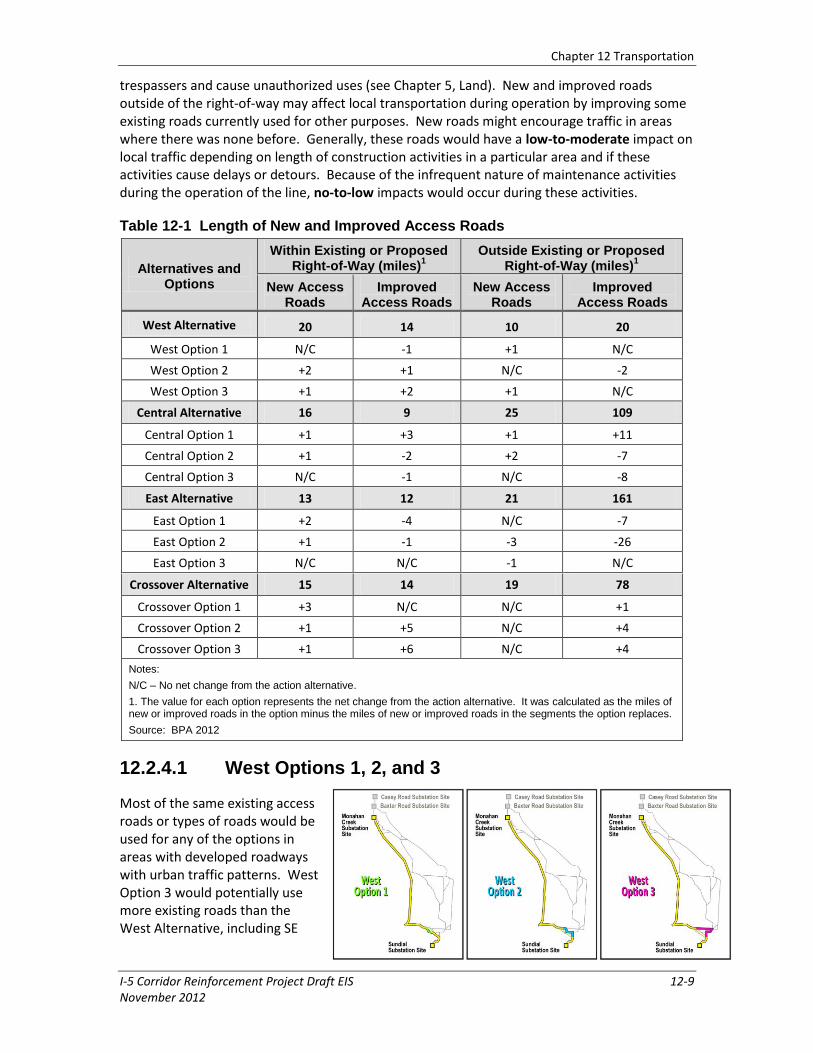
12.2.4.1 West Options 1, 2, and 3
Most of the same existing access roads or types of roads would be used for any of the options in areas with developed roadways with urban traffic patterns. West Option 3 would potentially use more existing roads than the West Alternative, including SE

Chapter 12 Transportation
12-10 I-5 Corridor Reinforcement Project Draft EIS November 2012
Blair Road and NE 58th Street. Construction traffic would be temporary and minor compared to existing traffic in the area and maintenance traffic would be much less.
Impact levels on transportation would be the same as the West Alternative.
Table 12-2 Existing Roads That Could Be Used During Construction
Alternatives and Options Existing Roads (miles)
West Alternative 173.6
West Option 1 -1.0
West Option 2 +7.6
West Option 3 +16.9
Central Alternative 180.7
Central Option 1 -2.2
Central Option 2 -25.9
Central Option 3 +4.6
East Alternative 154.6
East Option 1 -12.0
East Option 2 +25.4
East Option 3 +1.1
Crossover Alternative 147.6
Crossover Option 1 +11.7
Crossover Option 2 +10.0
Crossover Option 3 +10.2
Note:
1. The value for each option represents the net change from the alternative. It was calculated as the miles added by the option minus the miles in the segments the option replaces.
Source: BPA 2012
12.2.5 Central Alternative
The Central Alternative would cross several highways and state routes (I-5, I-205, SR 14, SR 411, SR 500, SR 502, SR 503, and SR 504), many other roads, including public arterials (Zillig Road, Lewis River Road, NE Yale Bridge Road, and SE Blair Road), and private access roads, including transit routes for timber harvest and private property access. The alternative would also cross railroads (BNSF Railway, Columbia and Cowlitz Railway, and Portland Vancouver Junction Railroad), and would be within 5,000 feet of the Portland-Troutdale Airport (see Maps 12-1A though 12-1D).
The Central Alternative would need 41 miles of new access roads, the most of all action alternatives, and would need 118 miles of improved access roads outside the right-of-way (see Table 12-1). Much of the Central Alternative is more rural than the West Alternative with fewer existing roadways and somewhat

Chapter 12 Transportation
I-5 Corridor Reinforcement Project Draft EIS 12-11 November 2012
less overall roadway capacity to accept construction traffic, although existing traffic is likely to be less than the West Alternative.
The Central Alternative could use about 181 miles of existing roads in the project area (see Table 12-2 and Maps 12-1A through 12-1D). Similar to the West Alternative, construction and maintenance crews would use any number of these roads at different times to access right-of-way, towers, or substation sites. The construction contractor would identify these roads for use at the time of construction (see Section 12.2.4, West Alternative).
Similar to those described in impacts common to action alternatives and the West Alternative, new and improved roads within rights-of-way would have no impact on transportation because they would not be public. These same roads though may provide unintended access from trespassers and cause unauthorized uses (see Chapter 5, Land). New and improved roads outside of the right-of-way may affect local transportation during operation by improving some existing roads currently used for other purposes. New roads might encourage traffic in areas where there was none before. Generally, these roads would have a low-to-moderate impact on local traffic depending on length of construction activities in a particular area and if these activities cause delays or detours. Because of the infrequent nature of maintenance activities during the operation of the line, no-to-low impacts would occur during these activities.
12.2.5.1 Central Options 1, 2, and 3
Central Option 1 would not add any additional crossings of public roads although many logging roads would be crossed. Central Option 2 would add a crossing of SR 411 and remove the crossing of SR 504. Central Option 3 would use additional local roads, including NE Cedar Creek Road, and NE 379th Street. Differences in impacts of the options compared to the Central Alternative would be temporary or intermittent, and would not cause a significant change in transportation impacts.
Impact levels on transportation would be the same as the Central Alternative.
12.2.6 East Alternative
Similar to the West and Central Alternative, the East Alternative would cross several highways and state routes (I-5, SR 14, SR 503, and SR 504) and many other roads, including public arterials (Rock Creek Road, Lewis River Road, Yale Bridge Road, and SE Blair Street), and private access roads, including transit routes for timber harvest and private property access. The alternative would also cross the BNSF Railway and the Columbia and Cowlitz Railway. It is also within 5,000 feet of a small paved private

Chapter 12 Transportation
12-12 I-5 Corridor Reinforcement Project Draft EIS November 2012
airstrip just south of the Lewis River crossing and the Portland-Troutdale Airport (see Maps 12-1A though 12-1D).
Much of the East Alternative is more rural than the West Alternative with fewer existing roadways and generally less overall capacity to accept construction traffic based on the number and design capacity of roads. Existing traffic on those roads is correspondingly less. The East Alternative would need 34 miles of new access roads, similar to the Crossover Alternative, and 173 miles of improvements to access roads—more than any other alternative (see Table 12-1).
The East Alternative could use about 155 miles of existing roads in the project area (see Table 12-2 and Maps 12-1A through 12-1D). Similar to the previous alternatives, construction crews would use any number of these roads at different times to access right-of-way, towers, or substations.
Similar to those described in impacts common to action alternatives and the previous alternatives, new and improved roads within rights-of-way would have no impact on transportation because they would not be public. These same roads though may provide unintended access from trespassers and cause unauthorized uses (see Chapter 5, Land). New and improved roads outside of the right-of-way may affect local transportation during operation by improving some existing roads currently used for other purposes. New roads might encourage traffic in areas where there was none before. Generally, these roads would have a low-to-moderate impact on local traffic depending on length of construction activities in a particular area and if these activities cause delays or detours. Because of the infrequent nature of maintenance activities during the operation of the line, no-to-low impacts would occur during these activities.
12.2.6.1 East Options 1, 2, and 3
Similar to Central Option 2, East Option 1 would cross West Side Highway, but remove the crossing of SR 504. East Option 2 would require 2 fewer miles of new access roads and 27 fewer miles of improved access roads. East Option 3 would add about 1 mile of existing roads. Differences in impacts compared to the East Alternative would be temporary or intermittent, and insignificant.
Impact levels on transportation would be the same as the East Alternative.

Chapter 12 Transportation
I-5 Corridor Reinforcement Project Draft EIS 12-13 November 2012
12.2.7 Crossover Alternative
Transportation impacts along this alternative would be the same as those along the northern portion of the West Alternative north of the Lewis River, and the southern portion of the East Alternative south of Yale Dam. Where the Crossover Alternative runs west to east, transportation impacts would be the same as those for the Central Alternative between the Merwin and Yale dams. Much of the Crossover Alternative is more rural than the West Alternative with fewer existing roadways and less overall capacity to accept construction traffic, although less existing traffic is likely to occur here than near the West Alternative. The Crossover Alternative would need 34 miles of new access roads, similar to the East Alternative, and would need 92 miles of improvement to access roads (see Table 12-1).
The Crossover Alternative could use about 148 miles of existing roads in the project area (see Table 12-2 and Maps 12-1A through 12-1D). Similar to other action alternatives, construction crews would use any number of these roads at different times to access right-of-way, towers, or substation sites.
Similar to those described in impacts common to action alternatives and the previous alternatives, New and improved roads within rights-of-way would have no impact on transportation because they would not be public. These same roads though may provide unintended access from trespassers and cause unauthorized uses (see Chapter 5, Land). New and improved roads outside of the right-of-way may affect local transportation during operation by improving some existing roads currently used for other purposes. New roads might encourage traffic in areas where there was none before. Generally, these roads would have a low-to-moderate impact on local traffic depending on length of construction activities in a particular area and if these activities cause delays or detours. Because of the infrequent nature of maintenance activities during the operation of the line, no-to-low impacts would occur during these activities.

Chapter 12 Transportation
12-14 I-5 Corridor Reinforcement Project Draft EIS November 2012
12.2.7.1 Crossover Options 1, 2, and 3
Crossover Option 1 would add 3 miles of new access road, and 1 mile of improved access road. By extending the right-of-way from the Monahan Creek substation site to the Baxter Creek substation site, Crossover Option 2 and Crossover Option 3 would cross additional roads mostly used for logging activities. Crossover Options 2 and 3 would require improvements of 9 to 10 more miles of access road. Differences in impacts compared to the Crossover Alternative would be minor.
Impact levels on transportation would be the same as the Crossover Alternative.
12.2.8 Recommended Mitigation Measures
Mitigation measures included as part of the project are identified in Table 3-2. The following additional mitigation measure has been identified to further reduce or eliminate adverse transportation impacts by the action alternatives. If implemented, this measure would be completed prior to, during, or immediately after project construction unless otherwise noted.
• Notify interested parties of construction and maintenance activities and schedules and traffic delays and detours.
12.2.9 Unavoidable Impacts
Unavoidable transportation impacts remaining after mitigation would be temporary delays, detours, and interruption to local traffic during construction and even less traffic during maintenance activities.
12.2.10 No Action Alternative
The No Action Alternative would have no impact on transportation because no new transmission lines, towers, access roads, or substations would be constructed. Transportation resources would likely expand through future development, but temporary impacts from operation and maintenance of existing transmission lines and substations in the project area would continue unchanged on current road systems.