Chapter 1 Introduction to Earth Science.ppt - jkaser.com 1 Introduction... · Earth science...
69
Chapter Introduction to Earth Science
-
Upload
truongthuan -
Category
Documents
-
view
222 -
download
2
Transcript of Chapter 1 Introduction to Earth Science.ppt - jkaser.com 1 Introduction... · Earth science...

Chapter Introduction toEarth Science

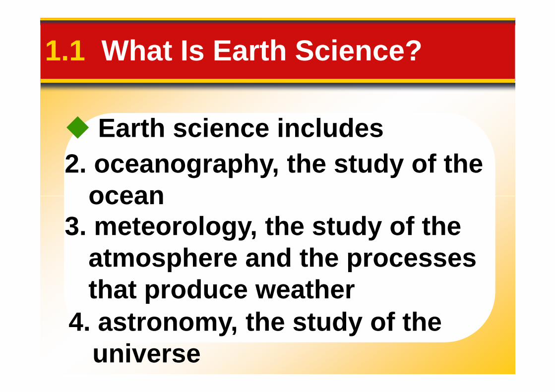
1.1 What Is Earth Science?
Encompasses all sciencesthat seek to understand
•Earth•Earth's neighbors in space
Overview of Earth Science
•Earth's neighbors in space


Earth science includes
1. geology, the study of Earth
1.1 What Is Earth Science?
1. geology, the study of Eartha. physical geology - examinationof the materials that make upEarth and possible explanationsfor the many processes that shapeour planet

Earth science includes
1. geology, the study of Earthb. historical geology - aim is to
1.1 What Is Earth Science?
understand Earth’s long history byestablishing a timeline of the vastnumber of physical and biologicalchanges that have occurred in thepast
Earth science includes
2. oceanography, the study of theocean
1.1 What Is Earth Science?
ocean
4. astronomy, the study of theuniverse
3. meteorology, the study of theatmosphere and the processesthat produce weather

Formation of Earth
Most researchers conclude thatEarth and the other planets formed
1.1 What Is Earth Science?
• The solar system evolved from anenormous rotating cloud called thesolar nebula.
Earth and the other planets formedat essentially the same time.
Nebular Hypothesis

• The nebula was composedmostly of hydrogen and helium.
Nebular Hypothesis
1.1 What Is Earth Science?
• About 5 billion years ago, thenebula began to contract.
• It assumed a flat, disk shapewith the protosun (pre-Sun) at thecenter.
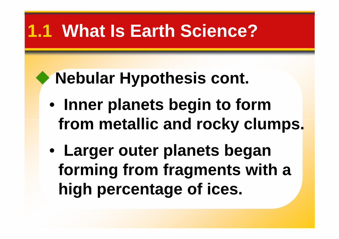
• Inner planets begin to formfrom metallic and rocky clumps.
Nebular Hypothesis cont.
1.1 What Is Earth Science?
from metallic and rocky clumps.
• Larger outer planets beganforming from fragments with ahigh percentage of ices.

A
C
BTheNebularHypothesis
D
E
Hypothesis

Layers Form on Earth
1.1 What Is Earth Science?
• As Earth formed, the decay ofradioactive elements and heat fromhigh-velocity impacts caused thehigh-velocity impacts caused thetemperature to increase.
• Lighter rocky components floatedoutward, toward the surface.
• Gaseous material escaped fromEarth’s interior to produce theprimitive atmosphere.
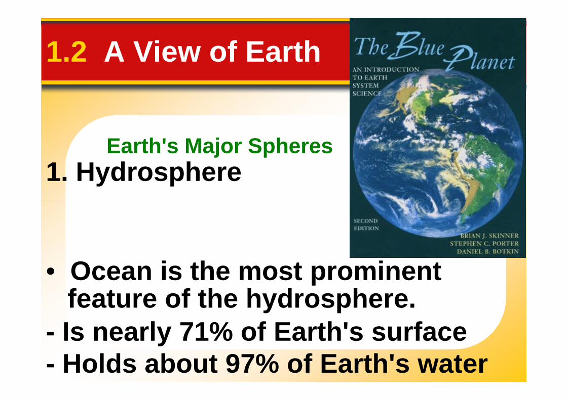
Earth's Major Spheres
1.2 A View of Earth
1. Hydrosphere
• Ocean is the most prominentfeature of the hydrosphere.
- Is nearly 71% of Earth's surface- Holds about 97% of Earth's water
Earth's Major Spheres
1.2 A View of Earth
1. Hydrosphere cont.
• Also includes fresh water foundin streams, lakes, glaciers, andgroundwater

Earth's Major Spheres
1.2 A View of Earth
2. Atmosphere
• Thin, tenuous blanket of air• Thin, tenuous blanket of air• 90% lies within 16 km (abt 10
miles) of the earth’s surface

Earth's Major Spheres
1.2 A View of Earth
3. Biosphere
• Includes all life
• Concentrated in a zone thatextends from the ocean floorupward for several kilometersinto the atmosphere

1.2 A View of Earth
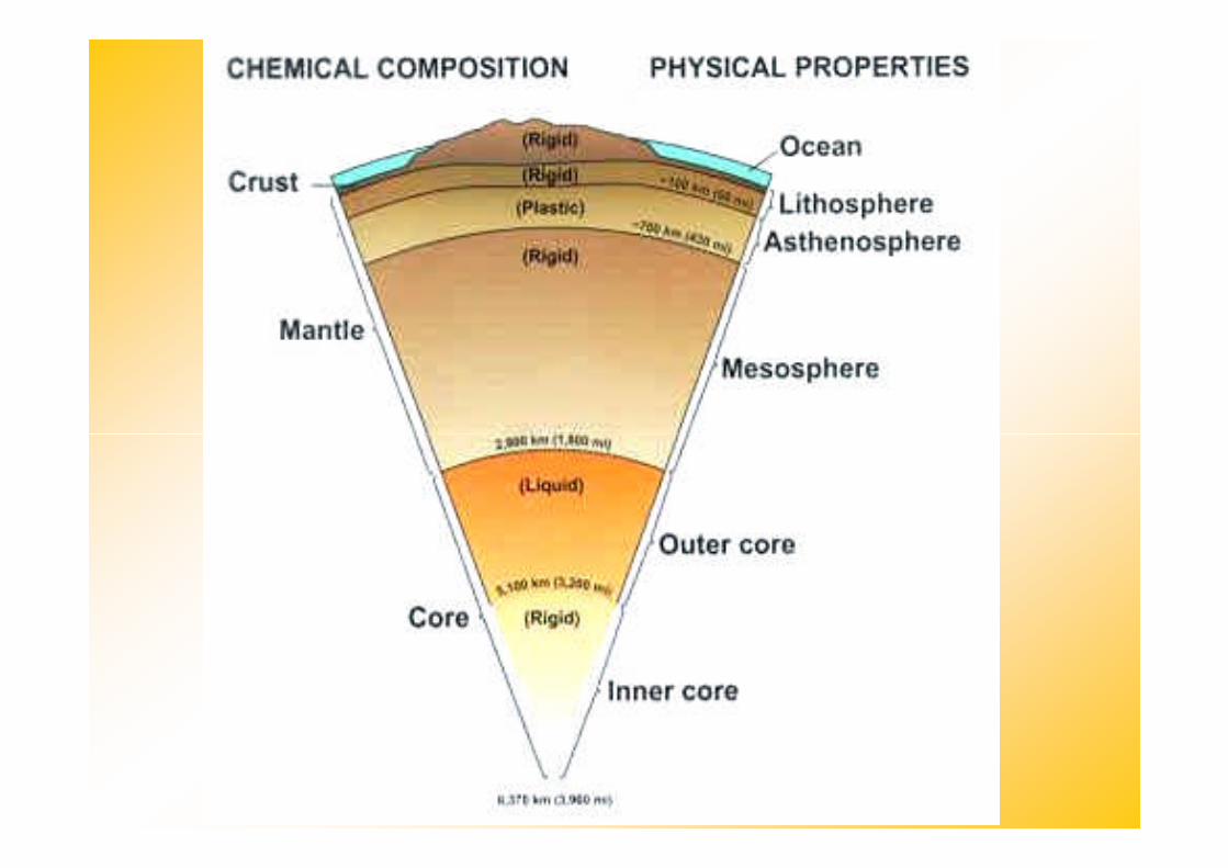
4. Geosphere• Based on compositional
differences, it consists of the crust,mantle, and core.
- Crust—the thin, rocky outer layer- Crust—the thin, rocky outer layerof Earth.- Mantle—the 2890-kilometer-thicklayer of Earth located below thecrust.
- Core—the innermost layer ofEarth, located beneath the mantle.


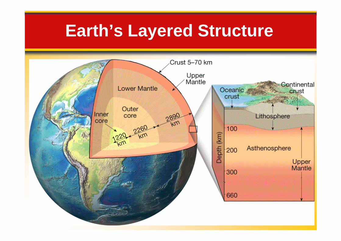
Earth’s Layered Structure


1.2 A View of Earth
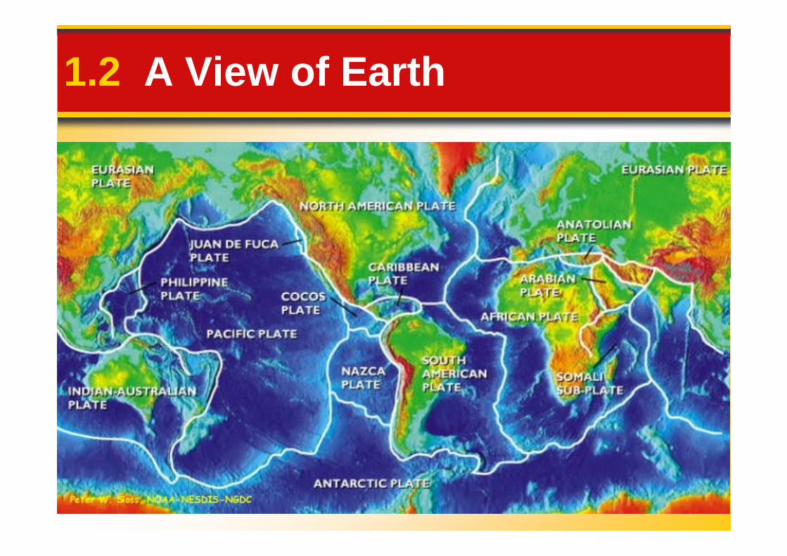
Plate tectonics is the theory thatproposes that Earth’s outer shellconsists of individual plates thatinteract in various ways and
Plate Tectonics
interact in various ways andthereby produce earthquakes,volcanoes, mountains, and Earth’scrust itself.Plate movement is driven by
unequal distribution of heatwithin the Earth


Plate Tectonics
1.2 A View of Earth
Two types of forces affecting theEarth’s surfaceEarth’s surfacedestructive - weathering and
erosion flatten the Earthconstructive - mountain building
and volcanism build up thesurface
1.2 A View of Earth

How to represent this as aflat surface?

1.3 Representing Earth’s Surface
Latitude and longitude are lines onthe globe that are used todetermine location.
Determining Location
determine location.• Latitude is distance north or south
of the equator, measured indegrees.
• Longitude is distance east or westof the prime meridian, measured indegrees.

1.3 Representing Earth’s Surface


1.3 Representing Earth’s Surface
No matter what kind of map ismade, some portion of the surface
Maps and Mapping
will always look either too small,too big, or out of place. Mapmakershave, however, found ways to limitthe distortion of shape, size,distance and direction.

1.3 Representing Earth’s Surface
Robinson projection map- show most distances, sizes, andshapes accurately with distortionsin areas around the edges of themapin areas around the edges of themap

1.3 Representing Earth’s Surface
Conic projection map- accuracy is great over a smallarea so are good for making roadand weather mapsand weather maps

1.3 Representing Earth’s Surface
Gnonomic projection map- distances and directions aredistorted but they show with greataccuracy the shortest distancebetween two pointsbetween two points

Mercator Projection


1.3 Representing Earth’s Surface
Topographic maps representEarth’s surface in threedimensions; they show elevation,
Topographic Maps
dimensions; they show elevation,distance directions, and slopeangles.
• Contour lines are lines on atopographic map that indicate anelevation.

1.3 Representing Earth’s Surface
• Contour interval is the distance inelevation between adjacent contour
Topographic Maps
elevation between adjacent contourlines.
• Lines close together indicate asteeper slope.
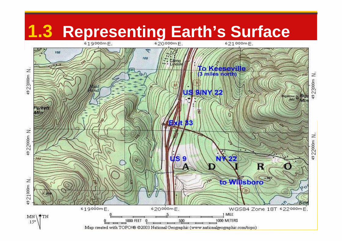
1.3 Representing Earth’s Surface

1.3 Representing Earth’s Surface
• Scale - maps are drawn to scalewhere a certain distance on themap is equal to a certain distance
Topographic Maps
map is equal to a certain distanceon the surface
• bar scales - allow you to determinethe distance represented
• Geologic Maps - show the type andage of the exposed rocks

1.3 Representing Earth’s Surface
• Use of satellites and computers tosend and receive data
• The process of collecting data from
Advanced Technology
• The process of collecting data froma distance is called remote sensing
• GPS - Global Positioning Systems -receives signals to compute theuser’s latitude and longitude aswell as speed, direction, andelevation

1.4 Earth System Science
Earth is a dynamic planet withmany separate but interactiveparts or spheres.
What is Earth System Science?
parts or spheres. Earth scientists study how
these spheres areinterconnected
1.4 Earth System Science
This way of looking at Earth isEarth system science - its aimis to understand earth as a
What is Earth System Science?
is to understand earth as asystem made up of numerousinteracting parts, orsubsystems.

1.4 Earth System Science
A system is any size group ofinteracting parts that form a
complex whole.
What Is a System?
Closed systems are self contained(e.g., an automobile coolingsystem). Open systems allow both energy
and matter to flow in and out of thesystem (e.g., a river system).
complex whole.
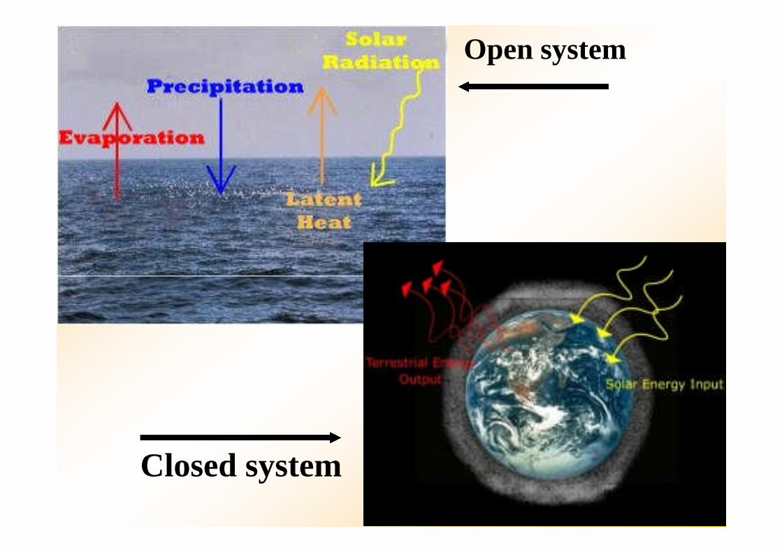
Open system
Closed system
1.4 Earth System Science
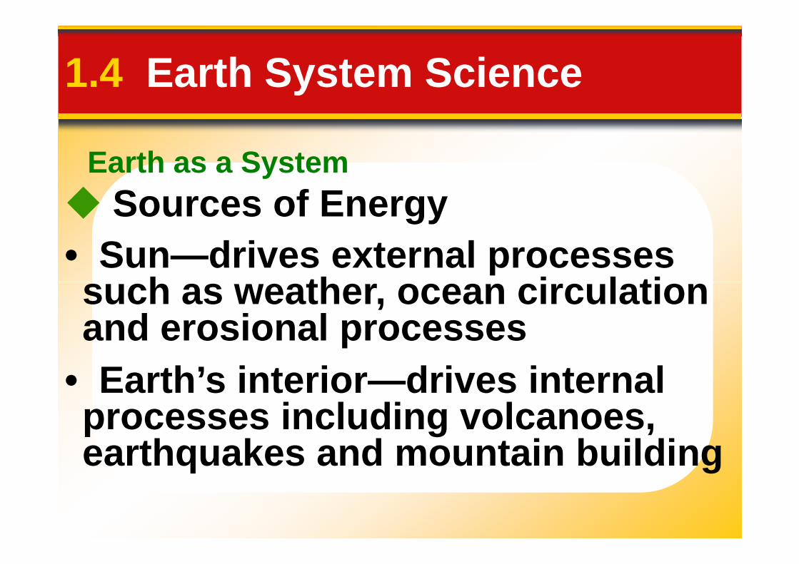
Sources of Energy
• Sun—drives external processessuch as weather, ocean circulation
Earth as a System
such as weather, ocean circulationand erosional processes
• Earth’s interior—drives internalprocesses including volcanoes,earthquakes and mountain building

Earth as a System
1.4 Earth System Science
Consists of a nearly endless arrayof subsystems (e.g., hydrologic
Humans are part of the Earthsystem.
Our actions produce changes inall of the other parts of the Earthsystem
of subsystems (e.g., hydrologiccycle)

1.4 Earth System Science
Environment• Surrounds and influences
organisms
People and the Environment
organisms
• Physical environment encompasseswater, air, soil, and rock
• The term environmental is usuallyreserved for those aspects thatfocus on the relationships betweenpeople and the natural environment.

1.4 Earth System Science
Resources• Include water, soil, minerals, andenergy• Two broad categories• Two broad categories
2. Nonrenewable—cannot bereplenished in the near future (e.g.,metals, fuels)
1. Renewable—can be replenished(e.g., plants, energy from water andwind)

1.4 Earth System Science
Population
• Population of the planet is• Population of the planet isgrowing rapidly
• Use of minerals/energy hasclimbed more rapidly than theoverall growth of population

Growth of World Population
Exponential Growth

1.4 Earth System Science
Caused by people and societies
Local, regional, and global
Environmental Problems
Caused by people and societies
• Urban air pollution • Acid rain
Caused by natural hazards• Landslides
• Ozone depletion • Global warming
• Earthquakes

1.5 What Is Scientific Inquiry?
Science assumes the naturalworld is
Science
world is
• consistent• predictable

1.5 What Is Scientific Inquiry?
Goals of science are• to through careful, systematicstudy, we can understand and
Science
• to use the knowledge to makepredictions about what should orshould not be expected
study, we can understand andexplain the natural world’s behavior

1.5 What Is Scientific Inquiry?
An idea can become a
• hypothesis—tentative or untested
Hypothesis and Theory
• hypothesis—tentative or untestedexplanation
• theory—tested, confirmed,supported hypothesis

1.5 What Is Scientific Inquiry?
Scientific Method
• Gather facts through observation
Hypothesis and Theory
• Formulate hypotheses
• Gather facts through observation
• Test hypotheses to formulatetheories

1.5 What Is Scientific Inquiry?
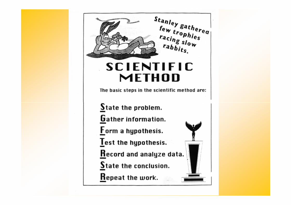
Scientific knowledge is gainedthrough following systematic steps1. Collecting facts through
Science Methods
1. Collecting facts throughobservation and measurement
2. Developing a hypothesis3. Conducting experiments to test
the hypothesis4. Reexamining the hypothesis and
accepting, modifying, or rejecting it


Massachusetts Physical Map - Massachusetts Relief Map
:This Massachusetts shaded relief map shows the major physical features ofthe state.
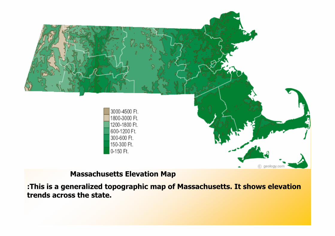
Massachusetts Elevation Map
:This is a generalized topographic map of Massachusetts. It shows elevationtrends across the state.

Massachusetts Rivers Map - Massachusetts Lake Map
:This map shows the major streams and rivers of Massachusetts and some ofthe larger lakes. The state is within the Atlantic Ocean Watershed.

Massachusetts County Map - Massachusetts Political Map
:This map shows Massachusetts's 7 counties and 7 census areas.

Map of Massachusetts Cities - Massachusetts Road Map
:This map shows many of Massachusetts's important cities and mostimportant roads. Important north - south routes include: Interstate 91,Interstate 93, Interstate 95, Interstate 195, Interstate 395 and Interstate495. Important east - west routes include: Interstate 90 and Interstate 290.