Challenges of Sea Search and Recovery Operations – Sharing ... · Kumai Port in Pangkalan Bun...
25
Challenges of Sea Search and Recovery Operations – Sharing of Experience from a Recent Joint Operation Tatang Kurniadi – Chairman, Indonesia National Transportation Safety Committee Ng Junsheng – Accident Investigator, Air Accident Investigation Bureau of Singapore
Transcript of Challenges of Sea Search and Recovery Operations – Sharing ... · Kumai Port in Pangkalan Bun...

Challenges of Sea Search and Recovery Operations – Sharing of Experience from a Recent Joint
Operation
Tatang Kurniadi – Chairman, Indonesia National Transportation Safety Committee Ng Junsheng – Accident Investigator, Air Accident Investigation Bureau of Singapore

1
Synopsis
On 28 Dec 14, radar contact with an AirAsia Indonesia A320 aircraft operating flight QZ8501 was lost. The Indonesia National Transportation Safety Committee (NTSC), as Indonesia’s accident investigation authority, coordinated the sea search effort to locate and recover the flight recorders of the aircraft. The search team comprised investigators from China, France, Indonesia, Singapore and the United Kingdom.
Kumai Port in Pangkalan Bun (PKN) was the launch point for the sea search team. The Directorate-General of Sea Transportation (DGST) of Indonesia offered two vessels (KN Jadayat and KN Andromeda) for the sea search team’s use in its flight recorder search effort. The search team distributed the manpower and equipment between the vessels to allow two parallel search operations to be conducted.
The sea search team turned back twice after the departures on 2 Jan 15 and
3 Jan 15 due to bad weather and adverse sea condition.
On 6 Jan 15, both vessels set sail again and arrived in the search area in the morning of 7 Jan 15. The search team deployed hydrophones, sonar side scan equipment and a remotely operated vehicle to locate the underwater locator beacon ping signals and debris field. A vessel equipped with an Ultra Short Base Line system performed additional detection of the ping signals which confirmed the search team findings and provided a better estimated position of the source of the ping signals.
Dive operations to retrieve the flight recorders commenced on 9 Jan 15. The flight data recorder and cockpit voice recorder were successfully recovered by Indonesian naval divers on 12 and 13 Jan 15 respectively.
The information in this paper details the challenges faced by the search team
and the excellent cooperation among the international specialists in this successful sea search and recovery operation.
CONTENTS
Paragraph No.
Introduction 1-4 Management of Sea Search 5-22 Deployment Attempts 23-38 Locating the Flight Recorders 39-56 Dive Operations 57-70 Recovery of Recorders 71-80 International Cooperation 81-90 Challenges Faced 91-103 Learning points 104-117 Conclusion 118-120
1
Challenges of Sea Search and Recovery Operations – Sharing of Experience from a Recent Joint Operation
Introduction
1 On 28 Dec 14, radar contact with an AirAsia Indonesia A320 aircraft operating flight QZ8501 was lost. The Indonesia National Transportation Safety Committee (NTSC), as Indonesia’s accident investigation authority, coordinated the sea search effort to locate and recover the flight recorders of the aircraft. The underwater search team included personnel from Indonesia, China, France, Singapore and the United Kingdom. 2 Shortly after receiving news of the missing flight, the Air Accident Investigation Bureau (AAIB) of Singapore offered the NTSC its assistance to locate the flight recorders of the aircraft.
3 On 29 Dec 14, the NTSC Chairman, Mr Tatang Kurniadi, accepted AAIB’s offer. In addition, the Maritime and Port Authority of Singapore (MPA) offered to support the AAIB team with marine underwater survey capabilities. The AAIB-MPA team compromising four AAIB investigators and six MPA hydrography specialists departed on 31 Dec 14 for Indonesia.
4 This paper will share the following aspects of the sea search experienced by the NTSC and AAIB:
• Management of sea search • Locating the flight recorders • Recovery of flight recorders • Challenges faced • International corporation • Lessons learnt
Management of Sea Search
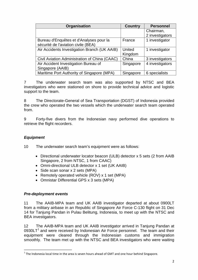
5 The sea search effort to recover the flight recorders was carried out by the NTSC while the search and rescue (SAR) operation, led by the Indonesia National Search and Rescue Agency (BASARNAS), was ongoing. All coordination between the underwater search team and the BASARNAS and other agencies that provided support was handled by the NTSC. Manpower 6 The manpower available for the underwater search team was as follows:
Organisation Country Personnel National Transportation Safety Committee Indonesia 1 adviser to
2
Organisation Country Personnel Chairman, 2 investigators
Bureau d'Enquêtes et d'Analyses pour la sécurité de l'aviation civile (BEA)
France 1 investigator
Air Accidents Investigation Branch (UK AAIB) United Kingdom
1 investigator
Civil Aviation Administration of China (CAAC) China 3 investigators Air Accident Investigation Bureau of Singapore (AAIB)
Singapore 4 investigators
Maritime Port Authority of Singapore (MPA) Singapore 6 specialists
7 The underwater search team was also supported by NTSC and BEA investigators who were stationed on shore to provide technical advice and logistic support to the team. 8 The Directorate-General of Sea Transportation (DGST) of Indonesia provided the crew who operated the two vessels which the underwater search team operated from.
9 Forty-five divers from the Indonesian navy performed dive operations to retrieve the flight recorders.
Equipment 10 The underwater search team’s equipment were as follows:
• Directional underwater locator beacon (ULB) detector x 5 sets (2 from AAIB Singapore, 2 from NTSC, 1 from CAAC)
• Omni-directional ULB detector x 1 set (UK AAIB) • Side scan sonar x 2 sets (MPA) • Remotely operated vehicle (ROV) x 1 set (MPA) • Omnistar Differential GPS x 3 sets (MPA)
Pre-deployment events 11 The AAIB-MPA team and UK AAIB investigator departed at about 0900LT from a military airbase in an Republic of Singapore Air Force C-130 flight on 31 Dec 14 for Tanjung Pandan in Pulau Belitung, Indonesia, to meet up with the NTSC and BEA investigators. 12 The AAIB-MPA team and UK AAIB investigator arrived in Tanjung Pandan at 0930LT1 and were received by Indonesian Air Force personnel. The team and their equipment were cleared through the Indonesian customs and immigration smoothly. The team met up with the NTSC and BEA investigators who were waiting
1 The Indonesia local time in the area is seven hours ahead of GMT and one hour behind Singapore.

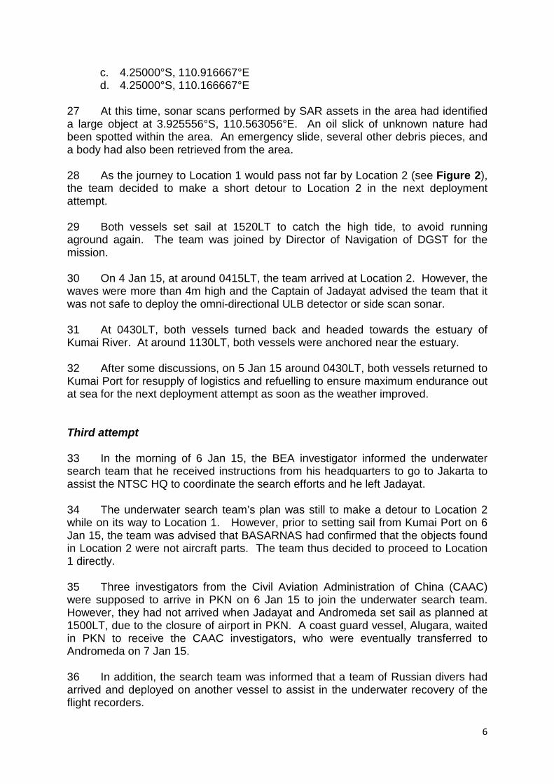
3
at the terminal building. A preliminary briefing was given by NTSC’s representative in-charge of the search of the flight recorders. 13 The underwater search team met at 1530LT and discussed the following:
• The coordinates of the start point for the search would be 3.60861°S,
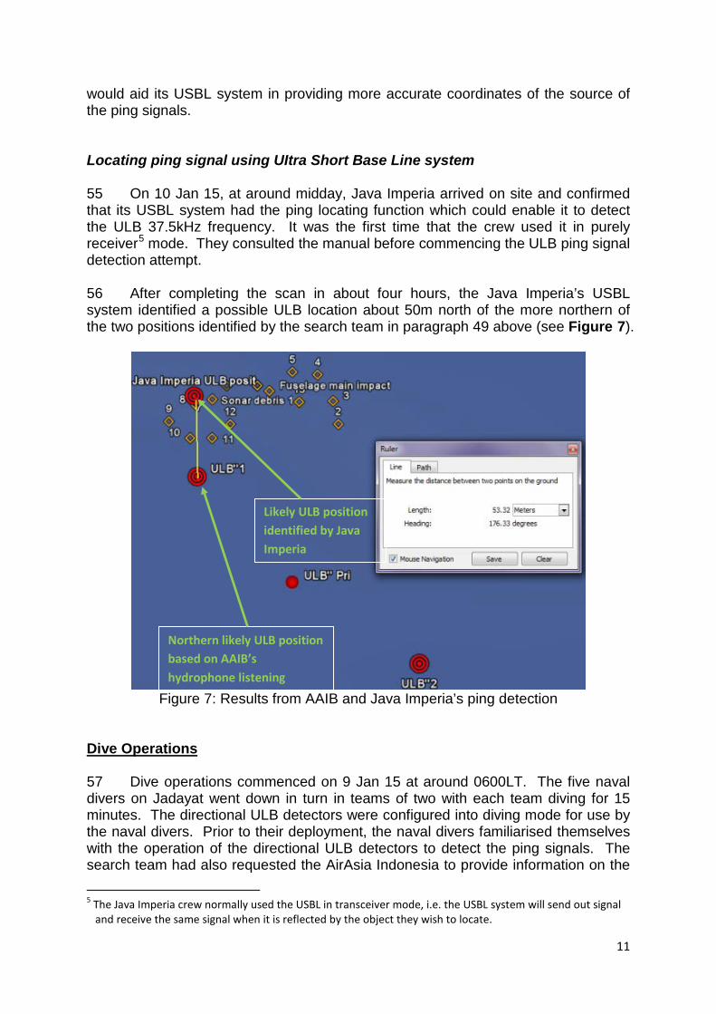
109.69611°E, the last known radar position. The coordinates were derived from Jakarta radar information, but with secondary radar information taken into account. According to the BEA investigator, a Russian study had concluded that in the majority of accidents involving loss of control in-flight, the wreckage was usually found within a radius of 10km around the last known radar position.
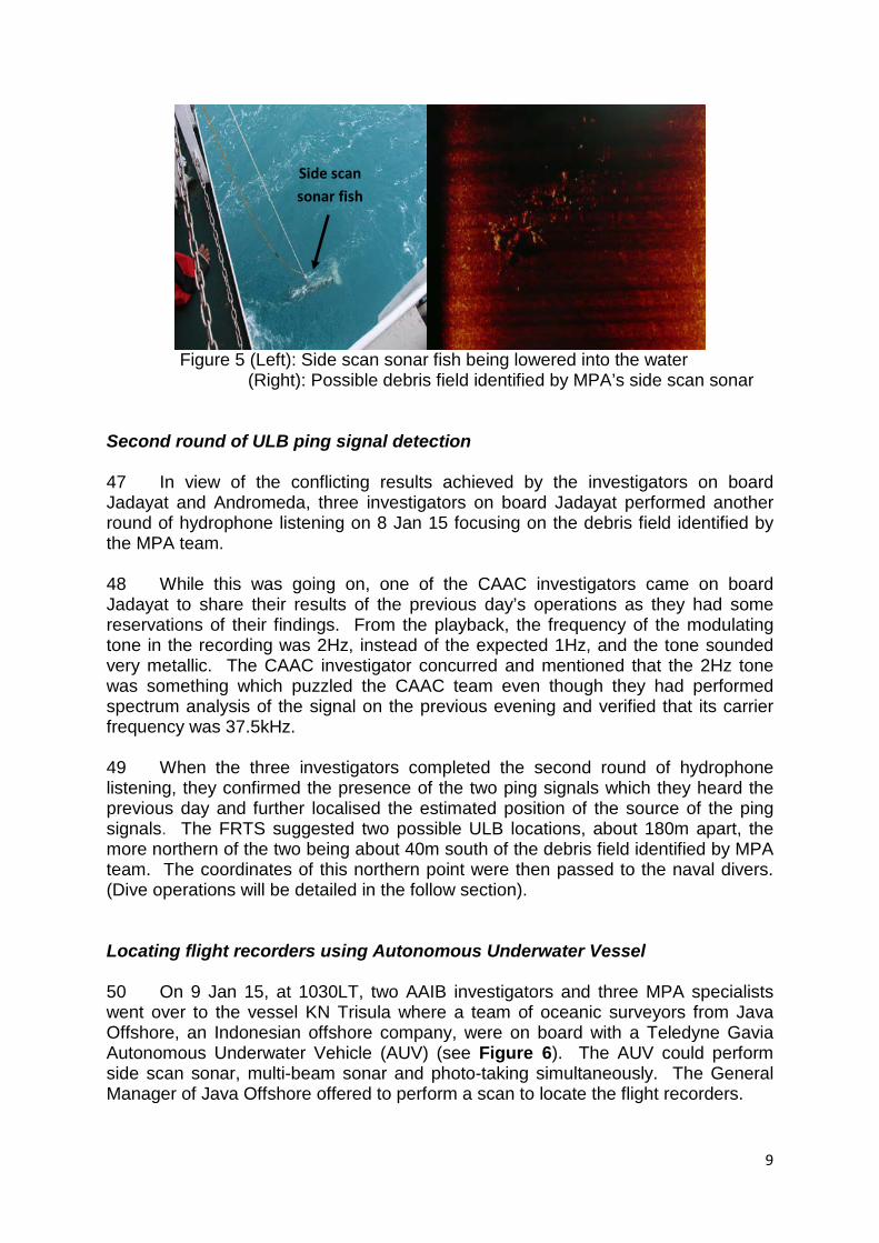
• Based on this information, the team decided that the initial search pattern would be a 12km x 12km square around the last known radar position provided by Jakarta radar. Omni-directional and directional ULB detectors would be used.
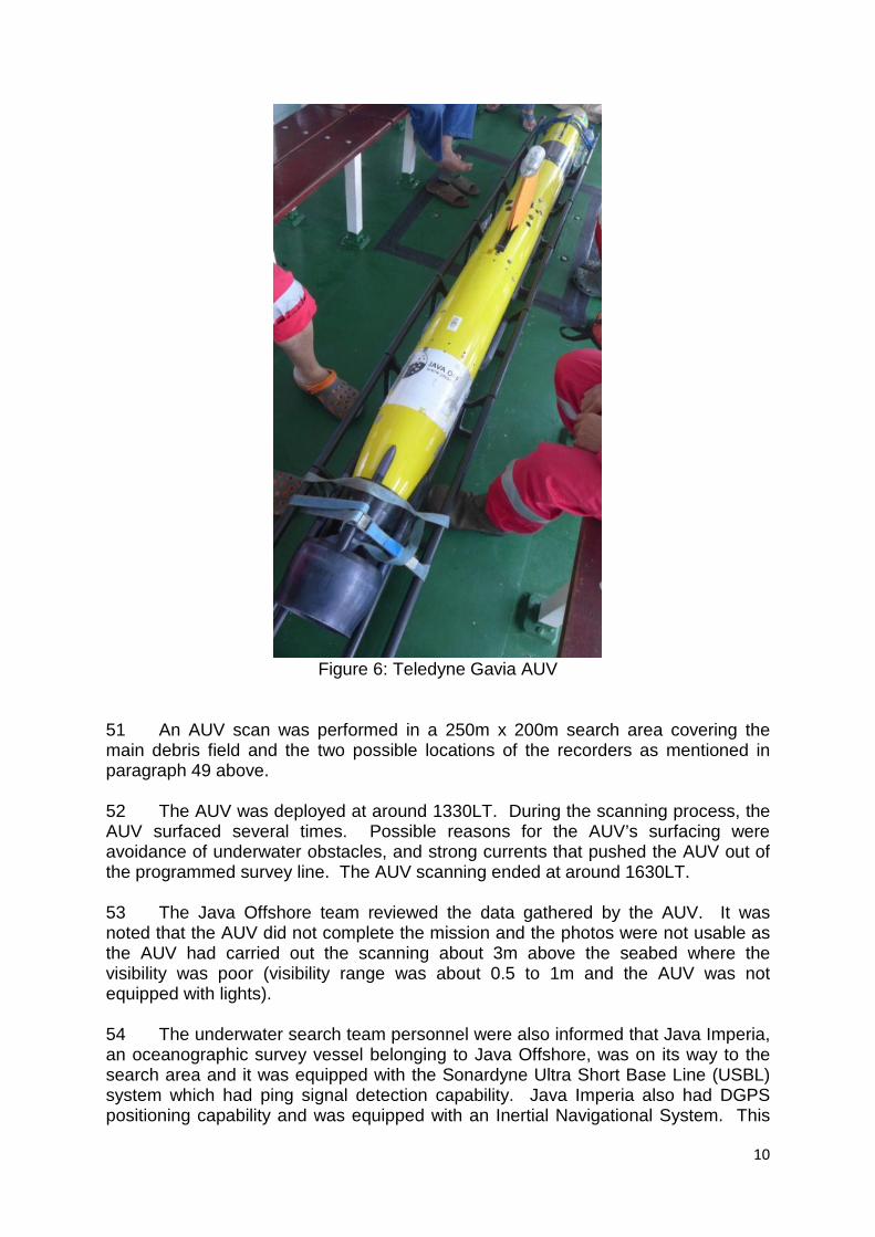
• The distance between the intermediate points within the search grid would be determined after the underwater search team conducted a trial to determine the optimal detection range of the ULB detectors in the waters near the search area.
• The team would first deploy the ULB detector to detect and localise the presence of the ULB ping signal. This would be followed by the deployment of the side scan sonar to pinpoint the source of the ULB ping signal.
14 Part of the underwater search team went to assess an Indonesia Navy vessel, the Pattimura, for its suitability for the underwater search for the flight recorders. Pattimura was deemed not suitable. While Pattimura had a small rubber dinghy which was good for the deployment of ULB detectors, its deck was not conducive for the deployment of side scan sonar. Pattimura also had to wait for spare parts which would take two days to arrive before she could set sail. 15 The weather condition in the targeted search area was forecasted to be stormy with sea state of 2 to 4 until 5 Jan 15. The investigators from the UK AAIB and BEA advised that for sea state above 2, the underwater current would produce noise which would prevent effective use of the ULB detection systems. 16 In view of the forecasted bad weather, the underwater search team considered that they would not be able to deploy in the following days. In view of the poor sea state condition, the UK AAIB investigator decided to depart for Jakarta on the following day to speak to the NTSC Chairman to discuss if the NTSC would need the UK AAIB’s towed pinger array2 and then return to the UK to make the necessary arrangement, if the UK AAIB’s equipment was needed. He left the UK AAIB’s omni-directional ULB detector behind for the underwater search team to use. 17 In the evening of 31 Dec 14, BASARNAS requested through the NTSC that the underwater search team travel to Pangkalan Bun (PKN) in Kalimantan as there 2 The UK AAIB’s towed pinger array is effective in sea state 3-4 with a towing speed of about 5kt.

4
were more ships berthing at PKN’s Kumai Port (on Kumai River) available for deployment. 18 On 1 Jan 15, the underwater search team departed Tanjung Pandan at 0930LT on an Indonesian Air Force CN295 and arrived in PKN around 1030LT.
19 A BEA investigator who was attached to the NTSC HQ in Jakarta and who had reviewed the Jakarta radar information recommended to the underwater search team to concentrate the search in a 6km x 6km area centred on the last known radar position (this area is hereinafter referred to as Location 1). This recommendation was based on an analysis of ADS-B3 data. The main wreckage was expected to be in the vicinity of the last known radar position where the water depth was about 30m, with visibility of less than 1m. Vessel allocation for underwater search team 20 While in PKN, the underwater search team was informed that a catamaran from BASARNAS had been assigned for its use. However, the catamaran was still required by BASARNAS to carry out SAR operations and the team had concerns that this could hinder its search operations. 21 Through the help of the Indonesia Minister of Transport, the Directorate-General of Sea Transportation (DGST) of Indonesia was informed to provide suitable vessels to support the underwater search team. In the evening of 1 Jan 15, the Director of Navigation of the DGST, contacted his MPA counterpart, Director (Port Services/Chief Hydrographer), to offer two buoy tender vessels, the KN Jadayat and KN Andromeda (see Figure 1), which were berthing at Kumai Port, for use by the underwater search team. The underwater search team in PKN was very glad to accept the offer.
Figure 1: KN Jadayat and KN Andromeda
3 ADS-B is a surveillance technology in which an aircraft determines its position using satellite technology and periodically broadcasts it, without pilot or external input, thus enabling it to be tracked.

5
22 The manpower and equipment on the two vessels were distributed to allow two parallel search operations to be performed. Deployment attempts First attempt 23 On 2 Jan 15, Jadayat and Andromeda set sail at 0645LT for Location 1. The journey was expected to take 18 hours (see Figure 2). However, at 0815LT, Jadayat ran aground on a shoal while travelling along Kumai River towards the Java Sea. It was decided not to wait for the next high tide (which would be around 1500LT) for the vessel to be freed, so a tow boat was requested to assist Jadayat. As for Andromeda, a decision was made for her to continue heading to Location 1.
Figure 2: Journey from Kumai Port to Location 1
24 In the meantime, the AAIB-MPA personnel carried out checks on their equipment on board Jadayat. The equipment were found to be fully operational. 25 At around 1145LT, Andromeda informed Jadayat that the sea state at her location, beyond the mouth of the river, was bad, with waves of 3.5 to 4m high. The forecast for Location 1 was expected to be worse. Andromeda turned back to Kumai Port for safety reasons. In view of this, Jadayat also returned to port after she was towed from the shoal at around 1330LT. Second attempt 26 In the morning of 3 Jan 15, the team received information that BASARNAS had identified an area with a high probability of finding the main wreckage (the area is hereinafter referred to as Location 2) which was defined by the following coordinates:
a. 3.666667°S, 110.166667°E b. 3.666667°S, 110.916667°E
Location 1 Location 2
6
c. 4.25000°S, 110.916667°E d. 4.25000°S, 110.166667°E
27 At this time, sonar scans performed by SAR assets in the area had identified a large object at 3.925556°S, 110.563056°E. An oil slick of unknown nature had been spotted within the area. An emergency slide, several other debris pieces, and a body had also been retrieved from the area. 28 As the journey to Location 1 would pass not far by Location 2 (see Figure 2), the team decided to make a short detour to Location 2 in the next deployment attempt. 29 Both vessels set sail at 1520LT to catch the high tide, to avoid running aground again. The team was joined by Director of Navigation of DGST for the mission. 30 On 4 Jan 15, at around 0415LT, the team arrived at Location 2. However, the waves were more than 4m high and the Captain of Jadayat advised the team that it was not safe to deploy the omni-directional ULB detector or side scan sonar.
31 At 0430LT, both vessels turned back and headed towards the estuary of Kumai River. At around 1130LT, both vessels were anchored near the estuary.
32 After some discussions, on 5 Jan 15 around 0430LT, both vessels returned to Kumai Port for resupply of logistics and refuelling to ensure maximum endurance out at sea for the next deployment attempt as soon as the weather improved. Third attempt 33 In the morning of 6 Jan 15, the BEA investigator informed the underwater search team that he received instructions from his headquarters to go to Jakarta to assist the NTSC HQ to coordinate the search efforts and he left Jadayat.
34 The underwater search team’s plan was still to make a detour to Location 2 while on its way to Location 1. However, prior to setting sail from Kumai Port on 6 Jan 15, the team was advised that BASARNAS had confirmed that the objects found in Location 2 were not aircraft parts. The team thus decided to proceed to Location 1 directly. 35 Three investigators from the Civil Aviation Administration of China (CAAC) were supposed to arrive in PKN on 6 Jan 15 to join the underwater search team. However, they had not arrived when Jadayat and Andromeda set sail as planned at 1500LT, due to the closure of airport in PKN. A coast guard vessel, Alugara, waited in PKN to receive the CAAC investigators, who were eventually transferred to Andromeda on 7 Jan 15.
36 In addition, the search team was informed that a team of Russian divers had arrived and deployed on another vessel to assist in the underwater recovery of the flight recorders.

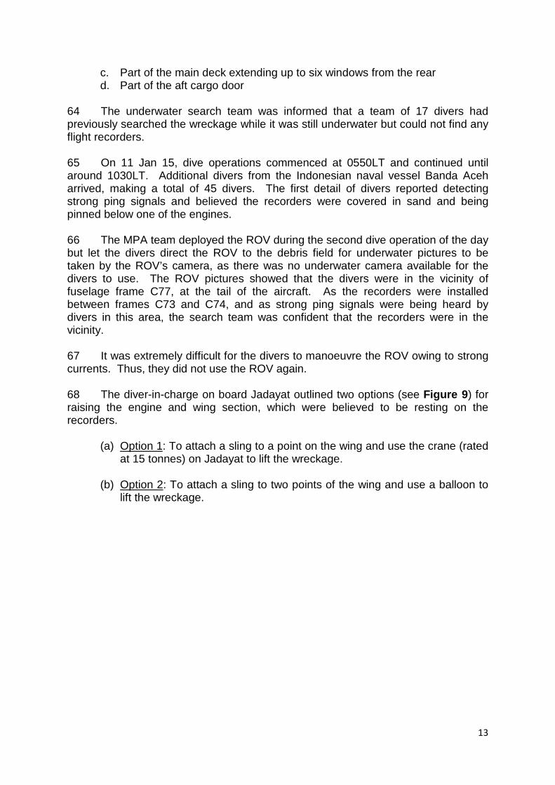
7
37 While enroute to Location 1, the team received information that the tail section of the aircraft had been located about 3km southeast of the last known radar position. This tail wreckage was within Location 1. This gave added confidence to the team that the recorders could be found within Location 1. The team decided that they would first perform hydrophone listening in the central 3km x 3km area of Location 1, i.e. the 3km x 3 km area centred on the last known radar position.
38 On 7 Jan 15 at around 0715LT, after sailing for more than 16 hours, Jadayat and Andromeda arrived in Location 1 where the sea state was relatively calm. Locating the Flight Recorders Initial round of ULB signal detection 39 At around 0800LT, an NTSC investigator and the AAIB team went on board a motorised wooden boat launched from Jadayat, bringing along the omni-directional ULB detector and the directional ULB detector. 40 It turned out that the omni-directional ULB detector did not operate properly4. Therefore, the team decided to use the directional ULB detector instead (see Figure 3).
Figure 3: Search team using the directional ULB detector for ping signal detection
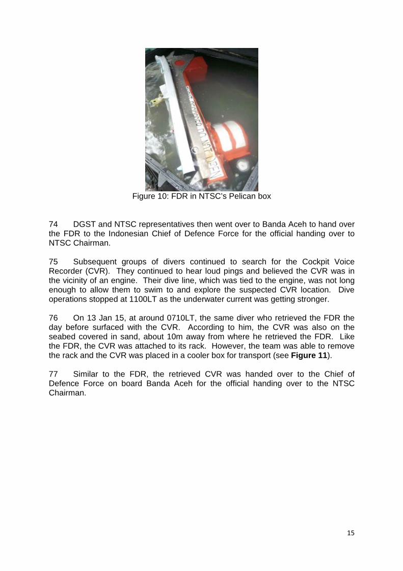
41 At around 0830LT, the team detected two ping signals. The team moved on to other locations and heard also the two ping signals at six other locations. In all,
4 The omni-directional detector was working properly during the equipment test performed on 2 Jan 15.
During second and third deployment attempts, the vessel encountered rough waves which caused the omni-directional detector to topple over a few times while being transported. This could have resulted in the malfunction of the omni-directional detector.

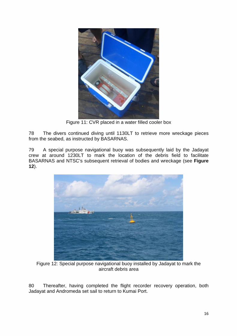
8
the team spent about four hours out in the sea and performed hydrophone listening at 13 locations to triangulate the ping signals. 42 The search team used the AAIB’s Flight Recorder Triangulation Software (FRTS) to derive, from the hydrophone listening results, an estimated position of the source of the ping signals (see Figure 4). This estimated source position was passed to the MPA specialists for them to plan their sonar scan. The MPA specialists scanned a 3km x 3km area centred on the estimated source position.
Figure 4: Results from hydrophone listening on 7 Jan 15
43 Meanwhile, at around 1030LT, Andromeda recovered a body and a debris piece found floating during her side scan survey south of Location 1. 44 At around 1200LT, the CAAC investigators on Andromeda deployed in another motorised wooden boat to perform ULB ping signal detection using the directional ULB detector at a location about 3km southeast of Jadayat’s location. This was near the location of the tail section of the aircraft found earlier. 45 Between 1245LT to 1530LT, the CAAC investigators detected a signal that sounded similar to a ULB’s ping signal at their first four locations. They did not hear the ping signal when listening from another four listening locations thereafter. Sonar scanning of seabed 46 At about 1755LT, the MPA specialists on Jadayat detected significant sonar contacts on the seabed. The contacts were scattered over an area of 100m x 40m and the largest object detected was about 15m x 3m x 3m. The spread and reflectivity of the sonar contacts suggested the presence of an aircraft debris field (see Figure 5). This suspected debris field was about 460m north of the estimated source position of the ping signals provided by the search team.
Estimated centre location from hydrophone listening
9
Figure 5 (Left): Side scan sonar fish being lowered into the water
(Right): Possible debris field identified by MPA’s side scan sonar
Second round of ULB ping signal detection 47 In view of the conflicting results achieved by the investigators on board Jadayat and Andromeda, three investigators on board Jadayat performed another round of hydrophone listening on 8 Jan 15 focusing on the debris field identified by the MPA team.
48 While this was going on, one of the CAAC investigators came on board Jadayat to share their results of the previous day’s operations as they had some reservations of their findings. From the playback, the frequency of the modulating tone in the recording was 2Hz, instead of the expected 1Hz, and the tone sounded very metallic. The CAAC investigator concurred and mentioned that the 2Hz tone was something which puzzled the CAAC team even though they had performed spectrum analysis of the signal on the previous evening and verified that its carrier frequency was 37.5kHz. 49 When the three investigators completed the second round of hydrophone listening, they confirmed the presence of the two ping signals which they heard the previous day and further localised the estimated position of the source of the ping signals. The FRTS suggested two possible ULB locations, about 180m apart, the more northern of the two being about 40m south of the debris field identified by MPA team. The coordinates of this northern point were then passed to the naval divers. (Dive operations will be detailed in the follow section).
Locating flight recorders using Autonomous Underwater Vessel 50 On 9 Jan 15, at 1030LT, two AAIB investigators and three MPA specialists went over to the vessel KN Trisula where a team of oceanic surveyors from Java Offshore, an Indonesian offshore company, were on board with a Teledyne Gavia Autonomous Underwater Vehicle (AUV) (see Figure 6). The AUV could perform side scan sonar, multi-beam sonar and photo-taking simultaneously. The General Manager of Java Offshore offered to perform a scan to locate the flight recorders.
Side scan sonar fish
10
Figure 6: Teledyne Gavia AUV
51 An AUV scan was performed in a 250m x 200m search area covering the main debris field and the two possible locations of the recorders as mentioned in paragraph 49 above. 52 The AUV was deployed at around 1330LT. During the scanning process, the AUV surfaced several times. Possible reasons for the AUV’s surfacing were avoidance of underwater obstacles, and strong currents that pushed the AUV out of the programmed survey line. The AUV scanning ended at around 1630LT. 53 The Java Offshore team reviewed the data gathered by the AUV. It was noted that the AUV did not complete the mission and the photos were not usable as the AUV had carried out the scanning about 3m above the seabed where the visibility was poor (visibility range was about 0.5 to 1m and the AUV was not equipped with lights).
54 The underwater search team personnel were also informed that Java Imperia, an oceanographic survey vessel belonging to Java Offshore, was on its way to the search area and it was equipped with the Sonardyne Ultra Short Base Line (USBL) system which had ping signal detection capability. Java Imperia also had DGPS positioning capability and was equipped with an Inertial Navigational System. This
11
would aid its USBL system in providing more accurate coordinates of the source of the ping signals. Locating ping signal using UItra Short Base Line system 55 On 10 Jan 15, at around midday, Java Imperia arrived on site and confirmed that its USBL system had the ping locating function which could enable it to detect the ULB 37.5kHz frequency. It was the first time that the crew used it in purely receiver5 mode. They consulted the manual before commencing the ULB ping signal detection attempt. 56 After completing the scan in about four hours, the Java Imperia’s USBL system identified a possible ULB location about 50m north of the more northern of the two positions identified by the search team in paragraph 49 above (see Figure 7).
Figure 7: Results from AAIB and Java Imperia’s ping detection
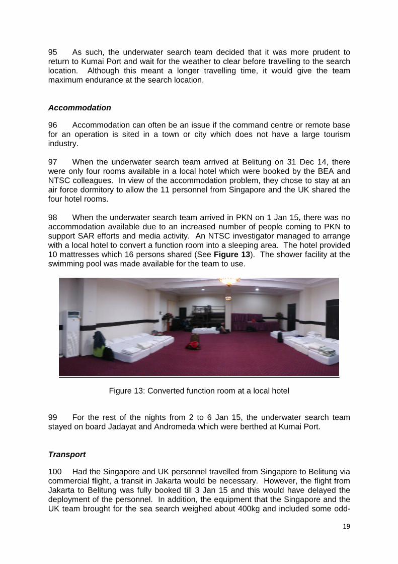
Dive Operations 57 Dive operations commenced on 9 Jan 15 at around 0600LT. The five naval divers on Jadayat went down in turn in teams of two with each team diving for 15 minutes. The directional ULB detectors were configured into diving mode for use by the naval divers. Prior to their deployment, the naval divers familiarised themselves with the operation of the directional ULB detectors to detect the ping signals. The search team had also requested the AirAsia Indonesia to provide information on the 5 The Java Imperia crew normally used the USBL in transceiver mode, i.e. the USBL system will send out signal
and receive the same signal when it is reflected by the object they wish to locate.
Northern likely ULB position based on AAIB’s hydrophone listening
Likely ULB position identified by Java Imperia

12
model of the ULBs installed on both flight recorders. The same model of the ULB was then used to replicate the ping signals during the training given to the divers to offer them the experience of how the detected signals felt like through the bone shaker. 58 The divers were also briefed on where the flight recorders were installed on the aircraft and how the flight recorders looked like. The divers were also advised to use their flashlight to search and look out for the reflection of the reflective tapes on the flight recorders. 59 After two dives, the divers returned to Jadayat. They reported hearing very loud ping signals using the ULB detector and seeing a large piece of wreckage which looked like a wing section. 60 The MPA team deployed their ROV at around 0815LT and obtained the first images of some debris pieces near the debris field identified by the MPA team (see Figure 8). The debris pieces appeared to be from an aircraft’s cargo compartment,
Figure 8 (Left): Picture of cargo sidewall lining captured on the MPA ROV’s first dive
(Right): SeaBotix ROV used by the MPA team
61 As there were only five divers on board Jadayat, the effective diving time was only about one hour each day. On 9 Jan 15, the NTSC representative, after discussing with the other search team members, requested for more divers. Nine more divers from the Indonesian naval vessel Banda Aceh (the On-scene Command Vessel) were made available to the search team, making a total of 14 divers. 62 The dive time on 10 Jan 15 was significantly extended with 14 divers taking turns to dive. However, the divers were hampered by strong underwater current as they were unable to hold the ULB detector in the direction of the strongest signal. Dive operations ceased at 0930LT. 63 At 1400LT, an NTSC and AAIB investigator went to the vessel Crest Onyx to survey the tail section that had been recovered from the seabed about 3km southeast of Jadayat. The wreckage recovered included:
a. The empennage section, less both horizontal stabilisers (Placards indicating frames C70, C71 and C72 were seen.)
b. Aft galley furnishing
13
c. Part of the main deck extending up to six windows from the rear d. Part of the aft cargo door
64 The underwater search team was informed that a team of 17 divers had previously searched the wreckage while it was still underwater but could not find any flight recorders.
65 On 11 Jan 15, dive operations commenced at 0550LT and continued until around 1030LT. Additional divers from the Indonesian naval vessel Banda Aceh arrived, making a total of 45 divers. The first detail of divers reported detecting strong ping signals and believed the recorders were covered in sand and being pinned below one of the engines. 66 The MPA team deployed the ROV during the second dive operation of the day but let the divers direct the ROV to the debris field for underwater pictures to be taken by the ROV’s camera, as there was no underwater camera available for the divers to use. The ROV pictures showed that the divers were in the vicinity of fuselage frame C77, at the tail of the aircraft. As the recorders were installed between frames C73 and C74, and as strong ping signals were being heard by divers in this area, the search team was confident that the recorders were in the vicinity. 67 It was extremely difficult for the divers to manoeuvre the ROV owing to strong currents. Thus, they did not use the ROV again. 68 The diver-in-charge on board Jadayat outlined two options (see Figure 9) for raising the engine and wing section, which were believed to be resting on the recorders.
(a) Option 1: To attach a sling to a point on the wing and use the crane (rated at 15 tonnes) on Jadayat to lift the wreckage.
(b) Option 2: To attach a sling to two points of the wing and use a balloon to lift the wreckage.

14
Figure 9: Illustration of possible methods to lift the aircraft wreckage
69 The diver-in-charge preferred Option 1 as it posed less risk to the divers and was less time-consuming (based on the experience he had lifting the tail section of the aircraft previously). However, the search team cautioned him that, instead of lifting the engine and wing section, the crane would drag the wreckage, and thus the flight recorders, along the seabed. This option might also not be preferable in view of a tear along the wing root area and of the fact that the wing and engine were partially submerged in sand. 70 On checking with the diver-in-charge, the search team realised that the divers were searching at a location about 50m away from the coordinates given by the search team. Apparently, they had not taken drift into consideration. Recovery of recorders 71 Dive operations resumed at 0545LT on 12 Jan 15. No decision was made on the previous day’s deliberation on how to lift the wreckage although a balloon rated to lift 5 tonnes was brought over to Jadayat and ready to be used. 72 On the second dive of the day, a diver successfully retrieved the Flight Data Recorder (FDR) which was still attached to its rack. According to him, it was buried under sand about 30m away from frame C77. The team attempted but, without the appropriate tool, was unable to separate the FDR from the rack, owing probably to the damaged connector. 73 The NTSC had prepared a Pelican case that was large enough to accommodate the FDR even with the rack attached, to transport the FDR (see Figure 10).
15
Figure 10: FDR in NTSC’s Pelican box
74 DGST and NTSC representatives then went over to Banda Aceh to hand over the FDR to the Indonesian Chief of Defence Force for the official handing over to NTSC Chairman. 75 Subsequent groups of divers continued to search for the Cockpit Voice Recorder (CVR). They continued to hear loud pings and believed the CVR was in the vicinity of an engine. Their dive line, which was tied to the engine, was not long enough to allow them to swim to and explore the suspected CVR location. Dive operations stopped at 1100LT as the underwater current was getting stronger. 76 On 13 Jan 15, at around 0710LT, the same diver who retrieved the FDR the day before surfaced with the CVR. According to him, the CVR was also on the seabed covered in sand, about 10m away from where he retrieved the FDR. Like the FDR, the CVR was attached to its rack. However, the team was able to remove the rack and the CVR was placed in a cooler box for transport (see Figure 11).
77 Similar to the FDR, the retrieved CVR was handed over to the Chief of Defence Force on board Banda Aceh for the official handing over to the NTSC Chairman.
16
Figure 11: CVR placed in a water filled cooler box
78 The divers continued diving until 1130LT to retrieve more wreckage pieces from the seabed, as instructed by BASARNAS. 79 A special purpose navigational buoy was subsequently laid by the Jadayat crew at around 1230LT to mark the location of the debris field to facilitate BASARNAS and NTSC’s subsequent retrieval of bodies and wreckage (see Figure 12).
Figure 12: Special purpose navigational buoy installed by Jadayat to mark the
aircraft debris area 80 Thereafter, having completed the flight recorder recovery operation, both Jadayat and Andromeda set sail to return to Kumai Port.

17
International Cooperation
81 The BASARNAS, which spearheaded the SAR effort, received valuable support from China, Japan, Malaysia, Russia, Singapore, South Korea and the United States. The BASARNAS managed its own resources together with those from these foreign countries, the Indonesian military and the provincial government to conduct the SAR. 82 On the investigation front, the NTSC received support from Australia, China, France, Russia, Singapore and the United Kingdom during the sea search phase and readout of the flight recorders. 83 For France, the BEA investigators participated and assisted as the State of Design and Manufacture in line with ICAO Annex 13.
84 AAIB Singapore and UK AAIB offered their assistance for the search of the flight recorders directly to the Chairman of the NTSC shortly after receiving news of the missing aircraft. Australia offered to the Chairman of the NTSC to provide a recorder specialist to assist in the readout of the recorder performed in the NTSC laboratory.
85 The Ministry of Foreign Affairs of Indonesia was contacted by China and Russia who offered their assistance for the search of the flight recorders and to support the search and rescue effort respectively.
86 The NTSC coordinated with the Ministry of Foreign Affairs of Indonesia for the necessary diplomatic clearance to be granted to the foreign participants even though the offers for assistance came in from various channels.
87 In the case of the AAIB-MPA team, the NTSC also facilitated in the smooth clearance of the large amount of equipment through the customs as the team arrived in Belitung.
88 Knowing that the foreign participants may not be conversant with the local language, the NTSC ensured that there was always one NTSC personnel assigned to each group of foreign participants to facilitate as a translator and the coordinator with its HQ.
89 While out the sea, the underwater search team was able to focus fully on the task of detecting and localising the ULB ping signal. For all other matters, in particular the request for more divers, the NTSC personnel on board the ships assisted in the coordination.
90 The successful multinational effort in retrieving and readout of the flight recorders underlined the importance of the close relationship which NTSC enjoys with its foreign counterparts. One of the avenues to develop such relations is through attending accident investigation related events such as the International Society of Air Safety Investigator (ISASI) seminars (and those of the regional chapter of AsiaSASI) or ICAO accident investigation meetings. As for the Asia and Pacific regions, there was developed an Asia Pacific Code of Conduct to foster a

18
cooperative spirit on accident investigation related matters. Within the Southeast Asia region, a memorandum of understanding was developed and agreed upon in 2008 by the governments to pledge their commitment for mutual assistance during an investigation into an accident. Clearly, it is important for such close relations to be developed before a crisis happens.
Challenges faced
Weather condition
91 The key challenge faced by the underwater search team was the weather condition as the Java Sea was experiencing the yearly monsoon season during the sea search period. 92 The weather had the following impact on the initial phase of the sea search:
a. The underwater search team was unable to perform hydrophone listening
as the motorised boats could only be safely deployed up to sea state 2. b. Above sea state 2, the underwater noise generated by the waves will
make detection of ULB ping signals using handheld hydrophones very difficult.
c. As the ULB battery life is officially rated for 30 days, the poor weather reduced the window of opportunity for the underwater search team to detect and localise the source of the ping signals.
d. The dive operations were limited to a maximum of four hour window between 7 to 11am due to strong underwater currents (beyond 3kt) building up after 11am daily. Hence, even when the Indonesian Navy provided significantly more divers, the efforts to retrieve the flight recorders were limited by the daily dive time.
e. The divers had to swim against the strong underwater current and this resulted in a reduced amount of time they had to search around the wreckage and attempt to locate the recorders.
f. Poor visibility of the water limited divers’ view and the use of AUV/ROV.
Logistics
93 The Jadayat and Andromeda both had seven days of endurance to stay out at sea. The only means of resupply was for the ships to return to Kumai Port, which required an 18-hour journey. 94 On two occasions, the underwater search team planned to anchor at the mouth of Kumai River (which would save about four hours of sailing time) to wait for the weather to pass before heading for the search location. However, that meant a reduction in the maximum endurance the team could have in the search area.
19
95 As such, the underwater search team decided that it was more prudent to return to Kumai Port and wait for the weather to clear before travelling to the search location. Although this meant a longer travelling time, it would give the team maximum endurance at the search location. Accommodation
96 Accommodation can often be an issue if the command centre or remote base for an operation is sited in a town or city which does not have a large tourism industry. 97 When the underwater search team arrived at Belitung on 31 Dec 14, there were only four rooms available in a local hotel which were booked by the BEA and NTSC colleagues. In view of the accommodation problem, they chose to stay at an air force dormitory to allow the 11 personnel from Singapore and the UK shared the four hotel rooms.
98 When the underwater search team arrived in PKN on 1 Jan 15, there was no accommodation available due to an increased number of people coming to PKN to support SAR efforts and media activity. An NTSC investigator managed to arrange with a local hotel to convert a function room into a sleeping area. The hotel provided 10 mattresses which 16 persons shared (See Figure 13). The shower facility at the swimming pool was made available for the team to use.
Figure 13: Converted function room at a local hotel
99 For the rest of the nights from 2 to 6 Jan 15, the underwater search team stayed on board Jadayat and Andromeda which were berthed at Kumai Port. Transport
100 Had the Singapore and UK personnel travelled from Singapore to Belitung via commercial flight, a transit in Jakarta would be necessary. However, the flight from Jakarta to Belitung was fully booked till 3 Jan 15 and this would have delayed the deployment of the personnel. In addition, the equipment that the Singapore and the UK team brought for the sea search weighed about 400kg and included some odd-
20
sized boxes. This would have resulted in significant excess baggage charges and likely required the equipment to be transported in more than one flight, given the limited cargo space available in narrow-bodied aircraft that operated between Jakarta and Belitung. It would also have been challenging for the underwater search team to arrange for land transport for both personnel and equipment. 101 When travelling from Singapore to Belitung, the airlift service provided by the Singapore Air Force allowed rapid deployment of the Singapore and the UK personnel and their equipment.
102 Similarly, the Indonesian Air Force provided the flight to help reposition the underwater search team and their equipment from Belitung to PKN.
103 For land transport, the Indonesian Army, Air Force and BASARNAS provided the vehicles and manpower needed when the underwater search team was moving from one point to another.
Learning Points
Search vessels
104 As the nature of SAR operations and underwater search of flight recorders are different, a vessel used for SAR operations may not be suitable for underwater search operation. Ideally, a dedicated vessel should be used for underwater search of flight recorders, for the deployment of ULB detectors and side scan sonars. 105 There should be more small boats available for the deployment of ULB detectors to effectively extend the area of underwater search. Dive operations
106 For dive operations, oxygen tank diving would limit the dive time. Where possible, umbilical diving which allows longer dive time should be considered. The availability of communications and image recording capabilities in some umbilical diving systems will allow a more efficient process of surveying the wreckage and recovering the flight recorders. 107 Divers may not be able to understand all that the investigators are trying to explain to them about aircraft details and use of equipment. This may affect the effectiveness of the search. One possibility is that investigators be trained as divers, at least in shallow sea. The investigators can then be paired with more professional divers. Equipment
108 It is desirable to bring along different sizes of waterproof bags to keep/protect electronic equipment.
21
109 As divers may not be familiar with aircraft parts, they may have difficulty describing what they see underwater. With underwater cameras, divers can record images of what they see so that they can explain more easily to the investigators. This is even more critical if the divers and investigators do not speak the same language.
110 The AAIB’s ULB detectors also do not have underwater compass, so it was difficult for the divers to know the direction underwater while operating the detectors. 111 It is essential for personnel on small boats, when deployed, to maintain communication with the mother ship. Walkie-talkies with longer range (about 5NM) would be desirable for maintaining communication with the mother ship. 112 Recorders recovered from underwater should be kept in water during transport. To avoid having to check the water level in the container and having to open up the container to verify the contents (e.g. when going through customs), transparent containers should be used.
113 During the ULB ping signal detection, it was noticed that signal was available from a sector of about 30° when closing in onto the target. This made pinpointing the ULB signal source extremely difficult. It has been suggested to use a signal damper (such as a rubber/foam tube attached to the hydrophone) to limit the detection sector. Hopefully, this can reduce the signal sensing sector and improve on the accuracy in locating the ULB signal. Communications
114 As the underwater search team operated in a remote area with no terrestrial based telecommunications, satellite phone was the only means of communication. Other than having voice communication, it would have been good if satellite data communications is available to allow the underwater search team to send document, photos and other data back to the headquarter and vice versa. Visual aids and documentation
115 There were many participants, such as the MPA team and divers, in the underwater search team who did not have aviation specific knowledge. It was found that the aircraft diagrams, with dimensions and other details, were useful during discussions. Hence, before deployment, copies of aircraft diagrams showing the colour scheme, dimensions, weight, etc., should be printed.
116 While underwater, divers may need to know how to unlock recorders from the rack where they are installed. They should practise unlocking with a lock mechanism mock-up. It will be useful for a flight recorder lock mechanism mock-up to be fabricated and brought along during deployment.
22
117 During the search of ULB signal, it would be desirable to record the detected ping signals. The audio recording could be replayed to those who did not have a chance to go out on a boat, in order to assure them of what the team has found.
Conclusion
118 The successful recovery of both flight recorders of QZ8501 was made possible through close cooperation among the various local and foreign agencies. The cooperation extended beyond the sea search when NTSC also received assistance from Australia during the readout of the flight recorders. 119 Even if an individual agency has the capability to perform underwater search for flight recorders, it is still beneficial to accept the offer of assistance by other foreign agencies for greater efficiency while searching for the flight recorders. The key challenge in this would be to coordinate all the available resources and assistance rendered by the foreign counterparts to conduct a successful sea search. 120 It is hoped that the experience and lessons learnt through this sea search will be beneficial for investigation agencies to develop or enhance their sea search capabilities.
- o -