
CESSIONS OF INDIAN TERRITORY. 35 - Hartford … OF INDIAN TERRITORY. 35 did not seek it, but it was...
5
CESSIONS OF INDIAN TERRITORY. 35 did not seek it, but it was brought to them j that they could not prevent it, nor could they possibly forbear from drinking it when it was within their reach j that they had lost all their manhood with their independence j that tltey were a degraded and disgraced racej tltat they now loolced upon the whiles as so milch their superiors that they would flat attempt to resist anything they did or should do. ' But,' continued the chief, elevating his dignified person, 'if our Great Father feels such an interest to preserve us as you mention. all-powerful as he is, why does he not command his people to abstain from seeking our destruction? He has but to will it and his will will be done. He can punish, -he can save us from the ruin which surrounds us.'" Words could not better have described the utterly abject and hopeless condition to which the tribe had fhllen, and in which (with ~ few exceptions) they remained until the time of their emigration (or rather exile) to the lands be- yond the Mississippi, which occurred a few yeam after the departure of their would-be benefactors, the missionaries. The chiefs of the tribe had ccded to the United States, by the Chicago Treaty of 1821, a vast scope of country, which may be describcd as including all of their ancient domain lying east of the St. Joseph River. Again, in 1828, they ceded to the government all of their possessions in Michigan between the St. Joseph River and Lake Mich- igan, except a tribal reservation of nearly fifty square miles area, whicb embraced the southeastern part of the present township of Buchanan, including Buchanan village, all of tbe township of Bertrand except its northwest corner, and all that part of Niles township which lies west of the St. Joseph River. On this reservation nearly all their villages were located, and here was the home of the tribe during the later years Qf their occupancy. Finnlly, .in September, 1833, this reservation-their last foothold-was ceded by them to the government, and the.y at the same time agreed to evacuate and remove from their lands within three years from that time. Long before the expiration of the time named in the treaty for their departure, however, they had bitterly repented of their promise to remove to the land of the setting sun, and prayed the Great Father that they mi!;ht be permitted to remain on the poor remnant of their ancient hunting-grounds, and to be buried near the graves of their fathers. Their request to remain was not gl1lDted,but their expulsion (for such it really was) was delayed until tbe fall of 1838, when the remnant of the once powerful tribe, now reduced to one hundred and fifty in number,* were called together at the McCoy Mission grounds, near Niles, for a " talk," which was understood as a preliminary to their final departure. At this convocation many protested earnestly ag-..linsttheir banishment, but it all resulted in a peremptory order from the government agents (Godfroy and Kercheval) to prepare for removal on a certain day. On that day they were gathered (but not all of them), and in charge of the agents, and escorted by two companies of United States troop!:1, detailed for this duty by order of Gen. Brady, they moved out on the Chicago road, some on foot, but many of the more helpless ~ As per pay-roll of 1837, based upon an estimate of Indian popn- IntlOn of Michigan, made by Henry R. Schoolcraft, United States I Indian agent. . i i ~ --- ones loaded in wagons, and in this way, dejected and sorrow- ful, they commenced their weary journey to new homes 'and hunting-grounds in Kansas. Not a few of them, however, escaped while on the way, and returned to the St. Joseph. These, with others who by some means had avoided being mustercd for removal in ] 838, wcre finally collected in the following year by Alexis Coquillard, and under his charge were removed to Kansas, where they joined those who had gone forward in the previous year. But Pokagon was not among those who emigrated to the West. He and a number of others of his band had em- braced the Catholic faith, and they were apprehensive that a removal to the wilderness beyond the Mississippi might in some way deprive them of the enjoyment of their re- ligion, as well as of the benefits of the partial civilization which they had acquired. They were therefore very deter- mined in their opposition to the removal, and Pokagon re- fused to sign or consent to the treaty by which the reserva- tion was relinquished until he and his fellow.Catholics had received guarantees that they should be allowed to remain in Michigan. After the departure of the tribe, Pokagon removed from his old home to Silver Creek, in Cass County, as has already been .mentioned. His death occurred at that place in 1841. Some of the Cathol.ic descendants of the Puttawallamies are still living at Silver Creek, and a few have their homes in the western part of Van Buren County. -- CHAPTER V. CESSIONS OF INDIAN TERRITORY-ERECTION OF COUNTIES AND TOWNS UPON IT. Indian Proprietorship of Lands recognized by the United States- Treaty of Greenville, 1795-Treaty of Detroit, 1807-Treaties of Springwells, 181:>,nnd Saginaw, 1819-Treaty of Chicago, 182t- Extensive Cession of Lands in Berrie>n and Van Buren Counties- Reservntions-Carey Mission Tract Ceded"-Treaty of Carey Mis- sion, 1827-Trcaty of 1828, at Carey Mission-Cession of Lnnds west of St. Joseph River-Treaty of Chloago, 1833-Cession of the Last of tbe Indiau Possessions on the St. Joseph-Erection of Counties and Towns on the Ceded Lands-Erection of WaJ"ne County-Territory of Berrien and Vnn Buren Counties nUnchcd to Monroe-Same attacbed to Lenaw_The Old Township of St. Joseph-Erection of Berrien and Van Buren Counties-Niles and Penn Townships. THE possCljSory title of the Indian tribes to the lands of which they were found in occupation has always been recog- nized by the United Statc>.sgovernment from the time of its formation, and the principle has been established that this title can only be acquired by the government, or with its consent, and can only be alienated from the native In- dians by their own voluntary act, done in public and open council, where the tribes arc represented by their chiefs and head men, and the government by its accredited agent or. commissioner. This principle has always been acted on and this method observed by the government in its treaties with Indians for the acquisition of their possessory rights in the public domain. TREATY OF GREENVILLE,1795. The first Indian treaty by which the aboriginal title to lands now within the State of Michigan was extinguished
Transcript of CESSIONS OF INDIAN TERRITORY. 35 - Hartford … OF INDIAN TERRITORY. 35 did not seek it, but it was...

CESSIONS OF INDIAN TERRITORY. 35
did not seek it, but it was brought to them j that theycould not prevent it, nor could they possibly forbear fromdrinking it when it was within their reach j that they hadlost all their manhood with their independence j that tltey
were a degraded and disgraced racej tltat they now loolced
upon the whiles as so milch their superiors that they wouldflat attempt to resist anything they did or should do. ' But,'continued the chief, elevating his dignified person, 'if ourGreat Father feels such an interest to preserve us as youmention. all-powerful as he is, why does he not commandhis people to abstain from seeking our destruction? Hehas but to will it and his will will be done. He can punish,-he can save us from the ruin which surrounds us.'"Words could not better have described the utterly abject
and hopeless condition to which the tribe had fhllen, and inwhich (with ~ few exceptions) they remained until thetime of their emigration (or rather exile) to the lands be-
yond the Mississippi, which occurred a few yeam after thedeparture of their would-be benefactors, the missionaries.
The chiefs of the tribe had ccded to the United States,
by the Chicago Treaty of 1821, a vast scope of country,which may be describcd as including all of their ancientdomain lying east of the St. Joseph River. Again, in1828, they ceded to the government all of their possessionsin Michigan between the St. Joseph River and Lake Mich-igan, except a tribal reservation of nearly fifty square milesarea, whicb embraced the southeastern part of the presenttownship of Buchanan, including Buchanan village, all oftbe township of Bertrand except its northwest corner, andall that part of Niles township which lies west of the St.Joseph River. On this reservation nearly all their villageswere located, and here was the home of the tribe during thelater years Qf their occupancy. Finnlly, .in September,1833, this reservation-their last foothold-was ceded bythem to the government, and the.y at the same time agreedto evacuate and remove from their lands within three yearsfrom that time. Long before the expiration of the timenamed in the treaty for their departure, however, they hadbitterly repented of their promise to remove to the land ofthe setting sun, and prayed the Great Father that theymi!;ht be permitted to remain on the poor remnant oftheir ancient hunting-grounds, and to be buried near thegraves of their fathers. Their request to remain was notgl1lDted,but their expulsion (for such it really was) wasdelayed until tbe fall of 1838, when the remnant of theonce powerful tribe, now reduced to one hundred and fiftyin number,* were called together at the McCoy Missiongrounds, near Niles, for a " talk," which was understood asa preliminary to their final departure. At this convocationmany protested earnestly ag-..linsttheir banishment, but itall resulted in a peremptory order from the governmentagents (Godfroy and Kercheval) to prepare for removal ona certain day. On that day they were gathered (but notall of them), and in charge of the agents, and escorted bytwo companies of United States troop!:1,detailed for thisduty by order of Gen. Brady, they moved out on theChicago road, some on foot, but many of the more helpless
~As per pay-roll of 1837, based upon an estimate of Indian popn-IntlOn of Michigan, made by Henry R. Schoolcraft, United States
IIndian agent. .ii~ ---
ones loaded in wagons, and in this way, dejected and sorrow-ful, they commenced their weary journey to new homes 'andhunting-grounds in Kansas. Not a few of them, however,escaped while on the way, and returned to the St. Joseph.These, with others who by some means had avoided beingmustercd for removal in ] 838, wcre finally collected in thefollowing year by Alexis Coquillard, and under his chargewere removed to Kansas, where they joined those who hadgone forward in the previous year.
But Pokagon was not among those who emigrated to theWest. He and a number of others of his band had em-
braced the Catholic faith, and they were apprehensive thata removal to the wilderness beyond the Mississippi mightin some way deprive them of the enjoyment of their re-ligion, as well as of the benefits of the partial civilizationwhich they had acquired. They were therefore very deter-mined in their opposition to the removal, and Pokagon re-fused to sign or consent to the treaty by which the reserva-tion was relinquished until he and his fellow.Catholics hadreceived guarantees that they should be allowed to remainin Michigan. After the departure of the tribe, Pokagonremoved from his old home to Silver Creek, in Cass County,as has already been .mentioned. His death occurred at thatplace in 1841. Some of the Cathol.ic descendants of thePuttawallamies are still living at Silver Creek, and a few
have their homes in the western part of Van Buren County.
--
CHAPTER V.
CESSIONS OF INDIAN TERRITORY-ERECTIONOF COUNTIES AND TOWNS UPON IT.
Indian Proprietorship of Lands recognized by the United States-Treaty of Greenville, 1795-Treaty of Detroit, 1807-Treaties of
Springwells, 181:>,nnd Saginaw, 1819-Treaty of Chicago, 182t-Extensive Cession of Lands in Berrie>n and Van Buren Counties-
Reservntions-Carey Mission Tract Ceded"-Treaty of Carey Mis-sion, 1827-Trcaty of 1828, at Carey Mission-Cession of Lnndswest of St. Joseph River-Treaty of Chloago, 1833-Cession of theLast of tbe Indiau Possessions on the St. Joseph-Erection ofCounties and Towns on the Ceded Lands-Erection of WaJ"neCounty-Territory of Berrien and Vnn Buren Counties nUnchcd to
Monroe-Same attacbed to Lenaw_The Old Township of St.Joseph-Erection of Berrien and Van Buren Counties-Niles andPenn Townships.
THE possCljSorytitle of the Indian tribes to the lands of
which they were found in occupation has always been recog-nized by the United Statc>.sgovernment from the time ofits formation, and the principle has been established that
this title can only be acquired by the government, or withits consent, and can only be alienated from the native In-
dians by their own voluntary act, done in public and opencouncil, where the tribes arc represented by their chiefs and
head men, and the government by its accredited agent or.commissioner. This principle has always been acted onand this method observed by the government in its treaties
with Indians for the acquisition of their possessory rightsin the public domain.
TREATY OF GREENVILLE,1795.
The first Indian treaty by which the aboriginal title tolands now within the State of Michigan was extinguished

36 HISTORY OF BERRIEN AND VAN BUREN COUNTIES, MICHIGAN.
was that which was concluded at Greenville, Ohio, Aug. 3,1795, by Gen. Anthony Wayne, on behalf of the UnitedStates, with representatives of the Pottawattarnie, JJ9an-dot, Sltawanoe, Ottawa, Cldppewa, and several other tribes.This treaty ceded to the United States a strip of Iana sixmiles in width, on and adjoining the west bank of the De-troit River, and extending from Lake St. Clair on the northto the river Raisin (the present eity of 1\Ionroe) on tbesouth, including, of course, the post of Detroit. On thistreaty, heading the list of chiefs of the "Poftawattarniesof the St. Joseph," appears the name of Thu-pe-ne-ba(Topinabc), whose name continued to bead the list of chiefsof his tribc, in treaties, from this time until 1833.
TREATY OF DETROIT, 1807.
The entire sautheastern part of Michigan was ceded tothe government by the treaty of Detroit, made and con-cluded Nov. 17, 1807, between Governor William Hull,commissioner and superintendent of Indian affairs, and thechiefs oftbe Pottawattamie, Ottawa, CMppelOa,and W9an-dot tribes. The territory here ceded extended westward totbe line which afterwards became the principal meridian ofthe State, and northward on that line to the centre of thepresent county of Shiawassee, from which point the northboundary of the ceded territory was drawn in a straightline to White Rock, on the west shore of Lake Huron.
TREATIES OF SPRINGWELLS,1815, AND OF SAGINAW,1819.
The three principal Indiaa nations of Michigan,-thePoftawatlamies, Cltippewas, and Otta.was,-by the offen-sive alliance which they madc with the British in the warof 1812-15, and their general conduct through that strug-gle, were regarded as having justly forfeited the landsreserved to them. The government, however, was notdisposed to enforce the forfeiture, but rather to adopt aconciliatory and friendly policy towards them; and in Sep-tember, 1815, Gen. William H. Harrison, Gen. McArthur,and John Graham, Esq., on the part of the United States,held a council with them at Springwells, near Detroit, where,on the 8th of that month, a treaty was concluded, by whichit was agreed that" the United States give peace to theCMppeu:a, Ottau;a, and Pottawaftamie tribes. They alsoagree to restore to the said CMppewa, Ottawa, and Potta-wattamie tribes all the possessions, rights, and privilegeswhich they enjoyed or were entitled to, in the year 1811,prior to the commencement of the late war with Gr€:atBritain; and the said tribes upon their part agree to placethemselves under the protection of the United St.-ttes,andof no other power whatsoever." And, at the same time,the treaty made at Greenvi\1e in 1795, and subsequenttreaties between these tribes and the United States, wereconfirmed and ratified.
The treaty of Saginaw, coneluded Sept. 24, 1819, eededan immense territory in Michigan, lying to the north andeast of a boundary line drawn due west from the" Indianboundary" (the principal meridian) to a point two or threemiles northeast of the village of Kalamazoo, and thencenorthward to the Thunder Bay River. At this treaty thePottuu:attarnies were not represented, for the. reason thatthey claimed no ownership in the lands there ceded.
TREATY OF CHICAGO,IS21.
In August, 1821, Gen. Lewis Cuss and Solomon Sibley,commissioners of the United States, met the sachems,chiefs, and warriors of the Pottawattamie, OUawa, andCIt'-ppewa tribes of Indians in council, at Chicago, andthere, on the 29th of that month, was made and concludeda treaty, by which those tribes ceded to the United States(excepting certain reservations) "all the land comprehendedwithin the following boundaries: Beginning at a point onthe south bank of the river St. Joseph, of Lake Michigan,near the Parc aux Vaches, due north from Rum's village,and running thence south to a line drawn due eastTromthe southern extreme of I.-ake Michigan, thence with thesaid line east to the tract ceded by the Poltawattarnies tothe United States by the treaty of Fort Meigs, in 1817, ifthe said line should strike the said tract,* but if the saidline should pass north of the said tract, then such line shallbe continued until it strikes the western boundary of thetract ceded to the United States by the treaty of Detroit, in1807; and from the termination of the said line, followingthe boundaries of former cessions, to the main branch of theGrand River, of Lake Michigan, should any of the saidlines cross the said river, but if none of the said lines sho~l!icross the said river, then to a point due east of t.he sourceof the said main branch of the said river, and from suchpoint., due west to the sourl)e of the said principal branch;and from the crossing of the said river, or from the sourcethereof, as the case may be, down the said riv€:r,on thenorth bank thereof, to the mouth; thence following theshore of Lake Michigan to the south bank of the said riverSt. Joseph, at the mouth thereof, and thence with the saidsouth bank to the place of beginning."
To this treaty of cession were signed the names of Com-missioners Cass and Sibley and the totemic signatures ofTopinabe Weesaw, and fifty-three other Pottawattamiechiefs and head men, affixed in presence of John R.Williams, adjutant-general of Michigan militia, AlexanderWolcott, Jr., G. Godfrey, and Whitmore Knaggs, Indianagents, John Kcnzie, sub-agent, H. Phillips, paymasterUnited States army, Jacob Visger, Henry 1. Hunt, R.Montgomery, John B. Beaubien, Conrad Ten Eyck, J.Whippley, George Miles, Jr., Henry Conner, James Ber-nard, and Jacob B. Varnum, United States factor.
The territory to which the Indian title was extinguishcdby this treaty included all of the prcsent county of Van-Buren and all tbat part of Berrien which lies east andnorth of the St. Joseph River (except nine individualreservations namcd below), with a tract one mile square onthe west side of tbat river. Besides these, it embraccd
nine entire counties, and parts of five other counties, all inthe southwest part of Michigan, and a strip ten miles widesouth of the Indiana linc.
All the southern portion of the territory (about four.-fifths of the whole) ceded at this treaty belonged to th"country of the ]>ottawattarnies; and in consideration ofthe cession the United States agreed to pay five thousand
'" It did not, however, strike the line named, but pMsed north of it;the territory ceded at Fort Meigs, in 1817, lying entirely south ofthe south line of Michigan.

CESSIONS OF I~DIAN TERRITORY. 37
dollars in specie,* yearly, to that tribe, for the term of
twenty years, and also to appropriate annually, for the termof fifteen years, the sum of one thousand doIlars, to be ex-
pended under direction of the President for t.he support ofa blacksmith and a teacher among the Indians. The cession
of one square mile of land on the west side of the St. Josephwas designated as the residence of the teacher and theblacksmith of the tribe, and it was to be selected and lo-cated under direction of the President of the United States.
The selection so made was nearly on the western bound-
ary of the present city of Niles, and the tract became theseat of the" Carey Mission," which is mentioned more
fully in the history of Niles.The individual reservations fl'om the tract ceded by this
treaty, within the county of Berrien, were described asfollows:
"To John Burnett, two sections of land."To James Burnett, Abraham Burnett, Rebecca Bur-
nett, and Nancy Burnett; each one section of land j whichsnid John, James, Abraham, Rebecca, and Nancy arc chil-dren of Kawkeemee, sister of Topinabe, principal chief ofthe Pottawattamie nation.
"To John B. I,a Lime, son of Nokenoqua, one-half ofa section of land adjoining the tract before granted, and onthe upper side thereof.
"To Jean B. Chandonai, son of Chippewaqua, two sec.tions of land on the river St. Joseph, above and adjoiningthe tract granted to J. B. La Lime.
"To Joseph Daze, son of Chippewaqua, one section .ofland adjoining the tract granted to Jean B. Chandonai."
The above-named reservations were to be laid out on the
north bank of the St. Joseph, commencing "about twomiles from the mouth," and to be laid out in succession upalong the bank of the stream. The ninth and last of the
individual reservations, within the present county of Ber.rien, was "To Madeline Bertrand, wife of' Joseph Bertrand,a Pottawattamie woman, one section of land at the Pare
aux Vaches, on the northeast side of the river St. Joseph."The treaty provided for a number of other individual
reservations, none of which were within the present countyof Berrien, but farther up the river. Among these, therewere reservations" to Joseph Bertrand, Jr., :aenjamin Ber-trand, Laurent Bertrand, Theresa Bertrand, and AmableBertrand, children of the said Madeline Bertrand, eachone-half of a section of land at the portage of the Kanka. .kee River." These were the half-breed children of the
trader Bertrand, who located on the. upper St. Joseph soonafter the Revolution, and whose name was given to oue ofthe townships of Berrien County.
TREATY AT CAREY MISSION, 1827.
. A treatywasheld by GovernorCassat the CareyMis.slont on the 19th of September,1827, at which time and
'" For the part ceded by the Ottawa. that tribe was to receive one
tbouSDpd dollars in specie, annually. The ChippnwaR, although twoof their chiefs signed the treaty, receh'ed nothing; hence it appearsthat no part of the ceded lands belonged to that tribe. The landsceded by the Ottawa. were those to the northward, along the GrandRiver. '
t This treaty is mentioned In the Revised Treaties of the United
Statesas being held at "St. Joseph,"by whichis doubtlessmeant.
place a number of small reservations were ceded to. theUnitcd States, "in order to consolidate some of the dispersedbands of the Pottawattamie tribe in the territory of Michi-gan, at a point removed from the road leading from Detroitto Chicago, and as far as practicable from the settlementsof the whites." A number of the reservations ccded at
that time were situated on the upper St. .Joseph, in thepresent county of St. Joseph, but none of them were lo-cated in Berrien or Van Buren.
CAREYMISSION TREATY, 1828.
A treaty council was held and a treaty concluded on the20th of September, 1828, "at the Missionary Establish-ments upon the St. Joseph, of Lake Michigan" (meaningthe Carey Mission, near Niles), between Lewis Cass andPierre Menard, on the part of the United States, and thechiefs and head men of the St. Joseph Pottawattamies, onthe part of their tribe. By this treaty, signed by Topi-nahet Pokagon, and sixty-seven other Pottawattamie ('hiefsand head men, there was ceded to the United States a tractof land described as " Beginning at the month of the St.Joseph, of Lake Michignn, and thence running up saidriver to a point on the same river, half-way between La-vache-qui-pisseand Macousin villagej thence in a directline to the nineteenth.mile tree, on the northern boundaryline of the State of Indiana j thence with the same westto Lake Michigan j and thence with the shore of the saidlake to the place of beginning."
The ceded territory within the boundaries thus de-scribed embraced all that part of the present county ofBerrien which lies west of the St. Joseph River, except atract of irregular shape, bounded on the south by the southline of the county, on the east and north by the St. JosephRiver, nnd on the west and northwest by a right line drawnfrom the point which forms the southwestern corner ofBertrand township and the southeastern corner of Galiento\vnship, on the south boundary of the county, to thepoint where the south line of section twelve of the town-ship of Buchanan. intersects the west bank of the St. Jo-seph River. This unceded tract (generally, though incor-rectly, mentioned as a reservation) embraced an area equalto about forty-nine square miles of territory, on whichwere located the villages and settlements of this division ofthe Pottawattamie tribe.
It was stipulated in the treaty, in the usual form, thatthe tribe should receive certain annuities-goods and cash-in consideration of the ceded lands. Also, that there
should be delivered to them annually a quantity of iron,steel, and tobaccoj that the sum of one hundred dollars perannum in goods should be paid to the chief Topinabe, dur-
ing his life j that a blacksmith should be kept permanentlyamong them at the expense of the United Statesj and
that it \Vas held on the river of that name. The Rev. Isaac McCoy,in his History of Baptist Missions, says, on page 319, "On the 17thof Septemher, 1827, His Excellency Lewis Cass and suite arrived atCarey, for the purpose of holding a treaty with our Patawalamieneighbo~, whom, by runners sent before him, he had assembled atour house. At this treaty se\'era1 small reservations on the north
sidc of the St. Joseph's were consolidated Inlo one; five bundred dol-
lars' worth of goods were paid them, and an annuity of twenty-fivehundred dollars."
38 HISTORY OF BERRIEN AND VAN BUREN COUNTIES, MICHIGAN.
that the government should also provide three laborers towork for the St. Joseph tribe four months in the year forten years. To Madeleine Bertrand, wife of Joseph Ber-trand, was granted one section of land, but it was not lo-cated nor described. Her claim on account of this grantwas afterwards purchased by Obed P. Lacey, of Niles, who,after several years' delay, obtained lands at West Nilesunder the grant.
TREATY A.T CHICAGO, 1833.
The last of the Indian land in Berrien County (beingthe tract mentioned above as bounded east by the St. Jo-seph River and south by the south line of the county) wasccded to the United States by articles supplementary to atreaty made at Chicago, Sept. 26, 1833. The supplement-ary articles were signed on the 27th of the same month byGeorge B. Porter, Thomas J. V. Owen, and William Weath-erford' commissioners on the part of the United States,and by Topinabe, Pokagon, Weesaw, and forty-five otherchiefs and hcad men, on the part of the PoUawattamres.This last relinquished possession of the St. Joseph Indiansis described in the article of cession as "the tract of land
.on St. Joseph River, opposite the town of Niles and extend-ing to the line of the State of Indiana, on which the vil-ages of To-pe-ne-bee and Po-ka-.gon are situated; supposed
to contain about forty-nine sections."The stipulation made for the final removal of the Indians
from the ceded tract was embraced in the third supplement-ary article, as follows: "All the Indians residing on thesaid reservations in Michigan [having reference not only tothis tract, but also to small reservations farther east, in thecounty of St. Joseph and elsewhere] shall remove there-from within t,hree years from this date, during which timethey shall not be disturbed in their possession, nor in hunt-ing upon the lands as heretofore. In the mean time nointerruption shall be offered to the lIurvey and sale of thesame by tbe United States. In case, however, the saidIridians shall sooner remove, the government may takeimmediate possession thereof." This was the beginning ofthe eDd of the Indian occupation. It has been told inpreceding pages how they were allowed to linger for a timeafter the expiration of the period named in the treaty of1833, but were (with the exception of Pokagon and a num-ber of others who had become converted to the Catholic re-
ligion) finally gathered together and removed beyond theMississippt
ERECTION OF COUNTIES AND TOWNS ON THE CEDEDLANDS.
The county of Wayne was erected by proclamation ofLewis Cass, Governor of the Territory of Michigan, Nov.
21,1815,* to embrace" that part of the Territory of Mich-
igan to which the Indian title has been extinguished." As
the first extinguishment of Indian title t{) any part of the
. Territorial Law8, voL,i. p. 323.
tenitory now embraced in the counties of Berrien and VanBuren was accomplished by the Chicago treaty of Aug. 29,1821, nearly six years after the establishment of WayneCounty by Governor Cass, consequently that county, em.bracing only territory to which the Indian title had thenbeen extinguished, included no part of Van Buren or Ber-rien County, though a contrary belief has prevailed to someextent.
By executive act dated Sept. 10, 1822, it was pro-claimed by Governor Cass thatt "an the country wit.hinthis territory to which the Indian title was extinguishedby the treaty of Chicago shall be attached to, and composea part of, the county of Monroe." By the same executiveact the county of Lenawee was erected, and also attachedto Monroe.
The territory thus attached to the county of Monroe in-cluded all of the present county of Van Buren, and allthat part of Berrien which lies north and east of the St.Joseph River; and it continued to be a part of that countyuntil Dec. 31, 1826,-the date of operation of an act of theLegislative Councilt (approved Nov. 20th of that year) bywhich the county of Lenawee was organized, and whichprovided that" all the country within this territory towhich the Indian title was extinguished by the treaty ofChicago shall be attached to, and compose a part of, thecounty of Lenawee."
The (old) township of St. Joseph was erected by act ofthe Legislative Council (approved April 12, 1827), to in-clude all the lands within the Territory of Michigan whichwere ceded at the treaty of Chicago.
In an act (approved Sept. 22, 1829) amendatory to theact organizing the counly of Laoawee, it was provided§"that all the country within this territory to which theIndian title was extinguished at tbe treaty held at the CareyMission in 1828 shall be attached to the county of Lena-wee, and the said district shall composea part of St. Josephtownship." Tbis added to the county and township namedall tbat part of the present county of Berrien lying westand south of the St. Joseph River, except the tract whichstill remained in possession of the Indians, embracing thesoutheast comer of the township of Buchanan, nearly allof Bertrand, and the part of Niles lying on the south andwest side of the St. Joseph River.
The counties of Berrien and Van Buren were erected
by act approved Oct.. 29, 1829, and one week later an actwas approved forming the towns of Niles aod Penn, theformer including all the territory of Berrien, and the latterall that. of Van Buren, both ot which had, up to that time,been included in (old) St. Joseph township. In the sep-arate histories of BerrieD and Van Buren a more extended
account will be given of the erection and organization ofthe two counties, and also of the several townships whichhave been formed within them.
t Ibid., pp. 336, 336.t Ibid., vol. ii. p. 292.l Ibid., p. '109.
NAVIGATION. 39
CHAPTER VI.
NAVIGATION-HARBOR IMPROVEMENTS.
The Lake COBSt and Harbors of Berrien and Van Buren Counties-
St. Joseph the Port of Destination of tbe first Vessel that eversniled tbe Upper Lakes-Tbe first Ship-Timber ever cut on tbeSbores of Lake Micbigan sawed at St. Josepb-Vessels runningto aDd from tbe Moutb of tbe River before tbe Year 1800-Vessels
bringing Supplies for tbe Carey Mission as e:Lrly as 18211- Capt.Hinckley" jumps the.Bar" at tbe Moutb of the River in 1827-
RILpid Increase of Commerce and Shipping-Navigation by LakeSteamers running to 5t. Josepb-Tbe 5tenmer Line from Cbicago
connecting witb Stages at 8t. Josepb-Decrease of Trade at tbeMoutb of tbe River on Completion of tbe Central Railroad-RapidIncrease of Steam Navigation caused by Development of the FruitInterest-Ship-Building on the St. Josepb River-Inland Naviga-tion on tbe St. Josepb-Keel-Boats, "Arks," Pirogues, and RiverSteamers-Tbe "St. Josepb Navigation Company"-Destructionof tbe Trade by tbe Central Railroad-Navigation at New Buffalo-First arrival of a Sailing Vessel there, in 1835-Steamer I.ine inCODnectionwith the Micbigan Central Railrond-8hipping Facili-ties at Soutb Haven-Lake Steamers at tbat Port-Ship-Buildingat tbe Moutb of tbe Blnck River-Harbor Improvements at St.
Josepb, New Buffnlo, and Soutb Haven.
THE counties of Bcrrien and Van Buren, of which Lake
Micbigan forms t.he western boundary, bave, together, acoast line of about sixty miles in lengtb, beginning at theextreme soutbwestern corner of tbe State of Micbigan,and extending thence in a general nortbeasterly direction.On this section of coast line there are situated three lake
barbors. Near its southwestern extremity is the harbor ofNew Buffalo, and equally near its nortbeastern terminationis the port of South Haven, at the mouth of Soutb BlackRive:-, in the northwestern corner of Van Buren County.About midway between these two is tbe port of St. Joseph,at the mouth of the river of tbe same name, in the countyof Berrien.
Of these three harbors St. Joseph is the most impor~tant, as it is also by far the oldest in its use as a port forvessels navigating tbe lake. More than two bundred yearsa~ it was known as a harbor, and when, in tbesummer of1679, tbe first vessel that ever floated on the upper lakes-tbe little" Griffin"-Ieft her anchorage in the NiagaraRiver, and, spreading ber sails to the Qreeze for the firsttime, bore away westward through the bright waters ofErie, she was bound for a haven at the mouth of the"river of the Miamis," which is now known as the St.Joseph. Her commander, La Salle, in planning his expe-dition of discovery to the Mississippi, had decided on thisplace as his base of operations .on Lake Michigan, for hehad learned from the men who had previously passed thisway with Marquette that here was a practicable entrancefrom tbe lake, and that bere his vessel could lie in safetyin the old cbannel of tbe river (which was then some dis-tance south of the present mouth), securely moorcd to theland, behind the sheltering sand-bills, wbile his canoes,floating in still water by her side, could receive their lading,~nd then glide away up the stream many scores of mileslOootbe interior on his proposed route to tbe Illinois andtbe Mississippi.
It is true that the" Griffin" never rcached this port ofher destination, for the reason that on touchin<7 at an'1 ' 018and near the mouth of Green Bay, she. found awaiting
her there a large quantity of furs, which it was necessaryto have transported east without delay, and, freigbted withthese, she sailcd back, bound for Niagura, but with ordersfrom tbe commander to deliver the cargo with all prac-ticable dispatch, and then return immediately to meet himat the mouth of the Miamis (St. Joseph); and here, fromthe high plateau that borders the south bank of the river,he kept long and weary watch for her coming, and builtbeacon fires at night, and anxiously scanned the dark-bluehorizon line of tbe lake by day, to catch tIle first glim-mer of her wbite sails,-a sight that never gladdened hiseyes, for she did not return, nor were any tidings of herever received. When all hope of tbe "Griffin's" safetywas gone, his next plan was to supply ber place by a secondvessel, to be built at the mouth of the St. Joseph, and forthis purpose a saw-pit was preparcd, and tbe timber andplanks were sawed out ready for her construction; but theadverse fortune which constantly attended J~a Salle pre-vented the execution of his plan, and so tbis first sbip-building project on the St. Joseph came to naught.
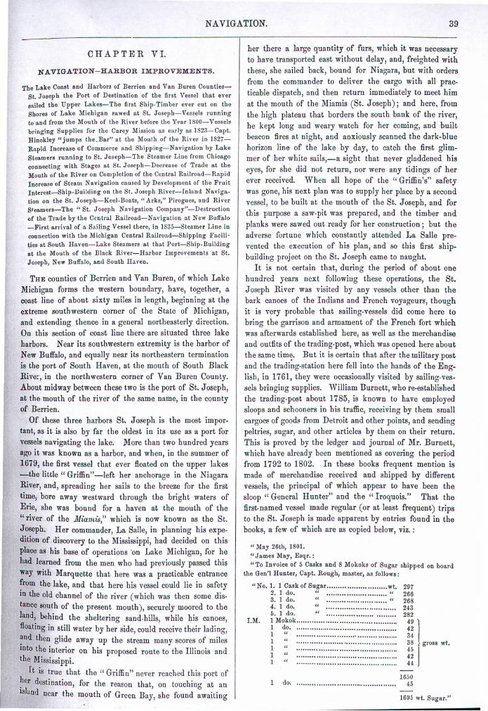
It is not certain that, during the period of about onehundred years nex~ following these operations, the St.Joseph River was visited by any vessels other tban thebark canoes of tbe Indians and French voyageurs, thoughit is very probable that sailing-vessels did come here tobring tbe garrison and armament of tbe French fort whichwas afterwards established here, as well as the merchandiseand outfits of tbe trading-post, which was opened here aboutthe same tim~. But it is certain that after tbe military postand tbe trading-station here fell into the hands of- the Eng-lish, in 1761, tbey were occasionally visited by sailing-ves-sels bringing supplies. William Burnett, who re-establishedthe trading-post about 1785, is known to have employedsloops and S"choonersin his traffic, receiving by them smallcargoct' of goods from Detroit and other points, and sendingpeltries, sugar, and other articles by them on their return.This is proved by the ledger and journal of Mr. Burnett,which have already been mentioned as covering tbe periodfrom 1792 to 1802. In these books frequent mention ismade of merchandise received and shipped by differentvessels, tbe principal of which appear to have been thesloop" General Hunter" and the" Iroquois." That thefirst-named vessel made regular (or at least frequent) tripsto the St. Joseph is made apparent by entries found in thebooks, a few of wbich are as copied below, viz.:
" May 26tb, 1801.
"James 1I1a.y,Esqr.:
"To Invoice of 5 CBSka and 8 Mokoks of Sugar shipped on boardthe Gen'l Hunter, Capt. Rougb, master, as follows:
"No.1. 1 Cask of Suga.r wt.2. 1 do. " '"'''''' "3. 1 do. " '''''' "4. 1 do. " ............5. 1 do. " .........
I.M. 1 Mokok ...........1 do. .........1 " """"''''''''''1 " .............................................1 " .............................................1 " .............................................1 " .................
297266268243282
49
1
423438
J
gross wt.454244
1 do. ...........................1650
45
1695 wt. Sugar."


