CE-405 STRUCTURAL ENGINEERING - WEC...
16
1 1 CE-405 STRUCTURAL ENGINEERING Credit Hours (3+0) Instructor: Muhammad Haroon Assistant Professor, Wah Engineering Colleg, Univ of Wah
-
Upload
nguyenhanh -
Category
Documents
-
view
215 -
download
0
Transcript of CE-405 STRUCTURAL ENGINEERING - WEC...

1 1
CE-405
STRUCTURAL ENGINEERING
Credit Hours (3+0)
Instructor:
Muhammad Haroon
Assistant Professor,
Wah Engineering Colleg, Univ of Wah

2 2
SEISMIC ZONING MAP
OF
PAKISTAN
3
3
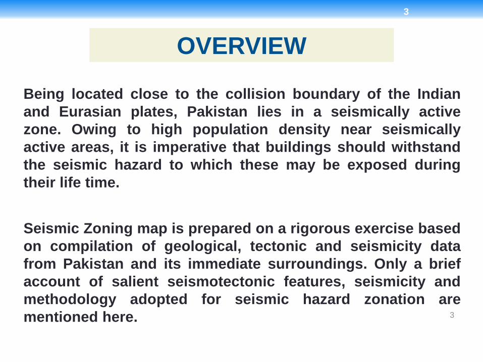
Being located close to the collision boundary of the Indian
and Eurasian plates, Pakistan lies in a seismically active
zone. Owing to high population density near seismically
active areas, it is imperative that buildings should withstand
the seismic hazard to which these may be exposed during
their life time.
OVERVIEW
Seismic Zoning map is prepared on a rigorous exercise based
on compilation of geological, tectonic and seismicity data
from Pakistan and its immediate surroundings. Only a brief
account of salient seismotectonic features, seismicity and
methodology adopted for seismic hazard zonation are
mentioned here.

4
4
1. Main Karakoram Thrust
2. Raikot Fault
3. Panjal-Khairabad Thrust
4. Riasi Thrust
5. Salt Range Thrust
6. Bannu Fault
7. Chaman Transform Fault
8. Quetta-Chiltan Fault
9. Pab Fault
10.Allah Bund Fault
11.Hoshab Fault
12.Makran Coastal Fault
Major Faults of Pakistan
Major active faults of Pakistan and surrounding areas that strongly influence
the seismic hazard are listed below:
13.Main Mantle Thrust
14.Main Boundary Thrust
15.Himalayan Frontal Thrust
16.Jhelum Fault
17.Kalabagh Fault
18.Kurram Fault
19.Ornach-Nal Transform Fault
20.Kirthar Fault
21.Kutch Mainland Fault
22.Nagar Parkar Fault
23.Nai Rud Fault

5
5
SEMINAR ACI CODE
After NESPAK 2006
Tirich Mir-Misgar F. MKT
MMT
Panjal T.
MBT
Raisi T. Jhelum F.
Kalabagh F.
SRT
Indus-Kohistan F
Muzafarabad T.
Kurram T.
Waziristan T.
Sulaiman Frontal T.
Kirthar F.
Pab F.
OrnachNal F. MakranSubduction Zone
Chaman F.
Ghazaband T.
Hoshab F.
Hoshab F.
Rann of Kuchh F.
Fault Map of Pakistan
6
6
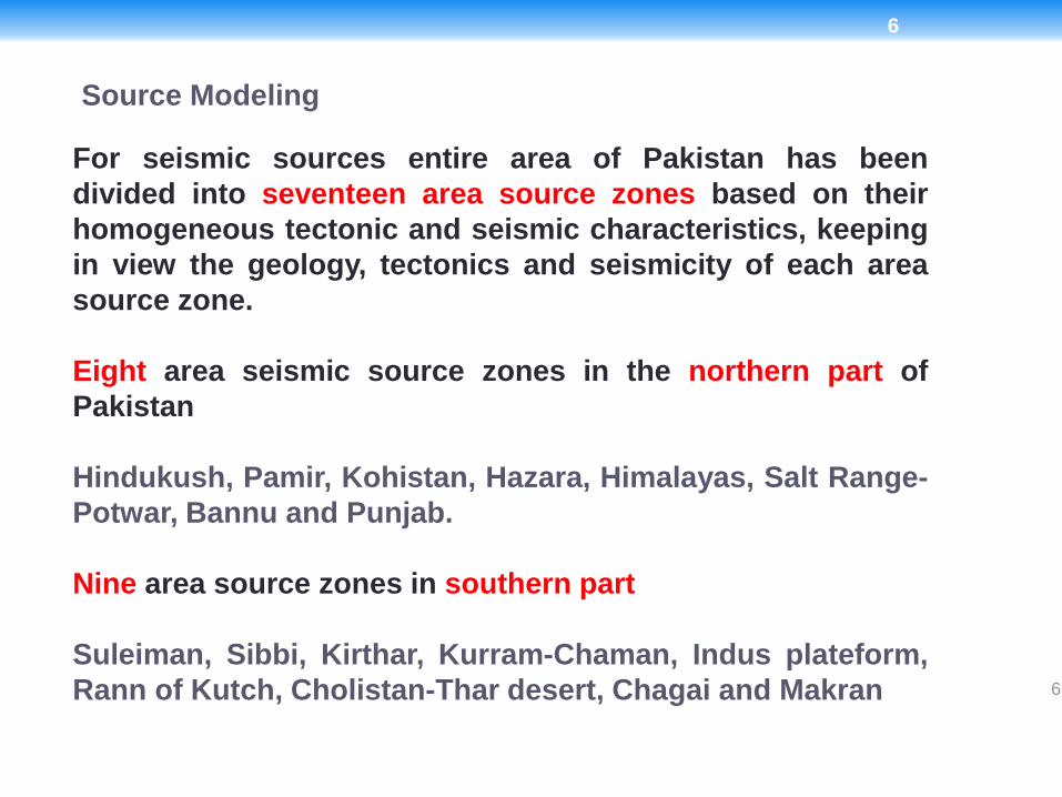
For seismic sources entire area of Pakistan has been
divided into seventeen area source zones based on their
homogeneous tectonic and seismic characteristics, keeping
in view the geology, tectonics and seismicity of each area
source zone.
Eight area seismic source zones in the northern part of
Pakistan
Hindukush, Pamir, Kohistan, Hazara, Himalayas, Salt Range-
Potwar, Bannu and Punjab.
Nine area source zones in southern part
Suleiman, Sibbi, Kirthar, Kurram-Chaman, Indus plateform,
Rann of Kutch, Cholistan-Thar desert, Chagai and Makran
Source Modeling
7
7

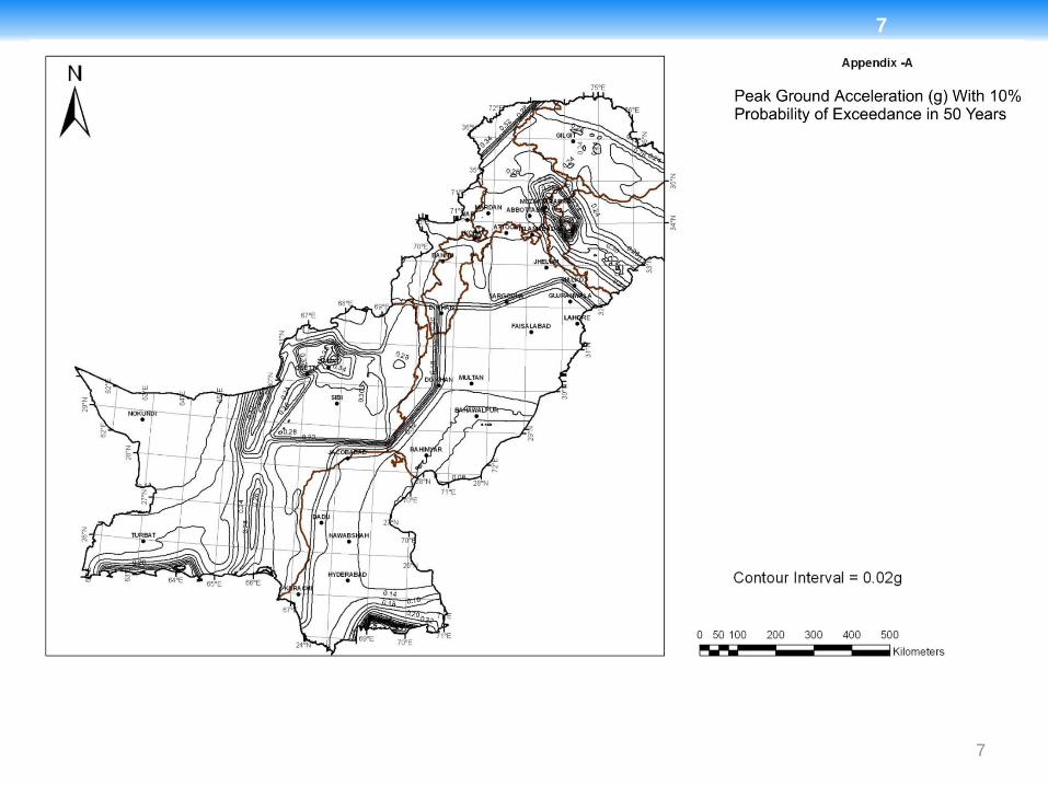
8
8
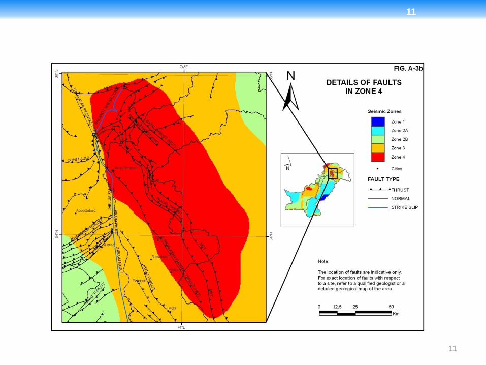
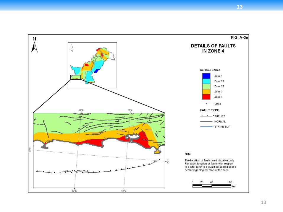
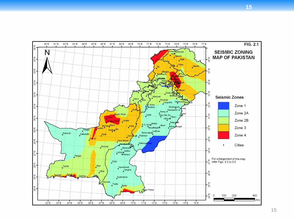
On the basis of PGA values, Pakistan has been divided into five seismic zones in line with UBC97. The boundaries of these zones are defined on the following basis:
Zone 1 0.05 to 0.08g
Zone 2A 0.08 to 0.16g
Zone 2B 0.16 to 0.24g
Zone 3 0.24 to 0.32g
Zone 4 > 0.32g
The seismic zoning map of Pakistan on this basis is shown in Fig. 2.1.
Seismic Zoning

9
9
SEISMIC ZONING MAP OF PAKISTAN
Zone 1 0.05 to 0.08g
Zone 2A 0.08 to 0.16g
Zone 2B 0.16 to 0.24g
Zone 3 0.24 to 0.32g
Zone 4 > 0.32g

10
10
11
11

12
12
13
13

14
14
15
15

16
16
THANK YOU