Catskill Scenic TrailCCatskill Scenic Trailatskill Scenic ...
Upload
doankhuongCategory
view
219download
0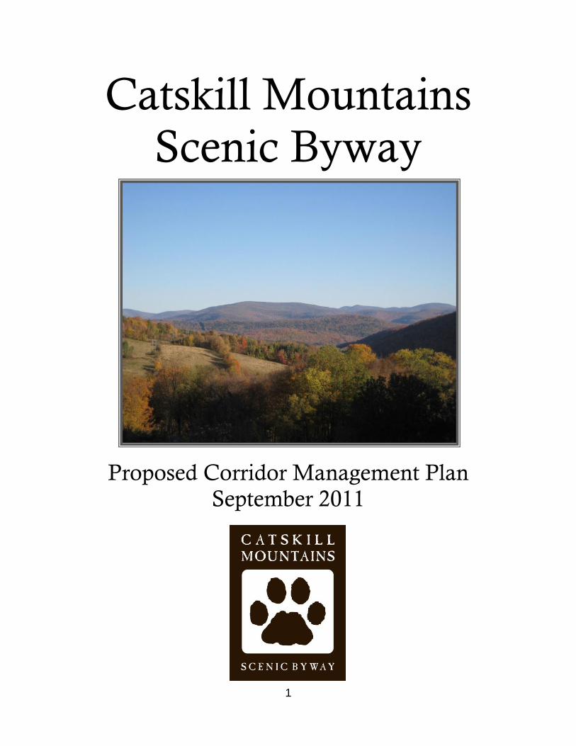
1
Catskill Mountains
Scenic Byway
Proposed Corridor Management Plan
September 2011

2
This plan was prepared by the Central Catskills Collaborative in cooperation with the Catskill Center for Conservation and Development and funded in part by the Catskill Watershed Corporation.
Central Catskills Collaborative
Alex Adelson and Martin Donnelly (Town of Andes) John Duda and Peggy Kearney (Village of Fleischmanns)
Melinda McKnight (Town of Hurley) Fred Miller and Carol O‟Beirne (Village of Margaretville)
Diane Galusha and Brian Sweeney (Town of Middletown) Helen Chase and Robert Selkowitz (Town of Olive)
Doris Bartlett and James Krueger (Town of Shandaken)
Past Collaborative Members
Harriet Grossman (Village of Fleischmanns) Dave Budin (Village of Margaretville)
Mike Finberg and Don Kearney (Town of Middletown)
Project Coordinator
Peter Manning, Regional Planner Catskill Center for Conservation and Development
Contributors
Barbara Puglisi, Economic Development Specialist,
Catskill Watershed Corporation Gabrielle Voeller, Cornell University Intern
This project would not have been possible without the participation and contributions of the citizens of the Central Catskills and agency staff from New York State DEC and DOT, Delaware and Ulster Counties, New York City Department of Environmental Protection, the Catskill Watershed Corporation, the Central Catskills Chamber of Commerce, the Catskill Center, and others.

3
Table of Contents
Executive Summary Regional Background Nature and Description of the Byway Route Scenic Byway Route Map Scenic Byway Regional Map Brief History of Route 28 Focus on Route 28 The Central Catskills Collaborative and Public Participation Vision Statement and Theme Development Corridor-Wide Resource Inventory Catskill Park New York City Watershed Proposed Catskill Interpretive Center Proposed Water Discovery Center Belleayre Mountain Ski Center Ulster and Delaware Railroad Corridor The Waterways SUNY ESF Regional Planning Studio Central Catskill Mountains/ Park Smart Growth Program Local Resource Inventory Town of Olive Town of Shandaken Village of Fleischmanns Town of Hurley Village of Margaretville Town of Middletown Town of Andes Stewardship Tourism Development
PAGE 5 7 8 9 10 12 14 17 19 21 21 23 24 24 25 26 29 30 32 32 33 43 51 57 64 69 77 82 90
4
Marketing and Promotion Resources Interpretation Financial Resources Support and Implementation Transportation Safety Summary of Recommendations Appendices 1. Municipal Nominating Resolution 2. Letters of Support 3. Establishing Resolution of the Central Catskills
Collaborative 4. Advisory Membership of the Central Catskills
Collaborative 5. Summary of meetings of the Central Catskills
Collaborative 6. Press Releases and Articles (Examples) 7. SUNY ESF Regional Planning Studio, Select Posters 9. Smart Growth Award Descriptions 8. Off-Premise Sign Inventory
96 99 100 102 104 108

5
Executive Summary
The Catskill Mountains Scenic Byway is a celebration of place. Formal designation of the proposed route by the State of New York will bring greater recognition and interpretation of the resources that make this place special. The Catskill Park and the New York City Watershed, in particular, are defining elements of this wild and scenic region. Communities along the route are fortunate to be located within such a unique and environmentally pristine area; yet their economic health depends in large part on maximizing the relationship between the natural qualities of the area and the visitors who wish to experience the beauty of the region and its many offerings. This plan sets a strategy for strengthening these connections while preserving the character of the route, and in doing so it is an affirmation of the collaborative spirit that has guided this nomination process.
This corridor management plan puts forth a comprehensive nomination to designate
sections of State Routes 28, 28A, 214, 42 and local roads (approximately 76 miles) as a
scenic byway (see route description p.8 and map p.9).
The Central Catskills Collaborative serves as the nominating committee and has
carefully considered the designation criteria and guidance in New York State‟s Scenic
Byways Nomination Handbook, as well as other sources, in the development of this
corridor management plan (CMP).
This CMP begins by setting the nomination in the context of the Catskill Region – its rich
natural and cultural history and other defining characteristics. In doing so, it helps
develop the understanding, embraced by the nominating committee, that the protection,
enhancement, and promotion of the corridor‟s scenic and intrinsic qualities are a key
strategy in the region‟s future economic vitality. Moving from this Regional
Background, the Description and Nature of Byway Route focuses on the details of
the proposed byway and immediate context. The Brief History of Route 28 reviews
major points in the development of this route as the primary access into the Central
Catskills. The introductory foundation is completed with Focus on Route 28, which
provides the necessary sketch of the numerous efforts over the years to protect and
promote Route 28 and its associated resources.
The CMP then treats each of the state-required components of a byway nomination,
beginning with The Central Catskills Collaborative and Public Participation. This
section is critical in illustrating the how this project is very much a locally driven
nomination steeped in public involvement and embraced by the community at large,
including the media. The Vision Statement and Theme Development discussion
reveals how local energies were focused into establishing a guide for a revitalized

6
corridor, illustrating consensus and setting goals to aspire toward. The vision also
provides a framework for the more-in depth components of the plan that follow.
The inventory is balanced by Corridor-Wide and Local Resource Inventories which
emphasize the major shared resources that help unite the communities as parts of the
whole and detail many of the individual points of interest that express local flavor and
intrigue for future byway travelers. Recommendations for the future of the byway
emerge from many of these inventories. The next several sections build upon these
recommendations and set forth numerous additional recommendations related to their
requisite scopes. These sections are Stewardship, Tourism Development, Marketing
and Promotion, Resources Interpretation, Financial Resources, Support and
Implementation, and Transportation Safety. The roles of local leadership and public
process are woven into these discussions, while a theme that emerges in advancing
their recommendations is the importance of partnerships. Collectively, these sections
further express the peoples‟ appreciation of the corridor‟s qualities while articulating how
a scenic byway is ideally suited to promote environmental quality and stimulate related
economic growth in the Central Catskills. The main portion of the CMP concludes with a
summary of Recommendations, Strategies, and Objectives.

7
Regional Background The Catskill Mountains figure prominently into the history and culture of New York and
the United States, but they also dwell in the imaginations of countless visitors and
residents who have fallen under their spell. Initially feared as a dark, inhabitable
wilderness, the Catskills became the setting where Americans first developed an
appreciation for the natural world through arts and literature. Author Washington Irving
(1783-1859) was among the first to be captured by the beauty and the mystery of the
Catskills and expressed this wonder in his works. The story of Rip Van Winkle (1819)
casts the Catskills as a fairyland in the imaginations of Americans, including early
tourists from New York City and Philadelphia who would soon flock to the mountains to
explore the mysteries and enchantments. Much of the allure is attributed to the fact that
the Catskills‟ rise sharply in the west from the Hudson Valley and create dramatic
scenery and ideal subjects for artists. Artist Thomas Cole (1801-1848) broke from the
tradition of painting the mountains from afar and journeyed into the Catskills, capturing
wild scenes that garnered high acclaim in
urban art circles. In 1824, the Catskill
Mountain House was located atop the
eastern escarpment of the mountains,
overlooking the Hudson River and soon
becoming a most popular tourist
destination. This spawned the
development of numerous mountain
houses, many of which would occupy the
interior of the mountains and be reachable
by railroad after mid-century.
Meanwhile, the rise of industry in the mountains – most notably logging, bluestone
quarrying, and tanning – provided economic stimulus but threatened the very qualities
the tourists were coming to appreciate. By late century, New York State created the
Forest Preserve and adopted the “forever wild” clause in the Constitution. In 1904, the
Catskill Park was created and all
lands acquired inside the “blue line”
of the Park would become part of the
forest preserve. During the 20th
century, six reservoirs were
constructed in the Catskills as part of
New York City‟s water supply system.
The popularity of the southern
Catskills among New York City‟s
Jewish communities, the decline of
Asher Durand, Shandaken Mountains, 1853

8
the railroads, and the advent of the automobile and airplane all contributed to a shift in
tourism patterns. As mountain houses and rustic retreats faded from the landscape,
more publically accessible state lands became part of the Catskill Forest Preserve. In
the 1990s, tensions escalated between New York City and Catskill communities
regarding proposed regulations in the upstate watershed at the core of the region.
Geologically speaking, the Catskills are young mountains, and are actually not
mountains in the truest sense, but rather the remnants of an eroded plateau or uplifted
delta. The eastern side of the delta has been largely removed by glaciers, creating the
striking difference in elevation noted above. In addition to the aesthetic appeal of the
mountains from the Hudson Valley, the climate, flora, fauna, soils, and bedrock of the
mountains are significantly different than the valley below. Although some hardscrabble
agricultural settlements were found in the core of the mountains, hunting, trapping,
fishing, quarrying, and logging were more reflective of the rugged topography and
available resources. As one moves west, the contrast between mountain and valley
softens, and agriculture, especially dairy farming, was more typical. The major streams
that have eroded the mountains have become defining elements of life in the valleys,
where most of the hamlets and roads are located. This land use pattern – small historic,
hamlets, surrounded by scenic rivers, wild mountains, publicly accessible recreation
lands, and some rolling farmland defines the character of the Central Catskills.
This character of the Central Catskills is also defined in part by the differing character of
the landscape found in all four directions. In the east, the mountains end abruptly and
are largely influence by the presence of the Hudson Valley. Towns along the eastern
side of the mountains are more densely populated than the interior towns along and
beyond the western end of the proposed byway. To the west, the elevation of the higher
peaks diminishes and the Hudson Valley influences fade. The Route 28 corridor also
lies north of the busier Route 17 (Interstate 86) corridor and the historic “Borsht Belt”,
well known for its Jewish bungalows, summer camps, and large hotels in the mid-20th
century. In the Mountaintop communities to the north where many the earliest mountain
houses were once located, the area is traversed by two east-west corridors (Routes 23
and 23-A) and supported by two private ski areas with adjacent private developments
that enjoy proximity to the Hudson Valley.
Nature and Description of the Byway Route
The proposed scenic byway route begins in the town of Hurley on Route 28 just west of
the intersection with Route 375 (between Road Markers 28-86012066 and 67). The
route continues west (Route 28 North) to the hamlet of Andes, where Route 28 makes a
90-degree turn toward Delhi and points beyond. Along the route, the byway enters the
hamlets of Phoenicia and Pine Hill and the villages of Fleischmanns and Margaretville,

9
SCENIC BYWAY ROUTE MAP

10
THIS PAGE FOR SCENIC BYWAY REGIONAL MAP

11
which were all bypassed when improvements and rerouting of Route 28 took place. This
main portion of the byway is a distance of more than 48 miles. An alternate scenic
byway route is proposed to begin at the junction of Route 28 and Basin Road in the
town of Hurley (just under a mile east from the beginning of the main route), continue
southerly to Route 28A, right onto Dike Road, right onto 28A and continue around the
Ashokan Reservoir, rejoining Route 28 at Boiceville, a distance of 19 miles. Additionally,
Reservoir Road (2 miles), connecting Routes 28 and 28A at the reservoir‟s midpoint, is
included in as part of alternate byway route. Both Routes 214 and 42 heading north to
the Greene County line from the hamlets of Phoenicia and Shandaken, respectively, are
also included in the proposed route, a distance totaling approximately 7 miles. Route
214 will connect the Catskill Mountains Scenic Byway with the Mountain Cloves Scenic
Byway in the town of Hunter.
The nearly 50 miles of Route 28
being proposed as a scenic byway
travel through the heart of the
Central Catskills, revealing a
fascinating regional cross section
that is rich in interpretive potential.
The alternate byway route around
the Ashokan Reservoir
complements the main route,
offering a slower paced, winding
tour along a roadway that is
narrower than Route 28. The
Central Catskills are where the largest contiguous stretches of the Catskill Forest
Preserve lie. Route 28 is the only major east-west thoroughfare and contains more road
miles (33) than any other state highway inside the Catskill Park.
Traveling from the east – the
direction most will discover the
byway from -- there is a sense of
entry at the beginning of the byway
where Route 28 narrows from four
lanes to two and then passes
through a rock cut. Moving west,
more and more mountainous vistas
emerge, while linear roadside
development begins to dwindle. The
construction of the Ashokan
Looking west near Boiceville
Phoenicia

12
Reservoir resulted in the relocation of the major east-west thoroughfare through the
valley, and the resulting modern-day Route 28 in Hurley and Olive does not have
historic downtown areas like those found along the route to the west. The interior of the
mountains is reached in the town of Shandaken, where the valleys are narrow and the
surrounding mountains are the highest. The byway route winds along the valley of the
Esopus Creek -- a name which belies its power and size as a river – crossing this
waterway three times between Mount Tremper and Big Indian. Along the stretch within
Shandaken, the byway offers extensive and pristine scenic views, many of them looking
at lands of the Catskill Forest Preserve. West of Big Indian, the byway leaves the
Esopus Valley and climbs to the Highmount saddle near the state-operated Belleayre
Mountain Ski Center. This pass also marks the boundary between Ulster and Delaware
Counties and the dividing line between the Hudson and Delaware Watersheds. The
route then descends into more open topography with rolling mountains. First paralleling
the Bushkill near Fleischmanns, the byway enters the valley of the East Branch of the
Delaware River near Arkville. Crossing the East Branch west of Margaretville, the river
becomes the Pepacton Reservoir immediately to the southwest, while the byway route
continues along Route 28 and ascends into the town of Andes. Again bridging a
mountain pass, the byway then descends into the hamlet of Andes.
Brief History of Route 28
The valley of the Esopus forms a natural passage into the mountains, and the road that
would eventually become Route 28 was shown as early as 1765 on a map produced by
William Cockburn. William Cockburn was a Scottish immigrant who settled in Kingston
in the early 1760s, and worked as a surveyor and land agent, mostly in Ulster County in
the Hurley and Hardenberg Patents.
In 1802, the route was
incorporated by the New York
Legislature as part of the Ulster
and Delaware Turnpike, a road
planned to run from Salisbury,
Connecticut through Rhinecliff,
Kingston and then Walton, to
Bainbridge on the Susquehanna
River. James Darling was the
surveyor who laid out the route in
Ulster and Delaware Counties.
Darling‟s sketches and notes
provide a window into the early
settlements along the route. (Darling‟s field book is preserved in the NYS Library along
Former Esopus valley road (photo by Melinda McKnight)

13
with the William Cockburn papers). The turnpike was meant to be four rods wide (66
feet) with 33 feet between the side ditches. The first toll gate was to be at least five
miles from the Hudson, to protect locals from tolls.
From 1802 Frederick DeZeng promoted and supervised construction of a mostly
existing roadbed, except for the section between Dunraven and Hamden. The road was
finished in 1807, but not paid for. In 1808 the Ulster and Delaware Road Company stock
was reported as being worthless. By 1816 toll gates were not maintained and in 1819,
the corporation ceased to function. Parts of the route were rebuilt in mid-century, and
the route also became known as the „Sopus Turnpike (a shortening of Esopus). The
Kingston and Middletown Turnpike Company was incorporated in 1831 to make a
turnpike between the Esopus Bridge in Kingston and Pine Hill. This operated until 1850.
The route was then turned over to the Ulster and Delaware Plank Road Company. Their
36-mile road ran from Pine Hill to Kingston in 1851. Although the road was maintained
into the 1860s, the planks eventually rotted and the route became a source of frustration
for travelers. Portions of the route were paved with bluestone slabs. Today, some of
these sections can be seen in the field, while others have removed and preserved. By
1870, the Ulster and Delaware Railroad reached the interior of the mountains and soon
became the predominant mode of transportation for people and freight until the advent
of the automobile.
In the 1920‟s, the predecessor of
Route 28 was known as the
Esopus valley road. As the
protected lands of the Forest
Preserve grew in size and
automobiles became more
accessible to the general public,
the region became popular for
recreational pursuits, such as
camping and scenic travel. With
the rise in motor touring, scenic
views from the roads of the
Catskills were increasingly being celebrated in travel brochures and literature. Receiving
special attention were the sweeping views from the roads that crossed the recently
constructed Ashokan Reservoir along the dividing weir and dam:
“Here is to be had the most intimate of all views in these mountains, and, as the
glow of color flares up behind the peaks, each summit is sharply outlined, only to
be followed, in another fifteen minutes, by the deep blue of darkness as it settles
Ashokan Reservoir and Catskill Mountains

14
down into the mystical and inaccessible “hollows” of the slopes themselves. It is
from such a view as this that a person gets „the feeling” of the Catskills.‟” [1]
In the 1930s, during the renumbering of state highways in New York, the Route 28
designation was affixed to the section from Colliersville to Kingston. Around 1937, the
widening of the road from two lanes to four between Kingston and West Hurley took
place. Also at that time, visions of extending a four-lane “super-highway” to Oneonta
were put forth by some, including the mayor of Kingston. [2] No further lane expansion
of the road between Kingston and Oneonta has ever been undertaken, although a
proposed bypass around Shokan and Ashokan was considered in the 1980s. In the
1940s, New York State Senator Arthur Wicks supported the naming of Route 28 as the
“Onteora Trail”. This name has since been used interchangeably with Route 28 and
appears on some road maps. Also in the 1940s, Wicks introduced legislation to develop
a ski center at Belleayre Mountain, and in 1947, through statewide referendum and
constitutional amendment, the Belleayre Ski Center came into being.
During the 1950, 60s, and 70s several improvements, realignments and bypasses were
constructed along the route. The hamlets of Phoenicia, Pine Hill, Fleischmanns, and
Margaretville were bypassed when new portions of 28 were added. This has had mixed
results for these communities, whose downtown areas have been preserved from “strip
development” but sometimes suffer from the competition or simply traffic passing along
the main highway. This corridor management plan proposes that the scenic byway route
go along the main streets of each of these communities.
Focus on Route 28
To more fully understand the present effort to nominate the Catskill Mountains Scenic
Byway, it is necessarily helpful to survey the interest focused on Route 28 over the
years. Among the numerous proposals, opinions, discussions, and techniques put forth
in planning the corridor‟s well being, several common threads have emerged that help
support this nomination. Essentially, the communities, government agencies, and
organizations having interest in the Central Catskills have expressed a desire to protect
the scenic attributes along the corridor, and they share the understanding that
protection and promotion of these attributes is integral to the economic well being of the
region.
The travelling experience along Route 28 has long been popular among tourists, and
the scenic quality of the route has been celebrated in many ways. National Geographic
included the 43 miles from Kingston to Margaretville in its Guide to Scenic Highways
and Byways. The popular Route 28: A Mile-by-Mile Guide to New York’s Adventure
Route gives a comprehensive description of the entire route (from Kingston to

15
Warrensburg), providing detailed information about businesses and offering historical
tidbits and other descriptions of sites along the corridor. [3] In 1993 Scenic America
named Route 28, from Kingston to Dunraven “one of America‟s 10 Most Endangered
Scenic Byways” citing the threat of strip development and recommending a
comprehensive regional plan for corridor management.
At the regional level, many studies and reports have examined the Route 28 corridor
and its adjacent resources and put forth recommendations for protection and promotion.
These efforts have focused in the areas of land use planning, tourism and marketing,
scenic protection, access to public lands, and stream management. There have also
been initiatives to consider the revitalization of the old Delaware and Ulster Railroad
corridor, including an effort to have Steamtown USA locate near Kingston, a proposal
for hotel/ train development near Phoenicia, and more recently a feasibility study on the
future use of the Ulster County portion of the corridor. The value of the rail corridor and
its relationship to the byway are discussed in the Corridor Wide Inventory and
Transportation Safety sections.
Over the years groups have formed around the various resources, studies, and issues
associated with the protection and promotion of Route 28 corridor. When the creation of
the Belleayre Mountain Ski Center was being considered by the State Legislature and
the State Conservation Department (predecessor to NYSDEC) in 1945, a group named
the Central Catskills Association, comprised of residents from Mount Tremper to
Margaretville, formed “to promote the welfare of the area and to bring about by the
united efforts of the people of the area certain improvements which will tend to increase
the resort business of the area and make it a year around vacation area.” [4] Concern
about the capacity of the road to safely handle additional traffic was also expressed at
this time.
In 1976, the DEC issued Towards a Scenic Roads Program for the Catskills, with
additional sections of the document focusing on Routes 28 and 23-A. This report
provided at least a partial basis for further studies undertaken by the Catskill Center for

16
Conservation and Development and partners. These reports included the Preliminary
Scenic Protection Study (1988), the Catskill Gateway Conservation Study: A Design
Strategy for Land Protection (1990), focusing on Ulster County, and the Route 28:
Scenic Road Study (1991), focusing on Delaware County. Public presentations held in
association with the release of these reports encouraged scenic road designation but
were received with mixed results. Local “home-rule” coupled with rising tensions
between New York City and upstate watershed communities contributed toward the lack
of forward progress on the recommendations of these studies at this time.
A few years later at a conference held at SUNY Delhi, noted Pace University land use
attorney John Nolon encouraged local leaders to protect the scenery of Route 28. Citing
the difficulties of establishing a single vision with so many local jurisdictions, he
recognized the Shandaken-Middletown Route 28 Corridor Committee as a good step,
yet added “But it‟s only a portion of that chain that links all of you.” [5] In March 1994,
the Route 28 Corridor Committee completed the Resource Protection and Economic
Development Strategy for the Route 28 Corridor and presented it to the elected leaders
of the towns of Shandaken and Middletown. The Strategy recommended that the two
towns “form an economic development partnership for the master planning, financing,
and development of a major, unified year-round „environmental recreation and
education project‟.” [6] The Strategy, in recognizing the scenic byway designation for the
portion of Route 28 within the Adirondack Park,
suggested a similar approach for Route 28 in the
Central Catskills, noting “the access it provides to
many historic and recreational resources,
underscores the need for a sound long-term
planning vision for this highway within the Catskills.”
[7] An outcome of the Strategy was the formation of
the Central Catskills Planning Alliance who
produced the Tourism Development Plan for the
Central Catskills in 1998. In addition to analyzing
market trends and presenting a range of concepts
for the development of a larger tourism facility, the
Strategy put forth a series of recommendations for
protecting existing environmental, scenic, and
cultural resources, including design guidelines for
land use development. This CMP borrows and
builds upon many of these guidelines.
A review of the collected materials for the Route 28 corridor at the Catskill Center‟s
libraries indicates that local communities and their residents feel strongly about

17
preserving the unique qualities of the corridor. Newspaper articles cataloging rezoning
proposals, motor vehicle accidents, billboard issues, transportation improvements, and
land use development projects all reflect the sensitivity to any proposed changes that
could affect the character of the roadway‟s context. Public interest in projects that plan
for the future of the region has also been strong. A good example is the Catskill Forest
Preserve Public Access Plan, issued in 1999 by NYS DEC, which sets forth
recommendations related to creating scenic byways, improving recreational access,
providing information to enhance the use, enjoyment,
and protection of the forest preserve, and encouraging
collaboration between state agencies and local
communities to accomplish mutual objectives. The DEC
also updated and revised the Catskill Park State Land
Master Plan, producing a draft in 2004 and, after
substantial public input, completed the plan in 2008. This
plan also contains specific language for enhancing state-
local partnerships to maximize the benefits of the forest
preserve while protecting it for future generations. This
CMP recognizes and builds upon many of the
recommendations from these plans as they integrate
well with the designation of a scenic byway.
The Central Catskills Collaborative and Public Participation
In 2008, the Central Catskills Collaborative formed with the mutual understanding and
commitment among its members that they would work cooperatively “through a bottom-
up process that builds on local goals and objectives and engages in a regional dialogue
focused on protecting and promoting the scenic, cultural, historic, and economic well
being of the Route 28 Corridor and the Central Catskills.” (See establishing resolution of
the Collaborative, Appx. 3). The Collaborative is comprised of representatives from
seven municipalities along the Route 28 corridor from Hurley to Andes. These
representatives are designated by the governing boards of the respective municipalities.
The Collaborative has adopted several recommendations including “Further explore the
creation of a Scenic Byway”. Since adoption of the recommendations (see below), the
group has made progress on each of them and continues to advance related initiatives.
Both the progress thus far and continued advancement of the recommendations are
integral to this CMP. Although the Collaborative has been active on a number of fronts
within its mission, the scenic byway nomination has been the group‟s main focus.
The Collaborative‟s open regional dialogue format generated and answered many
questions about scenic byways. At the third meeting of the Collaborative, a
representative of the NYS Scenic Byways Program delivered a presentation as a guest

18
speaker, and the many benefits of scenic byways became more evident to the
Collaborative and the public. The nomination process itself has catalyzed and
galvanized inter-municipal cooperation. For example, after the Collaborative learned
that funding for the nomination process was no longer available from the NYS
Department of Environmental Conservation, they regrouped and developed a
successful funding application to the Catskill Watershed Corporation. As part of the
application, each of the seven municipalities adopted a resolution in support of pursuing
the CMP and committed to provide a significant amount of in-kind services to complete
the project.
The formation of the Central Catskills Collaborative initiated a corridor-wide process of
public participation that has informed and enhanced the scenic byway nomination. From
the outset, the Collaborative has conducted each of its meetings in public and
encouraged open participation by all who attended. The Collaborative has held 28
meetings since its inception in 2008 and has featured a range of speakers and topics
that have attracted different members of the community, including business owners,
elected officials, fulltime residents, and seasonal homeowners. A purposeful effort was
made to rotate the location of meetings throughout the corridor communities. Meetings
have included team-building exercises, outdoor wood-fired pizza, food from local
restaurants, and the hosts have ranged from municipalities to non-profits to businesses.
All of the meetings of the Collaborative have been announced to the press utilizing the
Catskill Center‟s regional press distribution list, and several of the meeting notices
featured a full press release (see Appx. 6). All meeting announcements were distributed
via email to the Collaborative, advisory membership, and the mailing list that grew as
people signed up at the meetings. Press coverage of the project has been supportive
and activities along the byway have appeared in numerous publications (see Appx 6).
Since the initiation of the corridor management planning process in August 2009, 15
meetings have focused on the nomination and elements of the CMP. Prior to this date,
advancement of the nomination was discussed on several occasions. Meeting
attendees participated in exercises lead by project coordinators on the subjects of
visioning, asset-building, development of a management entity strategy, and marketing
and promotion. Meeting participants were also very active in discussions on byway
naming, logo design, tourism development, transportation safety, and other aspects of
corridor revitalization and planning.
In contributing to the development of this CMP, members of the Collaborative initiated
the formation of local byway groups in each of the seven communities. These groups
have generated considerable local interest in the byway, and byway group members
participated coordinating and delivering the presentations at the locally hosted resource

19
inventory meetings. Public participation is a hallmark of this nomination, and corridor
communities as a whole see the potential of the byway to connect, unify, and strengthen
their individual and collective assets.
The activities of the Collaborative, especially the scenic byway project, have given the
Catskills a much needed core of regional cooperation and revitalization. This has
increased the potential of implementing several recommendations from planning
documents that are aimed at realizing goals and objectives that are of mutual benefit to
the communities in the region. The scenic byway project has fueled positive outlooks for
the future grounded in such crucial
areas as collective marketing, improved
recreational access, and enhanced
interpretation for tourism. As discussed
above, numerous plans and studies
have been focused on the region, the
Route 28 Corridor, and developed by
local communities. The cooperation of
the Collaborative and the scenic byway
nomination are increasingly being
recognized as vehicles to realize these
longstanding visions.
(For a summary of Collaborative meetings see App. 5).
Vision Statement and Theme Development
The meeting following the project‟s kick-off was devoted to developing a byway vision
and theme. Participants were asked to answer two questions to aid in drafting a vision.
1) What do you love about Route 28?
2) What would you like to change about Route 28?
Participants were then asked to:
Describe what you would like the corridor to be like in three to five years;
Identify and describe how the special qualities or specific resources in your
community can contribute to the identity and promotion of the whole corridor;
and,
Identify one resource (or more) that you feel is under-promoted or under-utilized,
and is a key component in the future vision of the corridor. Briefly explain why.

20
The results of these and subsequent exercises yielded the following vision.
The Catskill Mountains Scenic Byway wends through the heart of the Catskills,
offering the traveler a unique experience of mountain scenery, clear waterways,
and rolling farmland, complemented by historic hamlets – and it is this
combination of resources that gives the region much of its character and is vital
to the region’s economy. The Byway will celebrate the Catskill Park, the New
York City Watershed, and the wild scenery that influenced the appreciation of
nature in America culture and continues to inspire artists, writers, spiritual
followers, and tourists. The Byway’s story connects the threads of history in the
Catskill Region, bringing together the natural resources of the reservoirs and
mountains, the past and present artistic colonies and communities, the historic
railroads and the early settlers, and the recreational opportunities for residents
and visitors afforded by the widespread publicly protected lands.
The Scenic Byway communities will benefit through increased cooperation and
will realize multiple opportunities for interpreting and promoting a wide range of
assets for the environmental and economic well being of the region. Travelers
will have greater awareness of the numerous historic landmarks and cultural
attractions along the corridor. Visitors will gain an appreciation for the role of
working landscapes and local businesses. A much improved system of signage
will enhance connections with trail systems, waterways, other recreational
resources, and vibrant downtowns. Byway communities envision improved public
and non-motorized transportation, including bike lanes and corridor trails.
Continued restoration of the historic Ulster and Delaware rail corridor will
enhance connectivity. These transportation improvements, along with means of
sustaining species biodiversity and ecosystem integrity adjacent to and across
the corridor, will help retain the rural feel of the traveling experience. More
pronounced gateways will greet travelers and play key roles in the interpretation
and celebration of the Byway and the region.
Attendees then formed four groups and undertook exercises for developing a byway
theme. Each of groups was passionate about its findings when reporting to the full
group. Results varied, with three separate themes emerging: Scenic, Recreation, and
Historical (two groups). Strong cases were made for Natural and Cultural as second
choices. Despite the variation, the whole group recognized that all of the themes were
interwoven and all of the themes had strong roots in history. It is noted that two primary,
region-defining characteristics – the Catskill Park and the New York City Watershed –
had strong ties with both natural and cultural history and they largely define the
character of the byway.

21
Subsequently, following the eight resource inventory meetings (seven local and one
regional), the byway‟s theme was revisited. During the inventory process, history proved
to be a common theme both locally and corridor wide. The Collaborative also consulted
theme statements from several CMPs across the state. This research and the findings
of the meetings reinforced history as a connective theme that enhances the strong
presence of the four other themes. The Collaborative, seeing history as a common
thread rather than a prominent marketing tool, agreed that the following statement
supports the vision and helps capture the essence of the byway.
The rich history of the Catskill Region connects the threads of the Catskill
Mountains Scenic Byway’s story. It is a history that binds together the natural
resources of the reservoirs and the mountains, the past and present artistic
colonies and communities, the historic railroads and the early settlers, and the
recreational opportunities for residents and visitors afforded by the widespread
publicly protected lands.
The results of the vision- and theme-building exercises
contributed to the corridor-wide resource inventory, as
did an asset-based planning exercise at the following
meeting. Participants identified corridor assets, needs
and formulated strategies to help meet those needs, and
these strategies have informed recommendations of this
plan.
Corridor-Wide Resource Inventory
In addition to telling the story of this road corridor, which holds great interpretive
potential in all of the scenic byway theme areas, this scenic byway nomination
reinforces the value of a number of corridor-defining elements that merit individual
discussion. By expanding on the Focus on Route 28 section this discussion gives a
stronger sense of how the scenic byway will not only physically connect a range of
regional resources, but will unite and advance a number of community initiatives,
adopted planning recommendations, and positive forces that aim to shape a heightened
sense of regional identity.
The Catskill Park
The majority of the scenic byway lies within or immediately adjacent to the Catskill Park.
The Catskill Park was formed in 1904 by an act of the New York State Legislature and
today encompasses about 705,000 acres or 1,102 square miles in portions of four
counties (Ulster, Greene, Delaware, and Sullivan). The Park is primarily a mix of public

22
forest preserve lands (41 percent) and private lands (52 percent). An additional 7
percent is owned by New York City for the purposes of providing and protecting its
drinking water supply, where limited recreation is permitted.
The creation of the Catskill Park has its roots in a history of state actions and laws
dating back to the 1870s that initially focused on the Adirondack Mountains. In 1894, the
“forever wild” clause was added to the state constitution, providing that:
The lands of the state, now owned or hereafter acquired, constituting the forest
preserve as now fixed by law, shall be forever kept as wild forest lands. They
shall not be leased, sold or exchanged, or be taken by any corporation, public or
private, nor shall the timber thereon be sold, removed or destroyed.
In 1885, the Forest Preserve was created by statute, and 12 years after the creation of
the Adirondack Park in 1892, the Catskill Park came into being. The primary purpose of
Catskill Park, defined by the “blue line” on maps, is to focus state land acquisitions.
Since 1885, the Catskill Forest Preserve has grown from 34,000 acres to over 290,000
acres.
The abundance of recreational
facilities and assets in the Catskill
Forest Preserve includes seven
campgrounds, a downhill ski facility,
two day use areas, 21 fishing access
sites, 60 miles of public fishing rights,
303 miles of hiking trails, 80 miles of
snowmobile trails, 34 miles of horse
trails, numerous mountain-biking
opportunities, 33 lean-tos; and five
restored fire towers. The state lands
and recreational facilities within the
park are managed by NYSDEC.
Many of these resources are readily accessible from the byway route, although
improving connections to these resources is a widely recognized goal, stated in this and
other plans and embraced by the Collaborative and its partners.
The mosaic of public and private lands inside the Park represents a unique and
balanced situation where communities coexist with large tracts of wilderness. The
byway is an ideal way of showcasing this special relationship between people and the
Entering the Catskill Park along the proposed scenic byway

23
natural environment because it traverses and connects the diverse elements that
collectively express the essence of the Park.
The New York City Watershed
The vast majority of the scenic byway lies within the New York City Watershed – the
largest, unfiltered municipal drinking water supply system in the United States. Six huge
reservoirs in the Catskill-Delaware Watershed supply more than a billion gallons each
day to more than 9 million people, roughly half the state‟s population. Approximately 25
miles of Route 28 lie in the watershed of the Ashokan Reservoir, while the remaining 21
miles are within the Pepacton Reservoir Watershed Basin.
During the 1910s, construction of the
Ashokan Reservoir displaced several
settlements in the Esopus Valley in the
towns of Hurley and Olive. This resulted in
the relocation of the roadway that predated
Route 28 and the relocation of more than
12 miles of the Ulster and Delaware
Railroad. While the construction of the
reservoir uprooted the original settlements
and significantly altered the geography of
the area, it does offer spectacular views of
the Catskills from roadways and pedestrian
promenades, as well as fishing and boating
access by permit.
The city‟s ongoing need for fresh drinking
water has not been met without
tremendous sacrifices on the part of
upstate communities. Tensions between the city and watershed communities have been
present for over a century. In the 1990s these tensions increased when the city wanted
to enact stringent regulations that would have directly affected upstate communities by
limiting their ability to develop land. After a series of negotiations led by then Governor
Pataki, the landmark Memorandum of Agreement (the Watershed Agreement) was
reached in1997. Signed by the upstate towns, New York City, and environmental
groups, the agreement strikes a balance between watershed protection and
environmentally sensitive development.
This scenic byway is the type of community development that fits within the vision of the
Watershed Agreement. It will enhance tourism by packaging and promoting the region‟s

24
scenic, recreational, cultural, natural, and historical resources. The narratives
associated with the creation of the water supply system are fascinating and unique, and
they hold great potential in supporting the economic vitality of the region‟s communities.
Likewise, the Watershed Agreement is an ongoing experiment that merits greater
interpretation for the region‟s visitors.
The Proposed Catskill Interpretive Center
The Catskill Park and Region, unlike the Adirondack Park, has no museum, interpretive
or welcome center. In the late 1980s, New York State, the Catskill Center, and others
worked to secure a site for a Catskill Interpretive Center in Mount Tremper adjacent to
Route 28. Interpretive exhibits were designed and the site was improved with a bridge
and entry road, but in 1995 the project was put on hold by the state. In 2003, the year
before the Park‟s centennial, the Friends of the Catskill Interpretive Center formed to
encourage the state to construct the needed facility. (www.catskillinterpretivecenter.org)
In 2008, the Central Catskills Collaborative began promoting the construction of an
interpretive kiosk at the site. The Collaborative formed partnerships with the SUNY
Delhi Architecture Club and Construction Technology Program, the Friends of the
Catskill Interpretive Center, the NYS Department of Environmental Conservation, and
others to undertake the project. In 2010, a 16-panel interpretive kiosk was erected at the
site immediately adjacent to Route 28 to provide regional information to visitors and
residents. In addition to providing a
long-term unmet need, the
Collaborative and partners see this
kiosk as a step to direct more
resources toward the goal of creating
an interpretive center. Likewise, the
efforts to nominate the scenic byway
have spread awareness of the need
for a gateway facility for the region,
and the Collaborative communities
understand that designation of the
scenic byway increases opportunities
for future support.
The Proposed Water Discovery Center
The Watershed Agreement provided funding “for a program of public education in West
of Hudson on the nature and importance of the City‟s water supply system, and the
critical role of Watershed residents as stewards of water quality.” A portion of the
funding was available “to pay the costs of establishing and maintaining exhibits on the
Catskill Interpretive Kiosk

25
City‟s water supply and the New York City Watershed at a Catskill regional museum.”
[8]
Different locations, designs, and sizes of such a museum were discussed in the years
following the Watershed Agreement. In 2007 a site in Arkville was chosen for a Water
Discovery Center, which is also the name of the non-profit organization that has formed
to bring the facility into being. The mission of the Water Discovery Center is “increasing
public awareness of the threats to global fresh water resources, developing solutions
and educating the world's water users. Using the Catskill/Delaware Watershed as a
living classroom, we will inspire people through programs, exhibits and events to care
for, conserve and protect the world's water resources for the benefit of generations to
come.” The facility is envisioned to include interactive exhibits, a state-of-the-art
education center, and the living classroom will feature 34 acres of wetlands habitat
bordering the East Branch of the Delaware River. (www.waterdiscoverycenter.org)
The Collaborative is very interested in the story of the New York City Watershed-- its
history, engineering, and ongoing partnerships -- and the scenic byway is integral in
revealing this story through a traveling experience in the natural setting, interpretive
media along the route, and by helping to market a museum and educational facility.
The Water Discovery Center, or related watershed interpretive facility, can serve as a
western anchor for visitors along the byway and be a counterpart to a Catskill
Interpretive Center. Both the Catskill Park and the New York City Watershed are unique
features of the region and deserve greater promotion for the benefit of visitors and the
local economy. Designation of the Catskill Mountains Scenic Byway will be a key step in
advancing the interpretive narratives and marketing potential of the Park and the
Watershed and the associated interpretive facilities as they evolve.
The Belleayre Mountain Ski
Center
In 1947 the people of the State of
New York voted in favor of
developing a ski center at Belleayre
Mountain, 34 miles west of Kingston
adjacent to Route 28. The statewide
referendum was necessary in order
to allow a portion of the “forever
wild” lands of the Catskill Forest
Preserve to be developed as an
intensive recreational use facility. Since its creation, the ski center has been an
economic engine of the Central Catskills and the Route 28 corridor. Over the years,

26
funding reductions or closure of the ski center has been threatened by the State of New
York, who operates the facility. Local groups, such as the Coalition to Save Belleayre,
have fought successfully for Belleayre to remain open and continue to be funded.
Recently, the ski center was again the target of cuts, and there were several layoffs and
salary reductions. This prompted regional advocacy groups and stakeholders to
examine alternatives for new management structures that could provide long-term
stability for the facility.
Since 1999, a large-scale resort development has been planned adjacent to the ski
center, generating significant controversy. In 2007 an agreement was reached between
the state, the developer, and a coalition of environmental groups for a scaled back
project and the addition of 1200 acres -- originally slated for development -- to the
Catskill Forest Preserve. The revised resort project would include a redevelopment of
an abandoned private ski center (Highmount), adjacent to both the Belleayre Ski Center
and the proposed resort. New York State also proposes to expand the Belleayre
Mountain Ski Center, adding new trails and lift service. The entire resort proposal and
state ski center expansion are being cumulatively examined under the current
environmental impact statement review process. The 2007 agreement includes
commitments for public transportation improvements along the Route 28 corridor.
The nominating committee for the Catskill Mountains Scenic Byway takes no position on
the proposed resort project or the proposed expansion of the Belleayre Mountain Ski
Center. Whether or not these proposed projects come into being, the designation of a
scenic byway along Route 28 will help stimulate the economy of the Central Catskills,
and this corridor management plan will help prepare the corridor communities with a
program for promoting intrinsic qualities, protection of scenic resources, and balancing
these needs with those of qualified economic activity.
The Ulster and Delaware Railroad Corridor
The Ulster and Delaware Railroad, organized as the Rondout and Oswego in 1866,
originated at Kingston Point on the Hudson River, followed the valley of the Esopus
Creek into the Catskills, and continued westward to Arkville along what is today the
Route 28 corridor. Continuing along the East and West Branches of the Delaware River,
the U&D reached Oneonta in 1900. Traversing the spectacular scenery of the Catskills,
the railroad was popular among tourists, but it also transported dairy and agricultural
products, as well as lumber, coal, and bluestone. A narrow-gauge branch of the U&D
went up and over the valley of the Stony Clove (today‟s Route 214) and reached -- via
the Kaaterskill Railroad -- the tourism destinations near Hunter, including the Catskill
Mountain House.

27
The U&D corridor is a significant
byway related resource because
it parallels the main portion of
the byway route for 33 of its 46
miles. In Ulster County, the
entire corridor is owned by the
County of Ulster and leased to
the Catskill Mountain Railroad.
The Catskill Mountain Railroad
(CMRR) is a business that runs
a seasonal, 12-mile round-trip
tourist train ride from Phoenicia
to Cold Brook (near Boiceville).
CMRR would like achieve
continuous service between
Phoenicia and Kingston. Much
progress has been made,
though it has been incremental
over the long term. Infrastructure
costs are high but many believe
the completion of the Kingston-
Phoenicia connection will have a
great economic return for the communities of the region. The route goes along the edge
of the reservoir offering tremendous views before joining the more enclosed but no less
scenic valley of the Esopus at Boiceville. At Phoenicia, CMRR is anchored by the
Empire State Railway Museum, a cultural and historic landmark featuring several
exhibits, lectures, a gift shop and numerous historical railroad cars and engines in
various stages of restoration.
Just west of CMRR‟s current terminus is a
section where the railroad right-of-way has
suffered severe damage from numerous
flooding episodes. Beyond this point, however,
the rail bed is in good shape and the rails
remain mostly intact to the Ulster County
boundary, a distance of approximately 12 miles.
This section of corridor remains unused in any
formal way and is overgrown in many sections.
With CMRR focusing on reestablishing service
to Kingston, interest in using this portion of rail Courtesy of CMRR

28
bed as a trail has grown. A pilot project to use a portion of the right-of-way (Big Indian to
Belleayre) with permission from the CMRR and Ulster County, remains in the planning
stages.
Beginning at Belleayre and going west,
a 45-mile portion of the former U&D
right-of-way is owned and managed by
the Catskill Revitalization Corporation
(CRC). CRC is a non-profit organization
whose board is comprised of the
supervisors or their representatives
from the seven towns through which the
right-of-way passes. CRC operates the
Delaware and Ulster Railroad, a popular
tourist train ride that currently runs
between Arkville and Roxbury (11
miles) from May through October. Beginning at Roxbury, the railroad tracks have been
removed and the non-motorized Catskill Scenic Trail continues to Bloomville, a distance
of 25 miles. The DURR has also operated between Belleayre Mountain and Arkville,
however due to a variety of factors this 8-mile section has not been in service in recent
years. Prior to the closure of the Belleayre-Arkville section, discussions of extending
DURR‟s service to Pine Hill took place.
Along with a designated scenic byway, any improvements in the connectivity and
continuity of the former U&D corridor will support the economic revitalization of the
Central Catskills and offer alternative modes of transportation. This plan does not
emphasize one mode of travel (rail or non-motorized trail) over another. Rather, this
CMP supports efforts that lead to greater usage and connection along the overall
corridor, including multi-modal opportunities and programs that may involve
pedestrians, cyclists, train passengers, river paddlers, or other combinations of users.
Delaware & Ulster RR
U&D RR Corridor Trail Feasibility Study, Alta Planning and Design
Unopened portion of rail corridor along Ashokan Reservoir (CMRR)

29
The Waterways
As noted above, the scenic byway circles the Ashokan Reservoir, follows the course of
the Esopus Creek from Boiceville to Big Indian for 15 miles and then parallels Birch
Creek toward the Highmount pass. Westward the route travels into the watershed of the
East Branch of the Delaware River. Both the East Branch of the Delaware (flowing into
the Pepacton Reservoir) and the Esopus Creek (flowing into the Ashokan Reservoir)
are critical to the clean drinking water supply of New York City, and both are state-
designated inland waterways.
To help ensure the ongoing success of the Watershed Agreement its progress is
periodically reviewed, and a Filtration Avoidance Determination (FAD) is issued to the
City of New York to allow the city to continue to provide unfiltered drinking water. The
last issuance of the FAD (2007) included several requirements for enhanced stream
management throughout the watershed. Stream management programs have been
established in each of the reservoir watersheds and community-supported stream
management plans have been completed. In addition to conducting research, offering
technical assistance and providing funding to municipalities for stream management
projects, the stream programs provide funding for improving access to the waterways.
Improving access to the waterways for
active and passive recreation is a goal of
this corridor management plan. Although
many of the local people are aware of and
use existing access points, it is clear that
there is inadequate signage and
promotional information for visitors. And,
there is great potential to develop
additional access sites. The stream
management programs in the East
Branch and Ashokan basins are
supporting projects that would increase
recreational access. The East Branch Enhanced Recreational Access Project has
identified numerous points of existing recreational access to waterways that could be
enhanced, as well as new points that could be developed. The second phase of the
project will direct resources to the physical improvement of these sites. Many of these
sites are in the corridor of the proposed byway and some are close to the roadway. The
Ashokan Watershed Stream Management Program has dedicated funding to support
enhancing access to waterways in the Ashokan (Esopus) basin. In preparation for the
Stream Access and Recreation Improvement Grant Program, the public, regional
Esopus Creek

30
organizations and governments were encouraged to complete surveys and identify
points of access. Thirty-five sites were indentified and information was collected by staff
through field visits. A committee was formed to help identify priority projects for funding.
The scenic byway designation will complement these efforts by creating a corridor-wide
structure for coordinating a system of enhanced access and promoting a traveling
experience that integrates water resources.
Because the Esopus and the East Branch of the
Delaware are designated inland waterways, the
municipalities along these waterways are eligible
for funding from the NYS Environmental
Protection Fund‟s Local Waterfront Revitalization
Programs. In 2008, two grants were awarded to
the corridor communities. These projects have
been merged into the Esopus-Delaware
Corridor Revitalization Strategy, a developing
economic revitalization plan that can serve as
the basis for further local waterfront revitalization
including site-specific design-and-build projects
that better integrate waterways within downtown
areas. As with the recreational access initiatives,
the scenic byway will help coordinate the various
initiatives that emerge from this corridor-wide strategy. During the course of the scenic
byway project, participants have expressed that there is no shortage of interesting
cultural sites, businesses, recreation activities, and other resources, but these individual
resources need the proper interpretation and promotion that a scenic byway can offer.
SUNY ESF Regional Planning Studio
The State University of New York, School of Environmental Science and Forestry
(SUNY ESF) Landscape Architecture Department focused a regional planning studio on
the Central Catskills in 2009. In this project, titled Community Resilience in the Central
Catskills, students utilized GIS information, conducted field visits, interviewed
stakeholders, consulted numerous existing plans, and collected other sources of
information to meet the following goals:
To help the towns and villages of the corridor see relationships between their
individual planning efforts and their role in the corridor as a whole,
To develop landscape inventory information that can be used in future planning
exercises,
East Branch Delaware River

31
To visualize development and conservation suitabilities so that the communities
can proactively plan for a resilient future, and
To explore specific design interventions that enhance quality of life in the villages
and hamlets, improve the imageability of the corridor, and create new
opportunities for recreation.
The students‟ work was expressed
primarily in large poster-board
format and included inventories,
analyses, and designs. The
inventories were organized around
the ecological, social and
economic, cultural and historic,
and recreational landscapes. The
project‟s final presentation took
place at a meeting of the
Collaborative. Collaborative
members and the public saw the
Central Catskills in new ways and
were inspired by the visions and
hard work of the students. Meeting attendees requested that the posters be made
available during the course of the scenic byway project so that information and concepts
could assist the process. An exhibit, Historic Route 28, the Making of a Scenic Byway,
featuring several of the posters, opened in 2010 at the Catskill Center‟s Erpf Gallery and
has been since relocated to the Center‟s rear gallery for longer term display.
This studio project has
contributed significantly to the
regional inventory because it
examines the corridor‟s
resources as a whole and shows
how assets can work together
and be promoted collectively.
Select posters have been
included in Appx 7 to illustrate
these features, while the balance
of the work remains on exhibit
and on file at the Catskill Center
to further inform corridor planning

32
efforts. An excerpt from the summary report further reinforces the value that a regional
scenic byway can realize:
“Communities of the Central Catskills, located along the Route 28 corridor, share a
destiny that is, and has always been, tied to the spectacular landscape that surrounds
them. The health and well-being of these towns and villages is linked to that of their
neighbors. Heritage is shared, as is the future. …community resilience is dependent on
shared vision and proactive community planning. The Central Catskills Collaborative is
an example of the type of collaboration that is essential for the future success of the
Route 28 communities.”
Central Catskill Mountains/ Park Smart Growth Program
In 2008, New York State announced a grant program available to the communities of
the Central Catskills to undertake capital improvements that would reinforce the assets
of the villages and hamlets and help preserve the heritage of the Catskill Park. The
program made $500,000 available to the six municipalities that would soon form the
Central Catskills Collaborative, and it served as a catalyst for the group‟s formation.
The State‟s recognition of the traditional land use pattern that defines the Central
Catskills and the commitment of resources to help enhance this character have
strengthened intermunicipal cooperation along the corridor. Like other corridor planning
efforts, the smart growth program has influenced the recommendations of this plan,
especially with relation to improving
connections with the Catskill Park
and strengthening the quality of
downtown areas. The program
received additional attention
because the funding was committed
to “bricks and mortar” rather than
planning. A listing of the awarded
projects (announced in November
2010) is provided in Appx. 8, and
the awardees have been finalizing
contracts in 2011.
Local Resource Inventory
As noted above, each community committed to forming a local byway group and hosting
a meeting to present its intrinsic qualities and resource inventory. This format worked
well because the local volunteers know their communities the best and they are
Phoenicia

33
passionate and motivated when it comes to expressing the intrinsic value of these
resources.
The local inventory meetings began in the town of Olive in January 2010 and continued
through June, culminating on the western end of the byway in the town of Andes. Each
community was provided with a guidance document which included suggestions for
surveying and presenting resources and intrinsic qualities, as well as examples from
other scenic byway CMPs. The communities were also offered a base map for
recording and presentation purposes and encouraged to advance any
recommendations for the future byway that may have emerged from inventory exercises
or are already articulated in a local plans.
A trend that emerged from the local inventory process is that the “corridor” is interpreted
in the broader sense. The town byway groups recognize that the primary byway
corridor is largely defined – topographically and visually -- by the major valleys it passes
through; however, the wild and scenic character of the region extends into the smaller
hollows and along the ridgetops, many of which are accessible to the tourist. It is the
intent of the Catskill Mountains Scenic Byway to help preserve this wild and scenic
character in the primary corridor, but also to create connections between the major
thoroughfares and the more secluded trailheads, farm roads, waterways and other
points of scenic and cultural interest.
The following local inventory summaries are supported by descriptions of points of
interest, photos, and maps showing the locations of these points. All of these materials
are not intended to be exhaustive, but are designed to provide a selection of
resources that express intrinsic qualities and support future byway interpretation. It is
the hope of each local byway group and the Collaborative that the promotional
strategies expressed in this plan will be supported with resources that will assist in
marketing the byway, so that travelers will discover the many other points of interest,
too numerous to list in this plan.
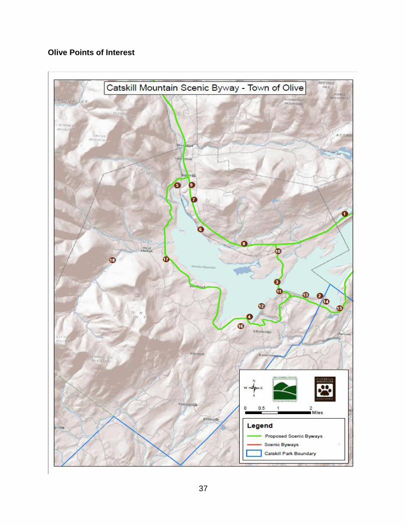
Town of Olive
Olive was founded in 1823, and less than a century later the town‟s geography was
significantly altered by the construction of the Ashokan Reservoir. The reservoir divides
the town, and the many displaced hamlets that skirt its perimeter have no historical
main street or downtown area. These hamlets include Shokan, Boiceville, West Shokan,
and Ashokan. Despite the influence of the reservoir, the town has an abundance of
scenic, cultural, natural, historical, and recreational resources, which include the
reservoir itself. Olive‟s local byway group includes several members with diverse
backgrounds and knowledge of the community. Working with the base map, the group

34
chose to use color-coded arrows
reflecting the five themes. A sixth
category, “curious roadside attractions”
was added and includes two sites with
sculptures visible from Route 28.
Route 28 is now the town‟s main
thoroughfare, while Route 28-A on the
south side of the reservoir offers a
scenic, more winding route and connects
with Route 28 on both ends of its 19-mile
course. Midway, Reservoir Road bisects
the Ashokan Reservoir atop the dividing
weir and connects Routes 28 and 28A.
The local byway group emphasized the high scenic value of this reservoir crossing and
its adjacent promenades, which are closed to vehicular traffic and are extremely popular
among walkers, runners, and cyclists. A grand panorama of the reservoir and several
high peaks, including Slide Mountain (the highest), is visible from Reservoir Road and
several points along the walkway to the south. These views are spectacular and really
showcase the byway. They are also intrinsically connected with the history of the
reservoir and the natural wonders of the Catskill Park and Forest Preserve. The town of
Olive proposed that the scenic byway route include Reservoir Road as well as 28-A. On
its eastern end, much of 28-A is within the town of Hurley, who also included this road in
the scenic byway route.
Olive‟s two members of the
Collaborative shared the
presentation with the local byway
group. A narrative reflecting an
interpretive journey along the
proposed byway was read aloud and
corresponded with points on the
map. In addition to the many
prominent resources found in and
beyond the byway corridor, the town
has many hidden historic treasures.
There are many old stone houses
from the early 1700s, churches, one-
room school houses, cemeteries, old hotels and boarding houses, and a few remaining
working farms. The town‟s active historical society can assist in developing a travel
Walkway along Ashokan Reservoir

35
guide to interpret this history and accompany the byway experience. Some of the
historical resources occupy prominent locations, such as the adaptively reused
buildings at Winchell‟s Corners, which is an important node connecting Reservoir Road
with Route 28 (and the alternate and main routes of the byway).
In cooperation with the town of Hurley, Olive sees itself as a gateway to the byway. The
town also recognizes the challenges of having Route 28 serve as both its main street
and major thoroughfare. The hamlets of Shokan and Ashokan have been working with
the Ulster County Main Streets program to examine strategies for business revitalization
and develop recommendations to improve the relationships between Route 28 and this
business district. The town also intends to use its smart growth funding to construct the
Ashokan Roadside Picnic Park, which will be an attractive resting place for travelers
along Route 28. It will feature a pavilion with picnic tables, a clean water source, a toilet
facility, and a kiosk to provide information about local history and culture, activities, and
nearby attractions.
The local byway group developed a series of recommendations and principles focused
on sustaining the byway, many of which are consistent with the overall
recommendations in this plan for the byway. Subsequently, the town of Olive Draft
Comprehensive Plan was developed and supports the ongoing effort to nominate the
Catskill Mountains Scenic Byway. The draft comprehensive plan also “identifies the
need to redesign the NYS Route 28 Corridor to meet the local community‟s residential,
business, recreational, and tourism land use needs while maintaining its function as an
arterial to uphold the Town‟s regional connectedness, public transportation, and access
for visitors and shoppers.” The plan continues by articulating:
Begin a dialogue with NYSDOT seeking the redesign of NYS Route 28 to
reduce the overall traffic speed in the hamlets and provide safe road crossing
features while maintaining the road‟s function as the gateway to the Catskills.
Seek reductions in the overall traffic speed, specifically within the hamlets of
Shokan and Boiceville.
Require the installation of safe traffic calming and road crossing features
such as walk crossing lights, median islands, landscape bump-outs, and other
devices to slow traffic and provide increased visual character to developed areas.
Roundabouts in hamlets could be helpful to provide pedestrian friendly
connections between businesses, services and residential communities on both
sides of the road which could be connected with a hamlet sidewalk network.

36
Plan and develop a sidewalk network in the Town hamlets that connects with
recreation trails, Esopus Creek, and Ashokan Reservoir access areas, as well as
other places of recreation, scenic, historic, or cultural interest.
Develop and support a coordinated program involving the design and
installation of well crafted signs that indicate and direct travelers to local
businesses, points of interest, recreation amenities, and other destinations within
the Town.
Participate in the Route 28 Corridor Management Plan planning process.
This plan is dedicated to protecting and promoting the natural and scenic
resources within and along the NYS Route 28 Corridor and the development of a
Scenic Byway nomination package. The Route 28 Corridor deserves customized
design and traffic engineering solutions befitting a scenic byway in a state park
which supports Olive‟s goals and visions of the Corridor hamlets.
Consider the establishment of NYS Route 28 Development Guidelines to
ensure that residential, commercial and industrial zoning districts and associated
development consider guidelines such as:
Create nodes of activity rather than strips or isolated businesses along the
highway to reduce the number of curb cuts required to support commercial
development and ease traffic flow throughout the corridor.
Aggressively manage access to avoid excessive curb cuts by requiring shared driveways, internal circulation roads and other designs that direct traffic to well-defined locations best able to support that traffic.
Reasonable parking standards that promote shared parking and access.
Provide access via multiple modes of transportation.
37
Olive Points of Interest

38
Olive Points of Interest
Kenozia Lake (1) is a water body
located immediately adjacent to
Route 28 that is complemented by a
natural roadside and a scenic
mountain vista.
Fishing Access to Ashokan Reservoir (2-5) – these sites allow access to the
reservoir for fishing, an activity that requires a permit from NYC DEP. The city also
allows for storage and use of row boats at some locations in conjunction with fishing on
the reservoir.
Winter Views of Reservoir and
Mountains (6) from Route 28 - this view
includes High Point Mountain and
Wagon Wheel Gap, a visible notch in
the eastern arm of High Point Mountain.
The gap is the result of a receding
glacier and is the point where meltwater,
contained in a periglacial lake, found an
outlet and downcut this v-shaped gorge.
Fabulous Furniture (7) is a business with
an outdoor sculpture display on Route 28
that has long been a roadside curiosity of
the Catskills. Owner Steve Heller is a self-
taught artist, woodworker, sculptor and
car builder. Fabulous Furniture has been
featured in Hot Rod Magazine, the NY
Times, and on Roadside America.com,
and it contributes an artistic and quirky
twist to the byway.
(www.fabulousfurnitureon28.com)
Kenozia Lake from Route 28
Aerial view of Wagon Wheel Gap and High Point Mountain

39
Grant Avery Park (8) is a town park that includes a pavilion, rest rooms, basketball and
tennis courts, softball and little league fields, and a children's playground. These
amenities can help support the diversity of offerings along the byway.
Scenic View. This excellent view of high peaks to the west occurs at a rise in the road
and is an enticement to continue traveling along the byway.
Brunel Park (9) is the former estate and inn of Emile Brunel, a French immigrant, artist,
and photojournalist, who traveled on the frontier to photograph American Indians and
opened numerous photography studios in New York City. The Brunel family home in
Boiceville overlooked the newly constructed Ashokan Reservoir and was a popular
resort known as Chalet Indien, which reached its heyday in the 1930s. Brunel created
numerous large sculptures and elaborate gardens on the property. In the late 1940s,
after Brunel‟s death, a significant portion of the grounds were lost to the straightening
and widening of Route 28. Many of the larger sculptures were relocated upslope from
present day 28, including two
sculptures of native Indians
that face the high mountains
to the west. The site was an
Indian trading post and
museum for a period, and the
property is now owned by a
member of Olive‟s local byway
group. The idea to open the
property‟s log cabin adjacent
to Route 28 as a welcome
center has been discussed by
the Collaborative and
partners.
The Bridge over the Railroad on Reservoir Road (10) provides a good view of the
intact railroad tracks that lie dormant from Boiceville to Kingston. Efforts to reestablish
rail service Kingston and Phoenicia have progresses but it‟s been almost 60 years since
the last passenger train ran on this line. Reconnecting the Central Catskills with the
Hudson Valley along this right-of-way is a crucial regional revitalization strategy.
The Dividing Weir (11), atop which Reservoir Road crosses the reservoir, functions to
abate sedimentation that periodically occurs in waters that enter the upper reservoir
basin. The weir slows the flow of water between the basins so that the sediment is
allowed to settle before the less turbid water is release from the lower basin to begin its

40
journey to the taps of New York City. The dividing weir offers spectacular views of the
reservoir and the backdrop of forested mountains. Although the road ends at an
intersection soon after crossing the reservoir, the view is continued along an axis that is
celebrated below by a series of fountains and a grass median, before terminating at the
entry to a large, symmetrical stone water-supply building.
There are two Reservoir Promenades (12,13) that have exceptional views of the
reservoir and the mountains and are popular among walkers, runners, cyclists, and bird
watchers. The first promenade begins on the town‟s eastern border with the town of
Marbletown at terminus of a circular cul-de-sac, locally known as “the Frying Pan.” (14)
There is also a interpretive kiosk at this location, one of six commemorative kiosks
located at each of the reservoirs in the Catskill-Delaware Watershed. The open, paved
path runs westerly along the edge of the reservoir for approximately 1.25 miles. Here it
ends to allow vehicular traffic to pass from Reservoir Road along a NYC Board of Water
Supply Road to Route 28-A. The second promenade begins immediately west of the
intersection with Reservoir Road and continues for approximately 1.35 miles where it
terminates at a parking area and the junction with Route 28-A. This promenade goes
along the reservoir and then enters a wooded section passing a monument dedicated to
J. Waldo Smith, engineer of the New York City water supply system. The former road
continues across a dam under which water can be released into the no-longer-dammed
Esopus Creek. Again, outstanding views of many Catskill high peaks can be seen.
Promenade and dividing weir (in distance)

41
The Spillway (15), seen from Route 28-A near the junction with Stone Church Road,
allows water to exit the reservoir as it exceeds capacity. Stone Church Road leads to
Beaverkill Road which crosses the Spillway Gorge, a long rock canyon that enables
water to pass from the Spillway to the Esopus Creek.
The Ashokan Center (needs #), located approximately one mile south of Route 28-A
on Beaverkill Road, is a cultural non-profit center where visitors can truly experience
nature, history and the arts through outdoor and environmental education. Popular
among schools and retreat groups, the 374-acre site and its many facilities are visited
by more than 500 school children each year. The Center‟s proximity to the Ashokan
Reservoir and its partnership with NYCDEP provide an ideal situation for watershed
education. (www.ashokancenter.org)
Acorn Hill (16) is a historic landscape containing remnants of the quarrying and railway
operations used in the construction of the Ashokan Reservoir. The property, owned by
NYC DEP and accessible by permit only, is reached from Route 28-A near the parking
area at the southern end of the
Promenade.
The Olive Free Library (17), located
just south of West Shokan on Route
28-A, was founded in 1952 and
provides a number of services to the
community. The library houses a
local history museum and a large
meeting space and has hosted a
meeting of the Collaborative.
Davis Park (needs #), is town park located just of Route 28 on Watson Hollow Road in
West Shokan. adjacent to town offices. It features a swimming pool, rest rooms, a
pavilion, a basketball and volleyball courts, softball and baseball fields, horseshoe pits,
and children's playground equipment. The town of Olive hosted an outdoor meeting of
the Collaborative in the park.
The Peekamoose Road (18), alternatively known as Watson Hollow Road, the West
Shokan-Peekamoose-Sundown Road, and County Route 42, is not on the proposed
byway route but offers several nearby points of interest. This scenic mountain drive
passes through a steep gorge with waterfalls, swimming holes, and camping spots.
There are also two trailheads along the road. The Kenape Brook Trailhead provides
Collaborative meeting at the Olive Free Library

42
access to the summit of High Point Mountain. The Long Path (a continuous trail from
the George Washington Bridge to the Helderberg Mountains near Albany) is accessed
from the Peekamoose Trailhead, where it lead to the summits of Peekamoose and
Table Mountains, two of the Catskills‟ 35 high peaks.
View from Peekamoose Mountain

43
Town of Shandaken
The Town of Shandaken, founded in 1804, is the largest town (119 sq. miles) along the
proposed byway route, and has the most road miles along Route 28 (17). The town also
occupies a central position along the byway and in the mountainous Catskill Park. More
than two-thirds of the town is state-owned forest preserve land, and the Catskills‟
highest peak, Slide Mountain (4180‟), rises along Shandaken‟s southern boundary. On
the town‟s western boundary is the Belleayre Mountain Ski Center, a downhill ski facility
on state land that is operated by the NYSDEC. With more than 150,000 skiers visiting
each season, Belleayre is an economic engine of the Central Catskills in the winter,
while each summer, the Belleayre Music Festival and other activities create attractions
at the ski center.
Taken in the regional context, (as illustrated on the Scenic Byway Route Map) Route 28
in Shandaken is abutted by a concentration of state lands, showing how this east-west
thoroughfare bisects the Catskill Forest Preserve. To the north and south, contiguous
stretches of forest ecosystems provide unfragmented habitat for plant and animal
species. The interaction of Route 28 with this vast natural system must be carefully
considered, such that wildlife migration and the safety of travelers are balanced. These
relationships were examined in detail when representatives from the Nature
Conservancy and the NYSDOT presented a series practices that included allowing for
Panther Mountain from Route 28

44
safe passage of wildlife migration under the highway, increasing awareness of the
special nature of the ecosystem to motorists, and tailoring land protection efforts to help
support preservation of lands between the corridor and the larger forest blocks.
The Shandaken local byway group gave a comprehensive presentation that required
two large maps to document the many resources, and the maps were complemented
with several poster boards and photo displays. With such a large percentage of state
forest preserve in the town, there are numerous trailheads, a state swimming area, a
campground, and a restored fire tower. And the Esopus Creek, paralleling and crossing
Route 28 for much of its length in the town, offers numerous recreational opportunities.
The recreational opportunities afforded by the wild, open lands of the town include
camping, hiking, backpacking, skiing, cycling, geo-caching and orienteering, hunting,
tubing, white-water racing, and bird watching. It was noted that there are more than 180
species of birds in the area, and this is not being promoted at all. The abundance of
wildlife, such as bear, deer, and eagles was also noted, as was the high quality of the
clean waters rushing out of the mountains. The group characterized the area‟s natural
heritage as consisting of “world-class irreplaceable natural resources”. They stated that
there‟s no reason the region cannot market itself better, and cited the byway a primary
means of doing so.
The town‟s natural heritage has long been a draw for artists, in addition to authors,
spiritual groups, tourists, and outdoorsman, especially fly fisherman – with Theodore
Gordon and Ed Van Putt being two of the most famous. Painters of the Hudson River
School were
attracted to the
Central Catskills
including Woodland
Valley, especially in
the latter part of the
19th century after
Slide Mountain was
determined to be the
highest summit and
the “Shandaken
Mountains”, as they
were known,
became more
popular among
tourists. John
Burroughs, the

45
world famous author and naturalist, was also attracted to Slide Mountain, and one of his
favorite spots was the Larkin Farm in Woodland Valley. Today there are numerous
artists residing in the town, and Shandaken is home to several galleries and the Mount
Tremper Arts Organization. Each July, the artist community organizes the Shandaken
Artists Studio Tour. In 2011 more than 50 artists participated, demonstrating the
concentration of artists in the town. Another remarkable local art initiative is the Leaping
Trout Project, created by the Ashokan-Pepacton Chapter of Trout Unlimited. In an effort
to raise awareness of the critical importance of water quality in the Catskill Watershed
and to promote local businesses and artists, 29 large metal trout were given to
volunteer artists who were free to create works from the trout using any medium they
choose. Once created, the trout were placed in local businesses and organizations
along the corridor. People were encouraged to visit the locations and place bids on the
pieces. At the conclusion of the project all the works were gathered and an auction was
held, with the proceeds benefitting the work of Trout Unlimited. Both the artists tour and
trout project are excellent examples of thematically organized, corridor-wide “trails” – a
tool that could be further developed as part of the scenic byway.
The abundance of natural resources in Shandaken has contributed to the town‟s rich
history in the extractive industries. Once home to numerous logging camps, mills,
hemlock tanneries, bluestone quarries, and a furniture factory (in Chichester), almost
none of these industries is active today although remnants of the operations may be
found in the landscape. This history is well
preserved in the Shandaken Museum, the
Empire State Railway Museum, and in other
collections. Despite the influence of these
industries on the natural resources,
considerable swaths of first growth forests
still remain on many mountaintops in the
town. One of those mountains, Panther
Mountain, is said to be located above a
meteor impact site. The circular drainage
patterns surrounding the mountain are
atypical for the Catskill Mountains. Geological
research has found evidence of a meteor
impact crater beneath Panther Mountain (see
http://en.wikipedia.org/wiki/Panther_Mountain
_(New_York).
The town‟s colorful past also includes much
in the way of cultural history. Numerous

46
boarding houses and hotels once dotted the landscape, including the Grand Hotel and
the Mount Tremper House. Although many are gone, the Roxmor Colony (1899) and
the Winnisook Club (1886) are private settlements that have been in continuous
operation. The Winnisook Club was named after a legendary and very tall Indian (also
the source of Big Indian), a statue of whom is found in the Big Indian Park along Route
28. Shandaken, like many towns in the area, saw much activity related to the Anti-Rent
War, which helped end feudalism in the United States. (This war is discussed in more
detail under the town of Andes inventory). Near the hamlet of Highmount lived the
famous opera singer Amelita Galli-Curci (1882-1963), whose mansion still stands today.
Although private, the estate was recently opened for a one-day tour. In Woodland
Valley, the famous Camp Woodland was a famed haven for well-known folk singers
from 1939-1962. As explained on the website www.campwoodland.org:
Just as there is a Hudson River School of Painting, whose artists like Thomas
Cole, Frederic Church, and Jasper Cropsey sought to capture and preserve an
idyllic view of the Hudson River Valley, so too is there a lesser known, unofficial
Hudson River School of Folk Music, among which Pete Seeger, Eric Weissberg,
and Joe Hickerson can be counted as some of its students. Like those painters
who created sweeping vistas of Catskill Mountain landscapes and majestic views
of Hudson River scenes, they too are creating an image with lyrics and melodies
of the lives and stories of the people who dwelled and settled in this region long
ago.
This brief review of Shandaken‟s resources, along with the inventory maps and
descriptions, provide a glimpse into the depth of stories that can enrich the scenic
byway. The townspeople treasure and celebrate their heritage and see great potential in
sharing its many stories. Every year the town celebrates its heritage by holding
Shandaken Day, a festival whose location rotates among many of the town‟s twelve
hamlets. These hamlet communities, along with such attractions as the Catskill
Mountain Railroad and a working blacksmith forge, show that history, recreation and the
arts are very much alive in Shandaken. Although the spirit of the community is quite
strong, the downtown areas need economic stimulus to be viable. The Ulster County
Main Streets Program helped initiate a revitalization effort in Pine Hill, where local
residents are pursuing designation of an historic district and streetscape improvements.
In Phoenicia, the popular Festival of the Voice is now a major event that attracts many
people to the hamlet. The Main Street Program is also working with the community of
Phoenicia, who is the beneficiary of a Creating Healthy Communities grant awarded to
Cornell Cooperative Extension. The grant will help the community advance pedestrian
friendly designs and explore trail development. These community projects, which are
vital to the immediate neighborhood, can be further advance through scenic byway
designation.

47
Shandaken Inventory Map

48
Shandaken Points of Interest
The Mount Tremper Fire Tower (1) is one of
five restored fire towers in the Catskill Park, and
a challenging hike is required to reach this
tower. The cabin of the tower is typically open to
the public on weekends from Memorial Day into
October, thanks to community volunteers. The
views from fire towers are spectacular and offer
a great way to experience the Catskill Park. It is
the intention of this CMP to ensure that scenic
byway visitors will enjoy the diverse array of
outdoor recreation opportunities.
Shandaken has several Hiking Trailheads,
almost all of which need directional signage
from Route 28. These include the Mount
Tremper (2), Tanbark Trail (3), Wittenberg,
Rochester Hollow (5), Fox Hollow (6),
Cathedral Glen
(7), Pine Hill-
West Branch
(8), Lost Clove (9), McKenley Hollow (10), Giant
Ledge (11), and Slide Mountain (12). Other public
access areas without hiking trails, such as Lower Birch
Creek Road, also need signage. There are also
numerous public Fishing Access Points throughout the
town.
Pine Hill Lake (Belleayre Mountain Day Use Area)
(13) is a NYSDEC Day Use Area adjacent to Route 28.
The lake is open for summer swimming and paddle
boating. A bathhouse and picnic grounds are also
available. Other than swimming pools, this is the
only area officially open for public swimming in the
byway corridor.
Belleayre Mountain (14), owned and operated by
the NYSDEC, offers downhill and cross-country
skiing, mountain, biking, music and seasonal
belleayre.com

49
festivals. The facility is a major attraction along the byway and employs many people in
the region (see also Corridor-Wide Resource Inventory).
The Zen Mountain Monastery (15) was founded in 1980 and is located on 230 wooded
acres. It is recognized as one of the West‟s most respected Zen Buddhist monasteries
and training centers. ZMM offers spiritual practitioners innovative ways to engage
Buddhist teachings through a wide range of retreats and residential programs that take
place within the context of authentic, full-time Zen monastic training.
Catskill Mountain Railroad (16) The Catskill Mountain Railroad Scenic Train offers a
12-mile round trip between Phoenicia and Boiceville along the Esopus Creek with views
of Mount Tremper and Mount Pleasant. The train runs on summer/fall weekends from
the Mount Tremper Depot. The CMRR is one of two stretches of the former Ulster and
Delaware Railroad right-of-way that is in use (see also Corridor-Wide Resource
Inventory). For more information on the CMRR: (845) 688-7400 or
http://catskillmtrailroad.com.
The Empire State Railway Museum (17) in Phoenicia is dedicated to bringing alive the
history of railroads in the Catskill Mountains. Located in the former Ulster & Delaware
station in Phoenicia it includes numerous displays, artifacts and restored rail cars. For
more information: (845) 688-7501 or http://esrm.com.
The Eagle Statue (18), located at Routes 28 & 214 in Phoenicia, is a notable landmark
along the byway. The statue is one of eleven installed in 1898 on the roof of Grand
Central Station in New York City. Long after the eagle was removed from the station, it
was donated to Phoenicia by David McLane and dedicated in 1986.

50
The Woodland Valley Campground (19) is located at the head of Woodland Valley
Road outside of Phoenicia. Its amenities include 72 tent and trailer sites, picnic area
with tables and grills, flush toilets, hot showers, trailer dump station, recycling center,
mobility impaired accessibility, pay phone. There are nearby fishing sites and marked
trails to Wittenberg, Cornell, Slide, and Panther Mountains.
The Shandaken Tunnel (20) carries water from the Schoharie Reservoir to the Esopus
Creek, feeding into the Ashokan Reservoir. The tunnel‟s outlet is immediately adjacent
to Route 28 and is an interesting feature along the byway; however, it could more
integral to the byway experience if there were a sign and interpretive information.
The Pine Hill Wastewater Treatment Plant (21), prominently located along the byway,
is a state-of-the-art facility that helps protect the quality of New York City‟s drinking
water. The facility, with its many buildings and curious architecture, attracts the attention
of the motorist. The Collaborative has recommended that the facility have a sign and
intends to provide more information in scenic byway promotional materials.
The Chief Winnisook Statue (22) in the Big Indian Park was carved from a log in honor
of the legendary giant warrior from which the hamlet takes its name. Local legend has it
that the seven-foot Indian eloped with Gertrude Molyneaux, after the woman
begrudgingly married Joe Bundy, despite her love for Winnisook. During a clash
between the Indians and white settlers at the location of present-day Big Indian,
Winnisook was mortally wounded by Bundy and took refuge in a hollow pine tree before
dying and was buried at the foot of the tree.
The Shandaken Historical Museum (23) is located on Academy Street in Pine Hill in
the former School District No.14 Building, a 1925 structure on the National Register of
Historic Places. It‟s open all year, admission is free and it reveals much of the town‟s
illustrious history.
The site of the proposed
Catskill Interpretive Center
(24) was acquired in the 1989
through a partnership between
the Catskill Center for
Conservation, the Trust for
Public Land, and the NYSDEC.
Construction of an interpretive
facility would be a major boon
for the region. To help meet the

51
need of providing regional information to travelers, a group of partners constructed the
Catskill Interpretive Kiosk in 2010. The site currently provides a quiet, flat park area
that is frequently used by dog walkers and was the site of Shandaken Day in 2008. (For
more information please see the Corridor-Wide Inventory section).
Mount Tremper Arts (25), located at 647 South Plank Road between Mount Tremper
and Phoenicia, supports contemporary artists in the creation and presentation of new
works of visual and performing arts. The 150-acre wooded site abuts state land and
includes gardens, hiking trails, streams, a pond, a sauna, a historic house, and a large
studio. Numerous events and exhibitions are held and residencies and rentals are
available.
The Kaatskill Kaleidescope (needs #), located on Route 28 in Mount Tremper, is the
world‟s largest kaleidoscope and is housed in a renovated barn silo. An extensive gift
shop accompanies the attraction, and the adjacent Emerson Resort and Spa offers
upscale logding and dining, as well as facilities for weddings and banquets.
Tubing the Esopus Creek (26) is a very popular activity in the summer months and
contributes significantly to the area‟s tourism and recreation economy. Two tubing
outfitters are located in Phoenicia; the Town Tinker was founded in 1980 and F&S
Adventures was established in recent years. Two courses – novice and beginner –
comprise a five-mile stretch of the Esopus. Periodic water releases from the Shandaken
Tunnel influence water levels, and whitewater events (kayaking and canoeing) are often
held in coordination with these releases.
Village of Fleischmanns
The village of Fleischmanns has many assets to bring to the proposed scenic byway.
Nestled in this beautiful area of the Catskill Mountains, and with a wealth of nearby
recreational opportunities, the village possesses a rich history and a lively contemporary
culture. Fleischmanns has an intact historic downtown, many active community groups,
a deep cultural history, and has recently completed its comprehensive plan, which adds
support for the scenic byway. Being much smaller in area than the towns along the
byway route, the community‟s intrinsic qualities are concentrated, yet the village also
“borrows” many of its resources from the surrounding landscape. Once well known as a
resort village over spilling with summer residents, Fleischmanns experienced decline in
the latter part of the 20th century, but is making a comeback with several community
groups, a downtown revitalization grant, and by reconnecting with its history.

52
Incorporated in 1913, the
village combined the
settlements of Griffin Corners
and Fleischmann and became
Fleischmanns. The
Fleischmann family (namesake
for the famous brand of yeast)
enjoyed baseball and donated
a park to the community in
1914. The ball field became a
popular pre-season playing
ground. Most notable of all the
players was Honus Wagner,
known as the Flying Dutchman
and inducted into the Baseball
Hall of Fame in 1936. It is thought by some that Wagner Avenue, an upscale residential
street bordering the park was named in honor of the great player. The park and ball
field, according to the Fleischmann family‟s wishes, have been preserved and kept open
to the public, and they are central to the village‟s current revitalization efforts.
Recently, the village has undertaken a historical
design study for the park and will be implementing
some of the improvements using funding from the
Central Catskills Smart Growth Program. Several
years ago, vintage base ball was revived in
Fleischmanns with the formation of the Mountain
Athletic Club. MAC competes with two other local
vintage ball clubs -- the Roxbury Nine and the
Bovina Dairyman – and all three are members of a
league. Members of these clubs recently set a
record for the longest continuous base ball
marathon, eclipsing the old record of 48 hours. It is
hoped that the train service of the Delaware and
Ulster Railroad is restored to Fleischmanns; then
the Roxbury and Fleischmanns ball clubs could
travel by rail to play baseball games, as they did in
the old days. The recommendation to re-establish
rail service was set forth during a Community
Empowerment Initiative several years ago and has
been readopted by the local byway group.

53
The local byway group also emphasized the importance of having the scenic byway run
along Main Street (old Route 28). As shown in the aerial photo, the heart of
Fleischmanns is adjacent to the byway, and the village is fortunate that strip
development has not occurred and competed with Main Street.
Fleischmanns has always
been known for its cultural
diversity. Today there are
prominent populations of
Hasidic (in summer) and
Mexican peoples. Due to
the presence of these
groups, the village is home
to synagogues and a
kosher grocery, as well as
two Mexican restaurants
and a Mexican grocery. A
recent film, Bienvenidos a
Fleischmanns, documented the Mexican population and has been well received at
several large film festivals. And over the years, a number of artists have lived and
worked in the Fleischmanns, including Paul Sawyier and Alfredo Santos.
The village is home to several shops
and galleries as well as a now-
closed historic movie theater. This is
an anchor building in the historic
downtown, which is the focus of a
recently awarded New York Main
Street grant that will restore several
structures. In 2011, SUNY Delhi
Architecture students proposed
redesign and revitalization of the old
auction building at the corner of
Main and Bridge Streets. The
students also proposed site designs
and connecting the building with the park. The Skene Library, another downtown
landmark, is home to numerous cultural activities and programs, many of them on
subjects related to local history. The village possesses an outstanding local history
museum located behind Skene Library. There are a handful of active community
fleischmannsny.com
Photo by Corneel Verlaan
East Branch Enhanced Recreation Program at Memorial Day Street Fair

54
groups, including Fleischmanns First, who meets regularly and organizes the annual
Memorial Day Street Fair and other events such as garden and house tours. The village
is active with the Central Catskills Chamber of Commerce. A new Business
Development Group has become active, allowing businesses to work together. Other
active groups include the fire department, community church, and Congregation B‟nai
Israel. Taken together, all of these groups help make this a vibrant village, eager to
show off its charms to visitors exploring the proposed scenic byway.
Many of the village‟s scenic qualities are found in the greater landscape around
Fleischmanns. There are several views of the village from roads on the surrounding
hillsides, including the views from Route 28 descending from Highmount. The village
shares many of the recreational and natural qualities with the surrounding communities,
and visitors enjoy many of the related activities – hiking, cycling, downhill skiing, fishing,
and hunting. The village also has a swimming pool, tennis courts, and a children‟s
playground. A historic downtown walking tour brochure was recently created.

55
Fleischmanns Points of Interest

56
Fleischmanns Points of Interest
Fleischmanns Park (1) is a five-acre open space in the center of town that includes four tennis courts, a basketball court, a soccer field, a baseball diamond, a children‟s playground, a horseshoe court, and access to the Bushkill stream. The park was gifted to the village by Julius Fleischman, son of Charles, in 1914. With the park‟s donation, the family included the stipulation that the land remain open, and always be used as a park and athletic grounds. In recent years, the village formed the Mountain Athletic Club, a vintage base ball club who competes with local vintage clubs, as well as others in the northeast. The village has made great strides in revitalizing the grounds and has focused its Catskills Park/ Mountains Smart Growth award on the park. The Skene Memorial Library (2) was founded by celebrated surgeon Alexander Skene and his wife, who were summer residents of Highmount for many years. It was through
the influence of Mrs. Skene that a $5,000 donation was obtained from Andrew Carnegie, making construction of the free public library possible. The cornerstone was laid in November 1901. The two war memorials located in front of the library honor those who fought in World War I & II (dedicated Memorial Day, 1954) and those who fought in Korea and Vietnam (dedicated Memorial Day, 1987). (Source: Wikipedia)
Main Street (3), also old Route 28, and runs the length of the village and expresses much of the community‟s charm and history. Wagner Avenue (4), which is parallel to Main, is the principal residential street that fronts on Fleischmanns Park. Like Main Street, many of the historic structures remain. In early and mid-20th century the community became an extremely popular vacation spot in the summer months, and it is estimated that there would routinely be as many as 10,000 summer residents in Fleischmanns. The community has made great strides toward revitalization and envisions the scenic byway – which is proposed for Main Street – to contribute a significantly in furthering these efforts.

57
Town of Hurley
The town of Hurley lies at the eastern gateway to the byway, and like other communities
along the byway it has a rich history and an abundance of resources that the byway will
help promote. The construction of the Ashokan Reservoir in the 1910s resulted in the
loss and displacement of hamlets in this western section of the town. The hamlets lost
were Ashton and Olive Branch, while Glenford has been displaced and West Hurley no
longer retains the central vibrancy it had prior to the reservoir. In addition to the
reservoir, which
geographically separates
the town, the relocation and
subsequent disuse of the
railroad has impacted the
West Hurley area.
Nevertheless, the main and
alternate byway routes are
proposed to diverge in this
area, and this can serve to
reinforce the town‟s role as
gateway to the byway and
to better connect the
northern and southern
portions of the town.
In many ways, Hurley has been the gateway into the Catskills over the course of history.
Evidence of Native Amercans and earlier settlers can be found in the woods near Route
28 and the reservoir. Evidence of hunting grounds from the Lenni Lenape Indians exists
on the Hurley Mountain Escarpment. Portions of the old Ulster and Delaware Turnpike
(precursor to Route 28) still
exist; evidence of the “Stone
Road” (when a portion of the
route was paved with
bluestone) can be found in
the field or have been
preserved elsewhere, such
as near the historic stone
houses. There are ten stone
houses within a quarter mile
on Hurley‟s Main Street,
making it a National Historic
Landmark. The houses were
Construction of Ashokan Reservoir (Olive Free Library)

58
built by the Dutch in the 17th and 18th century. This celebrated attraction is seven miles
south of the Route 28 and should become part of the regional promotion for the byway.
There is also much evidence of bluestone quarrying in the vicinity of the alternate route.
Some 40-50 quarries in the town employed
approximately 1500 men, and much of the
shipped stone was used for sidewalks in
New York City in the late 1800s. Also near
the byway alternate route are the remains
of Eagle‟s Nest, a former community of
enslaved people that included Native
Americans and white settlers. This little
known aspect but very significant part of
Hurley‟s heritage deserves meaningful
interpretation.
The West Hurley area is also home to the Maverick Concert Hall and the New York
Conservatory for the Arts. The Maverick Concert Hall was built in 1916 by Hervey
White, utopian philosopher and poet, “with the idea of gathering some good musicians
during the summer months and giving chamber music in a rustic music chapel among
tall trees at the foot of a hill.” The popular outdoor concert hall is on the National
Register of Historic Places. The New York Conservatory for the Arts was established in
1986 and offers a music theatre performing arts curriculum educating children ages 4
through adult in ballet, tap, jazz, voice, acting, theatre arts, and instrumental music.
All NYCA projects are made possible by the Pan-American Dance Foundation, with the
mission to promote, cultivate, sponsor, develop, aid and advance the public interest in,
respect and appreciation of the art of dance and the related arts of choreography,
music, painting, design and theatre arts through year-round educational and
performance projects and programming.
The portion of the alternate byway route that runs near the reservoir is quite scenic and
connects with the scenic resources reviewed in the Olive inventory section. One of the
goals of the Hurley Byway group is to provide an interpretive area along this section that
contains more information about the history of the area prior to and during the
construction of the reservoir. The existing kiosk at the “Frying Pan” parking area (which
is included in Olive‟s points of interest) contains some historic information, but Hurley
would like to complement this resource. To the east along Route 28 an observation
tower has been erected by a private landowner. This vantage point provides spectacular
views of the reservoir and the surrounding Catskill and Shawangunk Mountains. The
Hurley Stone House

59
tower is open only by appointment and is free to the public and can be incorporated into
byway promotion efforts.
In terms of recreational resources, a
portion of the 3000-acre NYS
Bluestone Wild Forest lies in Hurley,
The section of this forest providing
primary access to the public lies in the
adjacent towns of Kingston and
Woodstock; however, the local byway
group recommended that more formal
access to the Hurley parcels be
pursued. The Bluestone Wild Forest
features a lake, ponds, trails, old
quarries, hemlock and oak forests, and
is an ideal for hiking, mountain biking,
fishing, hunting and cross-country skiing. There is also a 76-acre DEP Recreational
Access Area near Kenozia Lake. And the West Hurley Park is located on Dug Hill Road,
just south of the alternate byway. Overall, most of the roads in West Hurley are ideal for
cycling. The entire Hurley portion of the U&D Rail Corridor is currently unused. The
Hurley Byway Group recommends that a trail could be developed on or next to the rail
bed to connect with the extremely popular rail trail on the former Ontario & Western Rail
bed adjacent to Route 209 on the Hurley Flats.
As in the town of Olive, the Hurley Byway Group felt strongly about the inclusion of
Route 28A into the scenic byway as an alternate route. The group‟s slideshow
presentation illustrated that the alternate route would pass many historic structures,
include amazing scenery, and provide motorists with the opportunity to view first hand
the landscape that was changed forever in the name of progress. The lost and
displaced communities as well as the great sacrifice by area residents can best be
understood by driving along Route 28A, the proposed alternate byway, which can
include new interpretive information to complement this traveling experience.
Town of Hurley Recommendations
Expand and augment the interpretive kiosk at the Frying Pan to provide travelers
with more information about the surrounding area prior to and during the
construction of the Ashokan Reservoir. Consider new locations for additional
information about Hurley‟s history with regard to reservoir construction.

60
In support of the Town of Hurley‟s Comprehensive Plan, create a unified
“Business District” along the Route 28 Corridor between the Zena/ Basin Road
intersection and Route 375 (9/10
of a mile). This could be
accomplished by creating
sidewalks to provide a safe way
for people to support local
business; providing parking at
the corner of Route 375 and
Route 28; creating a context
sensitive median to support the
business district and the gateway
to the byway.
Improve public access to state forest lands, including the separate parcels of the
Bluestone Wild Forest in the town of Hurley
Develop a Rail Trail along – or next to – the U & D rail bed to connect with O & W
Rail Trail along Route 209. This would provide greater recreational opportunities
to area residents and visitors alike and would connect communities.
Develop an interpretive area for tourists on Route 28 in Hurley.
Create an opportunity for recreation and community gathering at the vacant West
Hurley Elementary School & adjacent 35 acres through the development of a
park and community center. This is a significant opportunity to foster community
in an area that has gone without for nearly 100 years.
Expand recreational access permitting to NYCDEP reservoir lands to allow for
access for purposes other than fishing. There are many reasons why people
would like to gain access these expansive areas. There are historical features
(e.g. sites of old settlements) and recreational opportunities (e.g. birdwatching)
and simple hiking opportunities that are not incompatible with protecting water
quality.
Award winning context-sensitive design in Saratoga Springs

61
Hurley Map

62
Hurley Points of Interest The Bluestone Wild Forest (1) is comprised of a series of separate parcels, located north and south of Route 28 near the eastern gateway to the Catskill Park and the proposed Catskill Mountains Scenic Byway. The portions north of Route 28 offer public access to Onteora Lake, which is an Accessible Recreation Destination. Activities include hiking, mountain biking, fishing, hunting and cross-country skiing. To the south of Route 28 in the parcels of the Bluestone Wild Forest are open to the public but do not include formal public access. Hurley‟s byway group have recommended that these parcels include public access to promote more recreation and access to public lands in this eastern section of the byway. The West Hurley Town Park (2) is located near the top of Dug Hill Rd in West Hurley. The grounds boast a pavilion, building with kitchen and bathroom, playground, double ball field, basketball court,new tennis court and a sand volleyball court. There is also a small bike trail through the upper woods called Blueberry Trail due to the wild berries through which the trail was blazed. The park is open 9AM – 9PM every day and may be rented by town residents. Maverick Concerts (3) is America‟s oldest continuous summer chamber music festival and winner of the Chamber Music America/ASCAP Award for Adventurous Programming, thrives on the love of great music and the spirit of its unique site in the unspoiled woods. The rustic 1916 concert hall, with its perfect acoustics, is ideally suited to chamber music and the intimacy of live performance. Maverick Concerts continues the vision of Hervey White, founder of the collaborative Maverick Art Colony. Artists and other volunteers built the hand-hewn “music chapel” in 1916 and the Hall is now a multi-starred attraction on the National Register of Historic Places.

63
The New York Conservatory for the Arts (4) is located on Schildknecht Road and presents performances throughout the year by several theatre groups: a Repertory Company, a Victorian Caroling Troupe, a Kick Line Girls' Ensemble, Beyond the Edge Boys' Ensemble, a Student Theatre Company, a Theatre for Children by Children Company, and a combined NYCA Theatre Company presenting highly acclaimed theatrical presentations. NYCA‟s Touring Troupe has performed at the President's Park at the White House, at US Air Force Bases in Italy during the Bosnian Conflict, in Seville Spain at the World Expo, throughout Europe, the US and in New York City Off Broadway (www.nyca.org).
Ohayo Mountain Road (5) (also CR 41) is a highly scenic back road that climbs from Old Route 28 near the hamlet of Glenford to the hamlet of Woodstock, a popular destination north of the byway. Along the way, the road offers spectacular views of the Ashokan Reservoir and passes through woods and farmland. It is one of many examples of a scenic back road adjacent to the byway that could be further promoted as part of a driving tour.
There are significant amounts of land owned by the New York City Department of Environmental Protection in West Hurley. The 76-acre Boulevard Road Unit (6) near Kenozia Lake is open to the public for hiking. Along the Ashokan Reservoir, DEP lands are open by permit for fishing only. The local byway groups would like to work with DEP to explore ways to open lands adjacent to the Ashokan Reservoir for other activities such as walking, bird watching and historical field research.

64
The Knight Tower (7) is a portion of a restored fire tower that has been and erected near the alternate byway route. Although privately owned, the tower is open by appointment and offers tremendous views that reveal much of the region‟s intrinsic qualities. Unused portions of the former Ulster and Delaware Railroad (8) have restored important connections between the Catskill Mountains and the Hudson Valley but lie dormant. Such sections could be used as a pedestrian trail, whether this trail ran alongside or on top of the tracks.
NYC DEP Fishing Access Site (9) by permit only.
Village of Margaretville
Margaretville‟s inventory
meeting featured a walking
tour of the village led by the
byway group. Margaretville
is a community rich in
history and is a center of
commerce along the byway,
located roughly midway
between Kingston and
Oneonta. One of two
incorporated villages along
the byway, Margaretville‟s
population (596 in the 2010

65
Census) makes it the most populated hamlet or village on the byway. The concentration
and diversity of businesses and services in Margaretville, along with its small town
atmosphere, recreational opportunities, and many community groups, contribute to its
important role along the byway. The village has a hospital, a central school, a large
supermarket, several eateries, a Department of Motor Vehicles office, the Margaretville
Phone Company, the Catskill Watershed Corporation, and an active volunteer fire
department, all of which contribute to the community‟s vibrancy and economic base. In
2004 the village was awarded the Governor‟s Quality Communities Award for
Excellence, in large part due to its community spirit and downtown revitalization efforts
following the large flood in January 1996. Flooding continues to have an impact on the
village, with high-water events rising in frequency and intensity, and most recently the
impacts of rains from Tropical Storm Irene have been devastating.
During the walking tour, the large blocks
of intact historic buildings along Main
Street were pointed out, including the
former Galli Curci Theater, which is now
vacant. The tour also visited Pavilion
Park, which is the site of numerous
activities including the annual Cauliflower
Festival and vintage base ball games. The
Pavilion was recently rebuilt and serves
as an important community gathering
place. The East Branch of the Delaware
River, running the length of the downtown,
is an important recreational resource, with
fishing access, a riverwalk, and new
partnerships emerging for canoeing and
kayaking. These recreational resources
are part of the larger Enhanced
Recreational Access Project discussed in
the corridor-wide inventory section.
In addition to the walking tour, the byway group presented a slide program that included
many old postcards and other historic images, reinforcing history as a major theme in
the village and along the byway. The presentation also reviewed many of the other
village activities and cultural resources. There are many annual festivals in Pavilion
Park and along Main Street in addition to the Cauliflower Festival. These include Fire
Department Days on July 4th weekend with amusement rides, the street fair in August,
Margaretville Hospital Antique Sale and Flea Market, the Ride-n-Peak charity cycling
Photo by Franz Edlinger

66
event, the Catskill Forest Festival, the Holiday Treasure Express Thanksgiving
Weekend Parade, and the Ice on Main ice carving festival.
Among the cultural assets reviewed were Fairview Public Library, Longyear Art Gallery,
East Branch Art Gallery, Catskill Mountain Artisans Guild, and the Open Eye Theater.
Several resources in the greater town of the Middletown were also touched upon. These
were the Middletown Historical Society, the New Kingston Film Festival, the Hannah
Resort and Golf Course, the Belleayre Ski Center, and the site of the proposed Water
Discovery Center in Arkville (see Corridor Wide Inventory section). A community center,
possibly with a swimming pool, has also been proposed adjacent to the site of the
proposed Water Discovery Center. In many ways Margaretville is connected with
Arkville and the scenic byway can help strengthen these connections. As put forth in the
Transportation Safety section, sidewalks, streetscape improvements, and traffic calming
elements along Route 28 can help unify the two core hamlets, enhance the
attractiveness and functionality of this area, and help to guide future growth, as many
locations are out of the floodplain. There remain other opportunities for greenway
connections along the river.

67
Margaretville Points of Interest

68
Margaretville Points of Interest
The Park (1) and its Pavilion (2) in the downtown area are important anchors in Margaretville because they host numerous events that strengthen the sense of community and attract visitors. The park has undergone many improvements, including the pavilion itself which was designed by a group of students and professors from the Parsons School of Design. A new entry was also constructed through a multi-agency partnership.
Historic downtown Margaretville (3) serves as a commercial hub along Route 28 and is home to numerous businesses and some 600 residents. Resources in the community include Freshtown Supermarket, Margaretville Hospital, Margaretville Central School, Catskill Watershed Corporation, Central Catskills Chamber of Commerce, and the Margaretville Fire Department. The Pakatakan Trailhead (4), located in close proximity to downtown, offers hiking access to the Catskill Forest Preserve via the Dry Brook Ridge Trail. This trail includes two lean-tos, the Balsam Lake Mountain Fire Tower, and connects with several other trails along its 13.6-mile course.
Student Chefs at Margaretville Pavilion for Cauliflower Festival
Dowtown Margaretville and Pakatakan Mountain

69
Town of Middletown
The town of Middletown byway group held its inventory presentation in conjunction with
the village of Margaretville. Informative panel displays and a lively slide presentation
were delivered by a local author, historian, and member of the byway group. She
complemented the presentation with the following essay which captures the essence of
the intrinsic qualities of the town.
The Long Look Westward
Route 28 in the Town of Middletown
To travel West on NYS Route 28 from the Hudson Valley is to walk in the footsteps of
the Lenni Lenape and other Native Americans who found excellent hunting and fishing
in the hills and hollows of the Catskills. They are reputed to have established a seasonal
camp in the vicinity of Arkville, presaging by centuries the impulse of Catskill travelers to
pursue game, trout and other resources among the Blue Mountains.
The first European settlers migrating west from Shandaken into the valley of the Bush
Kill in the Town of Middletown were greeted by the same majestic view that impresses
travelers today. The splendid panorama from Highmount offers a long look westward,
as well as glimpses of the Halcott Valley in Greene County to the north, reachable only
through the Delaware County Village of Fleischmanns, a population center whose rich
history as a lodging and commercial hub is being revitalized.

70
Although drivers leave the Catskill Park at Highmount, the scenic nature of Route 28
does not fade. Beyond Fleischmanns, travelers encounter a scattering of residential
properties before entering the hamlet of Arkville. The Delaware and Ulster Railroad, one
of the area‟s primary tourist attractions, is located here. Arkville also features a
surprising number of businesses, including lodging, a gym, several restaurants and
various other commercial entities, whose backdrop is the beautiful Dry Brook Ridge.
Here the Bush Kill and the Dry Brook streams join the East Branch of the Delaware
River which, together with the 2450-foot Pakatakan Mountain, defines the community of
Margaretville a mile further west.At Margaretville -- the primary business hub between
Phoenicia and Andes -- Route 28 joins NYS Route 30 for a few miles. Route 30 South
leads travelers on a scenic stretch around the Pepacton Reservoir, the largest reservoir
in the New York City Water System. West-bound travelers on Route 28 confront a
winding stretch of roadway that climbs for five miles up a stream-carved hollow before
summiting Palmer Hill in the Town of Andes.
While scenic and functional, Route 28 in the Town of Middletown also points the way to
smaller offshoot roads that lead to many worthwhile points of interest.
A summary of Middletown‟s Route 28 assets follows: (Note: a few of these lie just
beyond Middletown¹s borders, but are in close proximity).
Recreation & Tourism Attractions: Delaware & Ulster Railroad (the right-of-way is
used for snowmobiling, skiing and hiking in the winter; the trackless Catskill Scenic Trail
is accessible further north in the Town of Roxbury); Arkville Bikeville, kayaking & wildlife
observation on Lake Wawaka, Pakatakan Farmers‟ Market, picnic areas in Halcottsville
and at the Delaware & Ulster Railroad; biking; Hanah Country Club and the Meadows
Par 3 Golf Course. Sanford‟s Horse Farm near Margaretville offers equestrian activities.
Pakatakan Farmers Market (pfmarket.org)

71
There are great swimming holes near the Dry Brook bridge in Arkville and at Big Rocks,
Margaretville.
Numerous State-maintained hiking trails and camping
lean-tos in the Dry Brook Ridge Wild Forest and
Balsam Lake Mountain Wild Forest can be accessed
from ancillary roads off Route 28. Trailheads are
located in Dry Brook, Huckleberry Brook and
Millbrook valleys. The Kelly Hollow trail winds through
a red pine plantation established by the Civilian
Conservation Corps in the 1930s; the Balsam Lake
Fire Tower – the first fire tower constructed in New
York State -- is another popular hiking destination
from Millbrook. In addition to State land, there are
hundreds of acres of land owned by New York City,
including an easily accessible parcel on Emory Brook
between Highmount and Fleischmanns, which boasts
two ponds, and a series of waterfalls.
Many Route 28 connecting roads provide excellent terrain (for every level of fitness) for
scenic walking and biking, including great spots around the Pepacton Reservoir, and in
the Dry Brook, New Kingston and Millbrook Valleys. Eagle watching is also growing in
popularity as the bald eagle has rebounded from near extinction to breed and winter
over in the region.
Middletown‟s top fishing spots include the East Branch of the Delaware River, the Bush
Kill stream, the Dry Brook, Plattekill and Millbrook streams. (Note: some streamside
lands remain in the hands of private hunting and fishing clubs whose members have
enjoyed prime angling here for a century or more.) The Pepacton Reservoir can be
fished from shore or boat with a New York City recreational access permit. A new
fishing pier in Dunraven provides access to the reservoir‟s tailwaters.
Scenic and Natural Attractions: Middletown offers a host of stunning scenic spots.
Some of the best viewing is available from Route 28, while other vistas are available
just a short distance off the beaten path. The most notable views include: from
Highmount; former site of Grand Hotel; view from Brush Ridge Road; Little and Big
Redkill Roads, Hog Mountain, Swart Road, New Kingston Valley, Bragg Hollow, Searles
and Bull Run Roads, and the Denver-Vega Valley. Photographers find inspiration in the
many classic barns, homesteads and farm outbuildings that dot the landscape,
Kelly Hollow

72
reflecting the town‟s agricultural roots. The only remaining operating farms in the Town
of Middletown are located in the New Kingston Valley.
Historic Attractions: Middletown sites in proximity to Route 28 that are listed on the
State and National Registers of Historic Places include: Skene Memorial Library and
Bnai Israel Synagogue in Fleischmanns; Pakatakan Art Colony in Arkville; Round Barn
(home of the seasonal Pakatakan Farmers‟ Market) in Halcottsville; Margaretville
Mountain Inn; the 1865 Old Stone Schoolhouse in Dunraven; Hubbell Homestead in
Kelly Corners; the Margaretville and New Kingston Presbyterian Churches, and the
entire hamlet of New Kingston, including the venerable post office building and several
century-old homes.
Other places to catch a glimpse of
history include the Anti-Rent War
marker in Highmount; the former
Ulster & Delaware Railroad train
depots in Fleischmanns and Arkville;
historic cemeteries in Clovesville,
Arkville, Millbrook, and Margaretville;
the 1902 Millbrook covered bridge,
several venerable buildings,
including the Maple House, the Post
Office and Casey Joe‟s Coffeehouse
in Arkville; and the Grange Hall, Old
School Baptist Church, creamery
and millhouse in Halcottsville.
New Kingston Valley
Dunraven Schoolhouse

73
Cultural and Community Entities: Exhibits, programs and educational services are
provided by Catskill Forest Association, Catskill Center for Conservation and
Development (including the Erpf Gallery), Catskill Community Garden Club, Central
Catskills Chamber of Commerce, Historical Society of the Town of Middletown and the
MARK Project. Margaretville Central School, Margaretville Memorial Hospital and
Mountainside Residential Care Center are large employers, and a Hospital Wellness
Committee has become active in health and fitness educational programming.
Natural Resources Industry: In addition to dairy farming, the area has been (and
continues to be) well known for bluestone excavation and wood products, as well as
maple syrup. These trades are celebrated at the Forest Festival and Cauliflower
Festival in Margaretville.
Curious Roadside Landmarks: Rust in Peace Cemetery in Arkville. The giant rotating
bowling pin at Margaretville Bowl.

74
Middletown Points of Interest

75
Middletown Points of Interest Along the Mill Brook Road -- which is one of several scenic tours adjacent to the byway is the Mill Brook Covered Bridge (1), one of the area‟s few remaining such structures. Another scenic tour begins at CR6 , which intersects Route 28 near the Middletown-Andes line and continues through the town of Bovina to rejoin Route 28 north of Andes. Along the way is the quaint hamlet of New Kingston (2), which is listed on the National Register of Historic Places and derives its name from an effort to relocate residents of Kingston after it was burned by the British in 1777. The scenic Dry Brook Valley (3) lies to the south of Route 28 and is accessible from both Ulster County Route 49-A at Highmount and Dry Brook Road in Arkville. There is access to several trailheads from the valley: German Hollow, Rider Hollow, Dry Brook Ridge, and Seager. As part of the scenic byway effort, it has been repeatedly recommended that signage be installed on Route 28 directing travelers to these resources.
The Balsam Lake Fire Tower (4), one of five preserved fire towers in the Catskill Park, is a premier hiking destination adjacent to the byway. The tower and an interpretive display inside a ranger‟s cabin are staffed by volunteers on weekends from May to October. A historic marker for an Anti-Rent War site (5) near the intersection of Todd Mountain Road and 49-A has been erected by the Historical Society of the Town of Middletown. The marker explains how a nearby boulder bares a large bore hole that held a flag which was raised by local “Anti-Renters”. (See the Andes inventory for more information on the Anti-Rent Wars). Route 30 runs along the Pepacton Reservoir (6), intersects Route 28 from Dunraven to Margaretville, then continues north passing
Balsam Lake Fire Tower

76
near the hamlet of Halcottsville (7) and the entrance to the Denver Valley (8) at Kelly Corners. At Halcottsville, Lake Wawaka, a dammed section of the East Branch of the Delaware, offers scenic beauty and kayak rentals. The Denver Valley offers opportunities for scenic driving loops that lead to the hamlet of Roxbury to the north. The Delaware and Ulster Railroad (9), discussed in the Corridor-Wide Inventory, has its headquarters in Arkville. The scenic train ride features preserved dining cars including a Vista Dome and Observation Car from 1948. The train runs from May through October between Arkville and Roxbury along the Delaware River, a distance of 11miles. The DURR is an important anchor for tourism along the byway and throughout the region.
The Emory Brook (10) is an East Branch headwaters stream that is accessible via permit on NYCDEP recreation lands. Access is immediately adjacent to Route 28; however parking or signage is non-existent. It is hoped that awareness of and improved access to this resource can be established over time.
Delaware & Ulster Railroad

77
Town of Andes
The town of Andes byway group gave a PowerPoint presentation that provided a
general survey of the town and focused primarily on the history, with particular
emphasis on the Anti-Rent War.
The first settlers arrived in Andes around 1794 and
the town was founded in 1819. Historical economic
activities included, logging, sawmills, rafting,
weaving, fulling, trip hammering, and dairy farming. A
railroad (the Delaware and Northern) operated from
1907 until 1942. The town is 113 square miles in area
and has about 1800 people, with an estimated 73
percent of the population owning second homes in
the town. The economy of today is mainly focused on
tourism, although there are several working farms,
including a few dairy farms. The 140-billion gallon
Pepacton Reservoir is a major presence, both today
and in the scope of history. It is about 15 miles long,
accounts for about a quarter of New York City‟s
drinking water, and has supplanted four
communities, fertile valley farms, roads, bridges,
cemeteries, and a railroad line. The town is also home to a library, museum, historical
society, school, beautiful park, and a thriving downtown that includes many eclectic
shops.
Andes occupies an important role in American history because of its involvement in
what became known as the Anti-Rent War. The Anti-Rent War was the uprising that
eventually ended feudalism in the United States, and a major incident that precipitated
the end of this war took place in Andes in 1845. Feudalism in the New York area was
active in the 17th, 18th and 19th centuries as Dutch and then English merchants and
royalty were granted large tracks of land for developing trading colonies. This “landed
gentry” established a patroon system with perpetual leases, such that rent would be
collected from all farmers using the land. This system was to become the prototype for
all farming economies in America. After farmers joined together to negotiate better lease
arrangements and were unsuccessful, these tenants formed local groups to protest the
system and tensions began to rise. In Andes, Middletown, Bovina, and other towns, the
uprisers were known as the Calico Indians since they disguised themselves with calico
gowns and leather masks.

78
On August 7, 1845 military authorities arrived on the Andes farm of Moses Earle to
begin the sale of the farm‟s livestock in lieu of non-payment of rent. The authorities
encountered a band of 300 Calico Indians and tensions escalated. Sheriff Osman
Steele was shot and died shortly thereafter. Following the incident, 90 arrests were
made and the governor declared Delaware County to be in a state of insurrection. The
incident aroused passions throughout the state and conflicts persisted for another five
years, but eventually the feudal system ended.
This historical event, which helps define Andes, is the subject for a town-branding
venture, known as “Calico”. This project, which is being funded by the New York State
Catskills Smart Growth Program, consists of four primary components: 1) Branding; 2)
Park revitalization, with foot bridge and overlook; 3) revitalizing the old railroad depot as
a media center and souvenir store; and 4)
Promoting and advertising. A map with
proposed locations for signs and flags was
displayed.
The byway route in Andes begins (in the
east) near an old bluestone quarry. At this
point, the road has just passed Canada
Falls (on the left) and continues its ascent,
paralleling Bryant‟s Brook. There is a wild
feel along this section, which has rock cuts,
hemlock trees, and views of the stream. Soon the hollow opens somewhat to the north
and the road passes a few farms before climbing Farmer‟s Hill to the crest. This is the
highest point on the byway at 2400‟. As the road descends to the hamlet of Andes, it
offers excellent views of farmland and mountains to the north and west.
Depiction of Anti-War Uprising in Andes

79
Andes Points of Interest

80
Andes Points of Interest Although the byway is replete with scenic views, the Palmer Hill Overlook (1) (cover photo) is a standout. The view, from the roadway, looks into the Catskill Park and includes four of the Catskills‟ high peaks: Balsam, Doubletop, Graham, and Balsam Lake Mountains. A side road leads immediately to a parking area for the overlook. This parking area needs improvements and signage – two objectives of the town. There are a number of working farms in Andes and adjacent to the byway, including the Gladstone Farm (2), one of the few remaining dairy farms in the town that is located next to the Andes hamlet.
As noted, the hamlet is a vibrant downtown that is a noted attraction among second homeowners and metropolitan tourists. In addition to a host of shops and restaurants, Andes has a popular outdoor swimming pool (3) and is home to Hunting Tavern Museum (4). The museum is the oldest structure in the village and was restored by the Andes Society for History and Culture, which is dedicated to preserving and promoting the history of Andes and the surrounding area and to providing diverse educational and cultural
programming. On the south end of the hamlet is Ballantine Park (needs #), a peaceful greenspace where summer concerts are held and where interpretive materials will be located as part of the Calico project.
Hunting Tavern Museum

81
The Tremperskill Road (5) (CR1) originates in downtown Andes and continues south for five miles until it becomes a NYC Board of Water Supply road, then reaches the Pepacton Reservoir at eight miles. This route, which passes historic architecture, the Anti-Rent War historical marker (6) noting the uprising at Moses Earle‟s farm, a working dairy farm, the Tremperskill Store (7), and the Pleasant Valley Meeting House (8), is another prime example of a scenic road located adjacent to the byway. Continuing over the Pepacton Reservoir on Route 30, the views are outstanding. Nearby is the the Watershed Commemorative Kiosk (9), one of six kiosks erected in the Catskill-Delaware Watershed honoring the communities lost to the reservoirs. (The other commemorative kiosk along the byway corridor is at
the “Frying Pan” along the Ashokan Reservoir). Four communities were lost to the Pepacton: Arena, Shavertown, Union Grove, and Pepacton. The Watershed Commemorative Kiosk project helped inspire the Catskill Interpretive Kiosk. On the south side of the reservoir, the Barkaboom Road leads to Big Pond (10), Little Pond Campground (11), and hiking trails which are all part of the Catskill Forest Preserve and can be better promoted with the designation of the scenic byway.
Kiosk at Pepacton Reservoir

82
Stewardship
Under the scenic byway nomination guidance provided by NYS Scenic Byway
Nomination Handbook, the stewardship plan addresses the strategies, tools and
techniques that will be employed to manage and enhance resources that distinguish the
route.
One strategy underlying effective stewardship of this byway is to continue to build upon
the successful “bottom-up” process that brought the Collaborative together. History has
demonstrated that home-rule in the Catskills has been a key factor in land-use decision
making. Communities of the Catskills have been decidedly independent, although they
have joined together periodically in opposition to forces that have threatened their
ownership of, and rights related to, the precious lands and waters within their
boundaries. Two of the most prominent examples are the Anti-Rent Wars in the mid-
1840s and the negotiations that led to the creation of the Watershed Agreement in the
1990s. The Central Catskills Collaborative is an example of a group of communities that
have come together to protect and promote their shared assets. Effective stewardship,
therefore, should evolve out of the active intermunicipal dialogue that has advanced this
nomination. This may seem obvious; however, the region‟s past includes several
instances whereby outside interests have attempted to chart a course for the region and
were unsuccessful. Now that seven communities have adopted a shared vision, they
have also committed to explore the tools and techniques discussed below.
A second underlying strategy of effective stewardship, building upon the first, is to
reinforce the appreciation of the intrinsic qualities and resources that make this
proposed route unique and marketable. This again may seem obvious, as it‟s a goal of
this plan, but many of the resources along the byway route are vastly under-promoted
and therefore not readily recognized by travelers and tourists, as well as by residents of
the region. The Catskill Park and the innumerable amenities of the Catskill Forest
Preserve, for example, are not as widely understood and appreciated as they could be.
Likewise, the resources of the New York City Watershed and the delicate balance
necessary to allow the city to continue providing unfiltered drinking water are generally
not well understood or communicated along the byway, and in some cases, they are
misunderstood. While scenic byway designation will help increase appreciation of these
and other resources, it will also help raise awareness of the importance of stewardship
and increase support for managing the byway.
Community-Agency Partnerships
A crucial means to help ensure stewardship along the byway is to communicate
regularly with NYS DOT and DEC to implement outstanding recommendations and work
in partnership on future management projects. This is one of the Collaborative‟s seven

83
adopted recommendations. One Catskill stakeholder meeting was convened by DOT in
June 2009, but follow-up on the identified actions is needed. While state budgetary and
workforce constraints are recognized, Central Catskill communities would like to see
more state resources directed to the region, which is largely defined by the Catskill Park
and state highways. Area communities depend on recreation and tourism and need to
strengthen agency partnerships and accomplish projects that will help tap into the latent
potential afforded by these public resources. The Catskill Forest Preserve Public
Access Plan (Access Plan) (1999) put forth several recommendations for increasing
state-local partnerships, including
the establishment of a DEC Catskill
coordinator position. The plan‟s key
issue‟s and actions are adopted by
reference as recommendations of
this CMP. Adopted by reference
means the actions are considered
as a working list; some actions have
been accomplished; others may no
longer be priorities; many are likely
to remain critical needs; and new
ones could be added.
Examples of key actions that could be advanced through DEC/DOT-local partnerships
are:
Complete and implement DOT’s Guidelines for the Catskill Park. Identified as
an action in the Access Plan, these guidelines will help ensure “consistent and
appropriate treatments of the roadside to keep the park-like appearance and scenic
beauty of the region intact”. A draft of the Guidelines was produced in 1999 but they
await refinement and adoption. Completed guidelines would likely share similar
characteristics to the Guidelines for the Adirondack Park (the Green Book), a multi-
chaptered volume that has been updated periodically. During the public planning
process of the Action Plan, many issues were raised about consistent treatments of
Park highways, and the necessity for extensive coordination between the three DOT
regions.
Implement a system of wayfinding signs for state resources along the byway.
The proximity of an abundance of public lands is one of the greatest qualities of the
Route 28 corridor. Hiking trails, fishing areas, lean-tos, fire towers, and
campgrounds are important components of the Catskill experience and support
State and Local Partners Developing Content for Interpretive Kiosk

84
economic vitality. However, of the ten intersections along Route 28 between
Boiceville and Margaretville, where local roads lead to 22 trailheads at distances that
range from one-quarter-mile to13 miles, only one of these intersections presently
has a sign. A primary goal of this plan is to create a more seamless connection
between the traveler and the available public recreation opportunities. Although
progress has been made on a developing a system of wayfinding signs over the past
few years, and it is the hope of the corridor communities that this system will be
implemented, this a task that could be expedited through more regular state-local
communications.
Facilitate the changeover to the new Catskill Park logo signs along the byway.
Background
Certain signage in the Catskill Park (and Adirondack Park) – including tourist
oriented destination signs; signs for hamlets, rivers, trailheads, and campgrounds;
mileage signs; and many others – has utilized a yellow-on-brown color scheme
(yellow letters/ brown background) that is unique to the two Parks. This scheme,
which contributes significantly to a park-wide identity, has been enabled through a
special agreement because it is an exception to the federal Manual of Uniform
Traffic Control Devices. The yellow-on-brown color scheme does not conform to the
manual because the figure-ground relationship between the yellow and brown does
not produce a sharp enough visual contrast. The manual is revised periodically, and
in the most recent revision process the Federal Highway Administration (FHWA) and
the NYSDOT have recommended that the Catskill Park change from yellow-on-
brown to white -on-brown signage. To help meet the requirements of the manual and
retain the park‟s identity through signage, FHWA and DOT encouraged the
development a placard and a logo to accompany the new white-on-brown signs
(which are used for national parks and therefore not unique to the Catskill and
Adirondack Parks). Stakeholder meetings were convened and Catskill Park
communities elected to pursue the design of a logo that helped communicate the
sense of place of the Park.
85
A final logo was developed and DOT Region 8 has erected several of the new signs
along Route 28 in Ulster County. In Delaware County, the signs have not been
installed, and no clear schedule of implementation has emerged. Increased
communication with DOT could help facilitate completion of Route 28 and help
identify and access alternative sources of funding, as needed. Local officials could
also become involved in or benefit from the increased communication and be
provided with additional guidance for implementing the new design on their local
street signs. The Collaborative communities recognize that great progress has been
made on the sign changeover, and they seek to work with DOT (and DEC) to
complete a more unified system that will create a stronger sense of regional identity.
Pursue improved sign management strategies. Such strategies should include
enforcement of the Catskill Park sign law, more uniformity and education about
tourism oriented development signs (TODs), and identification of ways to better
manage the proliferation of signage.
The Catskill Park sign law
The general purpose of the New York State Environmental Conservation Law, §9-
0305 Signs and advertising in Adirondack and Catskill parks, is “to conserve the
natural beauty of the Adirondack and Catskill parks, to preserve and regulate the
said parks for public uses for the resort of the public for recreation, pleasure, air,
light and enjoyment, to keep them open, safe, clean, and in good order for the
welfare of society, and to protect and conserve the investment of the state in forest
lands, campsites and other interests in real property in said parks”. In doing so, the
law prohibits off-premise signs in towns, but not villages, within the Catskill Park.
Along the proposed byway route and inside the Park, there are numerous off-
premise or billboard signs, as identified in the sign inventory of this CMP. These
signs conflict with the intention of the Catskill Park sign law; however, when the law
was enacted in the early 1970s, the owners of the signs were not reimbursed for
their investment. In other words, outright removal could not be accomplished at that
time unless due compensation was provided to the owner of the sign or an
amortization schedule was established, such that the investment in a sign would
expire and then it could be removed without monetary compensation. Neither of
these methods was employed, so the existing signs were allowed to continue.
Complicating matters is that DEC Region 3 cannot locate records for these signs,
does not have the resources to carry out enforcement duties, and many of the
grandfathered signs still exist due to periodic efforts of “maintenance” in lieu of
replacement, which is prohibited. Overall, the Catskill Park sign law and/ or the sign
regulations (NYCRR Part 195) should be revisited within the state-local partnership

86
discussions. Amend the DEC sign law is a recommendation of the 1999 Access
Plan.
The Collaborative, in fully recognizing the fiscal limitations within state agencies and
their impact on management of public resources, understands that new balances in
state-local partnerships may need to occur. For example, the New York-New Jersey
Trail Conference recently created the position of Catskill Regional Program Coordinator,
who can and has marshaled volunteers to accomplish trail related work that historically
was routinely performed by DEC. Similar arrangements should be explored and
pursued, as they are likely to make headway on longstanding recommendations, whose
execution are very much needed.
The Collaborative will also seek to continue regular communications with NYCDEP.
Areas of focus are likely to include implementation of the Catskill Park sign system on
Route 28-A( which is owned by NYC), management of Route 28-A, enhancing
information about existing DEP recreational opportunities, and identifying ways to
increase recreational access, such as by creating trail connections with adjacent state
land.
Communications with county planning and tourism agencies will also be continued.
Ulster County, for example, has adopted an Open Space Plan and a Non-Motorized
Transportation Plan, which have compatible goals with the scenic byway.
Integration with other Projects
As discussed under the Waterways section of the Corridor-Wide Inventory, there are
three active projects that will improve access to waterways: the East Branch Enhanced
Recreational Access Project, the Ashokan Watershed
Stream Access and Recreation Improvement Grant
Program, and the Delaware-Esopus Corridor
Revitalization Strategy. The Collaborative will
continue to build partnerships with each of the stream
management programs and project working groups
and pursue ways to reach mutual and complementary
goals. (In the Revitalization Strategy, the
Collaborative is the steering committee). By virtue of
their program missions and adopted plans, the stream
management programs are stewardship oriented.
Many scenic byway initiatives go hand in hand with
the goals of the stream programs. For example, the
Ashokan Watershed Stream Management Program

87
funded a significant portion of the Catskill Interpretive Kiosk because it helped meet
goals of the stream management plan related to increasing awareness of the resource
and its management. The Upper Esopus Stream Management Plan also points out
“Stream stewardship involves a broad cross-section of community members and
agencies. A shared understanding of stream stewardship principles in the community is
essential for coordinated stewardship practices.” Undeveloped public access sites along
sections of the byway immediately adjacent to a stream hold great potential for
achieving mutual goals the byway and stream projects. For example, there are two
existing “pull-off” sites owned by DOT in the Ashokan Basin. Proper development of
these sites will provide interest along the byway, increase awareness of the resource
and build appreciation for it, provide physical access for recreation, and involve all the
full cross-section of partners. The Collaborative will set these and related projects as
priorities.
Local Stewardship
The Roadside Environment
Uncoordinated roadside development can threaten the visual qualities of the byway and
incrementally degrade scenic character. Communities recognize that their land use
tools play an important role in balancing the much needed economic development with
the protection of the scenic resources of
the byway. All of the communities along
the byway have zoning, special use
permit, and site plan review. However a
comprehensive inventory and analysis of
these tools has not been undertaken.
Although the location of zoning districts
and allowable uses have been
documented, this information alone does
not provide an in-depth indication of how,
for instance, the community would look
under fuller build-out.
Several factors come into play in achieving visually desirable site design, including how
well the regulations are developed in terms of the elements of review within a site plan
review law; the specificity of standards under a special use permit regulation; the extent
of discretionary authority granted to the reviewing board; the diligence and consistence
of the reviewing board in applying the regulations and setting conditions, especially over
time; the enforcement of conditions; and the amount of turnover in the membership of
the board. Along the proposed byway, there are both specific sites and longer roadside
Route 28 Middletown

88
sections that illustrate less-than-desirable outcomes in terms of context sensitive
design. Conversely, many developed sites along the proposed byway and in the Catskill
Region accomplish the right balance or exhibit characteristics that are in keeping with
the byway‟s nature. Both desirable and less-desirable examples help emphasize how
local site plan and special use permit review have a direct impact on the quality of the
visual environment. Elements of review such as landscaping, access management,
signage, lighting, architecture, and building materials all have individual and collective
influence on improved site design and, by extension, the overall appearance along the
byway.
The Collaborative will explore opportunities to help improve the appearance of roadside
development, including:
Undertake a corridor-wide inventory and analysis of current land use regulations,
including details such as the elements of site plan review, special use permit
standards, and enforcement provisions. Similarities and differences can be
compared across communities and districts in an effort to identify which practices
might be more effective and could inform enhancement of existing land use tools.
This action may be dependent on funding resources.
Collaborative communities can coordinate training sessions between local
planning boards, county planning departments, the Catskill Center, or other
partners. These training sessions should focus on site plan, special use permit
review, overlay zoning, and other design related topics. These sessions should
offer state-required credit, incorporate visual
examples from the Catskill Region and
illustrative local laws from other communities.
Sessions could also feature guest speakers
and educators on additional topics such as
access management and historic
preservation.
Design guidelines, both local and corridor-
wide, should be considered. Illustrated
design guidelines can build on the positive
qualities of the corridor; facilitate project
review and the interaction between board and
applicant; be incorporated into practice as
either regulatory or non-regulatory, and serve
to retain the appearance and function of the Example of design guidebook from Shawangunk Mountains

89
corridor over time. Experience has demonstrated that land developers and
review boards can more easily reach mutual solutions if they are illustrated.
Scenic Views
Tools for the protection of the scenery that reflects the intrinsic qualities of the byway
are considered within three areas, each contributing to an overall strategy: Encouraging
Growth in Hamlets, Viewshed Inventory and Analysis, and the Role of Land Use Tools.
As with other strategies, any effective implementation should be grounded in home rule
and build upon the connections between the shared qualities along the entire byway.
And both increased appreciation of scenic resources and greater awareness of the link
between scenery (along with recreation and tourism) and the economy will gather
further support for the strategy.
Encouraging Growth in Hamlets and Villages
The land use settlement pattern in the Central Catskills is very much a reflection of the
natural environment; however, many of the economic drivers that fostered the
settlement of the region no longer exist, except tourism. It is a simple yet often
overlooked fact that visitors to the region are attracted by its simplicity – there are no
malls, the skies are dark, there are many small businesses, and the overall land use
pattern is characterized by historic, walkable nodes separated by great expanses of wild
lands and rivers. What also tends to get overlooked is that there really aren‟t many
places within a day‟s drive of the greater New York metropolitan area that exhibit such
qualities, simple as they may seem. However, large portions of Route 28 between
Kingston and the gateway to the proposed byway are oft cited by residents of the
Central Catskills as the antithesis of how the Central Catskills should look and function.
One of the keys to retaining the preserved land use pattern of the Central Catskills and
cultivate more tourism is to encourage growth in hamlet areas. This can be done in
several ways including land use tools – both basic and incentive-based – and the
location of infrastructure. The Central Catskills are fortunate that, as part of the
Watershed Agreement, state-of-the-art wastewater treatment plants are being
constructed to service hamlet areas. Farmland preservation can also help support
hamlet growth, and the town of Andes is where resources for preserving agriculture
have been and continue to be used. The Watershed Agricultural Council has a range of
resources to assist existing farming operations and encourage new ones.
Viewshed Inventory and Analysis
The byway is replete with stretches of undisturbed roadsides, hillsides, and distant
mountain views. Although the “forever wild” lands of the Catskill Forest Preserve
account for much of this scenic quality, private land contributes significantly, especially
on the western end of the byway. In the sections where state land predominates, it is

90
mostly located at the higher elevations, while
private land is found between the roadway and
the forest preserve. Although visual inventories
and analyses have been conducted along the
corridor (in reports referenced in this plan), they
have not involved the local communities to the
extent where the communities have identified the
resources and adopted the accompanying
recommendations of the plan. Local
comprehensive plans also do not contain this
type of information, and although enhanced
viewshed inventory is beyond the scope of this
plan (in part due to limited resources), it is a
logical next step. And the existing viewshed work
can be consulted as a starting point.
Role of Land Use Tools
The presence of the forest preserve, with its great expanses of undisturbed ridgeline, is
an attraction for residential development on nearby land. Privately owned ridges are
also attractive to those who would like to position their residence to see sweeping
views. These very scenic qualities of ridgelines and mountaintops that are attractive in
the real estate market are also a positive aesthetic and economic draw for tourists,
outdoor enthusiasts, and residents alike. Balancing these interests at the site, corridor,
and regional level is critical to the byway and the success of regional tourism
development. The Catskill Center has developed and presented a land use training
course on Ridgeline Protection and recommends that it fulfill two hours of state-required
credit for municipal planning board members. The course can also be integrated with
other land use trainings and topics (such as DOT context sensitive design and corridor
management) or adjusted for general audiences. And the overall topic of Scenic
Resource Protection could be the subject of other events and printed materials such as
design guidelines or handbooks. Likewise, Encouraging Growth in Hamlets, is a
separate but related topic that could be featured in trainings, meetings, and conferences
ranging on sub-themes from mixed-use zoning to “complete streets” to historic district
designation.
Tourism Development
The tourism potential for the proposed byway is tremendous. Much of this potential is
outlined in the West of Hudson Economic Development Study for the Catskill
Watershed Corporation. The study is a strategic plan for the Catskill Fund for the
Future, a $59.7 million fund for the Catskill-Delaware Watershed, created as part of the
Esopus Creek near Route 28 and Woodland Valley

91
Watershed Agreement and directed to support qualified economic development projects
in the form of loans and grants. At the outset of the study, under Strengths of Catskill
Economy, Location tops the list. It is noted that most of the previously conducted
studies “cited the short driving time between the region and the New York City and New
England Markets as a primary advantage. This proximity to a huge population base
provides benefits for many sectors of the regional economy. … The region offers prime
opportunities for mini-vacations and day trips to a huge potential population base.” [9]
At the time the study was completed in 1999 the average cost of gasoline was
approximately $1.20 per gallon; in Summer 2011the cost is about $3.90 per gallon in
the Central Catskills. This tripling of cost has contributed to changes in travel habits,
while the cost of air travel has also risen. These patterns favor the proximity of the
Catskills to the New York City Metropolitan Area, which is home to some 19 million
people. However, other factors –cited by the study as barriers to economic development
– may also contribute to limiting tourism potential. These include No Coordinated
Regional Marketing Efforts; Paucity of Well-located and Modern Tourist Facilities; and,
Fragmentation and Physical Isolation. While these difficulties are present in 2011 and
will pose challenges for the byway, the byway is also aimed at removing these very
barriers.
Potential is also expected to be realized when the
Ulster and Delaware County Tourism offices partner
with the Collaborative on joint marketing efforts to
promote the byway and its attractions (this is also
discussed under Financial Resources). Under the
CMP process, the Collaborative organized a Tourism
Development meeting, at which both county tourism
directors presented their programs and identified and
encouraged avenues of joint promotion. Several
interrelated avenues to market the byway and improve
the local economy were presented, and both tourism
directors and the Collaborative agreed that pursuing
these ways of marketing will demonstrate the value of
the byway in enhancing tourism.
Integrate the scenic byway within county tourism marketing plans and develop
travel “packages” and messaging for byway attractions.
Promote common themes and along the byway to help support “stay-cations”.
The byway will help unite common attractions such as the Delaware and Ulster
Delaware and Ulster County Tourism directors address the Central Catskills Collaborative

92
Railroad and the Catskill Mountain Railroad, which are currently being promoted
separately by each county. Water sports is another theme that should be jointly
marketed. Tubing the Esopus could be paired with the new boating program on
the Cannonsville Reservoir, for example. This reservoir is part of the NYC
Watershed supply and the boating program is a new expression of the
partnerships between the city and upstate communities. Existing “trails” such as
the Leaping Trout Art Trail and the Shandaken Artists‟ Tour can be linked with
other area trails such as the Wine Trail and the Apple Trail in Ulster County. It is
also noted that diversity among byway attractions is a related marketing strategy
that should also be employed.
Increase the online presence of the byway among the websites of the two
counties and the Collaborative and take advantage of emerging phone
technologies. Cross links among websites help keep online visitors in the
regional loop and mutually support area attractions.
Advance byway promotion efforts beyond the two counties to include the other
two counties (Greene and Sullivan) in the designated Catskill Region tourism
promotion area. Catskill Association for Tourism Services (CATS) is the official
regional tourism promotion agency (www.visitthecatskills.com). The promotion of
the Catskill Mountains Scenic Byway within the context of scenic byways in all
four counties will elevate the potential of all byways.
Use the Bobcat logo of the byway to develop new marketing strategies and
integrate it with other regional branding logos such as the Catskill Association of
Tourism Services logo and the new Catskill Park logo (which can be used freely
as a marketing tool outside the public highway domain).
Include the byway in NYC-based marketing efforts. For example, Ulster County
has undertaken advertising in the NYC subway system and on metropolitan radio
and TV stations.
The designation and promotion of the byway is expected to improve the local economy
to a significant degree. The byway will interpret, market, and link the region‟s diverse
and common resource offerings – as detailed in the inventories -- with nearby untapped
populations. Data has shown that tourism in the Catskill Region is a major industry that
supports some 17,000 jobs; however, the region includes four counties and the
communities in the Central Catskills recognize that the region‟s “hotspots” – other than
the Belleayre Ski Center – are generally not located along the byway corridor. The
communities also recognize that they are blessed with an abundance of public land, an

93
asset that is not being fully taken advantage of. In 2011, three Catskill regional
organizations held an event titled The Economic Benefits of Parkland. Featured in the
event was a study recently conducted in the nearby Shawangunk Mountains: Study of
the Economic Impact on the Local Economy of Minnewaska State Park Preserve,
Mohonk Preserve and Sam’s Point Preserve. The findings of the report conclude that
the three preserves (more than 30,000 contiguous acres of protected ridge
environment) and their operations have a positive economic impact on the local area of
$12.3 million annually while supporting 358 local jobs. At the event, Catskill
stakeholders suggested that a similar valuation study be conducted for the Catskill
Region. The three Catskill Region organizations developed a request for proposals to
cover the combined area of the Catskill Park and the New York City Watershed, and
selection of a consultant is expected in Fall 2011.
While the value of Catskill public lands and amenities is unknown, what is known is that
the potential of these resources are not being realized. From an economic standpoint,
the results of the valuation study will help focus regional attention and lay the foundation
for undertaking specific strategies to better leverage recreational resources and tourism.
Achieving designation of a scenic byway – as in the Shawangunks – has already been
identified as a mechanism for realizing improved economic return on recreational
amenities. The outdoor resources of the Central Catskills are highlighted since they
occupy a central and galvanizing role in the potential of the byway; yet all the resources
illustrated in the inventories will benefit economically from byway designation.
Protected Lands in the Catskills, 2011 (Source: Nature Conservancy)

94
What other services might be helpful to maximize the amount of time a visitor spends
along the byway?
Generally speaking, visitor accommodations along the byway are sufficient in meeting
current demand; however it is difficult to project how the existing facilities will handle
increased visitors to the byway. One of the dominant trends in the Central Catskills is
the so-called “feast-or-famine” pattern that is directly linked to ebbs and flows of
seasonal recreation and the “big weekends” such as Columbus Day Weekend. Each
end of this spectrum poses challenges for local businesses and visitors. During the
quieter off-season and mid-week periods, the general decrease in availability of
attractions and services contributes to a certain type of traveling experience for the
visitor. On the one hand, visitors may appreciate the quieter atmosphere, so long as
basic goods and services demands are met. Yet many tourists enjoy the busy
atmosphere and the availability of numerous attractions and will wonder where all the
excitement is. During peak times when the capacity of local accommodations is
exceeded, the visitor‟s experience can be diminished. In order for local businesses to
both survive and thrive, stability is needed. The chambers of commerce (Central
Catskills, Delaware and Ulster Counties) and the Belleayre Region Lodging and
Tourism Association can work with the Collaborative to enhance the communication
between businesses along the byway and develop strategies to offset or eliminate any
deficiencies in byway accommodations.
Over the years, tourism agencies, chambers of commerce, and local communities have
tried to populate lull periods by coordinating programs and events. One of the barriers to
the success of these strategies is the lack of regional coordination. The byway can help
bridge these challenges in many ways, not the least of which is that it links two counties
and therefore it becomes in both counties‟ best interest to jointly promote and
coordinate. When would-be travelers to the Catskills explore online resources they are
bombarded with an overwhelming amount of information, with each source rooted in its
own geography or interest area, and in some cases there is competition at play. A
scenic byway will not solve these age-old dilemmas of the Catskills, but it can help
agglomerate available information -- and more importantly, package a traveling
experience. As a tool of intermunicipal cooperation and promotion the byway will unite
the critical players of the region who can work together intelligently and innovatively to
promote shared assets. Travel packages should promote special deals and combine the
right mix of resources so as to reinforce a positive experience in visitors‟ minds. Such
strategic and coordinated approaches can influence local businesses to invest in their
facilities and improve the spectrum and availability of their offerings. Transcending

95
existing patterns of marketing – e.g. single-county or individual business promotion –
will be keys to future success.
In terms of specific accommodations along the byway, the lack of restrooms and cell
service have been identified as drawbacks for corridor travelers. It is also somewhat
difficult for large events, such as conventions or tour buses, to be handled in the Central
Catskills in terms of lodging, restaurants, and the provision of larger conference
facilities.
In moving to remedy the restroom situation, the town of Olive has proposed a toilet
facility as part of its smart growth project in Shokan. Big Indian Park, a central location
on the byway, has also been proposed as a location for a restroom, although it is not
part of a formal application or proposal at this time. And, the site of the proposed
Catskill Interpretive Center is likely to benefit from federal funding that would be used to
build a restroom and related subsurface infrastructure. Depending on the progress of
these initiatives, the designated scenic byway could seek additional funding to help
meet this need.
According to coverage maps, cell service is indeed spotty along the corridor and non-
existent in much of Shandaken. A combination of lack of user demand and limited signal
range in mountainous terrain has apparently kept providers from locating in this core
area. In this day and age, any departure from being electronically connected via the
worldwide web, email, cell or smartphone, comes as a shock to many. However, safety
considerations notwithstanding, the Catskills have traditionally been a place where
people go to “get away from it all”, and given the blanket cell-phone coverage in most
other areas, the Central Catskills is somewhat of an anomaly. With the increase in
coverage not likely in the near term, byway travelers should be informed about the
variable coverage along the byway.
Experiences affiliated with larger scale visits from locally organized conferences to an
influx of tour buses have exposed weaknesses in the ability of Central Catskills to
accommodate associated patterns of visitation effectively. Limited capacities of
restaurant and lodging facilities, less-than-optimal customer service, and the logistics of
coordinating with the various facilities (e.g. restaurant, hotel) have contributed to such
weakness. Again, an increase in regional coordination among the major players can
work to improve existing situations through various means such as training programs for
service people and coordinated dispersal of large groups. It is noted that any such
weaknesses are minor in comparison to the region‟s great strength of having a rich
diversity of smaller scale establishments that help make the region unique and exciting
for the visitor.

96
Overall, the visitor‟s experience will be enhanced through coordinated marketing efforts
between the Collaborative, the Delaware and Ulster County Tourism offices, the Central
Catskills Chamber, local businesses and tourism attractions, and other partners, such
as the Catskill Watershed Corporation. Existing needs, such as restrooms, will be
promoted by these partners and funding will be sought, as needed. In addition to the
coordinated promotion avenues outlined above, the Collaborative and its partners will
explore means of assessing visitors‟ experiences along the byway, such as by the use
of surveys, and pursue ways to enhance those experiences.
Marketing and Promotion
New opportunities for a community may result from the increased exposure a
byway receives. This exposure can be gained in a number of ways, such as by
targeted advertising campaigns, installation of byway signage, distribution of
maps and trip planning brochures or developing pre-planned itineraries for bus
tour companies. Outline the strategies you will use to market and promote the
byway. You may find it desirable to recommend a strategy for monitoring the
effectiveness of your marketing and promotion campaign.
- NYS Scenic Byway Nomination Handbook
The Collaborative organized a working meeting focused on Marketing and Promotion
and established seven recommendations. These recommendations are complementary
with those put forth under Tourism Promotion above. An eighth recommendation was
added following a presentation at a subsequent meeting to create a scenic byway
driving tour.
1) Explore Utilization of the Parking Area East of
Byway to Provide Byway Information
The Collaborative and meeting participants
emphasized the need to provide the traveler with
byway information near the beginning of the eastern
gateway to the byway, preferably before the
beginning. Earlier in the byway planning process, the
scenic byway was to include Route 28 and begin at
the point in West Hurley where the highway is
reduced from four to two lanes. As the project
evolved and Route 28A was included in the
nomination as an alternate byway route, some
considerations emerged in terms of how to best sign
the byway and inform the traveler of its route options

97
(Routes 28 and 28-A).
The beginning of the proposed alternate route occurs approximately one mile before
(east of) the beginning of the proposed main route. (Connecting the two loops was
considered but the consensus was to retain the beginning of the proposed byway where
the two lanes begin). In consulting with NYSDOT, signage at the initial intersection
(Route 28 and Basin Rd.) can indicate that the alternate byway route begins to the left
while the main route begins ahead (9/10 mile to the west). In order to inform the byway
traveler of this choice before the intersection and provide byway related information, the
Collaborative identified the opportunity to use an existing parking/ information pull-off
area located approximately 2.25 miles east of the intersection with Basin Road (RM
28/8601/2034). This parking area was established many years ago to provide
information about the Catskill Park; however, only a small kiosk with minimal information
exists. Additionally, there is no signage warning the motorist in advance of the
approaching parking area. It is proposed to use this existing pull-off area to provide
travelers with byway related information, to include the choice of routes and the new
kiosk on Route 28 in Mount Tremper at the site of the proposed Catskill Interpretive
Center. The site is owned by NYSDOT.
2) Create a Scenic Byway Brochure
After reviewing numerous examples from other byways, the Collaborative set this
recommendation as a short-term, low-cost priority.
3) Create a Scenic Byway Website
During the workshop, various examples of scenic byway websites and website
technologies were illustrated. Like the brochure, the Collaborative sees this
recommendation as readily accomplishable with relatively little investment. Shortly after
its formation, the Collaborative established a website that is incorporated in and hosted
by the Central Catskills Chamber of Commerce website (www.centralcatskills.org)
(http://co.centralcatskills.com/margaretvillechamber/V_Content.php?itm=CCC). In 2008,
the architects of the chamber website addressed the Collaborative and demonstrated
interactive tools that can be utilized to link aspects of the websites for each of the
corridor communities. For example, if one town along the byway posts an event, it will
be viewed by anyone who visits any one of the other town websites. The Collaborative
will be further exploring this option and will develop a website that is conversant with the
latest social media tools and networks (such as Facebook and Twitter). It was also
stressed that byway marketing and promotion keep in step with the most up-to-date
technologies, such as smart phones and i-pods.
4) Develop a Kiosk “Trail” to Inform Travelers

98
Central Catskill communities would very much like to have a series of informational and
wayfinding points to aid and inform byway travelers. This desire is evident in the
Shandaken, Olive, and Margaretville Smart Growth projects, where several kiosks are
being developed. It is envisioned that other byway communities will establish similar
information points, which could then be coordinated within the byway brochure, website,
and signage system. While some of these kiosks will be located adjacent to the main
highways at key intersections, others will be in downtown areas. This will improve
awareness of the many resources in the corridor as well as those located at distance on
the connecting roads. Efforts are being made to establish a consistent design
vocabulary in both structure and display materials.
5) Hold and Coordinate Corridor-Wide Events throughout the Year
As mentioned in the inventory discussion, the Shandaken Artists Studio Tour and the
Leaping Trout Project are thematic, corridor-wide initiatives that serve as examples and
inspiration to develop additional events and to better market existing events, both
individually and in concert. During peak seasons, many events are held on any given
weekend, while during quieter weekends there are little or no offerings. The byway and
the Collaborative can market two or more simultaneous events as a package and can
work to create activities during slower times. For example, a series of main street
activities involving local businesses can be hosted by individual communities during
winter weekends. This type of coordination will help build on existing successes and
avoid duplication whenever possible.
6) Develop a Uniform and Comprehensive Signage System for Our Businesses,
Cultural Attractions and Recreational Resources
As discussed in the Inventory and Stewardship sections, signage is critical to marketing
the innumerable resources along the byway. In addition to recreational and cultural
attractions there needs to be a coordinated system of Tourist Oriented Destination
(TOD) signs. This coordination should begin with
informational sessions, coordinated with DOT and
DEC, for communities and businesses as to how
the process works. This will assist in developing
clusters of signs rather than the cumulative
disorganization that has created visual distraction.
7) Create a Scenic Byway Logo
This recommendation has been advanced and
completed by the Collaborative (see logo). During
the corridor management planning process, the
Collaborative felt strongly about creating a logo
Logo design contest winner (left) being presented with award from Collaborative Chairman

99
and giving a name to the proposed byway. Both of these processes generated much
public support and visibility for the project. A logo design committee drafted design
contest rules and the competition was announced at the opening of the gallery exhibit in
November 2010, Historic Route 28, the Making of a Scenic Byway. Seventeen entries
were received, and the Collaborative received public input on the designs at the
February 2011 meeting. The field was then narrowed to six and the Collaborative
selected the winning logo on March 17. The winner received $100. The Collaborative
also involved the public in helping to choose a name for the proposed byway, first
collecting all suggestions then narrowing the field and making the final choice at the
October 2010 meeting.
8) Create a Scenic Byway Driving Tour
This recommendation was added after a public presentation by a local audio-production
professional. The project would follow the course of the proposed scenic byway and
would educate and entertain travelers. In compact disc format, the timed tracks would
be indexed to specific locations. Options for side trips and more information would be
offered in the scripted narration. The narration would include segments of recorded
interviews with local historians, community leaders, and scientists, for example. Both
local music and regional sounds (e.g. waterfalls) are intended to be used. Topics
include regional and natural history, outdoor activities, landmarks, and perhaps
information on lodging and other local businesses. The Collaborative unanimously
passed a resolution in support of the project “to raise awareness of the proposed
Catskill Mountains Scenic Byway, the Catskill Park, the New York City Watershed and
its waterways, and related resources of the Route 28 corridor for the overall purposes of
improving education, outreach, and access to these resources.”
Resources Interpretation
The NYS Scenic Byway Nomination Handbook directs nominating groups to
“Recommend locations for the placement of visitor centers, interpretive markers,
interpretive brochure distribution points and other planned interpretive opportunities.”
For the proposed Catskill Mountains Scenic Byway the importance of resource
interpretation and the relevant details have been emphasize throughout this CMP and
are summarized here. This plan:
Supports the development of both the Catskill Interpretive Center and the Water
Discovery Center at the chosen locations – Mount Tremper and Arkville,
respectively. The plan further supports cooperative efforts that will advance the
establishment of these visitor facilities, or components thereof.

100
Encourages the continued application of the new Catskill Park logo signs along
Routes 28 and 28A, as well as adjacent county,
town, and village roads, as appropriate. The
Collaborative, as byway management entity, will
continue to work with state, county, and local
stakeholders to encourage and support the
implementation of a complete system of signage
that employs the new logo.
Emphasizes the implementation of a system
wayfinding signs for recreational resources, as well as tourism oriented
destination signs that will identify businesses along and adjacent to the byway.
The Collaborative will actively promote the implementation of these signs with the
appropriate stakeholders.
Encourages the continued development of a “kiosk trail” along the byway that will
interpret the area‟s resources and provide helpful information to travelers.
In addition to improved agency (DOT and DEC) communications, supports
increased dialogue between the Collaborative and local businesses to explore
additional ways to enhance the provision of information and resources
interpretation along the byway.
Financial Resources
This section outlines potentially available financial resources to help upgrade, develop,
promote, and otherwise make the proposed scenic byway and its corridor available for
its intended uses
To begin realizing the vision for the byway, the Collaborative is setting priorities among
the recommendations. Low-cost, short-term projects -- the so called “low-hanging fruit”
– will be pursued in the near term. The Collaborative has also agreed that if designation
is granted, the installation of signage for the scenic byway becomes a top priority.
Promotional brochures and a website are also relatively low-cost measures that can
increase visitation, which in turn can support local businesses. A number of the
recommendations will be advanced through partnerships meetings of the Collaborative;
and the Catskill Center, per the Collaborative‟s establishing resolution, has agreed to
convene these meetings on a regular basis.
In terms of financial resources, the Federal Highway Administration‟s
yearly request for applications under of the National Scenic Byways

101
Program has been consistent. The Collaborative envisions application to this program
post-designation, and the priority project(s) will be developed for the submission at that
time.
The Collaborative also envisions additional partnership projects on applications to the
Ashokan Watershed and East Branch (Pepacton) Watershed Stream Management
Programs. The Catskill Interpretive Kiosk (discussed in the Corridor-Wide Inventory
section) is a model partnership project that was funded in part by the Ashokan stream
program. Many of the recreational access improvement sites, currently being identified
by both stream programs, are other funding avenues that will support byway goals. As
available, funds for administration and stewardship under such projects will be pursued.
The Esopus-Delaware Corridor Revitalization Strategy is being funded by the NYS
LWRP (Local Waterfront Revitalization Program), and once the plan is completed,
identified goals in the plan become eligible for additional rounds of funding. The goals
under this project are expected to be related to the revitalization of downtown
waterfronts -- another untapped area of potential along the byway.
During the Tourism Development meeting, both county tourism directors (Delaware and
Ulster) made it clear that matching funding opportunities under the I Love NY Tourism
program could help support the byway. In fact, the byway is a prime vehicle for
attracting such funds because it helps develop a common theme in both counties.
Common-theme strategies can be expanded to include the other Catskill counties
(Greene and Sullivan) where designated scenic byways are also present. A recent
campaign promoted the ski areas in all four of counties, offering discount passes and
encouraging visitors to circulate throughout the Catskills to experience each of the
venues. In like fashion, the scenic byways of the Catskills can become an ideal tool to
promote regional tourism, an activity that is favored under I Love NY Tourism.
Other byway funding opportunities being considered by the Collaborative include the
NYS Department of State Local Government Efficiency Program, which offers
competitive grants to local governments for the development of projects that will achieve
savings and improve municipal efficiency through shared services, cooperative
agreements, mergers, consolidations and dissolutions. As the Collaborative advances
and solidifies its status as a management entity, it will be exploring how cooperative
structuring and programming for the byway could be funded under this program, which
requires demonstrated cost savings.
In terms of smart growth, a second round of funding was provided to communities in the
Adirondack Park; the Collaborative, working with regional partners, will explore

102
opportunities for additional smart growth funding to support the byway and the Catskill
Park.
Private funding is also expected to play a role in support of the byway. A donor has
already pledged support for the wayfinding sign project discussed in the Stewardship
section. The donor, a local business owner, is also soliciting other area business
owners for support. And, as explained below, the Catskill Center and the Central
Catskills Chamber are examining a forthcoming foundation-funding opportunity to
support the management entity of the byway.
The Collaborative will also explore and additional municipal funding for planning and
project implementation related to NYC Watershed programs. As a product of the
Watershed Agreement, the NYS Department of State Master Planning and Zoning
Incentive Award Program offered Watershed municipalities several rounds of funding to
explore land use tools and strategies that support both qualified economic development
and watershed protection. Although this program fulfilled its Watershed Agreement,
shifted to the East-of-Hudson Watershed, there is still a need for communities in the
West-of-Hudson (WOH) Watershed to have this type of assistance under the evolving
Watershed Agreement. The successor WOH program -- the Local Technical Assistance
Program, administered by the Catskill Watershed Corporation -- has been discontinued.
It is clear that planning and development in the NYC Watershed is unique in that it
requires not only innovative approaches, but resources that make such projects as the
scenic byway sustainable. If these programs are not continued, it is possible to explore
new avenues to meet the needs of Watershed communities with the New York City
Department of Environmental Protection and the Catskill Watershed Corporation.
Support and Implementation
To illustrate how the byway can continue over time, this section outlines how the Central
Catskills Collaborative can be strengthened and formalized to become the capable
byway management entity.
The planning process for the development of this CMP has strengthened intermunicipal
cooperation, involved numerous key partners and the public, and solidified an overall
vision for the byway. The Collaborative recognizes that, in nominating this byway, they
have demonstrated the requisite strong and sustainable teamwork that is necessary to
support the byway in the long term. The Collaborative also recognizes that a more
definitive structure of management and support must accompany the strengths that they
have so ably exercised. In furtherance of this need, the Collaborative devoted a meeting
exclusively to exploring management options. Management structures in CMPs for four
byways (three designated; one proposed) were examined and considered. Attendees

103
divided into four groups and were asked to consider pros and cons of each
management structure, how the structures could inform this project, and to present
recommendations for the CMP.
The exercise yielded helpful findings. Although strong participation from each
municipality has reinforced the Collaborative as a beneficial regional entity, municipal
leaders are generally unwilling or unable to contribute monetary resources to a future
intermunicipal management entity. However, continued in-kind support and participation
to strengthen the Collaborative remains firmly pledged. The option of forming a new
non-profit organization was not favored; however, working with an existing non-profit
was viewed positively and builds logically on the partnership-oriented progress that has
been achieved. Discussions noted that there are already numerous non-profit
organizations in the Catskills and creating another one could increase competition and
would come with additional requirements. It was also noted that the Catskill Region
does not have an overarching regional entity that is either connected with state or
federal government, comprised of the local governments of the region, or formally
recognized by the state. Some examples of such entities include the Hudson River
Valley Greenway, the Tug Hill Commission, and the Adirondack North Country
Association. The Collaborative can be considered the beginnings for such an
organization. It should be noted that this scenic byway nomination helped spur interest
in a now developing nomination for the Route 30 Corridor, from Grand Gorge to East
Branch. This contributes to exploring the development of a regional management entity
for scenic byways that could also serve additional beneficial roles.
Given the results of the exercise, the Catskill Center and the Central Catskills Chamber
of Commerce emerged as two regional entities that could join with the Collaborative to
provide the needed managerial support. These organizations, however, would need the
additional resources to effectively assume the duties and help the management entity
thrive by tapping into additional resources. In support of this option, the Catskill Center
developed two funding proposals to help realize such a future partnership; however,
neither was successful. A new proposal with the Chamber of Commerce is being
considered. Funding support notwithstanding, the following steps are proposed to
strengthen and formalize the Collaborative and provide administrative support. In
addition to developing a structure for the management entity, these steps could also --
in the long term -- initiate the beginnings of a more encompassing regional entity
anchored by the local municipalities. Such a larger entity would strengthen existing
partnerships and likely increase the opportunities for financial support.
Transition the Collaborative and its advisory members from the nominating
committee to a formalized board of directors that will guide and sustain the
scenic byway.
104
Draft and adopt a Memorandum of Understanding between the Collaborative and
the supporting organization (e.g. the Catskill Center and/or Central Catskills.
Chamber and/or other organization) to jointly serve as the management entity
Create a set of bylaws to guide the procedures of byway management entity.
Pursue funding opportunities to implement the scenic byway corridor
management plan and sustain the newly formed management entity
Proposed Management Entity Board of Directors President (1), Vice President (1), Secretary (1), Treasurer (1) Board of Directors (voting members)
Town of Andes (1) Town of Hurley (1) Town of Middletown (1) Town of Olive (1) Town of Shandaken (1) Village of Fleischmanns (1) Village of Margaretville (1)
Advisory Members (non-voting)
NYS DEC (1) NYS DOT (1) NYC DEP (1) Central Catskills Chamber of Commerce (1) Ulster County Tourism (1) Delaware County Tourism (1) Delaware and Ulster Railroad (1) Catskill Mountain Railroad (1) Catskill Mountain Club (1)
Transportation Safety
Inventory NYSDOT Regions 8 and 9 provided traffic and accident data for Routes 28 and 28A. The Annual Average Daily Traffic (AADT) for Route 28 in Ulster County is as follows: Rt 375 to Reservoir Rd (Winchell Cors) 2005 9,790 Reservoir Rd (Winch Cors) to Rt 28A (Boiceville) 2005 7,820
Rt 28A (Boiceville) to Rt 212 2005 6,550
Rt 212 to Rt 214 2006 5,580
Rt 214 to Rt 42 2008 4,010
Rt 42 to Co Rt 47 2006 2,940
Co Rt 47 to Delaware Co Line 2006 2,880

105
For Route 28A, AADT data indicates that the western portion near Boiceville is 860; 600
in the central portion near the Olive-Marbletown line, and 1480 on the eastern portions,
including the section of the proposed scenic byway.
In Delaware County, AADT for Route 28 at the Ulster-Delaware is 2950; 3950 from
Fleischmanns to Arkville; 5200 from CR 38, Arkville through Bridge Street,
Margaretville; 2100 from Bridge Street to Fair Street; and 1260 from Fair Street to
downtown Andes.
AADT data for Route 28 in Ulster County indicates a consistent decrease in volume
from east to west. In Delaware County, the significant rise in AADT in the Margaretville-
Arkville area is accompanied by an otherwise decrease in volume from Fleischmanns to
Andes. It is likely that the higher AADT in the Margaretville area can be partially
attributed to daily commutes to and from the Margaretville area, especially from State
Route 30 to the north. On Route 28A the rise in AADT on the western portion may be
attributed to commutes to and from Ulster County 42.
Overall, the data for Routes 28 and 28A reflect lower volumes and fewer accidents than
other busier roads in the greater region. From December 1, 2006 through November 30,
the accident rate for the Ulster County portion of the Route 28 proposed byway is 2.1
per million vehicle miles; whereas the expected rate for a free access two-lane
undivided highway is 2.4 per million vehicle miles (2009). This portion of highway during
the same time period had three fatal accidents with causes listed as driving while
intoxicated, animal action, and driver inexperience – three factors that highway design
does not have direct influence over. No accident patterns were detected among the
data (11/2006 -11/2009) for this portion of the proposed scenic byway; however, more
recently a detailed study was commissioned for Route 28 in the town of Olive and the
results have not been completed.
Both Route 28 in Delaware County (to Andes) and Route 28A also had low traffic
volumes and accident rates in the same three-year span. Only one fatality occurred on
each of these sections, neither of which was
attributed to highway design and safety or affiliated
with any pattern of incidence. Animal related
accidents (i.e. deer) were a relatively consistent
factor throughout the examined data.
In terms of public transportation, the Ulster County
Area Transit service runs seven roundtrips from

106
Kingston to the Pine Hill area during the weekends; two round trips on Saturday; and
one on Sunday. The Trailways bus company serves the entire corridor with three or four
buses running to and from Kingston daily and additional buses available on Fridays and
Sundays. It is noted that the route departs from Route 28, following Route 375 in West
Hurley to Woodstock, then returning to Route 28 in Mount Tremper (and vice-versa).
The Collaborative formed a transportation committee and reached out to each of the
highway superintendents in the seven municipalities and the two counties. In the
correspondence, a map of the proposed scenic byway and the Transportation Safety
guidance from the NYS Scenic Byway Nomination Handbook were provided, and input
on any transportation issues or concerns was solicited.
Planning Process
Several transportation topics were discussed at Collaborative meetings during the
nomination process. The deteriorated condition of Route 28 from Mount Tremper to a
point west of Phoenicia was a primary concern, however, this section has been
repaved. The condition of the roadways and shoulders is critical to the success of this
scenic byway for safety, as well as aesthetic and recreational reasons. Route 28 in
Ulster County is a designated bike route however signage and width of shoulder vary
during the course of the route. The Collaborative would like to work with DOT to explore
ways to improve safety and enhance recreation along the main route of the byway.
Members of the Collaborative attended a Catskill Stakeholders meeting organized by
NYS DOT in June 2009 to discuss and advance a series of transportation related topics
and projects, including the promotion and safety of bike routes. As discussed within the
Stewardship section of this plan, these stakeholder meetings should continue in order to
assist in achieving objectives of this plan and to meet the Collaborative‟s overall
recommendation of communicating regularly with NYS DOT and DEC.
One of the outcomes of the June 2009 meeting was to pursue the completion of the
Catskill Park Guidelines, a goal that is outlined under the Stewardship section of this
plan. Catskill communities would like the Catskill Park to have its own set of guidelines,
like the Adirondack Park, in order to advance more consistency and predictability during
highway repair and improvement projects. Another agreed upon strategy, suggested by
DOT, was to explore the completion of a GPS inventory of infrastructure along the
byway with the assistance of student interns. This type of project, which was successful
along highways in the Adirondack Park and would collect information on culverts and
bridges, would be of great benefit to Route 28 in the Central Catskills. As discussed in
the Shandaken inventory section, representatives from the DOT and the Nature
Conservancy made presentations to the Collaborative about animal migration and
species continuity across the corridor. Because culverts and bridges are primary means

107
through which animals migrate under the roadway,
knowing the size, location, and number of these structures
can help highway managers make informed decisions over
time. Highway design features and signage could support
these efforts and could assist in preserving the integrity of
the greater ecosystem that is divided only by the highway
in sections of Shandaken. The contiguous forest blocks in
the Central Catskills are some of the largest in the High
Allegheny Plateau Region. Exploring ways to facilitate
animal migration and biotic connectivity -- along with improved interpretive and
promotional signage, enhanced bike routes, and the adoption of guidelines for state
highways in the Park – will assist in restoring the integrity and safety of the byway.
The Collaborative would also like to improve the streetscape along Route 28 in
Boiceville and between Arkville and Margaretville. Neither of these locations has
sidewalks yet these areas are frequently used by pedestrians. In Boiceville, the region‟s
primary school -- Onteora Central School – is located in the center of the hamlet. In
addition to sidewalks, traffic-calming devices and streetscaping elements should be
incorporated. In the Arkville-Margaretville stretch, there are numerous businesses and
offices along with multiple points of ingress and egress. Over time, this strip has
developed to the point where it now connects the two hamlets, so the addition of
sidewalks and streetscape elements, and the incorporation of access management
techniques will serve to improve efficiency, safety, and aesthetics in the coming years.
The context sensitive design work that was complete in downtown Andes several years
ago is frequently cited an illustrative model for other corridor communities.
As discussed in the Corridor Wide Inventory section, the Ulster & Delaware Corridor is a
major transportation asset along a significant portion of the byway. Any improvements in
the connectivity and continuity of the former U&D corridor will support the economic
revitalization of the Central Catskills and offer alternative modes of transportation. This
plan does not emphasize one mode of travel (rail or non-motorized trail) over another,
ehow.co.uk
Arkville Andes
108
but supports efforts that lead to greater usage and connection along the overall corridor,
including multi-modal opportunities and programs that involve pedestrians, cyclists, train
passengers, river paddlers, or other combinations of users.
Other projects that can be pursued through cooperation between DOT and the byway
municipalities include the development of a bicycle and pedestrian master plan; and the
Improvement of utilization of existing turnouts and rest areas and creation of new areas
as needed.
Summary of Recommendations
In realizing the vision for the byway, numerous principles, strategies, and actions have
been proposed throughout this plan. This section encapsulates these recommendations
and illustrates a series of corridor wide objectives that will advance the byway vision.
Reinforce downtown areas and support local businesses by routing the scenic
byway along the main streets of Phoenicia, Pine Hill, Fleischmanns, and
Margaretville.
Improve the appearance and functionality of areas along Route 28 where there are
existing concentrations of businesses, pedestrians and automobile traffic.
Specifically, ways to improve pedestrian friendliness and implement context
sensitive design should be pursued in West Hurley, Shokan-Ashokan, Boiceville,
and Arkville-Margaretville.
Make regional connections with other byways and other potential byways. Route 214
from Phoenicia to the Lanesville will connect with the proposed Mountain Cloves
Scenic Byway; Route 42 from Shandaken to the Greene County line is a scenic arm
of the this proposed byway that could be linked with future byway efforts in Greene
County.
Improve the interpretation of the Catskill Park and the New York City Watershed for
byway travelers. This includes supporting the construction of the Catskill Interpretive
Center and Water Discovery Center; developing a system of wayfinding signage for
outdoor public resources adjacent to the byway; establishing a kiosk “trail”; and
developing more interpretive information at specific watershed sites such as the
Ashokan Reservoir and the Shandaken Tunnel outlet.
Strengthen the eastern gateway to the byway.

109
Explore utilization of the parking area (east of proposed beginning of byway at
RM 28/8601/2034) to provide byway information.
Explore a temporary gateway/ interpretive center (e.g. log cabin at Brunel Park,
Boiceville).
Support the development the West Hurley business district (consistent with the
town‟s comprehensive plan), which can be reinforced with elements of context
sensitive design, including a highway median and sidewalks. Physical
improvements along this 9/10 mile section of Route 28 will connect the main and
alternate routes of the proposed byway.
Improve access to waterways to increase outdoor recreation, support local
businesses, and provide greater awareness of and appreciation for our stream
systems and the watershed.
Implement a system of wayfinding signs for state resources along the byway,
including hiking trailheads, public fishing areas, and campgrounds.
Pursue the established and relevant objectives of corridor-wide and local planning
efforts as they relate to realizing the vision of the scenic byway (e.g. the Catskill
Forest Preserve Public Access Plan; the Tourism Development Plan for the Central
Catskills; and Stream Management Plans).
Strengthen the intermunicipal cooperation of the Collaborative by formalizing the
group as the byway management entity; forming a partnership with an area
organization; pursuing funding opportunities to implement the scenic byway corridor
management plan and sustain the management entity; and by serving as a proactive
example of regional collaboration.
Work in cooperation with stakeholders to support and realize greater usage of the
former Ulster & Delaware Railroad corridor.
Continue to explore partnerships with educational institutions to advance
components of the corridor management plan.
Communicate regularly with NYS DOT and DEC to implement outstanding
recommendations from existing plans and work in partnership on future
management and public access projects, such as:
Complete and implement DOT‟s Guidelines for the Catskill Park;
Implement a system of wayfinding signs for state resources along the byway;

110
Facilitate the changeover to the new Catskill Park logo signs along the byway;
Pursue improved sign management strategies and implement a system of
tourism oriented destination (TOD) signs;
Explore improved utilization of existing turnouts and rest areas and creation of
new areas as needed;
Improve signage and markings for existing bike routes and explore the creation
of new bike routes.
Explore with NYCDEP and other parties the use of lands along the Ashokan
Reservoir for purposes other than fishing.
Work to create multiple modes of transportation options – improved bike routes,
utilization of the RR corridor, public transportation, jitneys and shuttles, and multi-
modal opportunities for recreation.
Stewardship
Conduct a comprehensive inventory and analysis of land use tools in the seven
municipalities along the byway
With byway partners coordinating public events and land use training sessions
on byway related topics such as context sensitive design, access management,
design guidelines, and site plan review.
Consider the establishment of NYS Route 28 Development Guidelines.
Encouraging Growth in Hamlets and Villages.
Conduct locally driven viewshed inventories and analyses.
Tourism Development
Integrate the scenic byway within county tourism marketing plans and develop
travel “packages” and messaging for byway attractions.
Promote common (and diverse) themes and along the byway to help support
longer and repeated visits by travelers.

111
Increase the online presence of the byway among the websites of the two
counties and the Collaborative and take advantage of emerging phone
technologies.
Advance byway promotion efforts beyond the two counties to include the other
two counties (Greene and Sullivan) in the designated Catskill Region tourism
promotion area.
Once approved, use the Bobcat logo of the byway to develop new marketing
strategies and integrate it with other regional brands.
Include the byway in NYC-based marketing efforts.
Foster increased regional coordination among chambers of commerce, lodging
establishments, tourism destinations, and regional organizations for improving
visitor accommodations along the byway and strengthening relationships among
businesses.
Marketing and Promotion
Explore utilization of the parking area (east of proposed beginning of byway at
RM 28/8601/2034) to provide byway information
Create a Scenic Byway Brochure
Create a Scenic Byway Website
Develop a Kiosk “Trail” to Inform Travelers
Hold and Coordinate Corridor-Wide Events throughout the Year
Develop a Uniform and Comprehensive Signage System for Our Businesses,
Cultural Attractions and Recreational Resources
Create a Scenic Byway Driving Tour
Resources Interpretation
Support the development of both the Catskill Interpretive Center and the Water
Discovery Center at the chosen locations ( Mount Tremper and Arkville)

112
respectively; and support cooperative efforts that will advance the establishment
of these visitor facilities, or components thereof.
Encourage the continued application of the new Catskill Park logo signs along
Routes 28 and 28A, as well as adjacent county, town, and village roads.
Work with DOT and DEC and other stakeholders to implement a system of
wayfinding signs for recreational resources, as well as tourism oriented
destination signs that will identify businesses along and adjacent to the byway.
Encourages the continued development of a “kiosk trail” along the byway that will
interpret the area‟s resources and provide helpful information to travelers.
In addition to improved communications with agencies (DOT and DEC), support
increased dialogue between the Collaborative and local businesses to explore
additional ways to enhance the provision of information and resources
interpretation along the byway.
Support and Implementation
Transition the Collaborative and its advisory members from the nominating
committee to a formalized board of directors that will guide and sustain the
scenic byway.
Draft and adopt a Memorandum of Understanding between the Collaborative and
the supporting organization (e.g. the Catskill Center and/or Central Catskills.
Chamber and/or other organization) to jointly serve as the management entity.
Create a set of bylaws to guide the procedures of byway management entity.
Pursue funding opportunities to implement the scenic byway corridor
management plan and sustain the newly formed management entity
Conclusion

113
Endnotes
[1] Haring, H. A. Our Catskill Mountains. 1931. G.P. Putnam‟s Sons. p. 295.
[2] Route 28 Is Wide Enough, Catskill Mountain News, August 12, 1938.
[3] Scharpf, Rob. Route 28: A Mile-by-Mile Guide to New York‟s Adventure Route. 1998.
Big Pencil Publishing, Melbourne, FL.
[4] Kingston Daily Freeman, December 24, 1945. [5] „Summit‟ suggested for Route 28 Corridor Oneonta Daily Star, January 22, 1994. [6] Resource Protection and Economic Development Strategy for the Route 28 Corridor. Route 28 Corridor Committee. March 1994. Preface excerpt. [7] Ibid. pp. 6-7. [8] New York City Watershed Memorandum of Agreement. Article V. 131. [9] West of Hudson Economic Development Study for the Catskill Watershed Corporation. Hamilton, Rabinovitz & Alschuler, et. al. 1999.

114
Appendix 1 – Municipal Nominating Resolutions
Resolution for Catskill Mountains Scenic Byway Nomination and Corridor Management Plan Adoption
WHEREAS, the scenic qualities of New York State Routes 28 and 28A and the surrounding mountains, valleys, and hamlets have been appreciated and celebrated for over a century by the residents of the Central Catskills, as well and tourists, artists, authors, poets and other visitors to the region; and it is this unique combination of mountain scenery, pristine waterways, historic hamlets that create the special sense of place that is vital to the economic health of the Central Catskills; WHEREAS, the Central Catskills Collaborative, comprised of representatives of the seven municipalities along the proposed scenic byway route, committed to work cooperatively to protect and promote the scenic, cultural, historic, and economic well being of the Route 28 Corridor and the Central Catskills and agreed to pursue the nomination of the Catskill Mountains Scenic Byway; WHEREAS, under the leadership of the Central Catskills Collaborative, each of the seven communities contributed to the development of this corridor management plan by forming local byway groups, encouraging public participation and leading individual meetings of the Collaborative; WHEREAS, the advisory committee of the Central Catskills Collaborative, consisting of representatives from state, county, and city agencies, tourism organizations, the regional chamber of commerce, and an outdoor recreation organization has strengthened partnership and the development of the corridor management plan; WHEREAS, in the process of developing this corridor management plan, the Central Catskills Collaborative has strengthened the bonds of intermunicipal cooperation and the involved communities envision further benefit through scenic byway designation including sustained collaborative progress, increased funding opportunities for recommendations identified in the plan, enhanced partnerships with agencies responsible for the stewardship of resources along and adjacent to the byway route, and an improved transportation experience that preserves, interprets, and promotes the corridor‟s intrinsic qualities and resources; NOW, THEREFORE, BE IT RESOLVED, that the [Town/ Village of _______ ] supports the designation of the Catskill Mountains Scenic Byway as defined above and in the Catskill Mountains Scenic Byway Corridor Management Plan and adopts said plan which includes programs for stewardship and enhancement of the scenic byway and guidance to manage future activities along its corridor;

115
BE IT FURTHER RESOLVED, that the [Town/ Village of __________ ] confirms that they will not issue building permits or any other permits or other permission to construct new outdoor advertising off-premise signs along the designated Byway route; and BE IT FURTHER RESOLVED, that the [Town/ Village of ____________] will work in partnership with the six other municipalities of the Central Catskills Collaborative and local and regional stakeholders in order to support future Byway program development and collaborate with these interested entities to explore opportunities for cooperation and methods to advance the Scenic Byway;
I, [____________, Town/Village] Clerk of the [Town/ Village of ________], Greene County, certify that this resolution was adopted by the [Town/ Village of ________] Board on the meeting of [DATE].
______________________________ _____________, [Town/ Village] Clerk

116
Appendix 2 – Letters of Support

117
Appendix 3 - Establishing Resolution of the Central Catskills Collaborative WHEREAS: New York State Route 28 is the major thoroughfare of the Central Catskill Mountains offering the traveler a unique experience of mountain scenery and clear waterways, complemented by historic hamlets -- and it is this combination of resources that gives the region much of its scenic and community character and is vital to the region‟s economy; WHEREAS: Route 28 passes through the heart of Catskill Park, a resource created by an act of the State Legislature in 1904 and now encompassing approximately 700,000 acres, about half of which are lands of the Forest Preserve and held in the public trust; WHEREAS: Much of the land in the Central Catskills lies in the New York City Watershed and provides unfiltered drinking water to some 9 million New Yorkers and the historic Memorandum of Agreement has enabled a series of partnership programs to further the mutual goals of watershed protection and environmentally sensitive economic development; WHEREAS: The State of New York recognizes the importance of local governments and has committed to providing $500,000 for a Central Catskill Mountains Smart Growth Program to support improvement projects that retain the vibrancy of the hamlets, villages, and town centers along the Route 28 Corridor, specifically in the Towns of Andes, Middletown, Olive, and Shandaken, and the Villages of Fleischmanns and Margaretville; WHEREAS: These six Central Catskills municipalities share many of the region‟s unique resources and can mutually benefit by exploring cooperative approaches, engaging in intermunicipal discussions and identifying collective strategies and actions that support and enhance such shared resources; WHEREAS: Numerous studies, reports, and conferences have focused on the Central Catskills and encouraged and promoted intermunicipal and regional planning, marketing, and development; and further, these efforts have put forth numerous recommendations, which have not been fully realized; NOW, THEREFORE, BE IT RESOLVED: In the spirit of cooperation, we the undersigned commit to working within the Central Catskills Collaborative (or other mutually determined name) through a bottom-up process that builds on local goals and objectives and engages in a regional dialogue focused on protecting and promoting the scenic, cultural, historic, and economic well being of the Route 28 Corridor and the Central Catskills; BE IT FURTHER RESOLVED: The signatories understand the Collaborative may conduct such activities, including but not limited to, identifying and pursuing specific actions to provide better access to natural and cultural resources; exploring design guidelines, signage coordination and incentives to preserve scenic character; utilizing
118
joint marketing approaches and funding mechanisms to support qualified economic development; and incorporating advisory members, including individuals with related interests and/or individuals from groups such as chambers of commerce, public agencies, not-for-profit organizations, and other local governments; BE IT FURTHER RESOLVED: The signatories understand that passage of this resolution does not bind the undersigned municipalities in any way other than the above stated commitment; BE IT FURTHER RESOLVED: The (Town/ Village of ______________) will designate two members (one regular and one alternate) to serve on the Collaborative and the names of these designees will be made within one month of the passage of this resolution; BE IT FURTHER RESOLVED: Upon the formation of a Central Catskills Collaborative the Catskill Center for Conservation and Development will, on a regular basis, convene the group and facilitate the regional dialogue and next steps, as identified by the Collaborative. IN WITNESS HEREOF: I (official representative of respective municipality) certify that the above resolution was duly passed by the (village/ town board of the respective municipality) on this of [day/ month/year]. (This resolution has been adopted by the elected bodies of the Towns of Olive, Shandaken, Middletown, and Andes, and the Villages of Fleischmanns and Margaretville. A similar resolution has been adopted by the Town of Hurley, who was not among the eligible municipalities in the Central Catskill Mountains Smart Growth Program).
Catskill Center for Conservation and Development – Regional Planning Program

119
Appendix 4 – Advisory Members of the Central Catskills Collaborative Willie Janeway, Director Region 3, NYSDEC Gene Kelly, Director Region 4, NYSDEC Kris Gilbert Region 9, NYSDOT Rich Peters, PE, Regional Planning and Program Manager Region 8, NYSDOT Nicole Franzese, Director Delaware County Planning Department Dennis Doyle, Director Ulster County Planning Department Principal Transportation Planner (Vacant) Ulster County Transportation Council Harry Jameson Catskill Mountain Railroad Dave Riordan, Executive Director Catskill Revitalization Corporation (Delaware & Ulster Railroad) Carol O‟Beirne, Executive Director Central Catskills Chamber of Commerce Aaron Bennett Catskill Mountain Club Jeff Graf, Chief Division of Watershed Lands and Community Planning NYCDEP
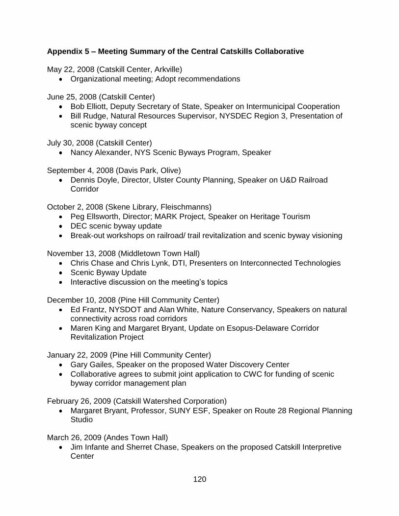
120
Appendix 5 – Meeting Summary of the Central Catskills Collaborative May 22, 2008 (Catskill Center, Arkville)
Organizational meeting; Adopt recommendations June 25, 2008 (Catskill Center)
Bob Elliott, Deputy Secretary of State, Speaker on Intermunicipal Cooperation
Bill Rudge, Natural Resources Supervisor, NYSDEC Region 3, Presentation of scenic byway concept
July 30, 2008 (Catskill Center)
Nancy Alexander, NYS Scenic Byways Program, Speaker September 4, 2008 (Davis Park, Olive)
Dennis Doyle, Director, Ulster County Planning, Speaker on U&D Railroad Corridor
October 2, 2008 (Skene Library, Fleischmanns)
Peg Ellsworth, Director; MARK Project, Speaker on Heritage Tourism
DEC scenic byway update
Break-out workshops on railroad/ trail revitalization and scenic byway visioning November 13, 2008 (Middletown Town Hall)
Chris Chase and Chris Lynk, DTI, Presenters on Interconnected Technologies
Scenic Byway Update
Interactive discussion on the meeting‟s topics December 10, 2008 (Pine Hill Community Center)
Ed Frantz, NYSDOT and Alan White, Nature Conservancy, Speakers on natural connectivity across road corridors
Maren King and Margaret Bryant, Update on Esopus-Delaware Corridor Revitalization Project
January 22, 2009 (Pine Hill Community Center)
Gary Gailes, Speaker on the proposed Water Discovery Center
Collaborative agrees to submit joint application to CWC for funding of scenic byway corridor management plan
February 26, 2009 (Catskill Watershed Corporation)
Margaret Bryant, Professor, SUNY ESF, Speaker on Route 28 Regional Planning Studio
March 26, 2009 (Andes Town Hall)
Jim Infante and Sherret Chase, Speakers on the proposed Catskill Interpretive Center

121
April 30, 2009 (Olive Free Library)
SUNY ESF Students and Faculty, Presentations for Route 28 Regional Planning Project
June 25, 2009 (Catskill Center)
Diane Galusha, Education Coordinator and Communications Director, Catskill Watershed Corporation, Speaker on Watershed Commemorative Kiosk Project
Brainstorming session on Catskill Interpretive Kiosk August 27, 2009 (Catskill Center)
Scenic Byway CMP Kickoff, Peter Manning, Regional Planner, Catskill Center
Ben Murdock, Educator, Catskill Center, Speaker on Invasive Species September 24, 2009 (Catskill Center)
Vision statement exercises for scenic byway CMP
Report from towns of Bovina and Delhi re: extension of proposed scenic byway October 22, 2009 (Pine Hill Community Center)
Scenic Byway Corridorwide asset-building exercises and theme development
Jennifer Schwartz Berky, Deputy Director, Ulster County Planning; Peter Manning, Catskill Center
January 28, 2010 (Olive Town Hall)
Olive Inventory Presentation
Catskill Park sign update March 4, 2010 (Pine Hill Community Center)
Shandaken Inventory Presentation March 25, 2010 (Skene Library)
Fleischmanns Inventory Presentation April 22, 2010 (Margaretville Village Hall)
Margaretville and Middletown Inventory Presentation May 27, 2010 (Pine Hill Community Center)
Hurley Inventory Presentation
Interpretive Kiosk update
Catskill Park sign update June 24, 2010 (Andes Town Hall)
Andes Inventory Presentation

122
July 22, 2010 (Catskill Center)
Exercises on management entity, theme revision, and byway naming September 23, 2010 (Catskill Center)
Marketing and Promotion presentation and adoption of recommendations
Initiation of logo design contest October 28, 2010 (Olive Town Hall)
Adopt name for proposed byway
Ulster County Main Street Program presentation, Jennifer Schwartz Berky (UC Planning) and Peter Fairweather (Consultant)
January 27, 2011(Ashokan Watershed Stream Management Program offices)
Liz Higgins, Coordinator, AWSMP, Presentation and exercises on recreational access
Brett Barry, Silver Hollow Audio, Presentation and discussion on Scenic Byway Audio Driving Tour
February 24, 2011(Emerson Resort and Spa)
Presentation and discussion of entries for logo design contest
Formation of Transportation Committee and discussion March 24, 2011
Award logo winner
Patty Cullen, Director, Delaware County Tourism
Rick Remsnyder, Director Ulster CountyTourism May 26, 2011
Catskill Interpretive Center Project update
Catskill Park signs update
Boiceville tourism information center opportunity, Cynthia Nikitin, Olive
East Branch Recreational Access Project, Aaron Bennett, Consultant
Route 30 Scenic Byway Concept, Caroline Martin, Downsville

123
Appendix 6 - Press Releases and Articles (Examples)
Catskill Center Press Room
#2009-33: October 16, 2009
Pine Hill to Host Workshop for Main Street and Scenic Byway Projects
The Central Catskills Collaborative has drafted a vision for the future of the Route 28 Corridor, setting the context for the Scenic Byway nomination process. The next step is for each community to identify its assets, needs, and action strategies and incorporate these within the Corridor Management Plan. "The Main Streets along the corridor are like pearls in a necklace" notes Peter Manning, the Catskill Center‟s Regional Planner, "if we take special care to polish each one, the collective shine will increase our region‟s attractiveness." In Pine Hill, a grassroots effort to reinvigorate Main Street is already underway and is being facilitated by the Pine Hill Community Center, the Ulster County Planning Board, and the Catskill Center. This effort will continue with a public workshop at the Pine Hill Community Center on Thursday, October 22 at 7PM. The workshop will also serve as the first in a series of inventory exercises to be held from Hurley to Andes during the inventory phase of the Scenic Byway Corridor Management Plan. Pine Hill is one of the hamlets to receive technical assistance under Ulster County‟s Main Street Toolbox Program. "This program builds on local assets and develops a strategic mindset that positions a community to take action," notes Jennifer Schwartz Berky, Deputy Director of the Ulster County Planning Board. The Toolbox emphasizes the value of historic, compact development and takes a hamlet community through a series of exercises that include conducting market analyses, identifying niche business opportunities, and making connections with outdoor recreation and other corridor communities. Success is driven by the motivation of the community. "What this effort is inspired by is a strong desire to pull this community together and to begin exploring the things that we can accomplish for our hamlet," explains James Krueger, Director of the Pine Hill Community Center; "we are trying to foster motivation, cooperation, communication and foresight, and to initiate a formal process of proactive planning." Thursday‟s workshop, featuring mapping exercises and group discussions, will demonstrate how each hamlet can play a key role in the Scenic Byway Corridor Management Plan. "This is a pivotal meeting for the byway nomination process" explains Helen Chase, Chair of the Central Catskills Collaborative. "The inventory techniques presented in Pine Hill will serve all the corridor communities, who will each be undertaking asset-mapping exercises." Anyone interested in the future of the Route 28 Corridor is encouraged to participate. Refreshments will be provided. For more information about Catskill Regional Planning, please contact Peter Manning at (845) 586-2611or visit www.catskillcenter.org. For more information about the Central Catskill Collaborative, please visit www.centralcatskills.org/ccc.

124
THE CATSKILL CENTER
for Conservation and Development
NEWS!
For Immediate Release
Date: September 26, 2008
Contact: David Turan (845) 586-2611
Village of Fleischmanns to Host Interactive Meeting on Heritage Tourism
The public is invited to participate in a meeting of the Central Catskills Collaborative at the historic Skene Memorial Library in Fleischmanns on Thursday, October 2 at 6PM. This month’s featured speaker will be Peg Ellsworth, Executive Director of the M-ARK Project, Inc. Ellsworth was a driving force behind the Town of Roxbury’s outstanding heritage tourism programs and landscapes, which earned the community the prestigious Preserve America Designation and the NY State Historic Preservation Award. The Roxbury Nine Vintage Base Ball Club and popular “turn-of-the-century” events like Railride into Yesteryear have helped stimulate the area’s economy for 10 years. The community of Fleischmanns, once a baseball hub of the Catskills, recently resurrected its vintage baseball team, the Mountain Athletic Club, and also hopes to connect with the historic Delaware and Ulster Railroad.
After the presentation, the gathering will organize into facilitated interest groups, who will discuss and present the connections between heritage tourism and two of the region’s key resources: Route 28 (Onteora Trail) and the Ulster & Delaware (U&D) Railroad Corridor. This session is designed to assist the Collaborative, which is beginning the planning process for a Rte. 28 scenic byway and looking into improving the connections along the U&D Corridor.
The Skene Library (also Village Hall) is located on Main Street in Fleischmanns. Refreshments will be served. For more information please contact Peter Manning, Regional Planner, The Catskill Center for Conservation and Development (845) 586-2611 or [email protected]

125

126

127
Appendix 7 – SUNY ESF Regional Planning Studio, Select Posters

128

129

130

131
Appendix 8 - Smart Growth Award Descriptions

132