CAMP CENTRAL APPRAISAL DISTRICT …Camp Central Appraisal District is a political subdivision of the...
25
1 CAMP CENTRAL APPRAISAL DISTRICT REAPPRAISAL PLAN FOR TAX YEARS 2017 & 2018 PUBLIC HEARING ADOPTED BY THE BOARD OF DIRECTORS ON APRIL 21, 2016 AMENDED ON JANUARY 19, 2017
Transcript of CAMP CENTRAL APPRAISAL DISTRICT …Camp Central Appraisal District is a political subdivision of the...

1
CAMP CENTRAL APPRAISAL DISTRICT
REAPPRAISAL PLAN FOR
TAX YEARS 2017 & 2018
PUBLIC HEARING ADOPTED BY THE BOARD OF DIRECTORS
ON APRIL 21, 2016
AMENDED ON JANUARY 19, 2017

2
TABLE OF CONTENTS
ITEM PAGE Code of Ethics 3 Executive Summary 3 The Written Plan 4 The Plan for Periodic Reappraisal 4 Performance/Monitoring Analysis and Quality Control 6 Analysis of Available Resources 7 Reappraisal Decision 9 Planning and Organization 9 Calendar of Events 10 Mass Appraisal System 13 Data Collection Requirements by Tax year 18 Pilot Study by Tax Year 19 Valuation by Tax Year 19 Mass Appraisal Report by Tax Year 21 Certification Statement 23 Value Defense 23 Computer Formulas 24 BOD Resolution to Adopt 25 Att. Reappraisal Plan – Capitol Appraisal Group, Inc.

3
Code of Ethics It is the strict policy of this Appraisal District to adhere to the following code of ethics.
(1) I will be guided by the principal that property taxation should be fair and uniform, and I will apply all laws, rules, methods and procedures in a uniform manner to all taxpayers.
(2) I will not accept anything of value from any party other than my employer unless acceptance of something is totally unrelated to my performance and duties as an appraiser, assessor or collector.
(3) I will not use information received in connection with my duties as an appraiser, assessor or collector for my own purposes or for my own gain, unless such information can be known by ordinary means to any ordinary citizen.
(4) I will not accept an assignment for which it is expected by any party that I will report a predetermined appraised value or report such predetermined values.
(5) I will not speak or act in a manner or engage in any practice that is dishonest, fraudulent, deceptive or in violation of law or generally accepted standards or morality.
(6) I will uphold the honor and dignity of the property tax profession.
Executive Summary/Scope of Responsibility
Camp Central Appraisal District is a political subdivision of the State of Texas established January 1, 1980. This reappraisal plan and report required by S.B. 1652 is generated to provide to the citizens of Camp County a better understanding of the district’s procedures, responsibilities, activities, results and effects of those activities. The ultimate goal is to obtain an effective and positive result when analyzed by the Property Tax Division of the Comptroller’s Office with the annual Property Value Ratio Study Report. This report establishes the position of equity and uniformity for the appraisal districts in the tested property categories. Camp Central Appraisal District is governed by a Board of Directors appointed by the taxing entities. The Board of Directors hires the Chief Appraiser as administrator of the appraisal district. The Property Tax Code is the governor of the legal, statutory, and administrative requirements of the appraisal district. The appraisal district is required to appraise all property in its district boundaries for the purpose of local property taxation at market value as of January 1 except as otherwise provided by Sec. 23 of the tax code. According to the Texas Property Tax Code “market value” is defined as the price at which a property would transfer for cash or its equivalent under prevailing market conditions if:
• exposed for sale in the open market with a reasonable time for the seller to find a buyer

4
• both the seller and buyer know all the uses and purposes to which the property is adapted and for which it is capable of being used and of the enforceable restrictions on its use, and;
• both seller and buyer seek to maximize their gains and neither is in a position to take advantage of the needs of the other
Various types of property exemptions are determined by the appraisal district office such as homestead exemptions, charitable or religious exemption, partial and absolute exemptions and agricultural productivity valuation. Appraisals are generated with computer assisted mass appraisal programs using recognized appraisal techniques and methods. We compare our data to data gathered from recent cost guides and market sales data. The district follows the standards of the International Association of Assessing Officers (IAAO) regarding its appraisal practices and procedures, and subscribes to the standards known as the Uniform Standards of Professional Appraisal Practice (USPAP) to the extent they are applicable. The purpose and requirement for the written reappraisal plan and periodic reappraisal resulted from the passage of S.B. 1652 which amended the Tax code as follows: The Written Plan According to Section 6.05 of the Tax Code subsection (i): “To ensure adherence with generally accepted appraisal practices, the Board of directors of an appraisal district shall develop biennially a written plan for the periodic reappraisal of all property within the boundaries of the district according to the requirements of Section 25.18 and shall hold a public hearing to consider the proposed plan. Not later than the 10th day before the date of the hearing, the secretary of the board shall deliver to the presiding officer of the governing body of each taxing unit participating in the district a written notice of the date, time and place of the hearing. Not later than September 15, of each even numbered year, the board shall complete its hearings, make amendments, and by resolution finally approve the plan. Copies of the approved plan shall be distributed to the presiding officer of the governing body of each taxing unit participating in the district and to the comptroller within 60 days of the approval date.” The Plan for Periodic Reappraisal Section 25.18 of the Tax code (a) and (b) implements the following:
(a) “Each appraisal office shall implement the plan for periodic reappraisal of property approved by the board of directors under Section 6.05 (i).
(b) The plan shall provide for the following reappraisal activities for all real and personal property in the district at least once every three years:
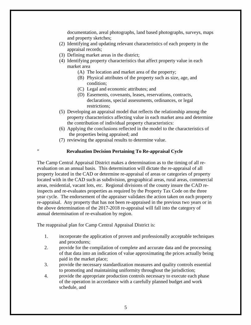
(1) Identifying properties to be appraised through physical inspection or by other reliable means of identification , including deeds or other legal
5
documentation, areal photographs, land based photographs, surveys, maps and property sketches;
(2) Identifying and updating relevant characteristics of each property in the appraisal records;
(3) Defining market areas in the district; (4) Identifying property characteristics that affect property value in each
market area (A) The location and market area of the property; (B) Physical attributes of the property such as size, age, and
condition; (C) Legal and economic attributes; and (D) Easements, covenants, leases, reservations, contracts,
declarations, special assessments, ordinances, or legal restrictions;
(5) Developing an appraisal model that reflects the relationship among the property characteristics affecting value in each market area and determine the contribution of individual property characteristics:
(6) Applying the conclusions reflected in the model to the characteristics of the properties being appraised; and (7) reviewing the appraisal results to determine value.
” Revaluation Decision Pertaining To Re-appraisal Cycle The Camp Central Appraisal District makes a determination as to the timing of all re-evaluation on an annual basis. This determination will dictate the re-appraisal of all property located in the CAD or determine re-appraisal of areas or categories of property located with in the CAD such as subdivision, geographical areas, rural areas, commercial areas, residential, vacant lots, etc. Regional divisions of the county insure the CAD re-inspects and re-evaluates properties as required by the Property Tax Code on the three year cycle. The endorsement of the appraiser validates the action taken on each property re-appraisal. Any property that has not been re-appraised in the previous two years or in the above determination of the 2017-2018 re-appraisal will fall into the category of annual determination of re-evaluation by region. The reappraisal plan for Camp Central Appraisal District is:
1. incorporate the application of proven and professionally acceptable techniques and procedures;
2. provide for the compilation of complete and accurate data and the processing of that data into an indication of value approximating the prices actually being paid in the market place;
3. provide the necessary standardization measures and quality controls essential to promoting and maintaining uniformity throughout the jurisdiction;
4. provide the appropriate production controls necessary to execute each phase of the operation in accordance with a carefully planned budget and work schedule, and

6
5. provide techniques especially designed to streamline each phase of the operation, eliminating functions, and reducing the complexities inherent in the appraisal process to more simplified but equally effective procedures.
PERFORMANCE/MONITORING ANALYSIS
QUALITY CONTROL As procedure has dictated and has occurred in years past 2017 and 2018 appraisal years will be analyzed with ratio studies from the previous years values along with the Comptroller’s Property Value Study report to determine appraisal accuracy and appraisal uniformity overall with the use additional market data gathered within and representing each of the state property reporting categories. In conjunction with the ratio study and the property value study the mean, median, and weighted mean ratios are calculated for properties in each reporting category to measure the level of appraisal accuracy. The mean ratio is calculated in each market area to indicate the level of appraisal accuracy by property reporting category. In 2017 and 2018 this analysis will be used to develop the starting point for establishing the level of accuracy on the appraisal performance. The testing result will be an indicator of which properties will need to be addressed with a change and which properties will not need a change. This result can indicate a negative or positive increase or decrease in value. All ratio calculations are in compliance with the Standard on Ratio Studies from the International Association of Assessing Officers. Model testing, Quality Control and Correlation are the final steps in the appraisal process. Model testing is dome to determine the final changes for current year’s final values. Quality control reviews all properties after the final values have been determined. Correlation is the process of comparing all three value methods as a test of market value. All of these are completed before the final values are implemented. Specifications are typical components of each individual class. These components are the “specifications” of its model. The specifications are reviewed each year from Marshall/Swift, local ratio studies and local builders/contractors. As newly constructed homes are inspected, the differences are noted so that a review of model specifications can be done. Calibration involves reviewing and measuring all variables that affect the market value. After all variables are analyzed, the model is calibrated. Final Value Implementation of changes is applied to the model to achieve market value. This process is done after final approval from Chief Appraiser. Final value implementation consists of schedule changes, neighborhood changes and individual property changes. Quality control and assurance measures produced by Camp CAD and Capitol Appraisal Group depend on the quality of the data from which they are generated. Therefore, all data collected is tested in a systematic manner throughout the entire appraisal process. The Chief Appraiser will review work throughout the entire appraisal process, reviewing work for conformity to appraisal standards. The Chief Appraiser and Senior Appraiser will conduct spot reviews of work throughout the appraisal process for potential errors. Camp CAD runs a number of verification reports through the PACS software. The software allows for a wide variety of user generated reports as well as those written by the vendor. The following are some of the more frequently used reports by Camp CAD:

7
•Exception Reports – assessed value, improvement value, land value, mobile home value and personal property value. •Gain/Loss Reports •Homestead Cap Verification Reports •Limitation on the absence from Homestead •Multiple Homestead Reports •Mismatched Personal Property/Entity Report •Recalculation Error Report Camp CAD software also allows “user rights”, the Chief Appraiser is the Administrator of those rights. The Chief Appraiser and Senior Appraiser only have the right to change schedules, create schedules, change class or depreciation, etc. The Camp CAD contracts with Capitol Appraisal Group for the appraisal and valuation of oil and gas leases, communication properties, public utilities and industrial properties. In addition to Capitol Appraisal Group’s performance tests and quality controls, Camp CAD will monitor the work as well. The Chief Appraiser will monitor the contractor’s work to ensure progress according to the reappraisal plan. The Chief Appraiser receives periodic update reports from the appraisers throughout the appraisal and review process. The Chief Appraiser is notified, and a part of, all settlement/wavier agreements. Capitol Appraisal Group appears before the ARB in June/July and gives an annual report with supporting documentation. Once Capitol submits the electronic file, and it has been imported for the current year, the Chief Appraiser will run all data verification reports before beginning the certification process.
ANALYSIS OF AVAILABLE RESOURCES Data, maps, information systems support, existing practices, budget and employee staffing are all major components required to assist in accomplishing final results necessary to ensure the appraisal district is conforming with the IAAO and USPAP standards and practices when appraising all categories of property. The ultimate goal is to have the proper employees in key positions with the experience, knowledge and certifications required to perform required duties. The office of the Chief Appraiser is responsible for the planning, organizing, staffing, and coordinating the district operations. The administrative functions are to direct and control the business support functions related to human resources, budget, finance, records management, purchasing, and the retention of fixed assets and facilities. The appraisal department or appraisers are responsible for the valuation of all real and personal property. These categories of property include commercial, residential, business personal, mineral, utilities, and industrial. The district’s appraisers are subject to the certification requirements adopted by the Texas Department of Licensing and Regulation which are subject to the provisions of the Property Taxation Professional Certification Act. Support Functions include records maintenance, information coordination, formal and informal property protest hearings, and many other citizen contacts. The appraisal district’s staff consists of 6 employees with the following classifications: Official/administrator (executive level administration) – 1

8
Technicians or appraisers – 2 Administrative support – 3 All certified personnel are required to receive additional training of a minimum of 30 hours of continuing education units every two years in order to continue working as a certified employee. Failure to comply with this requirement will result in a revoked license and possible termination from the appraisal district. No change in staffing has been recognized for the 2017 or 2018 appraisal years at the time of this writing. Staffing will impact the cycle of real property re-inspection and personal property on-site review that can be accomplished in the 2017-2018 time period. The appraiser’s longevity of employment with the Appraisal district can be a positive or negative effect on accomplishing the goals of reappraisal. Appraiser’s familiarity with the county is a must to accomplish this demandingly large task. The Camp Central Appraisal District is responsible for establishing and maintaining approximately 22,000 property accounts. The data that comprises the 22,000 property accounts include property characteristics, ownership, and absolute or partial exemption information. The GIS mapping system maintains parcel lines, split-outs and various layers of data and aerial photography. The district’s website allows a broad range of information available for public access, including information on individual appraisals, property characteristics, certified values, and exemption applications and forms. Aerial photography is especially helpful in determining the productive use of agricultural and timber lands. The GIS mapping system is maintained by BIS Consulting. They are responsible for ownership and spit-out updates and mapping properties according to the metes and bounds of deeds and resurveys. Aerial photography will be updated every two years using the information provided the US Geological Department. The Appraisal District last purchased high resolution aerials flown in December of 2011. Information system enables the district to maintain and continuously add additional data concerning the 22,000 accounts in the district. The server data base is a Dell Power Edge T610 with software support from the software group True Automation. The user base is networked to the mainframe using Windows 7 applications. True Automation programmers are updated on all applicable law changes and are continuously updating the software requirements that functions our reporting process. Annual budget requirements for the following year are presented to the Appraisal District Board of Directors by June 15th of the current year. The BOD must adopt the budget by September 15th of the current year and provide all participating entities with a copy.
PLANNING AND ORGANIZATION A calendar of events with target completion dates has been prepared and made a part of this document. The calendars only reflect the most relevant events that relate to the appraisal segment of the property tax administration.

9
REAPPRAISAL DECISION
Overview
The Camp Central Appraisal District, by policy adopted by the Board of Directors and Chief Appraiser, reappraises approximately one-third of all property in the district every year. A breakdown of the areas to be re-appraised is made using regional boundaries. Using regions as an area, accounts are totaled within each region. Regions are divided so there are approximately the same number of accounts appraised each year. Only certain regions are appraised in a given year. In any given appraisal year, the Chief Appraiser reserves the right to modify the schedule, if in-house ratio studies, natural disasters or other information deem re-appraisal necessary out of turn; while still ensuring adherence to the overall 3 year cycle. Example: Year A: Region 1 Year B: Region 2 Year C: Region 3 A re-appraisal year for an area is a complete appraisal of all properties in the district. In the areas of non re-appraisal years, staff will pick up new construction and remodeling, adjust changes in property characteristics that affect value and adjust previous year values. Appraisal District staff will monitor sales and building classifications (i.e. land, improvements) to reflect current market conditions in this county.
PLANNING AND ORGANIZATION
A calendar of events with critical completion dates is prepared for each major work area. This calendar identifies all key events for appraisal, clerical and information systems. A separate calendar is prepared for tax years 2017 and 2018. TAX YEAR 2017 Complete re-appraisal of Region 1 Mailing new homestead applications update letters to new owners Mailing requests for updated homestead and ag/timber applications when needed Mailing wildlife updates, misc. exemptions, special inventory declarations annually Ownership changes and mapping metes and bounds by deed research Split-outs as deeds warrant TAX YEAR 2018 Complete re-appraisal of Region 2 Mailing new homestead applications update letter to new owners Mailing requests for updated homestead and ag/timber applications when needed Mailing wildlife updates, misc. exemptions, special inventory declarations annually Ownership changes and mapping metes and bounds by deed research Split-outs as deeds warrant

10
2017 Calendar of Events
Phase Begin Complete Administration/Planning September 2016 June 2017 Training: Certifications/CE’s Ongoing Ongoing in-house training Ongoing Ongoing conference/workshops Ongoing Ongoing Data Collection/Discovery: Collect deeds, mechanic liens, building permits, assumed name filings etc. January 2017 April 2017 Mail Homestead Exemption Appl. Updates/Reapps January 2017 April 2017 Mail Annual Exemption Appls. January 2017 April 2017 Mail Ag/Timber/Wildlife Appl. January 2017 April 2017 Updates/Reapps/Annual Reports January 2017 April 2017 Mail Manufactured Home Letters August 2016 January 2017 Mail Renditions: Business PP/Real January 2017 April 2017 Sales Date Gathered Continuous Continuous Field Inspections Sept. 2016 March/April 2017 Data Entry October 2016 April 2017 On-going Mapping Deed research for metes and bounds in continuing process of unmapped properties and split-outs Continuous Continuous Valuation Analysis/Processing Ratio studies, schedule building/adjustment/ testing and determining need for modifiers January 2017 April 2017 Review Pilot studies/testing April 2017 April/May 2017 Notification April 2017 May 2017 Submission of records to ARB April 2017 May 2017 Hearings May 2017 July 2017 Certification of Values July 2017

11
2018 Calendar of Events
Phase Begin Complete Administration/Planning September 2017 June 2018 Training: Certifications/CE’s Ongoing Ongoing in-house training Ongoing Ongoing conference/workshops Ongoing Ongoing Data Collection/Discovery: Collect deeds, mechanic liens, building permits, assumed name filings etc. January 2018 April 2018 Mail Homestead Exemption Appl. Updates/Reapps January 2018 April 2018 Mail Annual Exemption Apps. January 2018 April 2018 Mail Ag/Timber/Wildlife Apps. January 2018 April 2018 Updates/Reapps/Annual Reports January 2018 April 2018 Mail Manufactured Home Letters August 2017 January 2018 Mail Renditions: Business PP/Real January 2018 April 2018 Sales Data Gathered Continuous Continuous Field Inspections Sept. 2017 March/April 2018 Data Entry October 2017 April 2018 On-going Mapping Deed research for metes and bounds in continuing process of unmapped properties and split-outs Continuous Continuous Valuation Analysis/Processing Ratio studies, schedule building/adjustment/ testing and determining need for modifiers January 2018 April 2018 Review Pilot studies/testing April/May 2018 Notification April 2018 May 2018 Submission of records to ARB April 2018 May 2018 Hearings June 2018 July 2018 Certification of Values July 2018

12
*Throughout both years: Enter sales data as it becomes available from buyer/seller surveys and Multiple Sales Listing, data entry for new/updated improvements and changes noted by appraisers, make ownership changes as deeds are available, enter/remove exemptions and special use valuation for accounts as they are qualified. Mail residence homestead exemptions applications to new owners as they are identified by the CAD. Continue to research metes and bounds by which to map and identify property in the county to add to our GIS mapping system. Map spilt-outs as deeds are received throughout the year. The appraisal staff is responsible for collecting and maintaining property characteristic data for classification, valuation and other purposes. Accurate valuation of real and personal property by any method requires a comprehensive physical description of personal property, land and building characteristics. The Chief Appraiser/Appraisal staff is responsible for administering, planning and coordinating all activities involving data collection and maintenance of all commercial, residential and personal property types located within the boundaries of Camp County and the jurisdictions of the appraisal district. The data collection effort involves the field inspection of real and personal property accounts, as well as entry of all data collected into the existing information system. The goal is to field inspect residential, commercial and personal properties in the district every 3 years by regions each containing approximately 7,400 parcels.
Staff Providing Significant Mass Appraisal Assistance
Jan Tinsley, RPA, RTA, CTA, CCA, CSTA Chief Appraiser Glenda Olivares, PRA, RTA Senior Property Appraiser BIS Consulting, Hector Gomez GIS Mapping Maintenance Chekita Royal Mapping Coordinator/Deed Research Gregg Davis, RPA Industrial Appraiser Capitol Appraisal Group LeLaina Taylor, RPA Mineral Appraiser Capitol Appraisal Group Cathy Jackson, RPA Commercial Appraiser Capitol Appraisal Group Alfonso Porras Utilities Appraiser Dawn May Railroads Capitol Appraisal District BIS Consulting Website/E-Protest

13
By May 15th, or as soon thereafter as practicable, the chief appraiser and each appraiser engaged in listing and appraising property shall sign a submission affidavit to the ARB which states: “I, ____________________________(Chief Appraiser/Appraiser) for Camp Central Appraisal District solemnly swear that I have made
Or caused to be made a diligent inquiry to ascertain all property in the district subject to appraisal by me and that I have included in the records all property that I am aware of at an appraised value as required by law.”
Mass Appraisal System
Real Property Valuation
Revisions to cost models, income models and market models are specified, updated and tested each year. Cost schedules are tested with market data (sales) to ensure the appraisal district is in compliance with the Texas Property Tax Code, Section 23.011. Replacement cost new tables as well as depreciation tables are tested for accuracy and uniformity using ration study tools and compares with cost data form recognized industry leaders such as Marshall & Swift and NADA Land tables are updated using current market data (sales) and then tested with ratio study tools. Value modifiers are developed for property categories by market area and tested on a pilot basis with ratio study tools.
Personal Property Valuation
Density schedules are updated using Marshall & Swift valuation guide. Valuation procedures are reviewed and modified as needed and tested.
Notice Processing
25.19 appraisal notice forms are reviewed and edited for updates. Updates include the latest copy of Comptroller’s Taxpayers Rights, Remedies and Responsibilities in English and Spanish. Camp CAD will mail notices for single family residence homestead properties by April 1st (or as soon thereafter as practicable) and all other properties will be mailed by May 3rd (or as soon thereafter as practicable), with the exception of business pp which will be mailed on May 15th ( or as soon thereafter as practicable).
Hearing Process Scheduling of informal and formal ARB hearings are continually reviewed and updated as required. Standards of documentation are reviewed and amended as required. The appraisal district hearing documentation is reviewed and updated to reflect the current valuation process. Production of documentation is tested and compliance with HB 201 is

14
insured. Camp CAD utilizes an automated informal and formal hearing schedule and appeals process that begins with the mailing of notices in April and May and continues until all appeals are heard. Camp County Appraisal Review Board reviews and adopts hearing procedures annually and adheres to all education and training requirements. Camp County Appraisal Review Board adopted, as part of their policies and procedures, the Comptroller’s Model Procedures and Guidelines January 17, 2014. The Appraisal Process With the aid of the Camp Central Appraisal District calendar the field appraisal staff is responsible for discovering, inspecting, calculating and evaluating property characteristics of all real and personal property. The goal is to correctly identify all characteristics of property in Camp County and to allocate those characteristics to our models developed as comparables to generate on a mass scale the correct market value for every property located within the appraisal district authority. This process will begin in September of each year and have a targeted completion date of April 1 with May 15 the target date for personal property of each year. The months of June, July, and August are set aside to complete formal and informal hearings of the equalization phase of the appraisal calendar. Properties will be identified through physical inspection, or other reliable means including deeds or other legal documentation, digital mapping, aerial photographs, land-based photographs, surveys, maps and property sketches. Characteristics of each property will be updated in the appraisal records.
Valuation Approach
Market areas will be defined by:
• location and economic attributes • Physical attributes of properties such as size, age, condition • Easements, covenants, leases, special assessments, ordinances or legal
restrictions Land Analysis: The analysis of land is conducted prior to neighborhood sales analysis. The land-to-property component is based on available market sales for comparable and competing land under similar usage. A comparison and analysis of comparable land sales is conducted based on land characteristics found to influence market value of land located in a neighborhood or area. The appraisers use abstraction and allocation methods to insure that estimated land values reflect the land’s market value to overall property value. Area Analysis: Regional economic forces such as demographic patterns, regional location factors, employment and income patterns, general trends in real property prices and rents, interest rates trends, availability of vacant land, and construction trends and costs are collected

15
from private vendors, contractors and public sources to provide the appraiser with a current economic outlook on the real estate market. Neighborhood and Market Analysis: Physical, economic, governmental and social forces influence property value. These effects are used to identify, classify, and stratify comparable properties into smaller subsets for more accurate appraisals of neighborhoods. Residential valuation and neighborhood analysis is conducted on various market areas within each of the political entities known as Independent School Districts (ISD). Market sales analysis forms the basis of estimating market activity and the level of supply and demand affecting the market within a market area or neighborhood. The effect of these market forces are interpreted by the appraiser into an indication of market price ranges. The first step in neighborhood analysis is the identification of a group of properties that share certain common traits.
A “neighborhood” is defined as the largest geographical grouping of properties where the property’s physical, economic, governmental and social forces are generally similar and uniform.
Once a neighborhood has been identified, the next step is to define the boundaries. This process is known as “delineation”. Part of the neighborhood analysis is the consideration of discernible patterns of growth that influence the neighborhood’s individual market.
Camp County Market Areas Indentified Camp County is experiencing a stage of growth according to the United States Census Bureau. Camp County has grown an estimate of 28% since 1990 when the population was 9,904. The 2000 population: 11,549 The 2010 population: 12,401 The 2014 population: 12,621 These figures are based on people living within the boundaries of Camp County. It does not factor in the numerous people who have established the county as a second home. Camp County’s market area consists of one Independent School District that encompasses the whole county. Within the market area there are subsets that may be characterized as being in a stage of growth, stability or decline. The growth period is a time of development and construction. The two main areas experiencing a high volume of growth and development in the county are commercial property, with Pittsburg City’s 75 acre annexation of commercially zoned property along Highway 271 north, and residential property located near Lake Bob Sandlin. Properties around Lake Bob Sandlin are in the growth and development phase and a direct influence on the market in the area. Property was purchased and developed into platted subdivisions, with new subdivisions developed within the last 24 months. The different characteristics of the property help indentify “neighborhoods” such as vacant lots with lake frontage, vacant lots with lake view, residential properties in subdivisions that are located in gated communities with amenities, residential properties located in subdivisions alone. Influences such as lakefront, lake view, lake front footage all further drive these areas. Lake subdivisions such as Cherokee Point, Cherokee Peninsula, Hills Point, Paradise Village, Meadowlake and others have become their own

16
market areas, each with unique features, amenities and characteristics. Eagle Shores Phase I, West Shores and Lazy Acres were developed into the newest subdivisions for new construction. This market area is driven by outside influences such as retirement, summer and weekend recreation. Another driving influence is supply and demand, the number of desirable properties for sale compared to the number of people wanting to buy lake properties. Areas in Pittsburg City are experiencing growth as well. Subdivisions such as Legacy, Dogwood Trails, Kentwood and Cedar Hill all are defined as market areas based on their unique characteristics. The county is divided into 3 Regions: Region 1 consists of properties defined by the appraisal district as “lake area” properties and properties within the City of Pittsburg. Region 2 consists of the northern part of Camp County with the exception of the “lake area’. Region 3 consists of properties in the southern part of the county. Region 1 is the most populated residential and commercial of the three regions. Regions 2 and 3 are more rural land with some residential. Production standards for field activities and results are tested on a quarterly basis with the use of sales data gathered through buyer and seller questionnaires mailed by the appraisal district, verbal contact with citizens of Camp County, and confirmations of sales activity in warranty deed or county clerks recorded documents. Just as with the annual Property Value Study performed by the Comptroller’s Property Tax Division the use of sales and recognized auditing and sampling techniques are used to determine the level and uniformity of property tax appraisal in this district. This process utilizes statistical analysis of sold properties (sales ratio) and appraisals of unsold properties (appraisal ratios) as a basis for assessment ratio reporting. The reported measures include the median level of appraisal, coefficient of dispersion (COD), the percentage of properties within 10% of the median, the percentage of properties within 25% of the median and price-related differential (PDR) for properties overall and by state category. The ratio study includes stratified samples to improve sample representation for measuring uniformity. True Automation software programming division provides updates of all program calculation adjustments, forms, and computer form revisions that are dictated in legislative sessions or changes in the law. Management assists with the scheduling and processing of these updates in order to be timely effective for the use in the appraisal process. The mass appraisal process is accomplished by using model calibration. Model calibration involves the process of periodically adjusting the mass appraisal formulae, tables, and schedules to reflect current local market conditions. The basic structure of a mass appraisal model can be valid over an extended period of time, with trending factors utilized for updating the data to current market conditions. If the adjustment process becomes too involved, the model calibration technique can mandate new model specifications or a revised model structure. Many times this occurs when new construction materials or cost and style develops into an additional class of property.

17
Cost schedules will be updates with market data (sales) to insure that the appraisal district is in compliance with Texas Property Tax Code, Sec. 23.011 (4) requirement of being within 10% of a generally accepted cost data source. Cost models are typically developed based on the Marshall & Swift Valuation Service. Cost models reflect replacement cost new of all improvements. Because a national cost service is used as a basis for the cost models, location modifiers are necessary to adjust these base costs specifically for various types of improvements. Accrued depreciation is the measured loss of value against replacement cost new taken from all forms of physical deterioration, functional and economic obsolescence. Estimates of accrued depreciation are calculated for improvements with a range of variable years of expected life based on observed condition with consideration of actual age. Effective and actual ages are noted in our computer assisted mass appraisal system. Effective age estimates are based on the utility of the improvements relative to the scale of its total economic life and its competitive position in the marketplace. Effective age estimates are considered and reflected based on five levels of observed condition. A depreciation override can be used if the condition or effective age of a property varies from the norm by appropriately noting the physical condition and functional utility ratings on the property data characteristics. These adjustments can be developed via ratio studies or other market analysis and are tied to specific condition adequacy or deficiency, property type or location. Estimating accrued depreciation and deducting that from the estimated replacement cost new of improvements indicates the estimated contributory value of the improvements. Adding land value, as if vacant, to the contributory value to the improvements indicates a property value by the cost approach. Land tables are updated using current market data (sales) and then tested with ratio study tools. Value modifiers are developed for property categories by market area and tested with ratio study tools. Income, expense, and occupancy data are useful tools in producing an income approach to value. The income approach is typically used to value property viewed as “income producing” such as duplexes, apartment buildings, storage facilities. The difficulty in gathering this important data has not afforded this district the ability to use this approach on a consistent nor wide spread basis. The district will continue to consider this approach to value as information permits. The income approach is used on the special appraisal process for the agricultural and timber properties. The data gathered and used in this type appraisal is downloaded directly from the Comptroller and is data they have gathered from Texas A&M University which in turn has gathered information from timber mills and suppliers. Capitalization process used in the income approach on agricultural and timber properties is a direct rate provided by Sec. 23.53 and Sec. 23.74 of the Property Tax Code.

18
Personal property valuation cost schedules are developed by analyzing cost data from property owner renditions, hearings, state schedules, and published cost guides. The cost schedules are reviewed as necessary to conform to changing market conditions. Most of the information used by the district is generated to the district from the owner in a form of a rendition. Each new years rendition is compared to the last year to verify additions or deletions and to get a better understanding of what the property should exist at the business. The present value factor is used as an express calculation in the cost approach. The present value factor is applied to historical cost as follows:
MARKET VALUE ESTIMATE=PVF X HISTORICAL COST Historical cost is normally supplied to the CAD via the completed rendition form from the owner of the business. The mass appraisal PVF schedule is used to ensure that estimated values are uniform and consistent and reflect current economic pressures of supply and demand.
DATA COLLECTION REQUIREMENTS
Activities scheduled for each tax year include new construction, demolition, remodeling, re-inspection of problematic market areas, and re-inspection of the universe of properties on a specific cycle. The specific cycle will be determined annually after appropriate documentation on sales activity, replacement cost new data, and or any other economic catalyst that affects a sufficient number of properties that indicate a complete re-appraisal is necessary. The final result accomplished with every property being reappraised by law at least once in every three years. The principal source of data collection on new construction and remodeling are generated by building permits and mechanic liens filed with the city and the county. A field effort of driving the county also generates a constant watchful eye on any new construction or additions that may be added to the property. With the addition of the web connection, property owners themselves are generating and filtering information to the cad about the property description of their individual property. Data surveys included in the buyer and seller questionnaire when returned is helpful in identifying characteristic that are needed to correctly appraise property and gives to the cad the current sales data. Identifying these characteristics with the sales information aides in the model calibration of properties included in that class or category and identifies problematic areas. Quality of data is emphasized as the goal and responsibility of each appraiser. Sales information is verified by sources such as new owner, seller, Multiple Listings Service, local realtors, and comptroller’s sales letter survey. Multiple Listings Service is a good source for data characteristics. Field appraisers perform field activities to ensure the data they have entered into the computer based system has been maintained and is correct. Data updates and file modification for property descriptions and input accuracy is conducted as the responsibility of the field appraiser.

19
Texas Railroad Commission and division orders are the source for our mineral appraisals. Personal Property rendition forms are the source of data for commercial property inventories, furniture and fixtures and machinery and equipment. Assumed names filed with county also, generate additional check points for new business personal property.
PILOT STUDY BY TAX YEAR
The International Association of Assessing Officers, Standard on Mass Appraisal of Real Property specifies that the universe of properties should be re-inspected on a cycle of 3 years. This re-inspection includes the re-measurement of at least two sides of each improved property. Sales ratio studies are conducted each tax year by category and market areas. Actual test results are compared with anticipated results and those models not performing satisfactorily are refined and retested. These procedures used for model specification and model calibration are in compliance with Uniform Standards of Professional Appraisal Practice, and Standard Rule 6.
VALUATION BY TAX YEAR
Calculation of preliminary values enables the district to use the market analysis of comparable sales and gathered cost data to ensure that the ratio study performed in each category of property, neighborhood, and defined market areas generates an acceptable ratio in each segment of property or grouped segment of properties. Properties in selected market areas are updated in non-reappraisal years as well as in re-appraisal years if the ratio results reflect the need for a change. Therefore, the need for re-appraisal year is made on an annual basis and determined by market areas. Every property is reappraised at least once in every three years. A change may or may not occur depending on the cost data gathered, sales information gathered, or other pertinent information pertaining to the individual property or property characteristics.
SPECIAL INVENTORY RESIDENTIAL PROPERTY
Cost approach to value is the most common usage in this category of property. Developers have the same benefits and rights as individuals with other types of inventory in which they are entitled to have their property grouped as if it were to be sold as a whole. This method is based on the use of cost or market which ever is the lowest. Sales approach is not used until the developer sales the property and the category changes to a category other than inventory. Income approach to value is not used on this property because it is not income producing.
MULTIFAMILY RESIDENTIAL PROPERTY
20
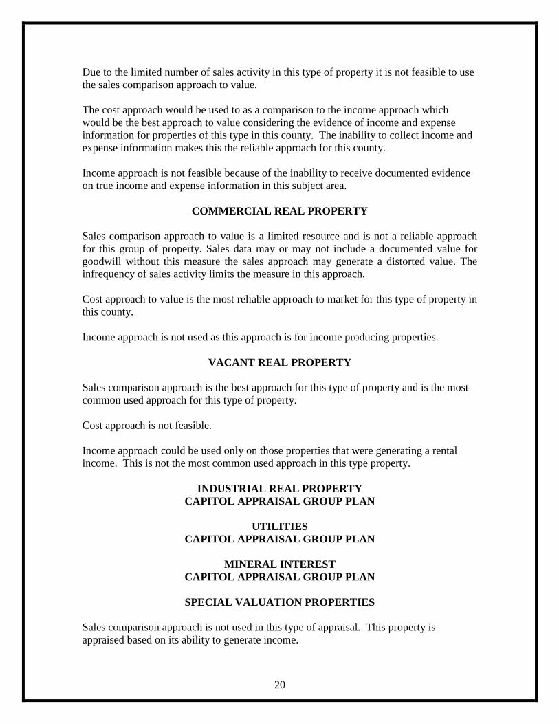
Due to the limited number of sales activity in this type of property it is not feasible to use the sales comparison approach to value. The cost approach would be used to as a comparison to the income approach which would be the best approach to value considering the evidence of income and expense information for properties of this type in this county. The inability to collect income and expense information makes this the reliable approach for this county. Income approach is not feasible because of the inability to receive documented evidence on true income and expense information in this subject area.
COMMERCIAL REAL PROPERTY
Sales comparison approach to value is a limited resource and is not a reliable approach for this group of property. Sales data may or may not include a documented value for goodwill without this measure the sales approach may generate a distorted value. The infrequency of sales activity limits the measure in this approach. Cost approach to value is the most reliable approach to market for this type of property in this county. Income approach is not used as this approach is for income producing properties.
VACANT REAL PROPERTY
Sales comparison approach is the best approach for this type of property and is the most common used approach for this type of property. Cost approach is not feasible. Income approach could be used only on those properties that were generating a rental income. This is not the most common used approach in this type property.
INDUSTRIAL REAL PROPERTY CAPITOL APPRAISAL GROUP PLAN
UTILITIES
CAPITOL APPRAISAL GROUP PLAN
MINERAL INTEREST CAPITOL APPRAISAL GROUP PLAN
SPECIAL VALUATION PROPERTIES
Sales comparison approach is not used in this type of appraisal. This property is appraised based on its ability to generate income.

21
Cost approach is not used on this type of property. There is no effective or feasible way to use a cost approach on this type property. Income approach is the correct approach used on this type of property because it is an income producing property and is based on the land’s ability to generate income. Cost approach to value is the most reliable approach with the aide of renditions that are prepared by the owner giving the historical cost of the items and with the use of indexing the historical value to generate an in use current value. Income approach is not used as the personal property is not normally used nor produces rental income.
INDUSTRIAL TANGIBLE PERSONAL PROPERTY CAPITOL APPRASIAL GROUP PLAN
THE MASS APPRAISAL REPORT
The appraisal of a large number of real and personal property as a group within an established period of time using standardized procedures and subjecting the resulting appraisals to statistical testing is the definition of mass appraisal. The mass appraisal report is a report prepared and certified by the Chief Appraiser at the conclusion of the appraisal phase of the ad valorem tax calendar. Since the majority of ad valorem real property taxation in Camp County is accomplished using mass appraisal techniques, the general standard for appraisal should reflect compliance with USPAP Standard 6. The signed certification is compliant with the Standard Rule 6-9 of USPAP. This written reappraisal plan is attached to the Mass Appraisal report by reference. The scope of work for a mass appraisal includes the following:
1. Identifying properties to be appraised 2. Defining market areas 3. Identifying characteristics that affect the market value 4. developing a benchmark property that reflects the relationship of characteristics
affecting value 5. calibrating the benchmark 6. calculate the conclusion of the property being appraised 7. reviewing the mass appraisal results
The purpose of the mass appraisal completed by Camp Central Appraisal District is to estimate fair market value for ad valorem tax purposes. These values are used by the taxing jurisdictions in the county. Ad valorem equates to tax based on value and maintains a consistent appraisal date of January 1 of each year with the exception of some inventories.

22
Appraisals completed by the appraisal district office are subject to the following assumptions and limiting conditions:
1. Title to the property is assumed to be good and marketable and the legal description correct.
2. All existing liens, mortgages, or other encumbrances have been disregarded and the property is appraised as through free and clear, under responsible ownership and competent management.
3. All sketches in the appraisal documents are intended to be visual aids and should not be construed as surveys or engineering report unless otherwise specified.
4. All information in the appraisal documents has been obtained by member of the appraisal district staff or other reliable sources.
5. The opinion of value for each property applies to land and improvements. The value of trade fixtures, furnishings and other equipment has not been included with the value of the real estate.
6. The appraisals were prepared exclusively for ad valorem tax purposes. 7. The appraisers developing these appraisals are not required to give testimony or
attendance in court by reason of the appraisal, unless directed by, employed by and provided legal counsel by the Camp Central Appraisal District.
8. Subsurface rights (minerals and oil) were not considered in making the appraisals. 9. The appraisers have inspected, as far as possible, by observation, the land and the
improvements, however, it is not possible to personally observe conditions beneath the soil or hidden structural components within the improvements. No representation of this matter is made unless specifically detailed by the owner or approval for inside inspection by the owner.
10. The values generated by the appraisal district are reviewed bi-annually by the Property Tax Division of Comptroller of Public Accounts in order to finalize a Value Study every two years for the purpose of the use in TEA state funding calculation in the school district budget.
It must be noted that no re-appraisal program, regardless of how skillfully administered, can ever be expected to be error free. The correction of errors can best be assisted by giving the taxpayer an opportunity to question the value placed upon his individual property and the opportunity to produce evidence that the value is incorrect or inequitable. Errors will be brought to light and taking corrective action will serve to further the objectives of the program.

23
CERTIFICATION STATEMENT; “I, Jan Tinsley, Chief Appraiser for the Camp Central Appraisal District, solemnly swear that I have made or caused to be made a diligent inquiry and search to ascertain all property in the district subject to appraisal by me, and that I have included in the records all property that I am aware of at an appraised value which, to the best of my knowledge and belief, was determined as required by law.” _____________________ __________________ Jan Tinsley Date Chief Appraiser
. VALUE DEFENSE
In addition to ratio review using sales data, cost data from generally accepted sources, original cost, effective age versus actual age, net operating income (when available, this one source that is very limited) and appraiser review, taxpayers are afforded an opportunity to review the appraised values and supporting documentation with the generation of appraisal notices in April or May of each year. This process then begins what is known as the equalization phase.
Sec. 25.19 appraisal notice forms are reviewed and edited for updates and changes by appraisal district management. Included in the notice is the public notice of protest and appeal procedures as required by Sec. 41.70 of the Property Tax Code. The equalization phase begins with the scheduling of formal or informal hearings. The appraisal district appraisers meet individually with the property owners to fulfill the informal process and make justified adjustments to property values. After due diligence in trying to inform the citizen of the changes that have occurred with their individual properties it may become necessary to schedule a formal hearing with the ARB. All standards, documentations, and procedures are reviewed to assure compliance with HB 201 producing documents to the taxpayer 14 days prior to their formal hearing or meeting with the Appraisal Review Board. A group of citizens from Camp County are appointed to form the Appraisal Review Board to listen to the concerns, complaints and evidence of the property owner in trying to determine the correct value of the property. This process is the second phase with the first phase being an informal review between the appraiser and the citizen. If the first phase does not accomplish a pleasing result for the property owner then he or she has the opportunity to appear before the Appraisal Review Board. After the final determination of the Appraisal Review board the citizen can complete an application for binding arbitration if: 1) the property qualifies as the owner’s residence homestead under Tax Code Section 11.13, or the appraised or market value of the property as determined by the appraisal review board order of determination is $1 million or less; and 2) the protest

24
was filed under Tax Code Section 41.41(a)(1) or Tax Code Section 41.41 (a)(2). A property owner can also file a lawsuit in district court appealing the ARB determination. Residential property defense mechanisms will include sales of comparable properties, replacement cost new less depreciation, cost guide information, similar properties with similar appraisals, effective age utility, full listing of characteristics of each property on an appraisal card as they were known at the time of appraisal, pictures, maps with location, and deeds of trust or ownership deeds. Special inventory residential property defense mechanisms will include the real property rendition generated to the appraisal district by the property owner. Multifamily residential property defense mechanisms will include sales of comparable properties, replacement cost new less depreciation, similar properties with similar appraisals, effective age utility, full listing of characteristics of each property on an appraisal card as they were known at the time of appraisal, pictures, location maps, and deeds of trust or ownership deeds. Commercial real property defense mechanism will include sales of comparable properties, replacement cost new less depreciation, similar properties with similar appraisals, effective age utility, full listing of characteristics of each property on appraisal card as they were known at the time of the appraisal, pictures, cost guide information, location maps, and deeds of trust or ownership deeds. Vacant real property evidence will consist of sales comparables when available, location maps, deeds of trust or ownership deeds, and land schedules that reflect value uniformity. Industrial real property, industrial tangible personal property, utilities, and mineral interest refer to Capitol Appraisal Group’s reappraisal plan. (Attached) Business tangible personal property evidence will be generated from the personal property rendition form completed by the business owner and calculations obtained from various professional sources such Marshall & Swift Valuation Service. COMPUTER FORMULAS AND MODELS Basic model for Real Property: MV = IV + LV MV = Market Value IV = Improvement or structure value LV = Land Value Expanded model: MV = [(IUNIT X ISIZE) + OR - ADDATIVES X % GOOD X INF] + [(LUNIT X LSIZE) X LNF] MV = MARKET VALUE

25
IUNIT = REPLACEMENT COST NEW PER SQ FT ISIZE = IMPROVEMENT SQ FT LIVING AREA ADDATIVES = IMPROVEMENT AMENITIES CONTRIBUTORY VALUES %GOOD = ALLOWED OR ALLOWABLE DEPRECIATION INAF = IMPORVEMENT NEIGHBORHOOD FACTOR IF MEASUREABLE LUNIT = LAND VALUE FROM SCHEDULES LSIZE = LAND PARCEL PER SQ FT, ACREAGE OR FRONT FOOTAGE LNAF = LAND NEIGHBORHOOD FACTOR IF MEASUREABLE Basic model for personal property: MV = PVF X HC X DF MV = MARKET VALUE PVF = PRESENT VALUE FACTOR HC = HISTORICAL COST DF = DEPRECIATION FACTOR
Camp Central Appraisal District Resolution to Adopt
2017-2018 Reappraisal Plan
Whereas, according to Section 25.18(c) and Section 6.05 (i) of the Texas Property Tax Code, the Board of Directors of an Appraisal District shall develop biennially a written plan for the periodic reappraisal of all property within the boundaries of the district according to the requirements of Section 25.18 (c) and Section 6.05 (i) shall hold a public hearing to consider the proposed plan. Therefore, on this 21st day of April, 2016 the Board of Directors of Camp Central Appraisal District does approve and adopt the attached reappraisal plan for the years 2017 and 2018. __________________________ ______________________________ Dan Kincaid, Chairman Alan Brison, Secretary __________________________ ______________________________ Steve Lindley Fred Cook ___________________________ Jeff Kilburn